Te Waka
26
attachments to the evidence of Di Lucas, Registered NZILA Landscape Architect Unison stage 2 proposal Te Waka Range, Hawkes Bay Nov 2008 View over the site from the south (Lucas, 2006). (Note anemometer mast on central ridge on the left. Te Waka trig and tower at end of eastern plateau margin on right, Camp Stream and beech forest below)
-
Upload
lucas-associates-ltd -
Category
Documents
-
view
217 -
download
4
description
Te Waka
Transcript of Te Waka
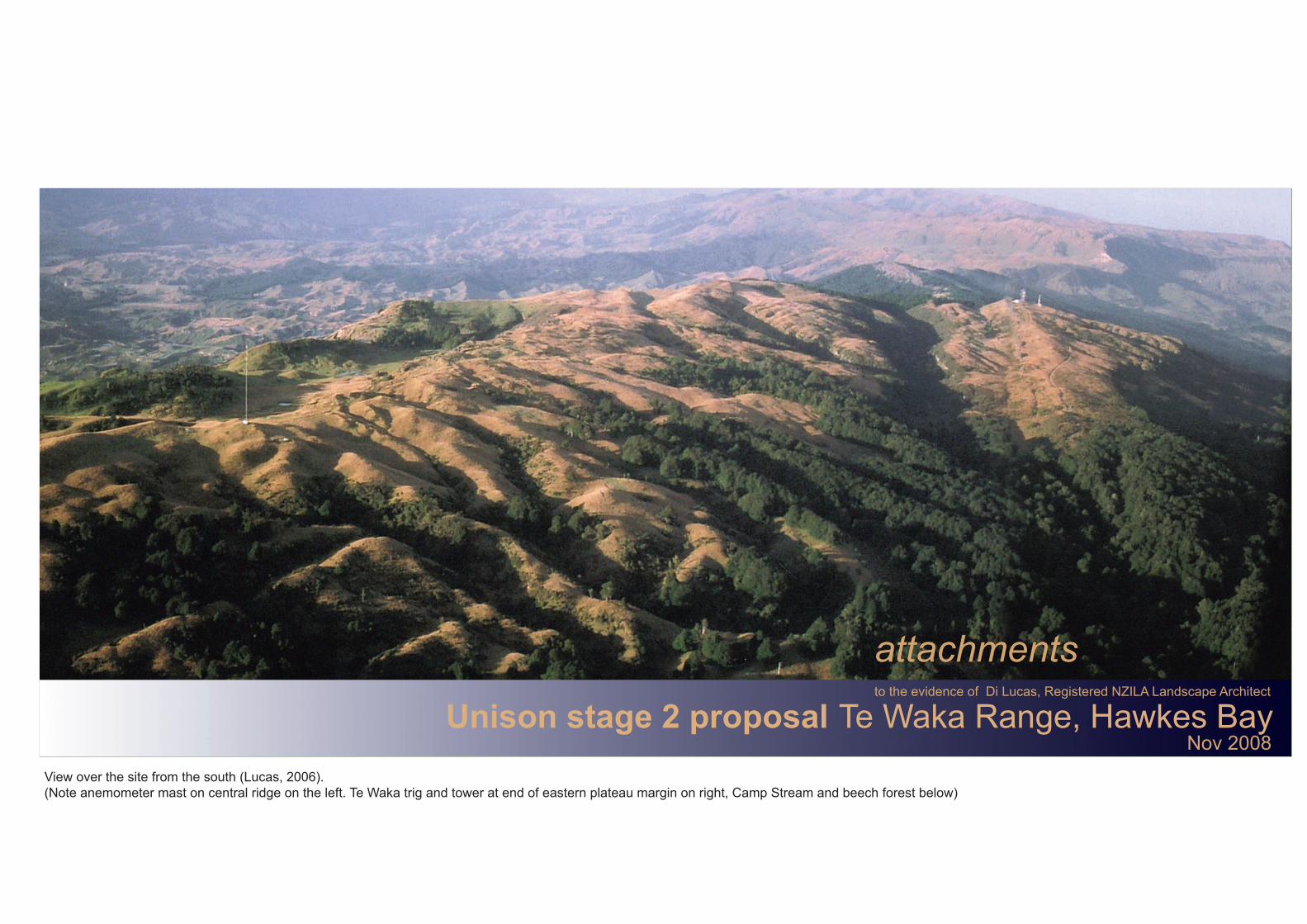
attachmentsto the evidence of Di Lucas, Registered NZILA Landscape Architect
Unison stage 2 proposal Te Waka Range, Hawkes BayNov 2008
View over the site from the south (Lucas, 2006). (Note anemometer mast on central ridge on the left. Te Waka trig and tower at end of eastern plateau margin on right, Camp Stream and beech forest below)

Te Waka Range - locationattachment 1
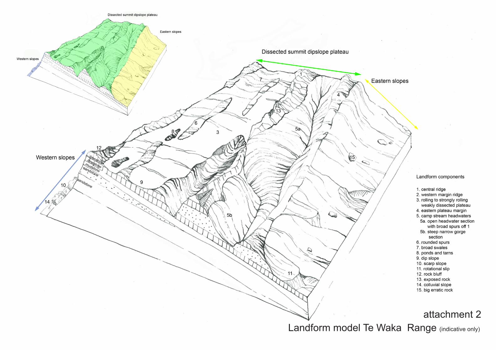
Landform model Te Waka Range (indicative only)
attachment 2
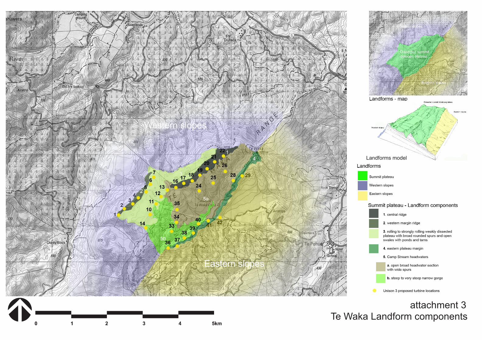
Te Waka Landform componentsattachment 3
Landforms model

attachment 4 Te Waka Range - sections
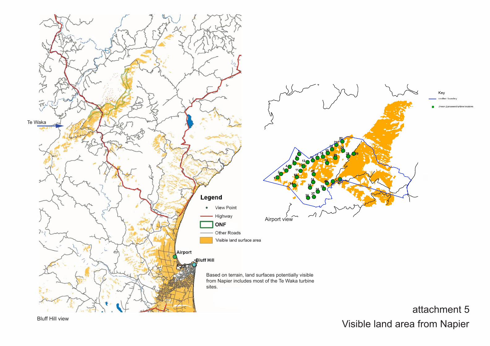
attachment 5Visible land area from Napier
Te Waka
Airport view
Based on terrain, land surfaces potentially visiblefrom Napier includes most of the Te Waka turbine sites.
Bluff Hill view
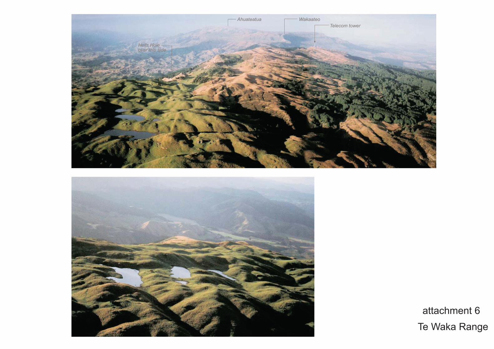
attachment 6Te Waka Range
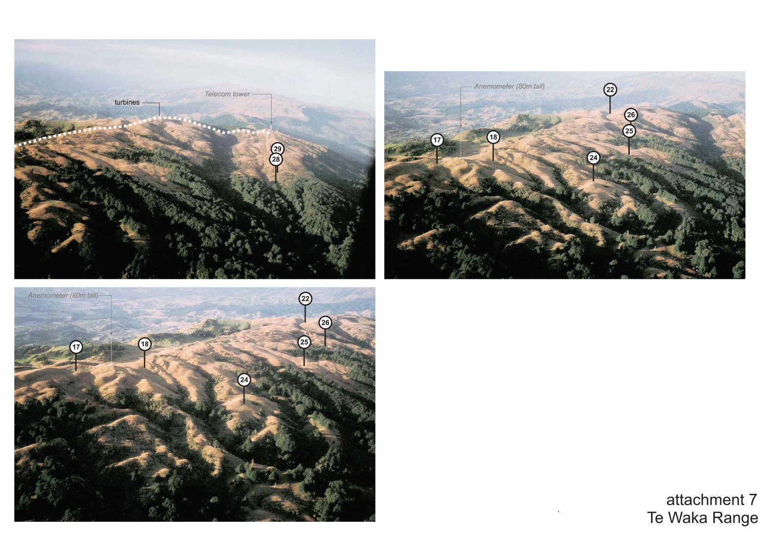
attachment 7Te Waka Range
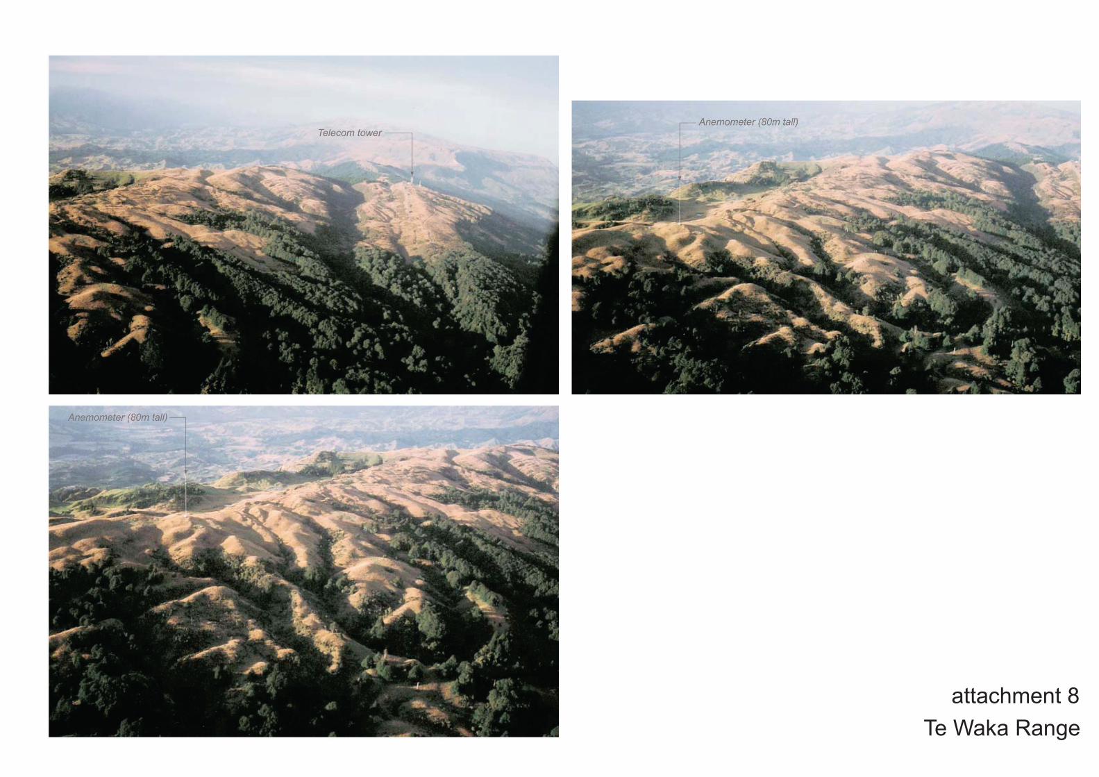
attachment 8Te Waka Range
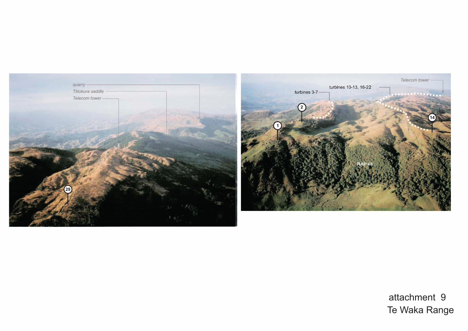
attachment 9Te Waka Range

Te Waka Range attachment 10

From Hospital Hill over Westshore to Te Waka-Titiokura-Maungaharuru and Heretaunga Plain (note Te Waka mast)
attachment 11

attachment 12 from Hospital Hill, Napier (November 2005)
* The mountain range is a tribal boundary. Viewed from the coast the full range is termed MAUNGAHARURU. From inland the full range is termed TITIOKURA.
*

attachment 13 Te Waka Range - access
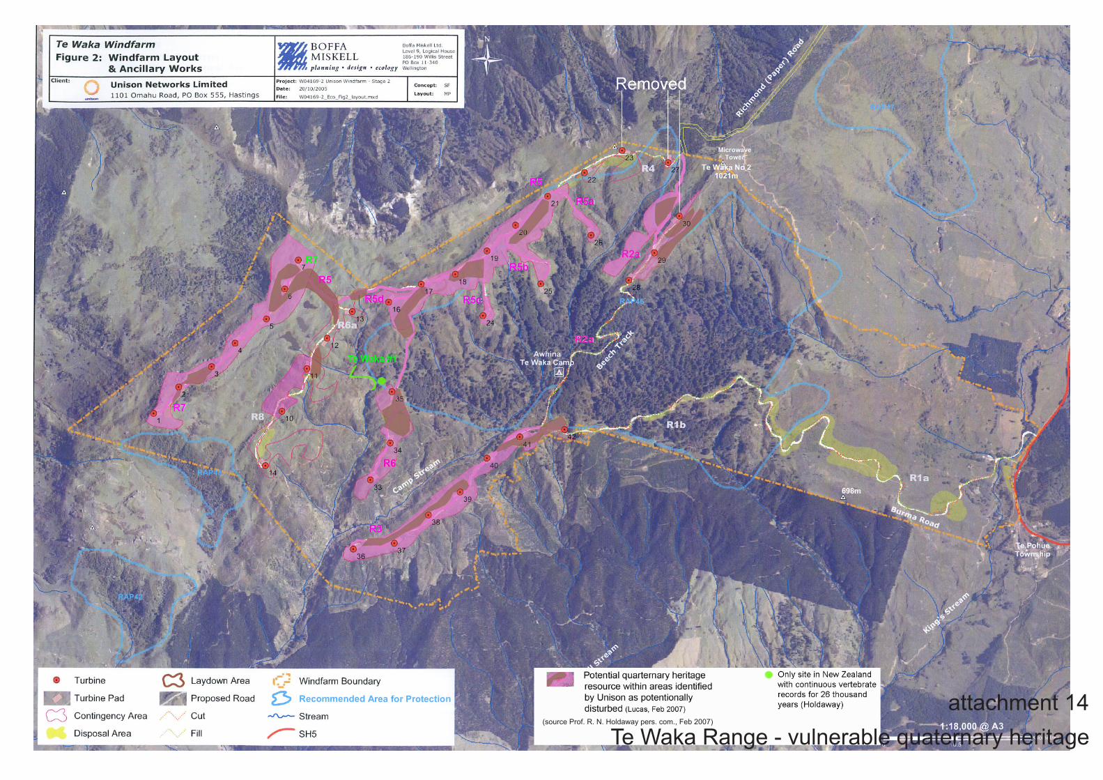
attachment 14Te Waka Range - vulnerable quaternary heritage
(source Prof. R. N. Holdaway pers. com., Feb 2007)

attachment 15Te Waka Range - indigenous vegetation
as indicated in the Land Cover Database 2

Emma Hamilton, 1910 - 1920. from Westshore, looking across Inner Harbour (now the airport) to Maungaharuru
attachment 16Te Waka Range

attachment 17Lewis Evans, 1916. from mouth of old Tutaekuri River, over the Ahuriri Inner Harbour to Te Waka
Te Waka Range
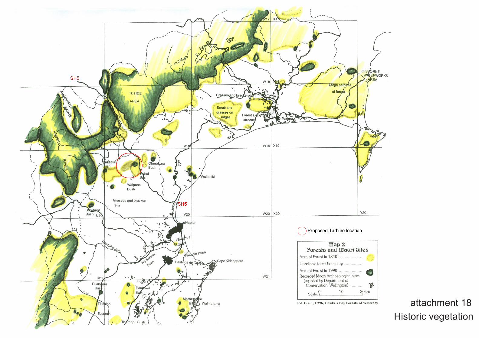
attachment 18Historic vegetation
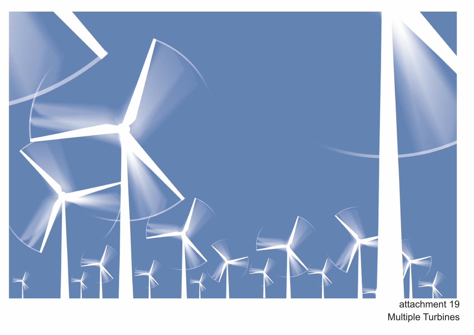
attachment 19Multiple Turbines
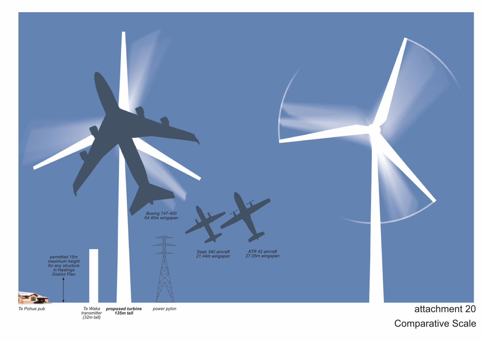
attachment 20Comparative Scale
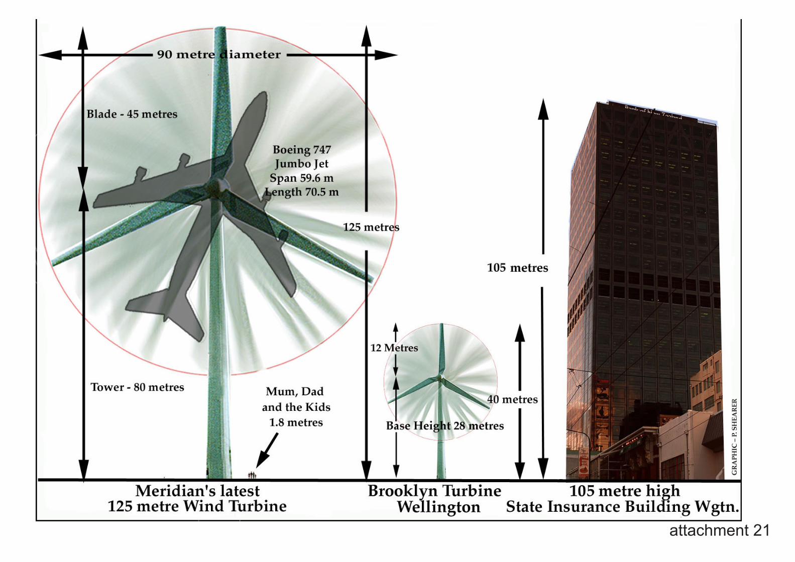
attachment 21
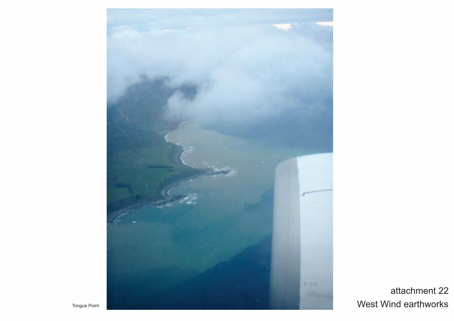
West Wind earthworksattachment 22
Tongue Point
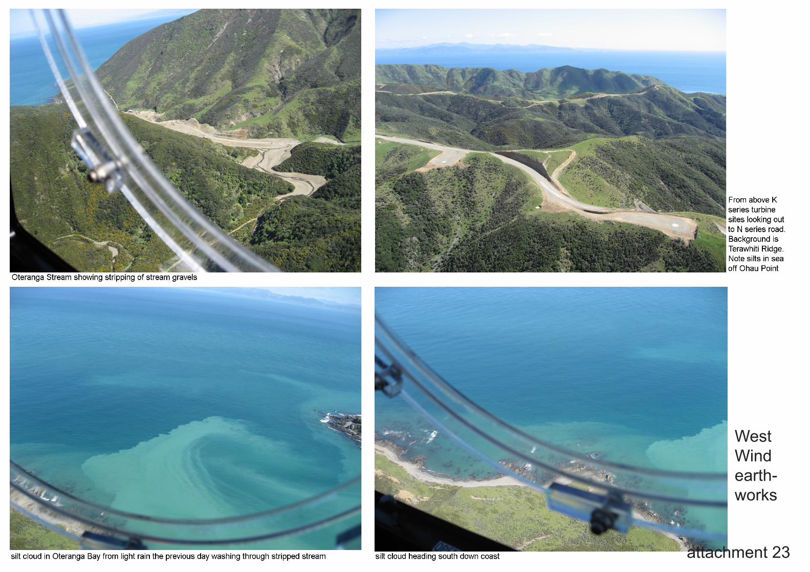
attachment 23
West Wind earth-works
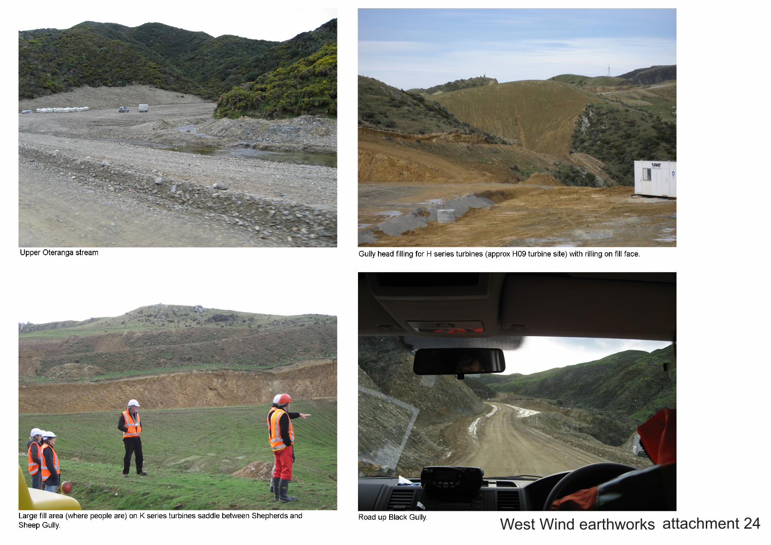
attachment 24West Wind earthworks

landscape architects‘Marokapara’351 Manchester StreetChristchurch Aotearoa New Zealand
Phone: (03) 365-0789 Fax: (03) [email protected]