SUYEAY O E GEOOGY O E OEMOY 4MIE · aious as o e aea. ^eoe 8, geoogica iesi gaios wee o a...
36
Transcript of SUYEAY O E GEOOGY O E OEMOY 4MIE · aious as o e aea. ^eoe 8, geoogica iesi gaios wee o a...

SUYEARY OF THE GEOLOGY OF THE TOBERMORY 4-MILEGEOLOGICAL SHEET.
.11
by
K.G. Smith and R.R. Vine.
RECORDS 1960/71
The information contained in this report has been obtai0edby the Department of National Development, as part of thepolicy of the Commonwealth. Government, to assist in theexploration and development of mineral resources. It maynot be published in any form or used in a company prospectuswithout the permission in writing of the Director, Bureau ofMineral Resources, Geology and Geophysics.
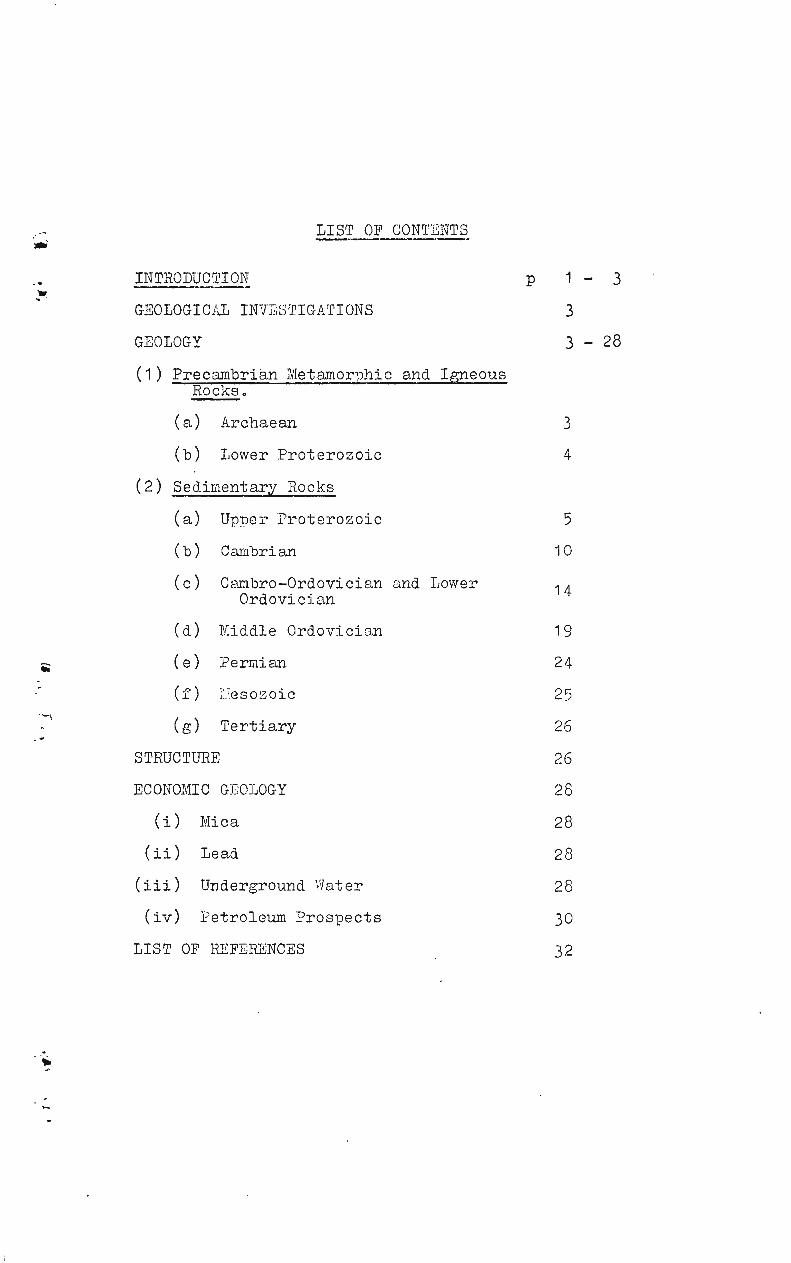
LIST OF CONTENTS
INTRODUCTION^ p 1 — 3
GEOLOGICAL INVESTIGATIONS^ 3
GEOLOGY^ 3 - 28
(1) Precambrian Metamorphic and Igneous Rocks.
(a)^Archaean 3
(b)^Lower Proterozoic 4
(2) Sedimentary Rocks
5(a)^Upper Proterozoic
(b) Cambrian
(c) Cambro—Ordovician and LowerOrdovician
(d) Middle Ordovician
10
14
19
(e) Permian 24
(f)^lesozoic 25
(g)^Tertiary 26
STRUCTURE 26
ECONOMIC GEOLOGY 28
(i) Mica 28
(ii) Lead 28
(iii) Underground Water 28
(iv) Petroleum Prospects 30
LIST OF REFERENCES 32

INTRODUCTION
The area covered by the Tobermory Four-Mile Sheet
is bounded by the meridians of 136 degrees 30 minutes and
138 degrees of East Longitude, and the 21st and 22nd paral-
lels of South Latitude.^The area is sparsely inhabited
with a total white population of about 30.^Nearly all of
these are engaged in some section of the pastoral industry,
producing. cattle for beef.^The area has four cattle
stations (Tarlton Downs, Marqua, Tobermory and Manners
Creek), one small Quarantine Reserve and a few Grazing
Licences.^Some of the area is not used for pastoral pur-
poses.
Access is provided by the southerly one of the
two main routes from Alice Springs to Mt Isa; this road has
a formed, earth surface and it is usually impassable for
several days after heavy rainfalls.^From this road a net-
work of station tracks leads to bores and other watering
places for stock.^Large parts of the area have no access
roads or tracks.
All of the station homesteads have transceivers
which are linked, according to proximity, with either the
Cloncurry or the Alice Springs Base Stations of the Royal
Flying Doctor Service, This Service provides prompt medical
attention and transmits and receives telegrams.^Tarlton
Downs, Marqua and Tobermory Stations have aerodromes
suitable for light aircraft.
Water for stock and for domestic puriaoses is obtained
mainly from bores; there are also several dams, earth tanks
and waterholes.^The largest of the waterholes is Cock-
roach Waterhole which lasts for about eight months after
being filled.
The courses of the larger streams are lined with
tall eucalypts; elsewhere, vegetation is generally sparse
and consists mainly of low gidyea, bloodwood and mulga trees and
many varieties of stunted shrubs.^Large areas are covered
by spinifex.^ .../2
2 .
The climate is one of short, mild winters and
long, hot summers.^The summer temperatures frequently
exceed 100 degrees Fahrenheit for periods of weeks and be-
cause of such conditions it is advisable to do field work
between the months of May and September.^The average annual
rainfall is about ten inches and although most of this falls
in summer months it is not uncommon to get rain in June.
The reliability of rainfall is generally low, and droughts
are frequent.^The prevailing wind is from the south-east
and in times of drought this wind is heavily charged with
sand and dust.
The two most prominent topographic units are the
flat-topped, heavily dissected Tarlton and Toko Ranges;
these rise 180-250 feet and 200-400 feet respectively above
the level of the surrounding land.^The remainder of the
area consists of gently-undulating country dotted with small
peaks and mesas.^In 1959, Surveyors from the Department
of the Interior obtained levels along the main road which
crosses the area, along Arthur Creek and the Hay River, and
along the road from Goatyard Bore to Yardida Bore (which is
on the adjoining Hay River Four-Mile Sheet).^These levels
show -
(a) On the main road, the highest elevation is at Sur-
vey Peg 60-18 which is located north of Mt Guide.
At this peg the elevation is 961 feet above mean
sea-level and the land slopes from here to Tober-
mory homestead whose altitude is 551 feet.^From
peg 60-18 the land slopes also to the road crossing
of Arthur Creek where the elevation is 870 feet
above mean sea-level.
(b) Survey Peg 61-8, located 1 mile north of No. 8
Dam, is near the divide between the north-flowing
Bloodwood Creek and the south-flowing Dinner Creek.
The land falls from 803 feet at this peg to an
altitude of 561 feet at Goatyard Bore.
3,
No levels are available for that part of the'
area which lies north of the main road, and there
are too few clearly-defined streams to give a
reasonable indication of a topographic basin which
may occur in that area,
GEOLOGICAL INVESTIGATIONS
In the late 19th century the explorers Barclay,
David, Hodgkinson, Lindsay and Winnecke journeyed through
various parts of the area.^Before 1958, geological investi-
gations were of a reconnaissance nature only; Whitehouse
(1936) published a sketch map of part of the area, and Madi-
gan (1937,a) and Hossfeld (1954) referred to the general geology
of the area.^Noakes (1956) and Casey & Tomlinson (1956)
published accounts of the j,eology of separate parts of the
Tobermory Four-Mile Sheet.
In 1958, Casey and 2ritchard mapped the Toko Range
area of the Sheet, and Condon and Smith reconnoitred tie
southern part of the sheet.
In 1959 a field party consisting of K.G.
P.W. Pritchard, D.R. Woolley, R.R. Vine, D.J. Forman and
A.R. Jensen mapped the remainder of the Tobermory Four-Mile
Sheet.^The 4-mile map and these notes are based mainly on
the work of that party.
Since 1954, Miss Tomlinson and Dr A.A. Opik have
examined fossil material collected in the area and have
determined the age of the Lower Palaeozoic formations.,
GEOLOGY
On the Tobermory Four-Mile Sheet there are out-
crops of Archaean metamorphic rocks, Lower Proterozoic grade,
and sediments of Upper Proterozoic, Cambrian, Ordovician,
Permian, Cretaceous and Tertiary ages.^The sediments have
not been metamorphosed.
(1)^Precambrian Metamorphic and Igneous Rocks
(a) Archaean.^Outcrops of Archaean rocks are con-
fined to the south-western quadrant of the Sheet, either
• 0 •/1

4Iw
4.
in small peaks surrounded by sand plain or in low
mesas.^There are a few sharp ridges which are the
expression of fault traces.
The rocks are regionally-metamorphosed psammitic
and pelitic sediments.^The lithologies include mus-
covit chist, biotite-quartz schist, biotite-quartz-
chlorite schist, quartz-hornblende schist, quartz-feld-
spar biotite gneiss, quartz-feldspnr-muscovite gneiss
and a quartz-feldspar-chlorite rock which is roughly
foliated.
Outcrops are too sparse to enable a reliable pre-
diction of regional structure.^Observations on available
outcrops suggest that the regional strike is 320 degrees;
observed dips are generally steep.
The age of the metamorphic rocks is assumed to be
Archaean.^The rock types and the degree of metamorphism
are very similar to those found in metamorphic rocks
mapped on the adjoining Huckitta Four-Mile Sheet (Joklik,
1955; Smith et al., 1960, unpubl.).^On the Huckitta
Sheet metamorphic rocks are regarded as belonging to the
Archaean Arunta Complex; granites which intrude them
have been dated, by Potassium-Argon ratio methods, at
1400-1500 million years (Hurley, Walpole and Smith, in
press).^This age, on current practice of the Bureau of
Mineral Resources, Geology and Geophysics, is Lower
Proterozoic.^Therefore, the Arunta Complex, and its
correlates on the Tobermory Four-Mile Sheet, are regarded
as being Archaean in age.^No age determinations -have
been made for granites which intrude metamorphic rocks
on the Tobermory Sheet.
(b) Lower Proterozoic.^Rocks which are assumed to be
of this age consist of granite, with a few pegmatites.
Outcrop generally is poor, low and sparse, but a few
small peaks occur.^Several types of granite have been
mapped; the dominant one is a leucocratiCi coarse-
i4i5

5.
grained, muscovite granite which is poorly foliated.
Other types include very coarse-grained porphyritic
granite and medium-grained, even-textured, leucocratic
granite.^Numerous fine-grained granitic dykes cut the
granite bodies and there are a few discordant pegmatites.
No workable mica-bearing pegmatite was mapped in the
south-western quadrant of the Meet, where most of the
granite crops out.^In the south-eastern quadrant, one
pegmatite has been worked for muscovite; the workings
are not extensive.^This pegatite is located about 6
miles west-north-west of Craigie Dam.
The age of the granite is incompletely known;
it intrudes rocks believed to be of Archaean age and is
overlain unconformably by unmetamorphosed sediments of
Upper Proterozoic age.^Therefore the age of the granite
on the Tobermory Sheet is believed to be Lower Protero-
zoic.
( 2)^
Sedimentary Rocks
(a) Upper Proterozoic.^In rocks of this age one•••■^ Formation and one set of Beds have been mapped.^These
are the Grant Bluff Formation and the Field River Beds.
The Field River Beds (new name) are the oldest of the
Upper Proterozoic sedimentary rocks exposed.^They have
been named and defined from the Field River area on the
adjoining Hay River Four-Hile Sheet which the field party
also mapped during 1959.^On the Tobermory Sheet the
distribution of the Field River Beds is confined to
the following -
(i) South-eastern area.^Extensive, low outcrops in
the area between Red Heart Bore and Craigie Dam.
In the type area the thickness of the Field River
Beds is 3650 feet; the basal unit consists of
boulder beds and green siltstone and this is suc-
ceeded by a sequence of arkose, dolomite, shale,
siltstone and quartz greywacke.^On the Tober-
mory Sheet the top part only of the boulder beds
..../6

6.
crops out and the full sequence of younger units
of the Field River -Beds is not present because it
has been eroded prior to the deposition of uncon-
formably overlying sediments of lower Middle
Cambrian age.
^
(ii) South-western area.^Small outcrops in the base
of the Keepera Ridges and small but strong out-
crops in a fault block on the eastern bank of
Limestone Creek.
^
(i) South-eastern area.^Two part-sequences of the
Field River Beds have been measured near a prominent
mesa located i mile east of the junction of station
tracks leading to Craigie Dam and to Noakes Bore.
The sequences are separated by a horizontal distance
of about 900 feet; this is underlain by green silt-
stone which has been faulted and folded to such a
degree that reliable estimates of the thickness
represented there are impossible.^A summary of
the sequences, in descending order, is -
Blue dhert of lower Middle Cambrian age unconformatly
overlying Sequence 2
^
50 feet of^red, thin-bedded, fine-grained
quartz sandstone;
^
80 feet of^brown, coarse, dolomitic arkose
with pebbles, cobbles and boulders;
this lenses along strike into pink
and purple dolomite with thin inter-
beds of hard, laminated medium-
grained purple quartz sandstone;
^
110 feet of^grey, very coarse-grained, cross-
bedded pebbly arkose;
^75 feet of^red and yellow dolomitic siltstone;
^
100 feet of^hard, dense, medium-bedded, yellow and
purple dolomite;
220 feet^concealed;
0 0 0 /7

210 feet of medium-coarse grained, cross-
bedded, pink and brown, micaceous
pebbly arkose;
^
720 feet of^poorly-outcropping, green, mica-
ceous siltstone with thin inter-
beds of fine-grained, pink arkose;
Total:, 1565 feet thickness of part-section
^
Gap of 900 feet^(horizontal distance) underlain
by Sequence I
^
165 feet of^green and grey, medium-grained,
micaceous arkose with thin interbeds
of green siltstone;
^
185 feet of^red and yellow, laminated, dolo-
mitic silstone with some beds of
buff dolomite lensing along strike
into dolomitic arkose;
340 feet of Boulder beds with interbeds of
green siltstone with "tillitic"
texture;
^
Total: 690 feet^thickness of part-section
The top part of sequence 2 can be identified easily
with beds in the Type Section of the Field River
Beds; the lower part of 2 and most of sequence 1
cannot be so readily identified with beds of the
Type Section but that may be because exposure is
poor in this part of the Type Section.
(ii) South-Western Area.^The following sequence has
been measured on the eastern bank of Limestone
Creek; in descending order the sequence consists of -
Blue chert of lower Middle Cambrian age unconformably
overlying
^
1 foot of^red siltstone;
7 feet of brown, laminated, micaceous grey-
wacke;
^9 feet of^grey, medium-bedded, cross-bedded

8.
silty quartz sandstone with
ripple marks and mud pellets;
^
190 feet of^red, micaceous, laminated, dolo-
mitic silstone with thin 'inter-
beds and lenses of red and purple,
brecciated dolomite;
^4 feet of^dark-brown, medium-bedded, medium-
grained, sandy dolomite;
105 feet of yellow, tan and buff fine-grained
• limestone with some sandy lenses
and some thin interbeds of medium-
grained arkose;
^94 feet of^laminated, flaggy, 'fine -grained
blue limestone, highly micaceous and
containing fragments of reworked red
garnets;
^
Total: 410 feet^thickness of part-section.
(Base not exposed).
In the same area there are some arkose beds containing
boulders, and some dolomitic arkose.^These beds
have been strongly disrupted by fault movements.
In the Keepera Ridges, a thickness of 960 feet
of the Field River Beds has been measured.^This
section, in descending order; consists of -
Grant Bluff Formation conformably overlying
^
635 feet of^poorly-outcropping, leached'
siltstone, gypsiferous in part,
with lenses of coarse-grained
arkose;
^
325 feet of^poorly outcropping, coarse-grained
grey arkose with some interbeds of
green siltstone and some interbeds
of dolomitic arkose;
^
Total: 960 feet^thickness of part-section.^Base
not exposed.
9 .
This sequence in the Keepera Ridges is very simi-
lar to that of the Elyuah Formation (Smith et. al.
1960 unpubl.) which conformably underlies the
Grant Bluff Formation in the Jervois Range to the
west, on the Huckitta Four-Mile Sheet,
The Grant Bluff Formation:
This Formation has been named and defined (Smith
et. al., 1960 unpubl.) on the adjoining Huckitta
Four-Mile Sheet.^The Type Section of the Formation
is located in the EIyuah Range, where the thickness
is 530 feet.^The thickness of the Formation increases
to the east and on the Tobermory and Hay River Four-
Mile Sheets it is about 1500 feet thick.
On the Tobermory Four-Mile Sheet, outcrops of the
Grant Bluff Formation are restricted to the Keepera
Ridges, in the western part of the area.^The
Formation has a distinctive lithology of alternating
sequences of grey, fine to medium-grained quartz
sandstone, and leached siltone with, in some places,.
thin dolomite bands containing the algal form
Collenia.^In some localities, the quartz sandstone
beds contain up to 105 of glauconite.
In the Keepera Ridges a thickness of 1500 feet
has been measured in the Formation.^The age of the
Grant Bluff Formation is regarded as Upper Proterozoic,
but it is considered that part, or all, of it may be
of Lower Cambrian age.^No determinations of age
have been made on the glauconite content.^On the
adjoining Huckitta Four-Mile Sheet the Grant Bluff -
Formation is conformably overlain by the Mt Baldwin
Formation (Smith et. al., 1960 loc. cit.) which
contains Lower Cambrian archaeocyathids in its upper
part.^The position of these fossils in Lower
Cambrian stratigraphy has not yet been determined.
.../10

1 0.
(b) Cambrian.^There are no known outcrops of
Lower Cambrian sediments on the Tobermory Four-Mile
Sheet; the Mt Baldwin Formation does not crop out and
no other beds which may be equivalent to it have been
recognised.^The oldest Cambrian sediments are fossili-
ferous, blue cherts of lower Middle Cambrian age (A.A.
Opik, pers. comm.).^These are succeeded by richly
fossiliferous shale and limestone with lenses of sand-
stone, ranging in age from lower Middle Cambrian to upper-
most Middle Cambrian..^A complete study of the fossils
from this sequence has not yet been made; a.preliminary
study indicates that there may be breaks in the sequence
which are not discernable on the ground and accordingly
the sequence is not divided into formations but is named
the Marqua Beds (new name).
The Marqua Beds crop out in the southern part of the
Tobermory Four-Mile Sheet, in isolated localities between
Limestone Creek, in the west, and roughly the longitude
of Craigie Dam in the east.^Usually, lower units of the
Beds do not crop out strongly, but the upper (limestone)
units often form prominent ridges.^These upper units,
when not cropping out strongly, usually support a dense
vegetation of gidyea trees and these are readily
identifiable on air photographs.^(alcly_ea grows also on
Upper Proterozoic and Ordovician dolomite in the area,
and care must be exercised in interpretation).
The Marqua Beds, and their equivalents to the west
and the east ,form the basal units of sedimentary rocks
deposited in the Georgina Basin.^The name 'Marqual is
taken from Marqua Station homestead and the Type Section
of the Beds is located about i mile north of the junction
al•
^ of station tracks leading to Noakes Bore and to Craigie
Dam.^The Type Section was measured about 50 yards west
of an old track which leads north from this junction.
At this locality the sequence, in descending order,
consists of -

30 feet of buff, medium-grained, flaggy, ? cal-
careous sandstone with fragments of
trilobites;
530 feet of ply-outcropping, fine-grained, flaggy
blue limestone with fragments of trilo-
bites; some strongly-outcropping,
thin interbeds of grey, medium-grained
sandy limestone;
^
105 feet of^buff, silicified shale with a rich
fauna of trilobites;
^
10 feet of^blue chert with fragments of trilobites
^
Total: 675 feet^thickness of part-section, unconformably
overlying dolomite of the Field River
Beds.
In the western part of the Sheet the following part-
sections have been measured in a small area on the east
of Limestone Creek; contacts between the sequences are
not exposed.^In descending order the sequences consist
of
3.^65 feet of^creamy, fine-to medium-grained, thin-
bedded, cross-bedded silty sandstone
with worm trails;
^
515 feet of^blue and blue-black flaggy limestone
containing a rich brachiopod fauna,
fragments of trilobites and numerous
1^ echinoderms.
^
Total: 580 feet^thickness of part-section
^
2. 250 feet of^hard, dense, laminated, blue and blue-
black limestone; some beds have a rich
trilobite fauna and have a petroliferous
odour when struck.^Upper beds are
faulted against dolomitic arkosecf the
Field River Beds.
^
Total: 250 feet^thickness of part section.
.../12

1.^Tarlton Formation, of ? Permian age,
unconformalfly overlying
80 feet of^strongly-outcropping buff shale;
15 feet of . blue chert;
95 feet of thickness of part-section, unconformably
overlying the Field River Beds.
The sequence in this western area has four units
whose lithology is very similar to units of the Type
Section; the 250 feet of limestone in sequence 2 has not
been observed in the eastern area, although its time
equivalents could be represented.^The Type Section
was located in the east because of ease of access.
The Marqua Beds are correlated, in part, with
the Arthur Creek Beds (Smith, Wooley and Vine, 1960,
unpubl.) exposed on the Huckitta Four-Mile Sheet.^The
buff shale and the flaggy, blue limestone with lenses of
sandstone are present on both the Huckitta and Tobermory
Sheets; the buff shale and its faunal content are very
similar in lithology and fauna to the Sandover Beds
(Opik, 1956) which dip south and east off the margins of
the Lower Proterozoic •sediments of the Davenport Range
(Smith, Stewart and Smith. 1960, in preparation) on
the Elkedra Four-Mile Sheet.^On the Elkedra Sheet
wet gas was obtained from a water bore drilled, in 1956,
into a limestone-shale sequence which would correspond
approxi,,ately to the top unit of the Marqua Beds and the
Arthur Creek Beds.
The Arrinthrunga Formation.
This Formation was named and defined (Smith, Woolley
and Vine, 1960, unpubl.) on the Huckitta Four-Mile Sheet,
where it overlies the Middle Cambrian Arthur Creek Beds
'and is overlain by fossiliferous sandstone of Upper
Cambrian age.^On the Tobermory Sheet the Arrinthrunga
Formation crops out strongly in a belt extending from the
vicinity of Marqua Station holliestead east-south-east to
000/13

13.
to the southern margin of the Sheet.^To the west of
this homestead the Formation crops out poorly and usually
only the top part of it is exposed;^evidence from
water bores proves that it underlies a large area between
Marqua Station homstead and Limestone Creek.
A complete section of the Arr hrunga Formation
was measured at a locality some three miles north of
Craigie Dam. Here, the sequence in descending order
consists of -
Cambro-Ordovician sandstone conformably overlying
^5 feet of^buff limestone;
10 feet of medium-grained calcarenite;
15 feet of^limestone with dolomitic mottling;
^5 feet of^medium-grained, dolomitic sandstone;
35 feet^concealed;
35 feet of limestone with dolomitic mottling and
thin interbeds of dolomite and intra-
formational breccia;
65 feet^concealed;
25 feet of^limestone with interlaminated dolomite;
10 feet of^fine-grained, dolomitic sandstone;
40 feet of^limestone with dolomitic mottling in
part; some silty interbeds and inter-
laminated dolomite and algal limestone;
30 feet^concealed
^
125 feet of^limestone with dolomitic mottling;
some algal limestone
100 feet^concealed;
15 feet of^sandy dolomite;
15 feet^concealed
10 feet of^limestone with dolomitic mottling;
15 feet^concealed;
20 feet of^dolarenite;
55 feet^concealed;
40 feet of^limestone with dolomitic mottling; some
thin beds of calcarenite;

14.
20 feet of limestone, limestone conglomerate and
coarse-grained calcarenite;
5 feet of sandy. dolomite;
15 feet^concealed;
130 feet of poorly-outcropping limestone with
dolomitic mottling; some inter-
laminated dolomite;
200 feet of limestone with dolomitic mottling;
125 feet of limestone with interlaminated dolomite;
some concealed softer interbeds;
185 feet of coarse-grained dolarenite,
overlying the Marqua Beds.
1350 feet^thickness of Arrinthrunga Formation.
In small fault blocks on the eastern side of
Limestone Creek the lower beds of the Arrinthrunga Formation
are exposed.^In this area a thickness of 410 feet was
measured; the sequence consists of dolomite in the lower
parts, succeeded by limestone and oolitic limestone.
The contact between the Arrinthrunga Formation
and the Marqua Beds is not exposed in sufficient detail to
prove conformity or otherwise of the two stratigraphic
units.^The Arrinthrunga Formation is unfossiliferous; it
is overlain bylbssiliferous sandstone of Upper Cambrian age
but its actual position in the Upper Cambrian is in doubt.
(c) CAhBRO-ORDOVICIAN AND^ORDOVICIAN.^Around the
margin of the outcrop of the Ninmaroo Formation (named by
Casey 1959) and scattered within it are numerous outcrops
of sandstone.^Many of these outcrops.are poor and discon-
tinuous.^The lithology is usually fine to medium-grained,
micaceous, well-sorted sandstone, glauconitic in part;
the sandstone is usually thin-bedded, laminated and strongly
slumped.^In part it is richly fossiliferous.^Interbedded
with the sandstone are dolomite, sandy dolomite which grades
laterally into sandstone, and minor beds of micaceous silt-

15.
stone.
Because of the discontinuity of outcrop and because
of sharp slump folds in the beds the relationships between
the sandstone and the Ninmaroo and Kelly Creek Formations are
incompletely known.^The significant facts are
(1) A sandstone unit of the order of 200 feet thick is
present below the Ninmaroo Formation and above the
Arrinthrunga Formabion, throughout the southern
part of the Tobermory Sheet.^In the vicinity of
Southern Cross Bore this sandstone contains
lenticular dolomite, and from the sandstone
Upper Cambrian fossils have been collected (Casey
& Tomlinson, 1956).^Some 4 miles south-east of
Lucky Bore the sandstone contains numerous
fossils, of Upper Cambrian age^()pill:, pers.
'comm.)
(2) In the south-eastern part of the Tobermory Sheet
the sandstone secuence is well-exposed;^here
the seTience becomes richer in carbonate rocks.
(3) Through the central part of the Sheet there are
many small sandstone hills; in some of these it
is clear that the sandstone overlies dolomite of
the Ninmaroo Formation.
(4) 15 miles north of Tarlton Downs Station homestead,
and also 6 miles east of the southern tip of the
Tarlton Range, sandstone units change laterally into
the carbonate-siltstone seuence of the Ninmaroo
Formation.
(5) East of the central part of the Tarlton Range the
Kelly Creek Formation overlies sandstone beds,
without app; rent unconformity; here it appears that
the e-uivalent of the whole of the Ninmaroo Formation
has a. sandstone lithology.
(6) In the north-western Dart of the sheet a seuence of
sandstone with interbedded dolomite contains fossils
16.
of Upper Cambrian -age.
It is believed probable that there is a sandstone
unit generally present between the 2.,rrinthrunga and Ninmaroo
Formations, but without detailed palaeontological study of
the faunas contained in the sandstone outcrops on the
Tobermory Sheet, it is not possible to separate sandstone
within the Ninmaroo Formation from sandstone immediately
below that Formation.^1\.ccordingly, most of the sandstone
is shown on the map as an un-named Unit of Cambro-Ordovician
age.
The Ninmaroo Formation:
Whitehouse (1936) named the Ninmaroo Limestone
from the Lower Palaeozoic limestone and dolomite sequence
exposed at Mt. Ninmaroo, Mt. Datson and Black Mountain,.
north-east of Boulia in western Queensland.^Subsernaent
work by field parties from the Bureau of Mineral Resources
showed that the lower third of the secuence at Black Mount-
ain contained a rich fauna of Upper Cambrian age and could
be separated as another Formation.^The Ninmaroo Limestone
was accordingly subdivided, and the names Chatsworth Lime-
stone and Ninmaroo Formation applied to the lower and upper
units respectively (Casey, 1959).^The age of the Ninmaroo
Formation is uppermost Upper Cambrian and Lower Ordovician,
The Ninmaroo Formation crops out in a belt extend-
ing through the centre of the Tobermory Four-Mile Sheet and
spreading over most of the northern half of the Sheet.
The outcrops normally form extensive plains dotted with rocky
rises, but where erosion has been more active a marked bench
topography is developed.^On the western side of the Toko
Range the Formation has been strongly folded and forms a
strong ridge.
A section in the Ninmaroo Formation has been
measured at a locality^miles south-west of Coolibah Dam

17.
At this locality the seuence, in descending order, consists
of
Kelly Creek Formation overlying
111 feet of very coarse-grained, blue-grey calcarenite
with interbedded quartz sandstone;
115 feet of poorly-outcropping, fine-grained (7uartz sand-
stone;^siltstone;^thick interbeds of calcare-
nite, intraformational breccia and grey
dolarenite;
131 feet of thick and thin-bedded blue-grey limestone,
dolomite and oolitic limestone;
83 feet of poorly-outcropping, fine-grained quartz sand-
stone.
of grey, coarse-grained, thick-bedded dolarenite,
the interval contains concealed interbeds of
soft rock;
thickness of Ninmaroo Formation, conformably
overlying 229 feet 'of quartz sandstone with thin
interbeds of dolarenite, dolomite and limestone;
this 229 feet is placed in the un-named Cambro-
'Ordovician beds.
In the western part of the Shhet a section has been
in outcrops between Limestone Creek and Camel Creek.
upper part of the Ninmaroo Formation is well exposed;
is not exposed but it is estimated that not more
feet of the Formation is concealed.^The sequence,
in descending order, consists of Kelly Creek Formation
conformably overlying
73 feet of grey, oolitic limestone, intraformational lime-
stone conglomerate and glauconitic calcarenite;
some interbedded buff sandstone;
85 feet of interbedded white, porous sandstone (fossili-
ferous) and green siltstone, with some thin
beds of very coarse-grained, grey calcarenite;
170 feet of blue-grey, coarse-grained calcarenite with some
172 feet
612 feet
measured
Here the
the base
than 150

18.
oolitic limestone; thin interbeds of white,
porous sandstone (fossiliferous) and green silt-
stone; short, straight nautiloids are present
in the interval, 80-95 feet above the base;
•••^328 feet^thickness of part-section.
Base not exposed.WO
The Kelly Creek Formation (unpublished name).^The name is
taken from Kelly Creek, which rises in the Toko RanLe and
flows east across the Northern Territory-Queensland border
at 138 00' E, 22 35'S.^The Formation crops out around the
margins of both the Toko and Tarlton Ranges.
In the Toko Range the lower part of the Kelly
Creek Formation issandy, semeti es containing glauconite;
the upper part is dolomitic and cherty.^The Formation is
transitional and apparently conformable with both the under-
lying Ninmaroo Formation and the overlying Coolibah Limestone.
The type section of the Kelly Creek Formation has been
measured at Gaphole Creek, on the western side of the Toko
Range.^A sumi,lary of this section, in descending order,
is: Coolibah Limestone conformably overlying:
38 feet of grey-brown, thin and medium-bedded, fine-grained
dolarenite with white, thin-bedded fossiliferous
chart;
60 feet^concealed;
60 feet of alternating hard and soft thick sets of thin-
bedded and laminated, fine-grained dolarenite,
with calcarenite at base of the interval;
208 feet of poorly-outcropping, thin-bedded, fine-grained
calcarenite, with sandy lenses in the upper 50AO
feet of the interval;
102 feet of white, thin-bedded, very fine-grained quartz
sandstone;
31 feet concealed;
51 feet of white, thick to medium sets of thin and medium-
1 9.
bedded, cross-laminated in part, fine-grained
euartz sandstone;
550 feet^thickness of Kelly Creek Formation, conformably
overlying the Ninmaroo Formation.
In the Tarlton Rmge area, the best exposures of
the Kelly Creek Formation are on the east side of the Range;
numerous sections have been measured here and the Formation
is about 250 feet thick.^It is dominantly a sandstone unit
but much of the sandstone is micaceous and glauconitic and
in the lower and middle parts of the Formation there are
numerous interbeds of laminated. green siltstone.^Several of
the sandstone beds grade laterally into dolomite and sandy
dolomite beds which feature cross-lamination.
In the Tarlton Range area the Kelly Creek Forma-
tion is transitional and conformable with the underlying
Ninmaroo Formation., The relationship with the overlying
Nora Formtion is not clear;^there is a sharp lithological
break between the two Formations and the lithology of the
Coolibah Limestone is not represented.^No other evidence
of non-conformity was found.
In the Tarlton Range area shelly fossils are not
very common in the beds of the Kelly Creek Formation;
brachioPods, trilobites and6autiloids have been collected
from a few thin bands.^Worm tubes and trails are very
common, and some beds seem to have been almost completely
"digeted" by burrowing organisms.^A preliminary determina-
tion of shelly fossils indicates a Lower Ordovician age for
the Kelly Creek Formation (Joyce Gilbert-Tomlinson, pers.
comm.)
(d) MIDDLE ORDOVICIAN.
The TOKO GROUP. (New name).^The name 'Tokol was first
used by ahitehouse in 1936, when he proposed Toko Series to
replace Glenormiston Series which he had used in 1930. The
name has been used by David and Browne (1950) and by the

-c
20.
compilers of the Geological Map of Queensland (1953 edition).
Casey (1959) used "Toko Beds" for all the rocks above the
Ninmaroo Formation.^Subsequent mapping has shown that the
Kelly Creek Formation is intimately related to the Ninmaroo
Formation and it appears likely that there lsfaunal break
between the Kelly Creek and Coolibah Formations.^Accord-
.
^
^ingly,Toko Group is now used for the Middle Ordovician sedi-
ments (Coolibah to Mithaka Formations)
In the Toko Range the Toko Groups consists of four
gradational ;:nd conformable Formations, namely the Coolibah,
Nora, Carlo and Mithaka Formations.^In the Tarlton Range
the lithology of the Coolibah Formation is not present but
an apparently conformable secluence similar to the other
three units has been mapped and these are tentatively corre-
lated with the corresponding units in the Toko Range.^The
outcrop of the Toko Group is restricted to the two Ranges.
Preliminary fossil determinations indicate a Middle Ordovician
age for the whole Toko Group (Joyce Gilbert-Tomlinson, pers.
comm.).
The Coolibah Formation (unpublished name)MOMMIWiJ
The name is taken from Coolibah Dam on Gravehole
Creek, at 137 44' E, 22 49' S.^Outcrops of the Coolibah
Formation form well-developed cuestas around the Toko Range.
The Coolibah Formation consists mainly of medium
and thick sets of blue-grey and brown-grey, crudely thin-
bedded calcilutite and green-white marl.^Some of the
calcilutite beds are oolitic and some have mottlings of
brown, coarse-grained carbonate litholbgy which is susceptible
to silicification.^There are minor amounts of yellow and
white chert and of brown, thin to medium-bedded, medium-
-
^
^grained to coarse-grained calcerenite and dolarenite which
is someti-es sandy.
Several complete sections of the Coolibah Forma-
tion have been measured •on the Tobermory Four-Mile Sheet.
These range in thickness from 27 feet (Type Section at Gaphole
21.
Creek) to 47 feet; farther east, in Queensland, the Forma-
tion is much thicker.
The Coolibah Formation is richly fossiliferous
and cOntainsrautiloids, gastropods, ribeirioids and horn-
shaped coral-like organisms up to 2 inches long.
The NOra Formation (Unpublished name)
The name is taken from Nora Gap, on the north-
eastern edge of the Toko Range, at 137 56' Ey 22 43' S.
The Formation crops out around the edge of the Toko Range,
where it is about 400 feet thick; it crops out also in the
Tarlton Range but there the thickness is about 200 feet.
The Type Section of the formation is in the
southern part of the Toomba Range, Mt. Wheelan 4-mile sheet).
In the Toko Range area a part-section has been
measured 13- miles north-west of Half-way Dam.^There the
sequence, in descending order consists of
Top not exposed
25 feet of brown and yellow micaceous Shale;
15 feet of impure calcarenite and fine-grained euartz
sandstone, thin-bedded and laminated;
35 feet of micaceous shale and fine-grained quartz sandstone;
30 feet^concealed;
45 feet of calcarenite and sandy calcarenite, with thin beds
of coc.uinite and brown, thin-bedded, laminated
fine-grained quartz sandstone;
150 feet^thickness of part-section of Nora Formation,
conformably overlying Coolibah Formation.
In the Tarlton Rane, the scarp is formed of a
dominantlyEiltstone-claystone lithology which grades upwards
into fine-grained sandstone.^Coquinites are common in the
basal part of the Formation and they persist as thin inter-
beds throughout most of the unit.^A complete section has
been measured in the southern part of the Range, where the
seuence, in descending order, consists of:
22.
Carlo Sandstone conformably overlying
49 feet^concealed;
28 feet of porous, friable, fine-grained quartz sandstone,
highly gypsiferous in part;
25 feet^concealed;
56 feet of brown and green claystone and siltstone,
gypsiferous in part, with numerous thin inter-
beds of brown, Dellety coquinite, and indurated
pale brown fine•grained sandStone;
27 feet of green, micaceous siltstone, with thin interbeds
of ferruginous, pellety couinite, indurated
yuartz sandstone and glauconitic sandstone;
17 feet of poorly-outcropping, ferruginous, pellety co-
quinite, and shelly dolomite;
202 feet^thickness of Nora Formation, overlying the Kelly
Creek Formation.
The Nora Formation is richly flissiliferous in the
lower pa2t, where nautiloids, brachitipods, pelecypods, tri-_^
lobites, sponges and bryozoa are common.^In the upper
part there are abundant tracks and trails on bedding planes,
but few shelly fossils have been found.
The Carlo Sandstone (Now name)
This dominantly sandstone unit forms the resistant
rim of the scarp of the Toko Range and the rubble-covered
rises above.^The name is taken from Carlo Station in the
Mt. Whelan area of Queensland.
The Carlo Sandstone consists of white and brown,
thin, medium and thick-bedded, fine to medium-grained
( luartz sandstone with some felspathic c:Liartz sandstone in
the lower part.^Towards the bottom of the formation there
are a few beds of quartz siltstone and an abundance of clay
pellets.^A few nautiloids, brachidpods, pelecy -pods andMO
worm tubes have been found in the formation, particularly
in the upper part of it.
2 3.
In the Toho Ranze the maximum thickness measured
is 263 feet but this does not represnnt a complete section.
In the Tarlton Rine a sandstone unit forms the
main rim and this sandstone is tentatively assigned to
the Carlo Sandstone.^It consists mainly of a fine to
medium-grained, well-sorted quartz sandstone, dominantly
chocolate and pale brown to grey in colour, with a few
interbeds of kaolinitic sandstone, and laminae of ferruginised
silrstone.^The characteristic features of the unit are the
presence of current features -- flute casts, current ripple
marks, mud pellets (some arranged in channels) and incipient
and small-scale slumps develped from ripple marks.^The
maximum thickness measuied was 65 feet; the full thickness
of the Carlo Sandstone in the Tarlton Range is estimated
to be 100 feet.
The Mithaka Formation^(New Name)
This name is taken from Eithaka Waterhole in the
Toko Range, at 138 00' I], 25 53' S.^In that area the For-
mation usually forms low, rubble-covered rises and good
•^ sections are rare.^The best-exposed sections of the upper
part of the Mithaka Formation are to the north of Cravens Peak
Bore (Type Section) on the adjoining Glenormiston Four-Mile
Sheet in Queensland (Casey at al., pers. comm.)^There the
lithologies consist of thin-bedded and laminated, fine-grained
quartz sandstone with some coquinite and brown shale towards
the top.^Asaphid trilobites, nautiloids, brachpods and
gastropods have been found in these beds, which are capped
by about 5 feet of medium-bedded, fine to medium grained
quartz sandstone with clay pellets.
On the Tobermory Four-Mile Sheet thin sections of
the lower part of the flithaka Formation arc exposed on the
western edge of the Toko Range near Gaphole Creek.^In this
locality the dominant rock type is a brown, soft, fossiliferous
gypsiferpus siltstone with interbedded brown, laminated,
24.
thin-bedded, fossiliferous, ripple-marked quartz sandstone.
The thickness of the Formation is estiated to be 200 feet.
On the Tarlton Ran3e there are several strongly-
lateritised residuals of massive siltstone, with a micaceous,
fine-grained sandstone at the base.^They contain fossil
bands with asaphid trilobites and linguloid brachibpods.
This sequence is tentatively assigned to the Mithaka Forma-
tion.^The maximum thickness measured was 41 feet.
(e) . ? PERMIAN
Tarlton Formation
Thin sequences of sedimentary rocks, believed to
be of terrestrial glacial origin and of Permian age, crop
out in many localities between the Tarlton RanLo and the
Georgina River in Queensland (Condon and Smith, 1959, unpubl.)
On the Tobermory Four-Mile Sheet the Formation crops out in
numerous mesas between the Tarlton and Toko Ranges, and in
low rises to the north and west of McCrae's Bore, near the
northern Margin of the Sheet, the Tarlton Formation uncon-
formably overlies Ordovician, Cambrian clad Proterozoic
sediments on the Tobermory Sheet, and in Cueensland is over-
lain bj Cretaceous sandstone and shale.^The Formation is
strongly lateritised.
The Type Section of the Tarlton Formation is located 11
miles south of Tarlton Downs homestead. The exact location
is shown on the map by Condon & Smith, (loc. cit.) . .^There
the sequence, in descending order, consists of
3 feet of "billy,"at top surface of mesa;
17 feet of silty, coarse and medium-grained sandstone,
and siltstone;
30 feet of white, silty, thin-bedded, medium-grained
sandstone, and siltstone;
20 feet of white, silty, very coarse, coarse and medium-
grained, cross-laminated sandstone with scour
and fill struc tures; silty, pebble conglomerate,
2 5 .
.thin, laminated siltstone;
3 feet of pale grey, pebbly claystone wiTh a few
boulders (ground moraine);
73 feet^thickness of Type Section, unconformably overlying
Ordovician sedi_ents.
The thickest suction measured in the Tarlton
Formation, on the Tobermory 3heet, is at Et. Lwing; here
the thickness if 140 feet, but the 1)::.se of the Formation
is not exposed.^Tho base is not exposed in most localities
where the Formation has been examined, but usually the
lowest exposure is a pebble or cobble conglomerate and
therefore the base is probably not far below the surface.
The Formation effectively masks the underlying rocks in
large areas between the Tarlton and Toko Ranges.
There is no definite evidence of -.Permian age for
the Tarlton Formation.^Coniferous wood has been found in
it at a locality 5 miles south-east of Burnt Viell; frag-
ments of unidentified fossil wood were located in numerous
loc alities during 1959, and some specimens from the Tarlton
Range, some 4 miles north of the Type Section, have been
examined by Mary E. White.^This collection contained
i:cuisetales and one possible Vertebraria, but the preserva-
tion of the latter made positive identification irffoossible.
(f) MESOZOIC
In the south-eastern part of the Sheet there are
several small mesas of sediments which unconformably over-
lie various units in the Ordovician sequence. They are
thought to be of Mesozoic (probably Crutaceous) age.^The
sediments consist of a basal conglomerate, succeeded by
medium and fine-grained sandstone, and siltstone containing
Rhizocorallium and fossil wood.^The wood has not been
identified.^The thickness of the sediments ranges from
50 to 100 feet.

•
26.
(g) TLRTIARY
Austral Downs LiMestone
In the north-eastern part of the Tobermory Sheet
there are numerous outcrops of sediments which are believed
to be of Tertiary age.^These sediments crop out in small
mesas which show on air photographs as a distinctive white
pattern.^The sediments consist of chalcedony and
cified limestone; the thickness ranges from 20 to 50 feet.
From the Tobermory Sheet the sediments extend eastwards into
(„ueensland where they have been traced (Casey et. al. pers.
comm.) along the valley of the Georgina River to outcrops
of the Austral Downs Limestone on the Urandangi Four-Mile
Sheet.
(h) STRUCTURE
The regional structure of the Archean rocks is
unknown because of paucity of outcrop.^Sediments of Upper
Proterozoic and lower Palaeozoic ages have been strongly
affected, in the southern part of the sheet, by post-Middle
Ordovician movements which have resulted in faulting and
sharp monoclinal folding.^A second series of faults, pro-
bably of the same age, has a north-easterly trend but affects
rocks of the Toko Range only.
Along the Tarlton Fault, on the western side of
the Tarlton Range, Archaean and Upper Proterozoic rocks have
been faulted against the Ninmaroo Formation, which is steeply
dipping and tightly folded.^On the west side of the Keepora
Ridges the Grant Bluff Formation apparently dips into
Archaean rocks and a faulted contract is postulated.
Associated with this probable fault is a parallel fold, the
Keepera Syncline.
On the western side of the Toko Range there are
three parallel, strong, structural lines which are faults,
at least in part.^The most easterly one, the Toomba
structure, is represented on the Tobermory sheet as a line of

27.
sharp folding south-east of Burnt ell.^It trends south-
eastwards onto the Hay River sheet and continues along the
Toomba Range, where it is a double fault, onto the Mt.
Wheelan Sheet of Queensland.
Along the middle line, the Craigie Fault, Field
River Beds are faulted against the complete sequence from
the base of the Middle Cambrian to the Ninmaroo Fermation.
Faulting is evident to only a short distance west of the
meridian of Craigie^Dam, thereafter the line continues
north-westwards as a zone of steep dips which gradually
swings westwards.
The westerly line, the Marqua Structure, is
monoclinal for most of its length, but in the south-east,
where the surface rocks are Upper Proterozoic, it changes
into a fault.
The Toko Syncline is the most prominent of the
broad fold structures^its axis trends north-west.^On
the western edge of this fold, the oldest beds are steeply-
dipping becaue of the effect of faulting along the north-
west trending structural lines.
The dips and distribution of the Arrinthrunga
Formation indicate a regional anticline with a shallow pitch
to the north-west.^The axis of this fold would lie roughly
midway between Southern Cross Bore and the eastern edge of
the Tarlton Range.^Field River Beds in the Red Heart Bore area
fom the core of this anticline.
To the north of the main road, the regional
structure is incompletely known.^In the western part of
the Sheet the interpretation of structure depends upon the
solution of the problem of stratigraphic position of many
of the sandstone units which are designated ?Cambro-Ordovi-
cian on the map.^In the north-west and west, the distri-
bution of fossiliferous Upper Cambrian sandstone could
indicate the edge of a basin structure.^For the remainder
of the area north of the main road, the lack of regional
28.
dips in the Ninmaroo Formation and inadequate knowledge of
its thickness (some deep bores have been drilled, e.g,
Dummy Bore - 600 feet, but they could have penetrated the
Arrinthrunga Formation) do not permit an interpretation of
regional structure based on dips, sub-surface information
and topography.^The mapping of the lower part of the Sand-
over River Four-Mile Sheet (schedule for the 1960 field
season) is expected to assist in the interpretation of this
regional structure.
The regional distribution of formations between
Earcala and Elkedra suggests bhat the regional dip in the
northern part of the Tobermory sheet is northward towards
the Sandover River syncline but the available information
Loos not permit confirmation or denial of this
ECONOMIC GEOLOGY
(i) Mica.^On the whole of the Tobermory Four-Mile Sheet
there is only one known ideality where a mineral
has been mined.^This locality is about three
miles west-north west of the junction of tracks
leading to Noakes Bore and to Craigie Dam.^A
pit and a few small costeans have been sunk on
an outcropping pegmatite but records of production
are not available.
(ii) Lead. Samples of galena have been obtained, according to
local information, from the area cast of the
southern tip of the Tarlton Range.^These almost
certainly were obtained from small pockets of
galena contained in the Ninmaroo Formation.
(iii) Under-ground dater.^In the area covered by the
Tobermory Four-Mile Sheet, there are about 45
bores which produce useful supplies of water and
there are at least 20 dud bores.
There is no bore which produces a reliable
supply of water from the Upper -Proterozoic Field
River Beds (but there arc some on the adjoining

• e*
29.
Hay River Sheet).^The only bore drilled into these Beds
is Rod Heart, on Marc .ua Station; about 1000 gallons per hour
were obtained from a sandstone interbed in a sequence of
green siltstone, but the aquifer was soon exhausted. and the
bore is no longer in use.
There are no producing bores in the Mar qua Beds
and these sediments are not known to include any aquifers;
one unsuccessful bore was drilled on Marqua Station, to a
depth of 600 feet in steeply-gipping blue limestone of the
Middlo a:-..mbrian sequence.
The Arrinthrunga Formation conains a few good
aquifers on the Huckitta Four-Mile Sheet; it is known that
one of the aquifers is in the basal dolarenite but the
stratigraphic positions of at least two other aquifers is
uncertain.^On the Tobermory Sheet, five bores have been
drilled in the Formation and three of these have been
unsuccessful.^One successful one on Mar(._ua Station drilled
into the basal dolomite of the Formation and produced about
1400 gallons per hour.^The other succesful bore was
drilled on Tarlton Downs Station and produced about 700
gallons Per hour after penetrating the topmost 170 feet of
the Formation.^It is possible that some deep bores in the
north-eastern m2adrant of the Sheet have passed through the
Ninmaroo Formation into the Arrinthrunga Formation but the
thickness of the Ninmaroo Formation in those parts is not
known and such logs as are available do not indicate the
presence of a thick sandstone unit in any of the bores.
Numerous bores have been drilled into the Ninmaroo
Formation, with mixed success.^On Tarlton Downs Station,
three dud bores have been'drilled and another yielded, for
a short time, 3000 gallons per hour from a depth of 40 feet.
This water was contained either in fractures or in solution
cavities.
30.
Manners Creek,Marqua,and Tobemmory Stations each
have several bores producing from the Ninmaroo Formation.
In some cases the yields are very good, e.g., 2000 gallons
72er hour from Sout:ern Cross Bore, 1800 from Jest End Bore
and 1600 from No. 2 Bore on Tobermory Station.^Yields
such as these are probably obtained from solution cavities
in carbonate rocks of the Formation, but some of the bore
logs show thin interbeds of sandstone.^Although some dud
bores have been dril]ed into the Ninmaroo Formation in the
'eastern Dart of the Tobermory Shoot ,it is believed that the
general success in drilling this Formation has been achieved
because the Formation contains less siltstone than it does
in the west and because of the topographic basin in the north-
eastern cyuadrant.
Tarlton Downs Sation has three successful bores
in the Kelly Creek Formation and one has been drilled on
Tobermory Station.^There are no successful bores in Middle
Ordovician sediments, partly because topography precludes
the use of the land for pastoral purposes.
(iv) Petroleum prosi2ects;
The richly-fassiliferous Marua Beds are possible
source beds for petroleum and they may contain some cap
rocks. The Marqua Beds form the basal unit of the sedi-
mentary seciuence in the Georgina Basin; on the Tobermory
Four-Mile Sheet their outcrop is always near the margins of
Precambrian outcrop but the Marcua Beds probably underlie
much of the area of the Sheet and structures worthy of
examination are believed to exist.
^
Both the Arrinthrunga^Ninmaroo Formations
may contain suitable reservoir rocks; the Arrinthrunga
Formation in particular contains water reservoirs and evidence
from water bores indicates that the water in such reservoirs
^
is under fairly strong pressure.^The lutites of the Middle
Ordovician Nora Formation may be a good cap rock, but the
value of other Middle Ordovician formations as source,

31.
reservoir and cao rocks is unknown.
Structures which may be favourable for oil accumu-
laion on the Tobermory Sheet are
(i) The Toho Syncline.
(ii) The Toomba Structure.
(iii) the probable regional syncline to the north of the
main road on the Tobermory Four-Mile Sheet.
Apart from incomplete information from water
bores, there is no available subsurface information for any
of these structures and no geophysical surveys have benn
done on them.
It is worthy of note that wet gas was obtained,
in 1956, from a water bore which penetrated Middle Cambrian
sediments on the inkedra Four-Mile Sheet.^As explained
earlier in this report, the Middle Cambrian sediments on the
Elkedra Sheet are correlated in part with the Marqua Beds.
411
32.
LIST OF R-LKRENCES
J.N.^1959^New Names in Queensland Stratigraphy.
A.O.G. Journal Vol. 5 No, 12
CASEY, J.N. & TOMLINSON,Joycc Gilbert, 1956.^Cambrian Geology of the Huckitta-
Marqua Region, N.T.^In El Sistema
Cambric o Su Paleografia y el Problema
debsu Base 20th International
Geological goll^moxicoa 1956.
CONDON, M.A. &^1959 Permian Glacials in CentralSMITH, K.G.
Australia. Bur. Min. Resgur. Aust.
Rec. 1959/29. Unymbl.
DAVID, T.d.E. &^1950 The Geology of the Commonwealth ofBMINE, 77.R.
Australia.^Arnold, London.
HOSSFELD, 2.S.^1954 Stratigraphy and Structure of the
Northern Territory of Australi,.
Trans. Roy. Soc. S. Aust.., vol 77.
HURLEY, P.M., WALI)OLE,B.P.j/adioactive age determination- ofand SMITH, K.G.
Flotorozoic granitosfrom the Northern
Territory,^in press.
JOKLIK, G.F.^1953^The Geology and 'Mica Fields of the
Harts Range, Central Australia.
Bur. Min, Resour, Aust. Bull.. No. 10.
MADIGAN, C.T. 1937^Additions to the Geology of Central
Australia the Region north of the
MacDonnell Rnes and eastward from
the telegraph line to the Queensland
border. Rep. Aust. As. Adv. Sci.
vol. 23 9 p. 89.
NOAK:S, L.C.^1956^Upper Proterozoic and Sub-Cambrian
Rocks in Australia.^In El_Lystemo
Cambrico.l_Su Paleoprafia y el Problema
do su Base 20th International Con ress
Mexico 1956.
ft
33.
NCIdf 3, 7,C,^1959.^-,xplan-tory Notes, Urandangi 4-
Ail° Geological Shet i. No.1.
^
-. .^0111-h, A.A.^1957^The Cambrian Geology of Australia.MI
^,^ Bur. Min. Rcsour. Aust. Bull, No. 49.
i-^PRITCHLRD, P.J.^1960^The Geology of the Toko Range
Area. Bur, Lin. Rosour. Aust.
Rec. in_aa.SMITH, K.G.,^1960^Progress Ro -,-)ort on the Geology ofSMITH,^400LL,.,Y,and PUL=,^the Marshall River Area, N.T.
Bur. Min, R,:sur. Aust. Rec. 1960/34
STITH, A.G.,^OLL_Y 1960^Second Progress Report on theD.R.G. & VIN -3 R.R.
Geology of the Huckitta area,
N.T.^Bur. Min, Resour. Aust. Rec.
1960A6 unpubl.
SMITH, K.C., jT:,'A.RT 1960^The Regional Geology of the Daven-J.R.^UTI1TH, J.
.port and Murchison Ranges, N.T.
Bur. Min, Rasour, Aust.Rec.1960/80(un7ub.),
WiITEHOUS2 F.W.^1936^The Cambrian faunas of north--
eastern Australia.^Part 4.hem. Qd. Mus. Vol. 11^59.
',At%
. •
s■ai••■