“ for municipalities, by municipalities, to benefit of municipalities ”
Upload
preinnewhofCategory
view
218download
1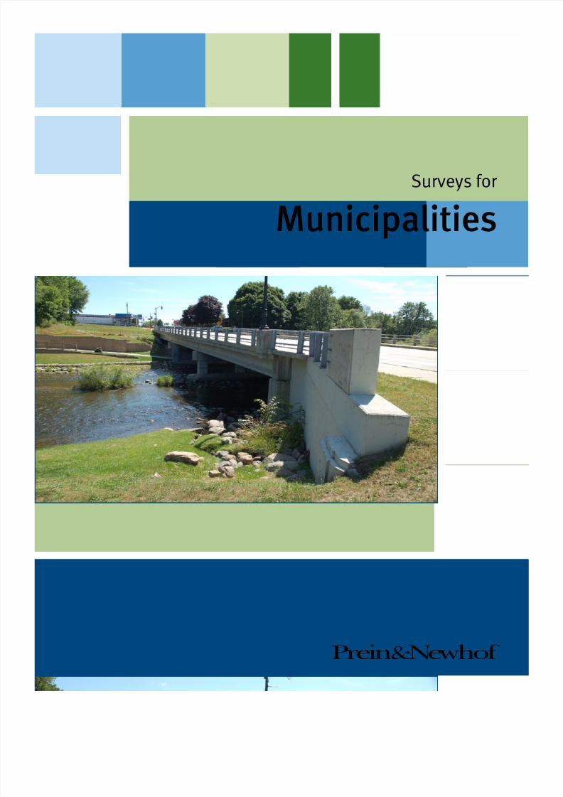
7/27/2019 Surveys for Municipalities
http://slidepdf.com/reader/full/surveys-for-municipalities 1/16
Prein&Newhof
Surveys for
Municipalities
7/27/2019 Surveys for Municipalities
http://slidepdf.com/reader/full/surveys-for-municipalities 2/16
1Prein&Newhof
Surveys for Municipalities
Types of Surveys ................................................................................................................2
What kind of surveys would be useful to me?
Frequently Asked Questions .............................................................................................. 6
What else should I know before I call?
Glossary .......................................................................................................................... 11
What do all of these terms mean?
About Prein&Newhof .......................................................................................................16
How can I learn more?
Table of Contents

7/27/2019 Surveys for Municipalities
http://slidepdf.com/reader/full/surveys-for-municipalities 3/16
2Prein&Newhof
Surveys for Municipalities
Types of Surveys
Terms in bold italics appear in the glossary, starting on
page 11.
Boundary Survey (Basic)
This survey determines the ofcial boundaries of a
property, based on the property’s legal description, by
locating it within the Public Land Survey System.
The process includes setting or restoring monuments
at the corners or along the lines of the property.
A basic Boundary Survey doesn’t include any
improvements or encroachments.
If a Title Commitment is provided, the surveyor will
review it and show any easements listed on the sketch.
During the survey, the surveyor will:
• Find or set permanent monuments at the corners of
your property.
• Set stakes at permanent monuments; set additional
stakes along property lines, if specied.
• Give you three signed and stamped original copies
of the Certicate of Survey, showing a sketch of
the property, including which corner points were
found or set.
Deliverables Permanent monuments found or set at
the corners of the property; wooden stakes set by all
permanent monuments. Additional stakes set along
Property lines, if specied. Three signed, stamped
original copies of the Certicate of Survey, showing
a sketch of the property and which corner points were
found or set.
Boundary Survey (with Improvements)
This survey determines the ofcial boundaries of a property, based on the property’s legal description.
The process includes setting or restoring monuments
at the corners or along the lines of the property. The
survey will also determine the location of any visible
improvements or encroachments and will show them
on the sketch. If a Title Commitment is provided, the
surveyor will review it and show any easements listed
on the sketch.
Deliverables Permanent monuments found or set at
the corners of the property; wooden stakes set by all
permanent monuments. Additional stakes set along
property lines, if specied. Three signed, stamped
original copies of the Certicate of Survey, showing a
sketch of the property, the improvements, and which
corner points were found or set.
Construction Staking
This is the process of translating construction plans
into physical markers on the construction site. These
markers (usually survey stakes) communicate the
location and elevation of key points, helping to
ensure that the project is built according to plan. The
contractor and the surveyor coordinate the location
of the construction stakes so that they will not be
disturbed during construction.
Deliverables Stakes and documentation, as required
by the client.

7/27/2019 Surveys for Municipalities
http://slidepdf.com/reader/full/surveys-for-municipalities 4/16
3Prein&Newhof
Surveys for Municipalities
Types of Surveys (continued)
Easement Exhibits
Easement exhibits describe the easements on a
property and show their location related to surrounding
properties. When creating a new easement, it
is advisable to attach an Easement Exhibit as a
supporting document. P&N will work with you and
your attorney to write descriptions and prepare exhibit
drawings for all types of easements.
Deliverables Easement exhibit drawings and
easement descriptions, as required by the client.
Engineering Support Survey
This survey gathers data to facilitate the design of
roads, pipelines, site grading, buildings, or other
infrastructure. Our surveyors provide high quality
surveying services to our engineering department,
making Prein&Newhof your single source for all your
surveying and engineering needs.
Deliverables Drawings, data les, or reports, asrequired by the client.
FEMA Flood Plain Determination
Law requires that if a building secured by a mortgage
is in a Special Flood Hazard Area, the owner must
get ood insurance. As Flood Maps are periodically
revised, properties near water can be added to the
Flood Zone – requiring property owners to get ood
insurance. Unfortunately, Flood Maps aren’t always
accurate, and they are frequently mis-read. If you think you have been wrongly placed in a Flood Zone, we
can help you set things right.
A Flood Plain Determination includes a review of the
current Flood Insurance Rate Map (FIRM) for your
area to determine if your property is included in a
Special Flood Hazard Area (SFHA).
• If your property is not included in the SFHA we
can provide you with an Elevation Certicate to
provide to your lender.
• If only a portion of your property falls within the
SFHA we can provide you with a survey showing
the limits of the SFHA, in relationship to the
improvements on your property.
• If your property is included in the SFHA we can
help you determine if it was wrongly included, and
can be removed by ling a Letter of Map Revision
Based on Fill (LOMR-F) with FEMA on your
behalf, requesting a Letter Of Map Amendment
(LOMA).
Deliverables Varies (see above)
Hazardous Waste / EnvironmentalCleanup Survey
These are topographic surveys performed on
environmentally-contaminated or other restricted-
access sites — for example, mapping the limits of
contaminates and staking for contamination removal
or mitigation efforts.
P&N has several experienced, 40-hour HAZWOPER
trained staff who can work on restricted sites,
7/27/2019 Surveys for Municipalities
http://slidepdf.com/reader/full/surveys-for-municipalities 5/16
4Prein&Newhof
Surveys for Municipalities
Types of Surveys (continued)
including landlls, contaminated rivers, and
contaminated industrial sites.
Deliverables Drawings, data les, or reports, as
required by the client.
Hydrographic Survey / River Crossing
A survey of a river bed or lake bottom, including
depth information. P&N has completed multiple
hydrographic surveys, for projects ranging from
utility river crossings, to marina design, to volume
calculations for sand mining operations. We have the
tools and experience to provide you with a reliable
map.
Deliverables Maps, charts, data les, or other
drawings, as required by the client.
Legal Description
This is a written description of a property, which
legally denes its boundaries. The description refers togovernment systems, coordinate systems, or recorded
maps.
Deliverables Exhibits, sketches, or documents, as
required by the client.
Photogrammetric Control
This is the process of creating maps using
photographs, usually aerial photographs. P&N’s
surveyors can provide high-accuracy ground
control points to your chosen contractor for use in photogrammetric mapping.
Deliverables Data les provided to the
photogrammetric mapping contractor; mapping from
the selected photogrammetric mapping contractor
combined with other survey data, as required by the
client.
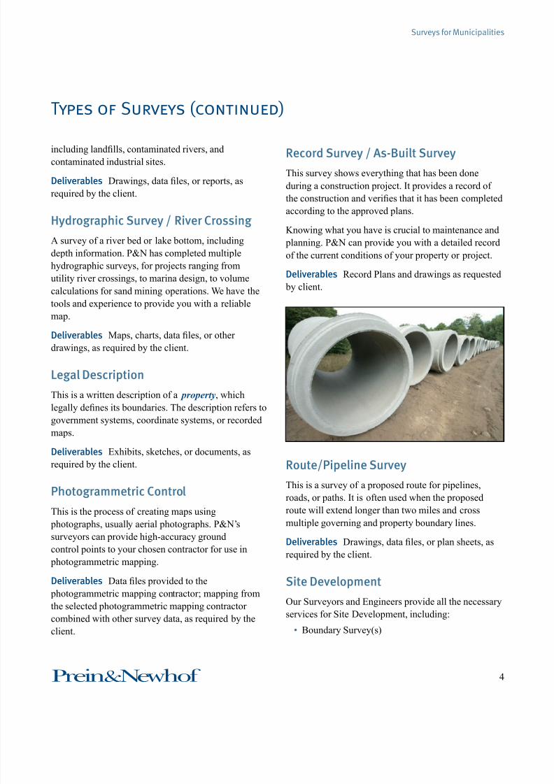
Record Survey / As-Built Survey
This survey shows everything that has been done
during a construction project. It provides a record of
the construction and veries that it has been completed
according to the approved plans.
Knowing what you have is crucial to maintenance and
planning. P&N can provide you with a detailed record
of the current conditions of your property or project.
Deliverables Record Plans and drawings as requested by client.
Route/Pipeline Survey
This is a survey of a proposed route for pipelines,
roads, or paths. It is often used when the proposed
route will extend longer than two miles and cross
multiple governing and property boundary lines.
Deliverables Drawings, data les, or plan sheets, as
required by the client.
Site Development
Our Surveyors and Engineers provide all the necessary
services for Site Development, including:
• Boundary Survey(s)

7/27/2019 Surveys for Municipalities
http://slidepdf.com/reader/full/surveys-for-municipalities 6/16
5Prein&Newhof
Surveys for Municipalities
Types of Surveys (continued)
• Topographic Survey(s)
• Site Plans (Preliminary & Final)
• Construction Plans
P&N’s surveyors and engineers have decades of
experience working with local governments, as well
as county and state agencies. Our team can help you
every step of the way, including planning, permitting,
site preparation, utility design, green compliance,
bidding, and construction. We specialize in nding
solutions that satisfy everyone, and in keeping projectson budget and on schedule.
Deliverables Boundary Survey, Topographic Survey,
Site Plans, and/or Construction Plans, as required by
the client and municipality.
Topographic Survey
This survey depicts changes in elevation, as well as
the location of natural and articial objects within the
area.
Deliverables Topographic Survey Maps

7/27/2019 Surveys for Municipalities
http://slidepdf.com/reader/full/surveys-for-municipalities 7/16
6Prein&Newhof
Surveys for Municipalities
What does a surveyor actually do?
There are many types of surveys, but they all involve
surveyors doing one of two things:
• Taking information from paper (deeds,
construction plans, etc.) and marking the features
on the ground, often with wooden stakes.
• Taking information from markers on the ground
and using it to create paper documents (maps,
plats, legal descriptions etc.).
How do surveyors describe the locationof a property?
Surveyors use the Public Land Survey System. The
state of Michigan was originally surveyed in the early
to mid-1800’s by the Government Land Ofce and
was divided into Townships (six miles square) and
Sections (one mile square, 640 acres). These Sections
were then divided into smaller squares by repeated
halving and quartering. A quarter section is 160 acres
and a “quarter-quarter section” is 40 acres.
Frequently Asked Questions
NW ½160 acres
N ½ NE ¼80 acres
S ½ NE ¼80 acres
NW ¼ SW ¼40 acres
SE ¼ SW ¼40 acres
SW ¼ SW ¼40 acres
NE ¼ SW ¼40 acres
N ½ NW ¼ SE ¼20 acres
S ½ NW ¼ SE ¼20 acres
NE ¼ SE ¼40 acres
W ½SW ¼SE ¼
20 acres
E ½SW ¼SE ¼
20 acres
NW ¼SE ¼SE ¼
SW ¼SE ¼SE ¼
SE ¼SE ¼SE ¼
NE ¼SE ¼SE ¼
The Legal Description of a property could, for
example, place it at “The South 1/2 of the Northwest
1/4 of the Northeast 1/4 of Section 24, Town 17 North,
Range 8 West, Warner Township, Acme County,
Michigan.” A surveyor’s job would be to identify and
mark that location on a map and physically on the site.
Why do surveys sometimes contradicteach other?
The state of Michigan was originally surveyed in theearly to mid-1800’s by the Government Land Ofce
and was divided into Townships (six miles square) and
Sections (one mile square, 640 acres). These Sections
were the divided into smaller squares by repeated
halving and quartering. A quarter section is 160 acres
and a “quarter-quarter section” is 40 acres. Surveyors
marked out Section corners with wooden posts or other
monuments.
At that time, surveyors used steel chains to measure
distances and a simple compass to measure angles,
so their work was sometimes inaccurate by today’s
standards. It is not uncommon to nd that the
measurement between two monuments that are
supposed to be one half mile apart, will actually be
signicantly longer or shorter than a half mile. This is
why it is common for a description of: The NE ¼ of
NE ¼ of Section 26, commonly known as a “40 acre
parcel" to contain 36.5 acres or 43.7 acres, when it is
actually surveyed.
The Federal Government realized this immediately,
and issued original deeds to the land using a systemknown as “aliquot parts” (i.e. The N.E. ¼ of the S.E.
¼, and so forth.) By law the location of the posts
placed in the ground by those early Surveyors controls
the location of the description.
Moreover, few of the original Section Corners remain
to serve as a reference. Surveyors today must rely on

7/27/2019 Surveys for Municipalities
http://slidepdf.com/reader/full/surveys-for-municipalities 8/16
7Prein&Newhof
Surveys for Municipalities
Frequently Asked Questions (continued)
the best available evidence of where the posts were
set. This increases the likelihood that two surveyors
may form different opinions as to the location of a
particular corner.
The surveyor must nd, interpret, and weigh the
available evidence (both on the ground and from
historic documents) to nd the location of each point
on the boundary of a parcel. This means that the
surveyor must be part historian, part archeologist, part
lawyer, and part mathematician.
What steps does a surveyor take?
During a typical boundary survey, the surveyor may:
• Study your property’s Legal Description; they may
also study the Legal Descriptions of surrounding
properties.
• Study previous surveys in the area.
• Locate the boundary onsite (rst locating Section
Corners and other controlling monuments, then
locating the property’s boundary with reference to
those points)
• Mark property corners and stake property lines, if
requested
• Prepare a survey map
What is that stake left in my yard by thesurveyors?
Surveyors often establish ‘control points’ to help them
with their calculations during a survey. These are
necessary and should remain in the ground. If any of
the surveyor’s markers are an annoyance to you, please
let the eld team know before they leave.
How accurate are a surveyor’smeasurements?
The question of accuracy depends somewhat on
the quality of instruments used, and the physical
conditions present at the time the measurement is
made. On average, a Surveyor using typical modern
equipment can make a measurement within a few
hundredths of a foot in angle and distance. This
equates to roughly ¼ of an inch, or the size of a pencil
eraser.
Why do surveyors often stand in themiddle of the road?
Most county roads were built along Section and
quarter-Section lines, as a matter of convenience. This
gave easy access to property owners and gave the
County a convenient way to describe the road right-of-
way; most roads are 66 feet wide, with 33 feet being
on each side of the section line.
This system is both a blessing and a curse for
surveyors. The roadway makes it much easier for surveyors to access the Section Corners, but it exposes
them to many hazards. Each year several surveyors are
injured or killed in trafc incidents.
Unfortunately, the monuments which mark Section
Corners are often damaged or destroyed in the course
of road construction, requiring the surveyor to spend

7/27/2019 Surveys for Municipalities
http://slidepdf.com/reader/full/surveys-for-municipalities 9/16
8Prein&Newhof
Surveys for Municipalities
Frequently Asked Questions (continued)
even more time in the road to reestablish the location
of the corner.
Can’t you just plug it in to your GPS?
GPS is a tool for measuring between two points; it is
essentially a high-tech tape measure. GPS equipment
does not and cannot determine the location of a
boundary line.
The location of boundary lines is determined by
many features (section corners, platted subdivision
monuments, railroad boundaries, road and highway
boundaries, etc.), and nding them requires research
and evaluation, not just measurement.
When is a survey necessary?
A survey is useful any time you need to dene exactly
where a piece of property is and what’s included on it,
for example:
• Before purchasing or dividing a piece of property.
• Before adding buildings or other improvements to
a property.
• To identify encroachments and title matters, such
as easements and rights-of-way.
• To settle a boundary dispute.
I’m buying new property, and my lender doesn’t require a survey. Why should Iget one?
A survey will:
• Give you a legal document that will help you
defend your property rights, should the need arise.
• Let you see exactly where the property’s
boundaries are.
• Identify easements called for in the legal
description.
• Notify you if any of the improvements on the
property encroach onto a neighbor’s property.
• Make you aware of potential encumbrances that
may exist on the property.
• Give you a professional opinion on the quality of
the property’s Legal Description.
In short, a survey alerts you to potential problems
that you wouldn’t otherwise notice. For example, if
the former property owner built a garage over part of
a utility easement, the utility provider may have thelegal right to remove the garage if it interferes with
the installation or maintenance of the utility. A survey
would make you aware of this problem and allow
you to negotiate a solution with the seller before you
purchase the property.
There’s an existing survey of theproperty. Do I need another one?
There are several potential problems with using anolder survey:
It could be out of date. Do you know that there have
been no changes to the property in the last several
years? Has anything been built near or across the
property lines? Have the neighbors bought or sold their
lands recently?

7/27/2019 Surveys for Municipalities
http://slidepdf.com/reader/full/surveys-for-municipalities 10/16
9Prein&Newhof
Surveys for Municipalities
Frequently Asked Questions (continued)
It could be copyrighted to the surveyor for a specic
purpose, and using it for another purpose (such as a
nancial transaction) without notifying the surveyor
could violate that copyright.
It could leave you nancial liable. Each survey is
certied to a specic party at a specic time; it is
intended to be used for a specic purpose and no other.
If a survey is not certied to you, and it causes you
nancial problems, you have no legal recourse against
the surveyor.
Having a property re-surveyed is the only way to avoid
these problems.
I have title insurance. Do I still need asurvey?
Yes. Title insurance only covers defects in the title of
your property, it does not and cannot protect you from
problems with the boundaries of your property.
All title insurance policies include exceptions for,
”(i) easements, or claims of easements, not shown by
the public record; and (ii) encroachments, overlaps,
boundary line disputes, or other matters that would be
disclosed by an accurate survey and inspection.”
Having a survey done is the only way to know if
easements, encroachments, etc. exist. For most
private residential property, a Boundary Survey
with Improvements (together with a review of the
Title Insurance Commitment by the Surveyor) will
be sufcient to notify the buyer of any potential
problems. Buyers of commercial property shouldconsider an ALTA/ACSM survey.
Will a Survey tell me what I own?
No. A survey identies the boundaries of a piece of
property. It doesn’t establish ownership or guarantee a
title.
Once a surveyor marks my boundaries,are they indisputable?
No. Any person has a right to dispute the location
of boundary lines in court. Surveyors provide their
professional opinion on the location of boundary lines,
and they are liable for their opinion, but they are not
the nal word. The nal word in boundary matters
belongs to the courts.
How much will a survey cost?
There many factors that determine survey cost,
including:
• Physical Conditions – Survey price is affected by
the size of the property, travel time to the job site,
and any terrain conditions that make surveying
more difcult (rough terrain, heavy underbrush,
wetlands, busy streets, etc.).
• State of Existing Data – Each survey is based on
existing records and monumentation. Surveyors
must research available legal documents, verify
and analyze physical monuments in the eld,
and compare all other existing evidence. If your
boundaries are not described clearly on your Legal
Description, or if there is little information in the
7/27/2019 Surveys for Municipalities
http://slidepdf.com/reader/full/surveys-for-municipalities 11/16
10Prein&Newhof
Surveys for Municipalities
Frequently Asked Questions (continued)
available records and physical evidence is scarce,
the surveyor may have a very complex job.
• Legal Issues – In the course of researching a
survey, the surveyor may discover disputed
boundaries or Legal Descriptions that contradict
each other. Sorting these out is complicated and
adds time to the survey process.
• Liability – Any survey completed by a
Professional Land Surveyor includes a guarantee
that the surveyor has not erred or omitted any
information, and that the boundaries shown in the
survey are correct. The surveyor accepts limited
liability for his or her actions; the more valuable
the property, the more liability the surveyor
accepts.
While surveys can be expensive, it is important to
remember that you are paying for a professional
service. You are paying for the surveyor’s knowledge
and experience, and for all the information that
the survey company has on record. As with all
professional services, those with more knowledge andexperience are often worth the higher fees that they
charge.
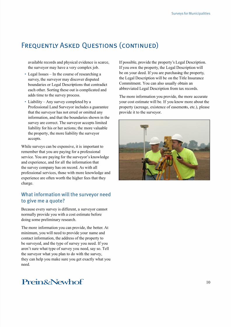
What information will the surveyor needto give me a quote?
Because every survey is different, a surveyor cannot
normally provide you with a cost estimate before
doing some preliminary research.
The more information you can provide, the better. Atminimum, you will need to provide your name and
contact information, the address of the property to
be surveyed, and the type of survey you need. If you
aren’t sure what type of survey you need, say so. Tell
the surveyor what you plan to do with the survey,
they can help you make sure you get exactly what you
need.
If possible, provide the property’s Legal Description.
If you own the property, the Legal Description will
be on your deed. If you are purchasing the property,
the Legal Description will be on the Title Insurance
Commitment. You can also usually obtain an
abbreviated Legal Description from tax records.
The more information you provide, the more accurate
your cost estimate will be. If you know more about the
property (acreage, existence of easements, etc.), please
provide it to the surveyor.

7/27/2019 Surveys for Municipalities
http://slidepdf.com/reader/full/surveys-for-municipalities 12/16
11Prein&Newhof
Surveys for Municipalities
unimproved land, space in an existing or proposed
building, marina slips, etc. Condominiums in
Michigan are regulated by the Condominium Act.
Coordinate System A reference system for dening
points in space.
Corner A point at which two or more boundary lines
meet.
Deed A legal document which conveys ownership
from one person (the grantor/seller) to another (the
grantee/buyer).
Easement The right of someone other than the
property owner to use a piece of private property
for a specic purpose (for example, the right of the
public to use a trail that crosses private property,
the right of a utility company to to install power
lines on private property, etc.). Easements are
often used to create a narrow passage across a
property. An easement restricts the owner’s rights
to that piece of property but doesn’t take them
away; the details vary depending on the easement
and situation.
Electronic Distance Meter (EDM) An instrument
that measures distances electronically using
infrared or laser light.
Glossary
Like any industry, the Surveying Profession has
developed its own unique terminology. The following
glossary is provided to help you understand some of
the more common terms used by surveyors. It is by no
means exhaustive. If a Surveyor uses a term you aren’t
familiar with, please ask for clarication.
Acre A unit of area equal to 43,560 square feet, or ten
square chains.
Adjoiner The land in contact with a property;
neighboring land. Can also refer to the writtendeed for the adjoining property.
Bearing The angle between north or south and a
direction, for example, N36°26’17”E (“from
North 36 degrees, 25 minutes, and 17 seconds
East”).
Benchmark A physical object (natural or articial)
with a known elevation. It is used to determine the
elevation of other points.
Boundary A line of demarcation between adjoining parcels of land, as determined by their legal
descriptions.
Certicate of Survey A statement signed by the
surveyor regarding the work they performed. It
generally appears on the drawing. Each type of
survey has its own unique certicate.
Chain The unit of measure used for Government
Surveys in Michigan. It is equal to 66 feet. A chain
is divided into 100 links, each 0.66 feet (7.92
inches) long. A Rod is equal to ¼ of a Chain; aLink is equal to 1/100 of a Chain.
Condominium A system of co-ownership where
individuals own portions of a larger property
and share joint ownership of common areas. The
larger property is referred to as the Condominium
Development; the individual parcels are called
Condominium Units. Condominium Units may be

7/27/2019 Surveys for Municipalities
http://slidepdf.com/reader/full/surveys-for-municipalities 13/16
12Prein&Newhof
Surveys for Municipalities
Glossary (continued)
Elevation Certicate A certicate that veries
the elevation of a structure on a given property
relative to the ground level, with reference to a
published datum. Communities and builders use
Elevation Certicates to comply with oodplain
management ordinances; insurance companies use
them to determine ood insurance policies.
Encroachment A structure that is located (wholly or
in part) on property not owned by the occupant.
Encumbrance Anything that effects or limits the
value of property ownership but doesn’t prevent
the transfer of ownership (easements, mortgages,
etc.).
Exception (Title Insurance) Any facts identied and
excluded from coverage in a title insurance policy,
resulting in less than a free and clear title.
Exception (Legal Description) Portions of land that
are included in the description of a larger parcel
of land but then excluded from it by a subsequent
legal description.
FEMA The Federal Emergency Management Agency,
which plans for, mitigates against, and responds
to man-made and natural disasters. A part of the
Department of Homeland Security.
Flood Insurance Rate Map (FIRM) The ofcial
FEMA map showing both the Special Flood
Hazard Areas and Risk Premium Zones in a
community. Insurance companies use these maps
to determine which property owners must obtain
ood insurance.
Gap An area of land between two neighboring
properties that is not included in the legaldescription of either property, the ownership of
which is uncertain.
Government Land Ofce (GLO) The federal agency
that conducted Government Surveys in Michigan
prior to 1946, when it was combined with other
federal agencies to create the Bureau of Land
Management (BLM).
Government Survey The original survey of a tract
of land conducted by the Federal Government.
Most of the land in Michigan was surveyed under the Public Land Survey System, which divided
the land into six-mile-square Townships, each
consisting of 36 Sections of one square mile each.
Most land descriptions reference these original
surveys.
GPS (Global Positioning System) A network
of satellites that can be used to determine the
location of points on the ground. Also refers to the
instruments that receive and process the satellite
signals. The system is more accurately called theGlobal Navigation Satellite System (GNSS), since
GPS refers only to a specic group of satellites,
not to the satellite-positioning system as a whole.
Modern survey equipment receives signals from
several groups of satellites.

7/27/2019 Surveys for Municipalities
http://slidepdf.com/reader/full/surveys-for-municipalities 14/16
13Prein&Newhof
Surveys for Municipalities
Glossary (continued)
HAZWOPER From the term “HAZardous Waste
OPerations and Emergency Response.” A standard
established by OSHA for dealing with hazardous
waste.
Hundredth A unit of length equal to 1/100 of a foot
(0.12 inch or 1/8 inch).
Improvements Man-made structures of a permanent,
durable nature (such as buildings, pavement, or
fences) are improvements whether or not they
add value to the property. Structures that can
be easily removed from the property (such as
detached decks or sheds with no foundation) are
not normally considered improvements for the
purposes of a survey.
Iron A general term for monuments that are made of
metal.
Legal Description A written description of a piece
of property that describes its precise location
by reference to government surveys, recorded
maps, or coordinate systems. It is the ofcial,
authoritative description of a piece of property.
Level An instrument used to determine the difference
in elevation between various points on the ground.
Link A unit of length equal to 1/100 of a chain, or
0.66 feet (7.92 inches).
Littoral Coastal; pertaining to a shore. Littoral Rights
are an owner’s rights to use a body of water (lake,
ocean, etc.) that touches their property, including
travel rights and use of the shore and bed.
Locate To determine the site of an object or boundary,
so that the object or boundary can be shown on
a map, described in writing, or marked on the
ground.
LOMA (Letter Of Map Amendment) An ofcial
document from FEMA that amends a Flood
Insurance Rate Map, and can remove the ood
insurance requirement for the included properties.
LOMR-F (Letter of Map Revision Based on Fill) An ofcial document from FEMA that amends
an effective Flood Insurance Rate Map, and can
remove the Federal ood insurance requirement
for the included properties.
Lot A piece of land that has been identied on a plat.
Lots are usually identied by their lot number and
subdivision name (Lot 94, Shady Acres).
Monument A physical object that represents the lines
and boundaries of a survey. Monuments can be
natural (boulders, trees, lakes, etc.) or man-made
(wooden stakes, iron rods, concrete monuments,
etc).
Overlap An area of land between two neighboring
properties that is included in the legal description
of both properties, the ownership of which is
uncertain.

7/27/2019 Surveys for Municipalities
http://slidepdf.com/reader/full/surveys-for-municipalities 15/16
14Prein&Newhof
Surveys for Municipalities
Glossary (continued)
Parcel Any portion of land that cannot be designated
by lot number.
Parent Parcel The original portion of land from
which a parcel has been taken; also any parcel
that has the potential to be divided. According to
Michigan’s Land Division Act, parcels that existed
on March 31, 1997, or have been in existence for
at least 10 years, are eligible to be parent parcels.
Patent The title conveyed by the government
describing land sold or granted by the government.
This may be thought of as the original deed to a
property.
Plat A map showing the boundaries and subdivisions
of a tract of land, along with all essential data
about the individual properties, as determined by a
survey. The term is sometimes used to refer to the
subdivision itself, rather than to the map.
Rod A unit of length equal to a quarter of a Chain, or
16.5 feet. Rods are also sometimes called Poles.
Right-Of-Way A parcel of land granted (by deed
or easement) to someone else, usually for
construction and maintenance of transportation or
utility lines (streets, ditches, power lines, etc.).
Riparian Pertaining to a stream or river and its
banks. Riparian Rights are an owner’s rights to
use a stream or river that touches their property,
including travel rights and use of the bank and
bed. (This term is often used interchangeably with
Littoral, which refers to lakes and oceans.)
Section A division or parcel of land created by the
Government Survey, approximately one square
mile (640 acres).
Section Corner A point on the boundary of a Section
of land, established by the Government Survey.
Section Corners were established every half mile
along the exterior boundary of each Section. This
term is often used in reference to the physical
monument, although this is not technically correct.
Special Flood Hazard Area (SFHA) An area
identied by FEMA as a high risk for ooding,
making ood insurance mandatory for properties
in the area.
Subdivision A portion of land that has been divided
into lots; the process of splitting a section of land
into smaller properties. In Michigan, subdivisions
are regulated by the Land Division Act. A map of a
subdivision is called a Plat.
Theodolite An instrument for measuring angles.
Tenth A unit of length equal to 1/10 of a foot (1.2
inches or 1 3/16 inches)
Title The legal evidence of the right of ownership in
a piece of property. Can also refer to the formaldocuments that serve as proof of these rights.
Total Station A surveying instrument that integrates
a theodolite with an Electronic Distance Meter
(EDM) to measure both angles and distances.
Tract An area of land, large or small.

7/27/2019 Surveys for Municipalities
http://slidepdf.com/reader/full/surveys-for-municipalities 16/16
15Prein&Newhof
Surveys for Municipalities
About Prein&Newhof
At P&N, our goal is to serve our clients wisely –
meeting their infrastructure needs with a combination
of experience, integrity, creativity, and common sense.
This commitment has made us the engineer of choice
for over 50 communities across West Michigan.
P&N offers a wide range of engineering, surveying,
consulting, and laboratory services, including:
• Water & Wastewater Systems
• Stormwater Management
• Roads & Trails
• Airports
• Private Development
• Environmental Consulting
• Laboratory Testing
• Structural Engineering
• Geotechnical Engineering
• Surveying
• GIS & Mapping
Employees
Prein&Newhof is 100% employee-owned, with 80
full-time personnel, including, surveyors, drafters,
geologists, chemists, communication specialists, and
support staff.
Sustainability
At P&N, if it isn’t sustainable, it isn’t good design. So
what does sustainability mean to us?
• Lower Ecological Impact – Smarter designs that t
seamlessly into our ecosystems.
• Energy Recovery & Conservation – Intelligent
systems that do more with less.
• Environmental Renewal – Creative engineering
that restores and improves communities.• Financially-Sustainable Improvements – Smarter
spending through big-picture planning.
Locations
Grand Rapids Ofce (Corporate Ofce)
3355 Evergreen Drive NE, Grand Rapids, MI 49525
t. 616-364-8491 • f. 616-364-6955
Holland Ofce
258 James Street, Holland, MI 49424
t. 616-394-0200
Kalamazoo Ofce
7123 Stadium Drive, Kalamazoo, MI 49009
t. 269-372-1158 • f. 269-372-3411
Muskegon Ofce
4910 Stariha Avenue, Muskegon, MI 49441
t. 231-798-0101 • f. 231-798-0337
Traverse City Ofce
1220 Airport Access Road, Traverse City, MI 49686
t. (231) 946-2394 • f. (231) 946-0580
Environmental Laboratory
3260 Evergreen Drive NE, Grand Rapids, MI 49525
t. 616-364-7600 • f. 616-364-4222
On the Internet
www.preinnewhof.com • [email protected]