Presented at: New Jersey Society of Professional Land Surveyors SurvCon 2010 February 5 th , 2010

February 5-7, 2014Bally’s Park Place Hotel
Atlantic City, New Jersey
SurvCon 2014
New Jersey Society of Professional Land Surveyors
35th Annual Conference and Exhibition

SurvCon 2014Welcome to
2
Welcome to SurvCon 2014 – our 35th Annual Conference and Exhibition, featuring three full days of classes where you can earn up to 24 hours of continuing education credit.
Here are some FAQ about SurvCon:
• Register on or before December 13, 2013 to take advantage of Early Bird Registration Savings.
• For our members and colleagues also licensed as engineers in New Jersey, many of our course offerings have been designed to fulfill the new PE continuing education requirements. Engineers should look for [PE] for qualifying courses.
• NJSPLS is an approved provider of continuing education for New York licensed land surveyors. Look for [NY] under the qualifying workshops. For Pennsylvania licensees, look for [PA] for Pennsylvania qualifying courses.
• Digital Handouts – The digital handouts for the workshops are overwhelmingly popular. The ability to download materials for any or all of the workshops has only enhanced this feature. Workshop handouts will NOT be distributed at the conference and will be posted exclusively online at www.njspls.org for you to download and print. We encourage you to bring the handouts to SurvCon.
• SurvCon Welcome Gala – Please join friends and fellow professionals from7:00 PM to 11:00 PM on Wednesday to kickoff the conference. The evening includes the impressive “International Buffet”, a two-hour hosted bar and our ever-popular DJ Mike. What a great way to start SurvCon 2014! Casual Attire. Cost: $50 per person.
• All continental breakfasts, lunches and breaks are INCLUDED in your registration fee.
• This year ALL Tower rooms in the Bally’s Tower are $89 per night. Please call Bally’s at 888-516-2215, 24 hours a day, seven days a week to make your reservation. Make sure to give them our Group Code: GBLAN14. The deadline for guaranteed group rates for SurvCon is January 7, 2014.
You can also reserve your room at Bally’s by going online at http://www.totalrewards.com/hotel-reservations?propCode=BAC&groupCode=GBLAN14
Questions? Please call NJSPLS at 800-853-5263
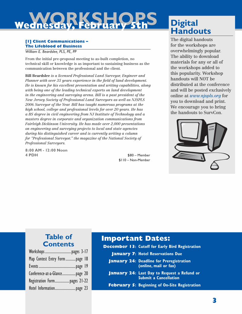
Table of Contents
Workshops ............................. pages 3-17Map Contest Entry Form ...........page 18Events .........................................page 19Conference-at-a-Glance ...............page 20Registration Form ................pages 21-22Hotel Information .......................page 23
WORKSHOPS Wednesday, February 5th
3
Important Dates: December 13: CutoffforEarlyBirdRegistration
January 7: HotelReservationsDue
January 24: DeadlineforPreregistration (online,mailorfax)
January 24: LastDaytoRequestaRefundor SubmitaCancellation
February 5: BeginningofOn-SiteRegistration
Digital HandoutsThe digital handouts for the workshops are overwhelmingly popular. The ability to download materials for any or all of the workshops added to this popularity. Workshop handouts will NOT be distributed at the conference and will be posted exclusively online at www.njspls.org for you to download and print. We encourage you to bring the handouts to SurvCon.
[1] Client Communications – The Lifeblood of BusinessWilliam E. Beardslee, PLS, PE, PP
From the initial pre-proposal meeting to as-built completion, no technical skill or knowledge is as important to sustaining business as the communication between the professional and the client.
Bill Beardslee is a licensed Professional Land Surveyor, Engineer and Planner with over 35 years experience in the field of land development. He is known for his excellent presentation and writing capabilities, along with being one of the leading technical experts on land development in the engineering and surveying arena. Bill is a past president of the New Jersey Society of Professional Land Surveyors as well as NJSPLS 2006 Surveyor of the Year. Bill has taught numerous programs at the high school, college and professional levels for over 20 years. He has a BS degree in civil engineering from NJ Institute of Technology and a masters degree in corporate and organization communications from Fairleigh Dickinson University. He has made over 2,000 presentations on engineering and surveying projects to local and state agencies during his distinguished career and is currently writing a column for “Professional Surveyor,” the magazine of the National Society of Professional Surveyors.
8:00 AM - 12:00 Noon4 PDH $80 – Member $110 – Non-Member

WORKSHOPSWednesday, February 5th
4
[2] Continuous Quality Improvement: CQI – More Than Just an Idea for GeomaticsJoseph V.R. Paiva, PhD, PS, PE
Quality Control (QC), Quality Assurance (QA) and Continuous Quality Improvement (CQI) are terms not frequently used in land surveying and other geomatics activities. Yet, as managers of spatial data (collection, adjustment, analysis, information extraction, mapping and other activities), most practitioners and their staffs may unknowingly use some aspects of these activities from the realm of Quality Professionals. This course will help them understand the overall scheme of quality management, and why such a structured approach is essential to maintaining consistent quality in their survey. As the final use of spatial data is so reliant on accurate and high quality processes so that the end user(s) of that data can reliably use and apply such data and information, having systematic ways of ensuring quality can be a decided benefit to a typical spatial data professional’s practice. In this course, the basics of QA, QC and especially CQI are covered. Then, suggestions are given on how to concretely apply them to a geomatics practice. Benefits of using the aspects of quality management and continuous quality improvement are presented together with the risks of not using them. It is likely that many course attendees will see in the described risks many negative outcomes they may have experienced. It is also possible that they may recognize these outcomes as a result of failure to apply basic quality management techniques to their businesses.
8:00 AM - 12:00 Noon4 PDH [NY-PA-PE] $80 – Member $110 – Non-Member
Joseph V.R. Paiva is a Registered Professional Land Surveyor, Registered Professional Engineer with more than 25 years experience working in civil engineering, surveying and mapping. He is a consultant in the field of geomatics and general business, particularly to international developers, manufacturers and distributors of instrumentation and other geomatics tools. Prior to establishing his own consulting practice, Joe was Managing Director of Spatial Data Research, Inc., a GIS data collection, compilation and software development company. Previously, while at Trimble Navigation Ltd., his assignments included serving as senior scientist and technical advisor for Land Survey research & development, VP of the Land Survey group, and director of business development for the Engineering and Construction Division. Earlier, Joe was Vice President and a founder of Sokkia Technology, Inc., guiding development of GPS- and software-based products for surveying, mapping, measurement and positioning. He has also held senior technical management positions in The Lietz Co. and Sokkia Co. Ltd. Joe’s experiences include serving as assistant professor of civil engineering at the University of Missouri-Columbia, and as a partner in a surveying/civil engineering consulting firm. Joe’s key contributions in the development field include design of software flow for the SDR2, SDR20 series and SDR33 Electronic Field Books, and software interface for the Trimble TTS500 total station. As an ACSM representative to the Accrediting Board for Engineering and Technology (ABET), he serves as a program evaluator and team chair. He currently writes for POB and The
Empire State Surveyor magazines. In his role as consultant to the Geomatics Industry Association of America, Joe organizes and presents workshops, and authors and edits articles for the technical press. Besides his magazine columns, he is currently working on a practitioner’s guide to the optimal use of total stations.

WORKSHOPS Wednesday, February 5th
5
[3] Site Control Issues: Understanding the Tools Available for Confident SurveyingWilliam Henning, PLS and David Doyle
Land Surveyors are fortunate to have many positioning tools available to them as they establish site control for their projects that may be accessed over many years. However, while it is easy to produce coordinates, it is also easy for them to be wrong or to have substandard accuracy. This workshop will interactively discuss various factors that land surveyors should understand for confident positioning and to help them select the tools that give them the desired control accuracy, including:
• Static GNSS vs. RTK GNSS• RTN vs. RTK• RTX© vs. RTN• PPP vs. differential processing• OPUS-S vs. OPUS-RS• Passive vs. Active Control• Grid vs. Ground• Precision vs. Accuracy• RMS and Other Data Collector/Processing Output• D h vs. D H• SPC vs. LDP• Datum Issues and Legacy Control• Remote Sensing and Mobile Mapping
8:00 AM - 12:00 Noon4 PDH [NY-PA-PE] $80 – Member $110 – Non-Member
William Henning, PLS, is a Registered Professional Land Surveyor with over 45 years of active experience in all phases of surveying technology. He has been the project lead for new height modernization geodetic networks in county-wide projects in the U.S., where he planned, helped construct, processed, adjusted and managed new geodetic control systems. He has been actively involved with education/outreach to the geospatial community for almost 20 years, presenting over 100 talks and workshops on surveying and GNSS technology. He has over 19 years experience working with various GNSS manufacturers’ real time positioning systems. Mr. Henning is Past President of the American Association for Geodetic Surveying (AAGS) and is an ACSM/AAGS Fellow. He has been presented with the NOAA Administrator’s Award for outstanding accomplishment in producing real time GNSS positioning guidelines. He is currently retired from NOAA’s National Geodetic Survey (NGS), where as a Geodesist he helped develop guidelines and support methodology for real time GNSS positioning with state, national and international organizations.
Dave Doyle recently retired from the National Geodetic Survey where he was employed, since 1972, as chief geodetic surveyor. He was responsible for the development, technical design and management of plans and programs that enhance the United States National Spatial Reference System. He provided technical assistance in Geodesy to
International, Federal, State and local surveying, mapping and GIS agencies. Mr. Doyle began his career as a geodetic surveyor in the U.S. Army in 1967, and served on numerous field survey campaigns until completion of his service in 1970. From 1970 until 1972 he worked for a private surveying company near Washington D.C. where he was responsible for completing boundary, topographic and engineering surveys while he pursued undergraduate studies in Geodesy and Mathematics at the George Washington University. At NGS his experiences included all phases of geodetic triangulation, astronomic positioning, leveling, GPS data collection, data analysis, datum transformations, network adjustments, and data publication. Mr. Doyle’s activities included extensive efforts on the development and implementation of the North American Datum of 1983 and the North American Vertical Datum of 1988. He has also provided technical support to various countries for the modernization of national and regional geodetic reference systems in Caribbean and Central America, Africa, and the Pacific. Mr. Doyle is a Past President of the American Association for Geodetic Surveying, a Fellow member of the American Congress on Surveying and Mapping, a charter member of the Geographic and Land Information Society, and has served on the U.S. delegation to the International Federation of Surveyors.

WORKSHOPS Wednesday, February 5th
6
[4] Laser Scanning: The Battle for Profitability (MS50 Multistation vs. PS20)Anthony Paturzo and Tommy Nichols
This seminar is designed for both current and potential Laser Scanning users and will highlight the latest technologies available in the world of 3D Laser Scanning. Discussions will include work flow, deliverables, common practices, types of scanners and most importantly, what is the recommended scanner for your job!. It will also include many marketing tips, for landing those special 3D scanning projects, and why you cannot continue to operate without a 3D Laser Scanner system as part of your tool box.
Included in this NEW session will be the P20 Laser Scanner, and for the first time at SURVCON, a special appearance will be made by the world’s very first “MULTISTATION” – the MS50.
8:00 AM - 12:00 Noon4 PDH [NY-PA]
$80 – Member$110 – Non-Member
Tommy Nichols (Technician Support) has been with Leica Geosystems for three years. He was a Sales and Support Technician for Loyola Spatial Systems from 2004-2009. Received his LSIT in 2003 while employed with the Virginia Department of Transportation as GPS Coordinator Hampton Roads District.
Anthony Paturzo has a strong survey background with over ten years of experience. He was a lead party chief at Cullinan Engineering in Boston for five of those years. While at Cullinan Engineering, Anthony not only worked on very large construction projects, but had the opportunity to develop the 3D Laser Scanning team. Now at Leica, with over six years of Laser Scanning experience, Anthony oversees all sales and support in the Northeast for HDS. Anthony holds a bachelor’s degree from Emerson College.
Debra A. Christen is Vice President of the Marquis Agency and a member of its professional practice leadership team and risk management committee. Debbie’s insurance and risk management career spans over 20 years, concentrated in the design professional liability market. Prior to joining Marquis, Debbie was a professional liability underwriter with AIG Group and was a senior executive with one of the nation’s leading design professional brokers. Debbie has been published in several Architecture and Land Surveying trade magazines. She has also developed and presents risk management webinars for Marquis’ clients and seminars for numerous design professional associations.
Barbara Sable joined RLI in July 2010 and is the Director, Professional Enterprise Risk Solutions for RLI’s Professional Services Group. She is responsible for developing the content for RLI’s risk management programs and addressing the day-to-day risk management needs of RLI’s policyholders. Barb provides face-to-face seminars, webinars, contract reviews, policy analysis, and insurance program guidance to RLI’s producers and insureds. Prior to joining RLI, Barb was an equity partner in a national insurance brokerage firm, serving the needs of that firm’s largest architecture and engineering clients. Before that, Barb was an executive with Victor O. Schinnerer, where she was responsible for underwriting and risk management for numerous architecture and engineering firms worldwide. She began her career with CNA Insurance Companies as an actuarial and financial analyst. Barb is a 1985 graduate of Northwestern University in Evanston, IL, with a B.A. in Mathematics.

WORKSHOPS Wednesday, February 5th
7
[5] Managing Risks for Land Surveyors & Civil EngineersDebra Christen and Barbara Sable
Understanding General Liability, Workers Compensation, Commercial Auto and Umbrella/Excess Exposures and Insurance| Of all the professional service firms, Land Surveyors and Civil Engineers probably have the most exposure to general liability, stolen or damaged equipment, workers compensation injuries and automobile accidents. A prudent firm will have good risk management policies and safety protocols in place. In addition the insurance policies you have in place must provide the amount of limits and coverage necessary to protect your firm against losses.
In this course we will discuss:• The important components of each of these policies, and how each
protects your practice• Contract requirements by Project Owners that could cause insurability
issues• Certificates of insurance; what protections they afford the certificate
holders; how it works the additional insured language works• Action – Over Claims – What are they? What is the potential impact to
your firm? How to avoid these claims through contract language• Discussion on Workers Compensation and Auto Exposures: Safety
Protocols to protect your employees and your firm• Understanding the Coverages for Natural Disasters• Disaster Recovery – Data Loss and Other Recovery Tips
8:00 AM - 12:00 Noon4 PDH [PE] $80 – Member $110 – Non-Member
[6] Field to Finish and Surface Modeling with Carlson SurveyJennifer DiBona
The first part of this class will be a thorough introduction to Carlson Survey’s Field to Finish feature. We will first show how the proper use of coding and descriptions in the field can drastically reduce the time spent creating an existing conditions plan in the office. Next, we will start with an empty drawing, import points and process with Field to Finish so that points, symbols and linework are inserted to the drawing on their proper layers. The second part of this class will cover surface modeling from start to finish. Using the processed field data and other data sets, we will explain the basics of a TIN model, demonstrate why some surface data (points, breaklines) is better than others (contours) and show tips and tricks for creating a model that accurately represents the existing ground. As time permits, we will also cover proposed pad design, retaining wall modeling and volume calculations. While Carlson Survey will be used for this presentation, the major principles of field to finish and surface modeling will be applicable regardless of the software used by attendees.
1:00 PM - 5:00 PM4 PDH [NY-PA-PE] $80 – Member $110 – Non-Member
Jennifer DiBona is a long-time CAD consultant and trainer doing business as That CAD Girl. She is based in Raleigh, North Carolina. Jennifer has a degree in Surveying Technology and has worked for surveying and civil engineering consulting offices in North Carolina and Illinois. She also worked for an Autodesk reseller for several years and built their technical services division from the ground up. Today, That CAD Girl provides sales, support and training for Carlson, AutoCAD and IntelliCAD software and Carlson hardware and data collection. They specialize in Field to Finish, Surface Modeling, CAD standardization and Carlson Software implementation. Jennifer is one of the charter members of Carlson College which is the certified program for authorized Carlson Software trainers. Jennifer also writes the “CAD Picks and Clicks” column for “Professional Surveyor Magazine”.

WORKSHOPS Wednesday, February 5th
8
[7] Retracements – Following the FootstepsWalter G. Robillard, PS, Esq. and Kimberly Buchheit, PSM
The phrase, “Following the Footsteps” is mentioned in numerous court decisions from local jurisdictions in various states to the Supreme Court of the United States. This presentation will place these three critical words under a magnifying glass, as the courts have done. Using decisions and opinions from the various courts, the instructors will reveal the elements that the modern surveyor should be aware of when seeking to “Follow the Footsteps” left behind from past surveys. The presentation will discuss the courts’ explanations about the importance of “Footsteps”: how to identify them, how to separate them, what they are and how to classify them. The attendees should leave this presentation with an understanding of the rulings from the courts and thus, the ability to apply the common law principles that continue to define the phrase, “Following the Footsteps”.
1:00 PM - 5:00 PM4 PDH [NY-PA] $80 – Member $110 – Non-Member
Walter G. Robillard is a graduate forester and a professional surveyor registered in four states. He has also earned three other college degrees in law and public administration. He is an attorney-at-law and a member of the Georgia Bar. He practices in the areas of land disputes, title problems, survey negligence and contract problems. His 49 years experience has taken him to all 50 states and numerous foreign countries. He has served as a commission chairman and a delegation head to the Federation International Geographic in Montreaux, Switzerland, and Brighton, United Kingdom. He serves as an adjunct professor at Mercer University in Macon, GA, and New Mexico State University in Las Cruces, NM. He has co-authored the college textbooks, “Boundary Control & Legal Principles” and “Evidence & Procedures for Boundary Location” and the legal research book, “Clark on Surveying & Boundaries”. Walt has testified in both Federal and State courts as an expert in the areas of boundaries, law, surveying, negligence and various other aspects of surveying.
Kimberly A. Buchheit, PSM has been surveying since completing her Bachelor of Arts Degree in Geography at the State University of New York at Buffalo in 1983. Working through the ranks and extending her survey studies at Valencia College in Orlando, Kim was well prepared to become a Professional Land Surveyor in the State of Florida in 1990. One year later, Ms. Buchheit founded Buchheit Associates, Inc. Surveyors & Mappers which she continues to own and operate as a 100% Woman-owned business in Altamonte Springs, FL. Ms. Buchheit is a qualified expert witness and has testified in several cases involving survey issues. In recent years, Kim has researched and studied court decisions pertaining to real property rights, with emphasis on landmark cases. Kim strives to follow in the footsteps of her mentors and honor the traditions of the land surveying profession by sharing information and knowledge through formal and informal continuing education programs.
David Lee Ingram is a Licensed Land Surveyor in three states, having been first Licensed in West Virginia in 1975 and later that year in Virginia. Maryland registration was granted in 1981. He is a 1978 graduate of James Madison University holding degrees in Economics and Business Administration. Mr. Ingram is an active member of several state and national professional associations including the Virginia Association of Surveyors, West Virginia Society of Professional Surveyors, Maryland Society of Surveyors, and Surveyors Historical Society. He has held numerous positions in these organizations including Secretary / Treasurer of the National Society of Professional Surveyors for three terms, two terms as a member of the Board of Directors of the American Congress on Surveying and Mapping, multiple terms and past Secretary of the Board of Directors of the Surveyors Historical Society, Chapter President and member of the Board of Directors of the Virginia Association of Surveyors, and he has served as chairman of the Ethics Committee of NSPS for several years and served as a member of the ACSM Ethics Committee for several years. He has served as the ACSM TAC of ABET Commissioner and a program evaluator for the Accreditation Board for Engineering Technology (ABET). Mr. Ingram resides in Mount Crawford, Virginia, where he is the Managing Partner of the firm of Ingram - Hagen & Co., PLC, a firm offering surveying, engineering, land planning, and consulting forestry services. He is married to Regina and has one daughter, Amanda.

WORKSHOPS Wednesday, February 5th
9
[8] Comparative Ethics for Surveyors and EngineersDavid Lee Ingram, RLS
What can Surveyors and Engineers learn from other professions? And why are other professions’ Ethics different (and the same) from Surveyors’ and Engineers’? Ethical considerations of business and professional practice have always been of concern to surveyors and engineers, but in recent years surveyors and engineers have seen an increasing emphasis on the need to understand and put into practice positive ethical attitudes. Attempts are made to impose ethics on surveyors and engineers from several directions including legal, professional and moral. An understanding of the implications of each is important. Additionally, surveyors and engineers find themselves interacting with other professions on a daily basis where an understanding of their ethical obligations is critical to a positive outcome for projects that require input from many different sources. However, it is frequently observed that priorities of different professions may be in conflict with each other. To focus thoughts for the remainder of the class, the workshop will begin with a review of ethical guidelines that surveyors and engineers from New Jersey are expected to adhere to and look at areas of common interest as well as areas of difference. After a discussion of the history of ethics for surveyors and engineers and an examination of modern ethical guidelines for surveyors and engineers, ethical guidelines for several other professions will be examined with an eye towards areas of commonality as well as areas of conflict. Some of these groups will be closely related professions to surveyors and engineers while others will be examined not for their areas of common interest, but rather to see what we can learn from them. Finally, the workshop will conclude with a guided discussion time where the class will discuss what ethics guidelines should be included in a code of ethics for surveyors and engineers and why these are important for professionals to keep in mind and adhere to.
1:00 PM - 5:00 PM4 PDH [NY-PA-PE] $80 – Member $110 – Non-Member
[9] Measurements on TrialJoseph V.R. Paiva, PhD, PS, PE and David Doyle
As surveyors, we use measurements on a daily basis. Could you defend your measurements against a well-versed attorney who is supported by his own surveying expert? Just what is two-sigma or three-sigma? Can my network fail the Chi-square test and still be good? What the heck is a Chi-square test anyway? Can I use GNSS for boundary evidence locations? Do I really need a least squares adjustment if my traverse closes 1 in 200,000? All of these questions and more will be answered by two nationally recognized experts in measurement, professor and Point of Beginning magazine contributor Dr. Joseph Paiva and former NGS chief geodesist David Doyle. Join them in a round-table style discussion regarding measurement theory and practice. They will cover some basic areas that often are not considered by surveyors preparing testify, even when it is property boundaries that they are testifying on, as well as more advanced topics that are still within the domain of cross-examination. Questions from the audience are welcomed and encouraged.
1:00 PM - 5:00 PM4 PDH [NY-PA-PE]
$80 – Member$110 – Non-Member

WORKSHOPS Thursday, February 6th
10
[10] Title vs. TidalLewis H. Conley, Jr., PLS, PP and Stewart Farrell, PhD
Water boundaries, while the oldest and most visible of boundaries are probably the most misunderstood and bitterly contested. Join with Lewis H. Conley Jr., PLS, for this land surveyor’s review of the history, laws, technical and non-technical knowledge necessary for establishing boundaries along the many waterways of New Jersey. Joining Mr. Conley will be Stewart Farrell, PhD director of the Coastal Research Center at Stockton University who will demystify the FEMA process to determining Velocity Zones by discussing wave heights and run-up, what causes waves and their affect to the shoreline.
8:00 AM - 12:00 Noon4 PDH [NY-PA-PE] $80 – Member $110 – Non-Member
[11] AUTOCAD Civil 3D and Terrain ModelingJohn Cooke
This course examines the creation of Digital Terrain Models, or Surfaces, in AutoCAD® Civil 3D®, with an emphasis on producing highly accurate models as efficiently as possible from survey data. Since the Civil 3D Surface is also the basis for contouring and analysis within the program, better surfaces yield better contouring and analysis results. The class reviews the data types for terrain modeling – point, breakline and contour data – and how their use is facilitated with survey data transferred into the drawing from field work. The class will examine how breakline data can be captured and included in the Civil 3D TIN, through the use of Civil 3D tools and from other solutions, including Carlson® and SmartDraft®. The course will examine various strategies for filtering point data for inclusion in the Civil 3D Surface, including Point Groups, Description Keys and other tools. Major topics also include the assessment of surface accuracy and surface editing, techniques for improving the quality of contouring, surface presentation and annotation styles, and the use of surfaces in analysis functions such as slope and drainage assessments.
8:00 AM - 12:00 Noon4 PDH [NY-PA-PE] $80 – Member $110 – Non-Member
Lewis H. Conley, Jr., PLS, PP is Vice President of Planning and Surveying for Van Note-Harvey Associates, is licensed in New Jersey, Maryland and Pennsylvania. He has been an adjunct professor at Atlantic Community College. In 1986, Mr. Conley was appointed to the New Jersey State Board of Professional Engineers and Land Surveyors by Governor Kean and re-appointed for a second term in 1991 by Governor Florio. He served as president of the State Board of Professional Engineers and Land Surveyors during 1990 and 1991, and again during 1993-1994. During 1991-1992, he was President of the Colonial States Board of Land Surveyor’s Registration (an organization of the licensing boards of Land Surveyors representing 18 Eastern States) and later served 10 years as its Executive Secretary. Mr. Conley is a member of MSS and a Fellow and Past President of NJSPLS. From 2005 to 2012 served as NSPS Area 2 Director. During his tenure with the licensing boards, Mr. Conley was the author of much of the legislation dealing with the profession.

WORKSHOPS Thursday, February 6th
11
[12] Modernization of the NSRSWilliam Henning, PLS and David Doyle
This program will discuss the on-going activities at the National Geodetic Survey (NGS) designed to enhance the availability, quality, and integrity of the National Spatial Reference System (NSRS). The session will outline NGS’s efforts to develop and adopt a new national horizontal reference system that will be consistent with the International Terrestrial Reference Frame (ITRF) to replace NAD 83, and Gravity for the Redefinition of the American Vertical Datum (GRAV-D) to replace NAVD 88. In addition, the program will highlight improvements to NGS software utilities that will enhance surveyor’s professional capacity to provide up-date recovery information and improved horizontal positions for vertical control points published as part of the NSRS for the greater benefit of the geospatial community.
8:00 AM - 12:00 Noon4 PDH [NY-PA-PE] $80 – Member $110 – Non-Member
[13] Practical Approach to Understanding and Using Grid CoordinatesJoseph V.R. Paiva, PhD, PS, PE
Surveyors do more and more work on some kind of a grid. If that grid is the state plane coordinate system (SPCS), when combining GPS with terrestrial measurements from total stations, the “magic” of software in the field office or office computers is brought in to solve the “issues”. But what are these issues? What is being solved? What does the surveyor need to keep in mind? State plane coordinates or other officially designated projections are often used when making such combinations of measurements. This is just one of many reasons for using the SPCS. But perhaps because of a lack of understanding of the mathematics involved, contractors, engineers, architects, and sometimes even surveyors themselves get into a world of trouble.Very often the problem is that the surveyor has not simply communicated their results with the appropriate definitions or meta data. This often happens because of that lack of understanding. Unfortunately, pushing buttons to get state plane coordinates from a ground survey, or ground values from state plane coordinates often delivers results that are not appropriate for the intended party or that are completely unusable. Worse, the results could even be inaccurate.
This course begins with a basic explanation of how projections work, followed by a easy-to-understand primer on basic cartographic and geodetic concepts. The latter is an essential part of learning how to deal with grid-to-ground issues. Then various strategies for communicating the issues and how stakeholders work with the published surveying information are covered. All of these strategies apply equally to communicating and computing within a surveying organization or between surveying organizations and users of the information.
8:00 AM - 12:00 Noon4 PDH [NY-PA-PE] $80 – Member $110 – Non-Member
John Cooke joined Wetland Studies and Solutions, Inc. in the fall of 2009 after working as an independent consultant and AutoCAD® instructor for over twenty years. Mr. Cooke presently operates the CivilTraining,LLC Division of Wetland Studies and Solutions, Inc., and supports Engineering, GIS and Surveying technology efforts within the office and for other clients nationwide. Mr. Cooke has been continuously affiliated with Autodesk Civil/Survey applications since 1989, functioning initially in development and then in consulting and training roles. Mr. Cooke has an extensive background in the development, implementation and training of Autodesk AEC Civil Engineering, Surveying, GIS and BIM solutions. He has provided training to thousands of individuals nationwide, assisted numerous clients in implementing Civil software, CAD standards and practices, and provided project consulting to many clients in unusual or challenging project applications. His experience level covers a spectrum from wide-area network based systems for large international clients to individual data collection and mapping stations for survey sole practitioners. His training experience ranges from multidiscipline firms at National and Regional levels to individualized field survey training in subway tunnels under New York City. Operating CivilTraining, LLC, Mr. Cooke continues to provide training and consulting services to national clienteles. Within Wetland Studies and Solutions, Inc., he participates in development efforts for Engineering and Survey automation, including the creation of custom software for stream restoration based on AutoCAD Civil 3D®.

WORKSHOPS Thursday, February 6th
12
[15] Certified Floodplain Manager (CFM) ProgramCleighton Smith, PE, CFM
This session is on the Certified Floodplain Manager (CFM) program, and how it can benefit the surveying community. There will be discussion on the background of the National Flood Insurance Program (run by FEMA) and why it led to the creation of the CFM program. Discussion on the role that the Elevation Certificate plays in the NFIP, and why recent reforms to the NFIP will lead to greater demand for Elevation Certificates. The workshop will include a hands-on exercise similar to one which would appear on the CFM exam.
1:00 PM - 5:00 PM4 PDH $80 – Member $110 – Non-Member
Cleighton Smith is the Regional Business Segment Manager of Water Resources for Bergmann Associates, working out of their Conshohocken, PA office. He has 35 years of civil/water resources engineering experience. He has been involved in the flood insurance program since 1978 and has been a CFM instructor since 2002. He is a graduate of Clarkson University in Potsdam NY with a BS in 1977 and MS in 1978 and is a PE in seven states.
[16] Contract Language for DummiesTerry Ann Coleman, Jack Bauerle and Gary Chiumento, Esq.
Liability insurance is a risk transfer mechanism. If you purchase a $1,000,000 professional liability policy, it doesn’t mean you won’t get sued for $2,000,000. It just means you have transferred the first $1,000,000 to a third party payor. But why wait until you get sued to understand the clauses contained in the agreement you signed were not there for your benefit. It is important for design professionals to keep sight of the need to include certain project-specific and general condition terms in their agreements and strive to limit onerous, unrealistic, ambiguous or uninsurable terms in their contracts. Participate in this fun-filled class, and we promise to not make it boring. Learn how to review and draft your own contract clauses.
We will cover the following contract clauses:1. Dispute Resolution Clause
2. Attorney’s Fees Clause
3. Standard of Care Clause
4. Sole Remedy Clause
5. Waiver of Third Party Obligations
6. Indemnity Clauses
7. Waiver of Consequential Damages
8. Limitation of Liability Clause
9. Disclaimer of Warranties and Guarantees
10. Defense Clause
1:00 PM - 5:00 PM4 PDH [PE]
$80 – Member$110 – Non-Member
[14] Take a Walk on the Wild SideDavid Lee Ingram, RLS
Starting in the 1920’s the Wild Company of Heerbrugg, Switzerland, developed and produced some of the finest surveying instruments ever made and stayed in production into the 1980’s. The T2 was the standard for the practicing surveyor and the T3 & T4 were the world class standards for geodetic work. Other common models including the T0, T1, & T16 were used by private surveyors, government agencies, and the military around the world. Additionally the company produced other equipment such as subtense bars, levels, photogrametric equipment, electronic distance measuring equipment, and many other useful tools to the surveyor and mapper of the mid-20th Century. This workshop will review the history of the company, the development of the various instruments, and an examination of the instruments. Examples of these instruments will be displayed & demonstrated and hands-on practical experience will be permitted.
Registered participants for this class will be asked to bring along a tripod (preferably with anti-kickout straps) and the class size will be limited to 40 participants to allow adequate time for examination of the different instruments and exploration of instrument usage and operation.
1:00 PM - 5:00 PM4 PDH $80 – Member $110 – Non-Member

WORKSHOPS Thursday, February 6th
13
Unmanned airborne systems (UAS) have become the rage among many potential users of this brand new technology. In this course small, unmanned airborne systems are discussed, specifically with regard to their use in solving geomatics problems. Currently, while we hear of many people experimenting or using UASs, it is illegal to operate one in the U.S. without a permit from the FAA and even then only if the permittee is a government agency. The FAA is in the process of preparing a report on how it will integrate UAS into the national airspace under a congressional mandate. However, private commercial use of UAS may only be possible in years, not months for the non-governmental user. Nonetheless, because of its enormous potential to deliver a selection of surveying and mapping products that a land surveyor can generate (after appropriate training in the technology), its ability to be inserted into projects where safety, access, frequency of surveys, speed in which optimally sized tracts can be mapped, and ability to map from the air at a cost that is a magnitude or more less in cost that was previously possible, it is deserving of consideration, so that businesses can develop in advance ways to take advantage of this technology. Doug McQueen, an aviation attorney at LeClairRyan and veteran commercial pilot, will discuss the legal considerations for UAS in the surveying field.
His topics will include:• Current state of UAS Regulation• Technological Considerations for Airspace Integration• Predicted Regulatory Requirements, Including Certification and
Training• Tort Liability and Insurance Considerations• Privacy, Nuisance and Trespass Considerations
In this course we will cover types of UAS, describe some of the operational details that require stringent attention to detail when flying a UAS, and the types of solutions that can be derived from UAS. Also discussed is the process of close range photogrammetry and how it differs from conventional photogrammetry. The current state of FAA regulations and projected changes based on the congressional mandate will be discussed. Types of results that can be achieved, and the new opportunities that use of UAS can bring to surveyors will also be presented.
1:00 PM - 5:00 PM4 PDH [NY-PA] $80 – Member $110 – Non-Member
NJSPLS is a Sponsor for New York Continuing EducationLook for [NY] forqualifying courses.
Doug McQueen is an aviation attorney at LeClairRyan and veteran commercial pilot. His legal practice focuses on litigation defense of a variety of aviation entities, including airlines, parts manufacturers and service providers. Doug has over 12,000 hours of domestic and international flying experience as a major airline pilot, regional airline pilot, corporate pilot and flight instructor. He holds an FAA certification as an aircraft dispatcher and has been trained as an accident investigator.
Doug has worked with major aviation insurance clients, unmanned aircraft manufacturers and other unmanned aircraft stakeholders to provide answers about the integration of civilian unmanned aircraft into the National Airspace System.
He holds a Juris Doctorate degree and a master’s degree from Rutgers University, and an undergraduate degree from Embry Riddle Aeronautical University.
[17] UAVs - Drones - UASs in Geomatics – Practical and Legal ConsiderationsJoseph V.R. Paiva, PhD, PS, PE and Doug McQueen, Esq.

WORKSHOPSFriday, February 7th
14
[18] Managing Projects and WorkloadWilliam E. Beardslee, PLS, PE
Keeping control of staff and scheduling is a skill which can be developed into a profit making mechanism. Open discussions will evaluate various methods of controlling these issues and setting fees accordingly.
8:00 AM - 12:00 Noon4 PDH [PE] $80 – Member $110 – Non-Member
[19] Creating Business LeadershipMichael Venuto, PE, PLS
This course is designed to help those interested in improving their business leadership skills and discovering strategies for increased overall personal or business success. This course will help attendees learn teamwork strategies, understand the importance of genuine communication, and teach the skills necessary to lead themselves or their teams toward a vision. We will use real life examples to explore the principles of leadership and success that they can apply to their own situations.
8:00 AM - 12:00 Noon4 PDH [PE] $80 – Member $110 – Non-Member
Michael Venuto is a NJ Licensed Professional Engineer and Professional Land Surveyor. He has been a member of the New Jersey Society of Professional Land Surveyors for the last ten years. Mike holds a Bachelor’s degree in Civil Engineering, a Bachelor’s degree in Survey Engineering Technology, and a Masters in Business Administration. He has resided in Washington Township with his family for twelve years. He has spoken to many groups about leadership and keys to success. His goal is to assist people in capitalizing on their individual strengths while building upon each success. He currently serves as the Chief Engineer for the Delaware River Port Authority.
[20] Survey Inside ESRIBruce Carlson
Carlson Software will present “Survey Inside ESRI”. With more and more mapping being conducted using ESRI products such as ArcMap, it is more important than ever to work natively in the ESRI environment. Bruce Carlson will show two methods of working in the ESRI world while in the field:
(1) Using SurvPC with the ESRI engine, surveyors can now bring ESRI maps to the field and work directly with the geodatabase and symbol sets of the customer. This allows survey firms to update and edit portions of the official map directly and adapt automatically to the specific schema and mapping techniques of each jurisdiction that they serve, with very little advance prep time. Just load the files and the program learns the particular system and feature codes and provides the requisite prompting.
(2) Using GIS360, rather than take the maps into the field, when in areas of good cell phone coverage, the field surveyor can access the map over the internet, and load only the portions of the map and the feature subset of interest. Then the new map information and GIS data can be transmitted from the field back to the office. The “augmented reality” features of GIS360 will also be introduced. Actual project examples will be shown from around the world.
8:00 AM - 12:00 Noon4 PDH [NY-PA]
$80 – Member$110 – Non-Member

WORKSHOPS Friday, February 7th
15
WHO SHOULD ATTEND THIS SEMINAR? This course has shown that typical participants benefiting the most from this course are those with limited exposure to the railway industry, or railroaders with highly specialized positions. For example, a surveyor-engineer well versed in highway/street design but with some exposure to railway boundaries would gain valuable knowledge about track, railroad cadastre, railroad terminology, theory and railway operations typically unfamiliar to those outside the industry. In addition to surveyors, the course is strongly recommended for civil engineers, attorneys, utility engineers and design professionals.
THE COURSE The course begins with the “dirty dozen”, a list of the 12 most common blunders, poor assumptions and bad guesses that railroad professionals see on an everyday basis coming to them from non-railroad professionals and agencies that kill or delay projects that involve crossing or bordering a railroad.
From here, the program investigates in detail:
• The ICC Valuation Maps & the ICC Cadastre that most are not aware of (or understand)…
• Safety: Right of Entry vs. 49CFR214 Roadway Worker Policy(are you trespassing? Is it worth a $10,000 Federal fine or your life? Where OSHA ends and FRA takes over)
• Railroad Turnouts, Frogs & Switches. (Geometry and common practice)
• Topographic Surveys, what a railroader expects to see when submitted a survey (or put another way, why mapping submitted to a railroader fails to tell him what he needs to know)
• Railroad Curves, Spirals (Searles to AREMA 10-chord) and following in the footsteps of the original surveyor/ how it translates to what exists today including the gauge shift issue.
• The abandonment issue (vs. embargoes and what really constitutes abandoned?)
• Retracement and Documentation pertaining to abandoned railroad R/W
• Land development around railroads (including utility crossings, road crossings, drainage)
• Easements vs. license/contract/permits (why “easement” is a dirty word at times)
• Railroad Survey Control hierarchy
• Research & Data Salvaging… Typical railroad records of interest to surveyors
• Railroad Terminology/ mapping graphical symbols and what they really mean
• Railroad Technology (Survey related, where it’s at and where it is headed, including GIS)
[21] Railroad Surveying 101Presented by Charlie Tucker, AREMA (American Railway Engineering and Maintenance of Way Association)
• Contacting the railroad (Geographically compiled railroad contact sheet provided)
• Track layout & design (Minimum standard expected by the railroad)
• Public Record Documents (Why limiting yourself to courthouse and assessor records may lead to a flawed boundary survey product. Why not to trust assessor maps showing railroad property and why Title Company policies have great difficulties with railroad boundaries.)
Upon completing this seminar, the surveyor should be much more aware of the issues and requirements to be addressed prior to tackling a railroad related project. The surveyor should now be more confident that railroad related work can be managed under his area of expertise. Enrollment is limited.
8:00 AM - 5:00 PM8 PDH [NY-PA-PE]
$200 – Member$250 – Non-Member

WORKSHOPS Friday, February 7th
16
[22] The Judge, the Jury and the SurveyorWalter G. Robillard, PS, Esq., Hon. Robert Shelton and Kimberly Buchheit, PSM
This workshop is designed to provide the surveyor with a general understanding of the courts and is intended to aid the Surveyor in preparing for potential litigation. Retired Judge Bob Shelton, Attorney/Surveyor Walt Robillard and Surveyor/Juror Kim Buchheit will lead this lively exploration of the courts’ unpredictable outcomes where decisions pertaining to boundary issues and other related topics have been debated. Using real world cases and some creative examples, attendees will be asked to consider evidence and render opinions which may or may not agree with the courts’ rulings. This presentation should increase the surveyor’s awareness of methodologies, procedures, rules of evidence and precedents that have been established by the Common Law system.
1:00 PM - 5:00 PM4 PDH $80 – Member $110 – Non-Member
Robert C. Shelton, Jr. is a retired Superior Court Judge and a practicing attorney in New Jersey. He earned degrees from Seton Hall University in Classical Languages and Philosophy and School of Law (JD). During his career, he has been an Associate and Senior Partner at various firms. He became a Prosecutor in Sussex County and later a Judge in Sussex County Court after serving as a member of the New Jersey General Assembly in the mid 1970’s. From 1977 until 1985, Bob was a New Jersey Superior Court Judge (Morris County) and since his retirement, he has been appointed as a Special Ethics Master by the New Jersey Supreme Court. Bob has collaborated to provide seminars for surveyors in numerous States and Countries. He enjoys travel, art, literature, music, and conversing by way of several languages as well as Amateur Radio (Extra Class).
[23] Cave Surveying and CartographyDwight Livingston
What is “Speleology?” That’s just one of many new terms you’ll learn (like “karst”) at this informative presentation on the Science of Surveying and Mapping Caves. Hundreds of feet underground, GPS is worthless. Do compasses even still work? Deep inside pitch-black caverns, often extending miles, scientists use land surveying techniques to accurately map and plot three-dimensional subterranean mazes. You think you’ve had tough survey jobs? Come listen as expert speleologist Dwight Livingston explains how caves today are accurately surveyed and mapped, despite the harshest underground conditions.
1:00 PM - 5:00 PM4 PDH [NY-PA] $80 – Member $110 – Non-Member
Dwight Livingston has been caving since 1985 and cave surveying since the mid ‘90s. In 2002 he began project caving with the Germany Valley Karst Survey (GVKS), where he helped in a five-year cave survey effort that took Hellhole, a classic vertical cave near Seneca Rocks, WV, from around nine miles to 28 miles of surveyed passage. In 2007 Livingston took on the role of cartographer for Shoveleater Cave, also in Germany Valley. GVKS took Shoveleater from a small hole to over five miles of surveyed passage, completing a map of Shoveleater in 2011. This map won best of show at the Cartography Salon of the 2011 National Speleological Society (NSS) convention. Livingston continues to survey in Germany Valley, and is working on a monograph of Shoveleater Cave. He is Chairman of the Survey & Cartography Section of the NSS. Dwight Livingston holds a Bachelor of Fine Art and Bachelor of Industrial Design from Rhode Island School of Design. He is employed in the R&D Mechanical Engineering Department at BD Diagnostics, Becton Dickinson, in Sparks, Maryland.

WORKSHOPS Friday, February 7th
17
[24] GIS/CAD Project WorkflowKevin R. Zelinsky, GISP
The goal of this seminar will be to demonstrate a successful workflow through a typical project utilizing both AutoCAD® and ArcGIS® technologies. The seminar focuses on realistic applications of GIS solutions most surveyors and engineers already own, or are readily available at nominal cost. The seminar topics will include project scoping, base mapping, field data acquisition, field data QA/QC, spatial analysis, cartographic display, and delivery to the client.
LEARNING OBJECTIVES1. Participants will be able to create project scoping ArcGIS ArcMap ex-
hibits and analyses using the sample project data used in the course.2. Participants will be able to export various GIS data layers and import
them into AutoCAD® Map basemaps for field work using the sample project data used in the course.
3. Participants will be able to consume, analyze, QA/QC, and display field data through AutoCAD Map, ArcGIS ArcMap, Microsoft Excel, and Microsoft Access using the sample data used in the course.
4. Participants will be able to deliver the project in the correct GIS for-mat using the sample data used in the course.
1:00 PM - 5:00 PM4 PDH [NY-PA-PE] $80 – Member $110 – Non-Member
Kevin R. Zelinsky is the CADD/Cartography/GIS Department Head and Associate with Remington & Vernick Engineers in Haddonfield, New Jersey. He oversees the entire mapping operation for the firm’s eleven regional offices located throughout Pennsylvania, New Jersey and Delaware. Kevin received his GISP certification from URISA in 2004, earned his Certified Mapping Scientist, GIS/LIS certification from ASPRS in 2006, and received his Professional Certificate in Geomatics from Rutgers University in 2008. He has over twenty-five years of experience in the civil engineering and cartographic industry, and his municipal maps have been honored with a variety of awards for excellence. Kevin is an accredited teacher of GIS fundamentals to municipal employees in the State of New Jersey and is also a member of the GIS Certification Institute (GISCI) Outreach Committee, which encourages GIS students and professionals to attain the level of education and experience needed for GISP certification.
AccreditationThe courses offered at SurvCon 2014 have been submitted to the State Board of Professional Engineers and Land Surveyors for the Professional Development hours (PDH) indicated.

18
ENTRY FORMCornelius (Neil) Carmody Memorial Map Contest
I submit one entry map in the following category: Each submission will be for one entry in one category.
Categories
❑ A. Small Lot Survey (Under 3 Acres) Leroy/CAD❑ B. Large Lot Survey (Over 3 Acres) Leroy/CAD❑ C. Topographic Survey – Leroy/CAD❑ D. Subdivision Plan – Leroy/CAD❑ E. Miscellaneous Maps (Free Hand, Leroy, CAD, Colored, Road Maps, Tax Maps, Site Plans, “Anything Goes”, etc. that is signed by PLS/PE/CLA)❑ F. Small Lot Survey (Title Survey) Leroy/CAD – Sheet Size No Larger than 12" x 18" ❑ G. Boundary and Topographic Survey (Under 5 Acres)❑ H. Boundary and Topographic Survey (Over 5 Acres)❑ I. ALTA/ACSM Survey ❑ J. Construction Survey, as Built, Laser Scanning
Contestant Information
This form may be duplicated
Contestant Name _______________________________________________________________________
Address ________________________________________________________________________________
City/State/Zip ___________________________________________________________________________
Business Sponsor/Affiliate _______________________________________________________________
Home Phone _____________________________ Business Phone ______________________________
E-Mail _________________________________________________________________________________
Enclosed is one print for the category entered and a check or money order in the amount of $25 payable to NJSPLS.
If you have never entered the Map Contest, you may enter ONE map at no cost.
Mail Entry to:
Nick WunnerCornelius P. Carmody Memorial Map Contest19 Route 10, Building 2, Unit 22 Succasunna, NJ 07876
Judging
All entries will be checked for compliance with New Jersey Statutes. No map will be judged if it does not comply with the law.
Maps must comply with “Preparation of Land Surveys”, Map Filing Law and Block Statute.
1. Compliance with the law. 2. Originality: any unusual situation, depicted clearly, unusual techniques. 3. Overall appearance: neatness, balance, consistency. 4. Title: name well defined. 5. Lettering: clear, unmistakable.
Regulations
1. Must be of an actual survey of New Jersey Land, drawn in Calendar Year 2013. Only maps addressed by the survey statutes will be reviewed. Design details and engineering construction details will not be reviewed.
2. Title blocks should not be blocked out.
3. Must be drawn by submitting individual.
4. All maps must bear the name of a licensed New Jersey land surveyor.
5. Entries shall be unmounted blue or black lines that become the property of NJSPLS.
6. Entries must indicate category and be accompanied by an entry form and fee of $25.00 per category. One entry is allowed per category per individual.
If you have never entered the Map Contest, you may enter ONE map at no cost.
7. Winning entries will be displayed at SurvCon 2014.
8. All Awards will be presented and all winners will be announced during the NJSPLS Annual Meeting on Thursday, February 6, 2014.
9. Maps and fees must be received on or before the end of business Friday, January 3, 2014.
10. All decisions of the judges are final.
✃

SPECIAL EVENTS SurvCon 2014
19
WEDNESDAY February 5, 2014
Lunch in Exhibit HallThe buffet lunch is included in your SurvCon registration.
Wednesday, February 512:00 Noon
NJIT ReceptionJoin Dr. Laramie Potts, Dr. John Miima and the alumni of the NJIT Surveying Program at an informal gathering for individuals who would like to learn how to pursue a degree in Land Surveying in New Jersey. Light refreshments will be served.
Wednesday, February 56:00 PM
SurvCon Welcome GalaPlease join friends and fellow professionals to kickoff the conference. The evening includes the impressive “International Buffet”, a two-hour hosted bar and, back by popular demand, DJ Mike. What a great way to start SurvCon 2014! Casual Attire.
Wednesday, February 57:30 PM - 11:00 PM
$50 per person
FRIDAY February 7, 2014
Past Presidents and Fellows BreakfastPresident Peter Burgess will host a breakfast for all NJSPLS Past Presidents and Fellows. If you are an NJSPLS Fellow or Past President of the Society and will be attending the Breakfast, please “check” the box when you register to reserve your place.”
Friday, February 77:00 AM
Lunch in Exhibit HallThe buffet lunch is included in your SurvCon registration.
Friday, February 712:00 Noon
THURSDAY February 6, 2014
Lunch in Exhibit HallThe buffet lunch is included in your SurvCon registration.
Thursday, February 612:00 Noon
NJSPLS Annual Meeting and Carmody Map Contest AwardsThis meeting is open to all SurvCon attendees. The meeting will include the installation of officers, chapter presidents and directors along with the presentation of the Carmody Memorial Map Contest Awards.
Thursday, February 65:00 PM
Dress Code
Attire at SurvCon 2014 is business casual. Feel free to be comfortable in slacks, polo shirts, sweaters, blazers, blouses, and most importantly, comfortable shoes! Suits, ties, nine-to-five dresses are not required.

SurvCon 2014 Conference at a Glance
20
Tuesday February 4, 2014
2:00 PM - 8:00 PM• Registration Desk Open
Wednesday February 5, 2014
7:00 AM• Registration Desk Opens• Continental Breakfast
8:00 AM - 12:00 Noon• Client Communications – The Lifeblood of Business
• Continuous Quality Improvement: CQI – More Than Just an Idea for Geomatics
• Site Control Issues: Understanding the Tools Available for Confident Surveying
• Laser Scanning: The Battle for Profitability (MS50 Multistation vs. PS20)
• Managing Risks for Land Surveyors and Civil Engineers
11:30 AM - 6:00 PM• Exhibit Hall Open
12:00 Noon - 1:30 PM• LUNCH in Exhibit Hall
1:00 PM - 5:00 PM• Field to Finish and Surface Modeling with Carlson Survey
• Retracements – Following the Footsteps
• Comparative Ethics for Surveyors and Engineers
• Measurements on Trial
6:00 PM• NJIT Reception
7:30 PM - 11:00 PM• SurvCon Welcome Gala
Thursday February 6, 2014
7:00 AM• Continental Breakfast• Registration Desk Opens
7:00 AM - 6:00 PM• Exhibit Hall Open
8:00 AM - 12:00 Noon• Title vs. Tidal
• AUTOCAD Civil 3D and Terrain Modeling
• Modernization of the NSRS
• Practical Approach to Understanding and Using Grid Coordinates
12:00 Noon - 1:30 PM• LUNCH in Exhibit Hall
1:00 PM - 5:00 PM• Take A Walk on the Wild Side
• Certified Floodplain Manager (CFM) Program
• Contract Language for Dummies
• UAVs - Drones - UASs in Geomatics – Practical and Legal Considerations
5:00 PM• NJSPLS Annual Meeting and Carmody Map Contest Awards
Friday February 7, 2014
7:00 AM• Continental Breakfast• Past Presidents and Fellows Breakfast• Registration Desk Opens
7:00 AM - 1:30 PM• Exhibit Hall Open
8:00 AM - 12:00 Noon• Managing Projects and Workload
• Creating Business Leadership
• Survey Inside ESRI
8:00 AM - 5:00 PM• Railroad Surveying 101
12:00 Noon - 1:30 PM• Friday Lunch in Exhibit Hall
1:00 PM - 5:00 PM• The Judge, the Jury and the Surveyor
• Cave Surveying and Cartography
• GIS/CAD Project Workflow
Photos on pages 19 and 20 courtesy of the Atlantic City Convention & Visitors Authority.

21
✃REGISTRATION SurvCon 2014
Nam
e:
FO
R O
FF
ICE
USE
ON
LY
Early Bird Registration
Register on or before December 13 and Save $$$
Three Ways to Register:
• Online at www.njspls.org• By Mail - Return the Registration Form with your credit card information or check made payable to NJSPLS to address below: NJSPLS SurvCon 2014 PO Box 101 Cream Ridge, NJ 08514-0101• By FAX - Fax your Registration Form (Both Sides) with credit card information to 1-888-475-1858.
NOTE: Faxed registrations will only be processed if charged to a credit card (American Express, VISA, MasterCard or Discover)
Registration Fees
The Registration Fee is required to attend SurvCon. Included in this fee are continental breakfasts, Exhibit Hall lunches and pass, breaks.
Spouse Registration
Registration for your spouse includes admission to all complimentary SurvCon meal functions and the Exhibit Hall. If your spouse is NOT registered for SurvCon, they will not have access to the Exhibit Hall.
One Day Registration $25Two Day Registration $50
Three Day Registration $75
Registration Deadline
The Deadline for registrations is Friday, January 24, 2014. After that date, registrations will only be accepted on site at Bally’s on February 5-8, 2013.
Registration Questions?
Call 1-800-853-5263
STANDARDREGISTRATION
(December14-January24)
EARLYBIRDREGISTRATION(ByDecember13th)
Registration Form
Name _________________________________________________________________________________
Company _______________________________________________________________________________
Address ________________________________________________________________________________
City/State/Zip ___________________________________________________________________________
Phone (DAY) _________________________________ (FAX) ____________________________________
Email Address __________________________________________________________________________
Name as you would like it to appear on your badge: ______________________________________
REGISTERED SPOUSE NAME: __________________________________________________________(fee must be included)
Conference Totals
Select the appropriate registration fee, workshop totals and special events (from page 22).
SELECT ONE:
MEMBER NON-MEMBER MEMBER NON-MEMBER
$ ________Single Day Registration............................$65............. $80................$80..............$95❑ Wed. ❑ Thur. ❑ Fri. (choose one)
MEMBER NON-MEMBER MEMBER NON-MEMBER
$ ________Two Day Registration...............................$90.............$110..............$120........... $140❑ Wed. ❑ Thur. ❑ Fri. (choose two)
MEMBER NON-MEMBER MEMBER NON-MEMBER
$ ________Three Day Registration..........................$120........... $140..............$150............$170
SPOUSE REGISTRATION please check the day(s) you will attend.............❑ Wed. ❑ Thur. ❑ Fri.
$ ________SPOUSE One Day....................................................................................................................$25
$ ________SPOUSE Two Days....................................................................................................................$50
$ ________SPOUSE Three Days...............................................................................................................$75
$ ________Workshops (from page 22)
$ ________Special Events (from page 22)
$ ________** On-Site Registration Fee ($100 will be added on site)
$ ________TOTAL AMOUNT ENCLOSED
Method of Payment
❑ Check (payable to NJSPLS)❑ AMEX ❑ VISA ❑ MasterCard ❑ Discover
Credit Card Account# ___________________________________________________________________
In the amount of $ _____________________________________Expiration Date _________________
Name Appearing on Card________________________________________________________________
3 or 4 Digit Security Code ____ ____ ____ ____
Authorized Signature ___________________________________________________________________

22
✃FEES SurvCon 2014Please make your selections here and enter totals on the other side.
Wednesday Workshops, February 5, 2014
$ ________ [1] Client Communications – The Lifeblood of Business ...................................... $80/Member; $110/Non-Member
$ ________ [2] Continuous Quality Improvement: CQI ........................................................... $80/Member; $110/Non-Member
$ ________ [3] Site Control Issues: Understanding the Tools Available ................................. $80/Member; $110/Non-Member
$ ________ [4] Laser Scanning: The Battle for Profitability (MS50 Multistation vs. PS20) .... $80/Member; $110/Non-Member
$ ________ [5] Managing Risks for Land Surveyors and Civil Engineers ............................... $80/Member; $110/Non-Member
$ ________ [6] Field to Finish and Surface Modeling with Carlson Survey ............................ $80/Member; $110/Non-Member
$ ________ [7] Retracements – Following the Footsteps ........................................................ $80/Member; $110/Non-Member
$ ________ [8] Comparative Ethics for Surveyors and Engineers .......................................... $80/Member; $110/Non-Member
$ ________ [9] Measurements on Trial .................................................................................. $80/Member; $110/Non-Member
Thursday Workshops, February 6, 2014
$ ________ [10] Title vs. Tidal ................................................................................................ $80/Member; $110/Non-Member
$ ________ [11] AUTOCAD Civil 3D and Terrain Modeling .................................................... $80/Member; $110/Non-Member
$ ________ [12] Modernization of the NSRS ........................................................................... $80/Member; $110/Non-Member
$ ________ [13] Practical Approach to Understanding and Using Grid Coordinates ............. $80/Member; $110/Non-Member
$ ________ [14] Take A Walk on the Wild Side ...................................................................... $80/Member; $110/Non-Member
$ ________ [15] Certified Floodplain Manager (CFM) Program ............................................. $80/Member; $110/Non-Member
$ ________ [16] Contract Language for Dummies .................................................................. $80/Member; $110/Non-Member
$ ________ [17] UAVs - Drones - UASs in Geomatics ............................................................. $80/Member; $110/Non-Member
Friday Workshops, February 7, 2014
$ ________ [18] Managing Projects and Workload................................................................. $80/Member; $110/Non-Member
$ ________ [19] Creating Business Leadership ...................................................................... $80/Member; $110/Non-Member
$ ________ [20] Survey Inside ESRI ....................................................................................... $80/Member; $110/Non-Member
$ ________ [21] Railroad Surveying 101 ...............................................................................$200/Member; $250/Non-Member
$ ________ [22] The Judge, the Jury and the Surveyor ......................................................... $80/Member; $110/Non-Member
$ ________ [23] Cave Surveying and Cartography ................................................................. $80/Member; $110/Non-Member
$ ________ [24] GIS/CAD Project Workflow ............................................................................ $80/Member; $110/Non-Member
Special Events
$ ________ SurvCon Welcome Gala (Wednesday) _______ Tickets @ $50 each
________ Past Presidents & Fellows Breakfast (Friday)

23
HOTELSurvCon 2014
Hotel Information
Bally’s Park Place Hotel and Casino on the Boardwalk in Atlantic City is the site for SurvCon 2014. This year we have been able to negotiate a great rate for SurvCon attendees! The NJSPLS room
rate is just $89.00 per room in Bally’s Tower. These rooms are available on a first-come, first-serve basis. Hotel guests at Bally’s can also enjoy us the wet area of the Spa ($10 per person per day) or the exercise area ($20 per person per day).
There are two ways to register for the hotel this year:
• Online at http://www.totalrewards.com/hotel-reservations?propCode=BAC&groupCode=GBLAN14, or
• Phone - Please call 888-516-2215 (24 hours a day, seven days a week) and state that you are with the New Jersey Society of Professional Land Surveyors and use **GROUP CODE: GBLAN14** to receive our group rate. Cut-off date for guaranteed reservation rate is January 7, 2014. Bally’s has assigned a reservation clerk and group code exclusively for our group.
Bally’s Park PlacePark Place and Boardwalk
Atlantic City, New Jersey 08401888-516-2215
(24.hours.a.day,.seven.days.a.week)Group.Code:.GBLAN14
Cancellation PolicyFor a FULL refund, written requests must be sent to NJSPLS by Friday, January 24, 2014. All approved refunds are subject to a $35.00 Administrative Fee.
Cancellations will not be accepted after January 24th. Refunds are not given for no-shows.
Please send written cancellation request to:
NJSPLS SurvCon 2014PO Box 101Cream Ridge, NJ 08514-0101

New Jersey Society of Professional Land SurveyorsPO Box 101, Cream Ridge, New Jersey 08514-0101
PRSRT STDU.S. POSTAGE PAID
TRENTON, NJPERMIT No. 964
EARLY BIRD REGISTRATIONRegister on or before December 13th and Save $$$
Badge Pick-Up:SurvCon registrants can pick up their name badge and related registration materials at the Registration Desk located on the 6th floor of Bally’s Park Place Hotel. Hours for Registration and Badge Pick-Up are as follows:
Tuesday,February4,2014 2:00PMto8:00PM
Wednesday,February5,2014 7:00AMto5:00PM
Thursday,February6,2014 7:00AMto5:00PM
Friday,February7,2014 7:00AMto1:00PM
Registration Questions?Contact: NJSPLS at 800-853-5263