Cultural Resources Survey for the Big Creek Channel Repair ...
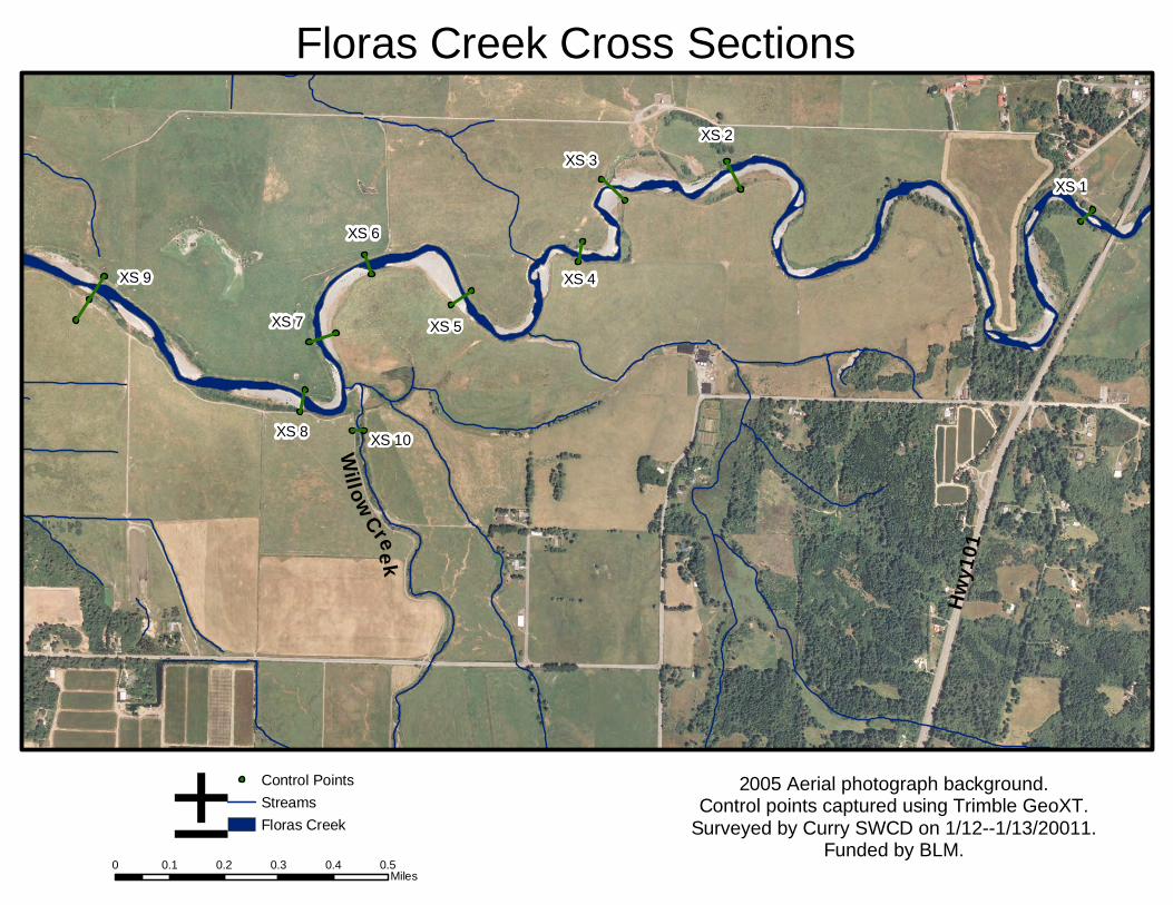
Summary of Lower Floras Creek Channel Cross-Section Surveys Completed for: Larry Standley – Hydrologist; BLM - Coos Bay District Completed by: Erin Minster - GIS/Data Specialist, & Matt Swanson – Monitoring
Coordinator; Curry Soil and Water Conservation District Survey Dates: January 10, 12 & 13, 2011 Survey Description: Landowners were contacted in early December 2010, and a
preliminary access plan was developed. In early January discharge dropped to a level where the stream could be waded. A reconnaissance trip was made to verify the access routes, and to locate and stake the cross-sectional transects. On January 10th the cross-sections were surveyed; they were resurveyed on January 12th and 13th due to software compatibility issues between the survey instrument and the transfer software.
The cross-sections were surveyed using a Nikon DTM 420 Total
Station. Each cross-section was surveyed as an independent set of points, using arbitrary northing, easting, and elevation values; no shots were taken to tie the cross-sections to one another. Rebar was used to set a permanent control point at each cross-section, which was occupied by the Total Station, and two back-sights were established using nails placed into fence posts. Each control point was given an arbitrary elevation of 100 feet. A Trimble GeoXT survey grade gps unit was used to mark each control point, as well as the end points of each cross section.
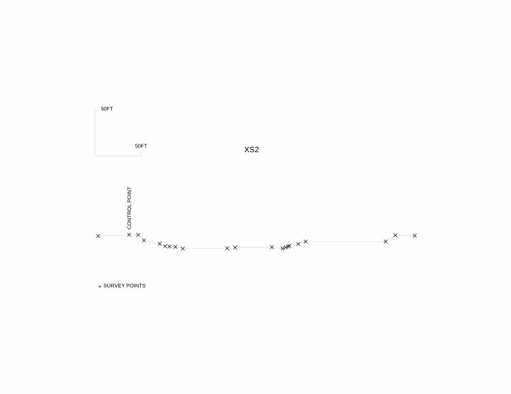
Points were taken along the cross-sectional profiles at distinct
breaks in slope, such that the ground surface between two points is assumed to be a straight line. Small undulations or changes in slope were not captured. The water surface was noted whenever it was intersected (on the edge of the wetted channel, if the transect crossed a point bar, etc.), and photos were taken depicting conditions along the transects.
Data Processing: The data was downloaded as one file from the Total Station using
TransIt transfer software. It was then exported as an asc file for each cross-section and those were imported into TraversePC surveying software. The surveying software was used to export each as a dwg drawing file. The drawing files were imported into DesignCad drawing software, and the distance and elevation of each point was captured in order to provide the information for an excel spreadsheet. The spreadsheet contains a separate tab for each cross-section with additional notes related to the survey.
XS 1
XS 2XS 3
XS 4
XS 5
XS 6
XS 7
XS 10XS 8
XS 9
Willow Cree k
Hwy1
01
2005 Aerial photograph background.Control points captured using Trimble GeoXT.
Surveyed by Curry SWCD on 1/12--1/13/20011.Funded by BLM.
0 0.1 0.2 0.3 0.4 0.5Miles
± Control PointsStreamsFloras Creek
Floras Creek Cross Sections

20FT
20FT
XS1
CONT
ROL P
OINT
SURVEY POINTS
50FT
XS2
CONT
ROL P
OINT
SURVEY POINTS
50FT
50FT
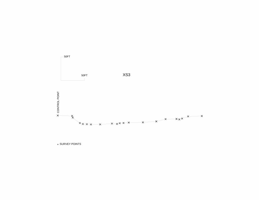
XS3
CONT
ROL P
OINT
SURVEY POINTS
50FT
50FT
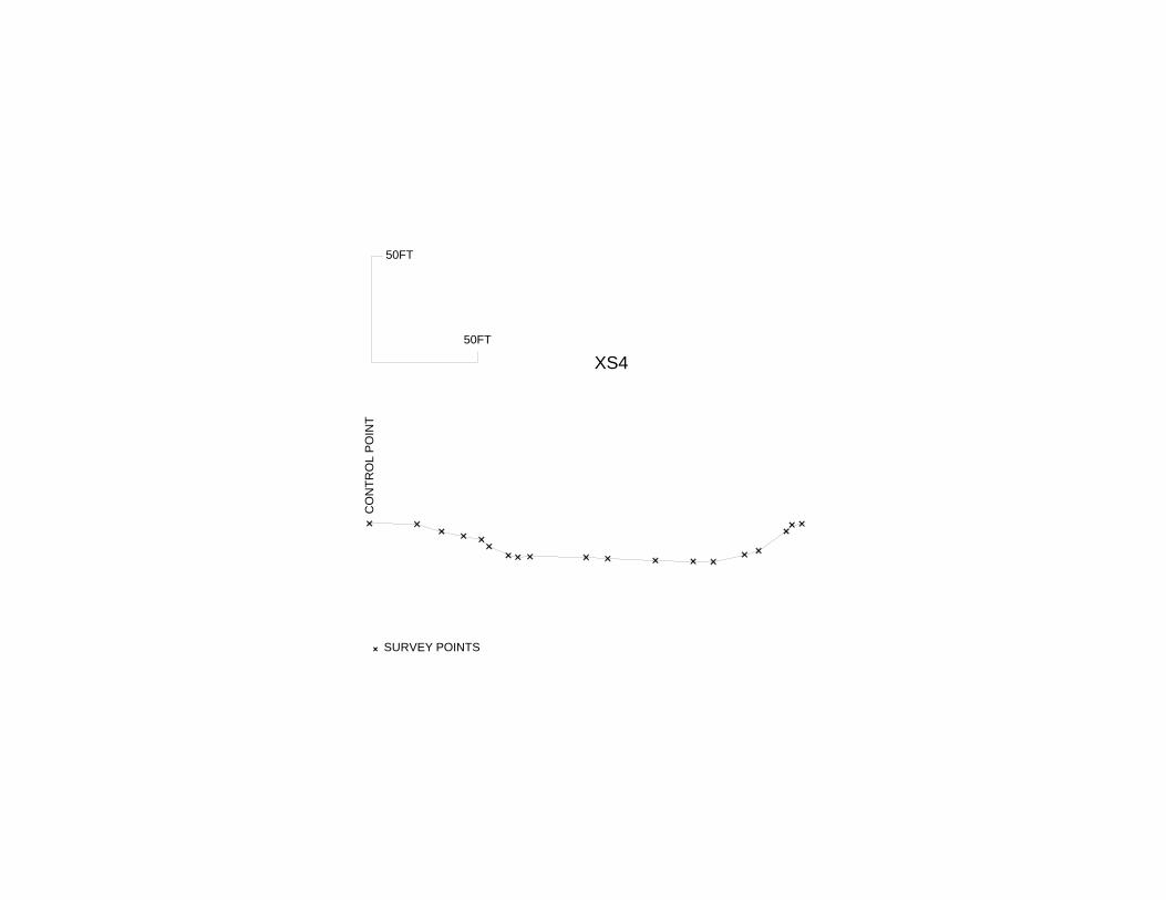
XS4CO
NTRO
L POI
NT
SURVEY POINTS
50FT

50FT
XS5CO
NTRO
L POI
NT
SURVEY POINTS
50FT
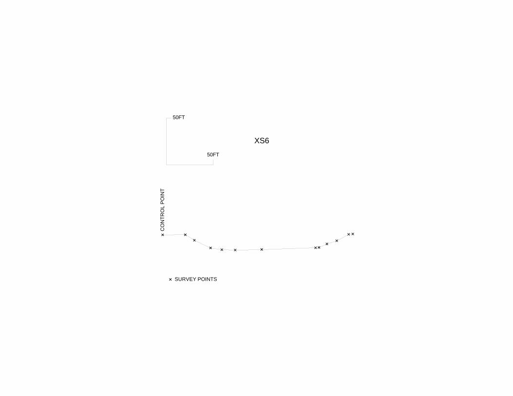
XS6
CONT
ROL P
OINT
SURVEY POINTS
50FT
50FT
50FT
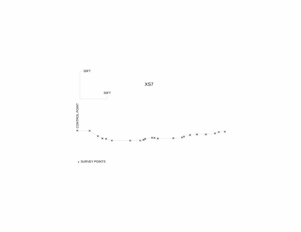
XS7CO
NTRO
L POI
NT
SURVEY POINTS
50FT
50FT
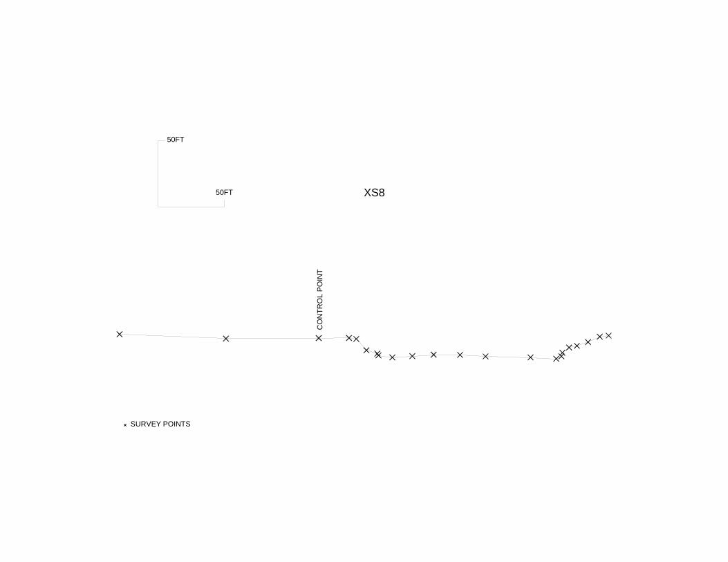
XS8
CONT
ROL P
OINT
SURVEY POINTS
50FT
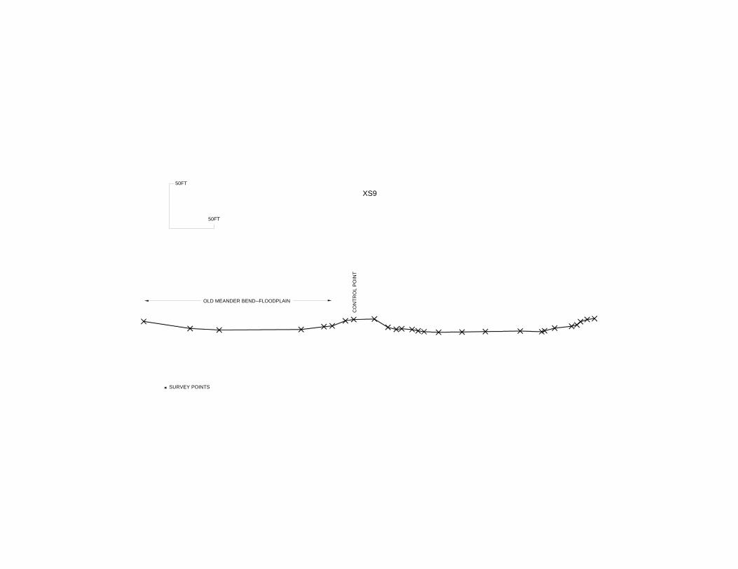
50FTXS9
CONT
ROL P
OINT
SURVEY POINTS
50FT
OLD MEANDER BEND--FLOODPLAIN
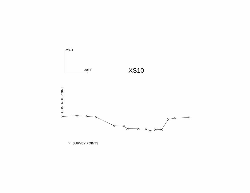
20FT
20FT XS10CO
NTRO
L POI
NT
SURVEY POINTS