Stirling - Argyll and Bute · Stirling West Dunbartonshire Renfrewshire 218590 218590 228590 228590...
1
° Argyll and Bute Local Development Plan Proposals Maps Adopted March 2015 Rhu Cardross Helensburgh Faslane Garelochhead Rahane Cove Kilcreggan Shandon Ardpeaton Rosneath Clynder Portincaple/ Whistlefield Portkil Peaton Colgrain Farm Ardoch Portkil House Inverclyde Stirling West Dunbartonshire Renfrewshire 218590 218590 228590 228590 673600 683600 683600 693600 693600 Reproduced by permission of Ordnance Survey on behalf of HMSO. © Crown copyright and database right 2015. All rights reserved. Ordnance Survey Licence number 100023368. 2,000 Meters 1:35,000 Helensburgh and Lomond at A1
Transcript of Stirling - Argyll and Bute · Stirling West Dunbartonshire Renfrewshire 218590 218590 228590 228590...
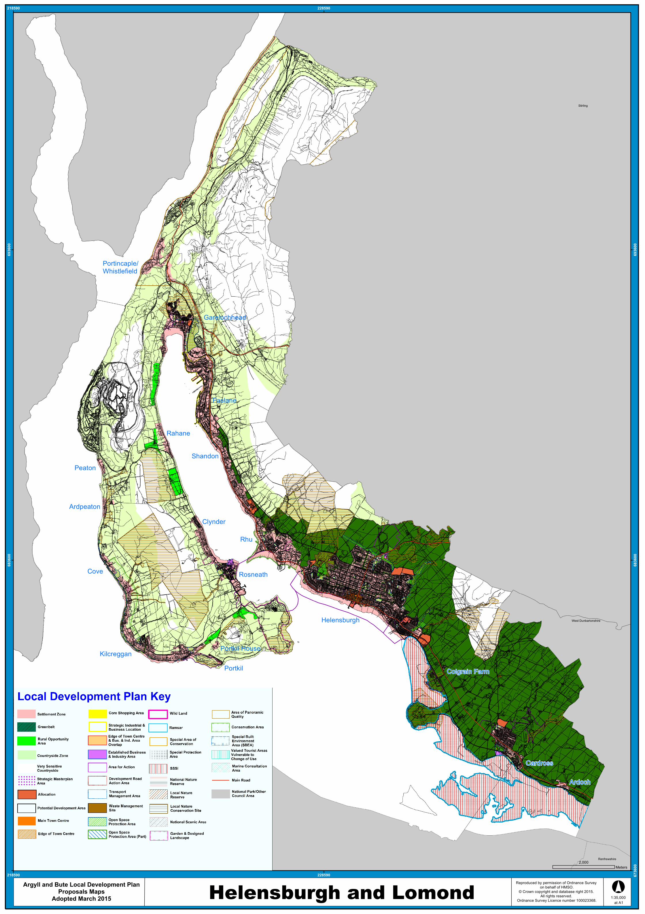
°Argyll and Bute Local Development Plan Proposals Maps
Adopted March 2015
Rhu
Cardross
Helensburgh
Faslane
Garelochhead
Rahane
Cove
Kilcreggan
Shandon
Ardpeaton
Rosneath
Clynder
Portincaple/Whistlefield
Portkil
Peaton
Colgrain Farm
Ardoch
Portkil House
Inverclyde
Stirling
West Dunbartonshire
Renfrewshire
218590
218590
228590
228590 6736
00
6836
00
6836
00
6936
00
6936
00
Reproduced by permission of Ordnance Survey on behalf of HMSO.
© Crown copyright and database right 2015. All rights reserved.
Ordnance Survey Licence number 100023368.
2,000Meters
1:35,000Helensburgh and Lomondat A1