Status of COMPASS/BeiDou Development - web.stanford.edu · The development of COMPASS/BeiDou is one...
39
Status of COMPASS/BeiDou Development Cao Chong China Technical Application Association for GPS Stanford’s 2009 PNT Challenges and Opportunities Symposium October 21-22,2009 1
Transcript of Status of COMPASS/BeiDou Development - web.stanford.edu · The development of COMPASS/BeiDou is one...

Status of COMPASS/BeiDou Development
Cao Chong China Technical Application
Association for GPS
Stanford’s 2009 PNT Challenges and Opportunities Symposium
October 21-22,2009
1

1. Basic Principles
2. System General Description
3. System Deployment
4. Applications and Markets
5. Compatibility and Interoperability
6. Conclusion
2
Contents
2
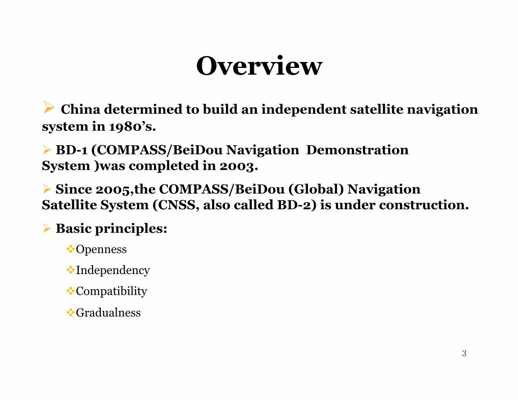
China determined to build an independent satellite navigation system in 1980’s.
BD-1 (COMPASS/BeiDou Navigation Demonstration System )was completed in 2003.
Since 2005,the COMPASS/BeiDou (Global) Navigation Satellite System (CNSS, also called BD-2) is under construction.
Basic principles: Openness
Independency
Compatibility
Gradualness
3
Overview
3
Basic Principles (1)
4
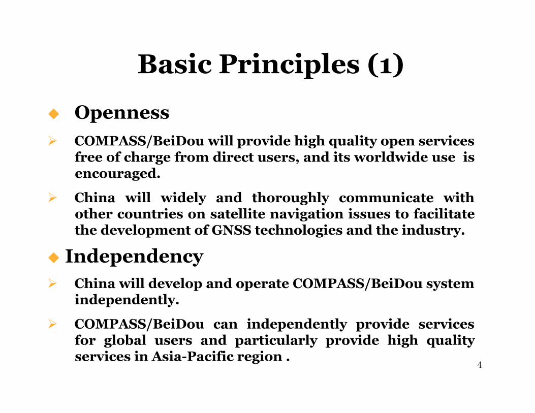
Openness COMPASS/BeiDou will provide high quality open services
free of charge from direct users, and its worldwide use is encouraged.
China will widely and thoroughly communicate with other countries on satellite navigation issues to facilitate the development of GNSS technologies and the industry.
Independency China will develop and operate COMPASS/BeiDou system
independently.
COMPASS/BeiDou can independently provide services for global users and particularly provide high quality services in Asia-Pacific region .
4
Basic Principles (2)
5
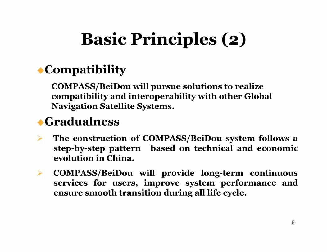
Compatibility COMPASS/BeiDou will pursue solutions to realize compatibility and interoperability with other Global Navigation Satellite Systems.
Gradualness The construction of COMPASS/BeiDou system follows a
step-by-step pattern based on technical and economic evolution in China.
COMPASS/BeiDou will provide long-term continuous services for users, improve system performance and ensure smooth transition during all life cycle.�
5
System Description
6
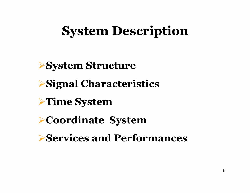
System Structure
Signal Characteristics
Time System
Coordinate System
Services and Performances
6

System Structure-1
Constellation
GEO Satellite
MEO Satellite
Space Segment � 5 GEO satellites and 30 Non-GEO satellites
7 7
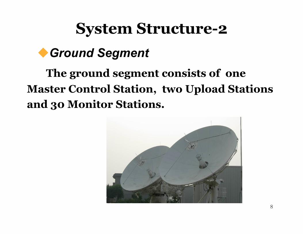
The ground segment consists of one Master Control Station, two Upload Stations and 30 Monitor Stations.
System Structure-2 Ground Segment�
8 8
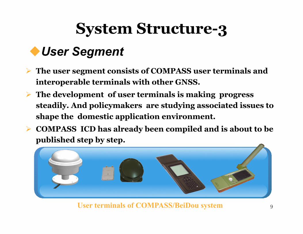
The user segment consists of COMPASS user terminals and interoperable terminals with other GNSS.
The development of user terminals is making progress steadily. And policymakers are studying associated issues to shape the domestic application environment.
COMPASS ICD has already been compiled and is about to be published step by step.
User terminals of COMPASS/BeiDou system
User Segment �
System Structure-3
9 9
Signal Frequencies
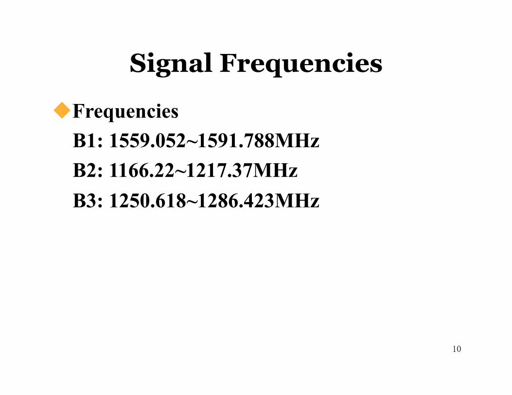
Frequencies B1: 1559.052~1591.788MHz B2: 1166.22~1217.37MHz B3: 1250.618~1286.423MHz
10 10
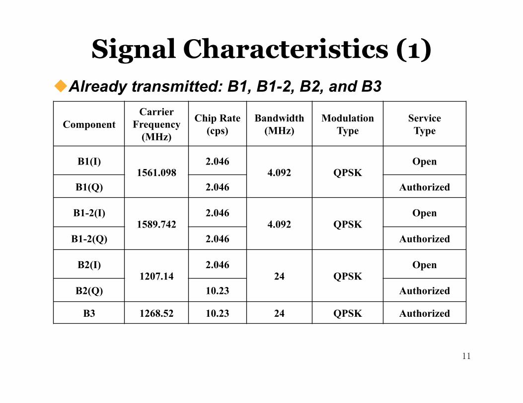
Already transmitted: B1, B1-2, B2, and B3 �
Signal Characteristics (1)
11
Component Carrier
Frequency (MHz)�
Chip Rate (cps) �
Bandwidth (MHz)�
Modulation Type
Service Type
B1(I) 1561.098
2.046 4.092 QPSK
Open
B1(Q) 2.046 Authorized
B1-2(I) 1589.742
2.046 4.092 QPSK
Open
B1-2(Q) 2.046 Authorized
B2(I) 1207.14
2.046 24 QPSK
Open
B2(Q) 10.23 Authorized
B3 1268.52 10.23 24 QPSK Authorized
11
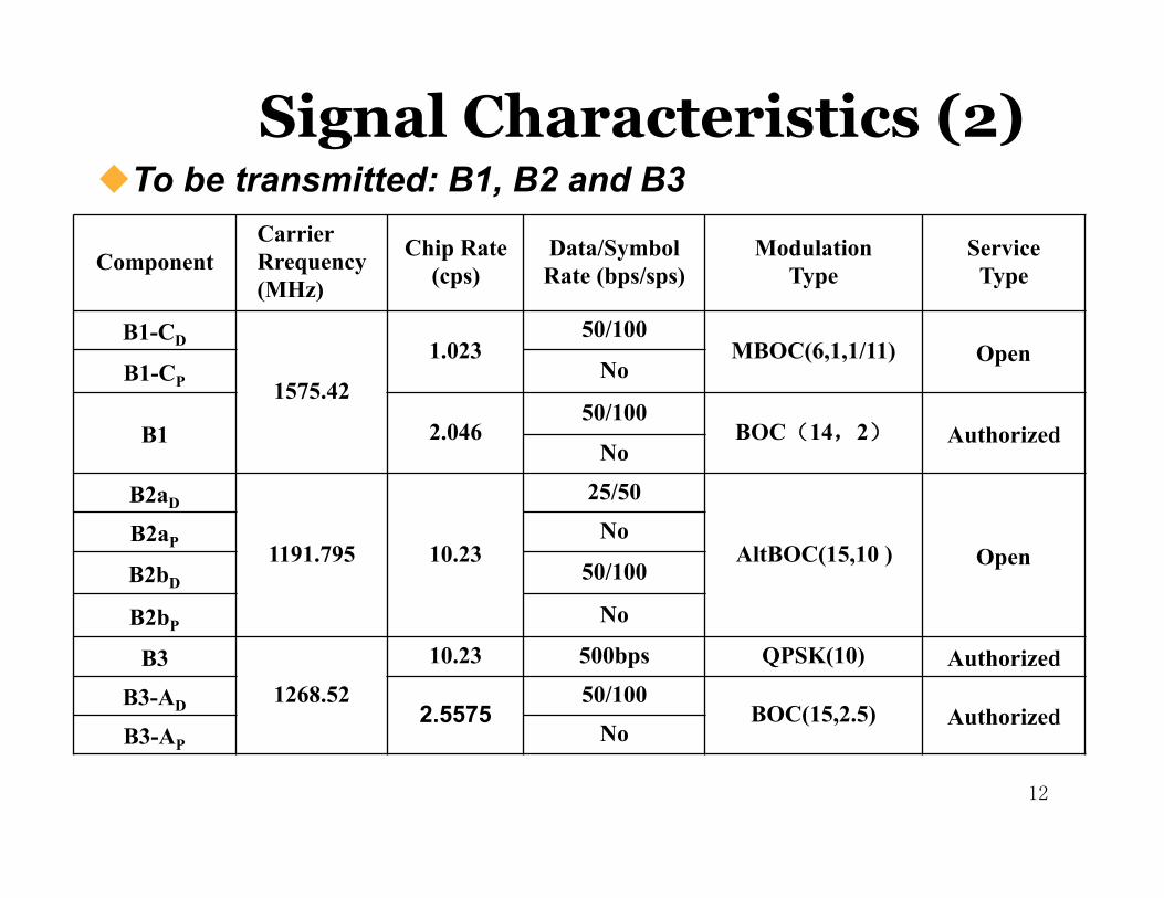
12
To be transmitted: B1, B2 and B3�
Component Carrier Rrequency (MHz)
Chip Rate (cps)
Data/Symbol Rate (bps/sps)
Modulation Type
Service Type
B1-CD
1575.42
1.023 50/100
MBOC(6,1,1/11) Open B1-CP No
B1 2.046 50/100
BOC(14,2)� Authorized No
B2aD
1191.795 10.23
25/50
AltBOC(15,10 ) Open B2aP No
B2bD 50/100
B2bP No
B3 1268.52
10.23 500bps QPSK(10) Authorized B3-AD 2.5575
50/100 BOC(15,2.5) Authorized
B3-AP No
Signal Characteristics (2)
12
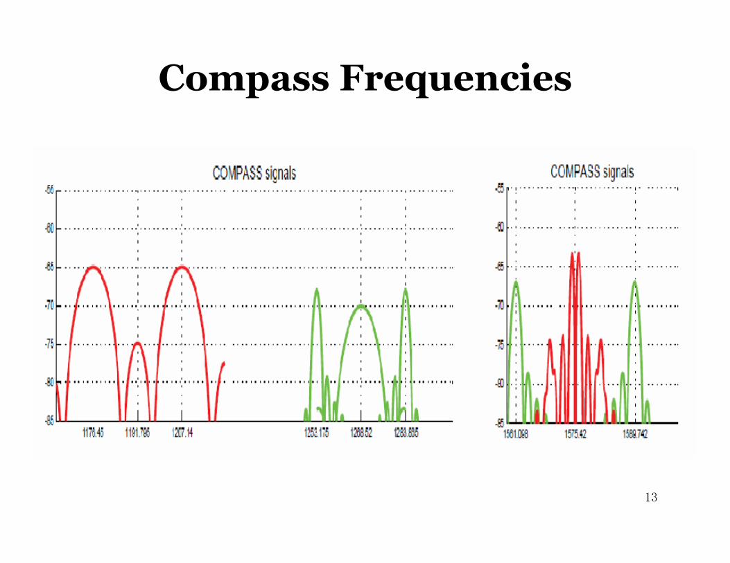
Compass Frequencies
13 13
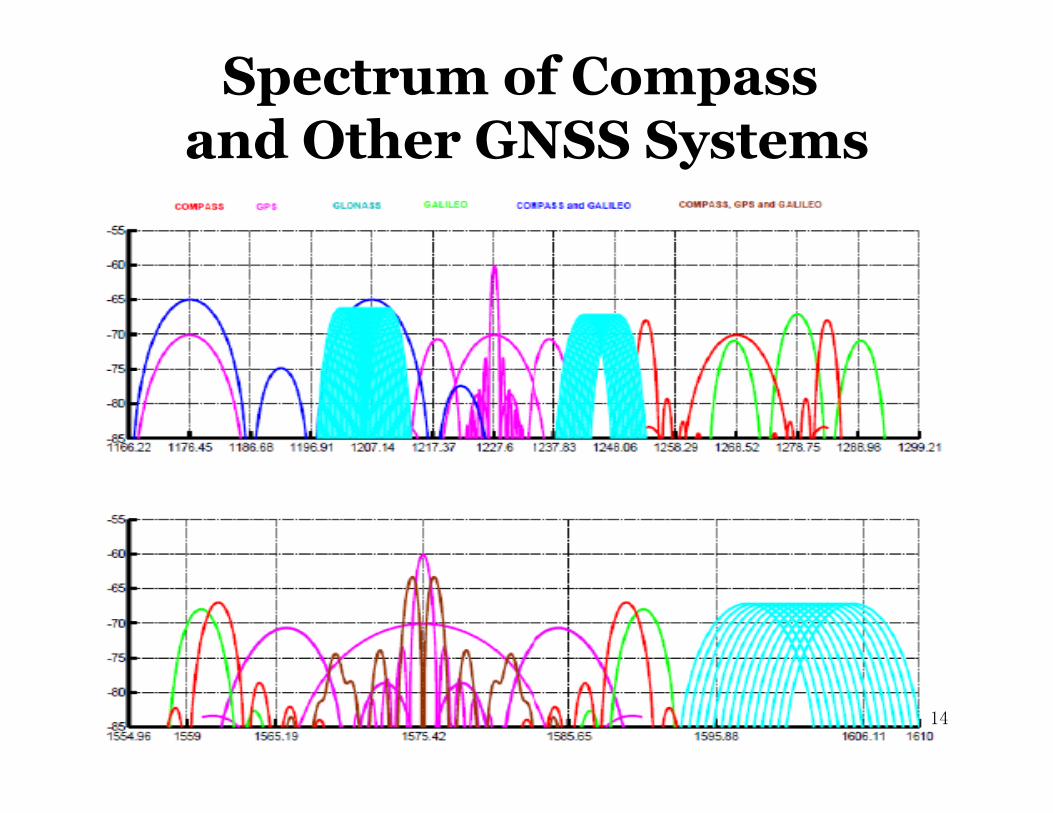
Spectrum of Compass and Other GNSS Systems
14 14
Time System
15
COMPASS/BeiDou time is named as BDT, traced to UTC, and synchronized with UTC within 100ns. The epoch time of BDT is UTC 00d 2006.
Interoperability of BDT with GPS/Galileo time was considered in the design of COMPASS/BeiDou time system. The offset between BDT and GPST/ GST will be measured and broadcasted.
15
COMPASS/BeiDou uses China Geodetic System 2000 (CGS2000)
Coinciding with ITRF at a few cm level.
Coordinate System
16 16

Services and Performances Two kinds of global services
Open Service:free and open to users
Positioning Accuracy: 10 m
Timing Accuracy: 20 ns
Velocity Accuracy: 0.2 m/s
Authorized Service: ensure high reliable use even in complex situation.
Two kinds of regional services Wide area differential service
Positioning accuracy: 1 m
Short message service 17 17
System Deployment
18
Deployment Steps
Launch Schedule
18
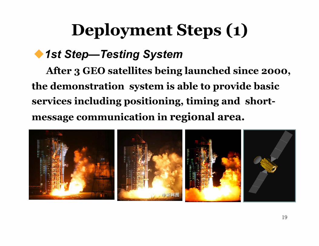
Deployment Steps (1) 1st Step—Testing System�
19
After 3 GEO satellites being launched since 2000, the demonstration system is able to provide basic services including positioning, timing and short-
message communication in regional area.
19
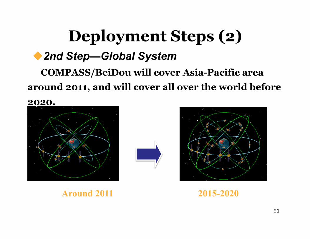
COMPASS/BeiDou will cover Asia-Pacific area around 2011, and will cover all over the world before 2020.
Around 2011 2015-2020
Deployment Steps (2) 2nd Step—Global System�
20 20
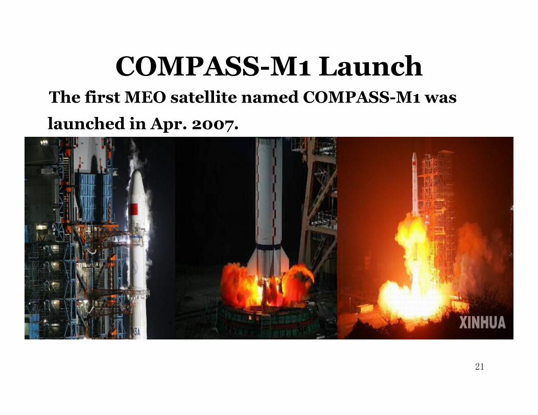
The first MEO satellite named COMPASS-M1 was
launched in Apr. 2007.
COMPASS-M1 Launch
21 21
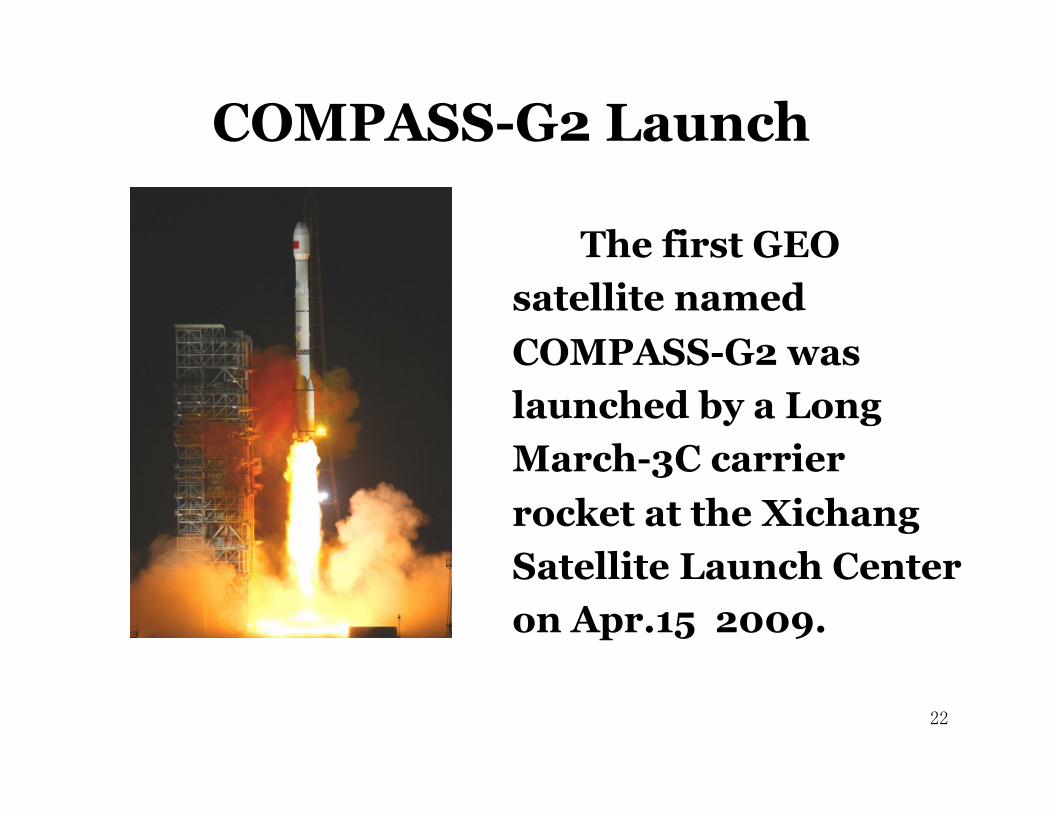
COMPASS-G2 Launch
The first GEO satellite named COMPASS-G2 was launched by a Long March-3C carrier rocket at the Xichang Satellite Launch Center on Apr.15 2009.
22 22

More than 10 satellites will be put into orbit in recent 2-3 years by Long-March launchers.
Launch Schedule
Planned launches in recent 2-3 years
23 23
CNSS Regional and Global Capacity
Regional Capacity(2011-2012) Will cover China and adjacent areas with 12 satellites:
5 in geostationary orbits (GEOs) 3 inclined geosynchronous orbit s(IGSO) 4 in middle earth orbits (MEO)
Global Capacity(2015-2020) CNSS will comprise the full operational capability (FOC)
system: 27 MEOs 5 GEOs 3 IGSOs
24

Applications and Markets
25
COMPASS Navigation Demonstration System has played important roles in different areas.
- Survey and mapping
- Communication - Water conservancy - Disaster mitigation
- Marine - Transportation
- Mining - Forest fire rescue - etc.
25

Estimated BD-1 Users
26

Projection of GNSS Users in China for 2005-2025 �
0
200
400
600
800
1000
2005 2010 2015 2020 2025
GNSS Users in China (million)
Others Vehicles Mobile
27
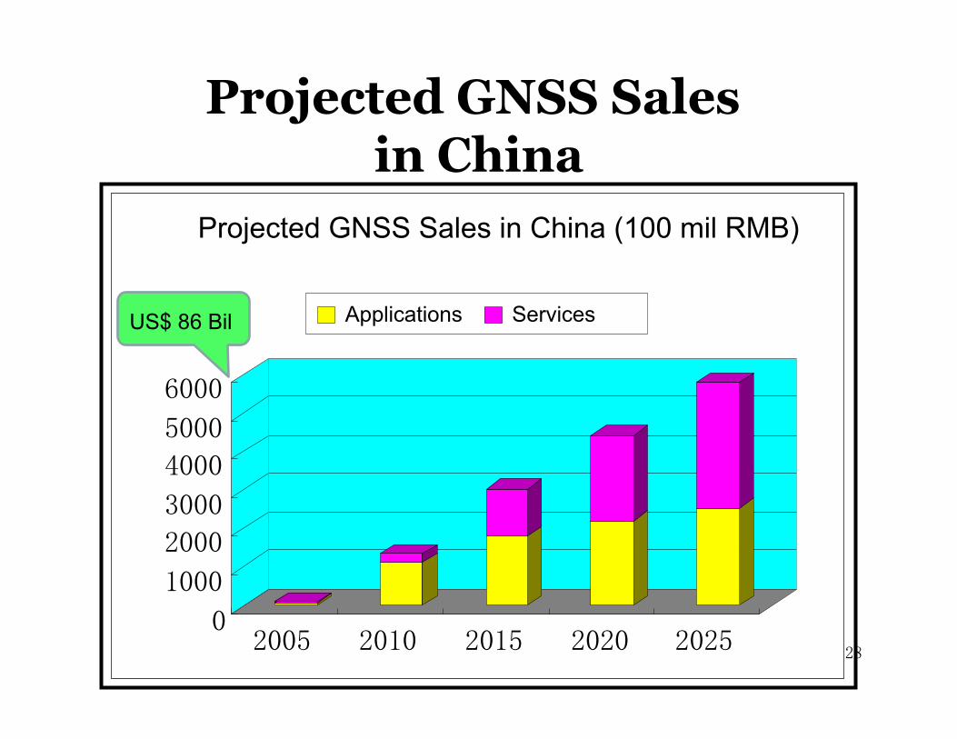
Projected GNSS Sales in China
0
1000
2000
3000
4000
5000
6000
2005 2010 2015 2020 2025
Projected GNSS Sales in China (100 mil RMB)
Applications Services US$ 86 Bil
28
Considerations of Compatibility and Interoperability
Related Bilateral Activities
Compatibility and Interoperability
29 29

Compatibility means the ability of multiple satellite navigation systems to be used separately or together, without generating interference to affect the navigation performance of each other.
International Telecommunication Union provides a framework for discussion on radiofrequency compatibility.
30
Compatibility Consideration (1)
30

Spectrum overlap:
There actually exist some cases of frequency overlap between signals of different systems
It is feasible for navigation systems to share the same frequency spectrum.
The frequency spectrum overlap of open signals is beneficial for the realization of interoperability for many applications.
31
Compatibility Consideration (2)
31
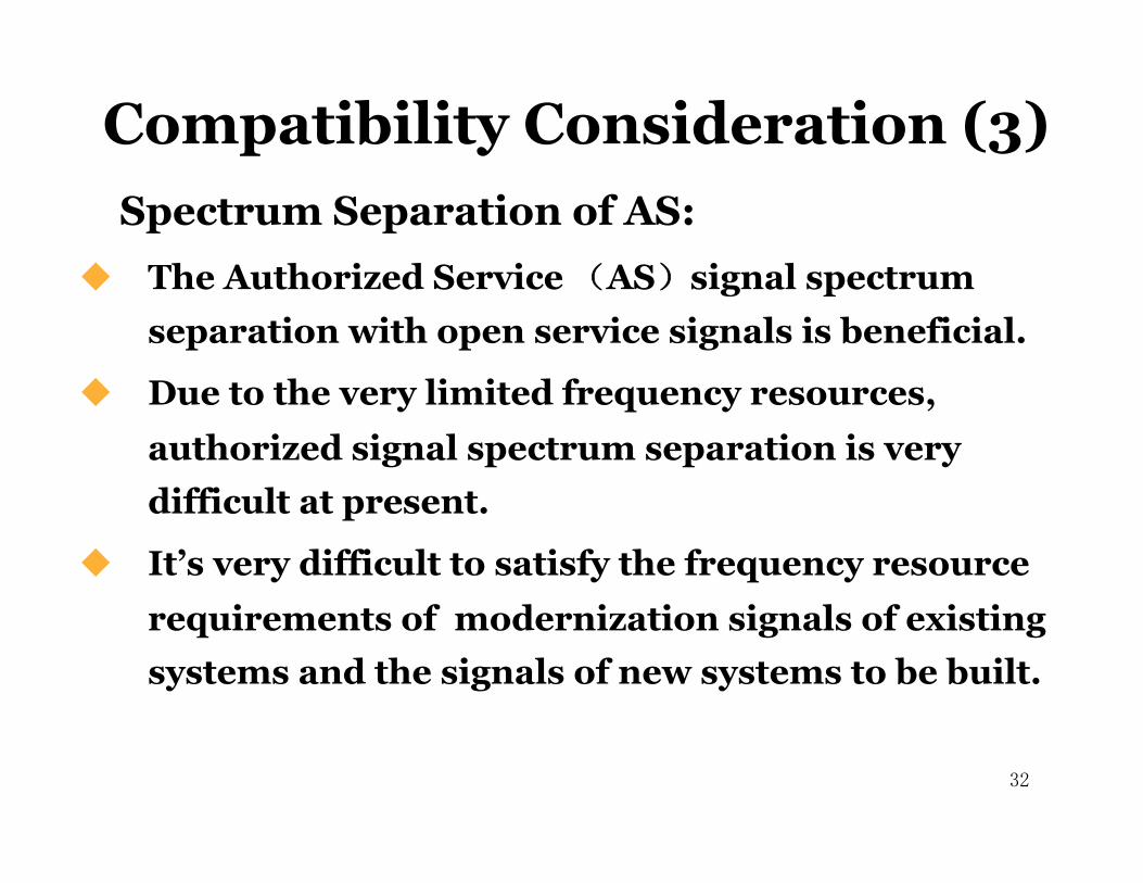
Spectrum Separation of AS: The Authorized Service (AS)signal spectrum
separation with open service signals is beneficial.
Due to the very limited frequency resources, authorized signal spectrum separation is very difficult at present.
It’s very difficult to satisfy the frequency resource requirements of modernization signals of existing systems and the signals of new systems to be built.
32
Compatibility Consideration (3)
32

Interoperability means the ability of open services of multiple satellite navigation systems to be used together to provide better capabilities at the user level than would be achieved by relying solely on one service, without significantly increasing the complexity of receivers.
33
Interoperability Consideration (1)
33
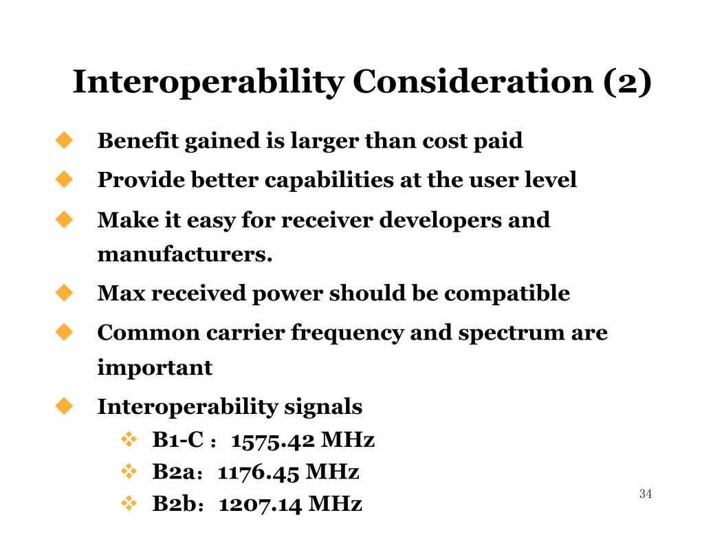
Benefit gained is larger than cost paid
Provide better capabilities at the user level
Make it easy for receiver developers and manufacturers.
Max received power should be compatible
Common carrier frequency and spectrum are important
Interoperability signals B1-C :1575.42 MHz B2a:1176.45 MHz B2b:1207.14 MHz � 34
Interoperability Consideration (2)
34

Related Bilateral Activities (1)
The 1st Meeting was held in Geneva in June 2007.
The 2nd Meeting was held in Xi’an in May 2008.
The 3rd Meeting was held in Geneva in Oct 2008.
Three meetings on frequency compatibility coordination�
35 35
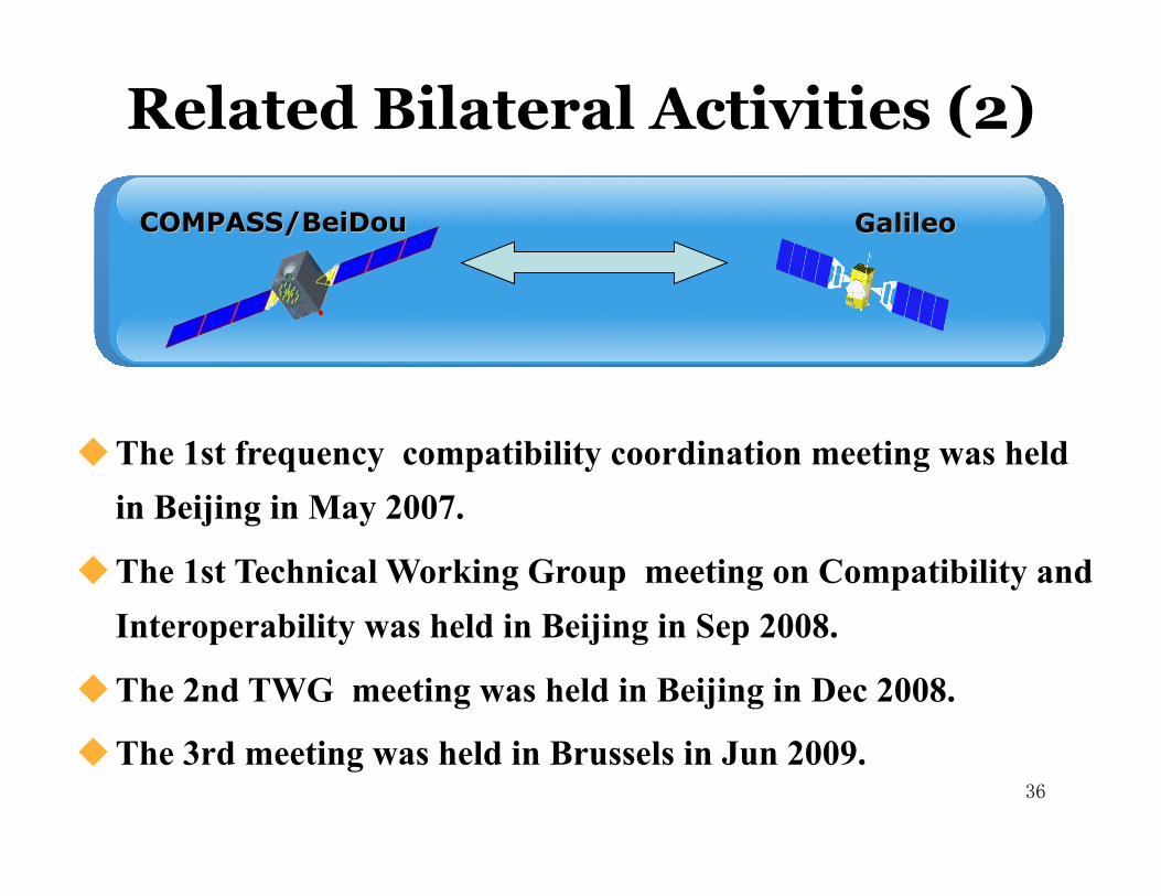
The 1st frequency compatibility coordination meeting was held in Beijing in May 2007.
The 1st Technical Working Group meeting on Compatibility and Interoperability was held in Beijing in Sep 2008.
The 2nd TWG meeting was held in Beijing in Dec 2008.
The 3rd meeting was held in Brussels in Jun 2009.
Related Bilateral Activities (2)
36 36
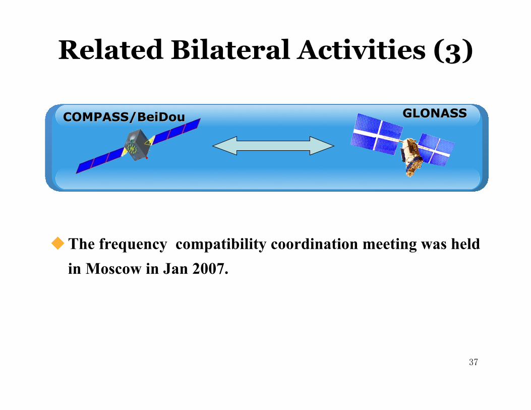
The frequency compatibility coordination meeting was held in Moscow in Jan 2007.
Related Bilateral Activities (3)
37 37
The development of COMPASS/BeiDou is one of China’s national strategies.
COMPASS/BeiDou is being constructed smoothly.
COMPASS/BeiDou is an essential element of the GNSS, and encourages international cooperation with other navigation systems. �
Conclusion
38 38

Thanks for your attention!
39 39