Special fronts
11
Special Fronts
Transcript of Special fronts

Special Fronts

Stationary Fronts
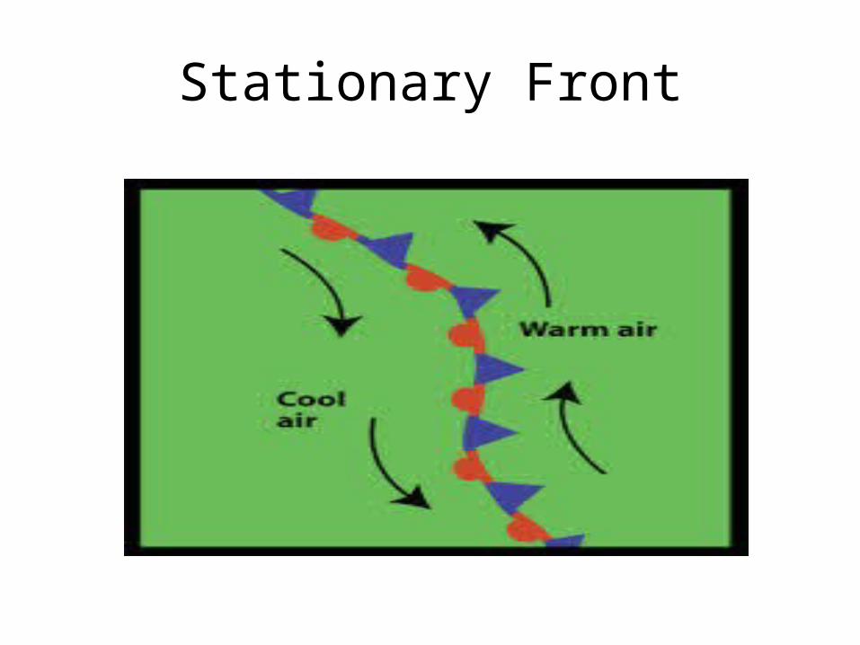
• In certain cases, then airflow on both sides of a front is neither toward the cold air mass nor toward the warm air mass, but almost parallel to the line of the front.
• The surface position of the front does not move, or it moves slowly.
• This condition is called a stationary front.

Stationary Fronts
• On a weather map, stationary fronts are shown with blue triangular points on one side of the line and red semi-circles on the other side of the line.
• Because overrunning usually occurs along stationary fronts, gentle to moderate precipitation is likely.
• Stationary fronts may remain over an area for several days.
• Flooding may be possibe.
Stationary Front

Stationary Front

Occluded Fronts
• The fourth type of front is called the occluded front.
• Here, a rapidly moving cold front overtakes a warm front.
• As the cold air wedges the warm air upwards, a new front forms between the advancing cold air and the air over which the warm front is gliding.

Occluded Fronts
• The weather in an occluded front is usually complex.
• Most precipitation is associated with the warm air being forced aloft.
• When conditions are suitable, the front that is formed is capable of producing precipitation on its own.
Occluded Fronts
• Because a cold front produces roughly the same amount of lifting as a warm front but over a shorter distance, the precipitation intensity is greater, but of shorter duration.

Occluded Fronts
• There are both cold-type and warm-type occluded fronts.
• For the cold-type, the air behind the cold front is colder than the cool air it is overtaking.
• This is the most common type of cold front east of the Rocky Mountains.
• For the warm-type, the air behind the advancing cold front is warmer than the air it is overtaking.
• These occur most frequently along the Pacific coast.

Occluded Front

Occluded Front