Spatial Concepts Mathematical Types of Space –Euclidean –Network –Metric –Topologic.
28
Spatial Concepts • Mathematical Types of Space – Euclidean – Network – Metric – Topologic
-
Upload
rose-griffin -
Category
Documents
-
view
220 -
download
1
Transcript of Spatial Concepts Mathematical Types of Space –Euclidean –Network –Metric –Topologic.
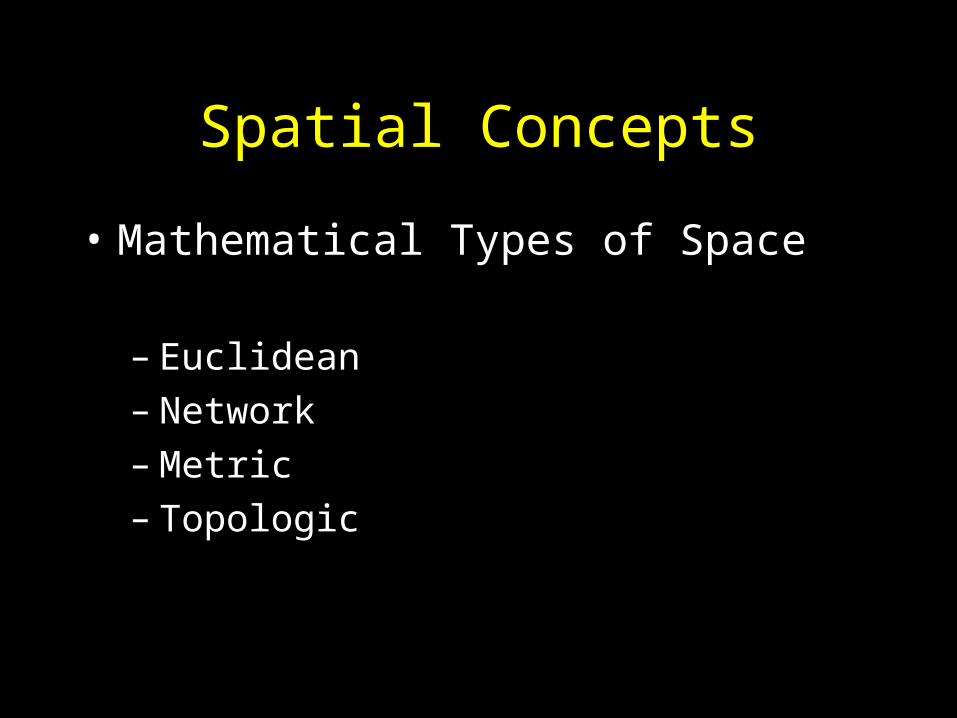
Spatial Concepts
• Mathematical Types of Space
– Euclidean– Network– Metric– Topologic
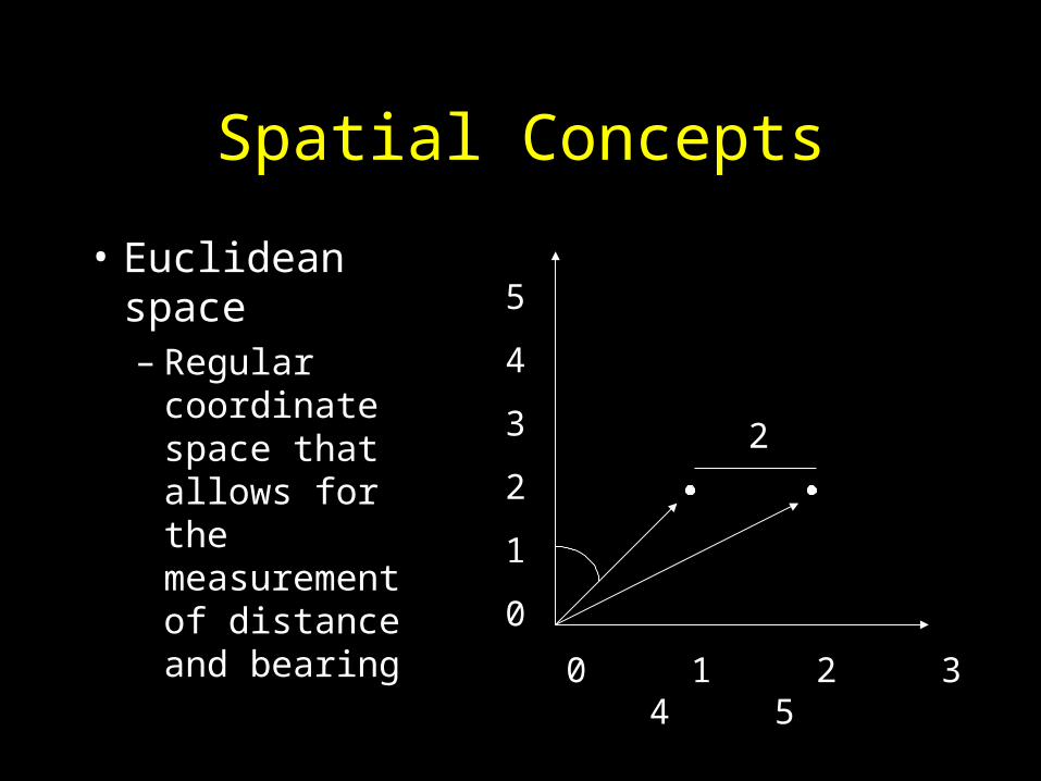
Spatial Concepts
• Euclidean space– Regular
coordinate space that allows for the measurement of distance and bearing
5
4
3
2
1
0
0 1 2 3 4 5
2
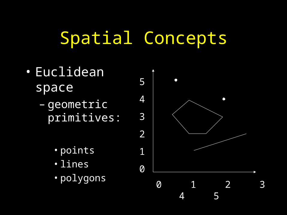
Spatial Concepts
• Euclidean space– geometric
primitives:
• points
• lines
• polygons
5
4
3
2
1
0
0 1 2 3 4 5
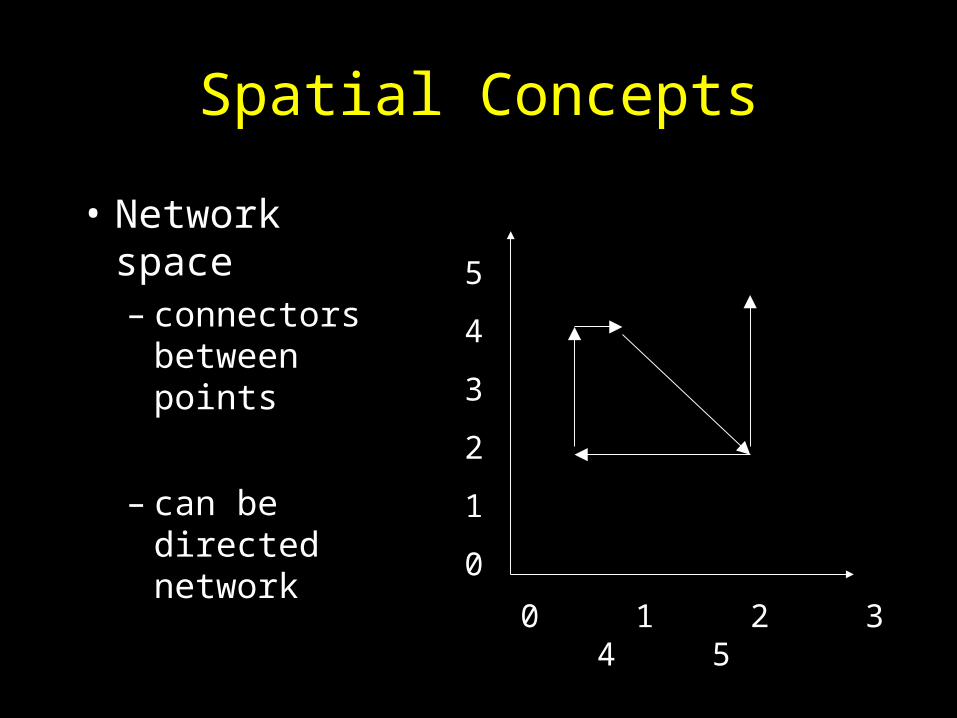
Spatial Concepts
• Network space– connectors
between points
– can be directed network
5
4
3
2
1
0
0 1 2 3 4 5
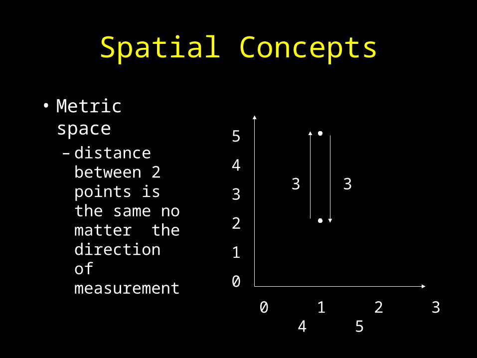
Spatial Concepts
• Metric space– distance
between 2 points is the same no matter the direction of measurement
5
4
3
2
1
0
0 1 2 3 4 5
33
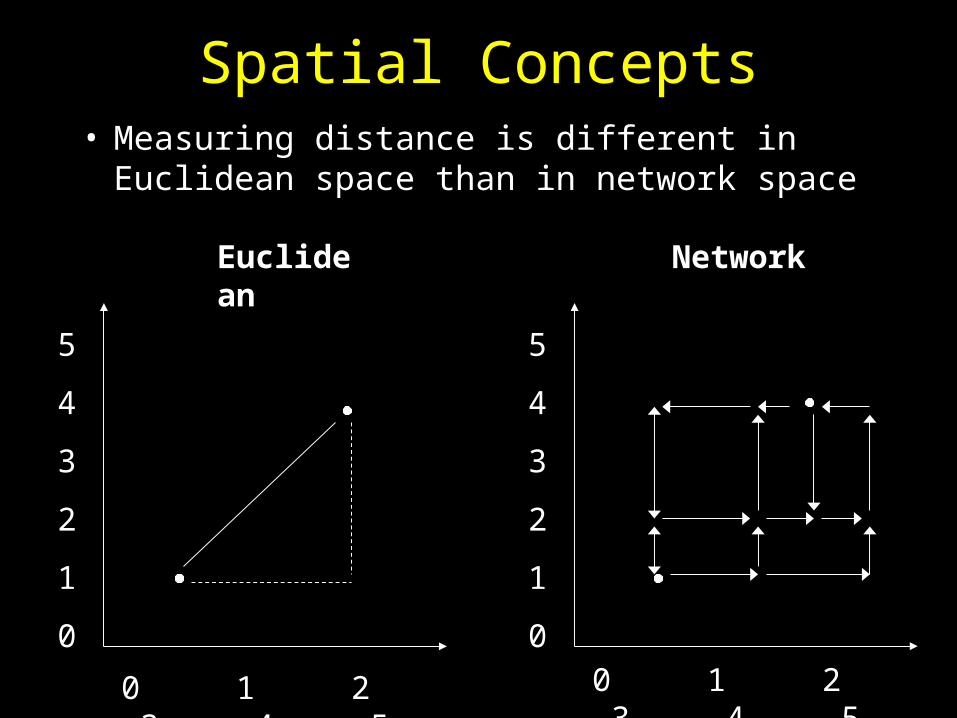
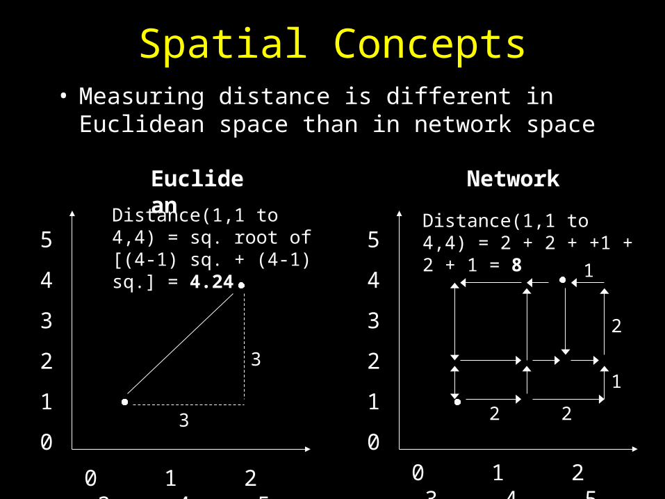
Spatial Concepts• Measuring distance is different in Euclidean space
than in network space
5
4
3
2
1
0
5
4
3
2
1
00 1 2 3 4 50 1 2 3 4 5
Euclidean Network
Spatial Concepts• Measuring distance is different in Euclidean space
than in network space
5
4
3
2
1
0
5
4
3
2
1
00 1 2 3 4 50 1 2 3 4 5
Distance(1,1 to 4,4) = sq. root of [(4-1) sq. + (4-1) sq.] = 4.24
Distance(1,1 to 4,4) = 2 + 2 + +1 + 2 + 1 = 8
3
3
2 2
1
2
1
Euclidean Network
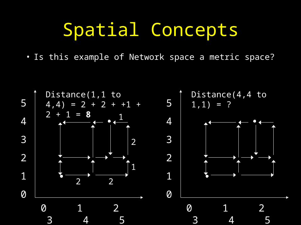
Spatial Concepts
• Is this example of Network space a metric space?
5
4
3
2
1
00 1 2 3 4 5
Distance(4,4 to 1,1) = ?5
4
3
2
1
00 1 2 3 4 5
Distance(1,1 to 4,4) = 2 + 2 + +1 + 2 + 1 = 8
2 2
1
2
1
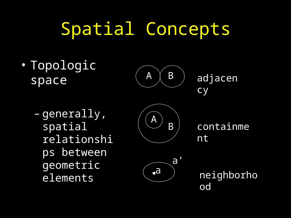
Spatial Concepts
• Topologic space
– generally, spatial relationships between geometric elements
adjacency
containment
neighborhood
A
A
B
B
aa’
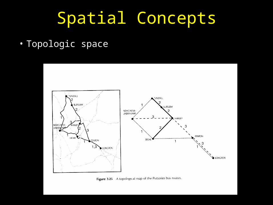
Spatial Concepts
• Topologic space
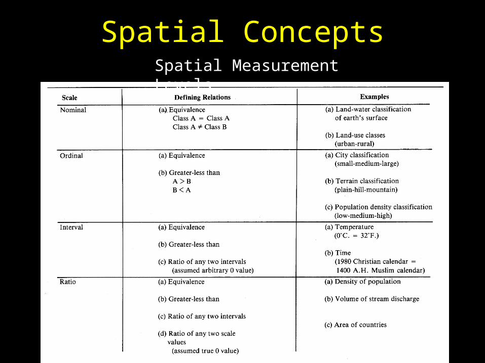
Spatial ConceptsSpatial Measurement Levels
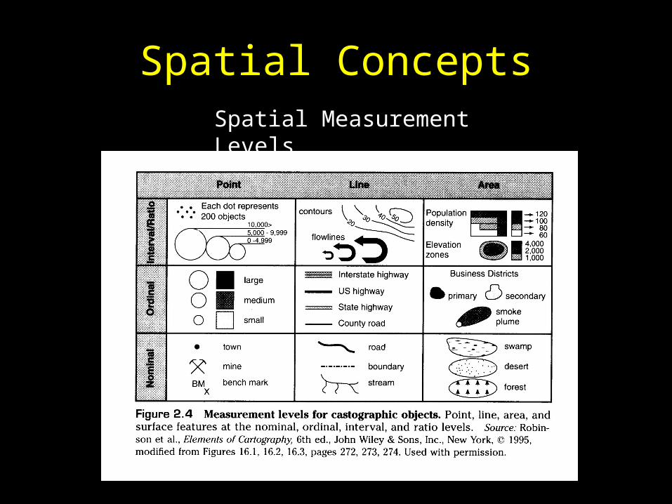
Spatial ConceptsSpatial Measurement Levels
Spatial Concepts
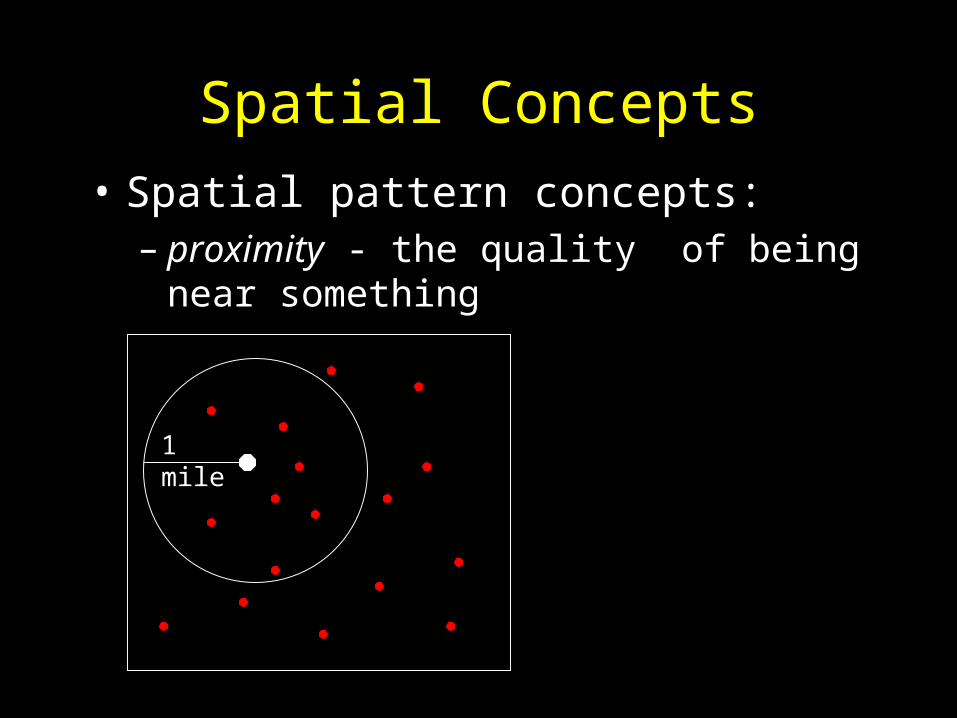
• Spatial pattern concepts:– proximity - the quality of being near something
1 mile
Spatial Concepts
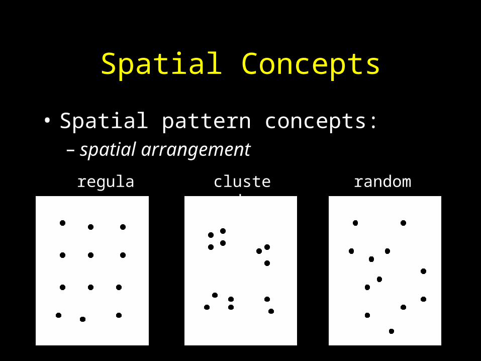
• Spatial pattern concepts:– spatial arrangement
regular clustered random
Spatial Concepts
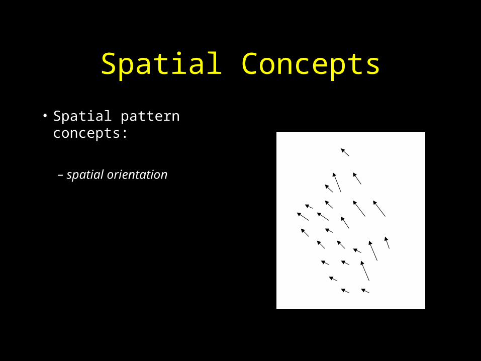
• Spatial pattern concepts:
– spatial orientation
Spatial Concepts
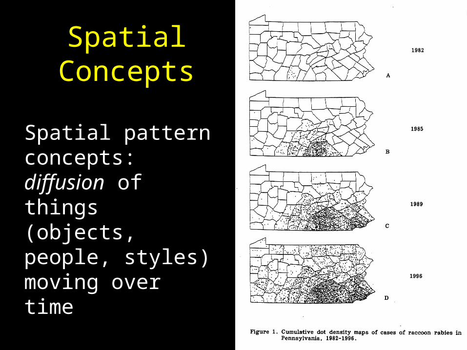
Spatial pattern concepts: diffusion of things (objects, people, styles) moving over time
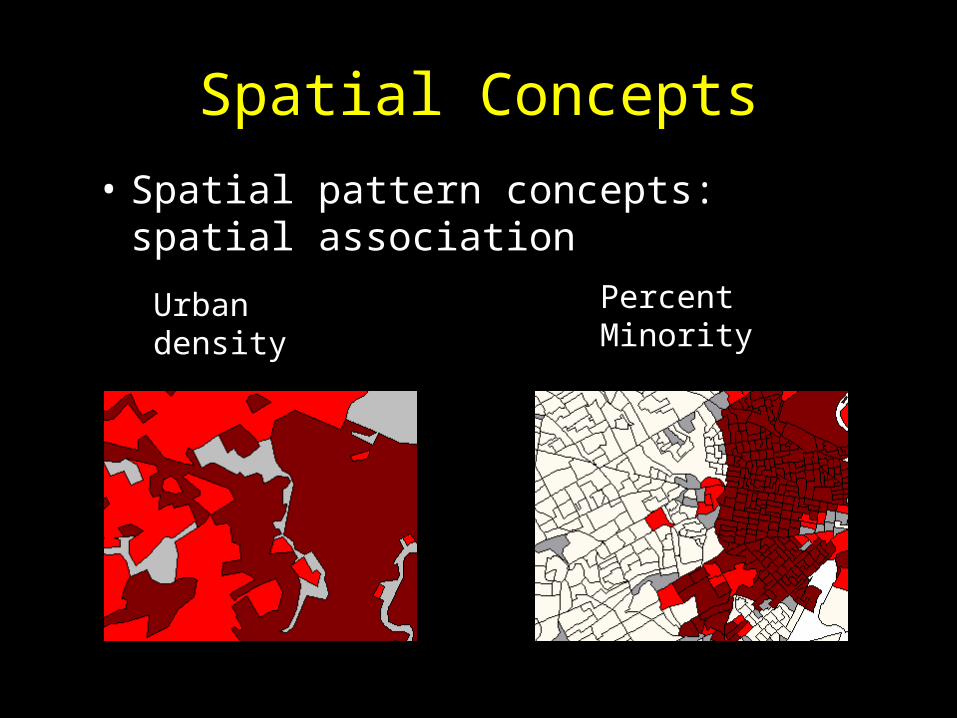
Urban density Percent Minority
Spatial Concepts
• Spatial pattern concepts: spatial association
Projections and Coordinate Systems
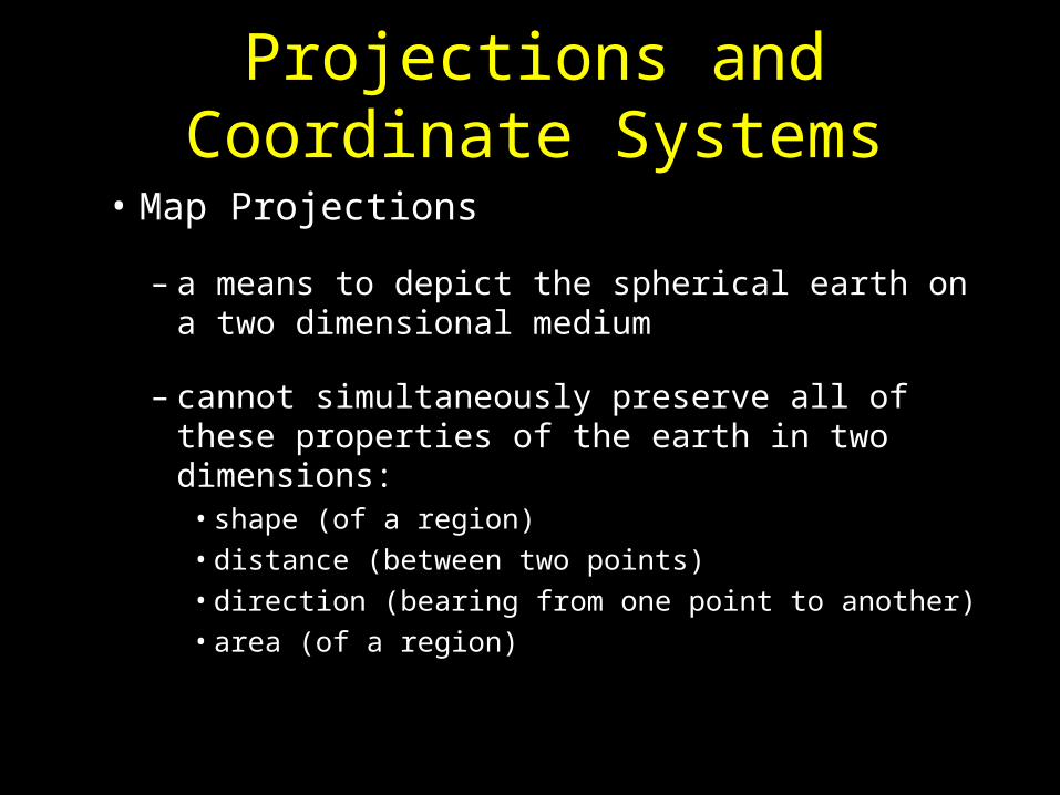
• Map Projections
– a means to depict the spherical earth on a two dimensional medium
– cannot simultaneously preserve all of these properties of the earth in two dimensions:
• shape (of a region)• distance (between two points)• direction (bearing from one point to another)• area (of a region)
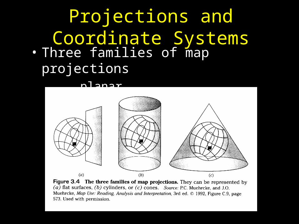
• Three families of map projections planar cylindrical conical
Projections and Coordinate Systems
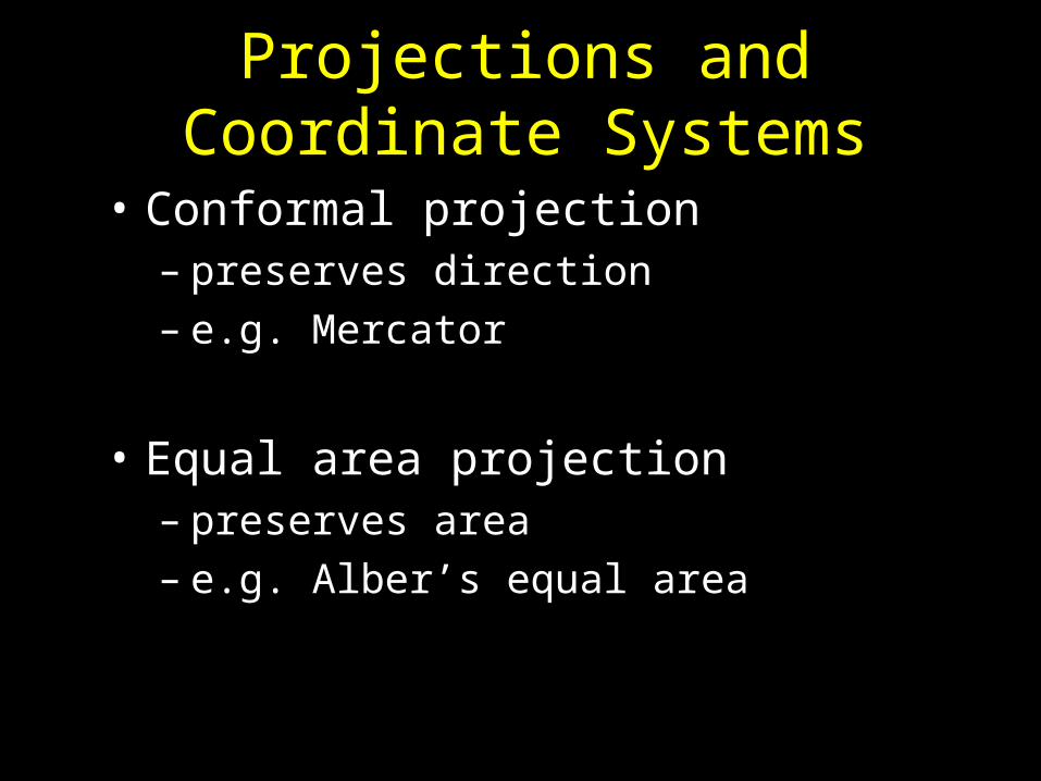
• Conformal projection– preserves direction– e.g. Mercator
• Equal area projection– preserves area– e.g. Alber’s equal area
Projections and Coordinate Systems
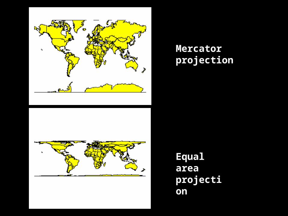
Mercator projection
Equal area projection
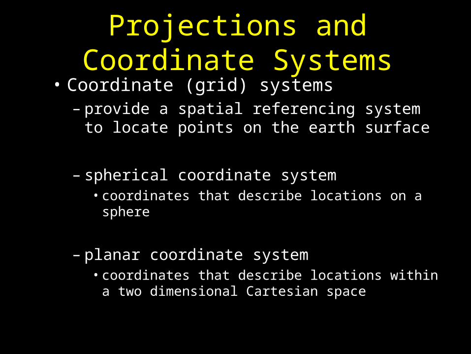
• Coordinate (grid) systems– provide a spatial referencing system to locate
points on the earth surface
– spherical coordinate system• coordinates that describe locations on a sphere
– planar coordinate system• coordinates that describe locations within a two
dimensional Cartesian space
Projections and Coordinate Systems
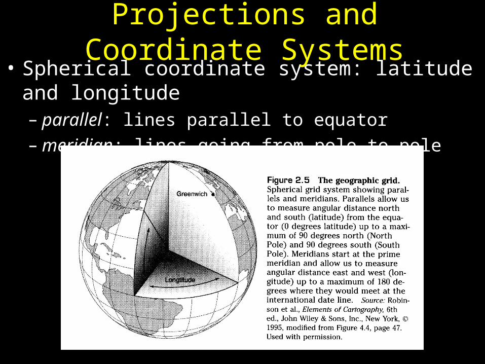
• Spherical coordinate system: latitude and longitude– parallel: lines parallel to equator– meridian: lines going from pole to pole
Projections and Coordinate Systems
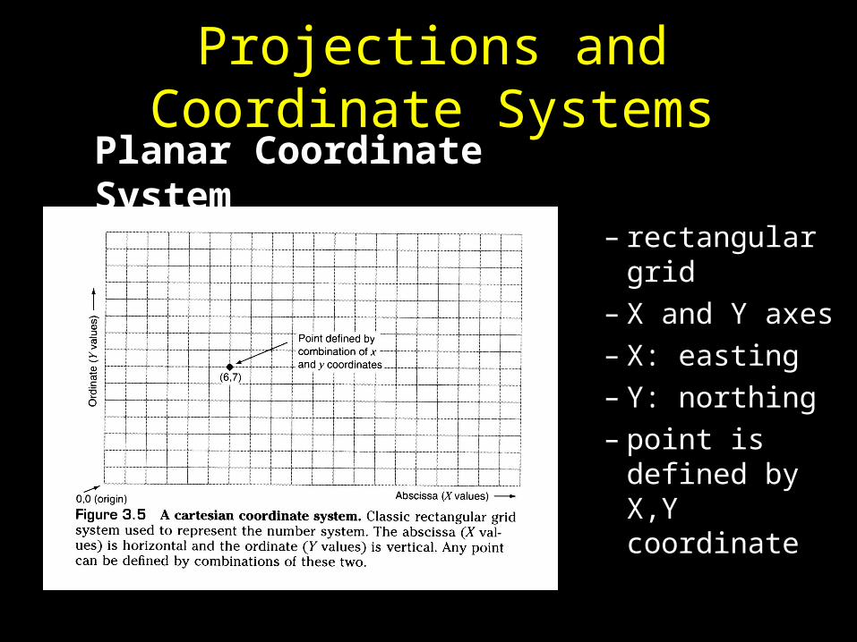
– rectangular grid– X and Y axes– X: easting– Y: northing– point is defined
by X,Y coordinate
Projections and Coordinate SystemsPlanar Coordinate System
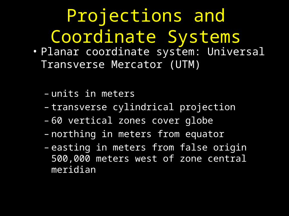
• Planar coordinate system: Universal Transverse Mercator (UTM)
– units in meters– transverse cylindrical projection– 60 vertical zones cover globe– northing in meters from equator– easting in meters from false origin 500,000
meters west of zone central meridian
Projections and Coordinate Systems
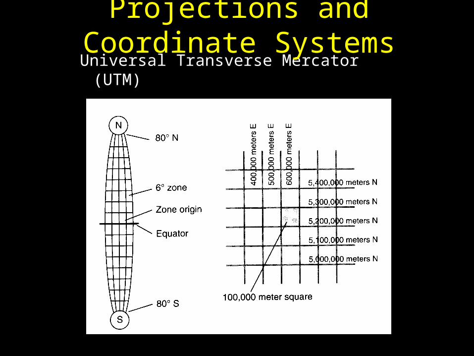
Universal Transverse Mercator (UTM)
Projections and Coordinate Systems
• Planar coordinate system: United States State Plane Coordinate System
– units in feet– projection in transverse Mercator or Lambert’s
conformal conic– tied to U.S. datum– two or more zones for each state with a false
origin southwest of the zone
Projections and Coordinate Systems
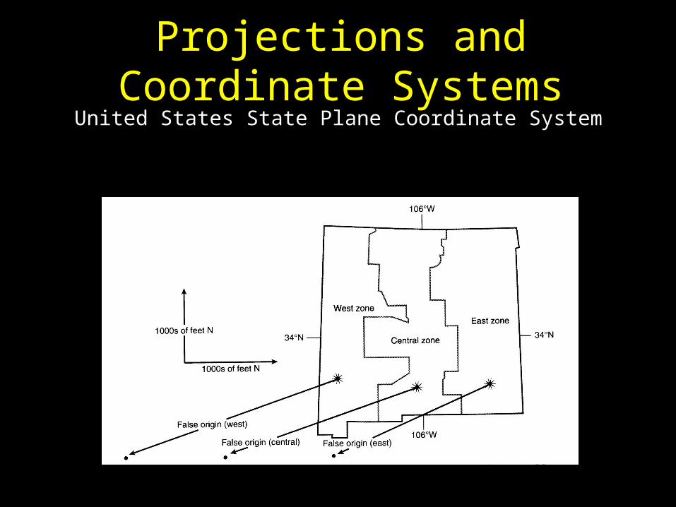
United States State Plane Coordinate System
Projections and Coordinate Systems