South Caspian Basin - II · The South Caspian Basin provides a variety of challenges from many...
152
Transcript of South Caspian Basin - II · The South Caspian Basin provides a variety of challenges from many...


3
Preface
A major international collaborative effort on the South Caspian Basin has been undertaken over the last few years between the Geologi-cal Institute of the Azerbaijan Academy of Sciences and the Basin Mod-eling Group at the University of South Carolina under the direction of Professor I. Lerche. The original phase of the effort culminated in a 625 page volume "Evolution of the South Caspian Basin: Geologic Risks and Probable Hazards" published in June 1996 under the auspices of the Azerbaijan Academy of Sciences, together with an associated ma-jor international meeting held 10-13 June 1996 in Baku. Since then evaluation of a variety of further problems dealing with aspects of the South Caspian Basin has been undertaken and re-sults are reported here. The active involvement of both GIA and USC personnel in ad-vancing the course of scientific understanding of the South Caspian Ba-sin provides a remarkable illustration of the level of progress that can be achieved between peoples when political, financial and bureaucratic bar-riers to progress are removed or minimized. The Republic of Azerbaijan is particularly pleased with the fruits of this on-going collaboration, and believes that future joint efforts will enhance even further the international friendships that have been al-ready forged, as well as leading to a more profound understanding of the South Caspian Basin. Academician Akif Ali-Zadeh Baku, Azerbaijan

4
Introduction
The South Caspian Basin provides a variety of challenges from many viewpoints as has been noted in an earlier volume ("Evolution of the South Caspian Basin: Geologic Risks and Probable Hazards", Azer-baijan Academy of Sciences, Baku, 1996). That earlier work was concerned mainly with assessing regional geology of the Basin from both tectonic and sediment perspectives; of assessing risk and hazard uncertainty based on historical on-shore mud volcano data; of assessing the evolution of mud diapiric structures in respect of their dynamic, thermal and stress influences on surrounding sediments; and of assessing quantitatively the factors causing the great-est uncertainties and risks in geological models of basinal evolution. Major controls on all aspects of that prior work were provided by the significant data bases collected over decades by the Geological Institute of the Azerbaijan Academy of Sciences. But, as oil exploration and exploitation interests focus more on the off-shore regions of the Azerbaijan South Caspian Basin, the data that can provide significant controls on both regional studies and on individual prospect studies become sparser in quantity, and also less able to control risk factors in the deeper water portions of the Basin. And yet, as the oil industry focus shifts more to these regions of the South Caspian Basin, it becomes imperative that some evaluations be provided of likely factors influencing both the risk of hydrocarbon proneness of prospects and the hazards associated with developing hydrocarbon accu-mulations. This second volume has been written in attempts to address some of these concerns. On the one hand there is at least some stratigraphic and geo-chemical information which can be used to constrain, even if poorly, exploration potential. On the other hand there are available geologic models which treat with uncertainty of evolution tied to whatever data are known, and also tied to limits on physical and chemical processes pertinent to geologic structures in the South Caspian Basin. In this way ranges of uncertainty can be provided for individual aspects of the Basin, and risks and hazards addressed to some extent even with limited information. The present volume shows how to per-form such technical manipulations so that a broad swath of diverse illus-trations is available which can be used as logic templates in both regional and prospect studies. The work reported here would not have been possible without an enormous cooperative effort from personnel at the Geological Institute of the Azerbaijan Academy of Sciences, and from the Industrial Associ-ates of the Basin Modeling Group at USC.

5
We are particularly grateful to our families and friends, who suf-fer silently and probably the most, during the endless effort it takes to bring a book volume together. To you all we extend our heartfelt thanks. This volume would not have come to fruition without the contin-ued support of the Azerbaijan Academy of Sciences, and the independent autonomous Republic of Azerbaijan, both of which provided strategic support and encouragement of the project.
Ian Lerche Akif Ali-Zadeh Ibrahim Guliyev Elchin Bagirov Rauf Nadirov Mushfig Tagiyev Akper Feizullayev
Columbia, SC and Baku, Azerbaijan

6
THE STRATIGRAPHY OF THE MESOZOIC AND CENOZOIC DEPOSITS*
OVERVIEW
The territory of Azerbaijan is a vast region covend with Mesozoic deposits
in the Caucasus and is characterized by stratigraphic completeness and faunal substantiation of the sections. In the section of Mesozoic in Azerbaijan faunal and flora complexes of Trias, Jurassic and Cretaceous are tightly linked with different provinces of the Mediterranean paleozoogeographic region. For the first time has a series of stratas been determined in Azerbaijan, providing a standard for regional stratigraphic studies of the vast Crimean-Caucasian re-gion. Rich paleontologic-stratigraphic data on reference and standard sections of structural-facial zones, and also data on drilling prospects and mapping, pro-vide the basis for studies on groups of ammonites, belemnites, incocerams, gastropods, ostracods, brachiopods, corals, foraminiferas, radiolarians, nanno-plancton etc. which were generalized in regional stratigraphic schemes of Azer-baijan and the Caucasus.This effort provides a rather high efficiency of biostrati-graphic research efforts aimed at solution of various problems of oil and gas geology and other common geological problems.To successfully conduct oil and gas geological exploration in the deposits of Mesozoic complex of Azerbaijan, where they are widely spread, contain well-known oil and gas fields and possess large potential resources,interregional and regional stratigraphic generalizations are required in relevant schemes and studies.This paper also deals with Meso-zoic deposits of a large and geologically complex territory which includes the main structures of the eastern parts of the mountainous systems of the Lesser and the Greater Caucasus and the Kura intermontane depression that sepa-rates them (Fig1).For many regions of the territory there exist rather complete paleontologic-stratigraphic data based on the studies of natural outcrops of mountainous regions,sections of numerous drilling wells of a local regions, and hard ejecta of mud volcanoes (Fig 2).However, there exist complex and slightly exposed regions which are lesser studied. Naturally, this influences the content of the regional description. On the whole, existing stratigraphic schemes meet the demands of regional geological and - primarily problems of oil and gas geol-ogy also.The paper deals with recent conditions of stratigraphy of Mesozoic deposits in Azerbaijan.It has been written on the basis of special research ef-forts made by authors and also interpretation and generalization of results of long studies conducted by many paleontologists and stratigraphers of the Cau-casus (N.A.Andrusov, 1902; P.Bonne, 1912; V.V.Bogachov, 1936; V.P.Ren-ngarten, 1959; A.G.Khalilov, 1959, 1965; Sh.A.Azizbekov, 1961; G.A.Aliev, 1963; E.Sh.Shikhalibeili, 1964; T.A.Hasanov, 1967; Ak.A.Ali-zadeh, 1972; E.Sh.Shikhalibeili and V.B.Agayev, 1972; T.A.Hasanov and T.Ab.Hasanov. 1972; A.G.Khalilov, G.A.Aliev, R.B.Askerov, 1974; Kh.Aliullah, 1977; M.M.Aliyev, A.G.Khalilov, M.Pavlova, and others; Ak.A.Ali-zadeh, Kh.Aliullah, R.N.Mamed-zadeh, 1986; A.G.Khalilov, Ak.A.Ali-zadeh, G.A.Aliev, 1986; Kh.Aliullah, A.R.Azizbekova, A.B.Abbasov, 1988;K. O.Rostovtsev, T.A.Hasanov, R.G.Baba-yev, M.R.Abdulgasumzadeh,1992 etc). In the Mesozoic section of Azerbaijan there have been determined all stages of a general stratigraphic scale and nu-merous local lithostratigraphic subdivisions-suits and horizons.Many detailed stratigraphic subdivisions are mapped on medium and large scales.All main strata of the Mesozoic in Azerbaijan were included in a summary scale ‘’A Geo- * Akif Ali-Zadeh

7
logical Timescale for Azerbaijan’’ which was constructed by scientists from the Institute of Geology of the Azerbaijan Academy of Sciences and published to-gether with the oil company consortium ‘’BP-Statoil’’in 1993. Paleontologic sub-stantiation of existence of Triassic deposits was a result of studies of ammonites and conodonts , many species of which are usually met in various types
Figure 1.W.G.Integrated Stratigraphy; IGCP-Project No.362; Baku, Azerbaijan 1997.

8
of facies and serve an important role in interregional correlation.Many authors, such as K.O.Rostovtsev (1971,1974),T.A.Hasanov (1984, 1986,1995) and M.V.Pyatakova (1983), studied these ammonites and conodonts. In the bio-stratigraphic dissection of Jurassic deposits, an important role is played a group of ammonites, many representatives of which play an exclusive role for global correlations, as studied by T.A.Hasanov (1967, 1973, 1992), M.R.Abdulgasum-zadeh, (1972, 1988), V.B.Agayev (1966, 1990, 1992), and K.O.Rostovtsev (1957, 1985). The value of constructing local biostratigraphic scale, and interre-gional and regional correlations of a group of corals (R.G.Ba-bayev - 1973, 1996), foraminiferas (N.Gasymova - 1955, 1959; G.Gasimova 1958,1982) has been substantiated too.An important role in the biostratigraphic dissection of the lower Cretaceous section is played by cephalopods and gastropods (A.G.Khalilov,1959, 1986) and G.A.Aliyev (1974,1986).Construction of biostrati-graphic scale of the lower and the upper Cretaceous, and its interregional corre-lation for belemnites, has been carried out by Ak.A.Ali-zadeh (1972, 1986). Myu-rian and cephalopods of the upper Cretaceous were studied by M.M.Aliyev (1952, 1980); R.A.Aliyev (1967, 1972), R.N.Mamed-zadeh (1967), O.B.Aliyev (1967). Kh.Aliyulla (1977, 1988), A.R.Azizbekova (1974, 1988) on the basis of studies of microfauna in the upper Cretaceous zonal schemes constructed for plankton foraminiferas.A.B.Abbasov (1984, 1991, 1995) determined typical complexes of radiolaria for the majority of the Cretaceous sections intervals.

9
Studies of the sporophyte-pollinic complexes were studied by S.B.Kuvayeva (1967) and at the present is being conducted by V.G.Shahbazova (1991, 1996). All the results obtained by the above scientists have been used in preparation of this monograph.
Figure 2.Summary scheme of location of the studied sections and points of Mesozoic deposits in Azerbaijan
Outcrop sections: I. 1-Lasa (J,Cr1.);2-Kysylskaya (J.Cr1-2);3-Sindanmurugh (Cr1);4-Sogubh(Cr-2);5--Erfi
(Cr1-2);6-Tenghiatly (J.Cr1-2);7-Afurja (Cr1-2);8-Haltan(Cr1);9-Seiva(Cr2);10-Gulgilchai (J.Cr1-2);11-Saadan (Cr2);12-atachai (J.Cr1-2);13-Keshchai (J.Cr1-2);14-Begimdagh (Cr1-2);15-Sovietabad (Cr1-2);16-Gyadysu (Cr1-2); 17-Sitalchai (Cr1-2); 18-Nasosnaya (Cr2);19-Aghburun (Cr2);20-West Aghburun (Cr2);21-Veghver (Cr2); 22-Ilhidagh(Cr2); 23-Giblyadagh (Cr2); 24-Tuva (Cr2); 25-Ambislyar (Cr2); 26-Chikilchai (Cr2); 27-Aghdara (Cr2); 28-Karayaz (Cr2); 29-Arpabulagh (Cr1-2); 30-Tahtaeilagh (Cr1-2); 31-Sarydashchai (Cr1-2); 32-Haltanski pass (Cr1); 33-Ahsuchai (Cr1-2); 34-Gyandov (Cr1-2); 35-Astrakhanka (Cr1-2); 36-Asratchai (Cr2); 37-Talystan (Cr2); 38-Julyanchai (Cr1-2); 39-Ahohchai (J.Cr1-2); 40-Geokchai (J); 41-Dastamazchai (J.Cr1); 42-Lasa(Cr1);43-Kusnet (Cr1); 44-Kutkashen (Cr1-2);45-Gamsalychai (J,Cr1);46-Abrych ( J.Cr1); 47-Tikanlychai (Cr2); 48-Filfily (Jcr1); 49-Aghlyk (Cr1);50-Halhalchai (J Cr1-2); 51-Vartashenchai (Cr1-2);52-Dashaghil (Cr1-2); 53-Kungutchai (Cr1-2); 54-Bashseisit (Cr1-2); 55-Sheki (Cr1); 56-Ohut (Cr1); 57-Shean (J,Cr1); 58-Kashkanchai (Cr1); 59-Ilisu (J,Cr1); 60-Kurmuhchai (Cr1-2); 61-Kumbashy (Cr1); 62-Kass (J);63-Muhanchai (J Cr1-2);64-Talachai (Cr1-2);65-Gabizdaragh (J Cr1-2); 66-Kateh (J Cr1-2); 67-Belokan (J Cr1-2); 68-Mazymchai (J); 69-Hramchai(Cr2);70-Kemerli(Cr2);71-Dash salahly (Cr2); 72-Kushchi-Airum (J Cr1-2); 73-Alpout (Cr2); 74-Musakei (Cr2); 75-Tatly (J,Cr2); 76-Yuhary-Oksuzly (Cr2);77-Dugyarli(Cr2); 78-Dseghamchai (J); 79-Asrikchai (J); 80-Shamhor (Cr2); 81-Elensutepeh (Jcr2); 82-Gillitepeh (Cr2); 83-Kurakchai (Jcr2); 84-Geranchai (Cr2); 85-Harhaput (Cr20; 86-Idjachai (Cr2);87-Madagis (J,Cr2); 88-Mardakert (Cr2);89-Gulably (Cr2) 90-Noragukh (Cr2); 91-Martuni- west (Cr2); 92-Martuni-east (Cr2); 93-Kysylkaya (J); 94-Kilit (Cr2); 95-Nusnus (Cr2); 96- Asa (Cr2); 97-Darydagh (Humurtchai) (Cr2); 98-Julfa canyon; 99-Quarabaghlyar.
II. well sections: 1-Yalama (J,Cr1-2); 2-Hudat (J,Cr1-2);3-Hachmas (J);4-Afurdzha (J,Cr1); 5- Siazan monocline (Cr2); 6- Sarat (Cr2); 7-Begimdagh-Tegchai (JCr1);8-Gyadysu (Cr1-2);9-Sovietabad (Cr1-2); 10-Tsurup bank (Cr1-2);11-Absheron bank (Cr1); 12-Sarbachi (Cr2); 13-0 Tuva (Cr2); 14-Karayas (Cr2); 15-Hilmilli (Cr2); 16-Asrahanka (Cr1-2); 17-Engeharan (Cr2);18-Matrasa (Cr2);19-Kasah-Taus (Cr2); 20-Shamhor (Cr2); 21-Borsunly (Cr2); 22-Kasanbulagh (Cr2); 23-Mir-Bashir (Cr2); 24-Gulluja (Cr2); 25-Agjabedi-east(Cr2);26-Zhdanovsk (Cr2); 27-sovietlyar (Cr2); 28-Jarly (Cr1-2); 29-Sor -sor (Cr2); 30-Sardob;31-Saatly
III.Mud volcanoes in hard ejecta of which the Mesozoic rocks have been determined.

10
MAIN FEATURES OF THE TECTONIC STRUCTURE OF THE MESOZOIC FOLDING.
The territory of Azerbaijan is the geologically constituted region within the
Caucasus, which includes the eastern parts of the Greater and the Lesser Cau-casus,the Lower-and the Middle Kura depression (that separates them) and adjoining parts of the Middle-and South Caspian depression.In many papers Caucasian research workers determined and generalized characteristic fea-tures of the tectonic structure of Azerbaijan. (M.F.Mirchink, 1935; Sh.A.Aziz-bekov, 1947, 1961; V.Y.Khain and A.N.Shardanov, 1950; M.H.Agabekov et al; F.S.Ahmedbeili; A.N.Shardanov, V.V.Tikhomirov (1950), Milanovski and V.Y.Khain (1963), A.A.Ali-zadeh and M.Zeinalov, 1972; A.V.Mamedov, 1973 et al).Recent notions on the tectonic zonation of Azerbaijan were provide by more detailed substantiations of Academician E.Sh.Shikhalibeili’s studies (1972, 1984, 1988, 1995). Given below is the scheme of structural-tectonic zonation of Azer-baijan and its brief geological description,which was mainly prepared - on the basis of E.Sh.Shikhalibeili’s papers and also with account of all further studies (Fig 3).
Figure 3. Scheme of tectonic zonation Mega-anticlinorium of the Lesser Caucasus is a rather complex sys-
tem of ridges, volcanics and plateux, which occupies the whole western territory of Azerbaijan.Thick series of volcanogenous-sedimentary and sedimentary-Mesozoic, Cenozoic and partially Paleozoic formations, here and there broken by intrusions of ultrabasic and acid rocks, are typical for the complex. In the complex geological structure of the Lesser Caucasus the following large tectonic elements are traced north-east to south-west:the Lock-Agdamian,Geckcha

11
(Sevan)-Quarabagh, Miskhana-Gafan and Araz zones (Shikhalibeili,1984).Each of these elements is subdivided into a series of finer units,which differ from each other according to their structural and geological history. The Lock-Aghdamian zone, parallel to the south edge of the Kura intermontane depression starting from the Lock moutains in Georgia on the west,stretches south-east as far as Araks river, there it is subdivided under young formations of the low Araks de-pression.From the south-west the zone is limited by fault dislocation,separating it from the neighbours of the Geckcha-Quarabagh zone,which started to form in the middle Jurassic and,mainly,was formed in the Cretaceous-Paleogene. One can distinguish between a series of echelon-like located structures: Sham-khorian, Murovdaghian and Aghdamian anticlinoria, and the Dashkesanian, Agjakend, Gasakh and Aghdarinian synclinoria.The north-west and the south-east parts of the Lock-Aghdamian zones differ sharply from each other accord-ing to their structures.In the north-west parts of this zone rises of a latitudinal strike (the Shamkhorian) dominates, on the flanrs of which one can observe crystallic shales of the Paleozoic basement.On the wings of the marginal rises are spread upper Mesozoic and, partially, Paleogene-Neogene deposits. For the more subsided south-east half of the zone narrow linear rises are typical, which are composed of an intensively folded volcanogenic series of a middle and carbonaceous facies of the upper Jurassic (Murovdagh and Aghdamian anticli-noria).The rises are alternated by rather wide openings in the south-east de-pressions,which are composed mainly of the thick series of the upper Juras-sic,the lower and upper Cretaceous and Paleogene (Dashkensanian, Gyan-jachai, Agjakend and Aghdara synclinoria).Geckcha-(Sevan)-Garabagh zone is one of the complex constructed structures in the Lesser Caucasus and occupies its central part.In the east the zone is separated from the Lock-Aghdamian zone by a large Murovdagh thrust,in the south-west it is limited by the Miskhana-Gafan anticlinorium.This zone in the north-west is traced deepwards to the terri-tory of Armenia, and in the south-east it stretches as far as the Araks river.In the Mesozoic structure of the Geckcha-Garabagh zone are reefogenous-pyroclastic deposits of the upper Jurassic,carbonaceous-terrigenous rocks of the lower Jurassic, and Albian-upper Cretaceous carbonaceous-terrigenous-volcanogenic series of the Upper Cretaceous. The most important for this zone is the pres-ence of the ophiolite formation in its structure, where differs sharply from the other tectonic elements in Azerbaijan.The Geckcha-Quarabagh zone represents a rather intense folded structure, complicated by flexures,faults,cross rises and depressions.In its recent structure one can distinguish between some large folds of the common Caucasian stretch: Touraghchai, Sarybabinian, Khojavend syn-clinoria, and also Garabagh anticlinorium and other structures of the lowest lev-els. Miskhana-Gafan zone is located to the south-west from the Geckcha-Garabagh zone and is separated from the latter by a large Lachyn-Bashlybel fault.It stretches from the head of the Terter river eastwards and occupies the whole area between the Garabagh and Zanghezur ridges.Most of the zone is located within the territory of Armenia.The Mesozoic section of the zone is formed by spilitic-keratophyric and reefogenous-pyroclastic formation of the middle and upper Jurassic,carbonaceous-terrigenous-volcanogenic formation of the lower and the upper Cretaceous.The largest structural elements of the zone composed by Mesozoic formations are the Gochas synclinorium and the Lachin anticlinorium, and also the Stratagh anticline and Khusabirtian syncline lines and Gafan anticlinorium. The Araz zone is located to the south from the Miskhan-Gafan zone and includes the Sharur-Julfa anticlinorium composed Paleozoic-Triassic; Zanghezur rise composed Devonian and Permian; the Ordubadnian synclinorium composed Jurassic-Paleogene deposits;and the Nakhichevan

12
superimposed trough composed of a Miocene molassic formations. The Kura-nian intermontane depression is located between large tectonic constructions of the Greater and the Lesser Caucasus. From the west it is closed by Dsirul massif in the territory of Georgia and in the east it opens and deepens and goes down to the Caspian Sea. The depression in its different parts developed vari-ously (from the point of view of structure and age). Mesozoic deposits are sub-sided under a thick series of Cenozoic sediments and are not totally encom-passed by wells.This fact makes studies of geological peculiarities and tectonic position of deep-seated layers of the Mesozoic rather difficult. Tectonic peculi-arities of the Kura depression are shown in papers of A.V.Mamedov (1973), M.H.Agabekov, R.A.Allahverdiev, A.S.Moshashvili (1977), E.Sh.Shikhalibeili (1984), S.H.Salayev (1983) et al.Within the Kura depression one can distinguish between three large troughs:the Upper, the Middle and the Lower Kura depres-sions.The latter two are located in Azerbaijan.As a result of works conducted over the last years,in some areas of the Lower Kura depression commercial accumulations of oil and gas have been determined.They are linked with volca-nogenic rocks of the Mesozoic. Studies of their stratigraphy is of great practical importance.In the Mesozoic structural stage of the Lower Kura depression one can distinguish between two tectonic troughs:the Iori-Ajinour in the north-west and Yevlah-Agjabedi in the south-east; they are separate oil and gas-bearing basins (A.Huseinov, F.Shirinov, 1980).
THE GEOLOGICAL-TECTONIC STRUCTURE
OF THE MEGA - ANTICLINORIUM OF THE GREATER CAUCASUS The mega - anticlinorium of the Great Caucasus was formed as result of
tangential compression.This process started during the Oligocene, finally creat-ing inversion of the relief.A cross - section through the Greater Caucasus shows a highly asymmetric mega - anticlinorium.The northeastern limb of this mega - anticlinorium, showing simple or monoclinal folds, consists mainly of Mesozoic sediments and partly of Paleogene terrigene-carbonate deposits.In contrast the southwestern limb is intensively folded and is built-up by a complex of Mesozoic sediments.The upper part of this complex contains relative thick flysh sediments concentrated in the synclinoriums of the southern limb.In a longitudinal direction it is divided in several uplifted and subsided segments,so called "stepped-bloc" structures. The axial zone of this mega - anticinorium is formed by the highest uplifted segment of the main mountain-ridge, consisting of Paleozoic sedi-ments,the Greater Caucasus is bounded to the south by the intermontaine Kura Trough, containing relatively reduced Mesozoic sediments of non-flysh origin.
Structural Subdivision
The south-eastern Greater Caucasus Mega - anticlinorium is divided into
structural units. From north to south the following stepped block units are recog-nized (after Khain,1950 and Shikhalibeily,1972): (1) Gusar, (2) Sudur,(3) Tengy-Beshbarmagh, (4) Khyzi, (5) Tphan, (6) Zakatala-Kovdagh-Sumgait, (7) Sha-makhy-Gobustan.
(1) GUSAR unit This unit can be divided into a Mesozoic-Paleogene and a Neogene stage
(Fig1b). During the Mesozoic-Paleogene stage this unit was paleographically subdivided by the Zihur and Guba Troughs, separated by the Gusar High. Later, during the Neogene stage, this unit formed one slope in connection with the Caspian sea.

13
(2) SUDUR unit This unit contains thick organogenous and reefal limestones of Late-
Jurassic to Early-Cretaceous age which are, here and there, covered by car-bonate-terrigene rocks of Late-Cretaceous to Neogene age.The southern tec-tonic contact of this unit is shown by the Gazmakryz thrust (location A,Fig. 2).
(3) TENGY-BESHBARMAGH unit Argillites and sandstones of Middle Jurassic and reefal limestones of
Late-Jurassic age are transgressively covered by carbonate and terrigene for-mations of Cretaceous age. Wild flysh olistostromes, flysh but also pelagic sediments are deposited during the Cretaceous.The Siazan thrust (location B,Fig.2) separates the Upper-Jurassic-Cretaceous deposits of this unit tectoni-cally from deposits of Oligocene-Miocene age of the Gusar unit.
(4) KHYZI unit Whithin the Khyzi unit sediments of Upper Jurassic-Valanginian and Up-
per Cretaceous are flysh deposits while Hauterivian-Aptian contain pelagical facies.This zone is structural subdivided into the Shahdagh zone to the west and the Khyzi zone to the east.The Shahdagh zone has tight folds (normally not ex-ceeding 30-40%) controlled by Upper Jurassic-Lower Cretaceous carbonate rocks.In the more subsided parts of the structures transgressive deposits of Campanian-Maastrichtian, with conglomerates at the base are present.In con-trast the Hyzin zone has typical broad,gentle synclines.To the north this unit is bounded by the Gazmakryz thrust (location A, Fig.3) in the west and by the Ga-rabulagh thrust (location C, Fig.3) to the east.To the south this unit is bounded by the Shahdagh-Germian fault (location D and E,Fig.3).
(5) TPHAN unit The oldest deposits are found in the centre of this unit and are of Liassic
age (Shikhalibeily,1972).This unit mainly contains a continuous section of Juras-sic rocks represented by very thick argillaceous shales and sandstones. A num-ber of anticlinoriums and synclinoriums are superimposed on this unit (pers comm. E.Sh.Shikhalibeily, V.Y.Khain and A.N. Shardanov). Within the western deposits of Berriassian-Valanginian small - scale folds with cleavage develop-ment are observed.
(6) ZAKATALA-KOVDAGH-SUMGAIT unit Sediments of Cretaceous age are widely developed within this unit. Car-
bonate-terrigene flysh deposits of Late Cretaceous age are located in the west (Girdimanchai section) with Paleogene-Neogene sediments in the east (Caspian Sea). Within the western area the tectonically thinned Berriasian-Valanginian sediments have developed small isoclinal folds with cleavage.The beds have a vertical to overturned orientation. Towards the east folding is more open.
(7) VANDAM unit This unit differs from other units,very thick volcanic deposits are located
in the centre of this unit overlain by transgressive deposits of Oligocene-Miocene age.Upper Jurassic and Cretaceous are represented here by normal marine and flysh formations. Note that the Albian-Cenomanian deposits are formed by a complex of volcanic, volcanogene-sedimentary deposits consisting of olistostromes, tuffconglomerates, breccias and tuff-sandstones. A thick Cre-taceous deposit can be observed in the river Dashaghilchai,starting with Berri-sian-Valanginian flysh alternation of carbonate and terrigene rocks.
(8) SHAMAKHY-GOBUSTAN unit This unit consists mainly of Cenozoic formations. In conclusion we want to point out that the Azerbaijan part of the Greater
Caucasus can be divided on the presence of lengthwise structural units divided by faults and thrust zones creating a step - wise character. Ofter these steps are

14
covered by younger transgressive sediments deposited in the more subsided units. These structural units are mainly formed during the Cretaceous, when the Tengry-Beshbarmagh unit was a barrier dividing the southeast Caucasus basin into a northern (Gusar unit) and southern part.In the northern part (Zakatala-Kovdagh-Sumgayit, Khyzi units) mainly flysh sediments were deposited in a trough - shaped flexure while in the northern part (Gusar unit) normal marine deposits are also recognized. The total thickness of Cretaceous sediments in-creases in south and east directions to a maximum of 5700 meters (about 3400 meter Lower Cretaceous and 2300 meter Upper Cretaceous). age assessments are based on ammonites, bellemnites, pelicipoda, foraminifers and radiolarian (Table 1 and 2). Ammonites,foraminifers and radiolarian are abundant pre-Aptian. While ammonite abundance decreased, belemnites and pelecipodes became abundant during Aptian-Albian. During the Late Cretaceous bivalve mollusks (mainly inocerames) and belemnites were abundant, while other fossil groups were only scarcely found.
REGIONAL STRATIGRAPHY The Mesozoic section in Azerbaijan is composed of various extremely
complex normal sedimentary, volcanogenic-sedimentary and volcanogenic formations, which are spread in all large tectonic zones.Deposits of the same age often suffer considerable lithofacies changes in space, determined by varia-tions in conditions of their formation. Thus,within the Greater Caucasus in the section of the Mesozoic, the main role is played by normal sedimentary marine deposits of Jurassic and Cretaceous, and, in the Lesser Caucasus and the Kura depression, by volcanogenic-sedimentary formations of the same stratigraphic interval.Stratigraphy of Mesozoic deposits in Azerbaijan has been developed on the basis of studies of rather rich data on natural outcrops of mountainous re-gions, exploration and prospecting wells of wcal regions and also on hard ejecta of mud volcanoes.Detailed lithologic characteristics of deposits, shown in col-umns of particular tectonic zones, their ages with a leading fauna com-plex,thickness and their confindness to concrete lithologic-stratigraphic subdivi-sions (suites and horizons) and also paleobathimetric conditions. This section deals with lithologic-biostratigraphic characteristics of Mesozoic deposits for large structural units from the north-east as far as the south-west.
Triassic system Deposits of the Triassic system in Azerbaijan are not widely spread and
are only met in construction of marginal parts of the Sharur-Julfa anticlinorium of the Araz zone in the Lesser Caucasus (Fig.4). For the first time information on distribution of Triassic deposits was provided in papers of G.W.Abich (1887), A.Stoyanov (1910),P.Bonne (1910). According to the latest data of K.O. Ros-tovtsev and T.A.Hasanov (1995), who conducted dissection of Triassic deposits for cephalopods, the presence of deposits of the Lower and the Middle Jurassic is paleontologically substantiated. The Upper Triassic in this territory is absent. The Lower Triassic is lithologically composed of mixed-coloured finely platy crypto-grained,here and there fucoid, and in the upper part of the section by dolomitized limestones,separated into a united Qarabaghlyar suite. Stratigraphi-cally complete sections of these deposits are well-known in the region of villages Avush, Ahura, Garabaghlyar, Ketchaltapa, Darasham and in Julfa canyon.

15Figure 4.Section of the Lower and the Middle Triassic of the Araz zone.

16
The lower margin of Triassic deposits in these sections goes through the base of the layers,which sit without obvious angular unconformity on the Upper Per-mian deposits. Paleontologically the presence of both stages Indian and Ole-nekian is substantiated there. The most complete section of these stages is known in the north-west part of Nakhichevan, 3km from the north-east Qara-baghlyar village (Rostovtsev and Hasanov, 1995). The Middle Triassic. Depos-its of the Middle Triassic are spread thnughout the whole zone and are ex-pressed by a monotonous series of dolomites (Tananamian suite in the Cauca-sus). They lie in the Upper Olenian limestones and culminate in the Nakhiche-van of the Triassic section (Rostovtsev ,1972).The most complete and typical for the territory of the Araksian zone is the section of the Middle Triassic, known in Julfa canyon. The Jurassic system. Outcrops of Jurassic deposits occupy a vast territory in the priaxial parts of the Major Caucasian Ridge and the water-divided parts of mountain ridges of the Lesser Caucasus. Moreover, these de-posits are being exposed by wells in a considerable part of the Pri-Caspian-Gubanian region and the Lower Kura depression. Recent state of the Jurassic deposits stratigraphy is characterized in papers by E.Sh.Shikhalibeili (1956, 1964, 1996), Sh.A.Azizbekov (1961), R.N.Abdullayev (1963), M.A.Gashgai (1960, 1965), V.B.Agayev (1990, 1992), T.A.Hasanov (1967, 1973, 1994), G.K.Gasimova (1970), M.A.Abdulkasimzadeh (1996) et al.The Greater Cauca-sus.The Lower Jurassic. The Lower Jurassic deposits are composed exclu-sively of marine, and often of deep marine formations (up to 4000m). Sine-murian stage. Deposits of this stage are outcropped in the interfluve of the Ma-sumchai and Belokanchai rivers.Their thickness occupies a great part of the Katsdagh suite (Agayev,1990). Lithologically they are represented by limestones which are schistosed by aleurolites,argillaceous shales alternating in the upper part by volcanogenic-sedimentary rocks and effusives (2200m).With these de-posits in the Greater Caucasus are linked the Katsdagh and Jikhih copper-pyrrholite fields.Age of deposits is determined by the presence of ammonite Arietites sp.(Melnikov et al,1973). Pliensbachian stage. The Pliensbachian deposits are spread in the base of the Masymchai and Belokanchai rivers and correspond to the Belokanian suite, composed of black shaly-argillaceous series the thickness of which is up to 1000m(Agayev,1980). These deposits are subdi-vided into the lower and the upper substages (T.A.Hasanov, G.K.Gasimova, M.R.Abdulkasimzadeh and L.A.Poroshina,1981). Toarcian stage. Deposits of the Toarcian stage are spread in the Tfan anticlinorium.Typical section of the Toarcian deposits is observed at the head of the Masymchai river, and is repre-sented by a series of limestones and argillaceous shales there,separated into the Gubakh suite (Agayev,1980).These deposits are characterized by ammon-ites: Dactylioceras sp. and Dumortieria bleicheri Ben. The Middle Jurassic. Deposits of the Middle Jurassic within the Greater Caucasus are represented by two lines.The south line is wider and is outcropped in the east part of the Tfan anticlinorium, and the north line, considerably narrower, coincides with the axial zone of the Tenghi-Beshbarmagh anticlinorium. Aalenian stage. These depos-its are widely spread in the east and especially in the south-east parts of the Tfan anticlinorium, and are represented mainly by alternation of dark-grey and black argillaceous shales,clays,aleurites,sandstones with interbeds of carbona-ceous rocks, and form the Karkhunian suite.A typical section of the Karkhunian suite is situated at the head of Karkhun river (500m) and contains Planammoto-

17
recas planinsigne Vacek.In the buried structures of the south-east subsidence of the Greater Caucasus, the Aalenian section is outcropped by wells in the areas Begimdagh-Tekchai and Keshchai (Fig.5).The Bajocian stage.Deposits of the Bajocian stage are spread in structures of the Tfanian,Vandamian,Tenghi-Beshbarmagh and Zakatala-Koudagh depressions.In the Pri-Caspian-Guba region these deposits are outcropped by wells in the areas Yalama, Ghudat, Afurja, Keshchai etc.The Lower Bajocian deposits are lithologically identical to the Upper Aalenian ones and, together with them, form the Jiminskaya suite,where argillites and aleurites are dominant.Most typical sections of the Jimin suite are located in the basins of Garachai and Jimichai rivers (up to 450m). The Jimin suite is overlapped by the Khinalug sandstone, and is spread in the east part of the Tfan anticlinorium. Most typical for this suite is a section in the region of Hinalugh village in the Gudialchai river,where it consists of three parts.In the lower part of the Bajocian deposits there were determined Otoites sauzei Orb., Sphawroceras globus Buckm; in the middle part-Stephanoceras humphriesianum Sow., S.scalare Wetzel; while the upper part is characterized by presence of Parkinsonia parkinsoni Sow.(Agayev,1992). In the Pri-Caspian- Guba region the Bajocian deposits outcrop in the Yalama, Khudat and Khach-mass areas. The Bathonian stage. The Bathonian deposits in the Greater Caucasus are not wide spread and only outcrop in the north slope in the basin of the Aghchai, Garachai and Babachai rivers.Lithologically they are represented by a series of ribbon alternations of argillites,aleurolites and sandstones (up to 400m) and are separated into the Keivanian suite.Their age is dated by fo-raminifera determined in the basins of the Babachai and Garachai rivers (by G.Gasimova).In the buried structures of the Caspian coast the Bathonian depos-its are outcropped by prospecting wells in the Yalama, Khachmass and Khudat areas.The Upper Jurassic.Deposits of the Upper Jurassic in the Greater Cau-casus are spread in the wings of the Tfan and Tenghi-Beshbarmagh anticlinoria and fill synclinoria that separate them. The Kallowian stage.Certain outcrops of the Lower Callowian are observed in the north-west areas of the Zakatala-Koudagh depression.They form the Zakatala suite,composed by flysh alterna-tions of flinty clays,aleurolites and sandstones (up to 350m). There were discov-ered: Partchiceras subobtusum Kud., Sigaloceras calloviensis Sow (Agayev,1992). Within the north-east Azerbaijan deposits of the Kallowian stage are absent. The Oxfordian stage. Deposits of the Oxfordian stage are found in the interfluve of the Katechchai-Jimichai rivers. Lithologically they are repre-sented by interbeds of clays, sandstones, limestones and marls (300-800m).In the region of Ilisei and Dashbulagh bivalved Chlamys viminea Sow.,Astarte ovata Smith.etc. (Agayev,1992) were found in the sandstones. In the north-east regions the isolated outcrops of the Middle-Upper Oxfordian, which is repre-sented by carbonaceous rocks, are traced in the line stretching from Tengialty, Tekya, Chyrakh and Guleh villages as far as Beshbarmagh (Babayev, 1996). The Kimmeridgian stage. Deposits of the Kimmeridgian stage in the south slope of the Greater Caucasus are represented by terrigenous-carbonaceous rocks and, in its north-east part, these deposits (together with the middle-upper Oxfordian and lower Tithonian deposits) form united reefogenous facies. In the Zakatala-Kowdagh zone in the region of Ilisu village, and around the heads of the Kurmukhchai and Shinchai rivers, the Kimmeridgian deposits (up to 500m) consist of:in the lower parts of sandy limestones and in the upper parts-of finely-bedded limestones, marls,clays and sandstones and contain Perisphinctes gar-neri Font., Calliphylloceras koshi (Opp.) etc. Reefogenous formations in the north-east regions form good outcrops near the villages of Beshbarmagh, Chy-rakhgala, Tekya etc... Upwards the section limestones become massive and

18
Figure 5. Correlation of middle Jurassic deposits in the Pri-Caspian-Guba region (by V.B.Agayev)
1-clays; 2-sandstone; 3-aleurolite; 4- concretion; 5-logation of fauna; 6-core sampling site.
19
recrystallized (98m). For the coral fauna these deposits are dated Kimmeridgian Tithonian. The Tithonian stage. Deposits of the Tithonian stage in the Greater Caucasus are characterized by a sharp facial variability. In the Zakatala-Kowdagh synclinorium the Tithonian stage is represented by argillites, lime-stones and sandstones (the Ilisu suite), in the Sudurian zone by sandy-argillaceous deposits, and in the Shahdagh and Tenghi-Beshbarmagh zones exclusively by organogenous breccia like limestones and dolomites (the Shahdagh facies). A typical section of the Ilisu suite is located near Gumbashy on the left bank of the Garachai river. Here it is composed of heavy-bedded limestones, aleurolites and clays (up to 430m) and contain gastropods Pentap-tyxis staszycii typica (Zitt.),Diptyxis conoidea (Pet).A standard section of the Shahdagh facies is located in the south cliff of the Shahdagh mountain,in the lower part of which lie grey,coarse-bedded reefogenous dolomitized limestones (225m), and in the upper part-pink coarse-bedded breccia-like limestones and dolomites with beds of breccia and conglomerates (nearly 550m). Fauna of myarians gastropods, corals, and rarely, Titonian ammonites Paraulacosphinc-tes derisiplicatus Waag were found.Thickness of Tithonian deposits in the Ten-ghinian canyon is nearly 120m.
THE LESSER CAUCASUS
The Lower Jurassic deposits, with limited spread in the interfluve of Asrik-chai and Akhynjachai,take place in nucleus of the Shamkhor anticlinorium.The Lower Jurassic is bedded transgressively on Paleozoic metamorphic shales and in turn is transgressively covered by the volcanogenic formations of low Bajo-cian.The Lower Jurassic deposits are represented by all stages and marine facies.Gettengian stage. The deposits of Gettengian stage outcrop in regions of Beyuk Gyshlak,Shamlyg,Chatag and other villages.They are represented by basal conglomerates and lenses of sandstones. Shingles consist of metamor-phic shales, argillites, quartz porphyrites and others (to 500m). On capacity it corresponds to Shamlyg suite.(Hasanov,1992). Sinemurian stage. The depos-its of Sinemurian are spread in the upper waters of the Asrikchai river,in the middle current of the Akhynja river, in the area of Shamlyg, Chatag, Beyuk, Gyshlak, Safarly, Garadash villages. They are represented by sandstones in the upper part, passing into tuffstone (80m). On capacity it spreads on Beyuk-gyshlag suite (T.A.Hasanov,1992) and contains ammonite fauna - Arnioceras objectum (Fucini),Echioceras declivis (Tr.), Arietites sp.Pliensbachian stage. In the upper waters of Asrikchai, a narrow anticlinal fold stretches,in the nucleus of which are thick-layered clayey,shales.The most complete sections of Pliensba-chian deposits are known in the area of Beyuk Gyshlak Cheshmali, Mollalar, Safarly villages (from 5 up to 26m), where ammonite fauna-Arietticeras algovi-anum Opp., Liporoceras ex gr.henleyi (Sow) has been found. Pliensbachian, Toarian and the Lower afalenian deposits there unite in the Safarly suite by T.A.Hasanov (1992). Toarian stage is widely spread and outcops in the upper waters of Asrikchai river, in the middle and upper flows of the Akhyndjai river. Lithologically they are represented by clayey shales with 5-10 sm lenses of marls and limestones (60m). In sections from Cheshmaly and Geyali village are found: Grammoceras saemanni Dum., Pseudoggrammoceras fallaciosum Bayle, Dumortieria tabulata Buckm.In the Araz zone, the volcanogenic Negram suite (T.A.Hasanov,1985) can be related on stratigraphic position to the Lower Jurassic.Their existence is known in Negram ravine,in regions of Chalkhangala
20
village by mandelstein basalts,diabasic porphyrites tuffconglomerates,tuffslones (270m). Middle Jurassic. Middle Jurassic deposits are included into the system of general Caucasian folds.In lithological-petrographical regard they are repre-sented in volcanogenic, pyroclastic and sedimentary facies by a thickness of about 4km.They are connected with sulphuric-pyrite ore deposit.Middle Jurassic deposits take place in structures of Lock-Agdam, Gekcha-Garabakh, Miskhana-Gafan and Araz zone. Aalenian stage is present in the north-eastern area of the Lesser Caucasus.The deposits of the Lower Aalenian, together with low bedded Lower Jurassic make the whole sedimentational cycle united in the Safarly suite (T.A.Hasanov).They come out on surface near the sources of Asrikchai river,in upper and middle flows of Akhyndjai river and expressed by sandy-clayey shales in the lower part, and by tuffoceous sandstones (120m) in the upper.The low Aalenian deposits concordantly are bedded on upper-Toarian and covered non-corcondantly by pyroclastic rocks of the Lower Bajocian. It can be characterized by ammonites: Leioceras cf.opalinum (Rein), Cattuloceras aratum (Buckm.). Non-divided Aalenian deposits are observed in Araz zone Negran ravine, near Charkhangala village and presented by territorial (rarely) carboniferous facies (10-12m). They are recognized in Evgin suite (K.S.Rostovtsev,1965).Aalenian deposits are limited by washouts on the base and roof.Faunistically character-ized:Ludwigia sp.,Hammatoceras sp., Mytiloceras amygdaloides (Goldf). Baio-cian stage. In north- eastern area of the Lesser Caucasus Bajocian deposits are presented by volcanogenic pyroclastic rocks,and Azar zone-by carbonifer-ous ones.In the upper waters of Asrikchai river (Gyumushluk m.)Bajocian pyro-clastic rocks over the thin thickness (2m) basal conglomerates transgressively are bedded on deposits of different stages of Lower Jurassic.In Araz zone Bajo-cian deposits transgressively are bedded on low bedded Aalenian ones. Bajo-cian-low-middle-Bathonian deposits can be recognized in Babek suite. (T.A.Ha-sanov, 1985).The deposits of Bajocian stage are divided into lower and upper substages.In north-eastern area of the Lesser Caucasus in the content of lower Bajocian the complex of lava and pyroclastic rocks (1,7km), is recognized in Dzegamchai suite (T.A.Hasanov,1992).The lower Bajocian stage can be defined due to stratigraphic position. In Araz zone lower Bajocian, deposits crop out in Negram ravine,in area of Chalkhangala village, Bilava.They are represented by calcic sandstones,clays,containing Otoites contractus (Sow.,),Stephanoceras humphriesianum (Sow.) Stemmatoceras subcoranatum (Quenst) and other ammonites.The upper Bajocian stage is represented by volcanogenic pyroclas-tic rocks, consisting of liparite-dacile porphyrzes and their tuffs, tuffstones (1km), recognized in the Gyzyldjin suite (T.A.Hasanov,1992). In the interfluve of Tauz-chai-Kyurekchai among the tuffs, tuffstones, quartz plagioporphyrs there, one finds Parkinsonia subarietis Wetz., Oppelia subradiata (Sow).In northern Gara-bakh in the area of Shakhmansur village among the breccia-like acid tuffs are Dinolyticeras zivagovi Besn., Pseudophylloceras kudernatschi (Hauer), etc. In Araz zone the upper Bajocian stage is defined in Negram ravine in area of Chalkhangala village, Bilvana and others.In lithological regard it consists of in-terbedding of clays,limestones and marls (50m) and characterized: Parantiana garantiana (Orb.), Parkinsonia (Sow), etc. Bathonian stage. Deposits of Batho-nian stage can crop out in middle flow of basins for Tauzchai, Gyandjachai, Ter-ter,Khachinchai,Domychai and also Araz rivers.The low content of Bathonian deposits is broken by the roof of the upper Bathonian liparite-dacile porphyrs and their tuffs.In the regions where Bathonian deposits are connected with Call-ovian gradual transition the upper contact of Bathonian is broken by the ap-pearence of the typical Callovian fauna in the section.In lithological regard the Bathonian is divided into low-middle substage (600m) and represented mainly

21
by the currents of porphyrs, tuffbreccia,gritstone,tuffconglomerates,tuffits (Das-hkesan suite, T.A.Hasanov, 1992). The upper substage (300m) is represented by tuffstones,clays,clayey sandstones, argillites (Kyurekchai suite, T.A.Hasanov, 1992). In Dashkesan, Agdara, Sarybaba synclinoria the Bathonian deposits on ammonite fauna are divided into three substages.The low substage contains: Oxycerites limosa (Buckm),Oecotraustes formosus Ark.; middle substag-Pro-ecotraustes splendes Ark.,Cadomites zlatarskii I.Steph.; upper substage Oxycerites aspidoides (Opp)Oecotraustes maubeugei I.Steph. etc. In Araz zone the Bathonian deposits are not fully represented.They kept in capacity of low-middle substage,which are observed in Negram ravine, in area of Chalkhangala, Bilava villages.The low-middle Bathonian deposits are the continuation of car-boniferous thickness of the upper Bajocian deposits (20-30m).Bathonian depos-its are presented by clayey band (50-80m).In some places they are covered by basal conglomerates of Cretaceous system, in other places-covered by calcic sandstones of Callovian.The Bathonian deposits are characterized by the follow-ing ammonites: Oxycerites limosa (Buckm.), Oecotraustes genicularis (Waag.), O.formosus Ark.etc.The Upper Jurassic.The Upper Jurassic deposits are spread in the same tectonic zones as the middle Jurassic and are represent by terrigenous,pyroclastic and (rarely) by volcanogenic rocks.In axes poles of troughs they are in their full form (up to 150m) more so than on rises.The Upper Jurassic deposits in the Lesser Caucasus contain different kinds of ore and non-ore natural resources (ferrum ore, alunite, gypsum, etc).Callovian stage. The deposits of Callovian stage are spread in basins of Gogaschai, Asrikchai, Shamkhorchai, Gyandjachai, Terter, Khachinchai, rivers, etc. Callovian trans-gressively and, in some places concordantlly (Dashkesan synclinorium) beds on the Bathonian and concordantly covers by the low Oxford.Lithologically it con-sists of alternation of argillites, tuffstones,shales,conglomerates (up to 300m). Callovian together with Oxfordian comprisestne Kyapyaz suite (R.G.Baba-yev,1996). Due to ammonite fauna it is divided into three substages.The lower is characterized by Macroceohalitis (Schloth.), Chof-Erymnoceras coronatum Br.,middle-Reineckeia anceps (Rein.), Erymnoceras coronatum Br.,the upper-Peltoceras athleta (Phill.), etc. In Araz zone the Callovian consists of calcic sub-stones (200m), containing:Procerites funatus (Opp.), Hecticoceras bunuloides Kil. On capacity it is recognized in Chalkhangala suite (T.A.Hasanov, 1985). Callovian deposits with washout are bedded on Bathonian and transgressively covered by the Upper Cretaceous. Oxfordian stage. In lithofacies regard it very often consists of terrigenous (rarely of carboniferous) rocks (500m).In some structures, based on ammonite fauna, the Oxfordian deposits are divided into three substages.The lower substage has:Griniceras renggeri (Opp.), Sower-byceras protortisulcatum (Pomp.); middle:Perisphinctes plicatilis (Sow.), Grego-riceras transversarium (Quenst.); the upper-Taramelliceras hauffianum (Opp.), Ochetoceras marentianum (Orb.). Within the capacity of the middle-upper Ox-fordian and Kimmeridgian stage synonym suites Galakend, Yukhary Agdjakend and Gonagkend are recognized (R.G.Babayev, 1996). In the Kura zone, ultra-deep Saatly well disclosed middle Oxfordian deposits, represented by rifogenic limestones and layers of spilites (84m); containing: Marssonella sp.-Sarygel suite; upper Oxfordian deposits (240m) have Microsonella foliasa-Jarly suite (Kh.Aliyulla, R.G.Babayev). Kimmeridgian stage consists of Carboniferous-terrigenous and volcanogenic formations, represented by tuffconglomerates, tuffbreccia, tuffstones, limestones, marls (up to 800m).The low Kimmeridgian is concordantly underbedded by the upper Oxfordian and non-concordantly cov-ered by the Kimmeridgian which, in turn, is non-concordantly covered by Titho-nian.Due to ammonite fauna it is divided into two substages.The low

22
has:Streblites tenuilobatus frotho (Opp.), Taremelliceras externnodosum (Dorn); the upper:Hybonoceras beckeri (Neum.), Ptychylloceras ptychoicum (Quenst.). In the Kura zone, the ultra-deep Saatly well disclosed deposits of Kimmeridgian stage, represented by reef-genic limestones (50m) and containing: Helicoenia orbigni-Kyurdamir suite (Kh.Aliyulla, R.G.Babayev). Tithonian stage is repre-sented by carboniferous deposits with interbeds of tuffaceous limestone, tuffit, conglomerate (335m). They are non-concordantly bedded on volcanogenic rocks of Upper Kimmeridgian and covered by lower Cretaceous deposits. Titho-nian deposits have corals,mollusks and brachipods. Due to these groups, the fauna can be divided into substages.The lower has: Subplanites contiquus (Cat.),Haploceras carachtheis (Zeuschn.), Perisphinctes zittely Siem.; middle-upper-Phaneroptyxis rugifera Zitt., Thecosmilia moraviensis Ogil.In capacity of low Tithonian Gushchular suite can be recognized,and middle-upper substage-Shamkhorchai suite. (R.G.Babayev, 1996).(Fig.6)

23
Figure 6

24
CRETACEOUS SYSTEM The Cretaceous deposits in Azerbaijan crop out within the Great and
Lesser Caucasus, exposed by drilling wells on the buried structures of Gusar-Divichi, Shemakha-Gobustan, Middle-Low-Kura trough in the area of Absheron archipelago. The recent regional stratigraphic schemes of Cretaceous in Azer-baijan are developed on the bas is of many years research carried out by the fol-lowing scientists A.G.Khalilov, Ak.A.Ali-Zadeh, Kh.Aliyully, G.A.Aliyev, P.H.Ma-medzade, O.B.Aliyev, A.R.Azizbekova and others. In stratigraphic schemes of Cretaceous in Azerbaijan one can distinguish all stages and substages, and also faunal zones on ammonites, belemnites, inocerams, foraminifera, radiolarians and nannoplankton (Tables I and 2). In lithological regard the Cretaceous de-posits are presented by various facies complexes of rocks with common thick-ness more than 5000m. In the Lesser Caucasus the Cretaceous is presented by mainly terrigenous-carboniferous (Berriasian-Hauterivian, Cenomanian-Turo-nian) and volcanogenic-sedimentary (lower Coniacian-Santonian) and carbonif-erous (in Santonian-Maastrichtian), terrigenous-carboniferous-tuffaceous (Bar-remian-Albian), and in the Great Caucasus-mainly Carboniferous-terrigenous flyschoid and flysch facies, except Vandamian zone of South slope of Great Caucasus,where volcanogenic-sedimentary rocks of Albian-Cenomanian are developed.
The Great Caucasus. Lower Cretaceous.
Beriasian stage.The Gyzylgazma suite and the lower part of the Ba-
badag suite correspond to Berrisian on the south-eastern end of the Great Cau-casus. It is considered in capacity of two ammonite zones,corresponding to sub-stages of the lower Spiticeras obliquilobatum and the upper Fauriella boissieri. The natural outcrops of Berriasian in north-eastern Caucasus can be observed in axis zones of Tengi-Beshbarmagh anticlinorium and onboard of the Shah-dagh-Khizi and Zakatala-Kovdagh synclinoria. In Shahdagh and Sudur zones (the sections of middle Shahdagh and Tagirjalchai) the Berrisian-Valanginian is expressed by carboniferous facies, consisting of (70-100m) dolomitic lime-stones.Facies of zoogenic dolomitic limestones of Berrisian crop out also in Tengi-ravine and Sogyub section where the following is disclosed: Euthymiceras transfigurabilis (Bogosl.), Salinea soloviensis (Pcel.), Trochoptygmatis nei-satzensis (Fogdt.) etc. In Southern direction the lithological content of Berrisian is changing and beds of terrigenous rock-clays, sandstones, gritstones and clayey marls appear. Whithin Khizi zone (Ugakh, Dahnachai Atachai sections) Berriasian, with basal conglomerates of the base, transgressively covers the different horizons of the middle and upper Jurassic and, in the neighbourhood of Gonakhkend, by piedmont where the Kelevudag mountain are in tectonic con-tact with middle Jurassic clayey shales. Here the low Barrisian is represented by bands (72m) of alternation, the grey compact marls,breccia limestones, aleu-rolist-clays and small-middlegrained sandstones,grouped in packets of flyschoid alternation. There are ammonites: Spiticeras obliquilobatus (Uhl.), Holephyllo-ceras tauricum (Ret.), Barriasella calisto (d’Orb.), also foraminifera and radio-larians. The upper Berriasian is represented by rythmical alternation (40m) of grey,dark-grey thin-layered ball calcic clays,light-grey, compact foliaceous marls, light-grey limestones and (rarely) sandstones, containing ammonites: Neo-comites cf.occitanicus (Pict.), Pseudosubpanites ponticus (Ret.)foraminifera and radiolarins.In Tengi-Beshbarmagh anticlinorium and in Nardaran ravine of Berri-asian (unlikely the same one of Khyzy) it is represented by a band (96m) of
25
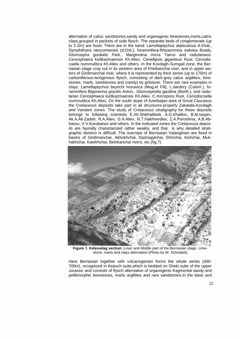
alternation of calcic sandstones,sandy and organogenic limestones,marls,calcic clays,grouped in packets of rude flysch. The separate beds of conglomerate (up to 2-3m) are fixed. There are in the band: Lamellaptychus atatscaicus A.Khal., Symphithyris neocomiensis (d;Orb.), foraminifera-Rhizammina indivisa Bvady, Glomospira gordialis Park., Marginulina micra Tairov and radiolarians-Cenosphaera kizilkazmaensis Kh.Aliev, Cenellipsis giganteus Rust, Cenodis-caella nummulitica Kh.Aliev and others. In the Kovdagh-Sumgait zone, the Ber-riasian stage crop out in its western area of Kheibarichai river, and in upper wa-ters of Girdimanchai river, where it is represented by thick series (up to 170m) of carboniferous-terrigenous flysch, consisting of dark-grey calcic argillites, lime-stones, marls, sandstones and (rarely) by gritstone. There are rare examples in clays: Lamellaptychus beyrichi moravica (Mug.et Fill), L.dardery (Colom.), fo-raminifera Bigenerina gracilis Anton., Glomospirella gaultina (Berth.), and radio-larian Cenosphaera kizilkazmaensis Kh.Aliev, C.micropora Rust, Cenodiscsella nummulitica Kh.Aliev. On the south slope of Azerbaijan area of Great Caucasus the Cretaceous deposits take part in all structures-properly Zakatala-Kovdagh and Vandam zones. The study of Cretaceous stratigraphy for these deposits belongs to following scientists E.Sh.Shikhalibeili, A.G.Khalilov, B.M.Isayev, Ak.A.Ali-Zadeh, R.A.Aliev, G.A.Aliev, N.T.Hakhverdiev, Z.A.Poroshina, A.B.Ab-basov, V.V.Korobanov and others. In the indicated zones the Cretaceous depos-its are faunally characterized rather weakly, and that is why detailed strati-graphic division is difficult. The outcrops of Berriasian Valanginian are fixed in basins of Girdimanchai, Akhokhchai, Dashagylchai, Shinchai, Kishchai, Muk-hakhchai, Katekhchai, Belokanchai rivers, etc.(fig.7).
Figure 7. Kelevudag section: Lover and Middle part of the Berriasian stage. Lime-stone, marls and clays alternation (Photo by W. Schnabel)
Here Berriasian together with volcanogenian forms the whole series (400-700m), recognized in Kepuch suite,which is bedded on Sheki suite of the upper Jurassic and consists of flysch alternation of organogenic-fragmental sandy and pellitmorphic limestones, marls argillites and rare sandstones.In the base and

26
upper part of section on Akhokhchai river the following foraminifera are dis-closed: Glomospirella gaultina (Berthelin), Glomospira subcharoides Chal., Glangulina lacrima Reuss, Marssonella neocomica (Chalil.) and others. Valanginian stage. On south-eastern Caucasus the deposits of Valanginian stage are developed in the same zones, that underlying them the Berriasinian deposits, together with which they have a gradual transition.The upper area of Bobadag suite corresponds to this stage, and is represented in facies of light-grey carboniferous - terrigenous flyschoid of Kaitar suite. Faunistically the Valanginian is divided into lower and upper substages corresponding to ammon-ite zones;Olostephanus drumensis,(lower) and Lamellaptychus didayi (upper) zones. The Valanginian deposits in Sahdag and Sudur zones on Shahdag m. and Tagirjalchai river and also in Tengin ravine are represented as a band (to 100m) of grey (compact in some places) siliceous, organogenic-fragmental, dolomitic limestones with Belbekella coralina neocomiensis Jac.et Fall. In west-ern and south-western area of Khizi synclinorium Kelevudag, Dahnyachai, Ugakh and other sections are consisted of alternation of clay beds, sand-stones,limestones and marls,with common series to 200m. On Kelevudag m. the low Valanginian is represented by a band (40m) of alternation of dark-grey,grey calcic clays, orangish-brown,bedde marls and grey platy lime-stones,containing Lamellaptychus didayi (Coq), Conobelus conicus (Blain) Pseudobelus bipartitus (Blainv.) and also foraminifera and radiolarians.The up-per Valanginian is represented at low (30m) level by interbedding of dark-grey,grey calcic clays,grey marls and grey,in some places by the platy lime-stones and fine-shingle conglomerates (5-10m) and in upper (40m)-by dark grey,calcic clays with interbeds of grey fragmental marls. In clays, together with above-mentioned cephalopods, the following are disclosed: Duvalia binervia (Rasp.) and the upper Valanginian association of foraminifera: Vaginulina arguta Reuss, V.recta Reuss, V.renngarteni Samysch., Dentalina nana Reuss and others. Towards the South-East in the approach to Beshbarmagh m. in Narda-ranian sections of Keshchai and Atachai rivers, the role of rudaceous rocks-sandstones,gritstones and conglomerates. In Nardaran ravine the conglomer-ates are grouped into packets up to 6-10m and consist of the fragments of shin-gle boulders,blocks of the Triassic, different in size and content. The other com-ponents of rude flysch (up to 30m) are aleurist marls,organogenic sandy and oolite limestones calcic sandstones and gritstones with thin interbeds of carbon-iferous clays with radiolarians: Conosphaera kizilkazmaensis Kh.Aliev, dictyomi-tra ordinaria Kh.Aliev, Xitus clivosa (Kh.Aliev),and others.The deposits of Valanginian stage in eastern segment of Zakatala-Kovdag trough are very simil-iar with those of the Khizi trough.In the upper waters of basins Girdimanchai and Pirsagatchai rivers they are presented by thick (to 500m) calcic-marl-argillite series with rich microfauna:Epistominata canariforma (Chalil.), Gaudryina Porosh, Cenodiscaella nummulitica Kh.Aliev, Cenellipsis gigantea Kh.Aliev and others. On south slope of the Great Caucasus in Vandamian zone Berriasian-Valanginian series on eastern territory (Akhokhchai river) consist of sandy or-ganogenic-fragmental and pelitomorphic limestones,sandstones,conglomerates and calcic breccia. Towards the west in basins of Dashagilchai, Kishchai, Shin-chai in Berriasian-Valanginian section the role of limestones and breccia is de-creased.At Bashdashgil river these deposits are represented by siliceous lime-stones, shaled clays, argillites with rare interbeds of sandstones (300m) and have: Lamellaptychus mortilleti londa (Trauth) and poor remains of foraminifera. Hauterivian stage. The deposits of Hauterivian stage in South-East of Cauca-sus have spread everywhere except to the North slope (Shahdag and Sudur subzones) and north-eastern are of Tengi-Beshbarmagh anticlinorium,where the

27
Hauterivian is represented by carboniferous facies; in all other zones it is repre-sented mainly by clayey facies.On south-eastern territory of the Great Caucasus the upper,the major area, of Kaitar suite (to 700m) corresponds to the Hau-terivian stage, the lower area of which belongs to Valanginian. Due to faunal content, the Hauterivian stage is divided into 2 substages. The lower substage corresponds to local zone of Lyticpceras regale, and the upper Speetoniceras auerbachi. In Shahdag and Sudur zones the Hauterivian stage (up to 100m) with underlying the Valanginian limestones are differenced by the appearance of beds of clays and sandstones in the section. There are Spitoniceras cf. inos-tranzewi Kar.,Pleurotomaria daghestanica Anth,,Loptha Rectangularis Roem and others.In all studied sections of Khizi zone, and also on southern wing of Tengi-Beshbarmagh anticlinorium, the Hauterivian deposits on lithofacial nature are significantly constant. These are mainly dark grey clays with interbeds of sandstones, limestones and marls with common thickness from 300m (Kelevu-dag m.) to 700m (Sitalchai). The more typical section of Hauterivian can be ob-served on Kevudagh m. where it is divided into two substages. The lower Hau-terivian is represented by a band (95m) of dark-grey,grey calcic ball clays with rare interbeds of thin-layered marls and calcic sandstones with fauna of fo-raminifera: Haplophragmoides infracretaceous Mjati., H.voccontianus Moull., Pseudocyclammina lituus (Jok.), Lenticulina muensteri (Roem), Darbyella ir-regularis Samych and others. In Ugakh, Dahnyachai, Gyzylkazmachai sections in lower part of Hauterivian have been disclosed the following: Lyticoceras re-gale (Pavi.),Phyllopachyceras katschience Drush., Duvalia binervia (Rasp.) and others. To upper Hauterivian can be corresponded the series (150m) of dark-grey, carboniferous clays with interbeds of calcic sandstones and marls contain-ing Haplophragmoides concavus (Champ.), Dantalina legumen (Reuss), Len-ticulina ouachensis Sigal and others.In eastern segment of Zakatala-Kovdag zone, the Hauterivian deposits are similiar with those of Khizi zone. In the most western area of Gobustan, in basin of Pirsagatchai river (near Zaratkheibari) and Girdymanchai-Pirsagatchai water division, the Hauterivian is represented by dark-grey calcic clays and argillites with frequent interbeds of sandstones, lime-stones, rarely gritstones. Here are the remains of belemnites: Duvalia binervia (Rasp.), Hibolites longior Schwetz andforaminifera. In Vandamian zone to the Gyrkhbulagh suite (B.M.Isaeva, 1968) consists of alternation of clayey shales with interbeds sandstones and limestones (60-300m). In Akhokhchai section poor microfauna are disclosed-Lenticulina caltarica (Agal), Anommalinasp.and others. Barremian stage..In south-eastern Caucasus the Barremian deposits are spread in all tectonic zones and everywhere are connected with underlying Hauterivian deposits by gradual crossings. Khalchai suite corresponds to Bar-remian stage,which is represented by clayey facies, except Shahdagh subzone, where these deposits are represented by carboniferous rocks with interbeds of clays. These deposits are divided into two substages: the lower Barremian cor-responds to the zone Holcodiscus caullaudi, and the upper-zone to Phyllopach-ceras ectocostatum. In Shahdagh and Sudur zones of Barremian (90-180m) it is represented mainly by light-grey limestones,with beds of clays in middle part of section.There Nautilus neocomiensis d; Orb.,Nucula planata Desh.,Lopha rec-tangularis Roem, are disclosed. In Khizi and Kovdagh-Sumgait zones, the Bar-remian is represented in monotonous clayey facies. The section (335m) of Bar-remian of Kelevdagh m. is typical for these zones,where rare interbeds of sandy limestones and marls and also blocks (up to 2m) of Jurassic limestones can be observed. Here are Dorocidaris urcustensis Neb., Mesohibolites cf varians (Schwetz.) and others. Towards the south-east the Barremian deposits regain their lithofacial nature, and only around the Beshbarmagh cordylite do the in-

28
terbeds of gritstone and conglomerates appear. In this direction deposits gradu-ally increase up to 600m (Dahnyachai river), 620m (Atachai river) and 885m (Gyzylkazmachai river). In this section the typical Barremian ammonites are observed: Phyllopachyceras infundibulub (d;Orb), Ph.segne Drush,Ph.eichwaldi (Kar.), Barremites charrierianus (d;Orb). In eastern area of Kovdagh-Sumgait zone near Altyagach mountain (215m), Dibrar m. (415m), Chikilchai river (425m), and the upper waters of Tudarchai river (400m), Gyadysu (more 425m) the Barremian consists of grey calcic clays with rare interbeds of limestones and marls,calcite and contain Phyllopachieceras katschiense Drush. In this area inside of clayey thickness of Barremian exotic blocks of the upper Jurassic lime-stones are observed. In Pri-Caspian-Guba area the Barremian deposits are discovered by structural-mapping and prospecting wells. On Yalama territory the part of Barremian deposits (up to 350m) which is represented by greenish-grey clays,sandstones with interbeds of limestones,with Lima cotaldina d; Orb. Trigo-nia sp.On Girdyman-Pirsadat water division near Zarat-Kheibari village Barre-mian, consists of clays with interbeds of marls, sandstones and limestones, containing Phyllopachyceras infundibulum (d;Orb), Ph.eichwaldi Kar and others. Farther towards North-West in Zakatala-Kovdagh zone in section of Barremian appear interbeds of clayey shales,shaly clays and argillites with general thick-ness from 175 to 386m. In Vandamian zone Barremian corresponds to Gendob suite (150-450m), consisting of alternation of light-grey limestones, marls, sand-stones, clays and gritstones. Aptian stage - The deposits of Aptian stage crop out within the Khizi, Zakatala-Kovdagh-Sumgait, Tengi-Beshbarmagh zones and are discovered by prospecting wells. In Shahdag and Sudur zones these depos-its were washed out by Pri-Caspian washout. Lithofacial nature of Aptian depos-its in all region is characterized by constancy. Septarian horizon and Khanaga suite correspond to Aptian stage, faunistically subdivided into three sub-stages:the lower-zone Dufronoya furcata, middle-zone Neohibolites inflexsus,the upper-zone Acanthoplites multispinatus. In Khizi zone (the section of Kelevdagh m.) the lower Aptian (40m) is represented by greenish-grey, strong carbonifer-ous clays with interbeds of marls and sandstones with Ammodiscus spirillina-formis Tair.,Bigenerina reopfax Tair,Bifarina aptica Tair., middle-upper Aptian (45m) is presented by reddish-brown calcic clays with interbeds of marls, con-taining Neohibolites montanus Ak.Aliz.,N.cairicus Natz.The more complete sec-tions of Aptian are known in south-eastern sections-in the basin of Atachai river (Tygh, Gariban vil.,Begimdag m. and others),where clays contain abundant re-mains of belemnites: Neohibolites ewaldi (Stromb) N.clava Stoll, N.montanus Ak.Aliz., N.inflexus Stoll, N.cairicus Natz. In Northern zone the Aptian is discov-ered by drilling wells to greath depth 300m in Yalama, Khudat area. Here they are represented by clays and sandstones with Trigonia longa Agal.,Nucula im-pressa Sow., Hedbergella aptica (Agal.), Globospirillina bulloides (Agal). The clayey facies of Aptian with rich remains macro-and micro fauna can be ob-served in Kovdagh-Sumgait zone in basin of Djarkhachichai river (198m), Tu-darchai river (191m), Gyadysu river (212m) and on Dibrar m. (152m). Here the lower Aptian is represented by greenish-grey clays with marly septaria, contain-ing a great deal of belemnites: Neohibolites ewaldi (Stromb)., N. montanus Ak.Aliz., N.compressus Ak.Aliz., Mesohibolites abkhasiensis Krimh and fo-raminifera. Middle and upper Aptian consist of grey, red, greenish and yellowish calcic clays and contain together with the above-mentioned belemnites, the middle-upper Aptian species as well: N.wollemanni Stoll., N.minor Stoll.Towards north-west in sections of Zarat-Kheibari (150m) and Girdyman-Pirsahat water division (240m) appear the interbeds of sandstones and sandy limestones. On South slope in Zakatala-Kovdagh zone the Aptian (60-300m) is represented by

29
flysch facies,consisting of rythmic alternation of clays, clayey shales, marls and limestones,usually without organic remains. Keihnadakhar suite (lower Aptian) and the Agbulag suite (middle-upper Aptian) correspond to Aptian stage in Van-damian zone. In basin of Girdymanchai river, the Keihnadakhar suite is repre-sented by band (105m) of aleurolites, limestones, sandstones and clayey shales; Agbulag suite is represented by multicoloured deposits (to 50m)-alternation of calcic sandstones, sandy limestones and siliceous argillites. Al-bian stage. In South-eastern Caucasus the Albian deposits are spread in the same zones as the Aptian deposits and usually are bedded on them concor-dantly. Altyagach suite horizon of Kyullyuli sandstones and Ayceline horizon correspond here to Albian stage. In central area of Khizi and Kovdagh-Sumgait synclinoria, the Albian section is complete and expressed by all three sub-stages.In area of Gonakhkend village the lower Albian (28m) is represented by clays with interbeds of sandstones and combustible shales. The middle Albian (30) is represented by the same rocks and contains Neohibolites minimus (List.), N.pinguis Stoll,and foraminifera. The upper Albian (50) consists of fly-schoid alternation of clays, sandstones and marls and is characterized by com-plex of belemnites Neohibolites stylioides Renng., N.subtilis Krimh., auceline Aucellina aptiensis (d;Orb.), A.pavlovi Sok., A.renngarteni Sok.,A.pompeckji Pavl,and foraminifera and radiolarians as well. In Northern zone Albian deposits (65m), due to data of drilling wells in Yalama and Khudat area, are represented by flysch alternation of grey, compact clays, sandstones, aleurolites and marls. In the lower part of section,corresponding to horizon of Kyulyulli sandstones, found Hoplites dentatus (Sow.) H.impressa Sow., Inoceramus concentrcus Park. The upper part of section, corresponding to Auceline horizon contains, Neohibolites stylioides Renng., Aucellina ef nassibianzi Sok. In central part of Kovdagh-Sumgait zone, the Albian is represented in lower (25-60m) and middle (50-60m) by clays of interbeds of sandstones, and in upper (50-60m) by clays, marls, sandstones and limestones. In sections of Dibrar m. and in area of Tak-hta-Yailag all three Albian substages are established, the presence of which can be proved by finds of belemnites, foraminifera and radiolarians. In sections of the Girdymanchai river the Albian deposits are subdivided into two parts: lower (85-90m) is represented by clays and limestones with Globuligerina tardita (An-ton.),Ticinella gaultina (Moroz)., the upper (30m)-clayey-sandy deposits with remains of foraminifera from Hedbergella group. Within Vandamian zone the main part of Albian section (from 200 to 600m) are tuffaceous rocks.The de-posits of lower - middle part of Albian are Lagich, and the upper-Djulyan suite (B.M.Isaev,1968). The more complete section of Albian can be observed on Sulutchai and Girdymanchai rivers where it is represented by alternation of argil-lites, tuffstones, tuffs and (rarely) by siliceous limestones, where poor remains of foraminifera can be disclosed: Gyroidinoides aff.nitidus Reuss., Gavelinella sp., Osangularia sp.
The Great Caucasus. The Upper Cretaceous.
The Upper Cretaceous deposits of the south-eastern end of the Great
Caucasus are characterized by monotonous lithofacies and richness of ammon-ite, belemnite, inoceram, echinoderms, corals foraminifera, ostracoda, radiolari-ans remains and others. In Cenomanian, Campanian and Maastrichtian depos-its the spore-pollen complexes can be observed. The scheme of division for Upper Cretaceous deposits of region has been developed due to paleontologic-stratigraphical works of M.M.Aliev (1951), M.M.Aliev and R.A. Aliev (1955, 1961, 1965), Ak.A.Ali-zadeh (1965, 1972), A.G.Khalilov and Ak.A.Ali-zadeh (1970),

30
Kh.Aliyulla, A.R.Azizbekov and A.B.Abbasov (1988) and others.The outcrops of the Upper Cretaceous are confined to the same structural-facial zones as in the lower Cretaceous. In the zone of the Northern slope, namely in observed area (Sudur,Shahdag zone) the normal marine and flysch-like formations mainly have been accumulated, and in southern area of region (Khizi, Kovdagh zone) -mainly flysch deposits. In Sudur zone the Upper Cretaceous is bedded non-corcon-dantly on the lower Cretaceous and represented by terrigenous-carboniferous sediments with poor thickness. In Shakhdagh and Tengi-Beshbarmagh zones the Upper Cretaceous is represented mainly by carboniferous rocks and charac-terized by availability of breaks in sections. In Kovdagh zone the section of the Upper Cretaceous can be characterized by lack of breaks, significant thickness (up to 2200m) of flysch deposits with prevalence of clayey rocks. Cenomanian stage. (Kemishdag suite). The deposits of this stage within observed territory crop out in Khizi and Kovdagh zones and they are discovered on prospecting Pri-Caspian-Guba area. In many sections (Kelevudagh, Dibrar and others) the transition from Albian deposits to Cenomanian is gradual (fig 8).
Figure 8.W.G.Integrated Stratigraphy; IGCP-Project No. 362; Baku, Azerbaijan 1997.

31
In Pri-Caspian-Guba area the Cenomanian deposits are discovered at depth lower than 2200m and have lithological likeness with the upper Albian sub-stage,which are represented by marls with interbeds of sandy clays and clayey sandstones with mixed fauna of the upper Albian-Cenomanian Neohibolites stylioides Renng., Inoceramus cf. scalprum Boehm, Aucellina cf. nassibianzi Sok etc. In Tengi-Beshbarmagh zone Cenomanian deposits are discovered by prospecting wells on Suraabad territory, where they consist of dark-grey, green-ish-grey clays,fine-grained sandstones,limestones and conglomerates (55-90m), with rare interbeds of tuffs and calcic tuffites. There are Inoceramus cf. scal-prum Boehm, Neohibolites ultimus d; Orb., Thamanninella appenninica (Renz) etc.. In Shah-dag-Khizi zone isolated outcrops of Cenomanian deposits can be observed in Budug trough on Chulgyazydag m., where they are transgressively bedded on washed out horizons of Albian and are covered non-concordantly by conglomerates of the upper Turonian. They are represented by carboniferous-terrigenous flysch (up to 50m) consisting of grey clays with interbeds of lime-stones, calcic sandstones and small shingle conglomerates. There are Neolibo-lites ultimus Orb.,N.subtilis Krimh., in lower part of section-complexes of fo-

32
raminifa. In Khizi zone in section of Kelevudag m. the lower Cenomanian (20-22m) is represented by alternation of grey,dark-grey fragmental, carboniferous clays, organogenic-fragmental,sandy,limestones with interbeds of marls and thick-plated calcic sandstones with rare interbeds of calcic gritstone. Here are Neolibolites ultimus d; Orb, N.subtilis Krimh., and foraminifera, radiolarians as well. The middle and upper Cenomanian (20m) is represented by alternation of small shingle conglomerates,gritstones and calcic sandstones with thin inter-beds of sandy clays. There are foraminifera Nodosaria obscura Reuss., Denta-lina lorneiana d’Orb., Frondicularia guadrigana Pern., Vaginulina truncata Reuss and radiolarians Cenodiscus cenomanicus Kh.Aliev and others. In Kov-dagh zone the Cenomanian deposits are close, based on lithological content, to the same age of Khizi zone deposits, differing from them by distinct,large thickness (300-330m) and strict reduction of small shingle conglomerates. The more full section of the Cenomanian deposits is in Dibrar m., where lithologically it is rep-resented by sandy-clayey calcic bands (up to 300m) and characterized by rich complexes as benthos and planktonic foraminifera, radiolarians and spore-pollens. In the same facies Cenomanian is represented in neighbourhood of Takhta-Yailag (158m) where rich fauna of foraminifera and radiolarians can be discovered. In section of Tudarchai river (115m) in Cenomanian Neohibolites ultimus (d’Orb) can be found. In north-eastern area of the zone in basin of Pir-sagatchai river near Zarat-Kheibari village the thickness of Cenomanian signifi-cantly reduces (65-70m) and is represented by a band of limestones,clays and marls,containing Inoceramus pictus Sow., Neohibolites ultimus (d’Orb), and microfossils. In South-eastern direction, in the valley of Sarydashchai river, the Cenomanian is represented by interbedding of grey,whilish-grey limestones,thin-plated sandstones and marls with thin interbeds of calcic clays,where Parahibo-lites tourtiae (Weign.) and complex of foraminifera have been found. In basin of Gyadysu river the band (90m) of white grey clays,marls,sandstones and lime-stones corresponds to Cenomanian. They contain Cenomanian complex of fo-raminifera: Hedbergella infracretacea (Glassen.), H.globigerinellinoides (Subb.), Heterohelix globulosa (Ehrenb.) H.cenomanica (Agal) etc. Turonian stage. (Zorat horizon and lower part of Kemchi suite). The deposits of Turonian stage concordantly are bedded on Cenomanian and lithologically represented in two differing facies.The lower part of Turonian stage, corresponding to Zorat hori-zon, is represented by bands of limestones,marls,calcic clays and sand-stones,with interbeds of combustible shales. The Upper Turonian is represented by carbonaceous facies and, due to lithological likeness with Coniacian deposits and poor paleontological remains, these stages are considered together. Tu-ronian deposits are spread non-uniformally in area. In zone of Northern slope in natural outcrops the Turonian deposits are unknown. Their upper part (to 200m) is drilled by wells in Yalama area,where it is represented by light-grey marls and organogenic-fragmental limestones with interbeds of sandstones with Inocera-mus lamarki Park. These deposits are completely represented in Khizi and Di-brar zones. In section of Kelevdagh m. the deposits of low Turonian are repre-sented by interbedding (to 30m) of compact, grey plate marls, limestones, argil-lites, dark-grey, in some places-by black clays with Inoceramus labiatus Scholth. Low-Turonian complex of foraminifera: Helvetoglobotruncana helvetica (Boll), Gyroidinoides nitidus Reuss,Whiteinella holli (Hagn.) in clays, and mass accu-mulation of radiolarians: Alievium superbum Pess., Dictyomitra striata Lipm., Amphipyndax atocki (Camp.et Clark) and others. The upper Turonian is repre-sented by a band (17m) of grey, dark-grey clays, limestones, marls, conglomer-ates and sandstones,containing typical complex of foraminifera Gavelinella montiliformis (Berth.),Heterohelix globulosa (Ehrenb.), H.glibifera Reuss. etc. In

33
Kovdagh zone the Turonian is concordantly bedded on Cenomanian and repre-sented in facies of typical terrigenous-carbonaceous flysch. On Dibrar m. the Turonian deposits are divided into two substages.The low Turonian consists of alternation (26-28m) of greenish-grey,redish-brown carboniferous clays, light-grey layer compact limestones and sandstones with occasional interbeds of purple-violet clays, with Inoceramus labiatus Scholoth. The remains of fo-raminifera and radiolarians can be observed in clays. The upper Turonian is represented by rythmical alternation (47-49m) of greenish-grey, brown clays, marls, light-grey crystallic limestones transforming in gritstones and fine-shingle conglomerates. Foraminifera Gavelinella moniliformis (Berth.), Heterohelix globulosa (Ehrenb.), H.globifera Reuss and radiolarians Gongylothorax annula-tus Dum., G.verbeeki (Tan Sin Hok) etc. can be observed in clays. Turonian deposits in some places falling out from section (Kozluchai r.) stretch as narrow stripes to the West and crop out in basins of Chikilchai, Pirsahat and Girdyman-chai rivers. In the most westerly area of Kobustan, in the neighbourhood of Zarat-Kheibari village, the Turonian deposits (77m) are represented by rythmic alternation of manycoloured (in some places cross-layerd) limestones, calcic clays and marls, containing Globotruncana renzi Gand., Gl.lapparenti Brotz., heterohelix globifera Reuss and radiolarians. In such facies the Turonian is rep-resented in the basin of the Sarydashchai river where inoceramus lamarki Park. and abundant remains of radiolarians Lithostrobus turritella Lipman and and foraminifera Stensioina praeexculpta (Kell), Globotruncana linneiana (d’Orb), Bolivinita eouvigeriniformus Kell can be observed. Towards the east the Tu-ronian deposits are registered in the neighbourhood of Takhta-Yailag area and along the right bank of Ambizlyar river. In both sections the lower part (up to 40m) of Turonian is characterized by flysch alternation,light-grey calcic clays with complex of microfossils Eggerellina subsphaerica (Reuss), Globotruncana lapparenti Brotz and radiolarians Sethocapsa microacanthos Squin., Amphipyn-dax stocki (Campb. et Clark.) etc. In upper Turonian (40m), in addition to the flysch components, the beds contain compact marls with Globotruncana lin-neiana (d;Orb), Gl.imbricata Morn., Heterohelix globulosa (Ehrenb.) etc. Conia-cian stage (the upper part of Kemchi suite). The deposits of Coniacian stage concordantly cover the Turonian deposits and are represented by clayey-marlous and carboniferous facies. Faunistically the stage is characterized by a rich complex of foraminifera and radiolarians, and as well by the presence of rare inocerama in the lower part. Bands of marls and limestones, with rare inter-beds of clays with typical complex of foraminifera discovered by wells (Yalama-Khudat area), correspond to this stage in the area of Northern slope. In Sudur and Shahdag zones in natural outcrops Coniacian deposits are unknown. Within Khizi zone the Coniacian deposits have been preserved from Pri-Santanian washout in Budug trough, where they are represented by carboniferous-terrigenous flysch, which consists of grey-pinkish clays, sandy limestones, marls with rare interbeds of fine-shingle conglomerates and contain the typical com-plexes of foraminifera. In section of Kelevudagh the Coniacian stage is pre-sented by both substages. The lower Coniacian (45m) is represented by light-grey clays, marls and limestones, which contain complex of microfauna Gyroidi-noides depressus (Alth.), Globorotalites multiseptus (Brotz.),Globotruncana angusticarinata Gand., Genodiscus cenomanicus Kh.Aliev., Gryptamphorella conara Dum.,Dictyomitra Zitt,etc. In the base of upper Coniacian (15m) massive sandstones appear and small shingle conglomerates,and on the roof-interbeds of conglomerates. Here can be observed the following: Gavellinella praeinfras-antonica (Mjatl.), Rugoglobigerina ordinaria (Subb.), Striataella striata (Ehrend.), Gongylothorax verbeeki (Tan Sin Hok), Theocapsomma teren For. and others.

34
In Kovdagh zone the deposits of Coniacian stage are concordantly bedded on the rocks of the upper Turonian and are represented by flysch facies. In the basin of Pirsagatchai river near Zarat-Kheibari village, to the lower Coniacian there is a corresponding band (40m) of alternation grey,dark-grey compact cal-cic clays, grey layer marlous limestones and marls, containing Inoceramus koe-neni Mull., Inderformis Meek., and foraminifera as well. The upper Coniacian is represented by a band (75m) of rythmic alternation of grey, dark-grey calcic clays various-grained limestones, marls with rare interbeds of leaf-like sand-stones. In clays the following foraminifera have been found: Tesserraella pseu-dotessera (Cushm.), Globotruncana globigerinoides Brotz., Gl.tricarinata (Quer.) and others. The same facies of Coniacian with foraminifera can be observed in the basin of Sarydashchai river, where the thickness of deposits reduces to 60m. In section of Dibrar mountain the lower Coniacian can be seenas flysch formations (75m) represented by light-grey, chocolate-brown greenish-grey car-boniferous clays, marls, limestones and sandstones. In clays abundant remains are observed of foraminifera Globorotalites hangensis Vass., Whiteinella holli (Hagn.), Globotruncana lapparenti Brotz., Heterohelix globulosa (Ehrenb.). The upper Coniacian is represented in the same facies as in the lower Coniacian, but the thickness reduces almost by a factor two. The clays contain: Globotrun-canella chalilovi (Alij.), Rugoglobigerina ordinaria (Subb.), Cryptamphorella con-ara Dum. and others. Towards the South in neighbourhood of Takhta-Yalag area the lower Coniacian (70m) is also represented by carboniferous facies with microfauna Globotruncana lapparenti Brotz., Gl.linneiana (d’Orb), Gl.angustica-rinata Gand., Dictyomitra multicostata Zitt., Amphipyndax enesseffi For. The upper Coniacian (40m) lithologically ages not change. Together with foraminif-era Rugoglobigerina ordinaria (Subb.), Globotruncana subbotinae Alij., Tesser-aella pseudotessera (Cushm). Here can be observed abundant remains of ra-diolarians: Porodiscus cretaceous Lipm., Orbiculiforma monticelloensis Pess., Gonhylothorax verbeeki (Tan sin Hok). In the basin of Gyadysu river the Conia-cian stage (50m) is represented by rythmic alternation of chocolate-brown, greenish-grey clays, light-grey limestones and marls, rarely-microconglome-rates. Among them are Inoceramus subquadratus Schlut and foraminifera. San-tonian stage (the low part of Yunusdagh suite). Santonian deposits are concor-dantly bedded on Coniacian and represented by terrigenous-carbonaceous fa-cies with prevalence of clayey rocks. They are paleontologically characterized mainly by foraminifera and rare finds of belemnite and inocerum, dating the Up-per Santonian age. The Santonian section in the zone of northern slope (the wells Yalama,Khudat) is represented by interbedding of clayey limestones and marls with typical microfauna. In Sudur, Shahdag and Tengi-Beshbarmagh zones these deposits are unknown. Santonian deposits are widely spread in Khizi zone, where they are bedded on the deposits of the Upper Coniacian and in some places on different horizons of lower Cretaceous. In the section of Kele-vudagh mountain Santonian stage is represented by a band (52m) of light-grey, grey massive overcrystallized limestones with interbeds of fine-grained con-glomerates and contain: Globotruncana tricarinata (Quer.), Globotruncanella chalilorvi (Alij.) Stensioina exsculpta (Reuss)., Gyroidinoides turgidus (Hag.), Orbiculiforma monticelloensis Pess., Sethocapsa microacanthos Squin., Tri-colocapsa dispar Tan Sin Hok. In Zakatala-Kovdagh zone the Santanian depos-its are bedded concordantly on deposits of Coniacian stage and lithologically differ by increase of clay thickness and by prevalence of brown colours in rock colouring. In section of Dibrar mountain the low Santonian is represented by a band (82m) of rythmic alternation of reddish-brown, greenish-grey strong car-boniferous clays with interbeds of grey, greenish-grey carboniferous sandstones

35
and limestones and rarely-fine-grained conglomerates and gritstones. In the band are inoceramus inconstans Wods foraminifera and radiolarians. To the Upper Santonian corresponds the band (77m) of rythmic alternation of greenish-grey, pinkish-brown compact, in some places leaf-like sandy clays with interbeds of grey limestones. In clays can be observed the complex of microfossils Sten-sioina exsculpta (Reuss), Gyroidinoides turgidus (Hag.). Orbiculiforma monticel-loensis Pess., Sethocapsa microacanthos Squin.,Tricolocapsa dispar Tan Sin Hok and others. In sections of Zarat-Kheibari (50m) and Takhta-Yailag (64m) the Upper Santonian lithologically is almost a mono-type and is represented by interbedding of clays, marls and limestones with prevalence of clays, in which the same foraminifera can be observed as in the Dibrar mountain section. In south-east the outcrops of the Santonian deposits can be observed in the basins of Gyadysu (80m) where they are represented by red carboniferous clays with interbeds of white-grey marls with Cavelinella infrasantonica (Bolakhm.), Glo-botruncana ventricosa White.,Gl. concavata (Brotd.) and others. The Cam-panian stage (the lower part of Agbura suite). The deposits of Campanian stage are spread in all troughs and are represented in the same facies as the lower bedded Santonian deposits but their thickness significantly increases (up to 215m). In Campanian the belemnites,pelecypods and foraminifera are widely spread on the base of which the substages are distinguished. In Sudur and Tengi-Beshbarmagh zones of the lower Campanian deposits are transgressive, with basal conglomerates on the base bedded at the rocks of the upper Barre-nian. In sections of wells of Northern slope they concordantly cover the upper Santonian and are represented by a weak band of multicoloured clays, clayey limestones, marls containing microfauna remains. Here the Upper Campanian consists of clays, marls and sandy limestones with rare interbeds of fine-grained conglomerates and the typical fauna of ammonites, foraminifera, belemnites, pelecypods and ostracoda. In Yalama and Khudat area drilling data indicate that the Campanian stage (more 200m) is represented by light-grey detritus lime-stones, marls and sandstones and contain Inoceramus desipiens (Zitt.), In. bal-ticus Boehm. and remains of foraminifera. In Shahdagh zone, at the base of upper Cretaceous section, the deposits of low Campanian are bedded trans-gressively and non-concordantly covering the different horizons of Barremian, Aptian, and in some places by block conglomerates in the base. In Shahdagh mountain area the lower Campanian (6m) is represented by clays with rare in-terbeds of limestones and marls, containing an early Campanian complex of foraminifera: Ataxophragmium crassum (d’Ord.), Gavelinella menneri (Kel.), Globotruncana arca (Cushm.), G.rugosa (marie) and others. The Upper Cam-panian corresponds to the thickness (144m) of interbedding of limestones, marls and clays, containing rich fauna of belemnites-Belemnitella mucronata senior Now., B.langei langei Jel., B.conica Arkh., Inoceramus balticus Brehm., In.regularis (d’Orb)., and foraminifera as well. In Khizi zone, in the base of Cam-panian, conglomerates are also observed which cover the Santonian deposits and different horizons of Cretaceous. On Kelevudag mountain the lower Cam-panian (30m) is represented by a band of pelitomorphic limestones limestones, sandstones, marls and clays with Belemnitella mucronata senior Now, inocera-mus balticus Roehm., Liostrea incurva Nilss. The Upper Campanian (34m) is represented by interbedding of sandy limestones, marls and clays with remains of foraminifera Globotruncana arca (Cushm) Gl.fornicata (Plumm.), Globotrun-canella stuarti (Lapp) and radiolarians Gongylothorax verbeki (Tan Sin Hok), Tricolocapsa granti Campb. et Clark, Cryptamophorella conara and others. The Campanian deposits in Kovdagh and Dibrar zones are widely spread and have similarities with those of Khizi zone, differing by the prevalence of clayey rocks.

36
On Dibrar mountain the lower Campanian has, in the base, fine-shingle con-glomerates (0,4m) and is represented by a band (52m) of alternation of white-grey, greenishgrey and meat-red carboniferous clays with rapid interbeds of marls, carboniferous sandstones and compact limestones. Here are Inoceramus balticus Boehm,abundant remains of foraminifera. The Campanian is repre-sented by flysch alternation (50m) of grey with greenish color of strong cor-bominiferous clays, plated sandstones, cross and wave-layer marls and lime-stones, containing foraminiferaStensioina pommerana Brotz., Globotruncana conica White, Gl.arca (Cushm), Gl.calici formis (Lapp) and radiolarians Coc-codiscus holmesi Campb. et Clark, Gongylothorax verbeeki (Tan Sin Hok), Theocapsoma ancus For. and others. Towards the South, in section of Cam-panian (Takhta-Yailag area, basin of Chikilchai river), the thickness of clayey beds significantly increases, in which are Belemnitella mucronata Link., B.mucronata senior Now.,B.mucronata parva Najd. in Kovdagh zone the Cam-panian deposits (up to 80m) due to the lithological content are close to Dibrar facies and crop out in the basin of Pirsahatchai in the neighbourhood of Zarat village, where in clays Globotruncana linneiana (d;Orb), Heterohelix globulosa (Shrenb.), Tesseraella pseudotessers (Cushm.), Schackoina multispinata (Cushm. et Wick). are found. Good outcrops of Campanian deposits can be observed within Shahandagh structures, on Shahandagh mountain, where the lower substage is represented by a band (80m) of alternation of grey, greenish-grey, sometimes red-brown carboniferous clays, white-grey,pink marls and fine-grained sandstones. Belemnitella mucronata Link., Inoceramus agdjakendensis Aliev can be observed here. The Upper Campanian (60m) is represented in the same facies as in the lower Campanian and contains: Belemnitella mucronata profunda Naid., B.mucronata senior Now, B.conica Arkhang and others. Maas-trichtian stage (the upper part of Agburun suite). The deposits of Maastrichtian stage concordantly are bedded on Campanian. Faunistically they are character-ized by ammonites, belemnites, inoceramus and foraminifera. In the area of the Northern slope the Maastrichtian deposits are discovered by wells (Yalama, Khudat area) and are represented by a thickness (about 200m) of grey lime-stones with interbeds of marls. There are Diplomoceras sp., Pachydiscus sp., Pecten spathulatus Roem., Magna pulmilis Sow., and the complex of foraminif-era in them. Weak conglomerates of lower Maastrichtian remain in the Sudur substage. The shingles of these conglomerates have removed Aptian-Albian mollusk fauna. In Tengi-Beshbarmagh zone in Tengi ravine the lower Maas-trichtian is represented by a band (67m) of alternation of grey sandy limestones, dark grey calcic clays, with rare interbeds of small-shingle conglomerates. In the upper part the clays are substituted by sandy marls which contain Inoceramus tenginicus R.Aliev, In.caucasicus cabardinica Dobrov, In.caucasicus monlifera Dobrov., In.caucasicus ravni Dobrov. In south-eastern zone Maastrichtian de-posits can be observed along the coast of Caspian Sea near Shuraabad village, where they are represented by thickness (260m) of light-grey marls and marlous clays, containing Globotruncana arca (Cushm.), Gl.conica White, Gl. contusa (Cushm.), Racemiguembelina fructicosa (Egger).In Shahdagh-Khizi zone Maas-trichtian deposits, as a result of recent erosive cut, have been preserved in some sections of Khizi trough. In Shahdagh substage (Shahdagh m.) the sec-tion of lower Maastrichtian (25m) consists of organo-fragmental limestones with interbeds of clays, sandstones, marls, containing foraminifera Planoglobulina acervulinoides (Egger), Pseudotextularia varians Rzehak and others. In Khizi substage in Budug trough (Chulgyazydagh) the Maastrichtian consists of clayey-calcic thickness with interbeds of marls, sandstones and fine-shingle conglom-erates. The lower Maastrichtian is dated by leading: Stegaster chalmasi Seunes,

37
Inoceramus caucasicus ravni Dobr.,Jn. caucasicus monlifera Dobr. and others, and the Upper Maastrichtian by belemnites Belemnella arkhangelskyi Najd., B.pontica Najd. These deposits contain typical complexes of foraminifera and ostracoda, as well as spore-pollen complex. On Kelevudagh the deposits of Maastrichtian stage are represented only by the lower substage, consisting of a band (35m) of limestones, marls, clays with interbeds of sandstones. In upper part of the band there are: Inoceramus caucasicus varni Dobr., In.tegulatus Hag. In marls the rich association of foraminifera and radiolarians have been dis-closed as well. In Kovdagh and Dibrar zones the deposits of Maastrichtian are widely developed and connected with Campanian by gradual transition; with lithological characterization by an increase of terrigenous material content. In section of Dibrar mountain, the Maastrichtian stage (70m) is represented by flysch alternation of grey and greenish-grey clays, marls sandy limestones, passing in some places to fine-shingle conglomerates, characterized by the presence of the following: Stensioina exculpta (Reuss), Globotruncana lappar-enti Brotz., Gl. contusa (Cushm.). Dibrar flysch facies of Maastrichtian can be observed in sections of basins Chikilchai (Takhta-Yailag section) and Tudarchai (Ambizlyar trough), differing by some increase of sandy limestones interbeds. There are Pseudovalvulineria alievi Ali., Globotrunca linneina (d’Orb), Gl.arca (Cuchm.). The complete section of Maastrichtian crops out in area of Dially vil-lage where the lower Maastrichtian (85m) is represented by interbedding of marls, limestones and clays in which Inoceramus balticus Boehm., In. ismail-liensis M.Aliev et R.Aliev, Stegaster chalmasi Seun and others are found. The upper Maastrichtian (50m) is represented in the same facies as the lower, but Maastrichtian in the roof of deposits can be observed fine-grained conglomer-ates. There are Gyroidinoides turgidus (Has.), Globotruncana arca (cushm.), Gl. linneiana (d;Orb), Abathomp-halus mayaroensis (Bolli).(Fig.9) Kura intermon-tane depression. Within the Kura intermontane depression the Mesozoic de-posits are bedded deeply and discovered by exploration wells. With these de-posits, especially in the Cretaceous, carboniferous and volcanogenic rocks are connected with industrial oil and gas accumulations. Here on the discovered sections of Mesozoic deposits the number of breaks in sedimentation can be registered, angular and azimuthal nonconcordancy of the beds, and, in this re-gard, some problems of stratigraphy of deep layers of Mesozoik are still not solved. The stratigraphy of Mesozoic of Kura depression was studied by the following scientists Kh.Aliyulla (1984), R.G.Babayev (1984), A.R. Azizbekova (1982), H.T. Akhverdiyev (1972), T.M. Gadiyeva (1988), M.A. Rzayev (1972) and others. Mesozoic complex of deposits has been disclosed in Jarly, Amir-arkh, Muradkhanly, Sor-sor, Zardab, Saatly, interfluve of Kura and Yori and oth-ers at depths grater than 2500 m. The oldest horizons of Mesozoic were discov-ered by ultradeep wells UD-I and OP-I, drilled in Saatly-Kyurdamir buried rise. Andesite-basalt complex of volcanogenic formations discovered here at depth greater than 3529m, and distinguished as Mu-radkhanly suite, may be regarded as lower and middle Jurassic. Fauna of radiolarians, disclosed later at depth of 6560m in interbeds of silicious tuffoaleurites, define the age of these rocks as the second half of the early-beginning of middle Jurassic (Tikhomirov,1990).The upper part of Muradkhanly suite consists of porphyrites and andesits with thick-ness 755m. It is disclosed by wells numbe-red 1, 6, 8 in Jarly area. Due to data Saatly from the ultradeep well over Murad-khanly suite, a thick series of carbon-iferous rocks (Saatly series) is followed.

38
Figure 9.W.G.Integrated Stratigraphy; IGCP-Project No. 362; Baku, Azerbaijan 1997. The lower part of this series (int. 3529-3445m), referred to as the Sarygel suite, is represented by crystallic, oolite-small fragmental limestones with interbeds of tuff and spilite and contains the single skeletal foraminifera: Nubeculinella sp., Marsonella sp., Trochammina sp. The age of Sarygel suite conditionally can be considered Callovian-lower Oxfordian (int.3445-3207m), distinguished in Djarli suite, and represented by organogenic-fragmental, oolite-finefragmental lime-stones with interbeds of spilite (10m). In the upper part of the suite, composed of coral limestones a complex of corals with Microsolena foliosa Ron., dating the Upper Oxfordian has been determined. From foraminifer one can find Nube-culinella sp.,Dentalina sp.,Nodosaria sp.,Turrispirillina sp. etc. Deposits of the Kimmeridgian in the Saatly well (SG-I) (int.3207-3150m) are represented by facies identical with the Upper Oxfordian and contain massive colonial corals: Heliocoenia (Hexaheliocoenia) orbignyi Ron.,Microsolena sp.,Lingulina sp. etc. In well OP-I in this interval (int.3207-3157m) are found volcanogenic formations with interbeds of breccia limestones,which contain numerous sponge spicules in the upper parts. In the Kura intermontane depression, in many drilled wells the faunally dated deposits of the Tithonian, Berriasian and Valanginian stages are absent. Deposits of the Hauterivian-Barremian in the area of the Middle Kura

39
depression (area Jarly,wells 4,1) are represented in the lower part by andesite porphyrites, which in the upper section change to tuffs, sandstones, tuffites, argillites, clays and (rarely) to limestones, the total thickness is up to 1000m.
Figure 10. Tugchai section: Detail of Aptian sediments with abundant belemnites. (Photo by W.Schnabel)
There were discovered single foraminifer Lenticulina sp.,Trocholina sp. etc. Deposits of the Barremian-lower Aptian in wells SG-I and OP-I transgressively lie in the washed out surface of the Kimmeridgian, and are composed of various carbonaceous rocks with Complexastraea sp.The Aptian deposits, outcropped in the area Jarly are represented by tuff-sandstones, tuffs, tuff-aleurolites and aleurolites (100-140m).Fig.10. In the area Saatly the upper Aptian deposits to-gether with Albian deposits, form the unit Sor-Sorian, suite which is composed of carbonaceous rocks and transgressively overlapped by the Sarmatian depos-its.Fig.11. The Albian deposits in other areas of the Kura depression have not been determined. The lower stages of the Upper Cretaceous (the Cenomanian, Turonian and Coniacian stages) within the Kura depression are found by single wells (areas Sor-sor and Muradkhanly) and are represented mainly,by tuffoge-nous-sedimentary formations (the total thickness of which is up to 450m). Fig.12. Usually they are poor in faunal remnants. Their age is determined by stratigraphic position and lithofacial peculiarities of the deposits. In the studied wells these dated deposits, as a rule, lie under faunally dated deposits of the Santonian stage. Deposits of the Santonian stage within the Kura depression have a peculiar set of types of thin component-rocks. In Jarly areas (well 1,int.3370-3637m) they are limestones and dolomites with interbeds of sharply dependent sandstones and tuff-sandstones.Within the same interval, deposits of the Santonian in Zardob, Amirarkh and Muradkhanly areas are represented by tuffogenous-sedimentary complex of rocks-tuffsandstones, argillites, limestones, tuffs and marls. There were determined from Globotruncana linneiana (d;Orb.), Gl.concavata Brotz., Gl.lapparenti Brotz., Rugoglobigerina ordinaria (Subb.) etc.In the territory of the Middle Kura depression, the Campanian-Maastrichtian are found in a majority of wells and are characterized by monotype of their com-

40
ponent deposites. Deposits of the Campanian stage in Muradkhanly (well7, int.3782-3855m) and Amirarkh (well 3,int.4990-5100m) areas composed a band of limestones,here and there organogenous with beds of marls. They contain Globotruncana arca (Cuchm.), Rugoglobigerina ordinaria (Subb.), Striataella striata (Ehrenb.) etc. The Maastrichtian stage in Muradhanly (well 7, int.3715-4235m) and Amirarh (well 2,int.5210-5250m) areas is represented by a band of white dense limestones with rare interbeds of marls and clays and are charac-terized by various species of foraminifers: Globotruncana contusa *Cushm.) Racemiguembelina fructicosa (Egger), Planoglobulina acervulinoides (Egger), Bolivinoides draco (Marsson) etc.
Figure 11. Tugchai section: Between Zorat and Chizy. Aptian sediments. (Photo by W.Schnabel)
Figure 12. Girdimanchai river section: Boundary between Lower Albian (grey clays and sandstones) and Middle/Upper Albian (white to grey tufsandstone)
(Photo by W.Schnabel

41
The Lesser Caucasus.The Lower Cretaceous. The Low Cretaceous deposits take part in the construction of Geckcha-Quarabagh,Lock-Aghdam and Miskhana-Gafan structural zones, and usually are characterized by the differen-tiation of deposits and incompleteness of sections. All stages of the Lesser Caucasus and, in its north-east part, lower stages of Cretaceous as far as Ap-tian are absent and the Albian transgressively lies on the upper Jurassic forma-tions. Regional stratigraphic schemes of the Lower Cretaceous in the Lesser Caucasus were prepared on the basis of long research efforts of V.P Rengar-ten, E.Sh.Shikhalibeily, A.G.Khalilov, Ak.A.Alizadeh, G.A.Alieva,R.B.Askerova et al. The Barriasian-Valanginian. Owing to the difficulty in constructing, a boundary between these stages in the Lesser Caucasus they are usually con-sidered together. They are not widely spread and usually occur in the central zone. In the whole zone of their spread the Berriasian-Valanginian deposits are lithologically represented by carbonaceous facies with tuffogenous admixture. More complete and paleontologically characterized sections are found within the Sarybabinian and Towraghachai depressions in the Geckcha-Quarabagh zone and Gochas depression in the Miskhana-Gafan zone. In Sarybaba mountain the Berriasian-Valanginian deposits are represented by limestones, often by silici-fied differences (230m) and transgressively lie on the Bathonian-Callovian rocks. They contain Berriassella callisto (d;Orb),Lamellaptychus beyrichi (Opp.), L.mortilleti (Pict. et Lor.), L.didayi (Coq.) etc. These deposits are traced in a narrow and interrupted strip far to the north and within the Towraghchai depres-sion (in Susuzlugh, Boghdadagh mountains) form a mountainous series (160m) which contains crystal, sandy and (rarely) gritstone and silicified limestones. They are linked with the underlying Tithonian by a gradual transition. In the mid-dle part of the series there have been determined Fauriella boissieri (Pict.),Lamellaptychus beyrichi (Opp) L.didayi (Coq) etc. In the Gochas syncli-norium a typical section of the carbonaceous series of the Berrias-Valanginian is observed in the basin of Yaghlydereh river,near Lachin mountain and in Ky-syldash mountain. Here in the lower part of the carbonaceous series (140m), which contains silicified and (rarely) sandy limestones with interbeds of tuffs and tuff-sandstones,was found the Berriasian fauna complex: Lamellaptychus bey-richi (Opp), L.lamellosus (Park), L.mortilleti (P.et.L.), Duvalia lata (Blainv.), D.lata constricta (Uhl.) etc. The upper part (100m), corresponding to the Valanginian stage, is represented by coarse-crystalline and sandy-flinty lime-stones which contain Lamellaptychus angullicostatus symphysocostata Tranth, Duvalia lata (Blain). The Hauterivian stage. Deposits of this stage are spread in the central and Miskhana-Gafan zones and everywhere are represented by the carbonaceous facies. In the central zone of the Lesser Caucasus the Hau-terivian deposits are spread widely and take part in the construction of the main tectonic units.In the extreme north parts of the central zone (head waters of Tekegayasychai,areas) the Hauterivian (60-100m) is found in a continued sec-tion of the Tithonian-Barrenian carbonaceous series composed of strong silici-fied sandstones, here and there with gritstone limestones. There were discov-ered:Lamellaptychus angulicostatus (Pict.et Lor), L.angulicostatus cristobalensis (O. Conn.), Hibolites longior Schwetz.In the Gochass synclinorium the Hau-terivian composes summits of Gysylkaya, Topagach, Dibyatly, Gysyldash and Lachindagh mountains and everywhere is linked with the Valanginian gradual transition.In these sections deposits (up to 200m) are represented by thin-layered,silicified limestones with the admixtures of tuffogenous materials. There were found Lamellaptychus angulicostatus (Pict.et Lor.), L.noricus (Wkl.), Hibo-lites subfusiformis (Rasp).The Barremian stage..Deposits of this stage are spread within the Aghdamian, Khojavend and Towragachai depressions. In the

42
Aghdamian anticlinorium the Barrenian deposits compose its north-east wing and are exposed near Garakend (202m),Abdal-Gulably (201m), Gasymly (85m), Shelli (96m) etc. villages. In these sections the Barremian is represented by light-grey organogenous-fragmental crystal limestones with rare interbeds of tuffogenous rocks,which transgressively (together with the basal conglomerate at the base) lie on volcanogenic-sedimentary Kimmeridgian formations. Age of limestones is dated by the presence of complex of brachiopods and echino-derms Cymatoceras pseudoelegans (d;Orb.) Barremites difficilis (a;Orb), B.biassalensis (Kar.), Duvalia grasiana (Duv.-Jouve), Hibolites subfussiformis (Rarp),Oxytoma cornueliana (d’Orb), Cyclothyris castellanensis (Jac.et. Fall.) Cidaris punctaissima Agass etc. Within the Khojavend depression the Barre-mian deposits as isolated outcrops are traced near Dilagharda (174m),Gajar (160m),the Upper Sizneck (30m),Shusha plateau (35m). In these sections the Barremian lies on the surface of the Oxfordian and is represented by a monoto-nous series of limestones which contain mainly a rich fauna of brachiopods. Here was determined Moutonithyris moutoniana (a’Orb.),Symphythyris neo-comiensis (d’Orb.),Cyclothyris lata (Jac.et. Fall.), Loriolithyris russilensis (Lor.) etc. In the north-east wing of the Kafan anticlinorium, the Barremian deposits, together with the lower Aptian deposits, form the Urgonian facies of a reefoge-nous complex, which is composed of coarse-fragmental-organogenous-carbonaceous series within the layers of volcanogenous-sedimentary rocks. In the southern part closer to the left bank of Araks river in Vezhnali (340m),Bartaz (190m), Seidlyar (187m) etc, the Barremian section is dominated by carbona-ceous rocks-organogenous-fragmental limestones and marls. Volcanogenic-sedimentary formations have a lesser contribution. In the limestones and marls abundant fauna art found Diozoptyxis coquandi (d; Orb), Pterotriginia caudata (Agass.) Neithea atava Roem.,Sellithyris sella (Sow.), Heteraster rengarteni Par., H.magnus Por.In the northeru parts, in the interfluve of Araks and Basar-chai rivers in Aligyliushaghi; Davutlu, Shahverdilyar etc., sections in the Barre-mian composition have volcanogenic-sedimentary components dominating over carbonaceous material. The latter are represented by reefy limestones which form different types of organogenous constructions (biostomes, bioherms),shore reef inclusive.There are found a rich complex of reef-constructing sclerenhymas and also large foraminifers,phipidistia,gastropods and myarian mollusks. Their age is determined by Protetragonites karakaschi Drush., Siliesites seranonsis (Uhl.),Barremites strettostoma (Uhl), Monopleura urgonensis Math., M.sulcata Math.,Felixigyra duncani Prever.The thickness of the Barremian is 450m. In the north-east part of the Gochass depression the upper Barremian (22m) is repre-sented by another facies-by calcic tuff-sandstones and sandy limestones with Silesites seranonsis (d’Orb.), Costidiscus recticostatus (d’Orb.).The Aptian Stage. Deposits of the Aptian stage are spread in the north-east part of the Miskhana-Gafan and the central part of the Geckcha-Garabagh zones. The Aptian stage is the most complete stratigraphically and is faunally well charac-terized in the Gochass depression (Dolanlar village) in the Gafanchai and Araks rivers, in Gartyz mountain (Guyudarah-Khashtab etc), and here and there is represented by all three substages.The lower Aptian (360m) is represented by clays,limestones,marls,sandstones and tuff-sandstones, (rarely) by gritstones with typical fauna:Deshayesites weissi (Neum.et Uhl.),D.dechy Pap.,Duvalia grasiana (Duv.-Jouv.) ,Neohibolites ewaldi (Stromb.). The Middle Aptian trans-gressively lies on the upper horizons of the lower Aptian and in some places (Chardagly village etc.) on the Barremian or older stages. Lithologically it is rep-resented (nearly 900 m) by tuff-sandstones,tuff-conglomerates, marls, clays and rarely by tuffs and limestones. There are found Salfeldiella hofmanni Sim.,

43
S.guettardi gelmiensis Renng.,Epicheiloniceras martini d’Orb., Acanthoplites subpeltoceratoides Sin., A.aschiltaensis Anth., gastropods, pelecypods, brachio-pods etc. The Upper Aptian is not widely spread and is traced near Saraly-Khashtab village where, over marls of the Middle Aptian, conformably lies on a band (35m) of marls, clays and sandstones with interbeds of limestones with typical clansenian fauna: Acanthoplites multispinatus Anth., A.aschiltaensis Anth.,Neohibolites andrusovi Natz,Epiaster kemali Veber. In the central zone-in the Sarybabinski depression the Aptian deposits are not widely spread and are found near Sarybaba mountain and near Gyshlagh village. Here the Aptian is represented by a band (50m) of oblique-bedded,coarse-grained and tuffsand-stones, tuff-gritstones and limestones with Neohibolites ewaldi (Stromb.) Aucel-lina caucasica (Buch.), A.nassibianzi Sok. The Albian stage. Deposits of the Albian stage, as compared with other stages of the lower Cretaceous, are widely spread within all three zones. They are only represented by the middle and the upper substages. Faunally characterized deposits of the lower Albian in the Lesser Caucasus are not known. Within the Lock-Aghdamian zone the Albian deposits (in a narrow interrupted strip in the form of separated isles) are traced from the north-west as far as the south-east and outcrop in some sections of the Gazakh, Agjakend and Aghdere depressions. The Albian deposits here (up to 150m) are represented by tuff-sandstones, marls and (rarely) by sandstones, they contain Neohibolites minimus (List.), N.stylioides Renng., Exogyra cau-casica Mordv.,Aucellina aptiensis (d’Orb.), Ostrea papyracea Sinz.etc. which characterizes the whole of the middle-upper Albian. In the Geckcha-Quarabagh zone the Albian deposits are spread more widely and are found in most sec-tions of the Lower Cretaceous of the Sarybaba,Towragachai and Khojavend depressions. In this zone Albian stage is better characterized faunally in the Lysogorski mountain pass. The middle Albian here (120m) is represented by tuff-sandstones,limestones sandstones and argillites with a typical complex of mollusks: Hoplites hexagonalis Lupp.,Turrilites catenatus d’Orb.,Neohibolites minimus (List.),N.stylioides Renng.,Aucellina aptiensis (d’Orb).The upper Albian (205m) is represented by alternation of marls,argillites,tuff-sandstones with lead-ing species Pervinquieria inflata (Sow.), P.fussicostata Spath.,Neohibolites stylioides Renng.,Actinoceramus sulcatus (Park). Within the Miskhana-Gafan zone the Albian deposits are found in all main sections of the Gochass depres-sion where they transgressively overlap different horizons of the upper Aptian, Barremian and Hauterivian. Typical for this zone is Dolanlar section, where the middle Albian (130m) consists of alternation of tuff-sandstones, argillaceous sandstones and sand with Puzosia cf.mayoriana (d’Orb), Actinoceramus sulca-tus (Park), Inoceramus concentricus Park.. The upper Albian (46m) is com-posed of tuff-gritstones,tuff-sandstones and sandy argillites with fauna of am-monites: Hysteroceras orbignyi Spath., H.carinatum Spath., Kossmatella agas-siziana (Pict.,) Puzosia planulata.(Sow).
The Upper Cretaceous.Deposits of the Upper Cretaceous in the Lesser Caucasus are more widely spread than those of the Lower Cretaceous and take part in construction of all tectonic zones. The section of the Upper Cretaceous here is characterized by a large thickness of the stratigraphic column,by rich mollusk complex,sea-urchins foraminifers, radiolaria, coccolithophorids and other organisms. The lower (Cenomanian-Turonian) and the upper (the upper Santonian-Maastrichtian) parts of the section are formed here by carbonaceous-terrigenous and carbonaceous deposits respectively,and the middle part (the Coniacian-lower Santonian) consists of volcanogenic-sedimentary and volcano-genic formations (Table 2). The Cenomanian stage. Deposits of the Cenoma-

44
nian stage are represented stratigraphically completely only in the central de-pressions and in the foothill parts of the Lesser Caucasus are exposed in cer-tain areas. Within the Lock-Aghdamian zone certain outcrops of weak Cenoma-nian deposits are found in Gazakh and Agdere depressions. They transgres-sively (60m) lie on the Albian here and are composed of tuffogenous sand-stones,sandy marls,limestones and clays. Near Madagiz and Mokhratagh vil-lages these deposits are represented by Oligoptyxis ornata Pcel.,Exogyra haliotides Sow., E.olisponensis Sharpe,Nautilus munieri Choff. The Cenomanian deposits are widely spread in Geckcha-Quarabagh zone, where the argillite-sandy-gritstone series, without considerable lithologic change, is traced in unin-terrupted line from the north-east edge of the Towragachai synclinorium as far as the south-west. In addition, maximum thickness (up to 400m) of these depos-its is observed in the north-east and the central areas of this zone. Here faunally characterized Cenomanian deposits are found in Umutlu, Agdavan, Elbecktash, Meidanchai, Kalaboinu, Jomard, Pchanis, Chowdar,Parukh,Ninghi etc.sections. One of the most typical facies complexes and faunally well characterized sec-tions is a section down Agdavan river,where the Cenomanian stage is subdi-vided into three substages. The lower Cenomanian is represented by a band (60m) of interbeds of dense sandy carbonaceous clays and argillites with rare interbeds of marls. In this band were discovered the lower Cenomanian cefalo-pods Pizosia dachumiensis (Sim., Bas.et Sar), Mantelliceras cf.man-telli (Sow.), Neohibolites ultimus d;Orb.and typical complex of foraminifers. The middle Cenomanian (128m) is represented by a band of clays and argillites which con-tain Mantelliceras cf.mantelli (Sow),and Hypholites crassifalcatus Sim.and fo-raminifers. Gyroidinides nitidus (Rouss.), Hedbergella infracretacea (Glaessn.), Praeglobotruncana stephani agdavanensis Alij. The Upper Cenomanian (150m) is composed of clays, argillites, sandstones and (rarely) gritstones with Acan-thoceras cf.rhotamagense Defr., Amphidonta columba plicatula Lam and rich foraminifers complex.Within the Miskhana-Gafan zone deposits of the Cenoma-nian are stratigraphically completely represented only in the axial part of the Gochass depression; in the south-west wing they are absent. Here they con-formably lieon the underlying Albian deposits and are represented by a band (180m) of limestones, clays, argillites and (rarely) by marls and gritstones. In these rocks were discovered Hedbergella brittonensis Loeb.et Tapp., Praeglo-botruncana stephani (Gand.), Lenticulina incrassata (Maric), and also mollusks Amphidonta columba plicatula Lam., Neithea aequicostata Lam,dating the Cenomanian age of deposits. The Turonian stage. Deposits of the Turonian stage in the Lesser Caucasus are spread very narrowly. They are absent com-pletely in the foothill areas in the central depressions and in the Araz zone. Within the Gochass depression near Dalidagsu rivers and near Sheilanly vil-lage, the Turonian stage conformably lies on the Cenomanian and is repre-sented by a band (130m) of alternating black schistose argillites,black marls and grey sandy limestones,rarely by sandstones and clays. There were found Stensioina praexculpta (Kell.), Helvetog-lobotruncana helvetica (Bolli), Glo-botruncana sigali Reich, G.globigerinoides Brotz.etc.To the Turonian stage one can refer the lower part of the flinty diabasic series which is exposed along the whole territory of the Sarybaba and Towraghachai depressions in the Geckcha-

45
Qarabagh zone. Among this series one can also observe silicified argillites and radiolarites (near Jomard,Erikli,Quarasaggal etc. Villages), which contain rich remnants of radiolaria Cenodiscus Kh.Aliev, Holocryptocanium barbui Dum., H.tuberculatum Dum, Theocorys antiqua For., Cyrtophormis azerbaijanensis Abbasov et Kasin. The Turonian deposits in the marine and continental facies with rich gastropods, pelecypods, foraminifers and seaweeds are found within the Araksian zone where they transgressively lie in the Jurassic and older rocks. In the section between Payiz and Asnaburt villages the Turonian is found in the argillaceous-argillite and marl facies with a typical Turonian complex of fo-raminifers: Bolivinopsis praelonga (Reuss), Valvulineria lenticula (Reuss.), Hel-vettoglobotruncana helvetica (Bolli), Heterohelix obtusa (Agal.) Continental for-mations of the Turonian are traced in basin of the East-Arpachai river,where in the band (80m) of marls,clays and sandstones are found charophytes seaweeds Atopochara multivolvis Peck., A.submultivolvis Romasch.,Raskyella caucasica Romasch. The Coniacian stage. Deposits of this stage are widely spread and are represented by normal-sedimentary and volcanogenic-sedimentary rocks. Within the Lock-Aghdam zone, in the most distant north-east parts of the Gazakh depression, the Coniacian deposits (120m) in Gushchi-Airum and Yuk-hary Oksuzly villages are represented by alternation of limestones, sandstones, tuff-sandstones and marls with Plesioptygmatis bicinata Bronn., Caprinula ro-busta Renng., Inoceramus koeneni Muell. In the Agjakend and Agdere depres-sions deposits of the Coniacian transgressively (together with the basal con-glomerates in the base) lieon different horizons of the Jurassic, Albian and Cenomanian. In the typical section of the Gulistan section down Injachai river, the Coniacian stage is represented by both substages. In the inner depressions of the Geckhcha-Qarabagh zone, within the central parts of the Sarybaba and Towraghachai synclinoria the Coniacian stage together with the lower Santonian form non-segmented volcanogenic-sedimentary series (nealy 800m), repre-sented by different porphyric covers,their tuffs,tuff-breccia and layers of flinty argillites, radiolarites and other silicites. There, in different sections, (Gylychly, Nadirkhanly, Jomard, Fingya etc.) was found a rich complex of radiolaria Alievium praegallowayi Pess., A.superbum (Squin.) Thanarla veneta (Squin.) Dictyomitra forquata For.,D.multicostata Zittel, D.inornata Bolli., Globotrunca-nella chalilovi (Alij.), Pseudovalvulineria monterelensis Maic. etc. indicating the Coniacian-the early Santonian age of the deposits. In the marginal parts of the above depressions (Galaboinu mountain, Purtaget river etc.) the Coniacian is represented by sedimentary facies and consists of grey carbonaceous argillites, clays and sandy limestones (200-280m). There were discovered rich macro-fauna Actaeonella cf.subovum Pcel.,Trigonoarca quadrans Renng., Inoceramus cf.cordiformis Sow., In.crassus Petz.etc. In the south-west wing of the Gochass synclinorium (Saraly-Khashtab, Ashaghy Emezli sections) the Coniacian stage is represented only by the upper substage, which usually transgressively lies on the lower Cretaceous limestones and is represented by a band (88m) of clays, sandstones and limestones. There were found Haustator kuruistanensis Pcel., Actaeonella gracilis Pcel., Inoceramus inconstans Woods, In.crassus Pets. In the north-west wing of the Gochass depression, in the section of Dalidaghsu river, the Coniacian deposits (90m) conformably lie on the Turonian stage and

46
are represented by argillites, sandstones, marls and (rarely) by fine-gravel con-glomerates with Actaeonella gracilis Pcel., Protocardia hillana Sow. Deposits of the Coniacian stage are also widely spread in the Araks zone near Bilava,Paiz and Gulistan villages and in the Neghram canyon, where they are represented by sandy-argillaceous and carbonaceous facies. The following mollusks are faunally characterized: Haustator subnodosa Pcel., Inoceramus subquadratus Schlut.,In.glatzia (Fleg.) and the complex of foraminifers Globotruncana angus-tricardinata and Striataella santonica (Agal.). The Santonian stage. Deposits of the Santonian stage are spread very widely and usually in the same places with the underlying Coniacian deposits. According to the lithofacial peculiarities and amount of fauna the Santonian stage is divided into lower and upper substages. In the north-east parts of the Lock-Aghdam zone the lower Santonian is repre-sented by thick (up to 600m) volcanogenic-sedimentary series; in the south-east direction the role of volcanogenous rocks and thickness of deposits decvtases. The most typical is the section down Injachai river,near Gulistan village,where the lower Santonian is expressed by three different lithologic levels. The lower part of the section (54m) is represented by grey stratified and often dry sand-stones,clays and marls, the middle partly argillaceous facies (50m), with the upper section by carbonaceous-argillaceous facies. In these deposits one can find a rich complex of foraminifers with Gaudryina pyramidata Cushm., Discorbis anellus Alij., Globotruncana subbotinae Alij. In the south-east regions of the Lesser Caucasus the role of the volcanogenic formations in the lower Santonian considerably increases; within the Gochass depression the lower Santonian is represented by a thick suite (up to 700m) of tuff-conglomerates,tuff-sandstones, porphyrites and tuffs: Protocardia hillana Sow, Trigonia tatevensis Mordv., Tr.scabra Lam. The Upper Santonian in the Lesser Caucasus is represented by marl-limestone facies. In the Gulistan section the Upper Santonian consists of interbanded marls,limestones and marlaceous clays,which in the upper parts transit into the pelitomorphic limestones and contain Globotruncana djaffarovi Chal., Gl.subarca Alij., Globotruncanella chalilovi (Alij.), Striatella striata (Ehr.), Pseudotextularia plummerae (Loett.) In the central depressions of the Geckcha-Qarabagh zone, near the middle stream of Terter river, the upper Santonian lies on the flinty-volcanogenic rocks and is represented by a band (80m) of thick-bedded,strong limestones and marls with veins of calcite. There were discov-ered: Inoceramus balticus Boehm., In. decipiens Zittel, and also foraminifers: Globotruncana linneiana (d;Orb), Gl.ventricosa White, Stensioina exsculpta (Reuss). In the central part of the Gochass depression in the middle stream of the Akera river (Lachin town) the upper Santonian is represented by the cal-careous-sandy facies (56m) with Neithea regularis Schol.,N.quinquicostata Lam. In the Araz zone the Santonian stage consists of alternation of clays, lime-stones, marls and sandstones with Radiolites galloprovincialis Math., Inocera-mus subquadratus Schlut,In.lobatus Mull. The Campanian stage. Deposits of the Campanian stage in the Lesser Caucasus are spread in all main structures and are expressed in the carbonaceous facies in some areas; in the lower Campanian there appear volcanogenic formations. In the whole extension of the Lock-Aghdam zone the Campanian deposits conformably lie on the upper San-tonian and are represented by a monotonous series of the carbonaceous rocks.

47
In the section of Gulistan village the Campanian stage is divided into two sub-stages. The lower Campanian is entirely composed of limestones (90m) with Gl.stuarti (Lapp.),Gl.rosseta Cars. In the upper Campanian in the band (90m) of limestones,here and there occur sandy clays containing Globotruncana arca (Cushm.), Gl.caliciformis, (Lapp.) Gl.conica White, Gl.linneiana (d;Orb), and also radiolaria Patellula verteroensis Pess., Pseudoaulophacus parguaerensis Pess., Amphipyndax stocki (Camp. et Clark). Deposits of the Campanian in the Geckcha-Quarabagh zone are widely spread in the left bank of Terter river,in the basin of Tutkhun river (Kalaboinu and Jomard sections) and near Seidlyar. Lithologically they are represented by a band (220m) of interbedding of pelito-morphic limestones and marls and contain: Inoceramus balticus Boehm, In.regularis d; Orb.,Galeola papillosa Klein, and also complexes of foraminifera. To the south,within the Khojavend depression in the Campanian,together with the carbonaceous series there appears volcanogenic facies as well. The volca-nogenic series (up to 200m) of the Campanian is represented mainly by ba-sins,porphyrites,dolerites and their pyroclasts alternating in some places by grey limestones. There were discovered the early Campanian foraminifers Stensioina exsculpta (Reuss.), Globotruncana arca (Cushm.), Gl.lapparenti Brotz. The car-bonaceous series (up to 500m) covers Upper Campanian and is represented by bedded, here and there platy, limestones with beds of marls, clays and sand-stones. There were discovered: Pachydiscus Ivyi Gross., P.icenicus Scharpe., Inoceramus regularis d; Orb., In. balticus Boehm. Deposits of the Campanian stage in the Araz zone are found near Paiz, Gulistan and Ketam villages and are represented by a series (80-300m). The stage is characterized by the presence of ammonites, inocerams, sea-urchins and foraminifers: with the leading spe-cies inclusive: Inoceramus azerbaijanensis Aliev., In.sagensis Owen., Micraster Stoll. The Maastrichtian stage. Maastrichtian stage in all zones of the Lesser Caucasus is represented in the carbonaceous facies. In the extreme north-east parts of the Lock-Aghdam zone (the Gazakh depression ) they are not widely spread, are of limited thickness (up to 45m), and are represented by crystalline organogenous-fragmental limestones. To the south, in the central part of the north-east foothills, the carbonaceous rocks of the Maastrichtian stage occupy more extensive territories and play a considerable part in the construction of the Agjakend and Aghdere depressions. As a rule,they conformably cover rocks of the Campanian and differ by the amount of argillaceous-sandy material and sometimes pebbles. In this zone a typical section of the Maastrichtian is ob-served in the basin of Garachai river near Borisy village.The lower Maastrichtian here is represented by a series (165m) of white and light-grey sandy limestones with interbeds of coarse-grained calcic sandstone. In the lower parts of the se-ries there exist remnants of mollusks and sea-urchins:Inoceramus balticus Boehm., Seunaaster lamberti Charl., Homoeaster tunetanus Pom.,and also complex of foraminifers. The upper Maastrichtian (60m) is represented by sandy limestones and marls with remnants of sea urchins: Echinocorys ovata Le-ske,E.pyramidata (Portl.), Pullenia dampelae Dain., P.kelleri (Subb.). On the left slope of Terter river the Maastrichtian is expressed by a series (420m) of dark-grey polymorphous limestones and marls with Inoceramus regularis d; Orb., Echinocorys arnaudi Seum. In the Araks zone deposits of the Maastrichtian are

48
exposed in the basins of the East Arpachai and Jaghrichai rivers. For sea ur-chins and foraminifers both stages of the Maastrichtian have been determined here. The lower Maastrichtian (132m) is represented by limestones, marls and argillites with a typical complex of foraminifers with Globotuncana contusa. The Upper Maastrichtian (150m) is represented by sandy and pelitomorphic lime-stones,marls,clays and sandstones with Rasemiguembelina fructicosa, Abathmphalus mayaroensis. Deposits of the Maastrichtian stage in many areas of the Lesser Caucasus are conformably overlapped by carbonaceous rocks of the Paleocene.
PALEOGENE IN AZERBAIJAN
Paleogene deposits in Azerbaijan are represented by different types of
sedimentary,volcanogenoic-sedimentary and volcanogenic formations of a large thickness and take part in construction of large tectonic units of the Greater and the Lesser Caucasus,the Kura depression and Talysh.
Fauna and stratigraphy of Paleogene deposits of Azerbaijan were studied by many researchers, such as G.Abich, I.Gubkin, V.Bogachov, K.Paffenholts, G.Alizadeh, E.Shikhalibeili, D.Khalilov, T.Mamedova,Sh.Babayev, Kh.Aliyullah, R.Koshkarly et al.
Tracing of the distribution of Paleogene deposits in Azerbaijan and clari-fication of their stratigraphic position is especially urgent to solve problems of dissection and correlation of Paleogene deposits of the Mediterranean- Alpine region.
On the basis of data of detailed studies, a regional stratigraphic scheme of the Paleogene period in Azerbaijan (see Table 1) has been con-structed and also independent scales according to the most widely spread ar-chistratigraphic groups of the Paleogene fossils-planktonic foraminifera, num-mulitides, radiolarians and nannoplanron. The identified stratigraphic subdivi-sions according to the different groups are paleontologically grounded and cor-related between each other by a scale of stages of Paleogene.
Given below is the analysis of the distribution of the Paleogene depos-its and fauna in different lithofacial zones of Azerbaijan.
Paleocene
Deposits of the Danian stage in the Greater Caucasus cover the Ilhyda-
gian suite and lower sections of the Sumgaitian suite, and are represented by grey,dark-grey clays, marls, marlaceous clays,sandstones with intervals of lime-stones with Globoconusa daubjergensis Bronn.,Acarinina schachdagica Chal., Cruciplacolithus tenuis (Str.), Chiasmolithus danicus (Brotz.), etc.Thickness of these deposits is 90-450m.
Danian deposits have been determined in Zeid,Yalama sections,in So-vietabad area,Yunusdagh ridge, Agdara, Hillmilly, Chukhuryurt, Goturdagh etc.
Deposits of the Monian stage are spread in the upper (greater) part of the lower Sumgait subsuite, and are represented by red-brown clays and, rarely, by grey marls with Globorotalia angulata (White),G.compressa (Plumm), Fascicu-

49
lithus tympaniformis Hay et Mohl., Chiasmolithus bidens (Bram.et Sull.). Thick-ness of these deposits is 40-140m. They have been determined in Zeid, So-vietabad sections, Yunusdagh rindge, Goturdagh, Agdara etc.
Deposits of the Tanethian stage are spread in the upper parts of the Sumgaitian suite and are represented by brick-red non-calcic gritstones clays, sandstones, conglomerates, the thickness of which is 40-180m.There were discovered Rhizammina indivisa Brady, Ammodiscus incertus d’Orb., Acarina subsphaerica (Subb.),Cenosphaera caucasica Boriss., Discoaster gemmeus Strad.,Marthasterites bramletteu Br.et Strad.etc.These deposits have been de-termined in Zeid, Gasma-Kryz, Rustov, Sovietabad, Yalama, Nardaran, Go-turdagh, Agdara etc. sections.
In the Middle Kura depression during the Paleogene period two large sedimentary basins were located.They are confined to the interfluve of the Kura and Iori rivers and to the east from the “Gyanja”meridian a deep Yevlakh-Agjabedi depressin is located.
Deposits of the Danian stage in the interfluve of the Kura and Iori rivers are stripped in Tauz-Kazah (wells 1,8,18,21,23),Hatunly (well 32)areas.They conformally lie there on the Upper Cretaceous limestones and are represented by marls,marlaceous limestones with interbeds of clays, the thickness of which is up to 100m.There were discovered Globigerina varianta Subb.,G.edita Subb., Subbotina triloculinoides (Plumm.),Globorotalia compressa caucasica Chal.etc.
Deposits of the Tanethian stage are exposed in the same areas and are composed of marl sandy clays, the thickness of which is up to 100m.
In the Yevlakh-Agjabedi depression the Paleocene deposits are exposed in Duzdagh, Amirarkh and Muradkhanly areas.
Danian formations are represented by limestones,marls and clays (20-40m) with Globigerina quadritriloculinoides Chal.,G.edita Subb., Acarinina shachdagica Chal., Marcalius inversus Defl. etc.
Deposits of the Monian stage are exposed in the same areas and are rep-resented by clays,marls with interbeds of sandstones,limestones with Globoro-talia angulata (White), Gaedita Subb., Fasciculithus tympaniformis Hay et Mohl etc.
Deposits of the Upper Paleocene are exposed in Duzdagh, Amirarkh, Mu-radkhanly and Mill areas and are represented by clays and marls with interbeds of limestone (25-95m)with Acarinina subsphaerica Subb.,A.acarinata Subb., Discoaster multiradiatus Bram. et Ried etc.
Danian deposits in the north-west foothills of the Lesser Caucasus are not widely spread. Their outcrops are observed in Gazakh (village Dashsalahly), Agjakend (Dozular, Shorbulagh, Borisy), Agdere (Gedakburun, Tazakhachin, village Nerkin-Oratagh), Khojavend (villages Sardarashen, Parukh, Khramort) synclinoria and are represented by limestones, marls, marlaceous clays (5-94m) with Globigerina pseudobulloides Plumm., G.fringa Subb., G.quadrata White, Acarinina inconstans (Subb.), Hercoglossa danica Schloth., Homoeaster abichi, Cyclaster danicus Schlut.
Deposits of the Monian stage are outcropped in the Gazakh (Dozular, Shorbulagh, Borisy, Gulistan etc.) synclinoria and are represented by calcic

50
clays, limestones,marls with Globorotalia angulata (White),Bolivina subincras-sata Chal.,Stensioina caucasica (Subb.) the thickness of which is 20-100m.
Deposits of the Tanethian stage are represented by marls,clays with in-terbeds of calcic sandstones and are spread in Kazah (Didivan), Agjakend (Dozular, Borisy, Indzhechai, Gulistan etc.), Agdere (Agdere, Madagis), Kho-javend (villages Khanabad) the thickness of which is 40-140m. with Nummulites fraasi de la H., N.deserti de la H.,Cardita minutula Roman., Acarinina sub-sphaerica (Subb.), Globigerina velascoensis Cushm., Discoaster multiradiatus Br.et Ried. etc. Deposits of the Danian stage in the Central part of the Lesser Caucasus are almost absent and, in the area of merging of the left tributary of the Bulanluk river into the Terter river in the axial line of the Sarybaba syncli-norium, are limestones and marls with Globorotalia pseudobulloides (Plumm.), Subbotina triloculinoides (Plumm.), the thickness of which is 165m.Monian de-posits have been determined there too.They are represented by a band of argil-laceous limestones and marls the thickness of which is 214-250m. with Subbot-ina triloculinoides (Plumm.),Globorotalia angulata (White).In the south part of the Shahdagh ridge in the north-west margin of the Sarybaba synclinorium (vil-lages Guneipeye,Yalkend,Jamilli) the thickness of the lower Paleocene argilla-ceous shales,argillites,aleurolites,sandstones and limestones is up to 375m. They contain Globorotalia angulata (white),Bulimina inflata Seg., Bolivina subin-crassata Chal. etc.
The Upper Paleocene deposits are spread in Kelbajar trough and in the south-east part of the Sarybaba synclinorium (villages Kalafalygh, Faraj, Nadirk-hanly, Bashlybel etc.). They are represented by argillites and limestones with interbeds of sandstones the total thickness of which is 500-600m.They contain Isaster abchasicus (Schwetz),Nummulites fraasi de la H.,N.solitarius de la H., Discocyclina seunesii (Douv.), Stensioina caucasica (Subb.), Globorotalia nana Chal.etc.In the south part of the Shahdagh ridge (Pambac,Geigel,Jamilli areas) the upper Paleocene deposits are represented by argillaceous shales, argillites, limestones the thickness of which is 50-200m.They contain Stensioina whitei Mor., Globorotalia nana Chal.etc.In the Araks zone of the Lesser Caucasus the Paleocene deposits are widely spread in the Ordubad synclinorium,in Tirkesh-Badamly and Ordubad-Yaiji. Deposits of the Danian stage are represented there by carbonaceous clays, calcic clays,gritstones and conglomerates the thickness of which is 100-300m. They contain Globoconusa daubjergensis (Bronn.), Glo-bigerina schachdagica Chal., Acarinina schachdagica Chal., A.inconstans Subb., Coccolithus eopelagicus (Br.et Ried.,Toweis emineus (Bram.et Sull.)etc.
Deposits of the Monian stage consequently overlapped the Danian ones and are represented by calcic clays,marls,sandstones,gritstones,with Globoro-talia angulata (white), Globigerina varianta Subb.,Stensioina whitei Moroz.etc.the thickness of which is 100-230m.
Deposits of Tanethian stage are lithologically similiar to the Monian stage. Their thickness is up to 60-370m.They contain Acarinina subsphaerica (Subb.), Globigerina velascoensis Cushm.,Discoaster multiradiatus Br.et Ried., Nummulites fraasi de la H.,N.deserti de la H.,Operculina heberti Muen.-Chalm., Discocylina seunesi Douv., Pitar pavlovi Arkhang.,Goniopora rudis (Reuss)etc.In the Mountainous Talysh Paleocene deposits are represented by argillites, aleu-

51
rotuffites, marls, aleurolites, limestones, tuff-sandstones with Discocyclina sp., Globorotalia angulata (White).Acarinina (Subb.),Globigerina nana Chal.etc..They are spread in the upper interfluve of Astarachai and Lyakarchai rivers,the south-eastern part of the Major Talysh anticlinorium.Their thickness is 960-1270m
EOCENE
Within the South -east Caucasus is the Cownian suite with three sub-suites corresponding to Eocene.The Lower Eocene deposits (Ypresian stage) reffer to the lower parts of Cownian and are represented by marls,marlaceous clays with interbeds of bentonite sandstones and limestones the thickness of which is 60-120m.They conformably lie on the upper Paleocene deposits with Globorotalia subbotinae Moroz., G.aragonensis Nutt., G.caucacica Glaessn., Cenosphera grossheimi Boriss., Marthasterites tribrachiatus Braml.et Ried. etc. The upper parts of the middle Eocene (Barthonian stage) correspond to the middle Cownian and are represented by marl bituminiferous clays,with interbeds of sandstones the thickness of which is 80-290m.They are traced in Zeid, Gasma-Kryz, Nardaran, Schahdagh, Agdara, Hilmilli etc.sections. Those depos-its contain Globigerina turkmenica Chal.,G.praebulloides Blow., Nummulites badensis Hant., Reticulofenestra umbilica (Levin)etc. Deposits of the Upper Eocene (Priabonian stage) refers to the Upper Cownian.Those deposits are represented by marlaceous clays,clays,sandstones with interbeds of marls with fucoids.Their thickness varies from 100m to 200m.They include Globigeri-natheka tropicalis (Bakn.et Blow), G.index (Finla),Globigerina corpulenta Subb., Bolivina antegressa Subb.,Discoaster barbadiensis Tan Sin Hoc,Chiasmolithus oamuruensis (Defl.)etc. Those deposits are traced in Gasma-Kryz, Yalama, Schuraabad, Yunusdagh ridge, Agdara, Khilmilli etc.In the interfluve of Kura and Iori rivers Ypresian deposits are exposed in Tauz-Gazakh (wells 17, 18, 19, 21, 22), Hatunly (16,22,29),Mamedtepeh (well 1),Gyrakhkesaman (wells 26,46) and Sazhdagh (wells 3,4) areas.They are represented by carbonaceous clays, sand-stones, marls and, rarely,by tuffs and limestones with Globorotalia subbotinae Moroz., G.aragonensis Nutt., Nummulites praelucasi Douv., N.pernotus Schaub, N.burdigalensisde la H., N.spileccensis Muen-Chalm., Operculina parva Douv., Discoaster binodosus Mart., D.lodoensis Mar. etc. Deposits of the Middle Eo-cene are spread in the same areas, and, moreover, in Damirtapa-Udabno, Keiruk-Keilan and Gurzundagh areas.They are nearly alike in different stages and with interbeds of marls,limestones and tuffs the thickness of which is 70-250m. They contain Acarinina bullbrooki (Bolli),A.rotundimarginata Subb., Glo-bigerina turkmenica Chal., Reticulofenestra umbilica (Levin),Nannotetrina ful-gence Stradn.etc. Deposits of the Upper Eocene have been studied according to the data obtained from wells in Damirtapa-Udabno, Mamedtepa, Sazhdagh and Khatunly areas. They are represented by clays with interbeds of sandstones the thickness of which is 70-320m. They contain Globigerina corpulenta Subb., G.officinalis Subb., Nummulites prestwichianus Jon., N.variolarius Lam., N.orbignyi Gal., N.rectus Curry, Chiasmolithus oamarunsis Defl., Sphenolithus pseudoradians Br.et Wilc.etc.The Eocene deposits in the Yevlakh-Agjabedy

52
depression are exposed in Duzdagh, Amirarkh, Shirvanly-Barda, Zardob, Mu-radkhanly, Shirinkum and Mill areas. Deposits of the Lower Eocene, unlike the younger Eocene formations are, only exposed in Duzdagh, Amirarh, Shir-vanly-Barda, Muradhanly areas and are represented by marls, clays, aleurolites with interbeds of limestones, the thickness of which is 100-200m. They contain Globorotalia subbotinae Moroz., G.caucasica Glaessn., Marthasterites tri-brachiatus Br.et Ried.The Middle Eocene deposits are represented by clays with interbeds of marls, limestones,sandstones the thickness of which is 50-460m.They contain Acarinina rotundimarginata Subb., Globigerina turkmenica Chal., Nannotetrina fulgence Str., Reticulofernestra umbilica (Levin) etc.The Upper Eocene deposits are represented by sandy calcic clays with interbeds of marls, limestones and tuffs the thickness of which is 120-140m. They contain Globigerina corpulenta Subb., G.officinalis Subb., Istmolithus recurvus Defl., Sphenolithus pseudoradians Br.et Wil.etc. Deposits of the Lower Eoecene in the Gazakh synclinorium are observed in Musakei village in volcanogenic-sedimentary facies (limestones, sandstones, clays dolirites) the thickness of which is 220m. They contain large amounts of Nummulites praelucasi Douv., N.burdigalensis de la H.,N.inkermanensis Schaub, N.leupoldi Schaub, N.subra-mondi de la H., Operculina parva Douv., Pitar lamberti Desh.etc.In the Agjakend depression the lower Eocene deposits are represented by sandstones clays, alevrolites, limestones the thickness of which is 10-230m.They contain Nummil-ites planulatus (lam), N.exilis Douv., N.spileccensis Muen-Chalm., Globorotalia subbotinae Mor.,G.marginodentata, Discoaster binodosus Mart., D.lodoensis, Cardita minutula Rom., Tellina denudata Desh.etc.Deposits of the Lutetian stage consequently lie in the deposits of the lower Eocene and are represented by marls and marlaceous clays with interbeds of sandstones the thickness of which is 20-120m.They contain Nummulites irregularis Desh., N.anomalis de la H., N.anomalis de la H., Acarinina bullbrooki (Bolli), A.rotundimarginata Subb., Turritella imbricataria Lmk.etc.Deposits of the Bartonian stage lie stratigraphi-cally higher and are represented by shaly clays and sandstones the thickness of which is 10m to 140 m.They contain Nummulites irregularis Desh., N.murchi-soni Ruet., N.atacius Leum., N.anomalis de la H., Acarinina bullbrooki Chal., G.praebulloidess Blow,Reticulofenestra hampdensis Edwards.etc. Deposits of the Upper Eocene are represented by marls,clays, sandstones, and argillites, the thickness of which is 150-200m. They contain Nummullites budensis Hantk., N.bouillei de la H., N.stellatus Rov., Bolivina nobilis Hantk., Globigerina corpu-lenta Subb., Nucula peregrina Desh., Nuculana alexeevi Mir.et Jark.Chlamus solea Desh.etc.Outcrops of the lower Eocene are located in the Central part of the Lesser Caucasus within the Kelbadjar superimposed trough,the Shahdagh synclinorium and the south-east subsidence of the Gochaz synclinorium. In the Kelbadjar superimposed trough layers of the Ypresian stage are exposed in the north-east wing of the Sarybulagdagh fold,along the north wing of the Mykhtokyan-Dalidagh syncline and in the north-east wing of the Garakhach brachy-anticline and are represented by limestones, sandstones, argillites and marls the thickness of which is up to 200m.They contain Heterohelix subglabra dosularensis Chal.,Nodellum velascoense (Cushm.) Nummulites silvanus Schaub, N.akkuurdanensis Nemk., N.praemurchisoni Nemk.et Barkh.,

53
N.leupoldi Schaub, N.distance Desh., Operculina gigantea May.-Eim.etc.In the Shahdagh synclinorium deposits of the lower Eocene are exposed in the south slope of the Turguzdagh ridge, at the heads of the Polad, Tarsa, Akhyn-jachai, Shamkhorchai rivers, to the south from Chobandagh etc.In the central part of the Shahdagh ridge Ypresian deposits are represented by tuffogenous-sedimentary series (400m.) and limestone (320m.) series.Tuffogenous-sedi-mentary series (near Novoivanovsk village) and Saryal is represented by tuff-sandstones, lens gritstone organogenous limestones, sandstones, tuff-conglo-merates, andesites and interbeds of tuff breccia. Limestones there contain Nummulites praelucasi Douv., N.pustulosus Douv., N.praemurchisoni Nemk.et Barkh., N.pernotus Schaub, N.planulatus (lam.), Discocyclina sella d’Arch. etc.The limestones series of the lower Eocene is observed both in the north (near Alagellyar,Karaarhach,Chobandagh,Gojadagh) and in the south slope of the ridge (from Ardanish to Jeal villages).This series is represented by brecci-ated multilayered limestones,which non-conformably lie on the carbonaceous deposits of the Campanian-Maastrichtian.They contain Nummulites praelucasi Douv., N.murchisoni Ruet., N.planulatus (Lam.) N.irregularis Desh., N.partschi de la H., N.distans Desh., Discocyclina pratti (Mich.) etc.In the south part of the Shahdagh ridge the Lower Eocene is represented by terrigenous and terri-genous-carbonaceous facies the thickness of which is 80-140m.They contain Nummulites partschi de la H., N.planulatus (lam.), N.praelucasi Douv. The lower Eocene deposits in the form of a narrow line are traced in the south-east subsi-dence of the Gochaz synclinorium from Gubatly region as far as Aliguliushagy village,and also near Ishykhly and Chereli villages.They are represented by limestones, argillites, clays and sandstones (5-45m) which non-conformably overlapped limestones of the Campanian-Maastritchtian. They contain Globig-erina nana Chal., G.aequa Cushm.and Renz, Acarinina acarinata Subb.etc. Deposits of the Lutetian stage are represented by limestones, clays, sand-stones aleurolites.They are observed in the Kalbajar superimposed trough (220m), the Gochaz synclinorium and the Gafan subzone of the Mishana-Gafan zone (260m) and in the central part of the Shahdagh synclinorium they are rep-resented by a thick volcanogenic-sedimentary complex (1000m). There were discovered Nummulites distans Desh., N.pratti d’Arch., et H., N.murchisoni Ruet., N.irregularis Desh., Discocyclina pratti (Mich.), N.rotularis Desh., Acarin-ina bullbrooki Bolli, A.rotundimarginata Subb, etc. Deposits of the Bartonian stage are represented by a thick volcanogenic series (the Kelbajar superim-posed trough) and a volcanogenic-sedimentary complex (the Shahdagh syncli-norium-1800m). They contain Nummulites gizehensis Forsk., N.ataticus N.incrassatus de la H.etc. Deposits of the Priabonian stage are represented by conglomerates, breccia, limestones, argillites and marls in the Kelbajar su-perimposed trough (250m)and in the south east subsidence of the Gochazski synclinorium and Kafan subzone of the Mishan-Kafan zone (160m). They con-tain Nummulites orbignyi Gal., Globigerina corpulenta Subb., Diastoma constel-lata Lmk.etc.In the Araks zone of the Lesser Caucasus of the Ypresian stage on the north bank of the Ordubad synclinorium contain alternation of clays, lime-stones and sandstones (380m) and in the south-west bank the lower part of the Ypresian stage they are represented in the sedimentary facies (170-160m)

54
and its upper parts by a volcanogenic series (up to 1000m).They are observed in the slopes of the Zangezur ridge. They contain Nummulites spileccensis Muen.-Chalm., N.bolcensis Muen-Chalm., N.aquitanicus Ben., N.partschi de la H.,Globorotalia subbotinae Mor., G.aragonensis Nutt. G.marginodentata Subb., Discoaster barbadiensis Tan Sin Hok, Marthasterites tribrachiatus (Br.et Ried), Alveolina bosci (Defr.) etc. Deposits of the Lutetian stage in the north-east bank of the Ordubad synclinorium (420m) are represented by clays, sandstones, tuff-sandstones, limestones and in the north-east wing of the Sharuro-Julfa anticli-norium-by basal conglomerates, limestones, sandstones, clays (100-200m), and in the central and the south-east part of the Ordubad synclinorium-by volcano-genic-sedimentary (80-900m), tuff-conglomerate series (80-800m) and by the lower parts of the sedimentary series (50-400m).They contain Nummulites lae-vigatus (Brug.), N.uroniensis Heim, N.polygyratus Desh., Assilina laxispira (de la H.), A.exponensis (Sow), Acarinina bullbrooki (Bolli),Globigerapsis subconglo-batus micra (Schutz.), Discoaster barbadiensis Tan Sin Hok,Spondylus radula Lmk., Pseudoamussium corneum So etc. Deposits of the Bartonian and Pri-abonian stages are widely spread in the Paradash and the Nors-Tirkesh de-pressions.Deposits of the Bartonian stage are represented by limestones, sandstones and clays (400-600m). They contain Nummulites brongniarti d’Arch. et H.,N.acutus (Sow), N.variolarius (Lmk.), N.millecaput Boub., N.perforatus (Montf.),N.gizehensis Forsk., Assilina exponens (Sow), Operculina alpina Douv.,Truncorotaloides rohri Bronn.et Berm., Globigerina pseudocorpulenta Chal.,G.azerbaidjanica Chal.,Discoaster saipanensis Br.et Ried., Coccolithus eopelagicus (Br.et Ried),Variamusslum fallax Korob.,Diastoma costellatum Lmk,etc.Deposits of the Priabonian stage are represented by argillites, clays, sandstones, conglomerates, nummulitic limestones the thickness of which is 30-40m.They contain Nummulites garnieri Bouss., N.fabianii Prev., N.budensis Hantk., N.concinnus Jarz., N.rectus Curry, Operculina alpina Douv., Rotalia octocamerata Chal., Bolivina antegressa Subb., Globigerina corpulanta Subb. etc. In the mountaneous Talysh region deposits of the Ypresian stage lie transgressively with sharp angular unconformity and basal conglomerate in the base on the Paleocene deposits.They are represented by series of leucite-sanidine tuffs of the volcanic breccia and conglomerates of andesite-basalts and basalts, lavas and pyroclasts of picrite-trachybasalts and leucite basalts (880-1330), spread in Cosmolyan depression and Astarinski rise. To the Lutetian stage referring to above sedimentary-tuffogenous series, were discovered Nummulites laevugatus (Brug.), N.uroniensis Heim, N.gallensis H.,N.brongniarti d’Arch. et H., N.millecaput Boub., Asterocyclina stella (Guemb.). Deposits of the Bartonian stage transgressively lie with the basal conglomerate in the base above the Lutetian layers and are represented by conglomerates, tuff-sandsto-nes, clays, marls, tuffs and limestones (300-800m) and stretches as a narrow line along the south-west bank of the Lerick depression.They contain Nummu-lites prestwichianus Jon., Operculina alpina Douv., Globigerina turkmenica Chal., G.ouachitaensis Howe et Wall.,Valvatia lamarckii Desh.,Chlamys pa-risiensis (Orb.)etc. Deposits of the Priabonian stage are represented by lavas and pyroclasts of porphyritic trachyandesite-basalts and leucite trachyandesites (900-1000m),which change to tuffs above, to tuff-sandstones,tuff-aleurolites and

55
clays (1000m) in the Lerick synclinorium and Alashar-Burovar rise. They contain Nummulites chavannesi de la H.,N.incrassatus de la H., Globigerinoides con-globatus Brady, Rotalia aff.similis Chal., R.aff.cubanensis Chal.etc.
OLIGOCENE
In the south-eastern part of the Greater Caucasus deposits of the Maico-
pian series (except for the uppest lower Miocene layers) refer to the Oligocene period. In the Shahdagh-Khizi (village Gasma-Kryz) and in the Gusar-Divichi (Khanaga and Rustov villages) depressions Oligocene deposits are not widely spread and are represented by shaly non-carbonaceous clays with a powdery coating of jarosite,concretions of siderite and fish remnants, the thickness of which is nearly 100m.In the Pri-Caspian region Oligocene is represented by marlaceous clays, clays with jarosite, sandy clays with interbeds of sands the thickness of which is up to 500m.In the Shemaha-Gobustan and Zakatala-Gobustan synclinoria the Maicopian deposits are widely spread and are rep-resented by argillaceous and sandy-argillaceous facies.Their thickness is up to 500-1150m.The Maicopian deposits are poor with microfauna.They contain Glo-bigerina ouchitaaensis (Howe et Wall.),Bolivina nobilis Hantk.,Nonion curvisep-tum Subb.,N.pseudomartkobi Chal., Cibicides lobatulus (W.et J.) etc. They con-tain numerous remnants of fish Lepidopus meletta priacanthus etc.and also remnants of trees Cedroxylon.In the interfluve of the Kura and Iori rivers, depos-its of the Lower Maicopian in the lower parts are represented by a series of sandy-argillaceous alternations (100-1000m) with Caucasina schischkinkayae (Sam.), Chiloguembelina gracilina And.,Coccolithus subdistichus Roth et Hay, which above are transformed into sandy clays and sandstones (700-900m) with Rotalia unduluta Chal., Neobulimina elongata (Orb.). Deposits of the Upper Mai-copian are represented by a series of sandy-argillaceous alternations with Vir-gulinella aequale Kusn.,V.pertusa (Reuss), V.poiliensis Kuzn.,Bolvina etc.In the Yevlakh-Agjabedi depression deposits of the Lower Maicopian in its lower parts are represented by clays with interbeds of sandstones (up to 1000m).They contain Globigerina tumbely Chal., G.bulloides Orb., Coccolithus subdistichus Roth et Hay which above are changed by alternation of sandy and limestone clays (300-900m). Deposits of the Upper Maicopian are represented by sandy-argillaceous facies (up to 300m). In the north-east foothills of the Lesser Caucasus the Oligocene deposits are represented by a facies of a Maicopian series and are very widely spread.Deposits of the Lower Maicopian in the lower parts are represented by alternation of marly sandy clays and sandstones (600-700m) with Caucasina schkinskae oligocaenica Chal.,Rotalia zeivensis Chal., R.diverosepta Chal., Nonion pseudomartkobi Chal.,Arca sulcocosta Nyst, Leda perovalis Koen., Thyasira vara Korob., Planorbella, Pontocypris oligocae-nica Zal., Disopontocypris oligocaenica (Zal) etc. which above are transformed into alternation of sands, sandstones, conglomerates and clays (300-1000m) with Glycymeris obovatus Lmk., Cordiopsus incrassata Sow., Ostrea callifera Lmk., Lentidium elongatum (Sandb.) Neritina fluveatilis Zin.etc. Deposits of the Upper Maicopian are represented by alternation of clays, sands and sand-stones (485-525m) with Cardium sp., Pecten sp., Quinqueloculina acneriana

56
(Orb.),G.gracilis (Karr.)etc. In the south-eastern subsidence of the Lesser Cau-casus, Oligocene is found on the left bank of the low flow of Basarchai river, along the south-western wing of the Gochaz synclinorium,in the region of Gubatly and in the left bank of the lower parts of Akera river. Oligocene depos-its in the lower parts are represented by conglomerates, sandstones, gritstone argillites, aleurolites and limestones (920m) with Lentidium donatciforme (Nyst),Corbula sokolovi slussarevi Merkl., Arca sandbergery Desh., Loxoconcha tunicata Mand., Cytherura placida Mand., Nonionella azerbaidjanica plana Chal.etc.Higher horizons of the Oligocene deposits are exposed near Gubatly and Khudaferine villages.They are represented by argillites, limestones, sand-stones and conglomerates (300-800m) with Glycymeris obovatus Lmk., Len-tidium lamberti Cossm.,Cordiopsis incrassata (Sow.), Turritella planispira Nyst etc.Oligocene deposits in the Araks zone are spread in the east and north-east parts of the Negram plateau,down the flow of Alinjachai river,in the region of Darrydagh, etc. These deposits are represented by tuff-breccia, tuff-gritstones, tuff-sandstones, tuff-conglomerates and tuffs (1000-1100m). In the Talysh folded zone the Oligocene deposits take part in construction of Yardymli syncli-norium, Leric depression, Alashar-Burovar rise and Jalilabad synclinorium. Within the Mountainous Talysh the lower parts of Oligocene (the Tylyakend suite=Khadum horizon) are represented by calcic clays, argillaceous shales, sandstones with Nummulites sp., Globigerina officinalis Subb., Rotalia mexicana Nutt., Traxinus juglandina Sap., Pteris cadigera S.etc.The upper horizons of the Lower Oligocene and the Upper Oligocene (the Pishnavar suite) deposits are represented by thin-layered clays, alternating with inequigranular sandstones with a powder coating of jarosite.Between the basins of Villashchai and Bolgar-chai, in rivers along the section there are observed increases of role the of ruda-ceous rocks with single foraminiferas, small fragments of bones and scales of fishes.Total thickness of these deposits varies from 670m to 2400m.
MIOCENE The Miocene deposits of Azerbaijan are widely spread in intermontane
and premountain area, as well as in adjoining aquatorium of the Caspian Sea. The oil and gas deposits both of onshore and offshore are different non-ore natural resources are associated with these deposits.
At the beginning of this century the Miocene deposits were studied by fol-lowing scientists : N.I. Andrusov (1896-1918), D.V. Golubyatnikov (1903-1933), I.M. Gubkin (1913-1916) and others. Further research on stratigraphy and pale-ontology were carried out by V.V. Bogachev (1927-1950), V.V. Veber (1927-1934), G.A. Ali-Zadeh (1946-1986), D.M. Khalilov (1941-1964), G.M. Sultanov (1947-1964), A.G. Voroshilova (1956-1974), A.A. Ali-Zadeh (1960-1985), D.V. Gajiyev (1961), L.D. Mamedova (1964-1997), E.Z. Atayeva (1964-1997), A.I. Azizbekova (1966-1986), Ak.A. Ali-Zadeh (1994-1997).
In whole the Miocene deposits are of marine origin except the internal zone of the Middle-Kura depression where the upper part of the Sarmatian and Meotian are represented by continental formations.

57
The Lower Miocene
The deposits of the lower Miocene in Azerbaijan are in lithofacies of “Maicop series” and represent Sakaraul and Kotsahur regiostages (south-eastern Caucasus and the minor Caucasus).
Sakaraul regiostage (50 m) is the lower part of the upper Maicop (Shefek horizon, according to I.A. Melikov, 1940). It is represented by clayey and clayey-sandy lithofacies (the minor Caucasus, Talysh) and contain macro-and micro-fauna (beds with Neobulimina elongata leninabadensis).
Kotsahur regiostage (130 m) is represented by clayey lithofacies (non-carbonate clays), lacking in microfauna (Gazakh-Mamedtape, Tumarkhanly, Khudaferin-Bekmanly) ; it contains fish and plant remains (Z.V. Kuznetsov, 1959).
The lower Miocene is the lower part of salt-bearing series-greycoloured series (carbonate, terrigenous), thickness of 70-160 m (Khachaparakh, Makhmud and others) with macrofauna Planorbarius, Lithophaga, etc. in the Nakhichevan trough (A.I. Azizbekova, 1986).
The Middle Miocene
Tarkhan regiostage. The deposits of Tarkhan regiostage in Azerbaijan
are represented by clayey (the Eastern Azerbaijan) and sandy-clayey (Lenkaran area, Jebrail region) lithofacies.
Their natural outcrops are of narrow spread and chiefly defined in wells on availability of foraminifera Globigerina tarchanensis (A.G. Voroshilova, 1974).
Within the Talysh zone the Tarkhan deposits (up to 80 m ) crop out on the right bank of Bolgarchai river, they are represented by clays with sand interbeds, sandstones, marls, and conglomerates.
Tarkhan is represented by marls and clays in Pre-Caspian-Guba area (Sovetabad, Tengialty, Kurkachidagh sea, etc.), Shamakhy-Gobystan syncli-norium and in Absheron (Shorbulag, Balakhany, Kirmaki, etc).
The Tarkhan deposits are hardly separated in drilled wells from Chokrak deposits due to weak thickness of Tarkhan and frequent absense of microfauna in cores. That’s why they are often observed together. Tarkhan was recognized on Kyurdakhany, Sulutepe, Gijaki-Akhtarma, Eastern Sundi, Cheildagh territory in mentioned regions due to availability of typical foraminifera (Globigerina tar-chanensis, Bolivina tarchanensis). It is represented by clayey-marl deposits with thickness of 4-30 m.
Besides microfauna, the Spiratella andrusovi tschokrakensis has been found in Tarkhan deposits within Kura and Iyori interfluve in Mamedtapa, Mol-ladagh, Kushkun area, etc. and also in region of Kabakhtepe mountain.
Tarkhan of South-eastern part of the minor Caucasus (Jebrail region) is represented by shallow-water deposits with mollusk fauna Ostrea digitalina, Crassostrea gryphoides, Cordiopsis islandicoides, etc. ( G.A. Ali-Zadeh, E.Z. Atayeva, 1980).

58
The Tarkhan deposits are bedded transgressively with angle non-concordance on grey-coloured series in the Nakhichevan trough. They are : Turritella vermicularis, T. strangulata, etc. (A.I. Azizbekova,1986).
Chokrak regiostage. The deposits of Chokrak regiostage of Azerbaijan are represented by sandy-clayey and clayey lithofacies. These deposits are con-cordantly bedded in Tarkhan of Talysh zone and represented by alternation of band (up to 400 m) of sandstones with interbeds of sandy clays and marls with numerous remains of mollusk Spiratella andrussovi tschokrakensis and also with Ostrea digitalina , Nuculara pella, Ervilia pusilla, etc. ; foraminifera, Ostra-coda , otholites, bones and scales of fish (G.A. Ali-Zadeh, E.Z. Atayeva, 1986).
Chokrak is represented by clays (with Spiratella andrussovi tschokraken-sis, Loripes dujardine, etc.) with thin interbeds of sands (50-340 m) in Pre-Caspian-Guba region.
In Shamakhy-Gobystan synclinorium Chokrak is represented by clayey lithofacies in the North (Kemchi, Boyanata, etc.) and by sandy-clayey-in the South (Umbaki, Ajiveli, Chieldere, etc.). The first lithofacies is represented by clays with dolomites interbeds of Spiratella. Mollusks of Arca, Ervilia, Gibbula, Ceritrium genera, foraminifera, Ostracoda, otholites are found in sandy-clayey lithofacies (pu to 500 m).
Chokrak is represented by clayey lithofacies on Absheron (Uchtepe, Koun, Jorat, Fatmai, etc.) and expressed by clays with interbeds of dolomites and marls, except the southern part of the Western Absheron where the facies have been developed.
The Chokrak deposits have been disclosed as a result of drilling in Ku-shana, Garadagh, Shorbulag area of Absheron with observing thickness fron 60 to 300 m. ; and also on Kirkishlak, Dongyzdyg, etc. area in Gobystan. Their thickness vary from 451 to 198 m on Duvanny and Duvanny-Western area.
Chokrak has been revealed in Tashmardan, Kalamadyn and other areas of the lower Kura depression, where it is represented by grey clays with inter-beds of sandstones, marls and dolomites (410-526 m).
Chokrak in the middle Kura depression (Chatma) is represented by clays-sandstones, marls with Spiratella. In the sediments of sandy-argillaceous and argillaceous-marl facies which are drilled by wells (Armudly, Sazhdagh, Mamed-tapa, Kirzan-Khuluf, etc.) there were found many remains of mollusks (Spiratella andrussovi tschokrakensis, Nuculana fragilis, etc.), foraminiferas (Quinquelocu-lina akneriana, etc.), ostracods, otolithes of fishes, etc. The thickness is 40 m.
In the south-east margin of the Lesser Caucasus (Jabrail reion) Chokrak is represented by a series of interbedding of clays, sands and sandstones with the inclusions of pebbles. There exist a rich mollusk fauna there: Spiratella an-drussovi tschokrakensis, Loripes dujardini, Cultellus probus, etc. ( G.A. Ali-Zadeh, E.Z. Atayeva, 1980). The thickness is 140 m.
Within the Nakhichevan depression the Chokrak deposits-the Spirialis-zandbergeries layers are conformably laid on turritel layers and are expressed by agrillaceous-gritstone-sandy rocks the thickness of which is 42-100 m.
In the sandstones in the east part of the depression there were found Sandbergeria acicularis, etc., and in the central part which is deeper-in clays there were found Spiratella andrussovi tschokrakensis (A.I. Azizbekova, 1986).

59
Karagan regiostage. In Azerbaijan the deposits of Karagan regiostage are mainly composed of grey clays with interbeds of sands, sandstones, dolo-lites and marls.
In Talysh zone their natural outcrops are observed in the valley of Tala-chai river and along the Lesser Bejirovan-Alashar and are represented mainly by argillaceous and sandy rocks, the thickness of which is 25 m. In Lazran, Tu-markhanly, Jalair, etc. areas Karagan is determined according to the presence in cores of Spaniodontella gentilis, Nonion miocenicus, Leptocythere stabilis, otolithes of fishes-Rhombus corius, Rh. corius miocenicus, etc. (V.M. Pobedina et al., 1956).
In the Pre-Caspian-Kuba region the Karagan deposits outcvop out in the basins of Velvelechai, Jagajukchai, Turzhanchai, Gilgilchai, etc. rivers. They are determined according to the data obtained from wells in Yalama, Sovetabad, Zeiva, Saadan-Amirkhanly etc. areas, and are composed of Spaniodontella gentilis, otolithes-Rhombus cories, single foraminiferas (D.M. Khalilov, 1941, V.M. Pobedina et al., 1956).
Deposits of Karagan regiostage in the Absheron-Gobystan region are ex-pressed in the facies of diatomic suite-by argillaceous “bookish” shales and compose of lower pack (D1) of diatomic suite according to I.M. Gubkin (1914-1916) and Chikilchai horizon according to N.S. Shatski and V.V. Veber (1931).
In Gobystan Karagan is represented in the north (Mayash, Geradyl, Si-yaki, etc.) by clays with interbeds of dololites and marls; in the south Umbaki, Ajiveli, Ilkhichi, etc.)-by sandy-agrillaceous deposits, the thickness of which is 350 m.
In Absheron Karagan is represented by agrillaceous and agrillaceous-sandy rocks with other beds of dolomites. Their thickness is 130 m. These de-posits are cropped out by wells in Kirmaki, Binagady, Shorbulag, etc. areas, near Fatmai, Atashgyakh etc. regions. In all these wells Karagan is character-ized by typical fragmental thick clays with the remains of otolithes-Rhombus cories, Rh. cories binagadinica, vertebras, teeth, bones of fishes and embryos of Spaniodontella gontiles.
In the interior part of the middle Kura depression deposits of Karagan are developed in the north-western part of Kura and Iyori rivers interfluve. In Sazhdagh and Chobandagh Karagan is represented by alternation of grey clays and grey marls. Their thickness is 202 and 110 m. accordingly.
These deposits are drilled in Sazhdagh, Armudly, Mamedtapa, Hatunly, Kirzan-Khuluf, Gyrakhkesaman, etc. areas and were determined according to the presence in the core of Spaniodontella gentilis, Rhombus cories etc.
Exposures of Karagan in the south-eastern margin of the Lesser Cauca-sus (Jebrail region) are represented by brown and red clays and sandstones with Spaniodontella, Rhombus cories, Quinquelloculina consobrina, etc., the thickness of which is 80 m.
In Nakhichevan depression deposits of Karagan are developed in the east and the central part (in Jagry, Akgaya and Aznabyurt villages) and are represented in the lower part of the regiostage by reddish-brown clays, aleurolites and sandstones with interbeds of gypsum, angidrite, rock salt. Their thickness is 85 m. These depos-its are called gypsum-salt-bearing layers (A.I. Azizbekova, 1986). In the central part

60
of the depression these layers are represented by gypsum clays and rarely-by sand-stones, aleurolites and marls. Their thickness is 350-400 m.
Foladic layers-aleurolite-sandy littoral formations with the thickness of 60-350 m are very well developed in the eastern part of the depression and repre-sent themselves the upper layers of the Karagan regiostage and are character-ized by the mollusk fauna : Clithon pictus, Barnea ujratamica, B. kubanica, etc. and also by the earth mollusks : Microstele cf. caucasica, Caucasotachea cf. kubanica, Chondrula, etc. (A.I. Azizbekova, 1986).
Konk regiostage. Konk deposits in Azerbaijan are spread in the same places as the Karagan ones. There exist some difficulties in separating of these deposits from the lower Sarmat and Karagan ones and that is why Karagan and Konk are examined together in the core.
Konk deposits in Talysh are cropped out down Talachai river and the lesser Bejirovan-Alashar and conformably lie on Karagan and are represented by grey clays with interbeds of sandstones and marl. Their thickness is 70-80 m. Sandy-agrillaceous deposits drilled by wells contain foraminifera : Elphidium kodakoense, Articulina konkensis, etc. otolithes-Trigla konkensis (V.M. Pobe-dina et al.,1956).
In the territory of the Pre-Caspian-Guba region Konk deposits are not widely spread and only developed in the south-east of the Gusar-Divitchi syncli-norium. They are drilled in Kizilburun, Saadan-Amirkhanly, Zagly, Zeiva, etc. areas and are expressed in the agrillaceous facies and by fauna Mactra bas-teroti konkensis, Dorsanum duplicatum, Elphidium kudakoensis, Trigla konken-sis, etc. (L.M. Mamedova, 1971).
In the Absheron-Gobystan resion the Konk deposits are represented in the fa-cies of diatomic suite and compose the pack D2 (according to I.M. Gubkin, 1914-1916) and Baigushkain horizon (according to N.S. Shatski and V.V.Veber, 1931).
In the Shemakhy-Gobystan synclinorium the Konk deposits in the north (Mayash, Geradyl, Siyaki) are represented in the agrillaceous facies with a num-ber of otolithes of fishes-Trigla konkensis. To the south in the sections one can observe increase of sandy material (Cheildagh, Umbaki, Arzani, tc.) with the mollusk fauna : Spiratella konkensis, foraminifera- Elphidium kudakoense etc. ; otolithes- Trigla konkensis ; ostracoda-Paracytherois gracilis, etc. (G.A. Ali-Zadeh, E.Z. Atayeva, 1986). In the upper part of the sections in clays with light-grey foliaceous shales there exist diatomic seaweed-Coscinodiscus radiatus, C. oculus, Cocconeis scutelum, etc. (Z.A. Shishova, 1955 ; E.A. Rasulov, 1986).
In the Absheron peninsula the Konk deposits are widely spread mainly in its western part (Gezdek, Gobi, Shabandagh, etc.) and are represented by agrilla-ceous facies, where clays and shales contain foraminifera-Elphidium kudakoense, Bulimina konkensis, etc.; otolithes-Rhombus cories miocenicus, etc. In the wells drilled in the Kirmakin valley, in the Pirallakhi isle, Fatmai, Binagady, Atashkyakh, Shorbulag, etc. the Konk is expressed by clays with Trigla konkensis.
In the interfluve of Kura and Iyori rivers the Konk regiostage has the same character (Armudly, Mamedtapa, Khatunly, etc.). In the interior part of the lower Kura depression the Konk deposits are represented in the west by sandy sedi-ments and in the east by argillaceous sediments with Spaniodontella gentilis, Sp. tapesoides. Their thickness is 75 m (A.V. Mamedov, 1960).

61
The Konk deposits in the south-eastern margin of the lesser Caucasus (Jabrail region) are not widely spread. Here they are expressed by the alternation of brown-yellow, grey-brown sandstones with the interbeds of grey-brown clays wih Ervilia trigonula, Pholas (Barnea) ustjurtensis with the thickness of 40 m.
Existence of the Karagan-Konk deposits has been determined lately as a result of drilling in Garadagh, Utalgi, Kyanizadagh, Duvanny, Duvanny-west, Solokhai, Sangachaly-deniz, Duvanny-deniz, etc. areas, where they compose the lower part of the diatomic suite and are expressed by grey sandy clays with the interbeds of sands, sandstones and marls.
The Upper Miocene
Sarmat regiostage. The deposits of Sarmat regiostage in Azerbaijan are
mainly of a marine character and are divided in most of the regions into three subregiostages. Only in the region of the interior part of the middle Kura depres-sion the upper Sarmatian marine deposits are replaced by the continental Eldarian suite.
In the Talysh zone the Sarmat deposits are spread in the north-east and north-western parts and are represented by all its three subregiostages.
The lower Sarmat is represented by grey clays with rare interbeds of sandstones and marls (Tumarkhanly, Agdash, etc. villages) with poor fauna Musculus sarmaticus, Ervilia pusilla dissita, Cerastoderma plicatum, etc., fo-raminifera of genera Elphidium, Nonion, Porosononion, etc., ostracoda and oto-lithes. Their thickness is 200 m.
The middle Sarmat is represented by cryptomactrian (lower) horizon, the thickness of which is 350 m. (Geoktapachai river) and is represented by clays with the mollusk fauna Musculus sarmaticus, Paphia naviculata, etc. and the upper horizon-the horizon with a typical middle sarmatian fauna which is ex-pressed by limestones clays with the interbeds of sandstones and sand with Mactra urupica, M. vitaliana, etc. Their thickness is 266 m.
The upper Sarmat has been determined by drilling near Tumarkhanly, Germely, Novogolovka, etc. villages. They are thick grey clays with interbeds of sandstones containing Mactra podolica, Solen subfragilis; Porosononion grano-sus, etc. (G.M. Sultanov, 1953) dating the lower (Rostov) horizon. Their thick-ness is 120 m.
In the Pre-Caspian-Guba region the Sarmat sediments are represented by all its subregiostages and are widely spread in the basins of Gylgylchai, Velvelechai, Kamalchai, Garachai, Gudialchai, etc. rivers.
The lower Sarmat from Velvelachai river to the north-west is represented in the shallow water-lithoral facies and has a rich accociation of the mollusk fauna Ervilia pusilla dissita, Gibbula subalatro, etc (Chakhmagh) ; to the east from the river-in the agrillaceous facies with the rich foraminifera fauna-Porosononion markobi, Nonion bogdanowiczi, etc. Their thickness is 150 m.
The middle Sarmat deposits are mainly of a shallow-water character (basins of Garachai, Gudialchai, Velvelechai, etc. rivers). Their thickness is 360 m. They are rich represented faunistically. Among the deposits of the lower Sarmat one can find the argillaceous type of deposits (Pre-Caspian) which is

62
developed in the territory from Gylchylchai river till the Caspian Sea shore and argillaceous-sandy (Guba) developed to the west from Turzhanchai river.
The Pre-Caspian type of lithofacies (Gylgylchai) is expressed by clays with rare interbeds of sand and sandstones with Paphia naviculata, Mactra urupica, Hydrobia elongata, etc. ( G.M. Sultanov, 1953). Their thickness is 91 m.
The Kuba type of lithofacies is expressed by clays, sands, sandstones, coquina with Musculus sarmaticus, Cerastoderma fittani, Calliostoma sarmates, etc. This lithofacies is especially rich faunistically near Chokhmagh. Its thickness is 102 m.
The lower Sarmat deposits of the region according to the foraminifera fauna are subdivided into 2 zones : zone of nonionides (Porosonion subgrano-sus, etc) and zone of elfidiides (Parellina regina , etc) (L.D. Mamedova, 1971).
The upper Sarmat according to the lithologic and faunal characteristics is subdivided into the lower-agrillaceous horizon (Rostov) and the upper-the sandy-agrillaceous (Herson) horizon. In these deposits one can find numerous Mactra caspia, M. bulgarica, M. crassicolis, M. nalivkini, etc. Their thickness is 250-300 m.
The Sarmat deposits are drilled in Talaby, Tengialty, Zagly, Zeiva, Amirk-hanly, Yalama, Sovetabad, Yashma, Sovetabad-deniz, Kurkachidagh-deniz, etc. The Sarmat in wells was drilled partially.
In the Shamakhy region the Sarmat is represented by its lower and middle subregiostages and has analogous complexes of the mollusk fauna and fo-raminifera (Meisari, Khynysly, Gyz-Galasy) with those from the Pre-Caspian-Guba region.
In the Absheron-Gobystan region the Sarmat deposits are related to the third pack of the diatomic suite-D3 (according to I.M. Gubkin, 1914-1916) and Akhudagh horizon (according to N.S. Shatski and V.V.Veber, 1931).
In Gobystan the Sarmat is known in the central and south-western parts. The lower Sarmat in the central Gobystan is represented in the argilla-
ceous lithofacies (grey, olive-brown clays with the rare interbeds of dolomnite) and sandy-argillaceous (“cheiladagh”) in the south-western Gobystan (sands and aleurolites). In the deposits of the lower Sarmat one can find foraminifera-Elphidium macellum, Miliolina reussi, etc. The thickness of the deposits is 150-300 m. and in the south-western regions-400 m Ajiveli, Umbaki, etc.).
The middle Sarmat conformally overlaps deposits of the lower Sarmat and in the southern part of the central Gobystan is represented by clays and marls with Musculus sarmaticus, Cryptomactra pesanseries, etc. (G.A. Akhme-dov, 1957). The thickness is no more than 65 m.
The upper Sarmat in Gobystan is widely spread and is represented by the Rostov and Herson horizons. The lower-the Rostov horizon is argillaceous and the upper-the Herson horizon is argillaceous-sandy with the interbeds of pebbles and conglomerates. They are porly characterized faunistically and are classified according to lithologic features. The thickest part of the upper Sarmat is the south-eastern part and it is 250 m.
In Gobystan the Sarmat is drilled by wells in Ajiveli, Gijaki-Akhtarma, Um-baki, Arzani-Glych, etc. areas, in the Alyat ridge in Dashgyl, Goturdagh, Solok-

63
hai, Tashmardan areas in the Jeirankechmez , Duvanny, Duvanny-west, etc. areas ; in Baku archipelago-in Sangachaly-deniz areas. The thickness is 800 m.
In the Absheron zone the Sarmat can not be divided quite distinctly into subregiostages. It is represented most completely in the northern part of the west Absheron.
The lower and the middle Sarmat has been determined in the north-western, the northern and the central parts of the peninsula (Uchtepe, Kosmali-dagh, Orjandagh, Fatmai, etc.). They are expressed by yellowish-grey and grey-brown clays with marl interbeds. Faunistically Sarmat is represented very poor, characterized by the presence of a great number of calci algae-ovulites-Ovulites sarmaticus, fish otolithes -Gadidarum minusculus, Gobius sarmatus. For sec-tions expressed in the sandstone-agrillaceous lithofacies except the mentioned fish and vegetative remnants, the presence of foraminifera are typical as El-phidium macellum, Porosonion granosus, etc. and rare mollusk shells. The thickness up to 100 m.
On the Absheron the Sarmat is exposed by a numerous wells on the Gala, Zyra, Mashtagy-Buzovny, Kirmaky, Binagady, Garadagh and others, and adjusted according to the presence of otolithes and ovulites. The thickness of deposits is 300 m. (Binagady).
In the Kura and Iyory interfluve and within the inner zone of the middle Kura depression the Sarmat deposits streching the narrow strips from the south-east to the north-west are cropped out in the regions of elevation of the Eldaro-yugy, Chobandagh, Molladagh, Palantekyan, Gyurzundagh, Alachyg, Yailachyg, Akhtakhtatapa, etc., and also exposed by drilling on the Armudly, Mol-ladagh, Sazhdagh, Gyurzundagh, Mamedtapa, Damirtapa-Udabno, Khatunly, etc.
The lower Sarmat deposits are outcropped mainly in the western part of the region (Mamedtapa) and in the lower part of sections are represented by clays with Abra reflexa, Ervilia pusilla dissata, etc., in the upper-by sandy depos-its with rich fauna genus of Abra, Ervilia, Gibbula, etc. with foraminifera fauna, ostracoda, otolithes and others. (G.A. Ali-Zadeh, E.Z. Atayeva, 1971).
The middle Sarmat in the mentioned region of the lower pat is repre-sented by cryptomarctra layers, where in the grey clays the rick complex of fauna consists of mollusks (Cryptomactra pesanseris, etc.), foraminifera genus of Quinqueloculina, Miliolinella, Dogielina, Articulina, etc., ovulites, otolithes, ostracoda and others.
The horizon with typical middle Sarmat fauna is expressed by sandstones and limestones with rich mollusk fauna genus of Paphia, Mactra, Cerastoderma, etc., leading of which are Mactra fabreana, Cerastoderma fittoni, Paphia pon-derosa, etc. (E.Z. Movla-Zadeh, 1967).
The upper Sarmat deposits are spread in the eastern part of region (Eldaroyugy, Bolshoi Palantekyan, Akhtakhtatapa) represented by marine (Rostov and herson horizons) and continental deposits (Eldar suite).
Rostov horizon (argillaceous) contains mollusks Mactra podolica, Solen subfragilis, etc. (200 m).
Herson horizon (sandy) except Mactra and Solen contains the rich com-plex of hipporion fauna (hipparions, antelope, giraffe, seals, hyaena, etc. (D.V. Gadjiyev, 1960).The thickness is 400 m.

64
Eldar suite is structured by alternation of particoloured clays, sands, sandstones with thin layers of gypsum. It contains the rich complex of fresh-water mollusks genus Unio, Melanopsis, Helix. (E.Z. Movla-Zadeh, 1964, 1966, 1967).The bones antelope, ostrich, hipparion, etc. were found.(D.V. Hajiyev, 1960). The thickness is up to 350 m.
In Nakhichevan depression the Sarmat deposits are subdivided into the lower-middle Sarmat and the upper Sarmat subregiostage.
The shows of the lower Sarmat are outcropped in the eastern and central parts of the trough, where they are expressed by aleurolite-sandy layers (60-80 m) with Pirenella disjuncta, P. picta mitralis, etc.
In the central part of the trough, the deposits of the lower Sarmat (350 m) and the lower part of the middle Sarmat (140 m) are represented by an alterna-tion of sandstones, aleurolites, clays amd marls with Sphaerium sarmaticum, Pisidium schakhtachticum, etc.
The upper Sarmat is (140-150 m) in the lower part contains the deposits of rock salt (5-10 m), and in the upper-Mactra caspia, M. bulgarica, etc. (A.I. Azizbekova, 1986).
Meotic regiostage
The deposits of Meotic within the Azerbaijan are spread in the Pre-
Caspian-Guba, Shamakhy-Gobystan, Absheron regions and in the regions of internal zone of the middle Kura depression.
In the Pre-Caspian-Guba region Meotic is expressed by breccia-shaped dolomites with thickness of 25 m (Gylgylchai river). Near the Zagly village the olitolic limestone with thickness of 70 m was adjusted by Meotic (V.E. Khain, 1950). According to the well data on the Sovetabad-deniz, Yashma-deniz, Kur-kachidagh-deniz, Meotic was adjusted according to the occurrence of fish oto-lithes-Sparidarum meoticus, etc, ostracoda-Loxoconcha meotica, etc., fo-raminifera-Quinqueloculina seminulum, etc., diatoms algae and also larvas shells of myarian mollusks.
In the Gobystan and on the Absheron peninsula, the Byurgut horizon of N.S.Shatski and V.V.Veber (1913), corresponds to the Meotic, corresponding to the Quaternary bend-D4 of diatoms suite according to I.M. Gubkin (1914-1916). The base facies of Meotic are represented by clays and argillaceous shales (the latest are more typical) with interbeds of dolomites, breccia and volcanic ashes with remnants of diatoms algae.
The lower Meotic depression are known in the central and northern Goby-stan , (Mayash, Siyaki, Byurgut) and in the Shemakhy region on the south slope of Pirdaryaki mountain, etc., where in the sandstones the early-Meotic fauna are found Mytilaster incrassatus, Abra tellinoides, Ervilia minuta, etc.(G.M. Sultanov, 1953).
These deposits outcvap near the Syundi village, where in the sandstones and limestones the early Meotic fauna is contained : Mytilaster uncrassatus, Cerastoderma arcella mithridatis, Pirnella disjuncta, etc. The thickness is up to 100 m.

65
The upper Meotic Syundi deposits are represented by sandstones, lime-stones, where Tirricaspia cf. jalpuhensis, Rissoa cf. trochus, etc. are found. The thickness is up to 30 m.
The Meotic deposits was adjusted in some wells, drilled in the Gidjaki, Sheitanud, Adjiveli, Rahim, Arzani-Glych, etc. Here Meotic is represented by sand-stone-argillaceous lithofacies and contains diatoms algae (Consinodiscus gigas, Grammatophora, etc.) (Z.A. Shishova, 1955), foraminifera (Quinquelocu-lina seminulum, Q. simplex, etc.), ostracoda (Leptocythere maeotica, Loxocon-cha maeotica, etc.), otolithes (Percidarum sigmolinoides, etc.), the shallow shells of myarian and gastropodas mollusks.
In the Absheron area Meotic is represented by clays and argillaceous shales Coscinodiscus gigas, C. oclisizides, etc. overfilled by diatoms algae (Gezdek, Jorat, Novkhany, Fatmai). The clays contain fish and vegetative ren-mants. The thickness of deposits is 70-150 m.
The Pontian Regiostage
The deposits of the upper Miocene of the Pontian regiostage in Azerbai-jan are represented by two strictly differed facies-marine and continenetal, and also by volcanogenic formations.Fig.13. These deposits are widely spread in the south-eastern submergence of the Great Caucasus-within Absheron peninsula-in Atashkya region, near Kobi village, Zigilpiri, Masazyr, Kepric and Keireki ; in Shamakhino-Gobystan area, on territore of Kura intermountain depression-in the south-eastern Shirvani, in intrfluve of Akhsu and Geokchai. The deposits have been drilled on islands of Absheron and Baku archipelagos, and also in Pre-Caspian-Guba area.
The marine facies, widely developed in the eastern Azerbaijan, is repre-sented by coastal shallow-water and relatively deep-water sediments.
Continental and volcanogenic formations are spread in the central and western parts of Azerbaijan.
The deposits of the Pontian regiostage are everywhere bedded trans-gressively on older deposits of Miocene (Absheron peninsula, Gobystan, Sha-makhy rgion) , Oligocene (Shanmakhino-Gobystan area, interfluve of Akhsu-Geokchai) and the upper Cretaceous (Pre-Caspian-Guba area).
They are also transgressively covered by oil and gas formations of pro-ductive series or deposits of the Akchagyl regiostage.

66
Figure 13. The Pontian deposits due to lithological rock content, content of rich ma-
rine Conchiliofauna, spatial and vertical distribution, are separated into 3 sub-stages : the lower Novorussian (odeski and yevpatoriysky beds), the middle-Shamakhi and the upper-Babadjan.
The deposits of the lower-Novorussian substage are of limited develop-ment and represented by coastal-shallow-water formations of sands, sand-stones, sandy clays. These deposits are of good faunistical characterization.

67
The more complete sections of the lower substage are known on Maraza plato (the north-western Gobystan) in area of Syundisk ravine (more 600 m), Nabur, Khilmili, the Absheron peninsula (section near Gorat village-155 m), which survived from wash-out of the middle Pontian transgression.
The deposits of the lower Pontian substage are characterized by not large complex of small-size, weak salt-water mollusk and Ostracosa fauna : Congeria panticapaea Andrus., C. novorossica Sinz., Dreissena simplex Barb., Monodac-na pseudocatillus Barb., Chione (Parvivenus) wildhalmi Sinz., Abra (Syn-desmya) tellinoides Sinz., Trachyleberis pontica Liv., Caspiella dorsoarcuata (Zal.), etc.
Idently of species content of the lower substage fauna in Chernomor and Caspian area allows to observe the volume of the lower substage of Azeri Pon-tian as a combination of Odessa and Yevpatory beds.
In whole judjing by appearance of the lower Pontian Conchiliofauna, its depression one can suppose that the conditions for its existence were unfavour-able during the lower Pontian period.
The Pontian deposits of Shamakhino-Gobystan area are strongly different lithologically from lithofacies of Absheron peninsula.
The Pontian deposits of Absheron peninsula are studied in region of Jorat village. Here and there horizons crop out.
The lower substage is lithologically represented by dark-grey, shale clays, brown clayey interbeds (21 m), containing small, sharp-ribbed Cardium, Limno-cardium, and the representatives of Paradacna abichi R. Hoern genus.
Lithological rock content, the form of fauna in them show its deep-water nature. The middle Pontian deposits of the Absheron peninsula are more devel-oped than the lower Pontian ones, they are represented by alternation (78,6 m) of dark-grey, light-brown stripped clays within interbeds of aleurites and volcanic ash. These deposits are faunistically characterized by the representatives of gastropods Valenciennius-V. annulatus Rouss., V. revolutus Bog., V. orientalis Bog., and also Paradacna abichi R. Hoern.
Besides the few forms of mollusks and Ostracoda are found. They are Didacna lutrae Andrus., D. schemachinica Andrus., D. meisserensis Andrus., Dreissena meissarensis Andrus., Melanopsis dianaeformis Andrus., Zagrabica rugosa Andrus., Pontoniella acuminata (Zal.), P. loezyi (Zal.), Xestoleberis lutrae (Schn.), etc.
The upper Pontian-Babadjan substage is represented on the Absheron peninsula by grey, dark-grey, greenish-grey compact shaly clays, and interbeds of clayey limestones and shell rocks. The thickness varies from 35 m to 55 m in different sections (Aladjalyar-Jorat).
The Pontian deposits are non-concordantly underbedded by clays of dia-tomic beds and unnoticeable angle non-concordance they are covered by sands of the lower segment (Kirmaki suite) of Productive series.
The Pontian deposits are developed in Shemakhy-Gobystan area in north-western direction of Shamakhy mountain on Shamakhy-Meisari ridge. They are represented by classic sections of Meisary and Khynysly, which are cut out by deep so-called Khynysly and Meisary ravines. Besides, the Pontian de-

68
posits crop out in vicinity of Madrasa, Kelakhane, Charkhan, Nyugdi, Geoglyar, Gushchi, Gubaly villages, etc.
The Pontian is non-concordantly bedded on the Sarmat deposits in these ravines, and is covered non-concordantly by dislocated Akchagyl beds. Here middle horizon of the Pontian regiostage is represented by bluish-grey, carbona-ceous fragmental clays with interbeds of small grained sands and compact sandstones, where Valenciennesia, Paradacna were found by N.I. Andrusov (1896).
Thee Pontian deposits are represented by limestones-shell rocks com-pact sandstones and sandy clays with typical fauna. Here the middle and the upper horizons have been remained.
The dominating fauna of the middle-Shamakha substage is represented by the following forms, Paradacna abichi R. Hoern., Valenciennius annulatus Rouss., Val. revolutus Bog., Chartoconcha bayerni R. Hoern. Didacna sche-machinica Andrus., D. meissarensis Andrus, etc.
The upper substage (360 m) is represented by following complex of dominating forms: Cardium negativum Andrus., Monodacna babadjanica An-drus., Didacna depereti Andrus., D. laskareni Andrus., D. pirsagatica Andrus., Prosodacna schirvanica Andrus., Limnocardium nargiavagicum Ebers. etc.
The deposits of the upper Babadjan horizon remained in the eastern part of Gobystan mountain. They are expressed lithologically by series of dark-grey and compact calcareous clays. The yellowish-grey detritus sandstones, lime-stones-shellrocks with typical the upper pontian fauna : Monodacna babadjanica Andrus., Didacna depereti Andrus., D. laskarevi Andrus., Prosodacna schir-vanica Andrus, etc. are bedded over clayey series. The section finishes by half-metre bed of volcanic ash.
The Pontian deposits crop out in valley of Gudialchai river, in vicinity of Kyusnet village of Pre-Caspian-Guba area. Lithologically they are represented by series (300 m) of dark-grey, bluish-grey striped clays with interbeds of sands and sandstones, they are bedded non-concordantly on the Cretaceous deposits.
The Pontian deposits are represented by continental facies, mainly by river and delta formations in the western part of Azerbaijan within Adjinour foot-hills and Shirak desert. They are in the content of so-called “shirak suite”.
The remains of representatives of fresh-water molluska, and also fauna of vertebral animals (tooth Dinotherium) have been found in these deposits.
Volcanogenic facies of the Pontian have been developed in foothills of mega anticlinorium of the minor Caucasus and in Nakhichevan AR.
The complex of volcanogenic formations (from 10 m up to 300 m), con-sisting of covers of andezites, dacites, liparilo-dacites and also tuffs and tufo-breccia can correspond to Pontian within Syrababa synclinorium and Kelbadjar superimposed trough. This complex is called “Basarkechar siute”.
The volcanogenic “Khodjakhan suite”, consisting of light-grey, lilac tufo-breccia, sandstones, clumpy conglomerates and clayey sndstones with thick-ness of 170-210 m can be recognized within Gochazsky synclinorium.
The volcanogenic Pontian, called “bichenakh suite” (800 m) is recognized within Nakhichevan Autonomic Republic.

69
PLIOCENE
The Lower Pliocene. The productive series of Azerbaijan differs by presence of rich oil field, gas and condensate, and distinguishing facies fea-tures. The deposition of productive series are widely developed and have a great thickness on the Absheron peninsula within Absheron and Baku archi-pelago, in low Kura depression Shemakhy-Gobystan (especially in Jei-rankechmyaz depression) region. These deposits are spread also in Pre-Caspian-Guba Ajinaur regions. Out of the Azerbaijan boundaries the analogies of these deposits are developed in Turkmenistan (Krasnosvet series), Georgia (tops of the Shirak series), on the north-eastern Caucasus (Tersk suite) etc. The first researches of the productive series ( G. Abich, Barbot de Marni, S. Simono-vich, A. Sorokin, Shegren etc), studied it on the Absheron peninsula in the sec-ond half of XIX century, and corresponded it to the Oligocene or Miocene though Batsevich at that time calling these formations as ‘’oil-content formations’’ corre-sponded them to the Pliocene. The stratigraphical position of the productive series after the long researches of N.I. Andrusov (1911), I.M. Gubkin (1915), D.V. Golubyatnikov (1913), that it was underlying on the Pontian and overlap-ping by the Akchagyl formations. By an overwhelming majority of geologists the productive series had been distinguished as an independent stratigraphical unit and corresponded to the middle Pliocene. For the last time owing to the trans-ference of Pontian regiostage to the Miocene, this series had been corre-sponded to the lower Pliocene. The sharp change of facies-lithological ap-pearence and thickness are typical to the productive thickness according to the area of its extension. There is a sharp section argillization within the equal re-gion, that to some extent complicates the comparison of separate suites and horizons of the productive series. This can be observed on the Absheron penin-sula, the Low Kura depression, Baku archipelago, in the South Gobystan etc. The most difficulty presents the paleontological correlation of more shallow stratigraphical units due to the lack of the typical fossils remnants. The found remnants of fauna in the productive series, particularly in its lower horizons are redeposited and small fresh-water and on-surface mollusks, ostracoda and charophytes algae do not play an essential role in the age relation. That is why determining the stratigraphical position of the separate suites and horizons of the productive series, the lithological-facies peculiarities of petrographical depo-sition characteristics are taken as a basis. The invaluable role belongs to the electro-logging wells sections. Taking into consideration the variety in the depo-sition’s lithological appearence, the following types of sediments as ( Absheron, Gyzylburun, Guba, Donguzdyg, East-Gobystan, Lengebiz, Saliyan etc) had been distinguished by Khain and others, with local separation scemes to each type. 5 complexes as (sandstones, sandstone-argillaceous, clayey, shingle, rock debris-loam, sandstone-loam) had been distinguished by I.I. Potapov, 1954 in the pro-ductive series of the South-East of Caucasus according to the lithological pecu-liarities. According to the mineralogical signs, the separation scheme of the pro-ductive series of Gobystan was suggested by Aliyev (1940), but in the scheme suggested by G.A. Akhmedov (1945), the principle of composition had been taken as a basis. Since, the united stratigraphical separation scheme has not

70
been developed yet, it would be reasonable to distinguish the following types of sediments and describe the stratigraphy of the productive series, according to the regions of its development. Up to now the following types of sediments are distinguished: I. Absheron type of sediments (the Absheron peninsula, Absheron archipelago and adjacent from the south and north aquatorium of the Caspian). II. The Low Kura type of sediments (the Low Kura depression and adjacent part of Baku archipelago. III. The Gobystan type of sediments ( Jei-rankechmyaz depression and the part of Baku archipelago. VI. Pre-Caspian-Guba type of sediments.V. Ajinaur type of sediments. The Absheron type of sediments of the productive series. Within the Absheron peninsula and adjacent aquatorium of the Caspian sea, the productive series are studied both on natural outcrops (Kirmaki and Yasamal valley, Atashkya, Shabandagh etc, and on large numbers’ sections of wells both on-shore and off-shore areas. The productive series is overlapped by deposits of Akchagyl stage to which the presence of clays of the black colour in the base are typical, not boiling up with saline acid with partings of volcanic ash. On the logging diagrams of wells, the roof of the productive series is chipped off there, where the sandy interbeds are appeared in the sections. The base of the productive series is chipped off comparatively easy. The base depositions are differed by the presence of remnants of typical fauna. Mono dacna babadjanica, Didacna lascarevi, Limnocardium sp., and fish remnants. The thickness of the productive series ( PS) on the Shah- Dily areas. (well 100) is 3810m. If we take into consideration the fact, that the well exposed only the tops of the Kirmaky suite, so the full thickness of the productive series would be less than 4000m. Hence, there is a sharp thickness increase of the productive series not only in the southern, eastern and south-eastern directions, but in the south-west in the direction of Garadagh and Lokbatan areas. ( Gorin, 1939). 3 schemes of separation had been suggested to separate the section of the productive series in the studied region. Up to now by an overwhelming ma-jority of areas of the Absheron oil-gas bearing regions, the scheme elaborated by M.V. Abramovich, N.I. Usheikin, B.G. Baba-Zadeh, V.A. Gorin, V.Y. Khain, I.I. Potapov, Sh.F. Mehdiyev, A.G. Aliyev, G.A. Ismailov, V.G. Idrisov. (Fig.14,15) Upper division Surakhany suite Sabunchi suite Balakhany suite + suite of “break” ( medium division) The Low Division OverKirmaky clayey suite ( OKCS) Over Kirmaky sandy suite (OKSS) Kirmaky suite (KS) Under Kirmaky suite ( UKS) Gala suite ( KaS)
Seven rhythms of the productive series’ deposits are distinguished by I.I. Potapov for all Absheron region.
I. rhythm-kala suite, II. rhythm-kirmaki and under-kirmaki suite, III above-kirmaki argillaceous and sandy suite, IV. the rhythm-of clay under the VIII hori-zon, IX and X horizons and the suite of “break”, V. rhythm-band IV. V.VI,VII hori-

71
zons of the Balakhany suite, VI tops-rhythm and the medium of sabunchi suite (upper foot of the 6 horizon), VII-rhythm-Surakhany suite.
The characteristics of the stratigraphical units of the productive series of the Absheron region is given below.
Figure 14. The map of the distribution borders of deposits for productive series. Gala suite.(KaS). Within the region the deposits of this region are
cropped out nowhere. They studied according to the numerous wells, exposed this suite on different areas of the Absheron peninsula and the adjacent aquato-rium of the Caspian Sea. The deposits of this suite was exposed by the wells for the first time, in the South-East pericline of the Gala fold and then in the eastern limb of the Surakhany and Garachukhur-Zygh anticlines, within the south peri-cline on the Bibi Heibat fold and on the areas of the Absheron archipelago (Piral-lahi island, Chilov island, Gyurgyan-Deniz, Neft-Dashlary etc.
Lately this suite was exposed by wells on Tyurkany, Zypa areas, in Bina-Hoisan syncline, and offshore on Guneshly, Azi Aslanov, Palchyg Pilpilyasy, Khaly, Jenub, Gum-Deniz areas, on western limb of Darvin uplift, southern peri-clinal part of Mardakyan-deniz structure, southern limbs Garadagh and Lok-batan folds of south-western Absheron. Gala suite (KaS) generally consists of sandy-argillaceous formations. Up to 1968-1969y. this suite had been divided into 3 subsuites ( from top to the bottom)-KaS, KaS2, KaS3.

72
Figure 15. Correlation of stratigraphical schemes and rhythmicity of deposits of productive series of Absheron area.
1-clay; 2-sand; 3-sand with gravel; 4-alternation of clays and sands (by I.I.Potapov, changes and additions by V.G.Idrisov)

73
More sandy is medium subsuite (KaS2), the lower subsuite (KaS3) is generally composed of clays, and subsuite KaS1 is represented by alternation of clays and sands with the predominance of the first ones.
KaS3 has the greats thickness of 150-160 m. The thickness of KaS1, var-ies from 75 to 80m. The thickness of KaS2 varies from 30-80m on north-west to 125m on south-west.
Lately with appearence of new data of drilling by south-eastern part of Ab-sheron area new subsuites had been distinguished in lower part of Gala suite. These subsuites are: KaS4, KaS5 and KaS6. In 1969 year, for the first time on Tyurkany and Zyra areas, G.N. Farzaliyev had distinguished the new subsuite.
Its thickness was from 50 to 200m. On Jenub, Chilov, Palchyg Pilpilyasy, Azi Aslanov areas, Pirallahy island and Purgyany-deniz of Absheron archipelago the KaS5 and KaS6 suites had been distinguished. The regular increase of thickness of KaS in eastern and southern directions has been determined. The maximum thickness of this suite is marked on areas of Apsheron archipelago. In well 7 on Azi-Aslanov area the exposed part of KaS section is more than 670m, in well 900 on Neft Dashlary area more than 570m, in well 1 on Oguz area more than 460m. On Pal Pilpilyasy, Jenub areas the full thickness of KaS varies from 328m to 423m. In south-west of Apsheron peninsula on Garadagh-deniz area the thickness of KaS is 30m (well 236), but on Lokbatan-deniz area the thick-ness is 45-65m ( well 844,2).
A large number of redeposited foraminifera, fragments and safe shells of pontian ostracoda, embryological shells of cardiid (rare) and fish remains (rare), espeicially Rotalio beccarii, Nonion ex gr. granosa, Globigerina ex. gr. bulloides, loxoconcha alatensis Schn., Cythere lata Schn, C. praebacuana Liv. and others have been found in Gala suite.
Underkirmaky suite ( UKS). The deposits of this suite within the Ap-sheron area outcvop at Kirmaki valley., Kirmaki mountain and Chilov island. In all the rest parts of area this suite has been studied by drilling of numerous wells. The underkirmak suite is expanded on wider area than Gala one and dis-tinguished by permanence of lithological composition. The section of this suite is represented by light-grey and grey quartz sands with inclusions of black grit and large rounded grains of quartz. The sands are weak-sorted, medium-and coarse grained, rarely fine-grained, and often cemented into sandstones. The interbeds of very sandy section of UK suite into the separate horizons ( UKS1., UKS2., UKS3.,UKS4., UKS5., ).
This zone is absent in western and north-western Apsheron. In south-western Apsheron this suite has been found in Garadagh and Lokbatan struc-tures and has the thickness of 30-70 m. In Atashkya of Shabandagh zone this suite also has a small thickness.
The maximum thickness the UK suite has on Azi- Aslanov (192 m), Neft Dashlary ( 174 m), Jenub ( 162 m), Tyurkyan ( 163 m) and Zirya ( 142 m) areas.
Kirmaki suite (KS). The deposits of Kirmakin suite are expanded wider than UK suites and takes nearly all area of Absheron area ( Saryncha-Gulbakht, Shongar, Garacibat, Shorbulagh and others), and also on arches of some uplifts of northern and north-eastern Absheron ( Binagady, Buzovna-Mashtagy). The
74
deposits of KS outcvop in Kirmakin Valley, Kirmaki mountain and Chilov island. On the rest areas they have been studied by drilling.
Kirmaki suite has more clayey character and presents itself the thick, per-sistent thickness and lithological composition, the series of alternated thin sands, sandstones, aleurolites and clays. To the bottom the section of suite becomes sandier. On some areas of northern and north-western Absheron the Kirmakin suite occurs on washed out surface of more ancient stratigraphical units ( Pont, Diatom, Maicop, Coun). Such picture is revealed also on the sepa-rate areas of eastern Absheron ( Buzovny, Khaly). In north-western Absheron the Kirmakin suite occurs on the deposits of Pontian stage and Diatomaceous suite with angular incomformity 10-150. As relics of Pontian microfauna ostra-coda Cythere cellula Liv., C.praebacuana Liv., C. olivina Liv., C. liventali Schn., Loxoconcha djafaroffi Schn., etc. and foraminifera-Nonion ex gr. granosa d orb., Rotalia beccarii (Lin) are found in deposits of KS.
The maximum thickness of KS are marked on Palchyg Pilpilyasi (> 400 m), Azi-Aslanov, Chilov island, Bahar ( > 300 m) areas. In central and eastern Absheron the thickness of suite is 200-290 m (Yasamal valley, Balakhany, Surakhany, Garachukhur, Gala, Tyurkany, Zyra and others). The equal thick-ness the Kirmakin suite has in Bibi-Heibat and in the southern limbs of Ga-radagh and Lokbatan uplifts.
Overkirmakin sandy suite (OKSS). The deposits of this suite are cropped out in Kirmakin valley, to the east of Fatmain salt lake, Shabandagh, in raised parts of uplifts of Chilov island, Neft Dashlary and others. These deposits are exposed by wells, drilling on different parts of Absheron area.
The suite is represented by series of fine-, medium- and coarse-grained sands of grey and white colours, lens-shaped sandstones and rare interbeds of clays. To the west of meridian of Lokbatan mud volcano the clayey section of OSS increase sharply. In north-western part of Gezdek trough, on the Gara Heibat, Shonglar, Saryncha-Gyulbakht areas, and also in zone of Koun and Yunusdagh anticlinories the OSS is absent. The thickness of OSS varies from 15-25 m up to 60-70 m within the Absheron area, but often varies from 30 up to 50 m. The following ostracoda have been discovered in rocks of this suite: Cythere olivina Liv., C. cellula Liv., Hemycythere pontica Liv., Cytheridea torosa littoralis Brady.
Overkirmakin clayey suite (OKCS). This suite, according to the compo-sition of composing rocks, looks like the KaS and KS, but with more content of clays. The interbeds of fine-grained sands are generally groupped in low of sec-tions and takes the subordinate position. Their thickness do not exceed 3-4 m. In western and south-western directions in OKS section many interbeds of sands gradually disappear and suite becomes almost clayey.
In faunistic relation this suite is represented only by Cythere cellula Liv, C. torosa litoralis Brady. In wide line, spreading all over the Kyurdakhany, Fatmay, Binagady, Balakhany, Garachukhur, Gousany, Kirmaki and often areas the thickness of suite is 15-50 m. To the west ( Sulutepe, Lokbatan, Puta) and to the east (Gala, Tyurkany, Shakhova Kosa, Neft Dashlary and others) the thickness of suite gradually increases and reaches the maximum values of 120-200 m. The greatest thickness of OKS suite is marked in east on the Oguz ( up to 200

75
m, well 1), Azi-Aslanov ( > 160 m, well 7), Shah Dily (156 m, well 100) and Zyrya (135-140 m) areas, in south-west on Lokbatan (160 m, well 844) and Garadagh (> 200 m, well 236) areas.
Balakhan suite+suite of “break”. The basis horizon of upper section of Ps, and also Balakhany suite is so-called suite of “break”.Suite of “break” was called due to availability of great amount rudoceous formations in the section (gritstones, conglomerates, pebbles, coars-grained sands, sandstones, gravels, etc). Suite of "break" composed in central Apsheron by rudaceous formations in cost, south, west, south-west directions, gradually enriches by clayey and aleu-rite interbeds and becomes oil-bearing. The greatest thickness of suite are marked in the east of Absheron area (140-250 m), offshore ( Bakhar, Jenub, Jenub-2, Guneshly) and others. Onshore the maximum thickness of this suite are on Housany, Shah Dily areas. On the rest parts of peninsula (Kyurdakhany, Buzovny, Yasamal Valley) the thickness of suite does not exceed 80-100 m. In suite of “break” Helix, Cytheridea torosa littoralis Brady have been found. And in the redeposited fauna the fragments of Inoceramus, sea-urchin and Terebratura Cretaceous, Spaniodontella, Cryptomacra Liocene, Cardium and Dreissena Pont, LowPermian Pusulinids have been found.
Balakhany suite is more thick and sandy one in section of upper series of PS. In lower part of suite sand and sandstones predominate ( 70-80%). But in upper part clayey interbeds already play an essential role.
For the areas of east and central Absheron the section of Balakhan suite and Sabunchy areas is very typical. In west, south and south-east directions the argillization of the section of Balakhan suite takes place. The thickness of Balakhan suite varies within from 250 m to 700-800 m, reaching the maximum of 900-1000 m in Oguz ( well 1), Shah Dily ( well 100) and Jenub-2 ( well 7) ar-eas. Cytheria torosa littoralis Brady has been found in Balakhan suite.
Sabunchy suite. For Sabunchy suite is very typical its constancy com-paratively with clayey section, stability of lithological composition of separate horizons in regional plane, bad elutriation of clays and sand sorting. The transi-tion of Sabunchy suite to overlying Surakhany suite is very sharp. Therefore their contact is reliable datum in comparison of well sections.
The quantity of sand levels of Sabunchy suite is reserved in south-east and west directions. Microfaunistically Sabunchy suite is characterized by Ilyo-cypris gibba, I. bradyi, Darvinela aurea and others. The thickness of this suite varies from 185 m to 450-520 m ( Zyra, Bahar, Gum-deniz and others).
Surakhany suite. This suite is the first from top. It is more thick and has the largest areal extension in PS section. Surakhany suite has a clayey charac-ter and differs by wide range of thickness alternation from 60-100 m ( Kyurdak-hany, Binagady and Balokhany areas) to 1400-1800 m and more ( Shah Dily, Zyra, Bahar, Jenub-2, Seiyar and other areas). Surakhany suite is represented by alternation of fine- and close-grained sands and clays with significant pre-dominance of last ones. In west and south-west directions the clayiness of sec-tion of Surakhany suite increases sharply, the sandy levels, distinguishing clearly in east Absheron are completely replaced by clays. The fresh-water fauna-Unio, Planorbis, Limnaea, Melania, and also ostrocods Cypridopsis nidua, Cypris sa-linus, Cyprinotus incongruens and others have been found in Surakhan suite.

76
The Lower Kura type of sediments of productive series
The deposits of PS within the Lower Kura depression and Baku archipel-
ago have a wide areal extension and big thickness. They crop out on north-east flange and partially in inner part of depression on arch of structures Balazanan, Beyuk and Kichik Haremi, Kalamadyn, Mishovdagh and Byandovan. On Baku archipelago PS partinaly crops out on arched uplifts under the modern forma-tions of Caspian Sea ( Alyaty-deniz, Hamamdagh-deniz, Sangy-Mugan and oth-ers).
Taking into account the sharp alteration of thicknesses and lithological characteristic of deposits in regional plane of area, G.A. Ismailov, V.G.Idrisov and E.A. Tagiyev ( 1972) suggested the scheme of separation of PT section of Lowerkura depression and Baku archipelago. They divide the PT section of mentioned area into 3 facial lithological complexes: Lengebiz-Kalamadyn, Alyat-Pirsahat and Kyurovdagh-Neftechala-Lengebiz-Kalamadyn, Lengebiz and Karanour suites.
Garanour suite is cropped out on big thickness in Garanour gorge, where its exposed part is 602 m and represented by clays with weak partings of conglomerate and gritstone and sandstone. Cropped out in well 11 on Dash-mardan area ( 232 m) this suite is represented by alternation of clays and pervi-ous variations.
Lengebiz suite is represented by alternation of dense cloddy, in some places bedded clays and inequigranular, dense, sometimes loose sandstones and sands. In section of well 1 of Dashmardan area in interval 1680-2730 m sandier part of the section occurs.
Kalamadyn suite. In Garanour, Ovchulin and Ortabulagh gorges this suite is represented by dense, cloddy clays with separate partings of dense sands, sandstones and gritstones. In Baridash gorge and also in sections of well 22 on Kalamadyn area and well 1 on Dashmardan area the quantity of sandy variations is increased. The thickness of suite is 480-873 m. N.G. Akatov and S.N. Alekseichik determined Planorbis sp., Helix sp., Pura sp., in tops of Lengebiz suite.
The areal of development of Alyat-Pirsagot complex spreads all over the great part of Lower Kura depression, confining by Alyat ridge on north and north-east, and south-west by line, passing in north-east and south-east di-rectins of Kalmas (the north-western periclinal) - Kyursanga (the deep submer-sion of north-eastern limb). This line offshore spreads all over the structures of Baku archipelago between Alyat-deniz on north and Atashkyan on south.
The deposits of Kyurovdagh-Neftchaly facial-lithological complex are cropped out on Neftchala, Khylly, Durovdagh, Garabaghly, Kyurovdagh, Mis-hovdagh mountain and other areas. Regarding the lower series of PT in both complexes the use of scheme separation of Absheron area is possible. KS is represented by clays and was exposed on Kalmas, Byandovan and Duvanny deniz, Dashgil, Goturdagh and others ( Alyat-Pirsahat complex) its thickness is < 60 m. In Kyurovdagh-Neftchala area KS is exposed only in Neftchala area (well 704, 701) and represented by clays ( 32-150 m). The PK suite in zone of exten-

77
sion of Alyat-Pirsahat and Kyurovdagh-Neftchaly complexes (well 704, 701) is represented by alternation of sands, sandstones and clays with thickness 35-70 m. The KS suite in zone of development of mentioned complexes is composed of clays with interbeds of sand of low thickness. Its thickness varies within 300- 400 m, reaching the maximum only on Hamamdagh-deniz area (~760 m). The OSS suite is differed by comparative arenosity and clearly distinguished in ma-jority of wells in zone of development of these complexes. Its thickness varies within 30-80 m.
The OSS suite is represented by strata of clays with rare thin partings of sands. The thickness of suite is 115-230 m. In zone of extension of deposits of Alyat-Pirsahat facies complex in the base of section of upper series the VII hori-zon occurs (by Garadagh separation). The horizon corresponds to suite of “break” represented by sands and sandstones with thickness 60-120 m. Overly-ing sections V-VII, horizon V and argill-arenaceous suite represented by argillo-arenaceous formations are corresponded to Balakhan suite. Their common thickness is 700-1500 m. Overlying Hamamdagh suite (420-800 m) is corre-sponded to Sabunchy one, and Dashgyl (clayey) and Goturdagh (sandy) (900-1600 m) suites are corresponded to Surakhan suite.
In Kyurovdagh-Neftchaly zone the upper section of productive series (PS) begins by VII horizon, ( the analogy of suite of “break”), represented chiefly by conglomerates and rubble with 100-120 m. Kyurovdagh suite ( the analogy of Balakhany suite) occurs upper and represented by alternation of sands, sand-stones and clays, with predominance of last ones. Its thickness is 330-350 m. Neftchalyn suite overlaps Kyurovdagh one and is composed of alternation of sands, sandstones and clays with thickness 420-960 m. By comparison this suite is corresponded to Sabunchy suite.
Overlying Babazan suite is corresponded to Surakhany suite and marked by strong arenosity and big thickness from 820-to 1350 m. Planorbis. sp., Helix sp., and others have been found in this suite.
The Gobustan type of sediments of productive series
The deposits of PS of Gobustan are mainly extended in Jeirankechmes
depression and transform in gulf-shaped into the regions of Central Gobustan. On north flange of Jeirankechmes depression, (Donguzdyk-Kirkishlak line), in separate regions of Central Gobustan (Beyuk Siyaki, Kichik Siyaki, Mayash) and in the south part of Suindy-Marazy depression the half-continental and continen-tal analogies of tops of PS with thickness 0-400 m are developed. On the rest parts of depression the PS has been studied by drilling. Different schemes of separation of PS have been suggested. Gathered data for the last years allows to use the Absheron scheme of separation of PS also in Gobustan.
The lowest stratigraphical unit of PS is Kalin suite in Gobystan has not been found yet. In all wells, exposed the lower section of PS, the suite of PS occurs on depositions of Pontian stage. Subkarmin suite (UK) is composed of conglomerates in lower part and calcareous sandstones and aleurolites in upper part. Its thickness is 15-30 m. On Miajik and Kyanizadagh areas and up to 50 m in zone of Alyat ridge (Goturdagh, Dashgyl and others). The clayey interval
78
withthin partings of sands occurs upper the UK suite. Its thickness is 160-250 m. UK suite is the analogy of Kirmaky suite (KS). Overkirmanian sandy suite (OKSS) is represented by alternation of sands and clays. Its thickness is 37-60 m (Miajik, Kyanizadagh areas). Overkirmanian clayey suite (OKCS) aproxi-mately on 95% is composed of clays. Its thickness is 150-220 m. The upper section of PS of Gobustan begins by Balakhany suite, which is represented by alternation of sands, sandstones and clays.
Figure 16. Correlation of arch sections for productive series. 1-sands, sandstones; 2-clays; 3-sandy shales; 4-limestone shales; 5-aleurolites; 6-gritstones.
Five sandy horizons with thickness from 85 to 115 m can be recognized in
suite section. The clayey interval with thin interbeds of sands with thickness 160-250 mm is bedded over the PS suite. This is analogue of KS suite.
Sabunchy suite is represented by clays with rare interbeds of sands. The thickness of suite is 450-600 m. Surakhany suite is the strongest stratigraphical

79
unit in PS of Gobystan. Its lower part consists of clays, with thickness of 400 m, and the upper part is represented by steady alternation of sandy-clayey forma-tions. The more thickness of Surakhany suite ( up to 1900 m ) can be observed on NE wing of Kyanizadagh fold. The general thickness of PS in Gobystan is 200-450 m up to 3900 m.
The redeposited Pontian fauna of Ostracoda has been found in the sec-tion of PS. They are the following: Paracypria acuminata Zal, Cythere prae-bacuana Liv., etc. Besides the mollusk fauna Planorbis, Melania rhodensis Buk, etc have been found in Cheidag and Rahim area.The thickness of Balakhany suite is 500-900 m.(Fig.16).
Pre-Caspian-Guba type of sediments of Productive series.
Productive series of Pre-Caspian-Guba region is represented by two fa-cies: the rudaceous-pebble ( Guba facies ) in West-North-West region and the sandy-clayey ( Gyzylburun facies)in the east-south east.
The thickness of PS significantly decreases from South-south-east and reaches zero in the South Dagestan where these deposits completely pinched out, and the Akchagyl stage is on the Mesozoic deposits ( Khain and others, 1952 ). Due to B.P. Yaseneva, I.F. Pustovalov, G.Y. Fuks-Romanova, V.Y.Khain and others PS is represented by rudaceous badly selected monotonous pebbles in the north-north-west zone of Pre-Caspian-Guba area. The reddish clays can be found on the right tributary of Gusarchai river in the low part of the section, they play the role of cement.Monotony of pebble series sometimes can be bro-ken by appearance of the clays, saturated by small pebbles, and sandstones which are frequently found especially in the upper part of PS in South-eastern part of Velvelichai and Agchai interfluve. The content of PS has a strong grit-stone-pebble nature in the West and in North-West between Agchai and Dus-tarchai. The thick lens interbeds ( 25-30 m ) of dark-grey coloured clays, clayey sands and rare sandstones are found in area of Dustarchai and Tagirzhalchai water division in section of PS. The interbed of volcanic ash ( 259 sm ) can be mentioned in the upper part of section near Bad Vil.
The thin interbeds of sands and loose sandstones ( 1-5 m ) are found in clays series. The upper part of section can be characterized by availability of thick beds of sandstones, and the low part-by interbeds of gritstones. The rede-posited Cretaceous, Miocene and typical for Pontian Ostracoda Xestolebres lutrae Schn., Cythere praebacuana Liv Paracypris loezyi Zal,are found in the lower group.
The middle group is more sandy relatively to lower one. The thin inter-beds of sands and sandstones ( 2-3 m ) are usually found in clay series. The quantaty of sandy differences reaches 20%. The upper group is represented by alternation of clays, sands and sandstones, howeover here the quantity of sandy differences is more than in sections of previous groups. For example, the con-tent of sandy interval is more than 30% in the section of Gainardja area.
Due to data of D.M. Khalilov a great amount of different species mainly Cretaceous, Paleogene and Sarmatian foraminifera, among them Nonion sp.,

80
Cibicides ex gr. granosa ( of Orb )., etc and Joxoconcha eichwaldi Liv and Cytheridea torosa lithoralis ( Braty ). Ostracoda-are in root bedding in the sec-tion of the upper group ( section on Gilgigchai ). Probably, all three groups cor-respond to the upper group of productive series.
Ajinour type of sediments of Productive series. Due to data of R.A. Shirinov and Y. P. Bazhenov ( 1962 ) the deposits of
productive series are spread through Adjinour till the western border - including the valley of Alazan river. They suppose that the area of spread of productive series rocks can not be limited in the west by the valley of Alazan river and it has the development to the west from mentioned river. Passing to territory of the Eastern Georgia they join with deposits of Shirak series.
Within Ajinour the more complete section of the productive series crop out on the right bank of Girdymanchai river, near Bilistan village. This line of natural outcrops of PS section is on the eastern part of Adjinour area and it stretches from North to South. As mentioned above, the PS rock outcrops are found in many parts of Ajinour till including Alazan river. However, the complete section of PS crops out only in valley of Girdymanchai and Geokchai rivers ( near Beyuk Vank village ). Due to the works of S. A Kovalevsky ( 1936 ) and V.V. Veber ( 1933 ) the significant roughness and decrease of thickness of PS deposits in Ajinour in North and North-West directions is defined, and also the change of facies-lithological appearance of the deposits down to PS section. Due to this S.A. Kovalevsky divided the PS section into the lower and upper groups.
Due to data of F.A. Shirinov and Y.P. Bazhenov the lower group-sandy-pebble or Girdyman suite with thickness of about 500 m consists of alternation of conglomerates beds, different-grained-sandstones and sandy clays. The up-per group-loamy “Gypsum-ferous or Agdari suite with thickness of 300 m con-sists of poor elutriated clays with interbeds of conglomerates in the South sec-tion of Girdymanchai river. In the northern section of Girdymanchai river the clays transfer into loams, which contain a great amount of admixture of sands and small pebbles, and sandstones are substituted by gritstones.
There are the beds of poor-cemented conglomerates in the low part of section. Due to works of F.A. Shirinov and Y.P. Bazhenov loamy “gypsum-ferous” (Agdari) and sandy-pebble (Girdyman) suites are analogies for kala-madym and lengebiz suites.
It should be mentioned that the section of productive series was disclosed in Ajinour well 1 drilled in south direction from the lake of the same name. The section is represented by alternation of rudaceous rocks, clays, sands and sandstones, the thickness is about 1000m. Helex, Planorbis were found in the nucleus of Dashyuz ridge of Productive series deposits. There is a comparison of productive series arch sections of Azerbaijan in fig.3.

81
THE SPREAD OF THE UPPER PLIOCENE QUATERNARY DEPOSITS IN AZERBAIJAN AND THEIR SEPARATION
The Upper Pliocene and Quarternary deposits are widely spread in Azer-
baijan and play important role in its geological structure. Geological structure consist of these deposits and their adjoining to the mega anticlinoria of the Great and Lesser Caucasus, Kura depression, piedmont of Gorny Talysh. In different periods of time the Upper Pliocene-Quaternary sedimentary complex of Azerbai-jan was studied by such investigators as Kh.Shoegren (1891), N.Barbot-de-Marni (1891), D.V.Golubyatnikov (1914, 1925), I.M.Gubkin (1914), D.V.Nalivkin (1914), N.I.Andrusov (1923, 1929), V.Y.Khain and A.N.Shardanov (1950), D.A.Shikhalibeili (1956), N.V.Pashaly (1964), G.M.Sultanov (1964), K.A.Ali-zade (1954, 1972, 1984), Ak.A.Ali-zade (1967, 1969, 1973, 1987), V.D.Fyodorov (1957, 1978, 1987), B.G.Vekilov (1969, 1984, 1985), A.V.Mamedov and B.D.Aleskerov(1985, 1986), S.A.Ali-zade (1988) and others.Fig.17. Lithologically the upper Pliocene and Quarternary deposits are represented by clayey-sandy formations, limestones, shingle conglomerates, and interbeds of gypsum and volcanic ash.The presence of numerous economic resources in these deposits needs thorough and more detailed study in various aspects including the bio-stratigraphical. Oven the last few years there are significant changes in strati-graphical scale of Cenozoic in Caspian area. So the International Stratigraphic Comission, due to this resolution, accepted the Absheron regiostage within Anthropogene system and its lower section-Eopleistocene. Thus, the lower bor-der of Anthropogene is accepted on the level 1,7-1,8 mil years.The rapid evolu-tion of dominating groups of fauna, the variety of gender and species content and their broad spread, allows one to develop more separate biostratigraphic schemes of division for the Upper Pliocene and Quaternary deposits.In particu-lar, the data of the study for stratigraphic spreading of mollusk and Ostracoda fauna allows one to accept trimember division for the Akchagyl, Absheron re-gional stages and Pleistocene section.There are six Ostracoda associations within Absheron stage which are in three complexes, different from each other in species and gender content.The intervals of distribution for these faunal asso-ciations correspond to three stages of Absheron transgression.Vivid complexes of mollusk fauna can be observed in Pleistocene-Holocene deposits,and it is possible to recognize in capacity of the line of separate stratigraphic units in the rank of horizons,subhorizons and layers.The correlation of stratigraphic schemes for the Pleistocene of the Black Sea and Caspian regions allows one at present to consider Upper Khazar beds in capacity of the Upper Pleistocene as a lower subhorizon. The Pleistocene section itself of the Quarternary system is divided into lower (Tyurkan beds,Baku horizon, Mingechaur beds), middle (lower Khazar-Gyurgyanski beds), and upper (upper Khazar beds, Khvalyn hori-zon) Pleistocene.Here there is a scheme for division of Upper Pliocene and Quarternary of Caspian region.Upper Pliocene (Akchagyl region stage). The low border of Akchagyl regional stage can be defined by appearence in sec-tions of poor marine fauna with the following mollusks-mactra, Cerastoderma, Potamides, foraminefera-ibicides, Cassidulina, Ostracoda, Lymnocythere inter-media, Loxoconcha aktchagylica and corresponds to the border

82
Figure 17

83
of the Paleomagnetic periods of Gilbert,Gauss-3,3 mil years. The most ancient dating of Akchagyl deposits for Azerbaijan is obtained from the results of study by the Treck method of ash interlayers of Yasamal valley-3,34±0,35 mil years.The upper Akchagyl stage can be observed by the disappearence of al-most all representatives of marine mollusk fauna and appearance of salt-water mollusks-Dreissena, Monodacna, Theodoxus and others. Recently accepted stratigraphic scale of Cenozoic of Eastern Parathethys (the upper border of Ak-chagyl) is the border between Anthropogene and Pliocene. Due to paleomag-netic data it is situated near Olduvei episode Matuyama paleomagnetic age.The deposits of Akchagyl stage are widely spread in Azerbaijan.They are in the structures of Kura depression, Schemakha-Gobustan synclinorium, Gusar-Divichi trough, Absheron Penninsula, piedmont of Talysh. The thickness of Akchagyl series presented by marine,coastal-continental and volcanogenic fa-cies reaches to 1000m. The results of paleontological researches allow one to divide Akchagyl deposits into 3 parts-lower, middle and upper substages. Lower substage can be characterized by complex fauna; mollusks-Mactra subcaspia (Andrus), M.ossoskovi (Andrus.) M.karabugasica (Andrus.), Cerastoderma dombra Andrus., Clessiniola vexatilis (Andrus.); foraminefera-Cassidulina crassa d Orb, Cibicides lobatulus (W,et J.), Bolivina akcaica; Ostracoda-Darwinula aurea (Brady et Robert), Eucypris puriformis Mand., Ilycypris bradyi Sors., J.gibba (Romd.) and others. Middle substage: mollusks-Mactra inos-trancevi (Andrus) M.nazarleb (Alz),Avimactra oviculoides (Andrus), Cryptomac-tra acutecarinata Andrus., Avicardium nikitini (Andrus), ostracoda-Condona faba Suz., C.fabae-formis Ros., C.abichi Liv., Loxoconcha varia Suz., L.axchagulica Ros., Cyprides littoralis (Brady) and others.The upper substage; mollusks-Cerastoderma dombra Andrus., C.naftalanicum Alz., C.modiolopsis Alz., Mactra parvula Alz., Avimactra oviculoides Andrus; ostracoda-Caspiocypris candida (Liv.) L.levatula Liv., Leptocythere picturata (Liv) and others.Some investigators (G.A.Alizadeh, 1954, Z.A.Nevesskaya, V.M.Tribukhin,1984) suggested to sepa-rate Akchagyl stage into 2 substages-lower and upper on the base of rare-costate cardiid (Avicardium) and wandering forms of mactra (Avimactra, Cryp-tomactra) appearing in the upper area of Akhagyl deposits.To prove two-member division of Akchagyl data of paleomagnetic method wasused after which two more large cycles of sedimentation in Akchagyl period were defined. However, today this problem is in discussion and there are not clear ideas. Lithologically Akchagyl the deposits are represented in Gusary-Divichi trough in lower substage by sandstones, shingles, conglomerates, in the middle-interbedding of grey medium-grained sandstones, thin-grained clays, in the up-per-conglomerates and shingle-gravel deposits.The thickness of Akchagyl reaches to 850 m. On Absheron periclinal trough Akchagyl deposits crop out in the neighbouring villages of Khodjasan, Kergez, Garadash mountains and oth-ers.They are represented in all three substages of clayey facies with interbeds of marls and volcanic ash. Their thickness is from 30m to 100m. Within She-makha-Gobustan synclinorium the outcrops of Akchagyl deposits are on maraza plato, in Meisari and Khynysli ravines, near Shorsulu, Kerkench, Geoglyar, Yek-yakhana, Syundi villages. Here Akchagyl is presented in two facies-clayey (lower) and clayey-sandy-carboni-ferous (upper). There are also the interbeds of

84
volcanic ash. The thickness of deposits reaches 225m. Akchagyl deposits have been studied in natural outcrops in Western Azerbaijan,which are in the neigh-bourhood of Naftalan town, Duzdag, Bozdag ridges in area of Gazanbulag. Classic section of Akchagyl, with three faunistically perfect characterized sub-stages, is situated in the area of Naftalan. Lower substage consists by sandy grey layered clays with interbeds of ash, grey sandstones, sands, gritstone, conglomerates. The thickness is up to 90m. Upper substage is represented by grey, greenish-greyish brown sandy clays, sandstones, sands limestones, con-glomerates, shingles.In the upper area of section the part of coastal-continental facies increases, and the content paleobiocoenosis takes a fresh-water nature; thickness is 95m. The thickness of Akchagyl deposits significantly increases to 550m in the area of Bozdag. Volcanic facies of Akchagyl, developed in the piedmont of the Lesser Caucasus, and is represented by alternation of different lava. Eopleistocene (Absheron region stage). Absheron deposits of Azerbai-jan, according to the data of faunal and lithofacies content, are separated into three substages.Here three complexes of Ostracoda and mollusk fauna can be recognized which correspond to three stages of Absheron transgression devel-opment-lower, middle and upper. Chronologically the lower substage is charac-terized by the following micro-and macrofauna: Caspiola acronasuta (Riv), Rec-tocypris reniformis (Schw), Liventalina gracilis (Liv), Leptocythere nostrata (Liv), L.angusta Klein., L.saljanica (Liv), Neomonodacna shoegrenii (Andrus), N.levigata (Andrus), N.catilloides (Andrus), Apsheronia propinqua (Eichw), Lim-nea apsheronica Andrus., Dreissena distincta (Andrus), Dr.eichwaldi (Andrus), Didacnomya caucasica (Andrus). The middle Absheron units four complexes of Ostracoda : 1.Caspiocypris candida (Liv), Loxoconcha kalickyi Liv, Leptocythere casusa (Mark.), Azerbaijanella pirsagatica (Liv), Loxoconcha liventali Scheid., Leptocythere camelii (Liv); 4 Herpetocypris diginitatis Step., Trachyleberis papil-losa (Schw.), T.bailovi (Liv), Leptocythere malva (Liv), mollusk fauna are repre-sented by Parapsheronica raricostata (Sjoegr.), Neomonodacna kabristonia (Andrus), N.bogatschovi (A.A-z et Alesker.), N.apscheronica (Alz.), Neopseudo-catilus caucasica (Andrus), Dreissena eichwaldi Andrus. The Upper Absheron is represented by fauna of Ostracoda Advenocypris kurovdagensis Klein. Lepto-cythere salebra Kul., L.rostrata (Liv), L.messeriensis Step, L.martha lingula (Liv);mollusks-Hyrcacania hyrcana (Andrus),H.intermedia (Eichw), Apscheronia propinqua (Eichw).As seen from the above-mentioned list,the faunal content is characterized by both typical marine and salt-water and fresh-water species.The Absheron deposits, are represented by marine and continental facies.The area of their distribution is more on less than the area of Akchagyl formations. Within Gusar-Divichi trough Absheron deposits, are represented not completely.Here one can recognize two types of lithofacies; south-eastern-clayey-sandy and North-Western-coastal-shallow-continental. The thickness reaches 1000m in the south-east.On Absheron peninsula the deposits of Absheron age crop out in the area of Yasamal valley,Baku ushi, Karagosh, Sabunchi ‘’Gora Baku stage’’ and in other places. The lower Absheron deposits, bedded on Absheron without noticeable concordance on Akchagyl rocks, consist of clays with interbeds of sands, marls, volcanic ash, gypsum.The thickness is from 30m to 500m in the south-eastern territory.The deposits of the middle Absheron correspondingly
85
bedded on the rocks of low Absheron.They are represented by alternation of clays, sands, sandstones, limestones, rarely conglomerates, shingles with thin thickness of gypsum interbeds and volcanic ash.The availability of large-grained and hard-fragmental material in lithofacies content shows the existence of coastal, coastal shallow-water conditions during middle Absheron period.The change of deep water basin to a more shallow, perfectly ventilating and lighted pond, brought to flourishing the Ostacoda fauna and the appearence of many new species.The thickness of the middle Absheron varies from 170 to 300m. According to lithological content, the upper Absheron deposits do not differ from the middle Absheron. The more thickness in the Baku trough is 175m.The litho-facies changeability can be noted on some territories for Absheron stage within the south-eastern submergence of the Great Caucasus.It is expressed by a gradual change of thick limestones in south-west direction clayey-sandy forma-tions. Absheron deposits are widely spread in Gobustan and Pre-Kura low-land,on the ridges of Malyi Kharami, Alyat range, in Cheildag, near station San-gachal, Duvanni and other area. In section of the lower Absheron there are bands of large-grained sandstones (Malyi Kharami) and clayey rocks with inter-beds of sandstones shells, ashes (Alyat range).The thickness ranges from 150m to 350m. The middle Absheron is represented by alternation of sandy grey clays with interbeds of shell limestones, volcanic ash. Thickness is 350-450m.The upper substage of Absheron in area of Gobustan is characterized by domination of shallow-water, coastal-shallow water facies which consist of lime-stones, sandstones, a little-clay.The thickness is 400-500m.In western Azerbai-jan the sections of Absheron deposits are classic both for Azerbaijan and for the whole South of the former USSR. Their outcrops can be observed within Baz-dag, Duzdag, Karadja folds. Faunistically they are represented by salt water fauna with fresh-water and semi fresh-water forms in some places.They are bedded with basal conglomerates on the base of Akchagyl deposits and can be characterized by the presence of all three substages in the section.The low sub-stage-consists of alternation of clays with interbeds of sands, sandstones.The thickness is 90 to 180m.The middle substage is clayey bands with thick sandy interbeds.The thickness is from 100m to 380m. The upper substage consists of interbedding of conglomerates, sandstones, ashes. The thickness reaches 500m. Besides marine and coastal-marine facies, the Absheron deposits are represented also by continental facies developed within Low Araz depression, the so-called Araz suite, Miskhana-Gafan zone-Akere suite.Here the fresh-water gastropods can be defined; Bythinia aff. fenticulata, Pisidium amicum Mull; on-surface forms-Planorbella Helicela.The thickness of the first and second suites approximately reaches 250m and 200m.
PLEISTOCENE Tyurkan beds
Tyurkyan beds are not widely spread in Azerbaijan and characterized mainly by fresh-water complex of fauna on the basis of which they were recog-nized in independent stratigraphic subsections. Some investigators (A.V.Ma-medov, B.D.Aleskerov, 1985) suggested to include Tyurkan deposits in the content of Baku horizon as the lower subhorizon.However, the special fresh-
86
water nature of faunal content, in our opinion,shows the validity of this strati-graphic unit.On the Absheron peninsula in the section of ‘’Gora Baku stage’’ between Absheron and Baku deposits the metre interbed of conglomerates can be noted, dating by Tyurkan age.In sections of Duzdagh, Karadja in western Azerbaijan, they are represented by dark-grey, greyish-brown clays, aleurites, crossbedded sandstones, sands. Thickness is 35-40m.
Baku horizon
At the present time there is the idea of a two-membar division of Baku deposits: the lower and upper Baku subhorizons.The rocks of this age can be differenced from Tyurkan deposits by the presence of a great deal of sandy-aleurite hard-fragmental and shell limestone rocks.The faunal content is charac-terized by the presence of the following species and gender of salt-water mol-lusks and Ostracoda:Didacna parvula Nal., D.catillus Eichw., Dreissena poly-mortha (Pal), Dr.rostriformis Desh., Micromelania caspia Eichw., Theodoxus pallasi Lindh., Ostracoda-here three complexes of Ostracoda can be distin-guished: 1.Caspiocypris filona (Schw.)Loxoconcha endocapra Shar., Lepto-cythere martha (Liv); L.lunata Step., L.aff, resupina Step.2. Caspiola liventalina (Evlach.), Leptocythere medicata Step.,L.pondoplicata Step., Xestoleberis ementis Mand; 3.Caspiola gracilis (Liv),Bacunella dorsorcuata (Zal), Loxocon-cha gibboida Liv., Leptocythere bakinica Scheid. The upper Baku subhorizon is represented by: Didacna rudis Nal.,D.carditoides Andrus., Dr.polymortha (Pall.), Dr.ponto-caspia Andrus., Clessiniola triton (Eichw.) Ostracoda-Pseudocteno-cypria asiatica Schn., Bacunella dorsuarcuata (Zal.), Leptocythere aff.referata Step.Stratotypical section of Baku deposits is the mountain of Baku stage on the Absheron peninsula.The presence of much faunal remains in rocks of Baku age allows one to separate these deposits into two subhorizons.Lower subhorizon, situated on basal conglomerate,consists of non-compact sandstones,sands with limestone beds,greenish-grey sandy clays, passing to upper beds of loose sandstones and sands.The deposits of lower Baku age, concordantly covered by the upper Baku subhorizon, are characterized by the presence of loose sandstones,shells,interbedding of clays and sands and bands of shells and sands.The general thickness is 60m, with a maximum thickness of Baku depos-its of 100-120m on Absheron Peninsula, accumulated on the eastern territory where shallow water facies prevailed and were spread within the Baku archipel-ago.In South-West and North-East, the coastal facies formed as mainly gravel-shingle,shell rocks. In Gobustan and lower Kura depression the content and changeability of lithofacies of Baku age are the same as on the Absheron penin-sula,i.e.fraction of rudaceous rocks and shells increases in western and north-ern directions.The thickness varies from 10 to 240m.The rocks of this period outcrop in sections of Shikhikaya, Davalidag, Kalamadyn, Malyi and Bolshoi Kharami, Kyuradag, Alyat range and others. In western Azerbaijan the deposits of Baku age are on ridges of Bozdag, Duzdag, Garadja, Godjashene, Gedak-boz.They are characterized by more rudaceous nature in comparison to the Absheron peninsula.The tendency of an increasing role of more small-grained material from west to east is refained. On the whole, the deposits consists of grey,greyish-brown clays, coarse - grained sandstones including shingles, inter-

87
beds of sandstones, conglomerates, volcanic ash. Thickness reaches 120-140m. In Pri-Caspian-Guba region, Baku rocks are represented by terraces with high gypsum. Thickness varies from 250 to 400m.In Lenkoran lowlands the deposits of Baku age are characterized by domination of sandy-aleurite and clayey material.Continental analogues of marine facies of Baku age are deposits of Predushtal and Ushtal suites,spread within Adjinour. As a result of definition of absolute age of Baku deposits by different radiometric and paleomagnetic methods the low border of this horizon can be fixed on the mark 690 er.-400-50 thousand years before the present.
Mingechaur (Urundjik) beds
Here one can understand the deposits with D.eulachia Bog.described for
the first time by V.V.Bogachov (1935) in Mingechaur region. Later on P.V.Fyodorov recognized the anolog beds with D.eulachia Bog in Turkmenia and called them Urundjik beds (1957); and he defined the independent position for these deposits on the basis of the junction nature of dominating fauna. How-ever, some investigators (A.B.Mamedov, B.D.Aleskerov, 1985; M.A.Lebedeva, 1978) considered the Mingechaur beds in the content of the upper Baku sub-horizon.In our view, as a result of research for specific structure of shells of dominating species Didacna eulachia Bog., one can talk about transition of this form carrying the features of catiloid (stretch) forms of Baku age and trigonoid (triangula) shells of Khazar Didacna.The peculiarities in Didacna eulachia, to-gether with stratigraphic position of beds and spread of these species on proper upper Baku formation, raise concerns about validity of deposits with D.eulachia Bog. (Mingechaur beds). The rocks of the period are developed within Absheron peninsula, Gobustan, and also in axes area of Kura depression. Lithologically they are represented by coquinas,sands,gravel-shingle material and wing parts of folds-sandy clays. In the beds, interbeds of volcanic ash (Duzdag) can be observed. The greatest thickness is 100m.on Duzdag. Faunistically character-ized (besides Didacha eulachia Bog) also are: D.pravoslavlevi Fed., D.karelini Fed., D.mingetschaurica Vekil;Ostracoda-Loxoconcha liventali Scheid., L.endo-capra Schar., L.kalickyi Lub., Leptocythere periculosa Step., L.posteriobiplicata Step., L.pondoplicata Step., Paraleptocythere caspia (Liv) Trachileberis pseu-doconvexa (Liv) and others. Mingeachaur deposits finish the lower Pleistocene stage of the Caspian basin development.
Khazar horizon
This horizon is divided into the lower Khazar (Gyurgan)and the upper
Khazar deposits of Caspian area and analogues of them on Evksinsk basin. The lower Khazar horizon can be observed in capacity of the middle Pleistocene and the upper Khazar-within the upper Pleistocene as a lower horizon. Faunistically both subhorizons are rich in fauna of mollusks and ostracoda. The lower Khazar subhorizon: mollusks-Didacna nalivkini Wass., D.pallasi Prav., D.paleotrigono-ides Fed., D.subpyramidata Prav., D.kovalevskii Bog., D.lindleyi Dasch., D.cha-ramica Fed and others;ostracoda Trachileberis pseudoconvexa (Liv), T.azer-
88
baijanica (Liv), Xestoleberis ementis Mand.and others.The upper Khazar beds: mollusks-Didacna surachanica Andrus., D.delenda Bog.,D.nalivkini Wass.and others.Complexes of Ostracoda fauna transform from the lower Khazar.In com-parison with Baku deposits, the lower Khazar rocks are characterized by domi-nation of more large-grained (sandy-aleurites) and rudaceous material.On Ab-sheron periclynal troughs were accumulated both in the coastal-shelly sandy facies (on the western territory) and in deep water facies-sandy-clay (in eastern area) The analogical content of facies is typical for the upper Khazar sedimen-tary complex. The upper Khazar transgression is less than the lower Khazar. In Gobustan the deposits of both horizons in the western area consist of shingles conglomerates,large-grained sands.On the eastern territory sandy-aleurites and clayey deposits prevail.Numerous interbeds of cone breccia show the intensive mud volcanic activity.The clayey formations are widely developed in the eastern area of Pri-Caspian territory and Baku archipelago. The Khazar deposits form in Pri-Caspian lowland with terraces on the height up to 200m.In western area of the lowland, the Khazar formations are characterized by sandy material with shingle conglomerates as in western Azerbaijan for the low sections of Duzdag and Karadja.They consist of greenish-grey, yellowish, strong-sandy clays, sands, sandstones, shingles, gritstones and conglomerates. Continental ana-logues of Khazar marine deposits,developed in Adjinour, are Ivana and Posti-vanov suites, synchronizing correspondingly with lower Khazar formations.The age of lower Khazar rocks on data of absolute dating is 254-300 thousand years ago (the lower border), -90 thousand years (the upper border).The more real dating for age of the lower part of the upper Khazar deposits, got by ther-moluminescene method is (TL-method) is 91±17 thousand years ago.The upper part of the subhorizon 30,7±1,5 thousand years ago (14S-method).
Khvalyn horizon
The Khvalyn transgression is more widely spread than the Khazar one. It can be characterized by two stages of its development with specific complexes of fauna:the lower Khvalyn subhorizon-Didacna parallella Bog., D.praetrigono-ides Nal.et Anis: the upper Khvalyn subhorizon-Didacna praetrigonoides Nal.et Anis., D.trigonoides Eichw.Khvalyn horizon finishes the Upper Pleistocene stage.The content and spread on areas of Khvalyn lithofacies do not differ es-sentially from those of Khazar age.The age of lower Khvalyn deposits can be defined by the range 42±5th.years.ago (14S-method)The upper Khvalyn sub-horizon 14,6+18,5 thousand years ago (TL-method), and 12,8+9,6 thousand years ago (14S-method).
Holocene (New Caspian horizon)
The beginning of the Holocene period can be dated 9-10 thousand years
ago.The area of new Caspian transgression spread, yields significantly the same one of previous Caspian advance of the sea. New Caspian deposits can be divided into lower and upper new Caspian subhorizons on paleontological data.The beginning of upper new Caspian (modern) stage is fixed on the ap-pearance in Caspian basin of Black Sea -Mytilaster lineatus Gmel. Lower new

89
Caspian deposits form the line of coastal embankment and accumulative ter-races, represented by sands with shingle,gravel.In the Kura depression lower new Caspian deposits are represented by marine clayey sands and alluvium deposits. The border of spreading is just within the eastern area of Mugan steppe.The typical fauna is Didacna triganoides (Eichw) D.baeri (grimm).They form in Pri-Caspian lowland with the coastal rising over the sea leveling the line of large-grained shelly sands with shingles.The upper newer Caspian deposits are developed along the beach.Regarding the rise of Caspian Sea level occur-ing for recent years the width of these deposits spreading significantly has been decreased.

90
CHAPTER 2
ISOTOPIC - GEOCHEMICAL CHARACTERISTICS OF ORGANIC MATTER (SOURCE ROCKS), OIL AND GAS IN THE SOUTH-CASPIAN BASIN.
2.1. SOURCE ROCKS*
About 400 samples were obtained from outcrop localities, wells and
ejecta from mud volcanoes, stretching from the Gusar-Devechi Trough in the north across the Great Caucasus to Gobustan and Apsheron Peninsula in the south. The ages of the samples range from the Middle Pliocene to the Middle Jurassic. The complex of the study of the rock samples included pyrolysis, the determination of the TOC content as well as vitrinite reflectance, isotopic com-position, GC and GCMS analyses. At the end of this chapter basic statistical values of geochemical maturation indices for considered sedimentary com-plexes are tabulated. Below the interpretation of the results on separate strati-graphic intervals of the sedimentary pile is given.
JURASSIC
The deposits from Middle Jurassic are widely distributed in the watershed section of the Major Caucasian Ridge and in its frame, being represented by black slates interbedded with sandstones and aleurolites. According to the drill-ing evidence they have been found to occur also within the Tengi-Beshbarmag anticlinorium and the Gusar-Devechi superimposed trough.
The total thickness of Middle Jurassic is up to 4000-4300m. The deposits forming Callovian and Oxfordian stages within the south-eastern Caucasus are found to be missing, while the deposits from Lusitanian, Kimmeridgian and Tithonian stages are observed in the watershed zone, within the lateral ridge on the Tengi range, composed of carbonaceous and sandy-argillaceous rocks, and are represented by two lithofacies.
The carbonaceous lithofacies of Upper Jurassic (mainly Tithonian stage) predominates in the Shahdag zone, being traced from the massifs of Shahdag and Gyzylgaya up to the Tengi gorge. It is composed of dense, highly fractured, pink zoogenic limestones and dolomites.
The sandy-argillaceous lithofacies of Upper Jurassic is very abundant in the Central zone of south-eastern Caucasus and within the lateral ridge, being composed of clayey slates, alternated with aleurolites, sandstones, marls and partially limestones. This lithofacies subsides towards the Shamakhy-Gobustan region.
On the south-eastern tip of the Tengi-Beshbarmag anticlinorium, and the Shahdag-Khyzy synclinorium, the Upper Jurassic deposits are missing, while the
* I.Guliyev, A.Feizullayev and M. Tagiyev

91
Lower Cretaceous deposits are transgressively overlain by those of Upper Ju-rassic. Maximal thickness of Upper Jurassic in the zones described amounts to 1400-1500 m.
The Cretaceous deposits are widely spread over the area of the Great Caucasus being represented by both periods.
The studied massive (about 1500m thick) Aalenian to the Oxfordian sec-tion consists mainly of clayey lithofacies. The Middle Jurassic part of the section (Aalenian-Callovian) consists of alternating fine-grained sandstones, siltstones and argillites, whose colours range from dark gray to black. It has been estab-lished that in the lower part of the section (Aalenian) there are clayey and side-ritic concretions that are nearly 20m in diameter. The clayey (argillitic) layer is 1m thick while that of the sandy layers is 0.5m thick. Within the Late Bathonian - Early Callovian there are 10 meters of good, overlain by a further 10 meters of very good, source for oil.
The deposits of the upper part of the section consist of light brown, red-dish and greenish clays alternating with marls and pelitomorphic limestones.
The composition of the organic matter in studied Jurassic samples are mixed with amorphous algal, inertinitic woody and herbaceous input, corre-sponding to kerogen types II - III. In Fig. 1 the series of histograms drawn on pyrolysis data are given. The Jurassic consists of poor to good oil prone source rocks. Total organic carbon content varies in the range of 0.53-3.41%, with the mean value at 1.16%. Distribution of Tmax values suggests that the sediments are mature to post-mature, and this is likely to be one of the reasons for HI and Reactive Carbon Index (RCI) to be at low values. This conclusion is supported by vitrinite reflectance values scattered in the range 0.26-1.96, with the mean value at 0.98 indicative of rather high thermal exposure in the geologic past. The geochemical information obtained characterizes the marginal part of Neogene basin. In the central part of the basin, where there are massive sequences of overlying younger deposits, one can expect the Jurassic sediments to be more mature and therefore they are one of the major sources for gas.
A progressive change through time is evident, which must be related to variations in the environment of deposition, but a restricted anoxic environment (perhaps with enhanced salinity) is envisaged for the Late Bathonian-Early Call-ovian interval. On the whole, Jurassic sediments are likely to be post-mature for oil and gas generation, but generation may have been late enough to enable migration and accumulation into younger shallower reservoirs. Any hydrocar-bons remaining in situ may have been displaced by gas generated at high tem-peratures.
Isotopic composition of carbon measured on kerogen varies within the range -27.3%0 to -25.2%0. The Pr/Ph ratio spans the range 1.28 - 5.9.

92
Figure 1. Histograms of different geochemical parameters of pyrolysis for the Jurassic rock samples collected across Eastern Azerbaijan.
CRETACEOUS
The Lower Cretaceous is most common within the south-eastern subsi-dence of the Great Caucasus while through numerous prospecting surveys and structural drilling data it is found to occur in Northern Gobustan, the Gusar-Devechi superimposed trough, and the Tengi-Beshbarmag anticlinorium. Within the zones mentioned above the Lower Cretaceous deposits are made up of al-ternating sandy, aleurolites, carbonaceous and argillaceous rocks, with lime-stones in the upper interval (Albian stage).

93
Separate blocks of sandstones, clays and limestones from Lower Creta-ceous age have also been found among the solid outbursts from mud volcanoes of Central and Southern Gobustan, which confirms their distribution in the de-pression zones of the south-eastern Caucasus. The total thickness of the Lower Cretaceous deposits is 3000-3300 m.
The Upper Cretaceous deposits are of common occurrence within the Shamakhy-Gobustan and the Pri-Caspian-Guba regions, as well as in certain localities of the Shahdag-Khyzy zone. They are represented by flysch type alter-nation consisting of sandstones, aleurolites, limestones and clays. The number and thickness of carbonaceous and sandy beds are markedly increased in the Upper Cretaceous section in the southern and south-eastern directions. This is also true for the Gusar-Devechi superimposed trough.
The conclusion given above is in agreement with evidence obtained dur-ing the exploration of mud volcanoes, commonly located in Southern Gobustan and the Lower Kura basin; solid outbursts from these volcanoes contain rather large blocks of limestones and sandstones of Upper Cretaceous age.
The thickness of the Upper Cretaceous deposits in the Shamakhy-Gobustan region amounts to 1700-1800m, in the Pri-Caspian-Guba region it is up to 500-600m. Few Hauterivian samples were obtained for this study, most emphasis being placed upon the Aptian-Cenomanian interval and upon the Maastrichtian, but the Cretaceous is characterized by poor source rocks. There are two exceptions to this generalisation: a good source facies in an isolated sample (Albian?) and, more significantly, an extremely rich oil source facies which is Late Cretaceous in age. This latter sample was obtained from a debris flow, and so the thickness of the interval which it represents cannot be defined, but it is a potentially significant source. On the whole, these sediments are un-likely to be a major source of hydrocarbons.
As can be seen in Fig.2 TOC content and generative potential of organic matter in the Cretaceous deposits are characterized by low values. Inconsis-tency in the distributions of high PI values and moderate Tmax values can be resolved in favor of Tmax if one takes into account that mean R0 value is at 0.67, with range of 0.38 to 1.15. Isotopic composition of carbon measured on kerogen varies within the range -27,2%о to -24,0%о.
EOCENE
The Paleogenic deposits occupy a considerable part of the territory of Azer-baijan, including the south-eastern Caucasus. According to the nature of compo-nent rocks, the Koun series deposits within the south-eastern Caucasus are di-vided into Lower, Middle and Upper periods. Lower Eocene is built up from light-gray white marls and clays with interlayers of sandstones, siltstones and ben-tonites. Middle Eocene consists of dark-brown clays, bituminiferous marls, and slates with sandstone interlayers; while the Upper Eocene is represented by greenish marlaceous clays with silicon sandstone interlayers with foraminifers, shales of ostracodes and the teeth of fish. The thickness of the Eocene deposits within the Shamakhy-Gobustan and the Pri-Caspian-Guba regions amounts to 1400-1500 m with a marked rise towards the south-east. According to recent well data obtained on the Apsheron Peninsula the thickness exceeds 1600-1700 m.

94
Figure 2. Histograms of different geochemical parameters of pyrolysis for the Cretaceous rock samples collected across Eastern Azerbaijan.
The claystones of the Brown (L.Eocene) and Green (M.Eocene) deposi-
tion of the Koun series are all characterized by inertinitic and woody organic matter and are poor source rocks for oil. This rating includes black claystones

95
from the Middle Eocene which presumably represent the “dark bituminous” lithology recorded in this area.
The hydrocarbons accumulated in the Middle Eocene volcano-clastic for-mations possibly have been generated by underlying L.Eocene argillaceous beds.
The Eocene is the poorest complex in the sedimentary pile in terms of both TOC content and generative potential (Fig.3). With 0.76% of TOC content on average, mean HI value is as low as 19 mgHC/g TOC. Maturity level evi-denced by R0 and Tmax is represented by the mean values of 0.62 and 4200C, respectively.
Figure 3. Histograms of different geochemical parameters of pyrolysis for the
Eocene rock samples collected across Eastern Azerbaijan.

96
OLIGOCENE-LOWER MIOCENE (MAYKOP SERIES)
Oligocene-Lower Miocene (Maykop suite), found within the south-eastern Caucasus and in the interfluve of the Kura and Iori rivers, is lithologically repre-sented by brownish, brownish-gray clays with jarosite tarnish and interlayers of gray fine-grained sandstones. Next in abundance to these types of deposits are marlaceous and sideritic concretions. The majority of outcrops of Maykopian strata are tied with phenomena of diapirisim, as a result of which these deposits were taken to the surface and, in most cases, put down along the kernels of numerous diapiric folds.
In Southern Gobustan and the Pri-Caspian-Guba region the commercial flows of gas and oil (the Umbaki and Siazan monoclines) are related to the de-posits of Maykop suite, the thickness being up to 1500-1800 m.
The early stages of Oligocene were characterized by a new turning-point in geotectonic development of the Caucasus. Many local troughs ceased to exist in the Great and the Lesser Caucasus, and the elevation within their boundaries, sharply intensified. By way of contrast in the Kura depression there was a sharp strengthening of submersions, with the disappearance of some previously exist-ing interior elevations.
The studied Shamakhy-Gobustan basin and bordering to it the territory of the Absheron peninsula in the Lower Oligocene, was surrounded by compara-tively low land. The south-east end of Caucasus island bordering from the north was distinguished by low relief and was marked only by a low elevation. Be-cause of that, in the basin in question mainly clays were deposited, interlayers of sands were comparatively rare and of limited, thin, thickness. The depth of sea here at that period was near 200 m. Beginning from Middle Oligocene, some extending of the area was observed, occupied by sea along with the northern wing of Shamakhy-Gobustan trough. Thickness of Maykop in the Shamakhy-Gobustan trough is lower than in the basic part of Kura depression, and in its axial zone is bit thicker than 1500 m.
By lithological composition the Maykop series is represented by dark-gray and chocolate-laminated shaly clays with numerous imprints of fish, scales of Melletta, and residues of stems of fossilized trees Cedroxylon; in interlayers of fish clays, exposed in ravines of the right bank of the river Sumgait-chay, were found numerous amphisyles. The flatness of stratification marks out the high content of jarozite. It is characteristic for these deposits that one has the monot-ony and permanency of lithological composition in whole, i.e. exclusively clayey composition, for example, there are hardly any sand strata in section.
The cover of Maykop deposits is well separated according to presence of dark clays with numerous imprints of Spririalis.
The characteristic peculiarity of some sections is the richness of fauna of vertebrates: large fish and cetaceans, among which a skeleton of Archalocety was discovered. The typical features of the Maykopian series are as follows:
1) When drying, dark gray clays disintegrate into very thin lamella, in addi-tion lamellar taluses are formed.
2) Yellow Ochre tarnish and pellets appear in fractures and on the planes of a layer.

97
3) When coming into contact with an acid, it does not boil. It contains some gypsum.
4) When the series is “fresh”, hammer and globular jointings are formed internally.
5) The pattern of the “fish scales” is the same throughout the series. During the Maykopian period, the paleogeographical situation was differ-
ent from paleogeographical conditions of the Lower and Middle Paleogene. It was during the Lower Maykopian period that the deepest (450 to 500m) basin existed. Its water was contaminated with hydrogen sulfide, and Its carbonate content was somewhat raised. Typical features were the absence of the cadcic benthos and an increase in the amount of the sandy one. At the beginning of the period, the salinity of the Maykopian basin was nearly normal. However, at the end of the period its salinity was reduced.
Nearly all Maykopian rocks contain more pyrite than iron oxides which is unlike the older periods; reducing conditions prevailed nearly everywhere during the Maykopian period.
The Maykop series is mainly composed of marine algal, amorphous algal organic matter (type II). Isotopic composition of carbon measured on kerogen varies within the range -28,2%о to -24,2%о.
Good source rocks are present in the Early, Middle and Upper Maykop but are by no means universal. They appear to be best developed and most abundant in the Upper Maykop and especially in the east of the study area to-wards the Caspian Sea, where they are also the richest and most oil-prone. Off-shore, these sediments are likely to be richer and more uniform, but onshore there are significant variations both vertically and laterally, recording short and long-term differences in the environment of deposition.
All three divisions of Maykop series are distinguished in the sedimentary cover by their high TOC content (Fig.4, 5, 6). According to pyrolysis results the highest generative potential (mean HI is 174, variation range 418-480) and the lowest TOC content (mean value is 1.40, range 0.55-3.84) among the divisions is characteristic of Early Maykop sediments. In addition, they are more mature compared with the Middle and Upper Maykop ones: the mean R0 values are 0.56, 0.36, and 0.37 in the sequence from old to young deposits.
Both the Upper and Middle Maykop have the same geochemical signa-ture and hence belong to one group. GC, biomarkers, pristane to phytane index, and isotopes all suggest an anoxic environment which varied between some-what restricted and open marine. The Early Maykop indicates a similar, fairly anoxic to normal marine environment.
MIDDLE-UPPER MIOCENE (DIATOMACEOUS SUITE)
Middle Miocene (Helvetian and Tortonian stages) can be traced in the Gobustan and Pri-Caspian-Guba regions and within the interfluve of the Kura and Iori rivers.
Helvetian stage (Tarkhan horizon) is of limited distribution and is repre-sented by marls and clays, its thickness being 25-30 cm. In the westwards sec-
98
tions of the Tarkhan horizon the number and thickness of sandy beds increases, reaching 90 cm in the interfluve of the Kura and Iori rivers.
Figure 4. Histograms of different geochemical parameters of pyrolysis for the Lower Maykop rock samples collected across Eastern Azerbaijan.

99
Figure 5. Histograms of different geochemical parameters of pyrolysis for the Middle Maykop rock samples collected across Eastern Azerbaijan.

100
Figure 6. Histograms of different geochemical parameters of pyrolysis for the Upper Maykop rock samples collected across Eastern Azerbaijan.
Tortonian stage (Chokrakian, Karaganian and Konkian horizons) is
spread within the Pri-Caspian-Guba, the Shamakhy-Gobustan and Apsheron regions, and in the interfluve of the Kura and Iori rivers. The deposits of this stage are clays with interlayers of marls, quartz sands and sandstones. The sands and sandstones in the Pri-Caspian-Guba and Gobustan regions (and

101
partially on the Apsheron Peninsula) are abundant in gas and oil. The thickness of these deposits is up to 7500-8000 m.
Upper Miocene (Sarmatian and Meotis stages) is widely developed in the south-eastern subsidence of the Great Caucasus and in the interfluve of the Kura and Iori rivers. The deposits are clays, brecciated dolomites, organoge-nous limestones and interlayers of conglomerates. Among the solid outbursts from the Akhtarma-Pashaly mud volcano, Sarmatian limestones are found. The sandstones and sands of Sarmatian stage within the interfluve of the Kura and Iori rivers are stained with oil. Weakly petroliferous sands and sandstones of Sarmatian stage are also observed within the Pri-Caspian-Guba, Apsheron and Shamakhy-Gobustan regions.
The thickness of the Upper Miocene deposits in the south-eastern Cau-casus ranges from 1200 to 2000 m, while that of the interfluve of the Kura and Iori rivers amounts to 2200-2300 m.
The Diatom sections consists mainly of the Upper Miocene sediments (Meotis and Sarmat). In addition, they contain an amount of Middle Miocene sediments (Konk-Karagan). They are common in the west of the Apsheron pen-insula as well as in Gobustan. The thickest part of these layers (up to 220 m thick) is in the south-west of Gobustan.
The Karagan basin was rather shallow and was separated from the Medi-terranean Sea. During the Kounian period it communicated with the ocean for a short time. As a result its salinity increased (>20%) and the oceanic forms of duraminifers (Bulimina elondata) crossed into the Karagan basin. During the Sarmatian period (especially at the end) the basin became shallow (fresh-water fauna appeared).
At the end of Sarmatian period and throughout the Meotisian period, a considerable regression of the basin occurred. The sea was preserved only in the Shamakhy-Gobustan trough, whose maximum depth was only 500 m.
All sections contain mainly gray, greenish gray and yellowish brown frag-mentary sandy clays. Some parts contain clay lying in thin layers.
Some parts of the clay are covered with a thick tarnish of manganese ox-ide. Shaly clays (typical diatomites) are common here, all sections contain them. In addition, the section contains interlayers of carbonate and sandy rocks whose thickness ranges from 15 cm to 1m.
The layers of sandy and carbonate rocks alternate with numerous veins of gypsum. There are also some gypsum-bearing benches.
Most of the claystones from the Diatomaceous Suite have poor to aver-age contents of land plants, or mixed algal and land plant organic matter, and are poor source facies for gas. However, in the same section there are several intervals, each a few meters thick, of good and very good source rocks for oil. The Diatomaceous Suite cannot be distinguished from the Upper Maykop on biomarkers, although, as noted above, its carbon isotope composition is distinc-tively different. The carbon isotope data suggest a hyper-saline environment during sedimentation of the Diatomaceous Suite within which there were fresh-ening events, but this is not supported by the biomarkers.

102
Possibly, if a similar environment prevailed across the area, these rich Diatomaceous Suite source facies could be widespread, although individual ho-rizons might not be continuous.
On the whole, the sediments of Diatomaceous suite are not rich in organic matter (on average 1.15%, Fig.7), although some samples showed TOC content as high as 16.4%. Generative potential, HI, spans broad range of 12-557 mg HC/g rock, while its mean value is at 113. Isotopic composition of carbon meas-ured on kerogen varies within the range -25,2%о to -19,4%о.
Figure 7. Histograms of different geochemical parameters of pyrolysis for the Diatom rock samples collected across Eastern Azerbaijan.

103
Figure 8. Histograms of different geochemical parameters of pyrolysis for the Productive Series rock samples collected across Eastern Azerbaijan.
MIDDLE PLIOCENE (PRODUCTIVE SERIES)
Middle Pliocene (Productive Series) is well represented in the Shamakhy-
Gobustan, Pri-Caspian-Guba, Apsheron, Pri-Kura gas- and oil-bearing regions and in the water area of the Caspian Sea by alternation of sandy-argillaceous rocks. The conglomerates and coarse-grained sandstones predominate in the section of the Pri-Caspian-Guba region, also in the interfluve of the Kura and Iori rivers. The main most abundant gas and oil pools of Eastern Azerbaijan are cor-related with the sandy-silty deposits of Middle Pliocene, their thickness being up to 3500 m.
Claystones were studied from the Productive Series (PS) to test the hy-pothesis that the principal reservoir in the South Caspian Basin could be locally sourced. PS, on the whole, is a poor quality source rock with kerogen types II / III, composed of inertinite, algal, herbaceous and woody material. TOC content in PS is quite low (mean value 0.48%), with HI at 198 mg HC/g rock (Fig.8).

104
Mean Tmax value, 4230C, indicates that these sediments are on the whole im-mature, although maximum reaches 4480C. According to basin modeling re-sults, to the vitrinite reflectance determinations, and to other indicators oil win-dow in the central more subsided part of the South Caspian depression is at the depths chiefly embracing PS lower division.
Isotopic composition of carbon measured on the rock extract (2 samples) varies within the range -26,8%о to -26,0%о. The Pr/Ph and CPI values are 1.0 and 1.50, respectively.
The organic matter in PS was accumulated in deltaic and near-sho-re/marine environments. Type of organic matter show a wide range of values - from Type I to Type III - where the majority of the samples fall within Type II.
The PS may be classified as a source rock, and consequently oil accumu-lations in this series may be partly syngenetic, with the bulk of oil generated in Diatomaceous Suite and then migrated upwards.
Figs.9 and 10 illustrate variation in organic matter quantity, quality and generative potential according to stratigraphic intervals. To avoid overloading of diagrams with numerous points only mean values are marked in them. The highest TOC content among considered intervals are in Upper and Middle Maykop, while organic matter in PS is the best in terms of HC yield. Table 1 summarizes statistical characteristics of the stratigraphic intervals.
Figure 9. Annotated diagram used for typing of organic matter in different stratigraphic intervals by HI and Tmax pyrolysis indicators (marks correspond to mean values).

105
Figure 10. Annotated diagram showing quality and quantity of organic matter in different stratigraphic intervals.
As is known, the main oil resources in Azerbaijan are concentrated in
Middle Pliocene deposits. Concerning the oil genesis the majority of researchers have the opinion up to now that this oil migrated from underlying deposits. The main reason is the low organic content and insufficient temperature conditions for transformation of organic matter to oil at the depths where PS occurs. How-ever, a wide complex of pyrolytical, GCMS, isotopic and other studies of sedi-mentary rocks carried out during the last few years permit one to make new principles, based on following conclusions :
1. Rocks of the lower division in the PS by organic content mainly do not lead to rocks of greater age.
2. Oil-rock correlation by the isotopic content of oil carbon shows that the PS is best of all correlated with organic matter of PS itself (lower division) and Diatomaceous suite (Middle-Upper Miocene).
3. Oil-oil correlation by isotopic-geochemical composition shows that oils of PS, are different from the reservoir oils of greater age, except for the oils from Sarmatian deposits (Upper Miocene). Their carbon isotopic composition is com-parable with that of oils occurring in PS.
4. According to basin modeling results, vitrinite reflectance measure-ments, and to other indicators the main phase of oil formation (oil window) in central, deeply buried part of the South Caspian depression is at the depths of PS, chiefly at the lower division.
We have the following suppositions from the above-mentioned items, which need to be tested with more penetrating special investigations:

106
- lower division may be related to the source rock and consequently oil fields in this series are syngenetic with possible oil participation, having been formed in Diatomaceous suite;
- lower and upper divisions of PS, according to the complex of geochemi-cal, lithofacies, hydrogeological and other indicators, are different from each other. Considering the interval in sedimentation after deposits laid down in lower division, one can suppose that there was a change of paleogeographical and paleoecological conditions of sedimentation for the rocks in the PS upper divi-sion;
-geochemical coincidence of oils and organic matter in the lower division of PS and Diatomaceous suite permits the supposition of complex paleo-geographical conditions of their sedimentation, and the possibilities to relate the lower division of PS to Miocene. In this regard it should be noted that this sup-position has quite independently found its expression in a new geochronological scale of Azerbaijan, which has been made up on the basis of the latest joint bio-stratigraphical research of Geology Institute of Azerbaijan and BP Statoil Com-pany.

107
Table 1. Basic statistical values of pyrolysis indicators for strati-graphic intervals in the South Caspian basin
Productive Series Valid N Mean Minimum Maximum Std.Dev.
TOC 46 0.48 0.06 4.31 0.90 S0 2 0.01 0.00 0.02 0.01 S1 7 3.76 0.04 14.39 5.36 S2 7 4.93 0.23 23.23 8.28 PI 7 0.34 0.15 0.56 0.17 HI 7 197.8 51.1 539.0 174.8
Tmax 7 423 398 448 16 TGP 7 8.69 0.27 37.62 13.52 RCI 7 35 6 87 32 R0 1 0.65 0.65 0.65 "-"
Diatom TOC 58 1.15 0.30 16.40 2.07 S0 58 0.01 0.00 0.06 0.01 S1 58 0.53 0.06 8.34 1.09 S2 58 2.74 0.07 91.30 11.95 PI 58 0.33 0.07 0.89 0.16 HI 58 113.0 11.7 556.7 99.1
Tmax 58 438 408 557 33 TGP 58 3.28 0.16 99.64 13.01 RCI 58 16 3 61 11 R0 23 0.50 0.25 1.10 0.24
Upper Maykop TOC 87 2.47 0.39 14.50 2.11 S0 87 0.02 0.00 0.06 0.01 S1 87 1.16 0.08 16.29 2.15 S2 87 4.29 0.12 59.34 8.76 PI 87 0.25 0.12 0.66 0.10 HI 87 130.4 25.6 498.7 91.9
Tmax 87 424 400 561 18 TGP 87 5.47 0.29 75.66 10.85 RCI 87 17 5 64 12 R0 23 0.37 0.25 0.64 0.09

108
Table 1. Continued
Middle Maykop
Valid N Mean Minimum Maximum Std.Dev.
TOC 36 2.55 0.43 11.20 1.88 S0 36 0.02 0.00 0.05 0.01 S1 36 1.08 0.23 4.91 0.90 S2 36 5.48 0.44 68.60 11.23 PI 36 0.23 0.07 0.48 0.11 HI 36 165.9 33.5 612.5 103.6
Tmax 36 427 406 562 25 TGP 36 6.57 0.69 73.54 11.97 RCI 36 21 5 66 11 R0 15 0.36 0.26 0.65 0.10
Lower Maykop TOC 24 1.40 0.55 3.84 0.97 S0 24 0.02 0.00 0.04 0.01 S1 24 0.44 0.13 1.99 0.41 S2 24 2.78 0.02 12.20 3.52 PI 24 0.22 0.03 0.61 0.16 HI 24 173.9 1.8 393.6 112.9
Tmax 24 440 418 480 18 TGP 24 3.24 0.55 12.96 3.69 RCI 24 20 3 40 10 R0 9 0.56 0.24 1.11 0.31
Eocene TOC 8 0.76 0.47 0.90 0.17 S0 8 0.00 0.00 0.01 0.01 S1 8 0.12 0.04 0.20 0.06 S2 8 0.15 0.08 0.23 0.06 PI 8 0.43 0.24 0.61 0.12 HI 8 18.9 13.3 29.1 5.6
Tmax 8 420 406 437 10 TGP 8 0.27 0.14 0.42 0.11 RCI 8 3 2 5 1 R0 3 0.62 0.58 0.67 0.05

109
Table 1. Continued
Cretaceous
Valid N Mean Minimum Maximum Std.Dev.
TOC 23 0.91 0.18 11.80 2.40 S0 23 0.02 0.00 0.04 0.01 S1 23 0.83 0.06 11.73 2.41 S2 23 3.51 0.06 71.91 14.93 PI 23 0.48 0.08 0.80 0.19 HI 23 107.6 14.6 609.4 127.6
Tmax 23 434 398 550 30 TGP 23 4.36 0.16 83.66 17.31 RCI 23 23 3 120 26 R0 14 0.67 0.38 1.15 0.18
Jurassic TOC 37 1.16 0.53 3.41 0.60 S0 37 0.01 0.00 0.03 0.01 S1 37 0.17 0.00 0.57 0.11 S2 37 1.38 0.23 13.57 2.74 PI 37 0.20 0.00 0.45 0.10 HI 37 86.0 21.5 413.1 92.6
Tmax 37 478 431 543 33 TGP 37 1.56 0.31 14.16 2.84 RCI 37 10 3 43 9 R0 12 0.98 0.26 1.96 0.64

110
2.2 OILS*
In spite of more than 100 year-long history of study of chemical composi-tion of oils in the South Caspian basin (SCB) by Sh.F.Mekhtiyev, A.A.Alizade, A.A.Ashurov, A.A.Petrov, F.G.Dadashev, I.S.Guliev, A.A.Feizullayev many key problems in this field, both of theoretical and applied importance, subject of dis-cussion. One of the most important questions is : what specific geological-geochemical processes resulted in the generation of unique oils of the western flank of the SCB.
Within Azerbaijan there are three main hydrocarbon provinces: - the lower Kura, Shamakhy-Gobustan, Apsheron area (onshore) and
Baku archipelago, Apsheron archipelago (offshore) where the thick sandstone sequences of the Middle Pliocene (Productive Series) are the main reservoirs, which have been producing petroleum since the end of the 19th century.
- the Middle Kura depression, which is located between the Greater and Lesser Caucasus mountain ranges and where the Productive Series is either absent or has poor reservoir properties and the main oil accumulations are in the Upper Cretaceous volcanogenic rocks and Paleogene, Miocene and Upper Pliocene deposits.
- the Pri-Caspian-Guba area in the north of Azerbaijan where the hydro-carbons are associated with Jurassic, Cretaceous, Paleogene, Miocene and Pliocene sediments.
Oil Seeps. Oil seepages are mainly confined to mud volcanoes and basin flanks where petroleum-bearing strata come out to surface, and were identified in wide stratigraphic range from the Aalenian stage of the Middle Jurassic to the Apsheron stage of the Upper Pliocene (Table 1). The oils are biodegraded, (Fig.1) having a naphthene-paraffin base and less than 0.5% sulfur content. The carbon isotopic composition of the crude oil varies from -28.2 to -25.0% and the pristane/phytane (Pr/Ph) ratio are within 0.9 to 2.0. The oil seeps from mud vol-canoes were generated at relatively low temperatures and appear to be low-maturity products. We have classified the oil seeps into two types: isotopically light (Shorbulag, Demirchi, Cheildag, and Ayrantekyan) and isotopically heavy (Matrasa, Melikchobanly, and Gyrlykh). The gas GC-MS traces show low aa and bb-sterane compounds; C28 is often the dominant sterane (Fig 2,3).
Reservoired oils from some 60 oil and gas fields in different areas were studied.
Selected oil samples were studied for total sulfur content, and separated into fractions of saturated and aromatic hydrocarbons, and NSO compounds using silicagel column chromatography.
Gas chromatographic analysis of C15+ saturated and aromatic fractions of all oil samples were performed. Some samples were selected for high resolution GC-MS analysis C15+ saturated hydrocarbon fractions were analyzed using cap-illary column gas chromatography. By gas chromatography results, saturated hydrocarbons predominate over aromatic hydrocarbons in all cases (Table 2,3). * I.Guliyev, A.Feizullayev

111
Figure 1. The gas chromatography of oil seep. The total sulfur analysis results show that oils are low in sulfur content
(Fig.4, Table 4). The low sulfur content of oils suggests a reactive iron-rich clas-tic source rock. Sulfur, produced by the activity of sulfate-reducing bacteria, was consumed in forming iron-sulfides (e.g. pyrite) in a slightly anoxic environment, and thus very little or no sulfur was left to form as organic sulfur or get incorpo-rated into the macromolecular structure of organic matter during early stages of diagenesis.
Histograms of oil gravity and wax content values are illustrated in Figs.5 and 6, respectively. Basic statistical values for these parameters are given in Table 4.

112
Figure 2. Distribution of C27 to C29 αα-sterane (a), and ββ-sterane (b) compounds.

113
Figure 3. Oil seep biomarkers.
Figure 4. Histogram of sulfur content in Azerbaijan oils.

114
Figure 5. Histogram of oil gravity values for Azerbaijan oils.
Figure 6. Distribution of wax content in Azerbaijan oils. Infra-red spectroscopic analyses of some oils support that conclusion.
These oils contain long-chain alkanes (720-cm-1 and 736-cm-1) and CH2 and CH3 aliphatic compounds (1378 cm -1and 1465 cm-1) (Fig.7). Pr/Ph ratio of oils mainly is greater than 1 and less than 3; indicating a slightly anoxic depositional environment. CPI value is greater than unity.

115
Figure 7.Infra-red spectroscopic analyses of some oils from mud volcanoes (a) and from the fields.(b)

116
Oils that have been severely altered by bacterial activity show almost complete removal of n-alkanes (Fig.8); thus, observation of carbon number dis-tribution of n-alkanes is impossible. However, n-alkanes of a wide carbon range from C15-C35 are present in slightly biodegraded or non biodegraded oils, and the carbon number distribution is relatively smooth. In many oils, maximum n-alkanes concentration is around C15 and decreases toward higher carbon num-bers (Fig.9)
Figure 8. The gas chromatography of biodegraded oils from fields.

117
Figure 9. The gas chromatography of reservoired oils : (a) Middle Pliocene; (b) Eocene; (c) Upper Cretaceous.

118
The distribution and relative abundance of steranes and triterpanes were obtained from representative m/z 217 and m/z 191 ion chromatograms (Fig.10-13). All of the oils have distribution of steranes suggesting a bay and/or estua-rine environment (Fig. 14).
Figure 10. GCMS analysis of oil from Middle Pliocene (PS).

119
Figure 11. GCMS analysis of oil from Chokrakian.

120
Figure 12. GCMS analysis of oil from Oligocene-Lower Miocene (Maykopian series).

121
Figure 13. GCMS analysis of oil from Middle Eocene.
122
Figure 14. The distribution of C27 to C29 αα-steranes in reservoired oils.
Figure 15. Relative percentages of C27, C28, C29 diasteranes.

123
In summary, the attempt to correlate the oils of different ages based on biomarkers did not allow identification of distinctly different genetic types (Fig.15-17). However, on isotopic evidence two major groups stand out, one with rela-tively heavy (-27.0%o to -25.0%o )and another with light (-29.0%o to -27.0%o) isotopic composition of carbon (Fig.18). The first group of oils is typical for young Neogene reservoirs, and the second group for Paleogene-Upper Creata-ceous ones.
Figure 16. Relative percentages of C27, C28, C29 isosteranes.
Figure 17. Percentage composition of C29 steranes, isosteranes and diasteranes.

124
Figure 18. δ13C(arom.) versus δ13C(satur.) in reservoired oils.
COMPARISON OF SURFACE SEEPAGE AND SUBSURFACE ACCUMULATIONS
Correlation based on δ13 C data show that the isotopically heavy oil seeps
are closely related to Neogene reservoir oils and that the isotopically light seeps correlate to Paleogene reservoir oils. Many of the natural seeps are intermediate to these end-members. Preliminary biomarker analyses indicate that oils from both subsurface accumulations and natural seepages were formed from mixed Neogene and Paleogene sources. In contrast, oils from fields offshore of the Apsheron Peninsula and the Lower Kura depression were formed primarily from Neogene sources, and those in the Shamakhy-Gobustan region and Middle Kura depression from Paleogene sources.
The maturity level of oil from natural seepages and commercial fields is of great importance from both theoretical and practical viewpoints. Research con-ducted in the past decade has resulted in the development of a zonation scheme for hydrocarbon formation. This zonation is based on the oil and gas that are generated as a result of the varying stages of organic matter matura-tion. According to this zonation, the bulk of the oil is generated during the matu-ration level of vitrinite reflectance (R0 = 0.5-0.7), up to mature oils (R0 = 1.3-2.0), and dry methane gas (R0 = 2.0-3.0). Determination of oil maturation level be-came possible with the development of isotope and biomarker geochemistry, considerably increasing the applicability of isotope and geochemical methods to practical oil and gas problems. In particular, by comparing the theoretical mod-

125
els of catagenesis zonation and the experimental determination of organic mat-ter, oil, and gas maturity, it is possible to gather data on the generation, accumu-lation, and migration of oil and gas. We were the first to analyze the hydrocarbon maturity level for the SCB, using the isotopic and geochemical characteristics of gases in petroleum fields and mud volcanoes.
Figure 19. Schematic plot of maturity (R0) against intensity of HC generation showing vertical zonality of HC formation on sedimentary basins.
Other biomarker data also indicate low maturation,not exceeding R0 = 0.8.
The present-day view is that such low-maturity oils are generated either at early stages of catagenesis or at late stages of diagenesis. Therefore, it is reasonable to assume that the generation of more mature liquid and gaseous hydrocarbons is possible and may considerably exceed the volume of lower maturity hydrocar-bons (Fig.19). Hydrocarbon gases of higher maturity may exist in the SCB sub-surface in the form of “primary” drop-like liquid oil, forming small, scattered con-centrations. However, there is evidence for much larger accumulations. In par-ticular, deep-seated strata, where the zones of hydrocarbon generation and ac-cumulation coincide, are of particular interest. Seismic data below 7 km suggest that there is good potential for hydrocarbon-bearing reservoir-quality structures. Thermodynamic calculations at these depth indicate that mature oils (R0 = 0.8-1.3), condensates and wet gases (R0 = 1.3-2.0), and dry gases (R0 = 2.0-3.0) are to be generated. Core samples from deep wells and mud volcano ejecta show good reservoir quality with up to 30% porosity and permeability as high as 200*10-15m2. These data indicate a strong potential for the generation and ac-cumulation of hydrocarbons of economic importance in the deep horizons of SCB. When a mud volcano erupts, a great amount of gas is emitted. Equivalent volumes of liquid hydrocarbons are expected to have accumulated in reservoirs proximal to these mud volcanoes. Various tectonically, stratigraphically, and

126
lithologically screened traps, as well as zones of contact with mud volcanoes, magmatic bodies, and shale diapirs, are present in the SCB. The comparison of parameters (biomarkers) of organic matter and oils from different stratigraphic intervals does not reveal undeniably correlated parameters, except isotopic data. All this, as well as geologic ideas concerning a rather wide catagenesis zone and involvement in oil generation of wide variety of stratigraphic units, from Productive Series to Miocene, confirms the conclusion about poligenic oil origin in the Productive Series. One of the major reasons of unique characteristics of the Productive Series oils is low catagenetic transformation, as well as the gen-eration of major part of it.
CONCLUSION
1. All the oils from PS reservoirs have been generated by source rock in-tervals containing organic matter of predominantly algal organic facies. The high relative abundance of the C28 steranes relative to the C27 and C29 ones suggests that the sapropelic kerogens were predominantly constituted of siliceous dia-tomes.
2. The geologic environment of source rock deposition was associated with fine-grained clastic sequences deposited in a salinity stratified ocean. The relatively low pristane/phytane ratio values (1.2-1.4), coupled with n-paraffin dis-tributions (which maximize around n-C15 ) suggest that these source were de-posited in a prodelta environment under anoxic conditions.
3. The present day maturity of the oils are rather low (0,65-0,80% in R0 equivalent). Such low maturity suggest expulsion and primary migration from rich and high quality shale subintervals, which were properly interbedded with sandy carrier beds of relatively high porosity and permeability. Primary hydro-carbon migration from each source bed to its respective reservoir was strati-graphically controlled. Consequently, each shale bed , located downdip on the flanks of each productive structure is mature and has “effective” source charac-teristics. On the other hand, at the same time equivalent shale bed deposited updip on the structural high, is immature and constitutes the seal of its respec-tive hydrocarbon accumulation.
4. By integrating low maturity of the oils to the algal organic facies concept of the source sub-intervals which generated them, the Miocene and particularly the lower division of Middle Pliocene is postulated to be the most probable age of the “effective” sources of the oils analyzed in this study.
Table 1. The stratigraphic range of oil shows in Azerbaijan

127
Stratigraphy
Region
Outcrop, Well, Area
Middle Jurassic
(Aalenian) Bajocian
Pri-Caspian-Guba
Lower Cretaceous (Valanginian, Hau-
terivian, Albian)
Pri-Caspian-Guba
Sovetabad, Gyadysu,
Kurkachidag
Upper Cretaceous
(Maastrichtian-Danian)
Pri-Caspian-Guba,
Shamakha-Gobustan, Gyanja
Astrakhanka
Paleocene
Pri-Caspian-Guba
Siazan monocline
Eocene
West Azerbaijan
Tarsdallyar, Gyurzundag
Maykop
Everywhere
Umbaki, Naftalan,
Kalamaddyn, Shorbulag and others
Chokrak (Middle Miocene)
Gobustan, Apsheron
Umbaki, Duvanny
Diatom
West Apsheron,
Shamkha-Gobustan
Binagady, Shabandag,
Garadag
Productive Series
Apsheron Peninsula, Apsheron
and Baku Archipelagos
40 oil/gas areas

128

129
130

131
Table 4. Basic statistical values for gravity, sulfur and wax content in oils of the South Caspian basin
Mean Minimum Maximum Std.Dev.
Gravity (0API) 67.9 17 45 6.2
Sulfur, % 0.67 0.08 3.83 0.56
Wax, % 2.48 0.23 12.3 3.2
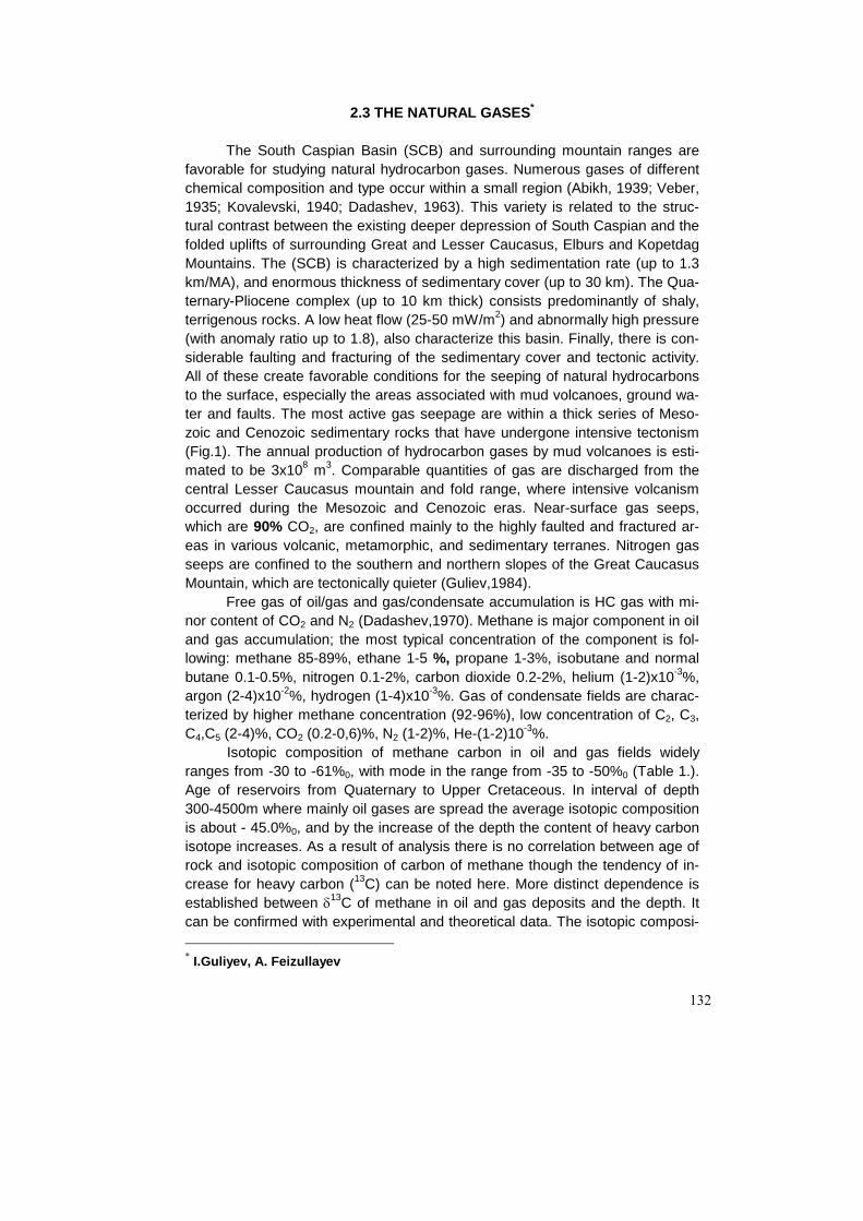
132
2.3 THE NATURAL GASES*
The South Caspian Basin (SCB) and surrounding mountain ranges are favorable for studying natural hydrocarbon gases. Numerous gases of different chemical composition and type occur within a small region (Abikh, 1939; Veber, 1935; Kovalevski, 1940; Dadashev, 1963). This variety is related to the struc-tural contrast between the existing deeper depression of South Caspian and the folded uplifts of surrounding Great and Lesser Caucasus, Elburs and Kopetdag Mountains. The (SCB) is characterized by a high sedimentation rate (up to 1.3 km/MA), and enormous thickness of sedimentary cover (up to 30 km). The Qua-ternary-Pliocene complex (up to 10 km thick) consists predominantly of shaly, terrigenous rocks. A low heat flow (25-50 mW/m2) and abnormally high pressure (with anomaly ratio up to 1.8), also characterize this basin. Finally, there is con-siderable faulting and fracturing of the sedimentary cover and tectonic activity. All of these create favorable conditions for the seeping of natural hydrocarbons to the surface, especially the areas associated with mud volcanoes, ground wa-ter and faults. The most active gas seepage are within a thick series of Meso-zoic and Cenozoic sedimentary rocks that have undergone intensive tectonism (Fig.1). The annual production of hydrocarbon gases by mud volcanoes is esti-mated to be 3x10⁸ m3. Comparable quantities of gas are discharged from the central Lesser Caucasus mountain and fold range, where intensive volcanism occurred during the Mesozoic and Cenozoic eras. Near-surface gas seeps, which are 90% CO2, are confined mainly to the highly faulted and fractured ar-eas in various volcanic, metamorphic, and sedimentary terranes. Nitrogen gas seeps are confined to the southern and northern slopes of the Great Caucasus Mountain, which are tectonically quieter (Guliev,1984).
Free gas of oil/gas and gas/condensate accumulation is HC gas with mi-nor content of CO2 and N2 (Dadashev,1970). Methane is major component in oiI and gas accumulation; the most typical concentration of the component is fol-lowing: methane 85-89%, ethane 1-5 %, propane 1-3%, isobutane and normal butane 0.1-0.5%, nitrogen 0.1-2%, carbon dioxide 0.2-2%, helium (1-2)x10-3%, argon (2-4)x10-2%, hydrogen (1-4)x10-3%. Gas of condensate fields are charac-terized by higher methane concentration (92-96%), low concentration of C2, C3, C4,C5 (2-4)%, CO2 (0.2-0,6)%, N2 (1-2)%, He-(1-2)10-3%.
Isotopic composition of methane carbon in oil and gas fields widely ranges from -30 to -61%0, with mode in the range from -35 to -50%0 (Table 1.). Age of reservoirs from Quaternary to Upper Cretaceous. In interval of depth 300-4500m where mainly oil gases are spread the average isotopic composition is about - 45.0%0, and by the increase of the depth the content of heavy carbon isotope increases. As a result of analysis there is no correlation between age of rock and isotopic composition of carbon of methane though the tendency of in-crease for heavy carbon (13C) can be noted here. More distinct dependence is established between δ13C of methane in oil and gas deposits and the depth. It can be confirmed with experimental and theoretical data. The isotopic composi- * I.Guliyev, A. Feizullayev

133
tion of carbon in methane from mud volcanoes can be observed in table 2,3,4 and Fig. 2. It is expressed as isolated areas and zones with similar isotopic composition. Thus, the “lightest” methane is found in gases from mud volcanoes in the Lower Kura basin, whereas the gases in the Shamakhy-Gobustan region are isotopically heavy. Mud volcanoes in the Apsheron peninsula can be divided into three distinct groups on the basis of the isotopic composition of carbon in methane. The first group includes the Abikh, Uchtepe, Akhtarma, and Garadag volcanoes- (δ13C : -35.9 to -41.5%0), the second group includes the Shorbulak, Gekmaly, Bozdag-Gobu and other volcanoes -(δ13C : -44.6 to -46.6%0), and the third group the Bog-Boga and Kirmaki volcanoes (δ13C : -55 to -60%0).
Figure 1. Schematic map of the study area in the South Caspian Basin showing the nature and intensity of surface gas seepages.

134
Figure 2. Distribution of methane δ13C in (a) mud volcanoes; (b) petroleum fields; and (c) carbon dioxide δ13C in mud volcanoes of Azerbaijan.
Theoretically, where the gas formed is wholly preserved, the section
should contain a series of zones of gas generated at different levels, with δ13C values varying from about -70/-75 to -25/-30%0. In actual geological conditions, the value of δ13C from methane in oil and gas accumulations varies in fact within a narrower range, from about -35 to -50%0, with an average of -44 to-45%0.
One of the possible reasons for the varying isotopic composition of car-bon in methane in different areas is the varying degree of preservation of gas; i.e. the degree of degassing of the deposits. Loss from the rock matrix of bio-genic methane or methane from an early stage of organic mater maturation, i.e. isotopically light methane, may lead to the accumulation of isotopically heavy methane; in contrast if these gases are preserved then more isotopically light methane may be present due to the mixing of various generations of gas.
The model proposed for the formation of the isotopic composition of' car-bon in methane does not deny the possibility of other mechanisms operating which may cause significant variations in the δ13C values in methane gases from different regions and fields. Thus, for example, different initial types of organic matter (alinic or arkonic) may lead to variations; or the breakdown of oil at great depths may form methane characterized by an elevated content of isotopically light carbon (δ13C up to -55 to 60%0).
In terms of the theoretical model outlined above, marked variations in the isotopic composition of carbon in methane from mud volcanoes of the Lower Kura basin and the Shamakhy-Gobustan region are probably due to different degrees of preservation of gases from different catagenetic levels. This ties in well with the geological development of the region.
Judging from data from isotopic (average δ13C methane -47%0) and chemical (average total heavy hydrocarbons, 2.1%) analyses, the gases from the volcanoes in the Lower Kura Basin are the products of an early stage of or-

135
ganic matter maturation, corresponding to the initial and middle stages of catagenesis, whereas gases from the Shamakhy-Gobustan region (average δ13C methane -41%0; average total heavy hydrocarbons 0.1%) are mainly repre-sented by methane from late and mature catagenetic stages.(Fig 3) It is evident that the main reason for the difference in isotopic composition of the gases is the varying degree of degassing of the deposits. Gases generated at an early stage in the Shamakhy-Gobustan region, due to their specific geological and tectonic history have been lost. The area is characterized by a complex geologi-cal structure, high seismicity, and the presence of a large number of faults. The significant amount of degassing of the deposits in this region is confirmed by the numerous mud volcanoes which erupt frequently, and also by the absence dur-ing drilling of major gas and oil accumulations.
Figure 3. Changes in carbon isotope composition of methane in the mud volcanoes of Azerbaijan. I-IV -Oil-gas regions: I-Pre-Caspian-Kuba; II-Apsheron; III-Shemakha-Gobustan; IV-Low Kura. (by A. Dadashev).

136
The Lower Kura Basin is covered by a thick (5-6 km), almost horizontal succession of Pliocene to Quaternary deposits. The number of volcanoes in the area is considerably less than in Shamakhy-Gobustan, and they erupt relatively infrequently. This fact, together with the presence of major accumulations of oil and gas (Kursangi, Garabagly, Neftchala and others) demonstrate that hydro-carbons are preserved better in this region compared to Shamakhy-Gobustan.
Correlation of the δ13C values of methane with the degree of sediment degassing (i.e. with the degree of preservation of gases generated) is confirmed by data from the isotopic composition of carbon in methane in mineral springs on the southern slope of the Great Caucasus. Isotopically light methane (δ13C -55 to -69.3%0) occurs within mineral waters which are expelled from rocks of mainly Neogene age, whereas isotopically heavy methane is associated with rocks of Jurassic and Cretaceous age. This shows that organic matter in Creta-ceous and Jurassic rocks is generating isotopically heavy methane at a mature catagenetic stage, and methane generated at earlier stages of catagenesis has been degassed. In contrast, organic matter in Neogene deposits lies within the early catagenetic stages, and no methane from mature catagenetic stages is present within the gases from mineral springs associated with the Neogene de-posits.
The established relationship between the δ13C of methane in mud volca-noes and mineral springs with the degree of sediment degassing may be used for a relative evaluation of the prospectivity for gas of the different regions in which mud volcanoes are developed.
Mud volcanoes are developed in the South Caspian Basin in areas where the thickness of the sedimentary cover varies from 8 to 25 km. In these condi-tions, as was noted above, virtually the entire range of gas genesis is occurring, from biogenic to apocatagenetic gas. The occurrence within the gases of mud volcanoes of isotopically light methane shows that conditions for its preservation at depth are good, and there is also the possibility of isotopically heavy methane occurring at great depth.
From the description of mud volcanoes on the western margin of the South Caspian basin given above, it is possible to recognize three groups ac-cording to the prospectivity for gas at great depths. Data from the study of δ13C in methane and carbon dioxide gases from the mud volcanoes of Azerbaijan, set out in, are also taken into account.
The first group includes the volcanoes of Bog-boga, Kirmaki, Durovdag, Gushchu and others, which have methane isotopic compositions of δ13C = -48 to -60%0 and C in carbon dioxide of -10 to 25%0. These data show that the gases provided initially to the mud volcanism formed at early and middle catagenetic stages, and the carbon dioxide in the gases is genetically related to oil, dis-persed organic matter and water-soluble organics. In the deep zones where these volcanoes develop (the destruction of oil is not examined), the gases of precisely the generations mentioned may be found; gases with isotopically heav-ier carbon in methane are generated at greater depths.
The second group includes thc volcanoes of Matrasa, Airantekyan, Sagi-yan, Goturdag and others with isotopic compositions of carbon in methane of δ13C = -43 to -48%0, typical of the middle stages of organic-matter maturation;

137
and δ13C on carbon dioxide of 10 to -10%0, showing that the carbon dioxide is related to organic matter and oil and, particularly, to formation from the decom-position of organic matter in an anaerobic environment .
Finally, the third group includes the volcanoes of Maraza, Pirekeshkyul, Khydyrzyndy, Demirchi, Utalgi, and others. These are activated by gases form-ing at late catagenetic stages, with δ13C in methane of -35 to -43%0, and contain carbon dioxide forming from the destruction of carbonates at great depth and the anaerobic destruction of organic matter: δ13C of carbon dioxide = +10 to +20%0.
Figure 4. South Caspian gas-hydrate-bearing submarine mud volcano province. Leg-end: (1) - gas-hydrate accumulations discovered at mud volcanoes (B: Buzdag, E: Elm); (2) -clay diapirs targeted for bottom sampling (S: Severnyy [Northern]; U: unnamed mud volcano on the Abikh bank); (3) - submarine mud volcanoes; (4) boundaries of gas-hydrate-bearing province. (by Ginsburg et. al.)
Cases of submarine gas hydrates were accidentally discovered in the
southern basin of the Caspian Sea (Fig.4), in 1979 during an expedition of the Institute of Geology. Clay deposits with inclusions of hydrates up to 5 cm across were brought up by a bottom grab from a depth of 480 m on the Vezirov anticli-nal high (the Shatski ridge). The content of hydrates in the rock was visually es-

138
timated to be 5-10%. Gas extracted from the hydrate-containing sediments by the thermal-vacuum method contained up to 18% methane homologs, hydrogen sulfide was present, and there were clayey-calcareous nodules and saline pore water with a mineralization of 26.2-30.1 g/L, in the sediment. It was concluded that the gas-hydrate manifestations coincide with a mud volcano.
The gases released from hydrates and hydrate-bearing sediment (Table 5) have an essentially hydrocarbon composition and are characterized by very high contents of methane homologs. The differences between gases obtained during spontaneous degassing and during gradual reduction of pressure are probably due to desorption of gas dissolved in the mud breccia. Samples taken during spontaneous degassing are probably more representative.
In comparison with gases from onshore mud volcanoes of the South Caspian Basin gases from hydrates and sediments of Buzdag, Elm, and the mud volcano on Abikh bank are sharply enriched in methane homologues. The high abundance of homologues (≥12.2%) suggests in particular a catagenic ori-gin for the gas; this is confirmed by the isotopic composition of the carbon in the methane (Table 6) and the association of the gas with oil.
The content of ethane in the gas hydrates is especially high; with a single exception, the content of ethane is higher than in associated gases of oil depos-its and gases of gas-condensate deposits of the South Caspian Basin. Differ-ences with respect to other heavy hydrocarbons were not noticed. The enrich-ment in ethane is probably a consequence of fractionation of the original gas during hydrate formation. This suggests that the mud volcano on the Abikh bank is also hydrate-bearing.
Two samples of gas collected on the Elm mud volcano differ substantially with respect to composition (Table 5): in one case (Station 18A), the composi-tion is similar to that of gases at Buzdag; in the other (Station 17), ethane is 25 times less abundant, but contents of C2, C3 and C4 increase in the order C2-C3-C4. This may also be a consequence of fractionation of gas when hydrate of structure ll is formed during hydrate formation. The carbon in the methane of this gas is isotopically lighter than at Buzdag.
The effect on gas composition of hydrate-forming process is clearly mani-fest in the low concentration of helium, which, as is well known, is not able to form hydrates because of the small size of its molecules. Gases of the mud vol-canoes of the South Caspian Basin are generally not characterized by high he-lium content (from 3 to 180 ppm). In the eight samples we investigated from Buzdag, the helium concentration was less than in the air.
Hydrogen sulfide is invariably present in hydrate gases: its odor was sensed during each raising of core. Quantitative determinations on board the vessel (using a standard chemical method with cadmium carbonate) yielded concentrations of H2S from 0.03 to 0.07%.
Composition of gases dissolved in formation waters of oil/gas fields is close to the composition of free gases in the fields. The predominant compo-nents are: CH4 - 90%, C2H6+ - 2-4%, CO2 – 0.1-5%. Gas saturation of formation water varies widely: from 100 to 3500 cm3/l. The most pronounced characteris-tics of distribution of gas dissolved in water are the increase of gas saturation of formation water, dissolved gas pressure, and dryness factor in the direction of

139
regional subsidence with depth. This trend was identified both for individual anti-cline zones and for fields and oil/gas regions in overall.
Sorbate gases were analyzed from cores from the Middle Kura Depres-sion, including Saatly superdeep well (SG-1) and its stand-by. HC sorbate gases content in sedimentary rocks is in general not high, up to 1.83 cm3/kg. The con-tent is lower in volcanic rocks than in sedimentary ones (0.2-0.4 cm3/kg).
Mountain / folded structures, framing the Kura Depression, were studied with the use of gases from mineral springs. Four types of springs can be identi-fied based on chemical composition of the gases: methane, CO2 nitrogen and mixed ones.
Isotopic carbon composition of methane from the mineral springs of the Great Caucasus varies from -25%0 to -70%0, with maximum between -35 and -45%0. Isotopic composition of CO2 carbon from mineral springs widely ranges from 1.0%0 to –10%0; the distribution has a pronounced maximum within the interval from 0 to -5%0. Isotopic ratio, He3/He4 varies for methane and nitrogen mineral springs of the Great Caucasus from 1,5 to 2,4x10⁻⁶. In carbonic - acid mineral springs of the Great Caucasus it is slightly higher, (0,6 to 8,5)x10-6; while high numbers (8,5-15,0)x10-6 are typical for carbonic acid waters of the Lesser Caucasus.
The schematic map of zonation of the Caucasus natural gases was con-structed to identify relations between natural gas distribution and geological structure and development history of the region. The map demonstrates that essentially methane gases with isotopic composition of' methane carbon from -35 to 50%0 are confined to the most subsided part of the depression, repre-sented by thick sedimentary Mesozoic-Cenozoic units. The amount of N2, CO2 and He increases in the flank zones. The Great Caucasus folded system is characterized by mixed methane-nitrogen and nitrogen gases. CO2 gases are confined to the areas of Neogene and Quaternary volcanoes. Within regional zones, for example, methane, subzones with different C2H6+, CO2, He, δ13CCH4, and other can be identified (Lower Kura, Apsheron, Shamakha-Gobustan, etc.).
Relative analysis of gas-bearing potential, isotopic/geochemical charac-teristics and gas zonation allows to identify intervals with similar gas parameters (Table 7, 8). These intervals are:
1.Quaternary-Neogene made up upper sections of Alpine intermountain depressions. These intervals contain gases generated, as a rule, from organic matter of early stages (up to PK3-MK1), in environment of isolation from deep fluids and energy. Autonomous process of HC generation in such intervals is provided by regionally continuous seals of plastic rocks. These formations contain accumulations with small reserves of biochemical (protocatagenic) gas. Oil accumulations, as a rule, were generated due to mi-gration from older formations. 2.Paleogene and Mesozoic formations made up the upper section of the depression. These formations were developed in higher pressure and tempera-ture environment resulting from their significant subsidence. The major gas source is the organic matter transformed to the stage of late catagenesis. These intervals generate large volumes of liquid and gaseous HCs, which migrate to

140
the overlying formations and create large oil accumulations under favorable conditions. 3.Mesozoic (Paleozoic) formations made up the basement of the depres-sions and participate in the structure of surrounding mountain structures. These are compact rocks affected by high temperatures and pressure. High degree of organic matter transformation (AK2-AK3), disturbance and permeability, caused by the presence of fluids from deep zones of the Earth crust, are typical for them. 4.Same formations in zones of Neogene and Quaternary volcanism. Additional factors to those listed above are carbonaceous rock transformations due to high temperatures (the Great Caucasus, the Lesser Caucasus, the Alps, the Apennines et al.), which cause generation of high volumes of CO2.
5.Paleozoic (Proterozoic) formations made up PreAlpine basement and cores of folded systems. Highly metamorphosed deposits, reworked by intru-sions, are highly saturated by deep fluids, particularly within areas of the crust through faults (the central part of the Great Caucasus).
Comparison of individual parameters indicates that they have a trend from type 1 to 5 and form empirical series of natural gases. The chemical composi-tion of gas changes from methane through methane-nitrogenous to carbonic acidic; the carbon isotopic composition is characterized by the increase of heavy methane isotope and CO2, with the increase in age of sedimentary and volcanic rocks.
There changes in chemical and isotopic gas content are connected with general evolution of oil and gas basin. Cases being the component part of pore fluids are changed due to intensity of generation by thermodynamic parameters and age of basins.
The more important parameter influencing on gases content is the inten-sity of gas generation. The developed methodics for study of intensity of gas generation allows to give approximate estimation for intensity of gas generation.
If this process can be described by a first-order reaction, with a constant rate of reaction λ, then the following relationship must exist between the source abundance and the weight-concentration of organic matter:
Fm
=22414
16ρ
γλ ,
where: ρ is the rock density, m is its porosity; and γ is the weight concentration of organic matter.
The concentration y at any moment must be related to the initial value, γ0, by the simple relationship:
γ γρρ
λ= −0
0 0
mm
te
Assuming that γ/λ=0.01-0.1; ρm/ρ0~10; t~107 years (=3.15x10¹⁴s), we find that λ~10-14s-1 and F~10-13-10-12s-1 on the assumption that γ~0.1-1.0 wt.%.
The occurrence of methane-forming abundances in the range 10-16-10-12 seems to be characteristic of alpine basins infilled with thick successions of sedimentary rocks.

141
The level of methane formation guarantees a continuous phase transition in the pore fluid continuum, and the generation within them of corresponding stresses. These stresses may be resolved either in the form of mud volcanoes, as shown above, or as less catastrophic phenomena such as the formation of piercement structures (mud diapirs), i.e. hydrocarbon formation at the scale es-timated is the driving force behind specific tectonic processes within the sedi-mentary succession. Moreover, in these types of system which occur in a near-critical state, the trigger mechanisms for these processes may be relatively mi-nor occurrences such as the ebb and flow of waves, seismic fluctuations, etc.
However, these stresses may be relieved by the simple redistribution of pore fluids, without any significant changes to the surrounding medium. In this case, continuous bodies of gas are formed and become established within the pore space. Hydrocarbon formation at the scale described is typical of the stage of development of a basin which may be described as "youthful". It corresponds to a period when accumulations of oil and gas form and grow. The genetic rela-tionship noted above between mud volcanoes and the processes of gas and oil formation can be explained in terms of the model presented here.
The level of methane formation, with typical values of 10-16s-1, provides the pore waters with the critical saturation, and also the thermodynamic stability for accumulations of gas and oil, found in continuum with the underground waters.
However, this is not sufficient for the formation of true gas phases. There-fore, the stage of development of a basin where hydrocarbon development oc-curs at this level may be designated "mature".
And finally, if the richness of methane sources in the basin falls below the level discussed, i.e. F<10-16s-1, then the concentration of methane within the pore fluids is reduced, methane from the gas body passes into solution, and the accu-mulation is involved in the processes of dissolution and dispersal. This final stage of existence of the accumulation is the geochemical “old-age” of the basin.
Acknowledgements: The authors are very grateful to N.Balley (Geo-chem Group limited), R.Archer (Geochemistry Association), D.Wavrek (The University of Utah), P.Barnard (Robertson), N.Yalchin (Tubitak Marmara Re-search Center) for their assistance in the preparation of this chapter.

142
Table 1. The isotopic composition of methane carbon of oil and gas fields
of Azerbaijan ( after A.Dadashev, 1985) Field Depth,m Well, No Suite, horizon δ13C of
methane %o
Surakhany 1656-1652 437 PS, Infra Kirmaki Suite -40.9
Garachukhur-Zykh 2537-2525 918 Gala Suite -42.8 Gum-Deniz 269 "-" -39.8
265 PS, Infra Kirmaki Suite -37.1 510 "-" -37.1
Lokbatan 986-931 279 PS, VII hor. -49.3 1035-922 1444 "-" -43.4 858-791 1352 "-" 43.7
Balakhany- Sabun-chy-Ramana
1181-1142 1981 PS, Infra Kirmaki Suite -44.1
Neftchala 1109-1081 2126 "-" -44 961-924 885 PS, VI hor. -44.1 893-875 889 "-" -44.1 1120-1108 533 PS, V hor. -43.3
Khilly 983-974 410 U. Plio.,Apsheron Suite -47.9 Saadan 1450-700 4 Maykop Series -47.8
1387-394 118 "-" -47.9 1418-611 7 "-" -47.1 1300-497 204 Cretaceous -47.8 1314-220 63 "-" -44.7 617-190 1208 "-" -36.5 1033-967 922 "-" -47.8 632-560 329 "-" -44.7 1341-733 125 Maykop Series -47.7 1059-501 1061 "-" -43.6 420-230 380 N1
2 -44.1
610-180 1176 "-" -46.6 1962-1781 1235 "-" -43.8 878-448 1414 Cretaceous -43.8 2087-1778 1222 "-" -45.9
Mirbashir 1000 14 Maykop Series -41.3 1003 70 "-" -41.4 1000 140 "-" -41.4

143
Table 1. (Cont.)
Field Depth,m Well, No Suite, horizon δ13C of methane
%o Umbaky 449-380 45 N1
2 -47.9
322-281 36 "-" -47.7 330-284 285 "-" -49.9 1580-1460 108 Maykop Series -54
Binagady 757-702 1897 PS, Kirmaki (6) -43.6 678-633 477 PS, Kirmaki (4) -42.7 886-846 2399 PS, Kirmaki (6) -43.2 843-841 2158 PS, Kirmaki (1) -43.6 990-868 594 PS, Kirmaki (5) -43.4 853-780 571 "-" -42.3 813-772 596 PS, Kirmaki (4) -42.1
Mishovdag 1063-1019 272 PS, I hor. -46.4 878-744 359 "-" -47.4 978-930 345 PS, II hor. -48.6 1007-992 453 PS, I hor. -46.6 864-862 400 PS, II hor. -49.3
Kyurovdag 2211-2153 817 U.Plio., Agjagil -46.6 1433-1324 916 PS, II hor. -43.8 1454-1314 914 PS, I hor. -45.6 1478-1432 940 PS, II hor. -43.8 494-488 887 U. Plio.,Apsheron -46.1
Sangachal-deniz 4353-4339 338 PS, VIII hor. -34.5 4228-4221 87 "-" -34.5 3534-3527 300 PS, V hor. -45.6 3687-3612 293 PS, VII hor. -35.1 3478-3418 349 PS, V hor. -37 3620-3595 274 PS, VII hor. -36.4 3030-2993 355 PS, V hor. -38.1

144

145

146

147

148
Table 3. Hydrocarbon and isotope composition of gases in the mud volcanoes of Azerbaijan
Concertration of
hydrocarbon gases, vol. %
No.
Mud volcano
CH4
heavy HC
δ3C CH4%o
Seat of mud vol-
cano, based on old-est
rocks ejected
1 Gaynarja 95.3 0.1 -59.1 Cret. 2 Saadan 89.22 0.5 -37.9 Jur - L.Cret. 3 Khydyrzyndy 90.31 1.54 -38.6 Jur - L.Cret. 4 Abikh 96.4 0.02 -39.5 U. Cret. 5 Geokmaly 97.32 0.55 -46 6 Bozdag 96.3 0.04 -46.5 U. Cret. 7 Uchtepe 96.3 0.03 -35.9 8 W. Bozdag 97.02 0.02 -45 9 Shorbulag 94.73 0.04 -42.8
10 Akhtarma-Garadag 97.7 0.06 -41.5 U. Cret. 11 Pirekeshkyul 95.44 0.07 -43 12 Maraza 98 0.01 -39.1 Palaeogene 13 Shikhzagirli 95.53 traces -40.3 U. Cret. 14 Demirchi 96.91 0.07 -36.3 U. Cret. 15 Sagian 97.2 0.08 -45.1 16 Matrasa 92.57 0.18 -46.3 U. Cret. 17 Gushchu 97.3 0.1 -54.8 U. Cret. 18 Nardaranakhtarma 95.64 traces -38.7 19 Suleimanakhtarma 91.84 2.13 -40.5 20 Cheildag 96.95 traces -37.1 Eocene 21 Galandarakhtarma 98.84 traces -39.2 U. Cret. 22 Utalgi 97.96 0.14 -38.7 23 Jagirli 96.16 traces -41.9 Palaeogene 24 Airantekyan 92 0.03 -44.6 U. Cret. 25 Goturdag 93.7 0.01 -45.4 Eocene 26 Dashgil 96.74 traces -38.6 U. Cret. 27 Bahar 98.71 traces -42.6 U. Cret. 28 Hamamdag 93.86 2.38 -47.3 U. Cret. 29 Khydyrly 96.37 0.11 -44.5 30 Agzybir 92.4 5.64 -44.8 Pliocene 31 Pirgaryn 95.2 4.17 -43.8 Pliocene 32 Babazanan 97.16 0.42 -49.4 33 Durovdag 96.83 1.87 -53.8 U. Cret. 34 Duzdag 96.06 0.1 -45.2 U.Pliocene

149
Table 4. The isotopic composition of carbon in hydrocarbon compo-
nents of mud volcano gases
No. Mud volcano CH4 C2H6 C3H8 C4H10
1 Shorbulag -46.3 -28.4 2 Pirekeshkyul -41.2 -26.5 3 Shikhzagirli -41.8 -28.6 -25.9 -26.4 4 Melikchobanly -45.2 -28.5 5 Gyrlykh -50 -26.8 6 Cheildag -37.3 -26.9 7 Airantekyan -49.8 -26.9 -25.8 8 Bahar -44.4 -28.3 9 Akhtarma -46.4 -23.3

150

151
Table 6. Isotopic Composition of Carbon in Hydrocarbon Components of Gases Released from Hydrate-Bearing Mud Breccia*
Mud Bottom Number of δ13C (%oPDB)
volcano station samples CH4 C2H6 C3H8 C4H10 Buzdag 7c 1 -44.8 -25.8 -22.3 -21.0
4 -44.8 -26.0 -22.1 -20.9 Elm 17 1 -55.7 -25.7 -7.3 -29.4
-57.3 -28.4 -8.4 -32.3 *Analysis carried out by Institure of Geochemistry and Analytical Chemistry after Vernadski of Russian Academy of Sciences; separation of components was carried out by chromatography. For composition of the gas and collection method, see Table 5.
Table 7. Isotopic-geochemical characterization of SCB seepages
Age CH
CH o4
134
(%)
(% )δ
CO
CCO o2
13
2
(%)
(% )δ
He
He He
(%)
/3 4
N2 (%) He
Arr
He
Ara
Quaternary-
Neogene
>
− −
90
45 80to
01 107 6 158
.. .
−− −to
( )
( )
1 2 10
5 7 10
3
8
− × −
− × − 1.5-5.0 0.1-0.5 <5
Paleogene-
Mesozoic
75 90
30 45
−
− −to
5 10
5 0 23 4
−
− +. .to
10 10
5 20 10
3 1
8
− − −
− × −( )
5.0-10 0.5-1.0 5-10
Mesozoic
(base)
0 1 90
28 45
. −
− −to
0 1 90.
?
−
10 1020 10
2 1
8
− −
−
−− ×(5 )
0.1-90 >1 >10
Table 8. Rare gases and ratios for distinctive mud volcanoes in Azerbaijan
Age Mud volcano
name He He
Arr
HeAra
Mesozoic Astrakhsnka Demirchi
0.0097 0.0100
2.5 2.5
31 30.5
Paleogene Cheildag Shorbulag
0.0011 0.0029
0.5 0.5
6.3 9.1
Neogene Matrasa Charagan
0.0007 0.0006
0.13 0.17
1.74 1.6

152
References - Abikh G.V. 1939. An island that appeared in the Caspian sea with mud vol-
cano and ejecta materials, Caspian region: Proceedings of Geo-logical Institute of Azerbaijan, Branch of USSR Academy of Sci-ences, Baku, AzFAN, V.XII/63 p. 21-129 (in Russian)
- Bailey N., Guliyev. I. and Feizullayev A. 1996. Sourse rocks in the South Caspian. AAPG/ASPG/ Research Symposium. October 6-9, Baku, Azerbaijan.
- Ginsburg G.D. et al, 1992 Gas hydrates of the southern Caspian International, Geology Review, 34 No 8, p.p. 765-782 (in Russian).
- Guliyev I., Feizullaev A. 1996. Geochemistry of Hydrocarbon Seepages in Azerbaijan. AAPG Memoir 66, p.63-70.
- Dadashev A.A. 1985 The peculiarites of isotope composition of carbon of hy-drocarbons on the west flang South Caspian depression, connec-tion with estimation prospectivitis of oil-gas bearingness of its deep zones. Dissertation. Moskow (in Russian)
- Dadashev F.G. 1963, Hydrocarbon gases of Azerbaijan mud volcanoes (in Russian) : Baku, Azerbaijan, 69 p. (in Russian).
- Inan, S, Yalchin, M.N, Guliyev I. and Feizullayev A. 1996. Deep petroleum occurences in the Lower Kura Depression, South Caspian Basin, Azerbaijan. Organic Geochemistry.
- Kovalevski S.A., 1940. Mud volcanoes of the South Caspian region: Azerbai-jan and Turkmenistan : Baku, Azgostoptekhizdat, 200 p (in Rus-sian).
- Petrov A.A. 1984, Hydrocarbons of oil (in Russian): Moscow, Nauka, 264 p. (in Russian).
- Valyaev N.M. et al. 1980 Doklady Akademii Nauk SSSR, V. 225, No 5 p. 1204-1207 (in Russian)
- Veber V.V. 1935, Baku region. In Natural gases of USSR : Leningrad-Moscow, ONTI NKTP SSSR, p. 345-365. (in Russian).
- Wavrek D., Collister J., Curtiss D., Quick J., Guliyev I. and Feizullayev A. Novel Application of Geochemical Inversion to Derive Generation /Expulsion Kinetic Parameters for the South Caspian Petroleum System (Azerbaijan). AAPG//ASPG/ Research Symposium. Octo-ber 6-9, Baku, Azerbaijan.