Source of irrigated area,cropping pattern in dindigul district
23
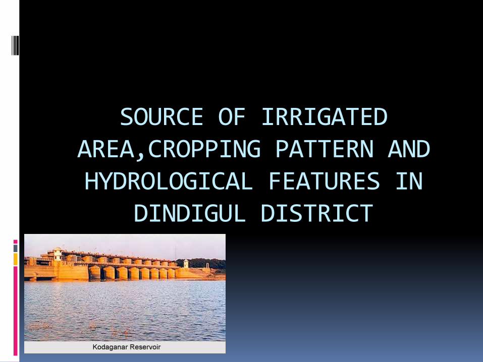
SOURCE OF IRRIGATED AREA,CROPPING PATTERN AND HYDROLOGICAL FEATURES IN DINDIGUL DISTRICT
-
Upload
oviya-indhuk -
Category
Environment
-
view
183 -
download
0
Transcript of Source of irrigated area,cropping pattern in dindigul district
SOURCE OF IRRIGATED AREA,CROPPING PATTERN AND HYDROLOGICAL FEATURES IN
DINDIGUL DISTRICT
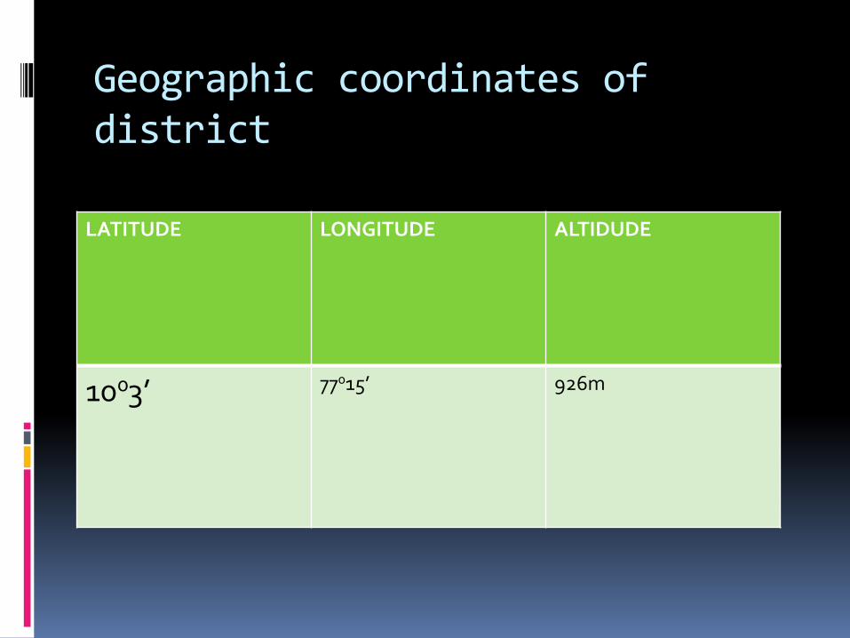
Geographic coordinates of district
LATITUDE LONGITUDE ALTIDUDE
1003’ 77015’ 926m
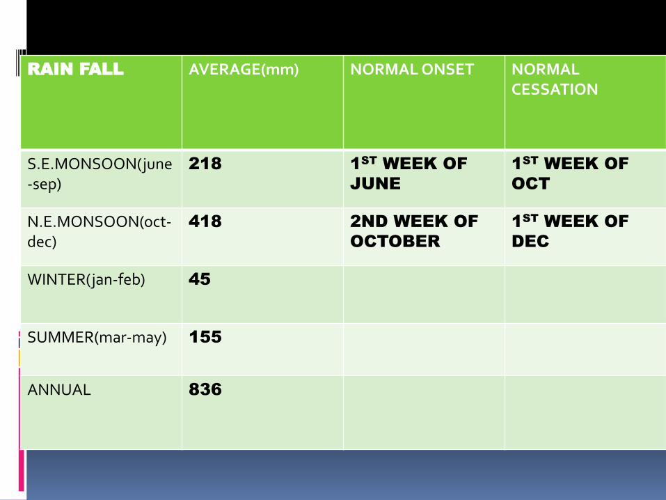
RAIN FALL AVERAGE(mm) NORMAL ONSET NORMAL CESSATION
S.E.MONSOON(june-sep)
218 1ST
WEEK OF
JUNE
1ST
WEEK OF
OCT
N.E.MONSOON(oct-dec)
418 2ND WEEK OF
OCTOBER
1ST
WEEK OF
DEC
WINTER(jan-feb) 45
SUMMER(mar-may) 155
ANNUAL 836

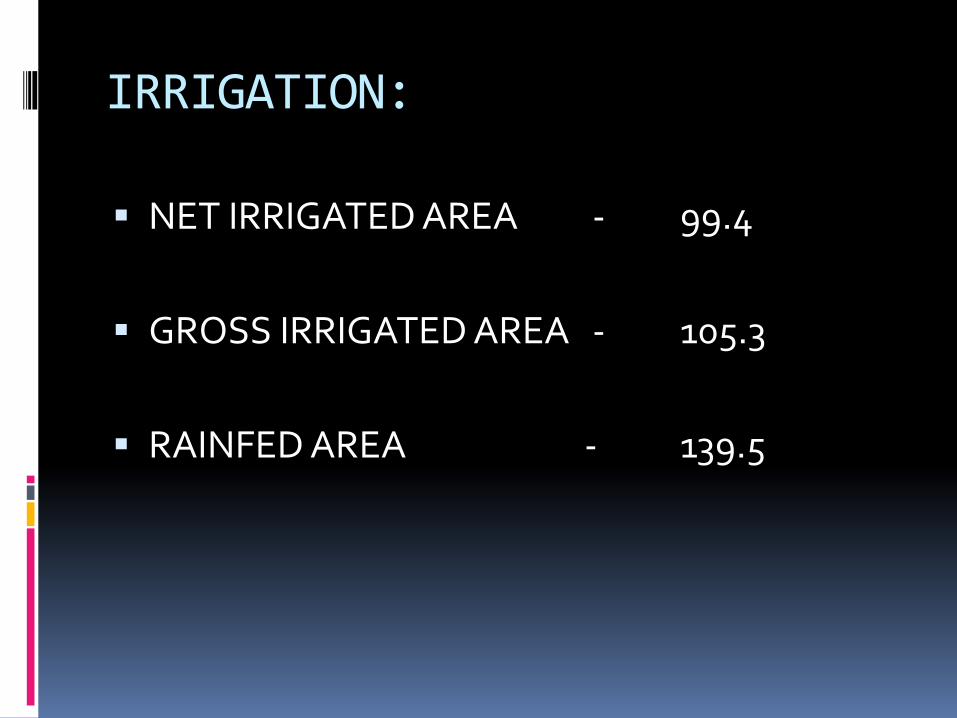
IRRIGATION:
NET IRRIGATED AREA - 99.4
GROSS IRRIGATED AREA - 105.3
RAINFED AREA - 139.5
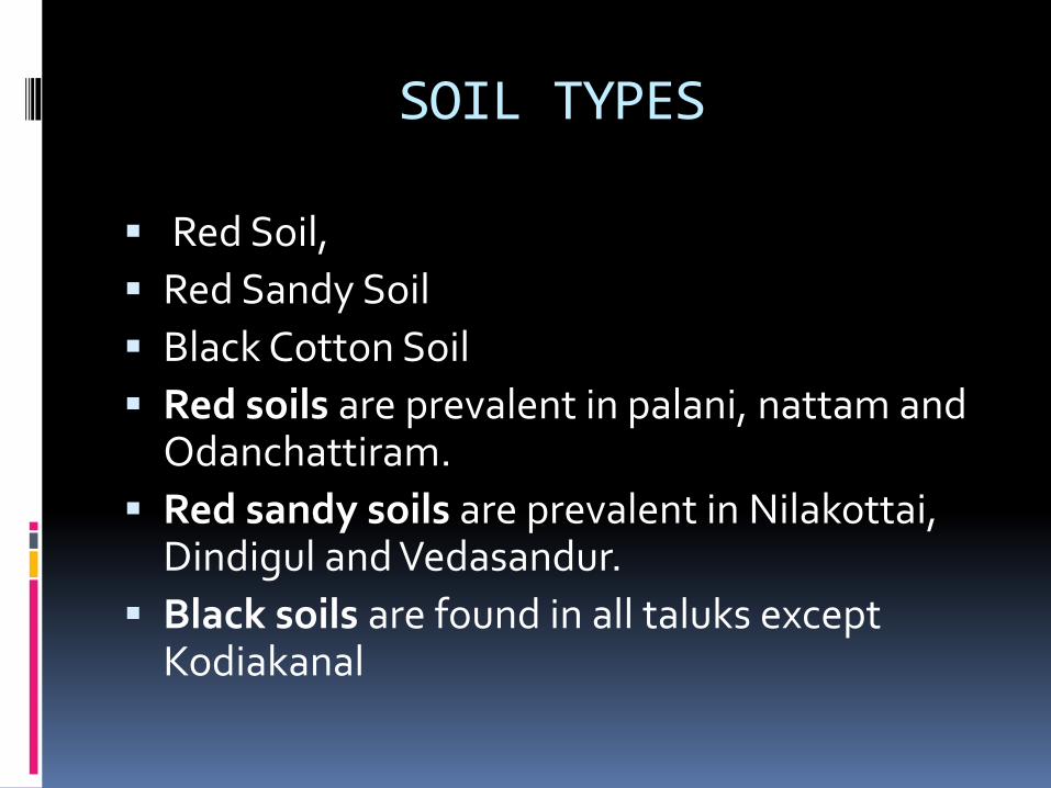
SOIL TYPES
Red Soil,
Red Sandy Soil
Black Cotton Soil
Red soils are prevalent in palani, nattam and Odanchattiram.
Red sandy soils are prevalent in Nilakottai, Dindigul and Vedasandur.
Black soils are found in all taluks except Kodiakanal
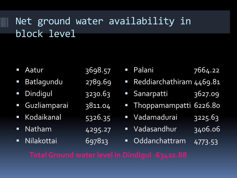
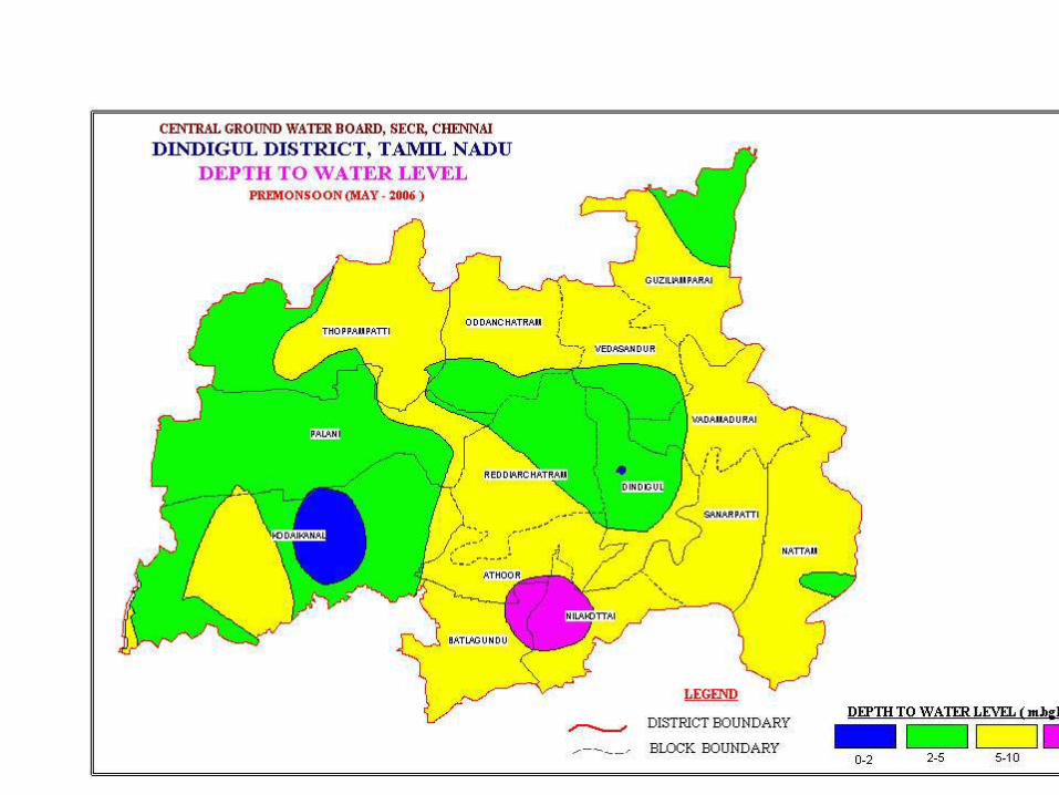
Net ground water availability in block level
Total Ground water level in Dindigul -63422.88
Aatur 3698.57
Batlagundu 2789.69
Dindigul 3230.63
Guzliamparai 3811.04
Kodaikanal 5326.35
Natham 4295.27
Nilakottai 697813
Palani 7664.22
Reddiarchathiram 4469.81
Sanarpatti 3627.09
Thoppamampatti 6226.80
Vadamadurai 3225.63
Vadasandhur 3406.06
Oddanchattram 4773.53
- - - - Pumpsets - Micro-irrigation -
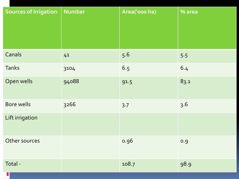
Sources of Irrigation Number Area(‘000 ha) % area
Canals 41 5.6 5.5
Tanks 3104 6.5 6.4
Open wells 94088 91.5 83.1
Bore wells 3266 3.7 3.6
Lift irrigation
Other sources 0.96 0.9
Total - 108.7 98.9
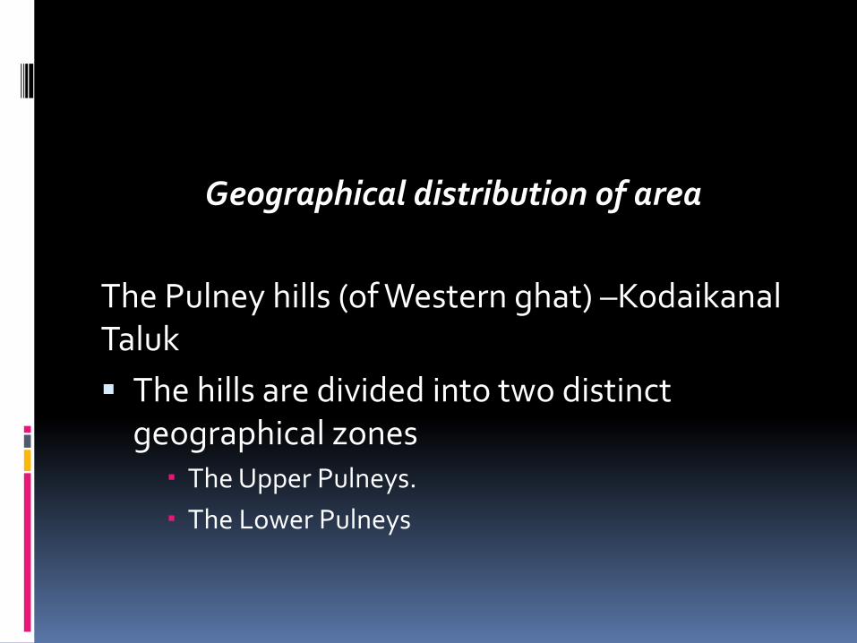
Geographical distribution of area
The Pulney hills (of Western ghat) –KodaikanalTaluk
The hills are divided into two distinct geographical zones
The Upper Pulneys.
The Lower Pulneys

The Lower Pulneys consist of peaks from 1000 to 1500 M height separated from one another by steep wooded valleys.
subtropical climate
maximum temperature - 20 oC to 30 oC,
minimum of 15 oC to 20 oC.
The rainfall is around 1455 mm
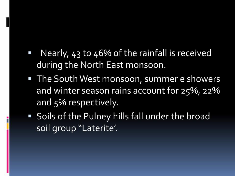
Nearly, 43 to 46% of the rainfall is received during the North East monsoon.
The South West monsoon, summer e showers and winter season rains account for 25%, 22% and 5% respectively.
Soils of the Pulney hills fall under the broad soil group “Laterite’.
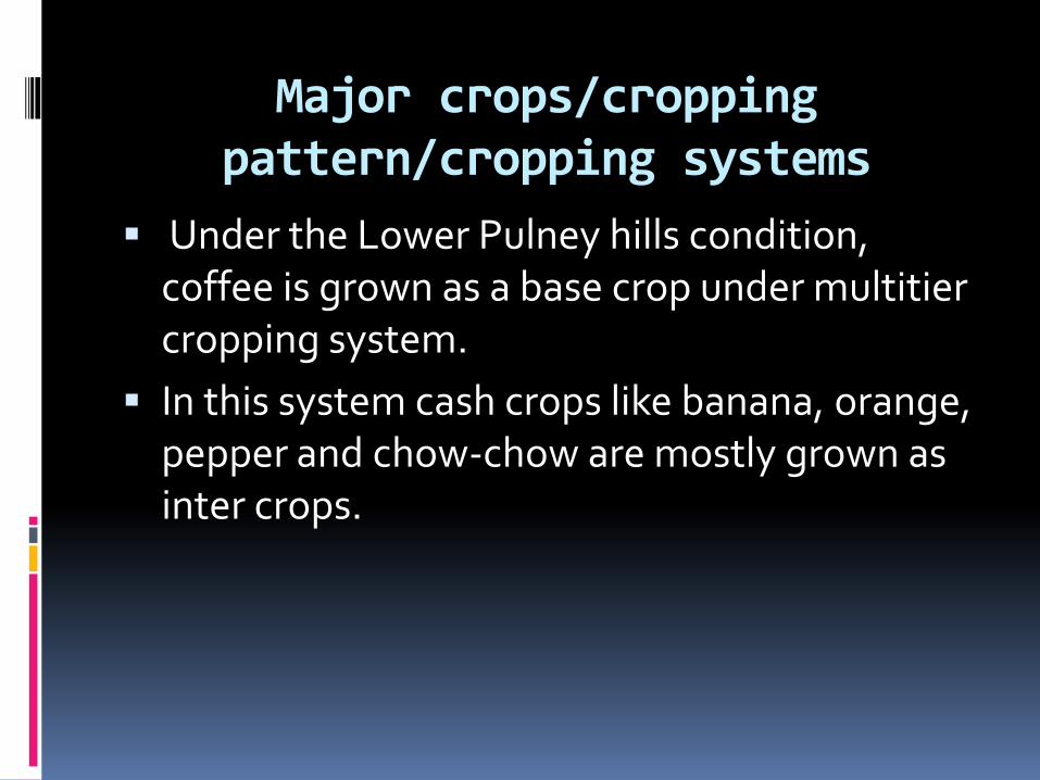
Major crops/cropping pattern/cropping systems
Under the Lower Pulney hills condition, coffee is grown as a base crop under multitier cropping system.
In this system cash crops like banana, orange, pepper and chow-chow are mostly grown as inter crops.
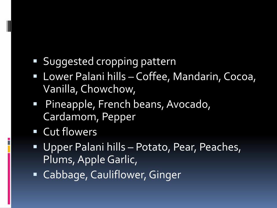
Suggested cropping pattern
Lower Palani hills – Coffee, Mandarin, Cocoa, Vanilla, Chowchow,
Pineapple, French beans, Avocado, Cardamom, Pepper
Cut flowers
Upper Palani hills – Potato, Pear, Peaches, Plums, Apple Garlic,
Cabbage, Cauliflower, Ginger
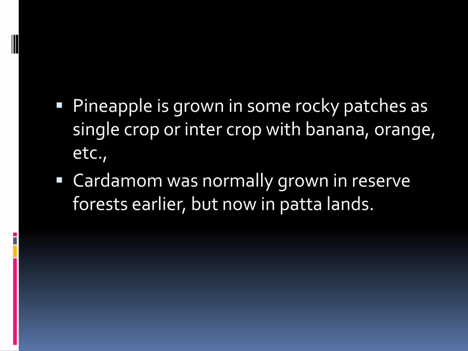
Pineapple is grown in some rocky patches as single crop or inter crop with banana, orange, etc.,
Cardamom was normally grown in reserve forests earlier, but now in patta lands.

Multitier cropping system
Coffee + banana + orange
Coffee + orange + silver oak (or) jack (with pepper)
Coffee + orange + silver oak
Coffee + chow chow
Coffee + orange + chow chow
Coffee + lime + jack (or) silver oak
Pine apple + banana
Pine apple + orange
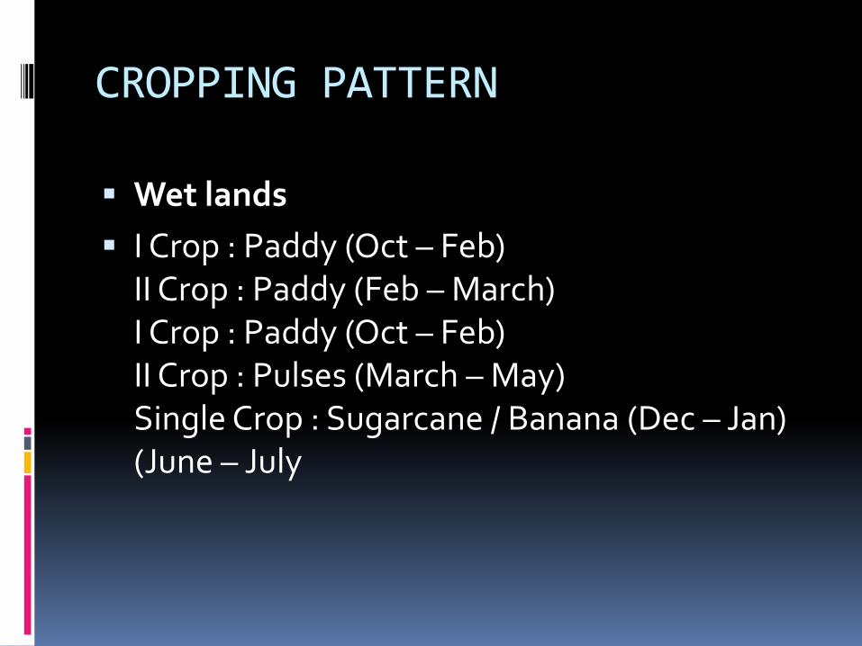
CROPPING PATTERN
Wet lands
I Crop : Paddy (Oct – Feb)II Crop : Paddy (Feb – March)I Crop : Paddy (Oct – Feb)II Crop : Pulses (March – May)Single Crop : Sugarcane / Banana (Dec – Jan) (June – July
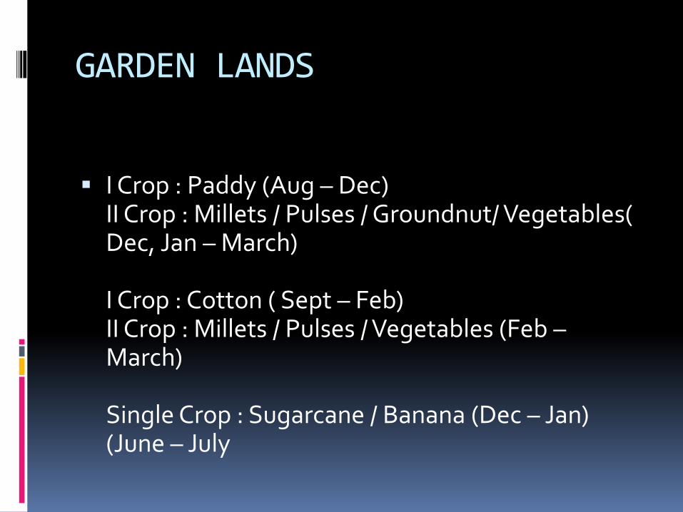
GARDEN LANDS
I Crop : Paddy (Aug – Dec)II Crop : Millets / Pulses / Groundnut/ Vegetables( Dec, Jan – March)
I Crop : Cotton ( Sept – Feb)II Crop : Millets / Pulses / Vegetables (Feb –March)
Single Crop : Sugarcane / Banana (Dec – Jan) (June – July
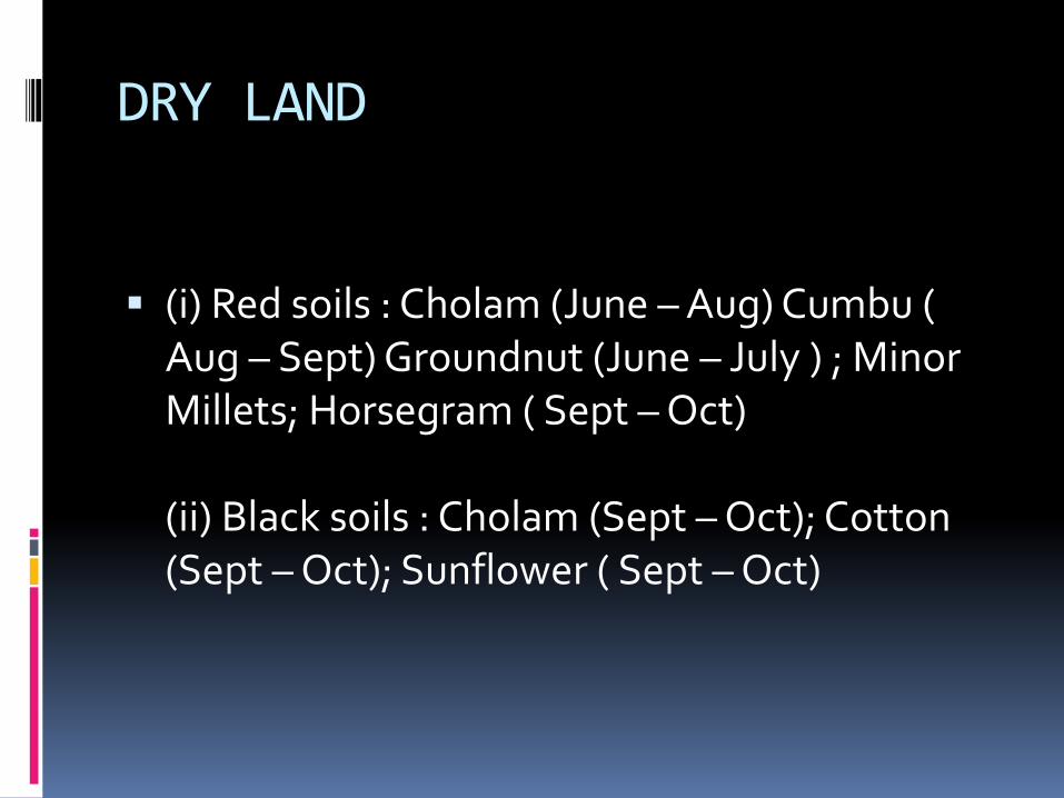
DRY LAND
(i) Red soils : Cholam (June – Aug) Cumbu ( Aug – Sept) Groundnut (June – July ) ; Minor Millets; Horsegram ( Sept – Oct)
(ii) Black soils : Cholam (Sept – Oct); Cotton (Sept – Oct); Sunflower ( Sept – Oct)
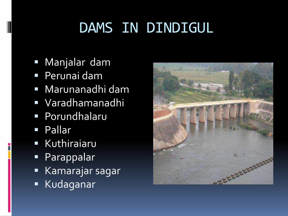
DAMS IN DINDIGUL
Manjalar dam Perunai dam Marunanadhi dam Varadhamanadhi Porundhalaru Pallar Kuthiraiaru Parappalar Kamarajar sagar Kudaganar
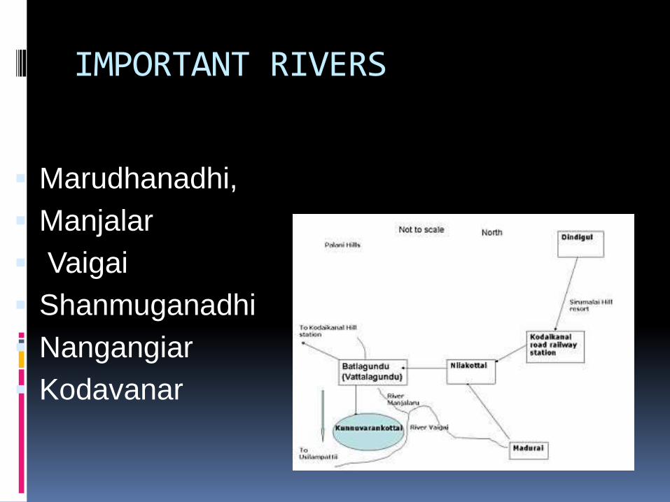
IMPORTANT RIVERS
Marudhanadhi,
Manjalar
Vaigai
Shanmuganadhi
Nangangiar
Kodavanar
• These rivers flow north and northeastward and join Amaravathiriver which finally confluences with river Cauvery.
• The southern part of the district falls under Vaigai Sub basin.
• The important rivers are