Soil Survey of Bergen County, New Jersey
153
United States Department of Agriculture Soil Conservation Service In cooperation with New Jersey Agricultural Experiment Station, Cook College, Rutgers, the State University; and the New Jersey Department of Agriculture, State Soil Conservation Committee Soil Survey of Bergen County, New Jersey
Transcript of Soil Survey of Bergen County, New Jersey
~~ United States ~wJl Department of ~ Agriculture
Soil Conservation Service
In cooperation with New Jersey Agricultural Experiment Station, Cook College, Rutgers, the State University; and the New Jersey Department of Agriculture, State Soil Conservation Committee
Soil Survey of Bergen County, New Jersey


How To Use This Soil Survey
General Soil Map
The general soil map, which is the color map preceding the detailed soil maps, shows the suNey area divided into groups of associated soils called general soil map units. This map is useful in planning the use and management of large areas.
To find information about your area of interest, locate that area on the map, identify the name of the map unit in the area on the color-coded map legend, then refer to the section General Soil Map Units for a general description of the soils in your area.
Detailed Soil Maps
The detailed soil maps follow the general soil map. These maps can be useful in planning the use and management of small areas.
To find information about your area of interest, locate that area on the Index to Map Sheets, which precedes the soil maps. Note the number of the map sheet, and turn to that sheet.
Locate your area of interest on the map sheet. Note the map unit symbols that are in that area. Turn to the Index to Map Units (see Contents), which lists the map units by symbol and name and shows the page where each map unit is described.
INDEX TO MAP SHEETS
MAP SHEET
MAP SHEET
NOTE: Map unit symbols in a soil survey may consist only of numbers or letters, or they may be a combination of numbers and letters.
The Summary of Tables shows which table has data on a specific land use for each detailed soil map unit. See Contents for sections of this publication that may address your specific needs.

ii
This soil survey is a publication of the National Cooperative Soil Survey, a joint effort of the United States Department of Agriculture and other Federal agencies, State agencies including the Agricultural Experiment Stations, and local agencies. The Soil Conservation Service has leadership for the Federal part of the National Cooperative Soil Survey.
Major fieldwork for this soil survey was completed in 1980. Soil names and descriptions were approved in 1985. Unless otherwise indicated, statements in this publication refer to conditions in the survey area in 1980. This survey was made cooperatively by the Soil Conservation Service and the New Jersey Agricultural Experiment Station, Cook College, Rutgers, the State University; and the New Jersey Department of Agriculture, State Soil Conservation Committee. It is part of the technical assistance furnished to the Bergen County Soil Conservation District. Partial funding for the survey was provided by the Bergen County Board of Chosen Freeholders.
Soil maps in this survey may be copied without permission. Enlargement of these maps, however, could cause misunderstanding of the detail of mapping. If enlarged, maps do not show the small areas of contrasting soils that could have been shown at a larger scale.
All programs and services of the Soil Conservation Service are offered on a nondiscriminatory basis, without regard to race, color, national origin, religion, sex, age, marital status, or handicap.
Cover: State Route 4 cuts through an area of Boonton-Rock outcrop complex, 15 to 25 percent slopes, in the Palisades Range west of the George Washington Bridge.

Contents
Index to map units . . . . . . . . . . . . . . . . . . . . . . . . . . . . . . . iv Summary of tables . . . . . . . . . . . . . . . . . . . . . . . . . . . . . . . vi Foreword ....................................... vii General nature of the county ....................... 1 How this survey was made ......................... 3
Map unit composition ............................ 4 General soil map units ............................ 7
Soil descriptions ................................ 7 Detailed soil map units . . . . . . . . . . . . . . . . . . . . . . . . . . 13
Soil descriptions . . . . . . . . . . . . . . . . . . . . . . . . . . . . . . . 13 Use and management of the soils . . . . . . . . . . . . . . . . 4 7
Woodland management and productivity ......... 48 Recreation .................................... 49 Wildlife habitat . . . . . . . . . . . . . . . . . . . . . . . . . . . . . . . . . 50 Engineering ................................... 51
Soil properties . . . . . . . . . . . . . . . . . . . . . . . . . . . . . . . . . . 57 Engineering index properties .................... 57 Physical and chemical properties ................ 58 Soil and water features ......................... 59
Classification of the soils ... ..................... 61 Soil series and their morphology ................... 61
Adrian series .................................. 61 Boonton series ................................. 62 Carlisle series . . . . . . . . . . . . . . . . . . . . . . . . . . . . . . . . . 63 Dunellen series ................................ 63 Fluvaquents ................................... 64 Haledon series ................................. 64 Hasbrouck series .............................. 65 Hibernia series ................................. 65 Otisville series ................................. 66 Pascack series . . . . . . . . . . . . . . . . . . . . . . . . . . . . . . . . 66 Preakness series ............................... 67 Riverhead series ............................... 68 Rockaway series. . . . . . . . . . . . . . . . . . . . . . . . . . . . . . . 68 Sulfaquents ................................... 69 Sulfihemists ................................... 69 Udorthents . . . . . . . . . . . . . . . . . . . . . . . . . . . . . . . . . . . . 70 Wethersfield series ............................. 70
Formation of the soils . . . . . . . . . . . . . . . . . . . . . . . . . . . 73 References. . . . . . . . . . . . . . . . . . . . . . . . . . . . . . . . . . . . . . 77 Glossary. . . . . . . . . . . . . . . . . . . . . . . . . . . . . . . . . . . . . . . . 79 Tables .......................................... 89
Issued March 1995
iii

Index to Map Units
Ad-Adrian muck ................................ 13 BoB-Boonton gravelly loam, 3 to 8 percent
slopes ...................................... 14 SoC-Boonton gravelly loam, 8 to 15 percent
slopes ...................................... 14 BoD-Boonton gravelly loam, 15 to 25 percent
slopes ...................................... 15 BoE-Boonton gravelly loam, 25 to 35 percent
slopes ...................................... 16 BrB-Boonton gravelly loam, 3 to 8 percent
slopes, very stony . . . . . . . . . . . . . . . . . . . . . . . . . . . 16 BrC-Boonton gravelly loam, 8 to 15 percent
slopes, very stony ........................... 16 BrD-Boonton gravelly loam, 15 to 25 percent
slopes, very stony . . . . . . . . . . . . . . . . . . . . . . . . . . . 1 7 BsB-Boonton-Rock outcrop complex, 3 to 8
percent slopes . . . . . . . . . . . . . . . . . . . . . . . . . . . . . . 1 7 BsC-Boonton-Rock outcrop complex, 8 to 15
percent slopes . . . . . . . . . . . . . . . . . . . . . . . . . . . . . . 18 BsD-Boonton-Rock outcrop complex, 15 to 25
percent slopes . . . . . . . . . . . . . . . . . . . . . . . . . . . . . . 18 SsE-Boonton-Rock outcrop complex, very
steep ...................................... 19 BUB-Boonton-Urban land complex, undulating ..... 19 BUG-Boonton-Urban land complex, gently
rolling ...................................... 20 BUD-Boonton-Urban land complex, hilly ........... 20 SUE-Boonton-Urban land complex, very hilly ...... 21 Ca-Carlisle muck ............................... 21 DuB-Dunellen loam, 3 to 8 percent slopes ......... 22 DuG-Dunellen loam, 8 to 15 percent slopes ....... 22 DuD-Dunellen loam, 15 to 25 percent slopes ...... 23 OVA-Dunellen-Urban land complex, nearly
level ....................................... 23 DVB-Dunellen-Urban land complex, undulating .... 23 DVC-Dunellen-Urban land complex, rolling ........ 24 DVD-Dunellen-Urban land complex, hilly .......... 25 FL-Fiuvaquents, loamy .......................... 25 HaS---Haledon gravelly loam, 3 to 8 percent
slopes ...................................... 25
iv
HbB-Haledon gravelly loam, 3 to 8 percent slopes, very stony ........................... 27
HUB-Haledon-Urban land complex, undulating ..... 27 HvA-Hasbrouck loam, 0 to 3 percent slopes,
very stony . . . . . . . . . . . . . . . . . . . . . . . . . . . . . . . . . . 28 HzB-Hibernia loam, 3 to 8 percent slopes, very
stony ....................................... 28 OlD-Otisville gravelly loamy sand, 15 to 25
percent slopes .............................. 29 OlE-Otisville gravelly loamy sand, 25 to 35
percent slopes .............................. 29 PoA-Pascack silt loam, 0 to 3 percent slopes ...... 29 Pr-Preakness silt loam .......................... 31 Ps-Pits, sand and gravel ........................ 31 RaA-Riverhead sandy loam, 0 to 3 percent
slopes ...................................... 31 RaB-Riverhead sandy loam, 3 to 8 percent
slopes ...................................... 32 RaG-Riverhead sandy loam, 8 to 15 percent
slopes ...................................... 33 RoC-Rockaway gravelly loam, 8 to 15 percent
slopes, very stony ........................... 33 RoD-Rockaway gravelly loam, 15 to 25 percent
slopes, very stony . . . . . . . . . . . . . . . . . . . . . . . . . . . 34 RoE-Rockaway gravelly loam, 25 to 35 percent
slopes, very stony . . . . . . . . . . . . . . . . . . . . . . . . . . . 35 ArC-Rockaway-Rock outcrop complex, gently
rolling ...................................... 35 RrD-Rockaway-Rock outcrop complex, hilly ....... 36 ArE-Rockaway-Rock outcrop complex, very
hilly ........................................ 37 SU-Sulfihemists and Sulfaquents, frequently
flooded ..................................... 37 Ua-Udorthents, loamy ........................... 38 Ub-Udorthents, organic substratum ............... 38 Uc-Udorthents, organic substratum-Urban land
complex .................................... 38 Ud-Udorthents, refuse substratum ................ 39 Ue--Udorthents, wet substratum .................. 39

Uf-Udorthents, wet substratum-Urban land complex .................................... 39
UR-Urban land ................................. 40 WeB-Wethersfield gravelly loam, 3 to 8 percent
slopes ...................................... 40 WaC-Wethersfield gravelly loam, 8 to 15
percent slopes . . . . . . . . . . . . . . . . . . . . . . . . . . . . . . 40 WeD-Wethersfield gravelly loam, 15 to 25
percent slopes . . . . . . . . . . . . . . . . . . . . . . . . . . . . . . 41 WeE-Wethersfield gravelly loam, 25 to 35
percent slopes . . . . . . . . . . . . . . . . . . . . . . . . . . . . . . 41 WrD-Wethersfield gravelly loam, 15 to 25
percent slopes, very stony ................... 41
WsB-Wethersfield-Rock outcrop complex, 3 to 8 percent slopes ............................ 42
WsC-Wethersfield-Rock outcrop complex, 8 to 15 percent slopes ........................... 42
WsD-Wethersfield-Rock outcrop complex, 15 to 25 percent slopes . . . . . . . . . . . . . . . . . . . . . . . . . . . 43
WsE-Wethersfield-Rock outcrop complex, very steep ...................................... 43
WUB-Wethersfield-Urban land complex, undulating . . . . . . . . . . . . . . . . . . . . . . . . . . . . . . . . . . 44
WUC-Wethersfield-Urban land complex, gently rolling ...................................... 44
WUD-Wethersfield-Urban land complex, hilly ...... 44
v

Summary of Tables
vi
Temperature and precipitation (table 1) ................................... 90
Freeze dates in spring and fall (table 2) ................................... 91
Growing season (table 3) ................................................ 91
Acreage and proportionate extent of the soils (table 4) ..................... 92
Woodland management and productivity (table 5) . . . . . . . . . . . . . . . . . . . . . . . . . . 94
Recreational development (table 6) . . . . . . . . . . . . . . . . . . . . . . . . . . . . . . . . . . . . . . . 99
Wildlife habitat (table 7) . . . . . . . . . . . . . . . . . . . . . . . . . . . . . . . . . . . . . . . . . . . . . . . . 1 05
Building site development (table 8) ...................................... 1 09
Sanitary facilities (table 9) . . . . . . . . . . . . . . . . . . . . . . . . . . . . . . . . . . . . . . . . . . . . . . 114
Construction materials (table 1 0) . . . . . . . . . . . . . . . . . . . . . . . . . . . . . . . . . . . . . . . . 119
Water management (table 11 ) ........................................... 125
Engineering index properties (table 12) .................................. 130
Physical and chemical properties of the soils (table 13) .................... 136
Soil and water features (table 14) ....................................... 139
Classification of the soils (table 15) ...................................... 142

Foreword
This soil survey contains information that can be used in land-planning programs in Bergen County. It contains predictions of soil behavior for selected land uses. The survey also highlights limitations and hazards inherent in the soil, improvements needed to overcome the limitations, and the impact of selected land uses on the environment.
This soil survey is designed for many different users. Foresters, landscape architects, and gardeners can use it to evaluate the potential of the soil and the management needed for woodland, ornamental plantings, and landscaping. Planners, community officials, engineers, developers, builders, and home buyers can use the survey to plan land use, select sites for construction, and identify special practices needed to ensure proper performance. Conservationists, teachers, students, and specialists in recreation, wildlife management, waste disposal, and pollution control can use the survey to help them understand, protect, and enhance the environment.
Great differences in soil properties can occur within short distances. Some soils are seasonally wet or subject to flooding. Some are shallow over bedrock. Some are too unstable to be used as a foundation for buildings or roads. Clayey or wet soils are poorly suited to use as septic tank absorption fields. A high water table makes a soil poorly suited to basements or underground installations.
These and many other soil properties that affect land use are described in this soil survey. Broad areas of soils are shown on the general soil map. The location of each soil is shown on the detailed soil maps. Each soil in the survey area is described. Information on specific uses is given for each soil. Help in using this publication and additional information are available at the local office of the Soil Conservation Service or the Cooperative Extension Service.
(\ - {) /\ ( uJ '> \..) . .;JI.i'-J..-v-
cecil B. Currin State Conservationist Soil Conservation Service
vii


Soil Survey of Bergen County, New Jersey
By Seymour D. Goodman, Soil Conservation Service
Fieldwork by Seymour D. Goodman, Soil Conservation Service, and Daniel P. Shinder, New Jersey Department of Agriculture
United States Department of Agriculture, Soil Conservation Service, in cooperation with the New Jersey Agricultural Experiment Station, Cook College, Rutgers, the State University; and the New Jersey Department of Agriculture, State Soil Conservation Committee
BERGEN CouNTY is in the northeast corner of New Jersey (fig. 1 ). It is bordered by New York State on the north, Passaic County on the west and southwest, Essex and Hudson Counties on the south, and the Hudson River on the east. It includes 70 municipalities and has an area of 149,135 acres. This acreage does not include rivers, lakes, and reservoirs that are more than 40 acres in size. In 1988, the population of Bergen County was estimated at 827,076. The population of Hackensack, the county seat, was 36,160 (4).
Because of Bergen County's proximity and easy accessibility to New York City, a unique mixture of agricultural land use and urban land use has developed in the area. In the early 1900's, high land values and competition between agricultural and urban uses were already serious problems. From 1900 to 1975, approximately 80 percent of the land area was used for residential, commercial, and industrial development. Currently, approximately 2 percent of the land area is used for agriculture (5). Fruits, vegetables, and ornamental plants are the major agricultural products. Farms are not concentrated in any one sector of the county. The size of individual farms has decreased significantly because of the pressure of urban development.
Approximately 2 percent of the acreage in the county is idle land (5). Most of this land is controlled by state, county, or municipal authorities. An additional
5 percent of the land area is used for private recreational facilities or is controlled by private utilities as open buffer zones and rights-of-way. The remaining acreage is used for public parks. About one-third of this acreage is state or interstate parkland. The largest areas of parkland are in the northwestern and northern valleys (5).
This survey updates an earlier survey of the Bergen area published in 1925 (7}. It provides additional information and has larger maps, which show the soils in greater detail.
General Nature of the County This section provides general information about the
survey area. It describes the geology and climate of Bergen County.
Geology Prepared by Thomas A. livari, geologist, Soil Conservation
Service.
Bergen County is part of the Appalachian Highlands, an area that includes several physiographic provinces or regions. Two of these provinces, the New England Highland physiographic province and the Piedmont physiographic province, occur within the county. The boundary between the two provinces follows the valley of the Ramapo River.

2
Figure 1.-Location of Bergen County in New Jersey.
The New England Highland physiographic province is west of the Ramapo Valley. Within New Jersey, this region, which is often called the New Jersey Highlands, consists of the rugged Ramapo Mountains. Relief ranges from 1,164 feet above mean sea level on Bald Mountain to 214 feet at the point where the Ramapo River drains into Pompton Lake. The terrain is dominated by a series of steep-sided and narrow ridges.
The Piedmont physiographic province is east of the Ramapo Valley. This region, which is also called the Triassic Lowlands, is marked by less rugged hills that are elongated and that are oriented from north to south. The maximum elevation is 771 feet on Campgaw Mountain. The landscape is characterized by gently sloping and rolling topography (11 ).
Crystalline rocks of Precambrian age underlie the New Jersey Highlands. These rocks are mainly granitic gneiss, which is a metamorphic rock that resembles
Soil Survey
granite. They are commonly exposed on the steep valley walls and ridgetops. They are some of the oldest rocks in New Jersey.
The Triassic Lowlands is underlain by rocks of the Newark Group of Late Triassic age. The Newark Group is made up of both sedimentary and igneous rocks. These rocks underlie the entire area from the Hudson River to the Ramapo River, where they are truncated by a major fault zone called the Great Border Fault. The rocks of the Newark Group lie against the Precambrian crystalline rocks along this fault, which is outlined by the valley of the Ramapo River. The Newark Group consists of the Brunswick Formation, the Hammer Creek Formation, the Stockton Formation, the Palisade Diabase, and the Watchung Basalt.
The Brunswick Formation, which underlies most of Bergen County, is made up largely of freshwater red sandstone and conglomerate containing interbedded shale. Minor amounts of siltstone, mudstone, and arkose, a feldspar sandstone, also are included, especially in the eastern half of the county. The Hammer Creek Formation is directly east of the Ramapo Valley. It consists of coarse conglomerate material deposited at the base of the Great Border Fault. A narrow area of exposed rocks of the Stockton Formation, which is a mixture of arkose, mudstone, and conglomerate, flanks the Palisade Diabase along the Hudson River.
The Triassic igneous rocks, the extrusive Watchung Basalt, or lava flows, and the intrusive rock of the Palisade Diabase are commonly called trap rock. These rocks are much harder and more resistant to erosion than the sedimentary rocks. They form prominent hills and ridges. First Watchung Mountain, Second Watchung Mountain, Preakness Mountain, and Campgaw Mountain are composed of basalt. The Palisades along the Hudson River are composed of diabase.
Unconsolidated deposits of Quaternary age cover the bedrock throughout most of the county. These surface deposits consist of unstratified and stratified drift deposited by the Wisconsin Glacier and its meltwaters during the Pleistocene Epoch of the Quaternary Period. Recent, or Holocene, alluvial deposits, which are reworked glacial sediments, occur along the stream channels.
Unstratified drift, or till, which is commonly a mixture of particles ranging in size from boulders to clay, covers most of the county. The till material consists of deposits laid down by the retreating glaciers. The till that covers the Precambrian gneisses and granites is generally thin. The bedrock is commonly exposed, especially on ridgetops and on the steeper slopes. The till is somewhat thicker over the Triassic rocks. The till is

Bergen County, New Jersey
thinnest over the ridges of trap rock and is thickest in the lowlands.
Stratified drift consists of beds of sand, gravel, and clay that were sorted and laid down by water flowing from the melting ice sheet. These glacial outwash deposits occur mainly over the Triassic rocks. Extensive deposits of outwash sediment are in the lowland between Ramsey and Mahwah. Extensive deposits of stratified sand and gravel occur as high terraces along the Ramapo River. These terraces are made up of material deposited between the valley walls and the melting glacier that occupied the valley. They range in width from less than a quarter of a mile to nearly a mile, but they average about half a mile. Eskers, which are long, twisting ridges of sand and gravel laid down by streams or meltwater flowing in tunnels beneath the glacial ice, occur throughout Bergen County. They are common near Wyckoff, Mahwah, Ramsey, Rochelle Park, Allendale, Hillsdale, and West Livingston (12).
The most recent Holocene sediments in Bergen County are stream alluvium, freshwater marsh and swamp deposits, and tidal marsh sediments. The alluvial sediments are sandy and gravelly material that has eroded from the glacial drift and has been redeposited on the flood plains along the stream valleys (6). Old remnant lakes, ponds, and kettles have filled in with organic material and mineral sediments to form swamps, bogs, and marshes. The tidal marsh in the southern tip of the county occurs in the depression that was formerly Glacial Lake Hackensack (12). This ancient lake was formed when glacial deposits dammed the southern end of the valley between Second Watchung Mountain and the Palisades. As the glacier melted, large amounts of sand, gravel, silt, and clay were deposited in the lake. The bottom of the former lake is at present-day sea level. Lake deposits as much as 200 feet thick are around the border of this former lake (6).
Climate
Table 1 gives data on temperature and precipitation for the survey area as recorded at Suffern, New York, in the period 1956 to 1978. Table 2 shows probable dates of the first freeze in fall and the last freeze in spring. Table 3 provides data on length of the growing season.
In winter, the average temperature is 28 degrees F and the average daily minimum temperature is 18 degrees. The lowest temperature on record, which occurred at Suffern on January 22, 1961, is -16 degrees. In summer, the average temperature is 82 degrees.
Growing degree days are shown in table 1. They are equivalent to "heat units." During the month, growing
degree days accumulate by the amount that the average temperature each day exceeds a base temperature (40 degrees F). The normal monthly accumulation is used to schedule single or successive plantings of a crop between the last freeze in spring and the first freeze in fall.
The total annual precipitation is about 45 inches. Of this, 25 inches, or 55 percent, usually falls in April through September. The growing season for most plants falls within this period. In 2 years out of 1 0, the rainfall in April through September is less than 20 inches. The heaviest 1-day rainfall during the period of record was 8.40 inches at Suffern on August 28, 1971. Thunderstorms occur on about 13 days each year.
The average seasonal snowfall is about 27 inches. The greatest snow depth at any one time during the period of record was 14 inches. On the average, 15 days of the year have at least 1 inch of snow on the ground. The number of such days varies greatly from year to year.
The average relative humidity in midafternoon is about 50 percent. Humidity is higher at night, and the average at dawn is about 70 percent. The sun shines 60 percent of the time possible in summer and 50 percent in winter. The prevailing wind is from the southwest. Average windspeed is highest, 12 miles per hour, in spring.
How This Survey Was Made
3
This survey was made to provide information about the soils in the survey area. The information includes a description of the soils and their location and a discussion of the suitability, limitations, and management of the soils for specified uses. Soil scientists observed the steepness, length, and shape of slopes; the general pattern of drainage; the kinds of crops and native plants growing on the soils; and the kinds of bedrock. They dug many holes to study the soil profile, which is the sequence of natural layers, or horizons, in a soil. The profile extends from the surface down into the unconsolidated material in which the soil formed. The unconsolidated material is devoid of roots and other living organisms and has not been changed by other biological activity.
The soils in the survey area occur in an orderly pattern that is related to the geology, landforms, relief, climate, and natural vegetation of the area. Each kind of soil is associated with a particular kind of landscape or with a segment of the landscape. By observing the soils in the survey area and relating their position to specific segments of the landscape, a soil scientist develops a concept, or model, of how the soils were formed. Thus, during mapping, this model enables the soil scientist to

4
predict with a considerable degree of accuracy the kind of soil at a specific location on the landscape.
Commonly, individual soils on the landscape merge into one another as their characteristics gradually change. To construct an accurate soil map, however, soil scientists must determine the boundaries between the soils. They can observe only a limited number of soil profiles. Nevertheless, these observations, supplemented by an understanding of the soillandscape relationship, are sufficient to verify predictions of the kinds of soil in an area and to determine the boundaries.
Soil scientists recorded the characteristics of the soil profiles that they studied. They noted soil color, texture, size and shape of soil aggregates, kind and amount of rock fragments, distribution of plant roots, reaction, and other features that enable them to identify soils. After describing the soils in the survey area and determining their properties, the soil scientists assigned the soils to taxonomic classes (units). Taxonomic classes are concepts. Each taxonomic class has a set of soil characteristics with precisely defined limits. The classes are used as a basis for comparison to classify soils systematically. The system of taxonomic classification used in the United States is based mainly on the kind and character of soil properties and the arrangement of horizons within the profile. After the soil scientists classified and named the soils in the survey area, they compared the individual soils with similar soils in the same taxonomic class in other areas so that they could confirm data and assemble additional data based on experience and research.
While a soil survey is in progress, samples of some of the soils in the area generally are collected for laboratory analyses and for engineering tests. Soil scientists interpret the data from these analyses and tests as well as the field-observed characteristics and the soil properties to determine the expected behavior of the soils under different uses. Interpretations for all of the soils are field tested through observation of the soils in different uses under different levels of management. Some interpretations are modified to fit local conditions, and some new interpretations are developed to meet local needs. Data are assembled from other sources, such as research information, production records, and field experience of specialists. For example, data on crop yields under defined levels of management are assembled from farm records and from field or plot experiments on the same kinds of soil.
Predictions about soil behavior are based not only on soil properties but also on such variables as climate and biological activity. Soil conditions are predictable over long periods of time, but they are not predictable from year to year. For example, soil scientists can
Soil Survey
predict with a fairly high degree of accuracy that a given soil will have a high water table within certain depths in most years, but they cannot assure that a high water table will always be at a specific level in the soil on a specific date.
After soil scientists located and identified the significant natural bodies of soil in the survey area, they drew the boundaries of these bodies on aerial photographs and identified each as a specific map unit. Aerial photographs show trees, buildings, fields, roads, and rivers, all of which help in locating boundaries accurately.
Map Unit Composition
A map unit delineation on a soil map represents an area dominated by one major kind of soil or an area dominated by two or three kinds of soil. A map unit is identified and named according to the taxonomic classification of the dominant soil or soils. Within a taxonomic class there are precisely defined limits for the properties of the soils. On the landscape, however, the soils are natural objects. In common with other natural objects, they have a characteristic variability in their properties. Thus, the range of some observed properties may extend beyond the limits defined for a taxonomic class. Areas of soils of a single taxonomic class rarely, if ever, can be mapped without including areas of soils of other taxonomic classes. Consequently, every map unit is made up of the soil or soils for which it is named and some soils that belong to other taxonomic classes. These latter soils are called inclusions or included soils.
Most inclusions have properties and behavioral patterns similar to those of the dominant soil or soils in the map unit, and thus they do not affect use and management. These are called noncontrasting (similar) inclusions. They may or may not be mentioned in the map unit descriptions. Other inclusions, however, have properties and behavior divergent enough to affect use or require different management. These are contrasting (dissimilar) inclusions. They generally occupy small areas and cannot be shown separately on the soil maps because of the scale used in mapping. The inclusions of contrasting soils are mentioned in the map unit descriptions. A few inclusions may not have been observed and consequently are not mentioned in the descriptions, especially where the soil pattern was so complex that it was impractical to make enough observations to identify all of the kinds of soil on the landscape.
The presence of inclusions in a map unit in no way diminishes the usefulness or accuracy of the soil data. The objective of soil mapping is not to delineate pure

Bergen County, New Jersey
taxonomic classes of soils but rather to separate the landscape into segments that have similar use and management requirements. The delineation of such landscape segments on the map provides sufficient
5
information for the development of resource plans, but onsite investigation is needed to plan for intensive uses in small areas.


General Soil Map Units
The general soil map at the back of this publication shows broad areas that have a distinctive pattern of soils, relief, and drainage. Each map unit on the general soil map is a unique natural landscape. Typically, it consists of one or more major soils and some minor soils. It is named for the major soils. The soils making up one unit can occur in another but in a different pattern.
The general soil map can be used to compare the suitability of large areas for general land uses. Areas of suitable soils can be identified on the map. Likewise, areas where the soils are not suitable can be identified.
Because of its small scale, the map is not suitable for planning the management of a farm or field or for selecting a site for a road or building or other structure. The soils in any one map unit differ from place to place in slope, depth, drainage, and other characteristics that affect management.
About 57 percent of the county consists of soils that formed in water-sorted material. About half of these soils have slight or moderate limitations that affect community development, and the rest have a seasonal high water table, have steep slopes, or are subject to occasional or frequent flooding. These soils have severe limitations if used as sites for sanitary facilities because they have a coarse textured subsoil that does not adequately filter the effluent.
About 43 percent of the county consists of soils that formed in glacial till. About half of these soils have slight or moderate limitations that affect community development, and the rest have a seasonal high water table, steep slopes, or a slowly permeable layer in the subsoil that restricts root development and the downward movement of water.
Soil Descriptions
Urban Land and Soils That Formed in Water-Sorted Deposits
These map units are on low terraces adjacent to valley streams, upland outwash plains, and tidal flats between the New Jersey Highlands and the Palisades
in the Piedmont physiographic province. They include loams and gravelly sandy loams and wet, organic or mineral soils underlain by stratified glacial outwash or marine and estuarine deposits.
1. Urban Land-Dunellen-Riverhead
7
Urban land and nearly level to steep, very deep, well drained, loamy and gravelly soils; on outwash plains and terraces underlain by deposits of stratified sand and gravel
This map unit is throughout the Piedmont province. It is near valley streams in low and intermediate positions on the landscape. It makes up about 48 percent of the county. It is about 34 percent Urban land, 29 percent Dunellen soils, 6 percent Riverhead soils, 15 percent other soils on terraces and outwash plains, and 16 percent soils of minor extent.
Urban land consists of areas in which more than 85 percent of the surface is covered by streets, roads, driveways, buildings, and other structures.
Dunellen soils formed in glacial outwash derived mostly from red sandstone, diabase, basalt, and minor fragments of granitic gneiss. The underlying red sandstone bedrock is generally at a depth of more than 6 feet.
Riverhead soils formed in glacial outwash derived mostly from granitic gneiss and from some red sandstone, shale, diabase, and basalt.
Other soils on terraces and outwash plains include Otisville, Pascack, and Preakness soils. The excessively drained Otisville soils are in intermediate positions on the landscape. The nearly level, somewhat poorly drained Pascack and poorly drained Preakness soils are in the lower areas and on flood plains.
Of minor extent in this unit are Udorthents, Fluvaquents, and Boonton, Haledon, Adrian, and Carlisle soils. Udorthents are in areas that have been cut, filled, smoothed, or otherwise disturbed by human activity. The gently sloping to steep, moderately well drained Boonton soils are on glacial till ridges. The somewhat poorly drained Haledon soils are in drainageways and in the lower areas. The very poorly

8
drained, organic Adrian and Carlisle soils are in depressions. Fluvaquents are somewhat poorly drained to very poorly drained and are on flood plains. They are subject to occasional or frequent flooding. Also of minor extent are water areas less than 40 acres in size. These areas make up about 1 percent of the unit.
This unit is used mainly for residential or commercial development. Undeveloped areas include parks, playgrounds, vacant lots, and isolated wooded tracts. Dunellen soils are well suited to community development. The coarse textured soils on terraces and outwash plains, however, are severely limited as sites for sanitary facilities.
2. Urban Land-Sulfaquents and Sulfihemists
Urban land and nearly level, very deep, very poorly drained, organic and mineral soils; in tide-flooded areas
This map unit consists of large areas of Urban land and soils in tidal marshes in the south-central part of the county. It makes up about 8 percent of the county. It is about 37 percent Urban land, 23 percent Sulfaquents and Sulfihemists, and 40 percent various types of Udorthents.
Urban land consists of areas in which more than 85 percent of the surface is covered by streets, roads, driveways, buildings, and other structures. The most extensive areas are parking lots, commercial centers, and industrial parks. Most areas have been paved well above the grade to provide adequate protection from flooding.
Sulfaquents and Sulfihemists are undeveloped and are subject to daily tidal flooding. The mineral Sulfaquents and organic Sulfihemists are underlain by stratified sand, silt, and clay deposits of postglacial Lake Hackensack.
Included in this unit are areas of Udorthents that have a wet substratum, an organic substratum, or a refuse substratum. These areas have been filled, smoothed, or otherwise extensively disturbed by human activity. The fill material generally consists of a mixture of rubble, stones, boulders, and various kinds of soil material. The Udorthents that have a refuse substratum are sanitary landfills that may contain high levels of natural gas and thus are unsuitable for most urban uses. The most extensive landfill site in the county is east of Porete Avenue in North Arlington. Because of the variability of the fill material, onsite investigation is needed to determine the suitability of the Udorthents for specific uses.
Sulfaquents and Sulfihemists are severely limited as sites for community development because of the daily tidal flooding. Also, the underlying material is unstable
Soil Survey
and becomes extremely acid when excavated because of the content of sulfides. These soils are suitable for wetland wildlife habitat.
Rock Outcrop, Urban Land, and Soils That Formed in Glacial Till
These map units are in the New Jersey Highlands, in the Palisades, and on the higher ridges and till plains throughout the Piedmont province. The soils are deep, gently sloping to very steep, and loamy. Stony soils and areas of Rock outcrop are common.
3. Boonton-Rock Outcrop
Rock outcrop and gently sloping to vety steep, very deep, moderately well drained, loamy soils; on uplands
This map unit is in wooded areas on the ridgetops and side slopes of the Palisades in the northeastern part of the county, mostly within Palisades Interstate Park. It is also in the Second Watchung Range in the western part of the county near Franklin Lakes. It makes up about 1 percent of the county. It is about 31 percent Boonton soils, 11 percent Rock outcrop, and 58 percent soils of minor extent.
Boonton soils formed in unsorted glacial till derived mostly from red sandstone, shale, basalt, and diabase. They typically have a slowly permeable subsoil layer called a fragipan. This layer restricts root development and the downward movement of water. Depth to the underlying sandstone, basalt, or diabase bedrock is commonly between 6 and 10 feet (fig. 2). Approximately 30 percent of the Boonton soils have steep or very steep slopes.
The Rock outcrop is mostly basalt or diabase. Of minor extent in this unit are Haledon and
Hasbrouck soils, Fluvaquents, and Udorthents. The gently sloping, somewhat poorly drained Haledon soils and the nearly level, poorly drained Hasbrouck soils are in drainageways and in the lower areas. Fluvaquents are somewhat poorly drained to very poorly drained and are on flood plains. They are subject to occasional or frequent flooding. Udorthents are in areas that have been cut, filled, smoothed, or otherwise disturbed by human activity.
This unit is used mainly as woodland. A few areas have been cleared and are used for low-density residential development.
The Boonton soils are limited as sites for community and recreational development because of a high erosion potential and because of the fragipan, which tends to cause lateral seepage of water into excavations and foundations. Blasting of the Rock outcrop is required if excavations are made.

Bergen County, New Jersey 9
Figure 2.-A deep cut In an area of Boonton soils. These soils are underlain by sandstone bedrocl< at a depth of about 3 meters.
4. Boonton-Urban Land-Rock Outcrop
Urban land, Rock outcrop, and gently sloping or undulating to very steep, very deep, moderately well drained, loamy soils; on uplands
This map unit is mainly on the ridgetops and side slopes of the Palisades in the extreme eastern part of the county overlooking the Hudson River and the New York City skyline. It is also on glacial till plains and the higher ridges in the western part of the county near Oakland, Mahwah, and Franklin Lakes. It makes up about 8 percent of the county. It is about 27 percent Boonton soils, 21 percent Urban land, 3 percent Rock outcrop, and 49 percent soils of minor extent.
Boonton soils formed in unsorted glacial till derived mostly from red sandstone, shale, basalt, and diabase. They typically have a slowly permeable subsoil layer called a fragipan. This layer restricts root development and the downward movement of water. Depth to the underlying diabase, basalt, or red sandstone bedrock is commonly between 6 and 1 0 feet. Slopes are steep or very steep on slightly more than 12 percent of the undeveloped acreage of Boonton soils.
Urban land consists of areas in which more than 85 percent of the surface is covered by streets, roads, driveways, buildings, and other structures.
The Rock outcrop is mostly basalt or diabase. Of minor extent in this unit are Haledon soils,
Fluvaquents, and Udorthents. The gently sloping,

10
somewhat poorly drained Haledon soils are in drainageways and in the lower areas. Fluvaquents are somewhat poorly drained to very poorly drained and are on flood plains. They are subject to occasional or frequent flooding. Udorthents are in areas that have been cut, filled, smoothed, or otherwise disturbed by human activity. Also of minor extent are areas of soils that are similar to the Boonton soils but have bedrock within a depth of 6 feet.
Most areas of this unit have been cleared and are used for residential or other urban development.
The Boonton soils are limited as sites for community development because of a high erosion potential and because of the fragipan, which tends to cause lateral seepage of water into excavations and foundations. Blasting of the Rock outcrop is required if excavations are made.
5. Boonton-Urban Land
Urban land and gently sloping or undulating to very steep, very deep, moderately well drained, loamy soils; on uplands
This map unit is mostly on glacial till plains and the higher ridges in scattered areas throughout the Piedmont province. It makes up about 18 percent of the county. It is about 57 percent Boonton soils, 16 percent Urban land, and 27 percent soils of minor extent.
Boonton soils formed in unsorted glacial till derived mostly from red sandstone, shale, basalt, and diabase. They typically have a slowly permeable subsoil layer called a fragipan. This layer restricts root development and the downward movement of water. Depth to the underlying sandstone, basalt, or diabase bedrock is generally more than 6 feet. Slopes are moderately steep to very steep on slightly more than 40 percent of the undeveloped acreage of Boonton soils.
Urban land consists of areas in which more than 85 percent of the surface is covered by streets, roads, driveways, buildings, and other structures.
Of minor extent in this unit are Fluvaquents, Udorthents, and Haledon, Hasbrouck, Dunellen, Riverhead, Pascack, Adrian, and Carlisle soils. The gently sloping, somewhat poorly drained Haledon soils and the nearly level, poorly drained Hasbrouck soils are in drainageways and in the lower areas. The well drained Dunellen and Riverhead soils and the somewhat poorly drained Pascack soils are on the major stream terraces. Fluvaquents are somewhat poorly drained to very poorly drained. They are in the lower areas on flood plains and are subject to occasional or frequent flooding. The very poorly drained, organic Adrian and Carlisle soils are in depressions. Udorthents are in areas that have been
Soil Survey
cut, filled, smoothed, or otherwise disturbed by human activity. Also of minor extent are areas of hard basalt or diabase rock outcrop and areas of shallow soils underlain by soft, red sandstone bedrock.
Most areas of this unit are used for residential or community development.
The Boonton soils are limited as sites for community development because of a high erosion potential and because of the fragipan, which tends to cause lateral seepage of water into excavations and foundations. Blasting of the rock outcrop is required if excavations are made. The soft sandstone bedrock in the areas of shallow soils is rippable with heavy machinery.
6. Rockaway-Rock Outcrop
Rock outcrop and sloping to very steep, very deep, moderately well drained, very stony soils; on uplands
This map unit is on the ridgetops and side slopes of the New Jersey Highlands west of the Ramapo River. It makes up about 6 percent of the county. It is about 62 percent Rockaway soils, 19 percent Rock outcrop, and 19 percent soils of minor extent.
Rockaway soils formed in unsorted glacial till derived mostly from gneiss and schist. They typically have a slowly permeable subsoil layer called a fragipan. This layer restricts root development and the downward movement of water. Depth to the underlying granite or gneiss bedrock is commonly between 6 and 10 feet. Slopes are steep or very steep on slightly more than 65 percent of the acreage of Rockaway soils.
The Rock outcrop is mostly granite or gneiss. Of minor extent in this unit are Hibernia, Adrian, and
Carlisle soils. The gently sloping, somewhat poorly drained Hibernia soils are in drainageways and in the lower positions on the landscape. The very poorly drained, organic Adrian and Carlisle soils are in depressions.
Most areas of this map unit are used for woodland wildlife habitat or are open space.
The Rockaway soils are limited as sites for community and intensive recreational development because of the fragipan, which tends to cause lateral seepage of water into excavations and foundations. Blasting of the Rock outcrop is required if excavations are made.
7. Wethersfield-Rock Outcrop
Rock outcrop and gently sloping to very steep, very deep, well drained, loamy soils; on uplands in the northern part of the Palisades
This map unit is on the ridgetops and side slopes of the Palisades in the northeast corner of the county. It is in the towns of Alpine, Norwood, and Rockleigh and is

Bergen County, New Jersey
almost entirely within the confines of the Palisades Interstate Park system. It makes up about 3 percent of the county. It is about 30 percent Wethersfield soils, 13 percent Rock outcrop, and 57 percent soils of minor extent.
Wethersfield soils formed in unsorted glacial till derived primarily from red sandstone and diabase. They typically have a dense, slowly permeable or very slowly permeable substratum. Depth to the underlying bedrock is commonly between 6 and 10 feet. Slopes are moderately steep to very steep on approximately 30 percent of the acreage of Wethersfield soils.
The Rock outcrop is basalt. Of minor extent in this unit are areas of soils in which
the bedrock is within a depth of 6 feet; areas of gently sloping, somewhat poorly drained soils; and areas of nearly level or level, poorly drained and very poorly drained soils in depressions and in broad, well defined drainageways.
More than 95 percent of this unit is woodland. Most of the woodland is used as extensive recreational facilities.
The Wethersfield soils are severely limited as sites for community and intensive recreational development. Areas that are not protected by a vegetative cover have a high erosion potential. The firm, slowly permeable substratum can cause lateral seepage of ground water into excavations and through basement walls. Blasting of the Rock outcrop is required if excavations are made.
8. Wethersfield-Urban Land
Urban land and gently sloping or undulating to steep, very deep, well drained, loamy soils; on uplands
This map unit is on glacial till plains and the higher ridges throughout the northern part of the Piedmont province. It makes up about 8 percent of the county. It is about 54 percent Wethersfield soils, 17 percent large areas of Urban land, and 29 percent soils of minor extent.
11
Wethersfield soils formed in unsorted glacial till derived primarily from red sandstone, basalt, and diabase. They typically have a dense, slowly permeable substratum that restricts root development and the downward movement of water. Depth to the underlying sandstone or basalt bedrock is commonly more than 6 feet. Slopes are moderately steep to very steep on approximately 25 percent of the undeveloped acreage of Wethersfield soils. About 3 percent of this unit consists of Wethersfield soils that have a very stony surface.
Urban land consists of areas in which more than 85 percent of the surface is covered by streets, roads, driveways, buildings, and other structures.
Of minor extent in this unit are Fluvaquents, Udorthents, and Haledon, Hasbrouck, Dunellen, Riverhead, Pascack, and Adrian soils. The gently sloping or nearly level, somewhat poorly drained Haledon and poorly drained Hasbrouck soils are in drainageways and depressions. The well drained Dunellen and Riverhead soils and the somewhat poorly drained Pascack soils are on narrow terraces along some of the major streams. The very poorly drained, organic Adrian soils are in depressions. Fluvaquents are somewhat poorly drained to very poorly drained and are on the broader flood plains. Udorthents are in areas that have been cut or filled. Also of minor extent are areas of soils that are similar to the Wethersfield soils but have bedrock within a depth of 4 feet.
Most areas of this unit are used for residential or community development.
The Wethersfield soils are limited as sites for community development. In the steeper areas, they have a moderately high or high erosion potential. The firm substratum tends to cause lateral seepage of water into excavations and foundations. Blasting of the basalt bedrock is required if deep excavations are made. The sandstone bedrock is generally rippable with heavy machinery.


Detailed Soil Map Units
The map units on the detailed soil maps at the back of this survey represent the soils in the survey area. The map unit descriptions in this section, along with the soil maps, can be used to determine the suitability and potential of a soil for specific uses. They also can be used to plan the management needed for those uses. More information on each map unit, or soil, is given under the heading "Use and Management of the Soils."
Each map unit on the detailed soil maps represents an area on the landscape and consists of one or more soils for which the unit is named.
A symbol identifying the soil precedes the map unit name in the soil descriptions. Each description includes general facts about the soil and gives the principal hazards and limitations to be considered in planning for specific uses.
Soils that have profiles that are almost alike make up a soil series. Except for differences in texture of the surface layer or of the substratum, all the soils of a series have major horizons that are similar in composition, thickness, and arrangement.
Soils of one series can differ in texture of the surface layer or of the substratum. They also can differ in slope, stoniness, salinity, wetness, degree of erosion, and other characteristics that affect their use. On the basis of such differences, a soil series is divided into soil phases. Most of the areas shown on the detailed soil maps are phases of soil series. The name of a soil phase commonly indicates a feature that affects use or management. For example, Boonton gravelly loam, 3 to 8 percent slopes, is a phase of the Boonton series.
Some map units are made up of two or more major soils. These map units are called soil complexes or undifferentiated groups.
A soil complex consists of two or more soils, or one or more soils and a miscellaneous area, in such an intricate pattern or in such small areas that they cannot be shown separately on the soil maps. The pattern and proportion of the soils are somewhat similar in all areas. Rockaway-Rock outcrop complex, gently rolling, is an example.
An undifferentiated group is made up of two or more soils that could be mapped individually but are mapped
13
as one unit because similar interpretations can be made for use and management. The pattern and proportion of the soils in the mapped areas are not uniform. An area can be made up of only one of the major soils, or it can be made up of all of them. Sulfihemists and Sulfaquents, frequently flooded, is an undifferentiated group in this survey area.
Most map units include small scattered areas of soils other than those for which the map unit is named. Some of these included soils have properties that differ substantially from those of the major soil or soils. Such differences could significantly affect use and management of the soils in the map unit. The included soils are identified in each map unit description. Some small areas of strongly contrasting soils are identified by a special symbol on the soil maps.
This survey includes miscellaneous areas. Such areas have little or no soil material and support little or no vegetation. Pits, sand and gravel, is an example. Miscellaneous areas are shown on the soil maps. Some that are too small to be shown are identified by a special symbol on the soil maps.
Table 4 gives the acreage and proportionate extent of each map unit. Other tables (see "Summary of Tables") give properties of the soils and the limitations, capabilities, and potentials for many uses. The "Glossary" defines many of the terms used in describing the soils.
Soil Descriptions
Ad-Adrian muck. This soil is level or nearly level and very poorly drained. It is in depressions on outwash plains. It is ponded. Most areas are oval or elongated and range from 5 to more than 150 acres in size. Slopes range from 0 to 3 percent.
Typically, this soil has layers of black muck about 25 inches thick. The substratum to a depth of 66 inches or more is stratified brown gravelly sand to dark gray loamy fine sand.
Included with this soil in mapping are areas of the poorly drained Hasbrouck and Preakness soils, the very poorly drained Carlisle soils, and the somewhat poorly

14
drained to very poorly drained Fluvaquents. Fluvaquents and Hasbrouck and Preakness soils do not have a thick organic surface layer. Carlisle soils have an organic surface layer that is more than 50 inches thick. Also included are some areas of mucky soils that have a substratum of loamy glacial till or alluvium. Included soils make up about 15 percent of the map unit.
Permeability is rapid in the Adrian soil. Surface runoff is slow if the soil is drained. The hazard of water erosion is slight, but the hazard of wind erosion is severe if the soil is cleared of vegetation and drained. The available water capacity is high. In areas that have not been limed, reaction is moderately acid to neutral in the organic material and neutral or mildly alkaline in the mineral substratum. The seasonal high water table is ponded on the surface or is directly below the surface from November through June in most years. The potential for frost action is high. The organic layers have low strength and tend to subside if the soil is drained.
Most areas of this soil support trees, shrubs, and herbaceous plants suited to wetlands. The frequent flooding, the seasonal high water table, and the low strength are the major limitations affecting community and recreational development. ·
This soil is well suited to habitat for wetland wildlife. The capability subclass is Vw.
BoB-Boonton gravelly loam, 3 to 8 percent slopes. This soil is undulating and moderately well drained. It is on long, narrow glacial till ridges and on slightly convex, broad plains. Individual areas are irregular in shape and range from 5 to 135 acres in size.
Typically, the surface layer is dark brown gravelly loam about 8 inches thick. The subsoil is about 35 inches thick. The upper 18 inches is yellowish brown or brown gravelly loam that has gray mottles in the lower part. The lower 17 inches of the subsoil is a firm and brittle fragipan of reddish brown gravelly fine sandy loam. The substratum to a depth of 66 inches or more is reddish brown gravelly fine sandy loam and gravelly loamy fine sand.
Included with this soil in mapping are the somewhat poorly drained Haledon soils in slightly concave areas and in narrow drainageways, areas of Boonton soils that have slopes of more than 8 percent, small areas that have a stony surface, and a few areas of rock outcrop. Also included, on ridges, are soils that are less than 40 inches deep over bedrock. Included areas make up about 10 percent of the map unit.
Permeability is moderate above the fragipan in the Boonton soil and slow or very slow in the fragipan.
Soil Survey
Surface runoff is medium. The hazard of erosion is slight. The available water capacity is moderate. In areas that have not been limed, reaction is strongly acid above the fragipan, moderately acid in the fragipan, and slightly acid or neutral in the substratum. The seasonal high water table is perched above the fragipan from November through May in most years. The potential for frost action is moderate.
Most areas are used for homesite development, woodland, or recreational facilities. A small acreage is used for the production of vegetables, fruit crops, or horticultural plants (fig. 3).
The seasonal high water table and the restricted permeability in the fragipan are the major limitations affecting community development. Downslope movement of water along the top of the fragipan is a hazard on sites for dwellings with basements and for waste disposal systems.
This soil has good potential as habitat for woodland and openland wildlife. It is suited to trees.
The capability subclass is lie.
BoC-Boonton gravelly loam, 8 to 15 percent slopes. This soil is sloping and moderately well drained. It is near the top of long, glacial till ridges and in areas around the perimeter of slightly convex plains. Individual areas are irregular in shape and range from 5 to 275 acres in size.
Typically, the surface layer is dark brown gravelly loam about 6 inches thick. The subsoil is about 35 inches thick. The upper 17 inches is yellowish brown or brown gravelly loam. The lower 18 inches is a firm and brittle fragipan of reddish brown or dark reddish brown gravelly fine sandy loam. The substratum to a depth of 66 inches or more is reddish brown gravelly fine sandy loam and gravelly loamy fine sand.
Included with this soil in mapping are the somewhat poorly drained Haledon soils in narrow drainageways, areas of Boonton soils that have slopes of less than 8 percent, small areas that have a stony surface, and a few areas of rock outcrop. Also included, on ridges, are soils that are less than 40 inches deep over bedrock. Included areas make up about 15 percent of the map unit.
Permeability is moderate above the fragipan in the Boonton soil and slow or very slow in the fragipan. Surface runoff is medium. The hazard of erosion is moderate. The available water capacity also is moderate. In areas that have not been limed, reaction is strongly acid above the fragipan, moderately acid in the fragipan, and slightly acid or neutral in the substratum. The potential for frost action is moderate.
Most areas are used for homesite development, woodland, or recreational facilities. A small acreage is

Bergen County, New Jersey 15
,
w(f
• "' ~ ... _
-,. ---,. •
Figure 3.-Vegetabl& producllon In on area ol Boonton gravelly loom, 3 to 8 percent slopeo.
used for the production of vegetables, fruit crops. or hor1icultural plants.
The slope and the restricted permeability in the fragipan are the major limitations affecting community development. Downslope movement of water along the top of the fragipan also is a limitation on sites for dwellings with basements and for waste disposal systems.
This soil has good potential as habitat for upland and woodland wildlife. It is suited to trees.
The capability subclass is llle.
BoD-Boonton gravelly loam, 15 t.o 25 percent slopes. This soil is moderately steep and moderately well drained. It is on lhe side slopes of long, narrow glacial Jill ridges. Individual areas are irregular In shape and range from 5 to 85 acres in size.
Typically, the surface layer Is dark brown gravelly loam about 5 inches thick. The subsoil is about 35 inches thick. The upper 17 inches is yellowish brown and brown gravelly loam. The lower 18 inches is a firm and brittle fragipan of reddish brown gravelly fine sandy loam. The substratum to a depth of 66 inches or more Is reddish brown gravelly fine sandy loam and gravelly loamy fine sand.
Included with this soil in mapping are areas ol Boonton soils that have slopes of less than 15 percent or more than 25 percent, areas that have a stony surface, and a few areas of rock oulcrop. Also Included, on ridges, are soils that are less than 40 Inches deep over bedrock. Included areas make up aboul t 5 percent of the map unit.
Permeability is moderate above the fragipan In the Boonton soil and slow or very slow In the fragipan.

16
Surface runoff is rapid. The hazard of erosion is moderate. The available water capacity also is moderate. In areas that have not been limed, reaction is strongly acid above the fragipan, moderately acid in the fragipan, and slightly acid or neutral in the substratum. The potential for frost action is moderate.
Most areas are used for homesite development, woodland, or recreational facilities. A small acreage is used for the production of vegetables, fruit crops, or horticultural plants.
The slope and the restricted permeability in the fragipan are the major limitations affecting community and recreational development. Downslope movement of water along the top of the fragipan is a hazard on sites for dwellings with basements and for waste disposal systems.
This soil is suited to woodland wildlife habitat and is fairly suited to openland wildlife habitat. It is suited to trees.
The capability subclass is IVe.
BeE-Boonton gravelly loam, 25 to 35 percent slopes. This soil is steep and moderately well drained. It is on the side slopes of glacial till ridges. Individual areas are irregular in shape. Most areas range from 5 to 100 acres in size.
Typically, the surface layer is dark brown gravelly loam about 4 inches thick. The subsoil is about 36 inches thick. The upper 16 inches is yellowish brown or brown gravelly loam. The lower 20 inches is a firm and brittle fragipan of reddish brown gravelly fine sandy loam. The substratum to a depth of 66 inches or more is reddish brown gravelly fine sandy loam.
Included with this soil in mapping are areas of Boonton soils that have slopes of less than 25 percent or more than 35 percent, areas of Boonton soils that have a stony surface, and a few areas of rock outcrop. Also included are soils that are less than 40 inches deep over bedrock. Included areas make up about 15 percent of the map unit.
Permeability is moderate above the fragipan in the Boonton soil and slow or very slow in the fragipan. Surface runoff is rapid. The hazard of erosion is severe. The available water capacity is moderate. In areas that have not been limed, reaction is strongly acid above the fragipan, moderately acid in the fragipan, and slightly acid or neutral in the substratum. The potential for frost action is moderate.
Most areas are used for homesite development, woodland, or recreational facilities. A small acreage is terraced and is used for the production of fruit crops.
The slope and the restricted permeability in the fragipan are the major limitations affecting community and recreational development. Downslope movement of
Soil Survey
water along the top of the fragipan is a hazard on sites for dwellings with basements.
This soil has fair or good potential as habitat for upland wildlife. It is suited to trees.
The capability subclass is VIe.
BrB-Boonton gravelly loam, 3 to 8 percent slopes, very stony. This soil is gently sloping and moderately well drained. It is on broad glacial till ridges and convex till plains. Individual areas are dominantly irregular in shape and range from about 50 to more than 1 00 acres in size.
Typically, stones cover 0.1 to 3.0 percent of the surface. The surface layer is dark brown gravelly loam about 6 inches thick. The subsoil is about 34 inches thick. The upper 20 inches is yellowish brown or brown gravelly loam that has gray mottles in the lower part. The lower 14 inches of the subsoil is a firm and brittle fragipan of reddish brown gravelly fine sandy loam that has gray mottles and streaks throughout. The substratum to a depth of 66 inches or more is reddish brown gravelly fine sandy loam.
Included with this soil in mapping are the somewhat poorly drained Haledon soils in slightly concave areas and in narrow drainageways, areas of Boonton soils that have slopes of more than 8 percent, small areas of Boonton soils that have a stony or extremely stony surface, and areas of rock outcrop. Included areas make up about 1 0 percent of the map unit.
Permeability is moderate above the fragipan in the Boonton soil and slow or very slow in the fragipan. Surface runoff is medium. The hazard of erosion is slight. The available water capacity is moderate. In areas that have not been limed, reaction is strongly acid above the fragipan, moderately acid in the fragipan, and slightly acid or neutral in the substratum. The seasonal high water table is perched above the fragipan from November through May in most years. The potential for frost action is moderate.
Most areas are used for homesite development or recreational facilities.
The restricted permeability in the fragipan, the seasonal high water table, and the very stony surface are the major limitations affecting community and recreational development. Downslope movement of water along the top of the fragipan is a hazard on sites for dwellings with basements and for sewage disposal systems.
This soil is suited to woodland wildlife habitat. The capability subclass is Vis.
BrC-Boonton gravelly loam, 8 to 15 percent slopes, very stony. This soil is sloping and moderately well drained. It is near the top of long, broad glacial till

Bergen County, New Jersey
ridges and convex till plains. Individual areas are dominantly irregularly shaped or elongated and range from 1 0 to 100 acres in size. The areas that are about 1 00 acres in size are in the boroughs of Franklin Lakes and Oakland and in the township of Mahwah.
Typically, stones cover 0.1 to 3.0 percent of the surface. The surface layer is dark brown gravelly loam about 6 inches thick. The subsoil is about 34 inches thick. The upper 17 inches is yellowish brown or brown gravelly loam. The lower 17 inches is a firm and brittle fragipan of reddish brown gravelly fine sandy loam. The substratum to a depth of 66 inches or more is reddish brown gravelly fine sandy loam.
Included with this soil in mapping are the somewhat poorly drained Haledon soils in narrow drainageways, areas of Boonton soils that have slopes of less than 8 percent or more than 15 percent, small areas of Boonton soils that are stony or extremely stony, and some areas of rock outcrop. Included areas make up about 15 percent of the map unit.
Permeability is moderate above the fragipan in the Boonton soil and slow or very slow in the fragipan. Surface runoff is medium. The hazard of erosion is moderate. The available water capacity also is moderate. In areas that have not been limed, reaction is strongly acid above the fragipan, moderately acid in the fragipan, and slightly acid or neutral in the substratum. The potential for frost action is moderate.
Most areas are used for homesite development, woodland, or recreational facilities.
The slope, the restricted permeability in the fragipan, and the very stony surface are the major limitations affecting community and recreational development. Downslope movement of water along the top of the fragipan is a hazard on sites for dwellings with basements and for sewage disposal systems.
This soil is suited to woodland wildlife habitat. The capability subclass is VIs.
BrD-Boonton gravelly loam, 15 to 25 percent slopes, very stony. This soil is moderately steep and moderately well drained. It is generally on the side slopes of long, broad glacial till ridges and convex till plains. Individual areas are irregularly shaped or elongated and range from 20 to 120 acres in size.
Typically, stones cover 0.1 to 3.0 percent of the surface. The surface layer is dark brown gravelly loam about 4 inches thick. The subsoil is about 36 inches thick. The upper 18 inches is yellowish brown or brown gravelly loam. The lower 18 inches is a firm and brittle fragipan of reddish brown gravelly fine sandy loam. The substratum to a depth of 66 inches or more is reddish brown gravelly fine sandy loam.
Included with this soil in mapping are areas of
17
Boonton soils that have slopes of less than 15 percent or more than 25 percent, small areas of Boonton soils that are stony, and some areas of rock outcrop. Included areas make up about 15 percent of the map unit.
Permeability is moderate above the fragipan in the Boonton soil and slow or very slow in the fragipan. Surface runoff is rapid. The hazard of erosion is severe. The available water capacity is moderate. In areas that have not been limed, reaction is strongly acid above the fragipan, moderately acid in the fragipan, and slightly acid or neutral in the substratum. The potential for frost action is moderate.
Most areas are used for homesite development, woodland, or recreational facilities.
The restricted permeability in the fragipan, the slope, and the very stony surface are the major limitations affecting community and recreational development. Downslope movement of water along the top of the fragipan is a hazard on sites for dwellings with basements and for waste disposal systems.
This soil is suited to woodland wildlife habitat. The slope and the very stony surface are moderate limitations affecting woodland management.
The capability subclass is VIs.
BsB-Boonton-Rock outcrop complex, 3 to 8 percent slopes. This map unit consists of the undulating, moderately well drained Boonton soil and areas of Rock outcrop. It is on the Palisades Range in the eastern part of the county and in areas associated with the First Watchung Range in the boroughs of Oakland and Franklin Lakes. The Boonton soil and the Rock outcrop occur as areas so intricately mixed or so small that it was not practical to map them separately. Individual areas are irregular in shape and range from 5 to 200 acres in size. They are about 50 percent Boonton soil, 25 percent Rock outcrop, and 25 percent included soils.
Typically, stones cover 0.1 to 3.0 percent of the surface of the Boonton soil. The surface layer is dark brown gravelly loam about 6 inches thick. The subsoil is about 34 inches thick. The upper 20 inches is yellowish brown or brown gravelly loam that has gray mottles in the lower part. The lower 14 inches of the subsoil is a firm and brittle fragipan of reddish brown gravelly fine sandy loam that has gray mottles and streaks throughout. The substratum to a depth of 66 inches or more is reddish brown gravelly fine sandy loam.
Rock outcrop consists mainly of basalt or diabase that is interbedded in places with red sandstone.
Included in mapping are the somewhat poorly drained Haledon soils in small, slightly concave areas and in narrow drainageways; narrow areas of Boonton

18
soils that have slopes of more than 8 percent; and small areas of Boonton soils that are stony. These soils make up about 1 0 percent of the map unit. Also included are areas of soils that are similar to the Boonton soil but are less than 40 inches deep over bedrock. These soils make up about 15 percent of the map unit.
Permeability is moderate above the fragipan in the Boonton soil and slow or very slow in the fragipan. Surface runoff is medium. The hazard of water erosion is slight. The available water capacity is moderate. In areas that have not been limed, reaction is strongly acid above the fragipan, moderately acid in the fragipan, and slightly acid or neutral in the substratum. The seasonal high water table is perched above the fragipan from November through May in most years. The potential for frost action is moderate.
Most areas are used for homesite development or recreational facilities.
The restricted permeability in the fragipan, the seasonal high water table, the very stony surface, and the Rock outcrop are the major limitations affecting community and recreational development. Downslope movement of water along the top of the fragipan is a hazard on sites for dwellings with basements and for waste disposal systems.
This map unit is suited to woodland wildlife habitat. The Boonton soil has moderate limitations affecting woodland management, but the areas of Rock outcrop are severely limited for this use.
No capability subclass is assigned.
BsC-Boonton-Rock outcrop complex, 8 to 15 percent slopes. This map unit consists of the rolling, moderately well drained Boonton soil and areas of Rock outcrop. It is on the top of the Palisades Range in the eastern part of the county, in areas associated with the First Watchung Range in the boroughs of Franklin Lakes and Oakland, and in the township of Mahwah. The Boonton soil and the Rock outcrop occur as areas so intricately mixed or so small that it was not practical to map them separately. Individual areas are irregularly shaped or elongated and range from 5 to 500 acres in size. They are about 55 percent Boonton soil, 20 percent Rock outcrop, and 25 percent included soils.
Typically, stones cover 0.1 to 3.0 percent of the surface of the Boonton soil. The surface layer is dark brown gravelly loam about 6 inches thick. The subsoil is about 34 inches thick. The upper 17 inches is yellowish brown or brown gravelly loam. The lower 17 inches is a firm and brittle fragipan of reddish brown or dark reddish brown gravelly fine sandy loam. The substratum to a depth of 66 inches or more is reddish brown gravelly fine sandy loam.
Rock outcrop consists mainly of basalt or diabase
Soil Survey
that is interbedded in places with red sandstone. Included in mapping are the somewhat poorly
drained Haledon soils in narrow drainageways, narrow areas of Boonton soils that have slopes of less than 8 percent or more than 15 percent, and small areas of Boonton soils that are stony. These soils make up about 10 percent of the map unit. Also included are soils that are similar to the Boonton soil but are less than 40 inches deep over bedrock. These soils make up about 15 percent of the map unit.
Permeability is moderate above the fragipan in the Boonton soil and slow or very slow in the fragipan. Surface runoff is medium. The hazard of erosion is moderate. The available water capacity also is moderate. In areas that have not been limed, reaction is strongly acid above the fragipan, moderately acid in the fragipan, and slightly acid or neutral in the substratum. The potential for frost action is moderate.
Most areas are used for homesite development or recreational facilities.
The restricted permeability in the fragipan, the slope, the very stony surface, and the Rock outcrop are the major limitations affecting community and recreational development. Downslope movement of water along the top of the fragipan is a hazard on sites for dwellings with basements and for waste disposal systems.
No capability subclass is assigned.
BsD-Boonton-Rock outcrop complex, 15 to 25 percent slopes. This map unit consists of the moderately steep, moderately well drained Boonton soil and areas of Rock outcrop. It is on the upper side slopes of the Palisades Range in the eastern part of the county, in areas associated with the First Watchung Range in the boroughs of Franklin Lakes and Oakland, and in the township of Mahwah. The Boonton soil and the Rock outcrop occur as areas so intricately mixed or so small that it was not practical to map them separately. Individual areas are long and narrow or irregularly shaped and range from 5 to 70 acres in size. They are about 50 percent Boonton soil, 20 percent Rock outcrop, and 30 percent included soils.
Typically, stones cover 0.1 to 3.0 percent of the surface of the Boonton soil. The surface layer is dark brown gravelly loam about 4 inches thick. The subsoil is about 36 inches thick. The upper 18 inches is yellowish brown gravelly loam. The lower 18 inches is a firm and brittle fragipan of reddish brown gravelly fine sandy loam. The substratum to a depth of 66 inches or more is reddish brown gravelly fine sandy loam.
Rock outcrop consists of basalt or diabase that is interbedded in places with red sandstone.
Included in mapping are areas of Boonton soils that have slopes of less than 15 percent or more than 25

Bergen County, New Jersey
percent and small areas of Boonton soils that are stony. These soils make up about 1 0 percent of the map unit. Also included are areas of soils that are similar to the Boonton soil but are less than 40 inches deep over bedrock. These soils make up about 20 percent of the map unit.
Permeability is moderate above the fragipan in the Boonton soil and slow or very slow in the fragipan. Surface runoff is rapid. The hazard of erosion is severe. The available water capacity is moderate. In areas that have not been limed, reaction is strongly acid in the upper part of the subsoil, moderately acid in the fragipan, and slightly acid or neutral in the substratum. The potential for frost action is moderate.
Most areas are used for homesite development or recreational facilities.
The restricted permeability in the fragipan, the slope, the very stony surface, and the Rock outcrop are the major limitations affecting community and recreational development. Downslope movement of water along the top of the fragipan is a hazard on sites for dwellings with basements and for waste disposal systems.
No capability subclass is assigned.
BsE-Boonton-Rock outcrop complex, very steep. This map unit consists of the very steep, moderately well drained Boonton soil and areas of Rock outcrop. It is on the side slopes of the Palisades Range in the eastern part of the county, in areas associated with the First Watchung Range in the boroughs of Franklin Lakes and Oakland, and in the township of Mahwah. The Boonton soil and the Rock outcrop occur as areas so intricately mixed or so small that it was not practical to map them separately. Individual areas are long and narrow and irregularly shaped or oval. Most areas range from 15 to 60 acres in size. They are about 40 percent Boonton soil, 20 percent Rock outcrop, and 40 percent included soils. Slopes range from 25 to 40 percent.
Typically, stones cover 0.1 to 3.0 percent of the surface of the Boonton soil. The surface layer is dark brown gravelly loam about 3 inches thick. The subsoil is about 37 inches thick. The upper 17 inches is yellowish brown gravelly loam. The lower 20 inches is a firm and brittle fragipan of reddish brown gravelly fine sandy loam. The substratum to a depth of 66 inches or more is reddish brown gravelly fine sandy loam.
Rock outcrop consists of basalt or diabase that is interbedded in places with red sandstone.
Included in mapping are areas of Boonton soils that have slopes of less than 25 percent or more than 40 percent and small areas of poorly drained and very poorly drained soils. These soils make up about 15 percent of the map unit. Also included are areas of soils that are similar to the Boonton soil but are less than 40
19
inches deep over bedrock. These soils make up about 25 percent of the map unit.
Permeability is moderate above the fragipan in the Boonton soil and slow or very slow in the fragipan. Surface runoff is very rapid. The hazard of erosion is severe. The available water capacity is low. In areas that have not been limed, reaction is strongly acid above the fragipan, moderately acid in the fragipan, and slightly acid or neutral in the substratum. The potential for frost action is moderate.
Most areas are used as woodland or for recreational facilities.
The restricted permeability in the fragipan, the slope, and the Rock outcrop are the major limitations affecting community and recreational development. Downslope movement of water along the top of the fragipan is a hazard on sites for dwellings with basements and for waste disposal systems.
This unit is suited to trees. The slope is a moderate limitation affecting woodland management.
No capability subclass is assigned.
BUB-Boonton-Urban land complex, undulating. This map unit consists of the undulating, moderately well drained Boonton soil and areas of Urban land. It is east of the Ramapo River on long glacial till ridges and on slightly convex, broad till plains. The Boonton soil and the Urban land occur as areas so intricately mixed or so small that it was not practical to map them separately. Individual areas are irregular in shape, and most range from 5 to 140 acres in size. They are about 55 percent Boonton soil, 30 percent Urban land, and 15 percent included areas. Slopes range from 3 to 8 percent.
Typically, the surface layer of the Boonton soil is dark brown gravelly loam about 8 inches thick. The subsoil is about 35 inches thick. The upper 18 inches is yellowish brown gravelly loam that has gray mottles in the lower part. The lower 17 inches of the subsoil is a firm and brittle fragipan of reddish brown gravelly fine sandy loam that has gray mottles and streaks throughout. The substratum to a depth of 66 inches or more is reddish brown gravelly fine sandy loam.
Urban land consists of areas in which the surface is covered by paved driveways, parking lots, patios, paved walkways, buildings, and other structures.
Included in mapping are areas of the somewhat poorly drained Haledon soils in narrow drainageways and small depressions, areas of Boonton soils and Udorthents that have slopes of less than 3 percent or more than 8 percent, areas of rock outcrop, and areas of soils that are similar to the Boonton soil but are less than 40 inches deep over bedrock. Included areas make up about 15 percent of the map unit.

20
Permeability is moderate above the fragipan in the Boonton soil and slow or very slow in the fragipan. Surface runoff is medium. The hazard of erosion is slight. The available water capacity is moderate. In areas that have not been limed, reaction is strongly acid above the fragipan, moderately acid in the fragipan, and slightly acid or neutral in the substratum. The seasonal high water table is perched above the fragipan from November through May in most years. The potential for frost action is moderate.
Most areas of this unit are used for single-family dwellings. Individual lots vary in size from one-fourth acre or less in the central and southeastern parts of the county to as much as 1 acre in the northeastern and western parts.
The restricted permeability in the fragipan and the seasonal high water table are the major limitations affecting community development. Downslope movement of water along the top of the fragipan is a hazard on sites for dwellings with basements and for waste disposal systems. The limitations affecting lawns, ornamental shrubs, and trees are slight or moderate.
No capability subclass is assigned.
BUC-Boonton-Urban land complex, gently rolling. This map unit consists of the sloping, moderately well drained Boonton soil and areas of Urban land. It is east of the Ramapo River on long glacial till ridges and in areas near the perimeter of slightly convex, broad till plains. The Boonton soil and the Urban land occur as areas so intricately mixed or so small that it was not practical to map them separately. Individual areas are irregular in shape, and most range from 5 to 150 acres in size. They are about 55 percent Boonton soil, 30 percent Urban land, and 15 percent included areas. Slopes range from 8 to 15 percent.
Typically, the surface layer of the Boonton soil is dark brown gravelly loam about 6 inches thick. The subsoil is about 34 inches thick. The upper 17 inches is yellowish brown gravelly loam. The lower 17 inches is a firm and brittle fragipan of reddish brown gravelly fine sandy loam that has gray mottles in the lower part. The substratum to a depth of 66 inches or more is reddish brown gravelly fine sandy loam.
Urban land consists of areas in which the surface is covered by paved driveways, parking lots, patios, paved walkways, buildings, and other structures.
Included in mapping are areas of the somewhat poorly drained Haledon soils in narrow drainageways, areas of Boonton soils and Udorthents that have slopes of less than 8 percent or more than 15 percent, areas of rock outcrop, and areas of soils that are similar to the Boonton soil but are less than 40 inches deep over
Soil Survey
bedrock. Included areas make up about 15 percent of the map unit.
Permeability is moderate above the fragipan in the Boonton soil and slow or very slow in the fragipan. Surface runoff is medium. The hazard of erosion is moderate. The available water capacity also is moderate. In areas that have not been limed, reaction is strongly acid above the fragipan, moderately acid in the fragipan, and slightly acid or neutral in the substratum. The seasonal high water table is perched above the fragipan from November through May in most years. The potential for frost action is moderate.
Most areas of this unit are used for single-family dwellings. Individual lots vary in size from one-fourth acre or less in the central and southeastern parts of the county to as much as 1 acre in the northeastern and western parts.
The restricted permeability in the fragipan, the seasonal high water table, and the slope are the major limitations affecting community development. Downslope movement of water along the top of the fragipan is a hazard on sites for dwellings with basements and for waste disposal systems. The limitations affecting lawns, ornamental shrubs, and trees are moderate.
No capability subclass is assigned.
BUD-Boonton-Urban land complex, hilly. This map unit consists of the hilly, moderately well drained Boonton soil and areas of Urban land. It is on the side slopes of long, narrow glacial till ridges. About 90 percent of this unit is east of the Saddle River, and 10 percent is between the Saddle and Ramapo Rivers. The Boonton soil and the Urban land occur as areas so intricately mixed or so small that it was not practical to map them separately. Individual areas are irregular in shape, and most range from 5 to 170 acres in size. They are about 65 percent Boonton soil, 25 percent Urban land, and 10 percent included areas. Slopes range from 15 to 25 percent.
Typically, the surface layer of the Boonton soil is dark brown gravelly loam about 5 inches thick. The subsoil is about 35 inches thick. The upper 17 inches is yellowish brown gravelly loam. The lower 18 inches is a firm and brittle fragipan of reddish brown gravelly fine sandy loam. The substratum to a depth of 66 inches or more is reddish brown gravelly fine sandy loam.
Urban land consists of areas in which the surface is covered by paved driveways, parking lots, paved walkways, buildings, and other structures.
Included in mapping are some areas of rock outcrop, areas of Boonton soils and Udorthents that have slopes of less than 15 percent or more than 25 percent, and areas of soils that are similar to the Boonton soil but

Bergen County, New Jersey
are less than 40 inches deep over bedrock. Included areas make up about 1 0 percent of the map unit.
Permeability is moderate above the fragipan in the Boonton soil and slow or very slow in the fragipan. Surface runoff is rapid. The hazard of erosion is severe. The available water capacity is moderate. In areas that have not been limed, reaction is strongly acid above the fragipan, moderately acid in the fragipan, and slightly acid or neutral in the substratum. The potential for frost action is moderate.
Most areas of this unit are used for single-family dwellings. Individual lots vary in size from one-third acre or less in the central and southeastern parts of the county to as much as 1 acre in the northeastern and western parts.
The restricted permeability in the fragipan, the depth to the fragipan, and the slope are the major limitations affecting community development. Downslope movement of water along the top of the fragipan is a hazard on sites for dwellings with basements and for waste disposal systems. The limitations affecting lawns are severe, and those affecting ornamental shrubs and trees are moderate.
No capability subclass is assigned.
BUE-Boonton-Urban land complex, very hilly. This map unit consists of the very hilly, moderately well drained Boonton soil and areas of Urban land. It is on the side slopes of the higher glacial till ridges between the Saddle River and the Palisades Range. The Boonton soil and the Urban land occur as areas so intricately mixed or so small that it was not practical to map them separately. Individual areas are dominantly irregular in shape, and most range from 5 to 100 acres in size. They are about 70 percent Boonton soil, 20 percent Urban land, and 10 percent included areas. Slopes range from 25 to 35 percent.
Typically, the surface layer of the Boonton soil is dark brown gravelly loam about 4 inches thick. The subsoil is about 36 inches thick. The upper 16 inches is yellowish brown gravelly loam. The lower 20 inches is a firm and brittle fragipan of reddish brown gravelly fine sandy loam. The substratum to a depth of 66 inches or more is reddish brown gravelly fine sandy loam.
Urban land consists of areas in which the surface is covered by paved driveways, patios, paved walkways, buildings, and other structures.
Included in mapping are small areas of Boonton soils and Udorthents that have slopes of less than 25 percent or more than 35 percent, areas of soils that are similar to the Boonton soil but are less than 40 inches deep over bedrock, and areas of rock outcrop. Included areas make up about 10 percent of the map unit.
21
Permeability is moderate above the fragipan in the Boonton soil and slow or very slow in the fragipan. Surface runoff is very rapid. The hazard of erosion is severe. The available water capacity is moderate. In areas that have not been limed, reaction is strongly acid above the fragipan, moderately acid in the fragipan, and slightly acid or neutral in the substratum. The potential for frost action is moderate.
Most areas of this unit are used for single-family dwellings. Individual lots vary in size from one-half acre or less in the southern part of the county to as much as 1 acre in the northern part.
The restricted permeability in the fragipan, the depth to the fragipan, and the slope are the major limitations affecting community development. Downslope movement of water along the top of the fragipan is a hazard on sites for dwellings with basements and for waste disposal systems. The limitations affecting lawns are severe, and those affecting ornamental shrubs and trees are moderate or severe.
No capability subclass is assigned.
Ca-Carlisle muck. This soil is nearly level and very poorly drained. It is frequently flooded. It is in depressions on outwash plains and glacial till plains and in the broader areas on flood plains. Most areas are oval or elongated and range from 5 to 90 acres in size. Some of the larger areas, primarily in the central part of the county, have been converted to urban land. Slopes range from 0 to 2 percent.
Typically, the surface layer and the upper part of the subsoil are black muck about 48 inches thick. Many woody fragments as much as 6 inches in length are between depths of 12 and 48 inches. The lower part of the subsoil to a depth of 66 inches or more is dark reddish brown muck that contains many woody fragments as much as 6 inches in length.
Included with this soil in mapping are narrow areas of the very poorly drained Adrian soils, the poorly drained Hasbrouck and Preakness soils, and the somewhat poorly drained to very poorly drained Fluvaquents. Also included, in narrow areas adjacent to streams, are soils that have a surface layer and subsoil of silt loam or fine sandy loam underlain by organic material. Included soils make up about 15 percent of the map unit.
Permeability is rapid in the Carlisle soil. Surface runoff is slow during periods when the water table is low or if the soil is drained. The hazard of water erosion is slight, but the hazard of wind erosion is significant if the soil is cleared and drained. The available water capacity is high. In areas that have not been limed, reaction ranges from neutral to very strongly acid throughout the profile. The seasonal high water table is at the surface

22
or directly below the surface for as much as 7 months in most years. The potential for frost action is high. The organic layers have low strength and tend to subside if the soil is drained.
Most areas support trees, shrubs, and herbaceous plants adapted to wetlands.
The frequent flooding, the seasonal high water table, and the low strength are the major limitations affecting community and recreational development.
This soil is well suited to habitat for wetland wildlife. The limitations affecting woodland management are severe.
The capability subclass is Vw.
DuB-Dunellen loam, 3 to 8 percent slopes. This soil is undulating and well drained. It is on broad outwash plains or stream terraces. Individual areas are irregularly shaped or oval. Most areas range from 5 to 65 acres in size.
Typically, the surface layer is very dark grayish brown loam about 5 inches thick. The subsoil is brown loam about 21 inches thick. The substratum to a depth of 66 inches or more is stratified reddish brown gravelly sand, sand, and loamy sand and brown sandy loam.
Included with this soil in mapping are Dunellen soils that have slopes of more than 8 percent; areas of the poorly drained Pascack soils in narrow drainageways; and nearly level soils, in depressions or adjacent to watercourses, that have gray mottles between depths of 18 and 40 inches. Also included, in the Northern Valley, are some areas of Dunellen soils in which the lower part of the subsoil and the substratum have thick layers of silt and very fine sand that are frequently saturated until late summer. Included soils make up about 15 percent of the map unit.
Permeability is moderate or moderately rapid in the subsoil of the Dunellen soil and rapid in the substratum. Surface runoff is medium or slow. The hazard of erosion is moderate. The available water capacity also is moderate. In areas that have not been limed, reaction is very strongly acid or strongly acid in the surface layer and the upper part of the subsoil and strongly acid or moderately acid in the lower part of the subsoil and the substratum. The potential for frost action is moderate.
Most areas are used as woodland or for recreational facilities. A small acreage is used for the production of vegetables, fruit crops, or horticultural plants.
The rapid permeability and the moderate potential for frost action are the major limitations affecting community development. Because of the rapid permeability, the effluent from waste disposal systems can contaminate the ground water. Downslope movement of water along the top of the subsoil or the
Soil Survey
stratified substratum is a hazard on sites for dwellings with basements and for waste disposal systems.
This soil is well suited to habitat for upland wildlife. The limitations affecting woodland management generally are slight.
The capability subclass is lie.
DuC-Dunellen loam, 8 to 15 percent slopes. This soil is gently rolling and well drained. It is on the side slopes of broad plains or stream terraces. Individual areas are long and irregularly shaped or oval. Most areas range from 5 to 165 acres in size.
Typically, the surface layer is very dark grayish brown loam about 3 inches thick. The subsoil is brown loam about 23 inches thick. The substratum to a depth of 66 inches or more is stratified reddish brown gravelly sand, sand, and loamy sand and brown sandy loam.
Included with this soil in mapping are a few small areas of Dunellen soils that have slopes of less than 8 percent, areas of the poorly drained Pascack soils in the lower reaches of narrow drainageways, and a few areas of soils that are similar to the Dunellen soil but have gray mottles between depths of 18 and 40 inches. Also included, in the Northern Valley, are some Dunellen soils in which the lower part of the subsoil and the substratum have thick layers of silt and very fine sand that are frequently saturated until late summer. Included soils make up about 15 percent of the map unit.
Permeability is moderate or moderately rapid in the subsoil of the Dunellen soil and rapid in the substratum. Surface runoff is rapid. The hazard of erosion is moderate. The available water capacity also is moderate. In areas that have not been limed, reaction is very strongly acid or strongly acid in the surface layer and the upper part of the subsoil and strongly acid or moderately acid in the lower part of the subsoil and the substratum. The potential for frost action is moderate.
Most areas are used as woodland or for recreational facilities. A small acreage is used for the production of vegetables, fruit crops, or horticultural plants.
The slope and the potential for frost action are the major limitations affecting community and recreational development. Because of the rapid permeability, the effluent from waste disposal systems can contaminate the ground water. Downslope movement of water along the top of the subsoil or the stratified substratum is a hazard on sites for dwellings with basements and for waste disposal systems.
This soil is suited to habitat for upland wildlife. The limitations affecting woodland management are slight.
The capability subclass is llle.

Bergen County, New Jersey
DuD-Dunellen loam, 15 to 25 percent slopes. This soil is moderately steep and well drained. It is on the side slopes of the higher, broad outwash plains or stream terraces. Individual areas are long and narrow or oval. Most areas range from 5 to 30 acres in size.
Typically, the surface layer is very dark grayish brown loam about 2 inches thick. The subsoil is brown loam about 31 inches thick. The substratum to a depth of 66 inches or more is stratified reddish brown gravelly sand, sand, and loamy sand and brown sandy loam.
Included with this soil in mapping are small areas of Dunellen soils that have slopes of less than 15 percent or more than 25 percent. Also included, in the Northern Valley, are some areas of Dunellen soils in which the lower part of the subsoil and the substratum have thick layers of silt and very fine sand that are frequently saturated until late summer. Included soils make up about 15 percent of the map unit.
Permeability is moderate or moderately rapid in the subsoil of the Dunellen soil and rapid in the substratum. Surface runoff is rapid. The hazard of erosion is severe. The available water capacity is high. In areas that have not been limed, reaction is very strongly acid or strongly acid in the surface layer and the upper part of the subsoil and strongly acid or moderately acid in the lower part of the subsoil and the substratum. The potential for frost action is moderate.
Most areas are used as woodland or for recreational facilities.
The slope and the potential for frost action are the major limitations affecting community and recreational development. The slope and the rapid permeability in the substratum are severe limitations on sites for waste disposal systems. Downslope movement of water along the top of the subsoil or the stratified substratum is a hazard on sites for dwellings with basements and for waste disposal systems.
This soil is fairly well suited to habitat for upland wildlife. The limitations affecting woodland management are moderate.
The capability subclass is IVe.
OVA-Dunellen-Urban land complex, nearly level. This map unit consists of the nearly level, well drained Dunellen soil and areas of Urban land. It is on broad outwash plains or stream terraces between the Ramapo River and the Palisades Range. The Dunellen soil and the Urban land occur as areas so intricately mixed or so small that it was not practical to map them separately. Individual areas are dominantly irregularly shaped or oval, and most range from 5 to 185 acres in size. They are about 55 percent Dunellen soil, 30 percent Urban land, and 15 percent included soils. Slopes range from 0 to 3 percent.
23
Typically, the surface layer of the Dunellen soil is very dark grayish brown loam about 6 inches thick. The subsoil is brown loam about 29 inches thick. The substratum to a depth of 66 inches or more is stratified reddish brown gravelly sand, sand, and loamy sand and brown sandy loam.
Urban land consists of areas in which the surface is covered by parking lots, patios, paved walkways, buildings, and other structures.
Included in mapping are narrow areas of Dunellen soils that have slopes of more than 3 percent, small areas of the poorly drained Pascack soils in depressions or adjacent to watercourses, areas of soils that have gray mottles at a depth of 18 to 40 inches, and areas of Riverhead soils west of the Saddle River and in the northern part of the county. Also included, in the Northern Valley, are some areas of Dunellen soils in which the lower part of the subsoil and the substratum have thick layers of silt and very fine sand that are frequently saturated. Included soils make up about 15 percent of the map unit.
Permeability is moderate or moderately rapid in the subsoil of the Dunellen soil and rapid in the substratum. Surface runoff is slow. The hazard of erosion is slight. The available water capacity is moderate. In areas that have not been limed, reaction is very strongly acid or strongly acid in the surface layer and the upper part of the subsoil and strongly acid or moderately acid in the lower part of the subsoil and the substratum. The potential for frost action is moderate.
Most areas of this map unit are used for single-family dwellings. Individual lots vary in size from one-fourth acre or less in the central and southeastern parts of the county to as much as 1 acre in the northeastern and western parts.
The rapid permeability in the substratum and the moderate potential for frost action are the major limitations affecting community and recreational development. Because of the rapid permeability, the effluent from sanitary facilities can contaminate the ground water. Downslope movement of water along the top of the subsoil or the stratified substratum is a hazard on sites for dwellings with basements. The limitations affecting lawns and landscaping are slight.
No capability subclass is assigned.
DVB-Dunellen-Urban land complex, undulating. This map unit consists of the undulating, well drained Dunellen soil and areas of Urban land. It is between the Ramapo River and the Palisades Range on broad outwash plains or stream terraces. The Dunellen soil and the Urban land occur as areas so intricately mixed or so small that it was not practical to map them separately. Individual areas are irregularly shaped or

24
oval, and most range from 5 to 310 acres in size. They are about 55 percent Dunellen soil, 30 percent Urban land, and 15 percent included soils. The areas that are more than 125 acres in size are primarily in the Northern Valley and in northwestern Bergen County. Slopes range from 3 to 8 percent.
Typically, the surface layer of the Dunellen soil is very dark grayish brown loam about 5 inches thick. The subsoil is brown loam about 21 inches thick. The substratum to a depth of 66 inches or more is stratified reddish brown gravelly sand, sand, and loamy sand and brown sandy loam.
Urban land consists of areas in which the surface is covered by parking lots, patios, paved walkways, buildings, and other structures.
Included in mapping are small areas of Dunellen soils that have slopes of less than 3 percent or more than 8 percent, small areas of the poorly drained Pascack soils in depressions or adjacent to watercourses, areas of soils that have a cobbly or stony surface, and the well drained Riverhead soils west of Saddle River and in the northern part of the county. Also included, in the Northern Valley, are some Dunellen soils in which the lower part of the subsoil and the substratum have thick layers of silt and very fine sand that are frequently saturated until late summer. Included soils make up about 15 percent of the map unit.
Permeability is moderate or moderately rapid in the subsoil of the Dunellen soil and rapid in the substratum. Surface runoff is medium. The hazard of erosion is moderate. The available water capacity also is moderate. In areas that have not been limed, reaction is very strongly acid or strongly acid in the surface layer and the upper part of the subsoil and strongly acid or moderately acid in the lower part of the subsoil and the substratum. The potential for frost action is moderate.
Most areas of this map unit are used for single-family dwellings. Individual lots vary in size from one-fourth acre or less in the central and southeastern parts of the county to as much as 1 acre in the northeastern and western parts.
The rapid permeability in the substratum and the moderate potential for frost action are the major limitations affecting community and recreational development. Because of the rapid permeability, the effluent from sanitary facilities can contaminate the ground water. Downslope movement of water along the top of the subsoil or the stratified substratum is a hazard on sites for dwellings with basements and for waste disposal systems. The limitations affecting lawns and landscaping are slight.
No capability subclass is assigned.
Soil Survey
DVC-Dunellen-Urban land complex, rolling. This map unit consists of the rolling, well drained Dunellen soil and areas of Urban land. It is between the Ramapo River and the Palisades Range on the side slopes of broad outwash plains or stream terraces. The Dunellen soil and the Urban land occur as areas so intricately mixed or so small that it was not practical to map them separately. Individual areas are long and irregularly shaped or oval, and most range from 5 to 300 acres in size. They are about 55 percent Dunellen soil, 30 percent Urban land, and 15 percent included soils. The areas that are more than 1 00 acres in size are primarily in the Northern Valley. Slopes range from 8 to 15 percent.
Typically, the surface layer of the Dunellen soil is very dark grayish brown loam about 3 inches thick. The subsoil is brown loam about 23 inches thick. The substratum to a depth of 66 inches or more is stratified reddish brown gravelly sand, sand, and loamy sand.
Urban land consists of areas in which the surface is covered by paved driveways, patios, paved walkways, buildings, and other structures.
Included in mapping are small areas of Dunellen soils that have slopes of less than 8 percent or more than 15 percent, small areas of the poorly drained Pascack soils in the upper end of small drainageways, areas that have a cobbly or stony surface, and Riverhead soils west of Saddle River and in the northern part of the county. Also included, in the Northern Valley, are some Dunellen soils in which the lower part of the subsoil and the substratum have thick layers of silt and very fine sand that are frequently saturated until late summer. Included soils make up about 15 percent of the map unit.
Permeability is moderate or moderately rapid in the subsoil of the Dunellen soil and rapid in the substratum. Surface runoff is rapid. The hazard of erosion is moderate. The available water capacity also is moderate. In areas that have not been limed, reaction is very strongly acid or strongly acid in the surface layer and the upper part of the subsoil and strongly acid or moderately acid in the lower part of the subsoil and the substratum. The potential for frost action is moderate.
Most areas of this map unit are used for single-family dwellings. Individual lots vary in size from one-fourth acre or less in the central and southeastern parts of the county to as much as 1 acre in the northeastern and western parts.
The rapid permeability in the substratum, the moderate potential for frost action, and the slope are the major limitations affecting community and recreational development. Downslope movement of water along the top of the subsoil or the stratified

Bergen County, New Jersey
substratum is a hazard on sites for dwellings with basements and for waste disposal systems.
No capability subclass is assigned.
DVD-Dunellen-Urban land complex, hilly. This map unit consists of the hilly, well drained Dunellen soil and areas of Urban land. It is mostly on the side slopes of broad outwash plains or stream terraces between the Saddle River and the Palisades Range. A few areas are in northwestern Bergen County, primarily in the municipalities of Allendale, Ramsey, and Saddle River. The Dunellen soil and the Urban land occur as areas so intricately mixed or so small that it was not practical to map them separately. Individual areas are mainly long and narrow or are irregularly shaped or oval, and most range from 5 to 50 acres in size. They are about 60 percent Dunellen soil, 25 percent Urban land, and 15 percent included soils. Slopes range from 15 to 25 percent.
Typically, the surface layer of the Dunellen soil is very dark grayish brown loam about 2 inches thick. The subsoil is brown loam about 31 inches thick. The substratum to a depth of 66 inches or more is stratified reddish brown gravelly sand, sand, and loamy sand.
Urban land consists of areas in which the surface is covered by parking lots, patios, paved walkways, buildings, and other structures.
Included in mapping are areas of Dunellen soils that have slopes of more than 25 percent and areas of Riverhead soils west of the Saddle River and in the northern part of the county. Also included, in the Northern Valley, are some Dunellen soils in which the lower part of the subsoil and the substratum have thick layers of silt and very fine sand that are frequently saturated from spring through late summer. Included soils make up about 15 percent of the map unit.
Permeability is moderate or moderately rapid in the subsoil of the Dunellen soil and rapid in the substratum. Surface runoff is rapid. The hazard of erosion is severe. The available water capacity is moderate. In areas that have not been limed, reaction is very strongly acid or strongly acid in the surface layer and the upper part of the subsoil and strongly acid or moderately acid in the lower part of the subsoil and the substratum. The potential for frost action is moderate.
Most areas of this map unit are used for single-family dwellings. Individual lots vary in size from one-third acre or less in the central and southeastern parts of the county to as much as 1 acre in the northeastern and western parts.
The slope and the rapid permeability in the substratum are the major limitations affecting community and recreational development. Downslope
movement of water along the top of the subsoil or the stratified substratum is a hazard on sites for dwellings with basements and for sewage disposal systems.
No capability subclass is assigned.
25
FL-Fiuvaquents, loamy. This map unit consists of nearly level, somewhat poorly drained to very poorly drained soils on flood plains. These soils are frequently flooded. Most areas are long and narrow and range from about 5 to 130 acres in size. Slopes range from 0 to 3 percent.
Permeability is moderately slow to moderately rapid. Surface runoff is medium or slow. The hazard of water erosion is severe, but new material is deposited regularly when floodwaters subside. The available water capacity is high. In areas that have not been limed, reaction ranges from moderately acid to neutral. The potential for frost action is high.
Most areas support reeds and herbaceous wetland plants. The somewhat poorly drained areas and some of the poorly drained areas support trees and shrubs adapted to wetlands.
The frequent flooding and the seasonal high water table are the major limitations affecting community and recreational development.
These soils have good potential as habitat for wetland wildlife, but they have severe limitations that affect woodland management.
No capability subclass is assigned.
HaB-Haledon gravelly loam, 3 to 8 percent slopes. This soil is gently sloping or undulating and is somewhat poorly drained. It is in narrow drainageways or at the base of glacial till ridges and till plains. Individual areas are dominantly long and narrow. Most areas range from 5 to 60 acres in size. The areas that are more than 20 acres in size are concentrated in the municipalities of Montvale, Saddle River, Upper Saddle River, and Woodcliff Lake.
Typically, the surface layer is very dark grayish brown gravelly loam about 8 inches thick. The subsoil is about 35 inches thick. The upper 7 inches is brown gravelly loam that has a few faint mottles. The next 16 inches is yellowish red gravelly loam and gravelly sandy loam that has many reddish gray mottles. The lower 12 inches is a firm and brittle fragipan of brown gravelly fine sandy loam that has gray coatings on peds. The substratum to a depth of 66 inches or more is reddish brown gravelly sandy loam.
Included with this soil in mapping are areas of Haledon soils that have slopes of less than 3 percent, areas of soils that have a stony surface layer, and areas of the poorly drained Hasbrouck soils in small

26 Soil Survey
Figure 4.-An area of Haledon gravelly loam, 3 to 8 percent slopes. This soil is suitable for ponds and recreational development.
depressions. Also included are a few areas of Haledon soils that have bedrock within a depth of 60 inches and in which the fragipan, if it occurs, is weakly expressed. Included soils make up about 15 percent of the map unit.
Permeability is moderate above the fragipan in the Haledon soil and slow in the fragipan . Surface runoff is medium. The hazard of erosion is slight. The available water capacity is moderate. In areas that have not been limed, reaction is moderately acid or slightly acid in the upper part of the subsoil and slightly acid or neutral in the fragipan and the substratum. The seasonal high water table is at a depth of 6 to 18
inches during winter and spring in most years. The potential for frost action is high.
Most areas are used as woodland. Many of the smaller areas are remnants of larger areas that have been filled or drained and are used for urban or commercial development (fig. 4).
The slow permeability in the fragipan , the seasonal high water table, and the high potential for frost action are the major limitations affecting community development. Downslope movement of water along the top of the tragipan is a hazard on sites for dwellings with basements and for waste disposal systems.
This soil is well suited to habitat for upland wildlife.

Bergen County, New Jersey
The seasonal high water table is a limitation affecting woodland management.
The capability subclass is lllw.
HbB-Haledon gravelly loam, 3 to 8 percent slopes, very stony. This soil is gently sloping or undulating and is somewhat poorly drained. It is in narrow drainageways on broad glacial till ridges and till plains. Individual areas are long and narrow or are broad and irregularly shaped. Most areas range from 5 to 180 acres in size.
Typically, stones cover 0.1 to 3.0 percent of the surface. The surface layer is very dark grayish brown gravelly loam about 8 inches thick. The subsoil is about 33 inches thick. The upper 7 inches is brown cobbly loam that has a few gray mottles. The next 18 inches is yellowish red gravelly loam that has many gray mottles in the upper part and gray gravelly sandy loam that has many yellowish red mottles in the lower part. The lower 8 inches of the subsoil is a firm and brittle fragipan of reddish brown gravelly sandy loam. The substratum to a depth of 66 inches or more is reddish brown gravelly sandy loam.
Included with this soil in mapping are areas of Haledon soils that have slopes of less than 3 percent or more than 8 percent, areas of stony or extremely stony soils, and areas of the poorly drained Hasbrouck soils in small depressions. Also included are a few areas of Haledon soils that have bedrock within a depth of 60 inches and in which the fragipan, if it occurs, is weakly expressed. Included soils make up about 15 percent of the map unit.
Permeability is moderate above the fragipan in the Haledon soil and slow in the fragipan. Surface runoff is medium. The hazard of erosion is slight. The available water capacity is moderate. In areas that have not been limed, reaction is moderately acid or slightly acid in the upper part of the subsoil and slightly acid or neutral in the fragipan and the substratum. The seasonal high water table is at a depth of 6 to 18 inches during winter and spring in most years. The potential for frost action is high.
Most areas are used as woodland. Many of the smaller areas are remnants of larger areas that have been filled or drained and are used for urban or commercial development.
The stony surface, the slow permeability in the fragipan, the seasonal high water table, and the high potential for frost action are the major limitations affecting community development. Downslope movement of water along the top of the fragipan is a hazard on sites for dwellings with basements and for waste disposal systems.
This soil is poorly suited to habitat for openland
27
wildlife but is well suited to habitat for woodland wildlife. The seasonal high water table is a moderate limitation affecting woodland management.
The capability subclass is Vlw.
HUB-Haledon-Urban land complex, undulating. This map unit consists of the undulating, somewhat poorly drained Haledon soil and areas of Urban land. It is east of the Ramapo River in slight depressions on broad glacial till ridges and till plains. The Haledon soil and the Urban land occur as areas so intricately mixed or so small that it was not practical to map them separately. Individual areas are either long and narrow or broad and irregularly shaped, and most range from 5 to 80 acres in size. They are about 45 percent Haledon soil, 30 percent Urban land, and 25 percent included soils. Slopes range from 3 to 8 percent.
Typically, the surface layer of the Haledon soil is very dark grayish brown gravelly loam about 8 inches thick. The subsoil is about 35 inches thick. The upper 5 inches is brown gravelly loam that has a few faint mottles. The next 18 inches is yellowish red gravelly loam that has many reddish gray mottles in the upper part and gray gravelly loam that has many yellowish red mottles in the lower part. The lower 12 inches of the subsoil is a firm and brittle fragipan of reddish brown gravelly loam. The substratum to a depth of 66 inches or more is reddish brown gravelly sandy loam.
Urban land consists of areas in which the surface is covered by paved driveways, patios, paved walkways, buildings, and other structures.
Included in mapping are narrow areas of the moderately well drained Boonton soils near the perimeter of the mapped areas and on small knolls. Also included are areas of soils that are similar to the Haledon and Boonton soils but are less than 40 inches deep over bedrock. Included soils make up about 25 percent of the map unit.
Permeability is moderate above the fragipan in the Haledon soil and slow in the fragipan. Surface runoff is medium. The hazard of erosion is slight. The available water capacity is moderate. In areas that have not been limed, reaction is moderately acid or slightly acid in the upper part of the subsoil and slightly acid or neutral in the fragipan and the substratum. The seasonal high water table is at a depth of 6 to 18 inches during winter and spring in most years. The potential for frost action is high.
Most areas of this map unit are used for single-family dwellings. Individual lots vary in size from one-fourth acre or less in the central and southeastern parts of the county to as much as 1 acre in the northeastern and western parts.
The slow permeability in the fragipan, the seasonal

28
high water table, and the high potential for frost action are the major limitations affecting community development. Downslope movement of water along the top of the fragipan is a hazard on sites for dwellings with basements and for waste disposal systems. The seasonal high water table is a moderate limitation affecting lawns, ornamental shrubs, and trees.
No capability subclass is assigned.
HvA-Hasbrouck loam, 0 to 3 percent slopes, very stony. This soil is level and is poorly drained or very poorly drained. It is in broad drainageways or depressions on till plains. Individual areas are dominantly long and narrow or broad and oval. Most areas range from 5 to 50 acres in size.
Typically, stones cover 0.1 to 3.0 percent of the surface. The surface layer is very dark brown loam about 4 inches thick. The subsurface layer is very dark gray loam about 3 inches thick. The subsoil is about 35 inches thick. The upper 11 inches is gray fine sandy loam that has light reddish brown mottles. The next 11 inches is reddish gray sandy clay loam that has strong brown and light reddish brown mottles. The lower 13 inches is a firm and brittle fragipan of reddish brown fine sandy loam. The substratum to a depth of 66 inches or more is reddish brown gravelly fine sandy loam.
Included with this soil in mapping, in areas adjacent to streams, are soils that have a surface layer and subsoil of silt loam. Also included are areas of soils in the deeper depressions that have a surface layer of mucky silt loam or muck and a subsurface layer as much as 16 inches thick and areas of Hasbrouck soils that are not so stony as the major Hasbrouck soil. Included soils make up about 20 percent of the map unit.
Permeability is moderate in the surface layer and subsoil of the Hasbrouck soil and slow or very slow in the fragipan. Surface runoff is slow. The hazard of erosion is slight. The available water capacity is moderate. In areas that have not been limed, reaction ranges from very strongly acid to slightly acid in the surface layer and the upper part of the subsoil, is moderately acid or slightly acid in the fragipan, and is slightly acid or neutral in the substratum. The water table is at the surface or within a depth of 6 inches during winter and spring in most years. The potential for frost action is high.
Most of the larger areas of this soil are used as woodland. Many of the smaller areas are remnants of larger areas that have been filled or drained and are used for urban or commercial development.
The slow permeability, the seasonal high water table, and the high potential for frost action are the major
Soil Survey
limitations affecting community and recreational development and onsite waste disposal.
This soil is well suited to habitat for wetland wildlife but is poorly suited to habitat for upland wildlife. The seasonal high water table is a severe limitation affecting woodland management.
The capability subclass is IVw.
HzB-Hibernia loam, 3 to 8 percent slopes, very stony. This soil is gently sloping or undulating and is somewhat poorly drained. It is in narrow drainageways or in depressions on broad glacial till ridges and till plains. Individual areas are long and narrow or oval. Most areas range from 5 to 30 acres in size. All areas of this soil are west of the Ramapo River in the township of Mahwah and the borough of Oakland.
Typically, stones cover 0.1 to 3.0 percent of the surface. The surface layer is very dark grayish brown loam about 6 inches thick. The subsoil is about 40 inches thick. The upper 24 inches is dark yellowish brown loam and yellowish brown loam that has many dark grayish brown and reddish yellow mottles. The lower 16 inches is a very firm and brittle fragipan of dark yellowish brown gravelly sandy loam. The substratum to a depth of 66 inches or more is olive brown gravelly sandy loam.
Included with this soil in mapping are areas of the poorly drained Hasbrouck soils; some small areas, in the deeper depressions, of soils that have a thin organic surface layer; and areas of Hibernia soils that are stony or extremely stony. Also included are areas of soils that are similar to the Hibernia soil but are less than 40 inches deep over bedrock. Included soils make up about 10 percent of the map unit.
Permeability is moderate above the fragipan in the Hibernia soil and slow or very slow in the fragipan. Surface runoff is medium. The hazard of erosion is slight. The available water capacity is moderate. In areas that have not been limed, reaction ranges from extremely acid to strongly acid in the surface layer and the upper part of the subsoil and is very strongly acid or strongly acid in the lower part of the subsoil and the substratum. The seasonal high water table is perched above the fragipan at a depth of 6 to 18 inches during winter and spring in most years. The potential for frost action is high.
Most areas of this soil are used as woodland, except for small areas in parks. Most areas have not been disturbed by urban or commercial development.
The stony surface, the restricted permeability in the fragipan, the seasonal high water table, and the high potential for frost action are the major limitations affecting community development. Downslope movement of water along the top of the fragipan is a

Bergen County, New Jersey
hazard on sites for dwellings with basements and for sewage disposal systems.
This soil is poorly suited to habitat for openland wildlife but is well suited to habitat for woodland wildlife. The seasonal high water table is a moderate limitation affecting woodland management.
The capability subclass is Vis.
OtD-Otisville gravelly loamy sand, 15 to 25 percent slopes. This soil is moderately steep and excessively drained. It is on the side slopes of kames and glacial outwash terraces. Individual areas are irregularly shaped or oval. Most areas range from 5 to 40 acres in size.
Typically, the surface layer is brown gravelly loamy sand about 3 inches thick. The subsoil is about 17 inches thick. The upper 9 inches is yellowish brown and dark yellowish brown gravelly loamy sand. The lower 8 inches is loose, dark yellowish brown gravelly sand. The substratum to a depth of 66 inches or more is dark yellowish brown extremely gravelly sand.
Included with this soil in mapping are small areas of Otisville soils that have slopes of less than 15 percent. Also included are a few areas of the well drained Riverhead soils east of Ramapo Valley Road. Included soils make up about 5 percent of the map unit.
Permeability is rapid in the Otisville soil. Runoff is medium. The hazard of erosion is slight. The available water capacity is very low. In areas that have not been limed, reaction ranges from extremely acid to strongly acid to a depth of about 35 inches and from extremely acid to moderately acid below that depth. The potential for frost action is low.
Most areas are used as woodland or are nonwooded tracts that support native herbaceous weeds.
The rapid permeability and the slope are the major limitations affecting community and recreational development.
This soil is poorly suited to wildlife habitat. The very low available water capacity is a severe limitation affecting woodland management.
The capability subclass is Vis.
OtE-Otisville gravelly loamy sand, 25 to 35 percent slopes. This soil is steep and excessively drained. It is on the side slopes of kames and glacial outwash terraces. Individual areas are long and narrow or are oval. Most areas range from 5 to 50 acres in size.
Typically, the surface layer is brown gravelly loamy sand about 5 inches thick. The subsoil is about 19 inches thick. The upper 5 inches is yellowish brown and dark yellowish brown gravelly loamy sand. The lower 14 inches is loose, dark yellowish brown gravelly sand.
29
The substratum to a depth of 66 inches or more is stratified dark yellowish brown extremely gravelly sand.
Included with this soil in mapping are a few small areas of Otisville soils that have slopes of less than 25 percent or more than 35 percent. Also included are a few areas of the well drained Riverhead soils east of Ramapo Valley Road. Included soils make up about 5 percent of the map unit.
Permeability is rapid in the Otisville soil. Runoff is medium. The hazard of erosion is slight or moderate. The available water capacity is very low. In areas that have not been limed, reaction ranges from extremely acid to strongly acid to a depth of 35 inches and from extremely acid to moderately acid below that depth. The potential for frost action is low.
Most areas are used as woodland or are nonwooded tracts that support native herbaceous weeds.
The rapid permeability and the slope are the major limitations affecting community and recreational development.
This soil is poorly suited to wildlife habitat. The slope and the low available water capacity are moderate or severe limitations affecting woodland management.
The capability subclass is VIIs.
PoA-Pascack silt loam, 0 to 3 percent slopes. This soil is nearly level and somewhat poorly drained. It is in shallow depressions and drainageways on glacial outwash terraces and in areas at the base of the terraces adjacent to perennial streams. Individual areas are long and narrow or are broad and oval. Most areas range from 5 to 100 acres in size. The areas that are more than 30 acres in size are in the northern part of the Northern Valley on outwash terraces adjacent to the Hackensack River and Sparkill Creek.
Typically, the surface layer is very dark grayish brown silt loam about 5 inches thick. The subsoil is about 27 inches thick. The upper 21 inches is dark brown fine sandy loam that has strong brown and brown mottles. The lower 6 inches is brown sandy loam that has reddish gray coatings on peds. The substratum to a depth of 72 inches or more is stratified reddish brown, dark reddish gray, and brown loamy sand, sand, and loamy very fine sand.
Included with this soil in mapping are level areas of the very poorly drained Adrian soils and areas of the poorly drained and very poorly drained Preakness soils in small depressions. Also included, in narrow areas near the perimeter of the map unit, are soils that are similar to the Pascack soil but have gray mottles between depths of 24 and 40 inches. Included soils make up about 15 percent of the map unit.
Permeability is moderate or moderately rapid in the

30 Soil Survey
Figure 5.- A typical area ol Proaknua alit loam. P11cack soils are In tho background.
subsoil of the Pascack soil and rapid or very rapid In lhe substratum. Surface runoff is slow. The hazard of erosion is slight. The available water capacity is moderate. In areas that have not been limed, reaction is strongly acid or very strongly acid in the subsoil and !he upper part of the substralum. It ranges lo moderalely acid below a depth of 48 inches. The seasonal high waler table is al a deplh of 6 10 18 inches from fall through spring in most years. The potential for frosl aclion is high.
Most areas of this soil are used as woodland. Many of the smaller areas are remnanls of larger areas that
have been used for urban or commercial development. The seasonal high wafer !able, !he rapid permeability
in the substratum, and lhe high potential for frosl action are the major limitalions affecling community development. The seasonal high water table is a limitation affecting lawns and landscaping and on sites used for recreational development.
This soil is well suited lo habitat for upland wildlife but is poorly suited to habitat for wetland wildlife. The seasonal high water !able is a llmilation affecling woodland management.
The capability subclass Is llw.

Bergen County, New Jersey
Pr-Preakness silt loam. This soil is level or nearly level and is poorly drained or very poorly drained. It is frequently flooded. It is in broad depressions on outwash plains and in postglacial lakebeds and on narrow flood plains along streams associated with outwash terraces. Individual areas are long and irregularly shaped or oval. Most areas range from 5 to 165 acres in size. Slopes range from 0 to 2 percent.
Typically, the surface layer is black silt loam about 10 inches thick. The subsoil is about 25 inches thick. The upper 16 inches is dark gray fine sandy loam that has pinkish gray and brown mottles and pinkish gray fine sandy loam that has reddish yellow mottles. The lower 9 inches is pinkish gray loamy fine sand. The substratum to a depth of 66 inches or more is stratified with colors and textures ranging from brown sand and gravelly sand to pinkish gray silt.
Included with this soil in mapping are level areas of the very poorly drained Adrian soils, the somewhat poorly drained Pascack soils in narrow areas near the perimeter of the map unit and on small knobs, and some soils in areas near the Hackensack Meadowlands that have a surface layer and subsoil of loamy sand. Included soils make up about 1 0 percent of the map unit.
Permeability is moderately rapid in the subsoil of the Preakness soil and rapid in the substratum. Surface runoff is slow. The hazard of erosion is slight. The available water capacity is moderate. In areas that have not been limed, reaction is strongly acid or very strongly acid in the subsoil and the upper part of the substratum. It ranges to moderately acid in the substratum below a depth of 60 inches. The seasonal high water table is at the surface or within a depth of 6 inches from fall through spring in most years. The potential for frost action is high.
Most areas are used as woodland. Some areas are open wetlands. Many of the smaller areas are remnants of larger areas that have been filled and are used for urban or commercial development (fig. 5).
The seasonal high water table, the frequent flooding, and the high potential for frost action are the major limitations affecting community and recreational development.
This soil is well suited to habitat for wetland wildlife. The seasonal high water table and the frequent flooding are limitations affecting woodland management.
The capability subclass is IVw.
Ps-Pits, sand and gravel. This map unit consists of areas that are being mined for sand and gravel or that were mined and are presently abandoned (fig. 6). It is in the municipalities of Franklin Lakes, Mahwah, and Oakland. Individual areas range from 10 to 110 acres in
size. Undisturbed soils surrounding areas of the unit include Dunellen, Otisville, Pascack, Preakness, and Riverhead soils. Slopes are dominantly 0 to 3 percent but range from 0 to 50 percent.
31
Included in mapping are mounds of cobbles and stones and mounds of soil material from the surface layer and subsoil that have been stockpiled for future use. Narrow areas of the steep or very steep Dunellen, Otisville, and Riverhead soils are near the perimeter of the map unit. Also included are soils that have layers of very fine sand, silt, and clay.
Permeability is rapid or very rapid in the sand and gravel and moderately slow or slow in the underlying layers of silt and clay. Surface runoff is slow to rapid. The hazard of water erosion is slight in the sand and gravel and severe in the silt layers. In areas that have not been limed, reaction is dominantly strongly acid in the relatively undisturbed perimeter areas. It ranges to slightly acid or neutral in the soil material on the floor of the pits. Depth to the seasonal high water table is extremely variable depending on the depth of excavation and the elevation of any adjacent stream or other body of water.
Abandoned areas of this map unit support some native herbaceous weeds and shrubs, but areas that are actively mined generally do not support vegetation. Because of the variability of the soil material in individual areas, onsite investigation is needed to determine the suitability of this map unit for any use.
No capability subclass is assigned.
RaA-Riverhead sandy loam, 0 to 3 percent slopes. This soil is nearly level and well drained. It is on convex outwash plains and stream terraces. Individual areas are irregular in shape. Most areas range from 5 to 65 acres in size.
Typically, the surface layer is dark brown sandy loam about 8 inches thick. The subsoil is about 26 inches thick. The upper 19 inches is yellowish brown gravelly sandy loam. The lower 7 inches is dark yellowish brown gravelly loamy sand. The substratum to a depth of 66 inches or more is loose, stratified yellowish brown and dark yellowish brown gravelly sand.
Included with this soil in mapping are narrow areas of Riverhead soils that have slopes of more than 3 percent. Also included, in depressions, are soils that are similar to the Riverhead soil but have gray mottles in the lower part of the subsoil. Included soils make up about 15 percent of the map unit.
Permeability is moderately rapid in the subsoil of the Riverhead soil and very rapid in the substratum. Surface runoff is slow. The hazard of erosion is slight. The available water capacity is low. In areas that have not been limed, reaction is strongly acid or very strongly

32 Soil Survey
Flgu"' 6.-A typical area of Pita, oand end grovel.
acid in the subsoil. It ranges to moderately acid in the substratum. The potential for frosl action is moderale.
Most areas are used as woodland or for recreational development. Some areas have been cleared and support native herbaceous weeds and shrubs. A few areas are used for the production of vegetables and fruil or are used as cemeleries. Many of lhe smaller areas are remnants of larger areas that have been used for urban or commercial development.
The very rapid permeability in the substralum and the moderate potential for frost action are the major limitations affecting community and recreational development. The loose material in the substratum may cause sidewalls Ia cave if shallow excavalions are made.
This soil is well suited to habitat for upland wildlife. It has few limitations that affecl woodland management.
The capability subclass is lis.
ReB-Riverhead sandy loam, 3 to 8 percent slopes. This soil Is gently sloping or undulating and Is well drained. It is on convex outwash plains and stream terraces. Individual areas are irregular in shape. Most areas range from 5 to 65 acces in size.
Typically, the surface layer is dark brown sandy loam about 6 inches thick. The subsoil is about 22 inches lhlck. The upper 18 inches is yellowish brown gravelly sandy loam. The lower 4 inches is dark yellowish brown gravelly loamy sand. The substratum Ia a depth of 66 inches or more is loose, stratified yellowish brown and dark yellowish brown gravelly sand.
Included with this soil in mapping are small areas of Riverhead soils that have slopes of less than 3 percent. Also included are areas of poorly drained Riverhead soils in narrow drainageways and areas of the excessively drained Otisville soils in the municipalities of Franklin Lakes and Mahwah. Included soils make up

Bergen County, New Jersey
about 15 percent of the map unit. Permeability is moderately rapid in the subsoil of the
Riverhead soil and very rapid in the substratum. Surface runoff is medium. The hazard of erosion is moderate. The available water capacity is low. In areas that have not been limed, reaction is strongly acid or very strongly acid in the subsoil. It ranges to moderately acid in the substratum. The potential for frost action is moderate.
Most areas of this soil are used as woodland or for recreational development. Some areas have been cleared and support native herbaceous weeds and shrubs. A few areas are used for the production of vegetables and fruit or are used as cemeteries. Many of the smaller areas are remnants of larger areas that have been used for urban or commercial development.
The very rapid permeability in the substratum is the major limitation affecting onsite sewage disposal systems. The slope is a limitation on sites for small commercial buildings, and the potential for frost action is a limitation on sites for local roads and streets. The loose material in the substratum may cause sidewalls to cave if shallow excavations are made.
This soil is well suited to habitat for upland wildlife. It has few limitations that affect woodland management.
The capability subclass is lis.
RaC-Riverhead sandy loam, 8 to 15 percent slopes. This soil is sloping or rolling and is well drained. It is on convex outwash plains and stream terraces. Individual areas are long and irregularly shaped. Most areas range from 5 to 170 acres in size.
Typically, the surface layer is dark brown sandy loam about 4 inches thick. The subsoil is about 24 inches thick. The upper 14 inches is yellowish brown gravelly sandy loam. The lower 10 inches is dark yellowish brown gravelly loamy sand. The substratum to a depth of 66 inches or more is loose, stratified yellowish brown and dark yellowish brown gravelly sand.
Included with this soil in mapping are small areas of Riverhead soils that have slopes of less than 8 percent or more than 15 percent and some soils in the steeper areas that are eroded and have a gravelly surface. Also included are a few small areas of the excessively drained Otisville soils in the municipalities of Franklin Lakes and Mahwah. Included soils make up about 20 percent of the map unit.
Permeability is moderately rapid in the subsoil of the Riverhead soil and very rapid in the substratum. Surface runoff is medium. The hazard of erosion is moderate. The available water capacity is low. In areas that have not been limed, reaction is strongly acid or very strongly acid in the subsoil. It ranges to moderately
33
acid in the substratum. The potential for frost action is moderate.
Most areas are used as woodland or for recreational areas or have been cleared and support native herbaceous weeds and shrubs. A few areas are used for the production of vegetables and fruit or are used as cemeteries. Many of the smaller areas are remnants of larger areas that have been used for urban or commercial development.
The very rapid permeability and the slope are the major limitations affecting community and recreational development. The moderate potential for frost action also is a limitation on sites for local roads and streets. The loose material in the substratum may cause sidewalls to cave if shallow excavations are made.
This soil is well suited to habitat for upland wildlife. It has few limitations that affect woodland management.
The capability subclass is llle.
RoC-Rockaway gravelly loam, 8 to 15 percent slopes, very stony. This soil is sloping or rolling and is moderately well drained. It is on the top of ridges and on foot slopes in hilly or mountainous areas characterized by glaciated topography (fig. 7). Individual areas are elongated and irregularly shaped or oval. Most areas range from 5 to 60 acres in size. All areas are west of the Ramapo River in the municipalities of Mahwah and Oakland.
Typically, stones cover 0.1 to 3.0 percent of the surface. The surface layer is dark brown gravelly loam about 2 inches thick. The subsurface layer is yellowish brown gravelly loam about 8 inches thick. The subsoil is about 32 inches thick. The upper 9 inches is slightly sticky, yellowish brown gravelly fine sandy loam. The next 8 inches is sticky, yellowish brown gravelly fine sandy loam that has dark brown mottles. The lower 15 inches is a firm and brittle fragipan of dark yellowish brown gravelly fine sandy loam that has dark brown mottles. The substratum to a depth of 66 inches or more is olive brown gravelly loamy sand.
Included with this soil in mapping are several small areas of Rockaway soils that have slopes of less than 8 percent, areas of soils that are stony or extremely stony, areas of Hibernia soils in narrow drainageways, and some areas of rock outcrop. Also included, in the northern half of Mahwah, are Riverhead soils in which the top of the fragipan is at a depth of more than 40 inches. Included areas make up about 25 percent of the map unit.
Permeability is moderate above the fragipan in the Rockaway soil. It is slow in the fragipan and moderate or moderately rapid in the substratum. Surface runoff is medium. The hazard of erosion is moderate. The available water capacity is low. In areas that have not

34 Soil Survey
Agure 7.-A typical area ol Rockaway gravelly loam, 8 to 15 percent a lopes, very stony.
been limed, reaction Is very strongly acid or strongly acid throughout the profile. The seasonal high water table is perched above the fragipan during winter and spring 1n most years. The potential for frost action is moderate.
Most areas are used as woodland or for recreational facilities. A few small areas are used for low-density residential development.
The slow permeability in the fragipan. the seasonal high water table. the slope, and the large stones on the surface are the major limitations affecting community and recreational development. Downslope movement of
water along the top of the fragipan is a hazard on sites for dwellings with basements and for sewage disposal systems.
This soil is well suited to habitat for woodland wildlife. It has few limitations that affect woodland management.
The capability subclass is VIs.
RoD-Rockaway gravelly loam, 15 to 25 percent slopes, very stony. This soil is moderately steep and moderately well drained. It is on the upper side slopes of high ridges and on the side slopes of low ridges. Individual areas are elongated and irregular in shape.
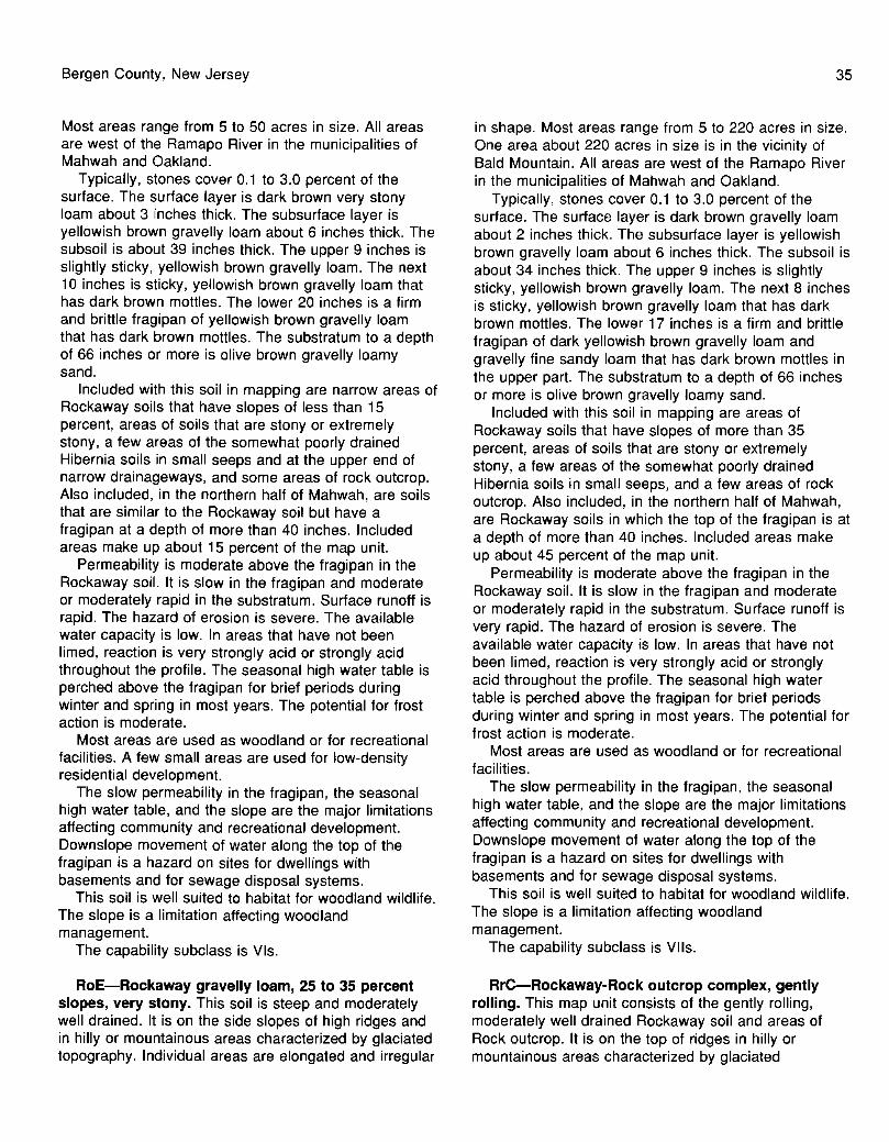
Bergen County, New Jersey
Most areas range from 5 to 50 acres in size. All areas are west of the Ramapo River in the municipalities of Mahwah and Oakland.
Typically, stones cover 0.1 to 3.0 percent of the surface. The surface layer is dark brown very stony loam about 3 inches thick. The subsurface layer is yellowish brown gravelly loam about 6 inches thick. The subsoil is about 39 inches thick. The upper 9 inches is slightly sticky, yellowish brown gravelly loam. The next 10 inches is sticky, yellowish brown gravelly loam that has dark brown mottles. The lower 20 inches is a firm and brittle fragipan of yellowish brown gravelly loam that has dark brown mottles. The substratum to a depth of 66 inches or more is olive brown gravelly loamy sand.
Included with this soil in mapping are narrow areas of Rockaway soils that have slopes of less than 15 percent, areas of soils that are stony or extremely stony, a few areas of the somewhat poorly drained Hibernia soils in small seeps and at the upper end of narrow drainageways, and some areas of rock outcrop. Also included, in the northern half of Mahwah, are soils that are similar to the Rockaway soil but have a fragipan at a depth of more than 40 inches. Included areas make up about 15 percent of the map unit.
Permeability is moderate above the fragipan in the Rockaway soil. It is slow in the fragipan and moderate or moderately rapid in the substratum. Surface runoff is rapid. The hazard of erosion is severe. The available water capacity is low. In areas that have not been limed, reaction is very strongly acid or strongly acid throughout the profile. The seasonal high water table is perched above the fragipan for brief periods during winter and spring in most years. The potential for frost action is moderate.
Most areas are used as woodland or for recreational facilities. A few small areas are used for low-density residential development.
The slow permeability in the fragipan, the seasonal high water table, and the slope are the major limitations affecting community and recreational development. Downslope movement of water along the top of the fragipan is a hazard on sites for dwellings with basements and for sewage disposal systems.
This soil is well suited to habitat for woodland wildlife. The slope is a limitation affecting woodland management.
The capability subclass is VIs.
RoE-Rockaway gravelly loam, 25 to 35 percent slopes, very stony. This soil is steep and moderately well drained. It is on the side slopes of high ridges and in hilly or mountainous areas characterized by glaciated topography. Individual areas are elongated and irregular
35
in shape. Most areas range from 5 to 220 acres in size. One area about 220 acres in size is in the vicinity of Bald Mountain. All areas are west of the Ramapo River in the municipalities of Mahwah and Oakland.
Typically, stones cover 0.1 to 3.0 percent of the surface. The surface layer is dark brown gravelly loam about 2 inches thick. The subsurface layer is yellowish brown gravelly loam about 6 inches thick. The subsoil is about 34 inches thick. The upper 9 inches is slightly sticky, yellowish brown gravelly loam. The next 8 inches is sticky, yellowish brown gravelly loam that has dark brown mottles. The lower 17 inches is a firm and brittle fragipan of dark yellowish brown gravelly loam and gravelly fine sandy loam that has dark brown mottles in the upper part. The substratum to a depth of 66 inches or more is olive brown gravelly loamy sand.
Included with this soil in mapping are areas of Rockaway soils that have slopes of more than 35 percent, areas of soils that are stony or extremely stony, a few areas of the somewhat poorly drained Hibernia soils in small seeps, and a few areas of rock outcrop. Also included, in the northern half of Mahwah, are Rockaway soils in which the top of the fragipan is at a depth of more than 40 inches. Included areas make up about 45 percent of the map unit.
Permeability is moderate above the fragipan in the Rockaway soil. It is slow in the fragipan and moderate or moderately rapid in the substratum. Surface runoff is very rapid. The hazard of erosion is severe. The available water capacity is low. In areas that have not been limed, reaction is very strongly acid or strongly acid throughout the profile. The seasonal high water table is perched above the fragipan for brief periods during winter and spring in most years. The potential for frost action is moderate.
Most areas are used as woodland or for recreational facilities.
The slow permeability in the fragipan, the seasonal high water table, and the slope are the major limitations affecting community and recreational development. Downslope movement of water along the top of the fragipan is a hazard on sites for dwellings with basements and for sewage disposal systems.
This soil is well suited to habitat for woodland wildlife. The slope is a limitation affecting woodland management.
The capability subclass is VIIs.
ArC-Rockaway-Rock outcrop complex, gently rolling. This map unit consists of the gently rolling, moderately well drained Rockaway soil and areas of Rock outcrop. It is on the top of ridges in hilly or mountainous areas characterized by glaciated

36
topography. The Rockaway soil and the Rock outcrop occur as areas so intricately mixed or so small that it was not practical to map them separately. Individual areas are elongated and irregularly shaped or oval, and most range from 5 to 360 acres in size. They are about 60 percent Rockaway soil, 20 percent Rock outcrop, and 20 percent included soils. All areas are west of the Ramapo River in the municipalities of Mahwah and Oakland. Slopes range from 8 to 15 percent.
Typically, stones cover 3 to 5 percent of the surface of the Rockaway soil. The surface layer is dark brown loam about 2 inches thick. The subsurface layer is yellowish brown cobbly loam about 6 inches thick. The subsoil is about 34 inches thick. The upper 9 inches is slightly sticky, yellowish brown gravelly loam. The next 8 inches is sticky, yellowish brown gravelly loam that has dark brown mottles. The lower 17 inches is a firm and brittle fragipan of dark yellowish brown gravelly loam and gravelly fine sandy loam that has dark brown mottles. The substratum to a depth of 66 inches or more is olive brown gravelly loamy sand.
Rock outcrop consists of hard granite, gneiss, or schist.
Included in mapping are areas of Rockaway soils that have slopes of less than 8 percent, Rockaway soils that are stony or very stony, areas of soils that are less than 40 inches deep over bedrock, and areas of the somewhat poorly drained Hibernia soils in narrow drainageways. Also included, in the northern half of Mahwah, are Rockaway soils in which the top of the fragipan is at a depth of more than 40 inches. Included soils make up about 20 percent of the map unit.
Permeability is moderate above the fragipan in the Rockaway soil. It is slow in the fragipan and moderate or moderately rapid below the fragipan. Surface runoff is medium. The hazard of erosion is moderate. The available water capacity is low. In areas that have not been limed, reaction is very strongly acid or strongly acid throughout the profile. The seasonal high water table is perched above the fragipan during winter and spring in most years. The potential for frost action is moderate.
Most areas of this map unit are used as woodland or for recreational facilities. A few small areas are used for low-density residential development.
The slow permeability in the fragipan, the seasonal high water table, the large stones on the surface, and the Rock outcrop are the major limitations affecting community and recreational development.
This unit is moderately suited to habitat for woodland wildlife. The large stones and the Rock outcrop are limitations affecting woodland management.
No capability subclass is assigned.
Soil Survey
RrD-Rockaway-Rock outcrop complex, hilly. This map unit consists of the hilly, moderately well drained Rockaway soil and areas of Rock outcrop. It is on the upper side slopes of high ridges in hilly or mountainous areas characterized by glaciated topography. The Rockaway soil and the Rock outcrop occur as areas so intricately mixed or so small that it was not practical to map them separately. Individual areas are elongated and irregular in shape, and most range from 5 to 60 acres in size. They are about 60 percent Rockaway soil, 25 percent Rock outcrop, and 15 percent included soils. All areas are west of the Ramapo River in the municipalities of Mahwah and Oakland. Slopes range from 15 to 25 percent.
Typically, the Rockaway soil has an extremely stony surface. The surface layer is dark brown extremely stony loam about 3 inches thick. The subsurface layer is yellowish brown cobbly loam about 6 inches thick. The subsoil is about 33 inches thick. The upper 9 inches is slightly sticky, yellowish brown gravelly loam. The next 10 inches is slightly sticky, yellowish brown gravelly loam that has dark brown mottles. The lower 14 inches is a firm and brittle fragipan of dark yellowish brown gravelly loam or gravelly fine sandy loam that has brown mottles. The substratum to a depth of 66 inches or more is olive brown gravelly loamy sand.
Rock outcrop consists of hard granite, gneiss, or schist.
Included in mapping are narrow areas of Rockaway soils that have slopes of less than 15 percent, Rockaway soils that are stony or very stony, areas adjacent to the Rock outcrop that are less than 40 inches deep, and areas of the somewhat poorly drained Hibernia soils in small seeps at the upper end of narrow drainageways. Also included, in the northern half of Mahwah, are soils that have a fragipan at a depth of more than 40 inches. Included soils make up about 15 percent of the map unit.
Permeability is moderate above the fragipan in the Rockaway soil. It is slow in the fragipan and moderate or moderately rapid below the fragipan. Surface runoff is rapid. The hazard of erosion is severe. The available water capacity is low. In areas that have not been limed, reaction is very strongly acid or strongly acid throughout the profile. The seasonal high water table is perched above the fragipan for brief periods during winter and spring in most years. The potential for frost action is moderate.
Most areas of this map unit are used as woodland or for recreational facilities. A few small areas are used for low-density residential development.
The slow permeability in the fragipan, the seasonal high water table, the slope, the large stones on the surface, and the Rock outcrop are the major limitations

Bergen County, New Jersey
affecting community and recreational development. This unit is moderately suited to habitat for woodland
wildlife. The slope, the large stones, and the Rock outcrop are limitations affecting woodland management.
No capability subclass is assigned.
ArE-Rockaway-Rock outcrop complex, very hilly. This map unit consists of the very hilly, moderately well drained Rockaway soil and areas of Rock outcrop. It is on the side slopes of high ridges in hilly or mountainous areas characterized by glaciated topography. The Rockaway soil and the Rock outcrop occur as areas so intricately mixed or so small that it was not practical to map them separately. Individual areas are elongated and irregular in shape, and most range from 5 to 600 acres in size. They are about 60 percent Rockaway soil, 30 percent Rock outcrop, and 10 percent included soils. All areas are west of the Ramapo River in the municipalities of Mahwah and Oakland. Slopes range from 25 to 35 percent.
Typically, stones cover 3 to 5 percent of the surface of the Rockaway soil. The surface layer is dark brown loam about 2 inches thick. The subsurface layer is yellowish brown cobbly loam about 6 inches thick. The subsoil is about 34 inches thick. The upper 9 inches is slightly sticky, yellowish brown gravelly loam. The next 8 inches is sticky, yellowish brown gravelly loam that has dark brown mottles. The lower 17 inches is a firm and brittle fragipan of dark yellowish brown gravelly loam and gravelly sandy loam that has dark brown mottles. The substratum to a depth of 66 inches or more is olive brown gravelly loamy sand.
Rock outcrop consists of hard granite, gneiss, or schist.
Included in mapping are narrow areas of Rockaway soils that have slopes of less than 25 percent, areas of Rockaway soils that are stony or very stony, and areas adjacent to the Rock outcrop that are less than 40 inches deep. Also included are the somewhat poorly drained Hibernia soils in small seeps and at the upper end of narrow drainageways. Included soils make up about 10 percent of the map unit.
Permeability is moderate above the fragipan in the Rockaway soil. It is slow in the fragipan and moderate or moderately rapid below the fragipan. Surface runoff is very rapid. The hazard of erosion is severe. The available water capacity is low. In areas that have not been limed, reaction is very strongly acid or strongly acid throughout the profile. The seasonal high water table is perched above the fragipan for brief periods during winter and spring in most years. The potential for frost action is moderate.
Most areas of this map unit are used as woodland or for recreational facilities.
37
The slow permeability in the fragipan, the seasonal high water table, the slope, the large stones on the surface, and the Rock outcrop are the major limitations affecting community and recreational development.
This unit is moderately suited to habitat for woodland wildlife. The slope, the large stones, and the Rock outcrop are limitations affecting woodland management.
No capability subclass is assigned.
SU-Sulfihemists and Sulfaquents, frequently flooded. This map unit consists of very deep, level or nearly level, very poorly drained soils in marine and estuarine marshes. They are subject to daily tidal flooding. Individual areas are irregular in shape and range from 5 to more than BOO acres in size. These soils were mapped together because they have no significant differences that affect use and management. They are remnants of one continuous marsh that extended northward along the Hackensack River to the confluence with Cole's Brook and along Overpeck Creek into the city of Englewood. At its southernmost point in Bergen County, the marsh was as much as 3 miles wide. Some areas of this unit are made up almost entirely of Sulfihemists or of Sulfaquents, and some areas are made up of both soils. The total acreage of this unit is made up of about 50 percent Sulfihemists, 40 percent Sulfaquents, and 10 percent included soils. Slopes are 0 to 1 percent.
Because of the variability of the soils, a typical profile is not described. Sulfihemists have at least 16 inches of organic material extending from the surface to any contrasting underlying mineral material. In most areas the organic material is more than 51 inches thick. The upper 12 inches is neutral in hue or is black, dark reddish brown, or very dark brown. The organic material is highly decomposed and contains roots of wetland plants. Below a depth of 12 inches, the organic material has colors similar to those in the upper 12 inches but is less decomposed and is interbedded with thin, highly decomposed organic layers that total less than 10 inches in thickness where the depth to contrasting mineral material is at least 51 inches. The underlying mineral material is stratified or varved and has colors ranging from dark gray to white and from pink to light yellowish brown. The material is dominantly fine sandy loam or silt loam, but it has thin layers that range in texture from very gravelly sand to clay.
In some areas Sulfaquents have a surface layer of organic material less than 16 inches thick. The organic material is black or dark reddish brown and is highly decomposed. In areas where the surface layer is made up of mineral material, it is black, dark reddish brown, or very dark brown silt loam or fine sandy loam and has an organic matter content of less than 20 percent. The

38
mineral surface layer is 4 to 12 inches thick. The underlying mineral material is stratified or varved and has colors ranging from dark gray to white and from pink to light yellowish brown. Textures of the individual strata range from very gravelly sand to clay.
Included with these soils in mapping are small areas of Udorthents that have an organic or refuse substratum. Included soils make up about 10 percent of this unit.
Available water capacity is high in the Sulfihemists and Sulfaquents. Permeability is rapid or very rapid in the organic material and variable in the mineral material. Runoff is very slow. The water table is above the surface daily at high tide and is generally within a depth of 1 foot at low tide. Reaction is slightly acid or neutral throughout when the soils are moist but is strongly acid or very strongly acid when the soils are dry. The depth to bedrock is more than 72 inches in the Sulfaquents. It is typically more than 1 0 feet in the Sulfihemists.
These soils are very poorly suited to cultivated crops, woodland, and most urban uses because of the prolonged periods of saturation and the daily flooding. They are well suited to habitat for wetland wildlife.
No capability subclass is assigned.
Ua-Udorthents, loamy. This map unit is on uplands in areas covered by glacial till or outwash and on stream terraces. Individual areas are irregular in shape. Most areas range from 5 to 85 acres in size. Slopes range from 0 to 5 percent.
Areas of this unit have been cut and smoothed or otherwise extensively disturbed to a depth of 3 feet or more. The original soil can no longer be identified.
Included in mapping are small areas of the moderately well drained Boonton soils and the somewhat poorly drained Haledon soils on glacial till ridges along the perimeter of the disturbed areas; areas that have short, steep slopes of more than 5 percent; small sand and gravel pits; areas of Udorthents that have a wet substratum; and areas of urban land. Included areas make up about 5 percent of the map unit.
In most areas of this map unit, layers of soil have been removed and about 5 to 10 inches of soil material from other areas has been added to the surface layer to support an adequate vegetative cover. In other areas, the soil material has not been replaced and the vegetative cover is sparse.
Most areas are used for playgrounds, baseball fields, or other intensive recreational facilities. Other areas are idle land or are reserved for future development. Because of the variability of the soil material, onsite
Soil Survey
investigation is needed to determine the potential of individual areas for any use.
No capability subclass is assigned.
Ub-Udorthents, organic substratum. This map unit is in low areas of marine and estuarine deposits. Individual areas are irregular in shape and range from less than 5 to about 195 acres in size. Slopes range from 0 to 5 percent.
Areas of this unit have been filled and smoothed or otherwise extensively disturbed to a depth of 3 feet or more. The original soil can no longer be identified. The fill material generally consists of a mixture of stones, boulders, rubble, and soil material. In most areas the original soils are presumed to have been deep, very poorly drained, organic or mineral soils that were subject to daily tidal flooding.
Included in mapping are small areas of the very poorly drained Sulfaquents and Sulfihemists; areas of Udorthents that have a refuse substratum; Udorthents that have a wet substratum, in narrow areas around the perimeter of the map unit; and areas that have short, steep slopes of more than 5 percent. Included areas make up about 10 percent of the map unit.
Most areas of this map unit are reserved for development and include railroad lines and unpaved service roads. Some areas have a vegetative cover and are used for recreational purposes.
Because of the variability of the soil material, onsite investigation is needed to determine the potential of individual areas for any use.
No capability subclass is assigned.
Uc-Udorthents, organic substratum-Urban land complex. This map unit is in low areas of marine and estuarine deposits and in the uplands. The Udorthents and the Urban land occur as areas so intricately mixed or so small that it was not practical to map them separately. Individual areas are irregular in shape and range from less than 5 to about 310 acres in size. They are about 50 percent Udorthents, organic substratum; 35 percent Urban land; and 15 percent included areas. The most extensive area is south of the Meadowlands Sports Complex in East Rutherford. Slopes range from 0 to 5 percent.
Areas of Udorthents, organic substratum, have been filled to variable depths and have been smoothed and partially paved. In most areas the original soils are presumed to have been deep to shallow, very poorly drained, organic soils that were subject to daily tidal flooding or prolonged pending. The fill material is made up of stones, boulders, rubble, and varying amounts of soil and nonsoil material.

Bergen County, New Jersey
Urban land consists of areas in which the surface is covered by single-family dwellings, commercial buildings, roads and streets, small parking lots, and other structures.
Included in mapping are loamy Udorthents, natural and constructed drainageways, areas of water, and areas that have short, steep slopes of more than 5 percent. Also included are small areas of the poorly drained Sulfaquents and Sulfihemists in marine and estuarine deposits, the very poorly drained Carlisle and Adrian soils, and the somewhat poorly drained Haledon soils in upland areas along the perimeter of the map unit. Included areas make up about 15 percent of the map unit.
This map unit is predominantly used for major thoroughfares, large parking lots, and commercial or industrial complexes.
Because of the variability of the fill material, onsite investigation is needed to determine the potential of individual areas for any use.
No capability subclass is assigned.
Ud-Udorthents, refuse substratum. This map unit is in low areas of marine and estuarine deposits, on upland stream terraces, and on till plains. Individual areas are irregular in shape. Most areas range from 5 to 41 0 acres in size. Slopes range from 0 to 5 percent.
This unit has been or is presently being filled or otherwise extensively disturbed to a depth of 3 feet or more. The original soil can no longer be identified. The fill material generally consists of various kinds of refuse, solid waste, and other nonsoil material. In some areas limited amounts of soil material have been added to or incorporated with the dominant fill material. In most areas the original soils are presumed to have been deep, somewhat poorly drained to very poorly drained soils in low areas and a few small upland areas.
Included in mapping are areas of the very poorly drained Sulfaquents and Sulfihemists, areas of Udorthents that have an organic or wet substratum, and areas that have short, steep slopes of more than 5 percent. Included areas make up about 5 percent of the map unit.
This unit is used mainly as sites for disposal of refuse. The disposal sites are used by several communities. Other extensive areas of the unit, such as those in Overpeck County Park, were formerly refuse disposal sites but have been closed to additional filling and now support vegetation. These areas provide excellent public recreational facilities.
Because of the variability of the fill material, onsite investigation is needed to determine the potential of individual areas for any use.
No capability subclass is assigned.
39
Ue---Udorthents, wet substratum. This map unit is on upland stream terraces, in drainageways, in areas of marine and estuarine deposits, and on flood plains. Individual areas are irregular in shape. Most areas range from 5 to 180 acres in size. Slopes range from 0 to 5 percent.
Areas of this unit have been filled and smoothed or otherwise extensively disturbed to a depth of 3 feet or more. In most areas the original soils are presumed to have been deep, somewhat poorly drained to very poorly drained soils that were subject to flooding or prolonged pending. The fill material generally consists of a mixture of soil material and varying amounts of stones, boulders, and rubble. Silty and sandy soil dredgings are common near bodies of water.
Included in mapping are small areas of urban land, areas of loamy Udorthents, and areas that have short, steep slopes of more than 5 percent. Included areas make up about 30 percent of the map unit.
Most areas of this map unit are used for playgrounds, baseball fields, or other intensive recreational facilities commonly associated with parks and schools. Other areas are open space or are reserved for future community development.
Because of the variability of the soil material, onsite investigation is needed to determine the suitability of individual areas for any use.
No capability subclass is assigned.
Uf-Udorthents, wet substratum-Urban land complex. This map unit is in low areas of marine and estuarine deposits, on upland stream terraces, and on flood plains. The Udorthents and the Urban land occur as areas so intricately mixed or so small that it was not practical to map them separately. Individual areas are irregular in shape. Most areas are less than 20 acres in size but range to as much as 580 acres. The largest area is south of Route 46 and extends along the west side of the Hackensack River in Little Ferry and Moonachie. Areas of this unit are about 50 percent Udorthents, wet substratum; 35 percent Urban land; and 15 percent included areas. Slopes range from 0 to 5 percent.
Areas of Udorthents, wet substratum, have been filled to a depth of at least 3 feet and have been smoothed and partially paved. In most areas the original soils are presumed to have been deep, poorly drained or very poorly drained soils that were subject to flooding or prolonged pending. The fill material consists of soil material; varying amounts of stones, boulders, and rubble; and small amounts of other nonsoil material.
Urban land consists of areas in which the surface is covered by single-family dwellings, commercial

40
buildings, roads and streets, small parking lots, and other structures.
Included in mapping are small areas of loamy Udorthents, small areas of somewhat poorly drained to very poorly drained soils that formed in water-sorted material or glacial till in areas along the perimeter of the map unit, and areas that have short, steep slopes of more than 5 percent. Included areas make up about 15 percent of the map unit.
Most areas of this map unit are used for residential, commercial, or industrial development.
Because of the variability of the fill material, onsite investigation is necessary to determine the potential of individual areas for any use.
No capability subclass is assigned.
UR-Urban land. This map unit is nearly level or gently sloping. It occurs throughout the survey area, except in the borough of Alpine and west of the Mahwah River in the boroughs of Mahwah and Oakland. Individual areas are irregular in shape and range from 5 to more than 750 acres in size. Slopes range from 1 to 5 percent.
This unit consists of areas that have been cut and filled or areas in which more than 85 percent of the surface is covered by paved surfaces or buildings and other structures.
Included in mapping are high-density residential areas in which less than 85 percent of the surface is covered and in which the soils consist of reworked soil material or Udorthents. In the Meadowlands area, the soils are Udorthents that have either a loamy substratum or a wet substratum. Included areas make up about 25 percent of the unit.
Most areas of this unit are used for commercial and industrial development, such as shopping malls and office building complexes. Some areas are used for central school sites.
Because of the variability of the soil material, onsite investigation is needed to determine the potential of individual areas !or any use.
No capability subclass is assigned.
WeB-Wethersfield gravelly loam, 3 to 8 percent slopes. This soil is gently sloping and well drained. It is in convex areas on broad glacial till plains. Individual areas are irregular in shape. Most areas range from 5 to 130 acres in size.
Typically, the surface layer is dark brown gravelly loam about 8 inches thick. The subsoil is 18 inches thick. The upper 10 inches is yellowish brown gravelly loam. The lower 8 inches is strong brown gravelly loam. The substratum to a depth of 65 inches or more is
Soil Survey
yellowish red gravelly fine sandy loam that is very firm in place.
Included with this soil in mapping are areas of Wethersfield soils that have slopes of less than 3 percent or more than 8 percent and Wethersfield soils that have less gravel in the surface layer and subsoil than the major Wethersfield soil. Also included are areas of the somewhat poorly drained Haledon soils in small, slightly concave areas and in narrow drainageways. Included soils make up about 1 0 percent of the map unit.
Permeability is moderate in the solum of the Wethersfield soil and slow in the substratum. Surface runoff is medium. The hazard of erosion is slight or moderate. The available water capacity is moderate. In areas that have not been limed, reaction is very strongly acid or strongly acid in the surface layer and subsoil and strongly acid or moderately acid in the substratum. The potential for frost action is moderate.
Most areas are used as woodland or for recreational facilities.
The slow permeability in the substratum is the major limitation affecting community and recreational development.
This soil is well suited to habitat for upland wildlife. It has moderate limitations that affect woodland management.
The capability subclass is lie.
Wee-Wethersfield gravelly loam, 8 to 15 percent slopes. This soil is strongly sloping and well drained. It is in perimeter areas of broad, convex glacial till plains. Individual areas are irregular in shape. Most areas range from 5 to 200 acres in size.
Typically, the surface layer is dark brown gravelly loam about 8 inches thick. The subsoil is 18 inches thick. The upper 10 inches is yellowish brown gravelly loam. The lower 8 inches is strong brown gravelly loam. The substratum to a depth of 65 inches or more is yellowish red gravelly fine sandy loam that is very firm in place.
Included with this soil in mapping are small areas of Wethersfield soils that have slopes of less than 8 percent and areas of the somewhat poorly drained Haledon soils in narrow drainageways. Included soils make up about 15 percent of the map unit.
Permeability is moderate in the solum of the Wethersfield soil and slow in the substratum. Surface runoff is medium. The hazard of erosion is moderate. The available water capacity also is moderate. In areas that have not been limed, reaction is very strongly acid or strongly acid in the surface layer and subsoil and strongly acid or moderately acid in the substratum. The potential for frost action is moderate.

Bergen County, New Jersey
Most areas are used as woodland or for recreational facilities.
The slope and the slow permeability in the substratum are the major limitations affecting community and recreational development.
This soil is well suited to habitat for upland wildlife. It has moderate limitations that affect woodland management.
The capability subclass is llle.
WeD-Wethersfield gravelly loam, 15 to 25 percent slopes. This soil is moderately steep and well drained. It is on the sides of low, long and narrow glacial till ridges. Individual areas are irregular in shape. Most areas range from 5 to 30 acres in size.
Typically, the surface layer is dark brown gravelly loam about 6 inches thick. The subsoil is 17 inches thick. The upper 9 inches is yellowish brown gravelly loam. The lower 8 inches is strong brown gravelly loam. The substratum to a depth of 65 inches or more is yellowish red gravelly fine sandy loam that is very firm in place.
Included with this soil in mapping are areas of Wethersfield soils that have slopes of less than 15 percent or more than 25 percent and areas of soils that are less than 40 inches deep over bedrock. Also included are areas of the somewhat poorly drained Haledon and poorly drained Hasbrouck soils in seeps. Included soils make up about 15 percent of the map unit.
Permeability is moderate in the solum of the Wethersfield soil and slow in the substratum. Surface runoff is rapid. The hazard of erosion is severe. The available water capacity is moderate. In areas that have not been limed, reaction is very strongly acid or strongly acid in the surface layer and subsoil and strongly acid or moderately acid in the substratum. The potential for frost action is moderate.
Most areas of this soil are used as woodland or for recreational facilities.
The slope and the slow permeability in the substratum are the major limitations affecting community and recreational development.
This soil is fairly well suited to habitat for upland wildlife. It has moderate limitations that affect woodland management.
The capability subclass is IVe.
WeE-Wethersfield gravelly loam, 25 to 35 percent slopes. This soil is steep and well drained. It is on the sides of high, long glacial till ridges. Individual areas are dominantly irregular in shape. Most areas range from 5 to 30 acres in size.
41
Typically, the surface layer is dark brown gravelly loam about 4 inches thick. The subsoil is 16 inches thick. The upper 7 inches is yellowish brown gravelly loam. The lower 9 inches is strong brown gravelly loam. The substratum to a depth of 65 inches or more is yellowish red gravelly fine sandy loam that is very firm in place.
Included with this soil in mapping are areas of Wethersfield soils that have slopes of less than 25 percent or more than 35 percent and areas of soils that are less than 40 inches deep over bedrock. Also included are areas of the poorly drained Hasbrouck and somewhat poorly drained Haledon soils in seeps. Included soils make up about 15 percent of the map unit.
Permeability is moderate in the solum of the Wethersfield soil and slow in the substratum. Surface runoff is very rapid. The hazard of erosion is severe. The available water capacity is moderate. In areas that have not been limed, reaction is very strongly acid or strongly acid in the surface layer and subsoil and strongly acid or moderately acid in the substratum. The potential for frost action is moderate.
Most areas of this soil are used as woodland or for recreational facilities.
The slope and the slow permeability in the substratum are the major limitations affecting community and recreational development.
This soil is fairly well suited to habitat for upland wildlife. It has moderate limitations that affect woodland management.
The capability subclass is VIe.
WrD-Wethersfield gravelly loam, 15 to 25 percent slopes, very stony. This soil is moderately steep and well drained. It is on the side slopes of low, long and narrow glacial till ridges. Individual areas are irregular in shape. Most areas range from 20 to 1 00 acres in size.
Typically, stones cover 0.1 to 3.0 percent of the surface. The surface layer is dark brown very stony loam about 3 inches thick. The subsoil is 21 inches thick. The upper 14 inches is yellowish brown gravelly loam. The lower 7 inches is strong brown gravelly loam. The substratum to a depth of 65 inches or more is yellowish red gravelly fine sandy loam that is very firm in place.
Included with this soil in mapping are a few areas of Wethersfield soils that have slopes of less than 15 percent or more than 25 percent and a few areas of soils that have bedrock at a depth of 40 to 60 inches. Also included are a few areas of the somewhat poorly drained Haledon and poorly drained Hasbrouck soils in seeps. Included soils make up about 15 percent of the map unit.

42
Permeability is moderate in the solum of the Wethersfield soil and slow in the substratum. Surface runoff is rapid. The hazard of erosion is moderate. The available water capacity also is moderate. In areas that have not been limed, reaction is very strongly acid or strongly acid in the surface layer and subsoil and strongly acid or moderately acid in the substratum. The potential for frost action is moderate.
Most areas are used as woodland or for recreational facilities.
The slow permeability in the substratum, the slope, the very stony surface, and the depth to bedrock are the major limitations affecting community and recreational development.
This soil is well suited to habitat for upland wildlife. It has moderate limitations that affect woodland management.
The capability subclass is VIs.
WsB-Wethersfield-Rock outcrop complex, 3 to 8 percent slopes. This map unit consists of the gently sloping, well drained Wethersfield soil and areas of Rock outcrop. It is on the top of the Palisades Range in the eastern part of the county. The Wethersfield soil and the Rock outcrop occur as areas so intricately mixed or so small that it was not practical to map them separately. Individual areas are irregular in shape, and most range from 1 0 to 200 acres in size. They are about 50 percent Wethersfield soil, 25 percent Rock outcrop, and 25 percent included areas.
Typically, stones cover 0.1 to 3.0 percent of the surface of the Wethersfield soil. The surface layer is dark brown gravelly loam about 3 inches thick. The subsoil is 21 inches thick. The upper 14 inches is dark yellowish brown and yellowish brown gravelly loam. The lower 7 inches is strong brown gravelly loam. The substratum to a depth of 65 inches or more is yellowish red and strong brown gravelly fine sandy loam that is very firm in place.
Rock outcrop consists primarily of diabase. Included in mapping are a few small areas of
Wethersfield soils that have slopes of less than 3 percent or more than 8 percent, some areas that are extremely stony, and small areas of the somewhat poorly drained Haledon and poorly drained Hasbrouck soils in small depressions or narrow drainageways. Also included are areas of soils that are similar to the Wethersfield soil but are less than 40 inches deep over bedrock. Included areas make up about 25 percent of the map unit.
Permeability is moderate in the solum of the Wethersfield soil and slow in the substratum. Surface runoff is slow. The hazard of erosion is slight. The available water capacity is moderate. In areas that have
Soil Survey
not been limed, reaction is very strongly acid or strongly acid in the surface layer and subsoil and strongly acid or moderately acid in the substratum. The potential for frost action is moderate.
Most areas of this unit are used as woodland or for recreational facilities.
The slow permeability in the substratum, the very stony surface, the depth to bedrock, and the Rock outcrop are the major limitations affecting community and recreational development.
This unit is well suited to habitat for woodland wildlife. The Wethersfield soil has moderate limitations that affect woodland management.
No capability subclass is assigned.
WsC-Wethersfield-Rock outcrop complex, 8 to 15 percent slopes. This map unit consists of the sloping, well drained Wethersfield soil and areas of Rock outcrop. It is on the top of the Palisades Range in the eastern part of the county. The Wethersfield soil and the Rock outcrop occur as areas so intricately mixed or so small that it was not practical to map them separately. Individual areas are irregular in shape, and most range from 5 to 40 acres in size. An area that is about 500 acres in size is near the southern end of the Palisades Range. The areas of this unit are about 55 percent Wethersfield soil, 20 percent Rock outcrop, and 25 percent included areas.
Typically, stones cover 0.1 to 3.0 percent of the surface of the Wethersfield soil. The surface layer is dark brown gravelly loam about 3 inches thick. The subsoil is 21 inches thick. The upper 14 inches is dark yellowish brown and yellowish brown gravelly loam. The lower 7 inches is strong brown gravelly loam. The substratum to a depth of 65 inches or more is yellowish red and strong brown gravelly fine sandy loam that is very firm in place.
Rock outcrop consists primarily of diabase. Included in mapping are a few small areas of
Wethersfield soils that have slopes of less than 8 percent or more than 15 percent, some areas that are extremely stony, and a few areas of the somewhat poorly drained Haledon soils in narrow drainageways. Also included are areas of soils that are similar to the Wethersfield soil but are less than 40 inches deep over bedrock. Included areas make up about 25 percent of the map unit.
Permeability is moderate in the solum of the Wethersfield soil and slow in the substratum. Surface runoff is medium. The hazard of erosion is moderate. The available water capacity also is moderate. In areas that have not been limed, reaction is very strongly acid or strongly acid in the surface layer and subsoil and

Bergen County, New Jersey
strongly acid or moderately acid in the substratum. The potential for frost action is moderate.
Most areas of this unit are used as woodland or for recreational facilities.
The slow permeability in the substratum, the very stony surface, the depth to bedrock, and the Rock outcrop are the major limitations affecting community and recreational development.
This unit is well suited to habitat for woodland wildlife. The Wethersfield soil has moderate limitations that affect woodland management.
No capability subclass is assigned.
WsD-Wethersfield-Rock outcrop complex, 15 to 25 percent slopes. This map unit consists of the moderately steep, well drained Wethersfield soil and areas of Rock outcrop. It is on the upper side slopes of the Palisades Range in the eastern part of the county. The Wethersfield soil and the Rock outcrop occur as areas so intricately mixed or so small that it was not practical to map them separately. Individual areas are long and narrow and irregularly shaped, and most range from 5 to 100 acres in size. They are about 50 percent Wethersfield soil, 20 percent Rock outcrop, and 30 percent included areas.
Typically, the Wethersfield soil has a very stony surface. The surface layer is dark brown very stony loam about 3 inches thick. The subsoil is 21 inches thick. The upper 14 inches is yellowish brown gravelly loam. The lower 7 inches is strong brown gravelly loam. The substratum to a depth of 65 inches or more is yellowish red gravelly fine sandy loam that is very firm in place.
Rock outcrop consists primarily of diabase. Included in mapping are a few small areas of
Wethersfield soils that have slopes of less than 15 percent or more than 25 percent, some areas that are extremely stony, and a few areas of the somewhat poorly drained Haledon and poorly drained Hasbrouck soils in small, slightly concave areas or narrow drainageways. Also included are areas of soils that are similar to the Wethersfield soil but are less than 40 inches deep over bedrock. Included areas make up about 30 percent of the map unit.
Permeability is moderate in the solum of the Wethersfield soil and slow in the substratum. Surface runoff is rapid. The hazard of erosion is moderate. The available water capacity also is moderate. In areas that have not been limed, reaction is very strongly acid or strongly acid in the surface layer and subsoil and strongly acid or moderately acid in the substratum. The potential for frost action is moderate.
Most areas of this unit are used as woodland or for recreational facilities.
The slow permeability in the substratum, the slope, the very stony surface, the depth to bedrock, and the Rock outcrop are the major limitations affecting community and recreational development.
43
This unit is poorly suited to habitat for openland wildlife but is well suited to habitat for woodland wildlife. The Wethersfield soil has moderate limitations that affect woodland management.
No capability subclass is assigned.
WsE-Wethersfield-Rock outcrop complex, very steep. This map unit consists of the very steep, well drained Wethersfield soil and areas of Rock outcrop. It is on the side slopes of the Palisades Range in the eastern part of the county. The Wethersfield soil and the Rock outcrop occur as areas so intricately mixed or so small that it was not practical to map them separately. Individual areas are dominantly long and narrow and irregularly shaped, and most range from 5 to 100 acres in size. They are about 40 percent Wethersfield soil, 20 percent Rock outcrop, and 40 percent included soils. The largest and steepest areas are on east-facing side slopes. Slopes range from 25 to 35 percent.
Typically, stones cover 0.1 to 3.0 percent of the surface of the Wethersfield soil. The surface layer is dark brown gravelly loam about 3 inches thick. The subsoil is 21 inches thick. The upper 14 inches is dark yellowish brown and yellowish brown gravelly loam. The lower 7 inches is strong brown gravelly loam. The substratum to a depth of 65 inches or more is y~llowish red and strong brown gravelly fine sandy loam that is very firm in place.
Rock outcrop consists primarily of diabase. Included in mapping are small areas of Wethersfield
soils that have slopes of less than 25 percent, some areas of soils that do not have a very stony surface, and a few small areas of the somewhat poorly drained Haledon soils in seeps. Also included are a few areas of soils that are similar to the Wethersfield soil but are less than 40 inches deep over bedrock. Included soils make up about 40 percent of the map unit.
Permeability is moderate in the solum of the Wethersfield soil and slow in the substratum. Surface runoff is very rapid. The hazard of erosion is severe. The available water capacity is moderate. In areas that have not been limed, reaction is very strongly acid or strongly acid in the surface layer and subsoil and strongly acid or moderately acid in the substratum. The potential for frost action is moderate.
Most areas of this unit are used as woodland or for recreational facilities.
The slow permeability in the substratum, the slope, the depth to bedrock, and the Rock outcrop are the

44
major limitations affecting community and recreational development.
This unit is poorly suited to habitat for upland wildlife. The Wethersfield soil has severe limitations that affect woodland management.
No capability subclass is assigned.
WUB-Wethersfield-Urban land complex, undulating. This map unit consists of the well drained Wethersfield soil and areas of Urban land. It is on the tops of long, broad glacial till ridges and on broad, convex glacial till plains east of the Ramapo River in the northern part of the county. The Wethersfield soil and the Urban land occur as areas so intricately mixed or so small that it was not practical to map them separately. Individual areas are irregular in shape, and most range from 5 to 100 acres in size. They are about 55 percent Wethersfield soil, 30 percent Urban land, and 15 percent included soils. Slopes range from 3 to 8 percent.
Typically, the surface layer of the Wethersfield soil is dark brown gravelly loam about 8 inches thick. The subsoil is 18 inches thick. The upper 1 0 inches is yellowish brown gravelly loam. The lower 8 inches is strong brown gravelly loam. The substratum to a depth of 65 inches or more is reddish yellow gravelly fine sandy loam that is very firm in place.
Urban land consists of areas in which the surface is covered by paved driveways, patios, paved walkways, buildings, and other structures.
Included in mapping are a few areas of Wethersfield soils that have slopes of less than 3 percent or more than 8 percent and areas of the somewhat poorly drained Haledon soils in small depressions and narrow drainageways. Also included, adjacent to areas of rock outcrop, are soils that are less than 40 inches deep over bedrock. Included soils make up about 15 percent of the map unit.
Permeability is moderate in the solum of the Wethersfield soil and slow in the substratum. Surface runoff is medium. The hazard of erosion is moderate. The available water capacity also is moderate. In areas that have not been limed, reaction is very strongly acid or strongly acid in the surface layer and subsoil and strongly acid or moderately acid in the substratum. The potential for frost action is moderate.
Most areas of this unit are used for single-family dwellings. Individual lots vary from one-fourth acre to 1 acre in size.
The slow permeability in the substratum is the major limitation affecting community and recreational development. The Wethersfield soil is well suited to plants that provide cover and food for small animals and birds.
Soil Survey
No capability subclass is assigned.
WUC-Wethersfield-Urban land complex, gently rolling. This map unit consists of the well drained Wethersfield soil and areas of Urban land. It is on the top of long glacial till ridges and in perimeter areas of broad, convex glacial till plains east of the Ramapo River in the northern part of the county. The Wethersfield soil and the Urban land occur as areas so intricately mixed or so small that it was not practical to map them separately. Individual areas are irregular in shape, and most range from 5 to 100 acres in size. They are about 55 percent Wethersfield soil, 30 percent Urban land, and 15 percent included soils. Slopes range from 8 to 15 percent.
Typically, the surface layer of the Wethersfield soil is dark brown gravelly loam about 8 inches thick. The subsoil is 18 inches thick. The upper 1 0 inches is yellowish brown gravelly loam. The lower 8 inches is strong brown gravelly loam. The substratum to a depth of 65 inches or more is yellowish red gravelly fine sandy loam that is very firm in place.
Urban land consists of areas in which the surface is covered by paved driveways, patios, paved walkways, buildings, and other structures.
Included in mapping are small areas of Wethersfield soils that have slopes of less than 8 percent or more than 15 percent and areas of the somewhat poorly drained Haledon soils in narrow drainageways. Also included, adjacent to areas of rock outcrop, are soils that are less than 40 inches deep over bedrock. Included soils make up about 15 percent of the map unit.
Permeability is moderate in the solum of the Wethersfield soil and slow in the substratum. Surface runoff is medium. The hazard of erosion is moderate. The available water capacity also is moderate. In areas that have not been limed, reaction is very strongly acid or strongly acid in the surface layer and subsoil and strongly acid or moderately acid in the substratum. The potential for frost action is moderate.
Most areas of this unit are used for single-family dwellings. Individual lots vary from one-fourth acre to 1 acre in size.
The slope and the slow permeability in the substratum are the major limitations affecting community and recreational development. The Wethersfield soil is well suited to plants that provide cover and food for small animals and birds.
No capability subclass is assigned.
WUD-Wethersfield-Urban land complex, hilly. This map unit consists of the well drained Wethersfield soil and areas of Urban land. It is on the side slopes of long

Bergen County, New Jersey
and narrow glacial till ridges in the northern part of the county, primarily east of the Saddle River. The Wethersfield soil and the Urban land occur as areas so intricately mixed or so small that it was not practical to map them separately. Individual areas are irregular in shape, and most range from 5 to 65 acres in size. They are about 65 percent Wethersfield soil, 25 percent Urban land, and 10 percent included soils. Slopes range from 15 to 25 percent.
Typically, the surface layer of the Wethersfield soil is dark brown gravelly loam about 6 inches thick. The subsoil is 18 inches thick. The upper 9 inches is yellowish brown gravelly loam. The lower 9 inches is strong brown gravelly loam. The substratum to a depth of 65 inches or more is yellowish red gravelly fine sandy loam that is very firm in place.
Urban land consists of areas in which the surface is covered by paved driveways, patios, paved walkways, buildings, and other structures.
Included in mapping are small areas of Wethersfield soils that have slopes of less than 15 percent or more
45
than 25 percent. Also included are areas of the somewhat poorly drained Haledon and poorly drained Hasbrouck soils in small seeps. Included soils make up about 10 percent of the map unit.
Permeability is moderate in the solum of the Wethersfield soil and slow in the substratum. Surface runoff is rapid. The hazard of erosion is severe. The available water capacity is moderate. In areas that have not been limed, reaction is very strongly acid or strongly acid in the surface layer and subsoil and strongly acid or moderately acid in the substratum. The potential for frost action is moderate.
Most areas of this unit are used for single-family dwellings. Individual lots vary from one-third acre to 1 acre in size.
The slope and the slow permeability in the substratum are the major limitations affecting community and recreational development. The Wethersfield soil is well suited to plants that provide cover and food for small animals and birds.
No capability subclass is assigned.


47
Use and Management of the Soils
This soil survey is an inventory and evaluation of the soils in the survey area. It can be used to adjust land uses to the limitations and potentials of natural resources and the environment. Also, it can help to prevent soil-related failures in land uses.
In preparing a soil survey, soil scientists, conservationists, engineers, and others collect extensive field data about the nature and behavioral characteristics of the soils. They collect data on erosion, droughtiness, flooding, and other factors that affect various soil uses and management. Field experience and collected data on soil properties and performance are used as a basis in predicting soil behavior.
Information in this section can be used to plan the use and management of soils as woodland; as sites for buildings, sanitary facilities, highways and other transportation systems, and parks and other recreational facilities; and for wildlife habitat. It can be used to identify the potentials and limitations of each soil for specific land uses and to help prevent construction failures caused by unfavorable soil properties.
Planners and others using soil survey information can evaluate the effect of specific land uses on productivity and on the environment in all or part of the survey area. The survey can help planners to maintain or create a land use pattern in harmony with the natural soil.
Contractors can use this survey to locate sources of sand and gravel, roadfill, and topsoil. They can use it to identify areas where bedrock, wetness, or very firm soil layers can cause difficulty in excavation.
Health officials, highway officials, engineers, and others may also find this survey useful. The survey can help them plan the safe disposal of wastes and locate sites for pavements, sidewalks, campgrounds, playgrounds, lawns, and trees and shrubs.
Land Capability Classification
Land capability classification shows, in a general way, the suitability of soils for most kinds of field crops. Crops that require special management are excluded. The soils are grouped according to their limitations for
field crops, the risk of damage if they are used for crops, and the way they respond to management. The criteria used in grouping the soils do not include major and generally expensive landforming that would change slope, depth, or other characteristics of the soils, nor do they include possible but unlikely major reclamation projects. Capability classification is not a substitute for interpretations designed to show suitability and limitations of groups of soils for rangeland, for woodland, and for engineering purposes.
In the capability system, soils are generally grouped at three levels-capability class, subclass, and unit (9). Only class and subclass are used in this survey.
Capability classes, the broadest groups, are designated by Roman numerals I through VIII. The numerals indicate progressively greater limitations and narrower choices for practical use. The classes are defined as follows:
Class I soils have few limitations that restrict their use.
Class II soils have moderate limitations that reduce the choice of plants or that require moderate conservation practices.
Class Ill soils have severe limitations that reduce the choice of plants or that require special conservation practices, or both.
Class IV soils have very severe limitations that reduce the choice of plants or that require very careful management, or both.
Class V soils are not likely to erode but have other limitations, impractical to remove, that limit their use.
Class VI soils have severe limitations that make them generally unsuitable for cultivation.
Class VII soils have very severe limitations that make them unsuitable for cultivation.
Class VIII soils and miscellaneous areas have limitations that nearly preclude their use for commercial crop production.
Capability subclasses are soil groups within one class. They are designated by adding a small letter, e, w, s, or c, to the class numeral, for example, lie. The letter e shows that the main hazard is the risk of erosion unless close-growing plant cover is maintained;

48
w shows that water in or on the soil interferes with plant growth or cultivation (in some soils the wetness can be partly corrected by artificial drainage); s shows that the soil is limited mainly because it is shallow, droughty, or stony; and c, used in only some parts of the United States, shows that the chief limitation is climate that is very cold or very dry.
In class I there are no subclasses because the soils of this class have few limitations. Class V contains only the subclasses indicated by w, s, or c because the soils in class V are subject to little or no erosion. They have other limitations that restrict their use to pasture, rangeland, woodland, wildlife habitat, or recreation.
The capability classification of each map unit is given in the section "Detailed Soil Map Units."
Woodland Management and Productivity
Table 5 can be used by woodland owners or forest managers in planning the use of soils for wood crops. Only those soils suitable for wood crops are listed. The table lists the ordination symbol for each soil. Soils assigned the same ordination symbol require the same general management and have about the same potential productivity.
The first part of the ordination symbol, a number, indicates the potential productivity of the soils for an indicator tree species. The number indicates the volume, in cubic meters per hectare per year, which the indicator species can produce. The larger the number, the greater the potential productivity. The number 1 indicates low productivity; 2 and 3, moderate; 4 and 5, moderately high; 6 to 8, high; 9 to 11, very high; and 12 or more, extremely high. The second part of the symbol, a letter, indicates the major kind of soil limitation. The letter R indicates steep slopes; X, stoniness or rockiness; W, excess water in or on the soil; T, toxic substances in the soil; 0, restricted rooting depth caused by bedrock, a hardpan, or other restrictive layers; C, clay in the upper part of the soil; S, sandy texture; and F, a high content of rock fragments in the soil. The letter A indicates that limitations or restrictions are insignificant. If a soil has more than one limitation, the priority is as follows: R, X, W, T, D, C, S, and F.
In table 5, slight, moderate, and severe indicate the degree of the major soil limitations to be considered in management.
Erosion hazard is the probability that erosion can occur as a result of site preparation or cutting where the soil is exposed along roads, skid trails, and fire lanes and in log-handling areas. Forests that have been burned or overgrazed are also subject to erosion. Ratings of the erosion hazard are based on the percent of the slope and on the erosion factor K shown in
Soil Survey
table 13. A rating of slight indicates that no particular prevention measures are needed under ordinary conditions. A rating of moderate indicates that erosioncontrol measures are needed in certain silvicultural activities. A rating of severe indicates that special precautions are needed to control erosion in most silvicultural activities. The proper construction and maintenance of roads, trails, landings, and fire lanes can reduce the erosion hazard.
Equipment limitation reflects the characteristics and conditions of the soil that restrict use of the equipment generally needed in woodland management or harvesting. The chief characteristics and conditions considered in the ratings are slope, stones on the surface, rock outcrops, soil wetness, and texture of the surface layer. A rating of slight indicates that under normal conditions the kind of equipment and season of use are not significantly restricted by soil factors. If soil wetness is a factor, equipment use is restricted for a period of less than 3 months. A rating of moderate indicates that equipment use is moderately restricted because of one or more soil factors. If soil wetness is a factor, equipment use is restricted for 2 to 6 months. A rating of severe indicates that equipment use is severely restricted either as to the kind of equipment or the season of use. If soil wetness is a factor, equipment use is restricted for more than 6 months. Choosing the best suited equipment and deferring the use of harvesting equipment during wet periods help to overcome the equipment limitation.
Seedling mortality refers to the death of naturally occurring or planted tree seedlings, as influenced by the kinds of soil or topographic conditions. The factors considered in rating the soils for seedling mortality are texture of the surface layer, depth to a seasonal high water table and the length of the period when the water table is high, rock fragments in the surface layer, rooting depth, and aspect of the slope. A rating of slight indicates that under usual conditions the expected mortality is less than 25 percent. A rating of moderate indicates that the expected mortality is 25 to 50 percent. Extra precautions are advisable. A rating of severe indicates that the expected mortality is more than 50 percent. Extra precautions are important. Replanting may be necessary. Selection of special planting stock and special site preparation, such as bedding, furrowing, and a surface drainage system, can reduce the seedling mortality rate.
Windthrow hazard is the likelihood that trees will be uprooted by the wind because the soil is not deep enough for adequate root anchorage. The main restrictions that affect rooting are a seasonal high water table and the depth to bedrock, a fragipan, or other limiting layers. A rating of slight indicates that under

Bergen County, New Jersey
normal conditions no trees are blown down by the wind. Strong winds may damage trees but do not uproot them. A rating of moderate indicates that a few trees can be blown down during periods when the soil is wet and winds are moderate or strong. A rating of severe indicates that many trees can be blown down during these periods. The use of special equipment that does not damage surficial root systems during partial cutting operations can reduce the hazard of windthrow. Care in thinning or not thinning at all also can reduce the hazard.
The potential productivity of merchantable or common trees on a soil is expressed as a site index. This index is the average height, in feet, that dominant and codominant trees of a given species attain in a specified number of years. The site index applies to fully stocked, even-aged, unmanaged stands. Commonly grown trees are those that woodland managers generally favor in intermediate or improvement cuttings. They are selected on the basis of growth rate, quality, value, and marketability.
The productivity class, a number, represents an expected volume produced by the most important trees. This number, expressed as cubic meters per hectare per year, indicates the amount of fiber produced in a fully stocked, even-aged, unmanaged stand. One cubic meter per hectare equals 14.3 cubic feet per acre.
The first species listed under common trees for a soil is the indicator species for that soil. This species is common in the survey area. It generally is the most productive species on the soil. The productivity class of the indicator species is the number in the ordination symbol.
Trees to plant are those that are suitable for commercial wood production on the soil.
Recreation
The soils of the survey area are rated in table 6 according to limitations that affect their suitability for recreation. The ratings are based on restrictive soil features, such as wetness, slope, and texture of the surface layer. Susceptibility to flooding is considered. Not considered in the ratings, but important in evaluating a site, are the location and accessibility of the area, the size and shape of the area and its scenic quality, vegetation, access to water, potential water impoundment sites, and access to public sewer lines. The capacity of the soil to absorb septic tank effluent and the ability of the soil to support vegetation are also important. Soils subject to flooding are limited for recreational uses by the duration and intensity of flooding and the season when flooding occurs. In planning recreational facilities, onsite assessment of the
49
height, duration, intensity, and frequency of flooding is essential.
In table 6, the degree of soil limitation is expressed as slight, moderate, or severe. Slight means that soil properties are generally favorable and that limitations are minor and easily overcome. Moderate means that limitations can be overcome or alleviated by planning, design, or special maintenance. Severe means that soil properties are unfavorable and that limitations can be offset only by costly soil reclamation, special design, intensive maintenance, limited use, or by a combination of these measures.
The information in table 6 can be supplemented by other information in this survey, for example, interpretations for septic tank absorption fields in table 9 and interpretations for dwellings without basements and for local roads and streets in table 8.
Camp areas require site preparation, such as shaping and leveling the tent and parking areas, stabilizing roads and intensively used areas, and installing sanitary facilities and utility lines. Camp areas are subject to heavy foot traffic and some vehicular traffic. The best soils have mild slopes and are not wet or subject to flooding during the period of use. The surface has few or no stones or boulders, absorbs rainfall readily but remains firm, and is not dusty when dry. Strong slopes and stones or boulders can greatly increase the cost of constructing campsites.
Picnic areas are subject to heavy foot traffic. Most vehicular traffic is confined to access roads and parking areas. The best soils for picnic areas are firm when wet, are not dusty when dry, are not subject to flooding during the period of use, and do not have slopes or stones or boulders that increase the cost of shaping sites or of building access roads and parking areas.
Playgrounds require soils that can withstand intensive foot traffic. The best soils are almost level and are not wet or subject to flooding during the season of use. The surface is free of stones and boulders, is firm after rains, and is not dusty when dry. If grading is needed, the depth of the soil over bedrock or a hardpan should be considered.
Paths and trails for hiking and horseback riding should require little or no cutting and filling. The best soils are not wet, are firm after rains, are not dusty when dry, and are not subject to flooding more than once a year during the period of use. They have moderate slopes and few or no stones or boulders on the surface.
Golf fairways are subject to heavy foot traffic and some light vehicular traffic. Cutting or filling may be required. The best soils for use as golf fairways are firm when wet, are not dusty when dry, and are not subject to prolonged flooding during the period of use. They

50
have moderate slopes and no stones or boulders on the surface. The suitability of the soil for tees or greens is not considered in rating the soils.
Wildlife Habitat
Soils affect the kind and amount of vegetation that is available to wildlife as food and cover. They also affect the construction of water impoundments. The kind and abundance of wildlife depend largely on the amount and distribution of food, cover, and water. Wildlife habitat can be created or improved by planting appropriate vegetation, by maintaining the existing plant cover, or by promoting the natural establishment of desirable plants.
In table 7, the soils in the survey area are rated according to their potential for providing habitat for various kinds of wildlife. This information can be used in planning parks, wildlife refuges, nature study areas, and other developments for wildlife; in selecting soils that are suitable for establishing, improving, or maintaining specific elements of wildlife habitat; and in determining the intensity of management needed for each element of the habitat (1 ).
The potential of the soil is rated good, fair, poor, or very poor. A rating of good indicates that the element or kind of habitat is easily established, improved, or maintained. Few or no limitations affect management, and satisfactory results can be expected. A rating of fair indicates that the element or kind of habitat can be established, improved, or maintained in most places. Moderately intensive management is required for satisfactory results. A rating of poor indicates that limitations are severe for the designated element or kind of habitat. Habitat can be created, improved, or maintained in most places, but management is difficult and must be intensive. A rating of very poor indicates that restrictions for the element or kind of habitat are very severe and that unsatisfactory results can be expected. Creating, improving, or maintaining habitat is impractical or impossible.
The elements of wildlife habitat are described in the following paragraphs.
Grain and seed crops are domestic grains and seedproducing herbaceous plants. Soil properties and features that affect the growth of grain and seed crops are depth of the root zone, texture of the surface layer, available water capacity, wetness, slope, surface stoniness, and flooding. Soil temperature and soil moisture are also considerations. Examples of grain and seed crops are corn, wheat, oats, and barley.
Grasses and legumes are domestic perennial grasses and herbaceous legumes. Soil properties and features that affect the growth of grasses and legumes are depth
Soil Survey
of the root zone, texture of the surface layer, available water capacity, wetness, surface stoniness, flooding, and slope. Soil temperature and soil moisture are also considerations. Examples of grasses and legumes are fescue, timothy, bromegrass, clover, and alfalfa.
Wild herbaceous plants are native or naturally established grasses and forbs, including weeds. Soil properties and features that affect the growth of these plants are depth of the root zone, texture of the surface layer, available water capacity, wetness, surface stoniness, and flooding. Soil temperature and soil moisture are also considerations. Examples of wild herbaceous plants are bluestem, goldenrod, beggartick, quackgrass, and ragweed.
Hardwood trees and woody understory produce nuts or other fruit, buds, catkins, twigs, bark, and foliage. Soil properties and features that affect the growth of hardwood trees and shrubs are depth of the root zone, available water capacity, and wetness. Examples of these plants are oak, poplar, cherry, sweetgum, apple, hawthorn, dogwood, hickory, blackberry, and blueberry. Examples of fruit-producing shrubs that are suitable for planting on soils rated good are gray dogwood, autumnolive, and crabapple.
Coniferous plants furnish browse and seeds. Soil properties and features that affect the growth of coniferous trees, shrubs, and ground cover are depth of the root zone, available water capacity, and wetness. Examples of coniferous plants are pine, spruce, yew, cedar, and hemlock.
Wetland plants are annual and perennial wild herbaceous plants that grow on moist or wet sites. Submerged or floating aquatic plants are excluded. Soil properties and features affecting wetland plants are texture of the surface layer, wetness, reaction, salinity, slope, and surface stoniness. Examples of wetland plants are smartweed, arrowhead, burreed, pickerelweed, cordgrass, rushes, sedges, and reeds.
Shallow water areas have an average depth of less than 5 feet. Some are naturally wet areas. Others are created by dams, levees, or other water-control structures. Soil properties and features affecting shallow water areas are depth to bedrock, wetness, surface stoniness, slope, and permeability. Examples of shallow water areas are marshes, swamps, and ponds.
The habitat for various kinds of wildlife is described in the following paragraphs.
Habitat for open/and wildlife consists of cropland, pasture, meadows, and areas that are overgrown with grasses, herbs, shrubs, and vines. These areas produce grain and seed crops, grasses and legumes, and wild herbaceous plants. Wildlife attracted to these areas include bobwhite quail, meadow vole, meadowlark, field sparrow, cottontail, and red fox.

Bergen County, New Jersey
Habitat for woodland wildlife consists of areas of deciduous plants or coniferous plants or both and associated grasses, legumes, and wild herbaceous plants. Wildlife attracted to these areas include wild turkey, ruffed grouse, woodcock, thrushes, woodpeckers, squirrels, gray fox, raccoon, and deer.
Habitat for wetland wildlife consists of open, marshy or swampy shallow water areas. Some of the wildlife attracted to such areas are ducks, geese, herons, shore birds, muskrat, frogs, and tree swallow.
Engineering
This section provides information for planning land uses related to urban development and to water management. Soils are rated for various uses, and the most limiting features are identified. Ratings are given for building site development, sanitary facilities, construction materials, and water management. The ratings are based on observed performance of the soils and on the estimated data in the "Soil Properties" section.
Information in this section is intended for land use planning, for evaluating land use alternatives, and for planning site investigations prior to design and construction. The information, however, has limitations. For example, estimates and other data generally apply only to that part of the soil within a depth of 5 or 6 feet. Because of the map scale, small areas of different soils may be included within the mapped areas of a specific soil.
The information is not site specific and does not eliminate the need for onsite investigation of the soils or for testing and analysis by personnel experienced in the design and construction of engineering works.
Government ordinances and regulations that restrict certain land uses or impose specific design criteria were not considered in preparing the information in this section. Local ordinances and regulations should be considered in planning, in site selection, and in design.
Soil properties, site features, and observed performance were considered in determining the ratings in this section. During the fieldwork for this soil survey, determinations were made about grain-size distribution, liquid limit, plasticity index, soil reaction, depth to bedrock, hardness of bedrock within 5 or 6 feet of the surface, soil wetness, depth to a seasonal high water table, slope, likelihood of flooding, natural soil structure aggregation, and soil density. Data were collected about kinds of clay minerals, mineralogy of the sand and silt fractions, and the kinds of adsorbed cations. Estimates were made for erodibility, permeability, corrosivity, shrink-swell potential, available water capacity, and
other behavioral characteristics affecting engineering uses.
51
This information can be used to evaluate the potential of areas for residential, commercial, industrial, and recreational uses; make preliminary estimates of construction conditions; evaluate alternative routes for roads, streets, highways, pipelines, and underground cables; evaluate alternative sites for sanitary landfills, septic tank absorption fields, and sewage lagoons; plan detailed onsite investigations of soils and geology; locate potential sources of gravel, sand, earthfill, and topsoil; plan drainage systems, irrigation systems, ponds, terraces, and other structures for soil and water conservation; and predict performance of proposed small structures and pavements by comparing the performance of existing similar structures on the same or similar soils.
The information in the tables, along with the soil maps, the soil descriptions, and other data provided in this survey, can be used to make additional interpretations.
Some of the terms used in this soil survey have a special meaning in soil science and are defined in the "Glossary."
Building Site Development
Table 8 shows the degree and kind of soil limitations that affect shallow excavations, dwellings with and without basements, small commercial buildings, local roads and streets, and lawns and landscaping. The limitations are considered slight if soil properties and site features are generally favorable for the indicated use and limitations are minor and easily overcome; moderate if soil properties or site features are not favorable for the indicated use and special planning, design, or maintenance is needed to overcome or minimize the limitations; and severe if soil properties or site features are so unfavorable or so difficult to overcome that special design, significant increases in construction costs, and possibly increased maintenance are required. Special feasibility studies may be required where the soil limitations are severe.
Shallow excavations are trenches or holes dug to a maximum depth of 5 or 6 feet for basements, graves, utility lines, open ditches, and other purposes. The ratings are based on soil properties, site features, and observed performance of the soils. The ease of digging, filling, and compacting is affected by the depth to bedrock, a cemented pan, or a very firm dense layer; stone content; soil texture; and slope. The time of the year that excavations can be made is affected by the depth to a seasonal high water table and the susceptibility of the soil to flooding. The resistance of the excavation walls or banks to sloughing or caving is

52
affected by soil texture and depth to the water table. Dwellings and small commercial buildings are
structures built on shallow foundations on undisturbed soil. The load limit is the same as that for single-family dwellings no higher than three stories. Ratings are made for small commercial buildings without basements, for dwellings with basements, and for dwellings without basements. The ratings are based on soil properties, site features, and observed performance of the soils. A high water table, flooding, shrinking and swelling, and organic layers can cause the movement of footings. A high water table, depth to bedrock or to a cemented pan, large stones, slope, and flooding affect the ease of excavation and construction. Landscaping and grading that require cuts and fills of more than 5 or 6 feet are not considered.
Local roads and streets have an all-weather surface and carry automobile and light truck traffic all year. They have a subgrade of cut or fill soil material; a base of gravel, crushed rock, or stabilized soil material; and a flexible or rigid surface. Cuts and fills are generally limited to less than 6 feet. The ratings are based on soil properties, site features, and observed performance of the soils. Depth to bedrock or to a cemented pan, a high water table, flooding, large stones, and slope affect the ease of excavating and grading. Soil strength (as inferred from the engineering classification of the soil), shrink-swell potential, frost action potential, and depth to a high water table affect the traffic-supporting capacity.
Lawns and landscaping require soils on which turf and ornamental trees and shrubs can be established and maintained. The ratings are based on soil properties, site features, and observed performance of the soils. Soil reaction, a high water table, depth to bedrock or to a cemented pan, the available water capacity in the upper 40 inches, and the content of salts, sodium, and sulfidic materials affect plant growth. Flooding, wetness, slope, stoniness, and the amount of sand, clay, or organic matter in the surface layer affect trafficability after vegetation is established.
Sanitary Facilities
Table 9 shows the degree and kind of soil limitations that affect septic tank absorption fields, sewage lagoons, and sanitary landfills. The limitations are considered slight if soil properties and site features are generally favorable for the indicated use and limitations are minor and easily overcome; moderate if soil properties or site features are not favorable for the indicated use and special planning, design, or maintenance is needed to overcome or minimize the limitations; and severe if soil properties or site features are so unfavorable or so difficult to overcome that
Soil Survey
special design, significant increases in construction costs, and possibly increased maintenance are required.
Table 9 also shows the suitability of the soils for use as daily cover for landfill. A rating of good indicates that soil properties and site features are favorable for the use and good performance and low maintenance can be expected; fair indicates that soil properties and site features are moderately favorable for the use and one or more soil properties or site features make the soil less desirable than the soils rated good; and poor indicates that one or more soil properties or site features are unfavorable for the use and overcoming the unfavorable properties requires special design, extra maintenance, or costly alteration.
Septic tank absorption fields are areas in which effluent from a septic tank is distributed into the soil through subsurface tiles or perforated pipe. Only that part of the soil between depths of 24 and 72 inches is evaluated. The ratings are based on soil properties, site features, and observed performance of the soils. Permeability, a high water table, depth to bedrock or to a cemented pan, and flooding affect absorption of the effluent. Large stones and bedrock or a cemented pan interfere with installation.
Unsatisfactory performance of septic tank absorption fields, including excessively slow absorption of effluent, surfacing of effluent, and hillside seepage, can affect public health. Ground water can be polluted if highly permeable sand and gravel or fractured bedrock is less than 4 feet below the base of the absorption field, if slope is excessive, or if the water table is near the surface. There must be unsaturated soil material beneath the absorption field to filter the effluent effectively. Many local ordinances require that this material be of a certain thickness.
Sewage lagoons are shallow ponds constructed to hold sewage while aerobic bacteria decompose the solid and liquid wastes. Lagoons should have a nearly level floor surrounded by cut slopes or embankments of compacted soil. Lagoons generally are designed to hold the sewage within a depth of 2 to 5 feet. Nearly impervious soil material for the lagoon floor and sides is required to minimize seepage and contamination of ground water.
Table 9 gives ratings for the natural soil that makes up the lagoon floor. The surface layer and, generally, 1 or 2 feet of soil material below the surface layer are excavated to provide material for the embankments. The ratings are based on soil properties, site features, and observed performance of the soils. Considered in the ratings are slope, permeability, a high water table, depth to bedrock or to a cemented pan, flooding, large stones, and content of organic matter.

Bergen County, New Jersey
Excessive seepage resulting from rapid permeability in the soil or a water table that is high enough to raise the level of sewage in the lagoon causes a lagoon to function unsatisfactorily. Pollution results if seepage is excessive or if floodwater overtops the lagoon. A high content of organic matter is detrimental to proper functioning of the lagoon because it inhibits aerobic activity. Slope, bedrock, and cemented pans can cause construction problems, and large stones can hinder compaction of the lagoon floor.
Sanitary landfills are areas where solid waste is disposed of by burying it in soil. There are two types of landfill-trench and area. In a trench landfill, the waste is placed in a trench. It is spread, compacted, and covered daily with a thin layer of soil excavated at the site. In an area landfill, the waste is placed in successive layers on the surface of the soil. The waste is spread, compacted, and covered daily with a thin layer of soil from a source away from the site.
Both types of landfill must be able to bear heavy vehicular traffic. Both types involve a risk of groundwater pollution. Ease of excavation and revegetation should be considered.
The ratings in table 9 are based on soil properties, site features, and observed performance of the soils. Permeability, depth to bedrock or to a cemented pan, a high water table, slope, and flooding affect both types of landfill. Texture, stones and boulders, highly organic layers, soil reaction, and content of salts and sodium affect trench landfills. Unless otherwise stated, the ratings apply only to that part of the soil within a depth of about 6 feet. For deeper trenches, a limitation rated slight or moderate may not be valid. Onsite investigation is needed.
Daily cover for landfill is the soil material that is used to cover compacted solid waste in an area sanitary landfill. The soil material is obtained offsite, transported to the landfill, and spread over the waste.
Soil texture, wetness, coarse fragments, and slope affect the ease of removing and spreading the material during wet and dry periods. Loamy or silty soils that are free of large stones or excess gravel are the best cover for a landfill. Clayey soils are sticky or cloddy and are difficult to spread; sandy soils are subject to wind erosion.
Alter soil material has been removed, the soil material remaining in the borrow area must be thick enough over bedrock, a cemented pan, or the water table to permit revegetation. The soil material used as final cover for a landfill should be suitable for plants. The surface layer generally has the best workability, more organic matter, and the best potential for plants. Material from the surface layer should be stockpiled for use as the final cover.
53
Construction Materials
Table 10 gives information about the soils as a source of roadfill, sand, gravel, and topsoil. The soils are rated good, fair, or poor as a source of roadfill and topsoil. They are rated as a probable or improbable source of sand and gravel. The ratings are based on soil properties and site features that affect the removal of the soil and its use as construction material. Normal compaction, minor processing, and other standard construction practices are assumed. Each soil is evaluated to a depth of 5 or 6 feet.
Roadfi/1 is soil material that is excavated in one place and used in road embankments in another place. In this table, the soils are rated as a source of roadfill for low embankments, generally less than 6 feet high and less exacting in design than higher embankments.
The ratings are for the soil material below the surface layer to a depth of 5 or 6 feet. It is assumed that soil layers will be mixed during excavating and spreading. Many soils have layers of contrasting suitability within their profile. The table showing engineering index properties provides detailed information about each soil layer. This information can help to determine the suitability of each layer for use as roadfill. The performance of soil after it is stabilized with lime or cement is not considered in the ratings.
The ratings are based on soil properties, site features, and observed performance of the soils. The thickness of suitable material is a major consideration. The ease of excavation is affected by large stones, a high water table, and slope. How well the soil performs in place after it has been compacted and drained is determined by its strength (as inferred from the engineering classification of the soil) and shrink-swell potential.
Soils rated good contain significant amounts of sand or gravel or both. They have at least 5 feet of suitable material, a low shrink-swell potential, few cobbles and stones, and slopes of 15 percent or less. Depth to the water table is more than 3 feet. Soils rated fair are more than 35 percent silt- and clay-sized particles and have a plasticity index of less than 10. They have a moderate shrink-swell potential, slopes of 15 to 25 percent, or many stones. Depth to the water table is 1 to 3 feet. Soils rated poor have a plasticity index of more than 1 0, a high shrink-swell potential, many stones, or slopes of more than 25 percent. They are wet and have a water table at a depth of less than 1 foot. They may have layers of suitable material, but the material is less than 3 feet thick.
Sand and gravel are natural aggregates suitable for commercial use with a minimum of processing. They are used in many kinds of construction. Specifications

54
for each use vary widely. In table 1 0, only the probability of finding material in suitable quantity is evaluated. The suitability of the material for specific purposes is not evaluated, nor are factors that affect excavation of the material.
The properties used to evaluate the soil as a source of sand or gravel are gradation of grain sizes (as indicated by the engineering classification of the soil), the thickness of suitable material, and the content of rock fragments. Kinds of rock, acidity, and stratification are given in the soil series descriptions. Gradation of grain sizes is given in the table on engineering index properties.
A soil rated as a probable source has a layer of clean sand or gravel or a layer of sand or gravel that is up to 12 percent silty fines. This material must be at least 3 feet thick and less than 50 percent, by weight, large stones. All other soils are rated as an improbable source. Coarse fragments of soft bedrock, such as shale and siltstone, are not considered to be sand and gravel.
Topsoil is used to cover an area so that vegetation can be established and maintained. The upper 40 inches of a soil is evaluated for use as topsoil. Also evaluated is the reclamation potential of the borrow area.
Plant growth is affected by toxic material and by such properties as soil reaction, available water capacity, and fertility. The ease of excavating, loading, and spreading is affected by rock fragments, slope, a water table, soil texture, and thickness of suitable material. Reclamation of the borrow area is affected by slope, a water table, rock fragments, bedrock, and toxic material.
Soils rated good have friable, loamy material to a depth of at least 40 inches. They are free of stones and cobbles, have little or no gravel, and have slopes of less than 8 percent. They are low in content of soluble salts, are naturally fertile or respond well to fertilizer, and are not so wet that excavation is difficult.
Soils rated fair are sandy soils, loamy soils that have a relatively high content of clay, soils that have only 20 to 40 inches of suitable material, soils that have an appreciable amount of gravel, stones, or soluble salts, or soils that have slopes of 8 to 15 percent. The soils are not so wet that excavation is difficult.
Soils rated poor are very sandy or clayey, have less than 20 inches of suitable material, have a large amount of gravel, stones, or soluble salts, have slopes of more than 15 percent, or have a seasonal high water table at or near the surface.
The surface layer of most soils is generally preferred for topsoil because of its organic matter content. Organic matter greatly increases the absorption and retention of moisture and nutrients for plant growth.
Soil Survey
Water Management
Table 11 gives information on the soil properties and site features that affect water management. The degree and kind of soil limitations are given for pond reservoir areas; embankments, dikes, and levees; and aquifer-fed excavated ponds. The limitations are considered slight if soil properties and site features are generally favorable for the indicated use and limitations are minor and are easily overcome; moderate if soil properties or site features are not favorable for the indicated use and special planning, design, or maintenance is needed to overcome or minimize the limitations; and severe if soil properties or site features are so unfavorable or so difficult to overcome that special design, significant increase in construction costs, and possibly increased maintenance are required.
This table also gives for each soil the restrictive features that affect drainage, irrigation, terraces and diversions, and grassed waterways.
Pond reservoir areas hold water behind a dam or embankment. Soils best suited to this use have low seepage potential in the upper 60 inches. The seepage potential is determined by the permeability of the soil and the depth to fractured bedrock or other permeable material. Excessive slope can affect the storage capacity of the reservoir area.
Embankments, dikes, and levees are raised structures of soil material, generally less than 20 feet high, constructed to impound water or to protect land against overflow. In this table, the soils are rated as a source of material for embankment fill. The ratings apply to the soil material below the surface layer to a depth of about 5 feet. It is assumed that soil layers will be uniformly mixed and compacted during construction.
The ratings do not indicate the ability of the natural soil to support an embankment. Soil properties to a depth even greater than the height of the embankment can affect performance and safety of the embankment. Generally, deeper onsite investigation is needed to determine these properties.
Soil material in embankments must be resistant to seepage, piping, and erosion and have favorable compaction characteristics. Unfavorable features include less than 5 feet of suitable material and a high content of stones or boulders, organic matter, or salts or sodium. A high water table affects the amount of usable material. It also affects trafficability.
Aquifer-fed excavated ponds are pits or dugouts that extend to a ground-water aquifer or to a depth below a permanent water table. Excluded are ponds that are fed only by surface runoff and embankment ponds that impound water 3 feet or more above the original surface. Excavated ponds are affected by depth to a

Bergen County, New Jersey
permanent water table, permeability of the aquifer, and quality of the water as inferred from the salinity of the soil. Depth to bedrock and the content of large stones affect the ease of excavation.
Drainage is the removal of excess surface and subsurface water from the soil. How easily and effectively the soil is drained depends on the depth to bedrock, to a cemented pan, or to other layers that affect the rate of water movement; permeability; depth to a high water table or depth of standing water if the soil is subject to ponding; slope; susceptibility to flooding; subsidence of organic layers; and the potential for frost action. Excavating and grading and the stability of ditchbanks are affected by depth to bedrock or to a cemented pan, large stones, slope, and the hazard of cutbanks caving. The productivity of the soil after drainage is adversely affected by extreme acidity or by toxic substances in the root zone, such as salts, sodium, or sulfur. Availability of drainage outlets is not considered in the ratings.
Irrigation is the controlled application of water to supplement rainfall and support plant growth. The design and management of an irrigation system are affected by depth to the water table, the need for drainage, flooding, available water capacity, intake rate,
55
permeability, erosion hazard, and slope. The construction of a system is affected by large stones and depth to bedrock or to a cemented pan. The performance of a system is affected by the depth of the root zone, the amount of salts or sodium, and soil reaction.
Terraces and diversions are embankments or a combination of channels and ridges constructed across a slope to control erosion and conserve moisture by intercepting runoff. Slope, wetness, large stones, and depth to bedrock or to a cemented pan affect the construction of terraces and diversions. A restricted rooting depth, a severe hazard of wind erosion or water erosion, an excessively coarse texture, and restricted permeability adversely affect maintenance.
Grassed waterways are natural or constructed channels, generally broad and shallow, that conduct surface water to outlets at a nonerosive velocity. Large stones, wetness, slope, and depth to bedrock or to a cemented pan affect the construction of grassed waterways. A hazard of wind erosion, low available water capacity, restricted rooting depth, toxic substances such as salts or sodium, and restricted permeability adversely affect the growth and maintenance of the grass after construction.


Soil Properties
Data relating to soil properties are collected during the course of the soil survey. The data and the estimates of soil and water features, listed in tables, are explained on the following pages.
Soil properties are determined by field examination of the soils and by laboratory index testing of some benchmark soils. Established standard procedures are followed. During the survey, many shallow borings are made and examined to identify and classify the soils and to delineate them on the soil maps. Samples are taken from some typical profiles and tested in the laboratory to determine grain-size distribution, plasticity, and compaction characteristics.
Estimates of soil properties are based on field examinations, on laboratory tests of samples from the survey area, and on laboratory tests of samples of similar soils in nearby areas. Tests verify field observations, verify properties that cannot be estimated accurately by field observation, and help to characterize key soils.
The estimates of soil properties shown in the tables include the range of grain-size distribution and Atterberg limits, the engineering classification, and the physical and chemical properties of the major layers of each soil. Pertinent soil and water features also are given.
Engineering Index Properties
Table 12 gives estimates of the engineering classification and of the range of index properties for the major layers of each soil in the survey area. Most soils have layers of contrasting properties within the upper 5 or 6 feet.
Depth to the upper and lower boundaries of each layer is indicated. The range in depth and information on other properties of each layer are given for each soil series under the heading "Soil Series and Their Morphology."
Texture is given in the standard terms used by the U.S. Department of Agriculture (8). These terms are defined according to percentages of sand, silt, and clay in the fraction of the soil that is less than 2 millimeters in diameter. "Loam," for example, is soil that is 7 to 27
percent clay, 28 to 50 percent silt, and less than 52 percent sand. If the content of particles coarser than sand is as much as about 15 percent, an appropriate modifier is added, for example, "gravelly." Textural terms are defined in the "Glossary."
57
Classification of the soils is determined according to the Unified soil classification system (3) and the system adopted by the American Association of State Highway and Transportation Officials (2).
The Unified system classifies soils according to properties that affect their use as construction material. Soils are classified according to grain-size distribution of the fraction less than 3 inches in diameter and according to plasticity index, liquid limit, and organic matter content. Sandy and gravelly soils are identified as GW, GP, GM, GC, SW, SP, SM, and SC; silty and clayey soils as ML, CL, OL, MH, CH, and OH; and highly organic soils as PT. Soils exhibiting engineering properties of two groups can have a dual classification, for example, CL-ML.
The AASHTO system classifies soils according to those properties that affect roadway construction and maintenance. In this system, the fraction of a mineral soil that is less than 3 inches in diameter is classified in one of seven groups from A-1 through A-7 on the basis of grain-size distribution, liquid limit, and plasticity index. Soils in group A-1 are coarse grained and low in content of fines (silt and clay). At the other extreme, soils in group A-7 are fine grained. Highly organic soils are classified in group A-8 on the basis of visual inspection.
If laboratory data are available, the A-1, A-2, and A-7 groups are further classified as A-1-a, A-1-b, A-2-4, A-2-5, A-2-6, A-2-7, A-7-5, or A-7-6. As an additional refinement, the suitability of a soil as subgrade material can be indicated by a group index number. Group index numbers range from 0 for the best subgrade material to 20 or higher for the poorest.
Rock fragments 3 to 1 0 inches in diameter are indicated as a percentage of the total soil on a dryweight basis. The percentages are estimates determined mainly by converting volume percentage in the field to weight percentage.

58
Percentage (of soil particles) passing designated sieves is the percentage of the soil fraction less than 3 inches in diameter based on an ovendry weight. The sieves, numbers 4, 1 0, 40, and 200 (USA Standard Series), have openings of 4.76, 2.00, 0.420, and 0.074 millimeters, respectively. Estimates are based on laboratory tests of soils sampled in the survey area and in nearby areas and on estimates made in the field.
Liquid limit and plasticity index (Atterberg limits) indicate the plasticity characteristics of a soil. The estimates are based on test data from the survey area or from nearby areas and on field examination.
The estimates of grain-size distribution, liquid limit, and plasticity index are generally rounded to the nearest 5 percent. Thus, if the ranges of gradation and Atterberg limits extend a marginal amount (1 or 2 percentage points) across classification boundaries, the classification in the marginal zone is omitted in the table.
Physical and Chemical Properties
Table 13 shows estimates of some characteristics and features that affect soil behavior. These estimates are given for the major layers of each soil in the survey area. The estimates are based on field observations and on test data for these and similar soils.
Clay as a soil separate consists of mineral soil particles that are less than 0.002 millimeter in diameter. In this table, the estimated clay content of each major soil layer is given as a percentage, by weight, of the soil material that is less than 2 millimeters in diameter.
The amount and kind of clay greatly affect the fertility and physical condition of the soil. They determine the ability of the soil to adsorb cations and to retain moisture. They influence shrink-swell potential, permeability, plasticity, the ease of soil dispersion, and other soil properties. The amount and kind of clay in a soil also affect tillage and earthmoving operations.
Moist bulk density is the weight of soil (ovendry) per unit volume. Volume is measured when the soil is at field moisture capacity, that is, the moisture content at Va-bar moisture tension. Weight is determined after drying the soil at 105 degrees C. In this table, the estimated moist bulk density of each major soil horizon is expressed in grams per cubic centimeter of soil material that is less than 2 millimeters in diameter. Bulk density data are used to compute shrink-swell potential, available water capacity, total pore space, and other soil properties. The moist bulk density of a soil indicates the pore space available for water and roots. A bulk density of more than 1.6 can restrict water storage and root penetration. Moist bulk density is influenced by
Soil Survey
texture, kind of clay, content of organic matter, and soil structure.
Permeability refers to the ability of a soil to transmit water or air. The estimates indicate the rate of downward movement of water when the soil is saturated. They are based on soil characteristics observed in the field, particularly structure, porosity, and texture. Permeability is considered in the design of soil drainage systems and septic tank absorption fields.
Available water capacity refers to the quantity of water that the soil is capable of storing for use by plants. The capacity for water storage is given in inches of water per inch of soil for each major soil layer. The capacity varies, depending on soil properties that affect the retention of water and the depth of the root zone. The most important properties are the content of organic matter, soil texture, bulk density, and soil structure. Available water capacity is an important factor in the choice of plants or crops to be grown and in the design and management of irrigation systems. Available water capacity is not an estimate of the quantity of water actually available to plants at any given time.
Soil reaction is a measure of acidity or alkalinity and is expressed as a range in pH values. The range in pH of each major horizon is based on many field tests. For many soils, values have been verified by laboratory analyses. Soil reaction is important in selecting crops and other plants, in evaluating soil amendments for fertility and stabilization, and in determining the risk of corrosion.
Shrink-swell potential is the potential for volume change in a soil with a loss or gain in moisture. Volume change occurs mainly because of the interaction of clay minerals with water and varies with the amount and type of clay minerals in the soil. The size of the load on the soil and the magnitude of the change in soil moisture content influence the amount of swelling of soils in place. Laboratory measurements of swelling of undisturbed clods were made for many soils. For others, swelling was estimated on the basis of the kind and amount of clay minerals in the soil and on measurements of similar soils.
If the shrink-swell potential is rated moderate to very high, shrinking and swelling can cause damage to buildings, roads, and other structures. Special design is often needed.
Shrink-swell potential classes are based on the change in length of an unconfined clod as moisture content is increased from air-dry to field capacity. The classes are low, a change of less than 3 percent; moderate, 3 to 6 percent; and high, more than 6 percent. Very high, greater than 9 percent, is sometimes used.
Erosion factor K indicates the susceptibility of a soil

Bergen County, New Jersey
to sheet and rill erosion by water. Factor K is one of six factors used in the Universal Soil Loss Equation (USLE) to predict the average annual rate of soil loss by sheet and rill erosion in tons per acre per year. The estimates are based primarily on percentage of silt, sand, and organic matter (up to 4 percent) and on soil structure and permeability. Values of K range from 0.05 to 0.69. The higher the value, the more susceptible the soil is to sheet and rill erosion by water.
Erosion factor Tis an estimate of the maximum average annual rate of soil erosion by wind or water that can occur without affecting crop productivity over a sustained period. The rate is in tons per acre per year.
Organic matter is the plant and animal residue in the soil at various stages of decomposition. In table 13, the estimated content of organic matter is expressed as a percentage, by weight, of the soil material that is less than 2 millimeters in diameter.
The content of organic matter in a soil can be maintained or increased by returning crop residue to the soil. Organic matter affects the available water capacity, infiltration rate, and tilth. It is a source of nitrogen and other nutrients for crops.
Soil and Water Features
Table 14 gives estimates of various soil and water features. The estimates are used in land use planning that involves engineering considerations.
Hydrologic soil groups are used to estimate runoff from precipitation. Soils not protected by vegetation are assigned to one of four groups. They are grouped according to the infiltration of water when the soils are thoroughly wet and receive precipitation from longduration storms.
Soils in table 14 may be assigned to two hydrologic groups. Dual grouping is used for one of two reasons. Some soils have a seasonal high water table but can be drained. In this instance, the first letter is for drained areas and the second is for undrained areas. For some soils that are less than 20 inches deep over bedrock, the first letter is for areas where the bedrock is cracked and pervious and the second is for areas where the bedrock is impervious or where exposed bedrock makes up more than 25 percent of the surface.
The four hydrologic soil groups are: Group A. Soils having a high infiltration rate (low
runoff potential) when thoroughly wet. These consist mainly of deep, well drained to excessively drained sands or gravelly sands. These soils have a high rate of water transmission.
Group B. Soils having a moderate infiltration rate when thoroughly wet. These consist chiefly of moderately deep or deep, moderately well drained or
well drained soils that have moderately fine texture to moderately coarse texture. These soils have a moderate rate of water transmission.
59
Group C. Soils having a slow infiltration rate when thoroughly wet. These consist chiefly of soils having a layer that impedes the downward movement of water or soils of moderately fine texture or fine texture. These soils have a slow rate of water transmission.
Group D. Soils having a very slow infiltration rate (high runoff potential) when thoroughly wet. These consist chiefly of clays that have a high shrink-swell potential, soils that have a permanent high water table, soils that have a claypan or clay layer at or near the surface, and soils that are shallow over nearly impervious material. These soils have a very slow rate of water transmission.
Flooding, the temporary inundation of an area, is caused by overflowing streams, by runoff from adjacent slopes, or by tides. Water standing for short periods after rainfall or snowmelt is not considered flooding, nor is water in swamps and marshes.
Table 14 gives the frequency and duration of flooding and the time of year when flooding is most likely to occur.
Frequency, duration, and probable dates of occurrence are estimated. Frequency is expressed as none, rare, occasional, or frequent. None means that flooding is not probable. Rare means that flooding is unlikely but possible under unusual weather conditions (the chance of flooding is nearly 0 percent to 5 percent in any year). Occasional means that flooding occurs infrequently under normal weather conditions (the chance of flooding is 5 to 50 percent in any year). Frequent means that flooding occurs often under normal weather conditions (the chance of flooding is more than 50 percent in any year). Duration is expressed as very brief (less than 2 days), brief (2 to 7 days), long (7 days to 1 month), and very long (more than 1 month). The time of year that floods are most likely to occur is expressed in months. About two-thirds to three-fourths of all flooding occurs during the stated period.
The information on flooding is based on evidence in the soil profile, namely thin strata of gravel, sand, silt, or clay deposited by floodwater; irregular decrease in organic matter content with increasing depth; and little or no horizon development.
Also considered are local information about the extent and levels of flooding and the relation of each soil on the landscape to historic floods. Information on the extent of flooding based on soil data is less specific than that provided by detailed engineering surveys that delineate flood-prone areas at specific flood frequency levels.
High water table (seasonal) is the highest level of a

60
saturated zone in the soil in most years. The estimates are based mainly on the evidence of a saturated zone, namely grayish colors or mottles in the soil. Indicated in table 14 are the depth to the seasonal high water table; the kind of water table-that is, perched or apparent; and the months of the year that the water table commonly is high. A water table that is seasonally high for less than 1 month is not indicated in table 14.
An apparent water table is a thick zone of free water in the soil. It is indicated by the level at which water stands in an uncased borehole after adequate time is allowed for adjustment in the surrounding soil. A perched water table is water standing above an unsaturated zone. In places an upper, or perched, water table is separated from a lower one by a dry zone.
Two numbers in the column showing depth to the water table indicate the normal range in depth to a saturated zone. Depth is given to the nearest half foot. The first numeral in the range indicates the highest water level. A plus sign preceding the range in depth indicates that the water table is above the surface of the soil. "More than 6.0" indicates that the water table is below a depth of 6 feet or that it is within a depth of 6 feet for less than a month.
Depth to bedrock is given if bedrock is within a depth of 5 feet. The depth is based on many soil borings and on observations during soil mapping. The rock is either soft or hard. If the rock is soft or fractured, excavations can be made with trenching machines, backhoes, or small rippers. If the rock is hard or massive, blasting or special equipment generally is needed for excavation.
Subsidence is the settlement of organic soils or of saturated mineral soils of very low density. Subsidence generally results from either desiccation and shrinkage or oxidation of organic material, or both, following drainage. Subsidence takes place gradually, usually over a period of several years. Table 14 shows the expected total subsidence, which results from a combination of factors.
Potential frost action is the likelihood of upward or lateral expansion of the soil caused by the formation of segregated ice lenses (frost heave) and the subsequent collapse of the soil and loss of strength on thawing. Frost action occurs when moisture moves into the freezing zone of the soil. Temperature, texture, density, permeability, content of organic matter, and depth to the water table are the most important factors considered in evaluating the potential for frost action. It is assumed that the soil is not insulated by vegetation or snow and is not artificially drained. Silty and highly structured, clayey soils that have a high water table in winter are the most susceptible to frost action. Well drained, very gravelly, or very sandy soils are the least susceptible. Frost heave and low soil strength during thawing cause damage mainly to pavements and other rigid structures.
Risk of corrosion pertains to potential soil-induced electrochemical or chemical action that dissolves or weakens uncoated steel or concrete. The rate of corrosion of uncoated steel is related to such factors as soil moisture, particle-size distribution, acidity, and electrical conductivity of the soil. The rate of corrosion of concrete is based mainly on the sulfate and sodium content, texture, moisture content, and acidity of the soil. Special site examination and design may be needed if the combination of factors results in a severe hazard of corrosion. The steel in installations that intersect soil boundaries or soil layers is more susceptible to corrosion than steel in installations that are entirely within one kind of soil or within one soil layer.
For uncoated steel, the risk of corrosion, expressed as low, moderate, or high, is based on soil drainage class, total acidity, electrical resistivity near field capacity, and electrical conductivity of the saturation extract.
For concrete, the risk of corrosion is also expressed as low, moderate, or high. It is based on soil texture, acidity, and amount of sulfates in the saturation extract.

61
Classification of the Soils
The system of soil classification used by the National Cooperative Soil Survey has six categories (10). Beginning with the broadest, these categories are the order, suborder, great group, subgroup, family, and series. Classification is based on soil properties observed in the field or inferred from those observations or from laboratory measurements. Table 15 shows the classification of the soils in the survey area. The categories are defined in the following paragraphs.
ORDER. Eleven soil orders are recognized. The differences among orders reflect the dominant soilforming processes and the degree of soil formation. Each order is identified by a word ending in sol. An example is Ultisol.
SUBORDER. Each order is divided into suborders primarily on the basis of properties that influence soil genesis and are important to plant growth or properties that reflect the most important variables within the orders. The last syllable in the name of a suborder indicates the order. An example is Udult (Ud, meaning humid, plus ult, from Ultisol).
GREAT GROUP. Each suborder is divided into great groups on the basis of close similarities in kind, arrangement, and degree of development of pedogenic horizons; soil moisture and temperature regimes; and base status. Each great group is identified by the name of a suborder and by a prefix that indicates a property of the soil. An example is Hapludults (Hap/, meaning minimal horizonation, plus udult, the suborder of the Ultisols that has a udic moisture regime).
SUBGROUP. Each great group has a typic subgroup. Other subgroups are intergrades or extragrades. The typic is the central concept of the great group; it is not necessarily the most extensive. lntergrades are transitions to other orders, suborders, or great groups. Extragrades have some properties that are not representative of the great group but do not indicate transitions to any other known kind of soil. Each subgroup is identified by one or more adjectives preceding the name of the great group. The adjective Typic identifies the subgroup that typifies the great group. An example is Typic Hapludults.
FAMILY. Families are established within a subgroup
on the basis of physical and chemical properties and other characteristics that affect management. Generally, the properties are those of horizons below plow depth where there is much biological activity. Among the properties and characteristics considered are particlesize class, mineral content, temperature regime, depth of the root zone, consistence, moisture equivalent, slope, and permanent cracks. A family name consists of the name of a subgroup preceded by terms that indicate soil properties. An example is coarse-loamy, mixed, mesic Typic Hapludults.
SERIES. The series consists of soils that have similar horizons in their profile. The horizons are similar in color, texture, structure, reaction, consistence, mineral and chemical composition, and arrangement in the profile. The texture of the surface layer or of the substratum can differ within a series.
Soil Series and Their Morphology In this section, each soil series or higher taxonomic
class recognized in the survey area is described. The descriptions are arranged in alphabetic order.
Characteristics of the soil and the material in which it formed are identified for each soil series. A pedon, a small three-dimensional area of soil, that is typical of the series in the survey area is described. The detailed description of each soil horizon follows standards in the "Soil Survey Manual" (8). Many of the technical terms used in the descriptions are defined in "Soil Taxonomy" (10). Unless otherwise stated, colors in the descriptions are for moist soil. Following the pedon description is the range of important characteristics of the soils.
The map units of each soil series are described in the section "Detailed Soil Map Units."
Adrian Series
The Adrian series consists of very deep, very poorly drained, organic soils that formed in nonacid organic sediments. These soils are in depressions on outwash plains. The depressions formerly were shallow lakes or ponds. Slopes range from 0 to 2 percent.

62
Typical pedon of Adrian muck, in a wooded area, 1 ,500 feet east of Pulis Avenue and 1 ,000 feet south of Old Mill Road, in the borough of Franklin Lakes:
Oa1-0 to 6 inches; muck, black (N 2/0) broken face and rubbed; about 5 percent fiber, less than 1 percent rubbed; moderate fine and medium granular structure; primarily herbaceous fibers; many roots and small woody fragments; slightly acid; abrupt smooth boundary.
Oa2-6 to 13 inches; muck, black (N 2/0) broken face and rubbed; about 5 percent fiber, less than 1 percent rubbed; weak coarse subangular blocky structure; primarily herbaceous fibers; common fine roots and small woody fragments; slightly acid; abrupt smooth boundary.
Oa3-13 to 25 inches; muck, black (N 2/0) broken face and rubbed; about 15 percent fiber, 5 percent rubbed; massive; primarily herbaceous fibers; few fine roots and small woody fragments; neutral; abrupt smooth boundary.
2C-25 to 66 inches; stratified dark brown (1 OYR 4/3) gravelly sand to dark gray (N 4/1) loamy fine sand; single grain; loose; about 25 percent gravel in the gravelly sand layers; mildly alkaline.
The combined thickness of the organic layers ranges from 20 to 35 inches. In most pedons the organic material has some partially decomposed woody fragments, ranging in size from one-half inch to more than 1 foot. The subsurface tiers may have thin layers of hemic or fibric material. Reaction ranges from moderately acid to neutral in the organic material and commonly becomes more alkaline with increasing depth. Reaction in the C horizon is neutral or mildly alkaline.
The surface tier has hue of 7.5YR or 1 OYR or is neutral in hue. It has value of 2 and chroma of 0 or 1. The subsurface tiers have hue of 7 .5YR or 1 OYR or are neutral in hue. They have value of 2 or 3 and chroma of 0 to 2.
The C horizon has hue of 1 OYR to 5Y, value of 3 to 6, and chroma of 1 to 3. Individual layers in which chroma is dominantly 3 have mottles with chroma of 2 or less. The C horizon ranges from sand to loamy fine sand in the fine-earth fraction. The material is stratified or nonstratified and massive or single grain.
Boonton Series
The Boonton series consists of very deep, moderately well drained soils that formed in glacial till dominated by red sandstone, shale, basalt, or diabase. These soils are generally on long, narrow ridges and
Soil Survey
broad till plains east of the Ramapo River. Slopes range from 3 to 50 percent.
Typical pedon of Boonton gravelly loam, 8 to 15 percent slopes, in a wooded area, 200 feet south of Franklin Avenue and 100 feet west of Anthony Place, in the township of Wyckoff:
Ap-0 to 6 inches; dark brown (10YR 3/3) gravelly loam; weak fine granular structure; friable; many fine and few medium roots; about 20 percent gravel; strongly acid; abrupt smooth boundary.
Bt1-6 to 15 inches; yellowish brown (10YR 5/6) gravelly loam; moderate medium subangular blocky structure; friable, slightly sticky; many fine and medium roots; few distinct clay films on faces of peds and in pores; about 15 percent gravel and 5 percent cobbles; strongly acid; clear smooth boundary.
Bt2-15 to 23 inches; brown (7.5YR 4/4) gravelly loam; moderate coarse subangular blocky structure; friable, slightly sticky; many medium and fine roots; few distinct clay films on faces of peds and in pores; about 15 percent gravel and 10 percent cobbles; strongly acid; abrupt smooth boundary.
Btx1-23 to 31 inches; reddish brown (5YR 4/4) gravelly fine sandy loam; weak coarse prismatic structure parting to moderate thin platy; firm and brittle; few fine roots along faces of prisms; few distinct clay films on faces of prisms and in pores; about 20 percent gravel; strongly acid; abrupt smooth boundary.
Btx2-31 to 36 inches; dark reddish brown (5YR 3/3) gravelly fine sandy loam; many medium distinct dark gray (5YR 4/1) and yellowish red (5YR 5/6) mottles; weak coarse prismatic structure parting to moderate medium platy; firm and brittle; few faint clay films in pores; about 30 percent gravel; moderately acid; abrupt smooth boundary.
Bx-36 to 41 inches; reddish brown (5YR 4/3) gravelly fine sandy loam; moderate medium platy structure; firm and brittle; about 20 percent gravel; slightly acid; abrupt smooth boundary.
C1-41 to 44 inches; reddish brown (5YR 5/3) gravelly fine sandy loam; weak medium platy structure; friable; about 20 percent gravel; slightly acid; abrupt wavy boundary.
C2-44 to 66 inches; reddish brown (5YR 4/4) gravelly loamy fine sand; massive; friable; about 25 percent gravel; slightly acid.
The thickness of the solum ranges from 40 to 47 inches. Depth to the fragipan ranges from 20 to 36 inches. The content of rock fragments, mainly rounded gravel, ranges from 0 to 35 percent in individual horizons. The content of cobbles ranges from 0 to 1 0

Bergen County, New Jersey
percent in the solum and from 0 to 2 percent in the substratum. In areas that have not been limed, reaction is very strongly acid or strongly acid in the upper part of the solum, strongly acid to slightly acid in the lower part of the solum, and moderately acid to neutral in the C horizon.
The A horizon has hue of 10YR or 7.5YR, value of 3 or 4, and chroma of 2 to 4. It is loam or silt loam in the fine-earth fraction.
The Bt horizon has hue of 5YR to 1 OYR, value of 4 or 5, and chroma of 4 to 6. In some pedons it is mottled below a depth of 20 inches. It ranges from silt loam to fine sandy loam in the fine-earth fraction.
The Btx and Bx horizons have hue of 5YR or 7 .5YR, value of 3 to 5, and chroma of 3 to 6. In some pedons the Btx1 horizon is mottled. The Btx and Bx horizons are gravelly loam or gravelly fine sandy loam. They are firm and brittle or very firm and brittle.
The C horizon has hue of 2.5YR to 7.5YR, value of 3 to 5, and chroma of 3 or 4. It is fine sandy loam, loamy fine sand, or the gravelly analogs of these textures. It is massive or has weak platy structure. It is friable or firm.
Carlisle Series
The Carlisle series consists of very deep, very poorly drained soils that formed in organic deposits derived primarily from woody plants. These soils are in low areas, bogs, and swamps that formerly were lakes and ponds. Slopes are generally 0 to 1 percent but range from 0 to 2 percent.
Typical pedon of Carlisle muck, in an idle field, 1,500 feet south of Ridgewood Road and 2,000 feet east of Pascack Road, in the township of Washington, across from Beth-El and Cedar Park Cemeteries:
Oa1-0 to 6 inches; muck, black (5YR 2/1) broken face and rubbed; about 10 percent fiber, 5 percent rubbed; moderate coarse granular structure; friable; neutral; clear wavy boundary.
Oa2-6 to 12 inches; muck, black (5YR 2/1) broken face and rubbed; about 10 percent fiber, 5 percent rubbed; moderate coarse granular structure; friable; primarily woody fibers; neutral; abrupt wavy boundary.
Oa3-12 to 48 inches; muck, black (5YR 2/1) broken face and rubbed; about 40 percent fiber, 5 percent rubbed; massive; friable; primarily herbaceous fibers; many woody fragments one-fourth inch to 6 inches in diameter; neutral; clear wavy boundary.
Oa4-48 to 66 inches; muck, dark reddish brown (5YR 2/2) broken face and rubbed; about 20 percent fiber, less than 10 percent rubbed; massive; primarily woody fibers; many woody fragments onefourth inch to 6 inches in diameter; neutral.
63
The combined thickness of the organic layers is more than 51 inches. The material between depths of 12 and 51 inches is dominantly sapric, but layers of hemic material 1 to 6 inches thick occur in some pedons. In most pedons woody fragments of twigs, branches, logs, or stumps occur in some horizons. These fragments make up as much as 30 percent of some horizons. The depth to bedrock ranges from 5 to more than 10 feet. In areas that have not been limed, reaction ranges from very strongly acid to neutral throughout the profile.
The surface tier has weak or moderate, fine to coarse granular structure. The subsurface tiers have hue of 5YR to 1 OYR, value of 2 or 3, and chroma of 1 to 3 broken face and rubbed. Value or chroma may change as much as 1 unit rubbed and typically becomes darker upon exposure to air. The subsurface tiers are massive or have weak granular structure or weak subangular blocky structure. In some pedons the upper part of the subsurface tiers has moderate structure.
Dunellen Series
The Dunellen series consists of very deep, well drained soils that formed in acid stratified material. These soils are on outwash plains and stream terraces east of the Saddle River. Slopes range from 0 to 25 percent.
Typical pedon of Dunellen loam, 8 to 15 percent slopes, in a wooded area, 100 feet east of the northern end of Mohawk Avenue, in the borough of Norwood:
A-0 to 3 inches; very dark grayish brown (1 OYR 3/2) loam; moderate fine granular structure; friable; many fine roots; about 2 percent gravel; very strongly acid; abrupt smooth boundary.
Bt1-3 to 15 inches; brown (7.5YR 4/4) loam; weak fine and medium subangular blocky structure; friable; many fine and medium roots; few faint clay films in pores; about 2 percent gravel; strongly acid; gradual wavy boundary.
Bt2-15 to 26 inches; brown (7.5YR 4/4) loam; weak medium subangular blocky structure; friable, slightly sticky; few fine roots; few faint clay films on faces of peds; about 5 percent gravel; moderately acid; abrupt wavy boundary.
2C-26 to 66 inches; stratified reddish brown (5YR 4/4) gravelly sand, sand, and loamy sand and brown (7.5YR 4/4) sandy loam; single grain and friable in the sandy strata; massive and friable in the sandy loam strata;. 5 to 25 percent gravel in individual strata; moderately acid.
The thickness of the solum ranges from 25 to 40 inches. The content of rock fragments ranges from 0 to

64
15 percent in the solum and from 5 to 50 percent in the C horizon. In areas that have not been limed, reaction ranges from very strongly acid to moderately acid and generally becomes more alkaline with increasing depth.
The A horizon has hue of 7.5YR or 1 OYR, value of 3 or 4, and chroma of 2 or 3.
The Bt horizon has hue of 5YR to 7 .5YR, value of 3 or 4, and chroma of 4 to 6. It is loam or fine sandy loam in the fine-earth fraction.
The C horizon has hue of 5YR or 7 .5YR and value and chroma of 3 or 4. It is stratified or nonstratified. If nonstratified, it is sand or loamy sand in the fine-earth fraction. If stratified, it has thin strata of sandy loam in most pedons.
Fluvaquents
Fluvaquents consist of very deep, somewhat poorly drained to very poorly drained soils that formed in recent water-laid sediments. These soils are on flood plains. They are subject to frequent flooding of long duration. Slopes range from 0 to 3 percent.
Because of the variability of Fluvaquents, a typical pedon is not described. The depth to bedrock is generally more than 60 inches. The content of gravel ranges from 0 to 25 percent in the solum and from 0 to 35 percent in the C horizon. In areas that have not been limed, reaction is slightly acid or moderately acid in the solum and slightly acid or neutral in the C horizon.
The A horizon has hue of 7.5YR or 10YR or is neutral in hue. It has value of 2 or 3 and chroma of 0 to 2. It is generally silt loam or loam, but in very poorly drained areas it is muck.
The 8 and C horizons have hue of 5YR to 1 OYR or are neutral in hue. They have value of 3 to 5 and chroma of 0 to 4. The texture of the 8 horizon ranges from silt loam to silty clay loam in the fine-earth fraction. The texture of the C horizon ranges from sandy loam to silty clay loam in the fine-earth fraction.
Haledon Series
The Haledon series consists of very deep, somewhat poorly drained soils that formed in glacial till. These soils are in long, narrow drainageways or oval depressions on upland till plains and the broader till ridges. Slopes range from 3 to 8 percent.
Typical pedon of Haledon gravelly loam, 3 to 8 percent slopes, in a grassed area, 50 feet north of East Allendale Road and 2,500 feet east of East Saddle River Road, in the borough of Saddle River:
Ap-0 to 8 inches; very dark grayish brown (1 OYR 3/2) gravelly loam; moderate fine and medium granular
Soil Survey
structure; friable; about 20 percent gravel ; many fine roots; moderately acid; abrupt smooth boundary.
BA- 8 to 15 inches; brown (7.5YR 4/4) gravelly loam; few fine faint brown (7.5YR 5/2) and strong brown (7.5YR 5/6) mottles; weak fine subangular blocky structure; friable; about 15 percent gravel; common fine roots; moderately acid; abrupt wavy boundary.
Bt1 - 15 to 23 inches; yellowish red (5YR 5/6) gravelly loam; many coarse distinct reddish gray (5YR 5/2) mottles; weak coarse subangular blocky structure; friable; few distinct clay films on faces of peds; few fine roots; about 15 percent gravel and 5 percent cobbles; moderately acid; abrupt wavy boundary.
Bt2-23 to 31 inches; yellowish red (5YR 5/6) gravelly sandy loam; many coarse distinct reddish gray (5YR 5/2) mottles; moderate fine and medium subangular blocky structure; friable; few distinct clay films on faces of peds; about 15 percent gravel and 10 percent cobbles ; slightly acid; abrupt wavy boundary.
Bx-31 to 43 inches; reddish brown (5YR 4/3) gravelly fine sandy loam; few faint gray (5YR 5/1) silt coatings on faces of peds; weak coarse prismatic structure parting to weak thin platy; firm , brittle; about 15 percent gravel and 1 0 percent cobbles; slightly acid; abrupt wavy boundary.
C-43 to 66 inches; reddish brown (5YR 4/3) gravelly sandy loam; massive; friable; about 30 percent gravel and 2 percent cobbles; neutral.
The thickness of the solum ranges from 40 to 60 inches. Depth to the fragipan ranges from 24 to 35 inches. The content of rock fragments, mainly gravel and cobbles, ranges from 5 to 25 percent in the solum and from 15 to 35 percent in the C horizon. In areas that have not been limed, reaction is strongly acid or moderately acid in the upper part of the solum, moderately acid or slightly acid in the lower part of the solum, and slightly acid or neutral in the C horizon.
The A horizon has hue of 7.5YR or 10YR, value of 3 or 4, and chroma of 1 or 2.
The BA horizon has hue of 7 .5YR or 1 OYR and value and chroma of 4 to 6.
The upper part of the Bt horizon has hue of 5YR to 1 OYR, value of 4 or 5, and chroma of 4 to 6. The lower part has hue of 5YR to 1 OYR, value of 4 or 5, and chroma of 3 to 6. This horizon has few or common mottles with chroma of 2 or less above a depth of 14 inches and common or many mottles with chroma of 2 or less between that depth and the top of the fragipan. The horizon is sandy loam, fine sandy loam, loam, or the gravelly analogs of these textures.
The Bx horizon has hue of 5YR or 7.5YR, value of 4

Bergen County, New Jersey
or 5, and chroma of 3 to 6. It is loam, fine sandy loam, sandy loam, or the gravelly or cobbly analogs of these textures. It is firm or very firm.
The C horizon has hue of 2.5YR to 7.5YR, value of 3 or 4, and chroma of 2 to 4.
Hasbrouck Series
The Hasbrouck series consists of very deep, poorly drained soils that formed in acid glacial till deposits capped with 2 to 3 feet of alluvial material. These soils are generally at the lower end of long, narrow drainageways or in roughly oval depressions on till plains. Slopes range from 0 to 3 percent.
Typical pedon of Hasbrouck loam, 0 to 3 percent slopes, very stony, in a wooded area, 50 feet north of East Clinton Avenue and 350 feet west of Route 9W, in the borough of Tenafly:
A-0 to 4 inches; very dark brown (1 OYR 2/2) loam; weak fine granular structure; friable; many fine and medium roots; about 5 percent gravel; strongly acid; abrupt smooth boundary.
Eg-4 to 7 inches; very dark gray (5YR 3/1) loam; weak fine and medium granular structure; friable; common fine and medium roots; about 5 percent gravel and 1 percent stones; strongly acid; abrupt smooth boundary.
BEg-7 to 18 inches; gray (5YR 5/1) fine sandy loam; common medium prominent light reddish brown (SYR 6/4) mottles; weak fine and medium subangular blocky structure; friable; few fine and medium roots; about 10 percent gravel; strongly acid; abrupt wavy boundary.
Btg-18 to 29 inches; reddish gray (SYR 5/2) sandy clay loam; many medium and coarse prominent strong brown (7.5YR 5/6) and distinct light reddish brown (SYR 6/4) mottles; weak fine and medium subangular blocky structure; friable; few fine roots; few faint clay films on faces of peds; about 10 percent gravel and 1 percent cobbles; moderately acid; abrupt wavy boundary.
Bx-29 to 42 inches; reddish brown (SYR 5/3) fine sandy loam; weak thick platy structure; firm in place, friable and brittle when removed; about 15 percent gravel; slightly acid; abrupt wavy boundary.
C-42 to 66 inches; reddish brown (5YR 5/3) gravelly fine sandy loam; massive; friable; about 20 percent gravel; neutral.
Stones cover 0.1 to 3.0 percent of the surface. The thickness of the solum ranges from 26 to 40 inches. Depth to the fragipan ranges from 16 to 30 inches. The content of gravel ranges from 2 to 20 percent in the upper part of the solum and from 15 to 35 percent in
65
the Bx and C horizons. In areas that have not been limed, reaction ranges from very strongly acid to slightly acid above the fragipan and is moderately acid or slightly acid in the Bx horizon. It is slightly acid or neutral in the C horizon, but in some pedons it is mildly alkaline below a depth of 60 inches.
The A horizon has hue of SYR to 1 OYR, value of 2 or 3, and chroma of 1 to 3.
The E horizon has hue of SYR to 1 OYR, value of 3 to 6, and chroma of 1 or 2. It is loam, fine sandy loam, or silt loam in the fine-earth fraction.
The BEg horizon has hue of SYR to 1 OYR, value of 3 to 6, and chroma of 1 or 2. It has common or many high-chroma mottles. It is loam or fine sandy loam in the fine-earth fraction.
The Btg horizon has hue of SYR to 1 OYR, value of 3 to 6, and chroma of 1 or 2. It has common or many high-chroma mottles. It is loam, clay loam, or sandy clay loam in the fine-earth fraction.
The Bx horizon has hue of SYR to 1 OYR and value and chroma of 3 to 6. It is loam, fine sandy loam, or sandy loam in the fine-earth fraction.
The C horizon has hue of 10R to 7.5YR, value of 4 to 6, and chroma of 2 to 4. It is massive throughout or has thick platy structure in the upper part. It is generally very firm or firm and weakly brittle or friable, but the lower subhorizons are firm or friable. It ranges from loamy sand to loam in the fine-earth fraction.
Hibernia Series
The Hibernia series consists of very deep, somewhat poorly drained soils that formed in acid glacial till deposits. These soils are generally in long, narrow drainageways in areas of the upland ridge-and-valley terrain west of the Ramapo River. Coarse fragments in these soils are mainly gneiss and schist. Slopes range from 3 to 8 percent.
Typical pedon of Hibernia loam, 3 to 8 percent slopes, very stony, in a wooded area, 3,600 feet west of the Ramapo River and 700 feet north of the entrance road to Camp Glen Gray, in an unnamed tributary of Fox Brook, in the township of Mahwah:
A-0 to 6 inches; very dark grayish brown (1 OYR 3/2) loam; moderate fine and medium granular structure; friable; many medium roots; strongly acid; abrupt smooth boundary.
BA-6 to 13 inches; dark yellowish brown (10YR 4/4) loam; moderate fine and medium subangular blocky structure; friable; common medium roots; few thin grayish brown (1 OYR 5/2) silt coatings on faces of peds; about 5 percent gravel; strongly acid; abrupt smooth boundary.
Bt-13 to 30 inches; yellowish brown (10YR 5/6) loam;

66
many medium and coarse distinct dark grayish brown (1 OYR 4/2) and prominent reddish yellow (7.5YR 4/8) mottles; moderate medium and coarse subangular blocky structure; friable, sticky; few fine roots; many prominent clay films on faces of peds and in pores; about 5 percent gravel; strongly acid; abrupt wavy boundary.
Bx-30 to 46 inches; dark yellowish brown (1 OYR 4/4) gravelly sandy loam; many coarse distinct yellowish brown (1 OYR 5/8) and brownish yellow (1 OYR 6/8) mottles; dark gray (1 OYR 4/1) coatings on faces of prisms; moderate coarse prismatic structure parting to weak thick platy; very firm and brittle; about 20 percent gravel and 5 percent cobbles; strongly acid; abrupt wavy boundary.
C-46 to 66 inches; olive brown (2.5Y 4/4) gravelly sandy loam; massive; friable; about 35 percent gravel; strongly acid.
Stones cover 0.1 to 3.0 percent of the surface. The thickness of the solum ranges from 33 to 50 inches. Depth to the fragipan ranges from 20 to 32 inches. The content of gravel and cobbles ranges from 5 to 25 percent in the solum. In the C horizon, it is dominantly 15 to 35 percent but ranges from 15 to 50 percent in some areas. In areas that have not been limed, reaction ranges from extremely acid to strongly acid in the A and BA horizons and is very strongly acid or strongly acid in the B and C horizons.
The A horizon has hue of 7.5YR or 1 OYR, value of 3 or 4, and chroma of 2 or 3. Some pedons have an E horizon. This horizon is less than 4 inches thick and has value 1 or 2 units higher than in the A horizon.
The BA horizon has hue of 7.5YR to 2.5Y, value of 4 or 5, and chroma of 4 to 6. It is loam or sandy loam.
The Bt horizon has hue of 7.5YR to 2.5Y and value and chroma of 4 to 6. It is silt loam, sandy loam, or cobbly loam. It has common or many mottles or coatings with chroma of 2 or less on faces of peds. In some subhorizons it has mottles with higher chroma.
The Bx horizon has hue of 1 OYR or 2.5Y and value and chroma of 4 to 6. It is gravelly loam or gravelly sandy loam. It has common gray coatings on faces of peds. Consistence is firm and brittle or very firm and brittle.
The C horizon has hue of 1 OYR to 5Y, value of 4 or 5, and chroma of 3 or 4. It is gravelly loamy sand or gravelly sandy loam. In some pedons it has few faint or distinct mottles in the upper part.
Otisville Series
The Otisville series consists of very deep, excessively drained soils that formed in glacial outwash. These soils are dominantly on small, low, rounded hills
Soil Survey
on outwash plains east of the Saddle River. Slopes range from 15 to 35 percent.
Typical pedon of Otisville gravelly loamy sand, 15 to 25 percent slopes, in a wooded area, 700 feet west of the Ramapo River and 1,200 north of Bear Swamp Road, in the township of Mahwah:
A-0 to 3 inches; brown (1 OYR 4/3) gravelly loamy sand; weak fine granular structure; friable; many fine roots; about 20 percent gravel; very strongly acid; abrupt smooth boundary.
Bw1-3 to 5 inches; yellowish brown (10YR 5/4) gravelly loamy sand; weak fine granular structure; friable; common fine and medium roots; about 25 percent gravel; very strongly acid; abrupt smooth boundary.
Bw2-5 to 12 inches; dark yellowish brown (10YR 4/4) gravelly loamy sand; very weak fine granular structure; friable; few fine and medium roots; about 30 percent gravel; very strongly acid; abrupt smooth boundary.
Bw3-12 to 20 inches; dark yellowish brown (10YR 4/4) gravelly sand; single grain; loose; few fine and medium roots; about 30 percent gravel; very strongly acid; clear smooth boundary.
C-20 to 66 inches; dark yellowish brown (1 OYR 4/4) extremely gravelly sand; single grain; loose; about 65 percent gravel and 10 percent cobbles; very strongly acid.
The thickness of the solum ranges from 18 to 28 inches. The content of gravel ranges from 0 to 35 percent in the A horizon, from 20 to 35 percent in the B horizon, and from 35 to 65 percent in the C horizon. The content of cobbles and stones ranges from 0 to 5 percent in the B horizon and from 0 to 1 0 percent in the C horizon. In areas that have not been limed, reaction ranges from extremely acid to strongly acid in the solum and from very strongly acid to moderately acid in the C horizon.
The A horizon has hue of 7.5YR or 10YR, value of 3 or 4, and chroma of 2 to 4. It is sandy loam or loamy sand in the fine-earth fraction.
The B horizon has hue of 5YR to 1 OYR, value of 4 or 5, and chroma of 3 to 6. It is loamy sand or sand in the fine-earth fraction.
The C horizon has hue of 7.5YR to 2.5Y, value of 3 to 6, and chroma of 2 to 4. In most pedons the material is stratified. It is dominantly loamy sand and sand in the fine-earth fraction.
Pascack Series
The Pascack series consists of very deep, somewhat poorly drained soils that formed in glacial outwash.

Bergen County, New Jersey
These soils are in depressions of varying shape on outwash terraces and in remnants of postglacial lakebeds east of the Ramapo River. Slopes range from 0 to 3 percent.
Typical pedon of Pascack silt loam, 0 to 3 percent slopes, in a wooded area, 400 feet south of Willow Drive and 650 feet west of the western end of Forest Avenue, in the borough of Old Tappan:
Ap-0 to 5 inches; very dark grayish brown (1 OYR 3/2) silt loam, pale brown (1 OYR 6/3) dry; weak fine granular structure; friable; many fine roots; very strongly acid; abrupt smooth boundary.
BA-5 to 12 inches; dark brown (7.5YR 4/4) fine sandy loam; few medium faint strong brown (7.5YR 5/6) mottles; weak fine and medium subangular blocky structure; friable; common fine roots; about 5 percent fine gravel; very strongly acid; gradual wavy boundary.
Bt-12 to 26 inches; dark brown (7.5YR 4/4) fine sandy loam; many medium and coarse faint strong brown (7.5YR 5/6) and brown (7.5YR 5/2) mottles; moderate medium and coarse subangular blocky structure; friable; common fine roots; few faint clay films on faces of peds; about 5 percent fine gravel; strongly acid; clear wavy boundary.
BC-26 to 32 inches; brown (7.5YR 5/4) sandy loam; reddish gray (5YR 5/2) coatings on faces of peds; weak coarse subangular blocky structure; friable; few fine roots; about 5 percent gravel; strongly acid; abrupt wavy boundary.
2C1-32 to 52 inches; reddish brown (5YR 4/4) loamy sand; many coarse prominent gray (5YR 6/1) mottles; weak thick platy structure; friable; common black (1 OYR 2/1) stains and small concretions; about 2 percent fine gravel; strongly acid; abrupt smooth boundary.
2C2-52 to 72 inches; reddish brown (5YR 4/4), dark reddish gray (5YR 4/2), brown (7.5YR 5/4), and pinkish gray (7.5YR 6/2), stratified loamy sand, sand, and loamy very fine sand; single grain and loose in the sandy strata; massive and friable in the loamy sand strata; 0 to 20 percent fine gravel in the individual sandy layers; strongly acid.
The thickness of the solum ranges from 20 to 40 inches. The content of gravel ranges from 0 to 15 percent in individual horizons in the solum and from 0 to 35 percent in individual strata of the C horizon. In areas that have not been limed, reaction is very strongly acid or strongly acid in the solum and the upper part of the C horizon and ranges from very strongly acid to moderately acid in the lower part of the C horizon.
The Ap horizon has hue of 7.5YR or 10YR, value of 3 or 4, and chroma of 2 or 3.
67
The BA, Bt, and BC horizons have hue of 7.5YR or 1 OYR, value of 4 or 5, and chroma of 4 to 8. Both highand low-chroma mottles are within the upper 24 inches of the argillic horizon. This horizon is fine sandy loam or sandy loam in the fine-earth fraction but may be loamy sand in the lower part.
The 2C horizon has hue of 5YR to 1 OYR and value and chroma of 2 to 6. It is stratified sand to sandy loam in the fine-earth fraction. It commonly has thin lenses or strata of finer textured material less than 2 inches thick.
Preakness Series
The Preakness series consists of very deep, poorly drained and very poorly drained soils that formed in sand and gravel deposits from glacial outwash capped with finer textured material from local alluvial deposits. These soils are in broad depressions on outwash plains and on flood plains along the major streams. Slopes range from 0 to 3 percent.
Typical pedon of Preakness silt loam, in a wooded area, 1,000 feet south of Willow Drive and 500 feet west of the western end of Forest Avenue, in the borough of Old Tappan:
A-0 to 10 inches; black (1 OYR 2/1) silt loam, gray (1 OYR 5/1) dry; moderate fine granular structure; friable; many fine and medium roots; very strongly acid; abrupt smooth boundary.
Bg1-10 to 20 inches; dark gray (N 4/0) fine sandy loam; many coarse distinct pinkish gray (7.5YR 6/2) and few distinct light brown (7.5YR 6/4) mottles; weak fine subangular blocky structure; friable; few fine roots; about 5 percent fine gravel; very strongly acid; abrupt wavy boundary.
Bg2-20 to 26 inches; pinkish gray (7.5YR 6/2) fine sandy loam; few distinct reddish yellow (7.5YR 6/6) mottles; weak fine subangular blocky structure; friable; few fine roots; few small spherical clay and silt bodies 3 to 6 millimeters in diameter; very strongly acid; abrupt wavy boundary.
BCg-26 to 35 inches; pinkish gray (7.5YR 6/2) loamy fine sand; few distinct reddish yellow (7.5YR 6/6) mottles; weak fine subangular blocky structure; friable; very strongly acid; abrupt wavy boundary.
C1-35 to 48 inches; stratified brown (7.5YR 5/4) sand, fine sand, and gravelly loamy fine sand and pinkish gray (7.5YR 5/2) very fine sand and silt; strata are 3 to 6 millimeters thick; many fine distinct brown (7.5YR 5/4) mottles; massive; friable; about 20 percent gravel in the gravelly strata; strongly acid; abrupt smooth boundary.
C2-48 to 60 inches; reddish brown (5YR 5/3) gravelly sand; single grain; loose; about 20 percent gravel;

68
strongly acid; abrupt smooth boundary. C3-60 to 66 inches; reddish brown (5YR 5/3) loamy
fine sand; massive; friable; moderately acid.
The thickness of the solum ranges from 20 to 35 inches. The content of gravel ranges from 0 to 20 percent in the solum and from 0 to 40 percent in the C horizon. In areas that have not been limed, reaction is generally very strongly acid or strongly acid throughout the profile but may be moderately acid below a depth of 60 inches.
The A horizon has hue of 1 OYR, value of 2 or 3, and chroma of 1 or 2.
The B horizon has hue of 7.5YR or 1 OYR or is neutral in hue. It has value of 4 to 8 and chroma of 0 to 2. Texture of the fine-earth fraction is fine sandy loam or sandy loam in the upper part of the B horizon and loamy fine sand to sandy loam in the lower part. The coarsest textures generally are in the lowest subhorizon.
The C horizon has hue of 5YR to 5Y or 5GY, value of 4 to 7, and chroma of 1 to 4. It is sand, fine sand, and loamy fine sand in the fine-earth fraction. Strata with coarser textures are single grain and loose. Strata with loamy textures are massive and friable.
Riverhead Series
The Riverhead series consists of very deep, well drained soils that formed in glacial outwash deposits of sand, silt, and some gravel. These soils are on stream terraces primarily west of the Saddle River. Slopes range from 0 to 15 percent.
Typical pedon of Riverhead sandy loam, 3 to 8 percent slopes, in an abandoned pine plantation, 3,600 feet north of Franklin Lake Road and 600 feet east of Spear Street, in the borough of Oakland:
Ap----0 to 6 inches; dark brown (1 OYR 3/3) sandy loam; weak fine and medium granular structure; friable; many fine and medium roots; about 5 percent gravel; strongly acid; abrupt smooth boundary.
Bw-6 to 24 inches; yellowish brown (1 OYR 5/6) gravelly sandy loam; weak fine and medium subangular blocky structure; friable; common fine and medium roots; about 15 percent gravel and 5 percent cobbles; strongly acid; abrupt smooth boundary.
BC-24 to 28 inches; dark yellowish brown (10YR 4/4) gravelly loamy sand; weak fine and medium granular structure; very friable; few medium roots; about 20 percent gravel and 1 0 percent cobbles; strongly acid; abrupt smooth boundary.
C1-28 to 36 inches; yellowish brown (1 OYR 5/6)
Soil Survey
gravelly sand; single grain; loose; few medium roots; about 20 percent gravel and 1 0 percent cobbles; strongly acid; abrupt smooth boundary.
C2-36 to 66 inches; stratified yellowish brown (1 OYR 5/4) and dark yellowish brown (1 OYR 4/4) gravelly sand; single grain; loose; about 30 percent gravel and 1 0 percent cobbles; strongly acid.
The thickness of the solum ranges from 24 to 35 inches. The content of gravel ranges from 0 to 20 percent in the A horizon, from 5 to 20 percent in the B horizon, and from 0 to 50 percent in the C horizon. In areas that have not been limed, reaction is dominantly very strongly acid or strongly acid but may be moderately acid below a depth of 40 inches.
The A horizon has hue of 7.5YR or 1 OYR, value of 3 or 4, and chroma of 2 or 3.
The Bw and BC horizons have hue of 7.5YR or 1 OYR, value of 4 or 5, and chroma of 4 to 6. Texture of the fine-earth fraction is sandy loam or fine sandy loam in the Bw horizon and sandy loam or loamy sand in the BC horizon.
The C horizon has hue of 1 OYR or 2.5Y, value of 4 to 6, and chroma of 3 to 6. It is loamy sand or sand in the fine-earth fraction. It is commonly stratified.
Rockaway Series
The Rockaway series consists of very deep, moderately well drained soils that formed in glacial till deposits. These soils are on long, narrow ridges and dissected till plains west of the Ramapo River. Coarse fragments in the soils are dominantly gneiss and schist. Slopes range from 8 to 35 percent.
Typical pedon of Rockaway gravelly loam, 25 to 35 percent slopes, very stony, in a wooded area, 50 feet north of Lake Vreeland in Camp Glen Gray and 7,000 feet west of the west bank of the Ramapo River:
A-0 to 2 inches; dark brown (10YR 3/3) gravelly loam; weak medium and coarse granular structure; friable; many fine and common medium roots; about 15 percent gravel and cobbles; strongly acid; abrupt smooth boundary.
E-2 to 8 inches; yellowish brown (1 OYR 5/6) gravelly loam; weak fine granular structure; friable; many fine and medium roots; about 15 percent gravel and 5 percent cobbles; strongly acid; abrupt wavy boundary.
Bt1-8 to 17 inches; yellowish brown (10YR 5/6) gravelly loam; weak fine and medium subangular blocky structure; friable, slightly sticky; common fine and medium roots; few faint clay films on faces of peds; about 20 percent gravel and 5 percent

Bergen County, New Jersey
cobbles; strongly acid; abrupt smooth boundary. Bt2-17 to 25 inches; yellowish brown (10YR 5/6)
gravelly loam; common medium and coarse distinct dark brown (7.5YR 3/2) mottles; moderate medium and coarse subangular blocky structure; friable, sticky; few fine and medium roots; many distinct clay films on faces of peds and in pores; about 20 percent gravel; strongly acid; abrupt wavy boundary.
Btx-25 to 34 inches; dark yellowish brown (1 OYR 4/4) gravelly loam; few medium distinct dark brown (7 .5YR 3/2) mottles; moderate medium and thick platy structure; firm and brittle, slightly sticky; few faint clay films in pores; about 20 percent gravel; strongly acid; abrupt wavy boundary.
Bx-34 to 42 inches; dark yellowish brown (10YR 4/4) gravelly fine sandy loam; weak thick platy structure; firm and brittle; about 25 percent gravel and 5 percent cobbles; strongly acid; abrupt wavy boundary.
C-42 to 66 inches; olive brown (2.5Y 4/4) gravelly loamy sand; massive; firm in place, friable when removed; about 25 percent gravel and 5 percent cobbles; strongly acid.
Stones that are 1 to 2 feet in diameter cover 0.1 to 5.0 percent of the surface. The thickness of the solum ranges from 30 to 45 inches. Depth to the fragipan ranges from 24 to 40 inches. The content of gravel and cobbles ranges from 1 0 to 25 percent in the horizons above the fragipan, from 10 to 35 percent in the fragipan, and from 25 to 45 percent in the C horizon. In areas that have not been limed, reaction is very strongly acid or strongly acid throughout the profile.
The A horizon has hue of 7.5YR or 1 OYR and value and chroma of 3 or 4.
The E horizon has hue of 7.5YR or 10YR, value of 4 to 6, and chroma of 2 to 6. It ranges from loam to sandy loam in the fine-earth fraction.
The Bt horizon has hue of 7.5YR or 1 OYR, value of 4 or 5, and chroma of 4 to 6. It is loam or sandy loam in the fine-earth fraction. It has few or common faint or distinct dark stains in the lower part. It has weak or moderate subangular blocky structure.
The Btx and Bx horizons have colors and textures similar to those of the Bt horizon. They have weak or moderate thick platy structure. They are firm and brittle or very firm and brittle. In some pedons they have few thin clay films lining pores.
The C horizon has hue of 1 OYR to 5Y, value of 4 or 5, and chroma of 2 to 4. It is sandy loam or loamy sand in the fine-earth fraction. Consistence is firm or friable. In some pedons the upper part of the C horizon is part of the fragipan and is brittle.
69
Sulfaquents
Sulfaquents consist of very deep, very poorly drained, mineral soils that formed in estuarine tidal marshes. These soils are on either side of the Hackensack River south of the confluence with Overpeck Creek. They are subject to daily tidal flooding. Slopes are 0 to 1 percent.
Because of the variability of Sulfaquents, a typical pedon is not described. The depth to bedrock is more than 60 inches. The content of gravel ranges from 0 to 15 percent in the A horizon and from 0 to 75 percent in individual strata of the C horizon. In some areas the mineral material is overlain by a layer of organic material less than 16 inches thick. Reaction is slightly acid or neutral when the soils are wet, but it is strongly acid or very strongly acid when the soils are dry.
The A horizon has hue of 5YR to 1 OYR or is neutral in hue. It has value of 2 and chroma of 0 to 2. Value is 1 or 2 units higher when the soils are dry. Where the surface layer is organic, the material is sapric. Where the surface layer is mineral, it is silt loam, loam, or fine sandy loam in the fine-earth fraction and the content of organic matter ranges from 1 0 to 20 percent.
The C horizon has hue of 5YR to 2.5Y or is neutral in hue. It has value of 4 to 8 and chroma of 0 to 4. The soil material is stratified or varved. It ranges from sand to clay in the fine-earth fraction of individual strata.
Sulfihemists
Sulfihemists consist of very deep, very poorly drained, organic soils that formed in estuarine tidal marshes. These soils are on either side of the Hackensack River south of the confluence with Overpeck Creek. They are subject to tidal flooding. Slopes are 0 to 1 percent.
Because of the variability of Sulfihemists, a typical pedon is not described. The depth to bedrock is dominantly more than 10 feet, but it may be within a depth of 60 inches in some areas. The combined thickness of the organic layers ranges from 16 to more than 51 inches. The organic layers do not contain gravel, but the content of gravel, dominantly fine or very fine gravel, ranges from 0 to 35 percent in the underlying mineral material. Reaction is slightly acid or neutral when the soils are moist, but it is very strongly acid when the soils are dry.
The surface tier has hue of 5YR or 7.5YR or is neutral in hue. It has value of 2 or 3 and chroma of 0 to 2. The organic material is mainly hemic, and the sapric layers are less than 10 inches thick above a depth of 51 inches. Some areas have interbedded layers or lenses of mineral material less than 8 inches thick. Where the

70
organic material is less than 51 inches thick, the underlying mineral material has hue of 5YR to 2.5Y or is neutral in hue. It has value of 4 to 8 and chroma of 0 to 4. The texture is dominantly fine sandy loam or silt loam in the fine-earth fraction, but it ranges from sand to clay in individual strata. The mineral material is stratified or varved.
Udorthents
Udorthents consist of deep and very deep, well drained and moderately well drained soils that formed in material transported by human activity or in the original C horizon of mineral soils. Udorthents are in the uplands throughout the survey area and in the tidal marsh areas along the Hackensack River and its tributaries. Slopes are dominantly 0 to 3 percent. In some narrow perimeter areas, they range from gently sloping to very steep.
Because of the variability of Udorthents, a typical pedon is not described. The depth to bedrock ranges from 40 to more than 60 inches. The content of gravel ranges from 0 to 70 percent in individual strata, and the content of stones ranges from 0 to 50 percent. Some areas contain thick or extremely thick layers of partially decomposed organic material and nonsoil material, or solid waste. Reaction ranges from slightly acid to very strongly acid throughout.
In areas where Udorthents have been in place and undisturbed for several years, a thin A horizon has formed. This horizon is 2 to 4 inches thick. It has hue of 7.5YR or 10YR and value and chroma of 3 or 4. It ranges from fine sandy loam to silt loam in the fineearth fraction, but it is dominantly loam.
The C horizon is variable and generally resembles the mineral material of the adjacent undisturbed soils. Areas used for waste disposal have layers of organic or nonorganic material in various stages of decomposition.
Wethersfield Series
The Wethersfield series consists of very deep, well drained soils that formed in glacial till deposits dominated by red sandstone and basalt or diabase. These soils are on long, narrow ridges and broad till plains in the northern part of the county, east of the Ramapo River. Slopes range from 3 to 50 percent.
Typical pedon of Wethersfield gravelly loam, in an area of Wethersfield-Rock outcrop complex, 3 to 8 percent slopes; in a wooded area, 1 ,500 feet west of U.S. Route 9W and 100 feet northeast of the water tower in the Boy Scouts of America camp, in the borough of Alpine:
Soil Survey
A-0 to 3 inches; dark brown (1 OYR 3/3) gravelly loam; strong medium and coarse granular structure; very friable; many fine and medium roots; about 20 percent gravel and 3 percent cobbles and stones; strongly acid; abrupt wavy boundary.
Bw1-3 to 9 inches; dark yellowish brown (10YR 4/4) gravelly loam; moderate medium and coarse subangular blocky structure; friable; many fine and medium roots; about 20 percent gravel and 3 percent cobbles and stones; strongly acid; clear wavy boundary.
Bw2-9 to 17 inches; yellowish brown (1 OYR 5/6) gravelly loam; moderate fine to coarse angular and subangular blocky structure; friable; many fine and medium roots; about 20 percent gravel and 3 percent cobbles and stones; strongly acid; clear wavy boundary.
Bw3-17 to 24 inches; strong brown (7.5YR 5/6) gravelly loam; moderate coarse angular blocky structure; friable; many fine and medium roots; some clay and silt bridging sand grains; about 20 percent gravel and 3 percent cobbles and stones; strongly acid; abrupt wavy boundary.
Cd-24 to 65 inches; yellowish red (5YR 5/6) and strong brown (7.5YR 5/6) gravelly fine sandy loam; massive; very firm in place, brittle or friable when removed; very few medium roots; about 25 percent gravel; moderately acid.
Stones cover 0.1 to 3.0 percent of the surface. The thickness of the solum ranges from 20 to 36 inches. The depth to bedrock is commonly more than 6 feet. The content of rock fragments ranges from 15 to 25 percent throughout the profile. As much as 5 percent of the rock fragments is cobbles and stones. The fragments are mostly subrounded and are dominantly diabase, basalt, and sandstone and minor amounts of quartz, gneiss, and schist. In areas that have not been limed, reaction is very strongly acid or strongly acid in the solum and strongly acid or moderately acid in the C horizon.
The A horizon has hue of 7.5YR or 10YR and value and chroma of 2 to 4.
The Bw horizon has hue of 5YR to 1 OYR, value of 3 to 5, and chroma of 3 to 6. It is loam, silt loam, or fine sandy loam in the fine-earth fraction. In some pedons few fine and medium faint mottles are immediately above the C horizon. The Bw horizon has angular or subangular blocky structure.
The Cd horizon has hue of 2.5YR to 7.5YR, value of 3 to 5, and chroma of 2 to 6. It is dominantly fine sandy loam in the fine-earth fraction, but the range includes loam that contains less than 10 percent clay. Consistence is firm or very firm in place.

Bergen County, New Jersey
The Wethersfield soils in Bergen County are taxadjuncts because they have browner colors in the subsoil than are defined as the range for the series and
because they have faint clay films. These differences, however, do not significantly affect the use and management of the soils.
71


Formation of the Soils
Soil is a product of the soil-forming processes acting on material deposited or accumulated through geologic forces. The five factors that typically influence soil development are parent material, climate, plant and animal life, relief, and time. Each of these factors functions interdependently with the other factors; consequently, changes in one factor can alter the effects of the others. In some areas one factor may dominate the formation of a soil and determine most of its properties.
In Bergen County, approximately two-thirds of the total land area has been strongly affected by human activity. For example, the use of bulldozers and other earthmoving equipment has destroyed some soils and created or modified others. Because human activity has influenced the other factors of soil formation, its effects on the soils are included in the description of each factor.
Parent Material
Parent material is the unconsolidated organic or mineral mass in which a soil forms. The type of parent material determines the texture and mineral composition of the soil. In the early stages of soil development, properties that are inherited from the parent material are the most evident. In later stages, these properties are modified and the soil acquires characteristics of its own.
In Bergen County the soils formed in four general types of parent material. These include material deposited by glacial action, called glacial till; unconsolidated sediments from glacial outwash and ancient lake materials that overlie rocks of the Precambrian or Triassic age; recent alluvial sediments derived from eroded glacial till or outwash slopes; and mixed deposits of fill material consisting of rock fragments, sand, silt, clay, inorganic substances, and organic material.
Glacial till material in Bergen County is derived from granitic rocks that are mainly on the ridges and side slopes of the Ramapo Mountains and from red
73
sandstone and shale on ridges and side slopes throughout the rest of the county. Rockaway and Hibernia soils formed as a result of weathering of the granitic glacial till. Boonton and Haledon soils formed as a result of weathering of the shale and sandstone glacial till.
When the glacial ice sheet of the Wisconsin age melted, the material transported by the ice sheet remained as a blanket of glacial till over the bedrock. As the meltwater poured from the glacier, the water carried gravel, sand, silt, and clay with it. In Bergen County this material, called glacial outwash, was deposited mainly in the basin between the Ramapo Mountains and the foot slopes of the Palisades. Otisville and Riverhead soils formed in glacial outwash.
An ancient lake known as Lake Hackensack was created by the meltwater as the glacier retreated. It covered a large acreage of the area that is now Bergen County. The former lakebed was filled with stratified sediments of clay, silt, and sand. The valleys associated with the Hackensack River and its tributaries are all that remain of this lake. Dunellen soils formed in the sandy and silty sediments. The soils that formed in the clayey sediments were at the southern end of the valley. They were mined for brickmaking or are completely covered by structures or other impervious surfaces.
Recent alluvial sediments consist of material that eroded from the glacial outwash and lakebed sediments and was redeposited in the flood plains along stream valleys. Some areas of remnant lakes and ponds were filled in with organic material and mineral sediments. Adrian and Carlisle soils formed in these highly organic materials. Sulfihemists and Sulfaquents also formed in recent alluvial sediments. They are in tidal marsh areas and are flooded daily by tides.
Much of the soil material in the survey area formed in parent material that has been deposited or extensively disturbed by human activity. The loamy Udorthents formed in areas that have been cut and filled. Udorthents that have an organic substratum formed in areas of tidal marsh that were covered by fill for

74
construction sites or sanitary landfills, and Udorthents that have a refuse substratum formed in sanitary landfills. The Udorthents that have an organic or a refuse substratum contain a high concentration of nonmineral material mixed with the fill.
Climate
Climate affects the physical, chemical, and biological properties of the soil through the influence of rainfall and temperature. Water supports biological activity. It dissolves and transports minerals and organic residue downward through the soil profile. Also, it influences the weathering of rocks and minerals and the removal and deposition of material by erosion. The amount of water that moves through a soil is determined by the amount of rainfall, the relative humidity, the temperature, and the degree of slope and by the rate of water infiltration and the permeability in the soil. Temperature influences the kind and amount of plants, the kind of animals and their activities, and the rate of chemical and physical processes that are part of weathering and soil formation.
The soils of Bergen County formed in a temperate, moist climate that probably was not greatly different from the present climate. The average annual temperature is about 53 degrees F. The distribution of rainfall is fairly uniform throughout the year. Winters are typically short, and the temperature is extremely low for only brief periods of time. Periods of high temperature in the summer are usually short.
Climate varies slightly throughout the county, but the differences are too small to be reflected in generalized soil properties. For example, the higher elevations that are away from the urban areas have slightly cooler temperatures and a shorter growing season. Also, urban heat in areas of high population density can increase the average soil temperature. Greater extremes in temperature can occur around buildings.
The temperature and rainfall in Bergen County contribute to the nearly continuous weathering of rocks and minerals. Under these conditions, soluble minerals and fine particles are leached by water from the surface layer into the lower horizons or are leached completely out of the soils.
Many of the soils in the county were deposited by water. In these soils, most of the soluble bases were already dissolved and washed away before deposition. The high rainfall has removed the remaining bases so that nearly all of the soils have a pH level of 4 or 5 in their natural condition. The soils that formed in glacial till, such as Boonton, Haledon, and Hasbrouck soils, have large amounts of carbonates. As a result of
Soil Survey
weathering, these carbonates have moved downward into the subsoil and substratum or out of the soil.
Plant and Animal Life
All living organisms, including vegetation, bacteria, fungi, and animals, are important to soil formation. Vegetation can influence erosion, the runoff rate, the available water capacity, and the content of organic matter. Leaves, grasses, twigs, and crops add organic matter to the soil. In forested areas leaf litter, twigs, and decayed roots make up the organic surface horizons and darken the A horizon. In open fields, cultivated areas, and suburban yards, grasses and crop residue darken the Ap horizon.
Trees and other plants bring plant nutrients from the lower part of the solum to the upper layers of the soil. Vegetation also forms a protective cover that slows down the erosion process and influences soil temperature. Channeling by roots and the uprooting of trees mixes soil material. The organic matter added by plants alters the chemical processes in the soil and results in the formation of humus.
Earthworms, insects, and small animals add organic matter to the soil and mix soil material, thereby making the soil more porous and allowing water and air to infiltrate the soil. Bacteria, fungi, and other microorganisms break down plant and animal residues. In areas where a high water table restricts these processes, a large amount of organic material accumulates in the surface layer and subsoil. Adrian and Carlisle soils and Sulfihemists are examples of soils in which organic material has accumulated in the surface layer and subsoil.
The effects of human activity on the soils are most noticeable in areas where the soils have eroded or have been drained, excavated, or filled. Cultivating the soils, applying fertilizer, and landscaping also change soil properties and characteristics. Walking and driving over the soil can result in compaction. Except for major landforming operations, most of the changes caused by human activities occur slowly; however, human activity is significant because of the extent and magnitude of the alterations that result.
Relief
Relief affects soil formation through its influence on drainage, erosion, plant cover, and soil temperature. Soils on flood plains, on broad flats, or in depressions are generally wetter than soils in the uplands. Soils on flood plains typically have mottles in the subsoil as a result of alternate wetting and drying of the soil layers

Bergen County, New Jersey
as the water table fluctuates. Red colors in some soils are caused by the oxidation of iron. Gray colors are caused by the reduction and removal of iron. The poorly drained Hasbrouck soils are examples of wet soils that have mottles and have gray matrix colors. Soils on flood plains that are frequently flooded, such as Fluvaquents, are constantly being altered. Consequently, they have less profile development than soils on uplands or terraces, such as Dunellen soils.
Relief greatly affects the potential for erosion. The hazard of erosion is much greater in the steeper areas on uplands than in nearly level areas or on broad flats. The soils in gently sloping areas form at a faster rate than the soils in areas that are more susceptible to erosion. Thus, the gently sloping soils show more evidence of horizon development than the steeper soils.
In Bergen County, the results of human activity complicate any analysis of the effects of relief on soil formation. Most soils on manmade land surfaces have been disturbed to such an extent that differences in color and other properties that are normally associated with topographic differences are not evident. By shaping the land and making new landforms, people have changed drainage relationships and thereby changed some of the chemical and physical processes in the soils. Udorthents are examples of soils that have been created or strongly altered by human activity.
75
Time
The time needed for a soil to form depends on the influences of the other soil-forming factors. Soil formation is more rapid in a warm, moist climate than in a cool, dry climate. Also, some kinds of parent material are more resistant to weathering than others. For example, quartz is a very hard mineral that may change very little by weathering, even if it is exposed to the elements for centuries. Riverhead soils have a less well developed profile than other soils of similar age that have less quartz in the earthy material. Thus, the age of a soil is measured by the degree of profile development rather than by the length of time during which the soilforming processes have been taking place.
Very young soils, such as those that formed in recent alluvium or in materials recently deposited by humans, are essentially unaltered parent material. Examples are Fluvaquents and Udorthents. These soils do not have distinct soil horizons and show little other evidence of soil development.
A soil is considered to be mature when it has developed a distinct profile. Soils with well developed profiles may be deep over bedrock or have distinct color differences or differences in content of clay between horizons. Dunellen and Boonton soils are examples of mature soils in the survey area.


References
(1) Allan, P.F., L.E. Garland, and R. Dugan. 1963. Rating northeastern soils for their suitability for wildlife habitat. 28th North Am. Wildl. Nat. Resour. Cont., Wildl. Manage. lnst., pp. 247-261.
(2) American Association of State Highway and Transportation Officials. 1986. Standard specifications for highway materials and methods of sampling and testing. Ed. 14, 2 vols.
(3) American Society for Testing and Materials. 1993. Standard classification of soils for engineering purposes. ASTM Stand. D 2487.
(4) Bergen County Department of Planning and Development. 1990. Planner's data book for Bergen County.
(5) Bergen County Planning Board. 1975. Open space and recreation inventory for Bergen County. Rep. 26.
(6) Parker, G.G., and others. 1964. Water resources of the Delaware basin. U.S. Geol. Surv. Prof. Pap. 381.
(7) United States Department of Agriculture. 1925. Soil survey of the Bergen area, New Jersey. Bur. of Chern. and Soils.
(8) United States Department of Agriculture. 1951. Soil survey manual. U.S. Dep. Agric. Handb. 18.
(9) United States Department of Agriculture. 1961. Land capability classification. U.S. Dep. Agric. Handb. 210.
(1 0) United States Department of Agriculture. 1975. Soil taxonomy: A basic system of soil classification for making and interpreting soil surveys. Soil Conserv. Serv., U.S. Dep. Agric. Handb. 436.
(11) Vecchioli, John, and E.G. Miller. 1973. Water resources of the New Jersey part of the Ramapo River basin. U.S. Geol. Surv. Water Supp. Pap. 1974.
(12) Widmer, Kemble. 1964. Geology and geography of New Jersey.
77


Glossary
ABC soil. A soil having an A, a B, and a C horizon. Ablation till. Loose, permeable till deposited during the
final downwasting of glacial ice. Lenses of crudely sorted sand and gravel are common.
AC soil. A soil having only an A and a C horizon. Commonly, such soil formed in recent alluvium or on steep, rocky slopes.
Aeration, soil. The exchange of air in soil with air from the atmosphere. The air in a well aerated soil is similar to that in the atmosphere; the air in a poorly aerated soil is considerably higher in carbon dioxide and lower in oxygen.
Aggregate, soil. Many fine particles held in a single mass or cluster. Natural soil aggregates, such as granules, blocks, or prisms, are called peds. Clods are aggregates produced by tillage or logging.
Alluvium. Material, such as sand, silt, or clay, deposited on land by streams.
Available water capacity (available moisture capacity). The capacity of soils to hold water available for use by most plants. It is commonly defined as the difference between the amount of soil water at field moisture capacity and the amount at wilting point. It is commonly expressed as inches of water per inch of soil. The capacity, in inches, in a 60-inch profile or to a limiting layer is expressed as:
Very low ................................ 0 to 3 Low .................................... 3to6 M~m~e ............................... Bm9 High ................................... 9 to 12 Very high ........................ more than 12
Basal till. Compact glacial till deposited beneath the ice.
Base saturation. The degree to which material having cation-exchange properties is saturated with exchangeable bases (sum of Ca, Mg, Na, K), expressed as a percentage of the total cationexchange capacity.
Bedding planes. Fine stratifications, less than 5 millimeters thick, in unconsolidated alluvial, eolian, lacustrine, or marine sediments.
Bedding system. A drainage system made by plowing,
79
grading, or otherwise shaping the surface of a flat field. It consists of a series of low ridges separated by shallow, parallel dead furrows.
Bedrock. The solid rock that underlies the soil and other unconsolidated material or that is exposed at the surface.
Bench terrace. A raised, level or nearly level strip of earth constructed on or nearly on the contour, supported by a barrier of rocks or similar material, and designed to make the soil suitable for tillage and to prevent accelerated erosion.
Bisequum. Two sequences of soil horizons, each of which consists of an illuvial horizon and the overlying eluvial horizons.
Blowout. A shallow depression from which all or most of the soil material has been removed by the wind. A blowout has a flat or irregular floor formed by a resistant layer or by an accumulation of pebbles or cobbles. In some blowouts the water table is exposed.
Bottom land. The normal flood plain of a stream, subject to flooding.
Boulders. Rock fragments larger than 2 feet (60 centimeters) in diameter.
Calcareous soil. A soil containing enough calcium carbonate (commonly combined with magnesium carbonate) to effervesce visibly when treated with cold, dilute hydrochloric acid.
Capillary water. Water held as a film around soil particles and in tiny spaces between particles. Surface tension is the adhesive force that holds capillary water in the soil.
Catena. A sequence, or "chain," of soils on a landscape that formed in similar kinds of parent material but have different characteristics as a result of differences in relief and drainage.
Cation. An ion carrying a positive charge of electricity. The common soil cations are calcium, potassium, magnesium, sodium, and hydrogen.
Cation-exchange capacity. The total amount of exchangeable cations that can be held by the soil, expressed in terms of milliequivalents per 1 00 grams of soil at neutrality (pH 7.0) or at some

80
other stated pH value. The term, as applied to soils, is synonymous with base-exchange capacity but is more precise in meaning.
Channery soil. A soil that is, by volume, more than 15 percent thin, flat fragments of sandstone, shale, slate, limestone, or schist as much as 6 inches along the longest axis. A single piece is called a channer.
Chiseling. Tillage with an implement having one or more soil-penetrating points that shatter or loosen hard, compacted layers to a depth below normal plow depth.
Clay. As a soil separate, the mineral soil particles less than 0.002 millimeter in diameter. As a soil textural class, soil material that is 40 percent or more clay, less than 45 percent sand, and less than 40 percent silt.
Clay film. A thin coating of oriented clay on the surface of a soil aggregate or lining pores or root channels. Synonyms: clay coating, clay skin.
Claypan. A slowly permeable soil horizon that contains much more clay than the horizons above it. A claypan is commonly hard when dry and plastic or stiff when wet.
Climax vegetation. The stabilized plant community on a particular site. The plant cover reproduces itself and does not change so long as the environment remains the same.
Coarse fragments. If round, mineral or rock particles 2 millimeters to 25 centimeters (1 0 inches) in diameter; if flat, mineral or rock particles (flagstone) 15 to 38 centimeters (6 to 15 inches) long.
Coarse textured soil. Sand or loamy sand. Cobblestone (or cobble). A rounded or partly rounded
fragment of rock 3 to 10 inches (7.6 to 25 centimeters) in diameter.
Colluvium. Soil material or rock fragments, or both, moved by creep, slide, or local wash and deposited at the base of steep slopes.
Complex slope. Irregular or variable slope. Planning or establishing terraces, diversions, and other watercontrol structures on a complex slope is difficult.
Complex, soil. A map unit of two or more kinds of soil in such an intricate pattern or so small in area that it is not practical to map them separately at the selected scale of mapping. The pattern and proportion of the soils are somewhat similar in all areas.
Concretions. Grains, pellets, or nodules of various sizes, shapes, and colors consisting of concentrated compounds or cemented soil grains. The composition of most concretions is unlike that of the surrounding soil. Calcium carbonate and
Soil Survey
iron oxide are common compounds in concretions. Congeliturbate. Soil material disturbed by frost action. Consistence, soil. The feel of the soil and the ease
with which a lump can be crushed by the fingers. Terms commonly used to describe consistence are: Loose.-Noncoherent when dry or moist; does not hold together in a mass. Friable.-When moist, crushes easily under gentle pressure between thumb and forefinger and can be pressed together into a lump. Firm.-When moist, crushes under moderate pressure between thumb and forefinger, but resistance is distinctly noticeable. Plastic.-When wet, readily deformed by moderate pressure but can be pressed into a lump; will form a "wire" when rolled between thumb and forefinger. Sticky.-When wet, adheres to other material and tends to stretch somewhat and pull apart rather than to pull free from other material. Hard.-When dry, moderately resistant to pressure; can be broken with difficulty between thumb and forefinger. Soft.-When dry, breaks into powder or individual grains under very slight pressure. Cemented-Hard; little affected by moistening.
Contour stripcropping. Growing crops in strips that follow the contour. Strips of grass or close-growing crops are alternated with strips of clean-tilled crops or summer fallow.
Control section. The part of the soil on which classification is based. The thickness varies among different kinds of soil, but for many it is that part of the soil profile between depths of 1 0 inches and 40 or 80 inches.
Coprogenous earth (sedimentary peat). Fecal material deposited in water by aquatic organisms.
Cover crop. A close-growing crop grown primarily to improve and protect the soil between periods of regular crop production, or a crop grown between trees and vines in orchards and vineyards.
Cutbanks cave (in tables). The walls of excavations tend to cave in or slough.
Depth to rock (in tables). Bedrock is too near the surface for the specified use.
Diversion (or diversion terrace). A ridge of earth, generally a terrace, built to protect downslope areas by diverting runoff from its natural course.
Drainage class (natural). Refers to the frequency and duration of periods of saturation or partial saturation during soil formation, as opposed to altered drainage, which is commonly the result of artificial drainage or irrigation but may be caused

Bergen County, New Jersey
by the sudden deepening of channels or the blocking of drainage outlets. Seven classes of natural soil drainage are recognized: Excessively drained.-Water is removed from the soil very rapidly. Excessively drained soils are commonly very coarse textured, rocky, or shallow. Some are steep. All are free of the mottling related to wetness. Somewhat excessively drained.-Water is removed from the soil rapidly. Many somewhat excessively drained soils are sandy and rapidly pervious. Some are shallow. Some are so steep that much of the water they receive is lost as runoff. All are free of the mottling related to wetness. Well drained.-Water is removed from the soil readily, but not rapidly. It is available to plants throughout most of the growing season, and wetness does not inhibit growth of roots for significant periods during most growing seasons. Well drained soils are commonly medium textured. They are mainly free of mottling. Moderately well drained.-Water is removed from the soil somewhat slowly during some periods. Moderately well drained soils are wet for only a short time during the growing season, but periodically they are wet long enough that most mesophytic crops are affected. They commonly have a slowly pervious layer within or directly below the solum or periodically receive high rainfall, or both. Somewhat poorly drained.-Water is removed slowly enough that the soil is wet for significant periods during the growing season. Wetness markedly restricts the growth of mesophytic crops unless artificial drainage is provided. Somewhat poorly drained soils commonly have a slowly pervious layer, a high water table, additional water from seepage, nearly continuous rainfall, or a combination of these. Poorly drained.-Water is removed so slowly that the soil is saturated periodically during the growing season or remains wet for long periods. Free water is commonly at or near the surface for long enough during the growing season that most mesophytic crops cannot be grown unless the soil is artificially drained. The soil is not continuously saturated in layers directly below plow depth. Poor drainage results from a high water table, a slowly pervious layer within the profile, seepage, nearly continuous rainfall, or a combination of these. Very poorly drained.-Water is removed from the soil so slowly that free water remains at or on the surface during most of the growing season. Unless the soil is artificially drained, most mesophytic
81
crops cannot be grown. Very poorly drained soils are commonly level or depressed and are frequently ponded. Yet, where rainfall is high and nearly continuous, they can have moderate or high slope gradients.
Drainage, surface. Runoff, or surface flow of water, from an area.
Drumlin. A low, smooth, elongated oval hill, mound, or ridge of compact glacial till. The longer axis is parallel to the path of the glacier and commonly has a blunt nose pointing in the direction from which the ice approached.
Eluviation. The movement of material in true solution or colloidal suspension from one place to another within the soil. Soil horizons that have lost material through eluviation are eluvial; those that have received material are illuvial.
Eolian soil material. Earthy parent material accumulated through wind action; commonly refers to sandy material in dunes or to loess in blankets on the surface.
Erosion. The wearing away of the land surface by water, wind, ice, or other geologic agents and by such processes as gravitational creep. Erosion (geologic). Erosion caused by geologic processes acting over long geologic periods and resulting in the wearing away of mountains and the building up of such landscape features as flood plains and coastal plains. Synonym: natural erosion. Erosion (accelerated). Erosion much more rapid than geologic erosion, mainly as a result of the activities of man or other animals or of a catastrophe in nature, for example, fire, that exposes the surface.
Erosion pavement. A layer of gravel or stones that remains on the surface after fine particles are removed by sheet or rill erosion.
Esker (geology). A narrow, winding ridge of stratified gravelly and sandy drift deposited by a stream flowing in a tunnel beneath a glacier.
Fallow. Cropland left idle in order to restore productivity through accumulation of moisture. Summer fallow is common in regions of limited rainfall where cereal grains are grown. The soil is tilled for at least one growing season for weed control and decomposition of plant residue.
Fast intake (in tables). The rapid movement of water into the soil.
Fertility, soil. The quality that enables a soil to provide plant nutrients, in adequate amounts and in proper balance, for the growth of specified plants when light, moisture, temperature, tilth, and other growth factors are favorable.

82
Fibric soil material (peat). The least decomposed of all organic soil material. Peat contains a large amount of well preserved fiber that is readily identifiable according to botanical origin. Peat has the lowest bulk density and the highest water content at saturation of all organic soil material.
Field moisture capacity. The moisture content of a soil, expressed as a percentage of the ovendry weight, after the gravitational, or free, water has drained away; the field moisture content 2 or 3 days after a soaking rain; also called normal field capacity, normal moisture capacity, or capillary capacity.
Fine textured soil. Sandy clay, silty clay, or clay. First bottom. The normal flood plain of a stream,
subject to frequent or occasional flooding. Flood plain. A nearly level alluvial plain that borders a
stream and is subject to flooding unless protected artificially.
Foot slope. The inclined surface at the base of a hill. Forb. Any herbaceous plant not a grass or a sedge. Fragipan. A loamy, brittle subsurface horizon low in
porosity and content of organic matter and low or moderate in clay but high in silt or very fine sand. A fragipan appears cemented and restricts roots. When dry, it is hard or very hard and has a higher bulk density than the horizon or horizons above. When moist, it tends to rupture suddenly under pressure rather than to deform slowly.
Frost action (in tables). Freezing and thawing of soil moisture. Frost action can damage roads, buildings and other structures, and plant roots.
Genesis, soil. The mode of origin of the soil. Refers especially to the processes or soil-forming factors responsible for the formation of the solum, or true soil, from the unconsolidated parent material.
Glacial drift (geology). Pulverized and other rock material transported by glacial ice and then deposited. Also, the sorted and unsorted material deposited by streams flowing from glaciers.
Glacial outwash (geology). Gravel, sand, and silt, commonly stratified, deposited by glacial meltwater.
Glacial till (geology). Unsorted, nonstratified glacial drift consisting of clay, silt, sand, and boulders transported and deposited by glacial ice.
Glaciofluvial deposits (geology). Material moved by glaciers and subsequently sorted and deposited by streams flowing from the melting ice. The deposits are stratified and occur as kames, eskers, deltas, and outwash plains.
Glaciolacustrine deposits. Material ranging from fine clay to sand derived from glaciers and deposited in glacial lakes mainly by glacial meltwater. Many deposits are interbedded or laminated.
Soil Survey
Gleyed soil. Soil that formed under poor drainage, resulting in the reduction of iron and other elements in the profile and in gray colors and mottles.
Graded stripcropping. Growing crops in strips that grade toward a protected waterway.
Grassed waterway. A natural or constructed waterway, typically broad and shallow, seeded to grass as protection against erosion. Conducts surface water away from cropland.
Gravel. Rounded or angular fragments of rock up to 3 inches (2 millimeters to 7.6 centimeters) in diameter. An individual piece is a pebble.
Gravelly soil material. Material that is 15 to 50 percent, by volume, rounded or angular rock fragments, not prominently flattened, up to 3 inches (7.6 centimeters) in diameter.
Green manure crop (agronomy). A soil-improving crop grown to be plowed under in an early stage of maturity or soon after maturity.
Ground water (geology). Water filling all the unblocked pores of the material below the water table.
Gully. A miniature valley with steep sides cut by running water and through which water ordinarily runs only after rainfall. The distinction between a gully and a rill is one of depth. A gully generally is an obstacle to farm machinery and is too deep to be obliterated by ordinary tillage; a rill is of lesser depth and can be smoothed over by ordinary tillage.
Hemic soil material (mucky peat). Organic soil material intermediate in degree of decomposition between the less decomposed fibric and the more decomposed sapric material.
Horizon, soil. A layer of soil, approximately parallel to the surface, having distinct characteristics produced by soil-forming processes. In the identification of soil horizons, an uppercase letter represents the major horizons. Numbers or lowercase letters that follow represent subdivisions of the major horizons. The major horizons are as follows: 0 horizon.-An organic layer of fresh and decaying plant residue. A horizon.-The mineral horizon at or near the surface in which an accumulation of humified organic matter is mixed with the mineral material. Also, any plowed or disturbed surface layer. E horizon.-The mineral horizon in which the main feature is loss of silicate clay, iron, aluminum, or some combination of these. B horizon.-The mineral horizon below an 0, A, or E horizon. The B horizon is in part a layer of transition from the overlying horizon to the

Bergen County, New Jersey
underlying C horizon. The B horizon also has distinctive characteristics, such as (1) accumulation of clay, sesquioxides, humus, or a combination of these; (2) granular, prismatic, or blocky structure; (3) redder or browner colors than those in the A horizon; or (4) a combination of these. C horizon.-The mineral horizon or layer, excluding indurated bedrock, that is little affected by soil-forming processes and does not have the properties typical of the overlying horizon. The material of a C horizon may be either like or unlike that in which the solum formed. If the material is known to differ from that in the solum, an Arabic numeral, commonly a 2, precedes the letter C. Cr horizon.-Soft, consolidated bedrock beneath the soil. R layer.-Hard, consolidated bedrock beneath the soil. The bedrock commonly underlies a C horizon but can be directly below an A or a B horizon.
Humus. The well decomposed, more or less stable part of the organic matter in mineral soils.
Hydrologic soil groups. Refers to soils grouped according to their runoff-producing characteristics. The chief consideration is the inherent capacity of soil bare of vegetation to permit infiltration. The slope and the kind of plant cover are not considered but are separate factors in predicting runoff. Soils are assigned to four groups. In group A are soils having a high infiltration rate when thoroughly wet and having a low runoff potential. They are mainly deep, well drained, and sandy or gravelly. In group D, at the other extreme, are soils having a very slow infiltration rate and thus a high runoff potential. They have a claypan or clay layer at or near the surface, have a permanent high water table, or are shallow over nearly impervious bedrock or other material. Some soils are assigned to two hydrologic groups.
llluviation. The movement of soil material from one horizon to another in the soil profile. Generally, material is removed from an upper horizon and deposited in a lower horizon.
Impervious soil. A soil through which water, air, or roots penetrate slowly or not at all. No soil is absolutely impervious to air and water all the time.
Infiltration. The downward entry of water into the immediate surface of soil or other material, as contrasted with percolation, which is movement of water through soil layers or material.
Infiltration capacity. The maximum rate at which water can infiltrate into a soil under a given set of conditions.
Infiltration rate. The rate at which water penetrates the
83
surface of the soil at any given instant, usually expressed in inches per hour. The rate can be limited by the infiltration capacity of the soil or the rate at which water is applied at the surface.
Intake rate. The average rate of water entering the soil under irrigation. Most soils have a fast initial rate; the rate decreases with application time. Therefore, intake rate for design purposes is not a constant but is a variable depending on the net irrigation application. The rate of water intake, in inches per hour, is expressed as follows:
Less than 0.2 ......................... very low 0.2 to 0.4 .................................. low 0.4 to 0.75 ...................... moderately low 0. 75 to 1.25 .......................... moderate 1.25 to 1.75 .................... moderately high 1.75 to 2.5 ................................ high More than 2.5 ........................ very high
Invaders. On range, plants that encroach into an area and grow after the climax vegetation has been reduced by grazing. Generally, invader plants follow disturbance of the surface.
Irrigation. Application of water to soils to assist in production of crops. Methods of irrigation are: Basin.-Water is applied rapidly to nearly level plains surrounded by levees or dikes. Border.-Water is applied at the upper end of a strip in which the lateral flow of water is controlled by small earth ridges called border dikes, or borders. Controlled flooding.-Water is released at intervals from closely spaced field ditches and distributed uniformly over the field. Corrugation-Water is applied to small, closely spaced furrows or ditches in fields of closegrowing crops or in orchards so that it flows in only one direction. Drip (or trickle).-Water is applied slowly and under low pressure to the surface of the soil or into the soil through such applicators as emitters, porous tubing, or perforated pipe. Furrow.-Water is applied in small ditches made by cultivation implements. Furrows are used for tree and row crops. Sprinkler.-Water is sprayed over the soil surface through pipes or nozzles from a pressure system. Subirrigation.-Water is applied in open ditches or tile lines until the water table is raised enough to wet the soil. Wild f/ooding.-Water, released at high points, is allowed to flow onto an area without controlled distribution.
Kame (geology). An irregular, short ridge or hill of stratified glacial drift.

84
Lacustrine deposit (geology). Material deposited in lake water and exposed when the water level is lowered or the elevation of the land is raised.
Landslide. The rapid downhill movement of a mass of soil and loose rock, generally when wet or saturated. The speed and distance of movement, as well as the amount of soil and rock material, vary greatly.
Large stones (in tables). Rock fragments 3 inches (7.6 centimeters) or more across. Large stones adversely affect the specified use of the soil.
Leaching. The removal of soluble material from soil or other material by percolating water.
Liquid limit. The moisture content at which the soil passes from a plastic to a liquid state.
Loam. Soil material that is 7 to 27 percent clay particles, 28 to 50 percent silt particles, and less than 52 percent sand particles.
Loess. Fine grained material, dominantly of silt-sized particles, deposited by wind.
Low strength. The soil is not strong enough to support loads.
Medium textured soil. Very fine sandy loam, loam, silt loam, or silt.
Metamorphic rock. Rock of any origin altered in mineralogical composition, chemical composition, or structure by heat, pressure, and movement. Nearly all such rocks are crystalline.
Mineral soil. Soil that is mainly mineral material and low in organic material. Its bulk density is more than that of organic soil.
Minimum tillage. Only the tillage essential to crop production and prevention of soil damage.
Miscellaneous area. An area that has little or no natural soil and supports little or no vegetation.
Moderately coarse textured soil. Coarse sandy loam, sandy loam, or fine sandy loam.
Moderately fine textured soil. Clay loam, sandy clay loam, or silty clay loam.
Moraine (geology). An accumulation of earth, stones, and other debris deposited by a glacier. Some types are terminal, lateral, medial, and ground.
Morphology, soil. The physical makeup of the soil, including the texture, structure, porosity, consistence, color, and other physical, mineral, and biological properties of the various horizons, and the thickness and arrangement of those horizons in the soil profile.
Mottling, soil. Irregular spots of different colors that vary in number and size. Mottling generally indicates poor aeration and impeded drainage. Descriptive terms are as follows: abundance-few, common, and many; size-fine, medium, and
Soil Survey
coarse; and contrast-faint, distinct, and prominent. The size measurements are of the diameter along the greatest dimension. Fine indicates less than 5 millimeters (about 0.2 inch); medium, from 5 to 15 millimeters (about 0.2 to 0.6 inch); and coarse, more than 15 millimeters (about 0.6 inch).
Muck. Dark, finely divided, well decomposed organic soil material. (See Sapric soil material.)
Munsell notation. A designation of color by degrees of three simple variables-hue, value, and chroma. For example, a notation of 1 OYR 6/4 is a color with hue of 1 OYR, value of 6, and chroma of 4.
Neutral soil. A soil having a pH value between 6.6 and 7.3. (See Reaction, soil.)
Nutrient, plant. Any element taken in by a plant essential to its growth. Plant nutrients are mainly nitrogen, phosphorus, potassium, calcium, magnesium, sulfur, iron, manganese, copper, boron, and zinc obtained from the soil and carbon, hydrogen, and oxygen obtained from the air and water.
Organic matter. Plant and animal residue in the soil in various stages of decomposition.
Outwash plain. A landform of mainly sandy or coarse textured material of glaciofluvial origin. An outwash plain is commonly smooth; where pitted, it is generally low in relief.
Pan. A compact, dense layer in a soil that impedes the movement of water and the growth of roots. For example, hardpan, fragipan, claypan, plowpan, and traffic pan.
Parent material. The unconsolidated organic and mineral material in which soil forms.
Peat. Unconsolidated material, largely undecomposed organic matter, that has accumulated under excess moisture. (See Fibric soil material.)
Ped. An individual natural soil aggregate, such as a granule, a prism, or a block.
Pedon. The smallest volume that can be called "a soil." A pedon is three dimensional and large enough to permit study of all horizons. Its area ranges from about 1 0 to 100 square feet (1 square meter to 10 square meters), depending on the variability of the soil.
Percolation. The downward movement of water through the soil.
Peres slowly (in tables). The slow movement of water through the soil, adversely affecting the specified use.
Permeability. The quality of the soil that enables water to move downward through the profile. Permeability is measured as the number of inches per hour that water moves downward through the

Bergen County, New Jersey
saturated soil. Terms describing permeability are: Very slow ................... less than 0.06 inch Slow ........................... 0.06 to 0.2 inch Moderately slow ................. 0.2 to 0.6 inch Moderate ................. 0.6 inch to 2.0 inches Moderately rapid ............... 2.0 to 6.0 inches Rapid ......................... 6.0 to 20 inches Very rapid ................. more than 20 inches
Phase, soil. A subdivision of a soil series based on features that affect its use and management, such as slope, stoniness, and thickness.
pH value. A numerical designation of acidity and alkalinity in soil. (See Reaction, soil.)
Piping (in tables). Formation of subsurface tunnels or pipelike cavities by water moving through the soil.
Pitting (in tables). Pits caused by melting ground ice. They form on the soil after plant cover is removed.
Plasticity index. The numerical difference between the liquid limit and the plastic limit; the range of moisture content within which the soil remains plastic.
Plastic limit. The moisture content at which a soil changes from semisolid to plastic.
Plowpan. A compacted layer formed in the soil directly below the plowed layer.
Ponding. Standing water on soils in closed depressions. Unless the soils are artificially drained, the water can be removed only by percolation or evapotranspiration.
Poorly graded. Refers to a coarse grained soil or soil material consisting mainly of particles of nearly the same size. Because there is little difference in size of the particles, density can be increased only slightly by compaction.
Productivity, soil. The capability of a soil for producing a specified plant or sequence of plants under specific management.
Profile, soil. A vertical section of the soil extending through all its horizons and into the parent material.
Reaction, soil. A measure of acidity or alkalinity of a soil, expressed in pH values. A soil that tests to pH 7.0 is described as precisely neutral in reaction because it is neither acid nor alkaline. The degrees of acidity or alkalinity, expressed as pH values, are:
Extremely acid ....................... below 4.5 Very strongly acid .................... 4.5 to 5.0 Strongly acid ......................... 5.1 to 5.5 Moderately acid ...................... 5.6 to 6.0 Slightly acid .......................... 6.1 to 6.5 Neutral .............................. 6.6 to 7.3 Mildly alkaline ........................ 7.4 to 7.8 Moderately alkaline ................... 7.9 to 8.4 Strongly alkaline ..................... 8.5 to 9.0 Very strongly alkaline ............ 9.1 and higher
85
Regolith. The unconsolidated mantle of weathered rock and soil material on the earth's surface; the loose earth material above the solid rock.
Relief. The elevations or inequalities of a land surface, considered collectively.
Residuum (residual soil material). Unconsolidated, weathered or partly weathered mineral material that accumulated as consolidated rock disintegrated in place.
Rill. A steep-sided channel resulting from accelerated erosion. A rill is generally a few inches deep and not wide enough to be an obstacle to farm machinery.
Rippable. Bedrock or hardpan can be excavated using a single-tooth ripping attachment mounted on a tractor with a 200-300 drawbar horsepower rating.
Rock fragments. Rock or mineral fragments having a diameter of 2 millimeters or more; for example, pebbles, cobbles, stones, and boulders.
Root zone. The part of the soil that can be penetrated by plant roots.
Runoff. The precipitation discharged into stream channels from an area. The water that flows off the surface of the land without sinking into the soil is called surface runoff. Water that enters the soil before reaching surface streams is called groundwater runoff or seepage flow from ground water.
Sand. As a soil separate, individual rock or mineral fragments from 0.05 millimeter to 2.0 millimeters in diameter. Most sand grains consist of quartz. As a soil textural class, a soil that is 85 percent or more sand and not more than 10 percent clay.
Sandstone. Sedimentary rock containing dominantly sand-sized particles.
Sapric soil material (muck). The most highly decomposed of all organic soil material. Muck has the least amount of plant fiber, the highest bulk density, and the lowest water content at saturation of all organic soil material.
Saprolite (soil science). Unconsolidated residual material underlying the soil and grading to hard bedrock below.
Sedimentary rock. Rock made up of particles deposited from suspension in water. The chief kinds of sedimentary rock are conglomerate, formed from gravel; sandstone, formed from sand; shale, formed from clay; and limestone, formed from soft masses of calcium carbonate. There are many intermediate types. Some wind-deposited sand is consolidated into sandstone.
Seepage (in tables). The movement of water through the soil. Seepage adversely affects the specified use.
Sequum. A sequence consisting of an illuvial horizon

86
and the overlying eluvial horizon. (See Eluviation.) Series, soil. A group of soils that have profiles that are
almost alike, except for differences in texture of the surface layer or of the substratum. All the soils of a series have horizons that are similar in composition, thickness, and arrangement.
Shale. Sedimentary rock formed by the hardening of a clay deposit.
Sheet erosion. The removal of a fairly uniform layer of soil material from the land surface by the action of rainfall and surface runoff.
Shrink-swell. The shrinking of soil when dry and the swelling when wet. Shrinking and swelling can damage roads, dams, building foundations, and other structures. It can also damage plant roots.
Silica. A combination of silicon and oxygen. The mineral form is called quartz.
Silica-sesquioxide ratio. The ratio of the number of molecules of silica to the number of molecules of alumina and iron oxide. The more highly weathered soils or their clay fractions in warmtemperate, humid regions, and especially those in the tropics, generally have a low ratio.
Silt. As a soil separate, individual mineral particles that range in diameter from the upper limit of clay (0.002 millimeter) to the lower limit of very fine sand (0.05 millimeter). As a soil textural class, soil that is 80 percent or more silt and less than 12 percent clay.
Siltstone. Sedimentary rock made up of dominantly siltsized particles.
Sinkhole. A depression in the landscape where limestone has been dissolved.
Site index. A designation of the quality of a forest site based on the height of the dominant stand at an arbitrarily chosen age. For example, if the average height attained by dominant and codominant trees in a fully stocked stand at the age of 50 years is 75 feet, the site index is 75 feet.
Slope. The inclination of the land surface from the horizontal. Percentage of slope is the vertical distance divided by horizontal distance, then multiplied by 100. Thus, a slope of 20 percent is a drop of 20 feet in 100 feet of horizontal distance.
Slope (in tables). Slope is great enough that special practices are required to ensure satisfactory performance of the soil for a specific use.
Sloughed till. Water-saturated till that has flowed slowly downhill from its original place of deposit by glacial ice. It may rest on other till, on glacial outwash, or on a glaciolacustrine deposit.
Slow refill (in tables). The slow filling of ponds, resulting from restricted permeability in the soil.
Soil. A natural, three-dimensional body at the earth's
Soil Survey
surface. It is capable of supporting plants and has properties resulting from the integrated effect of climate and living matter acting on earthy parent material, as conditioned by relief over periods of time.
Soil separates. Mineral particles less than 2 millimeters in equivalent diameter and ranging between specified size limits. The names and sizes, in millimeters, of separates recognized in the United States are as follows:
Very coarse sand ..................... 2.0 to 1.0 Coarse sand ......................... 1.0 to 0.5 Medium sand ....................... 0.5 to 0.25 Fine sand ......................... 0.25 to 0.10 Very fine sand ..................... 0.10 to 0.05 Silt .............................. 0.05 to 0.002 Clay ........................... less than 0.002
Solum. The upper part of a soil profile, above the C horizon, in which the processes of soil formation are active. The solum in soil consists of the A, E, and 8 horizons. Generally, the characteristics of the material in these horizons are unlike those of the substratum. The living roots and plant and animal activities are largely confined to the solum.
Stone line. A concentration of coarse fragments in a soil. Generally, it is indicative of an old weathered surface. In a cross section, the line may be one fragment or more thick. It generally overlies material that weathered in place and is overlain by recent sediment of variable thickness.
Stones. Rock fragments 10 to 24 inches (25 to 60 centimeters) in diameter if rounded or 15 to 24 inches (38 to 60 centimeters) in length if flat.
Stony. Refers to a soil containing stones in numbers that interfere with or prevent tillage.
Stripcropping. Growing crops in a systematic arrangement of strips or bands which provide vegetative barriers to wind erosion and water erosion.
Structure, soil. The arrangement of primary soil particles into compound particles or aggregates. The principal forms of soil structure are-platy (laminated), prismatic (vertical axis of aggregates longer than horizontal), columnar (prisms with rounded tops), blocky (angular or subangular), and granular. Structureless soils are either single grain (each grain by itself, as in dune sand) or massive (the particles adhering without any regular cleavage, as in many hardpans).
Stubble mulch. Stubble or other crop residue left on the soil or partly worked into the soil. It protects the soil from wind erosion and water erosion after harvest, during preparation of a seedbed for the

Bergen County, New Jersey
next crop, and during the early growing period of the new crop.
Subsoil. Technically, the B horizon; roughly, the part of the solum below plow depth.
Subsoiling. Breaking up a compact subsoil by pulling a special chisel through the soil.
Substratum. The part of the soil below the solum. Subsurface layer. Any surface soil horizon (A, E, AB,
or EB) below the surface layer. Summer fallow. The tillage of uncropped land during
the summer to control weeds and allow storage of moisture in the soil for the growth of a later crop. A practice common in semiarid regions, where annual precipitation is not enough to produce a crop every year. Summer fallow is frequently practiced before planting winter grain.
Surface layer. The soil ordinarily moved in tillage, or its equivalent in uncultivated soil, ranging in depth from about 4 to 10 inches (1 0 to 25 centimeters). Frequently designated as the "plow layer," or the "Ap horizon."
Surface soil. The A, E, AB, and EB horizons. It includes all subdivisions of these horizons.
Taxadjuncts. Soils that cannot be classified in a series recognized in the classification system. Such soils are named for a series they strongly resemble and are designated as taxadjuncts to that series because they differ in ways too small to be of consequence in interpreting their use and behavior.
Terminal moraine. A belt of thick glacial drift that generally marks the termination of important glacial advances.
Terrace. An embankment, or ridge, constructed across sloping soils on the contour or at a slight angle to the contour. The terrace intercepts surface runoff so that water soaks into the soil or flows slowly to a prepared outlet.
Terrace (geologic). An old alluvial plain, ordinarily flat or undulating, bordering a river, a lake, or the sea.
Texture, soil. The relative proportions of sand, silt, and clay particles in a mass of soil. The basic textural classes, in order of increasing proportion of fine particles, are sand, loamy sand, sandy loam, loam, silt loam, silt, sandy clay loam, clay loam, silty clay loam, sandy clay, silty clay, and clay. The sand, loamy sand, and sandy loam classes may be further divided by specifying "coarse," "fine," or "very fine."
Thin layer (in tables). Otherwise suitable soil material that is too thin for the specified use.
Till plain. An extensive area of nearly level to undulating soils underlain by glacial till.
87
Tilth, soil. The physical condition of the soil as related to tillage, seedbed preparation, seedling emergence, and root penetration.
Toe slope. The outermost inclined surface at the base of a hill; part of a foot slope.
Topsoil. The upper part of the soil, which is the most favorable material for plant growth. It is ordinarily rich in organic matter and is used to topdress roadbanks, lawns, and land affected by mining.
Trace elements. Chemical elements, for example, zinc, cobalt, manganese, copper, and iron, in soils in extremely small amounts. They are essential to plant growth.
Upland (geology). Land at a higher elevation, in general, than the alluvial plain or stream terrace; land above the lowlands along streams.
Upland wildlife habitat. Areas that predominantly support vegetation that is adapted to nonhydric soil conditions.
Valley fill. In glaciated regions, material deposited in stream valleys by glacial meltwater. In nonglaciated regions, alluvium deposited by heavily loaded streams.
Variegation. Refers to patterns of contrasting colors assumed to be inherited from the parent material rather than to be the result of poor drainage.
Varve. A sedimentary layer of a lamina or sequence of laminae deposited in a body of still water within a year. Specifically, a thin pair of graded glaciolacustrine layers seasonally deposited, usually by meltwater streams, in a glacial lake or other body of still water in front of a glacier.
Weathering. All physical and chemical changes produced in rocks or other deposits at or near the earth's surface by atmospheric agents. These changes result in disintegration and decomposition of the material.
Well graded. Refers to soil material consisting of coarse grained particles that are well distributed over a wide range in size or diameter. Such soil normally can be easily increased in density and bearing properties by compaction. Contrasts with poorly graded soil.
Wilting point (or permanent wilting point). The moisture content of soil, on an ovendry basis, at which a plant (specifically a sunflower) wilts so much that it does not recover when placed in a humid, dark chamber.


89
Tables

90 Soil Survey
TABLE 1.--TEMPERATURE AND PRECIPITATION
(Recorded in the period 1956-78 at Suffern, New York)
Temperature Precipitation
2 years in 12 years in 101 10 will have-- Average I will have-- I Average
Month IAverageiAverageiAveragel !number of Average I !number ofiAverage I daily I daily I I Maximum Minimum I growing I Less I More days withlsnowfall maximum minimum! I temperature temperature I degree than--1 than-- 0.10 inch
I I higher lower I days* I or more I I than-- than-- I I
0 0 I 0 0 0 I F F I F F F Units In In I In In
I January----- 35.7 15.2 25.5 61 -7 9 3.08 1.391 4.52 5 5.0
I February---- 37.8 17.1 27.4 61 -4 7 3.11 1. 791 4.27 5 10.1
I March------- 46.8 26.0 36.4 75 6 51 3.51 2.041 4.81 6 5.5
I April-------1 59.5 36.1 48.0 86 21 248 3. 97 2.541 5.27 7 .4
I May--------- 70.3 45.5 57.9 92 30 555 3.86 1.511 5.82 8 .0
I June-------- 79.0 55.3 67.2 95 40 816 4.08 2.341 5.61 7 .0
I July-------- 83.4 59.6 68.2 96 47 1,045 4.30 2.241 6.091 7 .0
I I August------ 82.3 57.7 66.8 93 44 1,004 4.36 2.531 5.98 7 .0
I September--- 75.1 50.3 62.7 92 33 681 4.70 2.481 6.64 6 .0
I October----- 64.6 38.7 51.7 84 23 367 3.66 1. 711 5.34 5 .0
I November---- 52.6 31.2 40.1 74 15 286 4.28 1.891 6.32 6 .3
I December .... --- 40.1 21.1 30.6 64 1 29 3.91 2.241 5.39 7 5.7
I I
Yearly: I I
Average--- 60.6 37.8 48.5 ---1 I
Extreme--- 97 -8 ---1 I
Total----- 5,098 46.82 39.241 54.361 76 27.0 I I
* A growing degree day is a unit of heat available for plant growth. It can be calculated by adding the maximum and minimum daily temperatures, dividing the sum by 2, and subtracting the temperature below which growth is minimal for the principal crops in the area (40 degrees F) .

Bergen County, New Jersey
TABLE 2.--FREEZE DATES IN SPRING AND FALL
(Recorded in the period 1956-78 at Suffern, New York)
Probability
Last freezing temperature in spring:
1 year in 10 later than--
2 years in 10 later than--
5 years in 10 later than--
First freezing temperature in fall:
1 year in 10 earlier than--
2 years in 10 earlier than--
5 years in 10 earlier than--
24 °F or lower
Apr. 10
Apr. 7
Apr. 2
Oct. 21
Oct. 26
Nov. 6
Temperature
28 °F or lower
Apr. 23
Apr. 20
Apr. 12
Oct. 5
Oct. 11
Oct. 22
TABLE 3.--GROWING SEASON
32 ~ or lower
May 15
May 10
Apr. 28
Sept. 26
Oct. 2
Oct. 13
(Recorded in the period 1956-78 at Suffern, New York)
Daily ~n1mum temperature during growing season
Probability Higher Higher Higher than than than 24 °F 28 °F 32 °F
Days Days Days
9 years in 10 197 172 140
8 years in 10 204 179 149
5 years in 10 218 192 167
2 years in 10 231 205 185
1 year in 10 238 212 194
91

92
Map symbol I
I I
TABLE 4.--AeREAGE AND PROPORTIONATE EXTENT OF THE SOILS
Soil name
Ad !Adrian muck------------------------------------------------------------------------BoB !Boonton gravelly loam, 3 to 8 percent slapes--------------------------------------Boe !Boonton gravelly loam, 8 to 15 percent slopes-------------------------------------BaD !Boonton gravelly loam, 15 to 25 percent slopes------------------------------------BeE !Boonton gravelly loam, 25 to 35 percent slopes------------------------------------BrB !Boonton gravelly loam, 3 to 8 percent slopes, very stony--------------------------Bre !Boonton gravelly loam, 8 to 15 percent slopes, very stony-------------------------BrD !Boonton gravelly loam, 15 to 25 percent slopes, very stany------------------------BsB IBaantan-Rack outcrop complex, 3 to 8 percent slopes-------------------------------BsC !Boonton-Rock outcrop complex, 8 to 15 percent slopes------------------------------BaD !Boonton-Rock outcrop complex, 15 to 25 percent slopes-----------------------------SsE !Boonton-Rock outcrop complex, very steep------------------------------------------BUB !Boonton-Urban land complex, undulating--------------------------------------------sue IBaantan-Urban land complex, gently rolling-----------------------------------------800 !Boonton-Urban land complex, hilly-------------------------------------------------BUE IBaantan-Urban land complex, very hi1ly---------------------------------------------Ca !Carlisle muck----------------------------------------------------------------------DuB !Dunellen loam, 3 to 8 percent slopes----------------------------------------------Due !Dunellen loam, 8 to 15 percent slopes---------------------------------------------DuD !Dunellen loam, 15 to 25 percent slopes--------------------------------------------OVA !Dunellen-Urban land complex, nearly level-----------------------------------------DVB !Dunellen-Urban land complex, undulating-------------------------------------------ove !Dunellen-Urban land complex, ralling----------------------------------------------DVD !Dunellen-Urban land complex, hilly-------------------------------------------------FL IFluvaquents, loamy-----------------------------------------------------------------HaB !Haledon gravelly loam, 3 to 8 percent slapes--------------------------------------HbB !Haledon gravelly loam, 3 to 8 percent slopes, very stony--------------------------HUB !Haledon-Urban land complex, undulating--------------------------------------------HvA !Hasbrouck loam, 0 to 3 percent slopes, very stony---------------------------------HzB !Hibernia loam, 3 to 8 percent slopes, very stony----------------------------------OtD !Otisville gravelly loamy sand, 15 to 25 percent slapes----------------------------OtE !Otisville gravelly loamy sand, 25 to 35 percent slopes----------------------------PoA IPascack silt loam, 0 to 3 percent slopes-------------------------------------------Pr IPreakness silt loam----------------------------------------------------------------Ps !Pits, sand and gravel--------------------------------------------------------------RaA !Riverhead sandy loam, 0 to 3 percent slapes---------------------------------------RaB !Riverhead sandy loam, 3 to 8 percent slapes---------------------------------------RaC !Riverhead sandy loam, 8 to 15 percent slopes--------------------------------------RoC !Rockaway gravelly loam, 8 to 15 percent slopes, very stony------------------------RoD !Rockaway gravelly loam, 15 to 25 percent slopes, very stony-----------------------RoE !Rockaway gravelly loam, 25 to 35 percent slopes, very stony-----------------------Rre !Rockaway-Rock outcrop complex, gently rolling-------------------------------------RrD !Rockaway-Rock outcrop complex, hilly--------------------------------------------~-RrE !Rockaway-Rock outcrop complex, very hilly------------------------------------------SO ISulfihemists and Sulfaquents, frequently flaoded-----------------------------------Ua IUdorthents, loamy------------------------------------------------------------------Ub IUdorthents, organic substratum-----------------------------------------------------Uc IUdorthents, organic substratum-Urban land complex----------------------------------Ud IUdorthents, refuse substratum------------------------------------------------------Ue IUdorthents, wet substratum---------------------------------------------------------Of IUdorthents, wet substratum-Urban land complex--------------------------------------OR !Urban land-------------------------------------------------------------------------WeB !Wethersfield gravelly loam, 3 to 8 percent slopes---------------------------------Wee !Wethersfield gravelly loam, 8 to 15 percent slopes--------------------------------WeD !Wethersfield gravelly loam, 15 to 25 percent slopes--------------------------------1 WeE !Wethersfield gravelly loam, 25 to 35 percent slapes--------------------------------1 WrD !Wethersfield gravelly loam, 15 to 25 percent slopes, very stany--------------------1 WsB !Wethersfield-Rack outcrop complex, 3 to 8 percent slopes---------------------------1 Wse !Wethersfield-Rack outcrop complex, 8 to 15 percent slapes--------------------------1 WsD !Wethersfield-Rock outcrop complex, 15 to 25 percent slapes-------------------------1 WsE !Wethersfield-Rock outcrop complex, very steep--------------------------------------1 WUB !Wethersfield-Urban land complex, undulating----------------------------------------1 wue !Wethersfield-Urban land complex, gently rolling------------------------------------1 WUD !Wethersfield-Urban land complex, hilly---------------------------------------------1
I I
Soil Survey
Acres
590 1,160 2,545
935 1,335
260 670 265 435
1,095 405
1,210 7,155 8,610 4,800 1,340
270 1,220 1,580
280 4,180
15,280 12,945 1,510 1, 920
460 930
1,780 960 520 360 310
1,200 2,000
200 400
1,890 2,290
560 490 710
2,240 1,210 3,260 3,190 1,400
840 750
1,270 4,360 8,160
22,570 1,520 1,555
605 405 405 575
1,025 515 390
1,005 2,070 1,250
I Percent I
0.4 0.7 1.6 0.6 0.8 0.2 0.4 0.2 0.3 0.7 0.3 0.8 4.5 5.4 3.0 0.8 0.2 0.8 1.0 0.2 2.6 9.6 8.2 1.0 1.2 0.3 0.6 1.1 0.6 0.3 0.2 0.2 0.8 1.3 0.1 0.3 1.2 1.4 0.4 0.3 0.4 1.4 0.8 2.1 2.0 0.9 0.5 0.5 0.8 2.8 5.2
14.2 1.0 1.0 0.4 0.3 0.3 0.4 0.6 0.3 0.2 0.6 1.3 0.8

Bergen County, New Jersey 93
Map symbo11
TABLE 4.--ACREAGE AND PROPORTIONATE EXTENT OF THE SOILS--Continued
Soil name Acres !Percent I I I
Water areas less than 40 acres in size----------------------------------------1 1,510 I 1.0 Water areas more than 40 acres in size----------------------------------------1 8,865 1 5.6
I-----------I------Tota1--------------------------------------------------------------------l 158,000 I 100.0
I I

94 Soil Survey
TABLE 5.--WOODLAND MANAGEMENT AND PRODUCTIVITY
(Only the soils suitable for production of commercial trees are listed. Absence of an entry indicates that info~tion was not available)
Soil name and map symbol
Ad--------------Adrian
BoB, BoC--------Boonton
BoD, BoE--------Boonton
BrB, BrC--------Boonton
BrD-------------Boonton
BsB**, BsC**: Boonton--------
Rock outcrop.
BsD**, BsE**: Boonton--------
Rock outcrop.
BUB**, BUC**: Boonton--------
Urban land.
BUD**, BUE**: Boonton--------
Urban land.
Management concerns Potential productivity I Ordi- Equip- I nation I Erosion symbol I hazard
ment ISeedlingl limita- mortal- I
Windthrow
hazard
Common trees ISite IProduc-ITrees lindexltivity I
to plant
I tion ity I I I class* I
I I I I
2W I Slight Severe Severe I Severe !Silver maple--------1 78 2 IRed maple. I I IRed maple-----------1 53 2 I I I I White ash-----------1 69 4 I I I I Quaking aspen-------1 60 4 I I I ITamarack------------1 45 2 I I I I Green ash-----------1 69 4 I I I I I I
4D I Slight Slight Slight I Moderate I Northern red oak---- 80 4 I Eastern white I I I White ash----------- 95 4 I pine, Austrian I I !Yellow-poplar------- 90 6 I pine, Norway I I I I spruce. I I I I
4R IModerateiModerateiSlight I Moderate I Northern red oak---- 80 4 !Eastern white I I I I I White ash----------- 95 4 I pine, Austrian I I I I !Yellow-poplar------- 90 6 I pine, Norway I I I I I I spruce. I I I I I I
4D I Slight I Slight I Slight I Moderate I Northern red oak---- 80 4 I Eastern white I I I I I White ash----------- 95 4 I pine, Austrian
I I I I I Yellow-poplar------- 90 6 I pine. I I I I I I
4R ModerateiModerate Slight I Moderate I Northern red oak---- 80 4 I Eastern white I I I White ash----------- 95 4 I pine, Austrian I I !Yellow-poplar------- 90 6 I pine. I I I I I I I I I
4D Slight I Slight Slight I Moderate I Northern red oak---- 80 4 I Eastern white I I I White ash----------- 95 4 I pine, Austrian I I I Yellow-poplar------- 90 6 I pine.
I I I I I I I I I I I I I I I I
4R Moderate I Moderate Slight IModerateiN~hern red oak---- 80 4 I Eastern white I I I White ash----------- 95 4 I pine, Austrian I I !Yellow-poplar------- 90 6 I pine. I I I I I I I I I I I I I I I I
4D Slight I Slight Slight I Moderate I Northern red oak---- 80 4 I Eastern white I I I White ash----------- 95 4 I pine, Austrian I I !Yellow-poplar------- 90 6 I pine, Norway I I I I spruce. I I I I I I I I I I I I I I I I
4R IModerateiModerateiSlight I Moderate I Northern red oak---- 80 4 I Eastern white I I I I I White ash----------- 95 4 I pine, Austrian I I I I !Yellow-poplar------- 90 6 I pine, Norway I I I I I I spruce. I I I I I I I I I I I I I I I I I I
See footnotes at end of table.

Bergen County, New Jersey 95
TABLE 5.--WOODLAND MANAGEMENT AND PRODUCTIVITY--Continued
Management concerns I Potential productivity Soil name and lOrdi- Equip- I I I
map symbol I nation I Erosion ment I Seedling I Wind- I Common trees I Site IProduc-ITrees to plant I symbol hazard limita- mortal- I throw I lindexltivity I I tion ity I hazard I I I class* I I I I I I I I I
Ca--------------1 2W Slight I Severe Severe I Severe IRed maple-----------1 50 2 IRed maple, Carlisle I I I I White ash-----------1 50 I green ash,
I I I !Swamp white oak-----1 60 3 I black willow. I I I I I I
DuB, DuC--------1 4A Slight !Slight Slight I Slight !Northern red oak----1 80 4 !Eastern white Dunellen I I I I Black oak-----------1 80 4 I pine, yellow-
I I I I White oak-----------1 80 4 I poplar, black I I I !Scarlet oak---------1 80 4 I walnut,
I I I I White ash-----------1 85 4 I Austrian pine,
I I I IYellow-poplar-------1 I Norway spruce, I I I I I I European I I I I I I larch. I I I I I
DuD-------------1 4R Moderate Moderate I Slight I Slight I Northern red oak---- 80 4 I Eastern white Dunellen I I I I Black oak----------- 80 4 I pine, yellow-
I I I I White oak----------- 80 4 I poplar, black I I I !Scarlet oak--------- 80 4 I walnut,
I I I I White ash----------- 85 4 I Austrian pine,
I I I !Yellow-poplar------- I Norway spruce, I I I I I European I I I I I larch.
I I I I I DVA**, DVB**, I I I I I
DVC**: I I I I I Dunellen------ 4A Slight Slight I Slight Slight !Northern red oak---- 80 4 I Eastern white
I I Black oak----------- 80 4 I pine, yellow-I I White oak-----------1 80 4 I poplar, black I !Scarlet oak---------1 80 4 I walnut,
I I White ash-----------1 85 4 I Austrian pine, I IYellow-poplar-------1 I Norway spruce,
I I I I European
I I I I larch. I I I I
Urban land. I I I I I I I I
DVD**: I I I I Dunellen------- 4R ModerateiModerateiSlight I Slight I Northern red oak----1 80 4 I Eastern white
I I I I Black oak----------- 80 4 I pine, yellow-I I I I White oak----------- 80 4 I poplar, black I I I I Scarlet oak--------- 80 4 I walnut,
I I I I White ash----------- 85 4 I Austrian pine,
I I I !Yellow-poplar------- I Norway spruce,
I I I I I European
I I I I I larch. I I I I I
Urban land. I I I I I I I I I I
HaB-------------1 4W Slight IModerateiModerateiModerateiPin oak------------- 70 4 I Eastern white Haledon I I I I I White oak----------- 70 4 I pine.
I I I I I White ash----------- I I I I I IRed maple----------- I I I I I I I
HbB-------------1 3W !Slight IModerateiModerateiModerateiWhite oak-----------1 70 3 I Eastern white Haledon I I I I I I Pin oak-------------1 70 3 I pine.
I I I I I I White ash-----------1 70 3 I I I I I I IRed maple-----------1 75 3 I I I I I I I I I
See footnotes at end of table.

96 Soil Survey
TABLE 5. --WOODLl\ND MANAGEMENT AND PRODUCTIVITY--Continued
Management concerns Potential productivity Soil name and lOrdi- Equip- I
map symbol I nation I Erosion ment I Seedling I Wind- CoDDUon trees I Site I Produc-1 Trees to plant lsymbollhazard limita-lmortal- I throw index tivity I
I tion I ity I hazard class* I I I I I I I
HUB**: I I I Baledon--------1 4W !Slight ModerateiModerateiModerateiPin oak------------- 10 4 I Eastern white
I I I I I White oak----------- 10 4 I pine. I I I I I White ash----------- I I I I I IRed maple----------- I I I I I I I
Urban land. I I I I I I I I I I I I
BvA-------------1 3W I Slight Severe I Severe I Moderate I Pin oak------------- 75 3 I Eastern white Hasbrouck I I I I IRed maple----------- 80 4 I pine, Norway
I I I I I White oak----------- I spruce, yellow-I I I I I Swamp white oak----- I poplar. I I I I I I
HzB------------- 4W I Slight I Moderate I Slight I Slight I White oak----------- 80 4 !Yellow-poplar, Hibernia I I I I I Pin oak------------- 80 4 I white ash,
I I I I I White ash----------- I white oak. I I I I I Yellow-poplar------- 90 6 I I I I I I I
OtD, otE-------- as Slight I Moderate I Severe I Slight !Eastern white pine-- 65 8 I Eastern white Otisville I I I I Northern red oak---- 60 3 I pine, European
I I I !Sugar maple--------- 55 2 I larch, red I I I I White oak----------- 60 3 I pine. I I I I Black oak----------- 60 3 I I I I I I
PoA------------- 4W Slight IModerateiModerateiModerateiPin oak------------- 75 4 I Eastern white Pascack I I I I White ash----------- I pine, red
I I I I White oak----------- I pine, European I I I I I larch. I I I I I
Pr-------------- 4W Slight I Severe I Severe IModerateiPin oak------------- 80 4 IRed maple, Preakness I I I I White oak----------- 80 4 I white oak.
I I I I IRed maple----------- 75 3 I I I I I I I
RaA, RaB, Rae--- 3A !Slight Slight I Slight I Slight !Sugar maple--------- 63 3 I Eastern white Riverhead I I I I Northern red oak---- 10 4 I pine, Norway
I I I I Black cherry-------- 10 3 I spruce, I I I I Eastern white pine-- 75 10 I European I I I I I larch. I I I I I
RoC------------- 4A I Slight Slight I Slight I Slight I Northern red oak---- 70 4 I Eastern white Rockaway I I I White oak----------- 70 4 I pine, Austrian
I I I Black oak----------- 70 4 I pine, Norway I I I Scarlet oak--------- 10 4 I spruce. I I I Yellow-poplar------- 75 4 I I I I White ash----------- 65 3 I I I I I
RoD, RoE-------- 4R Slight I Moderate Slight Slight I Northern red oak---- 10 4 I Eastern white Rockaway I I White oak----------- 10 4 I pine, Austrian
I I Black oak----------- 70 4 I pine, Norway I I Scarlet oak--------- 10 4 I spruce. I I Yellow-poplar------- 75 4 I I I White ash-----------1 65 3 I I I I I
RrC**: I I I I Rockaway------- 4X Slight I Moderate Slight I Slight I Northern red oak----1 10 4 I Eastern white
I I I White oak-----------1 10 4 I pine, Austrian I I I Black oak-----------1 10 4 I pine, Norway I I I Scarlet oak---------1 70 4 I spruce. I I IYellow-poplar-------1 75 4 I I I I White ash-----------1 65 3 I I I I I I
See footnotes at end of table.

Bergen County, New Jersey 97
TABLE 5.--WOODLAND MANAGEMENT AND PRODUCTIVITY--Continued
Management concerns Potential productivity Soil name and lOrdi- Equip- I I
map symbol nation I Erosion ment I Seedling I Wind- Common trees Site IProduc-ITrees to plant symbol hazard limita-lmortal- throw index tivity I
tion I ity hazard c1ass* I I I I I
RrC**: I I Rock outcrop. I I
I I RrD**, RrE**: I I
Rockaway------- 4X Slight Moderate I Slight Slight I Northern red oak---- 70 4 I Eastern white
I !White oak----------- 70 4 I pine, Austrian
I !Black oak----------- 70 4 I pine, Norway I !Scarlet oak--------- 70 4 I spruce.
I I Yellow-poplar------- 75 4 I I !White ash----------- 65 3 I I I I
Rock outcrop. I I I I I I
WeB, wee-------- 40 Slight Slight I Slight I Moderate I Northern red oak---- 74 4 I Eastern white Wethersfield I I !Eastern white pine-- 75 10 I pine, European
I I !Sugar maple--------- 63 3 I larch. I I !Yellow-poplar------- 87 6 I I I I I
WeD, WeE-------- 4R IModerateiModerateiSlight IModerateiNorthern red oak---- 74 4 I Eastern white Wethersfield I I I I !Eastern white pine-- 75 10 I pine, European
I I I I !Sugar maple--------- 63 3 I larch. I I I I !Yellow-poplar------- 87 6 I I I I I I I
WrD------------- 4R Moderate Moderate Slight IModerateiNorthern red oak---- 74 4 I Eastern white Wethersfield I !Sugar maple--------- 63 3 I pine, European
I !Eastern white pine-- 75 10 I larch. I !Yellow-poplar------- 87 6 I I I I
WsB**, WsC**: I I I Wethersfield--- 40 Slight Slight Slight IModerateiNorthern red oak---- 74 4 I Eastern white
I !Sugar maple--------- 63 3 I pine, European
I !Eastern white pine-- 75 10 I larch.
I !Yellow-poplar------- 87 6 I I I I
Rock outcrop. I I I I I I
WsD**, WsE**: I I I Wethersfield--- 4R Moderate I Moderate Slight I Moderate I Northern red oak---- 74 4 I Eastern white
I I !Sugar maple--------- 63 3 I pine, European
I I !Eastern white pine-- 75 10 I larch. I I !Yellow-poplar------- 87 6 I I I I I
Rock outcrop. I I I I I I I I
WUB**, wuc••: I I I I Wethersfield--- 40 Slight I Slight Slight IModerateiNorthern red oak---- 74 4 I Eastern white
I !Eastern white pine-- 75 10 I pine, European
I !Sugar maple--------- 63 3 I larch. I !Yellow-poplar------- 87 6 I I I I
Urban land. I I I I I I
WUD**: I I I Wethersfield--- 4R IModerateiModerateiSlight IModerateiNorthern red oak----1 74 4 I Eastern white
I I I !Eastern white pine--1 75 10 I pine, European
I I I !Sugar maple---------1 63 3 I larch. I I I IYellow-poplar-------1 87 6 I I I I I I I
See footnotes at end of table.

98 Soil Survey
Soil name and map symbol
WUD**: Urban land.
TABLE 5.--WOODLAND MANAGEMENT AND PRODUCTIVITY--Continued
IOrdilnationiErosion lsymbollhazard I I
Management concerns
Equip- I ment I Seedling I
limita-lmortal- I tion I ity I
Windthrow
hazard
Potential productivity
Conunon trees !Site IProduc-ITrees lindexltivity I I I class• I
* Productivity class is the yield in cubic meters per hectare per year calculated at the age of culmination of mean annual increment for fully stocked natural stands.
** See description of the map unit for composition and behavior characteristics of the map unit.
to plant

Bergen County, New Jersey
TABLE 6.--RECREATIONAL DEVELOPMENT
(Some terms that describe restrictive soil features are defined in the "Glossary. n See text for definitions of "slight," "moderate," and "severe 11
)
Soil name and map symbol
Camp areas
Ad-------------------- Severe: Adrian pending,
excess humus.
BoB------------------- Severe: Boonton peres slowly.
BoC------------------- Severe: Boonton peres slowly.
BoD------------------- Severe: Boonton slope,
peres slowly.
BoE------------------- Severe: Boonton slope,
peres slowly.
BrB-------------------ISevere: Boonton I peres slowly.
I
BrC------------------- Severe: Boonton peres slowly.
BrD------------------- Severe: Boonton slope,
peres slowly.
BsB*: Boonton-------------- Severe:
peres slowly.
Picnic areas
Severe: pending, excess humus.
Severe: peres slowly.
Severe: peres slowly.
Severe: slope, peres slowly.
Severe: slope, peres slowly.
Severe: peres slowly.
Severe: peres slowly.
Severe: slope, peres slowly.
Severe: peres slowly.
Playgrounds
Severe: excess humus, ponding.
Severe: small stones, peres slowly.
Severe: slope, small stones, peres slowly.
Severe: slope, small stones, peres slowly.
Severe: slope, small stones, peres slowly.
Severe: large stones, small stones.
I Severe: I large stones, I slope, 1 small stones. I !Severe: I large stones, I slope, I small stones. I I !Severe: 1 large stones, I small stones. I
Paths and trails! Golf fairways I I
Severe: I Severe: pending, I ponding, excess humus. I excess humus.
I Severe: I Moderate: erodes easily. I small stones,
I wetness. I
Severe: Moderate: erodes easily. small stones,
wetness, slope.
Severe: Severe: erodes easily. slope.
Severe: Severe: slope, slope. erodes easily.
Severe: I Moderate: erodes easily. I small stones,
I large stones. I
Severe: 1 Moderate: erodes easily. I small stones,
I large stones, I slope. I
Severe: I Severe : erodes easily. I slope.
Severe: erodes easily.
I I I I I Moderate: I small stones, I large stones. I
Rock outcrop---------IVariable--------IVariable--------IVariable--------IVariable--------IVariable. I I I I I
BsC*: I I I I I Boonton-------------- I Severe:
I peres slowly. I I I
I Severe: I peres slowly. I I I
I Severe: I large stones, I slope, 1 small stones. I
I Severe: I erodes easily. I I I
I Moderate: I small stones, I large stones, I slope. I
Rock outcrop---------IVariable--------IVariable--------IVariable--------IVariable--------IVariable. I I I I I
See footnote at end of table.
99

100 Soil Survey
TABLE 6.--RECREATIONAL DEVELOPMENT--Continued
Soil name and map symbol
Camp areas Picnic areas Playgrounds !Paths and trails I
Golf fairways
BsD*: Boonton-------------- I Severe:
I slope, I peres slowly. I I
Severe: slope, peres slowly.
Severe: large stones, slope, small stones.
I I I I I Severe: I erodes easily. I I I
Severe: slope.
Rock outcrop---------IVariable--------IVariable--------IVariable--------IVariable--------IVariable. I I I I I
BsE*: I I I I I Boonton-------------- I Severe:
I slope, I peres slowly. I I
I Severe: I slope, I peres slowly. I I
I Severe: 1 large stones, 1 slope, I small stones. I
!Severe: 1 slope, I erodes easily. I I
I Severe: 1 slope. I I I
Rock outcrop---------IVariable--------IVariable--------IVariable--------IVariable--------IVariable. I I I I I
BUB*: I I I I I Boonton-------------- I Severe:
I peres slowly. I I
I Severe: I peres slowly. I I
I Severe: I small stones, 1 peres slowly. I
I Severe: 1 erodes easily. I I
I Moderate: I small stones, I wetness. I
Urban land-----------IVariable--------IVariable--------IVariable--------IVariable--------IVariable. I I I I I
BUC*: I I I I I Boonton-------------- I Severe:
I peres slowly. I I I
I Severe: I peres slowly. I I I
I Severe: I slope, 1 small stones, I peres slowly. I
I Severe: 1 erodes easily. I I I
I Moderate: I small stones, I wetness, 1 slope. I
Urban land-----------IVariable--------IVariable--------IVariable--------IVariable--------IVariable. I I I I I
BUD*: I I I I I Boonton--------------1 Severe: I Severe: 1 Severe: 1 Severe: 1 Severe:
I slope, I slope, I slope, I erodes easily. I slope. 1 peres slowly. I peres slowly. I small stones, 1 I I I I peres slowly. I I I I I I I
Urban land-----------IVariable--------IVariable--------IVariable--------IVariable--------IVariable. I I I I I
BUE*: I I I I I Boonton-------------- I Severe:
I slope, I peres slowly. I I
I Severe: I slope, I peres slowly. I I
I Severe: I slope, I small stones, I peres slowly. I
I Severe: I Severe : I slope, I slope. I erodes easily. I I I I I
Urban land-----------IVariable--------IVariable--------IVariable-------- Variable--------IVariable. I I I I
Ca--------------------l Severe: Carlisle 1 flooding,
I ponding, I excess humus. I
I Severe: I ponding, I excess humus. I I
I Severe: 1 excess humus, I ponding, I flooding. I
DuB-------------------ISlight----------ISlight----------IModerate: Dunellen I I I slope,
I I I small stones. I I I
DuC-------------------IModerate: Dunellen I slope.
I
See footnote at end of table.
I Moderate: I slope. I
I Severe: 1 slope. I
Severe: pending, excess humus.
I Severe: I ponding, I flooding, I excess humus. I
Slight---------- I Slight. I I I
Slight----------IModerate: I I slope. I I

Bergen County, New Jersey 101
TABLE 6.--RECREATIOHAL DEVELOPMENT--Continued
Soil name and map symbol
Camp areas Picnic areas Playgrounds I Paths I
and trails! Golf fairways
I I I
DuD------------------- I Severe: Severe: slope.
I Severe: !Moderate: !Severe: Dunellen 1 slope. I slope.
I I slope. I slope.
I I I DVA*: I I I Dunellen-------------ISlight----------
1
I Slight----------IModerate: ISlight----------ISlight.
I I small stones. I
I I I I
Urban land-----------IVariable--------IVariable--------IVariable--------IVariable--------IVariable. I I I I I
DVB*: I I I I I Dunellen-------------ISlight----------ISlight----------IModerate: ISliqht----------ISlight.
I I I slope, I I I I I small stones. I I I I I I I
Urban land-----------IVariable--------IVariable--------IVariable--------IVariable--------IVariable. I I I I I
DVC*: I I I I I Dunellen-------------IModerate: !Moderate: !Severe: ISlight----------IModerate:
I slope. I slope. I slope. I I slope. I I I I I
Urban land-----------IVariable--------IVariable--------IVariable--------IVariable--------IVariable. I I I I I
DVD*: I I I I I Dunellen-------------ISevere: !Severe: \Severe: \Moderate: \Severe:
I slope. I slope. I slope. I slope. I slope. I I I I I
Urban land-----------IVariable--------IVariable--------IVariable--------IVariable--------IVariable.
I I I I I FL--------------------ISevere:
Fluvaquents 1 flooding, I wetness. I
HaB-------------------ISevere: Haledon I wetness.
I I
HbB-------------------ISevere: Haledon 1 wetness.
I I
HUB*: I Haledon-------------- I Severe:
I wetness. I I
Severe: flooding/ wetness.
Severe: wetness.
Severe: wetness.
Severe: wetness.
\Severe: I flooding, I wetness.
I I Severe: I small stones, 1 wetness. I \Severe: 1 large stones, I wetness. I I I Severe: 1 small stones, 1 wetness.
I
IVariable--------1
I I I Severe: I wetness. I I \Severe: I wetness.
I I I I Severe: I wetness.
I I
Severe: flooding, wetness.
Severe: wetness.
Severe: wetness.
Severe: wetness.
Urban land-----------IVariable-------- Variable-------- Variable--------IVariable--------IVariable. I I I
HvA-------------------ISevere: Hasbrouck 1 small stones.
I I
HzB-------------------ISevere: Hibernia 1 wetness.
I otD-------------------ISevere: otisville 1 slope.
I I
See footnote at end of table.
Severe: Severe: wetneSS 1 large small stones. small
Severe: Severe: wetness. small
Severe: Severe: slope. slope,
small
\Severe: \Severe: stones, I wetness. I small stones, stones. I I wetness.
I I I Severe: I Severe:
stones. I wetness. I wetness.
I I I Moderate: I Severe: I slope. I sloper
stones. I I droughty.
I I

102 Soil Survey
TABLE 6.--RECREATIONAL DEVELOPMENT--Continued
Soil name and map symbol
Camp areas
otE------------------- Severe: otisville slope.
PoA------------------- Severe: Pascack wetness.
Pr-------------------- Severe: Preakness flooding,
wetness.
Ps*------------------- Severe: Pits small stones,
I too sandy. I
RaA-------------------ISlight----------Riverhead I
I RaB-------------------ISlight----------
Riverhead I I
RaC-------------------IModerate: Riverhead 1 slope.
I RoC------------------- Moderate:
Rockaway slope, large stones, wetness.
RoD------------------- Severe: Rockaway slope .
RoE------------------- Severe: Rockaway slope.
RrC*: Rockaway------------- Severe:
large stones.
Picnic areas
I Severe: I slope. I I Moderate:
wetness.
Severe: wetness.
Severe: too sandy, small stones.
Playgrounds
Severe: slope, small stones.
Severe: wetness.
Severe: wetness, flooding.
Severe: small stones, too sandy.
I Paths I
and trails! Golf fairways
I
I Severe: I slope. I I I Moderate: I wetness. I I Severe: I wetness. I I
I I
I Severe: I slope, I droughty. I I Moderate: I wetness. I I Severe: I wetness, I flooding. I
I Severe: I Severe : I too sandy, I too sandy, I small stones. I small stones. I I
Slight---------- Slight----------ISlight----------ISlight.
Slight----------IModerate:
I Moderate: I slope. I I Moderate: I slope, I wetness, I large stones. I I Severe: I slope. I I I I Severe: I slope. I I I I I Severe: I large stones . I I I
I slope. I I Severe: I slope. I I Severe: I large stones, I slope, I small stones. I I Severe: I large stones, I slope, I small stones.
Severe: large stones, slope, small stones.
Severe: larqe stones, slope, small stones.
I I I I ISlight----------ISlight. I I I I ISlight----------IModerate: I I slope. I I ISlight----------IModerate: I I small stones, I I large stones . I I I I I Moderate: I slope. I I I !Severe: I slope. I I I I
I Severe: I slope. I I I !Severe: I slope. I I I I
!Slight---------- I Severe: I I small stones . I I I I I I
Rock outcrop---------IVariable--------IVariable--------IVariable--------IVariable--------IVariable. I I I I I
RrD*: I I I I I Rockaway------------- I Severe:
1 slope, I large stones. I I
I Severe: I slope, I large stones. I I
I Severe: I large stones, I slope, I small stones. I
!Moderate: I slope. I I I
!Severe: I small stones, I slope. I I
Rock outcrop---------IVariable--------IVariable--------IVariable--------IVariable--------IVariable. I I I I I
See footnote at end of table.

Bergen County, New Jersey 103
TABLE 6.--RECREATIONAL DEVELOPMENT--Continued
Soil name and map symbol
Camp areas Picnic areas Playgrounds IPaths and trails I
Golf fairways
I I I
RrE*: Rockaway------------- I Severe: I Severe: Severe: Severe:
I slope, I large stones. I
I slope, 1 large stones. I
large stones, slope,
I !Severe: 1 slope. I
small stones, slope.
small stones. I I I I
Rock outcrop--------- Variable--------IVariable-------- Variable-------- Variable-------- Variable. I
SO*: I Sulfihemists--------- Severe: I Severe: Severe: Severe: Severe:
excess humus, excess humus, excess humus, excess humus, flooding, wetness.
I excess humus, I flooding, flooding, flooding, flooding,
Sulfaquents---------- Severe: flooding, wetness.
I wetness. I I Severe: I flooding, I wetness. I
wetness.
Severe: flooding, wetness.
wetness. wetness.
Severe: Severe: flooding, flooding, wetness. wetness.
Oa, Ub----------------IVariable--------IVariable--------IVariable--------IVariable--------IVariable. Odorthents I I I I I
I I I I I Oc*: I I I I I Odorthents-----------IVariable--------IVariable--------IVariable--------IVariable--------IVariable.
I I I I I Urban land-----------IVariable--------IVariable--------IVariable--------IVariable--------IVariable.
I I I I I Od, Oe----------------IVariable--------IVariable--------IVariable--------IVariable--------IVariable.
Odorthents I I I I I I I I I I
Of*: I I I I I Udorthents-----------IVariable--------IVariable--------IVariable--------IVariable--------IVariable.
I I I I I Urban land-----------IVariable--------IVariable--------IVariable--------IVariable--------IVariable.
I I I I I UR*-------------------IVariable--------IVariable--------
Urban land I I I I
WeB-------------------IModerate: Wethersfield 1 small stones,
I peres slowly. I
WeC-------------------IModerate: Wethersfield 1 slope,
I small stones. I
WeD------------------- I Severe: Wethersfield I slope.
I I
WeE------------------- I Severe: Wethersfield 1 slope.
I I
I Moderate: I small stones, I peres slowly. I Moderate:
slope, small stones.
Severe: slope.
Severe: slope.
Variable--------IVariable--------IVariable.
Severe: small stones.
Severe: slope, small stones.
Severe: slope, small stones.
Severe: slope, small stones.
I I I I ISlight----------IModerate: I I small stones . I I I I ISlight----------IModerate: I I small stones, I I slope. I I I Moderate: I slope. I I I Severe: I slope. I I
I Severe: I slope. I I I Severe: I slope. I I
WrD-------------------1 Severe: Severe: Severe: I Moderate: I Severe: Wethersfield 1 slope. slope. large stones, I slope. I slope.
I slope. I I I I I
WsB*: I I I Wethersfield---------IModerate: !Moderate: Severe: ISlight----------IModerate:
1 large stones. I large stones. large stones. I I large stones. I I I I
Rock outcrop---------IVariable--------IVariable--------IVariable--------IVariable--------IVariable. I I I I I
See footnote at end of table.

104 Soil Survey
TABLE 6.--RECREATIONAL DEVELOPMENT--Continued
Soil name and map symbol
Camp areas Picnic areas Playgrounds I Paths I
and trails! Golf fairways
I
WsC*:
I I
Wethersfield---------IModerate: 1 slope,
I Moderate: I slope,
I Severe: I larqe stones, I slope.
ISlight----------IModerate: I I large stones,
I large stones. I
I large stones. I
I I slope. I I I
Rock outcrop---------IVariable--------IVariable--------IVariable--------IVariable--------IVariable. I I I I I
WsD*: I I I I I Wethersfield---------ISevere: !Severe: !Severe: !Moderate: !Severe:
I slope. I slope. I large stones, I slope. I slope. I I I slope. I I I I I I I
Rock outcrop---------IVariable--------IVariable--------IVariable--------IVariable--------IVariable. I I I I I
WsE*: I I I I I Wethersfield--------- I Severe:
I slope. I I
I Severe: I slope. I I
I Severe: I large stones, I slope. I
I Severe: 1 slope. I I
I Severe: I slope. I I
Rock outcrop---------IVariable--------IVariable--------IVariable--------IVariable--------IVariable. I I I I I
WOB*: I I I I I Wethersfield--------- I Moderate:
I small stones, I peres slowly. I
I Moderate: I small stones, I peres slowly. I
I Severe: I small stones. I I
ISlight----------IModerate: I I small stones . I I I I
Urban land-----------IVariable--------IVariable--------IVariable--------IVariable--------IVariable. I I I I I
WUC*: I I I I I Wethersfield--------- I Moderate:
I slope, I small stones. I
!Moderate: I slope, I small stones. I
I Severe: I slope, I small stones. I
ISlight----------IModerate: I I small stones, I I slope. I I
Urban land-----------IVariable--------IVariable--------IVariable--------IVariable--------IVariable. I I I I I
WUD*: I I I I I Wethersfield--------- I Severe: I Severe: 1 Severe: I Moderate: 1 Severe:
I slope. I slope. I slope, I slope. I slope. I I I small stones. I I I I I I I
Urban land-----------IVariable--------IVariable--------IVariable--------IVariable--------IVariable. I I I I I
* See description of the map unit for composition and behavior characteristics of the map unit.

Bergen County, New Jersey 105
TABLE ?.--WILDLIFE HABITAT
(See text for definitions of ''good," ''fair,'' "poor," and ''very poor." Absence of an entry indicates that the soil was not rated)
Potential for habitat elements I Potential as habitat for--Wild Soil name and
map symbol Grain and seedl crops I
Grasses herba- IHardwoodl Conif-
Ad----------------- Poor Adrian
BoB---------------- Good Boonton
BoC----------------IFair Boonton I
I BoD----------------IPoor
Boonton I I
BoE----------------IVery Boonton I poor .
I BrB----------------IVery
Boonton 1 poor. I
BrC, BrD-----------IVery Boonton I poor.
I BsB*: I Boonton----------- IVery
I poor. I
Rock outcrop. I I
BsC*, BsD*, BsE*: I Boonton----------- IVery
I poor. I
Rock outcrop. I I
BUB*: I Boonton----------- I Good
I I
Urban land. I I
BUC*: I Boonton----------- I Fair
I I
Urban land. I I
BUD*: I Boonton----------- I Poor
I I
Urban land. I I
BUE*: I Boonton----------- IVery
I poor. I
and ceous I trees 1 erous legumes plants I I plants
I Poor I I I Good I I I Good I I I Fair I I I Fair I I I Poor I I I Poor I I I I Poor I I I I I I Poor I I I I I I Good I I I I I I Good I I I I I I Fair I I I I I I Fair I I
Poor
Good
Good
I Good I I I Good I I I Good I I I Good I I I I Good I I I I I I Good I I I I I I Good I I I I I I Good I I I I I I Good I I I I I I Good I I
I Poor I I I Good I I I Good I I I Good I I I Good I I I Good I I Good
Good
Good
I Good I I I I I I Good I I I I I I Good I I I I I I Good I I
Poor
Good
Good
Good
I Good I I I Good I I Good
Good
Good
Good
Good
Good
I Good I I
See footnote at end of table.
WetlandiShallowiOpenland plants I water !wildlife
I areas I
I Good I I I Poor I I IVery I poor. I IVery I poor. I IVery I poor. I I Poor I I IVery I poor. I I I Poor I I I I I IVery I poor. I I I I I Poor I I I I I IVery I poor. I I I I IVery I poor. I I I I IVery I poor. I
I I I I I Good I I IVery I poor. I
I Poor I I I Good I I
IVery !Good I poor. I I I IVery IFair I poor. I I I IVery IFair I poor. I I I IVery I poor. I IVery I poor. I I IVery I poor. I I I I IVery I poor. I I I I IVery I poor. I I I I IVery I poor. I I I I IVery I poor. I I I I IVery I poor. I
I Poor I I I Poor I I I I Poor I I I I I I Poor I I I I I I Good I I I I I I Good I I I I I I Fair I I I I I I Fair I I
I I I Woodland I I wildlife I I I
Wetland wildlife
I Poor I I I Good I I I Good I I I Good I I I Good I I I Good I I I Good I I I I Good I I I I I I Good I I I I I I Good I I I I I I Good I I I I I I Good I I I I I I Good I I
I Good. I I IVery I poor. I IVery I poor. I IVery I poor. I IVery I poor. I IVery 1 poor. I IVery 1 poor. I I IVery I poor. I I I I IVery I poor. I I I I IVery I poor. I I I I IVery I poor. I I I I IVery I poor. I I I I IVery I poor. I

106 Soil Survey
TABLE 7.--WILDLIFE HABITAT--Continued
Potential for habitat elements I Potential as habitat for-Wild Soil name and
map symbol Grain land seedl I crops I
Grassesl herbaand I ceous
legumes! plants
BUE*: Urban land.
Ca-----------------l Poor Carlisle I
I DuB, DuC-----------IFair
Dunellen I I
DuD----------------IPoor Dunellen I
I DVA*: I Dunellen---------- I Good
I I
Urban land. I I
DVB*, DVC*: I Dunellen----------IFair
I I
Urban land. I I
DVD*: I Dunellen----------IPoor
I I
Urban land. I I
FL. I Fluvaquents I
I HaB----------------IFair
Haledon I I
HbB----------------IVery Haledon 1 poor.
I HUB*: I Haledon-----------IFair
I I
Urban land. I I
HvA----------------IVery Hasbrouck 1 poor.
I HzB----------------IVery
Hibernia I poor. I
otD----------------IPoor otisville I
I otE----------------IVery otisville 1 poor.
I PoA----------------IFair
Pascack I I
I Poor I I I Good I I I Fair I I I I Good I I I I I I Good I I I I I I Fair I I I I I I I I Good I I I Poor I I I I Good I I I I I Poor I I IVery I poor. I I Poor I I I Poor I I I Good I I
See footnote at end of table.
I I I I I I Poor I I I Good I I I Good I I I I Good I I I I I I Good I I I I I I Good I I I I I I I I Good I I I Good I I I I Good I I I I I Good I I I Good I I I Poor I I I Poor I I I Good I I
I Hardwood I trees I I I I I I I Poor I I Good
Good
Good
Good
Good
Good
Good
Good
I Fair I I I Good I I I Poor I I I Poor I I I Good I I
Coniferous
plants
Poor
Good
Good
Good
Good
Good
Good
Good
Good
Fair
Good
Poor
Poor
Good
WetlandiShallowiOpenland plants 1 water !wildlife
I areas I
Good
IVery I poor. I IVery I poor. I I I Poor I I I I I IVery I poor. I I I I IVery I poor. I I I I I I I Poor I I I Poor I I I I Poor I I I I I Good I I I Poor I I IVery I poor. I IVery I poor. I I Fair I I
I I I I I I I I I I I Good I I
I Poor I I
IVery !Good I poor. I I I IVery Fair I poor. I I IVery I poor. I I I I IVery I poor. I I I I IVery I poor. I I I I I I
Good
Good
I Fair I I I I I I I
IVery IGood I poor. I I I IVery I poor. I I IVery I poor. I I I I Fair I I
I Poor I I I I Good I I I I I Poor I I
IVery IPoor I poor. I I I IVery I poor. I IVery I poor. I I Poor I I
I Poor I I I Poor I I I Good I I
I Woodland I I wildlife I I I
Wetland wildlife
I I I I I I I I I I I Poor I I I Good I I I Good I I I !Good I I I I I I Good I I I I I I Good I I I I I I I I Good I I I Good I I I I Good I I I I I Fair I I I Good I I I Poor I I I Poor I I I Good I I
I Good. I I IVery I poor. I IVery I poor. I I IVery I poor. I I I I IVery I poor. I I I I IVery I poor. I I I I I I IVery I poor. I IVery I poor. I I IVery I poor. I I I I Fair. I I IVery I poor. I IVery I poor. I IVery I poor. I !Poor. I I

Bergen County, New Jersey 107
TABLE 7.--WILDLIFE HABITAT--Continued
Potential for habitat elements I Potential as habitat for--Soil name and Wild map symbol Grain Grasses I herba- I Hardwood Coni£- WetlandiShallowiOpenland I Woodland I Wetland
land seedl and I ceo us I trees erous plants I water I wildlife I wildlife I wildlife I crops I legumes I plants I plants I areas I I I I I I I I I I I I I I I I I I I
Pr-----------------IVery I Poor I Poor I Poor Poor I Good I Good I Poor I Poor I Good. Preakness I poor. I I I I I I I I
I I I I I I I I I Ps*----------------IVery IVery IVery IVery Very IVery IVery IVery IVery IVery Pits I poor. I poor. I poor. I poor. poor. I poor. I poor. I poor. I poor. I poor.
I I I I I I I I I RaA----------------IGood I Good I Good I Good Good I Poor IVery I Good I Good IVery
Riverhead I I I I I I poor. I I I poor. I I I I I I I I I
RaB, RaC-----------IFair I Good I Good I Good Good IVery IVery I Good I Good IVery Riverhead I I I I I poor. I poor. I I I poor.
I I I I I I I I I RoC, RoD, RoE------ IVery I Poor Good I Good Good I Poor IVery I Poor I Good IVery
Rockaway I poor. I I I I poor. I I I poor. I I I I I I I I
RrC*, RrD*, RrE*: I I I I I I I I Rockaway---------- Very IVery Good Good Good Very IVery I Poor Fair Very
poor. I poor. poor. I poor. I poor. I I I
Rock outcrop. I I I I I I
SU*. I I I Sulfihemists I I I
I I Sulfaquents I I
I I Ua, Ub. I
Udorthents I I
Uc*. I Udorthents I
I Urban land
Ud, Ue. Udorthents
Uf*. Udorthents
Urban land
UR*. Urban land
WeB---------------- Fair I Good Good I Good Good I Poor IVery Good Good IVery Wethersfield I I I I poor. I poor.
I I I I I wee---------------- Fair I Good Good I Good Good IVery IVery Good Good IVery Wethersfield I I I poor. I poor. I poor.
I I I I I WeD---------------- I Poor I Fair Good I Good Good IVery IVery I Fair I Good IVery Wethersfield I I I I poor. I poor. I I I poor.
I I I I I I I I WeE---------------- IVery I Fair Good I Good I Good IVery IVery I Fair I Good IVery Wethersfield I poor. I I I I poor. I poor. I I I poor.
I I I I I I I I I WrD----------------IVery I Poor I Good I Good I Good IVery IVery I Poor I Good IVery Wethersfield I poor. I I I I I poor. I poor. I I I poor.
I I I I I I I I I I
See footnote at end of table.

108 Soil Survey
TABLE ?.--WILDLIFE HABITAT--Continued
Potential for habitat elements I Potential as habitat for--
Soil name and Wild map symbol Grain Grasses I herba- I Hardwood Conif- WetlandiShallowiOpenland I Woodland I Wetland
land seedl and I ceous I trees erous plants I water I wildlife I wildlife I wildlife I crops I legumes I plants I plants I areas I I I I I I I I I I I I I I I I I I I
WsB*: I I I I I I I I Wethersfield------ IVery I Poor I Good I Good Good !Poor IVery I Poor I Good IVery
I poor. I I I I I poor. I I I poor. I I I I I I I I I
Rock outcrop. I I I I I I I I I I I I I I I I I I
NsC*, WsD*, WsE*: I I I I I I I I I Wethersfield------ IVery I Poor I Good I Good I Good IVery IVery I Poor I Good IVery
I poor. I I I I I poor. I poor. I I I poor. I I I I I I I I I I
Rock outcrop. I I I I I I I I I I I I I I I I I I I I
WUB*: I I I I I I I I I I Wethersfield------ I Fair I Good !Good I Good I Good I Poor IVery Good I Good IVery
I I I I I I I poor. I I poor. I I I I I I I I I
Urban land. I I I I I I I I I I I I I I I I I I
WUC*: I I I I I I I I I Wethersfield------IFair I Good !Good I Good !Good IVery IVery Good I Good IVery
I I I I I I poor. I poor. I I poor. I I I I I I I I I
Urban land. I I I I I I I I I I I I I I I I I I
WUD*: I I I I I I I I I Wethersfield------IPoor I Fair !Good I Good !Good IVery IVery !Fair !Good IVery
I I I I I I poor. I poor. I I I poor. I I I I I I I I I I
Urban land. I I I I I I I I I I I I I I I I I I I I
* See description of the map unit for composition and behavior characteristics of the map unit.

Bergen County, New Jersey 109
TABLE B.--BUILDING SITE DEVELOPMENT
(Some terms that describe restrictive soil features are defined in the ''Glossary." See text for definitions of "slight," "moderate," and "severe." Absence of an entry indicates that the soil was not rated. The information in this table indicates the dominant soil condition but does not eliminate the need for onsite investigation)
Soil name and map symbol
Shallow excavations
Dwellings without
basements
Ad----------------ISevere: !Severe: Adrian I cutbanks cave, 1 subsides,
I excess humus, 1 pending, I pending. I low strength. I I
BoB--------------- I Severe: Boonton 1 wetness.
I I
BoC---------------ISevere: Boonton 1 wetness.
I I I
BoD, BoE----------ISevere: Boonton 1 wetness,
I slope. I
BrB---------------ISevere: Boonton I wetness.
I I
Bre---------------I Severe: Boonton 1 wetness.
I I I
BrD--------------- Severe: Boonton
BsB*:
wetness, slope.
Boonton---------- Severe: wetness.
Rock outcrop.
BsC*: Boonton---------- Severe:
wetness.
Rock outcrop.
BsO*, BsE*: Boonton---------- Severe:
wetness, slope.
See footnote at end of table.
I Moderate: I wetness. I I !Moderate: I wetness, I slope. I I I Severe: I slope. I I I Moderate: I wetness. I I I Moderate: I wetness, I slope. I I I Severe: I slope. I I I I Moderate: I wetness. I I I I I !Moderate: I wetness, I slope. I I I I I I Severe: I slope. I I
Dwellings with
basements
Severe: subsides, pending.
Severe: wetness.
Severe: wetness.
Severe: wetness, slope.
Severe: wetness.
Severe: wetness.
Severe: wetness, slope.
Severe: wetness.
Severe: wetness.
I Severe: I wetness, I slope. I
Small commercial buildings
!Severe: I subsides, I pending, I low strength. I I Moderate: I wetness, I slope. I I Severe: I slope. I I I I Severe: I slope. I I I Moderate: I wetness, I slope. I I Severe: I slope. I I I I Severe: I slope. I I I I Moderate: I wetness, I slope. I I I I I Severe: I slope. I I I I I I !Severe: I slope. I I
Local roads and streets
!Severe: I subsides, I pending, I frost actio11. I I Moderate: I wetness, I frost action. I I Moderate: I wetnessr I slope, I frost action. I !Severe: I slope. I I I Moderate: I wetness, I frost action. I I Moderate: I wetness, I slope, I frost action. I !Severe: I slope. I I I I Moderate: I wetness, I frost action. I I I I I Moderate: I wetness, I slope, I frost action. I I I I \Severe: I slope. I I
Lawns and landscaping
I Severe: I pending, I excess humus. I I I Moderate: I small stones, I wetness. I I Moderate: I small stonesr I wetness, I slope. I I Severe: I slope. I I I Moderate: I small stones, I large stones. I I Moderate: I small stones, I large stones, I slope. I I Severe: I slope. I I I I Moderate: I small stones, I large stones. I I I I Moderate:
small stones, large stones, slope.
Severe: slope.

110
Soil name and map symbol
BsD*, BsE*: Rock outcrop.
BUB*:
Shallow excavations
Boonton----------tSevere: I wetness. I I
TABLE B.--BUILDING SITE DEVELOPMENT--Continued
Dwellings without
basements
I Moderate: I wetness. I I
Dwellings with
basements
Severe: wetness.
Small commercial buildings
I Moderate: I wetness, I slope. I
Local roads and streets
I Moderate: I wetness, I frost action. I
Soil Survey
Lawns and landscaping
I Moderate: 1 small stones, I wetness. I
Urban land-------IVariable-------IVariable-------IVariable-------IVariable-------IVariable-------IVariable. I I I I I I
BUC*: I I I I I I Boonton---------- I Severe:
I wetness. I I I
I Moderate: I wetness, I slope. I I
I Severe: I wetness. I I I
I Severe: I slope. I I I
I Moderate: I wetness, I slope, I frost action. I
I Moderate: I small stones, I wetness, I slope. I
Urban land-------IVariable-------IVariable-------IVariable-------IVariable-------IVariable-------IVariable. I I I I I I
BUD*, BUE*: I I I I I I Boonton----------ISevere: !Severe: !Severe: !Severe: !Severe: !Severe:
I wetness, I slope. I wetness, I slope. I slope. I slope. I slope. I I slope. I I I I I I I I I
Urban land-------IVariable-------IVariable-------IVariable-------IVariable-------IVariable-------IVariable. I I I I I I
Ca----------------l Severe: 1 Severe: 1 Severe : 1 Severe: !Severe: Carlisle 1 excess humus,
I ponding. 1 flooding, 1 flooding, 1 flooding, 1 ponding, I ponding, 1 ponding,
1 ponding, I flooding, I subsides. I
I I
DuB--------------- I Severe: Dunellen 1 cutbanks
I Due---------------l Severe: Dunellen 1 cutbanks
I I
DuD--------------- I Severe: Dunellen I cutbanks
I slope. I
DVA*: I Dunellen---------ISevere:
I cutbanks I
I subsides. I subsides. I subsides. I I I ISlight---------ISlight---------IModerate:
cave. I I I slope. I I I I Moderate:
cave. I slope. I I
I Moderate: I slope. I I
I Severe: I slope. I I
I Moderate: I frost action. I !Moderate: 1 slope, 1 frost action. I
1 Severe : I Severe: I Severe : I Severe: cave, 1 slope. 1 slope. I slope. I slope.
I I I I I I I I I I I I ISlight---------ISlight---------ISlight---------IModerate:
cave. I I I I frost action. I I I I
I Severe: 1 pending, I flooding, I excess humus. I !Slight. I I I Moderate: I slope. I I I Severe: I slope. I I I I Slight. I I
Urban land-------IVariable-------IVariable-------IVariable-------IVariable-------IVariable-------IVariable. I I I I I I
DVB*: I I I I I I Dunellen--------- I Severe: 1 Slight---------1 Slight--------- I Moderate: I Moderate: I Slight.
1 cutbanks cave. 1 I I slope. I frost action. I I I I I I I
Urban land-------IVariable-------IVariable-------IVariable-------IVariable-------IVariable-------IVariable. I I I I I I
DVC*: I I I I I I Dunellen--------- I Severe:
I cutbanks I I
I Moderate: cave. I slope.
I I
I Moderate: I slope. I I
I Severe: I slope. I I
I Moderate: 1 slope, I frost action. I
I Moderate: 1 slope. I I
Urban land-------IVariable-------IVariable-------IVariable-------IVariable-------IVariable-------IVariable. I I I I I I
See footnote at end of table.

Bergen County, New Jersey 111
TABLE 8.--BUILDING SITE DEVELOPMENT--Continued
Soil name and Shallow Dwellings Dwellings Small Local roads Lawns and map symbol excavations without with commercial and streets landscaping
basements basements buildings
DVD*: Dunellen--------- I Severe: I Severe: I Severe: I Severe: I Severe: I Severe:
I cutbanks cave, I slope. I slope. I slope. I slope. I slope. I slope. I I I I I I I I I I I
Urban land------- Variable-------IVariable-------IVariable-------IVariable-------IVariable-------IVariable.
FL---------------- Severe: Fluvaquents wetness,
flooding.
HaB, HbB---------- Severe: Haledon wetness.
HUB*:
I I I I I Severe: I wetness, I flooding. I !Severe: I wetness. I I I
I Severe: I wetness, I flooding. I !Severe: I wetness. I I I
Severe: wetness, flooding.
Severe: wetness.
I Severe: I wetness, I flooding. I I Severe: I wetness, I frost action. I I
I Severe: I wetness, I flooding. I I Severe: I wetness. I I I
Haledon---------- Severe: I Severe: 1 Severe: Severe: 1 Severe: I Severe: wetness. 1 wetness. 1 wetness. wetness. 1 wetness, I wetness.
I I I frost action. I I I I I
Urban land-------IVariable-------IVariable-------IVariable-------IVariable-------IVariable-------IVariable. I I I I I I
HvA---------------ISevere: Hasbrouck I cut banks
I wetness. I
HzB---------------ISevere: Hibernia I cutbanks
I wetness. I
OtD, OtE---------- Severe: Otisville slope,
cutbanks
PoA--------------- Severe: Pascack cutbanks
wetness.
Pr---------------- Severe: Preakness cutbanks
wetness.
Ps*---------------ISevere: Pits 1 cutbanks
I I
RaA---------------ISevere: Riverhead 1 cutbanks
I RaB---------------ISevere: Riverhead 1 cutbanks
I Rae--------------- I Severe: Riverhead 1 cutbanks
I I
RoC--------------- I Severe: Rockaway 1 cutbanks
I wetness. I I
I Severe: I Severe: Severe: I Severe: I Severe: cave, I wetness. I wetness. wetness. I wetness, I small stones,
I I I frost action. I wetness. I I I I I Severe: Seve!';"e: Severe: Severe: I Severe:
cave, I wetness. wetness. wetness. wetness, I wetness. I frost action. I I I I Severe: Severe: Severe: severe: I Severe:
slope. slope. slope. slope. I slope, cave. I droughty.
I Severe: Severe: Severe: Severe: I Moderate:
cave, wetness. wetness. wetness. frost action. I wetness. I I
Severe: Severe: Severe: Severe: I Severe: cave, flooding, flooding, flooding, wetness, I wetness,
wetness. wetness. wetness. flooding, I flooding. frost action. I
I Slight---------ISlight---------ISlight--------- Slight--------- I Severe:
cave. 1 I I I I I
Slight---------ISlight---------ISlight---------IModerate: cave. I I I frost action.
I I I ISlight---------ISlight--------- Moderate: !Moderate:
cave. 1 1 slope. 1 frost action. I I I I Moderate: I Moderate: Severe: I Moderate:
cave.l slope. I slope. slope. I slope, I I I frost action. I I I I Moderate: I Severe: Severe: I Moderate:
cave, 1 wetness, I wetness. slope. I wetness, I slope. I I slope, I I I frost action. I I I
I droughty, I small stones. I I Slight. I I I Slight. I I !Moderate: I slope. I I I Moderate: I small stones, I large stones. I I
See footnote at end of table.

112
TABLE B.--BUILDING SITE DEVELOPMENT--Continued
Soil name and map symbol
Shallow excavations
RoD, RoE---------- Severe: Rockaway cutbanks cave,
wetness, slope.
RrC*:
Dwellinqs without
basements
Severe: slope.
I Moderate: Rockaway--------- Severe: cutbanks wetness.
cave, 1 wetness, I slope.
Rock outcrop.
RrD*, RrE*: Rockaway--------- I Severe:
I cutbanks I wetness, 1 slope. I
Rock outcrop. I I
SU*: I Sulfihemists-----ISevere:
I wetness, I flooding. I
Sulfaquents------ISevere: I wetness, I flooding. I
I I I I I Severe:
cave, slope.
Severe: wetness, flooding.
Severe: wetness, flooding.
Dwellings with
basements
Severe: wetness, slope.
Severe: wetness.
I Severe: I wetness, I slope. I I I I I I Severe: I wetness, I flooding. I I Severe: I wetness, I flooding. I
Small commercial buildings
Severe: slope.
Severe: slope.
Severe: slope.
I Severe: I wetness,
I flooding. I I Severe: I wetness, I flooding. I
Local roads and streets
Severe: slope.
Moderate: wetness, slope, frost action.
Severe: slope.
Severe: wetness, flooding.
I Severe: I wetness, I flooding. I
Soil Survey
Lawns and landscaping
I Severe: I slope. I I I I Severe:
small stones.
Severe: small stones, slope.
Severe: wetness, flooding.
Severe: wetness, flooding.
Ua, Ub------------IVariable-------IVariable-------IVariable-------IVariable-------IVariable-------IVariable. Udorthents I I I I I I
I I I I I I Uc*: I I I I I I Udorthents-------IVariable-------IVariable-------IVariable-------IVariable-------IVariable-------IVariable.
I I I I I I Urban land-------IVariable-------IVariable-------IVariable-------IVariable-------IVariable-------IVariable.
I I I I I I Ud, Ue------------IVariable-------IVariable-------IVariable-------IVariable-------IVariable-------IVariable.
Udorthents I I I I I I I I I I I I
Uf*: I I I I I I Udorthents-------IVariable-------IVariable-------IVariable-------IVariable-------IVariable-------IVariable.
I I I I I I Urban land-------IVariable-------IVariable-------IVariable-------IVariable-------IVariable-------IVariable.
I I I I I I UR*---------------IVariable-------IVariable-------IVariable-------IVariable-------IVariable-------IVariable. Urban land I I I I I I
I I I I I I WeB---------------IModerate: Wethersfield I dense layer,
I wetness. I
WeC---------------IModerate: Wethersfield I dense layer,
I wetness, 1 slope. I
NeD, WeE, WrD-----ISevere: Wethersfield I slope.
I
See footnote at end of table.
I Moderate: I wetness. I I I Moderate: I wetness, I slope. I I I Severe: I slope. I
!Moderate: I wetness. I I !Moderate: I wetness, I slope. I I I Severe: I slope. I
Moderate: wetness, slope.
Severe: slope.
Severe: slope.
I Moderate: I wetness, I frost action. I !Moderate: I wetness, I slope, I frost action. I I Severe: I slope. I
I Moderate: I small stones. I I I Moderate: I small stones, I slope. I I I Severe: I slope. I

Bergen County, New Jersey 113
TABLE B.--BUILDING SITE DEVELOPMENT--Continued
Soil name and map symbol
Shallow excavations
Dwellings without
basements
Dwellings with
basements
Small commercial buildings
Local roads and streets
Lawns and landscaping
WsB*: Wethersfield-----IModerate:
I dense layer, I wetness. I
Rock outcrop. I I
WsC*: I Wethersfield----- Moderate:
dense layer, wetness, slope.
Rock outcrop.
WsD*, WsE*: Wethersfield----- Severe:
slope.
Rock outcrop.
I Moderate: I wetness. I I I I I Moderate:
wetness, slope.
Severe: slope.
I Moderate: I wetness. I I I I I Moderate:
wetness, slope.
Severe: slope.
Moderate: wetness, slope.
Severe: slope.
I Moderate: I wetness, I frost action. I I I I Moderate:
wetness/ slope, frost action.
I Moderate: I large stones. I I I I I I Moderate: I large stones, I slope. I I I I I
I Severe: Severe: I Severe: 1 slope. slope. I slope. I I I I I I
~·= I I Wethersfield-----! Moderate: I Moderate: 1 Moderate: 1 Moderate: I Moderate: I Moderate:
1 dense layer, 1 wetness. 1 wetness. 1 wetness, I wetness/ I small stones. I wetness. I I I slope. I frost action. I I I I I I I
Urban land-------IVariable-------IVariable-------IVariable-------IVariable-------IVariable-------IVariable. I I I I I I
WUC*: I I I I I I Wethersfield-----IModerate: !Moderate: !Moderate: !Severe: !Moderate: !Moderate:
1 dense layer, 1 wetness, 1 wetness, I slope. I wetness, I small stones, 1 wetness, 1 slope. 1 slope. I I slope, I slope. 1 slope. 1 I I I frost action. I I I I I I I
Urban land-------IVariable-------IVariable-------IVariable-------IVariable-------IVariable-------IVariable. I I I I I I
WUD*: I I I I I I Wethersfield-----ISevere: !Severe: !Severe: !Severe: !Severe: !Severe:
I slope. I slope. I slope. I slope. I slope. I slope. I I I I I I
Urban land-------IVariable-------IVariable-------IVariable-------IVariable-------IVariable-------IVariable. I I I I I I
* See description of the map unit for composition and behavior characteristics of the map unit.

114 Soil Survey
TABLE 9.--SANITARY FACILITIES
(Some terms that describe restrictive soil features are defined in the "Glossary.'' See text for definitions of "slight," "fair," and other terms. Absence of an entry indicates that the soil was not rated. The information in this table indicates the dominant soil condition but does not eliminate the need for onsite investigation)
Soil name and map symbol
Septic tank absorption
fields
Ad------------------ I Severe: Adrian I subsides,
I ponding, I peres slowly. I
BoB----------------- I Severe: Boonton I wetness r
I peres slowly. I
BoC-----------------JSevere: Boonton 1 wetness,
I peres slowly. I
BoD, BoE------------JSevere: Boonton 1 wetness,
I peres slowly, I slope. I
BrB-----------------ISevere: Boonton 1 wetness,
I peres slowly. I
BrC-----------------JSevere: Boonton I wetness,
I peres slowly. I
BrD-----------------JSevere: Boonton I wetness,
I peres slowly, I slope. I
BsB*: I Boonton------------ Severe:
wetness, peres slowly.
Rock outcrop.
BsC*: Boonton------------ Severe:
wetness, peres slowly.
Rock outcrop.
BsD*, BsE*: Boonton------------ Severe:
wetness, peres slowly, slope.
See footnote at end of table.
Sewage lagoon areas
I Severe: I seepage, I excess humus, I pending. I Moderate:
seepage, slope.
Severe: slope.
Severe: slope.
I Moderate: I seepage, I slope. I I Severe: I slope. I I I Severe: I slope. I I I I I Moderate: I seepage, I slope. I I I I Severe:
slope.
Severe: slope.
Trench sanitary landfill
I Severe: I seepage, I pending, I too sandy. I !Severe: I wetness. I I I Severe: I wetness. I I !Severe: I wetness, I slope. I I !Severe: I wetness. I I I Severe: I wetness. I I Severe: wetness, slope.
Severe: wetness.
Severe: wetness.
Severe: wetness, slope.
Area sanitary landfill
I Severe: I seepage, I ponding. I I !Moderate: I wetness. I I !Moderate: I wetness, I slope. I !Severe: I slope. I I I !Moderate: I wetness. I I !Moderate: I wetness, I slope. I I Severe: I slope. I I I I !Moderate: I wetness. I I I I I Moderate:
wetness, slope.
Severe: slope.
Daily cover for landfill
I Poor: I seepage, I too sandy, I pending. I I Poor: I small stones. I I I Poor: I small stones. I I I Poor: I small stones, 1 slope. I I I Poor: I small stones. I I JPoor: I small stones. I I I Poor: I small stones, 1 slope. I I I I Poor: I small stones. I I I I I I Poor: 1 small stones. I I I I I I Poor: I small stones, 1 slope. I I

Bergen County, New Jersey
TABLE 9.--SANITARY FACILITIES--Continued
Soil name and map symbol.
BsD*, BsE*: Rock outcrop.
BUB*:
Septic tank absorption
fiel.ds
Boonton------------ Severe: wetness, peres slowly.
Sewage lagoon areas
I Moderate: I seepage, I sl.ope. I
Trench sanitary l.andfil.l.
Severe: wetness.
Area sanitary l.andfil.l.
I Moderate: I wetness. I I
115
Daily cover for l.andfil.l.
Poor: small stones.
Urban l.and---------IVariabl.e---------IVariabl.e---------IVariabl.e---------IVariabl.e---------IVariabl.e. I I I I I
BUC*: I I I I I Boonton------------ I Severe:
I wetness, I peres sl.owl.y. I
I Severe: I sl.ope. I I
I Severe: I wetness. I I
I Moderate: I wetness, I sl.ope. I
I Poor: I smal.l. stones. I I
Urban l.and---------IVariabl.e---------IVariabl.e---------IVariabl.e---------IVariabl.e---------IVariabl.e. I I I I I
BUD*, BUE* : I I I I I Boonton------------ I Severe:
I wetness, I peres slowly, I sl.ope. I
I Severe: I sl.ope. I I I
I Severe: I wetness, I sl.ope. I I
I Severe: I sl.ope. I I I
I Poor: I small stones, I sl.ope. I I
Urban l.and---------IVariabl.e--------- Variabl.e--------- Variabl.e--------- Variabl.e---------IVariabl.e. I I
Ca------------------l Severe: Carl.isl.e 1 fl.ooding,
I ponding, I subsides. I
DuB-----------------IModerate: Dunel.l.en 1 peres sl.owl.y.
I I
DuC-----------------IModerate: Dunellen 1 peres slowly,
I sl.ope. I I
DuD----------------- I Severe: Dunel.l.en 1 sl.ope.
I I
DVA*, DVB* : I Dunel.l.en-----------IModerate:
I peres sl.owl.y. I I
Severe: seepage, flooding, excess humus.
Severe: seepage.
Severe: seepage, sl.ope.
Severe: seepage, sl.ope.
Severe: seepage.
Severe: fl.ooding, seepage, ponding.
Severe: seepage.
Severe: seepage.
Severe: seepage, sl.ope.
Severe: seepage.
Severe: fl.ooding, seepage, ponding.
Severe: seepage.
Severe: seepage.
Severe: seepage, sl.ope.
Severe: seepage.
I Poor: I ponding, I excess humus. I I I Fair: I small stones, I thin l.ayer. I I Fair: I small stones, I sl.ope, I thin l.ayer. I I Poor: I sl.ope. I I I I Fair: I small stones, I thin l.ayer. I
Urban l.and---------IVariabl.e---------IVariabl.e---------IVariabl.e---------IVariabl.e---------IVariabl.e. I I I I I
DVC*: I I I I I Dunel.l.en-----------IModerate:
I peres slowly, I sl.ope. I I
I Severe: I seepage, I sl.ope. I I
I Severe: I seepage. I I I
I Severe: I seepage. I I I
I Fair: I small stones, I sl.ope, I thin l.ayer. I
Urban l.and---------IVariabl.e---------IVariabl.e---------IVariabl.e---------IVariabl.e---------IVariabl.e. I I I I I
See footnote at end of tabl.e.

116
TABLE 9.--SANITARY FACILITIES--Continued
Soil name and map symbol
DVD*:
Septic tank absorption
fields
Dunellen-----------ISevere: I slope. I I
Sewage lagoon areas
I Severe: I seepage, I slope. I
Trench sanitary landfill
I Severe: I seepage, 1 slope. I
Area sanitary landfill
I Severe: I seepage, I slope. I
Soil Survey
Daily cover for landfill
I Poor: I slope. I I
Urban land---------IVariable---------IVariable---------IVariable---------IVariable---------IVariable. I I I I I
FL. I I I I I Fluvaquents I I I I I
I I I I I HaB-----------------ISevere:
Haledon I wetness, I peres slowly. I
HbB-----------------ISevere: Haledon I wetness r
I peres slowly. I
HUB*: I Haledon------------ISevere:
I wetness, I peres slowly. I
I Severe: I wetness. I I I Severe: I wetness. I I I I Severe: I wetness. I I
Severe: Severe: I Poor: wetness. wetness. I wetness.
I I
Severe: Severe: I Poor: wetness. wetness. I small stones,
I wetness. I I
Severe: Severe; I Poor: wetness. wetness. I wetness.
I I
Urban land---------IVariable---------IVariable---------IVariable---------IVariable---------IVariable. I I I I I
HvA-----------------JSevere: Hasbrouck I wetness,
I peres slowly. I
HzB-----------------ISevere: Hibernia I wetness,
I peres slowly, I poor filter. I
otD, otE------------ISevere: otisville I poor filter,
I slope. I I
PoA-----------------ISevere: Pascack I wetness,
I poor filter. I I
Pr------------------ Severe: Preakness flooding,
wetness, poor filter.
Ps*----------------- Severe: Pits poor filter.
RaA, RaB------------ Severe: Riverhead poor filter.
RaC-----------------ISevere: Riverhead I poor filter.
I I
See footnote at end of table.
I Severe: I seepage, I wetness. I I Severe: I seepage, I wetness. I I I Severe: I slope, I seepage. I I I Severe: I seepage, I wetness. I I Severe:
seepaqe, flooding, wetness.
Severe: seepaqe, slope, large stones.
Severe: seepage.
I Severe: I slope, I seepage. I
I Severe: I seepage, I wetness. I I Severe: I seepage, I wetness. I I I Severe: I slope, I seepage, I too sandy. I I Severe: I seepage, I wetness. I I I Severe: I flooding, I seepage, I wetness. I I Severe: I seepage, I too sandy. I I I Severe: I seepage, I too sandy. I I Severe: I seepage, I too sandy. I
I Severe: 1 wetness. I I I Severe: I seepage, I wetness. I I I Severe: I slope, I seepage. I I I Severe: I seepage, 1 wetness. I I Severe: flooding, seepage, wetness.
!Poor: I small stones, I wetness. I I Poor: I wetness. I I I I Poor: I seepage, I too sandy, I small stones. I I Poor: I seepage, I small stones, I wetness. I I Poor: I seepage, I too sandy, I small stones. I
Slight----------- I Poor:
Severe: seepage.
I Severe: 1 seepage. I I
I seepage, I too sandy, I small stones. I I Poor: I seepage, I too sandy. I I Poor: I seepage, I too sandy. I

Bergen County, New Jersey 117
TABLE 9.--SANITARY FACILITIES--Continued
Soil name and map symbol
Septic tank absorption
fields
Sewage lagoon areas
Trench sanitary landfill
Area sanitary landfill
Daily cover for landfill
RoC----------------- I Severe: Rockaway I wetness,
I peres slowly, I poor filter. I
RoD, RoE------------ISevere: Rockaway I wetness,
I peres slowly, I poor filter. I
RrC*: I Rockaway----------- Severe:
wetness, peres slowly, poor filter.
Rock outcrop.
RrD*, RrE*: Rockaway----------- Severe:
wetness, peres slowly, poor filter.
Rock outcrop.
SU*: Sulfihemists------- Severe:
wetness, flooding.
Sulfaquents-------- Severe: wetness, flooding.
Severe: seepage, slope, wetness.
Severe: seepage, slope, wetness.
Severe: seepager slope, wetness.
Severe: seepage, slope, wetness.
I Severe: I wetness, I flooding. I
I Severe: I depth to rock, I seepage. I I Severe: depth to rock, seepage, slope.
Severe: depth to rock, seepage.
I Severe: I depth to rock, I seepage, I slope. I I I I I Severe: I wetness, I flooding. I
Severe: seepage.
Severe: seepage, slope.
Severe: seepage.
Severe: seepage, slope.
Severe: wetness, flooding.
I Poor: I small stones. I I I I Poor: 1 small stones, I slope. I I I I Poor: I small stones. I I I I I I I Poor: I small stones, I slope. I I I I I I Poor: I wetness, I flooding. I
1 Severe: 1 Severe: Severe: I Poor: I wetness, I wetness, wetness, I wetness, 1 flooding. I flooding. flooding. I flooding. I I I I I I
Ua, Ub--------------IVariable---------IVariable---------IVariable---------IVariable---------IVariable. Udorthent s I I I I I
I I I I I Uc*: I I I I I Udorthents---------IVariable---------IVariable---------IVariable---------IVariable---------IVariable.
I I I I I Urban land---------IVariable---------IVariable---------IVariable---------IVariable---------IVariable.
I I I I I Ud, Ue--------------IVariable---------IVariable---------IVariable---------IVariable---------IVariable.
Udorthents I I I I I I I I I I
Uf*: I I I I I Udorthents---------IVariable---------IVariable---------IVariable---------IVariable---------IVariable.
I I I I I Urban land---------IVariable---------IVariable---------IVariable---------IVariable---------IVariable.
I I I I I UR*-----------------IVariable---------IVariable---------IVariable---------IVariable---------IVariable.
urban land I I I I I I I I I I
WeB----------------- I Severe: Wethersfield I peres slowly.
I I
See footnote at end of table.
I Moderate: I slope. I I
!Moderate: I wetness. I I
I Moderate: I wetness. I I
I Fair: 1 small stones, I wetness. I

118 Soil Survey
TABLE 9.--SANITARY FACILITIES--Continued
Soil name and map symbol.
Septic tank absorption
fiel.ds
Sewage l.agoon areas
Trench sanitary l.andfil.l.
Area sanitary l.andfil.l.
Daily cover for l.andfil.l.
wec-----------------ISevere: Wethersfiel.d 1 peres sl.owl.y.
I I I
WeD, NeE, WrD-------ISevere: Wethersfiel.d I peres sl.owl.y,
I sl.ope. I
wsB*: I
Severe: slope.
Severe: slope.
!Moderate: I wetness, I slope. I I !Severe: I slope. I I I
!Moderate: I wetness, I slope. I I !Severe: I slope. I I I
I Fair: I small stones, I slope, I wetness. I JPoor: I slope. I I I
Wethersfield-------ISevere: JModerate: !Moderate: !Moderate: !Fair: I peres slowly. 1 slope. I wetness. I wetness. I smal.l stones, I I I I I wetness. I I I I I
Rock outcrop. I I I I I I I I I I
WsC*: I I I I I Wethersfield------- I Severe: 1 Severe: I Moderate: I Moderate: I Moderate:
I peres slowly. I slope. I wetness, I wetness, I small. stones, I I I slope. I slope. I slope, I I I I I wetness. I I I I I
Rock outcrop. I I I I I I I I I I
WsD*, WsE*: I I I I I Wethersfield-------ISevere: !Severe: !Severe: !Severe: IPoor:
1 peres slowly, 1 slope. I slope. 1 sl.ope. I slope. I slope. I I I I I I I I I
Rock outcrop. I I I I I I I I I I
WUB*: I I I I I Wethersfield-------ISevere: !Moderate: !Moderate: !Moderate: !Fair:
I peres sl.owl.y. 1 slope. I wetness. I wetness. I small stones, I I I I I wetness. I I I I I
Urban land---------IVariable---------JVariable---------IVariable---------JVariable---------IVariable. I I I I I
WUC*: I I I I I Wethersfield------- I Severe:
I peres sl.owly. I I I
JSevere: I slope. I I I
I Moderate: I wetness, I slope. I I
I Moderate: I wetness, I slope. I I
I Fair: I small. stones, I slope, I wetness. I
Urban l.and---------JVariable---------JVariable---------IVariable---------IVariabl.e---------IVariable. I I I I I
WUD*: I I I I I Wethersfield------- I Severe:
I peres slowly, 1 slope. I
JSevere: I sl.ope. I I
!Severe: I sl.ope. I I
I Severe: I sl.ope. I I
I Poor: I sl.ope. I I
Urban land---------IVariabl.e---------JVariabl.e---------IVariabl.e---------IVariabl.e---------IVariable. I I I I I
* See description of the map unit for composition and behavior characteristics of the map unit.

Bergen County, New Jersey 119
TABLE 10.--CONSTRUCTION MATERIALS
(Some terms that describe restrictive soil features are defined in the "Glossary.~~ See text for definitions of "good," "fair," and other terms. Absence of an entry indicates that the soil was not rated. The information in this table indicates the dominant soil condition but does not eliminate the need for onsite investigation)
Soil name and map symbol
Ad-------------------- I Poor:
Roadfill
Adrian I wetness. I I
BoB, BoC--------------IFair: Boonton 1 wetness.
I I
BoD-------------------IFair: Boonton 1 wetness,
I slope. I I
BoE-------------------IPoor: Boonton 1 slope.
I I
.I BrB, BrC--------------IFair: Boonton 1 wetness .
I I
BrD-------------------IFair: Boonton I wetness,
I slope. I I
BsB*, BsC*: I Boonton--------------IFair:
I wetness. I I
Rock outcrop---------IPoor: I depth to rock, I slope. I
BsD*: I Boonton-------------- I Fair:
I wetness, I slope. I I
Rock outcrop---------IPoor: I depth to rock, I slope. I
BsE*: I Boonton-------------- I Poor:
I slope. I I I
Rock outcrop---------IPoor: I depth to rock, I slope. I
See footnote at end of table.
Sand Gravel
Probable------------- I Improbable:
Improbable: excess fines.
Improbable: excess fines.
Improbable: excess fines.
Improbable: excess fines.
Improbable: excess fines.
Improbable: excess fines.
Improbable: excess fines.
Improbable: excess fines.
I too sandy. I I Improbable: excess fines.
Improbable: excess fines.
Improbable: excess fines.
Improbable: excess fines.
Improbable: excess fines.
Improbable: excess fines.
Improbable : excess fines.
Improbable: excess fines.
Topsoil
I Poor: I excess humus, I wetness. I I Poor: 1 small stones, I area reclaim. I I Poor: 1 small stones, 1 area reclaim, I slope. I I Poor: 1 small stones, 1 area reclaim, I slope. I !Poor: I small stones, 1 area reclaim. I I Poor: I small stones, I area reclaim, I slope. I I I Poor: 1 small stones, 1 area reclaim. I I Poor: 1 depth to rock, I slope. I I I Poor: I small stones, I area reclaim, I slope. I I Poor: I depth to rock, I slope. I I I Poor: I small stones, 1 area reclaim, 1 slope. I I Poor: I depth to rock, I slope. I

120 Soil Survey
TABLE 10.--CONSTRUCTION MATERIALS--Continued
Soil name and map symbol
Roadfill Sand Gravel Topsoil
BUB*, BUC*: Boonton-------------- I Fair: \Improbable: \Improbable: \Poor:
I wetness. I I
I excess fines. I I
I excess fines. I I
I small stones, I area reclaim. I
Urban land-----------!Variable-------------!Variable-------------!Variable-------------!Variable. I I I I
BUD*: I I I I Boonton--------------\Fair: \Improbable: \Improbable: \Poor:
I wetness, I slope. I I
I excess fines. I I I
I excess fines. I I I
1 small stones, I area reclaim, 1 slope. I
Urban land-----------!Variable-------------IVariable-------------IVariable-------------IVariable. I I I I
BUE*: I I I I Boonton--------------IPoor: \Improbable: \Improbable: \Poor:
I slope. I I I
I excess fines. I I I
I excess fines. I I I
1 small stones, I area reclaim, I slope. I
Urban land-----------\Variable-------------IVariable-------------IVariable-------------IVariable. I I I I
Ca--------------------!Poor: \Improbable: \Improbable: \Poor: Carlisle I wetness, I excess humus.
I I excess humus. I
I excess humus, I wetness. I low strength.
I I I I DuB, DuC--------------!Good-----------------IProbable-------------IProbable-------------IPoor:
Dunellen I I I I small stones, I I I I area reclaim. I I I I
DuD-------------------!Fair: \Probable-------------IProbable-------------!Poor: Dunellen I slope. I I I small stones,
I I I I area reclaim, I I I I slope. I I I I
OVA*, DVB*, DVC*: I I I I Dunellen-------------\Good-----------------IProbable-------------IProbable-------------!Poor:
I I I I small stones, I I I I area reclaim. I I I I
Urban land-----------!Variable-------------IVariable-------------IVariable-------------IVariable. I I I I
DVD*: I I I I Dunellen------------- I Fair:
I slope. I I I
\Probable-------------IProbable-------------IPoor: I I 1 small stones, I I I area reclaim, I I I slope. I I I
Urban land-----------!Variable-------------IVariable-------------IVariable-------------!Variable. I I I I
FL--------------------!Poor: Fluvaquents I wetness.
I HaB-------------------!Poor:
Haledon I wetness . I I I
See footnote at end of table.
IVariable-------------IVariable-------------!Variable. I I I I I I I Improbable: I excess fines. I I I
\Improbable: I excess fines. I I I
\Poor: I large stones, I area reclaim, I wetness. I

Bergen County, New Jersey
Soil name and map symbol
TABLE 10.--CONSTRUCTION MATERIALS--Continued
Roadfill Sand Gravel
HbB-------------------IPoor: Improbable: Improbable: !Poor:
Topsoil
Haledon I wetness. excess fines. excess fines. I small stones, I I area reclaim, I I wetness. I I
HUB*: I I Haledon--------------IPoor: Improbable: Improbable: IPoor:
I wetness. excess fines. excess fines. I large stones, I I area reclaim, I I wetness. I I
Urban land-----------IVariable-------------IVariable-------------IVariable-------------IVariable. I I I I
HvA-------------------IPoor: I Improbable: I Improbable : I Poor: Hasbrouck 1 wetness.
I I I
I excess fines. I I
I excess fines. I I
I small stones, I area reclaim, I wetness.
I I I HzB-------------------IPoor: !Improbable: !Improbable: IPoor:
Hibernia I wetness. I excess fines. 1 excess fines. 1 small stones, I I I I wetness. I I I I
OtD-------------------IFair: IProbable-------------IProbable-------------IPoor: Otisville I slope. I 1 1 small stones,
I I I I area reclaim, I I I I slope. I I I I
OtE-------------------IPoor: IProbable-------------IProbable-------------IPoor: Otisville 1 slope. 1 1 1 small stones,
I I I I area reclaim, I I I I slope. I I I I
PoA-------------------IFair: IProbable-------------IImprobable-----------IPoor: Pascack 1 wetness. 1 1 1 small stones,
I I I I area reclaim. I I I I
Pr--------------------IPoor: IProbable-------------IProbable-------------IPoor: Preakness I wetness. I 1 I small stones 1
I I I I area reclaim, I I I I wetness. I I I I
Ps*-------------------IGood-----------------IProbable-------------IProbable-------------IPoor: Pits I I 1 1 too sandy,
I I I I small stones, I I I I area reclaim. I I I I
RaA, RaB, RaC---------IGood----------------- Probable-------------IProbable-------------IPoor: Riverhead 1 1 1 small stones.
I I I RoC-------------------IFair:
Rockaway 1 depth to rock, I wetness. I
RoD------------------- I Fair: Rockaway 1 depth to rock,
1 wetness, I slope. I
See footnote at end of table.
Improbable: excess fines.
Improbable: excess fines.
I Improbable: I Poor: I excess fines. I small stones, I I area reclaim. I I I Improbable: I Poor: I excess fines. I small stones, I I area reclaim, I I slope. I I
121

122 Soil Survey
TABLE 10.--CONSTRUCTION MATERIALS--Continued
Soil name and map symbol
Roadfill Sand Gravel Topsoil
RoE-------------------IPoor: Rockaway 1 slope.
I I I
RrC*: I Rockaway-------------IFair:
I depth to rock, I wetness. I
Rock outcrop---------IPoor: I depth to rock, I slope. I
RrD*: I Rockaway-------------IFair:
I depth to rock, I wetness, I slope. I
Rock outcrop---------IPoor: I depth to rock, 1 slope. I
RrE*: I Rockaway------------- I Poor:
1 slope. I I I
Rock outcrop---------IPoor: I depth to rock, I slope. I
SU*: I Sulfihemists---------IPoor:
I wetness. I
Sulfaquents----------IPoor: I wetness. I I
Improbable: excess fines.
Improbable: excess fines.
I Improbable: I excess fines. I I I I I I I I I Improbable : I excess fines. I I I I I I I I
Improbable: excess fines.
I Improbable: I excess fines. I I I I I I I I Improbable: I excess fines. I I I I I I I I I Improbable: I excess fines. I I I I I I I I
I Poor: I small stones, 1 area reclaim, I slope. I I I Poor: I small stones, I area reclaim. I I Poor: I depth to rock, I slope. I I I Poor: I small stones, I area reclaim, I slope. I I Poor: 1 depth to rock, I slope. I I I Poor: I small stones, I area reclaim, I slope. I I Poor: I depth to rock, I slope. I I
IVariable-------------IVariable-------------IVariable. I I I I I I IVariable-------------IVariable-------------IVariable. I I I I I I I I I
Ua, Ub----------------IVariable-------------IVariable-------------IVariable-------------IVariable. Udorthents I I I I
I I I I Uc*: I I I I Udorthents-----------IVariable-------------IVariable-------------IVariable-------------IVariable.
I I I I Urban land-----------IVariable-------------IVariable-------------IVariable-------------IVariable.
I I I I Ud, Ue----------------IVariable-------------IVariable-------------IVariable-------------IVariable.
Udorthents I I I I I I I I
Uf*: I I I I Udorthents-----------IVariable-------------IVariable-------------IVariable-------------IVariable.
I I I I Urban land-----------IVariable-------------IVariable-------------IVariable-------------IVariable.
I I I I UR*-------------------IVariable-------------IVariable-------------IVariable-------------IVariable.
Urban land 1 I I I I I I I
See footnote at end of table.

Bergen County, New Jersey
TABLE 10.--CONSTRUCTION MATERIALS--Continued
Soil name and map symbol
Roadfill
NeB-------------------IGood-----------------Nethersfield I
I I
NeC-------------------IGood-----------------Nethersfield I
I I I
NeD-------------------IFair: Wethersfield I slope.
I WeE------------------- I Poor: Wethersfield 1 slope.
I WrD-------------------IFair: Wethersfield 1 slope.
I WsB*: I
Sand
Improbable: excess fines.
Improbable: excess fines.
Improbable: excess fines.
Improbable: excess fines.
Improbable: excess fines.
Wethersfield---------IGoad-----------------IImprobable: I I excess fines. I I I I
Rock outcrop---------!Poor: 1
I depth to rock, 1
I slope. I I I
WsC*: I I Wethersfield---------!Good-----------------fimprobable:
I I excess fines. I I I I I I
Rock outcrop---------!Poor: I depth to rock, I slope. I
WsD*: I Nethersfield---------!Fair:
I slope. I
Rock outcrop---------IPoor: I depth to rock, I slope. I
WsE*: I Wethersfield--------- I Poor:
I slope. I
Improbable: excess fines.
Improbable: excess fines.
Rock outcrop---------IPoor: Improbable: I depth to rock, excess fines. I slope. I
WUB*: I Wethersfield---------IGood----------------- Improbable:
I excess fines. I I
Gravel
Improbable: excess fines.
Improbable: excess fines.
Improbable: excess fines.
Improbable: I excess fines. I I Improbable : I excess fines. I I I Improbable : I excess fines. I I I I I
Improbable: excess fines.
Improbable: excess fines.
Improbable: excess fines.
Improbable: excess fines.
I Improbable : I excess fines. I I
Topsoil
!Fair: I area reclaim, 1 small stones. I !Fair: I area reclaim, 1 small stones, I slope. I !Poor: I slope. I !Poor: 1 slope. I !Poor: 1 slope. I I !Fair: I area reclaim, 1 small stones. I !Poor: I depth to rock, I slope. I I !Fair: I area reclaim, I small stones, I slope. I !Poor: I depth to rock, I slope. I I !Poor: I slope. I !Poor: 1 depth to rock, 1 slope. I I !Poor: I slope. I I Poor: I depth to rock, 1 slope. I I !Fair: I area reclaim, 1 small stones. I
Urban land-----------IVariable-------------fVariable-------------fVariable-------------fVariable. I I I I
See footnote at end of table.
123

124 Soil Survey
TABLE 10.--CONSTRUCTION MATERIALS--Continued
Soil name and map symbol
Roadfill Sand Gravel Topsoil
IIUC*: Wethersfield---------IGood-----------------
1
Improbable: excess fines.
I Improbable: I excess fines. I
I Fair: I area reclaim, I small stones, I slope.
I I I I I I
Urban land-----------IVariable-------------IVariable-------------IVariable-------------IVariable. I I I I
WUD*: I I I I Wethersfield---------IFair: !Improbable: !Improbable: IPoor:
I slope. I excess fines. I excess fines. I slope. I I I I
Urban land-----------IVariable-------------IVariable-------------IVariable-------------IVariable. I I I I
* See description of the map unit for composition and behavior characteristics of the map unit.

(Some terms that describe restrictive soil features "moderate," and "severe." Absence of an entry indicates the dominant soil condition but does
Soil name and map symbol
Pond reservoir
areas
Ad---------------- I Severe: Adrian I seepage.
I I I
BoB---------------IModerate: Boonton 1 seepage,
1 slope.
BoC, BoD, Boonton
I BoE-----ISevere:
I slope. I I
BrB---------------IModerate: Boonton I seepage,
I slope. I
BrC, BrD----------ISevere: Boonton I slope.
I I
BsB*: I Boonton----------IModerate:
I seepage, I slope. I
Rock outcrop. I I
BsC*, BsD*, BsE*: I Boonton---------- I Severe:
I slope. I I
Rock outcrop. I I
See footnote at end of table.
Limitations for-
Embankments, dikes, and
levees
Severe: seepage, piping, ponding.
Severe: piping.
Severe: piping.
I Moderate: I thin layer, I wetness. I I Moderate: I thin layer, I wetness. I I I Moderate: I thin layer, I wetness. I I I I I Moderate: I thin layer, I wetness. I I I
TABLE 11. --WATER MANAGEMENT
are defined in the "Glossary." See text for definitions of "slight," indicates that the soil was not evaluated. The information in this table not eliminate the need for onsite investigation)
Aquifer-fed excavated
ponds Drainage
Severe: I Pending, slow refill, I subsides, cutbanks cave. I frost action.
Severe: no water.
Severe: no water.
Severe: no water.
Severe: no water.
Severe: no water.
Severe: no water.
I I I Peres slowly,
slope.
I Peres slowly, slope.
I Peres slowly, slope.
I Peres slowly, slope.
I Peres slowly, slope.
!Peres slowly, slope.
Features affecting--
I Terraces Irrigation I and Grassed
waterways I diversions
I I
Pending, JPonding, I Wetness, soil blowing, I too sandy, rooting depth. I soil blowing.
I rooting depth. I
Slope, wetness, droughty.
Slope, wetness, droughty.
Slope, wetness, droughty.
Slope, wetness, droughty.
Slope, wetness, droughty.
Slope, wetness, droughty.
I I I I !Erodes easily, I wetness.
!Erodes easily, droughty.
I I I Slope, I Slope, I erodes easily, 1 erodes easily, I wetness. I droughty. I I !Erodes easily, !Erodes easily, I wetness. I droughty. I I I I !Slope, !Slope, I erodes easily, I erodes easily, I wetness. I droughty. I I I I Erodes easily, wetness.
Slope, erodes easily, wetness.
Erodes easily, droughty.
Slope, erodes easily, droughty.
z CD :!: c._ CD Cil CD '<
1\) (.11

Soil name and map symbol
BUB*:
Pond reservoir
areas
Boonton----------IModerate: I seepage, I slope. I
TABLE 11.--WATER MANAGEMENT--Continued
Limitations for--
Embankments, dikes, and
levees
!Severe: I piping. I I
Aquifer fed excavated
ponds
!Severe: I no water. I I
Drainage
!Peres slowly, slope.
Features affecting--
Irrigation
I Slope, I wetness, I droughty. I
Terraces and
diversions
!Erodes easily, I wetness. I I
Grassed waterways
!Erodes easily, droughty.
Urban land-------IVariable-------IVariable-------IVariable-------IVariable-------IVariable-------IVariable-------IVariable. I I I I I I I
BUC*, BUD*, BUE*: I I I I I I I Boonton---------- I Severe:
1 slope. I I
!Severe: I piping. I I
!Severe: I no water. I I
!Peres slowly, I slope. I I
!Slope, I wetness, I droughty. I
!Slope, !Slope, 1 erodes easily, 1 erodes easily, I wetness. I droughty. I I
Urban land------- Variable------- Variable------- Variable-------IVariable-------IVariable-------IVariable-------IVariable.
Ca---------------- Severe: Carlisle seepage.
DuB--------------- Severe: Dunellen seepage.
Due, DuD---------- Severe: Dunellen
OVA*:
seepage, slope.
Dunellen--------- Severe: seepage.
Severe: excess humus, pending.
Severe: piping.
Severe: piping.
Severe: piping.
Severe: slow refill.
Severe: no water.
Severe: no water.
Severe: no water.
I I I I !Pending, I flooding, I subsides. I !Deep to water I I IDeep to water I I I I IDeep to water I I
Ponding, soil blowing, flooding.
IPonding, I soil blowing. I I
!Wetness. I I I
Slope----------IFavorable------IFavorable. I I I I
Slope----------ISlope----------ISlope. I I I I I I I I
IFavorable------IFavorable------IFavorable. I I I I I I
Urban land-------IVariable-------IVariable-------IVariable-------IVariable-------IVariable-------IVariable-------IVariable. I I I I I I I
DVB*: I I I I I I I Dunellen--------- I Severe:
I seepage. I
I Severe: I piping. I
!Severe: I no water. I
IDeep to water I I
ISlope----------IFavorable------IFavorable. I I I I I I
Urban land-------IVariable-------IVariable-------IVariable-------IVariable-------IVariable-------IVariable-------IVariable. I I I I I I I
ovc•, DVD*: I I I I I I I Dunellen---------ISevere: !Severe: !Severe: IDeep to water ISlope----------ISlope----------ISlope.
I seepage, I piping. I no water. I I I I I slope. I I I I I I I I I I I I I
Urban land-------IVariable-------IVariable-------IVariable-------IVariable-------IVariable-------IVariable-------IVariable. I I I I I I I
See footnote at end of table.
...... 1\) 0>
(f)
& (f) c < <D '<

Soil name and map symbol
Pond reservoir
areas
TABLE 11.--WATER MANAGEMENT--Continued
Limitations for--
Embankments, dikes, and
levees
Aquifer-fed excavated
ponds Drainage
Features affecting--
Irrigation Terraces
and diversions
Grassed waterways
FL----------------IVariable-------IVariable-------IVariable-------IVariable-------IVariable------- Variable-------IVariable. Fluvaquents I I I I I I
I I I I I I HaB, HbB----------IModerate: (Severe: I Severe:
Haledon I seepage, I piping, I no water. I slope. I wetness. I I I I
HUB*: I I I Haledon----------IModerate: I Severe: I Severe:
I seepage, I piping, I no water. I slope. I wetness. I I I I
I Peres slowly, I frost action, I slope. I I I Peres slowly,
frost action, I slope. I
!Wetness, I peres slowly, I rooting depth. I I I Wetness, I peres slowly, I rooting depth. I
Large stones, !Large stones, erodes easily. I wetness.
I I I
Large stones, !Large stones, erodes easily. I wetness.
I I
Urban land-------IVariable-------IVariable-------IVariable-------IVariable-------IVariable-------IVariable-------IVariable. I I I I I I I
HvA---------------ISevere: Hasbrouck I seepage.
I I I
HzB---------------JSevere: Hibernia I seepage.
I I
OtD, OtE----------ISevere: Otisville seepage,
I slope. I
PoA---------------ISevere: Pascack I seepage.
I I
Pr----------------J Severe: Preakness I seepage.
I I
Ps*---------------ISevere: Pits I seepage.
I RaA---------------ISevere:
Riverhead 1 seepage. I
RaB---------------ISevere: Riverhead I seepage.
I
See footnote at end of table.
I Severe: I seepage, I piping, I wetness. I I Severe: I seepage, I wetness. I !Severe: I seepage. I I I Severe: I seepage, I wetness. I I Severe: I seepage, I wetness. I I Severe: I seepage. I I Severe: I seepage. I I Severe: I seepage. I
!Severe: I no water. I I I Severe:
no water.
Severe: no water.
!Peres slowly, I frost action. I I I !Peres slowly, I frost action, I slope. I IDeep to water I I I
IWetness--------ILarge stones, !Large stones, I I erodes easily, I wetness, I I wetness. I erodes easily. I I I I I I !Wetness, I droughty, I peres slowly. I I Droughty, I fast intake, I slope. I
!Wetness, I rooting I
!Wetness, depth. I droughty.
I I Slope, I too sandy. I I
I I I Slope, I droughty. I I
Severe: fFrost action, IWetness--------IWetness, I Wetness. I cutbanks cave. I cutbanks cave . I I too sandy.
Severe: cutbanks
!Severe: I no water. I I Severe: I no water. I I Severe: I no water. I
I I I I I I I I I Flooding,
cave. I frost action. I I !Deep to water I I IDeep to water I I !Deep to water I I
!Wetness, I flooding. I I I Droughty, I fast intake. I
!Wetness, I too sandy. I I !Large stones, I too sandy. I
I Wetness. I I I !Large stones, I droughty. I
!Favorable------ I Too sandy------IFavorable. I I I I I Slope---------- I Too I I I I
I I
sandy------IFavorable. I I
OJ CD
cO CD :::J
0 0 c: :::J
~ z CD ::: c.... CD Ul CD '<

Soil name and map symbol
Pond reservoir
areas
Rae--------------- Severe: Riverhead seepage,
slope.
RoC, RoD, RoE----- Severe: Rockaway seepage,
slope.
RrC*, RrD*, RrE*: Rockaway--------- I Severe:
I seepage, I slope. I
Rock outcrop. I I
SU*: I
TABLE 11.--WATER MANAGEMENT--Continued
Limitations for--Embankments, dikes, and
levees
I Severe: 1 seepage. I I Severe:
seepage, piping.
Severe: seepage, piping.
Aquifer-fed excavated
ponds
I Severe: I no water. I I Severe:
no water.
Severe: no water.
Drainage
IDeep to water I I I !Peres slowly, I large stones, I slope. I I !Peres slowly, I large stones, I slope. I I I I
Features affecting--
Irrigation Terraces
and diversions
Slope---------- Slope,
Slope, wetness, droughty.
I Slope, I wetness, I droughty. I I I I
too sandy.
Slope, wetness, rooting depth.
Slope, wetness, rooting depth.
Grassed waterways
Slope.
Slope, droughty, rooting depth.
Slope, droughty, rooting depth.
Sulfihemists-----IVariable-------IVariable-------IVariable-------IVariable-------IVariable-------IVariable-------IVariable. I I I I I I I
Sulfaquents------IVariable-------IVariable-------IVariable-------IVariable-------IVariable-------IVariable-------IVariable. I I I I I I I
Ua, Ub------------IVariable-------IVariable-------IVariable-------IVariable-------IVariable-------IVariable-------IVariable. udorthents I I I I I I I
I I I I I I I Uc*: I I I I I I I Udorthents-------IVariable-------IVariable-------IVariable-------IVariable-------IVariable-------IVariable-------IVariable.
I I I I I I I Urban land-------IVariable-------IVariable-------IVariable-------IVariable-------IVariable-------IVariabla-------IVariable.
I I I I I I I Ud, Ue------------IVariable-------IVariable-------IVariable-------IVariable-------IVariable-------IVariable-------IVariable. Udorthents I I I I I I I
I I I I I I I Uf*: I I I I I I I Udorthents-------IVariable-------IVariable-------IVariable-------IVariable-------IVariable-------IVariable-------IVariable.
I I I I I I I Urban land-------IVariabla-------IVariable-------IVariable-------IVariable-------IVariable-------IVariable-------IVariable.
I I I I I I I UR*---------------IVariable-------IVariable-------IVariable-------IVariable-------IVariable-------IVariable-------IVariable.
Urban land I I I I I I I I I I I I I I
WeB---------------IModerate: Wethersfield I slope.
I I
See footnote at end of table.
I Severe: I piping. I I
I Severe: I no water. I I
IDeep to water I I I
!Slope, !Erodes easily, 1 peres slowly, I peres slowly. I rooting depth. I I I
!Erodes easily, rooting depth, peres slowly.
(/) g (/) c < CD '<

Soil name and map symbol
Pond reservoir
areas
wee, WeD, WeE, WrD--------------ISevere: Wethersfield I slope.
I I
WsB*: I Wethersfield----- Moderate:
slope.
Rock outcrop.
WsC*, WsD*, WsE*: Wethersfield----- Severe:
slope.
Rock outcrop.
WUB*: Wethersfield-----IModerate:
I slope. I I
TABLE 11.--WATER MANAGEMENT--Continued
Limitations for--
Embankments, dikes, and
levees
Severe: piping.
Severe: piping.
Severe: piping.
I Severe: I piping. I I
Aquifer-fed excavated
ponds
Severa: no water.
Severe: no water.
Severe: no water.
Severe: no water.
Drainage
IDeep to water I I I I IDeep to water I I I I I I IDeep to water I I I I I I IDeep to water I I I
Features affecting--
I Terraces Irrigation 1 and
I diversions Grassed
waterways
Slope, !Slope, !Slope, peres slowly, 1 erodes easily, I erodes easily, rooting depth. 1 peres slowly. I rooting depth.
I I I I
Slope, peres slowly, rooting depth.
Slope, peres slowly, rooting depth.
Erodes easily, peres slowly.
Slope, erodes easily, peres slowly.
!Slope, !Erodes easily, I peres slowly, I peres slowly. I rooting depth. 1
I I
Erodes easily, rooting depth, peres slowly.
Slope, erodes easily, rooting depth.
!Erodes easily, I rooting depth, I peres slowly. I
Urban land-------IVariable-------IVariable-------IVariable-------IVariable-------IVariable-------IVariable-------IVariable. I I I I I I I
WUC*, WUD*: I I I I I I I Wethersfield-----! Severe: 1 Severe: I Severe: I Deep to water I Slope, 1 Slope, 1 Slope,
I slope. I piping. I no water. I I peres slowly, I erodes easily, I erodes easily, I I I I I rooting depth. I peres slowly. I rooting depth. I I I I I I I
Urban land-------IVariable-------IVariable-------IVariable-------IVariable-------IVariable-------IVariable-------IVariable. I I I I I I I
* See description of the map unit for composition and behavior characteristics of the map unit.
Ill CD
<0 CD :::J
() 0 c: :::J
.:::: z ~ c.... CD Ul CD '<
1\) \0

130 Soil Survey
TABLE 12.--ENGINEERING INDEX PROPERTIES
(The symbol < means less than; > means more than. Absence of an entry indicates that data were not estimated)
Classification IFrag- Percentage passing Soil name and Depth I USDA texture ments sieve number- I Liquid Plas-
map symbol I Unified AASHTO 3-10 limit tieity I inches 4 10 40 200 index
In I Pet Pet
I I Ad--------------- 0-251Muck------------- PT IA-8
Adrian 25-661Stratified loamy SP, SM IA-2, A-3, 0 80-100 60-100 30-80 0-35 NP
I fine sand to I A-1 I gravelly sand. I I I
BoB, BoC, BoD, I I BoE------------- 0-6 I Gravelly loam---- CL-ML, IA-4, A-2 0-10 75-90 50-70 40-65 25-55 <25 3-7
Boonton I I SC-SM, I I I SM, ML I I 6-231Gravelly loam, CL-ML, IA-2, A-4 0-10 85-100 50-95 40-90 25-75 20-30 4-10 I I gravelly fine SC-SM, I
I sandy loam, silt CL, sc I I loam. I
23-411Gravelly sandy SC, SC-SM, IA-2, A-4 0-10 80-95 50-95 35-85 25-60 20-30 4-10 I loam, loam, CL, CL-MLI I gravelly fine I I sandy loam. I
41-661Loamy fine sand, SC-SM, IA-2, A-4 1 0-20 85-100 45-95 35-85 15-60 <25 2-7 I gravelly fine CL-ML, I A-1 I sandy loam, SM, ML I I gravelly loamy I I fine sand. I I I
BrB, BrC, BrD---- 0-6 IVery stony loam CL-ML, SM, IA-4, A-2 5-10 85-95 60-85 45-80 30-65 <25 3-7 Boonton I I SC-SM, MLI
6-231Gravelly loam, ICL-ML, CL, IA-4, 0-10 80-90 50-85 40-80 125-70 20-30 4-10 I gravelly fine I SC, SC-SMI A-2-4 I I sandy loam, I I I I gravelly silt I I I I loam. I I I
23-401Gravelly sandy ISC-SM, sc IA-2, A-4, 0-10 80-95 50-80 35-70 20-50 20-30 4-10 I loam, gravelly I A-1-b I loam, gravelly I I fine sandy loam. I
40-661Gravelly fine ICL-ML, SM, IA-2, A-4, 0-20 85-100 45-95 35-85 15-60 <25 2-7 I sandy loam, I SC-SM, MLI A-1 I gravelly loamy I I I fine sand, loamy I I I fine sand. I I I I I
BsB*, BsC*, BsD*, I I I BsE*: I I I Boonton-------- 0-6 IVery stony loam ICL-ML, SM, IA-4, A-2 5-10 85-95 60-85 45-80 30-65 <25 3-7
I I SC-SM, MLI 6-231Gravelly loam, ICL-ML, CL, IA-4, 0-10 80-90 50-85 40-80 125-70 20-30 4-10
I gravelly fine I SC, SC-SMI A-2-4 I I sandy loam, I I I I gravelly silt I I I I loam. I I I
23-411Gravelly sandy ISC-SM, sc IA-2, A-4, 0-10 80-95 50-80 35-70 120-50 20-30 4-10 I loam, gravelly I I A-1-b I I loamr gravelly I I I I fine sandy loam. I I I
41-661Gravelly fine ICL-ML, SM, IA-2, A-4, 0-20 85-100 45-95 35-85 115-60 <25 2-7 I sandy loam, I SC-SM, MLI A-1 I I gravelly loam, I I I I loamy fine sand. I I I I I I I
See footnote at end of table.

Bergen County, New Jersey 131
TABLE 12.--ENGINEERING INDEX PROPERTIES--Continued
Classification IFrag- Percentage passing Soil name and I Depth I USDA texture menta sieve number- Liquid Plas-
map symbol I I Unified AASHTO 3-10 limit ticity I I inches I 4 10 40 200 index
In I Pet Pet
I BsB*r BsC*, BsD*, I
BsE*: I Rock outcrop. I
I BUB*, BUC*, BUD*, I
BUE*: I Boonton-------- 0-6 I Gravelly loam----ICL-ML, IA-4, A-2 0-10 75-90 50-70 40-65 25-55 <25 3-7
I I SC-SM, I I I SM, ML I
6-231Gravelly loam, ICL-ML, IA-2, A-4 0-10 85-100 50-95 40-90 125-75 20-30 4-10 I gravelly fine I SC-SM, I I I sandy loam, silt I CL, sc I I I loam. I I I
23-411Gravelly sandy ISC, SC-SM, IA-2, A-4 0-10 80-95 150-95 135-85 125-60 I 20-30 4-10 I loam, loam, I CL, CL-MLI I I I I gravelly fine I I I I I sandy loam. I I I
41-661Loamy fine sand, ISC-SM, IA-2, A-4, 0-20 85-100 45-95 135-85 15-60 <25 2-7 I gravelly fine I CL-ML 1 I A-1 I I sandy loam, I SM, ML I I I gravelly loam. I I I I I I I
Urban land. I I I I I I I I
Ca--------------- 0-661Muck-------------IPT IA-8 0-30 I Carlisle I I I I
I I I I DuB, Due, DuD---- 0-3 I Loam-------------ISM, SC, IA-2, A-4 0-2 95-100 75-100160-80 30-70 20-30 3-10
Dunellen I I ML, CL I I 3-261Sandy loam, loam, ISM, SC, IA-2, A-4, 0-2 95-100 60-95 140-80 120-75 20-30 3-10
I gravelly sandy I ML, SC-SMI A-1 I I I loam. I I I I I
26-661Stratified very ISM, SP-SM IA-2, A-1 0-10 70-80 40-65 130-55 110-25 <20 NP
I gravelly sand tol I I I I I loamy sand. I I I I I I I I I I I
OVA*, DVB*, DVC*, I I I I I DVD*: I I I I I Dunellen------- 0-3 I Loam------------- SM, sc, IA-2, A-4 I 0-2 95-100 75-100160-80 130-70 20-30 3-10
I ML, CL I I I I 3-261Sandy loam, loam, SM, SC, IA-2, A-4, I 0-2 95-100 60-95 140-80 20-75 20-30 3-10
I gravelly sandy ML, SC-SMI A-1 I I I loam. I I I
126-661Stratified very SM, SP-SM IA-2, A-1 I 0-10 70-80 40-65 130-55 10-25 <20 NP
I I gravelly sand to I I I I I loamy sand. I I I I I I I I
Urban land. I I I I I I I I I I
FL. I I I I I Fluvaquents I I I I I
I I I I I
See footnote at end of table.

132 Soil Survey
TABLE 12.--ENGINEERING INDEX PROPERTIES--Continued
Classification IFrag- Percentage passing Soil name and Depth I USDA texture lments sieve number-- Liquid Plas-
map symbol I Unified AASHTO I 3-10 I limit ticity I inches I 4 I 10 40 200 index
In I Pet I Pet I I I I
HaB-------------- 0-8 I Gravelly loam----IML, CL, IA-4 0-20 175-90 175-85 65-80 50-70 20-30 3-10 Haledon I I CL-ML I I I
8-311Cobbly fine sandyiCL-ML, IA-2, A-4 0-20 185-100175-95 60-85 25-75 20-30 3-10 I loam, gravelly I SC-SM, MLI I I I sandy loam, I I I I I gravelly loam. I I I I
31-431Cobbly sandy ICL-ML, IA-2, A-4 0-20 180-100 75-85 45-80 30-60 20-30 3-10 I loam, fine sandyl SC-SM, I I I loam, gravelly I ML, SM I I I loam. I I I
43-661Gravelly sandy ISC-SM, IA-2, A-4 0-15 75-85 60-80 40-75 25-55 16-20 NP-8 I loam, sandy I CL-ML, SMI I loam, loam. I I I I I I
HbB-------------- 0-8 I Gravelly loam----IML, CL, IA-4 5-15 80-95 75-85 65-75 150-70 20-30 3-10 Haledon I I CL-ML I I
8-311Gravelly fine ICL-ML, IA-2, A-4 0-20 85-100 65-90 45-90 25-80 20-30 3-10 sandy loam, silt I SC-SM, MLI
I loam, cobbly I I I loam. I I
131-431Cobbly sandy ICL-ML, IA-2, A-4, 0-20 80-100 65-90 40-85 20-70 20-30 3-10 I loam, loam, I SC-SM, MLI A-1 I gravel.ly sandy I I I l.oam. I I
43-661Gravel.l.y sandy ISC-SM, IA-2, A-1 0-5 60-85 55-75 30-55 10-30 16-20 NP-8 I loam. I GM-GC I I I I
HUB*: I I I Hal.edon--------- 0-8 IGravel.l.y l.oam----IML, CL, IA-4 0-20 75-90 75-85 65-80 50-70 20-30 3-10
I I CL-ML I 8-311Cobbl.y fine sandyiCL-ML, IA-2, A-4 0-20 85-100 75-95 60-85 25-75 20-30 3-10
I loam, loam, I SC-SM, MLI I gravel.l.y l.oam. I I
31-431Cobb1y sandy ICL-ML, IA-2, A-4 I 0-20 80-100 75-85 45-80 30-60 20-30 3-10 I I loam, fine sandyl SC-SM, I
I loam, gravel.l.y I ML, SM I I loam. I I
43-661Gravel.l.y sandy ISC-SM, IA-2, A-4 0-15 75-85 160-80 40-75 25-55 16-20 NP-8 I loam, sandy I CL-ML, SMI I loam, loam. I I I I I
Urban l.and. I I I I I I
HvA-------------- 0-7 IVery stony loam IML, CL-ML IA-4 5-25 70-90 45-85 140-70 30-60 20-35 5-15 Hasbrouck 7-291 Loam, clay loam, IML, CL-ML, IA-4, A-6 5-25 170-90 45-80 140-70 20-65 20-40 5-15
I gravell.y sandy I sc I I I I I cl.ay loam. I I I I I
129-401Gravel.ly l.oam, IML, SM IA-2, A-4 0-25 160-80 25-50 115-45 110-35 15-30 3-10 I I gravel.l.y sandy I I I I I I I loam, very I I I I I I I gravel.l.y sandy I I I I I I I loam. I I I I I 140-661Gravel.l.y sandy ISM IA-2 5-45 150-80 20-75 115-50 I 5-25 NP-3 I I loam, very I I I I I I I gravel.l.y sandy I I I I I I I loam, cobbly I I I I I I I loamy sand. I I I I I I I I I I I I
See footnote at end of table.

Bergen County, New Jersey 133
TABLE 12.--ENGINEERING INDEX PROPERTIES--Continued
Classification IFrag Percentage passing
Soil name and I Depth I USDA texture ments sieve nwnber-- Liquid Plas-map symbol I I Unified I AASHTO 3-10 limit ticity
I I I inches 4 10 40 200 index
In I I Pet Pet
I I I I I HzB-------------- 0-6 IVery stony loam ICL-ML, CL IA-4 10-20 75-95 160-75 55-70 140-60 20-30 5-10
Hibernia 6-301Cobbly sandy ICL-ML, IA-4, A-2 5-15 80-95 165-90 40-80 130-60 20-30 5-10 I loam, cobbly I SC-SM I I I I loam, sandy I I I I I loam. I I I I
30-461Gravelly sandy ISC-SM IA-2, 0-5 75-95 165-80 40-55 120-35 20-30 5-10 I loam, gravelly I I A-1-b I I loam. I I I
46-661Gravelly loamy ISM, sc, IA-2, 0-10 65-90 160-80 40-70 15-25 16-25 NP-10 I sand, gravelly I SC-SM I A-1-b I I sandy loam. I I I I I I I
otD, OtE--------- 0-3 I Gravelly loamy ISM, GM, IA-1, A-2 0-10 55-80 150-75 125-50 10-30 NP Otisville I sand. I SW-SM, I I I
I I GW-GM I I I 3-201Gravelly sand, ISM, SP, IA-1 0-10 45-65 130-55 20-50 3-25 NP
I gravelly loamy I GP, GM I I I sand, very I I I I gravelly sand. I I I
120-661Very gravelly IGP, SP, IA-1 0-10 35-60 125-55 15-40 0-10 NP I I sand, very I GW-GM, I I I I gravelly loamy I SP-SM I I I I sand, extremely I I I I I gravelly sand. I I I I I I I I
PoA-------------- 0-5 I Silt loam--------ISM, SC, IA-4 0 85-100185-100 65-85 35-60 20-30 3-10 Pascack I I CL-ML, SMI I
5-261Fine sandy loam, SM, sc, IA-2, A-4 0 80-100180-100145-75 30-50 20-30 3-10 I sandy loam, SC-SM I I I I gravelly sandy I I I I loam. I I I
26-321Sandy loam, SM, sc, IA-2, A-4, 0 75-100165-100140-70 20-40 20-30 3-10 I gravelly sandy SC-SM I A-1-b I I I loam. I I I
32-72 Stratified SM, SP IA-1-b, 0 60-100145-100130-75 5-20 16-25 NP-5 gravelly loamy I A-2-4 I I sand to sand. I I I
I I I I Pr--------------- 0-10 Silt loam-------- SC-SM, IA-2-4, 0-5 195-100195-100170-85 30-80 20-30 5-10
Preakness CL-ML I A-4 I I I 10-35 Sandy loam, ISM, SP-SM IA-2-4, 0-5 185-100 70-100 55-85 110-40 NP-3
gravelly sandy I I A-4 I loam, gravelly I I I loamy sand. I I I
35-66 Stratified sand ISM, SP-SM IA-1, A-2, 0-10 165-90 50-85 30-70 10-30 <20 NP-5 to gravelly I I A-3 I sandy loam. I I I
I I I Ps*-------------- 0-601Extremely IGP, GW, IA-1 0-25 110-55 5-50 0-15 0-5 NP Pits I gravelly sand, I SP, sw I I
I extremely I I I I gravelly coarse I I I I sand, very I I I I gravelly coarse I I I I sand. I I I I I I I
See footnote at end of table.

134 Soil Survey
TABLE 12.--ENGINEERING INDEX PROPERTIES--Continued
Classification Percentage passing
Soil name and Depthl USDA texture
map symbol I
IFrag----------~--------lments
Unified AASHTO 1 3-10 -----~s-1_·e_v_e __ n~umb ___ e_r_-_-~ _____ 1Liquid
I limit
Plasticity index I
In I I
RaA, RaB, RaC---- 0-6 !Sandy loam-------ISM, ML IA-2, A-4 Riverhead 6-281Sandy loam, fine ISM, GM IA-2, A-4,
I sandy loam, I I A-1 I gravelly sandy I I I loam. I I
28-361Loamy sand, ISM, SP-SM, IA-1, A-2, I gravelly loamy I GM, GP-GMI A-4 I sand, fine sandyl I I loam. I I
36-661Stratified sand ISP, SW, IA-1 I and gravel. I SP-SM, GPI I I I
RoC, RoD, RoE---- 0-8 !Gravelly loam----ISM, SC-SM, IA-2-4, Rockaway I I ML, CL-MLI A-4
8-251Cobbly sandy ISM, SC-SM, IA-2-4, I loam, gravelly I ML, CL-MLI A-4, I fine sandy loam, I I A-1-b I gravelly loam. I I
25-421Cobbly sandy ISM, SC-SM, IA-2-4, I loam, gravelly I ML, CL-MLI A-4, I fine sandy loam, I I A-1-b
I I gravelly loam. I I 142-66 Gravelly loamy ISM, SC-SM IA-1-b, I sand, cobbly I I A-2-4 I loamy sand, I I I stony sandy I I I loam. I I I I I
RrC*. RrD*' RrE* : I I Rockaway-------- I 0-8 Extremely stony SM, SC-SM, IA-2-4,
I loam. ML, CL-MLI A-4, I I A-1-b I 8-25 Cobbly sandy SM, SC-SM, IA-2-4, I loam, gravelly ML, CL-MLI A-4, I fine sandy loam, I A-1-b I gravelly loam. I 125-421Cobbly sandy SM, SC-SM, IA-2-4, I I loam, gravelly ML, CL-MLI A-4, I I fine sandy loam, I A-1-b I I gravelly loam. I 42-661Gravelly loamy SM, SC-SM A-1-b,
I sand, cobbly A-2-4 I loamy sand, I stony sandy I loam.
Rock outcrop. I I
SU*: Sulfihemists.
Sulfaquents.
Ua, Ub. Udorthents
Uc*: Udorthents.
Urban land.
Ud, Ue. Udorthents
See footnote at end of table.
inches I 4 10 40
Pet
0-5 0-5
0-5
0-10
5-10
1-10
1-10
I I I I 195-100190-100155-95 165-100 60-95 140-80 I I I I I I 160-90 55-85 130-70 I I I I I I 140-95 35-90 125-50 I I I I 170-90 50-85 130-65 I I 180-95 60-85 40-75 I I I 80-95 60-85 40-75
200
I I 130-75 120-45 I I I 110-45 I I I 1 o-10 I I 115-55 I 120-60 I I I 20-60
5-40 60-78 40-75 20-50 10-25
10-15 60-80 45-75 25-70 15-55
1-10 80-95 60-85 40-75
1-10 80-95 60-85 40-75
5-40 60-78 40-75 120-50 I I I I I
120-60 I I I 120-60 I I I 110-25 I I I I I
Pet
16-18 16-18
20-25
20-25
20-25
16-20
20-25
20-25
20-25
16-20
1-3 1-3
NP
NP
3-7
3-7
3-7
NP-5
3-7
3-7
3-7
NP-5

Bergen County, New Jersey 135
TABLE 12.--ENGINEERING INDEX PROPERTIES--Continued
Classification IFrag- Percentage passing
Soil name and Depth USDA texture lments sieve nwnber- I Liquid Plas-map symbol Unified AASHTO I 3-10 I limit ticity
I inches 4 10 40 200 I index
In Pet I Pet
I I Uf*: I I Udorthents. I I
I I Urban land. I I
I I UR*. I I
Urban land I I I I
WeB, wee, WeD, I I WeE------------- 0-3 I Gravelly loam----IML, CL-ML, IA-4 0-10 65-85 160-75 50-65 140-60 20-40 3-12 Wethersfield I I SM, GM I I
3-241Loam, silt loam, IML, CL-ML, IA-4 0-15 65-95 160-90 50-80 40-70 20-40 3-12 I gravelly fine I SM, GM I I I sandy loam. I I I
24-651Gravelly loam, IML, CL-ML, IA-4 0-15 65-95 160-90 50-80 40-65 16-40 NP-12 I loam, gravelly I SM, GM I I I fine sandy loam. I I I I I I I
WrD-------------- 0-3 !Gravelly loam----IML, CL-ML, IA-4 5-15 65-95 60-90 50-80 40-70 20-40 3-12 Wethersfield I I SM, GM I
3-241 Loam, silt loam, IML, CL-ML, IA-4 0-15 65-95 60-90 50-80 40-70 20-40 3-12 I gravelly fine I SM, GM I I sandy loam. I I
24-651 Loam, gravelly IML, CL-ML, IA-4 0-15 65-95 60-90 50-80 40-65 16-40 NP-12 I loam, gravelly I SM, GM I I fine sandy loam. I I I I I
WsB*, WsC*: I I I I Wethersfield---- 0-4 I Gravelly loam----IML, CL-ML, IA-4 5-15 65-95 60-90 50-80 40-70 20-40 3-12
I I SM, GM I 4-241Loam, silt loam, IML, CL-ML, IA-4 0-15 65-95 60-90 50-80 40-70 20-40 3-12
I gravelly fine I SM, GM I I sandy loam. I I
24-501Loam, gravelly IML, CL-ML, IA-4 0-15 65-95 60-90 50-80 40-65 16-40 NP-12 I loam, gravelly I SM, GM I I I fine sandy loam. I I
Rock outcrop. I I I I I I
WsD*, WsE*: I I I Wethersfield---- 0-3 I Gravelly loam----IML, CL-ML, IA-4 5-15 65-95 60-90 50-80 40-70 20-40 3-12
I I SM, GM I 3-241Loam, silt loam, IML, CL-ML, IA-4 0-15 65-95 60-90 50-80 40-70 20-40 3-12
I gravelly fine I SM, GM I I sandy loam. I I
24-651Loam, gravelly IML, CL-ML, IA-4 0-15 65-95 60-90 50-80 140-65 16-40 NP-12 I loam, gravelly I SM, GM I I I fine sandy loam. I I I I I I I
Rock outcrop. I I I I I I I I
WUB* ' WUC*, WUD*: I I I I Wethersfield---- 0-3 I Gravelly loam----IML, CL-ML, IA-4 0-10 65-85 160-75 50-65 140-60 20-40 3-12
I I SM, GM I I I 3-241Loam, silt loam, IML, CL-ML, IA-4 0-15 65-95 160-90 50-80 140-70 20-40 3-12
I gravelly fine I SM, GM I I I I sandy loam. I I I I
24-651Gravelly loam, IML, CL-ML, IA-4 0-15 65-95 160-90 50-80 140-65 16-40 NP-12 I loam, gravelly I SM, GM I I I I fine sandy loam. I I I I I I I I I
Urban land. I I I I I I I I I I
* See description of the map unit for composition and behavior characteristics of the map unit.

136 Soil Survey
TABLE 13.--PHYSICAL AND CHEMICAL PROPERTIES OF THE SOILS
(The symbol < means less than; > means more than. Entries under "Erosion factors--T" apply to the entire profile. Entries under "Organic matter" apply only to the surface layer. Absence of an entry indicates that data were not available or were not estimated)
Erosion Soil name and Depth I Clay Moist Permeability I Available I Soil !Shrink-swell factors Organic
map symbol I bulk I water I reaction I potential I matter I density I capacity I I K I T
In I Pet q/cc In/hr In/in I pH I I Pet
I I I I I Ad--------------- 0-251 0.30-0.55 0.2-6.0 10.35-0.4515.1-7.3 1------------- 0.051 2 55-75
Adrian 25-661 2-10 1. 40-1.75 6.0-20 10.03-0.0815.6-8.4 I Low---------- 0.151 I I I I I
BoB, BoC, BOOr I I I I BoE------------- 0-6 I 7-15 1. 30-1.45 0.6-2.0 10.11-0.16 4.5-5.5 I Low---------- 0.371 3 2-4
Boonton 6-231 10-18 1. 55-1. 65 0.6-2.0 10.08-0.19 4.5-6.0 I Low---------- 0.371 23-411 7-15 1.65-1.80 0.06-0.2 10.02-0.06 5.6-6.5 I Low---------- 0.28 41-66 5-15 1.55-1.65 0.06-2.0 10.02-0.06 5.6-7.3 I Low---------- 0.37
I I BrB, BrC, BrD---- 0-6 7-15 1. 45-1. 60 0.6-2.0 0.11-0.19 4.5-5.5 I Low---------- 0.32 3 2-4
Boonton 6-23 10-18 1.55-1.65 0.6-2.0 0.08-0.19 4.5-5.5 I Low---------- 0.37 23-40 7-15 1. 65-1.75 <0.2 0.02-0.06 5.1-6.5 I Low---------- 0.28 40-66 5-15 1.55-1.65 0.06-2.0 0.02-0.06 5.6-7.3 ILow----------10.37
I BsB*, BsC*, BsD*, I
BsE*: I Boonton-------- 0-6 7-15 1. 45-1. 60 0.6-2.0 0.11-0.19 4.5-5.5 I Low---------- 0.32 3 2-4
6-23 10-18 1. 55-1.65 0.6-2.0 0.08-0.19 4.5-5.5 I Low---------- 0.37 123-41 7-15 1.65-1.75 <0 .2 0.02-0.06 5.1-6.5 I Low---------- 0.28 141-661 5-15 1. 55-1.65 0.06-2.0 0.02-0.06 5.6-7.3 I Low---------- 0.37 I I I
Rock outcrop. I I I I I I
BUB*, BUC*, BUD*, I I I BUE*: I I I Boonton-------- I 0-6 I 7-15 1. 30-1.45 0.6-2.0 0.11-0.16 4.5-5.5 I Low---------- 0.37 3 2-4
I 6-231 10-18 1.55-1.65 0.6-2.0 0.08-0.19 4.5-6.0 I Low---------- 0.37 123-411 7-15 1. 65-1. 80 0.06-0.2 0.02-0.06 5.6-6.5 I Low---------- 0.28 141-661 5-15 1.55-1.65 0.06-2.0 0.02-0.06 5.6-7.3 Low---------- 0.37 I I
Urban land. I I
Ca--------------- 0-661 0.13-0.23 0.2-6.0 0.35-0.45 4.5-7.8 ------------- 0.05 3 >70 Carlisle I
I DuB, ouc, DuD---- 0-3 I 5-20 1.10-1. 30 2.0-6.0 0.13-0.16 4.5-5.5 Low---------- 0.32 4 2-4
Dunellen 3-261 5-18 1. 20-1. 40 0.6-6.0 0.10-0.20 4.5-5.5 Low---------- 0.32 26-661 5-15 1.30-1.50 >6.0 0.05-0.10 5.1-6.0 Low---------- 0.24
I OVA*, DVB*, DVC*, I
DVD*: I I Dunellen------- 0-3 I 5-20 1.10-1.30 2.0-6.0 0.13-0.1614.5-5.5 Low---------- 0.32 4 2-4
3-261 5-18 1. 20-1. 40 0.6-6.0 0.10-0.2014.5-5.5 Low---------- 0.32 26-66 5-15 1.30-1.50 >6.0 0.05-0.10 5.1-6.0 Low---------- 0.24
Urban land.
FL. Fluvaquents
I HaB-------------- 0-8 10-25 1. 20-1. 40 0.6-2.0 0.16-0.20 4.5-6.0 Low----------10.28 4 2-4
Haledon 8-31 10-20 1. 30-1. so 0.6-2.0 0.14-0.19 5.1-6.5 Low----------10.43 31-43 10-20 1. 60-1.80 0.06-0.6 0.06-0.10 5.6-7.3 Low----------10.24 43-66 10-20 1.30-1.50 0.06-0.6 0.06-0.10 5.6-7.3 Low----------10.20
I
See footnote at end of table.

Bergen County, New Jersey
TABLE 13.--PHYSICAL AND CHEMICAL PROPERTIES OF THE SOILS--Continued
I I Soil name and /Depth/
map symbol I I I I I In I I I
HbB--------------1 0-8 I Haledon I 8-311
131-431 143-661 I I
HUB*: I I Haledon---------1 0-8 I
I 8-311 131-431 143-66 I
Urban land. I I
HvA--------------1 0-7 Hasbrouck I 7-29
129-40 140-66 I
HzB--------------1 0-6 Hibernia I 6-30
130-46 146-66 I
OtD, OtE---------1 0-3 I Otisville 3-20/
20-66
PoA-------------- 0-5 Pascack 5-26
26-32 32-72
Pr--------------- 0-10 Preakness 10-35
35-66
Ps*-------------- 0-6 Pits 6-60
RaA, RaB, Rae---- 0-6 Riverhead 6-28
/28-36 136-66 I
RoC, RoD, RoE----/ 0-8 Rockaway I 8-25/
/25-421 142-661 I I
RrC*' RrD*' RrE*: I I Rockaway--------/ 0-8 I
I 8-251 125-42/ /42-661 I I
Rock outcrop. I I I I
SU*: I I Sulfihemists. I I
I I Sulfaquents. I I
I I
Clay
Pet
10-25 10-20 10-20 10-20
10-25 10-20 10-20 10-20
15-25 20-30 10-20 3-10
7-15 10-18
5-15 5-10
1-10 1-5 1-5
8-18 10-18 10-18 2-10
5-10 5-10 2-10
0-1 0-1
3-10 1-8 1-8 1-8
5-15 5-15 5-10 2-10
5-15 5-15 5-10 2-10
See footnote at end of table.
Moist
bulk
I Permeability
I
I
density I g/cc I
I 1.20-1.40/ 1.30-1.501 1. 60-1. eo 1 1. 30-1. 50
1.20-1.40 1. 30-1.50 1. 60-1.80 1. 30-1.50
I /1.40-1.60 11. 50-1. 65 11.65-1.85 /1.50-1.65 I 1. 22-1. 35 1.25-1.42 1. 55-1. 70 1.50-1.75
1 .10-1. 40 1.25-1.55 1.45-1.65
1. 25-1.45 1. 25-1.50 1.25-1.50
/1.45-1.701 I I /1.20-1.351 1.35-1.60/ 1.40-1.601
I I I I
1.10-1.40/ 1.25-1.551 1.25-1.55/ 1. 45-1. 65 I
I 1.15-1.35 I 1.24-1.47/ 1.55-1.75/ 1. 20-1.55 I
I I
1.15-1.35/ 1.24-1.471 1.55-1.751 1.20-1.551
I I I I I I I I
In/hr
0.6-2.0 0.6-2.0
0.06-0.6 0.06-0.6
0.6-2.0 0.6-2.0
0.06-0.6 0.06-0.6
0.6-2.0 0.6-2.0 <0.2
0.6-6.0
0.6-2.0 0.6-2.0
0.06-0.2 6.0-20
6.0-20.0 6.0-20.0 >6.0
2.0-6.0 2.0-6.0 2.0-6.0
>6.0
0.6-6.0 2.0-6.0
>6.0
>6 .0 >6.0
2.0-6.0 2.0-6.0 2.0-6.0
>20
0.6-2.0 0.6-2.0
0.06-0.2 0.6-6.0
0.6-2.0 0.6-2.0
0.06-0.2 0.6-6.0
Erosion Available/ Soil /Shrink-swell factors
water capacity
Jreactionf I I
potential I /K T
In/in I pH
I 0.16-0.20/5.1-6.5 0.14-0.19/5.1-6.5 0.06-0.10/5.6-7.3 0.06-0.10/5.6-7.3
I I
0.16-0.20/4.5-6.0 0.14-0.19/5.1-6.5 0.06-0.10/5.6-7.3 0.06-0.10/5.6-7.3
I I I
0.15-0.22/4.5-6.5 0.08-0.18/4.5-6.5 0.06-0.10/5.6-6.5 0.05-0.12/6.1-7.8
I 0.10-0.16/3.6-5.5 0.10-0.16/4.5-5.5 0.06-0.10/4.5-5.5 0.06-0.09/4.5-5.5
I 0.05-0.10/3.6-5.5 0.02-0.05/3.6-5.5 0.01-0.02/4.5-6.0
I 0.14-0.20/4.5-6.0 0.10-0.16/4.5-6.0 0.07-0.13/4.5-6.0 0.05-0.08/4.5-6.0
I I 0.14-0.24/4.5-5.5 0.12-0.16/4.5-5.5 0.03-0.10/4.5-6.0
I 0.01-0.021 0.01-0.021
I 0.14-0.20/3.6-6.0 0.09-0.13/3.6-6.0 0.04-0.13/4.5-6.0 0.02-0.04/4.5-7.3
I 0.09-0.13/4.5-5.5 0.09-0.14/4.5-5.5 0.01-0.02/4.5-5.5 0.01-0.02/4.5-5.5
I I
0.08-0.12/4.5-5.5 0.09-0.14/4.5-5.5 0.01-0.02/4.5-5.5 0.01-0.02/4.5-5.5
I I I I I I I I
I I I /Low----------/0.24 /Low----------/0.43 /Low----------/0.24 /Low----------/0.20 I I I I /Low----------/0.32 /Low----------/0.43 /LOw----------/0.24 fLow----------/0.20 I I I I I I /LOW----------/0.24 /Low----------/0.37 /LOW----------/0.24 fLow----------/0.24 I I /LOw----------/0.24 /Low---------- 0.32 fLow---------- 0.28 fLow---------- 0.17 I fLow---------/Low---------/Low----------1
0.17 0.17 0.17
4
4
4
4
5
/LOW---------- 0.37/ 4 /LOw---------- 0.32/ /LOW---------- 0.24/ /Low---------- 0.171 I I /LOW---------- 0.32/ 4 /Low---------- 0.241 /LOW---------- 0.17/ I I I /LOW----------/0.10 5 JLow----------10.02 I I /Low----------/0.28 4 /Low----------10.28 /LOW----------/0.17 /Low----------/0.17 I I /Low----------/0.28 4 JLow----------/0.17 /Low---------- 0.17 /Low---------- 0.17 I I fLow---------/Low---------/Low---------/Low---------I I I I I I I I
0.24 0.17 0.17 0.17
4
137
Organic: matter
Pet
2-4
2-4
3-5
2-5
2-4
2-4
3-5
<.1
2-4
2-5
2-5

138
TABLE 13.--PHYSICAL AND CHEMICAL PROPERTIES OF THE SOILS--Continued
Soil name and
map symbol
!Depth
I I
In
ua, Ub. Udorthents
Uc*: Udorthents.
Urban land.
Ud, Oe. Udorthents
Uf*: Udorthents.
Urban land.
UR*. Urban land
WeB, WeC, WeD, WeE------------- 0-3 Wethersfield 3-241
124-651 I I
WrD--------------1 0-3 I Wethersfield I 3-241
124-65 I
WsB*, WsC*: I Wethersfield----! 0-4
I 4-24 124-50 I
Rock outcrop. I I
WsD*, WsE*: I Wethersfield----! 0-3
I 3-24 124-65 I
Rock outcrop. I I
WUB* I NUC*, WUD*: I Wethersfield----! 0-3
I 3-24 124-65 I
Urban land. I I
Clay
Pet
5-15 5-15 5-15
5-15 5-15 5-15
5-15 5-15 5-15
5-15 5-15 5-15
5-15 5-15 5-15
Moist
bulk density
g/cc
1. 10-1. 30 1. 20-1.50 1. 70-2.00
I 1.10-1.251 1.20-1.501 1. 70-2. oo 1
I I
1.10-1.251 1. 20-1.50 I 1.70-2.001
I I I I
1.10-1.251 1.20-1.501
11. 70-2. oo 1 I I I I I I I I 11.10-1. 30 I 11.20-1.501 11.70-2.001 I I I I I I
Permeability !Available! Soil !Shrink-swell
I water !reaction potential capacity I
Erosion factors
K T In/hr In/in I pH
0.6-2.0 0.6-2.0 <0.2
0.6-2.0 0. 6-2.0 <0.2
0.6-2.0 0.6-2.0
<O .2
0.6-2.0 0.6-2.0 <0.2
0.6-2.0 0.6-2.0
<O .2
I I I I I I I I I I I I I I I I I I I I I
0.11-0.1814.5-6.0 0.12-0.2014.5-6.0 0.05-0.1214.5-6.0
I 0.11-0.1814.5-6.0 0.12-0.2014.5-6.0 0.05-0.12 4.5-6.0
!Low---------- 0.32 ILow----------10.37 ILow----------10.24 I I ILow----------10.28 ILow----------10.37 !Low---------- 0.24 I I
0.11-0.18 4.5-6.0 !Low---------- 0.28 0.12-0.20 4.5-6.0 !Low---------- 0.37 0.05-0.12 4.5-6.0 !Low---------- 0.24
I I I I
0.11-0.18 4.5-6.0 !Low---------- 0.28 0.12-0.20 4.5-6.0 !Low---------- 0.37 0.05-0.12 4.5-6.0 ILow----------10.24
I I
0.11-0.1814.5-6.0 0.12-0.2014.5-6.0 0.05-0.1214.5-6.0
I I I
I I I I I I I I ILow----------10.32 ILow----------10.37 ILow----------10.24 I I I I I I
3
3
3
3
3
* See description of the map unit for composition and behavior characteristics of the map unit.
Soil Survey
Organic
matter
Pet
2-5
2-5

TABLE 14.--SOIL AND WATER FEATURES
("Flooding" and "water table" and terms such as "frequent," "brief," "apparent," and "perched" are explained in the text. The symbol < means less than; > means more than. Absence of an entry indicates that the feature is not a concern or that data were not estimated)
Flooding High water table Bedrock I Risk of corrosion Soil name and I Hydro- I I Total I Potential I
map symbol I logic I Frequency Duration Months Depth I Kind I Months I Depth Hard- subsid-1 frost I Uncoated I Concrete I group I I I I ness ence I action I steel I
I Ft I In In I I I I
Ad-------------- A/D I None-------- +1-l.OIApparentiNov-Mayl >60 29-33 IHigh-----IHigh-----IModerate. Adrian I I I I I I I
I I I I I I I BoB, BoC, BoD, I I I I I I I
BoE, BrB, BrC, I I I I I I I BrD------------ c I None-------- 2.0-3.01Perched I Nov-May I >60 I Moderate I Moderate I High.
Boonton I I I I I I I I I I I I I I
BsB*, BsC*, I I I I I I I BsD*, BsE*: I I I I I I I Boonton------- c I None-------- 2.0-3.01Perched INov-Mayl >60 I Moderate I Moderate I High.
I I I I I I I Rock outcrop. I I I I I I I
I I I I I I I BUB*, BUC*, I I I I I I I
BUD*, BUE*: I I I I I I I Boonton------- c I None-------- 2.0-3.01Perched Nov-May I >60 !Moderate !Moderate I High.
I I I I I I Urban land. I I I I I I
I I I I I I Ca-------------- A/D !Frequent---- Very brief Nov-Apr +.5-1.0 Apparent Sep-Jun >60 43-54 IHigh-----IHigh-----ILow. Carlisle I to long. I I I
I I I I DuB, Due, DuD--- B I None-------- >6.0 >60 !Moderate ILow------IModerate. Dunellen I I I I
I I I I OVA*, DVB*, I I I I
DVC*, DVD*: I I I I Dunellen------ B I None-------- >6.0 >60 I Moderate ILow------IModerate.
I I I I Urban land. I I I I
I I I I FL-------------- C/D IFrequent----IBrief or I Jan-Dec 0-l.OIApparentiOct-Junl >60 I I I
Fluvaquents I I long. I I I I I I I I I I I I I I I I
HaB, HbB-------- c INone--------1 I 0.5-l.SIPerched I Dec-May I >60 IHigh-----IModerate I Moderate. Haledon I I I I I I I I I
I I I I I I I I I
See footnote at end of table.
CD CD ca
CD :::J
0 0 c: :::J
-:.: z CD ::E c.__ CD Cil CD '<
w c.o

TABLE 14.--SOIL AND WATER FEATURES--Continued
Flooding Soil name and
map symbol I Hydro- I I logicl lgroup I
Frequency Duration
HDB*: Haledon-------- C
Urban land.
HvA------------- D Hasbrouck
HzB------------- C Hibernia
otD, OtE-------- A Otisville
PoA------------- C Pascack
Pr-------------- B/D Preakness
Ps*------------- A Pits
RaA, RaB, RaC--- B Riverhead
RoC, RoD, RoE--- C Rockaway
RrC*, RrD*, RrE*: Rockaway------ c
Rock outcrop.
SU*: Sulfihemists--- D
Sulfaquents---- D
I None--------I I I I None--------I I I None--------I I I None--------I I )None--------I I I Frequent---- I Brief-----I I I I INone--------1 I I I I INone--------1 I I I I INone--------1 I I I I I I I I INone--------1 I I I I I I I I IFrequent----IBrief or I I long. I I IFrequent----IBrief or I I long. I I
See footnote at end of table.
High water table Bedrock
I I Months Depth I Kind I Months I Depth Hard-
I I 1 ness
Ft I In
0.5-1.5JPerched I Dec-May I >60 I I I I I I I I I
0-0.SJPerched JNov-Junl >60 I I I I I I
0.5-1.5JPerched I Dec-May I >60 I I I I I I
>6.0 I I i >60 I I I I I I
l.0-2.0JApparentiNov-Aprl >60 I I I I I I
Feb-AprJ 0-l.OIApparentiOct-Mayl >60 I I I I I I I I I >6.0 I I I >60 I I I I I I I I I >6.0 I I I >60 I I I I I I I I J2.0-3.01Perched IDec-Mayi48-72JHard I I I I I I I I I I I I I I I I I I I I J2.0-3.01Perched 1Dec-M&yi48-721Hard I I I I I I I I I I I I I I I I I I I I
IJan-DecJ 0-l.OIApparentiJan-Decl >60 I I I I I I I I I I I I I JJan-Decl 0-l.OJApparentiJan-Decl >60 I I I I I I I I I I I I I
I Risk of corrosion
Total JPotentiall subsid-1 frost !Uncoated
ence 1 action I steel In I
JHigh-----IModerate I I I I I I
I Concrete I
I Moderate. I I I
IHigh-----IHigh-----JModerate. I I I I I I JHigh-----IModerate JHigh. I I I I I I ILow------ILow------IHigh. I I I I I I IHigh-----IModerate I High. I I I I I I IHigh-----IHigh-----JHigh. I I I I I I I I I I I I I I I I Moderate I Low------ I High. I I I I I I I Moderate I Low------ I High. I I I I I I I I I I I I I Moderate I Low------ I High. I I I I I I I I I I I I I I I I I I I I I I I I I I I I I I
(/) g, (/) c < ~

TABLE 14.--SOIL AND WATER FEATURES--Continued OJ
Floodinq Hiqh water table Bedrock I Risk of corrosion (!)
Soil name and )Hydro-) Total Potential) cO (!)
map symbol I loqic Frequency Duration Months Depth Kind Months Depth Hard- subsid- frost Uncoated Concrete ::J
)group ness ence action steel 0 In In
0 Ft c
::J
Ua, Ub. "?! Udorthents z
(!)
::E Uc*: c....
Udorthents. (!)
til (!)
Urban land. '<
Ud, Ue. Udorthents
Of*: Udorthents.
Urban land.
OR*. Urban land
WeB, wee, WeD, WeE, WrD------- c )None-------- 1.5-2.5)Perched JFeb-AprJ >60 )Moderate ILow------JModerate. Wethersfield I I I I I I I
I I I I I I I WsB*, WaC*, I I I I I I I
WaD*, WsE*: I I I I I I I Wethersfield-- c )None-------- Jl.5-2.5)Perched )Feb-Apr) >60 )Moderate )Low------JModerate.
I I I I I I I I Rock outcrop. I I I I I I I I
I I I I I I I I WUB*, WUC*, I I I I I I I I
WOO*: I I I I I I I I Wethersfield-- c )None-------- Jl.5-2.5)Perched )Feb-Apr) >60 )Moderate JLow------JModerate.
I I I I I I I I Urban land. I I I I I I I I
I I I I I I I I
* See description of the map unit for composition and behavior characteristics of the map unit.

142
TABLE 15.--CLASSIFICATION OF THE SOILS
(An asterisk in the first column indicates that the soil is a taxadjunct to the series. See text for a description of those characteristics of the soil that are outside the range of the series)
Soil name
Adrian--------------------1 Boonton-------------------1 Carlisle------------------1 Dunellen------------------1 Fluvaquents--------------Haledon------------------Hasbrouck----------------Hibernia-----------------Otisville----------------Pascack------------------Preakness----------------Riverhead----------------Rockaway-----------------Sulfaquents--------------Sulfihemists-------------Udorthents----------------
*Wethersfield--------------
Family or higher taxonomic class
Sandy or sandy-skeletal, mixed, euic, mesic Terrie Medisaprists Coarse-loamy, mixed, mesic Typic Fragiudalfs Euic, mesic Typic Medisaprists Coarse-loamy, mixed, mesic Typic Hapludults Fluvaquents Coarse-loamy, mixed, mesic Aquic Fragiudalfs Fine-loamy, mixed, mesic Typic Fragiaqualfs Coarse-loamy, mixed, mesic Aquic Fraqiudults Sandy-skeletal, mixed, mesic Typic Udorthents Coarse-loamy, mixed, mesic Aquic Hapludults Coarse-loamy, mixed, acid, mesic Typic Humaquepts Coarse-loamy, mixed, mesic Typic Dystrochrepts Coarse-loamy, mixed, mesic Typic Fragiudults Sulfaquents Sulfihemists Udorthents Coarse-loamy, mixed, mesic Typic Dystrochrepts
tJ U.S. GOVERNMENT PRINTING OFFICE: 1995-386·441100015

This document is not accessible by screen-reader software. The NaturalResources Conservation Service (NRCS) is committed to making its informationaccessible to all of its customers and employees. If you are experiencingaccessibility issues and need assistance, please contact our Helpdesk by phone at1-800-457-3642 or by e-mail at [email protected]. For assistancewith publications that include maps, graphs, or similar forms of information, youmay also wish to contact our State or local office. You can locate the correct officeand phone number at http://offices.sc.egov.usda.gov/locator/app.
The U.S. Department of Agriculture (USDA) prohibits discrimination in all itsprograms and activities on the basis of race, color, national origin, age, disability, andwhere applicable, sex, marital status, familial status, parental status, religion, sexualorientation, genetic information, political beliefs, reprisal, or because all or a part of anindividual’s income is derived from any public assistance program. (Not all prohibitedbases apply to all programs.) Persons with disabilities who require alternative meansfor communication of program information (Braille, large print, audiotape, etc.) shouldcontact USDA’s TARGET Center at (202) 720-2600 (voice and TDD). To file acomplaint of discrimination write to USDA, Director, Office of Civil Rights, 1400Independence Avenue, S.W., Washington, D.C. 20250-9410, or call (800) 795-3272(voice) or (202) 720-6382 (TDD). USDA is an equal opportunity provider andemployer.
Accessibility Statement