
Soil Evaluation Report - Lewis County
11
Soil Evaluation Report Ritchie Brothers – Lewis County Prepared for: Ritchie Bros. Properties Contact: Scott Lennon 9500 Glen Lyon Parkway Burnaby BC, Canada V5J OC6 (801) 455-9005 March 2010 Reviewing Agency Jurisdiction: Lewis County, Washington Project Number: Pending Project Contact: Mike Hamling, R.S. (360) 740-1365 Project Location N. Military Road, Winlock, WA Tax Parcel No. 014860011000 Project Engineer Prepared by: RB Engineering, Inc. PO Box 923 Chehalis, WA 98532 (360) 740-8919 (360) 740-8912 Fax Licensed Engineer: Robert W. Balmelli PE RBE Project: 08098 File Number: g:\rbengr\projects\2008\08098\Soils\08098.Soil Evaluation.doc i
Transcript of Soil Evaluation Report - Lewis County
Soil Evaluation Report Ritchie Brothers – Lewis County
Prepared for: Ritchie Bros. Properties Contact: Scott Lennon
9500 Glen Lyon Parkway Burnaby BC, Canada V5J OC6 (801) 455-9005
March 2010
Reviewing Agency Jurisdiction: Lewis County, Washington Project Number: Pending Project Contact: Mike Hamling, R.S. (360) 740-1365
Project Location N. Military Road, Winlock, WA Tax Parcel No. 014860011000
Project Engineer Prepared by: RB Engineering, Inc. PO Box 923 Chehalis, WA 98532 (360) 740-8919 (360) 740-8912 Fax Licensed Engineer: Robert W. Balmelli PE RBE Project: 08098 File Number: g:\rbengr\projects\2008\08098\Soils\08098.Soil Evaluation.doc
i

Table of Contents
SOIL EVALUATION REPORT................................................ I
TABLE OF CONTENTS......................................................................................... II
PURPOSE.............................................................................................................. 3
SCOPE................................................................................................................... 3
USDA SOIL ANALYSIS......................................................................................... 3
METHOD OF EVALUATION ................................................................................. 3
REQUIRED SEPTIC SYSTEM DISPOSAL METHOD .......................................... 3
RECOMMENDED DISPOSAL METHOD AND PRELIMINARY SIZING .............. 4
SOIL EVALUATION LOGS ................................................................................... 5
Appendix A: Map of Test Pit Locations Overall Facility Site Plan NRCS Soil Data
ii
3
Purpose
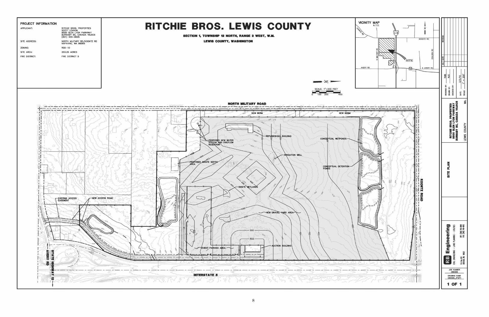
The purpose of this soil evaluation is to determine the type, structure and the depth of suitable soils for a commercial onsite septic system for the proposed Ritchie Brothers Lewis County Auction Facility.
Scope On March 18, 2010, RB Engineering (RBE) conducted two onsite soil evaluations in the area of the proposed septic system drain field. The evaluation included excavating and logging soil properties for suitability of an onsite septic system.
USDA Soil Analysis
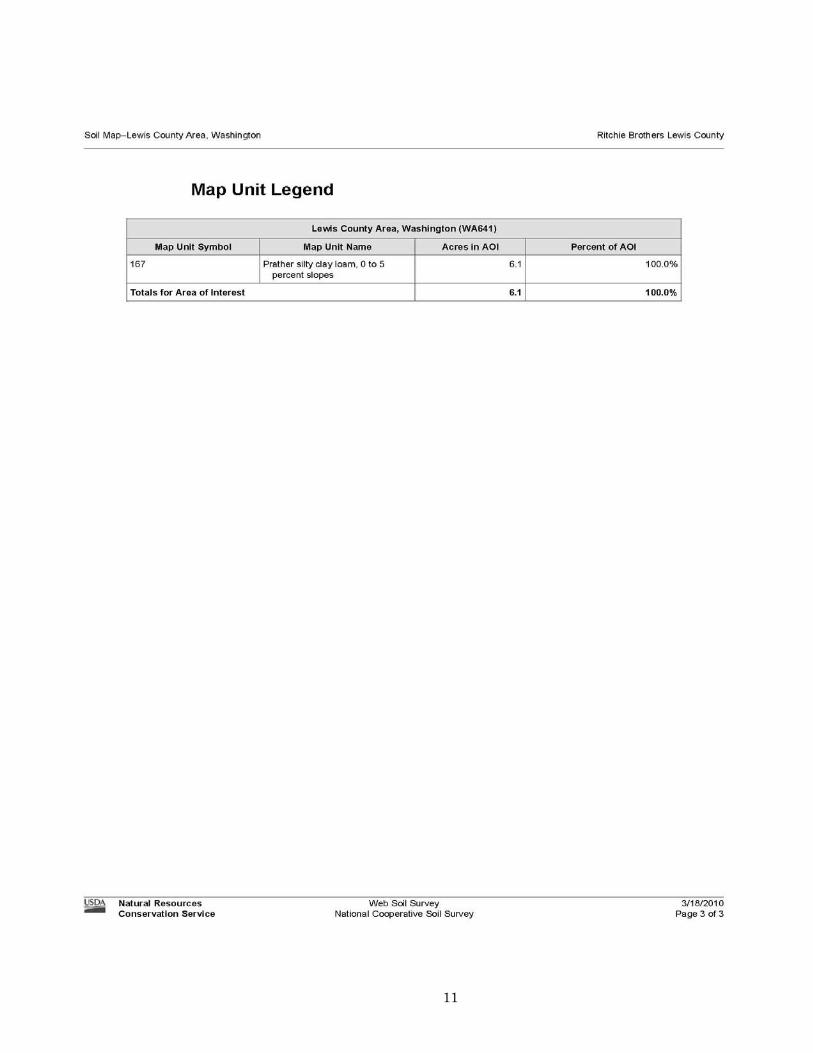
RBE staff reviewed the onsite soils information provided by NRCS. Appendix A includes copies of the site map and soil descriptions that make up the property geology. The site proposed for the septic system consists of Prather silty clay loam. The NRCS data and the onsite soil logs verified this classification.
Method of Evaluation Evaluations of the site were field determined by site topography and required setbacks from site features such as proposed buildings, property lines and wetlands. A total of 2 soil test pits were excavated and evaluated for determining suitability for an onsite septic disposal area. This evaluation analyzes soil properties by depth, texture, structure, color and evidence of any layer or soil horizon restrictive to downward movement of water. This analysis will determine the type of system best suited for this site.
Required Septic System Disposal Method Pressure Distribution Trench with Sand Filter Pre-Treatment This system is needed when the suitable soil depth is not sufficient to provide the required final treatment needed to properly dispose wastewater within the drainfield. Or Mound System An onsite sewage system consisting of a septic tank, pump chamber and mound disposal component. The mound is composed of coarse sand placed on top of native soils with the wastewater dispersal components placed within the mound.
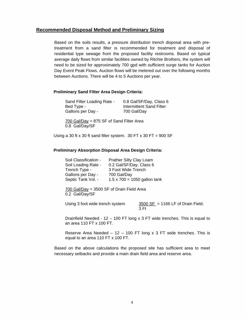
Recommended Disposal Method and Preliminary Sizing
Based on the soils results, a pressure distribution trench disposal area with pre-treatment from a sand filter is recommended for treatment and disposal of residential type sewage from the proposed facility restrooms. Based on typical average daily flows from similar facilities owned by Ritchie Brothers, the system will need to be sized for approximately 700 gpd with sufficient surge tanks for Auction Day Event Peak Flows. Auction flows will be metered out over the following months between Auctions. There will be 4 to 5 Auctions per year. Preliminary Sand Filter Area Design Criteria: Sand Filter Loading Rate - 0.8 Gal/SF/Day, Class 6 Bed Type - Intermittent Sand Filter Gallons per Day - 700 Gal/Day 700 Gal/Day = 875 SF of Sand Filter Area 0.8 Gal/Day/SF
Using a 30 ft x 30 ft sand filter system. 30 FT x 30 FT = 900 SF Preliminary Absorption Disposal Area Design Criteria: Soil Classification - Prather Silty Clay Loam Soil Loading Rate - 0.2 Gal/SF/Day, Class 6 Trench Type - 3 Foot Wide Trench Gallons per Day - 700 Gal/Day Septic Tank Vol. - 1.5 x 700 = 1050 gallon tank 700 Gal/Day = 3500 SF of Drain Field Area 0.2 Gal/Day/SF
Using 3 foot wide trench system 3500 SF = 1166 LF of Drain Field.
3 Ft Drainfield Needed - 12 – 100 FT long x 3 FT wide trenches. This is equal to an area 110 FT x 100 FT. Reserve Area Needed – 12 – 100 FT long x 3 FT wide trenches. This is equal to an area 110 FT x 100 FT.
Based on the above calculations the proposed site has sufficient area to meet necessary setbacks and provide a main drain field area and reserve area.
4

Soil Evaluation Logs Prepared by: Robert Balmelli PE Project Site: Ritchie Brothers Lewis County Date Soils Logged: March 18, 2010 Soil Pit #1
0” - 12” Dark Brown Silt Loam – Friable 12” - 24” Light Brown Silty Clay Loam 24”+ - Light Brown Silty Clay Loam – Fine Mottling Soil Pit #2
0” - 11” Dark Brown Silt Loam – Friable 12” - 25” Light Brown Silty Clay Loam 25”+ - Light Brown Silty Clay Loam – Fine Mottling
5

Appendix A Map of Test Pit Locations Overall Facility Site Plan
NRCS Soil Data
6
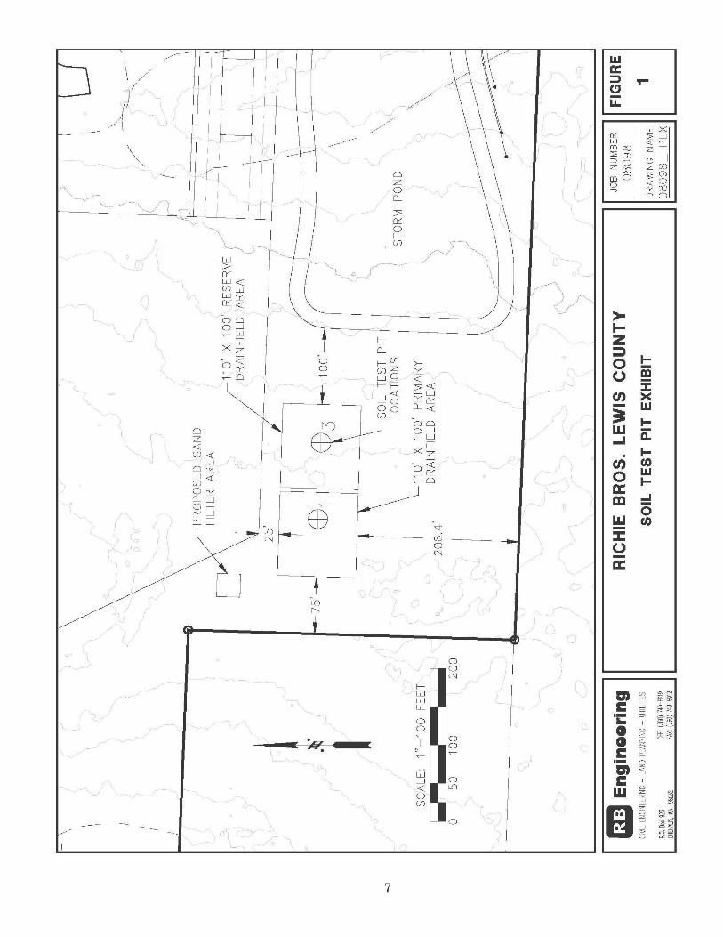
7
8
9
10
11


