SMART CITY SOLUTIONS - Swarco Hellas – First in Traffic ...€¦ · • Using WiFi, Bluetooth,...
17
SMART CITY SOLUTIONS Scalable urban management
Transcript of SMART CITY SOLUTIONS - Swarco Hellas – First in Traffic ...€¦ · • Using WiFi, Bluetooth,...

SMART CITY SOLUTIONSScalable urban management

32
SOLUTIONS FOR SMART CIT IESLet’s improve life in the city
Scalable ITS solutions for your city
Pedestrian and vehicle traffic safety solutions that protect the vulnerable road users in busy cities. How clever.
Smart solutions that use traffic information and data to keep your city running more smoothly. How intelligent.
Mobility solutions that keep traffic flowing and help people to get where they need to be. Now that is smart.
Congestion makes city traffic unpredictable. We provide clever
solutions to manage urban environments. Very smart.
Clever management solutions for more efficient,
environmentally friendly cities. Now that is intelligent.
SMART CITY
MOBILITY
INFORMATION SAFETY
URBAN ENVIRONMENTS
CITY MANAGEMENT

54
P U B L I CT R A N S P O R T
P.9
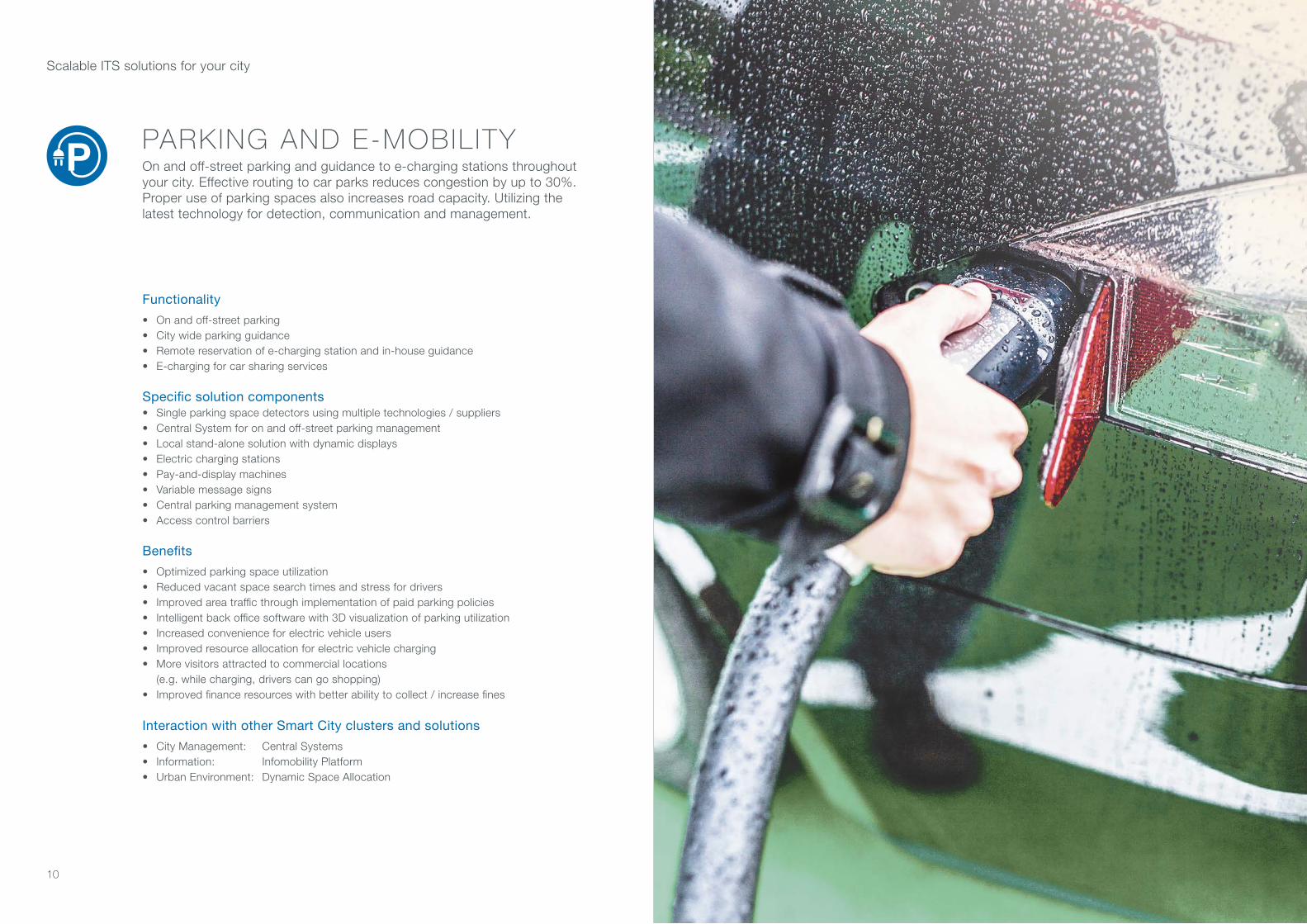
PA R K I N G &E - M O B I L I T Y
P.10
BLUE DATASYSTEM
P.13
DYNAMIC SPACE
P.15
E N V I R O N M E N TA L PAT R O L
P.16
I N T E L L I G E N T S T R E E T L I G H T I N G
P.29
P E R C E P T I V EI N T E R S E C T I O N
P.7
Scalable ITS solutions for your city
SMART CITY
MOBILITY P.6
INFORMATION P.22
SAFETY P.18
URBAN ENVIRONMENTS P.14
CITY MANAGEMENT P.26
C E N T R A LS Y S T E M S
P.27
INTELLIGENT MONITORING
P.19
INFOMOBILITY PLATFORM
P.23
S M A R T C R O S S W A L K
P.20
I N F O R M AT I O N AT P U B L I C S PA C E S
P.25
A CLUSTER OF SOLUTIONS

76
PA R K I N G &E - M O B I L I T Y
P.10
Functionality
• Optimal traffic control• Real-time distinction between vehicle types, cyclists and pedestrians, allows for individual assessment of upcoming traffic light cycles• Detection and response to priority vehicles and operatives• Interaction with C2X
Specific solution components
• Detectors based on: 3D-Radar, number plate recognition, license plate recognition, video, pedestrian actuators, induction loops, environmental sensors• Using WiFi, Bluetooth, RFID• Traffic controller• Central software application
Benefits
• Increased capacity of existing infrastructure• Maximum capacity — minimal investment• Intersection reconstruction can be avoided• Advise drivers on speed, based on traffic light signal forecast• Reduced waiting times and stress for road users• Improved traffic and pedestrian safety• Reduction of harmful emissions• Positive impact on public acceptance and appreciation• Microscopic approach to traffic control strategy
Interaction with other Smart City clusters and solutions
• Safety: Smart Crosswalk• Urban Environment: Intelligent Street Lighting• Mobility: Public Transport / Blue Data Systems
PERCEPTIVE INTERSECTIONReal-time traffic evaluation at intersections gives a clearer view of when to switch traffic lights to red and when to green. Optimizing the green time for traffic signals ensures a more effective traffic flow and safer roads.
P E R C E P T I V EI N T E R S E C T I O N
P.7
BLUE DATA SYSTEM
P.13
P U B L I CT R A N S P O R T
P.9
MOBILITY
Scalable ITS solutions for your city
MOBIL ITY SOLUTIONS THAT KEEP TRAFFIC FLOWING AND HELP PEOPLE GET TO WHERE THEY NEED TO BE. NOW THAT IS SMART.
98
Functionality
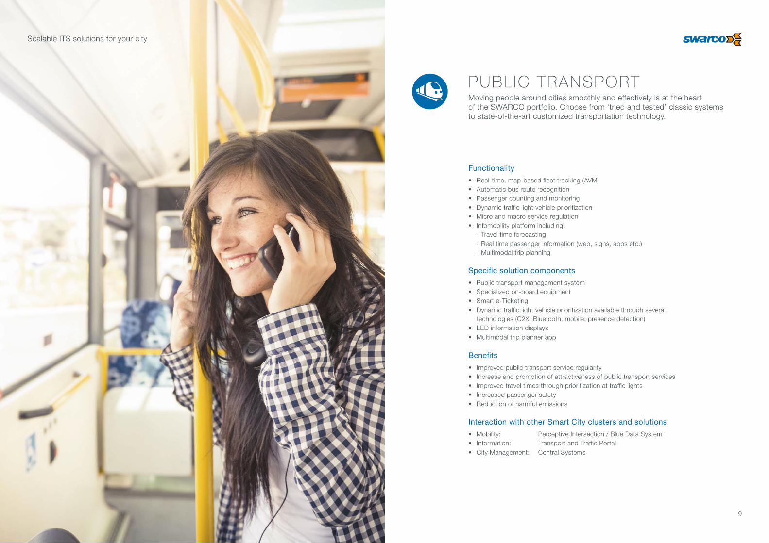
• Real-time, map-based fleet tracking (AVM)• Automatic bus route recognition• Passenger counting and monitoring• Dynamic traffic light vehicle prioritization • Micro and macro service regulation• Infomobility platform including: - Travel time forecasting - Real time passenger information (web, signs, apps etc.) - Multimodal trip planning
Specific solution components
• Public transport management system• Specialized on-board equipment• Smart e-Ticketing• Dynamic traffic light vehicle prioritization available through several technologies (C2X, Bluetooth, mobile, presence detection)• LED information displays• Multimodal trip planner app
Benefits
• Improved public transport service regularity• Increase and promotion of attractiveness of public transport services• Improved travel times through prioritization at traffic lights• Increased passenger safety• Reduction of harmful emissions
Interaction with other Smart City clusters and solutions
• Mobility: Perceptive Intersection / Blue Data System• Information: Transport and Traffic Portal• City Management: Central Systems
PUBLIC TRANSPORTMoving people around cities smoothly and effectively is at the heart of the SWARCO portfolio. Choose from ‘tried and tested’ classic systems to state-of-the-art customized transportation technology.
Scalable ITS solutions for your city
1110
PARKING AND E-MOBIL ITYOn and off-street parking and guidance to e-charging stations throughout your city. Effective routing to car parks reduces congestion by up to 30%. Proper use of parking spaces also increases road capacity. Utilizing the latest technology for detection, communication and management.
Functionality
• On and off-street parking • City wide parking guidance• Remote reservation of e-charging station and in-house guidance• E-charging for car sharing services Specific solution components• Single parking space detectors using multiple technologies / suppliers• Central System for on and off-street parking management• Local stand-alone solution with dynamic displays• Electric charging stations• Pay-and-display machines• Variable message signs• Central parking management system• Access control barriers
Benefits
• Optimized parking space utilization• Reduced vacant space search times and stress for drivers• Improved area traffic through implementation of paid parking policies• Intelligent back office software with 3D visualization of parking utilization• Increased convenience for electric vehicle users• Improved resource allocation for electric vehicle charging• More visitors attracted to commercial locations (e.g. while charging, drivers can go shopping)• Improved finance resources with better ability to collect / increase fines
Interaction with other Smart City clusters and solutions
• City Management: Central Systems• Information: Infomobility Platform• Urban Environment: Dynamic Space Allocation
Scalable ITS solutions for your city

1312
BLUE DATA SYSTEMTraffic and travel data is collected via Bluetooth and WiFi enabled devices. This information can then be used to inform and interact with a variety of traffic control and management solutions.
Functionality
• Travel analysis: - Travel time and speed - Origin — destination - Origin — distribution• Public transport prioritization• Emergency and special vehicles prioritization• Blind pedestrian prioritization• City analysis: - Statistics for the administration - Crowd flow in the urban network - Event economy and trade
Specific solution components
• Bluetooth / WiFi detectors and transmitter• Web-enabled visualization• Various software tools
Benefits
• Own historical data pool• Real-time traffic control and management• Simulations for planning• Independence from global players• Linkable to any other urban data
Interaction with other Smart City clusters and solutions
• City Management: Central Systems• Mobility: Public Transport, Perceptive Intersection• Safety: Smart Crosswalk
Scalable ITS solutions for your city
1514
Functionality
• Re-routing of traffic around the affected zone
• Information to road users
Specific solution components
• Stationary and mobile VMS• Traffic management• Security and locking devices• Parking management
Benefits
• Possibility to easily organize and host on-street public and social events in a predefined city area• Establishment of pollution free zones• Intelligent management and re-routing of traffic• City promotion by deployment of temporary traffic free zones that could attract various social events (like 'The City Breathes')
Interaction with other Smart City clusters and solutions
• City Management: Central Systems• Information: Information Systems in Public Spaces• Urban Environment: Intelligent Street Lighting
E N V I R O N M E N TA L PAT R O L
P.16
DYNAMIC SPACE
P.15
Scalable ITS solutions for your city
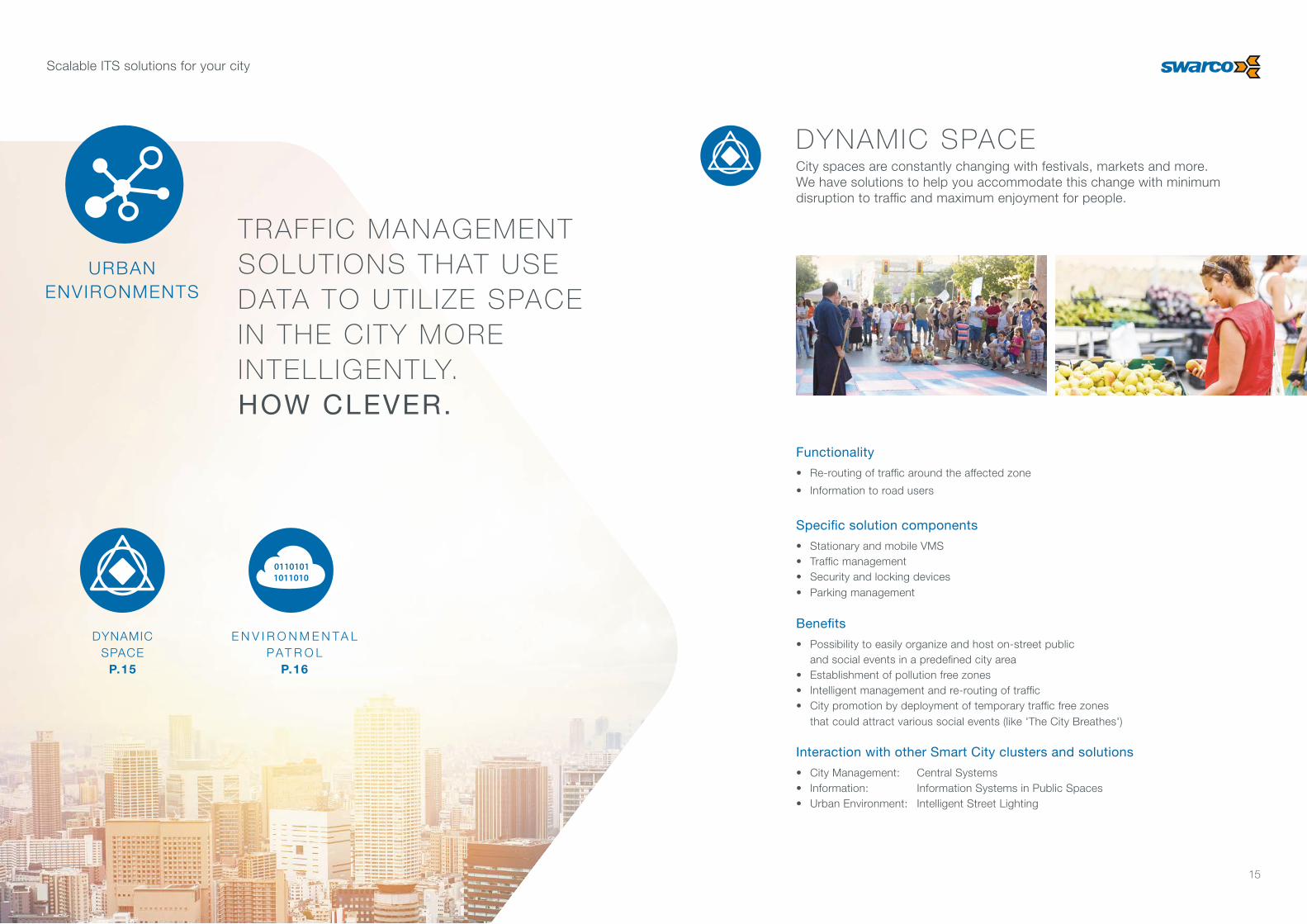
TRAFFIC MANAGEMENT SOLUTIONS THAT USE DATA TO UTIL IZE SPACE IN THE CITY MORE INTELLIGENTLY. HOW CLEVER.
DYNAMIC SPACECity spaces are constantly changing with festivals, markets and more. We have solutions to help you accommodate this change with minimum disruption to traffic and maximum enjoyment for people.
URBAN ENVIRONMENTS

1716
Functionality
• Representation of the environment in a map• Alarm function• Real time emission information• Citizen feedback• Heat maps
Specific solution components
• Environment sensors measurement over the city net: - Temperature - Noise - COx
- NOx
- Fine dust - Rain - Humidity• Precision weather station • Central software for 36-hour forecast
Benefits
• Permanent monitoring of environmental situation• Traffic-related response in relation to the environmental data• 36-hour prognosis for emissions• Early information for citizens• Own historical data
Interaction with other Smart City clusters and solutions
• City Management: Central Systems• Information: Information Systems in Public Spaces
ENVIRONMENTAL PATROLGet real-time air quality updates and 36-hour emission forecasts. A unique opportunity to plan ahead and inform the public if required. Environmental data with a map-based overview.
Scalable ITS solutions for your city

1918
CCTV MONITORINGReal-time image and data capture allow for greater insight into traffic, public areas, and public transport. Increased awareness and decision support for improved public and road safety.
Functionality
• Monitoring of traffic, public areas and public transport• Intelligent real-time video analysis for alarms or triggering of predefined events• Automated detection of incidents, crowd generation and abnormal behaviour• Objects of interest tracking
Specific solution components
• Various CCTV and radar sensors• Software for intelligent video processing in real-time
Benefits
• Reduced strain for operators monitoring video feeds by multiple sources• Increased safety in public areas• Traffic information on vehicle size, model, speed, etc.• Incident prevention• Possibility to integrate external systems to enhance functionalities of additional Smart City clusters
Interaction with other Smart City clusters and solutions
• Mobility: Perceptive Intersection and Public Transport• City Management: Central Systems
S M A R T C R O S S W A L K
P.20
INTELLIGENT MONITORING
P.19
Scalable ITS solutions for your city
MONITORING SOLUTIONS THAT ALLOW FOR TRANSPARENCY AND IMPROVE PEOPLE’S SAFETY. VERY SMART.
SAFETY

2120
Functionality
• Registration of blind or disabled pedestrians at a signalized intersection through centrally registered personal IDs• Monitoring of crosswalk zone and adjustment of signals in case of slower moving or disabled pedestrians• Visual warnings of pedestrians for approaching cars, trams or other city rail transport on crossings• Registration of children at traffic lights near schools• Interactive push-buttons with integrated display for various types of information
Specific solution components
• Traffic detectors• People and bicycle detectors• Environmental sensors• Bluetooth and WiFi sensors• RFID tags and readers• LED road markers• Push-buttons with integrated touch-screen LCD display
Benefits
• Increased pedestrian safety• Increased convenience for blind and disabled pedestrians• Increased safety at traffic lights near schools• Interactive public information announcement on smart push-buttons• High public appreciation
Interaction with other Smart City clusters and solutions
• Mobility: Perceptive Intersection / Blue Data System• Information: Information Systems in Public Spaces
SMART CROSSWALKMore intelligent ways to help people cross the road. The blind, disabled people, and children can all benefit from smarter, safer, customizable pedestrian crossings.
Scalable ITS solutions for your city

2322
INFOMOBIL ITYDetailed interactive information for people travelling in your city. Sharing knowledge on traffic, parking, emissions, e-charging, trip planning and much more across platforms and apps.
Functionality
• Platform based on big data processing • Smart mobile / web apps for: - Real time traffic information - Multimodal trip planner - Citizen feedback - Parking and e-charging - Emissions - Special events
Specific solution components
• Smart mobile / web apps• Central software for big data processing
Benefits
• Improved travel convenience through traffic and passenger information• Multimodal route planning• Park-and-ride planning• 36-hour prognosis on emissions and early announcement possible• City promotion through Smart Mobility apps• “Citizens as sensors” for city infrastructure status
Interaction with other Smart City clusters and solutions
• City Management: Central Systems• Information: Infomobility Platform
I N F O R M AT I O N AT P U B L I C S PA C E S
P.25
INFOMOBILITY PLATFORM
P.23
Scalable ITS solutions for your city
TRAFFIC PLATFORMS THAT SHARE USEFUL REAL-T IME INFORMATION WITH THE PEOPLE IN YOUR CITY. THAT’S INTELLIGENT.
INFORMATION

2524
Functionality
• Information dissemination on: - Traffic and travel - Warnings and advisory notices - Events, announcements, news, promotions, etc - Parking status• At various public spaces: - On the road - Onboard public transport vehicles - Public transport stops/terminals - Pedestrian zones - Airport, train station, harbor - Car parks
Specific solution components
• Public information displays and VMS• Content management systems
Benefits
• Improved public awareness of city-specific information• Improved travel convenience through traffic and passenger information• Overall enhancement of mobility within the city• Wide public access to warnings and advisory notices• Promotion of social or commercial events
Interaction with other Smart City clusters and solutions
• City Management: Central Systems• Information: Infomobility Platform
PUBLIC INFORMATIONSharing information is key to keeping people in cities informed. Intelligent communication of warnings and updates helps save time, avoid frustration, and simplify everyday life.
Scalable ITS solutions for your city

2726
Functionality
• Processing of new data sources in the analysis• More refined analysis• Cooperation of various systems - traffic, parking, highways• Observation and study of crowd flows to optimize traffic planning and steering
Specific solution components
• Central system software• Powerful communications system• Qualified privacy safeguards• Use of IoT data• Use of sources like: IoT, FCD, Bluetooth, WiFi, 3rd party traffic data suppliers, V2I interface, environmental data, mobile application
Benefits
• Better overview of urban interrelations• Provides information to various departments of a city• Optimized capacity of existing city infrastructure• New city services for the customer available with PaaS and a City Dashboard• Harmonized individual and fleet transport, public transport, and parking• Reduced waiting times and stress for road users• Improved time to destination• Reduced harmful emissions• Approach for traffic control and steering strategy
Interaction with other Smart City clusters and solutions
• All Clusters
CENTRALSYSTEMS
P.27
Scalable ITS solutions for your city
TOOLS FOR THE MANAGEMENT OF YOUR CITY. PROCESSING, ANALYSING, AND OPTIMIZ ING. TO HELP TRAFFIC FLOW SMOOTHLY. HOW CLEVER.
CENTRAL SYSTEMSIntelligent overarching control systems that collect traffic data, record, analyze, refine and optimize. To steer traffic, improve parking space availability, maintain highway harmony and much more.
I N T E L L I G E N TS T R E E T L I G H T I N G
P.29
CITY MANAGEMENT

2928
Functionality
• Intelligent street lighting according to night schedule traffic density, environmental conditions and incidents that may occur• Remote control of luminaires over powerline or wireless link• Centralized management through street lighting software
Specific solution components
• State-of-the-art LED luminaires with high energy efficiency and integrated smart management functionalities• Node controllers• Multiple sensor technology• Completely encrypted user sessions
Benefits
• Increased residential comfort and safety during night hours• Improved traffic safety due to light intensity regulation according to traffic or visibility conditions• Significant energy savings by efficient LED technology and intelligent dimming• State-of-the-art luminaires with unique design• Real-time information, issue tracking, and error reporting• Compatible with all relevant interfaces to the luminaires from multiple suppliers
Interaction with other Smart City clusters and solutions
• City Management: Central Systems• Mobility: Perceptive Intersection• Safety: CCTV Monitoring
INTELLIGENT STREET L IGHTING Our intelligent solutions allow you to manage, monitor, and control city lighting remotely. Providing better lit, more attractive and safer public spaces for everyone.
Scalable ITS solutions for your city

30
SOLUTIONS FOR SMART CIT IESLet’s improve life in the city

© 1/2017 SWARCO
SWARCO | FIRST IN TRAFFIC SOLUTIONS.
SWARCO is a growing international group providing a complete range of products, systems, services and solutions for road safety and intelligent traffic management.
With almost five decades of experience in the industry, the corporation supports the growing mobility needs of society with turnkey systems and solutions in road marking, urban and interurban traffic control, parking, public transport, infomobility and street lighting. Cooperative systems, V2I communication, electromobility, and integrated software solutions for Smart City are the latest, future-oriented fields in the group’s portfolio.
www.swarco.com