Shipwrecked Adventure The History of Ships and Navigation Adapted from Shipwrecked Island Adventure!
19
Shipwrecked Adventure Shipwrecked Adventure The History of Ships and Navigation Adapted from Shipwrecked Island Adventure! http://oncampus.richmond.edu/academics/education/projects/webquests/ shipwreck/ to meet the needs of our 2nd graders. QuickTime TIFF (Uncom are needed QuickTi TIFF (Unc are neede QuickTim TIFF (Uncom are needed QuickTi TIFF (Unc are neede QuickTim TIFF (Uncom are needed
-
Upload
lily-haynes -
Category
Documents
-
view
237 -
download
0
Transcript of Shipwrecked Adventure The History of Ships and Navigation Adapted from Shipwrecked Island Adventure!

Shipwrecked AdventureShipwrecked Adventure
The History of Ships and Navigation
Adapted from Shipwrecked Island Adventure! http://oncampus.richmond.edu/academics/education/projects/webquests/shipwreck/
to meet the needs of our 2nd graders.
QuickTime™ and aTIFF (Uncompressed) decompressorare needed to see this picture.QuickTime™ and aTIFF (Uncompressed) decompressorare needed to see this picture.QuickTime™ and aTIFF (Uncompressed) decompressorare needed to see this picture. QuickTime™ and aTIFF (Uncompressed) decompressorare needed to see this picture.
QuickTime™ and aTIFF (Uncompressed) decompressorare needed to see this picture.
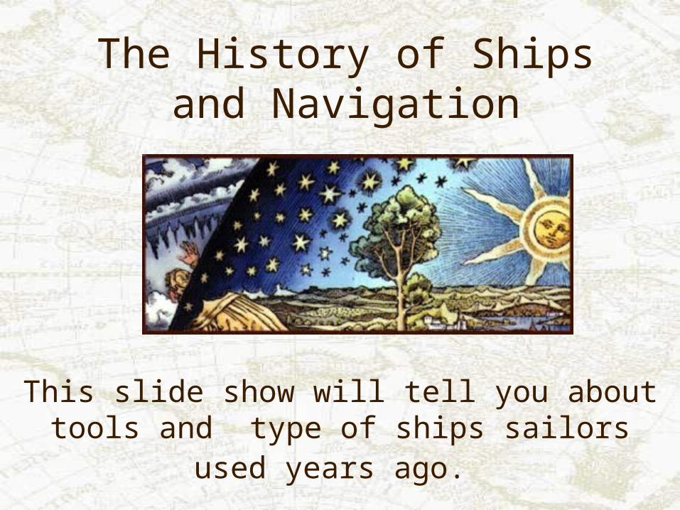
The History of Ships and Navigation
This slide show will tell you about tools and type of ships sailors used years ago.

Sailors of Ancient Times
Egyptians were sailing as early as 2750 B.C. Greek sailors were learning more about India and England through wars and trading. Arabian, Chinese, and other cultures were also doing exploring and mapping before the European discoveries began.

Early Ship Building Techniques
• Ancient ship builders used three patterns to cut shapes from wood. This was called moulding.
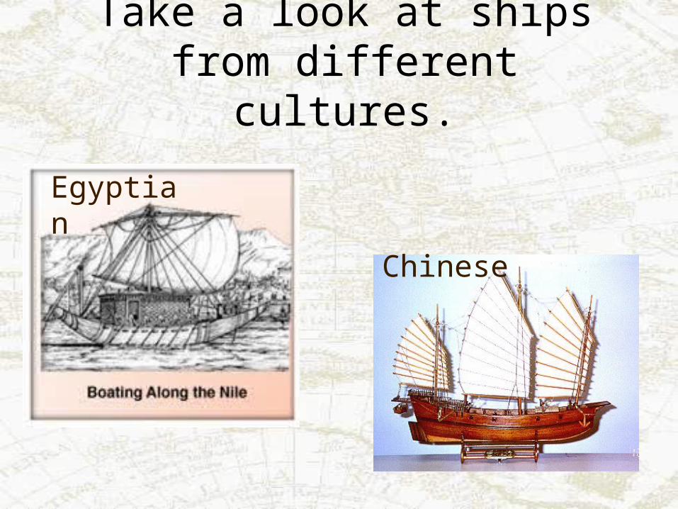
Take a look at ships from different cultures.
Egyptian
Chinese

More ships from ancient cultures
Can you imagine getting on one of these ships and heading out far into the ocean?
Viking
Greek

Sailors didn’t even have good tools to tell where they were going!
Look at these old charts. They were not very accurate. No wonder ships often
sailed off course!

Sailors used nature to help them figure out their location.
Animals like whales and birds let sailors know they were close to land.
QuickTime™ and aTIFF (Uncompressed) decompressor
are needed to see this picture.
QuickTime™ and aTIFF (Uncompressed) decompressorare needed to see this picture.
QuickTime™ and aTIFF (Uncompressed) decompressorare needed to see this picture.
QuickTime™ and aTIFF (Uncompressed) decompressorare needed to see this picture.
The sun, moon and stars helped sailors find their location.
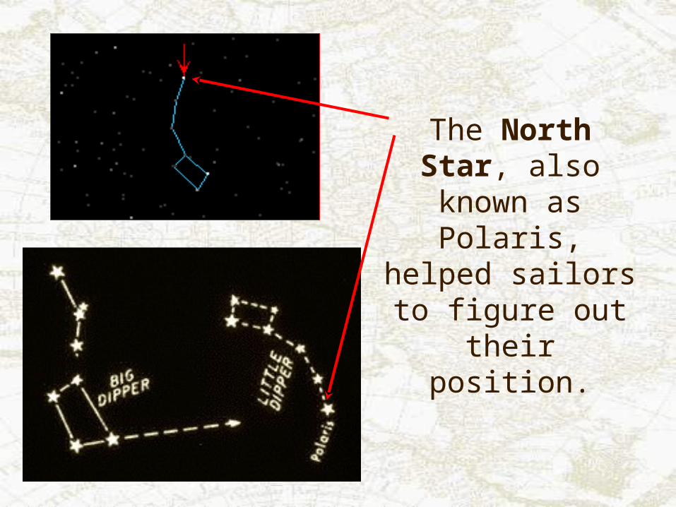
The North Star, also known as Polaris, helped sailors to figure
out their position.
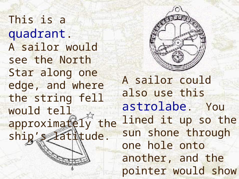
This is a quadrant.A sailor would see the North Star along one edge, and where the string fell would tell approximately the ship’s latitude.
A sailor could also use this astrolabe. You lined it up so the sun shone through one hole onto another, and the pointer would show your latitude.
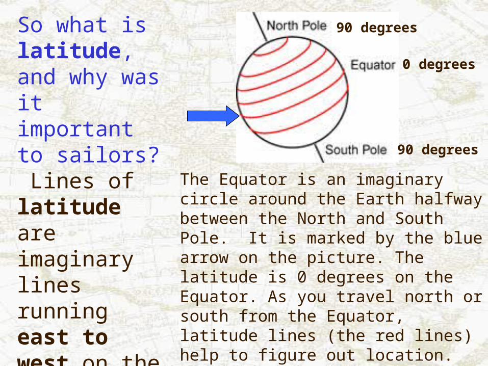
So what is latitude, and why was it important to sailors? Lines of latitude are imaginary lines running east to west on the Earth’s surface.
The Equator is an imaginary circle around the Earth halfway between the North and South Pole. It is marked by the blue arrow on the picture. The latitude is 0 degrees on the Equator. As you travel north or south from the Equator, latitude lines (the red lines) help to figure out location.
0 degrees
90 degrees
90 degrees
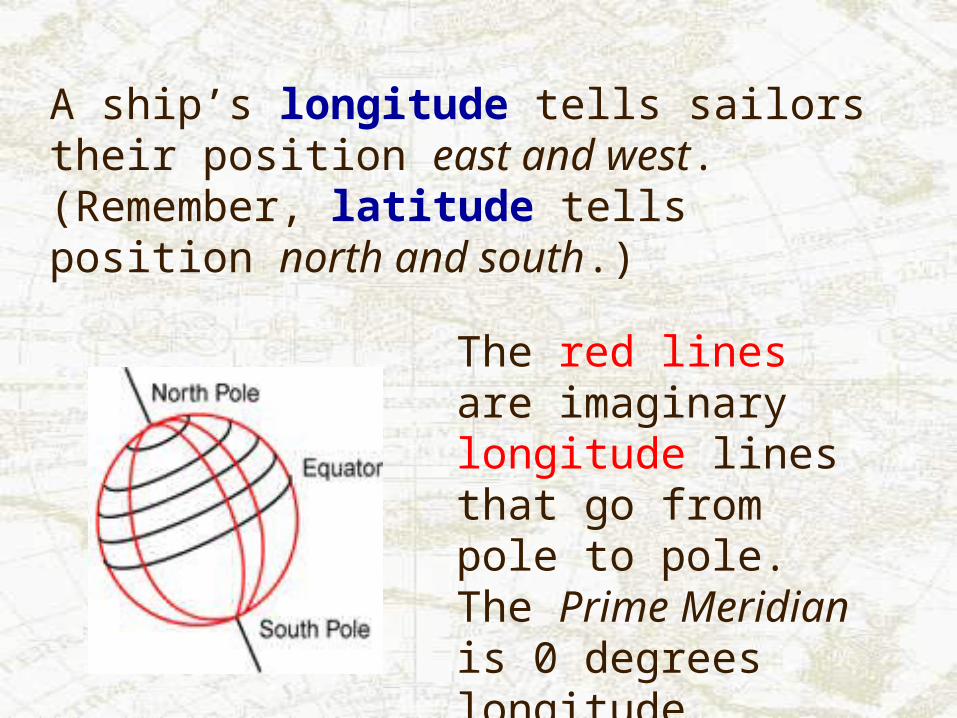
A ship’s longitude tells sailors their position east and west. (Remember, latitude tells position north and south.)
The red lines are imaginary longitude lines that go from pole to pole. The Prime Meridian is 0 degrees longitude.

In 1764, John Harrison created a very accurate chronometer (clock) that would keep time at sea. Finally sailors had a tool to measure longitude at sea

So why were navigators trying to sail anywhere far in the first place?
Why were they willing to risk their life through storms, flimsy ships, and bad maps?
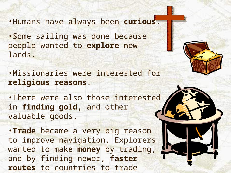
•Humans have always been curious.
•Some sailing was done because people wanted to explore new lands. •Missionaries were interested for religious reasons.
•There were also those interested in finding gold, and other valuable goods. K
•Trade became a very big reason to improve navigation. Explorers wanted to make money by trading, and by finding newer, faster routes to countries to trade with.

Well mates, we’ve seen that sailors have made progress over time. They have developed and perfected their tools and skills. We can always learn more from these ancient cultures.
It’s time to put all you’ve learned to the test and see if your investigation can find the shipwrecked sailor and help the Coast Guard rescue him. Good luck!

References
Text and Images From:
Boat Safe Kids:The History of Navigation.[Online] 7 April 2000http://www.boatsafe.com/kids/navigation.htmCopyright Nautical KnowHow Inc., Stuart, FL 1998
European Voyages of Exploration.[Online] 7 April 2000 http://www.acs.ucalgary.ca/HIST/tutor/eurvoya/Know.htmlCopyright The Applied History Research Group, The University of Calgary 1997

References ContinuedLatitude:The Art and Science of Fifteenth Century Navigation.[Online] 4 April 2000http://www.ruf.rice.edu/~feegi/
Polaris.[Online] 7 April 2000http://einstein.stcloudstate.edu/Dome/constellns/polaris.html
Ships of Discovery Research.[Online 4 April 2000http://einstein.stcloudstate.edu/Dome/constellns/polaris.html
References ContinuedThe Columbus Navigation Homepage.[Online] 3 April 2000http://steggy.minn.net/~keithp/index.htmCopyright Keith A. Pickering, Watertown, MS 2000
The Mariners’ Museum: The Age of Exploration Curriculum Guide.[Online] 3 April 2000http://www.mariner.org/age/menu.htmlCopyright The Mariners’ Museum, Newport News, VA 1999
Voyage to Puna Ridge: Science Factoids.[Online] 4 April 2000http://www.punaridge.org/doc/factoids/Default.htmPortions Copyright Woods Hole Oceanographic Institution 1998