SFWMD Land Use Assessment 2013 · SFWMD Land Use Assessment 2013 ... through donation in 1973....
17
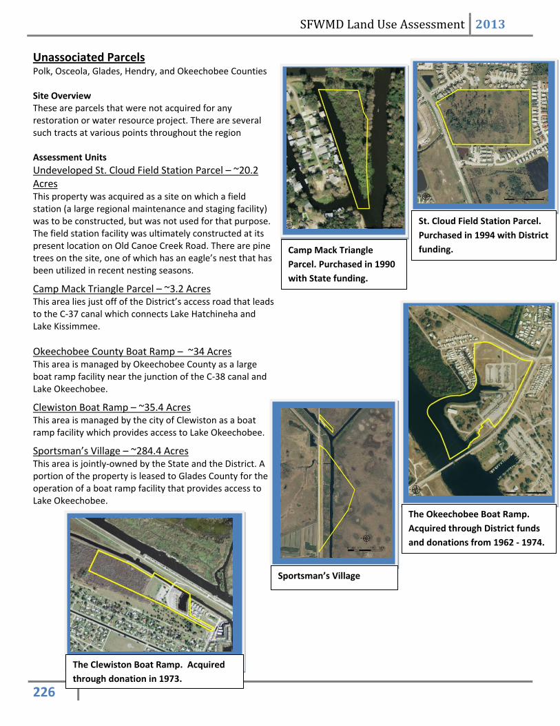
SFWMD Land Use Assessment 2013 226 Unassociated Parcels Polk, Osceola, Glades, Hendry, and Okeechobee Counties Site Overview These are parcels that were not acquired for any restoration or water resource project. There are several such tracts at various points throughout the region Assessment Units Undeveloped St. Cloud Field Station Parcel – ~20.2 Acres This property was acquired as a site on which a field station (a large regional maintenance and staging facility) was to be constructed, but was not used for that purpose. The field station facility was ultimately constructed at its present location on Old Canoe Creek Road. There are pine trees on the site, one of which has an eagle’s nest that has been utilized in recent nesting seasons. Camp Mack Triangle Parcel – ~3.2 Acres This area lies just off of the District’s access road that leads to the C-37 canal which connects Lake Hatchineha and Lake Kissimmee. Okeechobee County Boat Ramp – ~34 Acres This area is managed by Okeechobee County as a large boat ramp facility near the junction of the C-38 canal and Lake Okeechobee. Clewiston Boat Ramp – ~35.4 Acres This area is managed by the city of Clewiston as a boat ramp facility which provides access to Lake Okeechobee. Sportsman’s Village – ~284.4 Acres This area is jointly-owned by the State and the District. A portion of the property is leased to Glades County for the operation of a boat ramp facility that provides access to Lake Okeechobee. St. Cloud Field Station Parcel. Purchased in 1994 with District funding. Camp Mack Triangle Parcel. Purchased in 1990 with State funding. The Okeechobee Boat Ramp. Acquired through District funds and donations from 1962 - 1974. The Clewiston Boat Ramp. Acquired through donation in 1973. Sportsman’s Village
-
Upload
dangkhuong -
Category
Documents
-
view
219 -
download
0
Transcript of SFWMD Land Use Assessment 2013 · SFWMD Land Use Assessment 2013 ... through donation in 1973....
SFWMD Land Use Assessment 2013
226
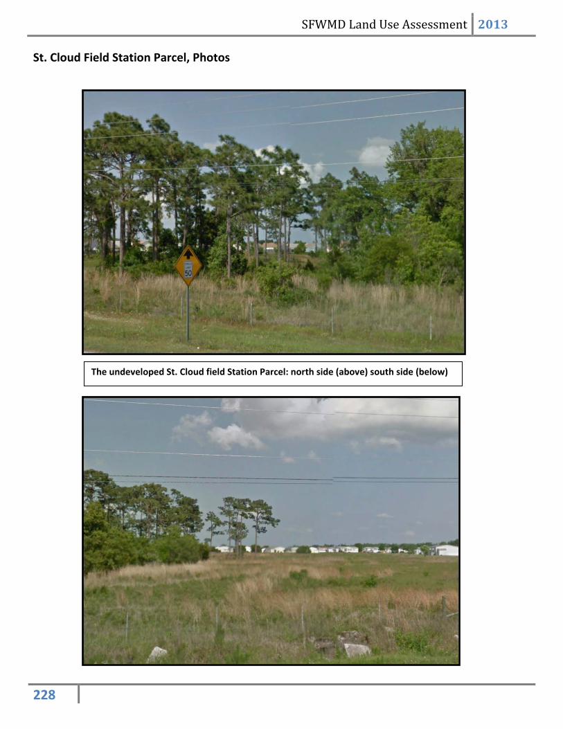
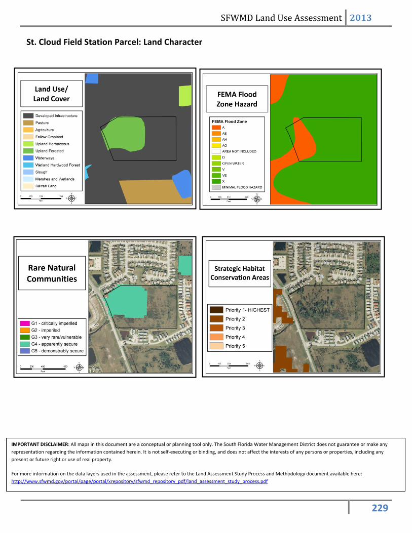
Unassociated Parcels Polk, Osceola, Glades, Hendry, and Okeechobee Counties Site Overview These are parcels that were not acquired for any restoration or water resource project. There are several such tracts at various points throughout the region Assessment Units Undeveloped St. Cloud Field Station Parcel – ~20.2 Acres This property was acquired as a site on which a field station (a large regional maintenance and staging facility) was to be constructed, but was not used for that purpose. The field station facility was ultimately constructed at its present location on Old Canoe Creek Road. There are pine trees on the site, one of which has an eagle’s nest that has been utilized in recent nesting seasons.
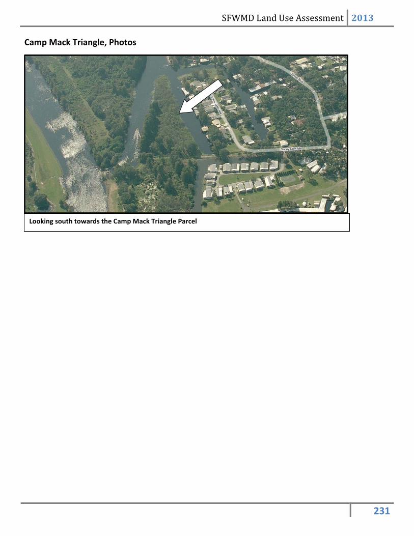
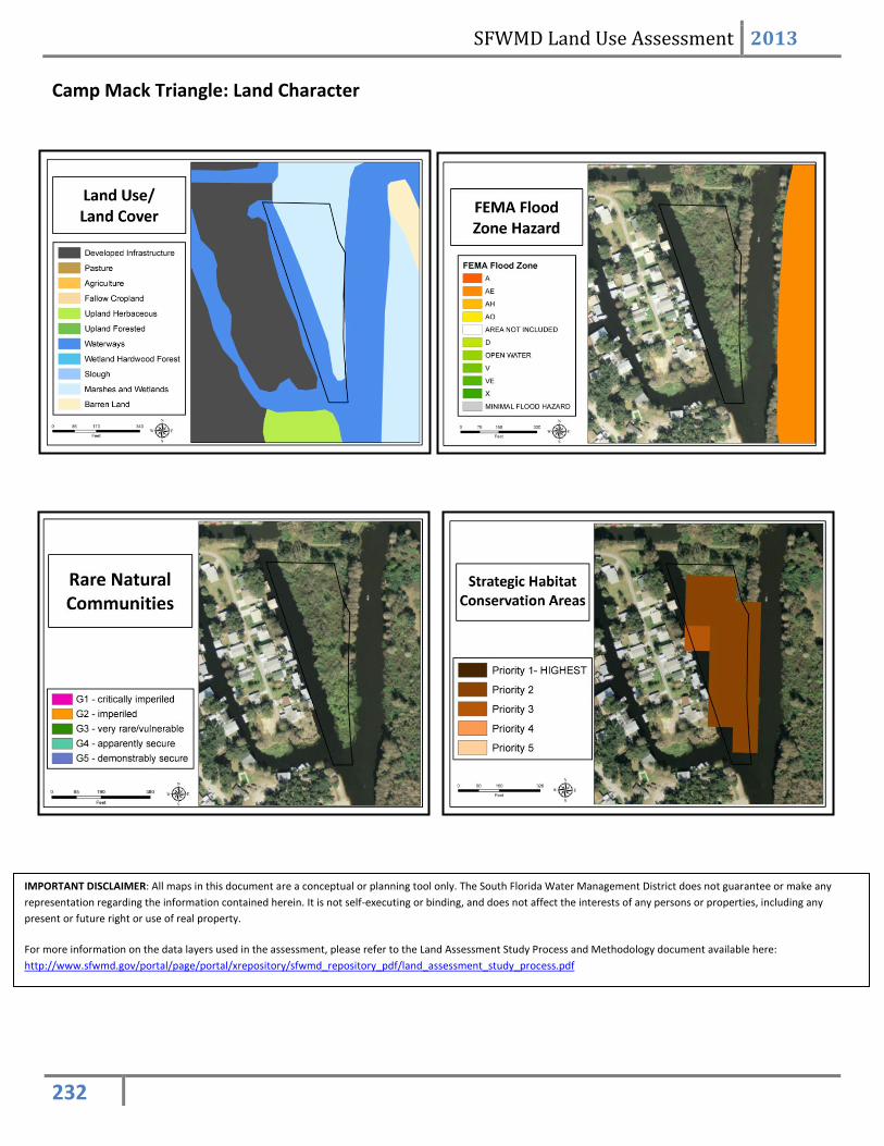
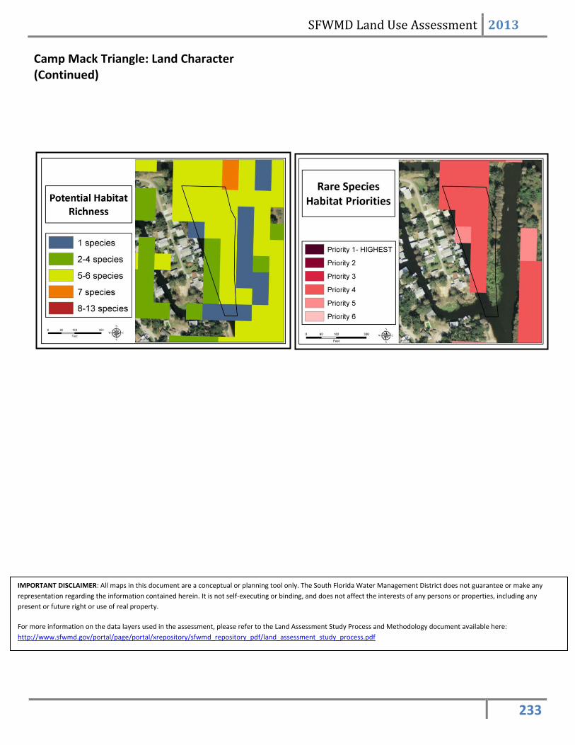
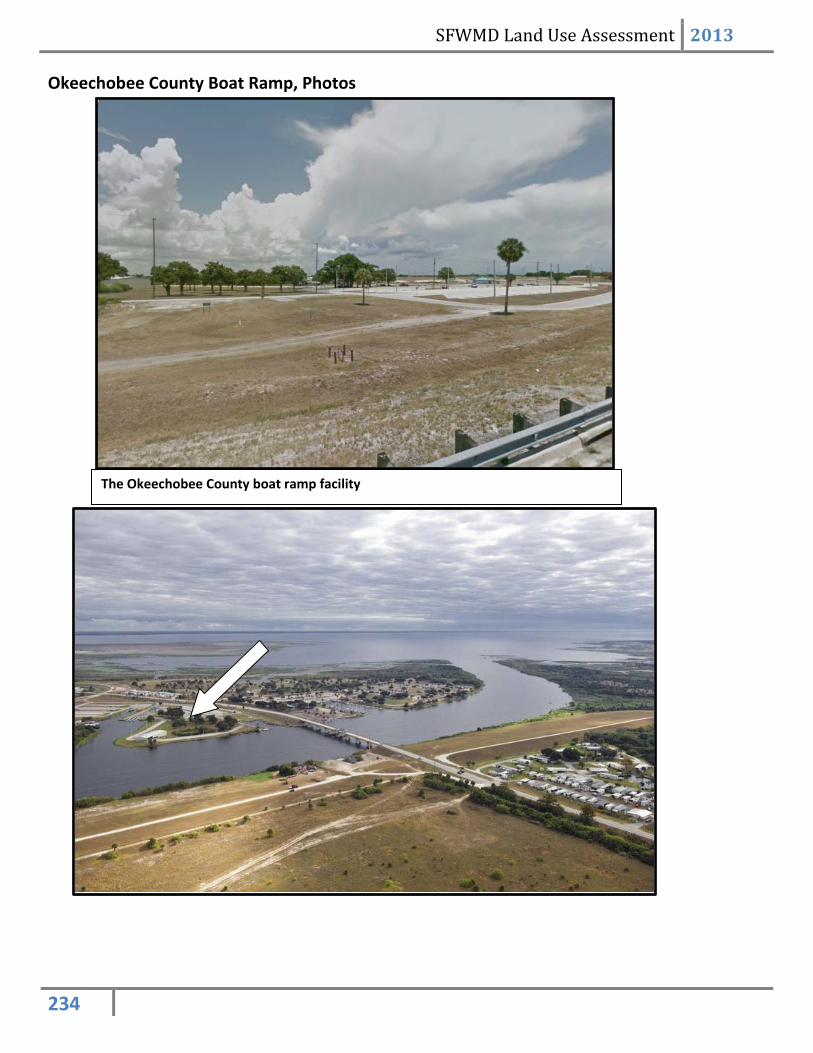
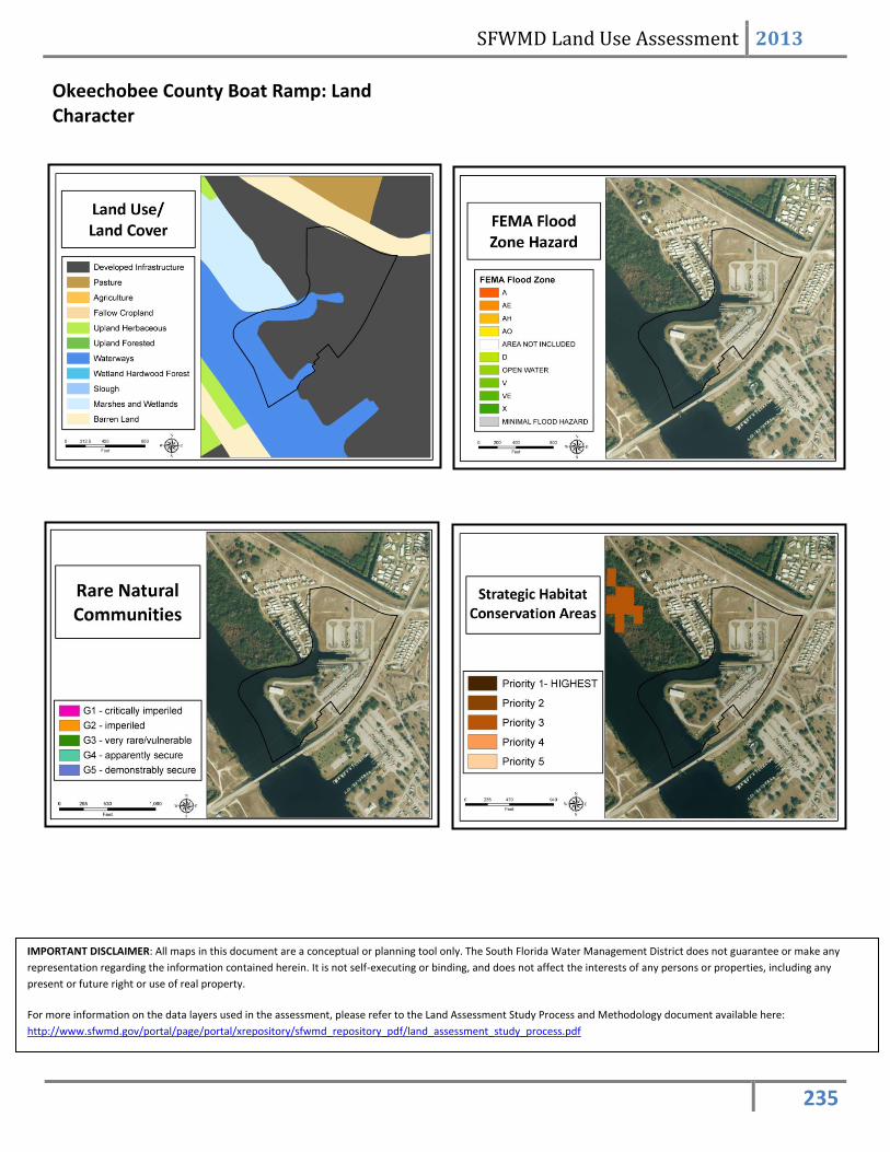
Camp Mack Triangle Parcel – ~3.2 Acres This area lies just off of the District’s access road that leads to the C-37 canal which connects Lake Hatchineha and Lake Kissimmee. Okeechobee County Boat Ramp – ~34 Acres This area is managed by Okeechobee County as a large boat ramp facility near the junction of the C-38 canal and Lake Okeechobee.
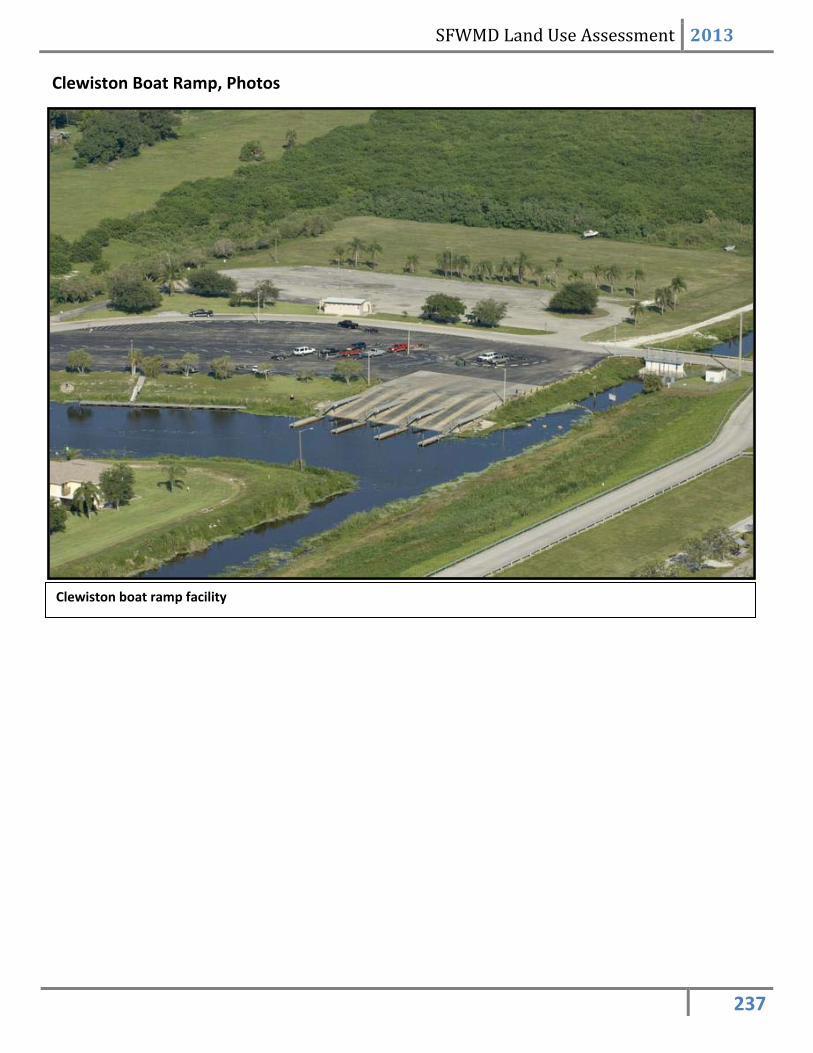
Clewiston Boat Ramp – ~35.4 Acres This area is managed by the city of Clewiston as a boat ramp facility which provides access to Lake Okeechobee.
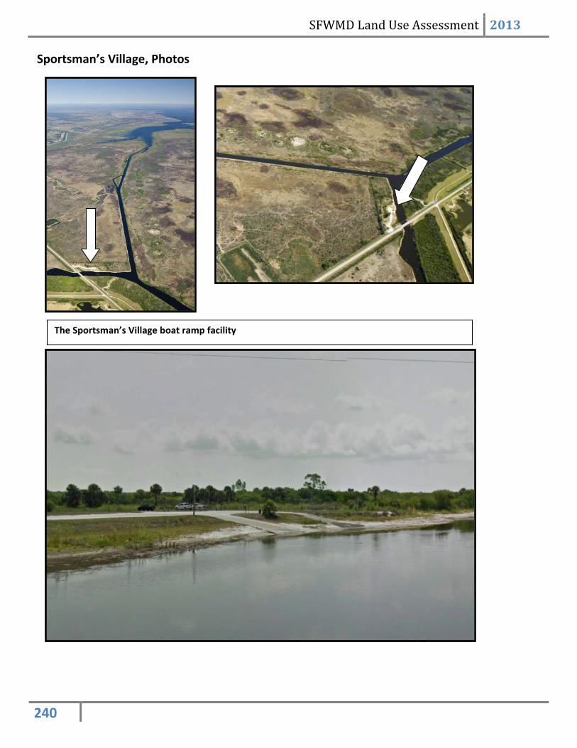
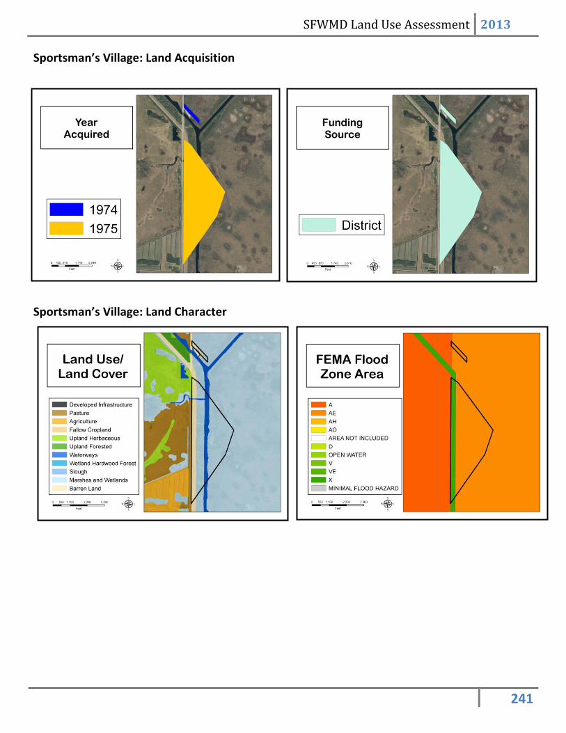
Sportsman’s Village – ~284.4 Acres This area is jointly-owned by the State and the District. A portion of the property is leased to Glades County for the operation of a boat ramp facility that provides access to Lake Okeechobee.
St. Cloud Field Station Parcel. Purchased in 1994 with District funding. Camp Mack Triangle
Parcel. Purchased in 1990 with State funding.
The Okeechobee Boat Ramp. Acquired through District funds and donations from 1962 - 1974.
The Clewiston Boat Ramp. Acquired through donation in 1973.
Sportsman’s Village
SFWMD Land Use Assessment 2013
227
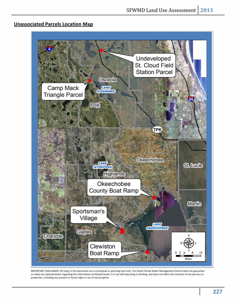
Unassociated Parcels Location Map
IMPORTANT DISCLAIMER: All maps in this document are a conceptual or planning tool only. The South Florida Water Management District does not guarantee or make any representation regarding the information contained herein. It is not self-executing or binding, and does not affect the interests of any persons or properties, including any present or future right or use of real property.
SFWMD Land Use Assessment 2013
228
St. Cloud Field Station Parcel, Photos
The undeveloped St. Cloud field Station Parcel: north side (above) south side (below)
SFWMD Land Use Assessment 2013
229
St. Cloud Field Station Parcel: Land Character
IMPORTANT DISCLAIMER: All maps in this document are a conceptual or planning tool only. The South Florida Water Management District does not guarantee or make any representation regarding the information contained herein. It is not self-executing or binding, and does not affect the interests of any persons or properties, including any present or future right or use of real property.
For more information on the data layers used in the assessment, please refer to the Land Assessment Study Process and Methodology document available here: http://www.sfwmd.gov/portal/page/portal/xrepository/sfwmd_repository_pdf/land_assessment_study_process.pdf
SFWMD Land Use Assessment 2013
230
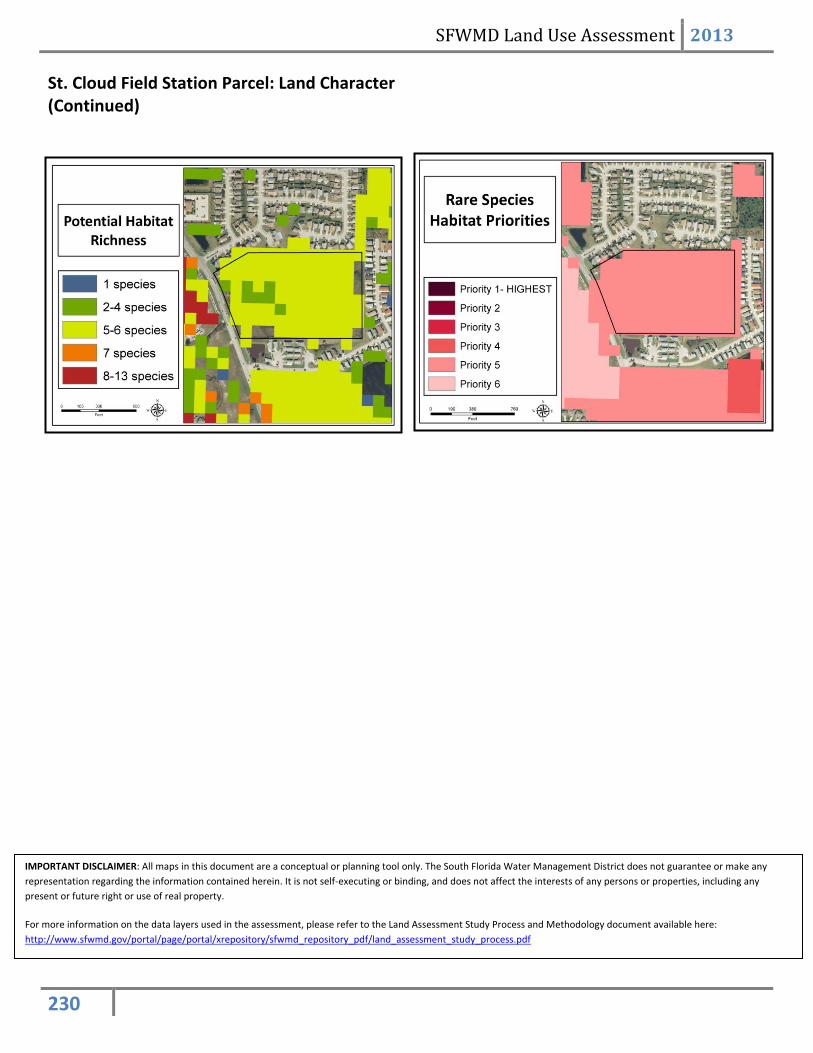
St. Cloud Field Station Parcel: Land Character (Continued)
IMPORTANT DISCLAIMER: All maps in this document are a conceptual or planning tool only. The South Florida Water Management District does not guarantee or make any representation regarding the information contained herein. It is not self-executing or binding, and does not affect the interests of any persons or properties, including any present or future right or use of real property.
For more information on the data layers used in the assessment, please refer to the Land Assessment Study Process and Methodology document available here: http://www.sfwmd.gov/portal/page/portal/xrepository/sfwmd_repository_pdf/land_assessment_study_process.pdf
SFWMD Land Use Assessment 2013
231
Camp Mack Triangle, Photos
Looking south towards the Camp Mack Triangle Parcel
SFWMD Land Use Assessment 2013
232
Camp Mack Triangle: Land Character
IMPORTANT DISCLAIMER: All maps in this document are a conceptual or planning tool only. The South Florida Water Management District does not guarantee or make any representation regarding the information contained herein. It is not self-executing or binding, and does not affect the interests of any persons or properties, including any present or future right or use of real property.
For more information on the data layers used in the assessment, please refer to the Land Assessment Study Process and Methodology document available here: http://www.sfwmd.gov/portal/page/portal/xrepository/sfwmd_repository_pdf/land_assessment_study_process.pdf
SFWMD Land Use Assessment 2013
233
Camp Mack Triangle: Land Character (Continued)
IMPORTANT DISCLAIMER: All maps in this document are a conceptual or planning tool only. The South Florida Water Management District does not guarantee or make any representation regarding the information contained herein. It is not self-executing or binding, and does not affect the interests of any persons or properties, including any present or future right or use of real property.
For more information on the data layers used in the assessment, please refer to the Land Assessment Study Process and Methodology document available here: http://www.sfwmd.gov/portal/page/portal/xrepository/sfwmd_repository_pdf/land_assessment_study_process.pdf
SFWMD Land Use Assessment 2013
234
Okeechobee County Boat Ramp, Photos
The Okeechobee County boat ramp facility
SFWMD Land Use Assessment 2013
235
Okeechobee County Boat Ramp: Land Character
IMPORTANT DISCLAIMER: All maps in this document are a conceptual or planning tool only. The South Florida Water Management District does not guarantee or make any representation regarding the information contained herein. It is not self-executing or binding, and does not affect the interests of any persons or properties, including any present or future right or use of real property.
For more information on the data layers used in the assessment, please refer to the Land Assessment Study Process and Methodology document available here: http://www.sfwmd.gov/portal/page/portal/xrepository/sfwmd_repository_pdf/land_assessment_study_process.pdf
SFWMD Land Use Assessment 2013
236
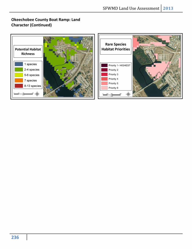
Okeechobee County Boat Ramp: Land Character (Continued)
SFWMD Land Use Assessment 2013
237
Clewiston Boat Ramp, Photos
Clewiston boat ramp facility
SFWMD Land Use Assessment 2013
238
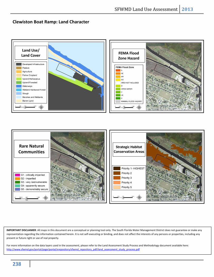
Clewiston Boat Ramp: Land Character
IMPORTANT DISCLAIMER: All maps in this document are a conceptual or planning tool only. The South Florida Water Management District does not guarantee or make any representation regarding the information contained herein. It is not self-executing or binding, and does not affect the interests of any persons or properties, including any present or future right or use of real property.
For more information on the data layers used in the assessment, please refer to the Land Assessment Study Process and Methodology document available here: http://www.sfwmd.gov/portal/page/portal/xrepository/sfwmd_repository_pdf/land_assessment_study_process.pdf
SFWMD Land Use Assessment 2013
239
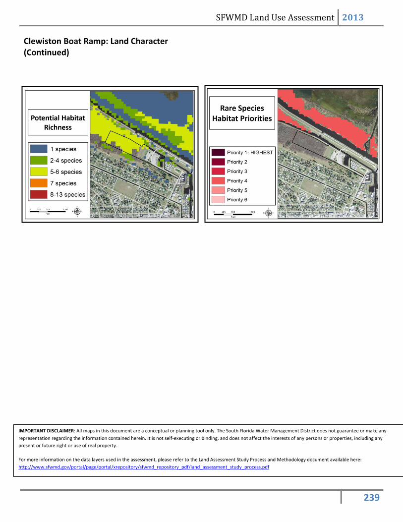
Clewiston Boat Ramp: Land Character (Continued)
IMPORTANT DISCLAIMER: All maps in this document are a conceptual or planning tool only. The South Florida Water Management District does not guarantee or make any representation regarding the information contained herein. It is not self-executing or binding, and does not affect the interests of any persons or properties, including any present or future right or use of real property.
For more information on the data layers used in the assessment, please refer to the Land Assessment Study Process and Methodology document available here: http://www.sfwmd.gov/portal/page/portal/xrepository/sfwmd_repository_pdf/land_assessment_study_process.pdf
SFWMD Land Use Assessment 2013
240
Sportsman’s Village, Photos
The Sportsman’s Village boat ramp facility
SFWMD Land Use Assessment 2013
241
Sportsman’s Village: Land Acquisition
Sportsman’s Village: Land Character
SFWMD Land Use Assessment 2013
242
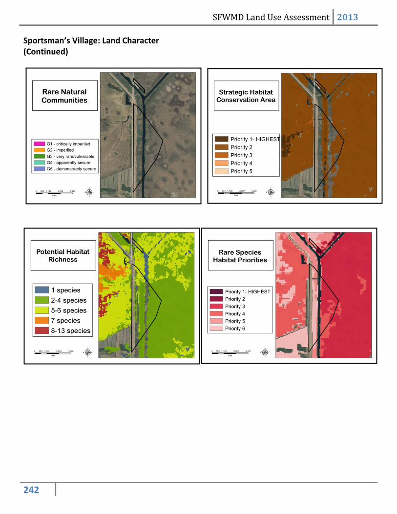
Sportsman’s Village: Land Character (Continued)