SENT VIA FEDEX - Maine · Ed Buzzell, Elizabeth Caruso, Greg Caruso, Roger Merchant, Justin...
66
Offices in Concord, New Hampshire and Portland, Maine 3 Maple Street, Concord, NH 03301 • nhlandlaw.com March 25, 2019 SENT VIA FEDEX Jim Beyer, Regional Licensing and Compliance Manager Bureau of Land Resources Maine Department of Environmental Protection 106 Hogan Road Suite 6, 3 rd Floor Bangor, Maine 04401 Bill Hinkel, Permitting and Compliance Regional Supervisor Land Use Planning Commission Department of Agriculture, Conservation and Forestry 22 State House Station 18 Elkins Lane Augusta, Maine 04330 Re: Central Maine Power Company’s New England Clean Energy Connect Project Dear Messrs. Beyer and Hinkel, Enclosed are Group 2 and 10’s Pre-File Rebuttal Testimonies with 1 original and 4 copies for the DEP and 1 original and 9 copies for the LUPC. The rebuttal testimony is provided by the following witnesses: Ed Buzzell, Elizabeth Caruso, Greg Caruso, Roger Merchant, Justin Preisendorfer, Garnett Robinson, Eric Sherman, and Matt Wagner Matt Wagner’s original signature page was guaranteed delivery by US Postal Service to reach my Concord office by 3:00 today but as of 3:30 it had not arrived. We will therefore mail it tomorrow for next day delivery. Please feel free to call or email if you have any questions. Sincerely, Elizabeth Boepple, Esq. Licensed in Maine, New Hampshire & Vermont [email protected] 603.225.2585
Transcript of SENT VIA FEDEX - Maine · Ed Buzzell, Elizabeth Caruso, Greg Caruso, Roger Merchant, Justin...
Offices in Concord, New Hampshire and Portland, Maine 3 Maple Street, Concord, NH 03301 • nhlandlaw.com
March 25, 2019 SENT VIA FEDEX Jim Beyer, Regional Licensing and Compliance Manager Bureau of Land Resources Maine Department of Environmental Protection 106 Hogan Road Suite 6, 3rd Floor Bangor, Maine 04401 Bill Hinkel, Permitting and Compliance Regional Supervisor Land Use Planning Commission Department of Agriculture, Conservation and Forestry 22 State House Station 18 Elkins Lane Augusta, Maine 04330 Re: Central Maine Power Company’s New England Clean Energy Connect Project Dear Messrs. Beyer and Hinkel, Enclosed are Group 2 and 10’s Pre-File Rebuttal Testimonies with 1 original and 4 copies for the DEP and 1 original and 9 copies for the LUPC. The rebuttal testimony is provided by the following witnesses: Ed Buzzell, Elizabeth Caruso, Greg Caruso, Roger Merchant, Justin Preisendorfer, Garnett Robinson, Eric Sherman, and Matt Wagner Matt Wagner’s original signature page was guaranteed delivery by US Postal Service to reach my Concord office by 3:00 today but as of 3:30 it had not arrived. We will therefore mail it tomorrow for next day delivery. Please feel free to call or email if you have any questions. Sincerely,
Elizabeth Boepple, Esq. Licensed in Maine, New Hampshire & Vermont [email protected] 603.225.2585

Offices in Concord, New Hampshire and Portland, Maine 3 Maple Street, Concord, NH 03301 • nhlandlaw.com
cc: Service List (last updated March 22, 2019) Clients
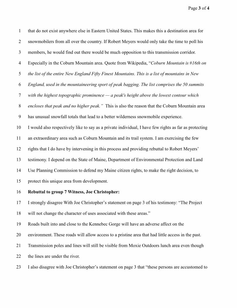
STATE OF MAINE
DEPARTMENT OF ENVIRONMENTAL PROTECTION
and
STATE OF MAINE LAND USE PLANNING COMMISSION
IN THE MATTER OF: CENTRAL MAINE POWER COMPANY 25 Municipalities, 13 Townships/Plantations, 7 Counties L-27625-26-A-N L-27625-TB-B-N L-27625-2C-C-N L-27625-VP-D-N L-27625-IW-E-N CENTRAL MAINE POWER COMPANY NEW ENGLAND CLEAN ENERGY CONNECT SITE LAW CERTIFICATION SLC-9
) ) ) ) ) ) ) ) ) ) ) ) ) ) )
APPLICATION FOR SITE LOCATION OF DEVELOPMENT ACT PERMIT AND NATURAL RESOURCES PROTECTION ACT PERMIT FOR THE NEW ENGLAND CLEAN ENERGY CONNECT
REBUTTAL TESTIMONY OF GARNETT ROBINSON OF
PRE-FILE TESTIMONY OF ROBERT MEYERS (GROUP 3)

Page 2 of 4
Q. Please state your name and address. 1
My name is Garnett Robinson, and my mailing address is PO Box 82, Dixmont, Maine 04932. I 2
own property located at 331 Moosehead Trail, Dixmont, ME 04932. 3
Q. Did you provide your general qualifications in your Pre-file Testimony? 4
Yes, I did. Please refer to my pre-file testimony and resume. 5
Q: What is the purpose of your rebuttal testimony? 6
A: The purpose of my testimony is to address/rebut the Testimony of Robert Meyers, 7
Executive Director of the Maine Snowmobile Association (MSA). 8
Q. What have you reviewed to prepare this testimony? 9
A: I reviewed the following: 10
1. Pre-Filed Direct Testimony of Robert Meyers dated February 28, 2019, Exhibit IG3-3 11
2. Various Websites. 12
Q. Can you detail any concerns, if any, that you have with Mr. Meyers testimony? 13
A. I do have concerns. I believe Mr. Meyers knowingly misrepresented the position of the 14
MSA membership. It is clear from sections 1 and 2 of Mr. Meyers’ pre-file testimony that he is 15
the head of a large association made up of many different clubs, each of which have many 16
members. It appears that he has presented his opinion to be representative of the club membership 17
despite never having polled members as to what experiences or sites draw them to areas, or what 18
values are important to members, or if the members actually support the proposed NECEC 19
Corridor; a polling process which other large public organizations did undertake. For example, the 20
Sportsman Alliance of Maine (SAM) which, after doing so, rescinded its support of NECEC. The 21
failure to poll members and the position taken by Mr. Meyers is one of the reasons I and others 22
dropped our membership/subscription to Maine Snowmobiler. 23

Page 3 of 4
In section 4 of his testimony, Mr. Meyers stats: “In my opinion, the predominant attitude of the 1
Association’s membership with respect to construction of the currently proposed transmission line 2
would be indifference or support, with little or no opposition.” Mr Meyers knew this to be untrue 3
and in fact contradicted this position in public statements to reporter Fred Bever for an article on 4
Maine Public (See Exhibit 1). In brief, the article reports that Mr. Meyers says: 5
[H]e’s seen contention in the group before, as when a development called Plum Creek was 6
proposed for the Moosehead Lake region. But that this year’s contention over the CMP 7
project has a certain edge. ‘This is literally the first time we’ve had somebody say ‘I don’t 8
like what you’re doing so much I’m going to quit,’ ” 9
This article aired/appeared after John Willard, a prominent MSA member and owner of the 10
Birches on Moosehead Lake, and numerous other MSA members testified in opposition to 11
NECEC before the PUC. They openly declared they would be dropping their membership to 12
MSA after a MSA spokesperson testified on behalf of the association in support of the project. 13
Mr. Meyer’s sworn testimony “with little or NO opposition” cannot be truthful given his 14
acknowledgment in public statements that the project is a subject of controversy within the 15
membership. 16
In addition to publicly acknowledging that the membership is not in fact in agreement with the 17
position Mr. Meyers expressed in his pre-file testimony, he has been actively trying to squelch the 18
voices of members in opposition to the project. Former MSA members, Monica Russ McCarthy 19
and her husband Steve McCarthy were asked to leave the MSA’s Maine Snowmobile Show 20
because they were wearing “Say No to the NECEC corridor” shirts. (See Exhibit 2). 21
In sum, Mr. Meyers pre-file testimony on behalf of the MSA asserting “little or no opposition” to 22
NECEC is not truthful. 23

Page 4 of 4
Q. Does this conclude your testimony? 1
Yes, it does. 2


GROBINSON Exhibit 1
https://www.mainepublic.org/post/some-maine-outdoorsmen-are-worried-about-potential-impact-
cmp-transmission-line
Some Maine Outdoorsmen Are Worried About The Potential Impact Of The CMP Transmission Line
By Fred Bever • Oct 25, 2018
When a representative of the Maine Snowmobile Association praised the new project at a public hearing
last week, some members dissented.
Some snowmobilers and hunters in Maine are raising their voices against the high-voltage transmission
line that Central Maine Power wants to string through western Maine in order to bring electricity to
Massachusetts. The Maine Snowmobilers Association (MSA) is contending with dissent in its ranks, while
the Sportsmen's Alliance of Maine is reconsidering its initial endorsement of the project.
CMP's website for the project highlights endorsements from a variety of groups, from Gov. Paul LePage
to the state Chamber of Commerce and a grab-bag of host communities. It also includes an
endorsement from the state's premier hunting and gun rights advocacy group, the Sportsmen's Alliance
of Maine (SAM).
"That was months and months ago,” says David Trahan, SAM’s executive director. “It's become quite
controversial."
Trahan says his board's initial endorsement vote was not unanimous, but given what seemed like the
project's inevitability and a longstanding relationship with CMP that enhanced hunters' access to the
woods, early support was warranted.
"Initially it looked like, with the governor's support, things seemed to be on greased skids to be
completed and done,” he says. “As more stuff has come up, more members have reached out to us and
said 'what are we going to do here?'”
Trahan says that as CMP has provided more information to the state, and as the Maine Department of
Inland Fisheries and Wildlife staff have raised concerns about ecosystem impacts, SAM's members have

become more concerned. They are worried about issues such as damage to winter deer yards and
buffers for pristine habitat for native trout.
Those concerns have long been voiced by SAM's former executive director, George Smith.
"They don't care about our native brook trout,” Smith says. “They were going to put these things 20 feet
from the water, and they moved them back a little bit, but not nearly enough. And we have all the
native brook trout in lakes and ponds left in this country. So this is a very important resource."
SAM is now sending a survey to its 8,000 members to get a better tally of their views on the project.
The snowmobiling community, meanwhile, also has a long-standing partnership with CMP, which
provides riders access to hundreds of miles of powerline corridor. But when a representative of the
Maine Snowmobile Association praised the new project at a public hearing last week, some members
dissented.
Tania Merette of Long Pond Township says she was an MSA member but, “I will be rescinding my
membership. I was one of those business members, I was one of those snowmobile members. So there's
one less of each of those. And I ride those trails a lot."
A handful of other project opponents also say they are terminating their MSA memberships. And others,
like Pete Dostie, say that they may stay in the organization, but will work against the project. Dostie's
built miles of snowmobile trail on and around Coburn Mountain, and he says that CMP's plan to run the
transmission line over a saddle in that mountain will ruin the outdoors experience there, harming area
businesses that depend on winter snow-travelers.
"If you lose those trails or have these massive wires going basically around it like a horseshoe, we won't
be able to get to it for two years for construction, and essentially after that it'll be... 'who wants to drive
ten hours from New Jersey to be back in New Jersey?' They'll just find somewhere else to go and we'll
lose that,” Dostie says.
MSA Executive Director Bob Myers says he's seen contention in the group before, as when a
development called Plum Creek was proposed for the Moosehead Lake region. But this year's
contention over the CMP project has a certain edge.

"This is literally the first time we've had somebody say 'I don't like what you're doing so much I'm going
to quit,’" he says.
Myers says the organization's 12,000 "family" memberships represent a diverse set of views on the
issue. But the board, he says, emphasizes CMP's history of cooperation with snowmobilers and the
importance of its trails for traversing the state, no matter what one thinks of their aesthetics.
"On a more basic level, they're a landowner, and it's our tendency to support landowners because they
are the people that provide the access for our trails around the state,” says Myers.
CMP has seen erosion in public support over the last couple of months. Five towns have voted to oppose
the project — even though initially their local or county governments had endorsed it — and more votes
in other towns are expected. The four candidates for governor have raised concerns about the project,
and none of them has endorsed it.
CMP spokesperson John Carroll argues that the project provides a conduit for renewable hydro-
electricity from Canada into New England, a positive step against global warming that, he says, outdoor
enthusiasts should applaud.
"If we don't have good reliable long winters, if we don't have a reliable snowpack, if we see radical
changes in our forest type that climate change affects everything about Maine, sportsmen as well as
everyone else will be affected by it," Carroll says.
But some environmental groups say the project will not result in a reduction in greenhouse gases. Last
week CMP filed its proposal to mitigate the project's ecosystem impacts. That includes the donation of
more than 2000 acres of land to the state, and paying more than $4 million into a state fund that can
identify and secure other wildlife habitat.
Originally published 3:43 p.m. Oct. 25

GROBINSON Exhibit 2 Facebook , Public Group, Say NO to NECEC, Post October 19, 2018; https://www.facebook.com/groups/279944929428517/search/?query=Maine%20Snowmobile%20Association&epa=SEARCH_BOX

STATE OF MAINE DEPARTMENT OF ENVIRONMENTAL PROTECTION
and
STATE OF MAINE
LAND USE PLANNING COMMISSION
IN THE MATTER OF: CENTRAL MAINE POWER COMPANY 25 Municipalities, 13 Townships/Plantations, 7 Counties L-27625-26-A-N L-27625-TB-B-N L-27625-2C-C-N L-27625-VP-D-N L-27625-IW-E-N CENTRAL MAINE POWER COMPANY NEW ENGLAND CLEAN ENERGY CONNECT SITE LAW CERTIFICATION SLC-9
) ) ) ) ) ) ) ) ) ) ) ) ) ) )
APPLICATION FOR SITE LOCATION OF DEVELOPMENT ACT PERMIT AND NATURAL RESOURCES PROTECTION ACT PERMIT FOR THE NEW ENGLAND CLEAN ENERGY CONNECT
REBUTTAL TESTIMONY OF EDWIN C. BUZZELL OF
PRE-FILE TESTIMONY OF ROBERT MEYERS (GROUP 3) AND JOSEPH CHRISTOPHER (GROUP 7)

Page 2 of 4
Rebuttal to Group 3 Witness: Robert Meyers 1
I strongly disagree with Robert Meyers Statement in Paragraph 4 of his testimony. “In my 2
opinion the predominant attitude of the Associations Membership with respect to the 3
construction of the currently proposed transmission line would be indifference or support, 4
with little or no opposition.” First off, this is not based on fact, this is Robert’s opinion only. 5
Robert has not taken it on himself to poll his membership on this matter. As one of the founders 6
of the Driftbusters Snowmobile Club, in Pittsfield, Maine and a past MSA member, I have ridden 7
many CMP transmission lines. I only rode them because they were established trails and then 8
only to get to better, more scenic trails. Snowmobilers such as myself, much prefer wilderness 9
trails with true undeveloped scenery. I realize that these trails are on private land and I am very 10
fortunate to have available access to these trails. I am a private land owner myself and also open 11
my land up to the public. I also enjoy the tax benefit of having my land in tree growth. All large 12
private landowners know that failing to open their land to the public will eventually lead to 13
changes in the tax law. 14
Very few snowmobilers would support this transmission line in the Coburn Mountain section of 15
the MSA trails. The view shed from the top of this mountain make for an extraordinary 16
snowmobile experience. This Mountain, as far as I know, is the highest Mountain in the Eastern 17
United States accessible by snowmobile. The addition of a transmission line up and over the 18
mountain would be severely detrimental to the view shed of snowmobilers for miles. The area is 19
unique in the fact that it is such a large land mass, that it creates its own weather. The 20
snowmobile season is actually extended in this area for this reason. This brings business to the 21
area and boosts the economy. If there is no early or late season snow anywhere, there is snow on 22
and around Coburn Mountain. This affords many on and off trail snowmobiling opportunities 23
Page 3 of 4
that do not exist anywhere else in Eastern United States. This makes this a destination area for 1
snowmobilers from all over the country. If Robert Meyers would only take the time to poll his 2
members, he would find out there would be much opposition to this transmission corridor. 3
Especially in the Coburn Mountain area. Quote from Wikipedia, “Coburn Mountain is #16th on 4
the list of the entire New England Fifty Finest Mountains. This is a list of mountains in New 5
England, used in the mountaineering sport of peak bagging. The list comprises the 50 summits 6
with the highest topographic prominence — a peak's height above the lowest contour which 7
encloses that peak and no higher peak.” This is also the reason that the Coburn Mountain area 8
has unusual snowfall totals that lead to a better wilderness snowmobile experience. 9
I would also respectively like to say as a private individual, I have few rights as far as protecting 10
an extraordinary area such as Coburn Mountain and its trail system. I am exercising the few 11
rights that I do have by intervening in this process and providing rebuttal to Robert Meyers’ 12
testimony. I depend on the State of Maine, Department of Environmental Protection and Land 13
Use Planning Commission to defend my Maine citizen rights, to make the right decision, to 14
protect this unique area from development. 15
Rebuttal to group 7 Witness, Joe Christopher: 16
I strongly disagree With Joe Christopher’s statement on page 3 of his testimony: “The Project 17
will not change the character of uses associated with these areas.” 18
Roads built into and close to the Kennebec Gorge will have an adverse affect on the 19
environment. These roads will allow access to a pristine area that had little access in the past. 20
Transmission poles and lines will still be visible from Moxie Outdoors lunch area even though 21
the lines are under the river. 22
I also disagree with Joe Christopher’s statement on page 3 that “these persons are accustomed to 23

Page 4 of 4
not only seeing the large hydro-electric facilities, but also transmission lines that run in close 1
proximity to, and even cross the Penobscot River.” People come to Maine to experience a 2
wilderness experience. The Kennebec Gorge is not the Penobscot River and both have their own 3
unique characteristics. The Kennebec Gorge has virtually been unchanged after Harris Dam to 4
The Forks for thousands of years. I think that does rate “pristine” by any standard. 5
I also disagree with Joe Christopher’s statement on page 4 that, “the project also proposes other 6
buffers that will allow the movement of animals between important habitats and help shield 7
adjacent uses from unsightly developments.” As an avid hunter I can safely say that any long 8
transmission corridor will greatly affect the deer population. Hunters will be drawn to the 9
corridor in hopes of an easy kill. I do not believe Joe Christopher is qualified to make this 10
statement as he has admitted to me that he has only ever hunted 10 minutes and in that 10 11
minutes, shot a Buck in back of his “Inn By The River.” 12
I also disagree with Joe Christopher on page 5 that “access to the Dead River is currently only 13
permitted if users and outfitters pay a premium of $13.50 per person.” While commercial trips 14
pay that fee, there is no fee for private users that I am aware of. 15
On page 5 Joe Christopher states, “ As part of the MOU, CMP has also agreed to evaluate and 16
negotiate in good faith donations of CMP land that is not essential to CMP’s current or 17
anticipated future needs in order to expand public access to trails, streams, ponds, and other 18
natural resources.” Second bullet point down - “River Frontage below The Forks” Joe 19
Christopher is currently leasing this land from CMP for his Three Rivers Camp Ground. This is 20
not about access to these areas, it is about personal gain for Joe Christopher. In fact I believe that 21
if it was not for personal gain, Joe Christopher would be very much against this project. 22


STATE OF MAINE DEPARTMENT OF ENVIRONMENTAL PROTECTION
and
STATE OF MAINE
LAND USE PLANNING COMMISSION
IN THE MATTER OF: CENTRAL MAINE POWER COMPANY 25 Municipalities, 13 Townships/Plantations, 7 Counties L-27625-26-A-N L-27625-TB-B-N L-27625-2C-C-N L-27625-VP-D-N L-27625-IW-E-N CENTRAL MAINE POWER COMPANY NEW ENGLAND CLEAN ENERGY CONNECT SITE LAW CERTIFICATION SLC-9
) ) ) ) ) ) ) ) ) ) ) ) ) ) )
APPLICATION FOR SITE LOCATION OF DEVELOPMENT ACT PERMIT AND NATURAL RESOURCES PROTECTION ACT PERMIT FOR THE NEW ENGLAND CLEAN ENERGY CONNECT
REBUTTAL TESTIMONY OF ELIZABETH CARUSO, TOWN OF CARATUNK OF PRE-FILE TESTIMONY OF ROBERT MEYERS (GROUP 3), AND LARRY WARREN
AND JOSEPH CHRISTOPHER (GROUP 7)

Page 2 of 5
Robert Meyers, Maine Snowmobile Association (Group 3) 1
Understandably, Mr. Meyers needs to stay politically correct with the large landowners of the 2
State. As he mentioned, “95% of the snowmobile trails are on privately owned land.” It is 3
obvious that his greatest need is land access, and therefore wants to support large landowners. 4
In item 4 (page 2), Mr. Meyers stated his opinion of the attitude of the Association’s membership 5
as being “indifferent or support, with little to no opposition” of the project in the new 53 miles of 6
corridor. From social media, the MSA snowmobile trade show in Augusta, and letters and calls 7
MSA has received regarding this Project, his stated opinion of the membership’s attitude is not 8
truthful. Business and individual members have stated their disapproval. However still, MSA 9
never conducted a query of their membership. Neither were any studies conducted regarding the 10
impact this corridor would have on the snowmobile industry. 11
Mr. Meyer’s opinion of snowmobile trails under or near transmission lines is similar fantasy. 12
According to those who ride, groom and maintain the trails, snowmobile trails under 13
transmission lines are the first to melt and close due to the absence of the forest canopy and the 14
tundra-like-surface terrain (as opposed to an improved, dirt road). Transmission lines are not 15
trails of destination, but merely required trails to access the true destination area. 16
Larry Warren, WRMC (Group 7) 17
In accordance with the Memorandum of Understanding, any signers of the MOU are required to 18
support the project in all agency proceedings. Accordingly, Mr. Warren’s testimony should be 19
read in that context. He states as follows on pages 3-4 of his pre-filed direct testimony: 20
Other areas of the Project that comprise new corridors have also been designed 21 in a manner that should help ensure that the Project will not unreasonably interfere with 22 existing scenic, aesthetic, recreational or navigational uses. A review of the information 23 provided by CMP as part of the Company's September 4, 2018 Response ("September 4, 24 2018 Response") to the Information Request by DEP/LUPC provides substantial 25

Page 3 of 5
evidence that recreational areas and other natural resources that coincide with hiking and 1 snowmobile trails (e.g., No. 5 Mountain, Mosquito Mountain, and the Appalachian Trail, 2 Coburn Mountain, etc.) will not be adversely impacted by the Project. As noted by CMP, 3 “snowmobilers are accustomed to seeing transmission corridors and traveling within the 4 cleared corridors, so it is unlikely that the Project would have an impact on their 5 continued enjoyment of snowmobile trails." 6 7
It may be common for snowmobilers to see transmission lines in some areas, however, this area 8
has 1) NO industrial infrastructure and 2) is one of the most highly targeted destination locations 9
in all of Maine. Coburn is not just any mountain. It is the highest groomed snowmobile trail in all 10
of New England. Visitors ride from all over Maine to summit Coburn for the 360-degree view of 11
unfragmented nature. There is no comparison, and Mr. Warren grossly misinterprets this area 12
because he is directly benefiting from the $5-10 million through Maine Huts and Trails. He is 13
wrong when he states the following on page 4 of his pre-file testimony: 14
"The VIA accurately demonstrates the areas that will be impacted by the Project and the 15 significance of these impacts upon viewers. Photo simulations provided by CMP as part 16 of Appendix D of its September 2017 application also show that the visual impact of the 17 Project will be minimal and should not have an adverse impact on existing scenic, 18 aesthetic, and recreational uses of natural resources adjacent to the NECEC. " 19
Joe Christopher, WRMC (Group 7) 20
On page 4, paragraph 2, Mr. Christopher states: “The characterization by intervenors that these 21
areas are ‘pristine,’ ‘untouched,’ and ‘natural’ are misleading and simply not true.” Contrary to 22
that statement, these areas are in fact natural as they are void of any manmade structures and 23
certainly void of industrial towers, transmission lines, EMFs and mechanical sounds. Yes, these 24
lands have been cut for generations by good stewards of the land. Everyone knows (and Google 25
Earth reveals) that clear cuts grow back, paper companies replant, and in 20 years, the section is 26
green with regrowth showing a healthy forest with the same habitat. The Nature Conservancy 27
clearly illustrates this in their testimonies. Also shown is the devastating effects transmission 28

Page 4 of 5
lines (with their inherent EMF and Corona) sterilize birds and desecrate necessary, contiguous 1
wildlife habitats. 2
Mr. Christopher goes on to state that “CMP has proposed the NECEC in a manner that seeks to 3
minimize adverse impacts of the project upon the experience of hikers, hunters, rafters, anglers 4
or other users of the wilderness whose activities may take them into the vicinity of the NECEC.” 5
This is simply not the truth. The adverse impacts include obtrusive invasion to the natural 6
skyline, 150’ swath through natural habitat, poisonous chemicals, inherent mechanical sounds, 7
cancerous electromagnetic frequencies and a destruction of the natural landscape, which 8
normally lures tourists living in industrialized settings to the natural landscape. The VIA posed 9
pictures of desolate areas, void of scenic attributes in an attempt to paint it unattractive and not 10
luring to recreationists. In fact, this corridor is a dramatic change of usage. 11
On Page 4, paragraph 3 of Mr. Christopher’s pre-file testimony, he states, “CMP has proposed 12
to site the line in a manner that seeks to avoid the impact on these areas and have proposed 13
buffers to help ensure that water bodies are protected.” Regarding Coburn/Johnson Mountain 14
snowmobiling and hunting area, the corridor would intersect the snowmobile trails system eight 15
(8) times, would reach highly visible elevations of 2,100’-2,800’, and cross important wetland 16
areas. Further in the paragraph, Mr. Christopher states “the project also proposes other buffers 17
that will allow for the movement of animals between important habitats and help shield adjacent 18
uses from unsightly developments…” This statement is overwhelmingly false as noted by The 19
Nature Conservancy testimonies and experts. 20
As Avangrid has proposed in other projects "for aesthetic purposes", and as is standard in the 21
industry, the only way to buffer and avoid scenic and environmental impact would be to bury 22

Page 5 of 5
the line. The applicant could have chosen the Route 201 corridor or existing logging roads such 1
as the Spencer Road to bury the line and avoid these devastating impacts. 2
On page 5, paragraph 3, Mr. Christopher refers to recreational fees to these areas. Currently, 3
there is only a fee for commercial customers to use the Kennebec River. There is no fee for any 4
other users to access the Kennebec River. Additionally, there is an access fee for only 5
commercial rafting customers to cross certain paper company land on their way to the Dead 6
River. THERE ARE NO OTHER FEES FOR ANY OTHER RECREATIONAL USERS IN 7
ANY OTHER AREAS. This supposed benefit referred to is non-existent. There are currently no 8
fees for hunting, snowmobiling, fishing, hiking or even kayaking and private rafting. Thus there 9
is no compensation factor here. 10
The bulleted list on page 6 reveals the incentive for Mr. Warren’s Maine Huts and Trails to have 11
the leases for the Flagstaff Hut and hut sites at Grand Falls, Chase Stream and Indian Pond and 12
trails under license agreement to Maine Huts and Trails. This is not mitigation for the State of 13
Maine, the Maine citizens, the Maine ratepayers, or the tourism public. This is only a business 14
deal for Mr. Warren. Here there is an exchange of public lands, public views, the welfare of our 15
environment, wildlife, brook trout fisheries for his business benefits and that of CMP and Hydro-16
Quebec. 17

Date : ->>(l^°! Respectfully submitted,
fcMUtA-AM^By:.Print NWie: ^{-Mj^d^ C^l^^O
STATE OF ^/w^COUNnOF
Personally appeared before me on the above- named ^llA^A. APA^O ^ who beingduly sworn, did testify that the foregoing testimony was true and correct to the best of his/herknowledge and belief.
Before me,
-Si-^ .X ^<^^^Notary PubKc/ Att&fney at LawMy Commission expires_

STATE OF MAINE DEPARTMENT OF ENVIRONMENTAL PROTECTION
and
STATE OF MAINE
LAND USE PLANNING COMMISSION
IN THE MATTER OF: CENTRAL MAINE POWER COMPANY 25 Municipalities, 13 Townships/Plantations, 7 Counties L-27625-26-A-N L-27625-TB-B-N L-27625-2C-C-N L-27625-VP-D-N L-27625-IW-E-N CENTRAL MAINE POWER COMPANY NEW ENGLAND CLEAN ENERGY CONNECT SITE LAW CERTIFICATION SLC-9
) ) ) ) ) ) ) ) ) ) ) ) ) ) )
APPLICATION FOR SITE LOCATION OF DEVELOPMENT ACT PERMIT AND NATURAL RESOURCES PROTECTION ACT PERMIT FOR THE NEW ENGLAND CLEAN ENERGY CONNECT
REBUTTAL TESTIMONY OF ERIC J. SHERMAN OF PRE-FILE TESTIMONY OF MALCOLM L. HUNTER, PHD., ROB WOOD, ANDY CUTKO AND BRYAN
EMERSON (GROUP 6)

Page 2 of 11
I originally became involved in the opposition to the NECEC because the proposed transmission 1
line would cross the Kennebec gorge where I’ve been rafting since I was 18 years old and 2
guiding since I was 23 years old. Since I became involved, I have read much about the pros and 3
cons of this project. The evidence that this corridor will not be good for Maine’s wilderness, 4
wildlife and way of life for the people who live in this region is overwhelming to me. I’m more 5
convinced that this project is a detriment to more than just that immediate area. I have studied the 6
testimonies of Malcolm L. Hunter Jr., PhD., Rob Wood, Andy Cutko, and Bryan Emerson of The 7
Nature Conservancy. After reading these testimonies, I am even more convinced and concerned 8
about the negative impacts this project would wreak should it be green-lighted. I am also 9
convinced that their own testimony does not support their recommendations to the Department 10
should NECEC be authorized. They made a rock-solid case for why NECEC should NOT be 11
permitted AT ALL, and here’s where I disagree with them: they allude that they are okay with 12
the corridor by giving suggestions on how to “do it better” when the best way to minimize the 13
habitat fragmentation they (and Dr. Hunter) so eloquently educated us about, is to not allow large 14
scale projects like NECEC to be permitted, especially when if allowed, more development would 15
further degrade the area’s habitat. These testimonies contain more convincing evidence for why 16
the DEP and LUPC should not permit the NECEC than they make a case for it. 17
18
Rebuttal Testimony of Malcolm L. Hunter’s Pre-Filed Testimony 19
Malcolm L. Hunter Jr., PhD. of the Nature Conservancy submitted testimony in favor of NECEC 20
that I began reading with rebutting in mind. However, the further I read into his testimony, the 21
further it solidified my belief that NECEC will destroy some unique features of the Maine 22
wilderness through which it is proposed. First, when Dr. Hunter discusses habitat fragmentation, 23

Page 3 of 11
he says, “In short, it is widely recognized that fragmentation is one of the leading causes of 1
biodiversity decline across the globe...,” (Hunter, pg. 3). He goes on to explain that the project 2
area, “... is an extensively managed, working forest, traversed by logging roads and marked by a 3
patchwork of forests in various age classes and harvest conditions… it is important to recognize 4
that with the exception of haul roads, clearing from forest management is temporary, and even 5
industrial forest management requires forests to grow back to maturity before they are harvested 6
again” (Hunter, pg. 3). I have hiked mountains, canoed and rafted rivers, and driven the roads in 7
and around the proposed project area, and it is NOT all clear-cuts like some imply and contend 8
that it is. There are large tracts that are in various stages of regrowth, from brand new cuts to 30, 9
40, maybe 50 years or older. Hunter characterizes the area as, “...largely intact and connected 10
landscape… Maine’s wildlife is able to move among these patches. In contrast to these 11
temporary and shifting impacts of forest management, the proposed NECEC corridor would be 12
a permanent fragmenting feature, much like the few major forest roads in the region… A 150-13
foot wide powerline will create a wider barrier to movement than a typical woods logging road… 14
generalist species such as black bear will react to a utility corridor very differently than a smaller 15
species that strongly prefers a shaded forest floor, like a spotted salamander or wood frog,” 16
(Hunter, pg. 3). Dr. Hunter is pointing out the very reasons for which the DEP and LUPC were 17
created and are charged with protecting: our shrinking natural environment with its vulnerable 18
wildlife. He also explains how there are no known examples of comparable development (and 19
impacts) of this large proportion which cross lands that The Nature Conservancy identifies as 20
“Resilient and Connected,” meaning the lands are capable of supporting biodiversity as the 21
climate changes, (Hunter, pg. 3). 22

Page 4 of 11
Dr. Hunter also addresses the immediate loss of forest vegetation, increase in “edge” (the border 1
between a forest and an opening), and a decrease in the overall amount of “interior” forest; all of 2
which have short-term and long-term impacts. He states, “...the proposed NECEC corridor will 3
retain shrub and herbaceous vegetation cover, Segment 1 (from Beattie Township to the Forks) is 4
nonetheless a direct loss of nearly 1000 acres of habitat for forest-dwelling species… home to 5
more than 800 species of vertebrate wildlife, including 200 that are listed as Species of Greatest 6
Conservation Need… For species [like] the red-backed salamander whose populations can reach 7
one per square yard in northern New England forests, the loss of 1000 acres of forested habitat 8
could impact millions of individuals,” (Hunter, pg. 4). He continues, “...the distribution and 9
density of ungulates are affected by powerline ROW, especially when combined with roads… 10
caused by a higher risk of predation, poor foraging conditions, hindered movement and 11
decreased habitat quality,” (Hunter, pg. 4). Our Maine wildlife, from amphibians to ungulates to 12
bears will be adversely affected if the NECEC is passed. 13
Dr. Hunter discusses the effects of increased [forest] edge and reduced [forest] interior in his 14
testimony. He states, “Forest loss associated with a transmission line and associated construction 15
roads is amplified by the edge effects that extend the corridor’s impact far into the adjacent 16
forest… forest edges influence… forests and contribute to worldwide decline in biodiversity and 17
ecosystem functions. These changes occur as a result of differences in light and wind exposure at 18
forest edges, associated changes in plant community composition and structure (e.g., forest vs. 19
shrub), introductions of invasive species, and changes in predator/prey relationships. Segment 1 20
of the NECEC will create more than 100 linear miles of permanent edge habitat in Segment 1 21
alone.” (Hunter, pg. 4). He continues, “...many species [that] are restricted to the specific habitat 22
of interior forest[s]. Depending on the species in question the edge impact may extend hundreds 23

Page 5 of 11
of feet into the forest… In particular, smaller-bodied amphibians, larger reptiles, and some 1
medium-sized mammals experience greater reduction from edge effects than other forest-core 2
species… distance from power lines has also been demonstrated as the most important factor 3
determining the choice of nest and rest sites, influencing the movement of migratory birds and 4
acting as a barrier to populations… Northeastern forests have been shown to support important 5
breeding grounds for many of these species, and these areas-sensitive habitat specialists will 6
decline if the size of habitat blocks falls.” (Hunter, pg. 5). All of this testimony is alarming! I 7
can think of no better reasons for NECEC to be struck down by the DEP and the LUPC members 8
than to preserve this fragile ecosystem that so many varied species use for habitat. 9
In reference to invasive species Dr. Hunter cites concerns he has about them in this area. He cites 10
Mosher, Silander, and Latimer as saying, “Overall the region surrounding the proposed NECEC 11
corridor has few invasive species documented, probably because large forest blocks resist woody 12
plant invasions better than land that has a history of agricultural or residential use.” He 13
continues, “The current rarity of invasive plants in the region increases the importance of 14
keeping them out, because after new populations establish in remote locations, they may go 15
undetected or controlled for many years, and control becomes virtually impossible once 16
populations have gained a strong foothold,” (Hunter, pg. 6). 17
In addressing the cumulative, long-term consequences of forest fragmentation, Hunter voiced 18
concerns that “...the impacts are not always immediate and may in fact, take years, or even 19
decades, to fully play out on the landscape.” He quotes Tere and Parasharya who say, “... the 20
cumulative effects of power lines and other sources of mortality might be noticed only after a 21
few decades, making it difficult to reverse population declines. If, for example, is [if] the edge 22
effect of a powerline causes just a 10% decline in reproduction rate of a population deterred from 23

Page 6 of 11
crossing a power line each year, over many years the cumulative impact of this may have a 1
significant lag time, whereby impacts created today set in motion a population decline that is not 2
fully manifested for years to come.” (Hunter, pg. 7). Again, the testimony Hunter gives is 3
disturbing; if the NECEC comes to fruition, the ramifications will take decades to play out. 4
Finally, Hunter specifies that there are shortcomings to the proposed mitigation plan. He 5
reiterates that, “... there really is no comparable precedent for assessing the impacts to wildlife 6
connectivity… there are approximately 800 species of vertebrate wildlife in Maine and 7
thousands of species of invertebrates, and many hundreds of species are present in the region 8
affected by this corridor… The proposed mitigation and compensation plan does not 9
adequately address the cumulative impact to the full array of Maine’s wildlife,” (Hunter, pg. 10
8). Hunter contends that based on his evidence, “... CMP has not made adequate provisions for 11
the protection of wildlife and fisheries,” (Hunter, pg. 8). 12
I contend that Hunter’s evidence is damning for NECEC and should be taken as reasons to deny 13
a permit for it because his testimony and evidence therein support the mission of the DEP which 14
is: “Legislative mandate directs DEP to prevent, abate and control the pollution of the air, 15
water, and land. The charge is to preserve, improve and prevent diminution of the natural 16
environment of the State. The Department is also directed to protect and enhance the public’s 17
right to use and enjoy the State’s natural resources.”1 The testimony and evidence support the 18
LUPC’s “About LUPC” website page which promises to protect Maine’s natural assets, “Along 19
with carrying out its planning and zoning responsibilities, the LUPC… For larger development 20
projects requiring DEP review under the Site Location and Development Law, the LUPC 21
certifies that the proposed land uses are allowed and that proposed development activities 22
1 https://www.maine.gov/dep/about/index.html (last visited March 14, 2019)

Page 7 of 11
comply with applicable LUPC land use standards… The unorganized and disorganized areas 1
include...the western mountains and up to the Canadian border. These areas are important to 2
the vitality of both the State and local economies, are home to many Mainers, and are enjoyed by 3
Maine residents and visitors in pursuit of outdoor recreation activities including hunting, fishing, 4
boating, hiking, and camping.”2 If there was a poster child of evidence for why the NECEC 5
should not be given a permit, Dr. Hunter’s testimony would be it. 6
Rebuttal Testimony of Pre-Filed Testimony submitted by Rob Wood, Andy Cutko, and 7
Bryan Emerson 8
I also studied the testimony submitted by Rob Wood, Andy Cutko, and Bryan Emerson of The 9
Nature Conservancy. In their opening statements, they explain how they are basically neutral on 10
the NECEC, and all they want to see happen is, “...avoidance, minimization, and compensation 11
for unavoidable impacts,” (Wood, Cutko, and Emerson, pg. 1). The impacts are completely 12
avoidable if there is no permit issued for the NECEC. They point out, “The Department’s 13
second procedural order states that 38 M.R.S.§ 480-D (3) and DEP Chapter 375 § 15 are within 14
scope of the NECEC hearing… [and] provides significant latitude for the Department to consider 15
cumulative, landscape-level impacts that extend beyond isolated impacts to specific resources..” 16
The relevant Chapter 375 § 15 language is: 17
“B) Scope of Review. In determining whether the developer has made adequate provision 18
for the protection of wildlife and fisheries, the Department shall consider all relevant 19
evidence to that effect, such as evidence that: … (2) Proposed alterations and 20
activities will not adversely affect wildlife and fisheries lifecycles.” (Emphasis 21
added.)” 22
2 https://www.maine.gov/dacf/lupc/about/index.shtml (last visited March 14, 2019)

Page 8 of 11
They declare, “We also believe that the scale and cumulative impact of the habitat fragmentation 1
caused by Segment 1 of the proposed NECEC corridor could potentially “adversely affect 2
wildlife and fisheries lifecycles” for many years into the future,” (Wood, Cutko, and Emerson, 3
pg. 2). In their exhibits, they discuss how unique the Western Maine forest is because of its 4
concentration of well-connected and climate-resilient wildlife habitat, and how the NECEC will 5
contribute to fragmentation of the landscape. In their TNC Exhibit 1 explanation, they again 6
mention how unique the Western Maine forest is, in that it has high-connectivity scores. In TNC 7
Exhibit 3 they assess the forest block through which the NECEC would traverse at more than 8
500,000 acres and as one of the largest unfragmented blocks in the region. They assert, 9
“Moreover, western Maine is the core of one of the world’s last remaining contiguous temperate 10
broad-leaf mixed forests… Maine has successfully maintained forest connectivity over time 11
while other regions have become increasingly fragmented,” (Wood, Cutko, and Emerson, pg. 3). 12
Their testimony mirrors and complements much of Dr. Hunter’s testimony, but they also include 13
information about species that Dr. Hunter did not. “...the western Maine region supports 14
exceptional biodiversity… It contains… forest ecosystems… that provide habitat for roughly 140 15
rare species and the last stronghold for wild native brook trout in the eastern U.S.,” (Wood, 16
Cutko, and Emerson, pg. 3). In addition, “… the region has also been mapped by the National 17
Audubon Society as a globally important bird area, providing crucial nesting habitat for more 18
than 30 northern woodland songbird species, ” (Wood, Cutko, and Emerson, pg. 4). They explain 19
that the diversity of the region’s landforms (wetlands, floodplains, mountaintops, and steep 20
slopes will, “... be especially effective at maintaining biodiversity as the climate changes. This 21
resilience to climate change is a function of the region’s connectedness. Connected forests allow 22
for great species movement over time in response to climate change, and western Maine will 23

Page 9 of 11
serve as a key wildlife linkage in the northern Appalachian region,” (Wood, Cutko, and 1
Emerson, pg. 4). 2
In their analysis of habitat fragmentation effects of the proposed NECEC corridor, Wood, Cutko, 3
and Emerson assert, “Segment 1 of the proposed NECEC corridor would create a new linear 4
fragmenting feature in what is currently a large, mostly unfragmented forest block. We contend 5
that this new fragmentation will have unpredictable implications for the health and viability of 6
wildlife and plant species over time, and that such implications could be significant. A growing 7
body of research presents findings on the negative impacts of habitat fragmentation from edge 8
effects… to spread of invasive species, to increased pressure from associated uses (such as 9
motorized vehicle use), to changes in species composition and behavior over time from reduced 10
habitat patch sizes,” (Wood, Cutko, and Emerson, pg. 4). They also point out that the NECEC 11
Site Location of Development Application acknowledges the potential direct impacts: “... they 12
may affect species movement, dispersal, density, nesting success and/or survival… may include 13
fragmentation and creation of new linear edges… Habitat conversion along transmission line 14
corridors results in loss of habitat types which, in turn, may adversely impact species that are 15
reliant on the original habitat types... However, the applicant does not propose any measures to 16
avoid, minimize, or compensate for these impacts,” (Wood, Cutko, and Emerson, pg. 4). In 17
their closing statements on habitat fragmentation effects, the author's voice apprehension to the 18
applicant’s statement that the corridor is located in an intensively managed timber production 19
area and therefore not likely to significantly alter existing fragmentation. They go on to say, 20
“...our concerns about habitat fragmentation stem from the linear and permanent nature of the 21
corridor… long-term forest management roads… are much narrower than the proposed 22
transmission line… A 53.5-mile corridor would create 107 miles of new habitat edge, while 23

Page 10 of 11
business-as-usual timber harvesting will result in significantly less edge and, moreover, timber 1
harvesting edge will change over time, whereas edge from a new transmission corridor will 2
likely be permanent,” (Wood, Cutko, and Emerson, pg. 5). Finally, the authors reveal that they 3
are concerned with more than just NECEC. They state, “... there is ample evidence that habitat 4
fragmentation from a variety of fragmenting features can have cumulative, and significant 5
negative effects on ecosystems over time, as well as ample research on specific species (e.g., 6
American marten) that are averse to forest edges. Moreover, NECEC could potentially allow for 7
new fragmenting features to develop in the future that could exacerbate habitat fragmentation– 8
for example, new roads to access and service the NECEC line or new energy infrastructure 9
development in the additional 150’ of the Segment 1 right-of-way,” (Wood, Cutko, and 10
Emerson, pg. 6). I will echo their apparent concern. It is my fear that if NECEC is approved, the 11
other 150’ of the corridor will be utilized by wind power that will be developed on the nearby 12
ridges and mountains. The wild feel of this area will disappear with the habitat and varied 13
species if NECEC is permitted. 14
Wood, Cutko, and Emerson’s testimony point out that the applicant has made some attempts at 15
compensating and mitigating the cold-water fisheries habitat and mitigating habitat 16
fragmentation. They point out that as part of the mitigation, the applicant has budgeted $200,000 17
for 20-35 Stream Smart culverts on lands outside of CMP’s ownership, but the cost of just one 18
Stream Smart culvert can range from $50,000 to several hundred thousands of dollars depending 19
on traffic. They think that realistically at the very least $1 million would be needed to achieve the 20
desired number. They also think a minimum of 100-foot buffers along all streams should be 21
provided. They also note the applicant acknowledges the impact NECEC would have on habitat 22
connectivity and plans on, “... allowing 25-35-foot softwood stands to grow under the lines in the 23

Page 11 of 11
Segment 1 Deer Wintering Area and raising pole heights… in Roaring Brook Mayfly and 1
Northern Spring Salamander habitat,” (Wood, Cutko, and Emerson, pg. 9). They are also quick 2
to point out that those, “... strategies apply only to a very small portion of the 53.5-mile Segment 3
1 corridor,” (Wood, Cutko, and Emerson, pg. 9). The authors also bring attention to habitat edge 4
effects. They state, “... we estimate that Segment 1 of the proposed NECEC corridor could 5
directly and permanently impact more than 5,000 linear acres of habitat for species that require 6
mature forest,” (Wood, Cutko, and Emerson, pg. 9). 7

STATE OF MAINE DEPARTMENT OF ENVIRONMENTAL PROTECTION
and
STATE OF MAINE
LAND USE PLANNING COMMISSION
IN THE MATTER OF: CENTRAL MAINE POWER COMPANY 25 Municipalities, 13 Townships/Plantations, 7 Counties L-27625-26-A-N L-27625-TB-B-N L-27625-2C-C-N L-27625-VP-D-N L-27625-IW-E-N CENTRAL MAINE POWER COMPANY NEW ENGLAND CLEAN ENERGY CONNECT SITE LAW CERTIFICATION SLC-9
) ) ) ) ) ) ) ) ) ) ) ) ) ) )
APPLICATION FOR SITE LOCATION OF DEVELOPMENT ACT PERMIT AND NATURAL RESOURCES PROTECTION ACT PERMIT FOR THE NEW ENGLAND CLEAN ENERGY CONNECT
REBUTTAL TESTIMONY OF GREG CARUSO OF PRE-FILE TESTIMONY OF ROBERT MEYERS (GROUP 3)
AND LARRY WARREN AND JOSEPH CHRISTOPHER (GROUP 7)

Page 2 of 5
Rebuttal of Pre-filed Direct Testimony of Robert Meyers, Maine Snowmobile Association 1
On page 2, paragraph 4, Bob Meyers writes “I have never heard a single complaint about seeing 2
or snowmobiling in the vicinity of a power line.” There is no doubt that he IS hearing complaints 3
from MSA members about the potential scenic impacts of the powerline in the Coburn/Johnson 4
Mountain trail system but is choosing to ignore them. Mr. Meyers has a seemingly uncaring 5
attitude toward his membership and the Coburn/Johnson Mountain trails systems including ITS 6
87, 89, the Coburn Mountain Connector, the North Shoulder Bypass and the Coburn Summit 7
Trail. In fact his membership, myself included, understand the riding public would be inundated 8
with obtrusive views in an upper alpine environment with the line crossing the trails at least eight 9
times and incurring large, in-your-face elevation changes from the time the trail crosses Route 10
201 until it reaches the Spencer Road. 11
One can appreciate having access on private land, but by industrializing it from a working forest, 12
the very nature of the use is changed - and with it, the remote character of the tourist destination 13
such as the Coburn/Johnson Mountain area. Such a change of designation demands that at the 14
very least, the line should be placed underground in critical areas where scenic impacts are high 15
and have a large draw of tourism. None of this have been proposed by CMP or asked as a 16
concession by Mr. Meyers. In addition to that, there have been no use studies by CMP with the 17
thousands upon thousands of snowmobilers that visit this area each year. 18
As a groomer, snowmobiler and MSA member for well over 20 years, I can attest that 19
powerlines, when used on snowmobile trails, are only used as means of egress to a destination 20
when absolutely no other option exists. They are bypassed regularly whenever possible because 21
they are an unimproved surface that doesn’t hold snow well, is boulder-strewn, full of spring 22
holes and swamp mud. 23

Coburn/Johnson Mountain area is the destination. The proposed line will not be part of the trail 1
but crisscross and fragment that very destination. 2
Rebuttal to Pre-filed Direct Testimony of Larry Warren, WM&RC 3
Page 4, paragraph 1 states that “as noted by CMP, snowmobilers are accustomed to seeing 4
transmission corridors and traveling in cleared corridors. So it is unlikely that the project would 5
have an impact on their continued enjoyment of the snowmobile trails.” This statement begs the 6
question, was there any user study completed in critical destination areas that this line would 7
affect? The answer is NO. In my professional experience, snowmobilers are not accustomed to 8
seeing powerlines in remote alpine, non-industrialized areas. It would most certainly diminish 9
their experience if the transmission line dramatically affects the very destination they are 10
planning on traveling to. He also states on page 4, paragraph 1, “that hikers experiences should 11
also not be adversely impacted by the project.” To which again, begs the question, were any user 12
studies done? Who did they ask? Would a transmission line above the Maine Huts and Trails 13
system affect the hikers there as it would on Coburn Mountain or Number 5 Mountain? 14
He goes on to say on page 4, paragraph 2, “In areas where hikers may see or pass under the 15
Project, the Project does not adversely impact existing scenic aesthetic and recreational uses and 16
employs buffers where necessary to minimize impact.” Again, there are no buffers from the top 17
of Coburn, Number 5, Pleasant Pond, Moxie Bald or other mountains where hikers frequent. 18
And again there was no attempt to bury the lines from view in these destination areas. 19
Mr. Warren also states in page 6, paragraph 2 that “the existing forest are hardly in pristine or 20
wilderness condition.” While Mr. Warren points out that the working forest of the area has been 21
overworked, it is still a remote wilderness area, pristine in the fact that it is not industrialized and 22
scarred by unnatural materials inconsistent with existing uses. Mr. Warren, of all people, 23

understands that but chooses to ignore it to benefit his huts and trails system. Why has he not 1
arranged to place new huts or trails in or on the NECEC corridor? After all, according to Mr. 2
Warren and CMP, “hikers should not be adversely affected by the Project.” 3
The hypocrisy of this testimony is overwhelming. 4
Rebuttal to Pre-filed Direct Testimony of Joe Christopher, WM&RC 5
On page 4, paragraph 2, Joe states: “The characterization by intervenors that these areas are 6
‘pristine,’ ‘untouched,’ and ‘natural’ are misleading and simply not true.” ….and that “CMP has 7
proposed the NECEC in a manner that seeks to minimize adverse impacts of the project upon the 8
experience of hikers, hunter, rafters, anglers or other users of the wilderness whose activities 9
may take them into the vicinity of the NECEC.” I ask, “How?” The working forest has been cut 10
over but is not industrialized with steel and concrete. So by saying something is pristine, 11
untouched or natural, that is referring to the LACK of any manmade industrial structures. 12
Trees, stumps, brush, gravel, and water are all natural…steel and concrete, 100’ towers are NOT. 13
This is a dramatic change of usage that should require at the very least an underground 14
alternative. 15
Page 4, paragraph 3 also says “CMP has proposed to site the line in a manner that seeks to avoid 16
the impact on these areas and have proposed buffers to help ensure that water bodies are 17
protected.” When looking at the maps of the line over Coburn/Johnson Mountain, the line would 18
make dramatic elevation changes along high alpine areas, full of springs and swamps and 19
headwaters to important streams and brooks with abundant brook trout habitat. Herbicide spray 20
to keep miles of powerline clear will most certainly end up in these water bodies. So how are 21
they being protected by an overhead line? Burying the lines under the current logging roads 22
would remedy this, but it is obvious that CMP has not considered this option. 23
Paragraph 3, Joe states “the project also proposes other buffers that will allow for the movement 1
of animals between important habitats and help shield adjacent uses from unsightly 2
developments…” This statement is overwhelmingly false. By CMP not considering an 3
underground option under current logging roads, further fragmentation of forest areas in the 4
Coburn/Johnson Mountain area will be abhorrently evident with the dramatic elevation changes 5
and crisscrossing of logging roads. In addition, the line will be carved through existing buffers 6
between current cutting areas, assuring that animal movements between important habitats are 7
further degraded. Furthermore, the suggestion that the project buffer “will help shield adjacent 8
uses from unsightly development” is an oxymoron. Considering the high visibility, high 9
elevation, 100’ towers with red, blinking lights, crisscrossing of snowmobile trails and 10
dramatically wide linear shape, they are assuring existing uses such as snowmobiling, hiking, 11
hunting, fishing, leaf-peeping or anything else will be ANYTHING but shielded! 12
As is clear in regards to scenic impact and existing uses, these testimonies along with CMP have 13
taken a shallow and narrow minded view of a dramatic change in use and skyline. They have not 14
given gravity to significant changes to mountain and forest, to 53 miles of wilderness area at risk 15
of industrial development. There has been no ample consideration or studies done with regards to 16
burying the line or at the very least in areas of high recreation value with maximum scenic and 17
environmental impact. The DEP and LUPC must consider the value of these remote places to our 18
fragile economy and thriving ecosystems in much more detail than these testimonies suggest 19
when charged with protecting Maine’s environment. 20


STATE OF MAINE DEPARTMENT OF ENVIRONMENTAL PROTECTION
and
STATE OF MAINE
LAND USE PLANNING COMMISSION
IN THE MATTER OF: CENTRAL MAINE POWER COMPANY 25 Municipalities, 13 Townships/Plantations, 7 Counties L-27625-26-A-N L-27625-TB-B-N L-27625-2C-C-N L-27625-VP-D-N L-27625-IW-E-N CENTRAL MAINE POWER COMPANY NEW ENGLAND CLEAN ENERGY CONNECT SITE LAW CERTIFICATION SLC-9
) ) ) ) ) ) ) ) ) ) ) ) ) ) )
APPLICATION FOR SITE LOCATION OF DEVELOPMENT ACT PERMIT AND NATURAL RESOURCES PROTECTION ACT PERMIT FOR THE NEW ENGLAND CLEAN ENERGY CONNECT
REBUTTAL TESTIMONY OF JUSTIN PREISENDORFER OF PRE-FILED
TESTIMONY OF ROBERT MEYERS (GROUP 3) ROB WOOD AND BRYAN EMERSON (GROUP 6) AND LARRY WARREN AND JOSEPH CHRISTOPHER
(GROUP 7)

Page 2 of 8
Q: Please state your name and role. 1
A: My name is Justin James Preisendorfer and I am a consultant on wilderness and 2
outdoor recreation planning and management. My testimony is reflective of my 3
professional opinion and is not associated in any way with my primary employment with 4
the USDA Forest Service. 5
Q: Is your experience consistent with Robert Meyer’s remarks about snowmobilers’ 6
attitudes toward power lines (Page 2, #4 in its entirety)? 7
A: Not entirely. I have worked in trail management for 24 years with all of that time in 8
Maine and New Hampshire. From my experience snowmobilers tolerate overhead 9
powerlines and have not complained about riding under them for a reason. With 620 10
miles of trail within CMP corridors snowmobilers understand the benefit of working with 11
a large-scale long-term landowner. There are dozens of “Powerline Trails” across the 12
state in part because maintenance of snowmobile trails benefits utility corridors and vice 13
versa. Snowmobile trails are also notorious for being plagued with dynamic landowner 14
access issues and stability is a precious commodity afforded with a long-term landowner. 15
Despite the benefits associated with coincident trail and power line alignments, and after 16
working with state trail agencies and dozens of snowmobile clubs I have yet to meet a 17
snowmobiler that prefers an industrial utility corridor experience over one that involves 18
natural settings and primarily undeveloped landscapes. They might accept a trail in a 19
utility corridor when no other long-term solution exists but would they support building 20
power lines in the viewsheds of their trails where such scenic impacts formerly did not 21
exist? I wouldn’t think so. I find it hard to believe that the snowmobile community would 22
be indifferent or supportive of a proposal to add power lines to the largely undeveloped 23

Page 3 of 8
landscape that they travel from all regions to enjoy and am curious where Mr. Meyers did 1
his sensing. Neither the Maine Snowmobile Association website nor their Facebook page 2
contain any photos that include power lines or obvious utility corridors. The truth is they 3
are bad for marketing because they’re such an obvious example of what people are trying 4
to get away from when they travel to northern Maine to snowmobile. 5
Q: Does the issue of habitat fragmentation as discussed by Rob Wood and Bryan 6
Emerson on behalf of the Nature Conservancy (pages 2-5 in entirety) have an 7
impact on scenic character and existing uses? 8
A: Habitat fragmentation has a clear and connected adverse impact on not only fish and 9
wildlife populations as described in Wood and Emerson’s testimony, but also on the 10
existing uses that are based on those fish and wildlife populations. Exhibits 1 through 3 11
submitted by the Nature Conservancy (TNC) provide a visual indicator of why the 12
Project Area serves as a destination for hunters, anglers, birdwatchers and others engaged 13
in wildlife-related activities. Habitat connectivity is high and the region serves as a 14
destination for activities that depend on its fish and wildlife populations. 15
The families that come to raft the Kennebec River want other activities to enhance their 16
time and wildlife viewing is a top attraction. As I mentioned in my February 28, 2019 17
testimony, the Maine State Comprehensive Outdoor Recreation Plan shows that between 18
1995 and 2009 the New England region added 2.1 million participants in the activity of 19
“viewing wildlife (besides birds).” No other category added as many participants making 20
this activity New England’s quickest growing. While the regulatory standing of whitetail 21
deer has forced mitigation measures for that species there are hundreds if not thousands 22
of species of vertebrates and invertebrates that would be impacted by the Project and 23

Page 4 of 8
have not generated similar protective measures. Reduced opportunities for wildlife 1
viewing can be expected when wildlife populations decline as a result of habitat 2
fragmentation and any businesses that are based on wildlife viewing in the affected 3
region are therefore at risk as a result of this proposal. 4
Habitat fragmentation has adverse impacts on wildlife populations and thus on the 5
hunters that pursue those animals and businesses surrounding hunting. According to a 6
report commissioned by the Maine Office of Tourism and the Maine Department of 7
Inland Fisheries and Wildlife, spending related to hunting and the multiplier effects of 8
that spending in Maine contribute $191 million to the state’s gross state product and a 9
total economic output of $338.7 million. By impacting the habitat on which game species 10
depend it would be reasonable to expect hunting quality to suffer and the economic 11
impact of hunting to go down. 12
Much of the same can be said about the cold water fisheries within the Project Area. 13
While some mitigation measures have been proposed, the applicant has chosen not to 14
follow MDIFW’s recommendation of a “100-foot buffer be maintained along all streams, 15
including perennial, intermittent, and ephemeral streams, within the Project area.” (March 16
15, 2018 MDIFW project review comments, p. 12). They have also proposed woefully 17
underfunded mitigation measures for stream connectivity as discussed in Wood and 18
Emerson’s testimony. (Page 8, 2nd paragraph of section titled “Cold Water Fisheries 19
Habitat”). The adverse impacts on the cold water fisheries within the Project Area will 20
therefore negatively impact existing use in the form of fishing, both recreational and 21
commercially guided. 22

Page 5 of 8
The Wood and Emerson testimony states that the “fragmentation will have unpredictable 1
implications for the health and viability of wildlife and plant species over time, and that 2
such implications could be significant.” (Page 4, first paragraph of section titled “Habitat 3
fragmentation effects of the proposed NECEC corridor,” last sentence). Dr. Malcom L. 4
Hunter Jr.’s testimony also states “the [Nature] Conservancy strongly asserts that the 5
project will have significant cumulative and long-term impacts on the region’s wildlife, 6
and that the compensation and mitigation currently proposed are inadequate and not 7
commensurate with those impacts.” (Page 2, 4th sentence of section titled “2. Role in this 8
Project”). Because the Project could have significant adverse impacts on wildlife species 9
and thus the existing uses that depend on them, I contend that the Applicant has not 10
demonstrated that the Project will not unreasonably interfere with existing uses as 11
described. 12
Q: Wood and Emerson made a suggestion that the Applicant should develop an 13
alternative that considers a greater amount of line burial. (Page 7, 2nd paragraph). 14
Would development of such an alternative reduce impacts on scenic character and 15
existing uses? 16
A: The development of such an alternative would surely reduce some of the Project’s 17
impacts on scenic character and existing uses should that alternative be approved. A 18
greater amount of burial should have been considered and built into the alternatives based 19
on recent history with Northern Pass and New England Clean Power Link. These projects 20
showed that line burial was not only logistically, technologically and financially 21
practicable, but also a reasonable way to address concerns with scenic impacts and 22
existing uses. 23

Page 6 of 8
Q: Do you agree with Joseph Christopher’s statement in his testimony that “There 1
also should be little impact from the Project upon users of other rivers, streams, 2
ponds, lakes, and waterways for rafting, boating, fishing or other activities” (Page 3, 3
last paragraph, 1st sentence.)? 4
A: I completely disagree with Mr. Christopher’s statement on the matter but understand 5
that his perspective is largely based on the impacts, both positive and negative, that are 6
likely to affect his business if the Project were approved as proposed. As a member of the 7
Board of Directors for the Western Mountain and Rivers Corporation, Mr. Christopher 8
has a formalized relationship with the Applicant documented in a Memorandum of 9
Understanding (MOU). Under this MOU Mr. Christopher’s business and many of those 10
most directly tied to the Kennebec River are best positioned to benefit from the 11
Applicant’s mitigation efforts. While these efforts would provide financial support to the 12
region’s outdoor recreation economy they fail to adequately address impacts across the 13
broader region in a meaningful way. A total of 724 waterbodies are intersected under the 14
proposed alignment and only the Kennebec River crossing has been discussed as being 15
considered for burial. That means that any recreation occurring on the other 723 16
waterbodies would have the potential to be impacted in a visual fashion. This includes 17
canoeing on a stream, trout fishing in a brook, or hunting in wetlands. Presence of 18
development including utility lines degrades the user experiences associated with these 19
nature-based activities and as such there would be obvious negative direct impacts on the 20
existing uses associated with those waterbodies intersected by the proposed route. 21
Q: Do you believe that the enhanced recreation access provided through the MOU 22
and discussed by Joseph Christopher in his testimony “will actually enhance scenic, 23

Page 7 of 8
aesthetic and recreational enjoyment of these new resources as well as other 1
resources that are adjacent to the NECEC facilities” (Page 6, last sentence of Section 2
III)? 3
A: I do not agree with this statement. There may be improved access which may enhance 4
recreational enjoyment at the site of improvement, but this is done at the cost of the 5
scenic and aesthetic values that draw people to the region. The visual impacts may not 6
necessarily be present at the site where access has been enhanced but they would be 7
within the context of the landscape. As a result it is hard to understand how a proposal 8
including a 145-mile transmission line would enhance scenic enjoyment of the region. I 9
believe that this statement reflects a focus on the site-specific benefits without a regard 10
for the greater regional context. 11
Q: Do you agree with the statement “The Project will preserve the existing scenic, 12
aesthetic, and recreational integrity of lands affected by the Project” as made by 13
Larry Warren in his testimony? (Page 6, 1st full paragraph, 2nd sentence). 14
A: I do not. Merriam-Webster defines preserve as “to keep safe from injury, harm, or 15
destruction” with a second definition “to keep alive, intact, or free from decay.” It is 16
unclear to me how the proposed development would not harm the scenic or aesthetic 17
integrity of the area. Mitigation measures have been proposed by the Applicant because 18
the proposed developments would in fact harm the scenic integrity and they seek to 19
minimize associated impacts. The scenic and largely undeveloped landscape that the 20
region is known for would not be kept intact. It would be permanently sliced in two by a 21
new 54-mile utility corridor and much of the remainder of the 145-mile path would be 22
subject to developments (wider clearing, taller poles) that do in fact have visual impacts. 23

Page 8 of 8
The application covers visual impacts from a number of locations and the associated 1
analysis states that the visual impacts would not have an unreasonable impact on the 2
scenic integrity of the area. I disagree with this assessment and find the impacts to be 3
unreasonable and compromising to the scenic integrity of the region. 4

Da.e: ^ ft^ Respeptfi^ly submi
STATE OF NfW H3VWP?l<«rCOUNTY OF (^y^^l^
By:^-/7W|\|.Print N^e: ,J u &?/» J/ Rre •' <,J&n^r^j^
^|V<;h^ t/^t^-tn(U^fwho beiiPersonally appeared before me on the above- named <, ]V^h ^ f f^^atn(U)^SH(rwho being duly swom,did testify that the foregoing testimony was true and correct to the best ofhis/her knowledge and belief.
Before me,
^U^aA^Notary Pubiic/^^Jp-mey aLLaw
My Commission expires ^7 l U f ^ ^
ls\^. W^- Mf^^..y^C'H :̂^'
STATE OF MAINE DEPARTMENT OF ENVIRONMENTAL PROTECTION
and
STATE OF MAINE
LAND USE PLANNING COMMISSION
IN THE MATTER OF: CENTRAL MAINE POWER COMPANY 25 Municipalities, 13 Townships/Plantations, 7 Counties L-27625-26-A-N L-27625-TB-B-N L-27625-2C-C-N L-27625-VP-D-N L-27625-IW-E-N CENTRAL MAINE POWER COMPANY NEW ENGLAND CLEAN ENERGY CONNECT SITE LAW CERTIFICATION SLC-9
) ) ) ) ) ) ) ) ) ) ) ) ) ) )
APPLICATION FOR SITE LOCATION OF DEVELOPMENT ACT PERMIT AND NATURAL RESOURCES PROTECTION ACT PERMIT FOR THE NEW ENGLAND CLEAN ENERGY CONNECT
REBUTTAL TESTIMONY OF MATT WAGNER TO PRE-FILE TESTIMONY OF ROBERT MEYERS (GROUP 3) AND LARRY WARREN AND JOSEPH
CHRISTOPHER (GROUP 7)

Page 2 of 6
Rebuttal to Testimony of Joseph Christopher on behalf of Western Mountains & Rivers 1
Corporation: 2
With regard to the testimony submitted by Joseph Christopher on behalf of Western Mountains 3
& Rivers Corporation, on page 3 of Mr. Christopher’s testimony, he asserts that CMP has 4
addressed concerns regarding the “scenic and aesthetic impact of the Project from an overhead 5
crossing of the Kennebec River. CMP has addressed these concerns by proposing that the 6
transmission line cross the river underground and by locating structures and other development 7
associated with the termination points away from the viewshed of users of the river.” It should be 8
noted that Mr. Christopher identifies in his pre-file testimony that his background and 9
qualifications are as a business owner and having leadership involvement with related business 10
associations. Mr. Christopher does not identify himself as a scenic and aesthetic expert, therefore 11
the previous statement should be disregarded by the review committee. 12
As a business owner and member of WM&RC, Mr. Christopher’s business would have a direct 13
benefit if NECEC is approved. It is to be noted that Mr. Christopher, as all of the WM&RC 14
Board of Directors per the MOU, are obligated to testify in these proceedings per the MOU on 15
page 6, item 7(a), which states, “At the request of CMP, WM&RC will provide written and/or 16
oral testimony to one of more regulatory agencies with the power to issue one or more of the 17
Required Approvals. The essence and extent of WM&RC’s testimony will be that the mitigation 18
packages for the crossings described in Sections 4(a) and 4(b) of this MOU are appropriate 19
offsets to the environmental, natural resources and community impacts of the Project because the 20
benefits of the package to the region are substantial and long lasting.”1 21
1http://mediad.publicbroadcasting.net/p/mpbn/files/201806/memorandum_of_understanding__may_30_2c_2018_final___p1522306x9f873_.pdf

Page 3 of 6
Also, on page 3 of his pre-filed testimony, Mr. Christopher does not provide any empirical 1
studies, whether it be related to environmental impacts or recreational-user impacts, to 2
substantiate his statement, “there also should be little impact from the Project upon users of other 3
rivers, streams, ponds, lakes, and waterways for rafting, boating, fishing, or other activities.” 4
This statement seems to reflect an anecdotal opinion that is not based upon any identified 5
research. 6
On page 5, “The economic benefits to the tourist industry and local economy would also be 7
significant and should not be understated.” To date, neither Mr. Christopher, nor the applicant, 8
nor any other party, has submitted an economic impact study related to NECEC to any of the 9
three approval agencies. This statement is hearsay and cannot be substantiated. 10
According to page 2 of the MOU, WM&RC was established to “promote outdoor activities in 11
Central and Northern Somerset County”.2 In Mr. Christopher’s conclusion on page 6, he asserts 12
that “we [WM&RC board members] are confident that the NECEC will have no adverse impact 13
on the existing scenic/aesthetic, recreational, or navigational uses of the areas directly impacted 14
or adjacent to the Project.” It is important to note that WM&RC does not speak for the people in 15
the affected region of western Maine. His assertion is in direct conflict with formal town votes 16
resulting in opposition along Segment 1 of the proposed corridor including towns of Jackman, 17
Moose River, Dennistown, Caratunk, West Forks, The Forks. Towns along other segments of the 18
corridor have voted to oppose NECEC including Embden, Wilton, and Alna. 19
Rebuttal to Testimony of Larry Warren on behalf of Western Mountains & Rivers 20
Corporation: 21
2http://mediad.publicbroadcasting.net/p/mpbn/files/201806/memorandum_of_understanding__may_30_2c_2018_final___p1522306x9f873_.pdf

Page 4 of 6
While Mr. Warren has had success as a lucrative businessman and developer in Franklin and 1
Somerset counties, he does not identify himself as an expert in the area of scenic character or 2
aesthetic quality. On page 3 of his testimony, Mr. Warren claims that NECEC’s river crossing 3
will have “no direct scenic or aesthetic impact from the standpoint of users of the river.” Group 4
10 reminds the Commission to consider appropriate source experts when deciding on this 5
component of the Site Application, such as James Palmer’s Visual Impact Analysis submitted to 6
these official proceedings. 7
Furthermore, Mr. Warren adds that the applicant stated that “snowmobilers are accustomed to 8
seeing transmission corridors and travelling within the cleared corridors, so it is unlikely that the 9
Project would have an impact on their continued enjoyment of snowmobilers. Hikers’ 10
experiences should also not be adversely impacted by the Project.” To date, neither Mr. Warren 11
nor the applicant have provided citations to user studies conducted to support these statements, 12
thus diminishing their credibility on these topics. 13
The Commission, again, should dismiss Mr. Warren’s testimony and refer to Palmer’s 2018 14
independent peer review of NECEC. On page 2, Palmer reports, “Recreation Use. There are no 15
data in the NECEC VIA describing recreation use of the role of scenic quality in recreation 16
experience and how “the use or viewer expectations of the scenic resource will be altered by the 17
visual change” (Chapter 315.9). There are only very general statements about how the project 18
will affect motorists, the recreation population and the working population. These statements are 19
not supported by references to authoritative sources.”3 20
Rebuttal to Robert Meyers on behalf of Group 3: 21
3 Palmer, J. Review of the New England Clean Energy Connect Visual Quality and Scenic Character. August 20, 2018.

Page 5 of 6
On page 2, item 4, Mr. Meyers’ pre-filed direct testimony states, “In my full-time work with the 1
Snowmobile Association I hear large numbers of complaints from snowmobilers. I have never 2
heard a single complaint about seeing, or snowmobiling in the vicinity of, a power line. In my 3
opinion, the predominant attitude of the Association’s membership with respect to the 4
construction of the proposed transmission line would be indifference or support, with little or no 5
opposition.” The focus of this statement is Mr. Meyer’s admission of it being his “opinion.” To 6
date, neither Mr. Meyers nor the Maine Snowmobile Association have conducted a member 7
survey regarding opinions on the proposed corridor. According to their website, MSA has the 8
capacity and history of conducting recreational studies4, however, in this case has not consulted 9
members on prevailing opinion voiding his assertion of MSA’s predominant attitude. Unlike the 10
Sportsman’s Alliance of Maine, the Maine Snowmobile Association did not allow members to 11
weigh in on the decision of whether or not to support NECEC.5 12
In his testimony, Mr. Meyers does not address or acknowledge members’ comments sent to him 13
in the Fall 2018 regarding their opposition to NECEC. At the October 2018 Maine Snowmobile 14
Association show at the Augusta Civic Center, Mr. Meyers personally escorted NECEC 15
opponents, who were MSA members, from the exhibition show.6 There is also concern789 that 16
Mr. Meyers’ support for NECEC is violating MSA Bylaws amended on April 22, 201710, which 17
states, “To encourage among its members an appreciation of the natural and scenic areas of our 18
state and the need to protect them.” 19
4 http://www.mesnow.com/Study.html 5 Trahan, David: SAM public comment 11-20-19; https://mpuc-cms.maine.gov/CQM.Public.WebUI/Common/CaseMaster.aspx?CaseNumber=2017-00232 6 https://www.facebook.com/groups/279944929428517/search/?query=snowmobile%20show&epa=SEARCH_BOX 7 https://www.facebook.com/groups/279944929428517/search/?query=msa&epa=SEARCH_BOX 8 https://www.facebook.com/groups/279944929428517/search/?query=msa&epa=SEARCH_BOX 9 https://www.facebook.com/groups/279944929428517/search/?query=msa&epa=SEARCH_BOX 10 http://www.mesnow.com/pdfs/BYLAWS4-17.pdf

Page 6 of 6
Mr. Meyers did, however, participate in the 2019 Winter Recreation Survey conducted by Sandra 1
Howard, Ph.D.11, which included 163 participants from 8 states. Relevant findings from this 2
study revealed 70% of respondents reported least preference to ‘riding along a power line trail’ 3
and most preference to ‘groomed trailing riding in forested areas.’ 70% of respondents reported 4
that a ‘150-foot wide cleared corridor with 90-foot transmission towers’ to have a strong 5
negative impact on their snowmobiling experience. 60% of respondents reported they would be 6
less likely to ‘visit a scenic area which contains large-scale developments for a snowmobiling 7
destination.’ Mr. Meyers’ expert opinion seems to be based on maintaining credibility and 8
snowmobile access with a private land-owner, the applicant, which he noted in item 3 of his 9
testimony - “620 miles of 14,000 miles of trails located on CMP property.” 10
11 https://drive.google.com/drive/folders/141IZFJODNaoCaNwIYlroTjewlEqOCZ5j


Page 1 of 9
STATE OF MAINE DEPARTMENT OF ENVIRONMENTAL PROTECTION
and
STATE OF MAINE
LAND USE PLANNING COMMISSION
IN THE MATTER OF: CENTRAL MAINE POWER COMPANY 25 Municipalities, 13 Townships/Plantations, 7 Counties L-27625-26-A-N L-27625-TB-B-N L-27625-2C-C-N L-27625-VP-D-N L-27625-IW-E-N CENTRAL MAINE POWER COMPANY NEW ENGLAND CLEAN ENERGY CONNECT SITE LAW CERTIFICATION SLC-9
) ) ) ) ) ) ) ) ) ) ) ) ) ) )
APPLICATION FOR SITE LOCATION OF DEVELOPMENT ACT PERMIT AND NATURAL RESOURCES PROTECTION ACT PERMIT FOR THE NEW ENGLAND CLEAN ENERGY CONNECT
REBUTTAL TESTIMONY OF ROGER MERCHANT, ME LPF#727 OF PRE-FILE TESTIMONY OF GERRY MIRABILE (APPLICANT)

Page 2 of 9
A. (Pg.5&6, b., i) Scenic Character and Buffering Visual Impacts 1
CMP offers some options for minimizing visual impacts, including their willingness 2
to run the power line under the Kennebec, a Class A river according to the state’s 3
1982 Maine Rivers study. 4
I would argue that going under the Kennebec may reduce visual impacts, but it will 5
not be impact-free with the presence of riverside cooling stations for the buried line. 6
I’d also argue that any disruption, on - adjacent to - above or below, on any Class A 7
river should be avoided and disallowed. 8
CMP provides attention to some, but not all of the scenic attributes and viewsheds in 9
Segment 1 in the Upper Moose River Basin. Here is what is missing in the CMP view: 10
I would argue that CMP photo-simulations, mostly taken at lower elevations on 11
moderately flat terrain, tend to minimize the visual impacts of the corridor and 12
power line. Higher elevation observation points reveal a dramatically different 13
picture of significant viewshed impacts as documented in my testimony (Merchant, 14
Intervener Group 2). 15
I would argue that absent from the CMP scenic assessment are four high value 16
viewshed points: 1.) Tumbledown Mountain that provides 360 degree views from 17
the abandoned fire lookout, 2.) Greenlaw Cliffs on the west flank of Number 6 18
Mountain, 3.) the viewshed west of Coburn Mountain, 4.) last but not least, the 19
highest value viewshed looking south from Sally Mountain... Likewise on GM-Page 6 20
where the “tapering” of corridor vegetation to reduce visual impact” is addressed, 21
again, these four high value locations are notably absent. 22

Page 3 of 9
(Field-based photographs of these four missing viewsheds are attached in Exhibit 1
A.) 2
Field Note: In Segment 1, the section of proposed power line running east from the 3
south flank of Moose Mtn. before it crosses the S. Branch Moose River, then easterly 4
along the north slopes of Peaked and Tumbledown Mtn. through The Notch-5
Greenlaw Cliffs, and on just east of Rock Pond is a primitive, high value, wild and 6
scenic section. Corridor clearing and power line towering will eliminate and 7
obliterate this remarkable, high value section. 8
Alternative: Putting the power line underground along this section would protect in 9
perpetuity, the wild and scenic value of this section. From a primitive outdoor and 10
photographic perspective, it stands on equal ground and at par with the scenic value 11
of the Kennebec Crossing. (RM) 12
This alternative would honor and bolster CMP’s Conclusion (Pg. 8, Par.3, iii)... “CMP 13
has made adequate provision for fitting the project harmoniously into the existing natural 14
environment... the development will not adversely affect scenic character in the 15
municipality or in neighboring municipalities... the activity will not unreasonably 16
interfere with existing scenic and aesthetic uses. 17
B. (Pg. 6, par. 5) Proposing riparian stream buffers to minimize visual impacts 18
CMP states “Proposing riparian stream buffers adjacent to all perennial streams, adjacent 19
to all cold-water fishery streams... [that] within these buffers stringent vegetation clearing 20
and management restrictions, as well as herbicide application restrictions, apply.” 21
I would argue that for a “headwaters” project of this extent and magnitude with intimate 22
connections to cold-water streams in the landscape, and given growing public concerns 23

Page 4 of 9
about water quality for fisheries as well as humans downstream, it is imperative that 1
CMP provide DEP and the public with data about the “proposed” herbicides of choice in 2
CMP’s vegetation management plans, including research data on the short and long-term 3
impacts these toxic chemicals will have on fisheries and people downstream. 4
Additionally, I am not a fisheries biologist but I am a fly fisherman. I remain concerned 5
about the impact this warm, open corridor will have on water temperature sensitive 6
Eastern Brook Trout in this headwaters fragmentation project. 7
C. (Pg.11, iii) ... Habitat Fragmentation (Relevant to DEP Review) 8
CMP speaks to siting the NECEC Project “to minimize habitat fragmentation.” From 9
my field-work and aerial photographic documentation over the summer of 2018 on 10
Segment 1, between Quebec and Coburn, I foresee a much larger and more significant 11
“multiple fragmentation pattern” emerging across this landscape as a result of 12
NECEC. The key distinction here is that NECEC will introduce a third, cumulative 13
layer of corridor fragmentation, into an already fragmented landscape. 14
I would argue that NECEC will add yet another layer of fragmentation upon the pre-15
existing patterns of temporary and permanent fragmentation, already embedded in the 16
landscape. Aerial photographs documenting the power line path across the landscape 17
(Merchant, Intervenor 2) reveal the forests and streams, and the extensive network of 18
permanent gravel roads that will intersect with NECEC. 19
Janet McMahon’s paper encapsulates this problem which seems minimally addressed in 20
CMP’s proposal. “Fragmentation typically begins when people build roads into a natural 21
landscape, then “perforate” the landscape further with associated development. This 22

Page 5 of 9
typically leads to additional roads, energy infrastructure and land conversion, and, over 1
time results in “patches” of habitat that are smaller and further apart (McMahon, Pg.6) 2
McMahon’s paper accurately describes what is already happening, and which will evolve 3
into “multiple fragmentations” as a result of NECEC, all along Segment 1. Based upon 4
my interpretation of aerial photography and review of literature, consider these three 5
components of “multiple fragmentations” to be intimately connected to NECEC. 6
1. Forest fragmentation from harvests already occupies 40% of the landscape. This 7
form of fragmentation is “transitional” and of less concern. Yet, the jury is still 8
out on the longer-term impacts that forest fragmentation will have on species and 9
habitat connectivity at the landscape and regional scale in a warming climate. 10
2. Permanent gravel roads to access timber are extensive all across Segment 1 and 11
travel in all directions of the compass. Many of these open road corridors and 12
yards are permanent features in the landscape. Forests do not grow back on most 13
of these ROW’s, so this second layer of more critical, permanent fragmentation 14
should be of more concern in the NECEC Proposal. 15
Additionally, consider the amount of construction materials and equipment 16
needed to haul into the farther reaches of Segment 1. Some pre-existing logging 17
roads will be expanded in width, straightness and drainage, especially on the 18
lesser-developed permanent roads west of The Notch and all the way to Quebec. 19
Indeed, this will contribute to the overall permanent fragmentation effects. 20
3. NECEC is the third and largest layer of permanent fragmentation, 150 feet wide 21
x 54 miles across the landscape. It’s documented that the edge effect impacts 22
from the open corridor will extend some 330 to 1000 feet deeper into the adjacent 23

Page 6 of 9
woods, (Hunter, Pg.6, Par.1). This third and largest footprint in the “multiple 1
fragmentation” series will significantly expand the base and basis of habitat 2
impacts. The cumulative impact of all three footprints will be substantially larger 3
than what CMP presents from their “minimized habitat fragmentation” position. 4
I argue that NECEC will create and contribute to significant “multiple fragmentations” 5
across habitats and landscape, forever. Pre-existing, improved gravel logging roads are 6
already contributing forest fragmentation effects. It is worth noting that the NECEC 7
power line, the permanent network of gravel roads adjacent to the corridor, including 8
those roads moving away from it, all will feed into cumulative impacts from “multiple 9
fragmentations” of the landscape and habitats on Segment 1. 10
Malcolm Hunter’s TNC testimony likewise concurs on the cumulative and long-term 11
impacts of fragmentation, and the short-sightedness of the regulatory system. 12
• “The regulatory framework often falls short in acknowledging cumulative 13
impacts...most impact assessments neglect the long-term effects of transmission 14
lines on biodiversity. (Pg.7,Par.2)... It is my contention that based on the 15
evidence presented, CMP has not made adequate provisions for the protection 16
of wildlife and fisheries.”(Pg.8,Par.2&3)... “It is widely recognized that 17
fragmentation is one of the leading causes of biodiversity decline across the 18
globe (Pg.3,Par.1)... 19
I argue this needs further investigation before permitting. 20
D. Loss of Carbon Storage From Deforestation. 21
In my CMP review I find no information about loss of carbon storage from deforestation 22
of the ROW. While this is a small point in most minds, there is a larger dimension to 23
Page 7 of 9
forest carbon storage loss in this whole HQ-CMP-NECEC Power System. The HQ power 1
production part of the “Power System,” includes the deforestation and annual carbon 2
storage loss from a vast area of boreal-taiga forest east of James Bay. It’s worth noting 3
this area flooded from the HQ Project, is approximately 42% the size of the State of 4
Massachusetts, customers for the HQ-CMP power. 5
I argue that forest carbon loss at the HQ power source needs to be incorporated into the 6
CMP proposal and review processes, and be evaluated for this project’s contribution to 7
global climate change. Because it is not addressed in the CMP proposal, and because 8
carbon storage loss is also a key element in CO2 emissions, climate change and global 9
warming this needs to be brought into public view and scrutiny, before any permitting. 10

Page 8 of 9
Exhibit A: Scenic Viewsheds Not Addressed by CMP
1.) Tumbledown Mountain West with power line and corridor track in yellow...
2.) Greenlaw Cliffs from The Notch...

Page 9 of 9
3.) Coburn Mountain West with power line and corridor track in yellow...
4.) Sally Mountain South viewshed with power line and corridor in yellow...