Scott Braddock and Seth Campbell March 19, 2013 University ...
20
Preliminary Winter Accumulation Rates for Mass Balance Estimates of the Juneau Icefield using 400 MHz Ground-Penetrating Radar [email protected] Scott Braddock and Seth Campbell March 19, 2013 University of Maine School of Earth and Climate Sciences
Transcript of Scott Braddock and Seth Campbell March 19, 2013 University ...
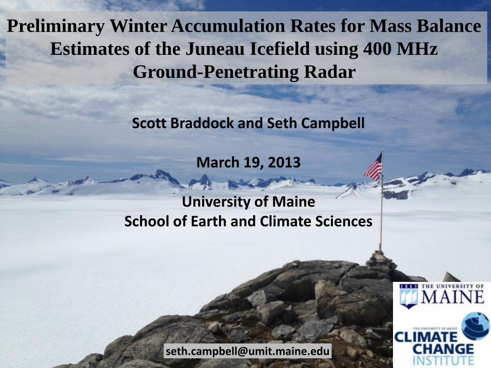
Preliminary Winter Accumulation Rates for Mass Balance
Estimates of the Juneau Icefield using 400 MHz
Ground-Penetrating Radar
Scott Braddock and Seth Campbell
March 19, 2013
University of MaineSchool of Earth and Climate Sciences
Objectives Study Location Methods Results and Interpretation Conclusions
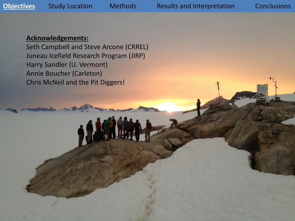
Acknowledgements:Seth Campbell and Steve Arcone (CRREL)Juneau Icefield Research Program (JIRP)Harry Sandler (U. Vermont)Annie Boucher (Carleton)Chris McNeil and the Pit Diggers!
Objectives Study Location Methods Results and Interpretation Conclusions
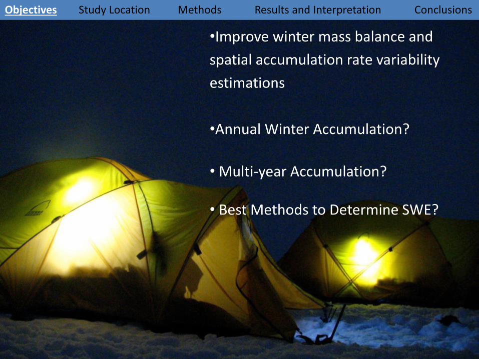
•Improve winter mass balance and
spatial accumulation rate variability
estimations
•Annual Winter Accumulation?
• Multi-year Accumulation?
• Best Methods to Determine SWE?

Objectives Study Location Methods Results and Interpretation Conclusions
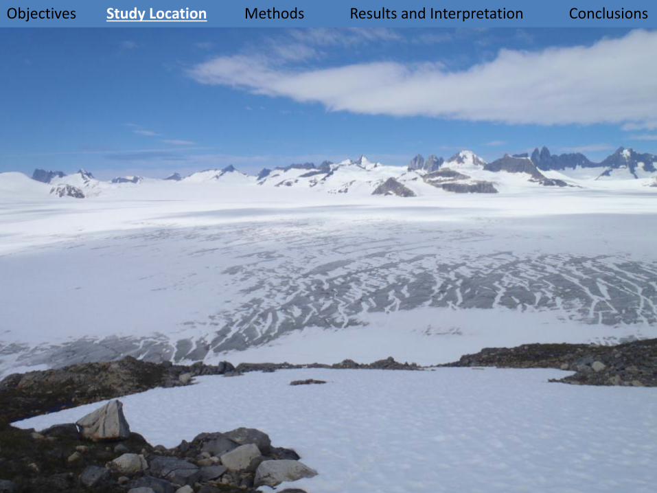
Juneau Icefield
• 1,955km2
• About 40 major and 100 minor glaciers
• Glaciers retreating with exception of Taku
Images from: SATELLITE IMAGE ATLAS OF GLACIERS OF THE WORLD: GLACIERS OF NORTH AMERICA— GLACIERS OF ALASKA (2008).

Radar Velocity:
CMP (Annan et al. 1994)
Ground Truth (Marshall et al., 2005)
Hyperbola Matching (Bradford and Harper, 2005)
Reflection Tomography (Bradford, 2006)
Objectives Study Location Methods Results and Interpretation Conclusions
Wave Velocity Depends on Density and Snow Wetness!

Objectives Study Location Methods Results and Interpretation Conclusions
Objectives Study Location Methods Results and Interpretation Conclusions

Objectives Study Location Methods Results and Interpretation Conclusions

Objectives Study Location Methods Results and Interpretation Conclusions
• 32 scans s-1
• 250 - 450 ns
• 2048 samples/scan
•100-800 MHz Filter
• Tow Rate: 3 - 7 km hr-1
• 14 – 40 scans/m
• 5-25 m penetrationGSSI SIR-3000 Control Unit
GSSI Model 5103A 400 MHz Antenna
Objectives Study Location Methods Results and Interpretation Conclusions
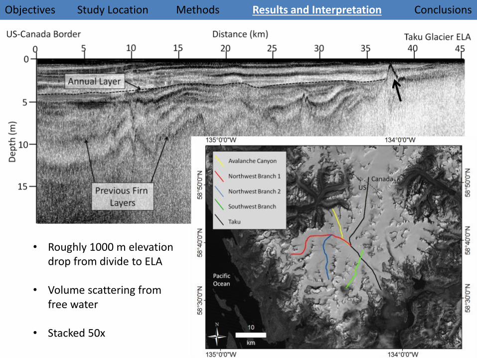
• Roughly 1000 m elevation drop from divide to ELA
• Volume scattering from free water
• Stacked 50x

Objectives Study Location Methods Results and Interpretation Conclusions
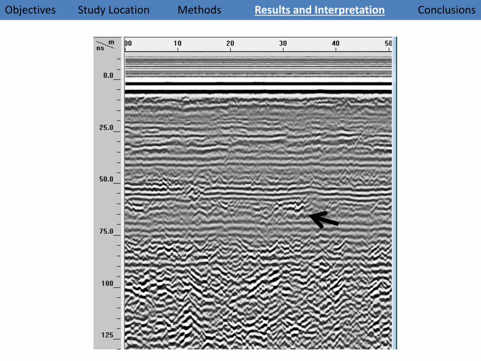
• +-+ GPR wave triplet (lower to higher permittivity)• Water table resting on ice under snow
Objectives Study Location Methods Results and Interpretation Conclusions
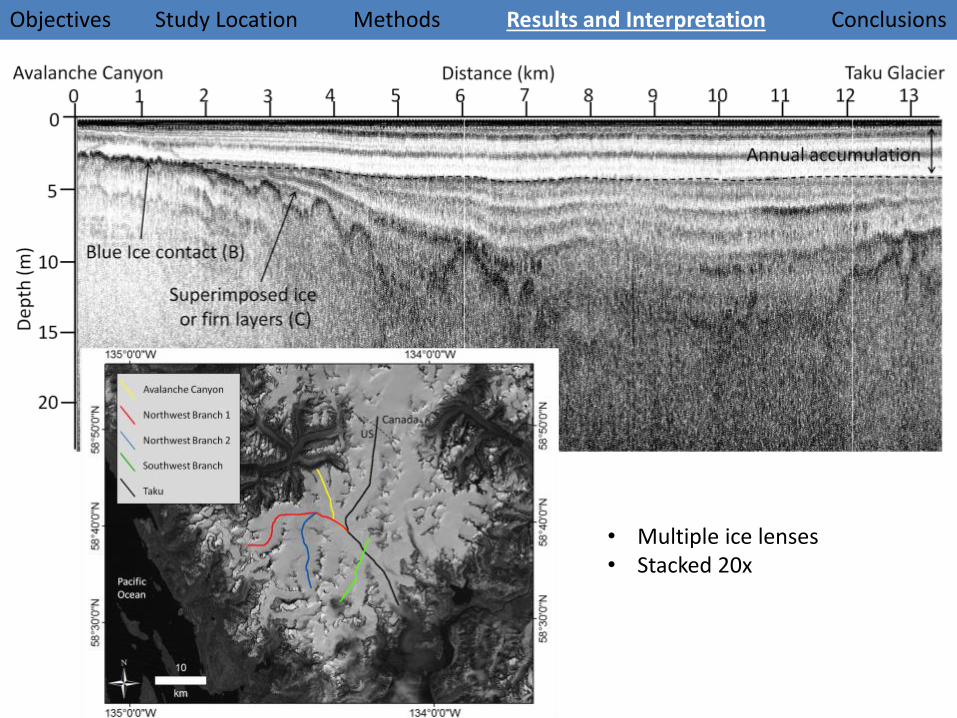
• Multiple ice lenses • Stacked 20x

Objectives Study Location Methods Results and Interpretation Conclusions
KEY POINT: Reverse Triplet Signature from dry snow over ice!

Objectives Study Location Methods Results and Interpretation Conclusions
1
2
3
4?

Objectives Study Location Methods Results and Interpretation Conclusions
Northern NW BranchThinning Stratigraphy:• Accumulation Gradient W to E• Divide towards ELA• Potential multi-year accumulation
Objectives Study Location Methods Results and Interpretation Conclusions
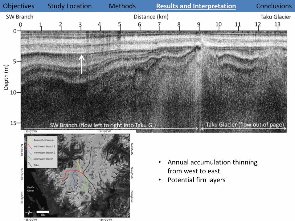
• Annual accumulation thinning from west to east
• Potential firn layers

Objectives Study Location Methods Results and Interpretation Conclusions
Future work:• Further processing to
acquire accurate depth measurements using hyperbola migration
Objectives Study Location Methods Results and Interpretation Conclusions
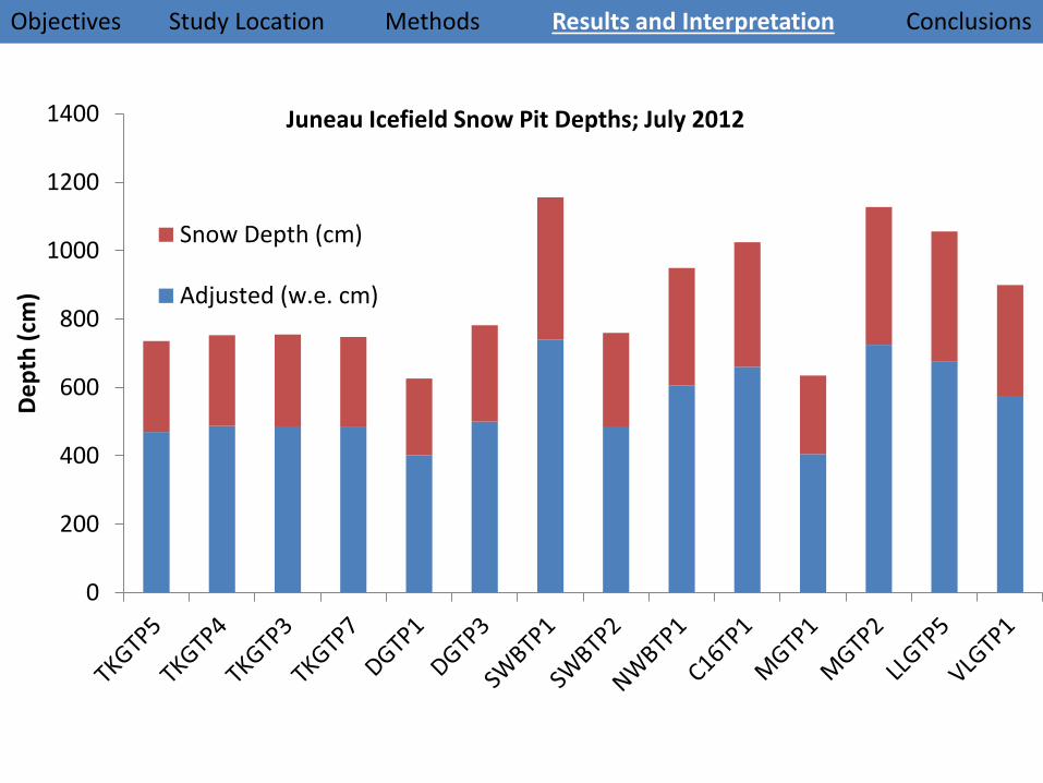
0
200
400
600
800
1000
1200
1400
De
pth
(cm
)
Juneau Icefield Snow Pit Depths; July 2012
Snow Depth (cm)
Adjusted (w.e. cm)
Objectives Study Location Methods Results and Interpretation Conclusions
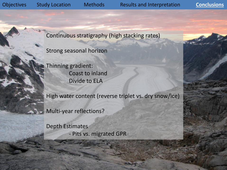
Continuous stratigraphy (high stacking rates)
Strong seasonal horizon
Thinning gradient:Coast to inlandDivide to ELA
High water content (reverse triplet vs. dry snow/ice)
Multi-year reflections?
Depth Estimates- Pits vs. migrated GPR
Objectives Study Location Methods Results and Interpretation Conclusions