Scoping Workshop to Develop Proposal: Vulnerability ... · Scoping Workshop to Develop Proposal:...
28
FINAL REPORT for APN PROJECT Project Reference Number: ARCP2012-22NSG-Prayitno The following collaborators worked on this project: Joko Prayitno, Center of Environmental Technology, Agency for The Assessment and Application of Technology, Indonesia, Email: [email protected] Kristine Garcia, School of Environmental Science and Management, University of the Philippines at Los Banos, Philippines, Email: [email protected] Mr. Kok Foo Kwan, Malaysian Meteorological Department, Malaysia. Email: [email protected] Scoping Workshop to Develop Proposal: Vulnerability Assessment of Mangrove Biodiversity to Climate Change in Southeast Asia
-
Upload
truongkhanh -
Category
Documents
-
view
228 -
download
1
Transcript of Scoping Workshop to Develop Proposal: Vulnerability ... · Scoping Workshop to Develop Proposal:...

FINAL REPORT for APN PROJECT
Project Reference Number: ARCP2012-22NSG-Prayitno
The following collaborators worked on this project:
Joko Prayitno, Center of Environmental Technology, Agency for The Assessment and
Application of Technology, Indonesia, Email: [email protected] Kristine Garcia, School of Environmental Science and Management, University of the
Philippines at Los Banos, Philippines, Email: [email protected] Mr. Kok Foo Kwan, Malaysian Meteorological Department, Malaysia. Email: [email protected]
Scoping Workshop to Develop Proposal: Vulnerability Assessment of Mangrove
Biodiversity to Climate Change in Southeast Asia

ARCP
2012
-22N
SG-P
rayi
tno-
FIN
AL R
EPO
R
Scoping Workshop to Develop Proposal: Vulnerability Assessment of Mangrove
Biodiversity to Climate Change in Southeast Asia Project Reference Number: ARCP2012-22NSG-Prayitno Final Report submitted to APN

1
©Asia-Pacific Network for Global Change Research
PAGE LEFT INTENTIONALLY BLANK


1
AR
CP20
12-x
xxx-
xxxx
-FIN
AL R
EPO
RT
OVERVIEW OF PROJECT WORK AND OUTCOMES Non-technical summary A scoping workshop on vulnerability assessment of mangrove biodiversity to climate change in Southeast Asia was conducted in Denpasar, Bali, Indonesia from 23-26 September 2012. The workshop was intended to gather information among collaborators from Indonesia, Philippines and Malaysia to further improve the research framework and methodologies of the full proposal to be submitted to APN in 2013 Annual Calls for Proposals under the ARCP Programme. The main activity of the proposed research is the assessment of mangrove ecosystem sensitivity and adaptability to climate change in Southeast Asia. This will be conducted by studying past and current biodiversity status in selected sites in Indonesia and Philippines, and gathering data on climate change factors such as sea-level rise, temperature, precipitation and CO2 concentration and their scenarios for 40 years based on available regional climate models. Furthermore, impacts of climate change on the sustainability of fish production in selected mangroves ecosystems will be investigated through historical data collection. Finally, socio-economic dependency on the sustainability of fish poduction in mangrove ecosystems will also be analysed. This scoping workshop was followed by a final workshop in Bali attended by Indonesian collaborators to finalize the proposal. Results of the proposed study will help decision makers in formulating climate change adaptation strategies for maintaining mangrove ecosystems biodiversity and sustainability of fish production. Keywords Climate change, mangrove, mangrove biodiversity, fish production Objectives The main objectives of the project were: 1. To gather information on what have been studied on mangrove biodiversity and on the impact
of climate change to mangrove ecosystem in Southeast Asia 2. To formulate the best methodologies to further study the impacts of climate change on
mangrove biodiversity and fish production in Southeast Asia based on data and resources availability.
3. To develop a proposal to assess the vulnerability of mangrove biodiversity to climate change in Southeast Asia.
Amount received and number years supported The Grant awarded to this project was: US$ 15,000 for Year 1: 2013 Activity undertaken
1. Meetings among collaborators within country: two small meetings were held in Jakarta for Indonesian participants on 23 August 2012 and 7 September 2013 to discuss data availability and methodologies on fisheries production and remote sensing in mangroves.
2. First Scoping Workshop of Collaborators in Bali Indonesia, 23-26 September 2012: The aims of this workshop were to introduce and get to know prospective collaborators and their expertise for the proposed project among; to share information, experience and knowledge among collaborators in order to identify the impact of climate change on mangrove ecosystem in the region and the appropriate methodology to study it; to discuss the role of each collaborator in preparing the proposal and during project implementation; and to identify prospective study sites in two countries (Indonesia and Philippines) with particular consideration on the availability of climate and biodiversity data for the sites, the availability

ARCP
2012
-22N
SG-P
rayi
tno-
FIN
AL R
EPO
R
of resources and appropriate methodologies to be used. 3. Site Visit: A site visit to mangrove ecosystem in Bali Indonesia was conducted on 26
September 2012. The visit was intended to give collaborators direct visualization of mangrove forests and to stimulate exchange of knowledge and experience among collaborators.
4. Final Scoping Workshop in Bali Indonesia, 18-20 February 2013: The final workshop was attended by Indonesia collaborators to refine and further develop draft proposal. The final proposal was produced after the final workshop and after discussions with collaborators from Malaysia and the Philippines via email.
Results Major outputs of this project was the production of a proposal titled ‘Vulnerability Assessment of Mangrove Ecosystem to Climate Change in Southeast Asia’ to be submitted to APN’s Call for Proposal 2013. The outline of the proposed activities in the proposal includes kick-off meeting, scenario development, assessment of mangrove ecosystem sensitivity and adaptability to climate change, vulnerability assessment of mangrove-ecosystem dependent communities/sector and final workshop for sharing results and policy recommendations. The proposed study site will be in Segara Anakan, Central Java, Indonesia and Aurora Province in the Philippines. Relevance to the APN Goals, Science Agenda and to Policy Processes
The Scoping Workshop is relevant to the APN Science agenda of both goal 1, 2 and 3 i.e., supporting regional cooperation by involving three Southeast Asia countries to conduct research on global change impact on mangrove biodiversity in the region and adaptation strategies for its sustainability. It will contribute significantly to the APN Scientific Agenda on climate change and biodiversity, and for making policy recommendations in the Southeast Asia context.
The Scoping Workshop produced a proposal that assess the vulnerability of mangrove biodiversity to climate change in Southeast Asia. There are sizeable mangrove forests along coastlines of Southeast Asian countries that are vulnerable to climate change. Mangrove forests are not only ecologically important for biodiversity sustainability but also have socioeconomic dimensions for humankind. The mangrove forests in Malaysia, Indonesia, and the Philippines are shrinking at an alarming rate due to a combination of natural causes and human exploitation. This in turn has reduced marine productivity in terms of fish, shrimp, crab and many other marine lives. Climate Change impact aggravated this shrinking in the Southeast Asian mangroves. By producing a proposal to address this issue, efforts have been made to understand mangrove vulnerability to climate change in Southeast Asia, which help develop future scenarios for adaptation of mangrove ecosystem. Self evaluation The Scoping Workshop allowed all collaborators involved actively in the process of developing the proposal and understood on how the whole proposed project was broken down into sub-tasks such as climate change scenario, mangrove biodiversity, fisheries production and socio-economic status of the community. The workshop also ensure that the tasks in the proposal was allocated according to the strengths of each team member, and that all team members understood that their own part would contribute to the group's success. Although not all team members listed in the proposal attended the workshop, all members were clear about the time frame and their own responsibilities. track. Potential for further work Results of this Scoping Workshop provide current information on climate change and mangrove biodiversity and can be a basis for studying the vulnerability of mangrove biodiversity to climate change in Southeast Asia. They also can be used to study mangrove ecology, fisheries production and socio-economic aspects of coastal zone in the region.
3
AR
CP20
12-x
xxx-
xxxx
-FIN
AL R
EPO
RT
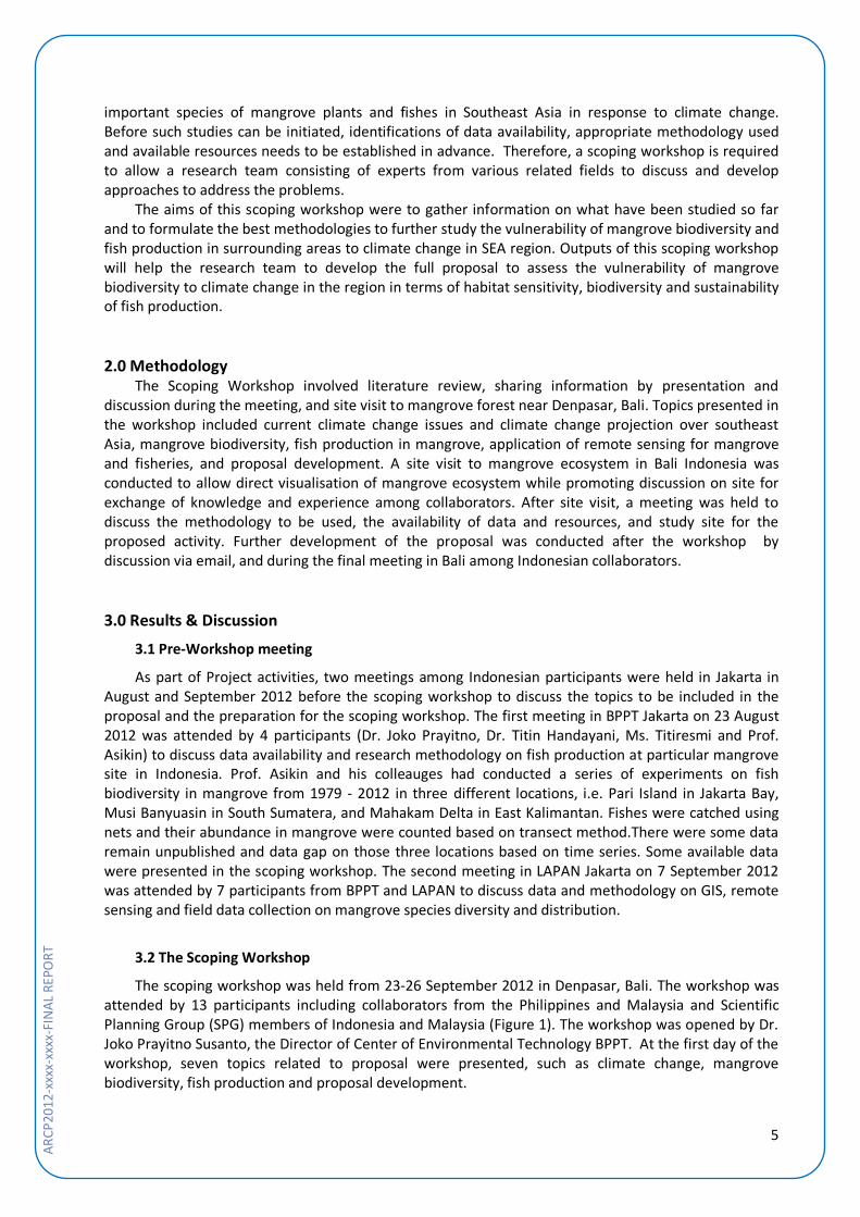
Publications Garcia K, J Prayitno and KF Kwan. 2012. Vulnerability Assessment of Mangrove Ecosystems to Climate Change in Southeast Asia. Poster session presented at First National Conference on Research in Climate Change and Variability, 27 Sept 2012, Manila, Philippines. http://www.apn-gcr.org/ resources/items/show/1761. References
Boquiren, R., Di Carlo, G. & Quibilan, M.C. (2010). Climate Change Vulnerability Assessment of the Verde Island Passage, Philippines. Technical Report. Conservation International, Arlington, Virginia, USA. 94p.
Giesen, W., Wulffraat, S., Zieren, M. & Scholten, L. (2007). Mangrove Guide Book for Southeast Asia. FAO and Wetlands International, Thailand. 198p.
Gilman, E.L., Ellison, J., Duke, N.C. & Field, C. (2008). Threats to mangroves from climate change and adaptation options. Aquatic Bot. 89:237-250.
Gilman, E.L.., Van Lavieren, H., Ellison, J., Jungblut, V., Wilson, L., Areki, F., Brighouse, G., Bungitak, J., Dus, E., Henry, M., Saun Jr, I., Kilman, M., Matthews, E., Teariki-Ruatu, N., Tukia, S. & Yuknavage, K. (2006). Pacific Island Mangroves in a Changing Climate and Rising Sea. UNEP Regional Seas Reports and Studies No. 179. United Nations Environment Programme, Regional Seas Programme, Nairobi, KENYA. 58p.
Giri, C., Ochieng, E., Tieszen, L.L., Zhu, Z., Singh, A., Loveland, T., Masek, J. & Duke, N. (2011). Status and distribution of mangrove forests of the world using earth observation satellite data. Global Ecol. Biogeogr. 2011. 20:154–159.
McLeod, E. & Salm, R.V. (2006). Managing Mangroves for Resilience to Climate Change. IUCN, Gland, Switzerland. 64p.
PEACE. (2007). Indonesia and Climate Change: Current Status and Policies. PEACE Indonesia. 82p. Acknowledgments
We would like to thank Dr. Erna S. Adiningsih and Dr. Subramaniam Moten for their advice and guidance as well as their valuable contributions during the workshop. We would also like to show our appreciation to Mr. Murdoko of Mangrove Forest Management Center, Ministry of Forestry, Jl. By Pass Ngurah Rai, Denpasar, Bali, Indonesia for facilitating the mangrove forest site visit and discussion room.

ARCP
2012
-22N
SG-P
rayi
tno-
FIN
AL R
EPO
R
TECHNICAL REPORT
Preface Climate change has impacts on ecosystems and human life. As part of coastal ecosystems, mangroves are threatened by climate change because of their location at the land-sea margin and because of economic and social pressures. This report describes activities of a scoping workshop to develop a proposal to be submitted to APN’s Annual Call for Proposal in 2013. The proposal is aimed to study the vulnerability of mangrove biodiversity to climate change and its impact on fish production and socio-economy status of local people. This scoping workshop and the proposal involved institutions from Indonesia, Malaysia and the Philippines.
Table of Contents
Preface ……………………………………………………………………………………………………………………….……… 1 Table of Contents …………………………………………………………………………………………………………….… 1 1.0 Introduction …………………………………………………………………………………………………………….…… 1 2.0 Methodologies …………………………………………………………………………………………………….……… 2 3.0 Results and Discussions …………………………………………………………………………………….….……… 2
3.1 Pre Workshop Meeting …………………………………………………………..……………..…………… 2 3.2 The Scoping Workshop ……………………………………………………………………………..….…….. 2 3.3 Site Visit to Mangrove Forest ………………………………………………………………………...……. 10 3.4 Discussion of Draft Proposal ……………………………………………………………………………….. 11 3.5 The Final Workshop ……………………………………………………………………………………………... 13 3.6 Discussion …………………………………………………………………………………………………………….. 13
4.0 Conclusion …………………………………………………………………………………………………………………… 14 5.0 Future Direction …………………………………………………………………………………………………..……… 14 References …………………………………………………………………………………………………………............... 14 Appendixes …………………………………………………………………………………………………………………..…… 16
1.0 Introduction Southeast Asia (SEA) harbours 35% of the world’s total mangroves on earth (Giri et al., 2011).
Mangroves are unique ecosystems found in estuaries, sheltered bays and coastlines within tidal areas. Mangrove ecosystems are host to various kinds of marine organisms such as fishes, crabs, zooplanktons and phytoplanktons. SEA’s mangroves are the most species-diverse in the world with 52 species endemic to SEA's mangrove habitat including 42 trees and shrubs (Giesen et al., 2007). Other important functions of mangroves include protecting coastal area from abrasion, storm surge and tsunamis (McLeod and Salm, 2006). Because of their significant role, conservation of mangrove is vital to socio-economic development including sustainable fish production.
Being located in archipelago countries, mangroves in SEA are vulnerable to sea-level rise and ocean warming resulted from climate change. Sea-level rise and ocean warming affect mangrove biodiversity and fishery sectors (Gilman et al., 2008), although the scale of this has yet to be determined. Increase in sea level will lead to inundation of mangroves and reduce available areas for recruitment of associated fauna that have fisheries value (Boquiren et al., 2010). Increase of sea surface temperature will affect most of the fisheries target species through disruption in timing of reproduction and decrease in reproductive output, leading to changes in fisheries productivity (Boquiren et al., 2010). As a consequence, climate change may also have impacts on socio-economic of local people living close to mangrove ecosystems.
Studies on the impacts of climate change on mangrove ecosystems have been conducted in SEA region (PEACE, 2007; Boquiren et al., 2010), however its impact on the sustainability of fish production is not known. Further studies are needed to assess the past and current level of biodiversity on
5
AR
CP20
12-x
xxx-
xxxx
-FIN
AL R
EPO
RT
important species of mangrove plants and fishes in Southeast Asia in response to climate change. Before such studies can be initiated, identifications of data availability, appropriate methodology used and available resources needs to be established in advance. Therefore, a scoping workshop is required to allow a research team consisting of experts from various related fields to discuss and develop approaches to address the problems.
The aims of this scoping workshop were to gather information on what have been studied so far and to formulate the best methodologies to further study the vulnerability of mangrove biodiversity and fish production in surrounding areas to climate change in SEA region. Outputs of this scoping workshop will help the research team to develop the full proposal to assess the vulnerability of mangrove biodiversity to climate change in the region in terms of habitat sensitivity, biodiversity and sustainability of fish production. 2.0 Methodology
The Scoping Workshop involved literature review, sharing information by presentation and discussion during the meeting, and site visit to mangrove forest near Denpasar, Bali. Topics presented in the workshop included current climate change issues and climate change projection over southeast Asia, mangrove biodiversity, fish production in mangrove, application of remote sensing for mangrove and fisheries, and proposal development. A site visit to mangrove ecosystem in Bali Indonesia was conducted to allow direct visualisation of mangrove ecosystem while promoting discussion on site for exchange of knowledge and experience among collaborators. After site visit, a meeting was held to discuss the methodology to be used, the availability of data and resources, and study site for the proposed activity. Further development of the proposal was conducted after the workshop by discussion via email, and during the final meeting in Bali among Indonesian collaborators. 3.0 Results & Discussion
3.1 Pre-Workshop meeting
As part of Project activities, two meetings among Indonesian participants were held in Jakarta in August and September 2012 before the scoping workshop to discuss the topics to be included in the proposal and the preparation for the scoping workshop. The first meeting in BPPT Jakarta on 23 August 2012 was attended by 4 participants (Dr. Joko Prayitno, Dr. Titin Handayani, Ms. Titiresmi and Prof. Asikin) to discuss data availability and research methodology on fish production at particular mangrove site in Indonesia. Prof. Asikin and his colleauges had conducted a series of experiments on fish biodiversity in mangrove from 1979 - 2012 in three different locations, i.e. Pari Island in Jakarta Bay, Musi Banyuasin in South Sumatera, and Mahakam Delta in East Kalimantan. Fishes were catched using nets and their abundance in mangrove were counted based on transect method.There were some data remain unpublished and data gap on those three locations based on time series. Some available data were presented in the scoping workshop. The second meeting in LAPAN Jakarta on 7 September 2012 was attended by 7 participants from BPPT and LAPAN to discuss data and methodology on GIS, remote sensing and field data collection on mangrove species diversity and distribution.
3.2 The Scoping Workshop
The scoping workshop was held from 23-26 September 2012 in Denpasar, Bali. The workshop was attended by 13 participants including collaborators from the Philippines and Malaysia and Scientific Planning Group (SPG) members of Indonesia and Malaysia (Figure 1). The workshop was opened by Dr. Joko Prayitno Susanto, the Director of Center of Environmental Technology BPPT. At the first day of the workshop, seven topics related to proposal were presented, such as climate change, mangrove biodiversity, fish production and proposal development.
ARCP
2012
-22N
SG-P
rayi
tno-
FIN
AL R
EPO
R
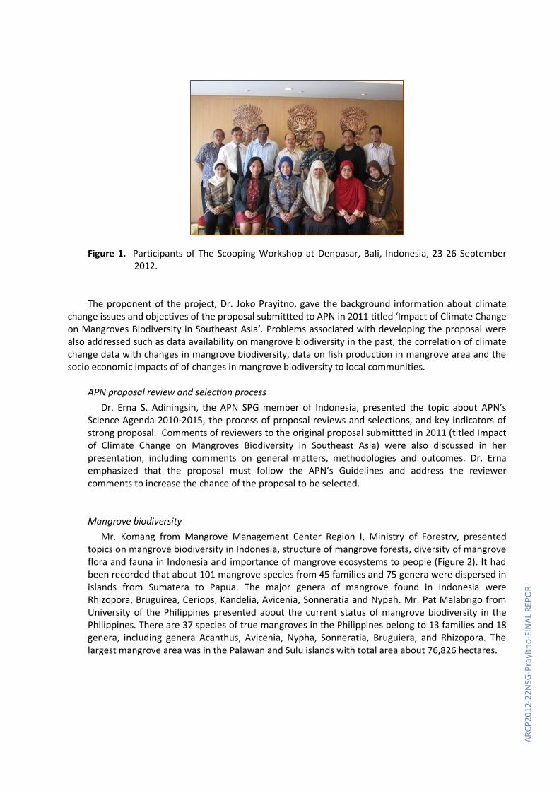
Figure 1. Participants of The Scooping Workshop at Denpasar, Bali, Indonesia, 23-26 September 2012.
The proponent of the project, Dr. Joko Prayitno, gave the background information about climate change issues and objectives of the proposal submittted to APN in 2011 titled ‘Impact of Climate Change on Mangroves Biodiversity in Southeast Asia’. Problems associated with developing the proposal were also addressed such as data availability on mangrove biodiversity in the past, the correlation of climate change data with changes in mangrove biodiversity, data on fish production in mangrove area and the socio economic impacts of of changes in mangrove biodiversity to local communities.
APN proposal review and selection process
Dr. Erna S. Adiningsih, the APN SPG member of Indonesia, presented the topic about APN’s Science Agenda 2010-2015, the process of proposal reviews and selections, and key indicators of strong proposal. Comments of reviewers to the original proposal submittted in 2011 (titled Impact of Climate Change on Mangroves Biodiversity in Southeast Asia) were also discussed in her presentation, including comments on general matters, methodologies and outcomes. Dr. Erna emphasized that the proposal must follow the APN’s Guidelines and address the reviewer comments to increase the chance of the proposal to be selected. Mangrove biodiversity
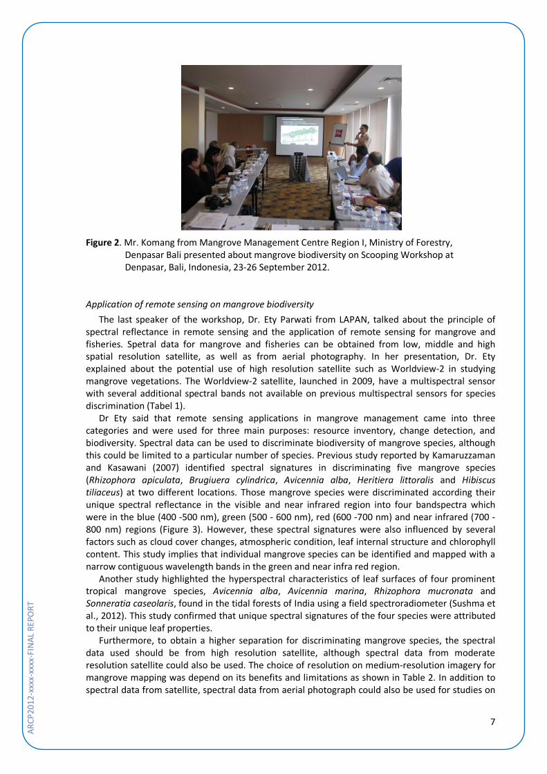
Mr. Komang from Mangrove Management Center Region I, Ministry of Forestry, presented topics on mangrove biodiversity in Indonesia, structure of mangrove forests, diversity of mangrove flora and fauna in Indonesia and importance of mangrove ecosystems to people (Figure 2). It had been recorded that about 101 mangrove species from 45 families and 75 genera were dispersed in islands from Sumatera to Papua. The major genera of mangrove found in Indonesia were Rhizopora, Bruguirea, Ceriops, Kandelia, Avicenia, Sonneratia and Nypah. Mr. Pat Malabrigo from University of the Philippines presented about the current status of mangrove biodiversity in the Philippines. There are 37 species of true mangroves in the Philippines belong to 13 families and 18 genera, including genera Acanthus, Avicenia, Nypha, Sonneratia, Bruguiera, and Rhizopora. The largest mangrove area was in the Palawan and Sulu islands with total area about 76,826 hectares.
7
AR
CP20
12-x
xxx-
xxxx
-FIN
AL R
EPO
RT
Figure 2. Mr. Komang from Mangrove Management Centre Region I, Ministry of Forestry,
Denpasar Bali presented about mangrove biodiversity on Scooping Workshop at Denpasar, Bali, Indonesia, 23-26 September 2012.
Application of remote sensing on mangrove biodiversity
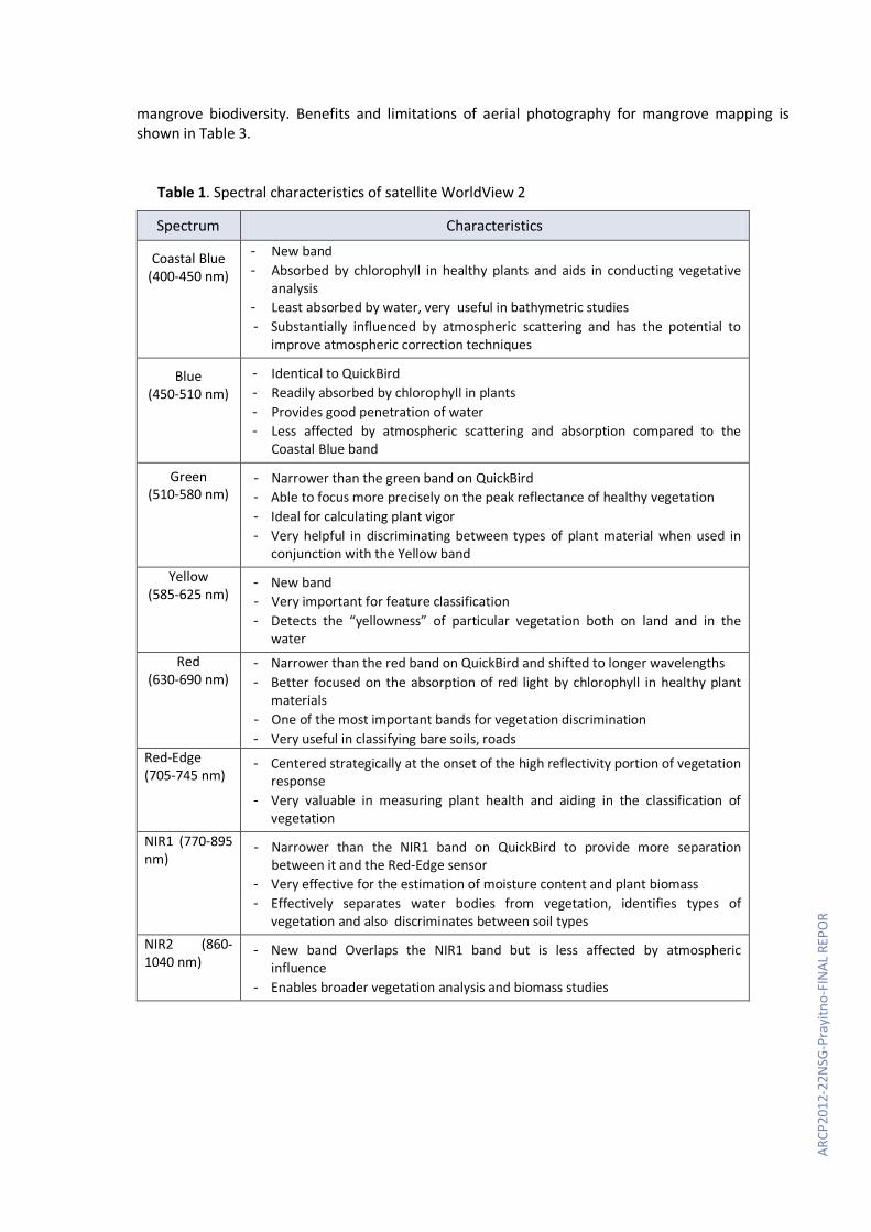
The last speaker of the workshop, Dr. Ety Parwati from LAPAN, talked about the principle of spectral reflectance in remote sensing and the application of remote sensing for mangrove and fisheries. Spetral data for mangrove and fisheries can be obtained from low, middle and high spatial resolution satellite, as well as from aerial photography. In her presentation, Dr. Ety explained about the potential use of high resolution satellite such as Worldview-2 in studying mangrove vegetations. The Worldview-2 satellite, launched in 2009, have a multispectral sensor with several additional spectral bands not available on previous multispectral sensors for species discrimination (Tabel 1).
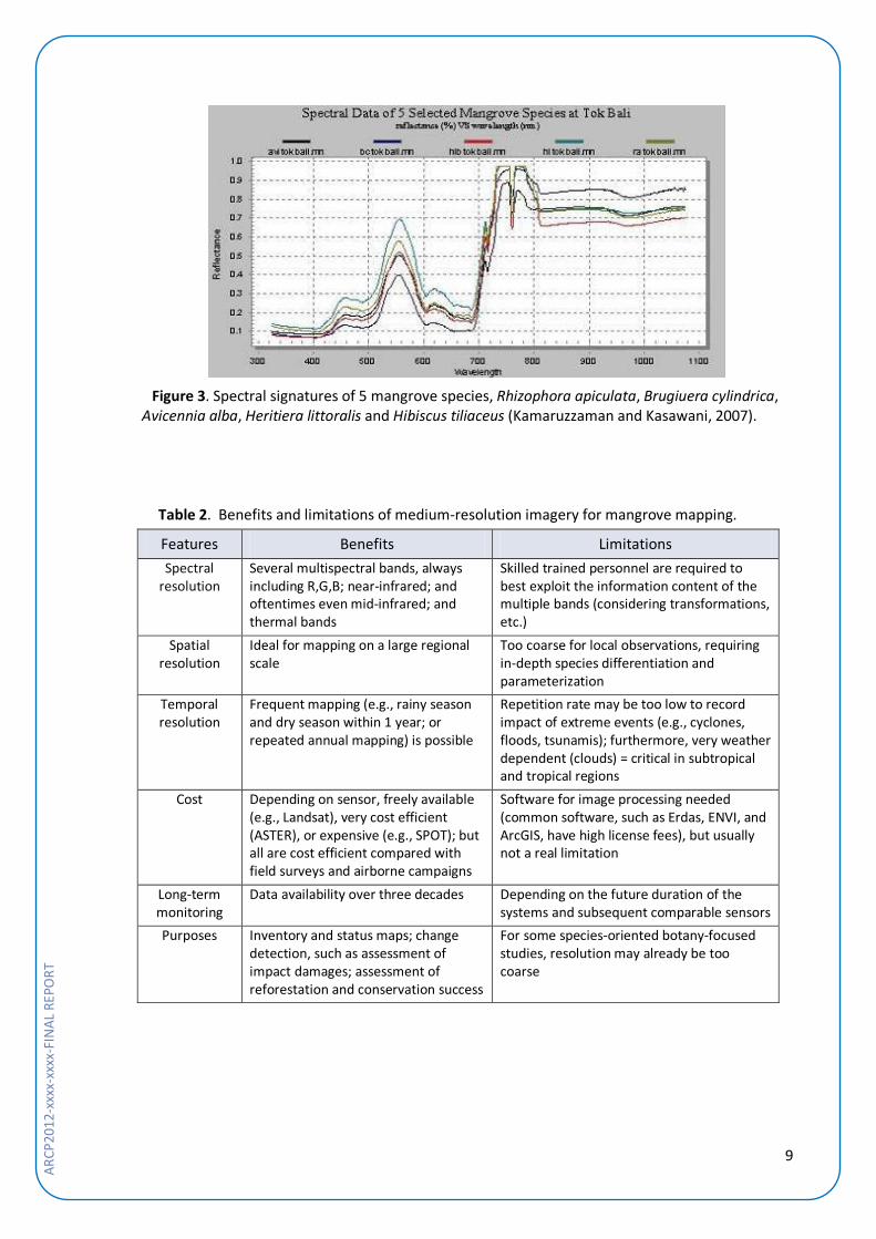
Dr Ety said that remote sensing applications in mangrove management came into three categories and were used for three main purposes: resource inventory, change detection, and biodiversity. Spectral data can be used to discriminate biodiversity of mangrove species, although this could be limited to a particular number of species. Previous study reported by Kamaruzzaman and Kasawani (2007) identified spectral signatures in discriminating five mangrove species (Rhizophora apiculata, Brugiuera cylindrica, Avicennia alba, Heritiera littoralis and Hibiscus tiliaceus) at two different locations. Those mangrove species were discriminated according their unique spectral reflectance in the visible and near infrared region into four bandspectra which were in the blue (400 -500 nm), green (500 - 600 nm), red (600 -700 nm) and near infrared (700 - 800 nm) regions (Figure 3). However, these spectral signatures were also influenced by several factors such as cloud cover changes, atmospheric condition, leaf internal structure and chlorophyll content. This study implies that individual mangrove species can be identified and mapped with a narrow contiguous wavelength bands in the green and near infra red region.
Another study highlighted the hyperspectral characteristics of leaf surfaces of four prominent tropical mangrove species, Avicennia alba, Avicennia marina, Rhizophora mucronata and Sonneratia caseolaris, found in the tidal forests of India using a field spectroradiometer (Sushma et al., 2012). This study confirmed that unique spectral signatures of the four species were attributed to their unique leaf properties.
Furthermore, to obtain a higher separation for discriminating mangrove species, the spectral data used should be from high resolution satellite, although spectral data from moderate resolution satellite could also be used. The choice of resolution on medium-resolution imagery for mangrove mapping was depend on its benefits and limitations as shown in Table 2. In addition to spectral data from satellite, spectral data from aerial photograph could also be used for studies on
ARCP
2012
-22N
SG-P
rayi
tno-
FIN
AL R
EPO
R
mangrove biodiversity. Benefits and limitations of aerial photography for mangrove mapping is shown in Table 3.
Table 1. Spectral characteristics of satellite WorldView 2
Spectrum Characteristics
Coastal Blue (400-450 nm)
- New band - Absorbed by chlorophyll in healthy plants and aids in conducting vegetative
analysis - Least absorbed by water, very useful in bathymetric studies - Substantially influenced by atmospheric scattering and has the potential to
improve atmospheric correction techniques
Blue (450-510 nm)
- Identical to QuickBird - Readily absorbed by chlorophyll in plants - Provides good penetration of water - Less affected by atmospheric scattering and absorption compared to the
Coastal Blue band
Green (510-580 nm)
- Narrower than the green band on QuickBird - Able to focus more precisely on the peak reflectance of healthy vegetation - Ideal for calculating plant vigor - Very helpful in discriminating between types of plant material when used in
conjunction with the Yellow band Yellow
(585-625 nm) - New band - Very important for feature classification - Detects the “yellowness” of particular vegetation both on land and in the
water Red
(630-690 nm) - Narrower than the red band on QuickBird and shifted to longer wavelengths - Better focused on the absorption of red light by chlorophyll in healthy plant
materials - One of the most important bands for vegetation discrimination - Very useful in classifying bare soils, roads
Red-Edge (705-745 nm)
- Centered strategically at the onset of the high reflectivity portion of vegetation response
- Very valuable in measuring plant health and aiding in the classification of vegetation
NIR1 (770-895 nm)
- Narrower than the NIR1 band on QuickBird to provide more separation between it and the Red-Edge sensor
- Very effective for the estimation of moisture content and plant biomass - Effectively separates water bodies from vegetation, identifies types of
vegetation and also discriminates between soil types NIR2 (860-1040 nm)
- New band Overlaps the NIR1 band but is less affected by atmospheric influence
- Enables broader vegetation analysis and biomass studies
9
AR
CP20
12-x
xxx-
xxxx
-FIN
AL R
EPO
RT
Figure 3. Spectral signatures of 5 mangrove species, Rhizophora apiculata, Brugiuera cylindrica,
Avicennia alba, Heritiera littoralis and Hibiscus tiliaceus (Kamaruzzaman and Kasawani, 2007).
Table 2. Benefits and limitations of medium-resolution imagery for mangrove mapping.
Features Benefits Limitations Spectral
resolution Several multispectral bands, always including R,G,B; near-infrared; and oftentimes even mid-infrared; and thermal bands
Skilled trained personnel are required to best exploit the information content of the multiple bands (considering transformations, etc.)
Spatial resolution
Ideal for mapping on a large regional scale
Too coarse for local observations, requiring in-depth species differentiation and parameterization
Temporal resolution
Frequent mapping (e.g., rainy season and dry season within 1 year; or repeated annual mapping) is possible
Repetition rate may be too low to record impact of extreme events (e.g., cyclones, floods, tsunamis); furthermore, very weather dependent (clouds) = critical in subtropical and tropical regions
Cost Depending on sensor, freely available (e.g., Landsat), very cost efficient (ASTER), or expensive (e.g., SPOT); but all are cost efficient compared with field surveys and airborne campaigns
Software for image processing needed (common software, such as Erdas, ENVI, and ArcGIS, have high license fees), but usually not a real limitation
Long-term monitoring
Data availability over three decades Depending on the future duration of the systems and subsequent comparable sensors
Purposes Inventory and status maps; change detection, such as assessment of impact damages; assessment of reforestation and conservation success
For some species-oriented botany-focused studies, resolution may already be too coarse
ARCP
2012
-22N
SG-P
rayi
tno-
FIN
AL R
EPO
R
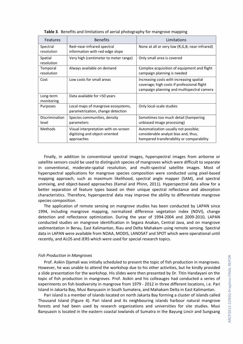
Table 3. Benefits and limitations of aerial photography for mangrove mapping
Features Benefits Limitations Spectral resolution
Red–near-infrared spectral information with red-edge slope
None at all or very low (R,G,B; near-infrared)
Spatial resolution
Very high (centimeter to meter range) Only small area is covered
Temporal resolution
Always available on demand Complex acquisition of equipment and flight campaign planning is needed
Cost Low costs for small areas Increasing costs with increasing spatial coverage; high costs if professional flight campaign planning and multispectral camera
Long-term monitoring
Data available for >50 years
Purposes Local maps of mangrove ecosystems, parametrization, change detection
Only local-scale studies
Discrimination level
Species communities, density parameters
Sometimes too much detail (hampering unbiased image processing)
Methods Visual interpretation with on-screen digitizing and object-oriented approaches
Automatization usually not possible; considerable analyst bias and, thus, hampered transferability or comparability
Finally, in addition to conventional spectral images, hyperspectral images from airborne or satellite sensors could be used to distinguish species of mangroves which were difficult to separate in conventional, moderate-spatial resolution, and multi-spectral satellite images. Most of hyperspectral applications for mangrove species composition were conducted using pixel-based mapping approach, such as maximum likelihood, spectral angle mapper (SAM), and spectral unmixing, and object-based approaches (Kamal and Phinn, 2011). Hyperspectral data allow for a better separation of feature types based on their unique spectral reflectance and absorption characteristics. Therefore, hyperspectral data may improve the ability to differentiate mangrove species composition.
The application of remote sensing on mangrove studies has been conducted by LAPAN since 1994, including mangrove mapping, normalized difference vegetation index (NDVI), change detection and reflectance optimization. During the year of 1994-2004 and 2009-2010, LAPAN conducted studies on mangrove identification in Segara Anakan, Central Java, and on mangrove sedimentation in Berau, East Kalimantan, Riau and Delta Mahakam using remote sensing. Spectral data in LAPAN were available from NOAA, MODIS, LANDSAT and SPOT which were operational until recently, and ALOS and JERS which were used for special research topics. Fish Production in Mangroves
Prof. Asikin Djamali was initially scheduled to present the topic of fish production in mangroves. However, he was unable to attend the workshop due to his other activities, but he kindly provided a slide presentation for the workshop. His slides were then presented by Dr. Titin Handayani on the topic of fish production in mangroves. Prof. Asikin and his colleauges had conducted a series of experiments on fish biodiversity in mangrove from 1979 - 2012 in three different locations, i.e. Pari Island in Jakarta Bay, Musi Banyuasin in South Sumatera, and Mahakam Delta in East Kalimantan.
Pari island is a member of islands located on north Jakarta Bay forming a cluster of islands called Thousand Island (Figure 4). Pari island and its neighbouring islands harbour natural mangrove forests and had been used by research organizations and universities for site studies. Musi Banyuasin is located in the eastern coastal lowlands of Sumatra in the Bayung Lincir and Sungsang

11
AR
CP20
12-x
xxx-
xxxx
-FIN
AL R
EPO
RT
sub-districts, Musi Banyu Asin District, South Sumatra Province (Figure 5). More than 30 species of mangrove are known to occur in this region. The main species are Rhizophora mucronata, R. apiculata, Avicennia alba, A. marina, Sonneratia alba, S. acida, Ceriops tagal, C. candoleana and Xylocarpus spp. There are also some extensive swamps of Nypha fruticans. Mahakam Delta is a configuration of 46 small islands forming a unique fan-shaped lobate which stretches out into the coastal area of the Makassar Strait of East Kalimantan (Figure 6). Mangrove forests in Mahakam Delta is predominantly consists of pedada (Sonneratia caseolaris) zone, Rhizophora zone, transition zone, Nypha zone and nibung (Oncosperma tigillarium) zone.
Figure 4. Pari island as part of Thousand islands on north of Jakarta.

ARCP
2012
-22N
SG-P
rayi
tno-
FIN
AL R
EPO
R
Figure 5. The location of Musi Banyuasin, South Sumatera.
Figure 6. Delta Mahakam, East Kalimantan

13
AR
CP20
12-x
xxx-
xxxx
-FIN
AL R
EPO
RT
Studies conducted by Prof. Asikin in Pari island, Musi Banyuasin Estuari, and Mahakam Delta showed that the number of fish species found in mangroves varied from 24 to 131 species, which belong to 16-61 families (Table 4). Fish abundance in Musi Banyuasin Estuari and Mahakam Delta were higher or more than doubled than those found in Pari island Jakarta Bay. The number of species in Musi Banyuasin Estuari and Mahakam Delta were ranged 57-99 and 80-131 species.
Tabel 4. Fish abundance in three mangrove locations in Indonesia.
Location Year Number
of Families
Number of
Species
Number of Specimen References
Pari Island, Jakarta Bay
1979 16 24 760 Hutomo & Djamali (1979) 1981 18 27 1224 1984 18 29 1719 Adrim, Djamali & Toro
(1984) Musi Banyuasin, South Sumatera
1980 10 70 NA Burhanuddin (1980) 1994 38 99 925 Genisa (1995) 1998 29 57 NA Djamali (1999)
March 2009 NA 72 NA Prianto & Aprianti (2012) June 2009 NA 81 NA Prianto & Aprianti (2012)
Mahakam Delta, East Kalimantan
2006 44 80 NA Genisa (2006) 2009 61 131 NA Suyatna (2010)
Note: NA = data not available
Ten dominant species found in Musi Banyuasin Estuari in 1980 were wolf-herring (parang-parang, Chirocentridae), slender sanding (Dussumieridae), gizzard shad (Dorosomatidae), anchovy (Engraulidae), sardine (Clupeidae), cat fish (manyung, Ariidae), common Grinner (Synodontidae), threadfin (senangin, Eleutheronema tetradactylum), hair tail (Trichiuridae) and puffer fish (Tetraodontidae). The dominant species found in the same location in 1999 were mullet (belanak, Valamugil seheli), cat fish (manyung, Ariidae), croakers (gulamah, Johnius trachycephalus), threadfin (senangin, Eleutheronema tetradactylum), black pomfret (bawal hitam, Parastromateus niger), barramundi (kakap putih, Lates calcarifer), tripletail (kakap batu, Labotes surinamensis), cat fish (sembilang, Plotosidae) and grouper (kerapu, Serranidae). In Mahakam Delta, the dominant species found in 2006 were Sardinella fimbriata, Leiognathus elongata, Rastrelliger kanagurta and Apogon caramensis. Individual distribution of each species at each observation sites was nearly equal. Species diversity index (H) ranged between 0.5300 – 1.5547, evenness index ranged 0.3308 – 0.9198 and richness index (d) ranged 13.1801 – 23.7026 (Genisa, 2006).
The most abundance species found in Pari Island in 1979 was Gerres macrosoma (Silver-Biddy) made up 80.92 % of total abundance. Fish abundance in mangrove ecosystems is depend on the location of the mangrove. Overall, studies conducted in Pari island, Musi Banyuasin Estuari, and Mahakam Delta showed that mangrove close to estuaries had higher number of fish species compared to mangrove in small island such Pari Island.
Regional Climate Change Data
Mr. Kwan Kok Foo from Malaysian Meteorigical Departement presented about climate change data availability, processing and projection over Southeast Asia. Data on regional temperatures over several past decades were shown and its projection for 40 years was shown. It was also possible to obtain other climate factors such as sea-level rise, extreme weather, temperature and CO2 concentration from IPCC reports and developed their scenario for 40 years using HadCM3 PRECIS climate model.
ARCP
2012
-22N
SG-P
rayi
tno-
FIN
AL R
EPO
R
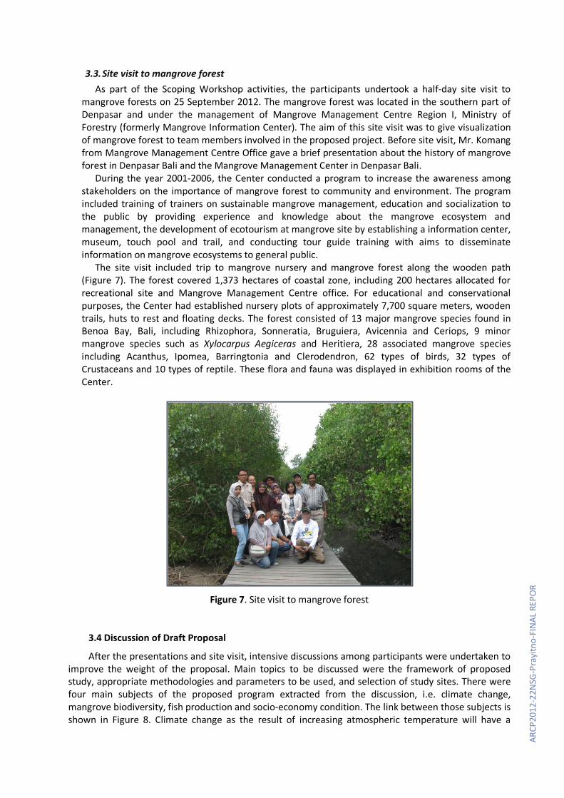
3.3. Site visit to mangrove forest As part of the Scoping Workshop activities, the participants undertook a half-day site visit to
mangrove forests on 25 September 2012. The mangrove forest was located in the southern part of Denpasar and under the management of Mangrove Management Centre Region I, Ministry of Forestry (formerly Mangrove Information Center). The aim of this site visit was to give visualization of mangrove forest to team members involved in the proposed project. Before site visit, Mr. Komang from Mangrove Management Centre Office gave a brief presentation about the history of mangrove forest in Denpasar Bali and the Mangrove Management Center in Denpasar Bali.
During the year 2001-2006, the Center conducted a program to increase the awareness among stakeholders on the importance of mangrove forest to community and environment. The program included training of trainers on sustainable mangrove management, education and socialization to the public by providing experience and knowledge about the mangrove ecosystem and management, the development of ecotourism at mangrove site by establishing a information center, museum, touch pool and trail, and conducting tour guide training with aims to disseminate information on mangrove ecosystems to general public.
The site visit included trip to mangrove nursery and mangrove forest along the wooden path (Figure 7). The forest covered 1,373 hectares of coastal zone, including 200 hectares allocated for recreational site and Mangrove Management Centre office. For educational and conservational purposes, the Center had established nursery plots of approximately 7,700 square meters, wooden trails, huts to rest and floating decks. The forest consisted of 13 major mangrove species found in Benoa Bay, Bali, including Rhizophora, Sonneratia, Bruguiera, Avicennia and Ceriops, 9 minor mangrove species such as Xylocarpus Aegiceras and Heritiera, 28 associated mangrove species including Acanthus, Ipomea, Barringtonia and Clerodendron, 62 types of birds, 32 types of Crustaceans and 10 types of reptile. These flora and fauna was displayed in exhibition rooms of the Center.
Figure 7. Site visit to mangrove forest
3.4 Discussion of Draft Proposal
After the presentations and site visit, intensive discussions among participants were undertaken to improve the weight of the proposal. Main topics to be discussed were the framework of proposed study, appropriate methodologies and parameters to be used, and selection of study sites. There were four main subjects of the proposed program extracted from the discussion, i.e. climate change, mangrove biodiversity, fish production and socio-economy condition. The link between those subjects is shown in Figure 8. Climate change as the result of increasing atmospheric temperature will have a

15
AR
CP20
12-x
xxx-
xxxx
-FIN
AL R
EPO
RT
global impact on many ecosystems. Since mangroves are the most prominent coastal ecosystem in tropical and subtropical area, the impact of climate change on these areas is likely to have great environmental, economic and social significance. Therefore, in this proposed project the impact of climate change on mangrove biodiversity would be first studied. It has been known that mangrove forests had positive impacts on fish abundance and provide nutrients to many type of fishes including Belanak (Liza subviridis) (Sewiko, 2011; Ramli, 2012). In this case, the impact of changes in mangrove biodiversity to fish abundance would then be assessed. Finally, the impact of changes in mangrove biodiversity on socio- economy of local community would be studied.
Figure 8. Main ideas of the proposed program
In discussion session, all collaborators agreed to choose two site locations for mangrove studies,
one in Segara Anakan Central Java, Indonesia, and another one in Aurora Province, the Philippines. Mangroves in Segara Anakan has been studied for decades and high number of literatures for this site are avaliable. Accordingly, current habitat and biodiversity status of mangrove ecosystems in those sites will be assessed through primary and secondary data gathering.
The methodologies and appropriate parameters to be studied were also discussed. Four parameters to be studied would be climate, mangrove, fish production and socio-economic parameters (Table 5). Important climate parameters include salinity, pH, ocean acidification, sea-surface and air temperature, and climate extreme events for at least the last 30 years. Secondary data of climatic parameters would be collected from publications, government agencies and research institution reports. A regional climate modelling system, PRECIS, would be used for the projection of climate change scenarios until 2100. PRECIS contains two regional climate models, HadRM3P and the HadRM3Q0. PRECIS is designed to construct high-resolution climate change scenarios for the region of interest on impact, vulnerability and adaptation studies. IPCC projection would be used for sea-level rise and sea-surface temperature projections. Data on those climatic factors and their scenarios for 40 years based on several regional climate models would be used for impact assessment.
Primary and secondary data on biotic factors in mangrove biodiversity such as number of dominant species, species density and sediment/nutrient flow, and vegetation cover; and physical factors affecting mangrove biodiversity such as relief, substrate, and water circulation would be obtained from field samplings, satellite images and government reports. We would consider the components and measures of exposure, sensitivity, and adaptive capacity of mangrove ecosystems to impacts of climate change and then assess their vulnerability. Indicator fish species, dominant species, crab and shrimp abundance in mangrove area were important parameters for fish production study. Primary and secondary data would be collected from government agencies and from field samplings. The impacts of climate change on the sustainability of fish production in selected mangrove ecosystems will be investigated and analyzed through historical data collection and will include the degree that it is exposed to social-economic demand. Finally, socio-economic status of local community would be studied including fish revenue, shifting jobs, demography, harvesting practices, relevant policies and ecological value of mangrove ecosystems.
Comments of reviewers on the submitted proposal were also discussed. It is possible that the impact of mangrove ecosystem on fisheries production is the loss of mangroves area in general rather than the loss of particular biodiversity within the mangroves themselves. Therefore, the link between mangrove biodiversity and fisheries production will be studied using correlation analysis between the identified parameters of mangrove biodiversity and fish production. Also, impacts associated with
Climate change
Mangrove Biodiversity
Fish Pnroduction
Socio-economy of community
ARCP
2012
-22N
SG-P
rayi
tno-
FIN
AL R
EPO
R
overfishing or land-based pollution and sedimentation on fisheries production and revenue will be studied using identified socie-economic parameters.
Output from this first scoping workshop was a two-pages summary proposal and a draft of full proposal. The draft of full proposal was further developed after the scoping workshop among collaborators by communicating via email. Timeline and budget of the proposed activities were discussed in the final scoping workshop in Februari 2013.
Table 5. Parameters and methods of the proposal
Factors Method of data collection Source of data a. Climate parameters • observed - salinity, pH, ocean acidification Secondary data Publications, government
agencies, research institutions - sea-surface and air temperature
(in at least one station per project site for the last 30 years)
Secondary data Publications, government agencies, research institutions
- climate extreme events (El Nino, typhoon, etc) for the last 30 years
Secondary data Publications, government agencies, research institutions
• projections - climate change scenarios until
2100 Secondary data PRECIS
- Sea-level rise and sea-surface temperature projections
Secondary data IPCC Projections
b. Mangrove parameters • Biotic - number of dominant species
(species sensitive to salinity) - Secondary data (ground data
if available for past data) - Primary data for current data
- Publications, government records
- Transect method (20m x 50m) - species density - Secondary data (ground data
if available for past data) - Primary data for current data
- Publications, government records
- Transect method (20m x 50m) - sediment/nutrient flow - Secondary data (for past data
for the last in at least 30 years)
- Landsat or SPOT at 20m resolution
• Physical - relief/morphology/elevation Secondary data including
remote sensing data Relevant government agencies/researches/ publications
- river sources Secondary data including remote sensing data
Relevant government agencies/researches/ publications
- substrates Primary data
- Field observations - Soil sampling and analysis
- tectonic movement Secondary data Relevant government agencies/researches/publications
- water circulation Secondary data Relevant government agencies/researches/publications
- landuse Secondary data including remote sensing data
Relevant government agencies/researches/publications
- landsat image of the area (30m resolution)- last 30 years and present for the vegetation cover
Remote sensing Landsat image at 2m resolution for the past 30 years
c. Fish production

17
AR
CP20
12-x
xxx-
xxxx
-FIN
AL R
EPO
RT
- indicator species - Acer fish - Secondary data - Primary data
- Literature - Field sampling using nets
(coordinates of occurrence to be specified)
- dominant species - Secondary data - Primary data
- Literature - Field sampling using nets
(coordinates of occurrence to be specified)
- Frequency count - Secondary data - Primary data
- Literature/records - Field sampling using nets
(coordinates of occurrence to be specified)
- crab production - Secondary data - Primary data
- Literature/records - Field sampling using nets
(coordinates of occurrence to be specified)
- shrimp - Secondary data - Primary data
- Literature/records - Field sampling using nets
(coordinates of occurrence to be specified)
d. Socio-economic - fisheries revenue (total harvest -
USD or tons/year) - Secondary data - Primary data
- Records/publications - Household/ stakeholders
interview - socio-economic
activities/demography - potential impact on shifting jobs
(construction of fish ponds, illegal logging, migration, etc)
- Secondary data
- Primary data
- Relevant government agencies/research institutions/publications
- Household/ stakeholders interview
- harvesting practices - Secondary data
- Primary data
- Relevant government agencies/research institution/publications
- Household/ stakeholders interview (how many respondents?)
- relevant policies to mangrove conservation (supporting data for recommendations)
- Secondary data - Relevant government agencies/ research institution/ publications
- ecological-economic value of mangrove ecosystem (supporting data, could be used to emphasize the significance of the project in the development of full proposal)
- Secondary data - Literatures
3.5. Final Workshop The final workshop was held on 18 -20 February 2013 in Kuta, Bali, Indonesia and was attended by
Indonesian collaborators. The aim of the final workshop was to finalize the draft proposal, particularly on budget and timeline of the proposed project. Since the proposed study will include socio-economic aspect, then the duration of project was proposed to be three years. In the first and second year, the activities will be to devise and implement a communication among team member, kick-off meeting, climate scenario development, GIS and model analysis of mangrove biodiversity vulnerability to climate change, data collection and analysis of mangrove biodiversity and fish production. Socio-economic study
ARCP
2012
-22N
SG-P
rayi
tno-
FIN
AL R
EPO
R
on mangrove biodiversity vulnerability to climate change will be studied in third year. Progress meetings will be conducted at the end of first and second year, while final workshop will be conducted at the end of third year. The data collection on mangrove biodiversity will be conducted both in Indonesia and the Philippines. Since the final workshop was attended only by Indonesian collaborators, the budget for the proposed activities in the Philippines were sent to Ms. Kristine Garcia after the workshop to be completed.
3.6. Discussion The role and importance of mangroves as a coastal resource is well established. Mangroves are
essential for maintaining coastal environment, not only characterize the ecosystem, but also define an economic resource for the surrounding communities. They also provide an important nursery area for the juveniles of many commercial fish and crustacean species and play important roles in coastal protection and water quality (Gilman et al., 2008). Although extensive studies have been conducted on mangrove biodiversity, studies on the impact of climate change on mangrove biodiversity is still limited, particularly in Southeast Asia.
The scoping workshop has established activities to study the impact of climate change on mangrove biodiversity, fish production and socio-economic status in southeast Asia. Important parameters and methodologies for study have been identified and will be used for the proposed project. Appropriate correlation analysis between identified parameters will be used to study the link between mangrove biodiversity and fisheries production. Overall, the scoping workshop has increased knowledge among collaborators and develop appropriate strategies to study the vulnerability of mangrove biodiversity to climate change. 4.0 Conclusions
The aim of this scoping workshop is to develop a proposal on mangrove vulnerability to climate change in Southeast Asia. Outputs of the first workshop were draft of summary proposal and a draft of full proposal, outline of proposed activities and proposed project sites in Indonesia and Philippines. The final summary proposal was completed in October 2012 and the draft of full proposal was further developed during the final meeting in Bali by Indonesia collaborators in February 2013. The outline of the proposed activities includes kick-off meeting, scenario development, assessment of mangrove ecosystem sensitivity and adaptability to climate change, vulnerability assessment of mangrove-ecosystem dependent communities/sector and final workshop for sharing results and policy recommendations. Major output of this project was a full proposal to be submitted to APN’s Call for Proposal 2013. 5.0 Future Directions
The scoping workshop will help the collaborators to clearly define activities of the proposed project to study the vulnerability of mangrove biodiversity to climate change in Southeast Asia. It is expected that the results of the proposed study will help decision makers in formulating climate change adaptation strategies for maintaining mangrove ecosystem biodiversity and sustainability of fish production, particularly in Southeast Asia. References
19
AR
CP20
12-x
xxx-
xxxx
-FIN
AL R
EPO
RT
Adrim M, A Djamali and AV Torro. 1984. Fishes community in the mangroves of Pari Islands. Proceeding of Second Mangrove Ecosystem Seminar, 183 – 195 (In Indonesian).
Burhanuddin. 1980. Fish fauna catched with tuguk in Banyuasin estuari. In Anonimous (Ed.). Sumber Daya Hayati Bahari. Rangkuman beberapa hasil penelitian Pelita II, Lembaga Oseanologi Nasional LIPI : 125 – 138.
Djamali A. 1999. Distribution and composition of benthic fauna. In Anonimous (Ed.). Ecosystem of Sembilang River, Musi Banyuasin, South Sumatera. Pusat Penelitian dan Pengembangan Oseanologi LIPI : 49 – 54 (In Indonesian).
Genisa AS. 1995. Fishes community in mangroves of Musi Banyuasin estuari Palembang. In S Soemodihardjo, P Wiroatmodjo, S Bandijono, M Sudomo, Suhardjono (Eds). Prosiding Seminar V Ekosistem Mangrove, Jember, 3 – 6 Agustus 1994. Panitia Program MAB Indonesia – LIPI : 168 – 174.
Genisa AS. 2006. Fish diversity in the mangrove area of Mahakam River, East Kalimantan. Oseanologi dan Limnologi di Indonesia, 41 : 39 – 53 (In Indonesian).
Gilman EL, J Ellison, NC Duke and C Field. 2008. Threats to mangroves from climate change and adaptation options. Aquatic Bot. 89:237-250.
Hutomo M and A Djamali. 1984. Influence of tide and its monthly variations on fish communities in mangrove region of Pari Island, Thousand Islands. In S Soemodihardjo, A Nontji & A Djamali, (Eds). Prosidings Seminar II Ekosistem Hutan Mangrove. Proyek Lingkungan Hidup-LIPI, Balai Penelitian Hutan, Perum Perhutani Biotrop, Direktorat Bina Program Kehutanan : 208 – 216 (In Indonesian).
Kamal M and S Phinn. 2011. Hyperspectral data for mangrove species mapping: A comparison of pixel-based and object-based approach. Remote Sens. 3: 2222-2242.
Kamaruzaman J and I Kasawani. 2007. Imaging spectrometry on mangrove species identification and mapping in Malaysia. WSEAS Transactions on Biology and Biomedicine, 4(8):118-126.
Panigrahy S, T Kumar and K Manjunath. 2012. Hyperspectral leaf signature as an added dimension for species discrimination: case study of four tropical mangroves. Wetlands Ecology and Management, 20(2):101-110.
Ramli M. 2012. Contribution of Mangrove Ecosystem as Source of Food to Belanak (Liza subviridis) in Northern Coast Water of Konawe Selatan, Southeast Sulawesi. Bogor Agricultural University, Bogor. PhD Thesis. 120p (in Indonesian).
Suyatna I, AA Bratawinata, AS Sidik and A Ruchaemi. 2010. Demersal fisher and their distribution in estuarine water of Mahakam Delta, East Kalimantan. Biodiversitas 11 (4) : 204 – 210.

ARCP
2012
-22N
SG-P
rayi
tno-
FIN
AL R
EPO
R
Appendix 1
Programme Schedule Scoping Workshop To Develop Proposal :
Vulnerability Assessment of Mangrove Biodiversity to Climate Change in Southeast Asia 23-26 September 2012, Denpasar, Bali, Indonesia
Day 1 : Sunday, 23 September 2012 Venue : Hotel IBIS KUTA Denpasar Bali
Time Program Subject 08.00 – 18.00 Travel to Denpasar and Check in to the Hotel All Team Members Day 2 : Monday, 24 September 2012 Venue : Hotel IBIS KUTA Denpasar Bali
Time Program Speaker 08.30 – 08.45 Registration 08.45 – 09.00 Welcoming Remarks : The Director of Center of
Environmental Technology BPPT Dr. Joko Prayitno Susanto
09.00 – 09.30 Self Introduction of each participant and Photo Session
09.30 – 10.00 Tea Break 10.00 – 10.45 Presentation 1 : Current Climate Change Issue and
Overview of Proposal ARCP2012-22SNG-Prayitno Dr. Joko Prayitno (BPPT)
10.45– 11.30 Presentation 2 : APN and Proposal Development Dr. Erna S. Adiningsih (APN SPG Member for Indonesia)
11.30 – 12.15 Presentation 3 : Mangrove biodiversity in Indonesia Mr. Komang (Mangrove Management Center Region I, Ministry of Forestry)
12.15 – 13.15 Lunch Break 13.15 – 14.00 Presentation 4 : Mangrove in Philippines Ms. Kristine Garcia (Uni Los
Banos Philippines) 14.00 – 14.45 Presentation 5 : Fish production in Mangrove Prof. Asikin Djamali (Fish-
Mangrove Expert) 14.45 – 15.15 Tea Break 15.15 – 16.00 Presentation 6 : Climate change projection over
south east Asia (data availability and processing) Mr. Kok Foo Kwan (Malaysian Meteorogical Department, Malaysia)
16.00 – 16.45 Presentation 7 : Application of remote sensing for mangrove and fisheries including data availability
Dr. Ety Parwati (LAPAN)
16.45 – 17.00 Wrap Up Dr. Titin Handayani (BPPT) Day 3 : Tuesday, 25 September 2012 Venue : Mangrove Information Center, Denpasar Bali
Time Program Speaker 08.00 – 08.30 Preparation for Site Visit 08.30 – 09.00 Travelling to Mangrove Site 09.00 – 10.00 Presentation about mangrove Site Mangrove Information Center Bali 10.00 – 12.00 Site Tour Mangrove Information Center Bali

21
AR
CP20
12-x
xxx-
xxxx
-FIN
AL R
EPO
RT
12.30 – 13.30 Lunch Break 13.00 – 15.00 Brainstorming on Proposal Improvement Dr. Joko Prayitno (BPPT) 15.00 - 15.30 Tea Break 15.30 – 17.00 Discussion of Draft Proposal Dr. Joko Prayitno (BPPT) 17.00 – 17.30 Travel to Hotel Day 4 : Wednesday, 26 September 2012 Venue : Hotel IBIS KUTA Denpasar Bali
Time Program Coordinator 08.30 – 11.30 Discussion of Draft Proposal Dr. Titin Handayani (BPPT) 10.00 – 10.15 Tea Break 11.30 – 12.00 Wrap Up and Closing of Workshop Dr. Joko Prayitno (BPPT) 12.00 – 12.30 Lunch Break 12.30 – 13.00 Packing Up and Checking Out 13.00 – Travel back Home
List of Participants Scoping Workshop To Develop Proposal :
Vulnerability Assessment of Mangrove Biodiversity to Climate Change in Southeast Asia 23-26 September 2012, Denpasar, Bali, Indonesia
Name Contact Details 1. Dr. Erna S.
Adiningsih Remote Sensing Technology and Data Center, National Institute of Aeronautics and Space (LAPAN) Jalan Lapan no.70, Pekayon, Pasar Rebo, Jakarta 13710, INDONESIA Phone: +62-21-8710786; Fax: +62-21-8717715 Email: [email protected], [email protected]
2. Dr. Subramaniam Moten
Malaysian Meteorological Department Jalan Sultan, 46667 Petaling Jaya, Selangor, MALAYSIA Phone: +603-87872161; Fax: +603-87871019 Email: [email protected]
3. Kwan Kok Foo Malaysian Meteorological Department Jalan Sultan, 46667 Petaling Jaya, Selangor, MALAYSIA Phone el: +603-87872161; Fax: +603-87871019 Email: [email protected]
4. Kristine Garcia World Agroforestry Centre-Philippines, 2F Khush Hall, International Rice Research Institute, College, Laguna Email: [email protected]; [email protected]
5. Pat L. Malabrigo Department of Forest Biological Sciences, College of Forestry and Natural Resources, University of the Philippines at Los Baños, College, Laguna 4031, Philippines Phone: +6349 536-2773 Email: [email protected]
6. Dr. Joko Prayitno Susanto
Center of Environmetal Technology, Agency for The Asessment and Application of Technology (BPPT) 19th Fl, BPPT Building II, Jl. MH Thamrin No. 8 Jakarta 13140 INDONESIA Phone: +62-21-3169762; Fax: +62-21-3169760;

ARCP
2012
-22N
SG-P
rayi
tno-
FIN
AL R
EPO
R
email: [email protected], [email protected] 7. Dr. Joko Prayitno Center of Environmetal Technology, Agency for The Asessment and
Application of Technology (BPPT) 19th Fl, BPPT Building II, Jl. MH Thamrin No. 8 Jakarta 13140 INDONESIA Phone: +62 21 3169745; Fax: +62 21 3169760; email: [email protected]
8. Dr. Arie Herlambang
Institute for Environmetal Technology, BPPT Gd. 412 Puspiptek Serpong, Tangerang, INDONESIA Phone: +62 21 7563116; Fax: +62 21 7560919; email: [email protected]
9. Dr. Budhi Priyanto Institute for Environmetal Technology, BPPT Gd. 412 Puspiptek Serpong, Tangerang, INDONESIA Phone: +62 21 7563116; Fax: +62 21 7560919; email: [email protected]
10. Dr. Titin Handayani Institute for Environmetal Technology, BPPT Gd. 412 Puspiptek Serpong, Tangerang, INDONESIA Phone: +62 21 7563116; Fax: +62 21 7560919; email: [email protected]
11. Titiresmi Institute for Environmetal Technology, BPPT Gd. 412 Puspiptek Serpong, Tangerang, INDONESIA Phone: +62 21 7563116; Fax: +62 21 7560919; email: [email protected]
12. Akira Lucia Center of Environmetal Technology, Agency for The Asessment and Application of Technology (BPPT) 19th Fl, BPPT Building II, Jl. MH Thamrin No. 8 Jakarta 13140 INDONESIA Phone: +62 21 3169762; Fax: +62 21 3169760; email: [email protected]
13. Dr. Ety Parwati Coastal and Marine Division, Center of Remote Sensing Application, The National Institute of Aeronatic and Space (LAPAN) Jln. Lapan Kalisari, Pasar Rebo. 13710 Jakarta INDONESIA Phone: +62-21-8710065; Email: [email protected]
14. Komang Mangrove Management Centre Region I, Ministry of Forestry Jl. Bypass Ngurah Rai Km 21, Suwung Kauh, Denpasar, Bali, INDONESIA Phone: +62-361 726969; Fax. +62-361 710473; Email: [email protected]
23
AR
CP20
12-x
xxx-
xxxx
-FIN
AL R
EPO
RT
Appendix 2
Programme Schedule Workshop to Finalize the Proposal:
Vulnerability Assessment of Mangrove Biodiversity to Climate Change in Southeast Asia Kuta, Denpasar, Bali, 18-20 February 2013
Day 1 : Monday, 18 February 2013 Venue: Adhi Jaya Sunset Hotel, Kuta, Bali
Time Program Subject 08.00 – 13.00 Travel to Denpasar and Check in to the Hotel All Team Members 14.00 – 17.00 Discussion on Draft Proposal : Review on Draft All Team Members Day 2 : Tuesday, 19 February 2013 Venue : Adhi Jaya Sunset Hotel, Kuta, Bali
Time Program Speaker 08.30 – 10.30 Discussion on Draft Proposal : Timeline All Team Members 10.30 – 11.00 Tea Break All Team Members 11.00 – 12.00 Discussion on Mangrove Management with Mr.
Murdoko (Mangrove Management Center Region I, Ministry of Forestry)
All Team Members, Mr. Murdoko
12.00 – 13.00 Lunch Break 13.00 – 15.00 Discussion on Draft Proposal : Timeline All Team Members 15.00 – 15.30 Tea Break 15.30 – 17.00 Discussion on Draft Proposal : Budget All Team Members Day 2 : Wednesday, 20 February 2013 Venue : Adhi Jaya Sunset Hotel, Kuta, Bali
Time Program Speaker 08.00 – 10.00 Discussion on Draft Proposal : Budget All Team Members 10.00 – 10.30 Tea Break 10.30 – 12.30 Discussion on Draft Proposal : Finalizing draft All Team Members 12.30 – 13.30 Lunch and check out 13.30 – 15.00 Travel to Airport and leaving Denpasar Bali All Team Members
List of Participants Workshop to Finalize the Proposal:
Vulnerability Assessment of Mangrove Biodiversity to Climate Change in Southeast Asia Kuta, Denpasar, Bali, 18-20 February 201
Name Contact Details
1. Dr. Joko Prayitno Center of Environmetal Technology, Agency for The Asessment and Application of Technology (BPPT) 19th Fl, BPPT Building II, Jl. MH Thamrin No. 8 Jakarta 13140 INDONESIA Phone: +62 21 3169745; Fax: +62 21 3169760;

ARCP
2012
-22N
SG-P
rayi
tno-
FIN
AL R
EPO
R
email: [email protected] 2. Dr. Titin Handayani Institute for Environmetal Technology, BPPT
Gd. 412 Puspiptek Serpong, Tangerang, INDONESIA Phone: +62 21 7563116; Fax: +62 21 7560919; email: [email protected]
3. Titiresmi Institute for Environmetal Technology, BPPT Gd. 412 Puspiptek Serpong, Tangerang, INDONESIA Phone: +62 21 7563116; Fax: +62 21 7560919; email: [email protected]
4. Dr. Budhi Priyanto Institute for Environmetal Technology, BPPT Gd. 412 Puspiptek Serpong, Tangerang, INDONESIA Phone: +62 21 7563116; Fax: +62 21 7560919; email: [email protected]
5. Saraswati Diah Asri Center of Environmetal Technology, Agency for The Asessment and Application of Technology (BPPT) 19th Fl, BPPT Building II, Jl. MH Thamrin No. 8 Jakarta 13140 INDONESIA Phone: +62 21 3169762; Fax: +62 21 3169760; email: [email protected]
6. Akira Lucia Center of Environmetal Technology, Agency for The Asessment and Application of Technology (BPPT) 19th Fl, BPPT Building II, Jl. MH Thamrin No. 8 Jakarta 13140 INDONESIA Phone: +62 21 3169762; Fax: +62 21 3169760; email: [email protected]
7 Wati Damayanti Center of Environmetal Technology, Agency for The Asessment and Application of Technology (BPPT) 19th Fl, BPPT Building II, Jl. MH Thamrin No. 8 Jakarta 13140 INDONESIA Phone: +62 21 3169762; Fax: +62 21 3169760; email: [email protected]
8. Dr. Ety Parwati Coastal and Marine Division, Center of Remote Sensing Application, The National Institute of Aeronatic and Space (LAPAN) Jln. Lapan Kalisari, Pasar Rebo. 13710 Jakarta INDONESIA Phone: +62-21-8710065; Email: [email protected]
9. Dr. Gathot Winarso Coastal and Marine Division, Center of Remote Sensing Application, The National Institute of Aeronatic and Space (LAPAN) Jln. Lapan Kalisari, Pasar Rebo. 13710 Jakarta INDONESIA Phone: +62-21-8710065; Email: [email protected]
10. Murdoko Mangrove Management Centre Region I, Ministry of Forestry Jl. Bypass Ngurah Rai Km 21, Suwung Kauh, Denpasar, Bali, INDONESIA Phone: +62-361 726969; Fax. +62-361 710473; Email: [email protected]