Scientific Support to the Danube Strategy: Specific focus ... · Relevance for the Danube Delta:...
21
Scientific Support to the Danube Strategy: Specific focus on the Danube Delta Vladimir Šucha Deputy Director-General Joint Research Centre Danube Environment Forum 27-29 June 2013, Tulcea
Transcript of Scientific Support to the Danube Strategy: Specific focus ... · Relevance for the Danube Delta:...

Scientific Support to the Danube Strategy:
Specific focus on the Danube Delta
Vladimir Šucha Deputy Director-General Joint Research Centre Danube Environment Forum 27-29 June 2013, Tulcea

Danube Region – Environmental assets
• Major international hydrological basin and ecological corridor
• Rich and diverse flora and fauna
• Interrelated and interdependent ecosystem
• Danube Delta as a World Heritage site with unique biodiversity and great potential for touristic development

Danube Region – Environmental challenges
• Extreme weather phenomena (floods and droughts) and global climate change
• Gradual reduction of biodiversity and variety of ecosystems • Land pollution
• Air pollution
• Deforestation • Disappearance of wetlands and floodplain areas

Danube Region – Water-related challenges
• High Nutrient (nitrogen and phosphorous) loads
• Competition for available water
• Overexploitation of surface and groundwater
• Changes in river flow patterns, including transport of sediment
• Contamination with hazardous substances
• Accidental pollution
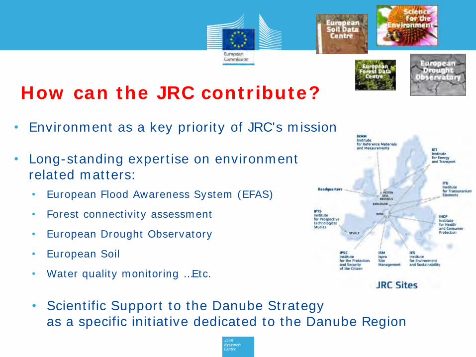
How can the JRC contribute?
• Environment as a key priority of JRC's mission
• Long-standing expertise on environment related matters:
• European Flood Awareness System (EFAS)
• Forest connectivity assessment
• European Drought Observatory
• European Soil
• Water quality monitoring …Etc.
• Scientific Support to the Danube Strategy as a specific initiative dedicated to the Danube Region

JRC support to situation assessment and flood forecasting
European Flood Awareness System (EFAS)
• Developed by JRC since 2002 in close cooperation with EC services, national hydrological and meteorological services and other institutes
• Early flood forecasting up to 10 days ; overview of on-going and forecast flood in support to the EC Emergency Response Centre
Copernicus Emergency Management Service (EMS)
• Service coordinated by JRC, aiming to provide timely geo-spatial information to support informed decision-making
• Activated 44 times to deliver map information in case of natural disaster

JRC support to situation assessment and flood forecasting
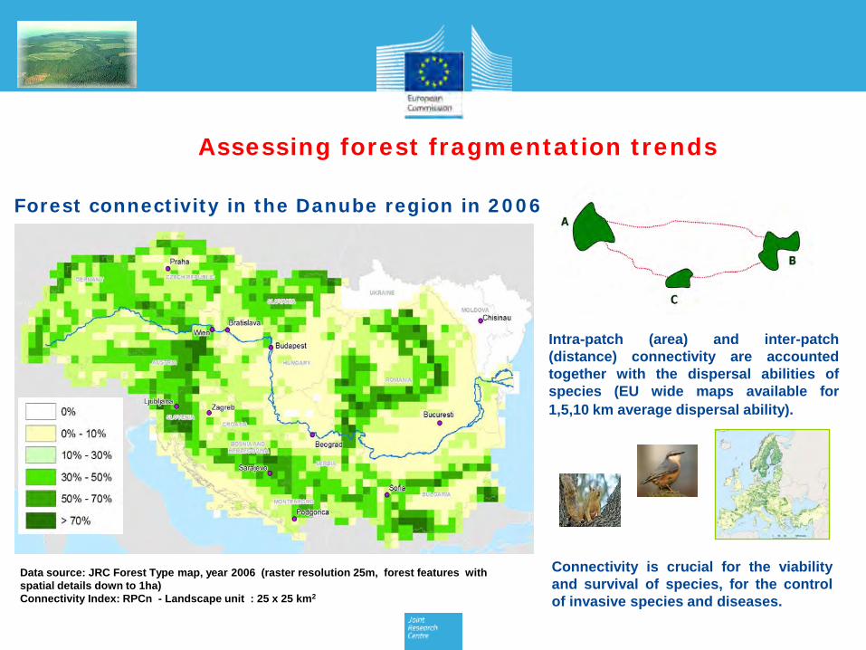
Forest connectivity in the Danube region in 2006
Data source: JRC Forest Type map, year 2006 (raster resolution 25m, forest features with spatial details down to 1ha) Connectivity Index: RPCn - Landscape unit : 25 x 25 km2
Connectivity is crucial for the viability and survival of species, for the control of invasive species and diseases.
Intra-patch (area) and inter-patch (distance) connectivity are accounted together with the dispersal abilities of species (EU wide maps available for 1,5,10 km average dispersal ability).
Assessing forest fragmentation trends

Scientific Support to the Danube Strategy
Objectives:
•Addressing the scientific needs related to the implementation of the EUSDR
•Strengthening scientific cooperation in the Danube Region

Launch and implementation
2011- 12: Launch, identification and validation of scientific priorities
2013: Identification and launch of the flagship clusters
March 2013: Scientific meeting with partners in Ispra (Italy)
May 2013: High-level event in Bratislava

Flagship clusters and activities 4 thematic flagship clusters: • Danube Water Nexus (DWN) • Danube Land and Soil Nexus (DLSN) • Danube Air Nexus (DAN) • Danube Bio-energy Nexus (DBN) 2 horizontal activities: • Danube Reference Data and Service Infrastructure
(DRDSI) pilot project • Smart Specialisation

• Scenarios of environmental and economic impacts of alternative water allocation measures across competing water-using sectors
• Methodology for modelling of water resources in the Danube river basin integrating quantity, quality, ecology and hydro-morphology
• Supporting the implementation process of the Water Framework Directive and planning of medium and long-term actions for the 2nd cycle of River Basin Management
Danube Water Nexus (DWN)

Danube Land and Soil Nexus (DLSN)
• Land and soil availability
• Land and soil quality
• Land and soil-related risks
• Preservation and restoration of above- and
belowground ecosystems and biodiversity
• Harmonised data collection and monitoring
• Awareness raising and capacity building

Relevance for the Danube Delta: Example of the Danube Land and Soil Nexus (DLSN)
Challenges:
• Soils of delta (peat) are major carbon sinks
• Drainage and land conversion putting pressure on natural areas
• Eutrophication of waters from agrochemicals
• Limited monitoring of changes in soil conditions and land use
Soil map of the Danube Delta (from JRC Soil Atlas of Europe)
Relevant DLSN activities:
• Danube-wide assessments of land and soil availability, quality (including above- and below-ground ecosystems and biodiversity) through harmonised national activities
• Assessments of land and soil consumption/sealing (including drivers and impacts on issues such as agricultural productivity, flooding, biodiversity, etc...)
• Underpinned through development of harmonised high-resolution soil database for Danube Region (1:250,000 scale based on the E-SOTER methodology & INSPIRE principles) that support national land inventory base
Danube Air Nexus (DAN)
• Identifying air pollution sources
• Scenarios of future air quality emissions
• Climate impact on air quality and health
• Assessing impacts of PAH on health
Danube Bioenergy Nexus (DBN)
• Mapping bioenergy development potential of the Region (extension of National Renewable Energy Action Plan databases to non-EU Danube countries and update of EU countries' data; detailed maps of raw resources potential, etc.)
• Assessing the relevant technological options
• Assessing the impacts of bioenergy development on agriculture, climate change, soil quality and on biodiversity

• Access to comparable and harmonised data across the Region
• Aligned to Priority areas of Danube strategy
• Shared governance • Reflecting actual needs
of Danube region users • Includes Observatory for
monitoring biodiversity in the Danube Delta
Danube Reference Data and Services Infrastructure (DRDSI) Project

Citizens sensors – scientific sensors
Citizens science
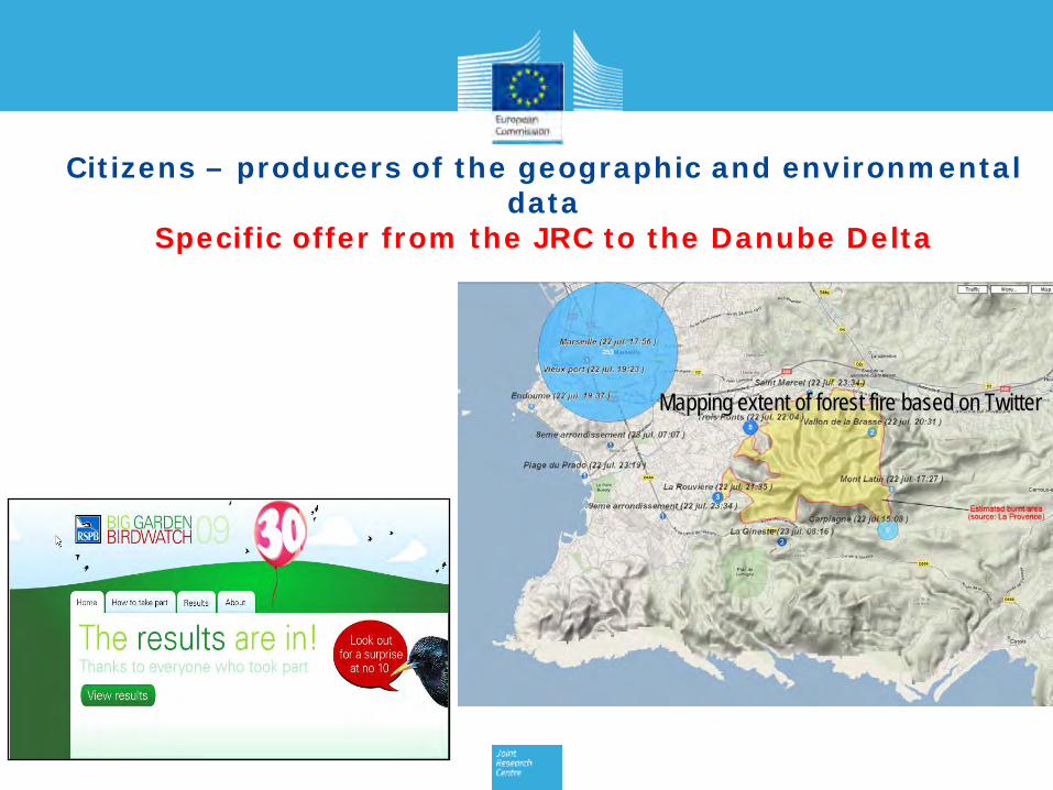
Citizens – producers of the geographic and environmental data
Specific offer from the JRC to the Danube Delta
Mapping extent of forest fire based on Twitter

Smart Specialisation for the Danube Region Danube Region as pilot area to study and foster integration and coordination of regional and national RIS3 at macro-regional level
Action plan: •Identification of transnational dimension of RIS3 in the wider macro-regional context → Kick-off event on 26 April in Brussels
•Development of new actions targeted at national policy-makers → 1st peer-review workshop of national RIS3 on 24-25 June in Budapest
•Strengthening of support already provided to the regional authorities of the EU Danube countries, but also of the non-EU Danube countries