SATREPS Project on Enhancement of Earthquake and...
11
Yamazaki, F. and Zavala, C. Review: SATREPS Project on Enhancement of Earthquake and Tsunami Disaster Mitigation Technology in Peru Fumio Yamazaki ∗ and Carlos Zavala ∗∗ ∗ Department of Urban Environment Systems, Graduate School of Engineering, Chiba University 1-33 Yayoi-cho, Inage-ku, Chiba 263-8522, Japan E-mail: [email protected] ∗∗ CISMID, Faculty of Civil Engineering, National University of Engineering Av. Tupac Amaru 1150 Rimac, Lima 25, Peru E-mail: [email protected] [Received November 24, 2012; accepted November 29, 2012] This project conducts comprehensive research on earthquake and tsunami disaster mitigation in Peru in the framework of “Science and Technology Re- search Partnership for Sustainable Development (SATREPS),” sponsored by Japan Science and Tech- nology Agency (JST) and Japan International Coop- eration Agency (JICA). The project focuses on five research fields, i.e., seismic motion and geotechnical, tsunami, buildings, damage assessment, and disaster mitigation planning. Almost three years have passed since the five-year project started in March 2010. Dur- ing this period, researchers in different fields from Japan and Peru collaborate to achieve the overall ob- jectives of the project. This paper summarizes the research framework and progress of the JST-JICA project on earthquake and tsunami disaster mitigation technology in Peru. Keywords: earthquake, tsunami, disaster mitigation, in- ternational cooperation, Peru 1. Introduction A new international research program called “Sci- ence and Technology Research Partnership for Sustain- able Development (SATREPS)” was started in 2008 un- der the joint sponsorship of Japan Science and Technol- ogy Agency (JST) and Japan International Cooperation Agency (JICA). The scheme of SATREPS is shown in Fig. 1. JICA, supervised by the Ministry of Foreign Af- fairs (MOFA), supports the project as a part of Official Development Assistance (ODA), which requires the im- plementation of practical technologies to Peruvian soci- ety. At the same time, JST, under the Ministry of Educa- tion, Culture, Sports, Science and Technology (MEXT), expects us to achieve scientific goals, e.g., developing novel theories and new technologies. Research proposals in the following four fields were in- vited to apply for the SATREPS grant: 1) Environment and Energy, 2) Bio-resources, 3) Natural Disaster Preven- tion, and 4) Infectious Disease Control. A proposal sub- mitted by the present authors, “Enhancement of Earth- quake and Tsunami Disaster Mitigation Technology in Peru,” was granted as one of the projects in the field of natural disaster prevention in April 2009. This project conducts a comprehensive research for earthquake and tsunami disaster mitigation in Peru con- sidering regional characteristics, in strong collaboration among researchers of Peru and Japan. The first au- thor, F. Yamazaki, is the principal investigator (PI) of the Japanese team and the second author, C. Zavala, is the PI of the Peruvian team. After the preliminary acceptance of our project, the preparatory phase started to plan the details of the joint research considering the needs of the developing country (Peru) and the promotion of science and technology on the global issue (disaster mitigation). The Record of Discussion (R/D) was signed on Jan- uary 15, 2010, by the responsible authorities of the two nations, i.e., JICA and National University of Engineer- ing in Lima, Peru. The project then was formally started and will continue for a five-year period until March 2015. This paper describes the overall objectives, research plan, and progress of the SATREPS Peru project. 2. Background and Objectives of the Peru Project Natural disasters are one of the major threats to the peo- ple of the world. Earthquakes and tsunamis are major ob- stacles to sustainable development, especially for coun- tries in the Asia-Pacific region. Understanding of natural hazards and upgrading of societal resilience are necessary in order to reduce disaster risks. Since earthquakes and tsunamis are rare but devastating events, data collection on a global scale is necessary and international collabora- tion is inevitable for reducing losses due to these events, as highlighted in the Hyogo Framework of Action [1]. In this sense, Japan is expected to serve a leading role in the promotion of international disaster mitigation because of its long history of coping with natural disasters. Peru is located in the circum-Pacific seismic belt of high seismic and tsunami risk. Fig. 2 shows tectonic set- 224 Journal of Disaster Research Vol.8 No.2, 2013
Transcript of SATREPS Project on Enhancement of Earthquake and...

Yamazaki, F. and Zavala, C.
Review:
SATREPS Project on Enhancement of Earthquake andTsunami Disaster Mitigation Technology in Peru
Fumio Yamazaki∗ and Carlos Zavala∗∗
∗Department of Urban Environment Systems, Graduate School of Engineering, Chiba University1-33 Yayoi-cho, Inage-ku, Chiba 263-8522, Japan
E-mail: [email protected]∗∗CISMID, Faculty of Civil Engineering, National University of Engineering
Av. Tupac Amaru 1150 Rimac, Lima 25, PeruE-mail: [email protected]
[Received November 24, 2012; accepted November 29, 2012]
This project conducts comprehensive research onearthquake and tsunami disaster mitigation in Peruin the framework of “Science and Technology Re-search Partnership for Sustainable Development(SATREPS),” sponsored by Japan Science and Tech-nology Agency (JST) and Japan International Coop-eration Agency (JICA). The project focuses on fiveresearch fields, i.e., seismic motion and geotechnical,tsunami, buildings, damage assessment, and disastermitigation planning. Almost three years have passedsince the five-year project started in March 2010. Dur-ing this period, researchers in different fields fromJapan and Peru collaborate to achieve the overall ob-jectives of the project. This paper summarizes theresearch framework and progress of the JST-JICAproject on earthquake and tsunami disaster mitigationtechnology in Peru.
Keywords: earthquake, tsunami, disaster mitigation, in-ternational cooperation, Peru
1. Introduction
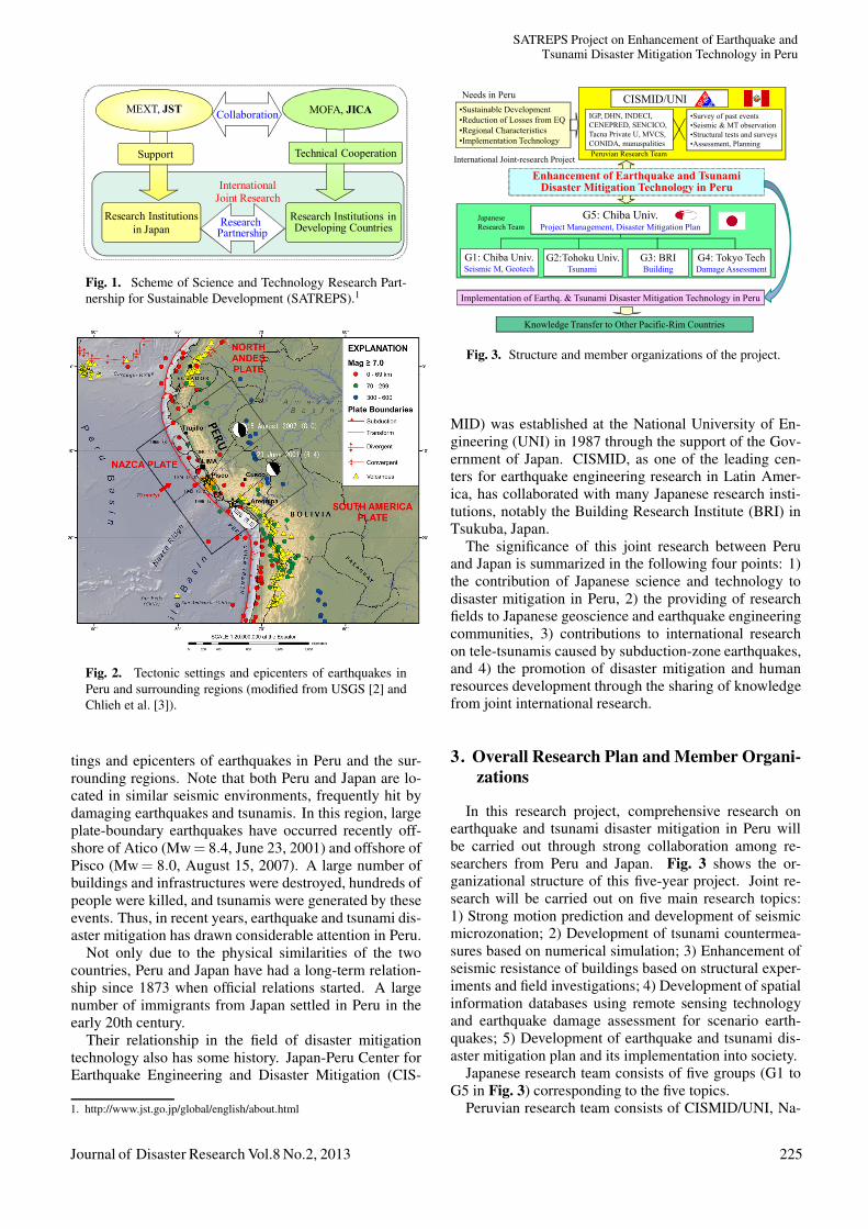
A new international research program called “Sci-ence and Technology Research Partnership for Sustain-able Development (SATREPS)” was started in 2008 un-der the joint sponsorship of Japan Science and Technol-ogy Agency (JST) and Japan International CooperationAgency (JICA). The scheme of SATREPS is shown inFig. 1. JICA, supervised by the Ministry of Foreign Af-fairs (MOFA), supports the project as a part of OfficialDevelopment Assistance (ODA), which requires the im-plementation of practical technologies to Peruvian soci-ety. At the same time, JST, under the Ministry of Educa-tion, Culture, Sports, Science and Technology (MEXT),expects us to achieve scientific goals, e.g., developingnovel theories and new technologies.
Research proposals in the following four fields were in-vited to apply for the SATREPS grant: 1) Environmentand Energy, 2) Bio-resources, 3) Natural Disaster Preven-tion, and 4) Infectious Disease Control. A proposal sub-
mitted by the present authors, “Enhancement of Earth-quake and Tsunami Disaster Mitigation Technology inPeru,” was granted as one of the projects in the field ofnatural disaster prevention in April 2009.
This project conducts a comprehensive research forearthquake and tsunami disaster mitigation in Peru con-sidering regional characteristics, in strong collaborationamong researchers of Peru and Japan. The first au-thor, F. Yamazaki, is the principal investigator (PI) of theJapanese team and the second author, C. Zavala, is the PIof the Peruvian team. After the preliminary acceptanceof our project, the preparatory phase started to plan thedetails of the joint research considering the needs of thedeveloping country (Peru) and the promotion of scienceand technology on the global issue (disaster mitigation).
The Record of Discussion (R/D) was signed on Jan-uary 15, 2010, by the responsible authorities of the twonations, i.e., JICA and National University of Engineer-ing in Lima, Peru. The project then was formally startedand will continue for a five-year period until March 2015.This paper describes the overall objectives, research plan,and progress of the SATREPS Peru project.
2. Background and Objectives of the PeruProject
Natural disasters are one of the major threats to the peo-ple of the world. Earthquakes and tsunamis are major ob-stacles to sustainable development, especially for coun-tries in the Asia-Pacific region. Understanding of naturalhazards and upgrading of societal resilience are necessaryin order to reduce disaster risks. Since earthquakes andtsunamis are rare but devastating events, data collectionon a global scale is necessary and international collabora-tion is inevitable for reducing losses due to these events,as highlighted in the Hyogo Framework of Action [1]. Inthis sense, Japan is expected to serve a leading role in thepromotion of international disaster mitigation because ofits long history of coping with natural disasters.
Peru is located in the circum-Pacific seismic belt ofhigh seismic and tsunami risk. Fig. 2 shows tectonic set-
224 Journal of Disaster Research Vol.8 No.2, 2013
SATREPS Project on Enhancement of Earthquake andTsunami Disaster Mitigation Technology in Peru
International Joint Research
Research Institutions in Developing Countries
Research Institutions in Japan Research
Partnership
MOFA, JICAMEXT, JST Collaboration
Support Technical Cooperation
Fig. 1. Scheme of Science and Technology Research Part-nership for Sustainable Development (SATREPS).1
Fig. 2. Tectonic settings and epicenters of earthquakes inPeru and surrounding regions (modified from USGS [2] andChlieh et al. [3]).
tings and epicenters of earthquakes in Peru and the sur-rounding regions. Note that both Peru and Japan are lo-cated in similar seismic environments, frequently hit bydamaging earthquakes and tsunamis. In this region, largeplate-boundary earthquakes have occurred recently off-shore of Atico (Mw = 8.4, June 23, 2001) and offshore ofPisco (Mw = 8.0, August 15, 2007). A large number ofbuildings and infrastructures were destroyed, hundreds ofpeople were killed, and tsunamis were generated by theseevents. Thus, in recent years, earthquake and tsunami dis-aster mitigation has drawn considerable attention in Peru.
Not only due to the physical similarities of the twocountries, Peru and Japan have had a long-term relation-ship since 1873 when official relations started. A largenumber of immigrants from Japan settled in Peru in theearly 20th century.
Their relationship in the field of disaster mitigationtechnology also has some history. Japan-Peru Center forEarthquake Engineering and Disaster Mitigation (CIS-
1. http://www.jst.go.jp/global/english/about.html
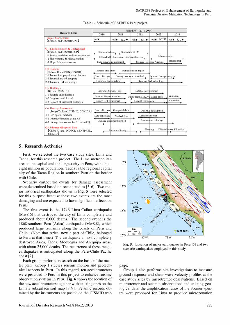
Enhancement of Earthquake and Tsunami Disaster Mitigation Technology in Peru
•Sustainable Development•Reduction of Losses from EQ•Regional Characteristics•Implementation Technology
CISMID/UNI
G5: Chiba Univ.Project Management, Disaster Mitigation Plan
G3: BRIBuilding
G1: Chiba Univ.Seismic M, Geotech
G4: Tokyo TechDamage Assessment
G2:Tohoku Univ.Tsunami
Implementation of Earthq. & Tsunami Disaster Mitigation Technology in Peru
Knowledge Transfer to Other Pacific-Rim Countries
•Survey of past events•Seismic & MT observation•Structural tests and surveys•Assessment, Planning
Needs in Peru
International Joint-research Project
Japanese Research Team
IGP, DHN, INDECI, CENEPRED, SENCICO, Tacna Private U, MVCS, CONIDA, munuspalitiesPeruvian Research Team
Fig. 3. Structure and member organizations of the project.
MID) was established at the National University of En-gineering (UNI) in 1987 through the support of the Gov-ernment of Japan. CISMID, as one of the leading cen-ters for earthquake engineering research in Latin Amer-ica, has collaborated with many Japanese research insti-tutions, notably the Building Research Institute (BRI) inTsukuba, Japan.
The significance of this joint research between Peruand Japan is summarized in the following four points: 1)the contribution of Japanese science and technology todisaster mitigation in Peru, 2) the providing of researchfields to Japanese geoscience and earthquake engineeringcommunities, 3) contributions to international researchon tele-tsunamis caused by subduction-zone earthquakes,and 4) the promotion of disaster mitigation and humanresources development through the sharing of knowledgefrom joint international research.
3. Overall Research Plan and Member Organi-zations
In this research project, comprehensive research onearthquake and tsunami disaster mitigation in Peru willbe carried out through strong collaboration among re-searchers from Peru and Japan. Fig. 3 shows the or-ganizational structure of this five-year project. Joint re-search will be carried out on five main research topics:1) Strong motion prediction and development of seismicmicrozonation; 2) Development of tsunami countermea-sures based on numerical simulation; 3) Enhancement ofseismic resistance of buildings based on structural exper-iments and field investigations; 4) Development of spatialinformation databases using remote sensing technologyand earthquake damage assessment for scenario earth-quakes; 5) Development of earthquake and tsunami dis-aster mitigation plan and its implementation into society.
Japanese research team consists of five groups (G1 toG5 in Fig. 3) corresponding to the five topics.
Peruvian research team consists of CISMID/UNI, Na-
Journal of Disaster Research Vol.8 No.2, 2013 225

Yamazaki, F. and Zavala, C.
Source Model
Deep Structure
Tsunami PropagationRock Motion
Bathymetry
T. Countermeasures
Seismic Resistance
Damage Detection
Damage Assessment
Disaster Mitigation Plan
Surface Motion Tsunami Run-up
Tsunami Damage
Topography & Soil
Spatial Database
Diagnosis & Retrofit
G2: TsunamiG1: Strong motion/Geotechnical
G4: Damage Assessment
G3: Building
G5: DisasterMitigation Plan
Fig. 4. Flowchart and research topics of the Peru projectand the five groups in charge.
tional Institute of Civil Defense (INDECI), Geophysi-cal Institute of Peru (IGP), Direction of Hydrology andNavigation (DHN), National Committee for AerospaceResearch and Development (CONIDA), Disaster Preven-tion and Study Center (PREDES), National Institute ofCulture (INC), Ministry of Housing, Construction, andSanitation (MVCS), National Service of Training for theConstruction Industry (SENCICO), Tacna Private Uni-versity (UPT), National Office of Electronic Governmentand Information (ONGEI-PCM), and Municipalities inthe project’s study areas.
In 2011, “National System for Disaster Risk Manage-ment: synergistic, decentralized, participatory and crosssystem (SINAGERD)” was issued by the Peruvian Gov-ernment. Under this new law, a new government agencycalled CENEPRED (Centro Nacional de Estimacion, Pre-vencion y Reduccion del Riesgo de Desastres) was es-tablished. CENEPRED is in charge of the reconstruc-tion, estimation, prevention, and reduction stages of thedisaster risk management process, while INDECI is incharge of the preparedness, response, and rehabilitationstages. These two organizations are considered the twopillars supporting the Presidency of the Council of Min-isters (PCM) in disaster risk management. Consideringthe importance of CENEPRED in natural disaster reduc-tion in Peru, we invited CENEPRED to be one of the keymembers of the project in August 2012.
Figure 4 shows research topics and items of the projectand the groups in charge of them. Based on research out-put from four groups (G1-G4), the disaster mitigation plangroup (G5) will propose and implement earthquake andtsunami disaster mitigation plans for case study areas inPeru. Two case study areas, Metropolitan Lima (includ-ing Callao) and Tacna, were selected after preliminarysurveys. In addition to these two areas, areas affected inrecent earthquakes, i.e., Pisco in the 2007 event and Ca-mana and Arequipa in the 2001 event, were also selectedas developing hazard and damage assessment models.
4. Scope and Prospected Outputs of the Project
The Japanese Detailed Planning Survey Team orga-nized by JICA visited Peru from August 5 to 13, 2009,for the purpose of working out the details of the technicalcooperation program concerning the project. During itsstay in Peru, the team exchanged views and had a seriesof discussions with Peruvian organizations concerned, ledby CISMID/UNI. As a result, the team and Peruvian or-ganizations agreed on the matters referred in the docu-ment [4].
The objective of this project has been agreed to as “de-veloping technologies and measures for the assessmentand mitigation of earthquake and tsunami disasters causedby large-magnitude interplate earthquakes occurring offthe coast of Peru.” It is further envisaged that such tech-nologies be widely used in Peru and also disseminated andapplied in other Pacific-rim countries, especially in neigh-boring countries facing the risks of large-magnitude inter-plate earthquakes and tsunamis. In addition, the project isexpected to contribute to human resources development aswell as research advancements in Peruvian and Japaneseinstitutes involved in the project.
The following seven expected outputs are listed in theagreed-upon master plan:
1) Scenarios of large-magnitude interplate earthquakesare identified that will potentially cause the most sig-nificant losses in Peru (G1, G2).
2) Geographical information on study areas is prepared(G4).
3) Tsunami disaster losses in study areas by scenarioearthquakes are estimated and mitigation technolo-gies are developed (G2).
4) Strong motion and ground failure in study areas byscenario earthquakes are simulated (G1).
5) Earthquake disaster losses in study areas by scenarioearthquakes are estimated, and mitigation technolo-gies are developed (G4).
6) Technologies for evaluating seismic-resistance andstructural retrofit are developed, adapted to buildingcharacteristics of Peru (G3).
7) Earthquake and tsunami disaster mitigation is pro-moted in study areas (G5).
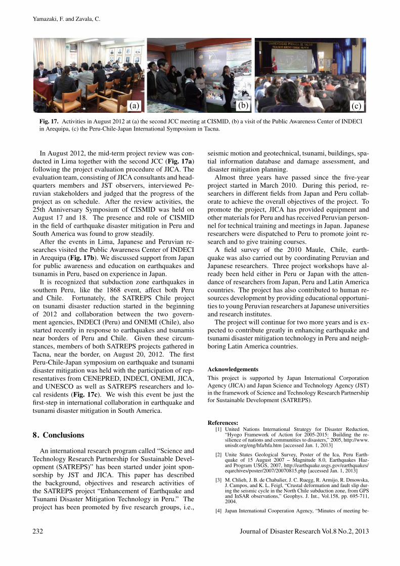
The schedule of the five-year project is shown in Ta-ble 1. To implement the project, JICA will provide theservices of JICA experts (Japanese research members),machinery, equipment and other materials necessary forconducting the project and will receive Peruvian person-nel for technical training in Japan. Actual joint researchis carried out by the five joint research groups. In additionto group-based technical collaborations, project membersmeet annually either in Peru or Japan on occasions ofproject workshops and other events.
226 Journal of Disaster Research Vol.8 No.2, 2013
SATREPS Project on Enhancement of Earthquake andTsunami Disaster Mitigation Technology in Peru
Table 1. Schedule of SATREPS Peru project.
Research Items Period FY(2010-2014)
2010 2011 2012 2013 2014 Project Management 【Chiba U and CISMID/UNI】
G1: Seismic motion & Geotechnical 【Chiba U and CISMID, IGP】 1-1 Source modeling and seismic motion 1-2 Site response & Microzonation 1-3 Slope failure assessment
G2: Tsunami 【Tohoku U and DHN, CISMID】 2-1 Tsunami propagation and impacts 2-2 Tsunami hazard mapping 2-3 Tsunami DM technology
G3: Buildings 【BRI and CISMID】 3-1 Seismic tests database 3-2 Diagnosis and Retrofit 3-3 Retrofit of historical buildings
G4; Damage Assessment 【Tokyo Tech and CISMID, CONIDA】
4-1 Geo-spatial database 4-2 Damage detection using RS 4-3 Damage assessment for Scenario EQ
G5; Disaster Mitigation Plan 【Chiba U and INDECI, CENEPRED,
CISMID】
Tsunami DM technology
Dissemination, Education Planning
WS▼ WS▼ WS▼ WS▼ WS▼
Data collection Damage assessment method
Inundation and impact
Tsunami damage analysis
Historical tsunami data
Tsunami simulation
Literature Survey, Tests
Develop diagnosis method
Database development
Retrofit technology, Validation tests
Survey, Risk assessment Retrofit Technology
Guideline
Guideline
Data collection Geospatial data
Methodology
Damage assessment method Assessment, risk map
Database development
Damage detection
Source modeling Simulation of SM
Field survey, measurement Seismic Response Analysis Hazard map EQ and MT observation, Geological survey Microzonation
Data collection
Literature Survey
JCC JCC JCCJCC
5. Research Activities
First, we selected the two case study sites, Lima andTacna, for this research project. The Lima metropolitanarea is the capital and the largest city in Peru, with abouteight million in population. Tacna is the regional capitalcity of the Tacna Region in southern Peru on the borderwith Chile.
Scenario earthquake events for damage assessmentwere determined based on recent studies [5, 6]. Two ma-jor historical earthquakes shown in Fig. 5 were selectedfor this purpose because these two events are the mostdamaging and are expected to have significant effects onPeru.
The first event is the 1746 Lima-Callao earthquake(Mw8.6) that destroyed the city of Lima completely andproduced about 6,000 deaths. The second event is the1868 southern Peru (Arica) earthquake (Mw8.8), whichproduced large tsunamis along the coasts of Peru andChile. (Note that Arica, now a part of Chile, belongedto Peru at that time.) The earthquake almost completelydestroyed Arica, Tacna, Moquegua and Arequipa areas,with about 25,000 deaths. The recurrence of these mega-earthquakes is anticipated along the Peru-Chile Pacificcoast [7].
Each group performs research on the basis of the mas-ter plan. Group 1 studies seismic motion and geotech-nical aspects in Peru. In this regard, ten accelerometerswere provided to Peru in this project to enhance seismicobservation systems in Peru. Fig. 6 shows the location ofthe new accelerometers together with existing ones on theLima’s subsurface soil map [8, 9]. Seismic records ob-tained by the instruments are posted on the CISMID web
Fig. 5. Location of major earthquakes in Peru [5] and twoscenario earthquakes employed in this study.
page.Group 1 also performs site investigations to measure
ground response and shear wave velocity profiles at thecase study sites by microtremor observations. Based onmicrotremor and seismic observations and existing geo-logical data, the amplification ratios of the Fourier spec-tra were proposed for Lima to produce microzonation
Journal of Disaster Research Vol.8 No.2, 2013 227

Yamazaki, F. and Zavala, C.
Fig. 6. Location of seismometers in Lima on a soil distribu-tion map [8, 9].
Fig. 7. Result of tsunami inundation simulation at La Puntafor the 1746 Lima-Callao earthquake [11].
maps [8].Group 2 studies tsunami modeling, numerical simula-
tion, damage assessment, and evacuation planning. Adri-ano et al. [10] calculated tsunami inundation areas forthe 2001 Atico earthquake, and compared the computedtsunami run-up height with field observation data. Thestudy shows good agreement between them, which con-firms the application of numerical simulation to tsunamihazard evaluation in Peru. Fig. 7 shows a result of tsunamipropagation simulation for the 1746 Lima-Callao earth-quake [11]. This kind of results are currently utilized tomap inundations in Callao and are referenced in evacua-tion planning in the La Punta district in Callao [12].
Fig. 8. Structural test at CISMID using the newly introducedjack system (bottom).
Group 3 studies seismic resistance and retrofit of build-ings in Peru. The structural laboratory of CISMID wasestablished in 1987, and since then, initially introducedtesting equipment had been used. New structural and ma-terial testing systems were recently introduced using theJICA’s budget for this project, as shown in Fig. 8. Usingthe new equipment, cyclic loading tests were conductedfor a typical structural system in Peru [13]. These ex-periments create a database to determine effective retrofitmethods for buildings in Peru, combined with field surveydata.
Group 4 assesses seismic damage to buildings in thecase study sites for the scenario earthquakes. Fig. 9 showsan example of a building inventory in Lima obtained fromthe combined use of census data, satellite images, andland-use and digital elevation maps [14]. Group 4 alsodevelops the methods of earthquake damage detection us-ing satellite optical and Synthetic Aperture Radar (SAR)images. For the 2007 Pisco earthquake, building dam-age detection was carried out using high-resolution op-tical satellite images [15] and moderate-resolution satel-lite SAR (ALOS/PALSAR) intensity images [16]. Thesedamage detection methods are considered to be useful inearly damage assessment after the occurrence of large-magnitude earthquakes.
Integrating all output from each research group, Group5 proposes disaster mitigation plans for the case study ar-eas. Various spatial data including land-use, roads andbuildings, geological profiles and elevations should begathered in addition to studying laws and regulations re-lated to urban planning in Peru. Fig. 10 shows the land-
228 Journal of Disaster Research Vol.8 No.2, 2013

SATREPS Project on Enhancement of Earthquake andTsunami Disaster Mitigation Technology in Peru
1234
5
67 8
9
1011
12
13
1
7-storyapartment
12 householdsUnder construction 2-story
Individual5 households
12
234
5
6-1
6-2
7
89
10
11
13
2-storyIndividual
1 household
2-storyIndividual
1 household
2-storyIndividual
1 household
2-storyIndividual
2 households
8-storyApartment
14 households
16-storyApartment
15 households
20-storyApartment
57 households
13-storyApartment
36 households
17-storyApartment
32 households
2-storyQuinta
9 households
2-storyQuinta
12 households
Fig. 9. Satellite image and photographs taken in the fieldsurvey for building inventory development in Lima [14].
Fig. 10. Land-use plan for Pisco city proposed by CISMIDafter the 2007 Pisco earthquake.
use plan for central Pisco city proposed by CISMID afterthe 2007 Pisco earthquake. Since buildings in this areawere severely damaged due to strong seismic motion, soilcondition was the major factor for this proposed land-use.
6. Joint Field Survey for the 2010 Maule, Chile,Earthquake
An earthquake with a moment magnitude (Mw) of 8.8occurred off the coast of the Maule Region of Chile onFebruary 27, 2010, at 03:34 local time (06:34 UTC). Theevent took place at the convergence boundary where theNazca plate subducts under the South American plate.The tsunami generated by the earthquake hit the coast-line of Chile and propagated across the Pacific Ocean toPacific islands and Japan. As a part of the SATREPS Peruproject, three survey teams, supported by JST and con-sisting of Japanese and Peruvian researchers, were dis-patched to affected areas from early April to May, 2010,as shown in Fig. 11. The reason why such internationalgroups conducted the field survey was that lessons fromthe 2010 Chile event are expected to apply to earthquakeand tsunami disaster mitigation technologies in Peru be-cause the two countries have common regional tectonicsand similar natural/social environments.
The first survey team collected quick damage data withthe aid of GPS and high-resolution satellite images. Geo-referenced photos and videos were taken in hard-hit areassuch as the example shown in Fig. 12. The results of fieldsurvey and analysis using high-resolution satellite imagesand collected GIS data were presented in a paper [17].
The second survey team, consisting of tsunami sci-entists, focused on measurement of tsunami inundationheight, flow depth and inundation extent, inspection ofstructural damage, and collection of eyewitness accounts.Using inundation depths obtained in the field surveyand through damage inspection using pre- and post-eventsatellite imagery in Dichato, tsunami fragility curves wereconstructed for the first time in southwestern Pacific coun-tries [18].
The third survey team, consisting of structural engi-neers, geotechnical engineers, and seismologists, con-ducted a field investigation on strong motion, local siteeffects, and building damage. In order to evaluate the seis-mic source model, Pulido et al. [19] calculated coseismicvertical displacements and compared them with observeduplift and subsidence values measured along the coast-line as well as with displacements obtained from strongground motion and high-sampling GPS records. Saitoet al. [20] summarized detailed information on buildingsdamaged due the earthquake.
The reconnaissance report was written and posted onthe project’s website [21]. These studies will be used forunderstanding earthquake and tsunami disasters in SouthAmerica.
7. Project Management and Outcome
For project management, project workshops are heldannually either in Peru or Japan. The first workshop washeld at the CISMID conference hall in Lima on March15 and 16, 2010, as shown in Fig. 13. In this kick-offworkshop, the Japanese Ambassador to Peru, the JICA
Journal of Disaster Research Vol.8 No.2, 2013 229

Yamazaki, F. and Zavala, C.
Fig. 11. The 2010 Maule, Chile, earthquake reconnaissance survey teams set up by SATREPS Peru Project. Team 1 to 3, left to right.
230cm
(a) (b)
(c) (d)
Tsunami water mark on the wall
Tsunami intruded from the river
Washed-away houses by the river
Tsunami water mark in residential area
Fig. 12. Field survey route and photo shooting points on asatellite image of Constitucion (top) and geo-referenced fieldphotos (bottom).
Lima office Director, and JST representatives attended inaddition to 25 Japanese researchers. From the Peruvianside, the president and directors of UNI, representativesof the Peru International Cooperation Agency (APCI),and members of the project and other engineers/studentsparticipated. We also invited ten earthquake engineeringresearchers from neighboring Latin American countries.The total number of participants, including the audience,was about 500 for this two-day workshop. The reason forsuch significant attention to this project in Peru was par-tially due to the 2010 Maule, Chile, earthquake, which
Fig. 13. Participants in the first workshop on March 15–16,2010, at CISMID/UNI in Lima, Peru.
Fig. 14. Participants in the second workshop on March 9-10, 2011, at Chiba University in Chiba, Japan.
occurred about two weeks before the workshop.The second workshop was held at Chiba University
in Chiba, Japan on March 9 and 10, 2011, as shown inFig. 14. Fifteen researchers from Peru and five fromneighboring Latin American countries were invited to-gether with Japanese members. After the two-day work-shop, participants from overseas and some Japanese mem-bers went on a technical visit to the Port and Airport Re-search Institute (PARI) in Yokosuka, Japan, to observe itslarge-scale tsunami testing facility. After viewing an ar-tificial tsunami in the morning, the 2011 Great Tohokuearthquake occurred in the afternoon when they were inKamakura. This workshop thus became truly unforget-
230 Journal of Disaster Research Vol.8 No.2, 2013

SATREPS Project on Enhancement of Earthquake andTsunami Disaster Mitigation Technology in Peru
Fig. 15. Participants in the third workshop on March 13, 2012, in Tokyo, Japan.
(a) (b) (c)
Fig. 16. Activities of Japanese researchers in Peru; (a) seminar at Peruvian Congress on earthquake and tsunami disaster mitigationtechnology, (b) tsunami simulation seminar and training at CISMID, (c) training of young researchers in Lima about microtremormeasurement.
table, especially for the overseas participants.The third workshop was held with more than 70 partic-
ipants in Japan again on March 13, 2012 (Fig. 15) be-cause of the one-year anniversary of the 2011 Tohokuearthquake. We discussed the progress of the projectand the annual schedule for the coming fiscal year. Theparticipants also attended the International Symposiumon Earthquake and Tsunami Disaster Reduction, com-memorating the Tohoku earthquake, held in Sendai fromMarch 14 to 16, organized by JICA, JST, and NationalResearch Institute for Earth Science and Disaster Preven-tion (NIED). For this symposium, members from fourSATREPS projects related to earthquake and tsunami, i.e.,Indonesia, the Philippines, Peru and Chile, participatedand shared knowledge and technologies in this field.
One of the important aspects of the Peru project istechnical supports by sending Japanese experts to Peruor inviting Peruvian researchers to Japan. Japanese re-searchers, especially young researchers, gain experienceby working with Peruvian researchers in performing lab-oratory tests and field surveys. Fig. 16 shows activities ofJapanese project members in Peru, such as (a) a seminarat the Peruvian Congress, (b) a tsunami simulation semi-nar and training, and (c) training in microtremor measure-ment.
The project also invites young Peruvian researchers forhuman resources development. Five short-term trainees
have already been invited to study in Japan, with thesupport of JICA, at Chiba University, Tohoku Universityand the Building Research Institute. Three doctoral stu-dents from CISMID/UNI selected for Japanese Govern-ment Scholarships by MEXT are now studying at Yoko-hama National University, Chiba University and TokyoInstitute of Technology.
The Joint Coordinating Committee (JCC), defined inthe minutes [4], was organized soon after the start of theproject. JCC provides oversight on the project and meetsannually and as necessary, in order to fulfill the followingfunctions:
1) Approve an annual work plan of the project,
2) Review progress of the annual work plan,
3) Review and exchange opinions on major issues thatmay arise during implementation of the project,
4) Discuss other issues pertinent to smooth implemen-tation of the project.
The first JCC meeting was held in September 2011 inLima, Peru, attended by the president of UNI, the directorof the JICA Peru office, APCI representative, the JapaneseAmbassador to Peru, and related organizations of Peruand Japan. The progress of the project was accepted bythe JCC.
Journal of Disaster Research Vol.8 No.2, 2013 231
Yamazaki, F. and Zavala, C.
(a) (b) (c)
Fig. 17. Activities in August 2012 at (a) the second JCC meeting at CISMID, (b) a visit of the Public Awareness Center of INDECIin Arequipa, (c) the Peru-Chile-Japan International Symposium in Tacna.
In August 2012, the mid-term project review was con-ducted in Lima together with the second JCC (Fig. 17a)following the project evaluation procedure of JICA. Theevaluation team, consisting of JICA consultants and head-quarters members and JST observers, interviewed Pe-ruvian stakeholders and judged that the progress of theproject as on schedule. After the review activities, the25th Anniversary Symposium of CISMID was held onAugust 17 and 18. The presence and role of CISMIDin the field of earthquake disaster mitigation in Peru andSouth America was found to grow steadily.
After the events in Lima, Japanese and Peruvian re-searches visited the Public Awareness Center of INDECIin Arequipa (Fig. 17b). We discussed support from Japanfor public awareness and education on earthquakes andtsunamis in Peru, based on experience in Japan.
It is recognized that subduction zone earthquakes insouthern Peru, like the 1868 event, affect both Peruand Chile. Fortunately, the SATREPS Chile projecton tsunami disaster reduction started in the beginningof 2012 and collaboration between the two govern-ment agencies, INDECI (Peru) and ONEMI (Chile), alsostarted recently in response to earthquakes and tsunamisnear borders of Peru and Chile. Given these circum-stances, members of both SATREPS projects gathered inTacna, near the border, on August 20, 2012. The firstPeru-Chile-Japan symposium on earthquake and tsunamidisaster mitigation was held with the participation of rep-resentatives from CENEPRED, INDECI, ONEMI, JICA,and UNESCO as well as SATREPS researchers and lo-cal residents (Fig. 17c). We wish this event be just thefirst-step in international collaboration in earthquake andtsunami disaster mitigation in South America.
8. Conclusions
An international research program called “Science andTechnology Research Partnership for Sustainable Devel-opment (SATREPS)” has been started under joint spon-sorship by JST and JICA. This paper has describedthe background, objectives and research activities ofthe SATREPS project “Enhancement of Earthquake andTsunami Disaster Mitigation Technology in Peru.” Theproject has been promoted by five research groups, i.e.,
seismic motion and geotechnical, tsunami, buildings, spa-tial information database and damage assessment, anddisaster mitigation planning.
Almost three years have passed since the five-yearproject started in March 2010. During this period, re-searchers in different fields from Japan and Peru collab-orate to achieve the overall objectives of the project. Topromote the project, JICA has provided equipment andother materials for Peru and has received Peruvian person-nel for technical training and meetings in Japan. Japaneseresearchers were dispatched to Peru to promote joint re-search and to give training courses.
A field survey of the 2010 Maule, Chile, earth-quake was also carried out by coordinating Peruvian andJapanese researchers. Three project workshops have al-ready been held either in Peru or Japan with the atten-dance of researchers from Japan, Peru and Latin Americacountries. The project has also contributed to human re-sources development by providing educational opportuni-ties to young Peruvian researchers at Japanese universitiesand research institutes.
The project will continue for two more years and is ex-pected to contribute greatly in enhancing earthquake andtsunami disaster mitigation technology in Peru and neigh-boring Latin America countries.
AcknowledgementsThis project is supported by Japan International CorporationAgency (JICA) and Japan Science and Technology Agency (JST)in the framework of Science and Technology Research Partnershipfor Sustainable Development (SATREPS).
References:[1] United Nations International Strategy for Disaster Reduction,
“Hyogo Framework of Action for 2005-2015: Building the re-silience of nations and communities to disasters,” 2005, http://www.unisdr.org/eng/hfa/hfa.htm [accessed Jan. 1, 2013]
[2] Unite States Geological Survey, Poster of the Ica, Peru Earth-quake of 15 August 2007 – Magnitude 8.0, Earthquakes Haz-ard Program USGS, 2007, http://earthquake.usgs.gov/earthquakes/eqarchives/poster/2007/20070815.php [accessed Jan. 1, 2013]
[3] M. Chlieh, J. B. de Chabalier, J. C. Ruegg, R. Armijo, R. Dmowska,J. Campos, and K. L. Feigl, “Crustal deformation and fault slip dur-ing the seismic cycle in the North Chile subduction zone, from GPSand InSAR observations,” Geophys. J. Int., Vol.158, pp. 695-711,2004.
[4] Japan International Cooperation Agency, “Minutes of meeting be-
232 Journal of Disaster Research Vol.8 No.2, 2013

SATREPS Project on Enhancement of Earthquake andTsunami Disaster Mitigation Technology in Peru
Appendix A. List of the Project Members
Group Peru Japan
G1
Zenon Aguilar (CISMID) Shoichi Nakai (Chiba University)Jorge Alva (CISMID) Toru Sekiguchi (Chiba University)Fernando Lazares (CISMID) Hiroaki Yamanaka (Tokyo Tech)Diana Calderon (CISMID) Hiroshi Arai (NILIM)Ronald Woodman (IGP) Nelson Pulido (NIED)Hernando Tavera (IGP) Shin Koyama (BRI)David Portugal (IGP) Selene Quispe (Tokyo Tech)Leonidas Ocola (UNMSM) Carlos Gonzales (Chiba University)
G2
Carlos Holguin Valdivia (DHN) Shunichi Koshimura (Tohoku University)Julio Kuroiwa (UNI) Yushiro Fujii (BRI)Miguel Estrada (CISMID) Gaku Shoji (Tsukuba University)Cesar Jimenez (DHN) Yuji Yagi (Tsukuba University)Atilio Aste (DHN) Hideaki Yanagisawa (Tohoku Gakuin Univ.)Nabilt Moggiano (DHN) Eric Mas (Tohoku University)Sheila Yauri (IGP) Bruno Adriano (Tohoku University)
G3
Carlos Zavala (CISMID) Taiki Saito (Toyohashi Univ. of Tech)Javier Pique (UNI) Masaomi Teshigawara (Nagoya University)Patricia Gibu (CISMID) Koichi Kusunoki (Yokohama National Univ.)Gabriela Silva (M Cultuta) Carlos Cuadra (Akita Prefectural Univ.)Maria Eugenia Cordova (M Cultura) Shunsuke Sugano (BRI)Ricardo Proano (CISMID) Masanori Tani (BRI)Luis Moya (CISMID) Miguel Diaz (Yokohama National Univ.)Jenny Taira (CISMID)Lourdes Cardenas (CISMID)Dina Cotrado (Tacna Private Univ.)Maria del Carmen Corrales(Lima Metropolitan Municipality)
G4
Miguel Estrada (CISMID) Saburo Midorikawa (Tokyo Tech)Jorge Pacheco (CONIDA) Hiroyuki Miura (Hiroshima University)Miguel Miranda (CONIDA) Masashi Matsuoka (Tokyo Tech)Carmen Villon (CONIDA) Yoshihisa Maruyama (Chiba University)Jorge Morales (CISMID) Luis Quiroz (Chiba University)
G5
Alberto Bisbal (INDECI) Fumio Yamazaki (Chiba University)Aurelio Padilla (UNI) Miki Muraki (Chiba University)Francisco Rios (CISMID) Hideki Kaji (Tokyo Tech)Jose Sato (PREDES) Hidehiko Kanegae (Ritsumeikan Univ.)Luis Tagle (MVCS) Osamu Murao (Tsukuba University)Carmen Kuroiwa (SENCICO) Shizuko Matsuzaki (Chiba University)Victoria Ramos (CISMID)
tween JICA detailed planning survey team and the National Univer-sity of Engineering,” 2009.
[5] A. Sladen, H. Tavera, M. Simons, J. P. Avouac, A. O. Konca, H.Perfettini, L. Audin, E. J. Fielding, F. Ortega, and R. Cavagnoud,“Source model of the 2007 Mw 8.0 Pisco, Peru earthquake: Impli-cations for seismogenic behavior of subduction megathrusts,” Jour-nal of Geophysical Research, Vol.115, B02405, 2010.
[6] N. Pulido, H. Tavera, Z. Aguilar, M. Chlieh, D. Calderon, S. Nakai,T. Sekiguchi, and F. Yamazaki, “Mega-earthquakes Rupture Sce-narios and Strong Motion Simulations for Central Andes, Peru,”The International Symposium for CISMID 25th Anniversary, Lima,Peru, CD-ROM, Paper No.TS-6-2, p. 8, 2012.
[7] E. A. Okal, J. C. Borrero, and C. E. Synolakis, “Evaluation ofTsunami Risk from Regional Earthquakes at Pisco, Peru,” Bulletinof the Seismological Society of America, Vol.96, No.5, pp. 1634-1648, 2006.
[8] D. Calderon, T. Sekiguchi, S. Nakai, Z. Aguilar, and F. Lazares,“Study of Soil Amplification based on Microtremor and Seismic
Records,” Journal of Japan Association for Earthquake Engineering,Vol.12, No.2, p. 20, 2012.
[9] CISMID, “Study of the Vulnerability and Seismic Risk in 42 dis-tricts of Lima and Callao,” National University of Engineering,Lima, Peru, 2005 (in Spanish).
[10] B. Adriano, S. Koshimura, and Y. Fujii, “Tsunami Source and In-undation Modeling of the June 2001 Peru Earthquake,” Joint Con-ference Proceedings 9CUEE/4ACEE, pp. 2061-2065, 2012.
[11] B. Adriano, E. Mas, S. Koshimura, Y. Fujii, S. Yauri, C. Jimenez,and H. Yanagisawa, “Tsunami Inundation Mapping in Lima, forTwo Tsunami Source Scenarios,” Journal of Disaster Research,Vol.8, No.2, pp. 274-284, 2013 (this number).
[12] E. Mas, B. Adriano, and S. Koshimura, “An Integrated Simulationof Tsunami Hazard and Human Evacuation in La Punta, Peru,” Jour-nal of Disaster Research, Vol.8, No.2, pp. 285-295, 2013 (this num-ber).
[13] C. Zavala, P. Gibu, L. Lavado, J. Taira, L. Cardenas, and L. Ce-ferino, “Cyclic Behavior of Low Ductility Walls Considering Per-
Journal of Disaster Research Vol.8 No.2, 2013 233
Yamazaki, F. and Zavala, C.
pendicular Action,” Journal of Disaster Research, Vol.8, No.2, pp.312-319, 2013 (this number).
[14] M. Matsuoka, H. Miura, S. Midorikawa, and M. Estrada, “Extrac-tion of Urban Information for Seismic Hazard and Risk Assess-ment in Lima, Peru Using Satellite Imagery,” Journal of DisasterResearch, Vol.8, No.2, pp. 328-345, 2013 (this number).
[15] S. Matsuzaki, F. Yamazaki, M. Estrada, and C. Zavala, “VisualDamage Interpretation of Buildings Using QuickBird Images Fol-lowing the 2007 Peru Earthquake,” The 3rd Asia Conference onEarthquake Engineering, Bangkok, Thailand, p. 8, 2010.
[16] M. Matsuoka and M. Estrada, “Development of Earthquake-Induced Building Damage Estimation Model Based onALOS/PALSAR Observing the 2007 Peru Earthquake,” Jour-nal of Disaster Research, Vol.8, No.2, pp. 346-355, 2013 (thisnumber).
[17] Y. Maruyama, F. Yamazaki, S. Matsuzaki, H. Miura, and M.Estrada, “Evaluation of Building Damage and Tsunami InundationBased on Satellite Images and GIS Data Following the 2010 ChileEarthquake,” Earthquake Spectra, Vol.28, No.S1, pp. S165-S178,2012.
[18] E. Mas, S. Koshimura, A. Suppasri, M. Matsuoka, M. Matsuyama,T. Yoshii, C. Jimenez, F. Yamazaki, and F. Imamura, “DevelopingTsunami fragility curves using remote sensing and survey data ofthe 2010 Chilean Tsunami in Dichato,” Natural Hazards and EarthSystem Sciences, European Geosciences Union, Vol.12, pp. 2689-2697, 2012.
[19] N. Pulido, Y. Yagi, H. Kumagai, and N. Nishimura, “Rupture pro-cess and coseismic deformations of the February 2010 Maule earth-quake, Chile,” Earth, Planets and Space, Vol.63, pp. 955-959, 2011.
[20] T. Saito, S. Kono, K. Kusunoki, Y. Kim, T. Matsui, M. Tani, Y. Hi-bino, C. Zavala, and P. Gibu, “Damage Investigation of ReinforcedConcrete Buildings at the 2010 Chile Earthquake,” Proceedings ofthe 8th International Conference on Urban Earthquake Engineering,Paper No.04-077, Tokyo, 2011.
[21] JST-JICA SATREPS Peru Project Chile Earthquake Field Investi-gation Team, 2010 Chile Earthquake and Tsunami Technical Re-port, http://ares.tu.chiba-u.jp/peru/pdf/output/tr/JST-JICA-CHILE-EARTHQUAKE-AND-TSUNAMI-REPORT.pdf [accessed Jan. 1,2013]
Name:Fumio Yamazaki
Affiliation:Professor, Department of Urban EnvironmentSystems, Chiba University
Address:1-33 Yayoi-cho, Inage-ku, Chiba 263-8522, JapanBrief Career:1978 Research Engineer, Shimizu Corporation, Japan1989 Associate Professor, Institute of Industrial Science, University of Tokyo2001 Professor, Asian Institute of Technology (AIT), Bangkok, Thailand2003 Professor, Department of Urban Environment Systems, ChibaUniversitySelected Publications:• W. Liu and F. Yamazaki, “Detection of Crustal Movement fromTerraSAR-X intensity images for the 2011 Tohoku, Japan Earthquake,”Geoscience and Remote Sensing Letters, Vol.10, No.1, pp. 199-203, 2013.• A. Meslem, F. Yamazaki, and Y. Maruyama, “Accurate evaluation ofbuilding damage in the 2003 Boumerdes, Algeria earthquake fromQuickBird satellite images,” Journal of Earthquake and Tsunami, Vol.5,No.1, pp. 1-18, 2011.Academic Societies & Scientific Organizations:• Japan Society of Civil Engineers (JSCE)• American Society of Civil Engineering (ASCE)• Seismological Society of America (SSA)• Earthquake Engineering Research Institute, USA (EERI)
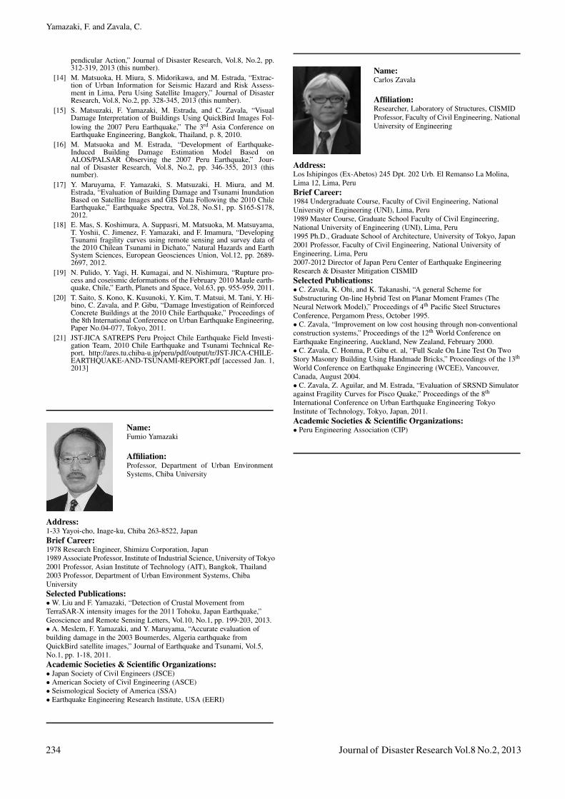
Name:Carlos Zavala
Affiliation:Researcher, Laboratory of Structures, CISMIDProfessor, Faculty of Civil Engineering, NationalUniversity of Engineering
Address:Los Ishipingos (Ex-Abetos) 245 Dpt. 202 Urb. El Remanso La Molina,Lima 12, Lima, PeruBrief Career:1984 Undergraduate Course, Faculty of Civil Engineering, NationalUniversity of Engineering (UNI), Lima, Peru1989 Master Course, Graduate School Faculty of Civil Engineering,National University of Engineering (UNI), Lima, Peru1995 Ph.D., Graduate School of Architecture, University of Tokyo, Japan2001 Professor, Faculty of Civil Engineering, National University ofEngineering, Lima, Peru2007-2012 Director of Japan Peru Center of Earthquake EngineeringResearch & Disaster Mitigation CISMIDSelected Publications:• C. Zavala, K. Ohi, and K. Takanashi, “A general Scheme forSubstructuring On-line Hybrid Test on Planar Moment Frames (TheNeural Network Model),” Proceedings of 4th Pacific Steel StructuresConference, Pergamom Press, October 1995.• C. Zavala, “Improvement on low cost housing through non-conventionalconstruction systems,” Proceedings of the 12th World Conference onEarthquake Engineering, Auckland, New Zealand, February 2000.• C. Zavala, C. Honma, P. Gibu et. al, “Full Scale On Line Test On TwoStory Masonry Building Using Handmade Bricks,” Proceedings of the 13th
World Conference on Earthquake Engineering (WCEE), Vancouver,Canada, August 2004.• C. Zavala, Z. Aguilar, and M. Estrada, “Evaluation of SRSND Simulatoragainst Fragility Curves for Pisco Quake,” Proceedings of the 8th
International Conference on Urban Earthquake Engineering TokyoInstitute of Technology, Tokyo, Japan, 2011.Academic Societies & Scientific Organizations:• Peru Engineering Association (CIP)
234 Journal of Disaster Research Vol.8 No.2, 2013