SAMPLE - nationalduediligenceservices.com · SAMPLE. TRANSACTION SCREEN ASSESSMENT I Project No.:...
56
National Due Diligence Services and Assessments, a Division of American Survey & Mapping. Incorporated 3191 Maguire Boulevard, Suite 200, Orlando, Florida 32803 Telephone: 407-426-7979; Fax: 407-970-9369 TRANSACTION SCREEN ASSESSMENT REPORT Commercial Office 555 E. Transaction Street Any City, Any State 12345 NDDS Project No.: 13-0456 Date Issued: July 30, 2013 Prepared For: Property Investments, LLC Attn: Mr. John Smith, Director 2013 Assessments Avenue, Suite 200 Mountain View, Florida 54321 SAMPLE
Transcript of SAMPLE - nationalduediligenceservices.com · SAMPLE. TRANSACTION SCREEN ASSESSMENT I Project No.:...

National Due Diligence Services and Assessments, a Division of American Survey & Mapping. Incorporated 3191 Maguire Boulevard, Suite 200, Orlando, Florida 32803
Telephone: 407-426-7979; Fax: 407-970-9369
TRANSACTION SCREEN ASSESSMENT REPORT
Commercial Office
555 E. Transaction Street Any City, Any State 12345
NDDS Project No.: 13-0456 Date Issued: July 30, 2013
Prepared For:
Property Investments, LLC
Attn: Mr. John Smith, Director 2013 Assessments Avenue, Suite 200
Mountain View, Florida 54321
SAMPLE

National Due Diligence Services and Assessments, a Division of American Survey & Mapping. Incorporated 3191 Maguire Boulevard, Suite 200, Orlando, Florida 32803
Telephone: 407-426-7979; Fax: 407-970-9369
July 30, 2013 Property Investments, LLC Attn: Mr. John Smith, Director 2013 Assessments Avenue, Suite 200 Mountain View, Florida 54321 RE: Commercial Office
555 E. Transaction Street Any City, Any State 12345 NDDS Project No.: 13-0456
Dear Mr. Smith: National Due diligence Services (NDDS) a Division of American Survey and Mapping, Incorporated has completed a Transaction Screen Assessment (TSA) Report of the above referenced property. The TSA was conducted in accordance with the scope and limitations as detailed in the ASTM International (ASTM) E1528-06 Standard Practice for Limited Due Diligence: Transaction Screen Process, the applicable engagement letter with Property Investments, LLC and generally accepted industry standards.
This report was prepared solely for the use of Property Investments, LLC and any party specifically referenced in Section 1.3 User Reliance. No other party shall use or rely on this report or the findings herein, without the prior written consent of NDDS.
Please do not hesitate to contact us at 877-439-2582 if you have any questions or if we can be of further service to you.
Sincerely,
Gregory A. Tan Vice-President Prepared By: Reviewed By:
George Pallo Ronnie Long, C.E.M. Environmental Professional Senior Client Manager/Assessments Coordinator
SAMPLE
TRANSACTION SCREEN ASSESSMENT I Project No.: 13-0456
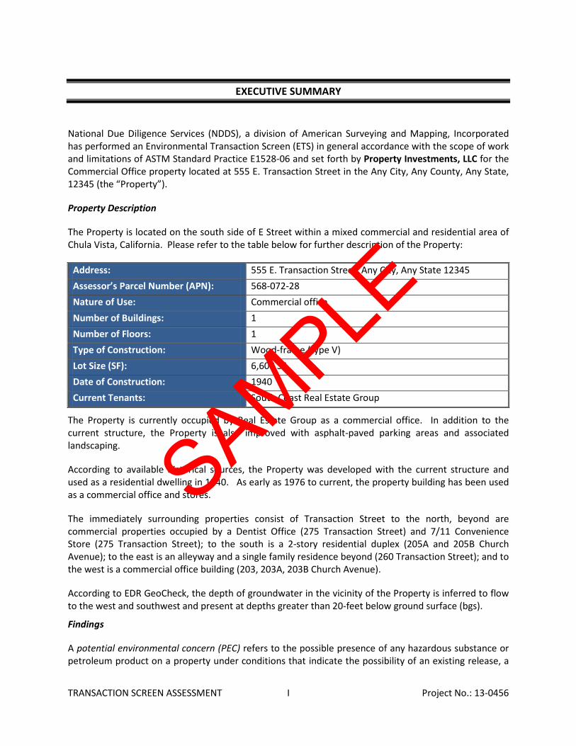
EXECUTIVE SUMMARY
National Due Diligence Services (NDDS), a division of American Surveying and Mapping, Incorporated has performed an Environmental Transaction Screen (ETS) in general accordance with the scope of work and limitations of ASTM Standard Practice E1528-06 and set forth by Property Investments, LLC for the Commercial Office property located at 555 E. Transaction Street in the Any City, Any County, Any State, 12345 (the “Property”).
Property Description
The Property is located on the south side of E Street within a mixed commercial and residential area of Chula Vista, California. Please refer to the table below for further description of the Property:
Address: 555 E. Transaction Street, Any City, Any State 12345 Assessor’s Parcel Number (APN): 568-072-28 Nature of Use: Commercial office Number of Buildings: 1 Number of Floors: 1 Type of Construction: Wood-frame (type V) Lot Size (SF): 6,608 SF Date of Construction: 1940 Current Tenants: South Coast Real Estate Group
The Property is currently occupied by Real Estate Group as a commercial office. In addition to the current structure, the Property is also improved with asphalt-paved parking areas and associated landscaping.
According to available historical sources, the Property was developed with the current structure and used as a residential dwelling in 1940. As early as 1976 to current, the property building has been used as a commercial office and stores.
The immediately surrounding properties consist of Transaction Street to the north, beyond are commercial properties occupied by a Dentist Office (275 Transaction Street) and 7/11 Convenience Store (275 Transaction Street); to the south is a 2-story residential duplex (205A and 205B Church Avenue); to the east is an alleyway and a single family residence beyond (260 Transaction Street); and to the west is a commercial office building (203, 203A, 203B Church Avenue).
According to EDR GeoCheck, the depth of groundwater in the vicinity of the Property is inferred to flow to the west and southwest and present at depths greater than 20-feet below ground surface (bgs).
Findings
A potential environmental concern (PEC) refers to the possible presence of any hazardous substance or petroleum product on a property under conditions that indicate the possibility of an existing release, a
SAMPLE
TRANSACTION SCREEN ASSESSMENT II Project No.: 13-0456
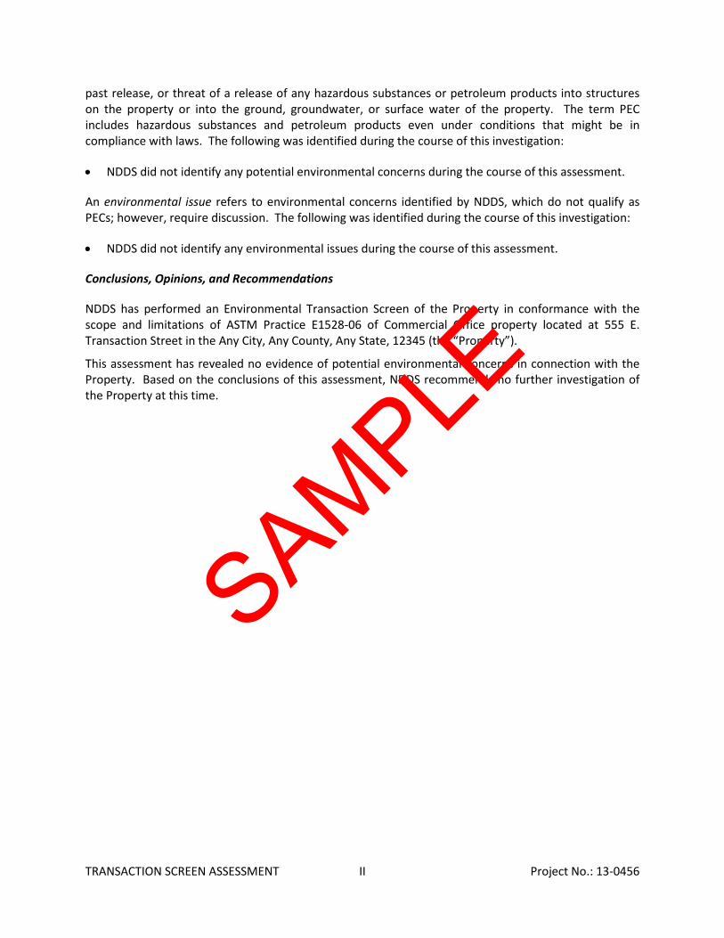
past release, or threat of a release of any hazardous substances or petroleum products into structures on the property or into the ground, groundwater, or surface water of the property. The term PEC includes hazardous substances and petroleum products even under conditions that might be in compliance with laws. The following was identified during the course of this investigation:
• NDDS did not identify any potential environmental concerns during the course of this assessment.
An environmental issue refers to environmental concerns identified by NDDS, which do not qualify as PECs; however, require discussion. The following was identified during the course of this investigation:
• NDDS did not identify any environmental issues during the course of this assessment.
Conclusions, Opinions, and Recommendations
NDDS has performed an Environmental Transaction Screen of the Property in conformance with the scope and limitations of ASTM Practice E1528-06 of Commercial Office property located at 555 E. Transaction Street in the Any City, Any County, Any State, 12345 (the “Property”).
This assessment has revealed no evidence of potential environmental concerns in connection with the Property. Based on the conclusions of this assessment, NDDS recommends no further investigation of the Property at this time.
SAMPLE
TRANSACTION SCREEN ASSESSMENT III Project No.: 13-0456
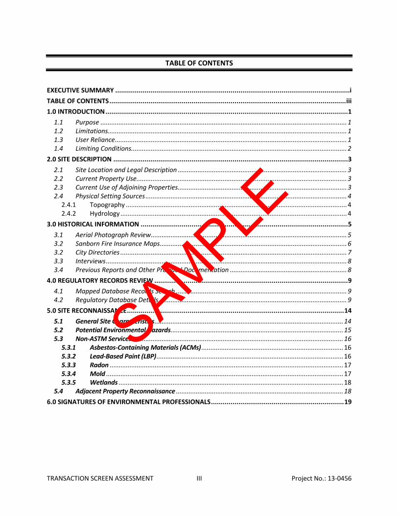
TABLE OF CONTENTS
EXECUTIVE SUMMARY ........................................................................................................................ i TABLE OF CONTENTS ......................................................................................................................... iii 1.0 INTRODUCTION ............................................................................................................................ 1
1.1 Purpose ......................................................................................................................................... 1 1.2 Limitations..................................................................................................................................... 1 1.3 User Reliance ................................................................................................................................. 1 1.4 Limiting Conditions........................................................................................................................ 2
2.0 SITE DESCRIPTION ........................................................................................................................ 3 2.1 Site Location and Legal Description .............................................................................................. 3 2.2 Current Property Use ..................................................................................................................... 3 2.3 Current Use of Adjoining Properties .............................................................................................. 3 2.4 Physical Setting Sources ................................................................................................................ 4
2.4.1 Topography ........................................................................................................................... 4 2.4.2 Hydrology .............................................................................................................................. 4
3.0 HISTORICAL INFORMATION .......................................................................................................... 5 3.1 Aerial Photograph Review ............................................................................................................. 5 3.2 Sanborn Fire Insurance Maps ........................................................................................................ 6 3.2 City Directories .............................................................................................................................. 7 3.3 Interviews ...................................................................................................................................... 8 3.4 Previous Reports and Other Provided Documentation ................................................................. 8
4.0 REGULATORY RECORDS REVIEW ................................................................................................... 9 4.1 Mapped Database Records Search ............................................................................................... 9 4.2 Regulatory Database Details ........................................................................................................ 9
5.0 SITE RECONNAISSANCE ............................................................................................................... 14 5.1 General Site Characteristics ......................................................................................................... 14 5.2 Potential Environmental Hazards ................................................................................................ 15 5.3 Non-ASTM Services ..................................................................................................................... 16
5.3.1 Asbestos-Containing Materials (ACMs) ............................................................................... 16 5.3.2 Lead-Based Paint (LBP) ........................................................................................................ 16 5.3.3 Radon .................................................................................................................................. 17 5.3.4 Mold .................................................................................................................................... 17 5.3.5 Wetlands ............................................................................................................................. 18
5.4 Adjacent Property Reconnaissance ............................................................................................. 18 6.0 SIGNATURES OF ENVIRONMENTAL PROFESSIONALS .................................................................... 19
SAMPLE
TRANSACTION SCREEN ASSESSMENT IV Project No.: 13-0456
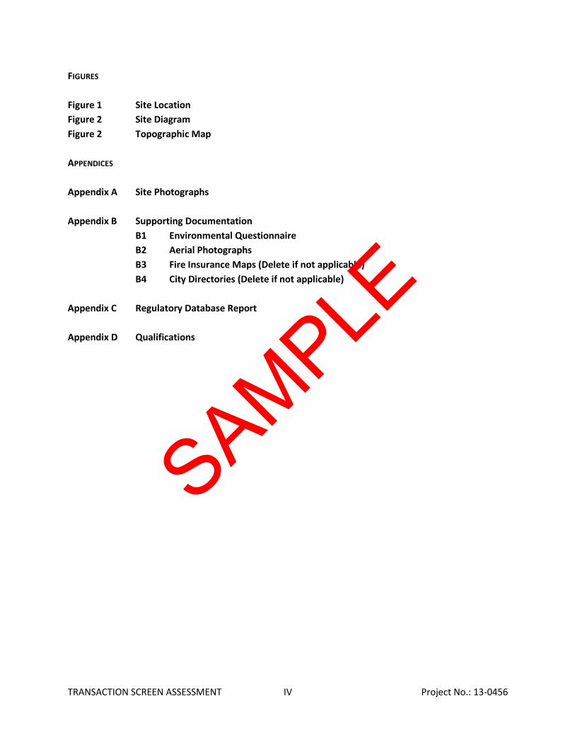
FIGURES Figure 1 Site Location Figure 2 Site Diagram Figure 2 Topographic Map APPENDICES Appendix A Site Photographs Appendix B Supporting Documentation B1 Environmental Questionnaire B2 Aerial Photographs
B3 Fire Insurance Maps (Delete if not applicable) B4 City Directories (Delete if not applicable) Appendix C Regulatory Database Report Appendix D Qualifications
SAMPLE

TRANSACTION SCREEN ASSESSMENT 1 Project No.: 13-0456
1.0 INTRODUCTION
NDDS has performed a Transaction Screen Assessment in general conformance with the scope and limitations of ASTM Standard Practice E1528-06 for the Commercial Office property located at 555 E. Transaction Street in the Any City, Any County, Any State, 12345 (the “Property”). Any exceptions to, or deletions from, this scope of work are described in the report.
1.1 Purpose
The purpose of this Transaction Screen Assessment (TSA) is to identify potential environmental concerns at the Property. The ETS includes: a site reconnaissance, interviews and completion of the Environmental Transaction Screen Questionnaire; review of government records as indicated in the Method; and review (if available) of one standard historical source (available historical fire insurance maps or local street directories).
1.2 Limitations
NDDS warrants that the findings and conclusions contained herein were accomplished in accordance with the methodologies set forth in the Scope of Work. These methodologies are described as representing good commercial and customary practice for conducting an Environmental Site Assessment of a property for the purpose of identifying potential environmental concerns. There is a possibility that even with the proper application of these methodologies there may exist on the Property conditions NDDS that could not be identified within the scope of the assessment or which were not reasonably identifiable from the available information. NDDS believes that the information obtained from the record review and the interviews concerning the site is reliable. However, NDDS cannot and does not warrant or guarantee that the information provided by these other sources is accurate or complete. The conclusions and findings set forth in this report are strictly limited in time and scope to the date of the evaluations. The conclusions presented in the report are based solely on the services described therein, and not on scientific tasks or procedures beyond the scope of agreed-upon services or the time and budgeting restraints imposed by the Property Investments, LLC. No other warranties are implied or expressed. The methodologies of this assessment are not intended to identify all environmental concerns which may be identified in a Phase I Environmental Site Assessment.
1.3 User Reliance
Property Investments, LLC engaged NDDS to perform this assessment in accordance with an agreement governing the nature, scope and purpose of the work as well as other matters critical to the engagement. All reports, both verbal and written, are for the sole use and benefit of Property Investments, LLC Corporation. Either verbally or in writing, third parties may come into possession of this report or all or part of the information generated as a result of this work. In the absence of a written agreement with NDDS granting such rights, no third parties shall have rights of recourse or recovery whatsoever under any course of action against NDDS, its officers, employees, vendors, successors or assigns. Any such unauthorized user shall be responsible to protect, indemnify and hold NDDS, Client and their respective officers, employees, vendors, successors and assigns harmless from any and all claims, damages, losses, liabilities, expenses (including reasonable attorneys’ fees) and costs
SAMPLE
TRANSACTION SCREEN ASSESSMENT 2 Project No.: 13-0456
attributable to such Use. Unauthorized use of this report shall constitute acceptance of and commitment to these responsibilities, which shall be irrevocable and shall apply regardless of the cause of action or legal theory pled or asserted. Additional legal penalties may apply.
1.4 Limiting Conditions
The findings and conclusions contain all of the limitations inherent in these methodologies that are referred to in ASTM E1528-06.
Specific limitations and exceptions to this ETS are more specifically set forth below:
The performance of this TSA was not limited in any way. NDDS was granted full and complete access to the Property.
SAMPLE
TRANSACTION SCREEN ASSESSMENT 3 Project No.: 13-0456
2.0 SITE DESCRIPTION
2.1 Site Location and Legal Description
The Property is located on the south side of E Street within a mixed commercial and residential area of Chula Vista, California. Please refer to the table below for further description of the Property:
Address: 264 E Street, Chula Vista, CA 91910 Assessor’s Parcel Number (APN): 568-072-28 Nature of Use: Commercial office Number of Buildings: 1 Number of Floors: 1 Type of Construction: Wood-frame (type V) Lot Size (SF): 6,608 SF Date of Construction: 1940 Current Tenants: South Coast Real Estate Group
The Property is also improved with asphalt-paved parking areas and associated landscaping.
Please refer to Figure 1: Site Location Map, Figure 2: Topographic Map; and Appendix A: Site Photographs for the location and site characteristics of the Property.
2.2 Current Property Use
The Property is currently occupied by South Coast Real Estate Group for use as a commercial office.
The Property was not identified in the regulatory database report of Section 4.2.
2.3 Current Use of Adjoining Properties
The Property is located within a mixed commercial and residential area of Chula Vista, California. During the vicinity reconnaissance, NDDS observed the following land use on properties in the immediate vicinity of the Property:
Immediately surrounding properties North: E Street, beyond are commercial properties occupied by a Dentist Office (275 E Street)
and 7/11 Convenience Store South: 2-story residential duplex (205A and 205B Church Avenue) East: Alleyway, beyond is a single family residence (260 E Street) West: Commercial office building (203, 203A, 203B Church Avenue)
No adjacent properties were identified in the regulatory database report of Section 4.2.
SAMPLE
TRANSACTION SCREEN ASSESSMENT 4 Project No.: 13-0456
2.4 Physical Setting Sources
2.4.1 Topography
The United States Geological Survey (USGS), National City, California Quadrangle 7.5-minute series topographic map was reviewed for this ESA. According to the contour lines on the topographic map, the Property is located at approximately 97-feet above mean sea level (MSL). The contour lines in the area of the Property indicate the area is sloping gently toward the southwest.
Please refer to Figure 3: Topographic Map.
2.4.2 Hydrology
According to topographic map interpretation, the direction of groundwater in the vicinity of the Property is inferred to flow to the southwest. The nearest surface water in the vicinity of the Property is the Sweetwater River located approximately ½ -1-mile north and northeast of the Property. No settling ponds, lagoons, surface impoundments, wetlands or natural catch basins were observed at the Property during this assessment.
According to EDR GeoCheck, the depth of groundwater in the vicinity of the Property is inferred to flow to the west and southwest and present at depths greater than 20-feet below ground surface (bgs).
SAMPLE
TRANSACTION SCREEN ASSESSMENT 5 Project No.: 13-0456
3.0 HISTORICAL INFORMATION
Per ASTM E1528-06 Scope of Work for a Transaction Screen Assessment, the focus of this research is to determine whether any past use of the property would suggest the presence of contamination associated with the property. Based on reasonably ascertainable information, NDDS reviewed Aerial Photographs, Sanborn Maps and City Directories.
3.1 Aerial Photograph Review
NDDS obtained available aerial photographs of the Property and surrounding area from Environmental Data Resources (EDR). The aerial photographs were reviewed for indications of previous uses, as discussed below:
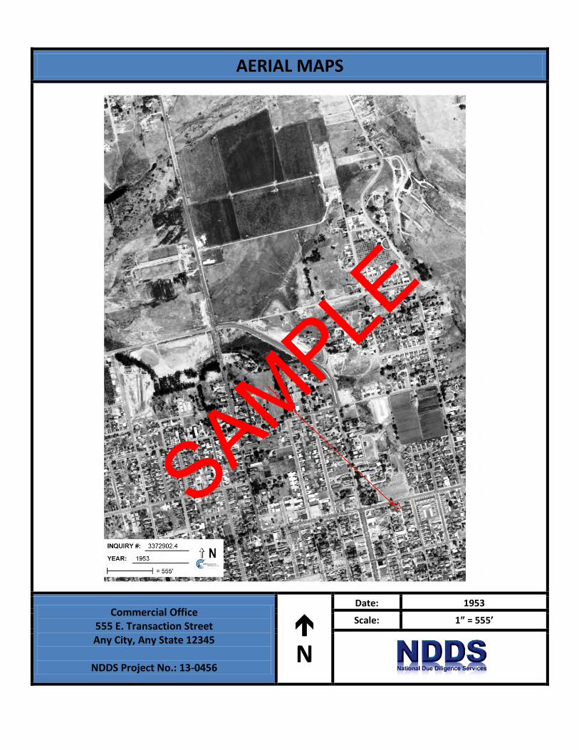
Date: 1953 Scale: 1”=555’
The Property appears to be developed with current structure.
The adjacent properties to the north, beyond E Street, appear to be undeveloped; to the south appears developed residentially; to the east beyond alleyway appears developed with residentially; to the west appears developed residentially.
Date: 1964 Scale: 1”=555’
The Property appears to be developed with current structure.
The adjacent properties to the north, beyond E Street, appear to be undeveloped; to the south appears developed residentially; to the east beyond alleyway appears developed with residentially; to the west appears developed residentially.
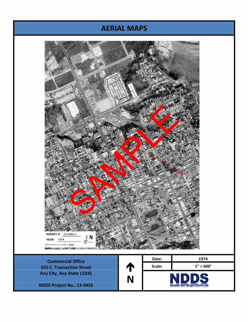
Date: 1974 Scale: 1”=600’
The Property appears to be developed with current structure.
The adjacent properties to the north, beyond E Street, appear to be commercially developed; to the south appears developed residentially; to the east beyond alleyway appears developed with residentially; to the west appears developed residentially.
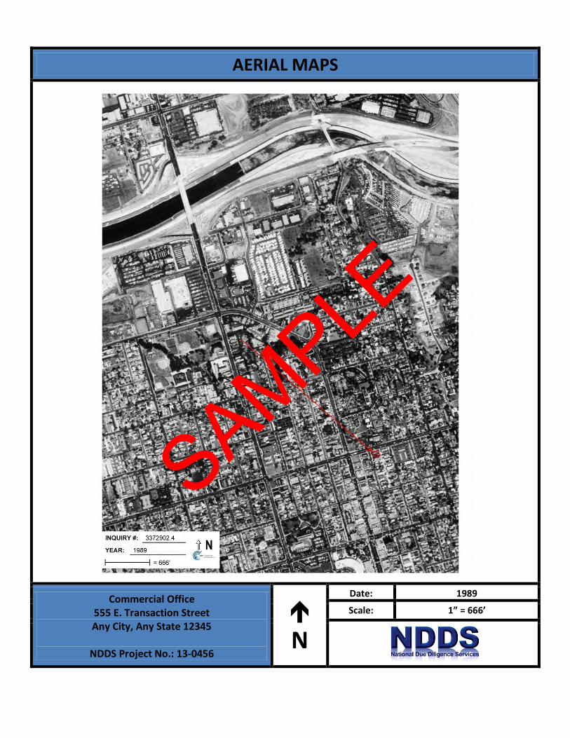
Date: 1989 Scale: 1”=666’
The Property appears to be developed with current structure.
The adjacent properties to the north, beyond E Street, appear to be commercially developed; to the south appears developed residentially; to the east beyond alleyway appears developed with residentially; to the west appears developed residentially.
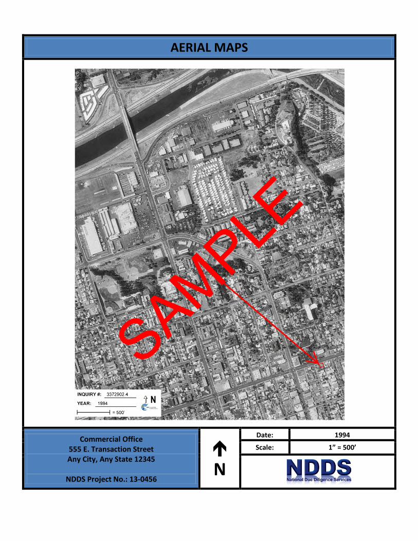
Date: 1994 Scale: 1”=500’
The Property appears to be developed with current structure.
The adjacent properties to the north, beyond E Street, appear to be commercially developed; to the south appears developed residentially; to the east beyond alleyway appears developed with residentially; to the west appears developed residentially.
SAMPLE
TRANSACTION SCREEN ASSESSMENT 6 Project No.: 13-0456
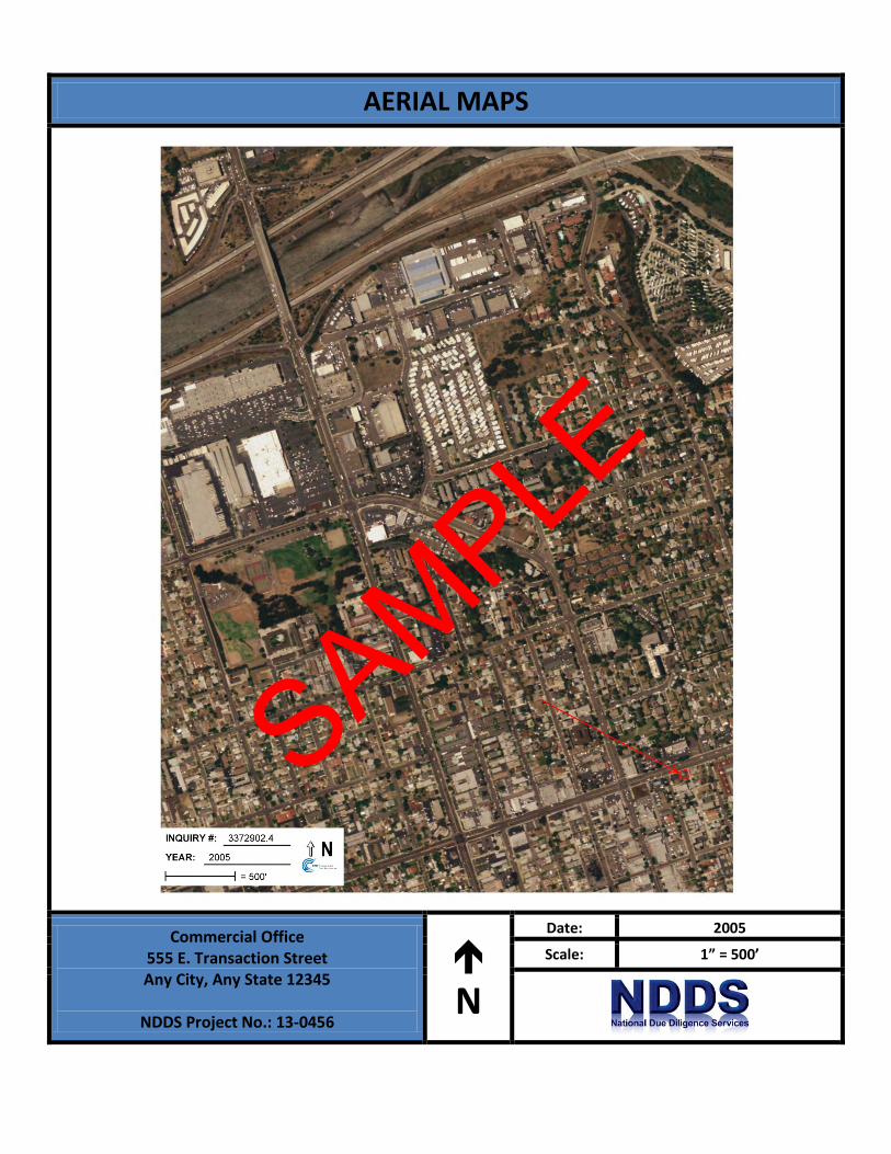
Date: 2005 Scale: 1”=500’
The Property appears to be developed with current structure.
The adjacent properties to the north, beyond E Street, appear to be commercially developed; to the south appears developed residentially; to the east beyond alleyway appears developed with residentially; to the west appears developed residentially.
Copies of aerial photographs are included in Appendix B of this report.
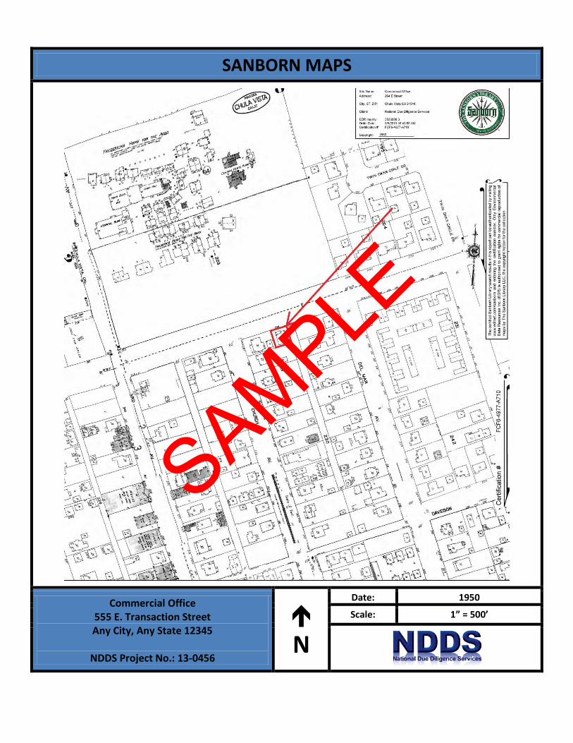
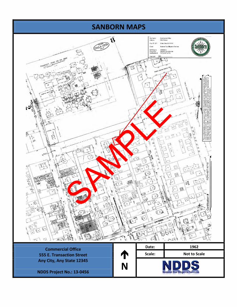
3.2 Sanborn Fire Insurance Maps
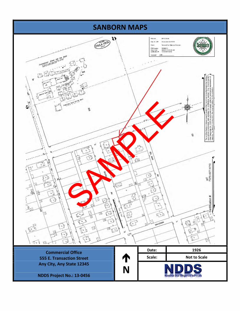
Sanborn maps were originally created in the late 1800s and early 1900s for assessing fire insurance liability in urbanized areas of the United States. These maps include detailed town and building information.
NDDS reviewed Sanborn Fire insurance maps obtained from EDR’s collection. Sanborn maps were available and reviewed for the years 1926, 1950, 1949 and 1926 as discussed below:
Date: 1926
The Property is depicted as undeveloped.
The adjacent properties to the north beyond E. Street are depicted as undeveloped; to the south is developed with a residential dwelling; to the east beyond alleyway is undeveloped; to the west is developed with a residential dwelling.
Date: 1949
The Property is depicted as developed with the current structure with residential dwelling as depicted use.
The adjacent properties to the north beyond E. Street are depicted as undeveloped; to the south is developed with a residential dwelling; to the east beyond alleyway is developed with a residential dwelling; to the west is developed with a residential dwelling.
Date: 1950
The Property is depicted as developed with the current structure with residential dwelling as depicted use.
The adjacent properties to the north beyond E. Street are depicted as undeveloped; to the south is developed with a residential dwelling; to the east beyond alleyway is developed with a residential dwelling; to the west is developed with a residential dwelling.
Date: 1962
The Property is depicted as developed with the current structure with residential dwelling as depicted use.
The adjacent properties to the north beyond E. Street are depicted as undeveloped; to the south is developed with a residential dwelling; to the east beyond alleyway is developed with a residential dwelling; to the west is developed with a structure depicted as a store and dwelling.
SAMPLE

TRANSACTION SCREEN ASSESSMENT 7 Project No.: 13-0456
Copies of reviewed Sanborn Maps are included in Appendix B of this report.
3.2 City Directories
City directories have been produced for most urban and some rural areas since the late 1800s. The directories are generally not comprehensive and may contain gaps in time periods.
NDDS reviewed historical city directories obtained from EDR for past names and businesses that were listed for the Property and adjacent properties. The findings are presented in the following table:
City Directory Search for 555 E. Transaction Street (Property) Year(s) Occupant Listed 1970 Residential listing 1976 Kreutzkamp Realty 1980 Residential listing 1985 Help U Sell of Chla and residential listing 1990 Attorney/Investigative Services
1996, 2000 Attorney 2005 Jazzy Jazz TC, Optical and Supplies, South Coast Real Estate Group 2010 Jazzy Jazz TC, Optical and Supplies, Salazar Real Estate, Santi Chinese Herb Shop
According to the city directory review, the Property has been occupied by commercial offices and stores since at least 1976. Based on the city directory review, no environmentally sensitive listings were identified for the Property address.
City Directory Search for Adjacent Properties Year(s) Occupant Listed 1976, 1980, 1985, 1990, 1996, 2000, 2005, 2010
North: (275 Transaction St.) 7-11 Food Store
1980, 1985, 1990, 1996, 2000, 2005, 2010
North: (265 Transaction St.) Commercial offices including doctors, dentist, insurance agencies, and realtors
1980, 1985, 1990, 1996, 2000, 2005, 2010
South: (205 Church Ave.) No listings
1970, 1976, 1980, 1985, 1990
East: (260 Transaction St.) Residential listings
1980, 1985, 1990, 1996, 2000, 2005, 2010
West: (203 Church Ave.) No listings
SAMPLE

TRANSACTION SCREEN ASSESSMENT 8 Project No.: 13-0456
Based on the city directory review, no environmentally sensitive listings were identified for the adjacent property addresses.
Copies of reviewed city directories are included in Appendix B of this report.
3.3 Interviews
NDDS conducted interviews with persons knowledgeable of the Property during the course of this investigation.
Owner of the Property
Ms. Bobby Brown, representative of the owner of the Property, was interviewed during the course of this investigation and completed the ASTM Standard Environmental Questionnaire. Ms. Brown was not aware of any environmentally sensitive issues related to the Property. Please refer to Appendix B for responses to the Environmental Questionnaire.
3.4 Previous Reports and Other Provided Documentation
No previous reports or other pertinent documentation was provided to NDDS for review during the course of this assessment.
SAMPLE
TRANSACTION SCREEN ASSESSMENT 9 Project No.: 13-0456
4.0 REGULATORY RECORDS REVIEW
4.1 Mapped Database Records Search
Information from standard federal, state, county, and city environmental record sources was provided by Environmental Data Resources, Inc. (EDR). Data from governmental agency lists are updated and integrated into one database, which is updated as these data are released. The information contained in this report was compiled from publicly available sources and the locations of the sites are plotted utilizing a geographic information system, which geocodes the site addresses. The accuracy of the geocoded locations is approximately +/-300 feet. Please refer to the radius map for a complete listing (Appendix C).
4.2 Regulatory Database Details
Federal NPL
The National Priorities List (NPL) is the Environmental Protection Agency (EPA) database of uncontrolled or abandoned hazardous waste sites identified for priority remedial actions under the Superfund Program.
No NPL sites are located within the 1.0-mile search radii.
Federal CERCLIS List
The Comprehensive Environmental Response, Compensation and Liability Information System (CERCLIS) list is a compilation of sites that the EPA has investigated or is currently investigating for a release or threatened release of hazardous substances.
No CERCLIS sites are listed within the 0.5-mile search radii.
Federal CERCLIS-NFRAP Sites List
The CERCLIS No Further Remedial Action Planned (NFRAP) List is a compilation of sites that the EPA has investigated, and has determined that the facility does not pose a threat to human health or the environment, under the CERCLA framework.
No CERCLIS-NFRAP sites are listed within the search radii.
Federal RCRA Generator List
The EPA Resource Conservation and Recovery Act (RCRA) Program RCRA program identifies and tracks hazardous waste from the point of generation to the point of disposal. The RCRA Generators database is a compilation by the EPA of reporting facilities that generate hazardous waste.
No RCRA Generator facilities are listed on or adjacent to the Property.
Federal RCRA CORRACTS Facilities List
SAMPLE
TRANSACTION SCREEN ASSESSMENT 10 Project No.: 13-0456
The RCRA CORRACTS database is the EPA’s list of hazardous waste facilities subject to corrective action under RCRA.
No RCRA CORRACTS facilities are listed within the 1.0-mile search radii.
Federal RCRA non-CORRACTS Facilities List
The RCRA CORRACTS database is the EPA’s list of TSD facilities subject to corrective action under RCRA.
NO RCRA non-CORRACTS facilities are listed within the 0.5-mile search radii.
Federal Resource Conservation and Recovery Act (RCRA) TSD Facilities List
The RCRA Treatment, Storage and Disposal (TSD) database is a compilation by the EPA of reporting facilities that treat, store or dispose of hazardous waste.
No RCRA TSD sites are listed within the 0.5-mile search radii.
Federal Institutional Controls/Engineering Controls (IC/EC)
The Federal IC/EC database is designed to assist the EPA in collecting, tracking, and updating information, as well as reporting on the major activities and accomplishments of the various Brownfield grant programs. The IC/EC sites are superfund sites that have either engineering or an institutional control in place. The data includes the control and the media contaminated.
No Federal IC/EC sites were found within the 0.5-mile search radii.
Federal Emergency Notification System (ERNS)
The Emergency Response Notification System (ERNS) is a national database used to collect information or reported release of oil or hazardous substances.
No ERNS sites are listed on or adjacent to the Property.
State/Tribal Sites (SPL)
The California Department of Toxic Substances Control (DTSC) maintains a State Priority List (SPL) of sites considered to be actually or potentially contaminated and a State CERCLIS-equivalent list (SCL) of sites under investigation that could be actually or potentially contaminated and presenting a possible threat to human health and the environment.
No SPL sites are listed within the search radii.
State/Tribal Equivalent CERCLIS (SHWS) Sites
The DTSC compiles a list of state hazardous waste sites equivalent to CERCLIS. These sites may or may not already be listed on the federal CERCLIS list.
No SHWS sites are reported within the 1-mile search radii.
SAMPLE
TRANSACTION SCREEN ASSESSMENT 11 Project No.: 13-0456
Solid Waste/Landfill Facilities (SWLF)
A database of SWLF is prepared by the California Department of Resources Recycling And Recovery.
No SWLF facilities are listed within the 0.5-mile search radii.
State Leaking Underground Storage Tank List (LUST)
The California Regional Water Quality Control Board (CRWQCB) compiles lists of all leaks of hazardous substances from underground storage tanks.
6 LUST sites are listed within the 0.5-mile search radii and discussed below:
• UNOCAL SS #0552 located at 201 3rd Ave., is listed as a LUST facility by the CRWQCB and is generally located to the west-southwest at a distance of approximately 475-feet. According to the listing the case type is “soil only” and the case was closed on December 28, 1995. NDDS concludes that this facility is not a concern to the Property due to its status, medium affected the suburban nature of the surrounding area, and the fact that the responsible party is identified. In addition, the entire area utilizes municipally-supplied drinking water.
• Mike’s Auto Repair located at 300 E Street, is listed as a LUST facility by the CRWQCB and is generally located to the west-southwest at a distance of approximately 486-feet. According to the listing the case type is “LUST cleanup site” with the status of “completed-case closed” as of September 1, 2006. NDDS concludes that this facility is not a concern to the Property due to its status, the suburban nature of the surrounding area, and the fact that the responsible party is identified. In addition, the entire area utilizes municipally-supplied drinking water.
• Fredericka Manor Care Center located at 111 3rd Ave., is listed as a LUST facility by the CRWQCB and is generally located to the west at a distance of approximately 498-feet. According to the listing the case type is “LUST cleanup site” with the status of “completed-case closed” as of September 26, 1997. NDDS concludes that this facility is not a concern to the Property due to its status, the suburban nature of the surrounding area, and the fact that the responsible party is identified. In addition, the entire area utilizes municipally-supplied drinking water.
• Jack Harrison Buick located at 363 E Street, is listed as a LUST facility by the CRWQCB and is generally located to the west-southwest at a distance of approximately 1,270-feet. According to the listing the case type is “LUST cleanup site” with the status of “completed-case closed” as of September 17, 1990. NDDS concludes that this facility is not a concern to the Property due to its status, the suburban nature of the surrounding area, and the fact that the responsible party is identified. In addition, the entire area utilizes municipally-supplied drinking water.
• ARCO Products/Prestige Stations located at 407 E Street, is listed as a LUST facility by the CRWQCB and is generally located to the west-southwest at a distance of approximately 1,909-feet. According to the listing the case type is “soil only” with the status of “completed-case closed” as of July 12, 1991. NDDS concludes that this facility is not a concern to the Property due to its status, the medium affected, the suburban nature of the surrounding area, and the fact that the responsible party is identified. In addition, the entire area utilizes municipally-supplied drinking water.
• Fire Station #1 located at 447 F Street, is listed as a LUST facility by the CRWQCB and is generally located to the southwest at a distance of approximately 2,454-feet. According to the
SAMPLE
TRANSACTION SCREEN ASSESSMENT 12 Project No.: 13-0456
listing the case type is “soil only” with the status of “completed-case closed” as of August 26, 1987. NDDS concludes that this facility is not a concern to the Property due to its status, the medium affected, the suburban nature of the surrounding area, and the fact that the responsible party is identified. In addition, the entire area utilizes municipally-supplied drinking water.
State Underground Storage Tank/Aboveground Storage Tank List (UST/AST)
The CRWQB compiles a list of UST and AST locations.
No registered UST/AST facilities are listed on or adjacent to the Property.
State/Tribal VCP Sites
The California DTSC compiles a list of Voluntary Cleanup Program (VCP) sites.
No State/Tribal VCP sites were found within the search radii.
State/Tribal Brownfield Sites
The California Environmental Protection Agency (CEPA) has developed an electronic database system with information about sites that are known to be contaminated with hazardous substances as well as information on uncharacterized properties where further studies may reveal problems.
No CEPA Brownfield sites were found within the search radii.
US Brownfield Sites
The EPA Brownfield database was reviewed to identify facilities that qualify for federal remediation funding under the Small Business Liability Relief and Brownfield Revitalization Act (the “Brownfield” amendment to CERCLA).
No US Brownfield sites were noted within the search radii.
State Spills Sites (SPILLS)
The CRWQCB maintains reports of sites that have records of spills, leaks, investigations and cleanups.
No SPILLS sites are listed on or adjacent to the Property.
Tribal Records
The EPA maintains a database of Indian administered lands of the United States that total 640 acres or more.
No Tribal sites were found within the search radii.
MANIFEST Sites
SAMPLE
TRANSACTION SCREEN ASSESSMENT 13 Project No.: 13-0456
The California DTSC maintains a Manifest database which lists and tracks hazardous waste from the generator through transporters to a TSD facility.
No Manifest sites are listed on or adjacent to the Property.
EDR Historical Cleaners
EDR maintains a list of registered dry cleaning facilities.
No EDR Historical Cleaners are listed on or adjacent to the Property.
SAMPLE
TRANSACTION SCREEN ASSESSMENT 14 Project No.: 13-0456
5.0 SITE RECONNAISSANCE
A site reconnaissance of conducted by NDDS on 3/7/2013. The weather at the time of the site visit was clear and 68 degrees F. The Site Contact was identified as Ms. Bobby Brown, who also accompanied NDDS during field reconnaissance activities and provided minimal information pertaining to the current operations and maintenance of the Property.
All areas of the Property were accessible at the time of the site reconnaissance. There were no physical or visual obstructions of the Property.
The Property is currently occupied by Real Estate Group. No potential environmental concerns were identified during the onsite reconnaissance.
5.1 General Site Characteristics
5.1.1 Solid Waste Disposal
Solid waste generated at the Property is disposed of in trash cans located on the west side of the Property. The City of Any City is responsible for picking up trash.
5.1.2 Sewage Discharge and Disposal
Sanitary discharges on the Property are directed into the municipal sanitary sewer system. The City of Any City services the Property vicinity. No wastewater treatment facilities or septic systems are located on the Property.
5.1.3 Surface Water Drainage
Storm water is removed from the Property primarily by sheet flow action across the paved surfaces towards the public right of way. The Property is connected to a municipal owned and maintained sewer system.
5.1.4 Source of Heating and Cooling
Heating and cooling systems are fueled by both gas and electricity. Hot water is not provided.
5.1.5 Wells and Cisterns
No aboveground evidence of wells or cisterns was observed during the site reconnaissance.
5.1.6 Wastewater
Domestic wastewater generated at the Property is disposed by means of the sanitary sewer system. No industrial process is currently performed at the Property.
SAMPLE
TRANSACTION SCREEN ASSESSMENT 15 Project No.: 13-0456
5.1.7 Septic Systems
No septic systems were observed or reported on the Property.
5.1.8 Additional Site Observations
No additional general site characteristics were observed.
5.2 Potential Environmental Hazards
5.2.1 Hazardous Materials and Petroleum Products Used or Stored at the Site
No hazardous materials or petroleum products were observed on the Property.
5.2.2 Aboveground & Underground Hazardous Substance or Petroleum Product Storage Tanks (ASTs/USTs)
No evidence of current or former ASTs or USTs was observed during the site reconnaissance.
5.2.3 Evidence of Releases
No spills, stains or other indications that a surficial release has occurred at the Property were observed.
5.2.4 Polychlorinated Biphenyls (PCBs)
No potential PCB-containing equipment (transformers, oil-filled switches, hoists, lifts, dock levelers, hydraulic elevators, etc) was observed on the Property during NDDS’s reconnaissance.
Additionally, no other potential PCB-containing equipment (interior transformers, oil-filled switches, hoists, lifts, dock levelers, hydraulic elevators, balers, etc.) was observed on the Property during NDDS’s reconnaissance.
5.2.5 Strong, Pungent or Noxious Odors
No strong, pungent or noxious odors were evident during the site reconnaissance.
5.2.6 Pools of Liquid
No pools of liquid were observed on the Property.
5.2.7 Drains, Sumps and Clarifiers
No drains, sumps or clarifiers, other than those associated with storm water removal, were observed on the Property.
5.2.8 Pits, Ponds and Lagoons
No pits, ponds or lagoons were observed on the Property.
SAMPLE

TRANSACTION SCREEN ASSESSMENT 16 Project No.: 13-0456
5.2.9 Stressed Vegetation
No stressed vegetation was observed on the Property.
5.2.10 Additional Potential Environmental Hazards
No additional environmental hazards, including landfill activities or radiological hazards, were observed.
5.3 Non-ASTM Services
5.3.1 Asbestos-Containing Materials (ACMs)
Asbestos is the name given to a number of naturally occurring, fibrous silicate minerals mined for their useful properties such as thermal insulation, chemical and thermal stability, and high tensile strength. Asbestos is commonly used as an acoustic insulator, thermal insulation, fire proofing and in other building materials. Exposure to airborne friable asbestos may result in a potential health risk because persons breathing the air may breathe in asbestos fibers. Continued exposure can increase the amount of fibers that remain in the lung. Fibers embedded in lung tissue over time may cause serious lung diseases including: asbestosis, lung cancer, or mesothelioma.
The Occupational Safety and Health Administration (OSHA) regulation 29 CFR 1926.1101 requires certain construction materials to be presumed to contain asbestos, for purposes of this regulation. All thermal system insulation (TSI), surfacing material, and asphalt/vinyl flooring that are present in a building constructed prior to 1980 and have not been appropriately tested are “presumed asbestos-containing material” (PACM).
The Property building was constructed in 1940. NDDS has conducted a limited, visual evaluation of accessible areas for the presence of suspect asbestos containing materials (ACMs) at the Property. The objective of this visual survey was to note the presence and condition of suspect ACM observed. Please refer to the table below for identified suspect ACMs:
Suspect ACMs
Suspect ACM Location Friable Yes/No Physical Condition
Drywall Systems Throughout Building Interior No Good
NDDS was not provided building plans or specifications for review, which may have been useful in determining areas likely to have used ACM.
According to the US EPA, ACM and PACM that is intact and in good condition can, in general, be managed safely in-place under an Operations and Maintenance (O&M) Program until removal is dictated by renovation, demolition, or deteriorating material condition. Prior to any disturbance of the construction materials within this facility, a comprehensive ACM survey is recommended.
5.3.2 Lead-Based Paint (LBP)
Due to the commercial nature of use of the Property, lead-based paint was not considered within the scope of this assessment.
SAMPLE
TRANSACTION SCREEN ASSESSMENT 17 Project No.: 13-0456
Lead is a highly toxic metal that affects virtually every system of the body. While adults can suffer from excessive lead exposures, the groups most at risk are fetuses, infants and children under 6. Congress passed the Residential Lead-Based Paint Hazard Reduction Act of 1992, also known as “Title X”, to protect families from exposure to lead from paint, dust, and soil. Section 1018 of this law directed the Housing and Urban Development (HUD) and the US EPA to require the disclosure of known information on lead-based paint (LBP) and LBP hazards before the sale or lease of most housing built before 1978. Sellers, landlords, and their agents are responsible for providing this information to the buyer or renter before sale or lease.
According to Section 1017 of Title X, “LBP hazard is any condition that causes exposure to lead from lead-contaminated dust; bare, lead-contaminated soil; or LBP that is deteriorated or intact LBP present on accessible surfaces, friction surfaces, or impact surfaces that would result in adverse human health effects.” Therefore, under Title X intact lead-based paint on most walls and ceilings is not considered a “hazard,” although the condition of the paint should be monitored and maintained to ensure that it does not become deteriorated. LBP is defined as any paint, varnish, stain, or other applied coating that has 1 mg/cm2 (or 5,000 ug/g by weight) or more of lead.
Based on the age of the Property building (pre-1978), there is a potential that LBP is present. Interior and exterior painted surfaces were observed in good condition and therefore not expected to represent a “hazard”, although the condition of the paint should be monitored and maintained to ensure that it does not become deteriorated.
5.3.3 Radon
Radon is a colorless, odorless, naturally occurring, radioactive, inert, gaseous element formed by radioactive decay of radium (Ra) atoms. The US EPA has prepared a map to assist National, State, and local organizations to target their resources and to implement radon-resistant building codes. The map divides the country into three Radon Zones; Zone 1 being those areas with the average predicted indoor radon concentration in residential dwellings exceeding the US EPA Action Limit of 4.0 picoCuries per Liter (pCi/L). It is important to note that the EPA has found homes with elevated levels of radon in all three zones, and the US EPA recommends site-specific testing in order to determine radon levels at a specific location. However, the map does give a valuable indication of the propensity of radon gas accumulation in structures.
Radon sampling was not conducted as part of this assessment. Review of the US EPA Map of Radon Zones places the Property in Zone 3, where average predicted radon levels are less than 2.0 pCi/L.
Based upon the radon zone classification, radon is not considered to be a significant environmental concern.
5.3.4 Mold
Molds are microscopic organisms found virtually everywhere, indoors and outdoors. Mold will grow and multiply under the right conditions, needing only sufficient moisture (e.g.in the form of very high humidity, condensation, or water from a leaking pipe, etc.) and organic material (e.g., ceiling tile, drywall, paper, or natural fiber carpet padding). Mold growths often appear as discoloration, staining, or fuzzy growth on building materials or furnishings and are varied colors of white, gray, brow, black,
SAMPLE

TRANSACTION SCREEN ASSESSMENT 18 Project No.: 13-0456
yellow, and green. In large quantities, molds can cause allergic symptoms when inhaled or through the toxins the molds emit.
NDDS observed accessible, interior areas for the Property building for significant evidence of mold growth; however, this TSA should not be used as a mold survey or inspection. Additionally, this inspection was not designed to assess all areas of potential mold growth that may be affected by mold growth on the Property. Rather, it is intended to give the client an indication as to whether or not conspicuous (based on observed areas) mold growth is present at the Property. This evaluation did not include a review of pipe chases, mechanical systems, or areas behind enclosed walls and ceilings.
No obvious indications of water damage or mold growth were observed during NDDS’s visual inspection.
5.3.5 Wetlands
Based on information obtained from the United States Department of Agriculture, the Property does not appear to be a designated wetland area. However, a comprehensive wetlands survey would be required in order to formally determine actual wetlands on the Property. No surface impoundments, wetlands, natural catch basins, settling ponds, or lagoons are located on the Property. No drywells were identified on the Property.
5.4 Adjacent Property Reconnaissance
The adjacent property reconnaissance consisted of observing the adjacent properties from the Property premises. No items of environmental concern were identified on the adjacent properties during the site reconnaissance, including hazardous materials, petroleum products, ASTs, USTs, evidence of releases, PCBs, strong or noxious odors, pools of liquids, sumps or clarifiers, pits or lagoons, stressed vegetation, or any other potential environmental hazards.
SAMPLE

TRANSACTION SCREEN ASSESSMENT 19 Project No.: 13-0456
6.0 SIGNATURES OF ENVIRONMENTAL PROFESSIONALS
NDDS has performed an Environmental Transaction Screen of the Commercial Office property located at 555 E. Transaction Street in the Any City, Any County, Any State, 12345 in general conformance with the scope and limitations of the protocol and the limitations stated earlier in this report. Exceptions to or deletions from this protocol are discussed earlier in this report.
Prepared By:
George Pallo Environmental Professional Reviewed By:
Ronnie Long, C.E.M. Senior Client Manager/Assessments Coordinator
SAMPLE
FIGURES
1- SITE LOCATION MAP
2- SITE DIAGRAM
3- TOPOGRAPHIC MAP
TRANSACTION SCREEN ASSESSMENT Project No.: 13-0282
SAMPLE

SITE LOCATION MAP
Commercial Office 555 E. Transaction Street Any City, Any State 12345
NDDS Project No.: 13-0456
N
Not To Scale
Figure 1
SAMPLE
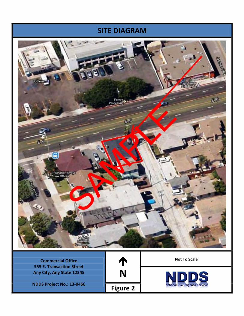
SITE DIAGRAM
Commercial Office 555 E. Transaction Street Any City, Any State 12345
NDDS Project No.: 13-0456
N
Not To Scale
Figure 2
SAMPLE
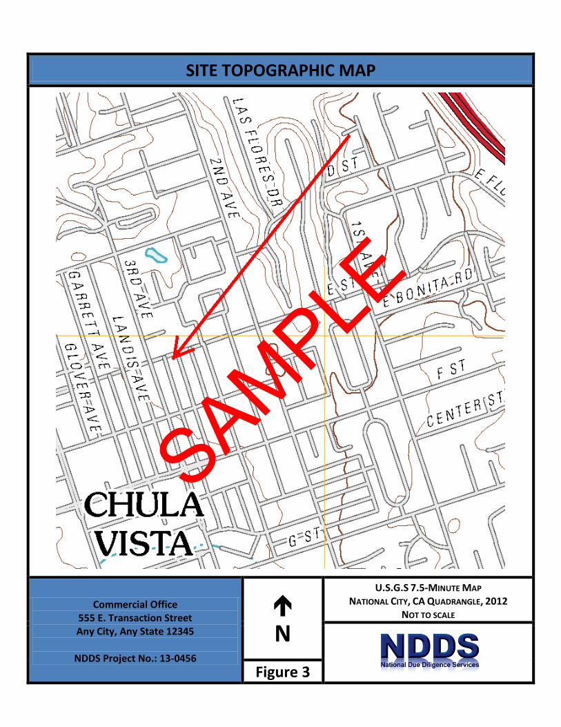
SITE TOPOGRAPHIC MAP
Commercial Office 555 E. Transaction Street Any City, Any State 12345
NDDS Project No.: 13-0456
N
U.S.G.S 7.5-MINUTE MAP NATIONAL CITY, CA QUADRANGLE, 2012
NOT TO SCALE
Figure 3
SAMPLE

APPENDIX A: SITE PHOTOGRAPHS
TRANSACTION SCREEN ASSESSMENT Project No.: 13-0282
SAMPLE

Photo 1. Front entry on north side Photo 2. Gas meter on west side
Photo 3. Property Line at sidewalk Photo 4. Electric meter on east side
Photo 5. View of open circuit breaker box Photo 6. View of eaves showing roof sheathing
SITE PHOTOGRAPHS
Commercial Office 555 E. Transaction Street Any City, Any State 12345 NDDS Project No.: 13-0456
SAMPLE

Photo 7. Interior restroom Photo 8. Signage at east side
Photo 9. East side showing exterior lighting Photo 10. South side elevation
Photo 11. View looking northwest from alley Photo 12. Disconnected downspout
SITE PHOTOGRAPHS
Commercial Office 555 E. Transaction Street Any City, Any State 12345 NDDS Project No.: 13-0456
SAMPLE

Photo 13. Storage unit at south side Photo 14. East elevation
Photo 15. Asphalt parking on west side Photo 16. Combination heater/air-conditioning unit
Photo 17. Typical flooring in office Photo 18. Typical ceiling
SITE PHOTOGRAPHS
Commercial Office 555 E. Transaction Street Any City, Any State 12345 NDDS Project No.: 13-0456
SAMPLE
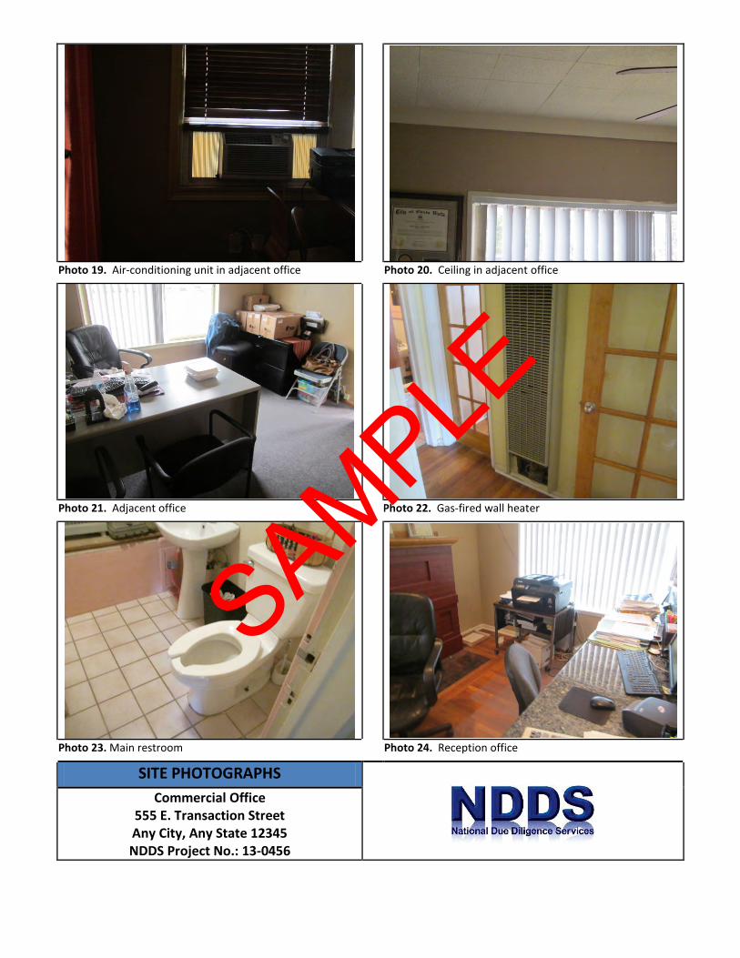
Photo 19. Air-conditioning unit in adjacent office Photo 20. Ceiling in adjacent office
Photo 21. Adjacent office Photo 22. Gas-fired wall heater
Photo 23. Main restroom Photo 24. Reception office
SITE PHOTOGRAPHS
Commercial Office 555 E. Transaction Street Any City, Any State 12345 NDDS Project No.: 13-0456
SAMPLE

Photo 25. Office under renovation Photo 26. Office under renovation
Photo 27. Concrete alley on east side Photo 28. Adjacent property on the east
Photo 29. Adjacent property on the south Photo 30. Transformer to the south
SITE PHOTOGRAPHS
Commercial Office 555 E. Transaction Street Any City, Any State 12345 NDDS Project No.: 13-0456
SAMPLE
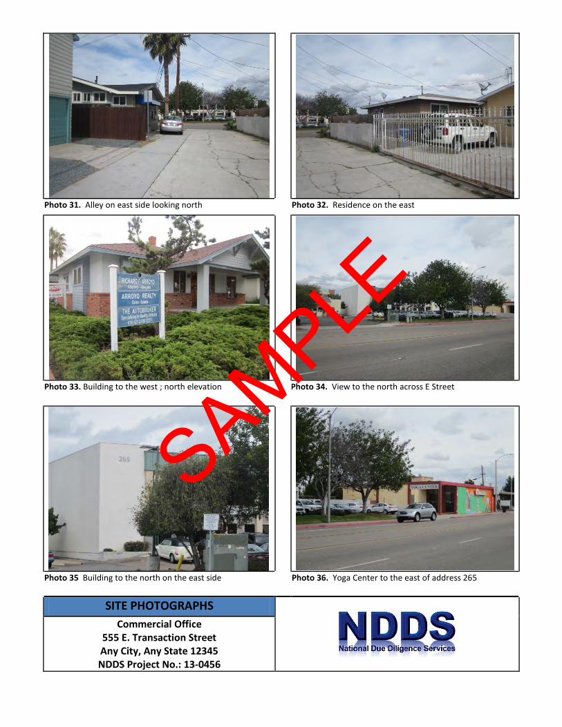
Photo 31. Alley on east side looking north Photo 32. Residence on the east
Photo 33. Building to the west ; north elevation Photo 34. View to the north across E Street
Photo 35 Building to the north on the east side Photo 36. Yoga Center to the east of address 265
SITE PHOTOGRAPHS
Commercial Office 555 E. Transaction Street Any City, Any State 12345 NDDS Project No.: 13-0456
SAMPLE

Photo 37. North building Photo 38. North buildings showing the 7/11 to the west
Photo 39. Looking east along E Street Photo 40. Looking west along E Street
Photo 41. Building to the west; east elevation
SITE PHOTOGRAPHS
Commercial Office 555 E. Transaction Street Any City, Any State 12345 NDDS Project No.: 13-0456
SAMPLE

APPENDIX B: SUPPORTING DOCUMENTATION
TRANSACTION SCREEN ASSESSMENT Project No.: 13-0282
SAMPLE
AERIAL MAPS
Commercial Office 555 E. Transaction Street Any City, Any State 12345
NDDS Project No.: 13-0456
N
Date: 1953
Scale: 1” = 555’
SAMPLE

AERIAL MAPS
Commercial Office 555 E. Transaction Street Any City, Any State 12345
NDDS Project No.: 13-0456
N
Date: 1964
Scale: 1” = 555’
SAMPLE
AERIAL MAPS
Commercial Office 555 E. Transaction Street Any City, Any State 12345
NDDS Project No.: 13-0456
N
Date: 1974
Scale: 1” = 600’
SAMPLE
AERIAL MAPS
Commercial Office 555 E. Transaction Street Any City, Any State 12345
NDDS Project No.: 13-0456
N
Date: 1989
Scale: 1” = 666’
SAMPLE
AERIAL MAPS
Commercial Office 555 E. Transaction Street Any City, Any State 12345
NDDS Project No.: 13-0456
N
Date: 1994
Scale: 1” = 500’
SAMPLE
AERIAL MAPS
Commercial Office 555 E. Transaction Street Any City, Any State 12345
NDDS Project No.: 13-0456
N
Date: 2005
Scale: 1” = 500’
SAMPLE
SANBORN MAPS
Commercial Office
555 E. Transaction Street Any City, Any State 12345
NDDS Project No.: 13-0456
N
Date: 1926
Scale: Not to Scale
SAMPLE

SANBORN MAPS
Commercial Office 555 E. Transaction Street Any City, Any State 12345
NDDS Project No.: 13-0456
N
Date: 1949
Scale: Not to Scale
SAMPLE
SANBORN MAPS
Commercial Office 555 E. Transaction Street Any City, Any State 12345
NDDS Project No.: 13-0456
N
Date: 1950
Scale: 1” = 500’
SAMPLE
SANBORN MAPS
Commercial Office 555 E. Transaction Street Any City, Any State 12345
NDDS Project No.: 13-0456
N
Date: 1962
Scale: Not to Scale
SAMPLE
TSA Questionnaire Page 1 of 4
ENVIRONMENTAL TRANSACTION SCREEN QUESTIONNAIRE (ASTM STANDARD E1528) PROPERTY ADDRESS: PROPERTY CITY, STATE ZIP:
Question Owner Occupants
(if applicable) Observed
During Site Visit
1a. Did you observe evidence or do you have any prior knowledge that the Property is currently or has been previously used for an industrial use?
Yes No Unk Yes No Unk Yes No Unk
1b. Did you observe evidence or do you have any prior knowledge that any adjoining property is currently or has been previously used for an industrial use?
Yes No Unk Yes No Unk Yes No Unk
2a. Did you observe evidence or do you have any knowledge that the Property is currently or has previously been used for any of the following: (if applicable, identify which) • gasoline station • motor repair facility • commercial printing facility • dry cleaners • photo developing laboratory • junkyard or landfill • waste treatment, storage, disposal,
processing or recycling facility
Yes No Unk Yes No Unk Yes No Unk
2b. Did you observe evidence or do you have any knowledge that any adjoining property is currently or has previously been used for any of the following: (if applicable, identify which) • gasoline station • motor repair facility • commercial printing facility • dry cleaners • photo developing laboratory • junkyard or landfill • waste treatment, storage, disposal,
processing or recycling facility
Yes No Unk Yes No Unk Yes No Unk
SAMPLE

TSA Questionnaire Page 2 of 4
Question Owner Occupants
(if applicable) Observed
During Site Visit
3. Did you observe evidence or do you have any knowledge that there are currently or have been previously any damaged or discarded automotive or industrial batteries, pesticides, paints, or other chemicals in individual containers of >5 gal (19 L) in volume or 50 gal (190 L) in the aggregate, stored on or used at the Property?
Yes No Unk Yes No Unk Yes No Unk
4. Did you observe evidence or do you have any knowledge that there are currently or have been previously any industrial drums (typically 55 gal) or sacks of chemicals located on the Property?
Yes No Unk Yes No Unk Yes No Unk
5. Did you observe evidence or do you have any prior knowledge that fill dirt has been brought onto the Property that originated from a contaminated source or is of an unknown origin?
Yes No Unk Yes No Unk Yes No Unk
6. Did you observe evidence or do you have any prior knowledge that there is currently or has been previously any pits, ponds, or lagoons located on the Property in connection with waste treatment or waste disposal?
Yes No Unk Yes No Unk Yes No Unk
7. Did you observe evidence or do you have any prior knowledge that there is currently or has been previously any stained soil on the Property?
Yes No Unk Yes No Unk Yes No Unk
8. Did you observe evidence or do you have any prior knowledge that there is currently or has been previously any registered or unregistered storage tanks (above or underground) located on the Property?
Yes No Unk Yes No Unk Yes No Unk
9. Did you observe evidence or do you have any prior knowledge that there is currently or has been previously any vent pipes, fill pipes, or access ways indicating a fill pipe protruding from the ground on the Property or adjacent to any structure on the Property?
Yes No Unk Yes No Unk Yes No Unk
SAMPLE
TSA Questionnaire Page 3 of 4
Question Owner Occupants
(if applicable) Observed
During Site Visit
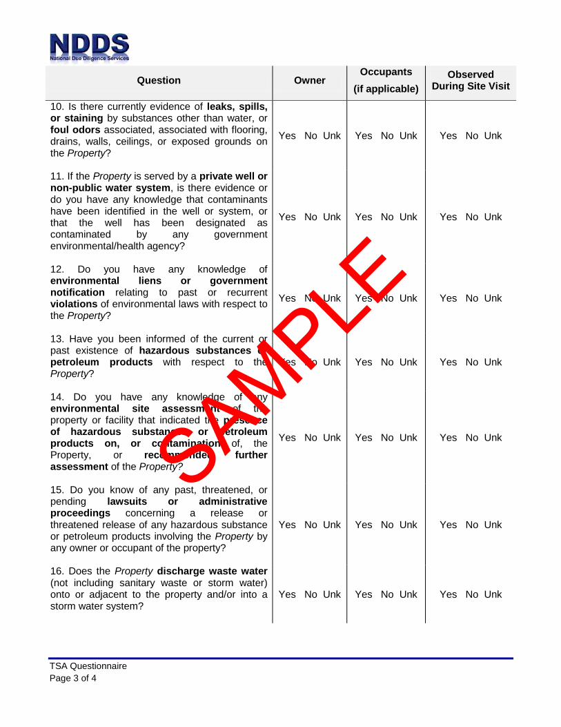
10. Is there currently evidence of leaks, spills, or staining by substances other than water, or foul odors associated, associated with flooring, drains, walls, ceilings, or exposed grounds on the Property?
Yes No Unk Yes No Unk Yes No Unk
11. If the Property is served by a private well or non-public water system, is there evidence or do you have any knowledge that contaminants have been identified in the well or system, or that the well has been designated as contaminated by any government environmental/health agency?
Yes No Unk Yes No Unk Yes No Unk
12. Do you have any knowledge of environmental liens or government notification relating to past or recurrent violations of environmental laws with respect to the Property?
Yes No Unk Yes No Unk Yes No Unk
13. Have you been informed of the current or past existence of hazardous substances or petroleum products with respect to the Property?
Yes No Unk Yes No Unk Yes No Unk
14. Do you have any knowledge of any environmental site assessment of the property or facility that indicated the presence of hazardous substances or petroleum products on, or contamination of, the Property, or recommended further assessment of the Property?
Yes No Unk Yes No Unk Yes No Unk
15. Do you know of any past, threatened, or pending lawsuits or administrative proceedings concerning a release or threatened release of any hazardous substance or petroleum products involving the Property by any owner or occupant of the property?
Yes No Unk Yes No Unk Yes No Unk
16. Does the Property discharge waste water (not including sanitary waste or storm water) onto or adjacent to the property and/or into a storm water system?
Yes No Unk Yes No Unk Yes No Unk
SAMPLE

TSA Questionnaire Page 4 of 4
Question Owner Occupants
(if applicable) Observed
During Site Visit
17. Do you have any prior knowledge that any hazardous substances or petroleum products, unidentified waste materials, tires, automotive or industrial batteries, or any other waste materials have been dumped above grade, buried and/or burned on the Property?
Yes No Unk Yes No Unk Yes No Unk
18. Is there a transformer, capacitor, or any hydraulic equipment for which there are any records indicating the presence of PCBs on the Property?
Yes No Unk Yes No Unk Yes No Unk
Please provide details relating to any questions answered “yes” in the space provided. Attach additional sheets or informative documents if necessary.
Signature of Party Completing Questionnaire: _______________________________ Name of Party Completing Questionnaire: __________________________________ Title/Relationship to Property: _______________________________ Phone Number/Email: ___________________________________________ Date: _____________________ Contact for additional information: Name: _____________________________________________ Relationship to Property: ________________________ Phone Number/Email: ________________________________
SAMPLE
APPENDIX C: REGULATORY DATABASE REPORT
TRANSACTION SCREEN ASSESSMENT Project No.: 13-0456
SAMPLE

APPENDIX D: QUALIFICATIONS
TRANSACTION SCREEN ASSESSMENT Project No.: 13-0456
SAMPLE

George Pallo Education: • AA (Architectural Engineering)
• BS (Management) • MBA
Years of Experience: 20 years+
Summary of Professional Experience Mr. Pallo has over 20 years of experience in the field of residential and commercial architecture, construction and building inspection. This includes experience on the drafting table as well as experience in the field working with homeowners, building owners, contractors and the financial community solving problems related to their properties and projects. He experience include project management and inspections for Property Conditions Assessments on a nationwide basis including the research and interviewing of appropriate municipal contacts and contracting professionals who may have special knowledge of the conditions of the Subject.
Mr. Pallo has completed over 1600 commercial property condition assessments and environmental assessments in all types of properties including:
• Numerous multi‐family housing units
• A five story student housing facility in Los Angeles which incorporated the inspection of
three underground stories of automobile parking.
• A fifty‐acre (50‐acre) ranch in New Mexico
• Large shopping centers including projects in Carpentaria, CA, Lake Forest, CA, Oceanside, CA,
Anaheim, CA, Riverside, CA, Escondido, CA, Granada Hills, CA, Oxnard, CA, Los Angeles, CA.
Valencia, CA, Carlsbad, CA, Encino, CA, Indio, CA, El Paso, TX and Miami, Florida
• Large shopping centers including a 16‐story commercial office structure in Phoenix and
Tucson, Arizona.
• Elderly care facilities in Stafford, Arizona and Fresno, California
• Mobile home parks and mass‐storage facilities
• Strip shopping centers
• Major hotels including The Grand Hotel in Grand Canyon, Arizona, Argonaut Hotel (San
Francisco), Sofitel Hotel (Philadelphia, PA) 14‐story hotel, Holiday Inn at LAX
• Aerospace/Warehouse facilities and warehouses up to 2,000,000 square feet.
SAMPLE

RONNIE LONG, CEM
SENIOR CLIENT MANAGER/ASSESSMENTS COORDINATOR
Education: B.S. Agriculture, Missouri State University Licenses/Registrations Certified Environmental Manager # EA-FQXH62DP Environmental Assessment Association Years of Experience: 14 years Summary of Professional experience
Mr. Long has more than 14-years of experience in environmental investigation and assessment. He is an accomplished manager of numerous environmental assessment, remediation and monitoring projects with demonstrated knowledge of the principles, practices, technology, regulation and methods of environmental management and sustainability. Mr. Long has managed hundreds of Environmental Site Assessments (ESAs) and Property Condition Assessments (PCAs) nationwide including service stations, dry cleaners, hotels, retail shopping centers, commercial offices, amusement parks, manufacturing plants, agricultural and residential properties.
His environmental background includes a detailed understanding of assessing risk associated with hazardous and regulated materials storage, use generation and disposal, above ground and underground storage tanks, polychlorinated biphenyls (PCBs), asbestos-containing materials (ACM), lead-based paint (LBP), mold and radon. Mr. Long has managed numerous subsurface investigations to assess the horizontal and vertical extent of soil and groundwater contamination as well as monitoring and reporting groundwater and surface water contamination.
SAMPLE