s3.ap-southeast-2.amazonaws.com€¦ · Web viewThe project team wishes to acknowledge ... Retain...
87
P l e n t y G o r g e P a r k D R A F T MAS TER PLAN No v e m b e r 2017
Transcript of s3.ap-southeast-2.amazonaws.com€¦ · Web viewThe project team wishes to acknowledge ... Retain...

P l e n t y G o r g e P a r kD R A F T M A S T E R P L A N N o v e m b e r 2 0 1 7
Revision Status DateA Draft 13 November 2017
Acknowledgement of Country
Plenty Gorge Park is within the Country of the Wurundjeri people. Parks Victoria on behalf of the Victorian Government acknowledges the significance of Plenty Gorge to the Wurundjeri people and seeksto reflect the views, interests and aspirations of theTraditional Owners in using and managing the park.
Report contributors
The project team wishes to acknowledge the input and assistance of the following:
• Parks Victoria - Project Working Group and ProjectControl Group members
• Consultants who helped prepare the report:Land Design Partnership and HM Leisure Planning
• Authors of the many background reports on thepark.
• Wurundjeri, community and stakeholder grouprepresentatives who gave their time and knowledgeduring various the engagement phases.
Have your say
This draft master plan is now released for public comment. Parks Victoria invites feedback from interested individuals, community organisations, groups and agencies.
For information on how to contribute visit: www.parkweb.vic.gov.au/explore/parks/plenty-gorge- park/plans-and-projects
Alternatively email: [email protected]
Parks VictoriaPlenty Gorge PlanLevel 10, 535 Bourke StreetMelbourne VIC 3000www.parks.vic.gov.auPhone: 13 196
About this document
This document is a master plan prepared for ParksVictoria to guide future directions for Plenty Gorge Park.
The master plan conveys a long-term vision for the park and provides a framework to improve leisure and recreation opportunities, whilst protecting and celebrating the park’s natural and cultural values. Itidentifies potential site enrichment opportunities and locations for these based on community and stakeholder engagement and investigation of the park’s features.
The master plan has considered directions from the previous Plenty Gorge Park Master Plan (1994) as wellas a number of existing concept plans and precinct plans for various areas within the park. Directions that are considered relevant to the current and future use of the park are incorporated into this document.
As a planning document, the master plan is not intended to provide detailed design or definition of specific uses that industry and/or the community might ultimately realise. The scale of plans and diagrams used in this report reflect this strategic intent.
The master plan provides a sound basis for future detailed design and implementation of the actions required to achieve the vision for Plenty Gorge Park. The plan’s recommendations will be implemented and staged over time as funding and resources become available.

PLENTY GORGE PARK DRAFT MASTER PLANParks Victoria | Land Design Partnership HM Leisure Planning
3
Contents
Welcome to Our Country 5
Executive summary 6
1.0 Introduction 91.1 Study area and context 91.2 Surrounding open space 101.3 Why a master plan is needed 10
2.0 Existing features and uses 122.1 Existing uses 122.2 Natural values 142.3 Cultural and heritage values 162.4 Engagement 17
3.0 Master plan 193.1 Vision 193.2 Guiding principles 193.3 Master plan structure 203.4 Key issues 203.5 Key objectives 223.7 Visitor experiences 243.8 Park areas and sites 263.9 General recommendations 273.10 Specific recommendations 28
4.0 Implementation plan 514.1 Priority recommendations 514.2 Immediate opportunities 54
5.0 References 56
6.0 Appendices 58Appendix A: Planning context 58Appendix B: Geology 60Appendix C: Flora 62Appendix D: Fauna 64Appendix E: Indigenous Heritage 66Appendix F: European Heritage 68


PLENTY GORGE PARK DRAFT MASTER PLANParks Victoria | Land Design Partnership HM Leisure Planning
5
Welcome to Our Country
The Wurundjeri people are intimately connected with the area known as PlentyGorge and as the Traditional Owners this has been true for over 40,000 years.
Plenty Gorge is of great significance to the Wurundjeri people with many artefact scatters and scarred trees located in the area which testify to the importanceof the site prior to colonial settlement, and which now serve to help connectWurundjeri descendants to their Ancestors, and their cultural heritage.
Despite many hardships faced by Wurundjeri people due to colonisation, contemporary culture has adapted to continue in an urban environment and to preserve the rich cultural heritage of their forebears.
We have strong spiritual ties to the country of our Ancestors. We continue to access and care for cultural places across our Country. Country is central to our sense of belonging; the natural world is a cultural world. We have a special connection to our Country and the health of waterways and land remains central to our cultural aspirations and the health and well being of our people.
Caring for country is still a cultural responsibility that remains central to the cultural heritage of the Wurundjeri people who continue to play a role in preserving their natural and cultural landscapes. Wurunderi is happy to support the Plenty Gorge Master Plan, which aims to support the conservation of the natural and cultural landscapes of the area.
~ Wurundjeri Tribe Land and Compensation Cultural Heritage Council Incorporated

PLENTY GORGE PARK DRAFT MASTER PLANParks Victoria | Land Design Partnership HM Leisure Planning
6
Executive summary
VisionPlenty Gorge Park will provide diverse visitor experiences, reflect community interestsand cherish the heritage and nature within the unique geological setting of Plenty Gorge.
About Plenty Gorge Park
Located only 20km north of Melbourne, Plenty GorgePark extends 11km along the Plenty River from Mernda toBundoora. The action of the river over time has led to thedramatic landforms found throughout the gorge, whichmake the park popular for nature-based recreationalactivities.
Plenty Gorge Park is the most species rich area in the Greater Melbourne region and is home to many plants and animals including many species of state and national significance.
The park is also a gem for cultural heritage values, specifically from the Traditional Owners, the Wurundjeri people, and in more recent times from European settlement, agriculture and mining.
Why a Master Plan
Plenty Gorge Park is located in a metropolitan growth area consisting of 500,000 residents, projected to increase to over 700,000 in the next 15-20 years.
The Plenty Gorge Park Master Plan provides guidance on improving the park to meet the open space needs of a rapidly growing community.
The plan highlights opportunities to increase community appreciation of the park’s significant values, to provide better visitor experiences and to make it easier for visitors to get into and around the park. It will also help protect and conserve the park’s natural and cultural values through community education and participation programs.
Key Objectives
The master plan outlines three key objectives and associated site recommendations for government and community to achieve the vision for Plenty Gorge Park. Of all recommendations outlined in the plan, the following are considered priorities.
Objective 1Improve access and connections
Complete the 21km Plenty River Trail to link visitor sites and to provide important walking and cycling access between northern and southern ends of the park. Provide safe access across Gorge Road. Ensure connections with the proposed Mernda and Hawkstowe Stations.
Provide bridges across Plenty River to connect communities east and west of the park and provide views of the gorge. Investigate utilising existing northern and southern pipetrack bridges as pedestrian crossings. Create a shared trail from the proposed Mernda Station to Yarrambat.
Provide a new main park entrance at Hawkstowe to provide clearer andeasier access to Le Page Homestead and associated picnic area.
Review the existing wildlife protection fence to allow suitable public access, but protect flora and fauna.

PLENTY GORGE PARK DRAFT MASTER PLANParks Victoria | Land Design Partnership HM Leisure Planning
7
Key Objectives (cont’d)
Objective 2Increase park awareness and involvement
Objective 3Enhance special places and experiences
Improve Nioka Bush Camp and increase use by the Traditional Ownersand various community and schoolgroups.
Develop and implement a mountain bike trail plan in collaboration withlocal groups to rationalise trails andprotect significant vegetation, habitat,and cultural values.
Prepare a wayfinding and iinterpretation strategy to interpretpark values and provide signage anddirections into and around the park.
Develop a community participant program to encourage community stewardship, education and involvement in conserving park values, including school, cultural and volunteer activities.
Provide permanent orienteering courses in collaboration with orienteering groups.
Implementation Plan and Benefits
The report’s Implementation Plan outlines ‘Priority Recommendations’ and indicative high-level costs, timeframes and benefits of each. There are also suggestions for ‘Immediate Opportunities’ that are low cost and feasible to implement in the short-term.
Develop a habitat managment strategy to ensure ongoing biodiversity, conservation and sustainable wildlife and vegetation management.
Update Hawkstowe Picnic Area to be the key site for community activitiesand events, including improved facilties,playground and new park entrance.
Develop a new Yellow Gum Recreation Area off Goldsworthy Lane as a new visitor site in the east including picnic facilities, amenities block, parking and trails. Downgrade Blue Lake visitor facilities.
Upgrade Tanunda Wetlands Precinct as a new visitor site with a low-key picnic area, nature trails and parking.
Investigate use of land north of Gorge Road for trail access and activities suchas rock climbing, upon completion ofland acquisition.
Enhance Middle Gorge as the prime location to view the gorge with improved lookouts, access and visitor facilities.
These are just some of the many benefits and opportunities identified in the master plan, which provides an important enabling framework for government and community to achieve the vision for Plenty Gorge Park.
Costs Benefits
Priority Recommendations$15.5 million
Immediate Opportunities$530,000
• Opportunities for physical activity and nature-based experiences
• Enhanced community connectivity via improvedtrails, crossings and entries
• Increased community awareness, involvementand stewardship of park values
• Improved social, health and wellbeing outcomes• Celebration and protection of cultural,
environmental and geological assets• Appropriate provision of park management and
visitor programs or activities
YAN YEAN RESERVOIR

PLENTY GORGE PARK DRAFT MASTER PLANParks Victoria | Land Design Partnership HM Leisure Planning
8

PLENTY GORGE PARK DRAFT MASTER PLANParks Victoria | Land Design Partnership HM Leisure Planning
9
1.0 Introduction
1.1 Study area and contextPlenty Gorge Park is within the Traditional Lands of the Wurundjeri people of the Kulin Nation. Parks Victoria acknowledges the significance of the site for the Traditional Owners and supports their opportunity to express connection to Country.
Plenty Gorge Park offers a wide range of natural, cultural, historic, and recreation experiences only 20 km fromthe Melbourne CBD (refer Figure 1). Located in South Morang, this regional park forms part of the Melbourne Metropolitan Park network.
Out of the 1,350 Ha reserved land for the park, currently1,250 Ha is secured in public ownership.
Whittlesea population2017: 209,1182036: 347,455
Growth 2017-36: 66.15%
Plenty Gorge Park
The park has a strong north-south orientation and extends 11km along the Plenty River - from the northern boundary along Bridge Inn Road at Mernda to the southern boundary near the Metropolitan Ring Road at Bundoora and Greensborough.
The suburbs around the park such as University Hill, Mill Park, South Morang, Mernda and Doreen have undergone rapid and significant urban growth in the last10-20 years.
Around 170,000 visitors per year visit the park for its spectacular landscape views, diverse picnic settings, recreational opportunities, cultural heritage features and native flora-fauna species.
Nillumbik population:2017: 62,8722036: 67,304Growth 2017-36: 6.82%
Darebin population:2017: 153,9472036: 192,142
Growth 2017-36: 24.81%
Banyule population:2017: 130,1452036: 148,095Growth 2017-36: 13.79%
Figure 2: Population growth by Council, forecast.id.com.au

PLENTY GORGE PARK DRAFT MASTER PLANParks Victoria | Land Design Partnership HM Leisure Planning
10
1.2 Surrounding open space
Plenty Gorge Park forms part of the existing networkof metropolitan parks within Melbourne. This networksupports and contributes significantly to Melbourne’sliveability.
Metropolitan parks help meet the open space needs of growing communities in a manner distinct from council managed local and district parks, by providing leisure and recreation opportunities within large-scale, semi-natural landscape settings.
Review of available open space surrounding the park (refer Figure 3) indicates that such resources are limited for the growing local communities.
The majority of surrounding municipal open space is located west and north-east of Plenty Gorge Park, and largely consists of local and neighbourhood parks as part of recent subdivisions.
East of Plenty Gorge Park the majority of land is in private ownership as part of larger subdivision blocks; therefore public open space is minimal. The exception is the adjoining Yarrambat Park, which is a Council owned district open space.
1.3 Why a master plan is needed
Given the rapid urban growth around Plenty GorgePark, there is increasing need for access to nature basedexperiences and quality open space for leisure andrecreation.
Updating the previous 1994 master plan for Plenty Gorge Park provides an opportunity to refresh the vision for the park to ensure it remains relevant in light of these urban changes. It also provides a framework for potential future partnerships and investment in appropriate provision of facilities across the park.
The master plan provides an implementation framework and priorities for works and programs required to bring the park up to an acceptable contemporary standardThe master plan will help inform Parks Victoria’s ‘Critical Built Assets Program’ which prioritises asset and facilities replacement and renewal across the state.
In addition, the master plan identifies a number of minor works and changes to park activities and programs which can be implemented through ongoing partnerships, management and maintenance practices.

PLENTY GORGE PARK DRAFT MASTER PLANParks Victoria | Land Design Partnership HM Leisure Planning
11
2.0 Existing features and uses
2.1 Existing uses
2.1.1 Access and connections
One of the key challenges for Plenty Gorge Park relates to a lack of awareness about the park and improving how the park can be better connected with surrounding communities. To be effective in attracting visitors to thepark, the entry points need to be obvious, easily accessedand closely connected to key visitor sites.
There is also a need to develop a holistic wayfinding and interpretation strategy to provide information about the park’s values and to assist visitors in finding their way into and through the park.
The existing visitor experience at Plenty Gorge Park is generally provided at key visitor sites scattered across the park, including Yarrambat Picnic Area, Hawkstowe Picnic Area, Middle Gorge and Yellow Gum Recreation Area.
These key visitor sites generally operate independently of each other as stand alone spaces rather than linked components of a unified park. There is a need to link these as a series of connected visitor sites, by completing the remaining sections of the main Plenty River Trail.
In addition, secondary trails that provide access tofeatures within the park, such as the Plenty River,should be reviewed and rationalised to ensure trails canbe maintained sustainably and to minimise impact inecologically sensitive areas.

PLENTY GORGE PARK DRAFT MASTER PLANParks Victoria | Land Design Partnership HM Leisure Planning
13
2.1.2 Visitor use and facilities
Plenty Gorge Park provides numerous leisure and recreational opportunities for the local and broader Melbourne communities, for example:
• Picnic areas and facilities including shelters, barbecues, public toilets and playgrounds.
• Use of historical homesteads and associated farm buildings for restaurants, community use or visitor centres.
• Open spaces for temporary community events, festivals and other larger group gatherings.
• Walking and nature based activities, such as birdwatching and observing the local fauna.
• Dog walking which is currently limited to selectlocations for dog on-lead only, in order to protectsignificant flora and fauna.
• Trail running which attracts participants from all overMelbourne for organised competitions, generally inthe southern section of the park.
• Orienteering utilising existing trails within the park.• Mountain bike riding, generally located in the
southern section of the park (refer Figure 5).
Around 50km of unauthorised mountain bike tracks have been constructed in the park’s south, resulting in significant impacts to the landscape and native vegetation. Collaboration with mountain bike groups should encourage riding on well-planned, marked and maintained trails. Also to discourage creation of new tracks or close existing tracks of threat to high environmental and cultural value areas.
Figure 5: Unauthorised mountain bike tracks in south of park
The master plan aims to encourage active lifestyles in nature, whilst balancing sustainable visitor access and protecting conservation areas. This includes improving information and interpretation about the park’s values, encouraging park participation and stewardship, and involving the community in activities, events and volunteer programs.

PLENTY GORGE PARK DRAFT MASTER PLANParks Victoria | Land Design Partnership HM Leisure Planning
14
2.2 Natural values2.2.1 Geology
The Plenty River defines a particularly significant geomorphological feature - the confluence of two distinct and vast bioregions - the Highlands (Southern Fall) andthe Victorian Volcanic Plain.
The distinct nature of these landforms is clearly visible within the park and is demonstrated by the varied landforms east and west of Plenty River. The terrain east of the river is rolling with clearly defined hills and valleys, whilst that to the west is flat to gently undulating.
The shallow nature of the river valley in the park’s north provides opportunities for visitors to access and interact with the waterway.
The deeply incised nature of the river valley downstream of Doreen, and particularly south of Gorge Road, means access to the river is more challenging. Yet this landscape provides dramatic views and opportunities for various recreational uses such as rock climbing, orienteering and mountain bike riding.
Interpretation and education regarding the geomorphology of Plenty Gorge and the distinct bioregions east and west of the river is an important consideration for the master plan.
2.2.2 Flora and fauna
Plenty Gorge Park has the greatest diversity of habitats of all parks in the Greater Melbourne area and is recognised as one of Melbourne’s most important refuge for threatened flora and fauna species (Parks Victoria 2010).
Of the 631 native flora species recorded in the park, there are several listed as vulnerable or endangered species. This includes 4 species listed under the national Environment Protection and Biodiversity Conservation Act (EPBC), 2 species under the state Flora and Fauna Guarantee Act (FFG), and 20 recorded as Victorian Rare and Threatened (VROT) species (Parks Victoria 2010).
Of the 262 native fauna species recorded in the park, 11 species are listed under the international migratory bird agreement (JAMBA / CAMBA), 4 under the national EPBC Act, 19 under the state FFG Act, and 39 are VROT species.
Flora and fauna protection is a key focus of education and management for Plenty Gorge Park. One aspect of thisis the existing wildlife protection fence along the south- west edge of the park (refer Figure 3, p.11). The purpose of this fence is largely to limit intrusion of weeds and pests in order to protect native fauna. While the fence has been effective in these measures, there is a need to investigate alternative approaches for protection, whilst still allowing suitable access for park visitors.
PLENTY GORGE PARK DRAFT MASTER PLANParks Victoria | Land Design Partnership HM Leisure Planning
15
2.2.3 Landscape types
There are a number of features within Plenty Gorge Park that provide a range of visitor experiences. A summary of different landscape types found throughout the park is outlined below.
Gorge and riverThe Plenty River has formed dramatic geological featuresthroughout the length of the gorge. In the park’s north,the river flows through a relatively shallow valley.Whereas, approximately two kilometres downstream ofMernda the landscape is a deep and steep-sided gorgeoffering spectacular views, but limited access for visitors.
WoodlandThis comprises the wooded slopes and plateau areasof the park, including areas of high conservation value.There is a sense of ‘wild’ and enclosure provided by thetrees and understory plantings throughout.
WetlandThere are several wetland areas within the park, notablyMorang Wetlands and Tanunda Wetlands. These areasconserve biodiversity values and provide habitat forwetland flora and fauna. They provide a more opencharacter than the gorge and woodland areas.
PastureThe grassy pasture areas lend themselves to communitygathering areas as they are relatively flat and have anopen character, allowing for long views across the park.
ParklandThe parkland areas provide community gathering spacesfor both leisure and events. They generally have modifiedlandscapes with exotic plantings that provide a visualpoint of difference to the remainder of the park.
PLENTY GORGE PARK DRAFT MASTER PLANParks Victoria | Land Design Partnership HM Leisure Planning
16
2.3 Cultural and heritage values
2.3.1 Traditional Owners
The Plenty Valley is part of the territory of the Wurundjeri-willam, a clan of the Woiwurung language group.
Plenty Gorge would have been significant to indigenous communities as ‘a resource-rich environment at the interface of the open woodland of the basaltic plainto the west, and the forested undulating sedimentary terrain of the eastern side. The Plenty River and its gorge would also have been the source of raw materials, food and perennial fresh water’ (Ellender 1991).
There are significant opportunities for Wurundjeri to express their connection to Country and share their knowledge and stories, through various interpretation, education and event opportunities at the park.
It is important for Wurundjeri to be involved in ongoing park planning and management to ensure protection of natural and cultural assets. Also, given that all of the park has cultural sensitivity, the Office of Aboriginal Affairs Victoria principles should be applied when considering any future works in the park.
2.3.2 Post Contact Heritage
The earliest European settlement in Plenty Gorge Park dates back to the late 1830s, when pastoral squatters used large tracts of land for sheep and cattle (Ellender1991). Subsequent land practices, including gold mining, the construction of Yan Yean Reservoir, agriculture (wheat and fruit), and quarrying have had a significant impact on the landscape.
A number of remnant buildings and structures remain within the park, reflecting early European use of the area. These include: Carome Homestead (1864), LePage Homestead (1850’s), Farm Vigano, Yan Yean aqueduct, Stuchbery Farm, and various former mill buildings and quarries (Hicks 1998 and Ellender 1991).
These buildings and structures play an important role in interpreting the impacts and effects of colonisation in the area and add value to the character of PlentyGorge Park. It is important to conserve and protect these heritage listed assets and continue partnerships with the Committees of Management, Heritage Victoria and local heritage groups.

PLENTY GORGE PARK DRAFT MASTER PLANParks Victoria | Land Design Partnership HM Leisure Planning
17
2.4 Engagement
2.4.1 Preliminary engagement
Engagement with the community, Traditional Owners, park staff and stakeholders was held during the early investigation and planning stages of the project. This included engagement via a number of forums, such as:
• One to one interviews with key stakeholders, such as Wurundjeri, Whittlesea Council and Nillumbik Council representatives.
• Meetings with Parks Victoria staff and park rangers.• Development of a dedicated project Facebook
webpage for the issues identification stage.• Use of an interactive online ‘Crowdspot’ mapping
and feedback page.• An online survey regarding the concept plan, which
received 127 responses.• A community engagement day seeking feedback on
the early concept plan, held at two separate venuesnear the park.
• Community consultation regarding the concept plan,held at the Thomas Mill Heritage Victoria Dig Day.
Refer to Key Issues - Section 3.4 for a summary of feedback received, which helped inform the content in this report.
Additional community and stakeholder engagement on the draft master plan will then inform the final master plan.

PLENTY GORGE PARK DRAFT MASTER PLAN 19Parks Victoria | Land Design Partnership HM Leisure Planning
3.0 Master plan
3.1 Vision
Plenty Gorge Park will provide diverse visitor experiences, reflect community interestsand cherish the heritage and nature within the unique geological setting of Plenty Gorge.
3.2 Guiding principles
A set of guiding principles has been developed to provide the framework to progress the vision for Plenty Gorge Park. These guiding principles will guide future management decisions and the development of visitor facilities. The principles are outlined under the following themes derived from Parks Victoria’s strategic ‘Shaping our Future’ report.
Conserving Victoria’s special places
• Celebrate the park’s cultural heritage valuesthrough interpretation, education, partnerships andprotection of significant features.
• Protect and enhance the park’s rich biodiversity bycarefully locating park activities, conservation of floraand fauna, and ongoing management of key threatssuch as weeds, pests or inappropriate uses.
• Enrich the park’s waterways by protecting sensitiveareas, limiting pollution or degradation, andproviding appropriate access.
• Highlight the unique geological features of PlentyGorge through interpretation, accessible view points,and activities that value and protect the naturalfeatures.
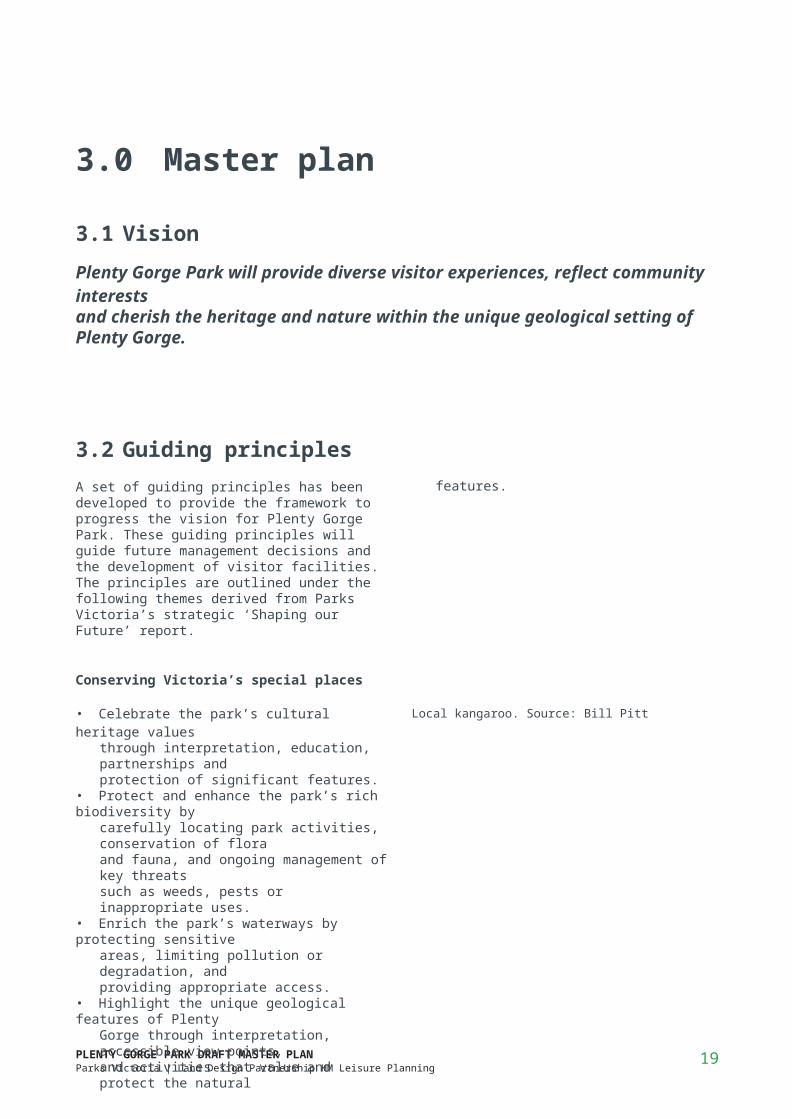
Local kangaroo. Source: Bill Pitt
Connecting people and parks
• Improve access into and around the park to better connect local communities and key visitor sites.
• Offer diverse nature-based visitor experiences which provide equitable opportunity, enable conservation objectives and appeal to diverse leisure or recreational interests.
• Encourage community interaction and care for the park by involving Traditional Owners, partners, user groups, local communities and volunteers.
Providing benefits beyond park boundaries
• Respond to the communities’ interests and needs, in particular with regard to urban growth and declining open space provision.
• Increase awareness of the park, includingrecreational opportunities and important natural andcultural values, via ongoing marketing, education,signage, improved entries and connections tocommunities facilities beyond the park.
• Promote the park’s economic and well being benefitsand facilitate suitable commercial activity where itcontributes to a better visitor experience.
• Provide appropriate park management activities withpositive community outcomes, such as careful firemanagement, enhanced downstream water quality,protection of wildlife, and safe community access.

PLENTY GORGE PARK DRAFT MASTER PLANParks Victoria | Land Design Partnership HM Leisure Planning
20
3.3 Master plan structure
The master plan outlines future opportunities for Plenty Gorge Park and will guide its future development. It was prepared based on background documents, site analysis and engagement outcomes. The Vision, Guiding Principles and Objectives provide the overarching direction for the park, whilst the actions to achieve these are outlined under Recommendations and the Implementation Plan.
The master plan is made up of the following sections:
Key issuesProvides a summary of the key issues for the park thatthe master plan should address.
Key objectivesThe key objectives aim to provide general directions forthe park.
Visitor experiencesThe visitor experience icons illustrate and describe thedesired experience for each visitor site.
Park areas and sitesThe park is broken into four ‘Park Areas’ each whichinclude a number of ‘Sites’. Detailed plans are providedfor each Park area for more specific site detail and Siterecommendations.
General recommendationsIncludes recommendations applicable to the entire site.
Site recommendationsIncludes specific site recommendations with ‘codes’ tohelp locate on the Park Area’s detailed plan.
Implementation planThis section outlines an order of ‘Priority Initiatives’ forimplementation including high-level indicative costs,timeframes and investment benefits. It also lists some‘Immediate Opportunities’ which are low cost initiatives,but feasible to implement in the short term.
3.4 Key issues
The following Key Issues were identified in background documents, site analysis and early discussions with community and stakeholders (refer to Section 2.4):
• Community awareness about the park and its values is relatively low. This highlights the need to increase knowledge and appreciation of the park, better connect surrounding communities, and improve visitor access and wayfinding into and around the park.
• Visitors cannot travel the full length of the park as the main trail is incomplete and disjointed. Also, the internal trail network needs improvement to cater for different types of use such as walking, mountain biking and orienteering.
• The site’s significant environmental, cultural and heritage values should be better celebrated and protected.
• There are limited opportunities to view, access and cross the Plenty River and gorge, which are the park’s main features.
• Existing visitor sites and attractions could be enhanced and better utilised (e.g Hawkstowe Picnic Area, Carome Homestead, and Yellow Gum Recreation Area). In particular, there is need to prepare and cater for increased visitor use of thepark, as a result of the rapidly growing surrounding communities.
• Mountain biking should be encouraged on designated, authorised and environmentally sustainable tracks only, as there are significant environmental and safety risks with inappropriate riding and unauthorised track creation. Thisincludes cultural heritage impacts, removal of native vegetation without a permit (refer 2016 Native Vegetation Clearing Regulations), soil erosion and inadvertent spread of weeds or pathogens. Where required, unauthorised tracks should be rehabilitated to stabilise soil and regenerate habitat for wildlifeand native flora.
1 km

PLENTY GORGE PARK DRAFT MASTER PLANParks Victoria | Land Design Partnership HM Leisure Planning
21
3.5 Key objectives
The following key objectives provide general directions for the park, in keeping with the Vision and Guiding Principles and in response to early discussions with
Objective 1Improve access and connections
community and stakeholders (Section 2.4). Complete the 21km Plenty River Trailto link visitor sites and to provide important walking and cycling access between northern and southern ends of the park. Provide safe access across Gorge Road. Ensure connections with the proposed Mernda and Hawkstowe Stations.
Improve the internal trail network to better connect with the Plenty River Trail, park entries, features, lookoutsand visitor sites. Offer diverse circulation routes for various interests and abilities, including recreation, contemplation, interpretation, and linking or loop trails.
Provide bridge access across Plenty River to connect communities east and west of the park and provide views of the gorge. Investigate utilising existing northern and southern pipe track bridges as pedestrian crossings. Create a shared trail from the proposed Mernda Station to Yarrambat.
Provide a new main park entry at Hawkstowe to improve access and wayfinding to Le Page Homestead and picnic area. Also improve other park entries to make them more inviting and attractive, to better connect the community with the park, and to make it easier to find and access the park via clear signage and directions.
Review the existing wildlife protection fence and gate locations, to allow suitable visitor access into significant areas of the park, whilst continuing to protect wildlife from cats and dogs.

PLENTY GORGE PARK DRAFT MASTER PLANParks Victoria | Land Design Partnership HM Leisure Planning
22
Objective 2Increase park awareness and involvement
Objective 3Enhance special places and experiences
Improve Nioka Bush Camp and increase use by Traditional Owners and various community and school groups.
Develop and implement a mountain bike trail plan in collaboration with local groups to rationalise trails and protect significant vegetation, habitat and cultural values.
Prepare a Wayfinding and Interpretation Strategy to interpret park values and provide signage and directions into and around the park.
Develop a community participation program to encourage community stewardship, education and involvement in conserving park values, including school and volunteer actvities.
Provide permanent orienteering courses in collaborationwith orienteering groups.
Develop a habitat managment strategy to ensure ongoing biodiversity, conservation and sustainable wildlife and vegetation management.
Update Hawkstowe Picnic Area to be the key site in the park’s west for community activities and events, including improved facilties, playground and new park entrance. Ensure conservation of Morang Wetlands and better utilise the Nioka Bush Camp for education based groups.
Develop a new Yellow Gum Recreation Area as the key visitor site in the east by planning a new trailhead at the Goldworth Lane property and downgrading facilities at Blue Lake.
Upgrade Tanunda Wetlands Precinct as a new visitor sitewith a low-key picnic area, nature trails and parking.
Investigate use of land north of Gorge Road for trail access and activities such as rock climbing, upon completion of land acquisition.
Enhance Middle Gorge as the prime location to view the gorge with improved lookouts, access and visitor facilities.

PLENTY GORGE PARK DRAFT MASTER PLANParks Victoria | Land Design Partnership HM Leisure Planning
23
3.6 Visitor experiences
The visitor experience is a complex relationship between individuals, the natural and cultural environments and the opportunities provided in the park for visitors. ParksVictoria manages and seeks to protect landscape settings, presents recreation opportunities and provides facilities and services to support visitors. The following visitor experience icons illustrate and describe the desired experience for each of the various visitor sites.
3.6.1 Landscape experience
Any future works in the park should be mindful of the following landscape experiences and seek to emphasise and enhance the park’s unique natural and cultural values.
Space Isolation Discovery
*
Where the park landscape conveys a sense of open space this should be valued and retained.
Plenty Gorge Park creates a senseof isolation and remoteness in spiteof its proximity to local residentialcommunities and Melbourne’s CBD.This is a highly valued quality in whatis a rapidly developing area.
There are numerous opportunities for exploration and discovery in this landscape which should be encouraged and enhanced.
Interaction
The largely untamed natural park environment allows visitors to interact with a natural landscape through activities such as camping, conservation programs, mountainbiking, walking, orienteering and rockclimbing.
Views / outlook
The landform of the Plenty River and gorge offers opportunities for viewing points across scenic landscapes and vistas.
Stories
There are multiple layers and stories within the landscape which can be interpreted to reveal the wealth of natural, cultural and heritage values.

PLENTY GORGE PARK DRAFT MASTER PLANParks Victoria | Land Design Partnership HM Leisure Planning
24
3.6.2 Recreation experience
The following recreation experiences have potentialto attract visitors to the park, prompt return visits andincrease community participation and stewardship of thepark.
Dogs on lead
Visitors are able to walk their dogs on lead in many areas of the park; however dogs are not permitted in certain high conservation areas.
Social activity
A number of visitor areas encourage, social gatherings, includingbarbecues and picnics.Connecting these uses to other areasof the park would provide morediverse experiences.
Nature based sports
The park’s natural qualities attract participants in a range of nature based activities such as mountain biking, orienteering, trail running and rock climbing. Parks Victoria is working with user groups including mountain biking, orienteering and rockclimbing to develop sustainable use opportunities.
Wildlife
Many visitors to the park enjoy bird watching, spotting the kangaroos, or other wildlife.Plenty Gorge park offers a unique experience to interact with wildlife in an area relatively close to Melbourne’s CBD.
Cultural activity
A number of the visitor sites have capacity to host events and activities such as arts festivals, cultural gatherings and festivals, heritage activities, demonstrations, weddings and other social gatherings.
Camping
Nioka Bush Camp provides for a bush camping experience in an area close to Melbourne. The camp offers the accommodation options of campsites or bunk rooms in the hall.
Trails
There are a number of trails, both sealed paths and unsealed tracks, suitable for walking, jogging, trail running and cycling. The proposed Plenty River Trail will provide a connecting pedestrian and bicycle link along the full length of the park.
PLENTY GORGE PARK DRAFT MASTER PLANParks Victoria | Land Design Partnership HM Leisure Planning
25
3.7 Park areas and sites
To better describe more specific Site Recommendations (refer Section 3.10), the study area has been divided into four Park Areas (PA) each of which contain Visitor Sites as follows:
PA1: Park Area 1 - NorthVisitor sites:
- Mayfield- Carome Homestead- Wiltonvale
PA2: Park Area 2 - YarrambatVisitor sites:
- Yarrambat
PA3: Park Area 3 - HawkstoweVisitor sites:- Morang Wetlands- Smugglers / Purvis Gully- Hawkstowe Picnic Area- Red Gum Picnic Area- Nioka Bush Camp- Farm Vigano / Bushmans Way
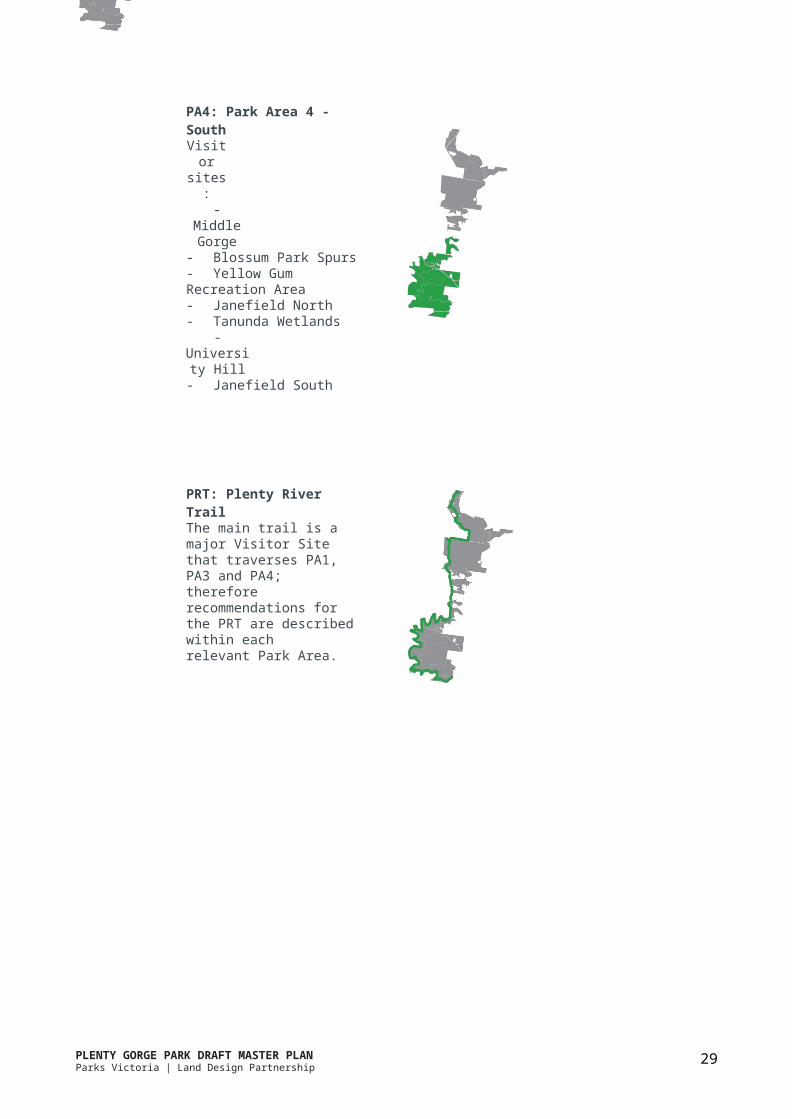
PA4: Park Area 4 - SouthVisitor sites:- Middle Gorge- Blossum Park Spurs- Yellow Gum Recreation Area- Janefield North- Tanunda Wetlands- University Hill- Janefield South
PRT: Plenty River TrailThe main trail is a major Visitor Sitethat traverses PA1, PA3 and PA4;therefore recommendations forthe PRT are described within eachrelevant Park Area.
PLENTY GORGE PARK DRAFT MASTER PLANParks Victoria | Land Design Partnership HM Leisure Planning
26
3.8 General recommendations
To achieve the Vision, Principles and Objectives the following table outlines general recommendations that are applicable to the entire park. Each recommendation shows the indicative priority and costs and a ‘code’ to help locate the action on the Park Area’s detail plan.
Recommendations Priority CostPRT Plenty River Trail
Construct the new sections of the Plenty River Trail (in accordance with the PlentyRiver Trail project documentation). When complete, the proposed 21km lengthshared-use trail will link all visitor sites west of the river and provide importantwalking and cycling access between the northern and southern ends of the park. Atotal of 17.4km has yet to be built to connect the 3.6km of existing trail.
WAY Wayfinding and Interpretation StrategyDevelop a strategy that outlines key wayfinding points, required signage anddirections into and around the park. Develop for interpretation and celebration ofthe site’s important park features, including environmental sensitivity, biodiversity,significance, heritage assets and cultural values. Incorporate digital methods andnew technology and ensure materials proposed are consistent throughout the park.
PAR Community Participation ProgramDevelop programs in line with the Parks Victoria Learning in Nature Strategyto provide opportunities to increase awareness of the park, such as on-goingmarketing, education, park promotion, and community stewardship and activationprograms.
ENT EntrancesImprove existing park entries and provide new entries where required, to improveaccess into the park and better connect to surrounding communities. Entriesshould reflect the landscape character of the Park Area and provide clear signage ordirections to key visitor sites.
HMS Habitat Management StrategyDevelop and implement a strategy to ensure ongoing biodiversity, conservationand sustainable wildlife and vegetation management. In addition to ongoingprotection of existing significant habitat areas, the strategy will focus on significantlyaltered landscapes of recently acquired land. It shall outline priorities, timeframes,monitoring, resources, revegetation, fire management, weed and pest control.It shall focus on impacts of overgrazing and persistence and welfare of kangaroopopulations in the park.
WPF Wildlife Protection FenceReview the existing wildlife protection fence and gate locations, to allow suitablevisitor access into significant areas of the park, whilst continuing to protect wildlifefrom cats and dogs.
INF New InfrastructureAny new public infrastructure that requires use of or development of park land(e.g. stormwater drains, rail works, communication towers), should avoid negativepark impacts and provide positive public realm, environmental, and social benefitoutcomes for the park as compensation for the community.
High $$$
High $$
High $
High $$
High $$
Medium $
Ongoing
PLENTY GORGE PARK DRAFT MASTER PLANParks Victoria | Land Design Partnership HM Leisure Planning
27
3.9 Specific recommendations
To achieve the Vision, Principles, and Objectives the following pages outline specific Site Recommendations within each Park Area. Each recommendation shows indicative priority and costs, and a code to help locate on the Park Area’s detailed plan.
3.9.1 Dogs in the park
Dog walking is an important activity for many adjoining neighbours and wider community of the park. In line with this, visitors are able to walk their dogs on lead in many areas of the park. However to protect important natural and cultural values there are no off-lead areas withinthe park, and in high conservation areas dogs are not permitted. Refer to Figure 7.
Ensure dog on lead areas and areas where dogs are not permitted are clearly signposted.
Investigate the opportunity for a fenced dog off-lead area within a suitable location of the park and which coincides with Council’s dog off-lead plans.

PLENTY GORGE PARK DRAFT MASTER PLANParks Victoria | Land Design Partnership HM Leisure Planning
28
3.9.2 Park Area 1 - North
The North Park Area (PA1) contains three sites:• Mayfield• Carome Homestead• Wiltonvale
The Mayfield site is well located on Bridge Inn Road at the northern extremity of the park. The setting is predominantly rough pastures on land formerly utilised for farming. The future Mernda Town Centre and proposed Mernda Railway Station are located adjacent to this area of the park and should be considered in any planning for this park area.
Access is limited to pedestrians and bicycles.The Plenty River Shared trail has been constructed fromBridge Inn Road to Carome Homestead, including a rivercrossing within the park. A second section has beenconstructed at Wiltonvale.
Carome Homestead is managed by a Committee ofManagement.
The Plenty River is relatively accessible and visible in thisarea of the park.
Wiltonvale provides access to open space for new communities west of the park and a sense of retreat from the busy Plenty Road.
Key visitor Offer:Recreation (refer to Section 3.4.1)• Trails - walking / jogging / cycling• Wildlife• Dogs on lead
Landscape experience (Refer to Section 3.7)• Space - an open pasture setting creates the sense of
space.• Interaction - conservation activities.• Stories - Remnant native vegetation communities
such as plains grassy woodlands including river redgums provide a strong visual character.
• Stories - Rich pre and post settlement heritage isevident.
• Discovery.• Views / outlook.
Issues• Lack of facilities.• Constrained area adjacent to Bridge Inn Road limits
the capacity for large gatherings.• No vehicular access, except to Carome.• Poorly signed access to Carome Homestead from
adjacent areas as well as inside the park.• Lack of pedestrian connections within the park.• Lack of orientation / interpretation.
Opportunities• Potential for the Mayfield site to be the main
northern gateway into the park for the localcommunities of Mernda and Doreen.
• Provision of car park to support the trail head of thePlenty River Trail.
• Interpretation of natural history.• Encourage community gatherings by the provision of
facilities.• Creation of connections with local neighbourhoods
and the proposed Mernda Railway Station and TownCentre.
• Improve shared use trail connections.• Provision of park orientation interpretation boards
at trail head.• Utilise the views of the river at Wiltonvale.• The large open area at Wiltonvale has the potential
to cater for large gatherings.• A high concentration of Aboriginal cultural
heritage sites exist in the north, as do a number ofEuropean heritage sites, offering the potential forinterpretation as appropriate.
PLENTY GORGE PARK DRAFT MASTER PLANParks Victoria | Land Design Partnership HM Leisure Planning
29
Site: MayfieldObjective: Upgrade the site as it is currently underutilisedand has potential to become a future northern gatewayinto the park for the communities of Mernda and Doreen.Refer to Figure 8, p.31.
Visitor Experiences
Recommendations Priority CostM01 Prepare a precinct plan to consider future facilities that supports
this area as a trail head and northern gateway to the park, including:• signage• vehicle access and car parking for park and Plenty River Trail
(PRT) users• pedestrian and cycle access / connection• open space provision• planting and revegetation areas• integration with Mernda Railway Station, Mernda Town Centre,
Mernda and Doreen residential neighbourhoods
Low $
M02 Negotiate and implement works to establish a river crossing utilising the existing Melbourne Water pipe track and flume bridge
High $$
M03 Develop new secondary trail to the east of the Plenty River, creating a northern shared trail loop and connection to Yarrambat.
Medium $
M04 Establish formal connection between the existing Plenty River Trail and the future Mernda Railway station.
Low $
WAY Provide interpretation of heritage sites, potentially as a heritagetrail.
Medium $
ENT1 Provide new vehicular entry at Bridge Inn Road, associated with any future facilities at this site.
Low $$

PLENTY GORGE PARK DRAFT MASTER PLANParks Victoria | Land Design Partnership HM Leisure Planning
30
Site: Carome HomesteadObjective: Upgrade the setting around CaromeHomestead to improve amenity and access for visitors tothe homestead which is managed under a Committee ofManagement agreement. The lease for the homesteadsits wholly within the park boundary, therefore visitoraccess and trail, connections must be integrated andcoordinated with the Committee of ManagementRefer to Figure 8, p.31.
Visitor Experiences
*
Recommendations Priority CostC01 Establish trail connections from PRT to the local residential path
network and to Carome Homestead, in collaboration with the CoM.Medium $$
C02 Undertake a planting program outside the lease area to improve arrival, visual amenity and sense of place for the homestead.
Medium $$
C03 Provide park amenity outside the lease area such as shelters / decks to allow for wildlife viewing and interaction with the river environment.
Low $
WAY Improve existing vehicular entrance to Carome Homestead, with improved signage at Plenty Road, as well as directional signage within the park.
Medium $
HMS1 As part of the vegetation management strategy, develop a plantingprogram for any land parcels added to the park.
Medium $
Site: WiltonvaleObjective: Upgrade Wiltonvale by improving trail accessand connecting PRT to Carome Homestead. This large sitehas potential as a visitor node.Refer to Figure 8, p.31.
Visitor Experiences
Recommendations Priority CostW01 Construct secondary trail loop to access river environs (in
accordance with Plenty River Trail project documentation).Medium $$
W02 Undertake planting program to define broad park spaces betweenWiltonvale and the Plenty River.
Low $
W03 Investigate the potential for a visitor node at Wiltonvale to allow for large groups of visitors, events and recreation activities.
Low $
W04 Investigate opportunity for a footbridge crossing over Plenty River, to connect Wiltonvale trails to Yarrambat. Only one bridge is required, therefore most appropriate location to be confirmed.
Low $
PRT1 Construct new section of Plenty River Trail from Wiltonvale to Carome Homestead (in accordance with the Plenty River Trail project documentation).
High $$

PLENTY GORGE PARK DRAFT MASTER PLANParks Victoria | Land Design Partnership HM Leisure Planning
31
3.9.3 Park Area 2 - Yarrambat
The Yarrambat Park Area (PA2) contains one site:• Yarrambat
The Yarrambat site is located in the park’s north east with access from Yan Yean Road. It offers open space for the new residential communities in Doreen. Yarrambat means‘High Hill’ and offers views and large open spaces ideal for family gatherings, picnics, ball games or kite flying. There are existing picnic facilities and car parking.
Key Visitor OfferRecreation:• Social activity• Sports• Walking• Dogs on lead• Cycling
Landscape experience• Space• Views / outlook• Stories - there are pre settlement cultural heritage
sites at Yarrambat.• Discovery
Site: YarrambatObjective: Maintain the existing parkland facilities andimprove connections to the adjoining Yarrambat Parkand surrounding communities of Doreen and Yarrambat.Explore compatible alternative uses which encourageincreased use of the site. Refer to Figure 9.
Issues• Assets are aging and have a low level of use.• No connections to other areas of the park, so visitors
are not able to explore the rest of Plenty Gorge Parkfrom this site.
Anti social behaviour, possibly associated with theisolated nature of this site.• No directional or park information signage.• Lack of a defined purpose.• Undefined visual and landscape character.
Opportunities• Improve connections with the local communities of
Yarrambat, Doreen and Mernda.• Improve trail connections to Council’s Yarrambat Park
and other areas of Plenty Gorge Park.• Determine a defined purpose for the site such as
fitness / active sports.• Retain sensitive habitat areas.
Visitor Experiences
Recommendations Priority CostY01 Construct a shared trail to connect the Mayfield site to Yarrambat High $$Y02 Collaborate with VicRoads and Councils to improve safe public and
vehicle access into Yarrambat Park, including potential alternative access from Jorgensen Ave.
Low $$
Y03 Work with Nillumbik Council to improve connections withYarrambat Park facilities.
Medium $
HMS2 As part of the vegetation management strategy, develop a plantingprogram for any land parcels added to the park.
Medium $

3.9.4 Park Area 3 - Hawkstowe
The Hawkstowe Park Area (PA3) contains a number ofdiverse sites:• Morang Wetlands• Smugglers / Purvis Gully• Hawkstowe Picnic Area and Le Page Homestead• Red Gum Picnic Area• Nioka Bush Camp• Farm Vigano
Morang Wetlands has very high conservation values which should be protected. Existing trails provide access through the area to suitable viewing points.
Smugglers / Purvis Gully site has high conservationvalues, with forest vegetation communities on a landformof steep slopes, rocky escarpments, spurs, gullies andriver flats. It also features cultural heritage sites.
The Hawkstowe site is currently the main park focus with the historic Le Page Homestead, sheltered picnic facilities, walking trails and car parking. The Nioka Bush Camp provides group bush camping close to Melbourne, mainly for education based activities.
Red Gum Picnic site offers a small play space and carpark and adjoins the future Whittlesea Council recreationreserve and sports fields.
Farm Vigano, managed under a Committee of Management (CoM) agreement, sits within the park boundary, therefore visitor access and trail connections must be integrated and coordinated with the CoM.
Key Visitor OfferRecreation: (Refer to Section 3.4.1)• Trails - walking / jogging / cycling• Social activity• Nature based sports• Wildlife• Cultural activity• Camping• Dogs on lead
Landscape experience: (Refer to Section 3.4.2)• Space• Isolation• Discovery• Interaction• Views / outlook• Stories
Issues• Lack of directional and interpretive signage.• Lack of connections to other areas of the park.• Managing high visitor numbers as well as protecting
natural biodiversity and sensitive environments.• Lack of shade at picnic facilities, especially Red Gum
Picnic Area.• Accessibility to facilities from car parks.• Topography at Le Page Homestead limits the
provision of car parking.• ‘Tired’ facilities.• Anti social behaviour associated with the public
toilets at Red Gum Picnic Area.• Limited access into the Smugglers / Purvis Gully area.• Managing access into environmentally sensitive
areas.
Opportunities• Shared-use trail connections to the north and south.• Park connections with proposed Hawkstowe Station.• Sites such as Hawkstowe Picnic Area currently have a
profile with visitors and host a range of activities.• Improve connections to other areas, including river
crossings to draw visitors from this site further intothe park.
• The proposed Council Park sports fields provide theopportunity for the co-location of visitor facilitiessuch as public toilets.
• Nioka Bush camp offers a unique opportunity forcamping in a bush environment in close proximity tothe local urban context.
• The open area at Le Page Homestead providesthe opportunity for group experiences, such ascommunity events and festivals.
• Morang Wetlands is an environmentally sensitivearea with many rare and threatened species,providing opportunities for interpretation, as well asfurther enhancement of the habitats present.
• The Smugglers / Purvis Gully area combines highbiodiversity with a number of heritage featuresproviding opportunities for interpretation, potentiallyas part of an environmental and heritage walkingtrail.
• Viewing would be enhanced by the provision of lookout areas associated with walking trails.
• Investigate the viability of a permanent orienteeringcourse.

PLENTY GORGE PARK DRAFT MASTER PLANParks Victoria | Land Design Partnership HM Leisure Planning
38
Recommendations Priority CostMW01 Update and implement the Morang Wetlands Development Plan
(1999). Retain existing management trails for nature observation and bird viewing, and prohibit cyclists on secondary trails within Morang Wetlands.
Medium $
MW02 Develop infrastructure to support nature observation such as shelters / bird hides, seats and signage according to the Morang Wetlands Development Plan.
Low $
MW03 Develop planting program for western park boundary, adjacent to the proposed rail alignment, to screen rail line and boundary fence from within the park and to enhance habitat.
Medium $
PRT2 Construct Plenty River Trail (in accordance with Plenty River Trail project documentation), along with signage highlighting biodiversity values and providing clear directions to destinations.
High $$
WAY As part of the Wayfinding and Interpretation Strategy, provide interpretation of the natural values associated with Morang Wetlands. Also, provide directional information at the Wiltonvale Road entry of the Plenty River Trail.
High $
Site: Morang WetlandsObjective: Maintain current visitor experience as naturebased, with a focus on preservation of significantbiodiversity. To protect significant habitat values, dogs are
not permitted. Refer to Figure 10, p.37.
Site: Smugglers / Purvis GullyObjective: Upgrade existing spaces to enhance existinglow key usage such as walking and nature observation.Refer to Figure 10, p.37.
Visitor Experiences
*
Visitor Experiences
Recommendations Priority CostS01 Provide secondary walking trail to connect Yarrambat Park,
Smugglers / Purvis Gully and the existing ford crossing (NB02) of Plenty River near Nioka Bush Camp.
Medium $$
S02 Provide for better public use of, and connections to, the ford (NB03)at Gordons Road once land ownership permits.
Low $$

PLENTY GORGE PARK DRAFT MASTER PLANParks Victoria | Land Design Partnership HM Leisure Planning
39
Site: Hawkstowe Picnic Area and Le Page Homestead Objective: Upgrade to be the primary visitor focus in the central area of Plenty Gorge Park, with enhanced provision for community events and festivals, and largesocial gatherings with a focus on heritage interpretation, cultural activities and passive recreation. Utilise the opportunity to draw visitors to Hawkstowe Picnic Area further into the park. Refer to Figure 10, p.37.
Visitor Experiences
Recommendations Priority CostH01 Investigate the preferred location and layout and implement a
permanent orienteering course.High -
H02a Prepare an updated site plan for Hawkstowe, including picnic facilities, event infrastructure, playground, signage, planting, access, trails, parking and paving existing road and car park. Planning to coincide with Council sports field planning.
High $
H02b Implement agreed site plan for Hawkstowe. Medium $$
H03 Undertake planting program to protect and enhance existing bushland and habitat areas, and to mitigate any adverse impacts from events and community activities.
Medium $
ENT2 Relocate main Hawkstowe entrance to existing Le Page Homestead exit location, including 75m of new road, planting to screen the depot, and signage / directions from Gordons Road.
High $
WAY As part of the Wayfinding and Interpretation Strategy, develop interpretive signage system to explain local heritage associated with the site, as well as directions to other features of the broader park.
High $

Recommendations Priority CostRG01 Remove playground, car park and toilet block once the future
recreation reserve is developed by the City of Whittlesea.Low $
RG02 Investigate the potential for a fenced dog off-lead area near the existing Red Gum Picnic Area. Consider Council’s existing and proposed facilities within close proximity.
Medium $
PRT2 Develop the Plenty River Trail (in accordance with the Plenty River Trail project documentation), including trail head facilities such as signage and park information at main entry from Gordons Road.
High $$
ENT3 Improve existing park entry and vehicle circulation to Red Gum Picnic area, to coincide with Council’s future sports field planning and shared trail entrance / access road.
Medium $
PLENTY GORGE PARK DRAFT MASTER PLANParks Victoria | Land Design Partnership HM Leisure Planning
40
Site: Red Gum Picnic AreaObjective: Downgrade site in response to upgradeof Hawkstowe site and the development of a futurerecreation reserve and sporting fields by City of
Whittlesea. Refer to Figure 10, p.37.
Site: Nioka Bush CampObjective: Upgrade site to continue to provide bushcamping experience in an urban context for groups suchas Traditional Owners, schools and Scouts.
Visitor Experiences
Visitor Experiences
Recommendations Priority CostNB01 Review site use and opportunities for increased use by groups
(e.g. Scouts and Wurundjeri). Upgrade facilities and buildings including site circulation, all abilities access and interpretation and wayfinding as required.
High $
NB02 Provide integrated path connection to camp ford river crossing and to Smugglers walking trails.
Medium $$
NB03 Provide better trails and connections for river crossing at GordonsRoad once land ownership permits.
Medium $

PLENTY GORGE PARK DRAFT MASTER PLANParks Victoria | Land Design Partnership HM Leisure Planning
41
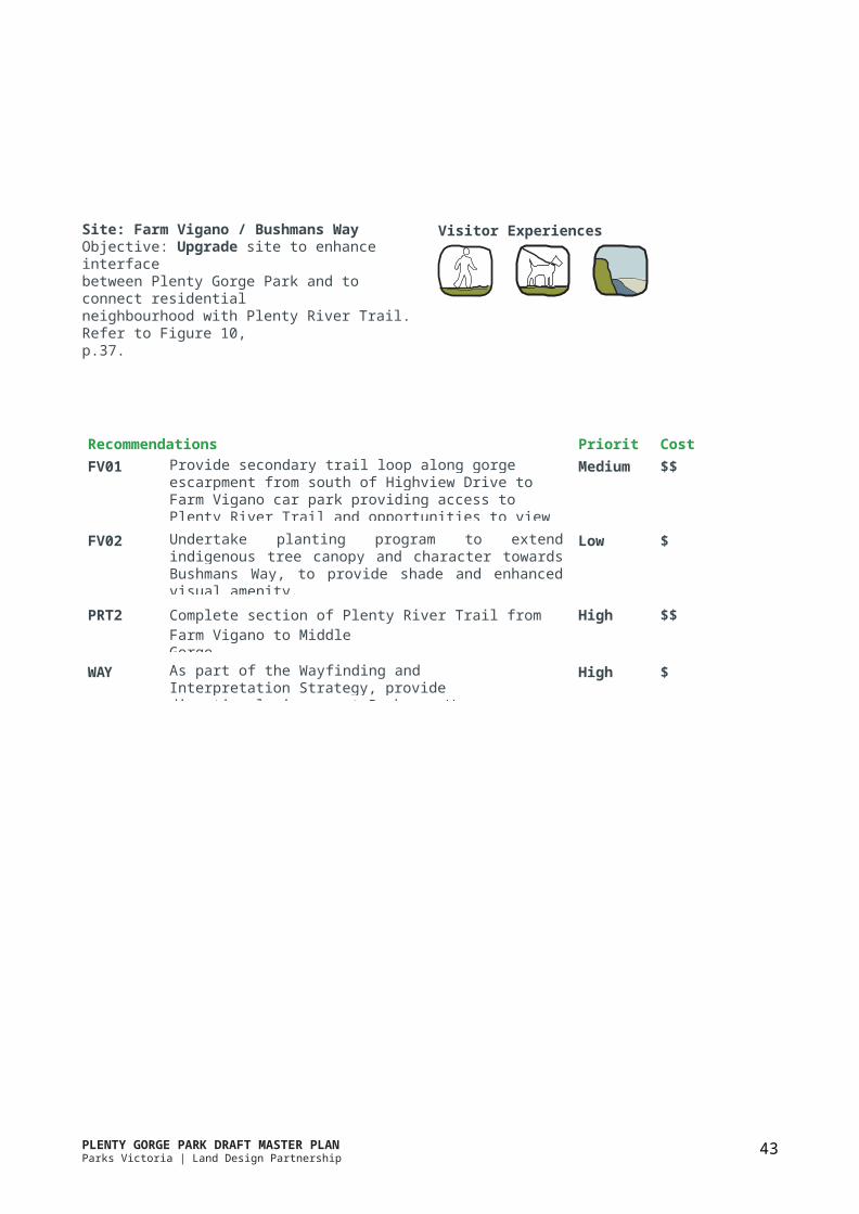
Site: Farm Vigano / Bushmans WayObjective: Upgrade site to enhance interfacebetween Plenty Gorge Park and to connect residentialneighbourhood with Plenty River Trail. Refer to Figure 10,p.37.
Visitor Experiences
Recommendations Priority CostFV01 Provide secondary trail loop along gorge escarpment from south of
Highview Drive to Farm Vigano car park providing access to Plenty River Trail and opportunities to view over Plenty Gorge.
Medium $$
FV02 Undertake planting program to extend indigenous tree canopy and character towards Bushmans Way, to provide shade and enhanced visual amenity.
Low $
PRT2 Complete section of Plenty River Trail from Farm Vigano to MiddleGorge.
High $$
WAY As part of the Wayfinding and Interpretation Strategy, provide directional signage at Bushmans Way playground.
High $

PLENTY GORGE PARK DRAFT MASTER PLANParks Victoria | Land Design Partnership HM Leisure Planning
42
3.9.5 Park Area 4 - South
The South Park Area (PA4) incorporates the sites:• Middle Gorge• Blossom Park Spurs• Yellow Gum Recreation Area• Janefield North• Tanunda Wetlands• University Hill• Janefield South
Middle Gorge connects the park’s north and south and offers dramatic landforms and extensive forest vegetation. Gorge Road provides access across Plenty River, with opportunities to view and access the gorge.
The Blossom Park Spurs are a series of dramatic landforms separating numerous creek gullies that flow into Plenty River. The small open spaces at the end of each spur offer spectacular views over the gorge.
Yellow Gum Recreation Area is easily accessed fromYan Yean Road and is the main visitor area on the park’seastern edge. It is popular for Blue lake, lookouts, picnicareas and trail based activities.
Janefield North is a large area of remnant regenerating vegetation with significant habitat values and is popular for nature based activities.
Tanunda Wetlands has significant habitat values thatmust be protected.
University Hill provides important open space foradjoining residential communities.
Janefield South offers valuable habitat, including a mixof open grassland and forested bushland along the river.The gorge is not as steep in this section and the area ispopular for trail based activities.
Key Visitor OfferRecreation (refer to Section 3.7)• Trails - walking / jogging / cycling• Social Activity• Nature based sports• Wildlife• Dogs on lead
Landscape Experience (Refer to Section 3.7)• Space• Isolation• Discovery• Interaction• Views / outlook• Stories
Issues• Proximity of local residential developments
encroaching on the park.• Limited connecting trails.• Risk and hazard management issues associated with
quarry walls, diving / jumping into Blue Lake, ropeswings.
• Managing mountain bike trails and sensitivevegetation communities and erosion.
• Limited access to some areas.• Limited river crossings.• Lack of facilities in areas with connection to the local
residential and commercial areas such as Janefield.
Opportunities• Gorge Road provides access across Plenty River, with
opportunities for viewing and accessing the gorge.• Investigate potential to strengthen the nature based
sports offer, potential for rock climbing.• Existing car park at Gorge Road provides the
opportunity for provision of visitor facilities.• Yellow Gum Recreation Area is currently the main
visitor site on the east of the park, with potential forimproved visitor facilities.
• Provide a shared trail connection to the Plenty RiverTrail in the north
• Protect, enhance and interpret high biodiversityvalues in areas such as Tanunda Wetlands, JanefieldNorth and South.
• A high concentration of Aboriginal culturalheritage sites exist in the south, as do a number ofEuropean heritage sites, offering the potential forinterpretation as appropriate.

PLENTY GORGE PARK DRAFT MASTER PLANParks Victoria | Land Design Partnership HM Leisure Planning
43
Site: Middle GorgeObjective: Upgrade Middle Gorge as a point of entry intothe Plenty Gorge, both to the north and to the south,and as a highly accessible destination in its own right.Maximise opportunities for great views of the gorge.Refer to Figure 11, p.43.
Visitor Experiences
Recommendations Priority CostMG01 Implement a new trail to interact with and view the river, and
provide connections to the Council owned car park.Medium $
MG02 Develop visitor amenities associated with the existing Middle Gorge car park and gorge walk. Provide trail head facilities to enhance this location as a key point of access for the Plenty River Trail. Provide picnic shelters, trail signage, seating. Enhance existing lookout and investigate a further lookout over the gorge along the lower trail walk. Extend indigenous tree planting to visually integrate the car park and visitor amenities with surrounding park character.
High $$
MG03 Complete acquisition and transfer of land north of Gorge Road to form a part of the park. Improve visitor access and use of this area, including completion of the PRT and investigation of facilities required to provide potential rock climbing.
High $
MG04 Undertake a planting program to extend tree canopy between gorge escarpment and Teatree Drive to improve visual amenity, provide shade for park users and form passive park spaces suitable for dog on-lead walking. Provide seats at appropriate locations along existing trail.
Medium $
MG05a Undertake detailed investigation and design of grade separated Plenty River Trail crossing of Gorge Road and ensure integration with car park upgrade (MG02) and northern site plan (MG03).
High $
MG05b Implement works for a grade separation of Plenty River Trailcrossing over Gorge Road.
High $$
MG06 Develop a planting program within transmission line easements, in collaboration with the service provider, with a view to enhancing visual character and visitor amenity.
Medium $
WPF Review the existing wildlife protection fence and gate locations, to allow suitable visitor access into significant areas of the park, whilst continuing to protect wildlife from attack by cats and dogs.
Medium $
PRT3 Construct the Plenty River Trail (in accordance with the Plenty River trail documentation), along with signage providing clear directions to destinations.
High $$
HMS3 As part of the Vegetation Management Strategy, develop a plantingplan for land added to the park.
Medium $
WAY Improve signage and wayfinding at existing car park entry High $

PLENTY GORGE PARK DRAFT MASTER PLANParks Victoria | Land Design Partnership HM Leisure Planning
44
Site: Blossom Park SpursObjective: Upgrade to provide access to Plenty RiverTrail and to enhance amenity for local park users to takeadvantage of gorge and gully views.Refer to Figure 11, p.43.
Visitor Experiences
Recommendations Priority CostBP01 Construct trail link and lookout platform, as per Plenty River Trail
project documentation.Medium $$
BP02 Undertake detailed design of secondary trail loop along Stockdale Way, in accordance with the Plenty River Trail Project documentation.
Medium $
WPF Review the existing wildlife protection fence and gate locations, to allow suitable visitor access into significant areas of the park, whilst continuing to protect wildlife from attack by cats and dogs.
Medium $
PRT3 Complete sections of the Plenty River Trail in accordance with the Plenty River Trail project documentation, including retaining walls, drainage and elevated boardwalks over gullies as required. Negotiate with adjoining land owners (council and Melbourne Water) to link PRT to existing trails and open spaces.
High $$$
PLENTY GORGE PARK DRAFT MASTER PLANParks Victoria | Land Design Partnership HM Leisure Planning
45
Site: Yellow Gum Recreation AreaObjective: Downgrade the existing picnic area at BlueLake. Develop the primary visitor site at the formerprivate property at Goldsworthy Lane. This site is to bedeveloped cater for large groups and community events,and as a focus for nature based recreation pursuits suchas mountain biking, trail running and orienteering, natureobservation and sight seeing. Refer to Figure 11, p.43.
Visitor Experiences
Recommendations Priority CostYG01a Prepare a site plan for the new Yellow Gum Recreation Area visitor
site, with a view to enhancing visitor amenities and trail head for mountain biking activity. The site plan should consider:• vehicle access and car parking• picnic shelters and seating• all abilities access trails to facilities and to allow engagement
with the natural landscape• provision of toilet facilities• enhanced local loop trail around Blue lake• enhanced signage• additional vegetation to provided enhanced tree canopy for
shade and shelter• at Blue Lake, remove parking, toilets, barbecues, picnic shelters
and some tables.
High $
YG01b Implement the site plan for Yellow Gum (YG01a). High $$
YG02 Develop a permanent orienteering course in collaboration with thepeak orienteering body.
High -
YG03a Investigate the feasibility of providing a high level pedestrian bridge to cross Plenty River south of Blue Lake Park. The bridge would provide a strategic link between Tanunda Wetlands and Yellow Gum/ Blue Lake, connecting with the Plenty River Trail. The bridge would be a high visitor attraction, offering an engagement with the unique environment of Plenty Gorge Park.
Medium $
YG03b Implement bridge based on findings of investigation (YG03a). Medium $$$
WAY Improve signage and wayfinding for the park entry. High $
HMS4 As part of the vegetation management strategy, develop a plantingprogram for land added to the park.
Medium $
PLENTY GORGE PARK DRAFT MASTER PLANParks Victoria | Land Design Partnership HM Leisure Planning
46
Site: Janefield NorthObjective: Upgrade site to provide additionalopportunities for enhanced nature based recreation,including controlled mountain bike riding, natureobservation and bush walking. Refer to Figure 11, p.43.
Visitor Experiences
Recommendations Priority CostJN01 Provide designated walking trails, connecting to the new visitor site
and trail head facilities at Yellow Gum Recreation Area, for exploration of bush areas and viewing into Plenty Gorge. Alignment of trails subject to detailed biodiversity investigation to ensure protection of significant habitat areas.
Medium $
JN02a Liaise with mountain bike groups to develop a sustainable trail plan which rationalises current informal networks and includes necessary facilities, access, signage and environmental and cultural heritage assessments to minimise impact on significant values. (refer to Figure 12)
High $
JN02b Implement trails and related facilities as per the trail plan (JN02a). High $$
JN03 Define key opportunities for views into and over Plenty Gorge and provide appropriate look out structures, seating and interpretive information regarding environmental sensitivity and biodiversity significance.
Low $
Figure 12: Mountain bike track formalisation proposal
PLENTY GORGE PARK DRAFT MASTER PLANParks Victoria | Land Design Partnership HM Leisure Planning
47
Site: Tanunda WetlandsObjective: Upgrade site as an entrance into Plenty GorgePark from the south west, providing for low level passiverecreation activity, park information, connection into thePlenty River Trail and protection of significant habitatareas. Refer to Figure 11, p.43.
Visitor Experiences
*
Recommendations Priority CostTW01a Review and update the Tanunda Wetlands Development
Plan (2000) as primarily a passive recreation area including:• access and parking• picnic areas• nature based play• viewing into wetlands and gorge• tracks for walking / jogging• serve as a trail head and connection to the Plenty River Trail
High $
TW01b Implement the Tanunda Wetlands Development Plan. Medium $$
TW02 Undertake planting program to edges of wetland area to moderate view to Wildlife Protection Fence, direct views to wetland and integrate residential interface with Plenty Gorge Park.
Medium $
WPF Review the existing wildlife protection fence and gate locations, to allow suitable visitor access into significant areas of the park, whilst continuing to protect wildlife from attack by cats and dogs.
Medium $
PRT4 Complete sections of the Plenty River Trail in accordance with thePlenty River Trail project documentation.
High $$
ENT4 Provide a new park entry for Tanunda precinct. Medium $$
WAY Improve signage and wayfinding for park entry. High $
PLENTY GORGE PARK DRAFT MASTER PLANParks Victoria | Land Design Partnership HM Leisure Planning
48
Site: University HillObjective: Minor upgrade to the site to provideenhanced facilities associated with local community useand to act as an introduction to the broader Plenty GorgePark. Refer to Figure 11, p.43.
Visitor Experiences
Recommendations Priority CostUH01 Provide local seating opportunities at key points along existing
Plenty River Trail, in order to take advantage of river views and the shade of the indigenous tree canopy.
Low $
UH02 Undertake a planting program to enhance existing tree canopy and extend low level vegetation towards the residential edge.
Medium $
PRT4 Complete sections of the Plenty River Trail in accordance with thePlenty River Trail project documentation.
High $$
Site: Janefield SouthObjective: Maintain existing area and provide for lowimpact continuation of existing local activity and low levelbushwalking.
Visitor Experiences
Recommendations Priority CostJS01 Provide secondary loop trails from Plenty River Trail to provide local
walking opportunity within existing woodland (in accordance with Plenty River Trail Project).
Medium $$
JS02a As per recommendation JN02, liaise with mountain bike groups to develop and implement a sustainable trail plan focused in Janefield North and minimise environmental and cultural impacts in Janefield South.
High $
JS02b Implement trail plan and related facilities. High $$
PRT5 Complete sections of the Plenty River Trail in accordance with thePlenty River Trail project documentation.
High $$


PLENTY GORGE PARK DRAFT MASTER PLAN 51Parks Victoria | Land Design Partnership HM Leisure Planning
4.0 Implementation plan
All general and specific site recommendations should be considered for the future of the park and life of the master plan. However, based on community and stakeholder feedback this section proposes Priority Recommendations (identified as high priority in Section 3.10) including indicative high-level costs, timeframes, and investment benefits. There are also suggestions for ‘immediate opportunities’ that are feasible to implement in the short-term and that are low cost.
The following recommendations and associated indicative cost estimates exclude ongoing maintenance and management. Furthermore, this plan does not represent a commitment to implement all recommendations, which will be staged over time and are subject to available funding and resources.
4.1 Priority recommendations
Priority Code Recommendation Actions Benefits Timing Cost
Plenty River Trail1 PRT Plenty River Trail
completion
Breakdown of PRT sections as follows:
Construct the remaining trail segments (17.4km of 21km) in accordance with PRT project documentation.
- Full north-south access- Link visitor sites- Connect communities- Improve recreationand sustainabletransport opportunities
Short -Medium
$11MAB
PRT1 PA1 North 3.0km concrete Short PRT2 PA3 Hawkstowe 3.2km concrete Short PRT3 PA4 South (A) 4.0km concrete Medium PRT4 PA4 South (B west) 6.0 km concrete Medium PRT5 PA4 South (B east) 1.2km concrete Short
2 MG05a Gorge Road gradeseparation for PRT
Investigate and design works for a grade separation to allow PRT crossing over Gorge Road.
- Provide safe access across Gorge Road from north and south park sections
Medium $50KA
Shared Trail (Mayfield site to Yarrambat)3 Y01 Shared trail 550m compacted gravel - Provide critical gap in
the east-west trail connection in the north- Connect proposedMernda Stationand Town Centreto Yarrambat andcommunities in east
Medium $200KAB
Indicative cost estimate includes:A Planning, survey/assessments, design and documentationB Implementation/construction works and contingency
Photo: Northern park grasslands. Source: Matthew Kneale
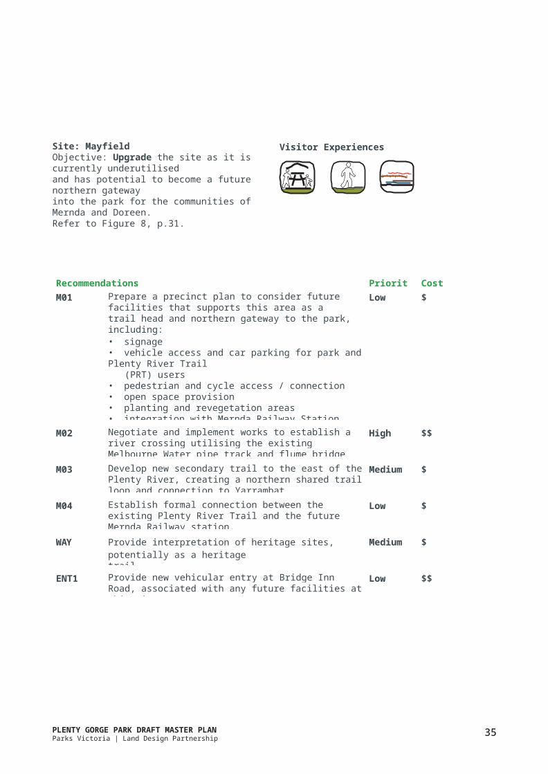
PLENTY GORGE PARK DRAFT MASTER PLANParks Victoria | Land Design Partnership HM Leisure Planning
52
Priority recommendations (continued)
Priority Code Recommendation Actions Benefits Timing Cost
Plenty River crossings and connections4 JS03 Existing
Maroondah pipe track bridge
Negotiate for crossing along existing Maroondah pipe bridge. Investigate, design and implement works.
- East-west access in park’s south- Connect the PRT to Greeensborough and Lower Plenty River Trail
Short $550KAB
5 M02 Existing flumebridge crossing
Negotiate with Melbourne Water to use the existing pipe track/flume bridgefor pedestrian crossing. Investigate, design and implement works.
- East-west access in park’s north- Connect Mernda andDoreen communities- Offer river/gorge views
Medium $600KAB
Wayfinding, interpretation and community participation
6 WAY Wayfinding and Interpretation Strategy
Develop and implement a strategy that includes:- signage methods and consistent material use- wayfinding points and park directions- interpretation of site values- collaboration withWurundjeri for content- use of technology anddigital methods- on-going marketing,education and promotion.
- Increase awareness about the park- Help visitors find theirway in/around the park- Highlight the park’sheritage, environmentand unique features
Short $300KAB
7 PAR Community Participation Program
Develop and implement a program that includes:- direction and guidance from Parks Victoria’s Learning in Nature Strategy- programs/activities in the park that connect community and youth with nature- ongoing education opportunities and marketing/promotion of park values
- Understanding stories and park values- Encourage community stewardship and involvement in conservation and park activities
Short -Medium
$50KC+ ongoingcoststo runprograms

PLENTY GORGE PARK DRAFT MASTER PLANParks Victoria | Land Design Partnership HM Leisure Planning
53
Priority Code Recommendation Actions Benefits Timing Cost
Enhance places and experiences
8 YG01a and YG01b
Prepare and implement a new YellowGum visitor site development plan
Plan and design new visitor site off Goldsworthy Lane including entrance, paving road from Memorial Drive signage, trails/links, picnic tables/shelters, BBQs, seating and toilets. Remove existing Blue Lake facilities including parking, toilets, shelters and BBQ’s.
- Utilise existing assets at Goldsworth Lane property for visitor site- Provide trailhead for walks/mountain bikes- Downgrade Blue Lake site to improve safety and maintenance issues
Short -Medium
$2.0MAB
9 H02a Update Hawkstowe development plan (1996)
10 TW01a Update Tanunda Wetlands precinct plan (Sept 2000)
11 MG02 Middle Gorge improvements (south of Gorge Road)
12 HMS Habitat Management Strategy
Plan to improve picnic facilitates, event infrastructure, playground, signage, planting, access, trails, parking and paving existing road and carpark. Planning to coincide with Council sports fields planning.Update precinct planto include parking, PRTaccess, trails, nature basedplay, picnic facilities, viewpoints and entrance fromUniversity Hill.Update 1996 Development Plan and implement works including PRT connections, enhanced entrance, lower trail extensions, picnic tables/shelters, seating, signage and new lookout.Develop and implement a strategy that includes:- reveg of altered landscapesand impacts of overgrazing.- fire management- weed and pest control.- priorities, timeframes,monitoring and resourcesrequired.
- Capitalise on existing visitor attraction- Create primary visitorsite in park’s centre- Facilitate communityevents, and activities
- Provide visitor site and trailhead in southwest edge of park
- Improve Middle Gorge as the park’s north- south connection point along the PRT and akey location to view theriver and gorge.
- Ensuresongoing biodiversity, conservationand sustainable habitat management.- Protects existing significant habitats.- Persistence and welfare of kangaroos.
Medium - Long
Medium - Long
Medium - Long
Medium - Long
$15KA
$15KA
$450KA
$270KAB
Indicative cost estimate includes:TOTAL (ALL PRIORITY RECOMMENDATIONS) $15.5M
A Planning, survey/assessments, design and documentationB Implementation/construction works and contingencyC Initial and ongoing resources for programming and implementation
PLENTY GORGE PARK DRAFT MASTER PLANParks Victoria | Land Design Partnership HM Leisure Planning
54
4.2 Immediate opportunities
The following table outlines Recommendations (as per Section 3.10) that are relatively low cost, but feasible toimplement in the short-term.
Priority Code Recommendation Actions Benefits Timing Cost1 WPF Wildlife
Protection FenceReview the existing wildlife protection fence. Installfour new gates and relocate approx 100m section of fence to allow access in PA4.
- Allow PRT and visitoraccess into PA4- Continue to protectwildlife and habitat
Short $50KAB
2 JN02JS02
Mountain bike trail plan and works
Liaise with mountain bike groups to develop and implement a sustainable trail plan which rationalises current informal networks and includes necessaryfacilities, access, signage and environmental and cultural heritage assessmentsto minimise impact onsignificant values.
- Provide suitable trailsand facilities for users- Control accessby providing cleardirections- Minimise impact onsignificant habitat areas
Short $300KAB
3 H01YG02
Permanent orienteering courses
Investigate preferred location and alignment for permanent orienteering courses at Hawkstowe and Yellow Gum, for orienteering body to implement.
- Facilitate orienteering as ideal recreation activity in the park- Support local groups- Encourage visitorengagement & park use
Short none
4 NB01 Nioka Bush Camp Establish agreements for increased use by groups. Upgrade facilities as required, including kitchen, painting, floors, windows, gutterings, drainage andall-abilities access.
- Better utilise existingpark assets- Support local groups- Encourage visitorengagement & park use
Short -Medium
$60KAB
5 MG03 Land north ofGorge Road
Upon completion of land acquisition north of Gorge Road and investigate and design facilities and access required for activities such as rock climbing.
- Facilitate rock climbing as ideal recreation activity in the park- Encourage visitorengagement & park use
Short -Medium
$20KA
6 ENT2 New HawkstoweEntry
Relocate main entry to current Le Page Homestead exit. Remove existing gravel road and construct 75m of new gravel road as entry. Include screening planting, and signage / directions from Gordons Road.
Provides clear, direct access to the popular Hawkstowe Picnic Area and Le Page Homestead
Short -Medium
$100KAB
Indicative cost estimate includes:A Planning, survey/assessments, design and documentationB Implementation/construction works and contingency
Photo: Le Page Homestead. Source: Vanessa Bluett
TOTAL (ALL IMMEDIATE OPPORTUNITIES) $530K
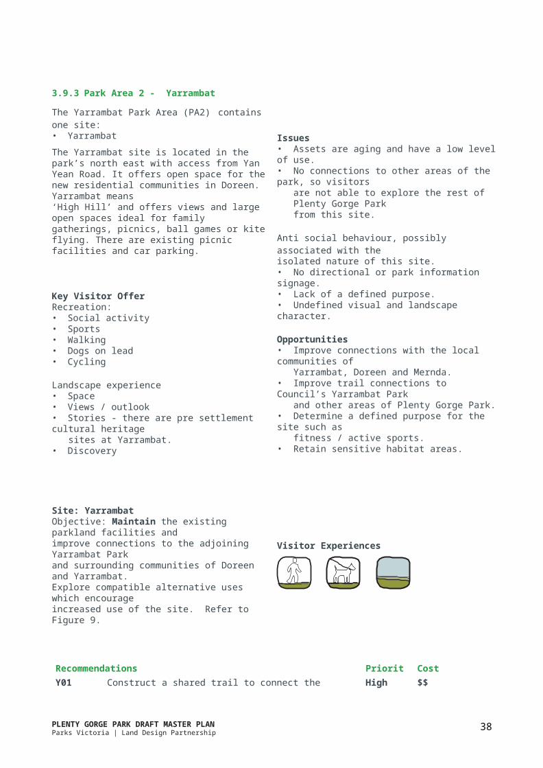
PLENTY GORGE PARK DRAFT MASTER PLANParks Victoria | Land Design Partnership HM Leisure Planning
55PLENTY GORGE PARK DRAFT MASTER PLAN 55Parks Victoria | Land Design Partnership HM Leisure Planning
5.0 References
Alviano, Philip’ 1998; The Impact of Kangaroo Grazing on Sediment and Nutrient Mobilisation at Yan Yean Reservoir and the Plenty Gorge Parklands: A Preliminary Report Prepared for Parks Victoria and Melbourne Water
Aspect Studios, 2010; Hawkstowe Recreation Reserve - Landscape Master Plan
Beardsell, Cam, 1997 (1); Sites of Faunal and Habitat Significance in North East Melbourne: Prepared for the North EastRegion of Councils
Beardsell, Cam, 1997 (2); Plenty Gorge Vegetation Community Survey & Sites of Botanical Significance: Prepared forParks Victoria
Centre for Environmental Management University of Ballarat, 2002; Plenty Gorge Parklands: Vegetation ConditionAssessment
EcoPlan Australia Pty Ltd, 1996; A Kangaroo Management Plan for Plenty Gorge Parklands
EcoPlan Australia Pty Ltd, 1995, Macropod & Rabbit Study Report: Yan Yean Catchment and Reservoir Park, PlentyGorge Park, Cardinia Catchment and Reservoir Park
Ellender, Isabel, 1991; The Plenty Gorge Metropolitan Park: The Archaeological Assessment of Aboriginal Sites
Hansen Partnership, 2015: Carome Homestead Masterplan & Management Plan
Hicks, P, 1988; Plenty Valley Historical Survey: A Report Commissioned by the Ministry for Planning & Environment
McKenzie, J and O’Connor, W, 1989; The Fish Fauna and Habitats of the Plenty River: A Report Prepared for theDepartment of Conservation, Forests and Lands
Melbourne & Metropolitan Board of Works, 1989; Plenty Gorge Metropolitan Park: Regional Geological Survey
Melbourne Parks & Waterways, 1994; Plenty Gorge Parklands: Development Policy Framework
Melbourne Parks & Waterways, 1994; Plenty Gorge Parklands Master Plan
Melbourne Parks & Waterways, 1995; Middle Gorge Development Plan
Meredith C, Larwill, S and Javemoric, R, 1991; The Fauna of Plenty Gorge Metropolitan Park: Planning andManagement Guidelines: Prepared for Melbourne Water
Parks Victoria, 1998; Plenty Gorge Parklands North Vegetation Mapping
Parks Victoria, 1998; Plenty Gorge Parklands South Vegetation Mapping
Parks Victoria, 2002; Linking People and Places: A Strategy for Melbourne’s Open Space Network
Parks Victoria, 2010; State of the Parks - Management Effectiveness Report Card - Plenty Gorge Parklands
Parks Victoria, 2012; Plenty Gorge Parklands Information Resource Kit
SMEC Australia, 2009; Proposed Hawkestowe Sportsfield Floodlighting - Ecological Assessment
Sport and Leisure Solutions, 2012; Yarrambat Park Master Plan

PLENTY GORGE PARK DRAFT MASTER PLANParks Victoria | Land Design Partnership HM Leisure Planning
56
State of Victoria Melbourne Planning Authority, 2014; Plan Melbourne
Sullivan, B, 2001; Future Directions for the Wildlife Protection Fence at Plenty Gorge Park - Volume 1
Sullivan, B, 2001; Future Directions for the Wildlife Protection Fence at Plenty Gorge Park - Volume 2
Thompson Berrill Landscape Design, 1999; Morang Wetlands Development Park
Thompson Berrill Landscape Design, 2000; Tanunda Wetlands Development Park
Thompson Berrill Landscape Design, 2008; Plenty River Trail Project Plenty Gorge Park
Thompson Berrill Landscape Design, 2015; Draft City of Whittlesea Open Space Strategy
Varcoe, T and French, G, 2000; Review of Wildlife Protection Fence at Plenty Gorge Park
PLENTY GORGE PARK DRAFT MASTER PLANParks Victoria | Land Design Partnership HM Leisure Planning
57
6.0 Appendices
Appendix A: Planning context
Plenty Gorge Park forms part of the existing networkof metropolitan parks within Melbourne. This networksupports and contributes significantly to Melbourne’sliveability.
“Open space is not only for recreation and conservation of environmental and cultural values; it is the foundation of urban liveability. It underpins many social, ecological and economic benefits that are essential to the healthy functioning of the urban environment.” (Parks Victoria2002)
Parks Victoria’s Healthy Parks, Healthy People philosophyrecognises that time spent in nature improvespeople’s health, reduces stress and promotes physicalwell being.
Metropolitan parks express this philosophy by providing people with opportunities to connect to nature and recreate within typically large scale natural landscapes that are generally not available to them in smaller parks in the local open space network. Metropolitan parks are essential to supporting recreation, gathering, relaxation and adventure based experiences within natural orsemi-natural settings, enabling escape from the built environment. In addition, parks can provide habitat for endangered fauna and flora species and can contribute to positive community health. Parks also play an important role in climate change adaptation, mitigation and urban heat island effect. Furthermore parks offer protectionand interpretation of cultural heritage and landscapevalues.
In providing recreation opportunities for urban communities in semi-natural, large scale settings, metropolitan parks are provided in responseto development, to meet the needs of growing communities, in a manner distinct from council managed local and district parks.
Relevant planning documents
Parks Victoria released Linking People and Spaces: a Strategy for Melbourne’s Open Space Network in 2002 (Parks Victoria, 2002). The purpose of the document was to ensure that the supply of open space will be appropriate and sufficient to cater for the needs of a growing and changing urban population.
Linking People and Spaces acknowledges the role that regional open space has in recreation, conservation, liveability, health and well-being and the economy. It also contains some specific actions in relation to Plenty Gorge Park:
• Monitor and evaluate further development demand for and use of recreational venues within Plenty Gorge Parklands.
• Investigate opportunities to expand nature-basedtrails.
• Protect open space that supports significant flora andfauna species, including... Plenty Gorge Parklands.
• Protect, restore and increase the cover of depletedvegetation communities, including Plains GrassyWoodland, Herb-Rich Woodland, Native Grasslandand Box Ironbark Forest within the existing openspace network. Examples include Plenty GorgeParklands.
• The development of a shared trail along the PlentyRiver to Yan Yean Reservoir, including through PlentyGorge Park was also a key recommendation ofLinking People and Spaces.
The Draft City of Whittlesea Open Space Strategy 2015 also includes references to Plenty Gorge Park. The proposed Plenty River Trail is included within proposed off-road shared trail network for the municipality providing improved connectivity and accessibility. The strategy recommends continued advocacy to Parks Victoria to provide the shared Plenty River Trail.
PLENTY GORGE PARK DRAFT MASTER PLANParks Victoria | Land Design Partnership HM Leisure Planning
58
Other recommendations include improvements of the interfaces between Council managed open space and Plenty Gorge Park to improve facilities that might take advantage of views and / or access over and into Plenty Gorge Park.
A master plan was previously prepared for Plenty GorgePark in 1994 by Melbourne Parks and Waterways.This plan was prepared with an range of clearly statedobjectives:
1. conservation2. recreation3. management4. community involvement.
In responding to these objectives, the 1994 master plan defines a number of key nodes and trails within the park:
1. The Northern Recreation Nodes: Yarrambat -Wiltonvale / Hawkstowe - Carome
2. Yellow Gum Bush Park3. The Gorge4. Janefield Bushland5. Morang Wetlands6. Plenty River Trail7. Eastern Park Trail
These nodes and trails have been progressively developed by Melbourne Parks and Waterways and Parks Victoria in ensuing years and remain as fundamentally appropriate elements of Plenty Gorge Park today.
In this regard the updated master plan does not seek to re-work the overall structure outlined in the 1994 plan, but rather to refine it in response to the current urban context.
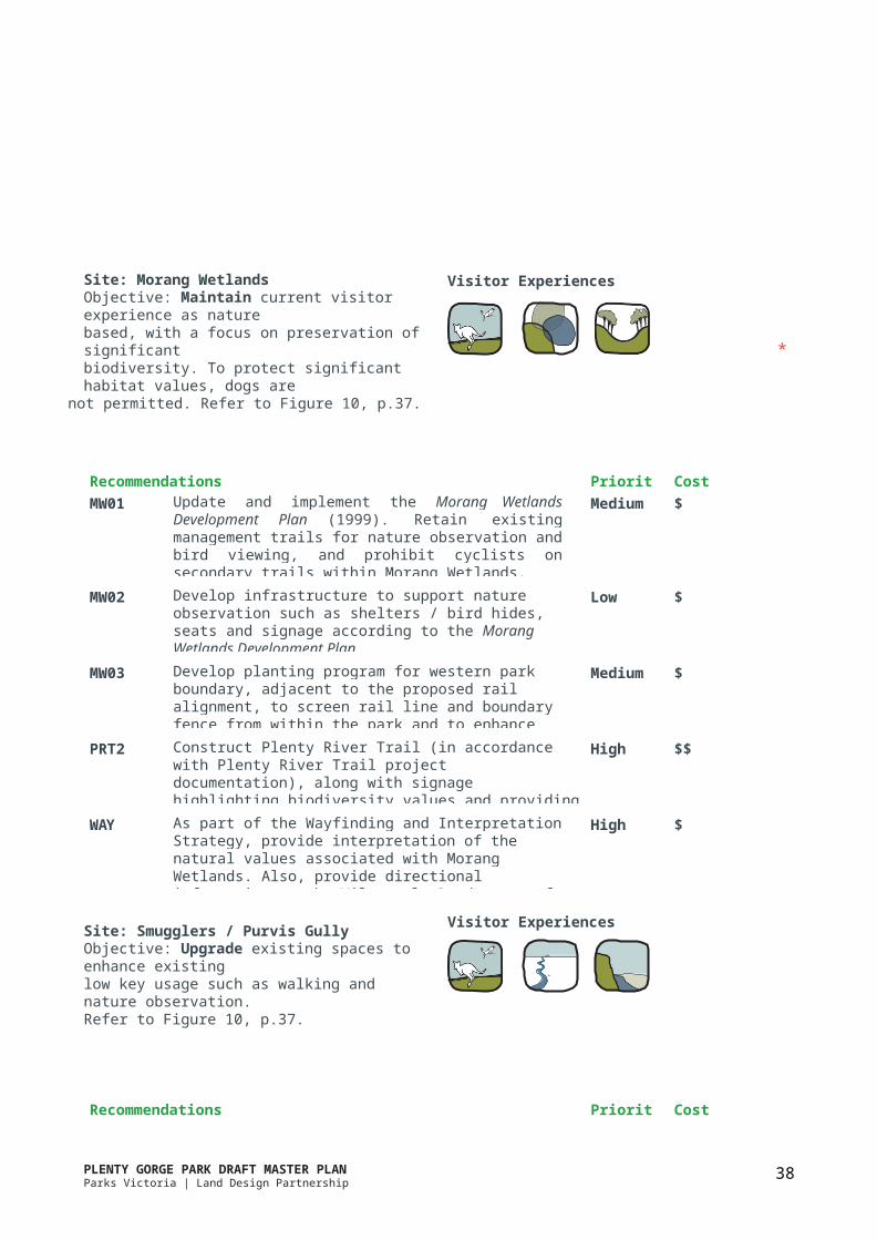
PLENTY GORGE PARK DRAFT MASTER PLANParks Victoria | Land Design Partnership HM Leisure Planning
59
Appendix B: Geology
The Plenty River defines a particularly significant geomorphological feature - the confluence of two distinct and vast bioregions - the Highlands (Southern Fall) andthe Victorian Volcanic Plain. The distinct nature of these landforms is clearly visible within Plenty Gorge Park and is demonstrated by the distinctly different landform to the east and west of the Plenty River. In broad terms, the landform to the east of the river comprises two physiographical units - the Kinglake Plateau and the Nillumbik Surface. The landform to the west comprises the Newer and Older Volcanics Lava Plain. The resultant terrain to the east of the river is rolling with clearly defined hills and valleys, whilst that to the west is characteristically flat to gently undulating.Refer to Figure 12.
The Plenty River itself demonstrates a diverse form as it interacts with this geomorphology. In the northern reaches of the park, the river traverses the hard basalt geology of the Volcanic Plain. The strength of the basalt has resisted the downcutting action of the river, which therefore flows through a relatively shallow andreasonably accessible valley. Upon reaching less resistant Silurian geology, two kilometres downstream of Mernda, the River valley becomes a deep and steep-sided gorge rendering the waterway inaccessible for much of its journey through the park.
The river remains the distinguishing feature of thelandscape within the park. This unique physiographyhas led to the dramatic landforms including a number oflocations where the escarpments provide vantage pointsalong the waterway and over the surrounding plain,providing long views to the west and south.
In line with the physiography of the region, the park area demonstrates some diversity in geology and soil type, broadly characterised by basaltic soils to the west and north of the river, and siltstone and mudstone to the east, with alluvial soils, sand and gravels within the river valley.
This geology has led to mining and quarrying of basalt aggregates, sands, clay and shale and even gold within the park boundaries. These activities have left a numberof features which remain as elements of the park, such asBlue Lake.
Implications for the Master Plan
• The shallow nature of the river valley in the northern areas of the park provides the opportunity for interaction with the waterway and the opportunity for additional experience and understanding of the natural landscape.
• The deeply incised nature of the river valley downstream of Doreen, and particularly south of Gorge Road, provides opportunities for dramatic views.
• The dramatic landforms in the southern half of the park are attractive to a range of “adventure” sports such as rock climbing, orienteering and mountain bike riding.
• These landforms also introduce a potential for risk to personal safety and so introduce an element of risk management.
• There is an opportunity for interpretation and education regarding the geomorphology of Plenty Gorge, and the distinct nature of the bioregions to its east and west.

PLENTY GORGE PARK DRAFT MASTER PLANParks Victoria | Land Design Partnership HM Leisure Planning
60
Appendix C: Flora
The geomorphology of the Plenty Gorge has created an area with a number of different landforms (twelve distinct character types) which support a corresponding diversity in plant communities, refer to Figure 13.
Plenty Gorge Park has the greatest diversity of habitats of all parks in the Greater Melbourne area and is recognised as one of Melbourne’s most important refuge for threatened species (Parks Victoria 2010).
The park supports a variety of Ecological Vegetation Classes (EVCs) such as escarpment shrubland, creekline grassy woodland, creekline herb-rich woodland, floodplain riparian woodland, swampy riparian complex, riparian scrub, plains grassy wetland, box ironbark forest, plains grassy woodland, and valley grassy forest.
Of the 631 native flora species recorded in the park, there are a number listed as vulnerable or endangered species. This includes 4 species listed under the national Environment Protection and Biodiversity Conservation Act (EPBC), 2 species under the state Flora and Fauna Guarantee Act (FFG), and 20 recorded as Victorian Rare and Threatened (VROT) species (Parks Victoria 2010).
Vegetation influences landscape character and visitor experience. The diversity of communities present provides significant educational value, but also presents management challenges in terms of balancing protection and enhancement with recreation activity.
Implications for the Master Plan
• With increased urban development in Melbourne’s north, areas contributing to local and regional biodiversity have decreased and fragmented, placing potentially greater emphasis and importance on remaining areas such as Plenty Gorge Park.
• Plenty Gorge Park has an important role to play inthe ongoing protection of significant species.
• Intensification of urban development and visitoraccess puts pressure on ecological values.
• There are opportunities for interpretation andcommunity education associated with the uniquebiodiversity of Plenty Gorge Park, providing anadditional layer of interest and meaning for visitors.
• There is a need for planning to address issuesimpacting biodiversity including location of trails,invasive plant species, kangaroo populations,stormwater runoff, rubbish dumping etc.
• Ongoing revegetation across the park presentsopportunity to protect biodiversity values andenhance habitat corridors within the region. Italso creates the opportunity to enhance the visitorexperience through improved landscape character.

PLENTY GORGE PARK DRAFT MASTER PLANParks Victoria | Land Design Partnership HM Leisure Planning
64
Appendix D: Fauna
Plenty Gorge Park has the greatest diversity of habitats of all parks in the Greater Melbourne area and is recognised as one of Melbourne’s most important refuge for threatened species (Parks Victoria 2010).
Extensive research has revealed high fauna diversity in the park, reflective of the range of habitats and overlapping geological regions (refer to Figure 14).
Of the 262 native fauna species recorded in the park, several are listed as vulnerable or endangered species. This includes 11 species listed under the international migratory bird agreement (JAMBA / CAMBA), 4 species under the national Environment Protection and Biodiversity Conservation Act (EPBC), 19 under the state Flora and Fauna Guarantee Act (FFG), and 39 recordedas Victorian Rare and Threatened (VROT) species (ParksVictoria 2010).
Protection high habitat value areas has been a key management focus for Plenty Gorge Park. One ofthe elements of this focus has been the construction and maintenance of a wildlife protection fence in the southern portion of the park. The purpose of this fence is to limit intrusion of pest animals in order to protect native fauna, as well as inhibit the spread of domestic weeds by reducing human access to sensitive areas.
While the fence has been effective in these measures, the further growth and intensification of residential development has seen a number of key locations where the fence has been repeatedly damaged. Management of access into areas of high conservation value has been proposed as a tool to protect sensitive areas.
Implications for the Master Plan
• Vandalism to the existing wildlife fence is on-going in a number of key areas, suggesting a need to investigate alternative approaches to protection of sensitive areas.
• Managing the pressures of ongoing development around the park and the subsequent impacts upon the viability of some species due to habitat degradation and the loss of habitat corridors.
• The ongoing management of areas of high habitat value is required, including determining which areas, if any, should be considered for restricted access in order to preserve their habitat values and to protect rare or threatened species.

PLENTY GORGE PARK DRAFT MASTER PLANParks Victoria | Land Design Partnership HM Leisure Planning
65
Appendix E: Indigenous Heritage
The Plenty Valley is part of the territory of the Wurundjeri-willam, a clan of the Woiwurung language group. Published and unpublished accounts of early European settlers provide some insight into the economy, settlement patterns and culture of the Aboriginal people in the area.
It is likely that the local Wurundjeri people lived according to a seasonal economy, moving to higher country during the winter months to avoid flooded river flats. Spring, and summer would have seen a return to the floodplains and swamp lands.
Plenty Gorge would have been significant to indigenous communities as ‘a resource-rich environment at the interface of the open woodland of the basaltic plainto the west, and the forested undulating sedimentary terrain of the eastern side. The Plenty River and its gorge would also have been the source of raw materials, food and perennial fresh water’(Ellender 1991).
Plenty Gorge Park contains evidence of early human occupation of the region in many sites along the river and the gorge. There is evidence of Aboriginal activity in the area including scar trees and stone artefacts, indicating the presence of camp sites in a significant, resource rich environment cared for by the Wurunderi people. Culturally scarred trees, found mostly on large, old RiverRed Gums, are generally located on the basalt plain abovethe break of slope.
The scatters of stone artefacts indicate the presence of old campsites. All the big campsites found in the park were closely associated with the gorge, with the highest density above, but close to the break of slope.
Implications for the Master Plan
• Opportunity for Wurundjeri to express their connection to Country and share their knowledge and stories, as key players in interpretation, education and event opportunities on site.
• Clarifying the appropriateness of interpreting indigenous cultural heritage, in engagement with the Wurundjeri.
• Opportunity for Wurundjeri to be involved in ongoing park planning and management to ensure protection of natural and cultural assets.
• Support for ongoing investigations to identify additional sites within the park.
• Recognising that all of Plenty Gorge Park has cultural sensitivity, the Office of Aboriginal Affairs Victoria (OAAV) principles should therefore be appliedwhen considering all future detailed design and orimplementation works.

PLENTY GORGE PARK DRAFT MASTER PLANParks Victoria | Land Design Partnership HM Leisure Planning
66
Appendix F: European Heritage
The earliest European settlement in the area of Plenty Gorge Park dates back to the late 1830s, with the settlement of pastoral squatters utilised large tracts of land for sheep and cattle.
Subsequent land practices including gold mining, the construction of Yan Yean Reservoir, agriculture including wheat production and fruit orchards, and quarrying have had a significant impact on the landscape.
A number of remnant buildings and structures reflecting early European use of the area remain within the park. Refer to Figure 16.
These include Carome Homestead (1864), which has been renovated for use as a restaurant, LePage Homestead (1850’s), which has been renovated and is utilised by various community groups, Farm Vigano, the Mayfield aqueduct, and former mill buildings and quarries (Hicks (1998), Ellender (1991).
These buildings and structures play an important role in interpreting the impacts and effects of colonisation in the area.
Implications for the Master Plan
• Identifying the detailed role of remnant European cultural heritage structures and sites in response to community engagement.
• Protecting and restoring remnants, artefacts and structures, where appropriate, in order to tell the story of the use and development of the PlentyValley corridor. Investigate partnerships with HeritageVictoria and local heritage groups.
• Utilising significant remnant structures as part of thecharacter and theme of Plenty Gorge Park.