Rotuma GIS Scoping Report
9
Communitybased protection of ‘rano’ swamplands, freshwater sources to enhance climate resilience and safeguard food security on Rotuma. GIS Mapping and Scoping Report, February 2013. LäjeRotuma Initiative
Transcript of Rotuma GIS Scoping Report

Community-‐based protection of ‘rano’ swamplands, freshwater sources to enhance climate resilience and safeguard food security on Rotuma. GIS Mapping and Scoping Report, February 2013.
LäjeRotuma Initiative

1
Introduction:
The year 2013 is the UN International Year for Water Cooperation, highlighting the connection between water and wetlands during this year’s World
Wetlands Day celebrated around the world on 2nd February. It marks the date of the adoption of the Convention of Wetlands on 2 February, 1971 in the
Iranian city of Ramsar. Each year since 1997, government agencies, NGOs and citizen groups at all levels of the community take the opportunity to take
actions aimed at raising public awareness of wetland values and benefits recognized under the Ramsar Convention.
Such global recognition becomes relevant at grassroot level when communities living in or near wetlands recognize the vital role of these ecosystems and take
part. The freshwater swamps or "rano" are key important wetland areas found in the 43 km2 volcanic island of Rotuma located 12 0 South latitude, 177 0 East longitude, at an estimated distance about 465km North of Fiji. Rano wetland is an important part of the island ecosystem providing habitat and food source to many living flora and fauna as part of the island biodiversity. Very little is known of the biodiversity in these
swamplands and how much of this resource remains except that the practice of harvesting the tuberous swamp plant for certain feasts is becoming less frequent. These swamps or rano capture much of the surface water that recharges the island’s freshwater lens, the water source that supply for households.
Rano swampland is culturally associated to certain customary practices and subsistence resource use in past coping strategies during times of natural disaster or extreme dry periods. Currently, these "rano" are fast disappearing mainly from change in weather patterns i.e. long periods of drought can dry up the
swamplands, change in land use patterns (eg. damage caused by feral pigs), increased monocrop agriculture, shift in community's resource use due to shift in resource value (eg. the value of planting the tuberous plant), limited replanting of the Cyrtosperma chamissonis in the swampland upon harvesting
and its slow growth that takes years before actual harvest . Back in the island home, efforts are led by the Rotuma Women Association to engage with rano communities in rehabilitation and awareness outreach about values of protecting these critical
swampland areas’ risk of drying up. These activities are supported by the SPC/GIZ funded Rano project implemented by LäjeRotuma, the community-‐based environmental initiative aimed at informing, strengthening capacity of its own community to make informed decisions and mobilize to manage
natural resources on Rotuma. This report documents our first investigation of Rotuma’s swamplands by utilizing geographical
information systems tools, complemented with local resource use knowledge to understand its condition in order to reduce the risk of further degradation.
REPORT OUTLINE: page #
Introduction 1
Objectives: 2
Methodology: 2
Geographical Information Systems 2
Habitat change detection 2
Field scoping 3
Interpretation of results: 4
Vulnerability Assessment Profile 4
Next steps: 4
Rotuma Rano Management Plan: 5

2
Objectives:
1. To conduct field scoping for mapping profile of all rano swamplands and freshwater sources on Rotuma;
2. To document local resource use knowledge linked to the rano swamplands and freshwater sources;
3. To better understand the biophysical changes of
the rano habitat over a time series from available imagery and aerial photos.
Methodology:
Geographical Information Systems (GIS)
Maps visualise our understanding of the threats to our environment, species extinction, loss of habitat, pollution as well as help develop critical thinking from a spatial
perspective to the scope of conservation interest in species and habitat biodiversity. GIS technology with a basic knowledge enables LäjeRotuma and its partners to create and work with interactive maps not only to learn about GIS but to get a more in-‐depth
understanding of their subject material i.e. land-‐use, socio-‐economic factors, turtles and nesting beaches, coral reefs, habitat detection of rano, seagrass, coastal erosion and coral reefs.
Habitat Change Detection Analysis The aerial photos of 1980 were scanned, geo referenced and digitized. The digitized polygons were then overlay
with the satellite Imagery of 2007 to visualize the extent of the boundary. To confirm the location of this swampland, the present land
use map created by the land use section with reference to the Land Use Capability map was made. The GPS points collected from the survey was then overlaid
onto these maps to further carry out analysis.
Dates of rano visits 2012-‐2013
Location of rano
Time spent (hours)
26th November (Monifa Fiu & Voi Manueli)
Noatau, Southeast
4
26th January (Rupeti Vafo’ou)
Fapufa, West 3
6th February (Rupeti Vafo’ou)
Hapmafau, South
3
Yet to scope! Malha’a
List of equipment: Desktop profiling:
- Aerial photos available
- Satellite imagery ( 2007) - Aerial Photos of 1980
- Computer - GIS software ArcGIS 10.0
Field scoping of ‘ rano’:
- Hand-‐held GPS Garmin 5 unit
- Spare set of AA batteries - Zip-‐lock plastic bag for GPS+
batteries - Clipboard + Notebook + Pencil
- Safety walking shoes!
Cyrtosperma chamissonis locally known
as ‘papąi’.

3
Field Scoping
Maps (top-‐ Noatau rano, below-‐ Motusa and Fapufa rano) showing the GPS tracks during the field scoping days.
Field journal notes: Rupeti Vafo’ou
“The sun was reaching out its rays to the horizon as I sat under the coconut trees captivated by the beautiful scenery and ever thing nature had to offer me. From the lazy lapping of the waves on the sand to the quick rush of
crabs [Fupa] into their holes. It was a beautiful morning so I thought a perfect day for me to walk around the swamp (rano) areas at Fapufa to mark its extent , using a hand-‐held GPS (Global Positioning Systems) unit. The walk to Fapufa was exhausting under the heat of the sun but enjoyable at the same time. I have never operated a

4
GPS device so it was a good thing Monifa briefed me whilst
on the wharf before I boarded the boat, with a note on how to operate it slipped in the zip lock bag which housed the
hand piece of equipment. Back to the rano work at hand for after a few test runs I was
ready to start with my work as if I was a professional. It was quite challenging to multi-‐task in the rano, to mark my tracks
on the hand-‐held GPS, record on my book and take photos at the same time whilst looking out for snakes up on the tree
branches! After three encounters and my dash out of the rano screaming like mad, I decided to call it a day and return
home. Ten days later, on the 6th of February I explored the second rano using the hand-‐held GPS to mark the extent of
the swamps in the Motusa area. This was much easier to track for there were signs of people using the rano more often
with cleared patches of papai and no signs of snakes, an object of my fears. In overall, I enjoyed my rano experience
and learning new things such as the use of the hand-‐held GPS unit, visiting our swampy backyards that I would never go to
under normal circumstance. I am hoping I don’t get asked to go into the Vao rano again”.
Interpretation of Results:
The spatial detection of change in the extent of the swampland was determined as follows: Fapufa rano (head): 1980-‐ 1.124 ha; 2007-‐ 1.781ha Noatau rano (tail): 1980-‐ 4.135ha; 2007-‐ 5.835ha Hapmafu-‐Motusa (neck): 1980-‐ 5.003; 2007-‐ 6.663ha Next steps: Ongoing spatial analysis involves the overlay of land-‐use in these rano areas i.e. growth of the papai growth to actual swampland (based on the soil map) of the area to determine space for restoration of the papai plant. However, the overall rano management plan involve 2-‐pronged approach to restoring
the significant swampland areas on Rotuma and replant listed useful indigenous plant seedlings in adjacent pre-‐selected areas by the 12-‐15 women clubs of Rotuma Women Association (RWA). A greenhouse (specs: 25m2 x 15m2 x 25m2) is planned to be built during April at the backyard of RWA
resource centre in Ahau. This greenhouse will purposely contain the target of 1000 seedlings of listed indigenous trees useful to herbal medicine and scents of Rotuma for the rehabilitation plan. A training
program developed with technical expertise in agro-‐technology and landscaping is currently planned for late April once the greenhouse is built and the seedling bank is almost completed. A resource person will provide the training for the women groups in the subject of potting and maintenance of the greenhouse
with a domestic marketing plan for its seedling bank.
Rupeti out scoping Fapufa rano

5
Profile for assessing climate vulnerability:
Freshwater resources are threatened by: agriculture and the use of pesticides; over-‐abstraction of groundwater lenses, and development that damages or drains the lens (for example, excavations that
allow saltwater penetration; climate change (predicted to alter the rainfall patterns and quantity) and sea level rise (increased saltwater intrusion into groundwater lenses); poor waste disposal systems that pollute groundwater; and poor maintenance of water supply infrastructure and excessive wastage.
Historical climate baseline for Rotuma: (Source: FMS, 2008). Rotuma’s equatorial location implies hotter uncomfortable conditions than currently experienced.
Trends below for the period 1933 until 2007 for the annual mean maximum temperature suggest a steadily rise in temperature for the past 75 years. Trends for the period 1912 until 2006 for the wet season total rainfall (96 years) profiled a decline in the occurrence of rainfall periods and similarly with
less rain.
Volcanic island: 13km long, 4km wide.
Island area: 43 square km, bisected into a larger eastern part, western peninsula by a low narrow isthmus.
Population density: proxy to human pressure.
Resource utilization dynamics: proxy to preferences.
Swampland current area: to be verified.
Present land-use: proxy to via growth, rehabilitation plan
Forest/ invasives cover: proxy for management.
Soil characterization: proxy to saline conditions in rano
Island population (2012): count of 1901 people..
Environmental practice: 4% of households’ compost.
Access to piped water: at least 65% of island households, 32% of households own water tank.
Climate baseline: future climate scenario.
Annex I.
6
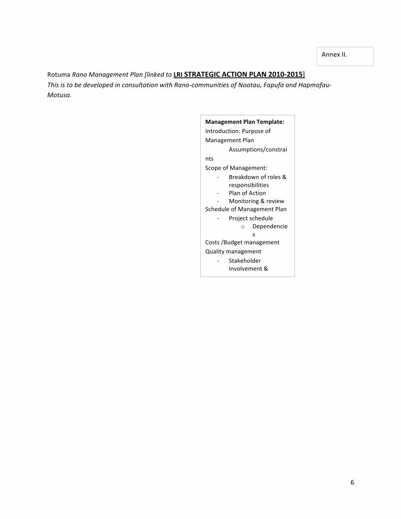
Rotuma Rano Management Plan [linked to LRI STRATEGIC ACTION PLAN 2010-‐2015] This is to be developed in consultation with Rano-‐communities of Noatau, Fapufa and Hapmafau-‐Motusa.
Annex II.
Management Plan Template:
Introduction: Purpose of Management Plan
Assumptions/constraints
Scope of Management: -‐ Breakdown of roles &
responsibilities -‐ Plan of Action -‐ Monitoring & review
Schedule of Management Plan -‐ Project schedule
o Dependencies
Costs /Budget management Quality management
-‐ Stakeholder involvement & partnerships
-‐ Risk management Communications management
Monitoring Sustainability

7
BUILDING BLOCK-‐TENET OBJECTIVES Address the challenges in the respective building blocks.
INDICATORS (SMART) Determines the specific outputs from the actions that will contribute to at least one of the listed outcomes above.
ACTIONS Address the objectives and the output of each action is measured by the indicator.
1. Research & Access to Information
Improve information on Rotuma’s biodiversity for formal and non-‐formal education curricula;
Inform Rotuma and her people on the social economic benefits of its resources;
Improve available information specifically on health status of Rotuma’s biological resources;
Document the status of Rotuma’s biodiversity resources, in particular the threatened, endemic forms;
Establish mechanisms which encourage and facilitate local biodiversity research on Rotuma.
Rotuma 100-‐year historical climate baseline by 2010;
Rotuma Environmental Risk Assessment Report by 2010;
Status reports on fisheries resource use and knowledge, useful trees & fauna (butterfly, birdlife) and locally available energy and water resources;
Mechanisms established and resources secured by 2011;
Two researches conducted by 2015.
Site profiling on historical climate variability and present socio economic status;
Habitat mapping to detect changes caused by land use patterns & other physical changes i.e. coastal erosion, layers of biodiversity and culturally significant information;
Assess the health status of existing natural habitats and viability of certain natural resources for development potential;
Develop communication products on vulnerability assessment for sharing and dissemination of information during community island outreach;
Provide access to non-‐formal education programs with recognized accredited institutions;
Production of a publication on varietal impressions from women, youth and children in Rotuma including partner island Fijian communities;
The publication and profiles of climate witnesses shared with community e-‐based website portal and links;
Mapping exercise of freshwater outlets eg. wells, boreholes, springs
Conduct a water situation analysis for Rotuma
Conduct restoration activities for freshwater wells, tanks etc.
2. Capacity Building Develop communities’ capabilities in dealing with adverse impacts of climate change;
Conduct a community training needs assessment
Community training on adaptation priorities specific to food security,

8
2. Capacity Building Develop communities’ capabilities in dealing with adverse impacts of climate change;
Develop communities’ capabilities to manage and utilize local resources in a sustainable manner for improved livelihood;
Enhance biodiversity management skills;
Implement a programme of ethno-‐biological and traditional conservation practices enquiry.
Conduct a community training needs assessment by 2011;
Community training program developed by 2012;
Funding secured for 2010-‐2015 to implement LRI’s capacity building initiatives;
500 islanders participated in the training program by 2015;
A mechanism established with clear guidelines;
At least one village per district implementing initiatives such as “Plastic free zone”, Seagrass Watch, Organic farming and Sand watch.
Community training on adaptation priorities specific to food security, adaptive management, enhancing water security and integrated disaster risk management;
Leadership training for focal youth, women and other group representatives;
Fostering smart partnerships with key network links in areas of disaster risk management, climate services, funding agencies, technical cooperation, etc;
Establish an incentive mechanism for village engagement to better manage resources and adopt best practice principles.
3. Community Outreach Promote community support for biodiversity conservation and ecologically sustainable development through improved understanding, awareness and appropriate action;
Mainstream gender into climate change adaptation/mitigation efforts in Rotuma;
Promote sustainable fishing methods and best use practices;
Effectively manage threatened species and culturally significant species.
One series of island impact stories published by 2015.
Production of a documentary on Rotuma in a changing climate.
• Documentation of climate witness stories in the different social groups on Rotuma;
• Two exhibitions to showcase the manifestations of climate change in Rotuma-‐ form of photographs, artwork and other nature expressions depicted visually, by sound from the women, youth and children groups-‐focus on their contribution to building resiliency of communities against Climate Change;
Protect key freshwater outlets & swamplands essential to maintain Rotuma’s biodiversity and build community’s climate resilience, promoting healthy island living.