River Erosion In Bangladesh
21
HAVE EVER THOUGHT YOU
-
Upload
faheem-rashid -
Category
Documents
-
view
191 -
download
0
Transcript of River Erosion In Bangladesh

HAVE EVER
THOUGHT YOU

EROSION
ABOUT RIVER
AND HOW IT’S AFFECTING
BANGLADESH

River ErosionWearing away of rocks and other deposits from earth’s surface by the action of water, ice, glacier, winds, waves etc.
Affecting the socio-economic situation
A hindrance in sustainable development
Leaves a long lasting devastating affect in the lives of the sufferes
Erosion also involves the breaking down of the rock particles being carried downstream by the river

River Erosion: A Threat to Bangladesh
An endemic and recurrent natural hazard in Bangladesh
Bangladesh considered as a river reign country
5% Floodplain of Bangladesh is directly affected by river erosion
Nearly 94 upazilas near major rivers are sufferers of river erosion
34 upazilas are severely affected including Kajipur, Faridpur, Shariyatpur, Madaripur, Comilla, Chadpur, Shirajganj
About 700 rivers and 60 of them are major rivers
In a year about 2400 km of river bank line experiences major erosion
About 40% migration to Dhaka is due to river erosion

Processes of river erosion:Hydraulic Action:
Decomposition of rock particles from river bed due to water pressure
Occurs near water falls and fierce forced streams of rivers
Abrasion:
Wearing away of river banks by river sediments.
Occurs during the depression stage of rivers

Attrition:
Eroded particles collide and break into smaller particles
Corrosion: Carbon di oxide dissolves in the river to form a weak acid.
The edges of rock particles becomes more rounded and smaller
Attrition makes the sediment particles smaller
It forms limestones and chalks are found as sediments

The major rivers responsible for river erosion:
The Padma
The Upper Meghna
The Lower MeghnaThe Jamuna
The Brahmaputr
a

THE MAJOR CAUSE FOR
RIVER EROSION SHIFTING OF RIVER CHANNELS

Source: Google Earth

Jamuna Ganges Padma Upper Meghna Lower Meghna
Bank Erosion
Rate (m/year)
Left
100 20 38 7 66
Right 84 56 121 9 182
Maximum Bank Erosion Rate
(m/year)784 665 620 NA 824
Rate of river erosion
Source: ISPN,1995, Rates are derived from 1984-1992

Width decrease in major rivers:
The Jamuna The Brahmaputra
The Padma The Upper Meghna
The Lower Meghna
Average width (m)
1984 9,720 4,367 5,689 3,406 6,661
1993 11,220 4,693 7,116 3,391 8,897
Rate of change of width(m/year)
184 36 159 2 248
Source: ISPN,1995

Micro-level Analysis On Kazipur upazila: Situated near the Brahmaputra river
Severely affected by river erosion
Source: Google Map
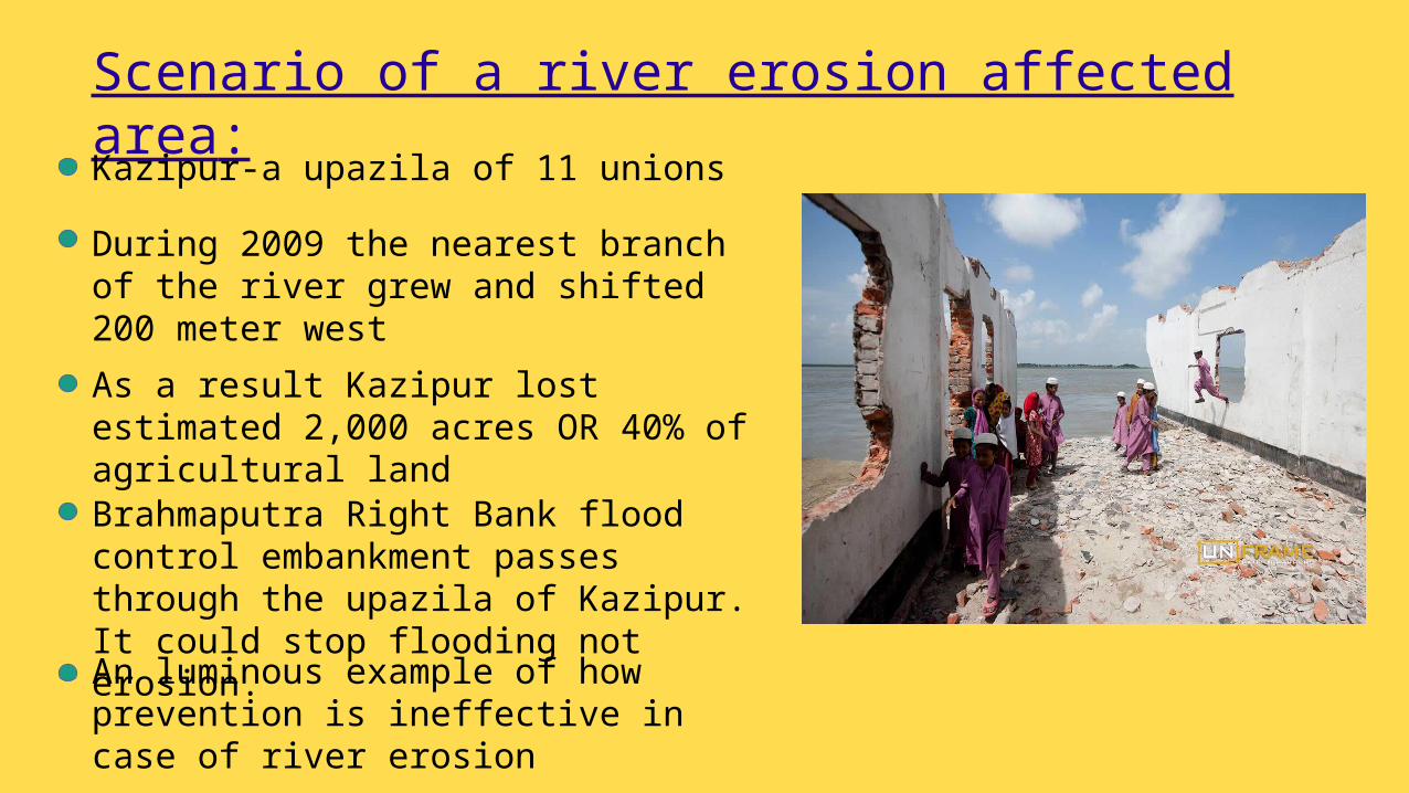
Scenario of a river erosion affected area:Kazipur-a upazila of 11 unions
During 2009 the nearest branch of the river grew and shifted 200 meter west
As a result Kazipur lost estimated 2,000 acres OR 40% of agricultural land
Brahmaputra Right Bank flood control embankment passes through the upazila of Kazipur. It could stop flooding not erosion.
An luminous example of how prevention is ineffective in case of river erosion

Before river erosion After river erosion
Source: Google Earth

Socio-economic effects
Estimated 1,000,000 people are affected annually
Estimated 500,000,000 USD monetary loss annually
A big set back for agriculture
Erodes farmland, infrastructure and communication system
Lifestyles of native people degrades drastically
Affected people lose assets and fall in future debt
Migration of inhabitants
River erosion is considered as a major cause of growing poverty

A Family Which Has Been The Cruelest Victim Of River ErosionTale of a Taher Mollah
Source: USAID

Taher Mollah- scenario of 2012
Used to own 60 bighas (20 acres) of land
Born in 1950 in a well off family in khidirpur.
Lived as a day labourer in the city of Rajshahi
Still hoped of going back to the char when it will rise.
Due to river erosion he has lost all. Even his living place.
Irony of his life was he never got to see his living place again.
Source: USAID
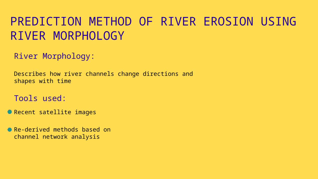
PREDICTION METHOD OF RIVER EROSION USING RIVER MORPHOLOGYRiver Morphology:
Describes how river channels change directions and shapes with time
Recent satellite images
Re-derived methods based on channel network analysis
Tools used:

GOVERNMENT MEASURES
PREVENTION
MITIGATIONNOT

TWO MAJOR PROJECTS:
JAMUNA-MEGHNA RIVER EROSION MITIGATION PROJECT
DISSAPPEARING LANDS PROJECT
Enhance Economic Growth
Reduce Poverty
Ensure Livelihood Security
Already Changed About 2,000,000 Peoples’ lives
Objectives Of The Projects

BEING COMPASSIONATE
IS THE KEY