Requirements for the next generation standardized location...
13
Requirements for the next generation standardized location technology protocol for location-based services Lauri Wirola, Ismo Halivaara and Jari Syrjärinne Nokia Inc., Finland Abstract The booming location-based services business requires more accuracy and availability from positioning technologies. While several proprietary location and positioning protocols have been developing in the market, scalable and cost-effective solutions can only be realized using standardized solutions. Currently the positioning protocol standardization is concentrated in the 3GPP and 3GPP2 that define Control Plane (CP) positioning technologies for Radio Access Networks’ native use. The limitations of the control plane in terms of architecture and bearer protocols are necessarily reflected in the CP positioning protocols and limit the feature sets offered. In addition to 3GPP/2 positioning technologies are also defined in WiMAX Forum and in IEEE for WLAN networks. Location protocols in IP-networks, such as OMA SUPL (Open Mobile Alliance Secure User Plane Location protocol), encapsulate the CP positioning protocols. Thus the limitations of the CP protocols have also been copied to the User Plane, although the bearer there would be much more capable. Due to the shortcomings in the CP positioning protocols, standardization activity for a new bearer-independent positioning protocol is proposed in order to fulfil the needs of the future location-based services. This paper discusses the current solutions, trends in the location technologies and outlines requirements for the future location technology protocol in terms of protocol features and data content. The development of a generic positioning technology protocol is seen as an important development towards a convergence in the location protocols and the capability to provide location-based services irrespective of the bearer network. This has a major impact on the service development as well as user experience. Key words: User Plane, Positioning protocol, Assisted GNSS, Fingerprint, Hybrid positioning 1. Introduction Developing positioning and location standards has substantial market demand. Already now AGPS-enabled (Assisted GPS) mobile terminals constitute a significant share of the global navigation device market. The 2008 annual GPS-enabled smart phone sales are estimated above 30 million units and the analysts estimate that in 2011 the annual sales surpass 90 million units (Canalys, 2008). Moreover, modern smart phones are location- aware at least through the cellular network base station information. Finally, laptops can be made location-aware using WLAN-based positioning methods. Positioning protocol standardization is concentrated in 3GPP (The Third Generation Partnership Project) and 3GPP2, which define positioning protocols for the Control Planes of GERAN (GSM EDGE Radio Access Network), UTRAN (UMTS Terrestrial RAN), E-UTRAN (Enhanced UTRAN) and CDMA (Code Division Multiple Access) networks. GERAN, where EDGE stands for Enhanced Data rate for Global Evolution, is better known as GSM (Global System for Mobile communications). UTRAN, where UMTS stands for Universal Mobile Telecommunications System, is commonly referred to as WCDMA (Wide-band CDMA). Finally, E-UTRAN is also known as LTE (Long-Term Evolution). The Release 8 of GERAN standard will include the possibility to provide terminals with assistance data for all the existing and some future GNSSs (Global Navigation Satellite System). The assistance includes, among other things, the navigation model (orbit and clock parameters), reference location and reference time. In an assisted situation, the receiver does not need to download the navigation model from the satellites, but receives it over the cellular network to considerably reduce the time- 1
Transcript of Requirements for the next generation standardized location...

Requirements for the next generation standardized location technology protocol for location-based services Lauri Wirola, Ismo Halivaara and Jari Syrjärinne Nokia Inc., Finland Abstract The booming location-based services business requires more accuracy and availability from positioning technologies. While several proprietary location and positioning protocols have been developing in the market, scalable and cost-effective solutions can only be realized using standardized solutions. Currently the positioning protocol standardization is concentrated in the 3GPP and 3GPP2 that define Control Plane (CP) positioning technologies for Radio Access Networks’ native use. The limitations of the control plane in terms of architecture and bearer protocols are necessarily reflected in the CP positioning protocols and limit the feature sets offered. In addition to 3GPP/2 positioning technologies are also defined in WiMAX Forum and in IEEE for WLAN networks. Location protocols in IP-networks, such as OMA SUPL (Open Mobile Alliance Secure User Plane Location protocol), encapsulate the CP positioning protocols. Thus the limitations of the CP protocols have also been copied to the User Plane, although the bearer there would be much more capable. Due to the shortcomings in the CP positioning protocols, standardization activity for a new bearer-independent positioning protocol is proposed in order to fulfil the needs of the future location-based services. This paper discusses the current solutions, trends in the location technologies and outlines requirements for the future location technology protocol in terms of protocol features and data content. The development of a generic positioning technology protocol is seen as an important development towards a convergence in the location protocols and the capability to provide location-based services irrespective of the bearer network. This has a major impact on the service development as well as user experience.
Key words: User Plane, Positioning protocol, Assisted GNSS, Fingerprint, Hybrid positioning
1. Introduction Developing positioning and location standards has substantial market demand. Already now AGPS-enabled (Assisted GPS) mobile terminals constitute a significant share of the global navigation device market. The 2008 annual GPS-enabled smart phone sales are estimated above 30 million units and the analysts estimate that in 2011 the annual sales surpass 90 million units (Canalys, 2008). Moreover, modern smart phones are location-aware at least through the cellular network base station information. Finally, laptops can be made location-aware using WLAN-based positioning methods. Positioning protocol standardization is concentrated in 3GPP (The Third Generation Partnership Project) and 3GPP2, which define positioning protocols for the Control Planes of GERAN (GSM EDGE Radio Access Network), UTRAN (UMTS Terrestrial RAN), E-UTRAN (Enhanced UTRAN) and CDMA (Code Division Multiple Access) networks. GERAN, where EDGE stands for Enhanced Data rate for Global Evolution, is better known as GSM (Global System for Mobile communications). UTRAN, where UMTS stands for Universal Mobile Telecommunications System, is commonly referred to as WCDMA (Wide-band CDMA). Finally, E-UTRAN is also known as LTE (Long-Term Evolution). The Release 8 of GERAN standard will include the possibility to provide terminals with assistance data for all the existing and some future GNSSs (Global Navigation Satellite System). The assistance includes, among other things, the navigation model (orbit and clock parameters), reference location and reference time. In an assisted situation, the receiver does not need to download the navigation model from the satellites, but receives it over the cellular network to considerably reduce the time-
1

Wirola, et al.: Requirements for the next generation standardized location technology protocol for location-based services
to-first-fix. Moreover, location and time data improve sensitivity significantly. The positioning is thus enabled in adverse signal conditions such as urban canyons. The improvement in user experience is significant compared to the performance of the autonomous GPS or simple cell-ID based positioning. In addition to the RAN-independent AGNSS data each 3GPP location protocol also contains RAN-specific items. For instance, RRLP (3GPP-TS-44.301) (Radio Resource LCS Protocol, LCS LoCation Services) for GERAN networks and RRC (3GPP-TS-25.031) (Radio Resource Control protocol) for UTRAN networks include time difference and round trip time measurements, respectively, allowing for native RAN-based network positioning. Moreover, the reference time is given in a RAN-specific way by binding the cellular frame timing to the GNSS time. Solutions for IP-networks include OMA (Open Mobile Alliance) SUPL (Secure User Plane Location protocol) Release 1 (OMA-TS-SUPL-1-0, 2007) and (draft) Release 2 (OMA-TS-SUPL-2-0, 2009) that encapsulate Control Plane positioning protocols defined by 3GPP/3GPP2 as sub-protocols to ULP (User plane Location Protocol). In addition to the capabilities of 3GPP and 3GPP2 positioning protocols the (draft) SUPL Release 2 adds items for, for instance, WLAN- (Wireless Local Area Network, IEEE 802.11) and WiMAX-based (Worldwide Interoperability for Microwave Access) positioning. Currently the AGNSS-based positioning methods are essentially the only standardized positioning solutions available for global LBS (Location-Based Services). The native RAN-based methods are not widely deployed and their accuracy is varying. Moreover, the WLAN-based positioning capability in the (draft) OMA SUPL Release 2 is quite limited. The future location services require more accuracy and availability from the standardized positioning solutions, because the use cases and user appetite for LBS will become more demanding. The requirement for increased availability can be understood by noting that people tend to stay indoors majority of the time, which is also the environment, where AGNSS performance is the worst. Accuracy requirement is, naturally, a question of application – location-sharing in a social network may require only cell-based positioning. On the other hand guiding a person to the correct entrance instead of just address requires higher accuracy than the current standardized solutions can offer. However, when it comes to introducing new features into the standards, the problems lie in the currently utilized Control Plane positioning standards being bound to the
architecture and protocol limitations in the respective RANs. Moreover, because those protocols evolve from RAN needs (mainly emergency call positioning requirements), Control Plane positioning protocols will not add support, for example, for novel signal-of-opportunity -based positioning technologies. Therefore, a new standardized location protocol is required to introduce and implement new novel features and positioning technologies. This article reviews the existing positioning protocols, discusses the future location needs and shows the limitations of the current solutions. Finally, based on the future needs and use cases, requirements are outlined for the new standardized location technology protocol that is flexible, scalable and comprehensive. In the long term the sought goal is the convergence towards a single generic User Plane location technology protocol. It should be emphasized that in this article the term location technology protocol refers strictly to protocols associated with obtaining the position estimate of the user using different location technologies. The services including sharing location with third parties, security and privacy are out-of-scope of this article. The same also applies to the term location technology which refers to technologies related to obtaining the plain position information. 2. Radio Positioning Protocols in Different
Radio Access Networks 3GPP TS 44.031 Radio Resource LCS Protocol (RRLP) 3GPP TS 44.031 (3GPP-TS-44.031) for the Control Plane of GERAN networks is defined in the 3GPP GERAN (General Radio Access Network) Working Group 2. RRLP is a stand-alone positioning protocol used in the communication between the Mobile Station (MS) and the SMLC (Serving Mobile Location Centre). RRLP carries information on the positioning methods, such as MS-assisted and MS-based modes, as well as assistance data. RRLP also enables reporting Enhanced Observed Time Difference (EOTD) measurements as well as delivering information about the cell tower locations and real-time differences (RTD) between the base stations to the MS for MS-based EOTD that can be used as an alternative to or in combination with Assisted GNSS (AGNSS). EOTD is based on trilateration of the MS with respect to the base stations. However, EOTD requires relatively expensive infrastructure investments in the network (LMUs, Location Measurement Unit for measuring the RTDs) and, hence, its deployment has been very limited. The release 98 of RRLP defined the support for Assisted GPS and EOTD. The Release 7 of the RRLP brought in
2

Wirola, et al.: Requirements for the next generation standardized location technology protocol for location-based services
the support for A-Galileo and for multi-frequency measurements (including carrier-phase measurements), but also a generic structure for easy addition of other satellite systems. Finally, the Release 8 adds the support for GLONASS (Global Navigation Satellite System), QZSS (Quasi-Zenith Satellite System), Modernized GPS as well as various SBAS (Space-Based Augmentation System), such as WAAS (Wide-Area Augmentation Service) and EGNOS (European Geostationary Navigation Overlay Service). Fig. 1 shows a simplified functional LCS architecture (3GPP-TS-43.059) in the GERAN network. The functional components in addition to MS, SMLC and LMU are BSC (Base Station Controller), BTS (Base Transceiver Station), CBC (Cell Broadcast Centre) and BSS (Base Station System). Note that the GERAN network consists of several BSS entities. The location requests originating from location clients are directed to the SMLC that handles the requests. In the example of Fig. 1 the SMLC and CBC are integrated in BSC, although they can also be standalone components. From the positioning point of view the role of SMLC is to be the termination point of RRLP and CBC is responsible for broadcasting the assistance data to all the MSs within the cell (this is an alternative channel to distributing data over RRLP). Moreover, an LMU can be, for instance, an entity with a GPS-receiver measuring the cellular time – GPS time relation for assistance data purposes. As mentioned, LMU is also needed for EOTD for measuring time relations between base stations. The LMU can also be a separate entity from BTS. Although the GERAN LCS architecture is not the primary focus of this paper, the example given works to show that the Control Plane positioning protocols are strictly bound to the underlying architecture, which linkage is necessarily reflected also in the RRLP. The RRLP includes two primary choices for the location of the position determination. In an MS-based mode the terminal autonomously determines its position taking advantage of the assistance that the terminal receives from the network. In contrast, in an MS-assisted mode the terminal typically receives only a measurement request and minimal assistance for fast signal acquisition, such as code phase search window in the AGNSS case, from the network and reports measurements to the SMLC, which determines the position. The measurements may either include GNSS measurements or EOTD measurements or alternatively both types for a hybrid solution. One to three sets of measurements can be requested and delivered to the SMLC.
In addition to MS-based and MS-assisted modes the range of methods in RRLP also includes MS-assisted preferred, MS-assisted allowed, MS-based preferred and MS-based allowed. Apart from RRLP, it should be noted that due to the limited adoption of EOTD, emergency services primarily utilize UTDOA (3GPP-TS-43.059) (Uplink Time Difference Of Arrival) in GERAN networks. Moreover, the actual assistance data requests are not delivered in RRLP, but in the BSS Application Part LCS Extension protocol (3GPP-TS-49.031). 3GPP TS 25.331 Radio Resource Control (RRC) 3GPP TS 25.331 (3GPP-TS-25.331) is the radio resource control protocol for the User Equipment (UE) - UTRAN interface. RRC defines, amongst other items, similar functionality for positioning of an UE in an UTRAN network as RRLP does for positioning of an MS in a GERAN network. It should, however, be noted that whereas RRLP is a standalone positioning protocol with termination points at MS and SMLC, RRC carries in addition to positioning payload also a plethora of other data. Hence, RRC is not only a standalone positioning protocol. RRC is terminated at UE and RNC (Radio Network Controller) of the UTRAN. RRLP and RRC therefore differ in scope and implicated architecture, although both can carry the same type of positioning and location information. In addition to AGNSS-based positioning, RRC also provides a RAN-based trilateration method called IPDL-OTDOA (Idle Period DownLink - Observed Time Difference Of Arrival). Similarly to EOTD, IPDL-OTDOA requires infrastructure investments and, hence, the deployment has been limited. 3GPP2 C.S0022-A C.S0022-A (or IS-801-A) (3GPP2-C.S0022-A) defines a position determination protocol for IS-95/IS-2000 and HRPD (High Rate Packet Data) systems and is maintained by 3GPP2. The capabilities of C.S0022-A are similar to its 3GPP counterparts. The support for additional satellite systems will be included in the coming release C.S0022-B. The IS-95/IS-2000 networks also support TOA-based (Time Of Arrival) positioning method called Advanced Forward Link Trilateration (AFLT). AFLT is based on the time synchronized base stations that allow the network or the terminal to calculate the position estimate of the terminal based on the TOA measurements.
3

Wirola, et al.: Requirements for the next generation standardized location technology protocol for location-based services
MSGSM/UMTS
Core Network
BTS BSC
Type BLMU
SMLC
CBC
BSS
GERAN Fig. 1 GERAN LCS architecture.
OMA SUPL 1.0 and 2.0 The previously considered RRLP, RRC and TIA-801 are positioning protocols for Control Plane of the cellular networks - they are an integral part of the cellular network. However, in addition to Control Plane solutions, there are also User Plane solutions, which provide assistance and positioning data over IP-networks. Examples of User Plane solutions are the SUPL (Secure User Plane Location protocol) Release 1 (OMA-TS-SUPL-1-0, 2007) and (draft) Release 2 (OMA-TS-SUPL-2-0, 2009) standardized in OMA (Open Mobile Alliance). SUPL architecture provides a wide-range of services, such as authentication, security and charging, through other enablers (defined by OMA, 3GPP or other standardization fora) as well as various location services including triggered periodic and area events. Therefore, the OMA LCS architecture with SUPL can be considered to be a complete end-to-end solution as required of OMA enablers. In positioning technologies OMA SUPL relies on Control Plane protocols, such as RRLP and RRC, which the SUPL encapsulates as sub-protocols (see Fig. 2). Over the recent years the importance of SUPL has increased due to the growth in the LBS business. Increasingly the primary use for the Control Plane methods, such as A-GPS as well as AFLT in the CDMA networks and U-TDOA in GERAN networks, is in emergency services, whereas LBSs are based on User Plane positioning solutions. Fig. 3 introduces a simplified OMA Location Architecture - for full architecture see (OMA-AD-SUPL-2-0, 2008). The architecture shows the major entities including SUPL Location Platform (SLP), Short Messaging Service Centre (SMSC), WAP PPG (Wireless Application Protocol Push Proxy Gateway) and SET (SUPL-Enabled Terminal), which is the terminal to be positioned. The functional entities of SLP, SUPL Location Centre (SLC) and SUPL Positioning Centre (SPC), handle amongst other items subscription, authentication, security, charging, privacy, positioning and assistance data delivery.
In the SUPL framework the positioning session can either be SET-initiated or Network-Initiated. In the SET-initiated case the SMSC and WAP PPG do not have a role, but the SET directly connects to the SLP (in proxy mode – the behaviour in the non-proxy mode in CDMA networks is somewhat different) and, for example, retrieves the required assistance data from the SLP. In the Network-Initiated case the SET must be notified so that it knows to set up data connection to the SLP. The channels to deliver the notification are, for example, over an SMS (text message) or over WAP. In an exemplary case of the network-initiated session a SUPL Agent external to the SET (an application, for instance) requests SLP to position the SET. Having received the request the SLP sets up a Network-Initiated session with the SET using an SMS and positions the SET. The advantages of OMA SUPL lie in the possibility to rely on other OMA enablers and also on other standardized architectures including SMS. The Network-Initiated sessions can, for example, be utilized in various services as well as in lawful interception and positioning of emergency calls. LTE and WiMAX considerations The emerging RANs, 3GPP E-UTRAN and WiMAX (based on IEEE 802.16), also need positioning solutions. The 3GPP LTE has a work item open for an LTE-native Control Plane solution that will incorporate AGNSS as well as time difference –based methods. WiMAX Forum has agreed to use SUPL as one option for positioning. Moreover, in WiMAX Forum there is also a work item towards a WiMAX-native positioning solution called WLP (Wireless Location Protocol). It should be noted that the (draft) SUPL Release 2 supports both LTE and WiMAX and, hence, the use of SUPL might be an adequate solution in these networks. The draft release also supports LTE-native positioning protocol, even though it has not been defined yet. However, its inclusion can be justified by respective timelines of future SUPL releases and LTE Release 9.
TCP/IP
TLS
ULP
RRLP RRC LTE RRC TIA-801
Fig. 2 OMA SUPL Release 2 protocol stack.
4

Wirola, et al.: Requirements for the next generation standardized location technology protocol for location-based services
Fig. 3 OMA Location Architecture
3. Shortcomings in the Existing Positioning
Protocols The Control Plane positioning protocols have been developed and evolve based on RANs’ needs (mainly emergency call positioning) and capabilities. The positioning protocols defined in 3GPP and 3GPP2 contain RAN-specific items that are not needed outside the scope of the respective RAN. These include, for instance, the native RAN methods including EOTD and AFLT. Hence the use of RAN-specific positioning protocols complicates the User Plane deployments. This is especially true of RRC, which is the protocol for the radio resource control in general. Moreover, the Control Plane protocols suffer from the limitations of the protocols lower in the hierarchy in the RAN protocol stack and prevent realization of novel features. For instance, in the Control Plane it has been impossible to realize solutions for high-accuracy sub-meter positioning methods, such as Real-Time Kinematic (Leick, 2004) because of bandwidth, architecture and protocol limitations. To be more specific, for instance RRLP is designed for one-time point-to-point assistance and measurement delivery and is, therefore, unsuitable for positioning methods requiring constant stream of reference measurements (Wirola et al., 2007b and 2008b). Because the Control Plane protocols are also being utilized in the IP-networks via the use of OMA SUPL, the in-built protocol limitations have also been copied to the User Plane solutions. This leads to sub-optimal solution, because in the User Plane the bearer-networks and -protocols would in fact be capable of providing more services and significantly larger bandwidth for positioning purposes. Considering the current and future needs one of the most serious flaws in the 3GPP-based protocols is the lack of support for the signal-of-opportunity -based, such as WLAN, positioning. The Control Plane protocols do
include the support for the RAN-native network measurements, but they lack the capability to transfer measurements made from other RANs or radio networks. For instance, because IEEE networks are out-of-scope of 3GPP, it is highly unlikely that 3GPP would define positioning methods that are based on IEEE technologies including WLAN. The same also applies vice versa. In the (draft) SUPL Release 2 this deficiency has been overcome to some extent by incorporating items for signal-of-opportunity positioning in the ULP-layer (User plane Location Protocol) of SUPL shown in Fig. 2. These capabilities include the possibility to report radio network measurements from various networks, including GSM, WCDMA, LTE and WLAN in the ULP-layer messages. The ULP-layer defines messaging, for example, for initiating and terminating the SUPL session as well as capabilities handshakes and service subscriptions. However, because the AGNSS and the other RAN-based positioning methods (EOTD, IPDL-OTDOA) are encapsulated in the sub-protocols to the ULP, the layer-approach typically adopted in the protocol design is dismantled due to the positioning technology additions made to the ULP layer. Therefore, the structure and capabilities of SUPL have suffered significantly from inheriting the limited Control Plane positioning protocols. Hence, also OMA SUPL would benefit from developing a flexible and comprehensive positioning technology protocol solely for the User Plane. Another challenge in the user plane is the GNSS fine time assistance. The more accurate the time assistance is the more precisely the AGNSS receiver can predict the Doppler and code phase in order to improve sensitivity and, hence, the time to first fix. In the Control Plane the GNSS time assistance is tied to the cellular frame timing. However, as mentioned, this requires the deployment of LMUs in the network. The same capability is also available in the User Plane. However, this approach has a drawback that it makes SUPL inherently operator-tied service, because access to the core network is needed in order to obtain the GNSS-cellular time relations. In the User Plane alternative solutions to be considered include Network Time Protocol (NTP) and timing services available in the Internet. However, the latency of the IP-network, especially over the air, results in unpredictable errors in the time assistance. Another future option is to obtain the cellular time -tied time assistance from another terminal in the same cell over a peer-to-peer network or via a server caching the cellular timing data collected from terminals. However, in any case these latter methods would not provide a solution for, say, WLAN-only devices. Therefore, time assistance over the IP-network remains a challenge.
5

Wirola, et al.: Requirements for the next generation standardized location technology protocol for location-based services
Finally, one of the drawbacks in performing positioning in the User Plane using OMA SUPL is that WLAN-only devices cannot utilize all the SUPL services unless the terminal and the WLAN network are I-WLAN -enabled (3GPP Interworking WLAN). For example, authentication in OMA SUPL requires having a SIM card (Subscriber Identification Module) in the terminal and a subscription to the 3GPP network. I-WLAN provides a mechanism to support 3GPP specified mechanisms, including authentication, over the WLAN bearer. 4. Trends in location technologies Positioning services can be characterized by four attributes: availability, accuracy, integrity and authenticity of the source. Availability refers to the fraction of time, when positioning is possible. For example, GNSS-based positioning has excellent availability in rural outdoor conditions. However, in urban and indoor environment the availability degrades rapidly. Accuracy, on the other hand, refers to how precise location information a given positioning technology may yield. Typically GNSS is considered an accurate technology, whereas cell-based methods are referred to as inaccurate technologies with a potential position error of several kilometres. Integrity refers to the reliability of the positioning service. For instance, in GNSS-based positioning integrity may be compromised by a faulty satellite. Because of this satellites send their health (or integrity) data to the user equipments. The integrity information is also provided in the AGNSS assistance. Finally, authenticity refers to the authenticity of the signal source. Typical examples for signal authentication include the methods to prevent the spoofing of GNSS signals. Spoofing can be understood to mean misguiding of users by means of forged signals (Günter, 2007). While military users have always been concerned with the potential spoofing and jamming of the signals, these aspects are also of growing importance in the civilian sector now that, for instance, location-based security solutions are being introduced. Moreover, in addition to deliberate forging attempts, unintentional interference from in-device or from other devices are potential sources of errors. While integrity and authenticity are major concerns in the emergency services, they are not currently considered as major drivers in developing positioning technologies for location-based services. This is due to the inherent problems with availability and accuracy in consumer solutions, such as positioning services in mobile terminals. These issues must be solved first. However, as
technologies develop in these areas, solutions in the areas of integrity and authenticity will be required as well. For instance, applications requiring or providing location-based charging necessitate integrity and authenticity guarantees. One option to tackle both spoofing and interference is to have at least two independent positioning technologies enabled in the device. Therefore, the two near-future driving factors in the location technologies are accuracy and availability. Accuracy requirements can be addressed by enabling more advanced GNSS-based positioning methods and AGNSS assistance to the consumers. From technology point-of-view it would be possible to provide the end users with high-accuracy GNSS positioning methods, such as Real-Time Kinematics (RTK) (Wirola et al., 2006) and Precise Point Positioning (PPP) (Leick, 2004). However, these methods both require new protocol messaging as well as new types of assistance data services, such as high-accuracy navigation models as well as regional atmosphere models in the case of PPP. These methods cannot be realized in the Control Plane protocols and extending SUPL to sew up the sub-protocol (RRLP or RRC) shortcomings has been shown unfeasible (Wirola, 2008b). Although a full-scale multi-frequency RTK may be an overkill for a handset integrated GNSS, it is feasible to realize at least a light-version of RTK using an external GNSS-receiver connected via Bluetooth to the device (Wirola et al. 2006 and 2008a). The increasing availability of satellite systems and civilian signals in consumer-grade GNSS devices will eventually enable the technologies now in professional use also to the wider audience. By the light-RTK the authors refer to abandoning rigorous integrity requirements of professional RTK solutions to some extent and also on being satisfied with a float solution. Moreover, the availability of GNSS reference networks and, hence, the availability of virtual reference measurement services introduce interesting opportunities for future high-accuracy positioning technologies for consumers. However, in order to realize this potential the standardized positioning solutions must be able to carry appropriate data content, which they are not capable of doing at the moment. The same also applies to PPP. A rigorous professional-quality PPP may not be feasible for consumer devices, but significant performance improvements can already be achieved by enabling high-accuracy navigation models and, say, regional troposphere and ionosphere models. Again, such a PPP solution might be called light-PPP. The discussed high-accuracy AGNSS methods, however, have low availability due to the requirement to have good
6

Wirola, et al.: Requirements for the next generation standardized location technology protocol for location-based services
or excellent satellite signal conditions. The availability aspect, on the other hand, can be addressed by the radio network -based methods based on fingerprinting, fingerprint databases and associated positioning technologies. A fingerprint database is defined as a grid, in which each grid point is associated with a set of measurements from a set of radio networks (Honkavirta, 2008). The measurement types include time delay measurements, time difference measurements between the base stations, channel or signal quality measurements (power histograms, number and spread of RAKE fingers, pulse shapes) and measurements from multiple antennas (diversity receiver). The databases may have wide or even global coverage. An important aspect in signal-of-opportunity –based positioning is that it must be based on existing infrastructure. Limited areas, such as hospitals, can be populated with special positioning tags or similar, but a global scale positioning solution must take advantage of already existing wide-spread infrastructure. This can be seen as one of the drivers for WLAN-based positioning. The WLAN infrastructure is widely available and various devices are already equipped with a WLAN chip. Hence its utilization in positioning is a natural step. The only remaining aspect is the availability and transfer of WLAN access point maps, which transfer is currently in the scope of no positioning standards. The IEEE 802.11 has activity towards standardizing an interface that allows the access point to report its position to the terminal or vice versa (IEEE, 2008). However, it takes time to replace the existing WLAN infrastructure with new equipment supporting new standards. And even then, not all the access points may have their coordinates set for further distribution. Hence, the current WLAN-based positioning solutions rely on databases with records of access points versus their coordinates in the simplest form of databases. As discussed, the fingerprint positioning solutions almost completely lack support in the location standards. Although the (draft) SUPL Release 2 supports reporting GSM, WCDMA, LTE, CDMA, HRPD, UMB (Ultra Mobile Broadband), WLAN and WiMAX network information, SUPL is not designed for the fingerprint collection. Moreover, OMA SUPL is based on an assumption of network-based SET-assisted RAN-based positioning and, hence, it is impossible to transfer a fingerprint database to the terminal for positioning purposes using the current SUPL versions. Again benefits for SUPL can be seen in defining a new positioning technology package for the User Plane LBS needs.
Moreover, the support for sensor-generated measurements and information originating from e.g. accelerometers, magnetometers and barometers is not covered by the current standards. For instance, although heading information is supported in various standards, motion state (walking, running, etc.), which can be extracted from the accelerometer data, is not. Moreover, taking advantage of the full potential of barometers requires availability of either pressure reference data or troposphere models. Sensors are also expected to play a major role in addressing the indoor positioning challenge (Alanen et al., 2005). Due to the limitations in the currently utilized standardized Control Plane/User plane solutions several User Plane -oriented proprietary systems have been developing in the market. Examples include WLAN-based positioning solutions as well as proprietary GNSS assistance data services. These are differentiators in the market and all the techniques can never be standardized due to the intellectual property right and business secret issues. Although the standards cannot provide unified interface towards these services, the standards could still, however, provide generic containers for proprietary payloads so that both, standardized and proprietary assistance, could be carrier within the same standardized framework. The advantage of such an approach is that each new assistance service would not then have to define a new protocol. The introduction of proprietary containers would also work to prevent the fragmentation of the positioning protocols. Currently each new RAN is forced to define a new positioning protocol for its native use. In addition, each new assistance service is compelled to define a proprietary protocol for carrying the data. The negative effects of such fragmentation include increased costs due to the need to support multiple protocols. Yet another driver for the location technologies is the location-awareness and power consumption, which are closely related. Being location-aware requires performing positioning periodically or based on some other criteria such as change of an area. However, such frequent positioning events lead to increased power consumption and also to data costs. Hence, the location technologies being developed generally try to minimize the data connections – an example of such are predicted ephemeris services. Moreover, such power consumption requirements also lead to positioning being performed by the technology that just and just fulfils the required quality-of-service. For example, if only crude position estimate is required, GNSS shall not be used. Instead, the terminal is always aware of its serving cell and, hence, assuming an availability of an appropriate fingerprint database, the terminal can be positioned without significant additional energy consumption.
7

Wirola, et al.: Requirements for the next generation standardized location technology protocol for location-based services
Also, the applications utilizing location data, such as Nokia Maps, operate on the User Plane and are becoming more interactive. Therefore, it is natural that the development of the location technology protocols is concentrated in User Plane, not in the Control Plane. In conclusion, the discussion above shows that there is a need for standardization activity in location technology protocols in the User Plane. Authors have been proposing a work item for the LTP (Location Technology Protocol) in the OMA Location working group, but so far such a work item has not been approved. 5. Use Cases In the current location solutions (for example see Figs. 1 and 3) there is a strict architecture with the location server (for example SMLC in GERAN and SLP in SUPL) providing the terminals (MS or SET, respectively) with assistance and positioning instructions. The network element has been given the control of the positioning session - it is the network element that decides, or recommends, which positioning method shall be used. These both issues must change since they imply heavy architecture and network-controlled positioning session, respectively. Firstly, the LTP must not limit the roles of different entities – instead, the LTP can find its use between various different types of entities. Any entity (for instance, handset, laptop, server and service/data provider) can work in any role. For example, traditionally there has been a server providing terminals assistance data – however, it is equally feasible for the server to request assistance data from terminals for distribution to other terminals. Similarly, the LTP messaging must also flow between any types of entities. For instance, in device-to-device relative positioning measurement messages are exchanged between two devices, for example two terminals, not between a terminal and server. This implies that the LTP must not be tied to any specific architecture, because any entity can request and deliver almost any data. Such a concept is shown in Fig. 4, in which different entities are represented as nodes that are termination points of the LTP. Any node should, in principle, be allowed to work as a data producer (i.e. allowed to publish, for example, the satellite ephemerides the node has received) in the location network. Also, any node should be able to function as a data provider (i.e. work, for instance, as a cache server for assistance data) in the network. Such a scheme opens up a possibility to set up community-based assistance networks.
Note that the complexity with, for instance, security, charging, privacy, setting up the point-to-point or even point-to-multipoint as well as multipoint-to-point connections is hidden in the bearer protocol. Such aspects are not in the scope of the location technology protocol, but are taken care by the bearer protocol encapsulating the LTP. The bearer protocol is indicated in Fig. 4 by the notation B(LTP), which refers to the LTP being encapsulated by a bearer (B) protocol. The retrieval of assistance data from an external source to the location server for distribution has thus far also been out-of-scope of location technology protocols. However, the data from the Wide-Area Reference Networks (WARN) is essentially similar to the data provided by the location server to the terminals. Therefore, the third use case to consider for the LTP is in this interface. The requirement can again be achieved by considering the WARN feed provider as a node (see Fig. 4) with certain capabilities. Cost savings can be induced by standardizing also the channel between the data provider and the assistance server.
Fig. 4 The LTP is designed to not to limit the flow of information between the nodes in the location network. However, the bearer protocol may limit the actual connections. The notation B(LTP) is introduced to highlight that LTP needs to be encapsulated by a lower level bearer protocol. The fourth use case to consider is the event-based assistance data. Currently, the protocols are designed so that the terminal either requests assistance data or the server pushes assistance data to the terminal in the beginning of the positioning session. However, there are emerging assistance data types including atmosphere models and long-term GNSS navigation models, which require that a serving node must be capable of pushing updated assistance data to the terminal as the data changes. Also, the nodes must be able to subscribe this data.
8

Wirola, et al.: Requirements for the next generation standardized location technology protocol for location-based services
Finally, the fifth use case for the data content in the LTP is broadcasting. Majority of, for instance, GNSS assistance data is global by nature. Therefore, server loads and bandwidth requirements can be eased, if GNSS assistance were broadcasted, for example, over OMA BCAST (OMA-TS-BCAST, 2008). Also, some data may be regional. For example, Europe-wide ionosphere maps could be broadcasted using OMA BCAST, because the enabler also provides means to control the distribution geographically. Also RTK measurements from GNSS reference networks are suitable for broadcasting. In such a case measurements and locations of the reference stations are distributed so that the terminal can process all the measurements (from the network and the terminal) in a single filter. The approach has been shown to produce superior results (Dao, 2005). Another option is to distribute reference measurements and spatial correction terms to the terminals. Finally, also updates to the geographically-segmented fingerprint databases could be delivered over the OMA BCAST channel. 6. Data content requirements In the Assisted GNSS -side, the LTP must offer the same types of AGNSS assistance as today - for thorough discussion about AGNSS assistance refer to (Syrjärinne et al., 2006). This includes being able to provide data common to all the GNSSs (such as, ionosphere model) and GNSS-specific data (such as navigation models) in a generic format. Also, an important aspect is having a multi-mode navigation model enabling providing GNSSs navigation models also in non-native formats (Wirola, 2007a). The present protocols also support differential GNSS, data bit assistance, earth-orientation parameters and real-time integrity. All these must be supported by any subsequent protocols. In general, the current positioning standards for AGNSS support effectively all the content available in the GNSS broadcasts. In addition to the broadcast data types, the data must also support reference location and time. Reference location may be given based on radio network –data. The reference time must be defined in such a way that it can be given with respect to any given radio system. Currently the RAN-specific positioning standards support only giving GNSS time with respect to the specific RAN time. However, the frame timings that are typically given in RAN-specific units for reference time purposes can be reduced into common units including SI-units. Also, the future protocol must have suitable content to support novel high-accuracy GNSS positioning methods. This means having certain measurement types, namely code phases and carrier phases at suitable resolution, in the standard (Wirola et al. 2007b) in order to be able to
support RTK. For PPP the new required data content includes high accuracy navigation models, differential code biases and regional atmosphere (ionosphere, troposphere) models. Additionally also, for instance, antenna information may be considered. Finally, the AGNSS side must also consider the emerging predicted navigation model services and their derivatives. The 3GPP specifications already include one implementation of predicted navigation models that can provide the terminal navigation model data for several days ahead. However, there are also other implementations and also data transfer needs for proprietary services including autonomous predicted ephemeris generation in the terminal. In the radio network -based positioning the assistance to be carried by the LTP consists of fingerprint database. These items are not consistently included in any location standard. Although the (draft) SUPL Release 2 specification defines measurement parameters for a number of networks, the parameters are not equal between the systems (contents of data elements, resolutions, ranges). The hybrid use of different networks is, therefore, very difficult due to profound differences in the measured parameters and the measurement report contents in the User Plane specifications. The generic fingerprint to be included in the LTP must therefore equalize the systems by providing, for example, such generic timing (or time difference) and observed signal strength measurement report that it is applicable to all the systems. Only then are the real hybrid methods feasible. This addresses especially the availability challenge. The systems considered may include GSM, WCDMA, WLAN, WiMAX, Near-Field Communications, Bluetooth and DVB-H (Wirola, 2008c). The positioning using the fingerprint database is based on statistically comparing the measured fingerprint to the database records (Honkavirta, 2008). Another type of data, based on fingerprint database however, suitable for positioning are radiomaps (Wirola, 2009) that contain access point and/or base station coverage area models in terms of shapes defined in 3GPP GAD (3GPP-TS-23.032) including ellipses, ellipsoids or polygons. Finally, the support for sensor-generated measurements and information originating from e.g. accelerometers, magnetometers and barometers must be covered. For example, supporting barometer fingerprints could allow the server to keep its pressure assistance grid up-to-date for assistance data purposes instead of relying on weather forecasts or similar.
9
Wirola, et al.: Requirements for the next generation standardized location technology protocol for location-based services
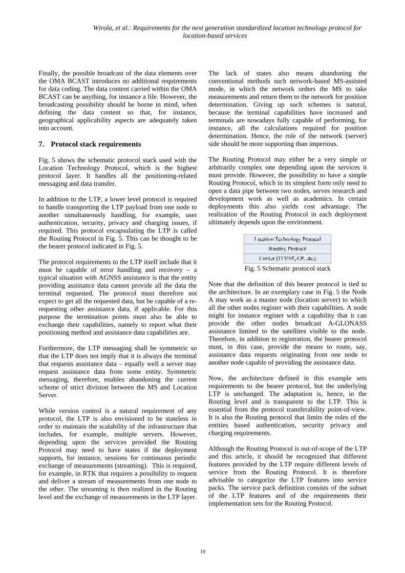
Finally, the possible broadcast of the data elements over the OMA BCAST introduces no additional requirements for data coding. The data content carried within the OMA BCAST can be anything, for instance a file. However, the broadcasting possibility should be borne in mind, when defining the data content so that, for instance, geographical applicability aspects are adequately taken into account. 7. Protocol stack requirements Fig. 5 shows the schematic protocol stack used with the Location Technology Protocol, which is the highest protocol layer. It handles all the positioning-related messaging and data transfer. In addition to the LTP, a lower level protocol is required to handle transporting the LTP payload from one node to another simultaneously handling, for example, user authentication, security, privacy and charging issues, if required. This protocol encapsulating the LTP is called the Routing Protocol in Fig. 5. This can be thought to be the bearer protocol indicated in Fig. 5. The protocol requirements to the LTP itself include that it must be capable of error handling and recovery – a typical situation with AGNSS assistance is that the entity providing assistance data cannot provide all the data the terminal requested. The protocol must therefore not expect to get all the requested data, but be capable of a re-requesting other assistance data, if applicable. For this purpose the termination points must also be able to exchange their capabilities, namely to report what their positioning method and assistance data capabilities are. Furthermore, the LTP messaging shall be symmetric so that the LTP does not imply that it is always the terminal that requests assistance data – equally well a server may request assistance data from some entity. Symmetric messaging, therefore, enables abandoning the current scheme of strict division between the MS and Location Server. While version control is a natural requirement of any protocol, the LTP is also envisioned to be stateless in order to maintain the scalability of the infrastructure that includes, for example, multiple servers. However, depending upon the services provided the Routing Protocol may need to have states if the deployment supports, for instance, sessions for continuous periodic exchange of measurements (streaming). This is required, for example, in RTK that requires a possibility to request and deliver a stream of measurements from one node to the other. The streaming is then realized in the Routing level and the exchange of measurements in the LTP layer.
The lack of states also means abandoning the conventional methods such network-based MS-assisted mode, in which the network orders the MS to take measurements and return them to the network for position determination. Giving up such schemes is natural, because the terminal capabilities have increased and terminals are nowadays fully capable of performing, for instance, all the calculations required for position determination. Hence, the role of the network (server) side should be more supporting than imperious. The Routing Protocol may either be a very simple or arbitrarily complex one depending upon the services it must provide. However, the possibility to have a simple Routing Protocol, which in its simplest form only need to open a data pipe between two nodes, serves research and development work as well as academics. In certain deployments this also yields cost advantage. The realization of the Routing Protocol in each deployment ultimately depends upon the environment.
Fig. 5 Schematic protocol stack
Note that the definition of this bearer protocol is tied to the architecture. In an exemplary case in Fig. 5 the Node A may work as a master node (location server) to which all the other nodes register with their capabilities. A node might for instance register with a capability that it can provide the other nodes broadcast A-GLONASS assistance limited to the satellites visible to the node. Therefore, in addition to registration, the bearer protocol must, in this case, provide the means to route, say, assistance data requests originating from one node to another node capable of providing the assistance data. Now, the architecture defined in this example sets requirements to the bearer protocol, but the underlying LTP is unchanged. The adaptation is, hence, in the Routing level and is transparent to the LTP. This is essential from the protocol transferability point-of-view. It is also the Routing protocol that limits the roles of the entities based authentication, security privacy and charging requirements. Although the Routing Protocol is out-of-scope of the LTP and this article, it should be recognized that different features provided by the LTP require different levels of service from the Routing Protocol. It is therefore advisable to categorize the LTP features into service packs. The service pack definition consists of the subset of the LTP features and of the requirements their implementation sets for the Routing Protocol.
10

Wirola, et al.: Requirements for the next generation standardized location technology protocol for location-based services
8. Exemplary implementation In the 3GPP systems the Routing Protocol already exists to some extent, because for example authentication is inherent to the architecture. In the IP-networks the Routing Protocol could be the ULP, because it can rely on, for instance, security (based on TLS, Transport Layer Security), authentication (based on 3GPP GBA (3GPP-TS-33.220), Generic Bootstrap Architecture) and charging mechanisms already defined in 3GPP, OMA and other fora. However, it should be noted that the (draft) SUPL Release 2 cannot support the LTP, but the future releases of SUPL could consider the LTP, if standardized, as a location technology enhancement exerting certain requirements on the ULP-layer as well as on the OMA LCS architecture. Fig. 6 shows the realization of the LTP in the OMA SUPL architecture. The LTP has been introduced alongside the current 3GPP/2 positioning protocols as a sub-protocol to the ULP. Within the LTP there are modules for different positioning technologies including GNSS and Radio Network –based positioning. The LTP itself contains the capabilities handshake and positioning requests for different positioning technologies or their hybrids.
Fig. 6 Exemplary stack implementation
The GNSS module in the LTP is the protocol for Assisted GNSS data. It includes the content, request and delivery mechanisms found in the 3GPP AGNSS specifications. Also included are, for instance, capabilities to request and deliver regional atmosphere models, measurements required for high-accuracy methods and the multitude of non-native navigation models. Moreover, the historical division to MS-based and MS-assisted methods is not required, because similar functions can be realized through simply requesting and providing assistance data and measurements. The Radio Network –module is, on the other hand, a protocol for transferring generic fingerprints and radiomap data. For example, through this module it is possible to transfer a WLAN access point coverage area map.
The individual modules can be coded in the wanted formats – they can follow the same coding or have different codings. Exemplary codings include XML and ASN.1. XML has the advantage of being flexible and robust as well as easy to debug. The drawbacks include high bandwidth consumption. The situation can be improved by binary XML such as Efficient XML (W3C, 2008). Even though the binary XML typically achieves good compression ratio, ASN.1 with PER (Packet Encoding Rules) encoding is still superior bit-consumption-wise especially, when the unaligned version is used. On the other hand, aligned PER is more efficient to decode, but consumes more bandwidth. However, extending ASN.1 in future releases results in the code being challenging to follow. The actual choice of the encoding depends on the anticipated environment as well as future needs. For example, it could be argued that the GNSS-based methods and required assistance data elements are well-established and known and, hence, no major future changes are expected to take place. Hence, ASN.1 is the choice for the GNSS package. On the other hand, the Radio Network –package with new and novel fingerprint databases requires flexibility and expandability. Hence, XML might be the choice for that package. In order to support, for instance, the delivery of basic GNSS assistance data (navigation models etc.) the OMA LCS architecture and the ULP layer need not be modified to a large extent. In principle the only modification required is adding the indication of the support for the LTP to the ULP-layer. The LTP can then be carried in the same container as the 3GPP/2 positioning protocols. Bigger changes are, however, required, for instance, for streaming of GNSS measurements between two (or more) users. This requires changes to the OMA LCS architecture and additional messaging so that one user can request such a data pipe to be opened, a network-initiated method to request such measurements from the other user as well as an architecture enabling such routing of measurements for a pre-defined time. 9. Conclusions Several shortcomings in the currently utilized positioning protocols have been identified in the view of the future location and positioning needs. The current approach of each standardization forum working with location technology protocols for their own domain leads to continued fragmentation of location technology standards and to domain-specific implementations. These domain-specific standards differ in scope and capabilities depending upon the bearer network capabilities as well as the development cycles. Therefore, harmonized positioning performance cannot be guaranteed across all
11

Wirola, et al.: Requirements for the next generation standardized location technology protocol for location-based services
the networks and access network handovers. Moreover, due to the long development cycles of standards, various proprietary location technology protocols have been developing in the market leading to further fragmentation. Instead, the domain-specific items must be addressed in a lower level adaptation protocol, which is transparent to the location technology protocol. For the location-based services it is important that the location experience is independent of the access network. Such a location technology protocol free of domain-specific hooks can address the needs of every domain (IP, RAN) and lead to convergence in location standards by being re-usable in every domain. The location technology protocol itself must address in their entirety positioning procedures, messages, measurements and assistance for GNSS-, sensor- as well as radio network -based positioning methods. The protocol must also be as flexible and comprehensive as possible so that additions can be made in fast schedule, when needed. Also, placeholders for proprietary extensions reduce the need for the proprietary protocols in the market. The authors see that there is a market demand for a comprehensive standardized location technology protocol for User Plane needs. In the long term the standardized solutions are the most cost effective approaches and lead to the widest adoption of the technologies. Acknowledgements The authors wish to thank Tommi Laine (Nokia Inc.) and Kimmo Alanen (Nokia Inc.) for providing insightful comments. References 3GPP-TS-23.032 Universal Geographical Area
Description (GAD) 3GPP-TS-25.331 Radio Resource Control (RRC)
protocol specification 3GPP-TS-33.220 Generic Authentication Architecture
(GAA); Generic Bootstrapping Architecture 3GPP-TS-44.031 Radio Resource LCS (Location
services) Protocol (RRLP) 3GPP-TS-43.059 Functional Stage 2 Description of
Location Services (LCS) in GERAN
3GPP-TS-49.031 Location Services (LCS); Base Station System Application Part LCS Extension (BSSAP-LE)
3GPP2-C.S0022-A Position determination service for
CDMA2000 Spread Spectrum Systems Alanen, K. and Käppi, J. (2005) Enhanced assisted
barometric altimeter AGPS hybrid using the Internet. In Proceedings of ION GNSS 2005, 13th-16th September, Long Beach, USA.
Canalys (2008). Mobile Navigation Analysis. Issue
2008.04 / 9th December 2008 Dao, T.H.D (2005) Performance evaluation of Multiple
Reference Station GPS RTK for Medium Scale Network. Master of Science thesis, University of Calgary.
Günter, H. and Kneissl, F. and Ávila-Rodríguez, J. and
Wallner, S. (2007) Authenticating GNSS, Proofs against Spoofs. InsideGNSS, July-August 2007.
Honkavirta, V. (2008) Location fingerprinting methods
in wireless local area networks. Master of Science thesis, Tampere University of Technology.
IEEE (2008) 802.11k-2008 Leick, A. (2004) GPS Satellite Surveying, 3rd ed. John
Wiley & Sons. OMA-TS-BCAST (2008) OMA-TS-
BCAST_Distribution-V1_0-20081209-C File and Stream Distribution for Mobile Broadcast Services
OMA-TS-SUPL-1-0 (2007) OMA-TS-ULP-V1-0-
20070615-A, User Plane Location Protocol Release 1.0
OMA-TS-SUPL-2-0 (2009) OMA-TS-ULP-V2-0-
20090226-D, User Plane Location Protocol Draft Release 2.0
OMA-AD-SUPL-2-0 (2008) OMA-AD-SUPL-V2-0-
20082706-C, User Plane Location Protocol Release 2.0 Architecture Document Candidate
Syrjärinne J. and Wirola L. (2006) Setting a New
Standard - Assisting GNSS Receivers That Use Wireless Networks. InsideGNSS, pages 26–31.
W3C (2008) Efficient XML Interchange (EXI) Format
1.0. W3C Working Draft 19th September.
12

Wirola, et al.: Requirements for the next generation standardized location technology protocol for location-based services
Wirola, L. and Alanen, K. and Käppi, J. and Syrjärinne, J. (2006) Bringing RTK to Cellular Terminals Using a Low-Cost Single-Frequency AGPS Receiver and Inertial Sensors. In Proceedings of IEEE/ION PLANS 2006, 25th-27th April, San Diego, CA, USA, pages 645–652.
Wirola, L. and Syrjärinne, J. (2007a) Bringing the
GNSSs on the Same Line in the GNSS Assistance Standards. In Proceedings of the 63rd ION Annual Meeting, 23rd-25th April, Boston, MA, USA, pages 242–252.
Wirola, L., Verhagen, S., Halivaara, I. and Tiberius, C.
(2007b) On the feasibility of adding carrier phase –assistance to the cellular GNSS assistance standards. Journal of Global Positioning Systems, vol. 6, no. 1, pages 1-12.
Wirola, L. and Kontola, I. and Syrjärinne, J. (2008a) The
effect of the antenna phase response on the ambiguity resolution. In proceeding of IEEE ION PLANS 2008, 6th-8th May, Monterey, CA, USA.
Wirola, L. (2008b) RRLP Shortcomings. Technical
report LOC-2008-0385, presented in OMA LOC WG meeting, Chicago, USA, 18th-22nd August.
Wirola, L. (2008c) OMA-LOC-2008-0303: Generic
Fingerprinting in SUPL2.1, presented in OMA LOC WG interim meeting in Wollongong, Australia, 19th-21st May.
Wirola, L. (2009) OMA-TP-2008-0470R02 Socialization
of WID 0181 – Generic Location Protocol 1.0, provided to OMA Technical Plenary 8th January.
13