Rensselaer Plateau Trail Vision Plan Phase I Report
19
Rensselaer Plateau Regional Trail Vision Plan July 2015
Transcript of Rensselaer Plateau Trail Vision Plan Phase I Report

Rensselaer Plateau
Regional Trail Vision
Plan
July 2015
Rensselaer Plateau Trail Vision Plan
Acknowledgments
Rensselaer Plateau Alliance Executive Director, Jim Bonesteel
Rensselaer Plateau Alliance Board of Directors
Rachel Riemann Akera Lawrence Howard Fred DeMay Lisa Hoyt Jim de Waal Malefyt David Hunt Francille Egbert Walter Kersch Richard Gibbs Sarah Parks Shari Gibbs Rik Scarce Alice Howard
This Plan was developed in part by funding from the Hudson River Valley Greenway.
With assistance from Behan Planning and Design, Monica Ryan AICP and Sarah Parks, Amala Consulting
Additional thank you to the following organizations for their input and support:
Friends of the Dyken Pond Environmental Education Center
Friends of Grafton Lakes State Park
Rensselaer Land Trust
Rensselaer Plateau Alliance
Taconic Hiking Club
September 4, 2015
Rensselaer Plateau Trail Vision Plan
Table of Contents
Introduction .................................................................................................................................................. 1
About the Plateau ......................................................................................................................................... 2
Public Engagement ....................................................................................................................................... 6
Vision, Goals and Potential Strategies .......................................................................................................... 9
Conclusion ................................................................................................................................................... 15
Bibliography ................................................................................................................................................ 16
1 | P a g e
Rensselaer Plateau Trail Vision Plan
Introduction
This Trail Vision Plan is phase I of a two‐phase project to develop an implementable plan for trail development on the Rensselaer Plateau. Phase I was intended to bring all plateau municipalities, landowners, recreation organizations, and the public together to create a vision for a future network of trails. The Vision Plan would address important questions and concerns (landowner rights, liability, trail management and maintenance, etc.), and identify and prioritize opportunities for short‐term and longer‐term projects that will lead to the realization of the regional trails vision The Rensselaer Plateau Alliance received a grant from the New York State Hudson River Valley Greenway for the Trail Vision Plan. The Hudson River Valley Greenway is program created by New York State to facilitate the development of a regional strategy for preserving scenic, natural, historic, cultural and recreational resources while encouraging compatible economic development and maintaining the tradition of home rule for land use decision‐making.1 Phase II will illustrate the envisioned future trail network (including alternatives as appropriate). This plan utilizes graphics and photos to help convey the potential of this network as a recreational and economic asset to the Plateau and the region. Next step are identified and prioritized, and details about how the project could be accomplished, including responsibilities, partnerships and sources of funding, are included. This document will be distributed widely to inspire action by communities and organizations across the Plateau.
The Rensselaer Plateau Alliance (RPA) is a diverse group of organizations and people who live on or near the Plateau with interests to conserve the qualities and character of this region and the benefits it provides. The RPA seeks to work cooperatively with municipalities, groups, and residents to help educate and promote actions that protect the environmental and economic values provided by the Plateau for the long term. The Rensselaer Plateau Alliance is a non‐for‐profit organization that started in 2006 as a group of interested people representing landowners, local organizations, and recreational users. The RPA has 32 alliance member organizations including the very large and very small and ranging from recreational groups such as horseback riding, cycling and snowmobile clubs to sportsman clubs, lake associations, forest owner association and environmental organizations. The RPA’s mission is to:
Work with the community to promote and facilitate the conservation of the Rensselaer Plateau’s undeveloped and unfragmented forests and other ecologically important areas.
The RPA’s 2014 Strategic Goals included:
Conserve Unbroken Forests & Ecologically Important Areas Expand Education, Outreach & Communication Establish the Plateau as a Recreational Destination Establish a Community Forest for the People Increase Organizational Capacity
1 Hudson River Valley Greenway Mission Statement found at: http://hudsongreenway.ny.gov/AbouttheGreenway/OverviewandMission.aspx

2 | P a g e
Rensselaer Plateau Trail Vision Plan
About the Plateau
The Rensselaer Plateau is one of the largest and most ecologically intact native habitats in New York State. The Plateau covers about 118,000 acres in the towns of Berlin, Brunswick, Grafton, Hoosick, Nassau, Petersburgh, Pittstown, Poestenkill, Sand Lake, Stephentown and the Village of East Nassau. According to the 2010 US Census, there are approximately 8,250 living on the Plateau. There are approximately 4,070 housing units, 5,200 property owners and 5,900 parcels of land. More than 90% of the land on the Rensselaer Plateau is privately owned and about 10% is permanently protected from development. The State of New York is the second largest
landowner on the Plateau (approx. 8,500 acres). 2
Land uses on the Plateau are dominated by vacant land and residential land uses, followed by wild, forested, conservation lands and public parks.3 Business and employment opportunities on the Plateau are most common in the food and drinking establishment industry followed by forest products, tourism and recreation, agriculture and mining. 4
Fifth Largest Forest in NYS and Unique Geological Formation5
The boreal forests of the plateau contain the headwaters of seven watersheds. Four drain into the Hudson River below the Troy Dam. Three of the northeast sections drain into the Hoosick River then into the Hudson River in Stillwater. Other waters feed the Tomhannock Reservoir (the public water supply for much of the county).
An escarpment steeply rising from the surrounding lower elevations marks the Plateau’s boundary. The Plateau’s relatively high elevations (1,000 – 1,800 feet) and cool climate, acidic soils, and its poor drainage contribute to plants, forests, and wetlands more similar to the northern forests than to the surrounding
2 Rensselaer Plateau Alliance, Rensselaer Plateau Regional Conservation Plan (2013) p.17 3 Ibid p. 20 4 Zweig, Brian Economic Impact Study of Business Activities of the Rensselaer Plateau (May 2012) p. 3. 5 Information regarding the geology, ecology and wildlife was provided by the Rensselaer Plateau Alliance Regional Conservation Plan (2013) and the Rensselaer Plateau Alliance website: www.rensselaerplateau.org.

3 | P a g e
Rensselaer Plateau Trail Vision Plan
local area. Its forests still exist in relatively large continuous blocks with few dividing roads. The natural resources of the Plateau are valuable for providing clean air, clean water, stormwater handling, and healthy habitat for many native plants and wildlife.
The Plateau’s forests provide healthy habitat for many native plants and wildlife. The large unbroken forest is essential to the populations of fisher, bobcat, bear, moose, porcupine, hermit thrush, and black‐throated blue warbler. Many birds are experiencing declining population numbers in the Northeast due in part to loss of large blocks of forest.
The Plateau is home to numerous plants that are rare to the regions, and some that are at the global scale. Some examples of rare plant species include: Allegheny vine, Anderson's Peat Moss, Farwell's milfoil, Purple bladderwort and Wood Lily.
The ecological distinctiveness of the Rensselaer Plateau has led it to be included in the New York State’s Open Space Plan (2014) and recognized as an “Important Bird Area” by Audubon New York, and the focus of conservation efforts of the Rensselaer Land Trust and The Nature Conservancy.
Existing Recreation Opportunities
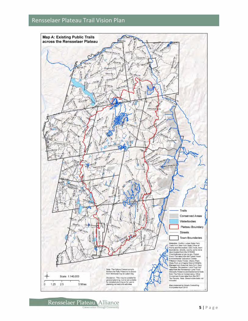
As Map A on page 5 illustrates, the Rensselaer Plateau offers a variety of recreation opportunities including fishing, hiking, birding, snow shoeing, mountain biking and cycling, auto touring, horseback riding, cross‐country skiing and snowmobiling. Many trails are open to the public, others are through private easements or recreational facilities. Most of the present trail options for hiking and mountain biking are located at public facilities such as the state forest preserves and wildlife management areas, state parks and Dyken Pond. A new opportunity for trail development is on the 350‐acre Rensselaer Plateau Community Forest in Poestenkill which is anticipated to have trails as well other programs. Below is a summary of the present public recreational opportunities:
Grafton Lakes State Park6 includes six ponds and nearly 2500 acres. Long Pond has a large, sandy beach, which is a popular summer attraction. All ponds have fishing access, launch facilities for canoes, sailboats and rowboats, electrics boat are allowed. There are also picnicking facilities and 25 miles of trails including nature trails, hiking, biking and equestrian. In winter, the trails are groomed for snowmobilers, and visitors may also snowshoe, cross‐country ski, ice skate or ice fish when conditions permit.
6 NYS Office of Parks, Recreation and Historic Preservation website: http://www.nysparks.com/parks/53/details.aspx
4 | P a g e
Rensselaer Plateau Trail Vision Plan
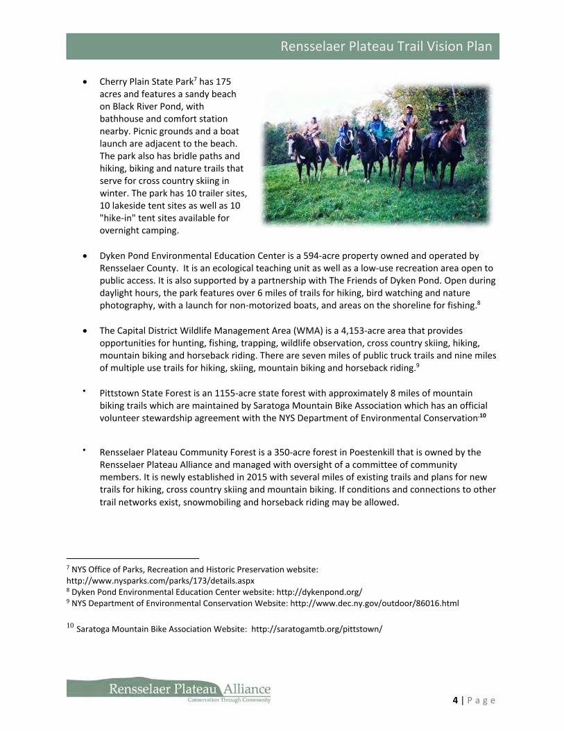
Cherry Plain State Park7 has 175 acres and features a sandy beach on Black River Pond, with bathhouse and comfort station nearby. Picnic grounds and a boat launch are adjacent to the beach. The park also has bridle paths and hiking, biking and nature trails that serve for cross country skiing in winter. The park has 10 trailer sites, 10 lakeside tent sites as well as 10 "hike‐in" tent sites available for overnight camping.
Dyken Pond Environmental Education Center is a 594‐acre property owned and operated by Rensselaer County. It is an ecological teaching unit as well as a low‐use recreation area open to public access. It is also supported by a partnership with The Friends of Dyken Pond. Open during daylight hours, the park features over 6 miles of trails for hiking, bird watching and nature photography, with a launch for non‐motorized boats, and areas on the shoreline for fishing.8
The Capital District Wildlife Management Area (WMA) is a 4,153‐acre area that provides opportunities for hunting, fishing, trapping, wildlife observation, cross country skiing, hiking, mountain biking and horseback riding. There are seven miles of public truck trails and nine miles of multiple use trails for hiking, skiing, mountain biking and horseback riding.9
Pittstown State Forest is an 1155‐acre state forest with approximately 8 miles of mountain biking trails which are maintained by Saratoga Mountain Bike Association which has an official volunteer stewardship agreement with the NYS Department of Environmental Conservation.10
Rensselaer Plateau Community Forest is a 350‐acre forest in Poestenkill that is owned by the Rensselaer Plateau Alliance and managed with oversight of a committee of community members. It is newly established in 2015 with several miles of existing trails and plans for new trails for hiking, cross country skiing and mountain biking. If conditions and connections to other
trail networks exist, snowmobiling and horseback riding may be allowed.
7 NYS Office of Parks, Recreation and Historic Preservation website: http://www.nysparks.com/parks/173/details.aspx 8 Dyken Pond Environmental Education Center website: http://dykenpond.org/ 9 NYS Department of Environmental Conservation Website: http://www.dec.ny.gov/outdoor/86016.html
10 Saratoga Mountain Bike Association Website: http://saratogamtb.org/pittstown/
5 | P a g e
Rensselaer Plateau Trail Vision Plan
6 | P a g e
Rensselaer Plateau Trail Vision Plan
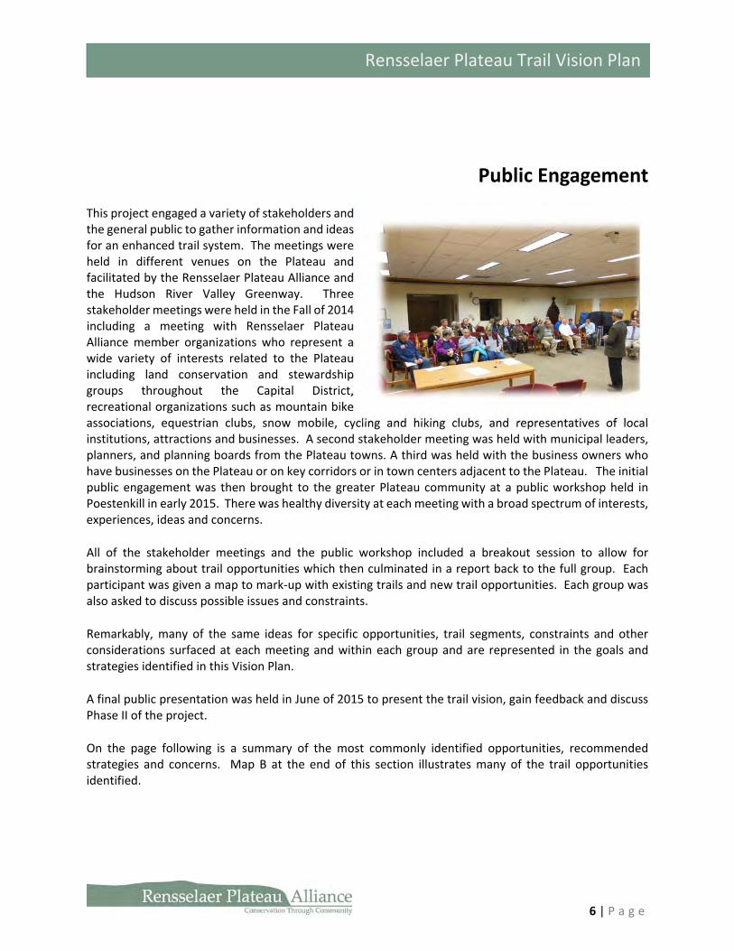
Public Engagement
This project engaged a variety of stakeholders and the general public to gather information and ideas for an enhanced trail system. The meetings were held in different venues on the Plateau and facilitated by the Rensselaer Plateau Alliance and the Hudson River Valley Greenway. Three stakeholder meetings were held in the Fall of 2014 including a meeting with Rensselaer Plateau Alliance member organizations who represent a wide variety of interests related to the Plateau including land conservation and stewardship groups throughout the Capital District, recreational organizations such as mountain bike associations, equestrian clubs, snow mobile, cycling and hiking clubs, and representatives of local institutions, attractions and businesses. A second stakeholder meeting was held with municipal leaders, planners, and planning boards from the Plateau towns. A third was held with the business owners who have businesses on the Plateau or on key corridors or in town centers adjacent to the Plateau. The initial public engagement was then brought to the greater Plateau community at a public workshop held in Poestenkill in early 2015. There was healthy diversity at each meeting with a broad spectrum of interests, experiences, ideas and concerns.
All of the stakeholder meetings and the public workshop included a breakout session to allow for brainstorming about trail opportunities which then culminated in a report back to the full group. Each participant was given a map to mark‐up with existing trails and new trail opportunities. Each group was also asked to discuss possible issues and constraints.
Remarkably, many of the same ideas for specific opportunities, trail segments, constraints and other considerations surfaced at each meeting and within each group and are represented in the goals and strategies identified in this Vision Plan.
A final public presentation was held in June of 2015 to present the trail vision, gain feedback and discuss Phase II of the project.
On the page following is a summary of the most commonly identified opportunities, recommended strategies and concerns. Map B at the end of this section illustrates many of the trail opportunities identified.

7 | P a g e
Rensselaer Plateau Trail Vision Plan
General Priority Trail Ideas
Connect trails to town economic centers and population centers to increase business and provide goods and services to visitors.
Connect existing clusters of recreational amenities utilizing loops wherever possible.
Develop trails, including multi‐use trails and single use trails, responsive to a wide variety of users.
Consider trails that alternate users with seasons (Ex: snowmobiling and equestrian)
Provide trails for all ages and abilities.
Utilize existing assets such as scenic views, cultural and historic assets and natural hikes to augment trail experiences.
Utilization of existing infrastructure easements, rail beds and utility corridors.
Old logging roads are easily converted to trails.
Utilization of rural roads, paper streets, gravel roads, stage coach roads.
Use snowmobile club licensing agreements as a model for other trails.
Specific Trail Opportunities
Connect Grafton Lakes State Park with Pittstown and Tibbetts State Forests
Connect Grafton Lakes State Park with Dyken Pond and Cherry Plain State Park
Connect the Community Forest to Dyken Pond
Connect the Plateau to the Taconic Crest Trail System ‐ a northern connection through Petersburgh and a southern connection in Berlin/Cherry Plain.
Plan for connections to the planned Corkscrew Rail Trail in Stephentown.
Utilize the Poestenkill Creek and Wynantskill Creek to create a trail that someday connects to the Hudson River and residents of Troy and Rensselaer.
Utilization of the Old Albany‐Bath Road
Connect the Plateau to Bear’s Head and Sand Lake hamlets
Issues and Constraints
Trail maintenance (overgrowth, garbage etc.)
Volunteer fatigue – trail maintenance and development
User conflicts/incompatible users and the ability to management this issue.
Maintaining non‐permanent easements, licensing agreements – trail segments can disappear when properties change hands
Visitors/users straying onto private property not part of trails.
Difficult to incentivize easements
Liability concerns – real and/or perceived
Safety – trails span a large geographic area, some areas very remote

8 | P a g e
Rensselaer Plateau Trail Vision Plan

9 | P a g e
Rensselaer Plateau Trail Vision Plan
Vision, Goals and Potential Strategies
River to Ridge
The Rensselaer Plateau will have a diverse trail system that allows its communities and visitors to
experience the Plateau in new and diverse ways. The trail system will provide a wide range of year round
recreational opportunities, for all ages and abilities connecting people to its unique natural, scenic,
historic and community resources in an environmentally responsible manner. It will benefit the region’s
local economy by attracting visitors and new residents. This trail system will unite the historic river towns
of the Hudson River with the communities on the Plateau and will link across the valley of the Hoosic
Rivers to the Taconic Ridge.
Goal 1: Provide opportunities for a wide variety of uses year round, for all ages and abilities ‐ from
snowmobiles and auto touring routes to cross‐country ski trails, bike paths and equestrian
facilities.
The Plateau trail system will have a wide variety of on and off‐road trails covering a wide range
of recreational activities including walking, hiking, mountain biking, equestrian, cycling,
paddling, snowmobiling, cross‐country skiing and auto touring. Trails will be available for all
ages and abilities including trails that are handicap accessible, ideal for learning or light activity,
appeal to hard‐core adventurists and everything in between.
Potential Strategies and Resources
Create hiking trails for all ability levels including short hikes to destination points and day
long back country treks that may include overnight campsite opportunities.
Identify a location for a formalized mountain biking trail network.
Work with local cycling groups to identify and map quality cycling routes on the Plateau that
consider safety, general road conditions (including available shoulder, traffic), difficulty
(elevation changes) and scenic attributes.
Identify opportunities for multi‐use trails including seasonal user changes such as snow
mobile and equestrian.
Work with local equestrian organizations to identify opportunities for expanding existing
networks.
Identify shorter segment nature hikes along longer trails to engage walkers and hikers in the
local ecology and environment.

10 | P a g e
Rensselaer Plateau Trail Vision Plan

11 | P a g e
Rensselaer Plateau Trail Vision Plan
Goal 2: Collaborate with property owners, communities and other partners to ensure proper
stewardship related to maintenance, public access, safety and sustainability.
As so much of the Plateau is privately owned property,
partnerships with property owners for trail easements
will be critical to the success of this vision and respect
for property will be essential. Maintenance and
management of trails can be a daunting task if not
properly planned and analyzed for not just feasibility
but sustainability. Collaboration with local communities
on projects and building off of existing recreational and
environmental resource operators are obvious
opportunities for creating efficiencies and economies of
scale. Priority should be given to developing trails that
are most feasible in terms of land ownership and cost;
are appropriate for different user groups; create
important connections to other trails, assets and
destinations on and off the Plateau; and connect to
town centers.
Potential Strategies and Resources
Establish criteria for prioritizing trail development.
Create a trail easement program for private property owners that might include renewable
easements or opting out mechanisms.
Set up a mechanism to indemnify property owners who make their land available to the
public.
Establish a trail maintenance program that collaborates with different recreational
organizations and establish a group of volunteers for different geographic parts of the
Plateau to avoid volunteer fatigue.
Develop low‐profile, attractive trailhead/recreational signage in key locations including
along transportation corridors, and in town centers.
Work with the region’s police, emergency medical services and fire departments as
recreational assets become more established to ensure that they are aware of all trail
locations and to provide emergency contact information for trail users.
12 | P a g e
Rensselaer Plateau Trail Vision Plan
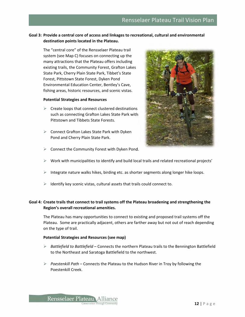
Goal 3: Provide a central core of access and linkages to recreational, cultural and environmental
destination points located in the Plateau.
The “central core” of the Rensselaer Plateau trail
system (see Map C) focuses on connecting up the
many attractions that the Plateau offers including
existing trails, the Community Forest, Grafton Lakes
State Park, Cherry Plain State Park, Tibbet’s State
Forest, Pittstown State Forest, Dyken Pond
Environmental Education Center, Bentley’s Cave,
fishing areas, historic resources, and scenic vistas.
Potential Strategies and Resources
Create loops that connect clustered destinations
such as connecting Grafton Lakes State Park with
Pittstown and Tibbets State Forests.
Connect Grafton Lakes State Park with Dyken
Pond and Cherry Plain State Park.
Connect the Community Forest with Dyken Pond.
Work with municipalities to identify and build local trails and related recreational projects’
Integrate nature walks hikes, birding etc. as shorter segments along longer hike loops.
Identify key scenic vistas, cultural assets that trails could connect to.
Goal 4: Create trails that connect to trail systems off the Plateau broadening and strengthening the
Region’s overall recreational amenities.
The Plateau has many opportunities to connect to existing and proposed trail systems off the
Plateau. Some are practically adjacent, others are farther away but not out of reach depending
on the type of trail.
Potential Strategies and Resources (see map)
Battlefield to Battlefield – Connects the northern Plateau trails to the Bennington Battlefield
to the Northeast and Saratoga Battlefield to the northwest.
Poestenkill Path – Connects the Plateau to the Hudson River in Troy by following the
Poestenkill Creek.
13 | P a g e
Rensselaer Plateau Trail Vision Plan
Wynantskill Wanderer – Connects the Plateau to Town of Sand Lake and on to the City of
Rensselaer and the Hudson River.
Core to Crest – Connects that Plateau to the existing Taconic Crest Trail System in the south
from Cherry Plain State Park, through Berlin over Maddison Hollow
Plateau to Pittsfield – Connects the Plateau to the trail system at Pittsfield State Forest
Core to Chatham – Connects the Plateau to the Nassau trail, and the future Harlem Rail Trail
which is proposed to reach Chatham.
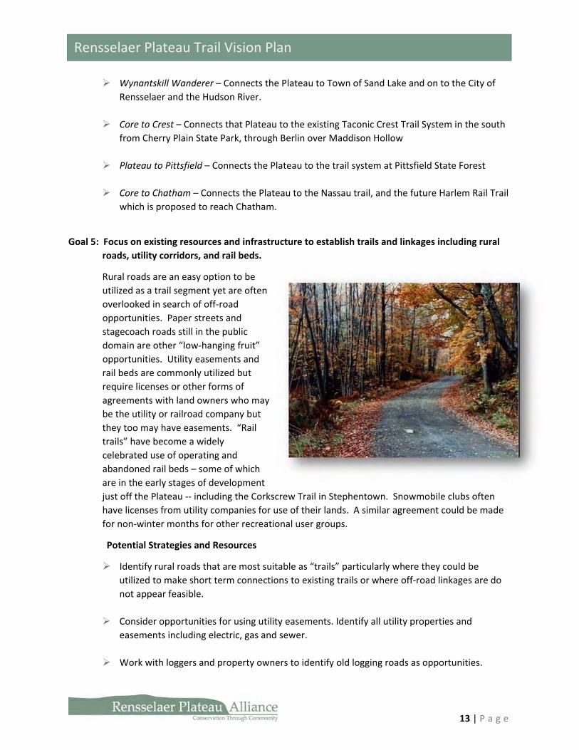
Goal 5: Focus on existing resources and infrastructure to establish trails and linkages including rural
roads, utility corridors, and rail beds.
Rural roads are an easy option to be
utilized as a trail segment yet are often
overlooked in search of off‐road
opportunities. Paper streets and
stagecoach roads still in the public
domain are other “low‐hanging fruit”
opportunities. Utility easements and
rail beds are commonly utilized but
require licenses or other forms of
agreements with land owners who may
be the utility or railroad company but
they too may have easements. “Rail
trails” have become a widely
celebrated use of operating and
abandoned rail beds – some of which
are in the early stages of development
just off the Plateau ‐‐ including the Corkscrew Trail in Stephentown. Snowmobile clubs often
have licenses from utility companies for use of their lands. A similar agreement could be made
for non‐winter months for other recreational user groups.
Potential Strategies and Resources
Identify rural roads that are most suitable as “trails” particularly where they could be
utilized to make short term connections to existing trails or where off‐road linkages are do
not appear feasible.
Consider opportunities for using utility easements. Identify all utility properties and
easements including electric, gas and sewer.
Work with loggers and property owners to identify old logging roads as opportunities.
14 | P a g e
Rensselaer Plateau Trail Vision Plan
Map all paper streets, gravel roads and old stage coach roads as information is available.
Goal 6: Strengthen local economies by strategically designing a system that connects town centers
with trails and work with local businesses and community leaders to identify amenities, goods
and services marketable to trail users.
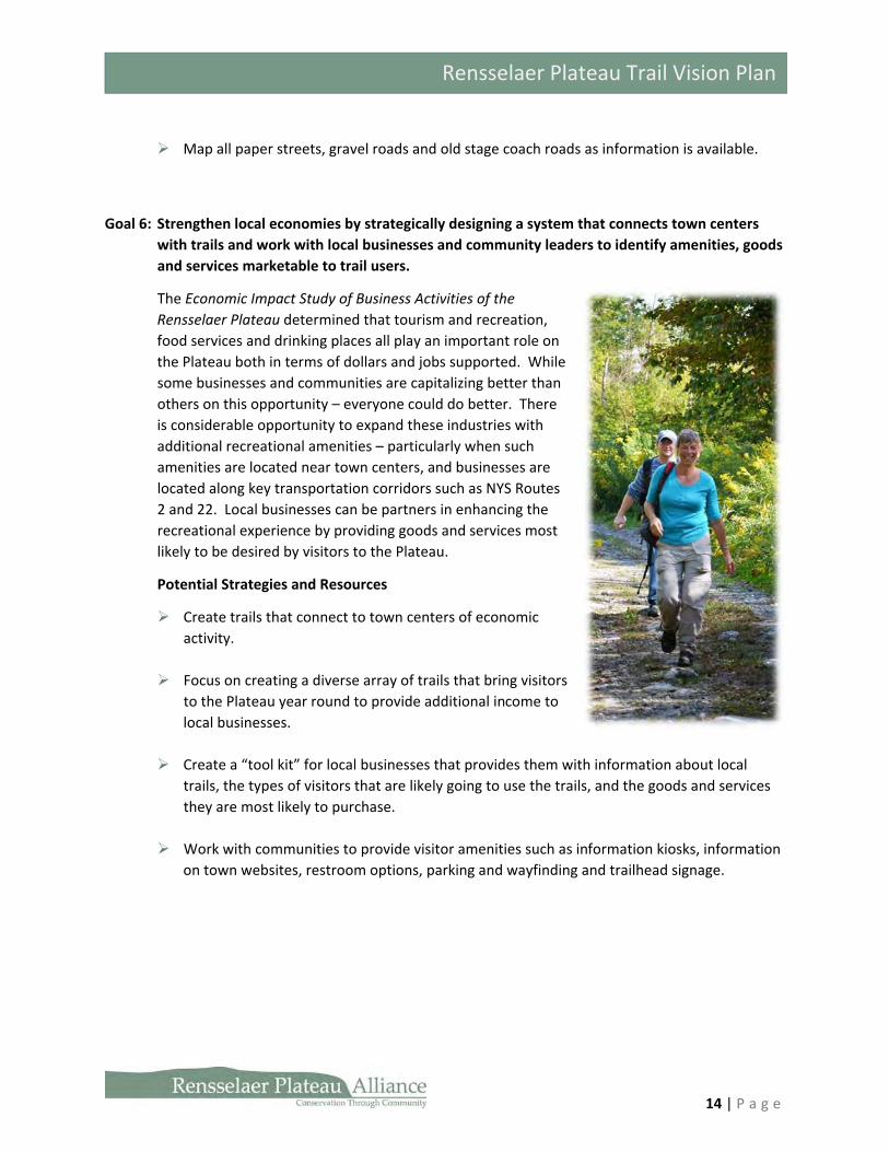
The Economic Impact Study of Business Activities of the
Rensselaer Plateau determined that tourism and recreation,
food services and drinking places all play an important role on
the Plateau both in terms of dollars and jobs supported. While
some businesses and communities are capitalizing better than
others on this opportunity – everyone could do better. There
is considerable opportunity to expand these industries with
additional recreational amenities – particularly when such
amenities are located near town centers, and businesses are
located along key transportation corridors such as NYS Routes
2 and 22. Local businesses can be partners in enhancing the
recreational experience by providing goods and services most
likely to be desired by visitors to the Plateau.
Potential Strategies and Resources
Create trails that connect to town centers of economic
activity.
Focus on creating a diverse array of trails that bring visitors
to the Plateau year round to provide additional income to
local businesses.
Create a “tool kit” for local businesses that provides them with information about local
trails, the types of visitors that are likely going to use the trails, and the goods and services
they are most likely to purchase.
Work with communities to provide visitor amenities such as information kiosks, information
on town websites, restroom options, parking and wayfinding and trailhead signage.
15 | P a g e
Rensselaer Plateau Trail Vision Plan
Conclusion
Making Connections—Creating Experiences
Social scientists and economists are increasingly recognizing that investing in experiences yields a
greater long‐term personal benefit than say purchasing a desirable (but not necessary) consumer good.
In terms of choosing among the options of outdoor recreation activities, the prospect of planning and
heading out onto a trail opens one’s imagination to a wide range of enjoyable trail‐based activities—all
seasons, many modes of travel, a myriad of settings. Each phase of this trail‐based recreation experience
creates long‐lasting memories and value for the individuals involved‐‐the planning and anticipation
phase, the experience out on the trail itself, and the reflection phase—which can be enjoyed many years
later.
The Rensselaer Plateau offers a unique setting for a wide range of trail experiences connecting travelers
to nature, history and the slower pace of life in the small towns and rural landscapes of the region.
Whether on a scenic ride on the highways and town roads across the flanks of the plateau where one
can enjoy vistas of working farms, forests and peaceful hamlet centers or rolling with a group of
mountain bike riders along a small stream on an abandoned gravel road deep in the center of the
plateau’s forest, or gliding along the soft winter snow on a pair of cross‐country skis —there are
countless trail experiences to be enjoyed travelling around the plateau.
In rating a recreation experience, people typically base that evaluation upon their expectation—and
how well it was met. Organizing the effort toward making these collective trail experiences better is a
key objective of this vison plan. And so, some of the most cost‐effective, early investments in the
enhancement of the trail system which will be identified in the more detailed phase II of the plan will
focus on assembling and sharing the best information about the resources that exist and can be
immediately accessed. For example, identifying a scenic on‐the‐road bike and driving route that can
create some of the initial corridors of the “River to Ridge” trail including mapping, signage and
promotion of this trail route. Over time, such routes can be supplemented with improved connections,
such as off‐the‐road shared‐use paths where one can be free to roam far from our automobiles.
The extent to which these trail experiences can be made accessible and enjoyable to a wide variety of
users will increasingly make the Rensselaer Plateau a trail‐lovers destination. Benefits of that outcome
for residents and property owners include increased local business activity and improved property
values and quality of life as the enhanced trail system provides an important economic amenity value.
In the city, being able to step outside one’s door and walk to a nice restaurant or attractive park creates
an important part of the value of one’s home and property. On the Plateau, the ability to step outside
one’s door and go anywhere on a trail is a refreshing thought—whether by bike, ski or snowshoe,
horseback or snowmobile or just taking a hike. Time to hit the trail.

16 | P a g e
Rensselaer Plateau Trail Vision Plan
Bibliography
Dyken Pond Environmental Education Center, Website: http://dykenpond.org/ NYS Department of Environmental Conservation Website: http://www.dec.ny.gov/outdoor/86016.html NYS Office of Parks, Recreation and Historic Preservation Website:
http://www.nysparks.com/parks/173/details.aspx and http://www.nysparks.com/parks/53/details.aspx Rensselaer Plateau Alliance website: www.rensselaerplateau.org. Rensselaer Plateau Alliance with assistance from Behan Planning Associates, Rensselaer Plateau Regional
Conservation Plan (2013)
Saratoga Mountain Bike Association Website: http://saratogamtb.org/pittstown/
Zweig, Brian Economic Impact Study of Business Activities of the Rensselaer Plateau (May 2012) p. 3.