Regional Geographies Agricultural Spaces and Places Across America Martha L. Henderson, Ph.D. April...
47
Regional Geographies Agricultural Spaces and Places Across America Martha L. Henderson, Ph.D. April 14, 2005
-
date post
21-Dec-2015 -
Category
Documents
-
view
216 -
download
0
Transcript of Regional Geographies Agricultural Spaces and Places Across America Martha L. Henderson, Ph.D. April...

Regional Geographies
Agricultural Spaces and Places Across America
Martha L. Henderson, Ph.D.
April 14, 2005

Agricultural Patterns and Regional Identity
• Spatial relationships
• Landscapes
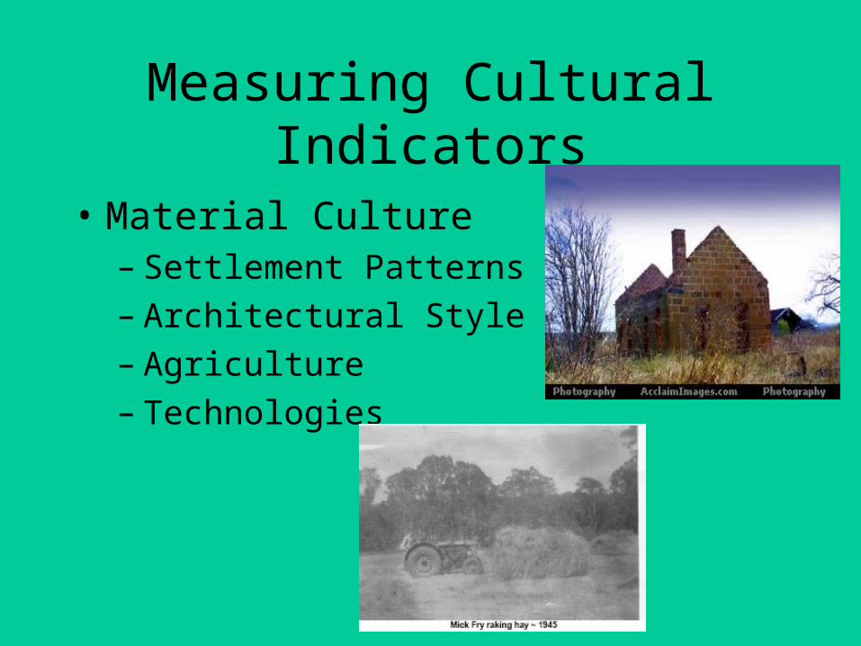
Measuring Cultural Indicators
• Material Culture– Settlement Patterns– Architectural Style and Form– Agriculture– Technologies
Measuring Cultural Indicators
• Non-material Culture– Belief Systems
– Family Identities
– Political Beliefs
– Language Patterns
Non-material culture takes on physical forms
Landscapes are the representation of the non-material

Hypothesized Cultural Regions of the U.S.
• 1. New England
• 2. New York Metropolitan
• Pennsylvania
• South (Lowland, Upland, Mtn, Western)
• Upper Midwest Pacific Southwest
• Central Midwest Pacific Northwest
• Rocky Mtn Alaskan
• Mormon Hawaiian
• Interior Southwest
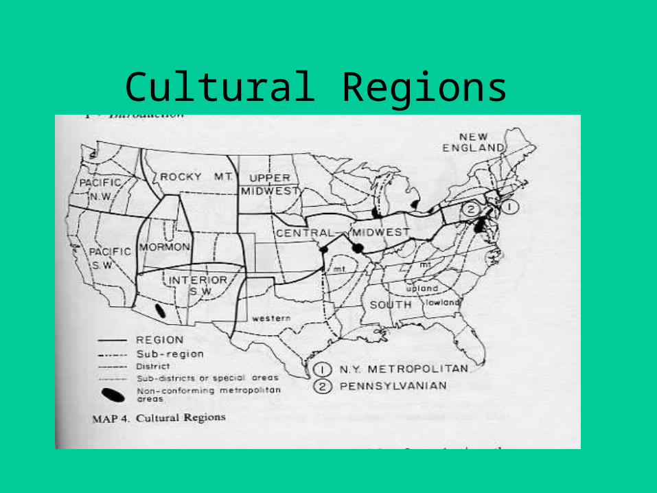
Cultural Regions
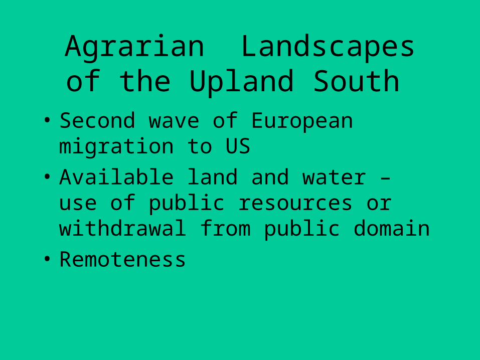
Agrarian Landscapesof the Upland South
• Second wave of European migration to US
• Available land and water – use of public resources or withdrawal from public domain
• Remoteness

Settlement Patterns
• Scattered small subsistence farms
• Few urban or regional centers
• Waterways more important than roads
• Long distances to markets

Subsistence Farms
• Vegtables: variety
• Fruit Trees: variety
• Animals: pigs, chickens, dairy cows
• Corn – only crop for export
• Hunting
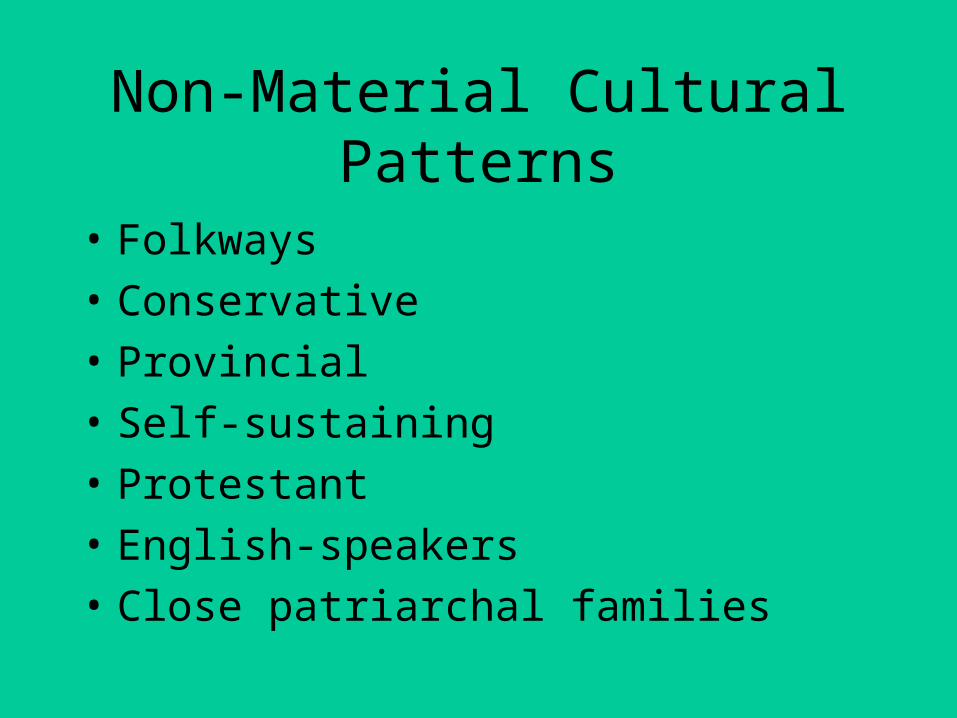
Non-Material Cultural Patterns
• Folkways
• Conservative
• Provincial
• Self-sustaining
• Protestant
• English-speakers
• Close patriarchal families

Political Culture
• Moralistic – emphasizes community, idealism, utopianism
• Individualistic – emphasizes no common interest
• Traditionalistic – assumes a fixed hierarchical society of elites and majorities

Political Affinities Map

The Pacific Northwest
• Historical migration from eastern and mid-western U.S.
• Contemporary migration from U.S. and foreign countries
• Patterns of material and non-material culture are localized and difficult to generalize for the entire region
Physical Regions
Climate Regions of the Pacific Northwest
Maritime Climates
Continental Climates

World Climate Regions
Köppen Climate Classification System• The Köppen Climate Classification System
is the most widely used for classifying the world's climates. Most classification systems used today are based on the one introduced in 1900 by the Russian-German climatologist Wladimir Köppen. Köppen divided the Earth's surface into climatic regions that generally coincided with world patterns of vegetation and soils.

•
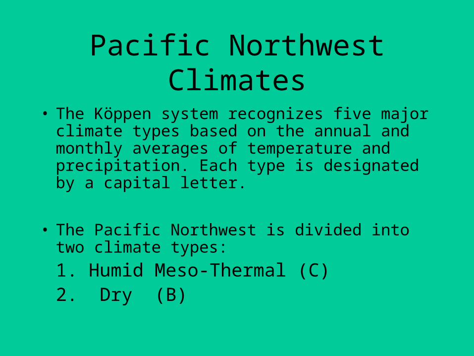
Pacific Northwest Climates
• The Köppen system recognizes five major climate types based on the annual and monthly averages of temperature and precipitation. Each type is designated by a capital letter.
• The Pacific Northwest is divided into two climate types:
1. Humid Meso-Thermal (C)2. Dry (B)
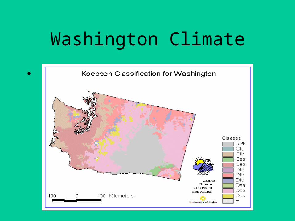
Washington Climate
•

1. Marine West Coast Climate (C)
C - In Humid Middle Latitude Climates land/water differences play a large part. These climates have warm,dry summers and cool, wet winters.‘b’ is added to indicate warm summer months.‘s’ is added to indicate dry summer months
Washington (Olympia) has a Csb climate west of the Cascades
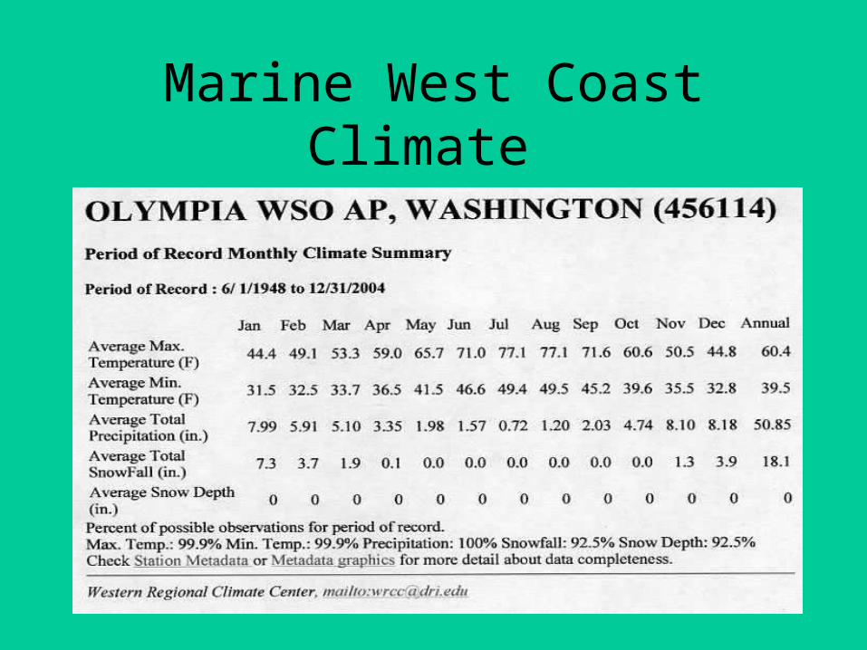
Marine West Coast Climate
2. Dry Climate (B)
B - Dry Climates are characterized by little rain and a huge daily temperature range. Two subgroups, S - semiarid or steppe, and W - arid or desert, are used with the B climates.
‘k’ is added to indicate cold and dry.
Washington and Oregon have BSk climate regions east of the Cascade Mountains
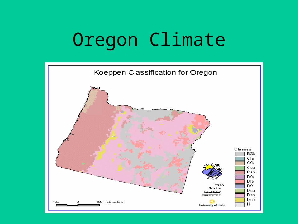
Oregon Climate

Interior Dry Climate
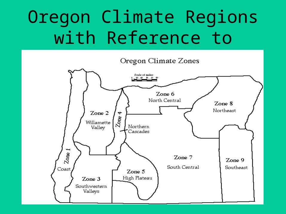
Oregon Climate Regionswith Reference to Agriculture
•
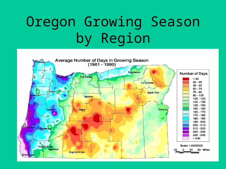
Oregon Growing Season by Region

Significant Climate Conditionsacross the PNW
• Pacific (marine) SW weather systems
• Continental (interior) weather systems
• Orographic effect over the Cascade Mountains

“Owning It All”The Problem of Western Lands
Agriculture• Arid environments• Large ‘unsettled areas’• Federal goals vs local needs• Treatied lands and associated rights• Changing international and local markets• Transportation routes – Railroads• Water rights over time• Changing technology – fencing and motors

William Kittredge
• William Kittredge grew up on the MC Ranch in southeastern Oregon, farmed until he was 35, studied in the Writers' Workshop at the University of Iowa, and became the Regents Professor of English and Creative Writing at the University of Montana until he retired in the spring of 1997. He received numerous prestigious awards including a Stegner Fellowship at Stanford, two Writing Fellowships from the National Endowment for the Arts, and two Pacific Northwest Bookseller's Awards for Excellence. He was co-producer of the movie "A River Runs Through It."
• He is also the author of Western novels of the "Cord" Series, the short story collection The Van Gogh Field, and a book of essays Owning It All. With Annick Smith, he edited The Last Best Place: A Montana Anthology.

Kittredge Geography
• High Plateau
• East Side Climate Region (BSk)
• Interior Drainage
• Fault Block Landforms
• Steppe/Grasslands
• Remote
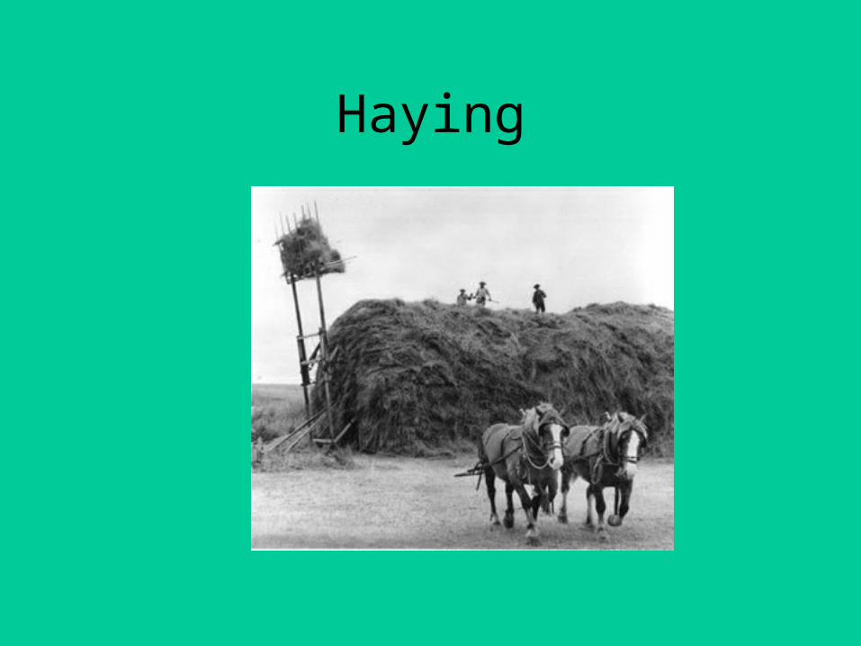
Haying

High PlateauView from Warner Peak
on Hart Mountain looking south west towards Plush
•
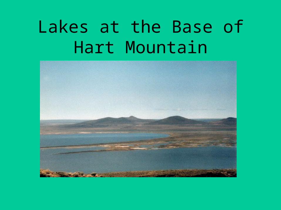
Lakes at the Base of Hart Mountain
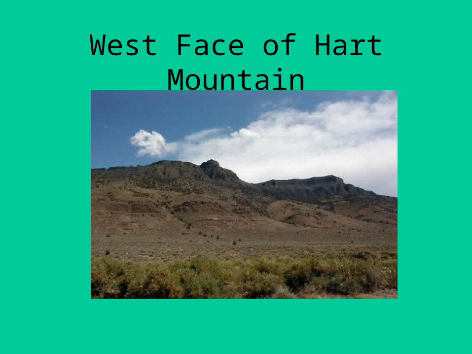
West Face of Hart Mountain

Historic Agricultural Practices in SE Oregon: A Time Line
• mid-1800s – small farming operations on homesteads with marginal success with localized drainage and irrigation systems
• 1870s – use of public domain land by large cattle operations (Miller Lux Corporation)
• 1880s-transhumance and long distance sheep grazing on public and unfenced lands: range wars
• Consolidation of lands and large scale drainage projects: fencing

Time Line (con’t)
• 1920s - abandonment of small farm operations
• Continued land consolidation and conversion to irrigation by large land owners
• 1930s – Bureau of Reclamation, US Fish and Wildlife, and CCCs as active agents
• 1970s – Conflict with other water users

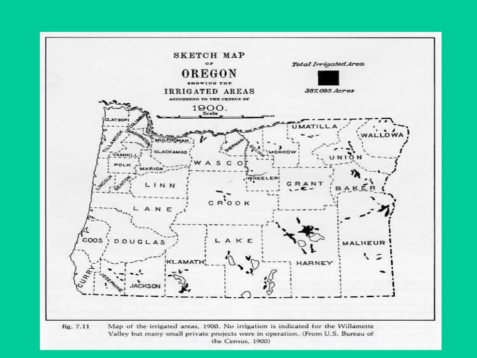
Swamp Land Act of 1860
• Allowed public to acquire surveyed and un-surveyed wetlands from public domain for the purposes of draining land for cultivation – often section by section
• Total of 60 million acres nationwide• Large scale ranchers acquired ‘swamp and overflow’
lands – used for cattle and haying
• http://www.profsurv.com/ps_scripts/article.idc?id=1239
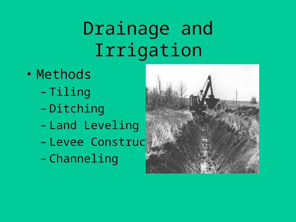
Drainage and Irrigation
• Methods– Tiling– Ditching– Land Leveling– Levee Construction– Channeling


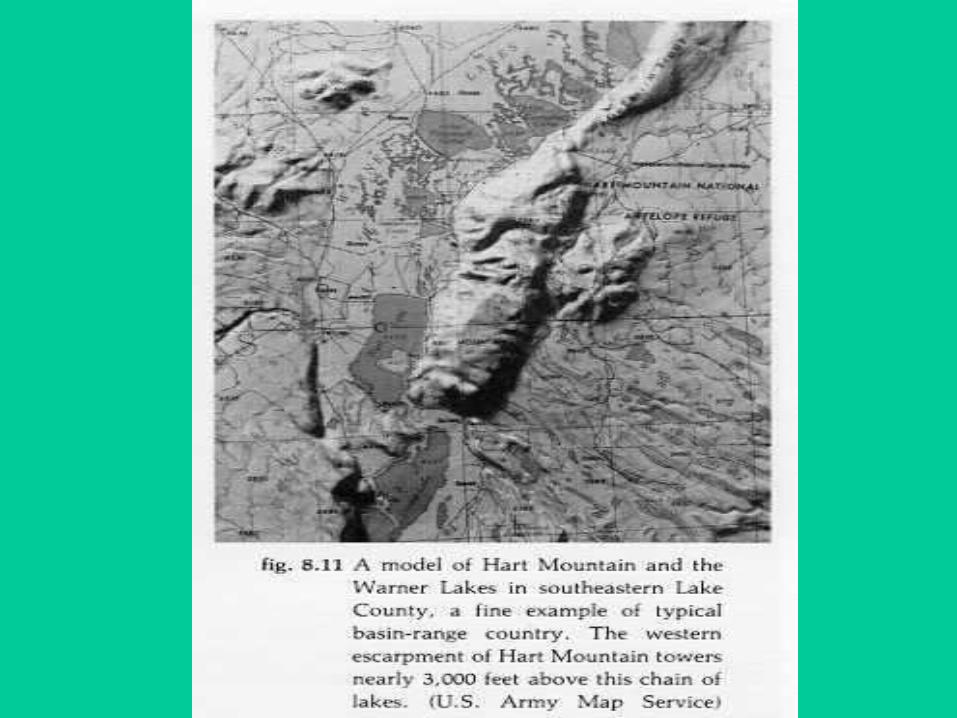
Channeled Drainage BelowHart Mountain
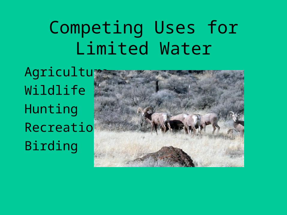
Competing Uses for Limited Water
Agriculture
Wildlife
Hunting
Recreation
Birding
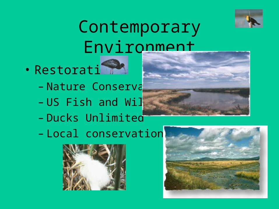
Contemporary Environment
• Restoration– Nature Conservancy– US Fish and Wildlife– Ducks Unlimited– Local conservation groups

Restoration (con’t)
• Federal Regulations– Enforcement of Endangered Species Act– Protection of habitat areas– Recognition of Treaty Rights
• State Regulations– Administration of water rights allocations– Protection of habitat areas

Sources
• Langston, Nancy. Where Land and Water Meet. Seattle: University of Washington Press, 2003.
• Vileisis, Ann. Discovering the Unknown Landscape: A History of America’s Welands. Washington, D. C.: Island Press, 1997.
• Zelinsky, Wilbur. The Cultural Geography of the United States. 2nd edition. New Jersey: Prentice Hall, 1992.