RealEarth - BOM
30
RealEarth And its use for monitoring Floods and Fires (earth) (air) (fire) (water) (time)
Transcript of RealEarth - BOM
RealEarth
And its use for monitoring Floods and Fires
(earth) (air) (fire) (water) (time)
RealEarth
Sam BatzliSpace Science & Engineering Center
And its use for monitoring Floods and Fires
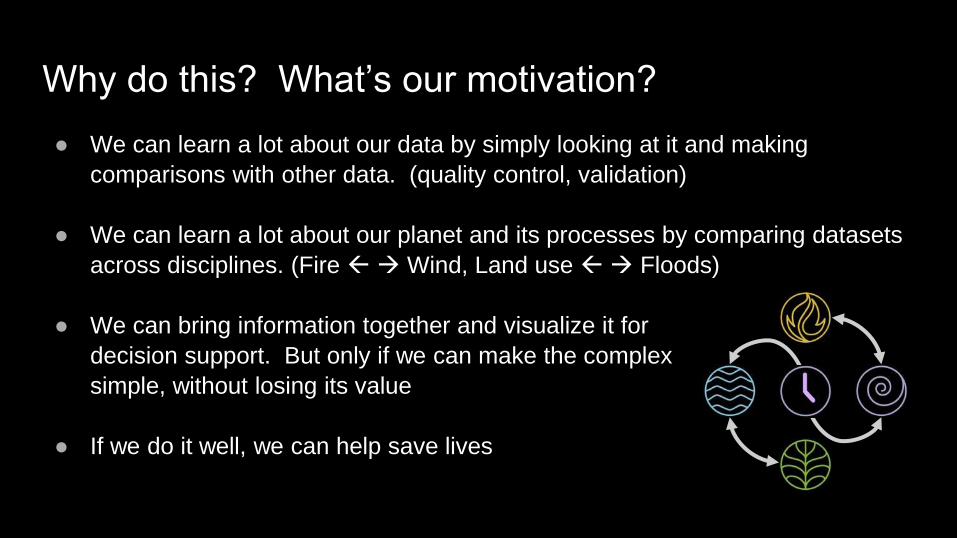
Why do this? What’s our motivation?
● We can learn a lot about our data by simply looking at it and making
comparisons with other data. (quality control, validation)
● We can learn a lot about our planet and its processes by comparing datasets
across disciplines. (Fire → Wind, Land use → Floods)
● We can bring information together and visualize it for
decision support. But only if we can make the complex
simple, without losing its value
● If we do it well, we can help save lives
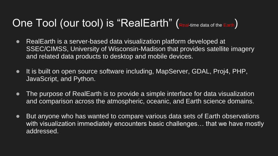
One Tool (our tool) is “RealEarth” (Real-time data of the Earth)
● RealEarth is a server-based data visualization platform developed at SSEC/CIMSS, University of Wisconsin-Madison that provides satellite imagery and related data products to desktop and mobile devices.
● It is built on open source software including, MapServer, GDAL, Proj4, PHP, JavaScript, and Python.
● The purpose of RealEarth is to provide a simple interface for data visualization and comparison across the atmospheric, oceanic, and Earth science domains.
● But anyone who has wanted to compare various data sets of Earth observations with visualization immediately encounters basic challenges… that we have mostly addressed.
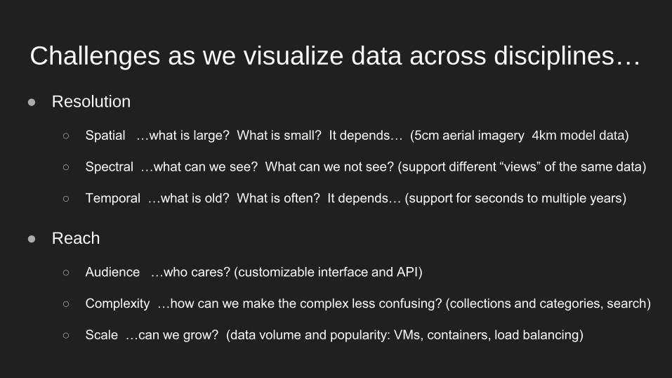
Challenges as we visualize data across disciplines…
● Resolution
○ Spatial …what is large? What is small? It depends… (5cm aerial imagery 4km model data)
○ Spectral …what can we see? What can we not see? (support different “views” of the same data)
○ Temporal …what is old? What is often? It depends… (support for seconds to multiple years)
● Reach
○ Audience …who cares? (customizable interface and API)
○ Complexity …how can we make the complex less confusing? (collections and categories, search)
○ Scale …can we grow? (data volume and popularity: VMs, containers, load balancing)
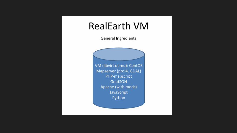
RealEarth VM
VM (libvirt qemu): CentOSMapserver (proj4, GDAL)
PHP-mapscriptGeoJSON
Apache (with mods)JavaScript
Python
General Ingredients
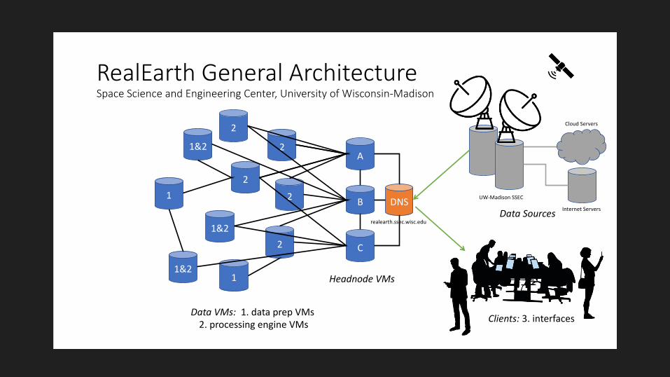
RealEarth General ArchitectureSpace Science and Engineering Center, University of Wisconsin-Madison
2
2
2
1&2
2
1
1&2
2
1&2
1
Data VMs: 1. data prep VMs 2. processing engine VMs
DNS
C
B
A
Headnode VMs
Data Sources
Clients: 3. interfaces
realearth.ssec.wisc.edu
UW-Madison SSEC
Internet Servers
Cloud Servers
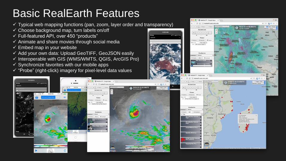
✓ Typical web mapping functions (pan, zoom, layer order and transparency)
✓ Choose background map, turn labels on/off
✓ Full-featured API, over 450 “products”
✓ Animate and share movies through social media
✓ Embed map in your website
✓ Add your own data: Upload GeoTIFF, GeoJSON easily
✓ Interoperable with GIS (WMS/WMTS, QGIS, ArcGIS Pro)
✓ Synchronize favorites with our mobile apps
✓ “Probe” (right-click) imagery for pixel-level data values
Basic RealEarth Features
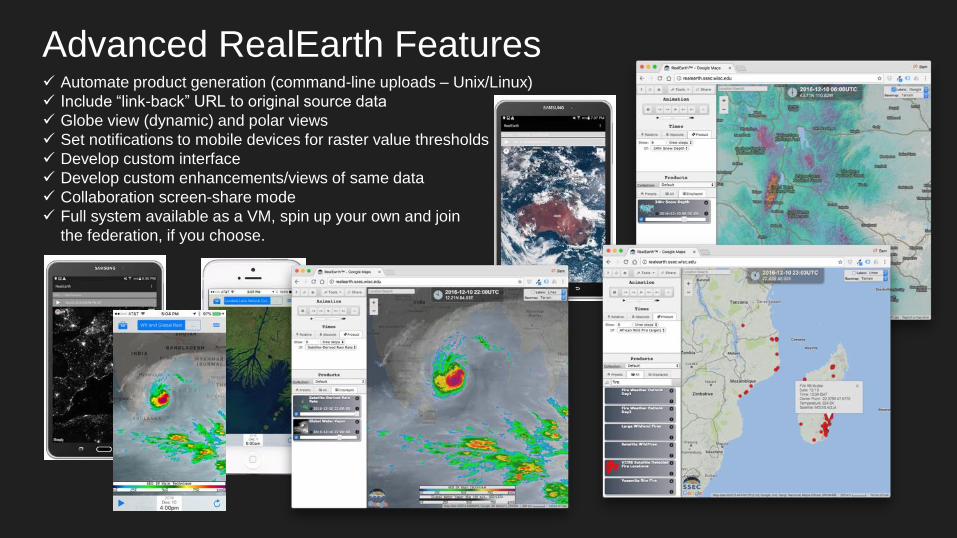
✓ Automate product generation (command-line uploads – Unix/Linux)
✓ Include “link-back” URL to original source data
✓ Globe view (dynamic) and polar views
✓ Set notifications to mobile devices for raster value thresholds
✓ Develop custom interface
✓ Develop custom enhancements/views of same data
✓ Collaboration screen-share mode
✓ Full system available as a VM, spin up your own and join
the federation, if you choose.
Advanced RealEarth Features
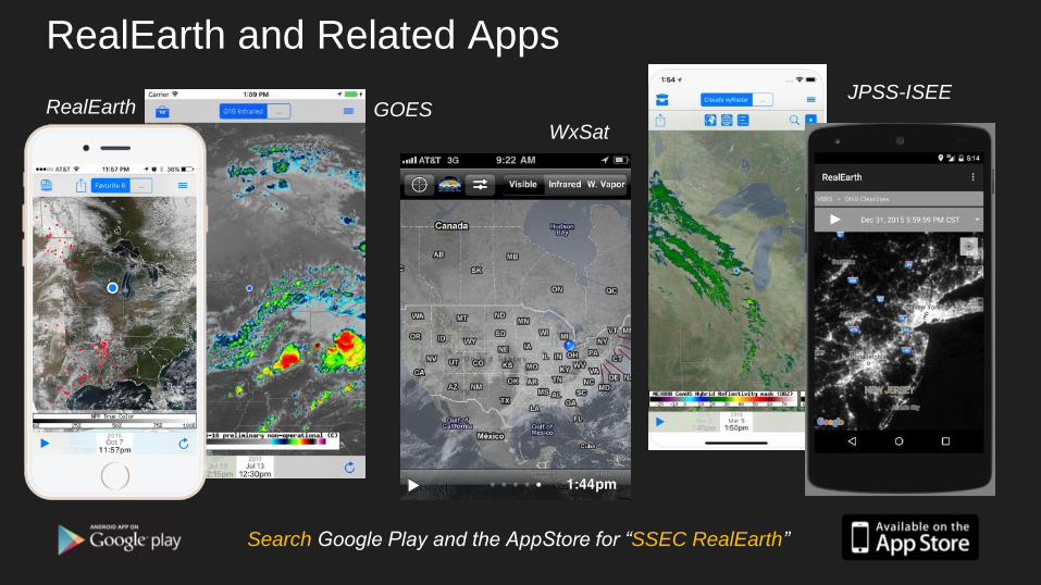
RealEarth and Related Apps
Search Google Play and the AppStore for “SSEC RealEarth”
RealEarth GOESJPSS-ISEE
WxSat
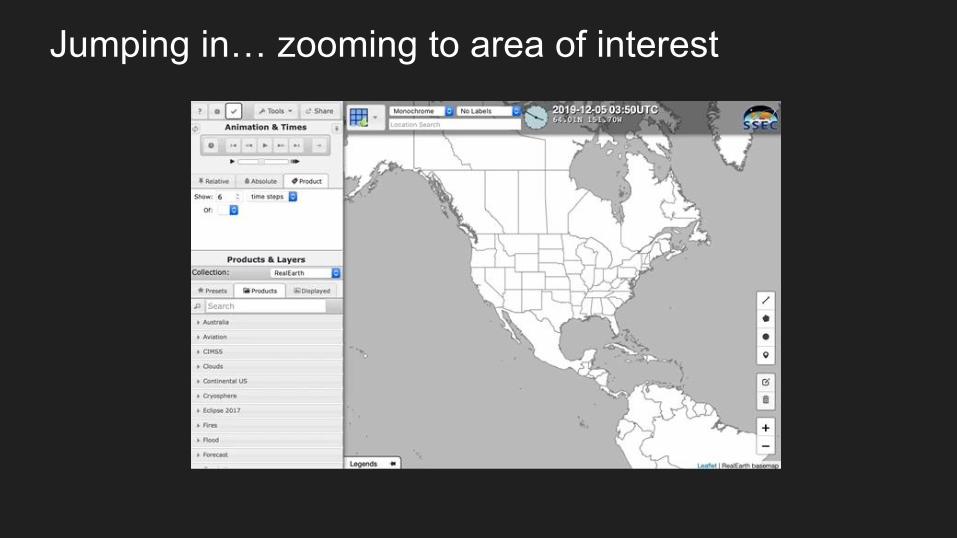
Jumping in… zooming to area of interest

Animate and Share

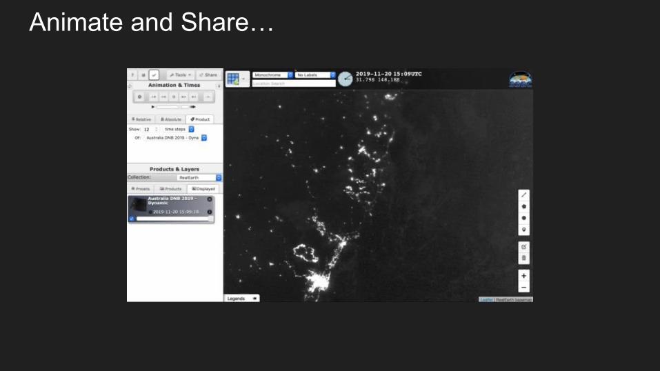
Animate and Share…
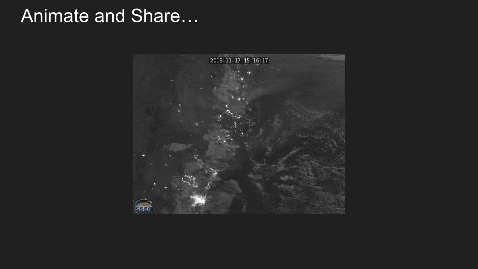
Animate and Share…
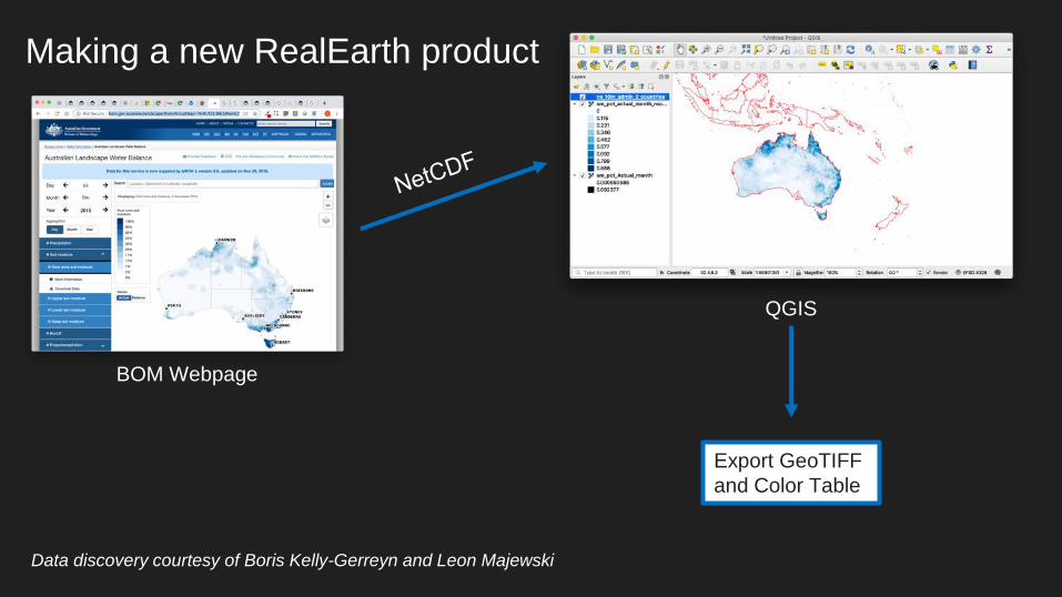
Making a new RealEarth product
BOM Webpage
QGIS
Export GeoTIFF
and Color Table
Data discovery courtesy of Boris Kelly-Gerreyn and Leon Majewski
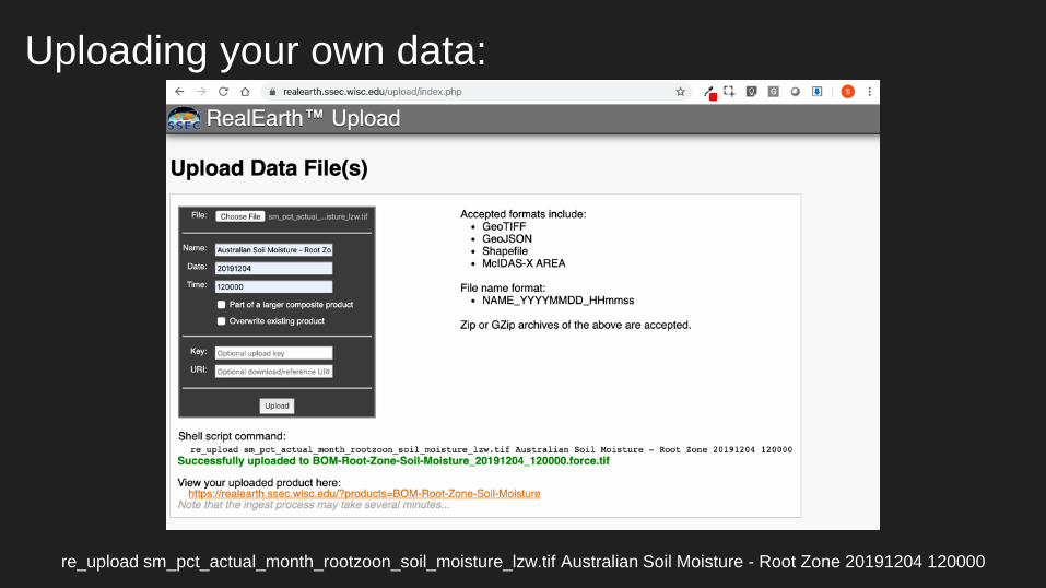
Uploading your own data:
re_upload sm_pct_actual_month_rootzoon_soil_moisture_lzw.tif Australian Soil Moisture - Root Zone 20191204 120000
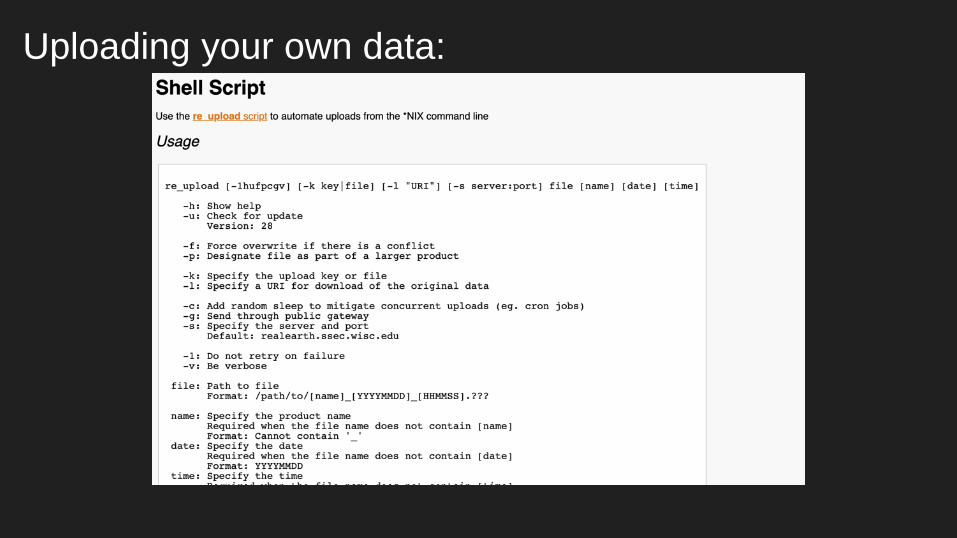
Uploading your own data:
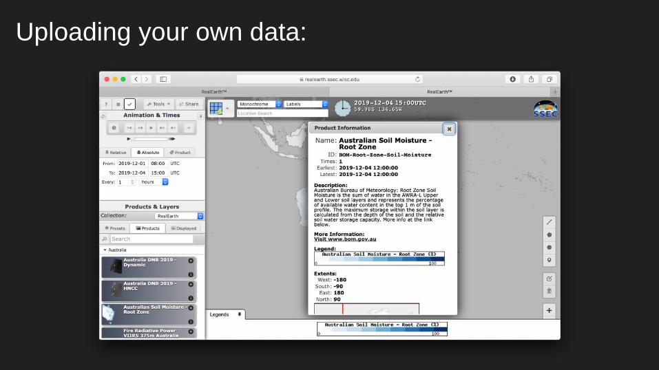
Uploading your own data:
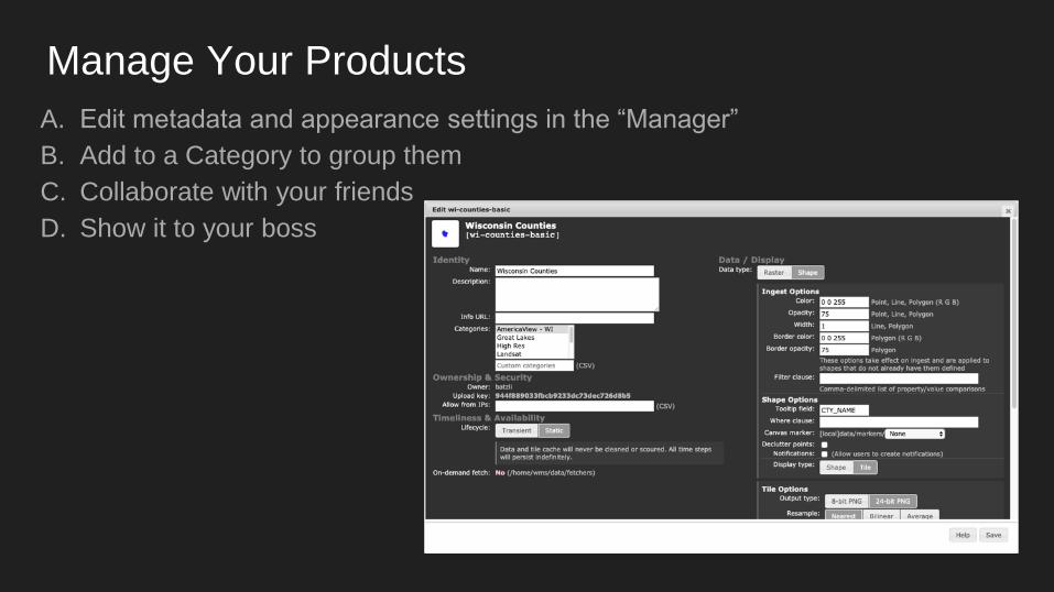
Manage Your Products
A. Edit metadata and appearance settings in the “Manager”
B. Add to a Category to group them
C. Collaborate with your friends
D. Show it to your boss
Decision Support from Satellite-Derived Info
● The Right Information at the Right Time in the Right Context
○ Deriving useful info from satellites and visualizing it
○ Monitoring: supporting near real-time
○ Interoperable: web services published in useful formats
● Intuitive Access and Controls
○ Familiar icons, safe colors, button-shapes, drop-downs, limiting choices and options
○ Customize interface, modular inclusion of interface elements, locatable URI/URL
○ Stream into the existing workflow of others (WMTS, WMS)
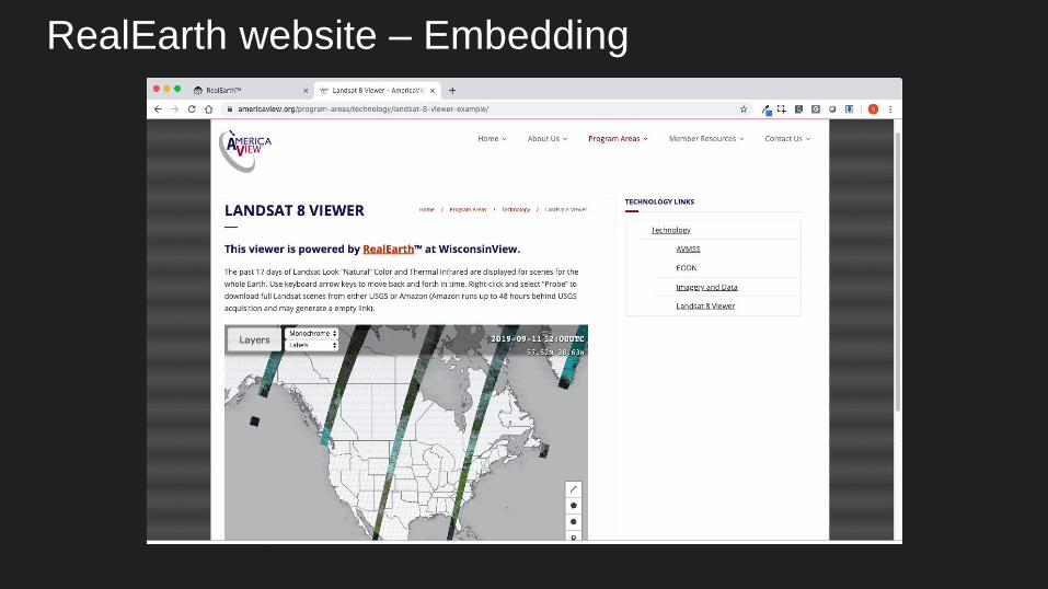
RealEarth website – Embedding
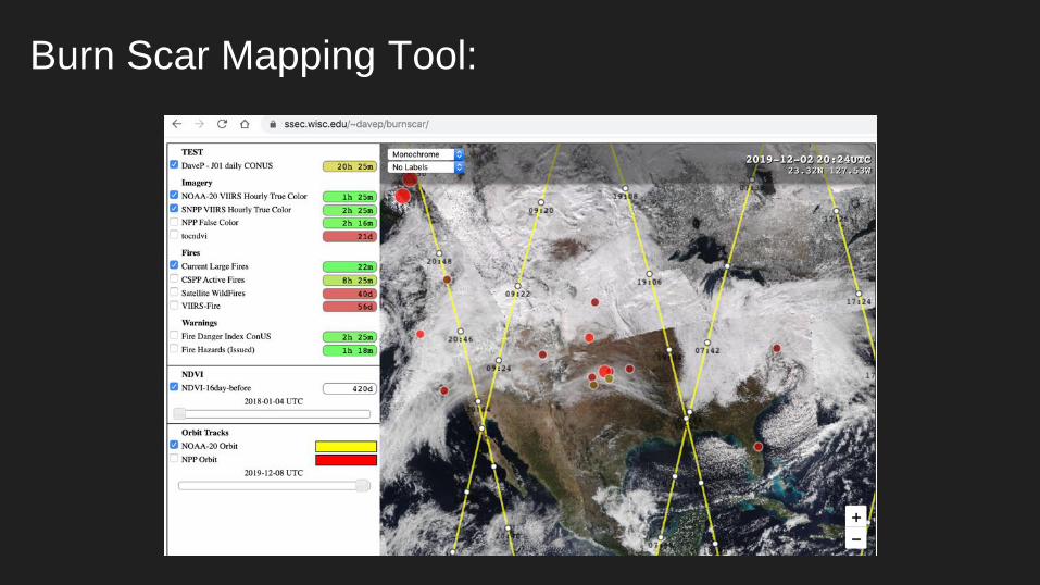
Burn Scar Mapping Tool:
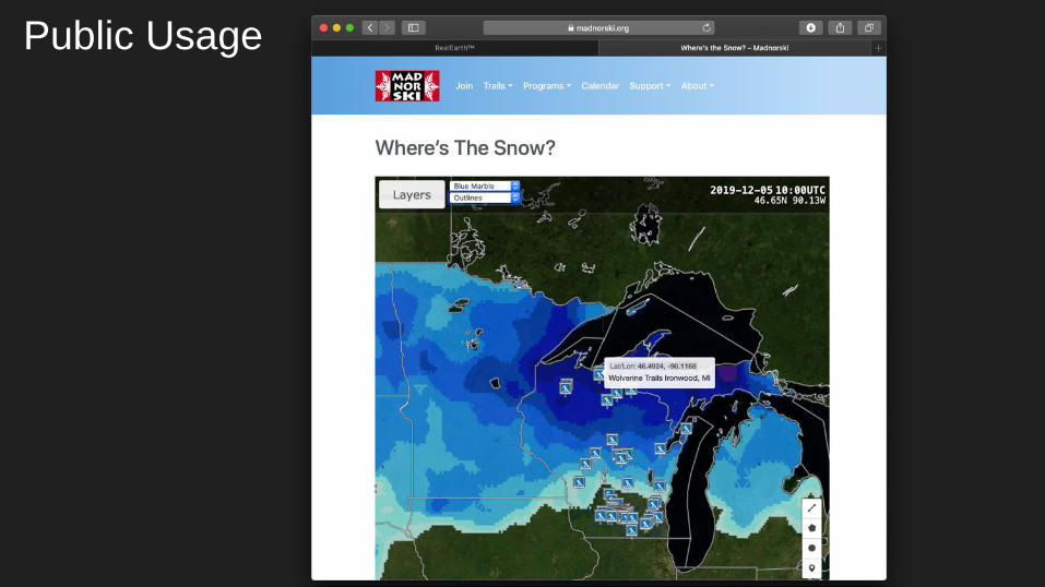
Public Usage
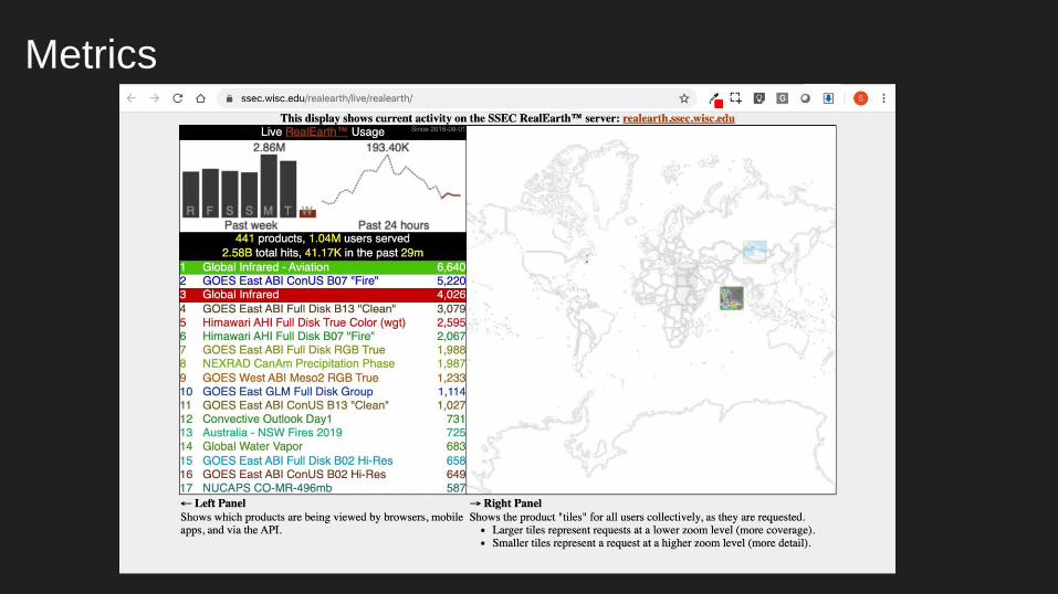
Metrics
Many people to thank…
Allen Huang
Mitch Goldberg
Steve Goodman
Liam Gumley
Jerry Robaidek
Kathy Strabala
Developers: Dave Parker, Nick Bearson, Russ Dengel, Tommy Jasmin
Researchers: who furnish data (Ivan Csiszar, Bob Carp, Andy Heidinger,
Jeff Key, William Straka, Tony Wimmers, and dozens more…
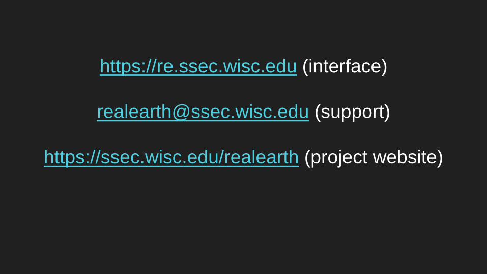
https://re.ssec.wisc.edu (interface)
[email protected] (support)
https://ssec.wisc.edu/realearth (project website)
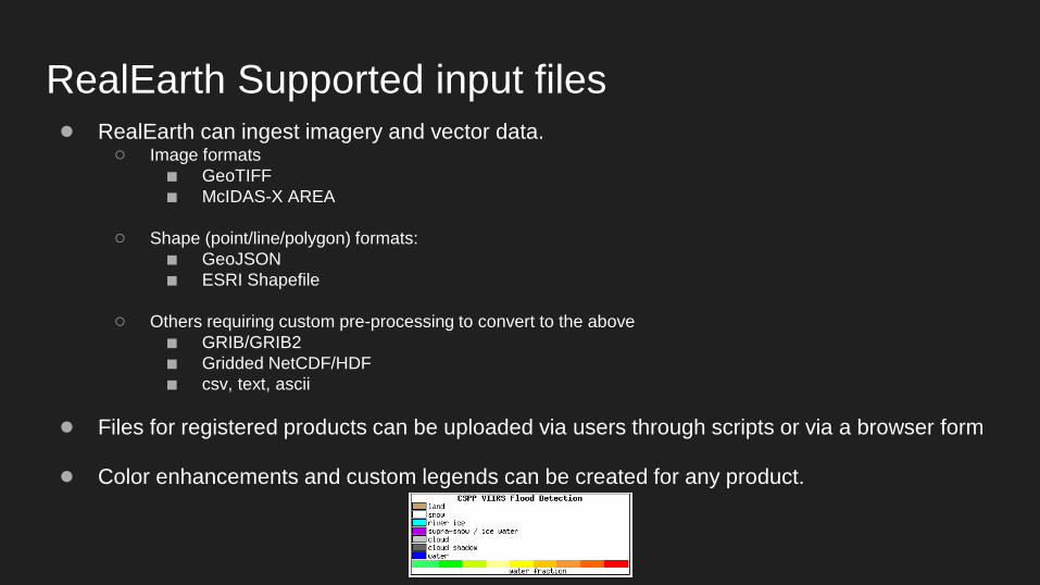
RealEarth Supported input files● RealEarth can ingest imagery and vector data.
○ Image formats
■ GeoTIFF
■ McIDAS-X AREA
○ Shape (point/line/polygon) formats:
■ GeoJSON
■ ESRI Shapefile
○ Others requiring custom pre-processing to convert to the above
■ GRIB/GRIB2
■ Gridded NetCDF/HDF
■ csv, text, ascii
● Files for registered products can be uploaded via users through scripts or via a browser form
● Color enhancements and custom legends can be created for any product.
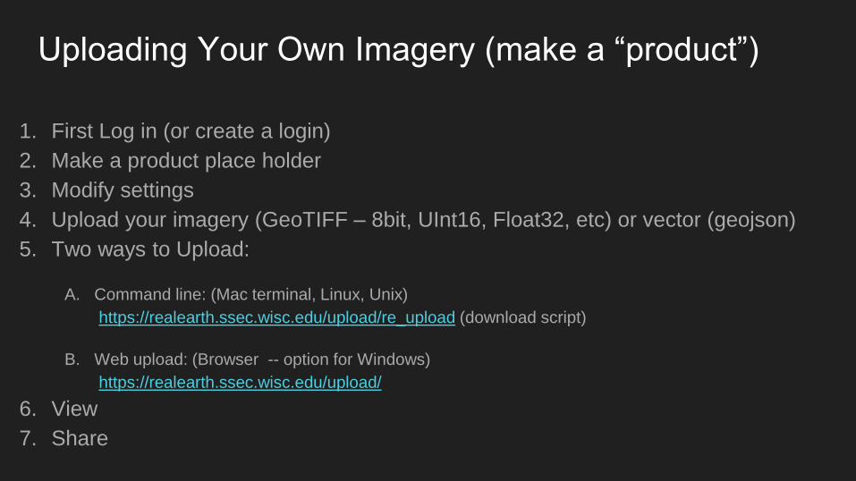
Uploading Your Own Imagery (make a “product”)
1. First Log in (or create a login)
2. Make a product place holder
3. Modify settings
4. Upload your imagery (GeoTIFF – 8bit, UInt16, Float32, etc) or vector (geojson)
5. Two ways to Upload:
A. Command line: (Mac terminal, Linux, Unix)
https://realearth.ssec.wisc.edu/upload/re_upload (download script)
B. Web upload: (Browser -- option for Windows)
https://realearth.ssec.wisc.edu/upload/
6. View
7. Share