Rapid Scan Of Decision Support System Tools for Land · PDF fileRapid Scan Of Decision...
65
Rapid Scan Of Decision Support System Tools for Land-Use Related Decision Making Pamela Johnson and Beth Lachman May 28, 2001 Prepared for Association for Biodiversity Information
Transcript of Rapid Scan Of Decision Support System Tools for Land · PDF fileRapid Scan Of Decision...
Rapid Scan Of Decision Support System Tools for Land-Use Related Decision Making
Pamela Johnson and Beth Lachman May 28, 2001
Prepared for Association for Biodiversity Information

TABLE OF CONTENTS Background & methodology ...................................................................................1
Study Purpose & Focus............................................................................................................... 2 • The range & capabilities of existing tools ................................................ 2 • Current use of biodiversity information..................................................... 2 • Considerations for the consortium................................................................ 2 • Have been used successfully in actual decision making processes 2 • Unique or outstanding capabilities, or ........................................................ 2 • Use biodiversity information........................................................................... 2
Overview of tools......................................................................................................3 Many Potentially Relevant Tools................................................................................................ 4 Agricultural/grazing models ....................................................................................................... 4 Environmental characterization systems..................................................................................... 4 Forest & ecosystem management models................................................................................... 4 Hazards assessment tools............................................................................................................ 4 Land use & land cover change models ....................................................................................... 4 Land-use planning & smart growth tools.................................................................................... 4 NEPA, EIA, & EIS tools............................................................................................................. 4 Place based natural resource management tools ......................................................................... 4 Real estate models....................................................................................................................... 4 Species distribution & biodiversity models ................................................................................ 4 Sustainable community models .................................................................................................. 4 Transportation planning models ................................................................................................. 4 Watershed planning models........................................................................................................ 4 Rapid Scan .................................................................................................................................. 5 Over 100 DSS tools examined.................................................................................................... 5
• Internet and literature search,.................................................................................. 5 • Interviews & “Snowball” sample........................................................................... 5 • Covered most of the application types.................................................................. 5
50 + written up in detail, summary information on .................................................................... 5 • What tool is & does ................................................................................................... 5 • Sample applications of the tool .............................................................................. 5 • How tool incorporates environmental/biodiversity information.................... 5 • How to acquire and key names to contact ........................................................... 5 • Key functions & characteristics.............................................................................. 5 • Lessons learned/relevance to biodiversity tool(s).............................................. 5
Diversity in DSS Tools ............................................................................................................... 6 What decisions? .......................................................................................................................... 6
• Agricultural zoning? community planning? forest management? Land trust acquisition?.......................................................................................................................... 6

Which decision makers? At what level?..................................................................................... 6 • Community planners & stakeholders?.................................................................. 6 • Private corporations or individuals?...................................................................... 6 • Federal resource managers? .................................................................................... 6 • City? Region?.............................................................................................................. 6
Who are the users? ...................................................................................................................... 6 • Individuals? ................................................................................................................. 6 • Consultants? ................................................................................................................ 6 • City planners? ............................................................................................................. 6
What functionalities? .................................................................................................................. 6 What Decisions? ..................................................................................................................... 7
DSS tools have many different purposes ........................................................7 • Planning........................................................................................................................ 7 • Management & operational ..................................................................................... 7 • Financial & budgeting............................................................................................... 7 • Compliance & enforcement..................................................................................... 7 • Policy............................................................................................................................. 7 • Advocacy...................................................................................................................... 7 • Consumer decisions................................................................................................... 7 • Education & outreach................................................................................................ 7 • Descriptive & monitoring ........................................................................................ 7 • Science & research..................................................................................................... 7 • Consensus building.................................................................................................... 7
Many Different Planning Tools .................................................................................................. 8 Community land-use planning.................................................................................................... 8 County planning analysis............................................................................................................ 8 Watershed or water resource planning........................................................................................ 8 Agricultural planning .................................................................................................................. 8 Forest planning............................................................................................................................ 8 Site selection ............................................................................................................................... 8 Species protection plans.............................................................................................................. 8 Park or conservation preserve planning...................................................................................... 8 Architectural planning & design................................................................................................. 8
Community Land-use Planning .............................................................................................. 9 Forest Management Tools....................................................................................... 12 Compliance & Enforcement Tools: ICAM........................................................................... 14
Users: Different Jobs, Organizations & Skills ....................................................15 Who are the decisionmakers? Individual consumers/citizens?................................................ 16 Who are the decisionmakers? County and Town Planners Example ....................................... 17
Summary of trends & lessons learned .................................................................18 Diverse levels of sophistication ................................................................................................ 19
Simple Tools: LUPIN ........................................................................................................... 20
Mid-range Tools: SWAMP................................................................................................... 20 Mid-range Tools: SWAMP................................................................................................... 21 Complex Tool Kits: WaRSMP/MMS/RiverWare & the GIS Weasel ................................. 22
Key Functions ........................................................................................................................... 23 Infrastructure Needed to Use Tools .......................................................................................... 32 Regional & Local Considerations............................................................................................. 33 Environmental Issues in Tools.................................................................................................. 35
SUCCESS FACTORS ...........................................................................................37 Considerations for Biodiversity decision tool(s) .....................38
Considerations for the Consortium ........................................................................................... 39 Maximizing Consortium’s Impact ............................................................................................ 40 Some Options to Consider ........................................................................................................ 41 Focus on the Users .................................................................................................................... 45
CONCLUSIONS ....................................................................................................46 APPENDIX A: Tools by main application area..................................................47 APPENDIX B: Examples of Tools that Exhibit Key Characteristics...............49 Appendix C: Profiles of 50 Tools..........................................................................54 Appendix D: Land Use Decision Support System Tool Description Template56
Description of the Tool ......................................................................................................... 56 Information About the Use of the Tool................................................................................. 56 Environmental Considerations.............................................................................................. 57 Logistical Information About the Tool ................................................................................. 57 Detailed Questions About Technical DSS Functions & Characteristics .............................. 57 Lessons learned and the Significance of the Tool ................................................................ 58
Appendix E: Resources and References ..............................................................59

1
BACKGROUND & METHODOLOGY

2
Study Purpose & Focus Survey decision support tools to identify • The range & capabilities of existing tools • Current use of biodiversity information • Considerations for the consortium Emphasis on tools that • Have been used successfully in actual decision making processes • Unique or outstanding capabilities, or • Use biodiversity information

3
OVERVIEW OF TOOLS

4
Many Potentially Relevant Tools Agricultural/grazing models Environmental characterization systems Forest & ecosystem management models Hazards assessment tools Land use & land cover change models Land-use planning & smart growth tools NEPA, EIA, & EIS tools Place based natural resource management tools Real estate models Species distribution & biodiversity models Sustainable community models Transportation planning models Watershed planning models
There are thousands of different tools that relate to land use decision-making. Here we list examples of these potentially relevant tools be application areas. See Appendix A for a list of tools we studied by application areas.

5
Rapid Scan Over 100 DSS tools examined • Internet and literature search, • Interviews & “Snowball” sample • Covered most of the application types 50 + written up in detail, summary information on • What tool is & does • Sample applications of the tool • How tool incorporates environmental/biodiversity information • How to acquire and key names to contact • Key functions & characteristics • Lessons learned/relevance to biodiversity tool(s) We rapidly reviewed the range of decision support system tools and focused on 50 tools that seemed particularly relevant. We tried to interview at least one user or developer for every tool, however this was not possible in all cases. The information on the cases reflects the knowledge that was available to us given the short period of time.

6
Diversity in DSS Tools What decisions? • Agricultural zoning? community planning? forest management? Land trust
acquisition? Which decision makers? At what level? • Community planners & stakeholders? • Private corporations or individuals? • Federal resource managers? • City? Region? Who are the users? • Individuals? • Consultants? • City planners? What functionalities? To understand any individual tool and its strengths and weaknesses, it is important to understand how it is being used, who is using it, for what purposes and what specific functionalities are included.

7
What Decisions? DSS TOOLS HAVE MANY DIFFERENT PURPOSES • Planning • Management & operational • Financial & budgeting • Compliance & enforcement • Policy • Advocacy • Consumer decisions • Education & outreach • Descriptive & monitoring • Science & research • Consensus building
There are a variety of purposes for decision support tools.
8
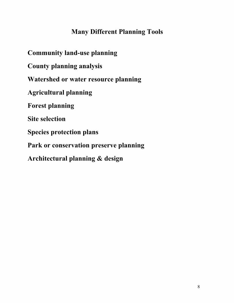
Many Different Planning Tools
Community land-use planning County planning analysis Watershed or water resource planning Agricultural planning Forest planning Site selection Species protection plans Park or conservation preserve planning Architectural planning & design

9
Community Land-use Planning
COMMUNITY LAND-USE PLANNING TOOLS Users: Community members, consultants & local planners Characteristics: Process & facilitation is key Tool kits - - allocation, voting & consensus, etc. Visualization is important Citizen engagement Need to move from vision to concrete actions

10
ENVISION UTAH
Envision Utah was a land use planning process facilitated by non-profit and consultants. They developed a core model (QCET) and a tool kit to analyze options, build consensus and develop a Quality Growth Strategy. As part of Envision Utah, they developed 4 alternate growth scenarios for Greater Wasatch Area. To get citizen input they posted questionnaire online, distributed 570,000 growth questionnaires in daily newspapers and weekly and supplements and held more than 50 town meetings. More than 17,000 people completed growth questionnaires; the input was used to develop a Quality Growth Strategy.

11
Community Land-use Planning Example: CommunityViz
EXAMPLE: CommunityViz is a suite of ArcView extensions being developed by the Orton Family Foundation to help communities assess land use alternatives. This tool kit, currently being beta tested, has three components: • Scenario Constructor to design scenarios and assess the impacts of a proposed
scenario. • TownBuilder is a 3D fully interactive real time environment with a
customizable kit that allows users to visualize and refine alternative scenarios. • Policy Simulator predicts probable change resulting from alternative policies.

12
Forest Management Tools
Users • Federal & state foresters, private companies & landowners
Characteristics
• Diversity of management objectives • Well developed toolkits available
• Larger land owners use to using analytical tools
• Many users with analytical backgrounds
• Biodiversity information weak
13
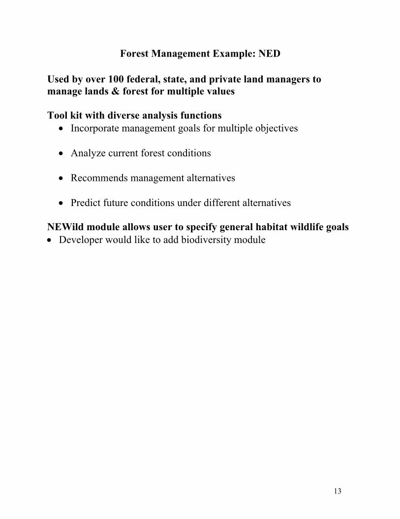
Forest Management Example: NED
Used by over 100 federal, state, and private land managers to manage lands & forest for multiple values Tool kit with diverse analysis functions
• Incorporate management goals for multiple objectives • Analyze current forest conditions
• Recommends management alternatives
• Predict future conditions under different alternatives
NEWild module allows user to specify general habitat wildlife goals • Developer would like to add biodiversity module

14
Compliance & Enforcement Tools: ICAM
EXAMPLE: ICAM The Chicago Police Department uses ICAM (Information Collection for Automated Mapping) to map hot spots and focus enforcement efforts. Hot spot analysis is used by many police departments as a management and decision support tool (see Mapping Out Crime and other references). ICAM is also the basis for the public website to give residents with a tool to assist them in problem-solving and combating crime and disorder in their neighborhoods. Citizens can search the Chicago Police Department's database of reported crime. It includes maps, graphs, and tables of reported crime. The database contains 90 days of information - - refreshed daily (most recent information is back-dated 7 days from current date).

15
USERS: DIFFERENT JOBS, ORGANIZATIONS & SKILLS
• Individual consumers & citizens (LEM, Scorecard) • Town & city planners (Planning Analyst, CityGreen) • Private consultants (RAPIDsite, TRANSIMS) • Federal & state resource managers (KLEMS, SR3) • Federal & state planners (INFORMS, CVAT) • Private company managers (NED) • Individual land owners (GLA, Main Street) • Community groups & others non-governmental organization users (NEWS, NRHP)
There are many different types of users with different skills, working in different organizations.

16
Who are the decisionmakers? Individual consumers/citizens?
Some tools are directed at individual “decision-makers” -- and seek to have a social effect by reaching individual buyers of land, houses, and other products. EXAMPLES: LEM: Location Efficient Mortgage is a tool developed by the Center for Neighborhood Technologies working with Fannie Mae. LEM helps potential homebuyers obtain larger mortgages if they buy homes closer to public transportation. Fannie Mae initiated the program with $100 million; the program is being offered in Seattle, Chicago, San Francisco and Los Angeles to encourage purchases in the center city. MainStreet: The National Trust for Historic Program has created a national online listing service for properties that are located in downtown areas. An online tool matches sellers with potential buyers of historic properties.

17
Who are the decisionmakers? County and Town Planners Example
EXAMPLE: Planning Analyst City and county planners in Verona, Wisconsin worked together to develop a replicable planning process to promote smart growth. The team made extensive use of a suite of existing GIS tools including ArcView, ArcInfo and ArcExplorer. They developed allocation software called PlaceIT. They also used a number of tools and techniques to engage “citizen planners” including an online site (above) and community meetings. ESRI plans to publish a book next year on this community land use planning process.

18
SUMMARY OF TRENDS & LESSONS LEARNED

19
Diverse levels of sophistication
Simple tools • Web & GIS viewing tools • No real analysis functions, view existing data only • Often designed for general public Mid-range tools • One to few analysis functions • Designed in well known software packages, such as ARCVEIW & ORACLE Complex toolkits • Sophisticated tool kits with interoperable models • Wide range of simulation & analysis functions • Diverse display & visualization capabilities • Often designed & used for multiple purposes The tools range significantly in their level of sophistication: from simple tools which are mostly static viewing tools to extensive and complex sets of tools organized into a multi-purpose toolkit. In between are mid-range tools that have some basic analysis functions, but are not as sophisticated as the complex toolkits. Based on this diversity, the tools can be classified into three categories: simple tools, mid-range tools, and complex toolkits. Next, we illustrate each category by presenting an example of each type of these tool categories along with the main strengths and weaknesses for the category.

20
Simple Tools: LUPIN
SIMPLE TOOLS Examples: • Web based information sites - - LUPIN, ScoreCard • GIS viewing tools - - Community 2020 Strengths, often: • Cheaper to develop • Potential to reach large number of users, including general public & non-technical users • May require little or no training to use Weaknesses, often: • Requires constant updating • Lots of competition • Less technically capable, such as no what if features • Limited purposes since informational display only
21
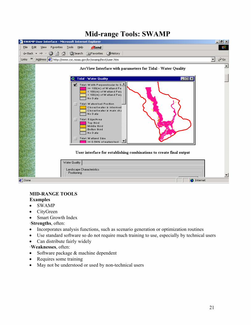
Mid-range Tools: SWAMP MID-RANGE TOOLS Examples • SWAMP • CityGreen • Smart Growth Index ·Strengths, often: • Incorporates analysis functions, such as scenario generation or optimization routines • Use standard software so do not require much training to use, especially by technical users • Can distribute fairly widely ·Weaknesses, often: • Software package & machine dependent • Requires some training • May not be understood or used by non-technical users

22
Complex Tool Kits: WaRSMP/MMS/RiverWare & the GIS Weasel
Examples • WaRSMP/MMS/RiverWare & the GIS Weasel • LMS & NED • Smart Places & CommunityViz Strengths, often • More capabilities, especially simulation & modeling, scenario generation & analysis
capabilities • Interoperability & diverse output capabilities • Flexibility to address range of problems • Better ones have developed user communities, which could tap into if added biodiversity
module to the existing tool set • Developers continue to revise & update the tools Weaknesses, often • ·More expensive to develop & maintain • ·May need expert users & facilitators for effective use

23
Key Functions Visualization - Graphs, text, 3D & GIS • Many tools had GIS or map viewing capabilities • 3D useful for communication, not analysis GIS capabilities - Many ARCVIEW based Modeling & simulation • What if scenario generation & analysis functions • Simulation of activities & impacts • Optimization routines & rule-based algorithms Multiple objectives • Some of the models included the ability to address multiple objectives We also examined main functions of the tools and summarize trends across the tools here. Special attention was paid to functions identified by the Federal Interagency Group for Decision Support for Natural Resources and the Environment, as being capabilities needed for natural resource and environmental decision making needs. (See: IGDS, A Strategy for the Development and Application of Decision Support Systems for Natural Resources and the Environment, IGDS, August 1998.) We hi-light the first four functions here and illustrate some of them with a tool example in the next few slides. For a full list of functions see characteristics list in Appendix B. Most of the tools had GIS capabilities, and many were based in ARCVIEW. Other visualization features included graphs, textual explanation and 3D images. We found that the 3D visualization techniques were useful for communication and education, especially the public, but not for analysis purposes. There was a range of modeling and simulation features within the tools. Many tools had simple to complex scenario generation, simulation, and analysis functions to model different management and situational scenarios and analyze the consequences. Other tools used linear programming and other types of optimization routines or used rule-based algorithms. An important feature for analyzing management options was the ability to handle
multiple objectives within the tool.

24
What Functionalities? Visualization
EXAMPLE: RAPIDsite This tool, developed by Evans & Sutherland, is designed to create rapid photorealistic models of sites. Designed for a professional audience, the tool can create “views,” “walk-throughs” and “fly-throughs.”

25
What Functionalities? Modeling & Simulation
EXAMPLE: TRANSIMS TRANSIMS is an integrated transportation forecasting model developed by Los Alamos National Laboratory for transportation planners. TRANSIMS creates a virtual metropolitan region and then simulates the movement of individuals and cars across the network. The model simulates actual behavior of real people in the region and can judge miles traveled, air emissions and judge overall performance of the transportation system.

26
What Functionalities? Multiple Objectives
EXAMPLE: Smart Places
Smart Places is a comprehensive tool kit that allows users to assess different design scenarios. Users can establish multiple objectives and assign a goal for each - - for example “maximize use of existing infrastructure” and “promote transit accessible housing and jobs.” Design scenarios can be constructed interactively and evaluated against the objectives and related goals.
27
Key Functions (continued)
Many of the tools had some ability to handle different levels of scale Most tools did not have real time functionality More sophisticated tools tended to have • Some capability to address uncertainty in data or output • Interoperability • Logging & tracking functions Stakeholder input consideration in some of the tool designs Some tools had Internet connectivity, often simple tools Here we hi-light the trends we found across the tools for the other key functions: scalability; real time functionality; uncertainty; interoperability; logging and tracking; stakeholder input; and Internet connectivity. On the next few slides we illustrate these functionalities with some examples. For tools that exhibited such functions see Appendix B.

28
What Functionalities? Scale
EXAMPLE: Global Forest Watch
Global Forest Watch combines online maps depicting forest cover and condition and the location of major developments and concessions within forested areas. Using ERDAS Imagine software, it is also working to develop monitoring and mapping activities on the country level - - working in 21 countries by 2005.
29
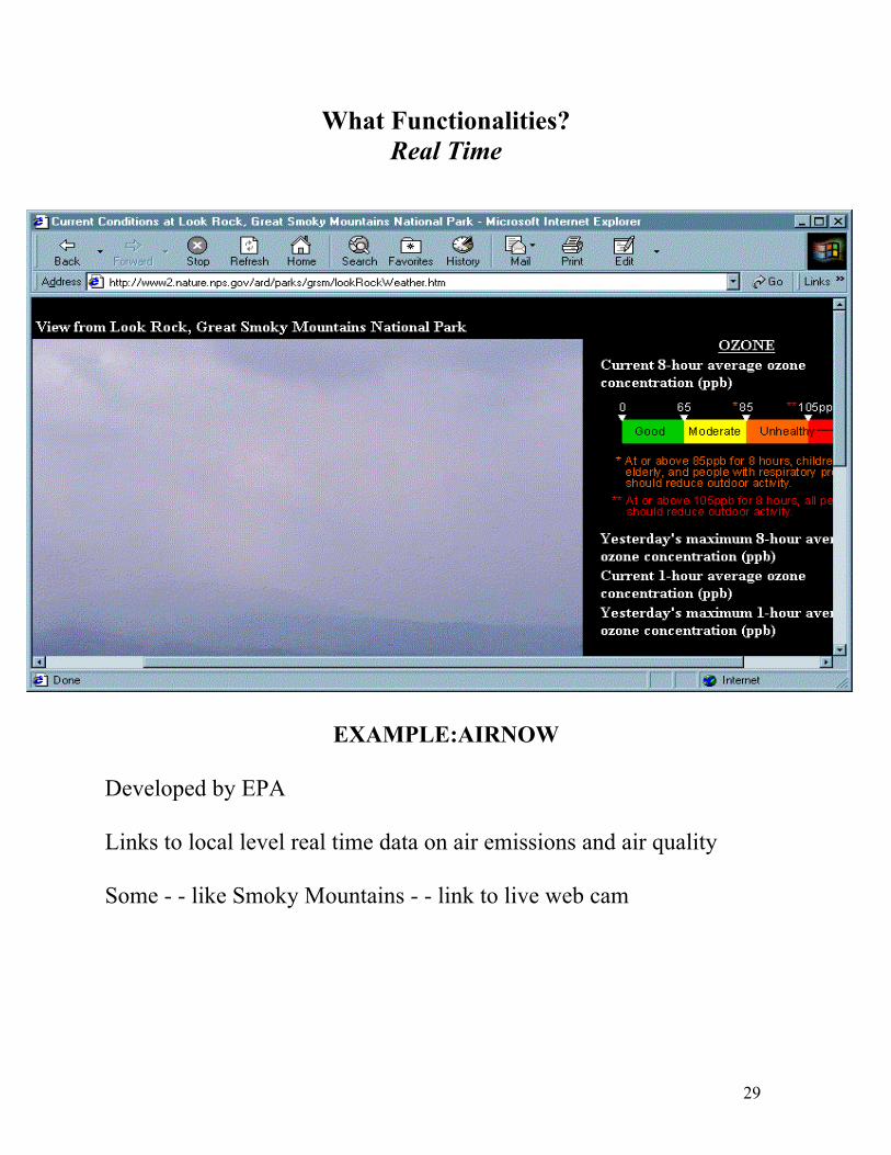
What Functionalities? Real Time
EXAMPLE:AIRNOW
Developed by EPA Links to local level real time data on air emissions and air quality Some - - like Smoky Mountains - - link to live web cam
30
What Functionalities? Stakeholder Involvement
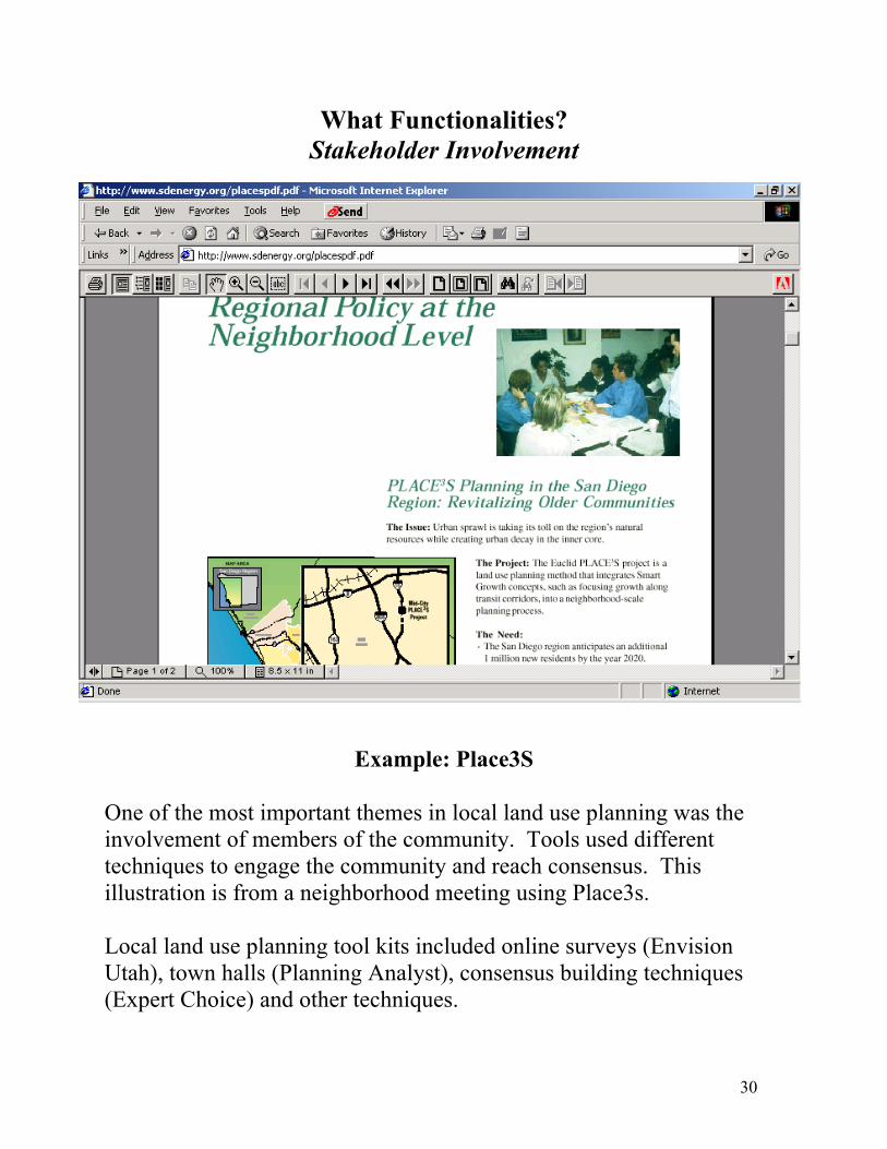
Example: Place3S
One of the most important themes in local land use planning was the involvement of members of the community. Tools used different techniques to engage the community and reach consensus. This illustration is from a neighborhood meeting using Place3s. Local land use planning tool kits included online surveys (Envision Utah), town halls (Planning Analyst), consensus building techniques (Expert Choice) and other techniques.

31
What Functionalities? Internet Connectivity
Example: Scorecard Scorecard, a site sponsored by the Environmental Defense Fund, has shown the potential of an environmental site on the Internet. With 1 million hits in its first 24 hours, Scorecard has been widely emulated. It started with Toxic Release Inventory data available by zip code and opportunities for citizen involvement. It has evolved over time and now includes more than 400 environmental databases.

32
Infrastructure Needed to Use Tools Wide range of skills & resources needed for tool use • Technical level of user No skills to extensive domain or software knowledge
• Machine type, power, & space Web access Almost any PC Special platform with a lot of storage & powerData requirements None to minimal Extensive datasets·Software requirements Web browser GIS packages: ARCVIEW, Spatial Analyst, or ARC/INFO Database programs: Oracle or Access Other C++
Besides the tool itself, there were also key infrastructure issues that varied by tool. An important factor in whether the tool was being used is the infrastructure needed to acquire and use the tool. Such infrastructure concerns include: the technical expertise that a user must have; the type of computer hardware needed; the data input requirements; and the software requirements, including software version. The cost of acquiring the tool and training needed to run it also impacted how widely the tool was being used and how it was used. In general, more expensive tools that required more expensive infrastructure (machine, software, expertise, etc.) were not being used as much. Another key issue is that many users in the field are not using the latest software versions. For example, one Forest Service tool user mentioned how he did not use tools requiring Arcview's Spatial Analyst even though he had the software because the Forest Service PC's did not contain the proper video chip needed to use this newer software extension.

33
Regional & Local Considerations
Some tools developed for specific location, ecosystem, or region • ·Especially tools that include more environmental information • ·Once successful adapted for other places
General approaches & methodology can be transferable Different ecological processes unique to places
• ·Coasts & deserts • ·Eastern wetlands & Western riparian areas
Different types of decisions & management practices Different cultures & approaches to environmental issues We found that there are many decision support system tools, including processes that are mostly non-computerized, that are designed for local and regional needs. Tools that included more extensive environmental information, such as those modeling local ecological processes, were often designed for the specific location. However, with many of these site specific tools the general approaches and methodology seemed transferable. We found many different features are unique to the culture, politics, or ecology of the local or regional place. Ecological processes are unique to different parts of the Untied States. For example, how one models the ecological processes and ecosystem dynamics of an Eastern wetland is very different from modeling a Western riparian area. Similarly, the types of management practices and decisions are very different for these places. Part of this variation was also based on the local political and culture views of an area or the type of tool users. For example, in parts of the United States one cannot use the term ecosystem management with farmers or ranchers.

34
Example of Regional & Local Considerations: Eglin Air Force Base
Eglin Air Force Base is implementing a comprehensive ecosystem management effort. This slide shows this locally based decision making process for this ecosystem management activity. This US Air Force Base consists of about 464,000 acres in the Florida Panhandle, mostly a sandhill vegetation ecosystem with prime habitat of old-growth stands of longleaf pine. Societal values about a strong well trained military, ecosystem and endangered species protection helped Air Force managers develop specific project goals of protecting and enhancing the key habitat and species protection while sustaining base missions. With the help of the Nature Conservancy, local University scientists, and base experts, analysts in the Eglin effort developed an ecological model about the sandhill vegetation ecosystem on the base. This model also helped them develop specific project goals and data needs for their ecosystem management effort. Based on this ecological model, and on-going data collection, monitoring, and analysis; the project analysts developed a series of indicator calculations about key ecosystem components, including vegetation cover change, fire size distribution, soil disturbance, and Red Cockaded Woodpecker distribution. These indicators are being used by Air Force managers in facility management decisions which impact the ecosystem, such as burning and harvesting decisions. This decision process is an adaptive management process where they continue to monitor the results of their actions which feeds back into the goal setting and data collection process, and then into the continued development of the ecological process model and indicator calculations.
Goals: Enhanced Ecosystem Mgmt; Sustained Base Missions, & Protect Endangered Species.
Data Needs?
Research
Ecological Model: Sandhill
VegetationResponse
Indicator Calculations: Vegetation
Cover Change, Fire Distribution, Etc.
Decisions: Restoring
Actions such as Burn and Harvest
Decisions.
Data Collection/ Monitoring
Indicators: Fire Size & Distribution
Societal Values: Strong, well-trained military; Ecosystem Preservation, & Endangered Species Preservation.

35
Environmental Issues in Tools
Often general information, such as • Land cover/land-use • Location of water features & wetlands
Not much information on
• Biodiversity • Individual species
Few exceptions, mostly in habitat & site specific tools Many tool developers would like better biodiversity information in their tools • But not a development priority

36
Example of Environmental Issues: ACE Basin Characterization
The Characterization of the Ashepoo-Combahee-Edisto (ACE) Basin, South Carolina is an interdisciplinary synthesis of environmental information about the ACE Basin, presented in a GIS, multimedia, and interactive tool. This tool's components include narrative text syntheses of physical setting, biological and socioeconomic resources, and important ecosystem interactions. In addition to descriptions of the ACE Basin environment, this characterization also explores current issues affecting resources in the region, especially land use and water quality. The water quality and land use modules within this tool summarize relevant ecological and socioeconomic information (with links to narrative text sections) and discuss issues and management options.

37
SUCCESS FACTORS
• Clarity about purpose, decisions, decision-makers & users • The process for using the tool is as important as the tool • Building on existing tools and software • Listening to users & relevant stakeholders throughout the tool development process
• Tool more likely to be used if • Meets important unmet needs of users • Is effectively marketed • Users have necessary skills & training
• Build on sound data • Plan to evolve tool over time • Capitalize on partnerships Not all tools are successful - - some do not go much beyond the development stage and a large number have a very limited number of users. Certainly clarity about the purpose and users of a tool and listening to users throughout the development stage help to guard against a tool being too academic. Even having a good tool isn’t sufficient -- widely used tools are not only targeted to users’ needs, they are marketed and supported by training and support groups. Defining success as having an impact on the ground, it is clear that successful tool kits address the process of decision-making, not just putting information in front of decision-makers. Successful tools also build on sound data and include the flexibility to review and change assumptions. Many successful efforts included components and data built and maintained by others -- academics, state, federal and local agencies and commercial entities. And almost every tool and tool kit we saw that is in wide use evolved over time. They started simply and added functionalities in response to users and to changing technology. And many tools -- especially those with a national impact -- built on extensive partnerships with state and local entities, federal agencies, experts and other organizations.
38
CONSIDERATIONS FOR BIODIVERSITY DECISION TOOL(S)

39
Considerations for the Consortium
• PURPOSE OF TOOL • WHERE CAN CONSORTIUM HAVE THE BIGGEST IMPACT?
• INFORMATION RESOURCES • WHAT OTHER RESOURCES?
• FOCUS AND AUDIENCE FOR TOOL • WHICH DECISIONS & THREATS AFFECT BIODIVERSITY? • WHICH DECISION MAKERS ARE INVOLVED?
• ·HOW TO ENGAGE DECISION-MAKERS • ·LEVEL OF TECHNOLOGY • ·LEVEL OF EXPERTISE & TRAINING • ·TOOL OR TOOLBOX? • ·EVOLUTION OVER TIME • ·POTENTIAL OF PARTNERSHIPS These are considerations that we believe are important for the consortium’s decision support initiative. It is critical to be clear about the purpose of the tool or tools that the consortium is building and the decisions and decision-makers the consortium is seeking to influence. There are already many “decision support tools” that have little connection to the practical decisions that local officials make. To engage busy public officials and the planners who support them so that they consider biodiversity as they make these local decisions is a challenge. We do believe that there is a significant opportunity for the consortium to partner with the many organizations that have well-advanced tools and tool kits that address land use planning. With mounting interest in smart growth and quality of life, there is a convergence of interest between the environmental community and the traditional planning actors who have in the past primarily focused on the built environment.

40
Maximizing Consortium’s Impact
• INFORMATION RESOURCES • BIODIVERSITY NETWORK - - scientists & researchers • PARTNERS -- state, local, federal, private • Use Precious Heritage Information on priorities Activities that are biggest
threat to biodiversity Agriculture Land conversion for commercial development Water development
• Land owners where most species & habitat are at risk Federal government: FS, BLM, & DOD Private lands
• Locations of the biodiversity hot spots Southern Appalachians & Florida California & Hawaii
The consortium also has an opportunity to leverage its resources to have a significant impact. Clearly the consortium’s information resources and the work on priorities are important. However just as important are the consortium’s partners and its Biodiversity Network of experts. Perhaps the consortium can’t build a tool that is a “biologist in a box” -- but it can take a page from other tools that have found ways to capitalize on the expertise of scientists and researchers to help establish local priorities (sees Scorecard), answer questions (see Ask the Expert tools) and bring experts and expertise as well as data to local areas.
41
Some Options to Consider
Potential priorities • ·Slow rate of biodiversity loss in the US during the next 20 years? • ·Focus on protecting biodiversity hot spots?
• ·Provide biodiversity information & tools to as many people as possible?
• ·Facilitate a specific decision making process using more biodiversity information in their process?
• ·Advance the use of biodiversity information in decision support tools?
42
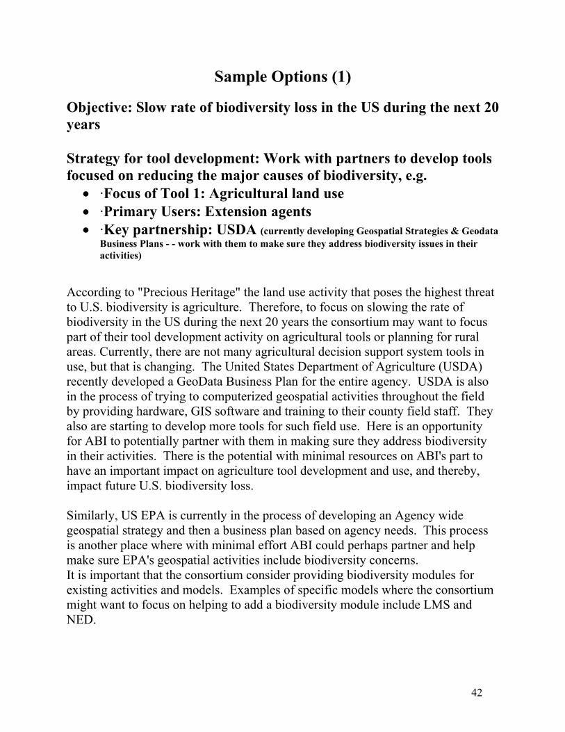
Sample Options (1) Objective: Slow rate of biodiversity loss in the US during the next 20 years Strategy for tool development: Work with partners to develop tools focused on reducing the major causes of biodiversity, e.g.
• ·Focus of Tool 1: Agricultural land use • ·Primary Users: Extension agents • ·Key partnership: USDA (currently developing Geospatial Strategies & Geodata Business Plans - - work with them to make sure they address biodiversity issues in their activities)
According to "Precious Heritage" the land use activity that poses the highest threat to U.S. biodiversity is agriculture. Therefore, to focus on slowing the rate of biodiversity in the US during the next 20 years the consortium may want to focus part of their tool development activity on agricultural tools or planning for rural areas. Currently, there are not many agricultural decision support system tools in use, but that is changing. The United States Department of Agriculture (USDA) recently developed a GeoData Business Plan for the entire agency. USDA is also in the process of trying to computerized geospatial activities throughout the field by providing hardware, GIS software and training to their county field staff. They also are starting to develop more tools for such field use. Here is an opportunity for ABI to potentially partner with them in making sure they address biodiversity in their activities. There is the potential with minimal resources on ABI's part to have an important impact on agriculture tool development and use, and thereby, impact future U.S. biodiversity loss. Similarly, US EPA is currently in the process of developing an Agency wide geospatial strategy and then a business plan based on agency needs. This process is another place where with minimal effort ABI could perhaps partner and help make sure EPA's geospatial activities include biodiversity concerns. It is important that the consortium consider providing biodiversity modules for existing activities and models. Examples of specific models where the consortium might want to focus on helping to add a biodiversity module include LMS and NED.

43
Sample Options (2)
Objective: Protect biodiversity hot spots Strategy for tool development: Develop tools that track and encourage land acquisition, covenants and enforcement in hot spots, e.g.
• Local level pilot to develop simple ARCVIEW extension tool, designed for key land development process & users, ex. Primary Users: County planners, land trusts, real estate developers, watershed/sustainable community groups
• ·Regional level pilot targeted towards more strategic conservation planning processes -More sophisticated analysis tools & scientific information; use UCSB expertiseA second option would focus tool development on tools to protect
biodiversity hot spots. This could build on the work done for Precious Heritage, successful existing approaches such as Sites (SSM) and C-Plan, and experience with hot spot management approaches from other sectors (see “Mapping out Crime” and other references and resources). A tool development strategy focused on hot spots could include two complementary approaches:
1) Develop a simple ARCVIEW extension that would let local planners, land trusts, developers and others identify and prioritize local hot spots. Such a tool would need to identify the key elements of a decision-making process (see Planning Analyst), make relevant data available, find a way for communities to access expertise and link communities with best practices and incentives (see LEM, Main Street and others). Clearly, this would be complemented by ABI’s monitoring and tracking work with its partners.
2) Focus more sophisticated tool development on one or more hot spot areas
and work with academic institutions, private partners and communities to protect diversity within that region. An excellent model for such a multi-community technology effort is the Silicon Valley initiative on smart growth and Smart Permit.

44
Sample Options (3)
Objective: Provide biodiversity information to as many people as possible Strategy for tool development: Focus on educational outreach, e.g.Participate in Watersheds Watcher development
Chance to use visualization tools & media to target the general public • ·Design environmental/biodiversity DSS tool web site by application areas -Post own tools -Provide links to many other related tools
Another option ABI may want to consider is providing biodiversity information to as many people as possible. If this is a specific goal then focusing on educational outreach would be a high priority. There exist some fairly low cost options to pursue such an objective. For example, the Watershed Watchers is a tool development activity being developed and piloted in the DC area. This tool focuses on integrating volunteer watershed monitoring information, with watershed analysis, satellite, maps and graphic information, and video information live on the web and on television. By partnering in this development, or even just attending some of their planning workshops, ABI might be able to help educate a larger general public audience about biodiversity information. In addition, ABI could develop a biodiversity DSS tool web site, organized by end user application areas. Actually, we recommend this fairly low cost activity because there is no good web site for such tools, and such a site would help educate the public and get more visibility for biodiversity tools and ABI's activities. At this site ABI could post tools developed by the consortium, provide links to other tools, and even allow users to enter information about their own tools. The tools descriptions in Appendix C, and the template in Appendix D provides a starting point for such an activity. All these different options have illustrated that there really is a portfolio of activities that ABI could be conducting in their activities focusing on DSS tools for biodiversity.

45
Focus on the Users
What are the main decisions & at what levels? • ·Agricultural zoning, development design, community planning, forest management? • ·Site? City? Region?
Who are the key decisionmakers?
• ·Private corporations or individuals? • ·Federal resource managers? • ·Community planners & stakeholders?
Who conducts the analysis/uses the tools for those decisions? We end this presentation repeating the admonition “focus on the users.” In reviewing tools, we found that that this was too often the missing element in the tool development process.

46
CONCLUSIONS
• No comprehensive biodiversity tool exists • Many land-use tools lack biodiversity information • Wealth of approaches, methodologies & tools to consider • No “silver bullet” • Important to focus on biodiversity priorities, key decision makers and users to: Maximize impact Guide tool design

47
APPENDIX A: TOOLS BY MAIN APPLICATION AREA These tools are grouped by the main application areas where they are applied, usually the main focus area and designed purpose for the tool. Since many of these tools are extensive toolkits used for multiple purposes, they might fit in other categories as well. If they are frequently used or have clear strengths for another type of application they are listed as secondary under that category. We did not try to list tools under every application area where they might be applicable.
Agricultural Management/planning Great Plains Framework for Agricultural Resource Management (GPFARM)
Biodiversity/species/conservation planning models Biodiversity Management Area Selection (BMAS) Refuge GAP Sites/Site Selection Module (SSM)
Citizen and Community Engagement and Education BoxCity Characterization of the Ashepoo-Combahee-Edisto (ACE) Basin, SC Community Image Earth’s 911 Online Atlas ScoreCard Watershed Watchers
Ecosystem management tools Ecosystem Management Decision Support (EMDS) Multiple Species Conservation Program (MSCP)
Forest management and planning tools CityGreen Forest Vegetation Simulator (FVS) Global Forest IMPLAN INtegrated FOrest Resource Management System (INFORMS) NEDS
Hazards assessment Community Vulnerability Assessment Tool (CVAT)
Housing and Real Estate Development Community 2020 Financing Land LEM

48
Main Street National Register of Historic Properties Neighborhood Early Warning System
Land development, management & planning tools Community Viz Envision Utah Index Land Management System (LMS) LUPIN Multiple Species Conservation Program (MSCP) (Secondary) NEDS (Secondary) Place3S Planning Analyst RapidSite SmartPlaces Urban Sim WhatIf? World Construction Set
NEPA/EIS planning process tools INtegrated FOrest Resource Management System (INFORMS) (Secondary) Nobility EM
Transportation Planning Quantm Transims
Watershed and water resources decision making Modular Modeling System and the GIS Weasel RiverWare Snake River Resources Review (SR3) Spatial Wetland Assessment for Management & Planning (SWAMP) Watershed and River System Management Program (WaRSMP)

49
APPENDIX B: EXAMPLES OF TOOLS THAT EXHIBIT KEY CHARACTERISTICS
For each function or characteristic we have listed examples of tools that exhibit that characteristic. These characteristics are based on those developed by the Interagency Working Group for Decision Support Systems for Natural Resouces and the Environment. Tools that are especially strong in a particular area are so noted.
GIS capabilities Almost every tool had GIS capabilities, so we are not listing them all.
Real-time functionality Community Vulnerability Assessment Tool (CVAT) Snake River Resources Review (SR3) Watershed and River System Management Program (WaRSMP)
Scalability A majority of the tools had scalability, so we are not listing them all.
Modeling and simulation tools Biodiversity Management Area Selection (BMAS) Model CityGreen Ecosystem Management Decision Support (EMDS) - fuzzy logic–based reasoning algorithms Forest Vegetation Simulator (FVS) - includes family of forest growth simulation models Great Plains Framework for Agricultural Resource Management (GPFARM) - such as economic tools IMPLAN INtegrated FOrest Resource Management System (INFORMS) Land Management System (LMS) Modular Modeling System and the GIS Weasel NED Nobility EM Quantm RiverWare Sites/Site Selection Module (SSM) Snake River Resources Review (SR3) Spatial Wetland Assessment for Management & Planning (SWAMP) Transims Urban Sim Watershed and River System Management Program (WaRSMP) - Strength
Visualization tools BoxCity Community Viz Forest Vegetation Simulator (FVS)

50
Great Plains Framework for Agricultural Resource Management (GPFARM) INtegrated FOrest Resource Management System (INFORMS) Land Management System (LMS) Modular Modeling System and the GIS Weasel NED Nobility EM RapidSite RiverWare Snake River Resources Review (SR3) Watershed and River System Management Program (WaRSMP) Watershed Watchers WhatIf? World Construction
Stakeholder involvement Community Image Community Viz Community Vulnerability Assessment Tool (CVAT) - Process designed for diverse stakeholders to use Expert Choice Envision Utah Index Main Street Modular Modeling System and the GIS Weasel Multiple Species Conservation Program (MSCP) National Register Place3S Planning Analyst
Uncertainty Ecosystem Management Decision Support (EMDS) - such as "evidence based reasoning" that reports back information on data that are missing. INtegrated FOrest Resource Management System (INFORMS) Land Management System (LMS) Modular Modeling System and the GIS Weasel NED Nobility EM RiverWare
Multiple objectives Biodiversity Management Area Selection (BMAS) Model Ecosystem Management Decision Support (EMDS) Eglin Air Force Base Ecosystem Management Activity Forest Vegetation Simulator (FVS) Great Plains Framework for Agricultural Resource Management (GPFARM)

51
INtegrated FOrest Resource Management System (INFORMS) Land Management System (LMS) Modular Modeling System and the GIS Weasel Multiple Species Conservation Program (MSCP) NED - strength is managing for multiple values and then evaluate different tradeoffs RiverWare Sites/Site Selection Module (SSM) Snake River Resources Review (SR3) Spatial Wetland Assessment for Management & Planning (SWAMP) Watershed and River System Management Program (WaRSMP)
Scenarios C-PLAN Ecosystem Management Decision Support (EMDS) Eglin Air Force Base Ecosystem Management Activity Forest Vegetation Simulator (FVS) Great Plains Framework for Agricultural Resource Management (GPFARM) INtegrated FOrest Resource Management System (INFORMS) Land Management System (LMS) Modular Modeling System and the GIS Weasel NED Nobility EM RiverWare Sites/Site Selection Module (SSM) Snake River Resources Review (SR3) Spatial Wetland Assessment for Management & Planning (SWAMP) Watershed and River System Management Program (WaRSMP)
Modularity Ecosystem Management Decision Support (EMDS) Great Plains Framework for Agricultural Resource Management (GPFARM) INtegrated FOrest Resource Management System (INFORMS) - Strength modular and open system Land Management System (LMS) Modular Modeling System and the GIS Weasel RiverWare Snake River Resources Review (SR3) Watershed and River System Management Program (WaRSMP)
Internet connectivity Community 2020 Earth’s 911 Global Forest Land Management System (LMS) LUPIN

52
Neighborhood Early Warning System Online Atlas ScoreCard Snake River Resources Review (SR3) Watershed Watchers Interoperability Forest Vegetation Simulator (FVS) Great Plains Framework for Agricultural Resource Management (GPFARM) INtegrated FOrest Resource Management System (INFORMS) Land Management System (LMS) Modular Modeling System and the GIS Weasel NED RiverWare Watershed and River System Management Program (WaRSMP)
Logging and tracking Ecosystem Management Decision Support (EMDS) Forest Vegetation Simulator (FVS) INtegrated FOrest Resource Management System (INFORMS) Land Management System (LMS) Modular Modeling System and the GIS Weasel NED Nobility EM RiverWare Snake River Resources Review (SR3)
Legal/planning documents Community Vulnerability Assessment Tool (CVAT) Ecosystem Management Decision Support (EMDS) Financing Land IMPLAN Infracycle INtegrated FOrest Resource Management System (INFORMS) – NEPA LEM LUPIN Nobility EM
Use of biodiversity/ecosystem information in tool Biodiversity Management Area Selection (BMAS) Model Characterization of the Ashepoo-Combahee-Edisto (ACE) Basin, SC - Good textual descriptions about ecological processes Eglin Air Force Base Ecosystem Management Activity - Strength, especially its' use of ecological processes Multiple Species Conservation Program (MSCP)
53
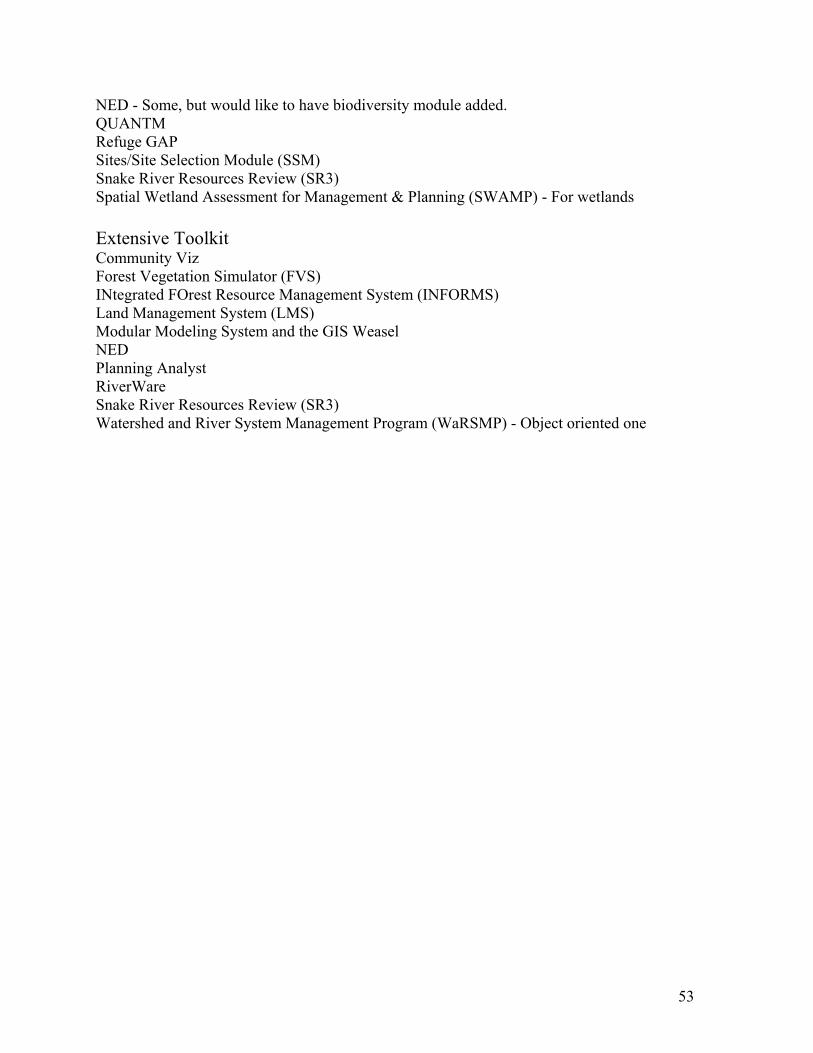
NED - Some, but would like to have biodiversity module added. QUANTM Refuge GAP Sites/Site Selection Module (SSM) Snake River Resources Review (SR3) Spatial Wetland Assessment for Management & Planning (SWAMP) - For wetlands
Extensive Toolkit Community Viz Forest Vegetation Simulator (FVS) INtegrated FOrest Resource Management System (INFORMS) Land Management System (LMS) Modular Modeling System and the GIS Weasel NED Planning Analyst RiverWare Snake River Resources Review (SR3) Watershed and River System Management Program (WaRSMP) - Object oriented one

54
APPENDIX C: PROFILES OF 50 TOOLS Note: These tools are individually paged and arranged alphabetically. 1. Biodiversity Management Area Selection (BMAS) 2. BoxCity 3. Characterization of the Ashepoo-Combahee-Edisto (ACE) Basin, SC 4. CityGreen 5. Community 2020 6. Community Image 7. Community Viz 8. Community Vulnerability Assessment Tool (CVAT) 9. C-PLAN 10. Earth’s 911 11. Ecosystem Management Decision Support (EMDS) 12. Eglin Air Force Base Ecosystem Management Activity 13. Envision Utah 14. Expert Choice 15. Financing Land 16. Forest Vegetation Simulator (FVS) 17. Global Forest 18. Great Plains Framework for Agricultural Resource Management (GPFARM) 19. Implan 20. Index 21. Infracycle 22. INtegrated FOrest Resource Management System (INFORMS) 23. Land Management System (LMS) - (Need to add notes from document) 24. LEM 25. LUPIN 26. Main Street 27. Modular Modeling System and the GIS Weasel 28. Multiple Species Conservation Program (MSCP)(Shorten & edit) 29. National Register 30. NEDS 31. Neighborhood Early Warning System 32. Nobility EM 33. Online Atlas 34. Place3S 35. Planning Analyst 36. Quantm 37. RapidSite 38. Refuge GAP 39. RiverWare 40. ScoreCard 41. Sites/Site Selection Module (SSM) 42. Snake River Resources Review (SR3) 43. Spatial Wetland Assessment for Management & Planning (SWAMP)

55
44. Transims 45. Urban Sim 46. Watershed and River System Management Program (WaRSMP) 47. Watershed Watchers 48. WhatIf? 49. World Construction

56
APPENDIX D: LAND USE DECISION SUPPORT SYSTEM TOOL DESCRIPTION TEMPLATE
This file contains instructions for how to enter additional land use related Decision Support System (DSS) tools within this system. For each tool create a separate Microsoft Word file with page number and tool name in the footer. Call that file by the tool name. For that tool enter the following information:
Description of the Tool 1. What is the name of the tool? 2. What does the tool do or is suppose to do? 3. What are the main functions and capabilities of the tool? 4. What level of scale is the tool designed for use at (parcel, site level, county level, regional, macro tool, etc.)? Is it a hardwire design for a specific region of the country? 5. What are the data and other requirements for being able to use the tool? Briefly mention such requirements.
Information About the Use of the Tool 6. A. Who is actually using this tool in practice? (Be sure to list specific groups including: community land use planners, regional, state, and federal land use planners/managers, industry (real estate, forest products, agriculture, etc.) Also, list a specific point of contact of a tool user if available. If not being used, why not? If appropriate, ask lessons learned? B. Where is it being used? 7. Has it been successfully used in practice? If not, why not? What decisions were actually impacted by the application of the tool? 8. How is the tool being used in practice? 9. What has been the outcome when the tool has been used? 10. Is the tool used on an on-going basis? Or was it used just once or only in a demonstration/prototype mode or because of a one time decision?

57
Environmental Considerations 11. How does the tool handle/deal with natural resource/environmental issues? 12. How could the tool deal with natural resource/environmental issues if not already addressing? 13. Has the tool dealt with biodiversity issues at all? If yes, how? 14. Any suggestions about how the tool could more effectively deal with biodiversity issues?
Logistical Information About the Tool 15. The official point of contact for the tool (both a developer and a user)? Include name, phone number and e-mail. 16. How can someone acquire the tool? 17. Cost of the tool? 18. What samples and descriptions of the tool are available (CD-ROM demo, documents, web sites, etc.) ? List specifics of all that apply. 19. What are the data and other requirements for being able to use the tool?
Detailed Questions About Technical DSS Functions & Characteristics
Answer if the DSS has the following functionality and characteristics, where appropriate, some may not apply and others will already be answered in the previous discussion. Circle, yes, no, not applicable (N/A) or write-in brief description if not obvious yes or no answer or where the details are important. Then enter the answers in the table below.
C1. GIS capabilities. Yes No N/A C2. Real-time functionality: Ability to accept and utilize real-time data. Yes No N/A C3. Scalability: Ability to select different geographic and temporal scales. Yes No N/A C4. Modeling and simulation tools. Yes No N/A C5. Visualization tools to display data, relationships, and anticipated results. Not just GIS maps, such tools
include graphs, 3-D visualization and/or the ability to do a spatial query. Yes No N/A C6. On-going monitoring and feedback: Tools to facilitate on-going monitoring or feedback in the
management process. Yes No N/A

58
C7. Stakeholder involvement: Mechanisms to facilitate stakeholder involvement. . Yes No N/A C8. Uncertainty: Means to depict uncertainty in data, relationships or results. Yes No N/A C9. Multiple objectives: Explicit methods to treat multiple goals, objectives, and measures. Yes No N/A C10. Scenarios: Ability to create and store scenarios. Scenarios related to changes in landscape or
management, or predictive outcomes. Yes No N/A C11. Modularity: Designed in modules so user can more easily insert or replace modules. Yes No N/A C12. Internet connectivity: Yes No N/A C13. Interoperability: Yes No N/A C14. Logging and tracking: Methods to log or track tool's calculations or process. Yes No N/A
C15. Legal/planning documents: Yes No N/A Enter answers in table below: Function/Characteristic Does the Tool Have It? GIS capabilities Real-time functionality Scalability Modeling and simulation tools Visualization tools On-going monitoring and feedback Stakeholder involvement Uncertainty Multiple objectives Scenarios Modularity Internet connectivity Interoperability Logging and tracking Legal/planning documents
Lessons learned and the Significance of the Tool 20. What have been the lessons learned from using the tool or developing the tool? 21. Why would this tool be of significance for the biodiversity DSS tool consortium?

59
APPENDIX E: RESOURCES AND REFERENCES This list contains references for this study and useful resources. There are additional references listed for each tool under the individual tools. This section also includes web sites and references for interesting tools that we did not have a chance to write up in Appendix C. Agricultural WAter Resources Decision Support (AWARDS). An automated information system to assist
water users by providing easy access to rainfall and daily crop water use estimates; see http://yampa.earthsci.do.usbr.gov:8080/awards/awards.html
AIRNOW, Developed by the US Enivironmental Protection Agency. http://www.epa.gov/airnow/
American Institute of Architects. Communities by Design: Influencing Your Communities Quality of Life, Spring 2001.
AQUIMS. A computerized system for interpreting and intergrating information on air pollution effects on Natural Resources. See http://www.aqd.nps.gov/ard/infoman.html
Biodiversity Expert Systems Tool (BEST) for County Planners, http://www.sdvc.uwyo.edu/wbn/bdss/
Center for Excellence for Sustainable Development. http://www.sustainable.doe.gov/hotspots.shtml
Chesapeake Bay Program, Ecosystem Models of the Chesapeake Bay Program 1994-1996, CBP/TRS 177/97, August 1997.
Conrad, Lawrence M., and Samuel N. Seskim, The Costs of Alternative Land Use Patterns, Prepared for U.S. Department of Transportation Federal Highway Administration, June 1998.
Crime Mapping Research Center, website http://www.ojp.usdoj.gov/cmrc/.
Grizzly Bears in Swan Valley. In the Swan Valley in Northwestern Montana citizens and different government agencies have collaborated to develop land use guidelines to help protect grizzly bears in their valley. A GIS system was used to develop key linkage zones for grizzly bears in the Swan Valley which were then used to develop the guidelines. (See Sandstrom, 1996)
Growth Management and Preservation Tools for Rural Legacy Proposals. http://www.plannersweb.com
Hardesty, Jeffrey et al., Monitoring Ecological Condition in a Northwest Florida Sandhill Matrix Ecosystem, The Nature Conservancy, Gainesville, Florida, October 13, 1997.
ICAM, Integrated Collection for Automated Mapping, Developed by the Chicago Police Department. http://www.ci.chi.il.us/CommunityPolicing/AboutCAPS/NewTech/ICAM.html, http://12.17.79.6/.
IGDS [The Interagency Group for Decision Support for Natural Resources and the Environment], A Strategy for the Development and Application of Decision Support Systems for Natural Resources and the Environment, IGDS, August 1998. Available from Tom Gunther, DOI.
Leslie, Michele et al., Conserving Biodiversity on Military Lands: A Handbook for Natural Resource Managers, The Nature Conservancy, Arlington, VA, 1996.

60
Lessard, Gene and Thomas Gunther, Editors, Report on the Decision Support Systems Workshop, Denver, Colorado, February 18-20, 1998, USGS, Open-File Report 99-351, 1999.
MSCP [Multiple Species Conservation Program], MSCP Subarea Plans: Volume II, August 1996.
NOAA Web site with links to many different interesting models, such as Yakutat, Alaska Land Cover Change and San Francisco Bay Area Land Cover Change CD-ROM, environmental education tools. http://www3.csc.noaa.gov/CSCweb/tempProdCat.asp
Performance Indicators Visualization and Outreach Tool (PIVOT), http://csc.noaa.gov/products/pivot/
Porter, Douglas R., Managing Growth in America's Communities, Island Press, Washington, D.C., 1997.
Regional Ecosystems and Land Management (RELM). RELM is a Linear Programming based optimization program which proportions forest-wide, strategic planning solutions to tactical sub-units of the forest. These sub-units are often watersheds or landscapes. See http://www.fs.fed.us/institute/planning_center/plan_relm.html
Sandstrom, Per Lennart, Identification of Potential Linkage Zones for Grizzly Bears in the Swan-Clearwater Valley Using GIS, MS Thesis, University of Montana, 1996.
Sargent, Frederic O., Paul Lusk, Jose A. Rivera, and Maria Varela, Rural Environmental Planning for Sustainable Communities, Island Press, Washington, D.C., 1991.
Sierra Nevada Ecosystem Project (SNEP), http://www.biogeog.ucsb.edu/projects/snep/snep.html
Smart Growth INDEX tool, Criterion Planners/Engineers, Portland, Oregon, 1999. For more information about this tool see their web page at: www.crit.com/smartgrowth.htm.
Snake River Resources Review (SR3) web pages at http://www.usbr.gov/stewardship/index.htm; http://www.if.uidaho.edu/SR3/basin.html; http://mac1.pn.usbr.gov/sr3/index.html
Social Cost of Alternative Land Development Scenarios (SCALDS), Federal Highway Administration.
Spray Advisor. A DSS tool developed for forest pest control specialist and resource managers. See http://fhpr8.srs.fs.fed.us/sprayadvisor/spray/
SPUR2 is a general grassland ecosystem simulation model designed to determine beef cattle performance and production by simultaneously simulating production of up to 15 plant species on 36 heterogeneous grassland sites. SPUR2 simulates grassland hydrology, nitrogen cycling, and soil organic matter on grazed ecosystems as well as rangeland production under different climatic regimes, environmental conditions, and management alternatives. See http://www.gpsr.colostate.edu/gpsr/products/spur2/spur2.htm
Sojda, Richard S., "A Decision Support System for Wetland Management on National Wildlife Refuges," AI Applications, Vol. 8, No. 2, 1994.
Stein, Bruce A.; Lynn S. Kutner; and Jonathan S. Adams, editors, Precious Heritage, The Nature Conservancy and the Association for Biodiversity Information, Oxford University Press, 2000.
USGS. Report on the Decision Support Systems Workshop. Denver, Colorado, February 18-20, 1998, Open-File Report 99-351, 1999.

61
Waddell, Jim, Reinventing the Urban Environment: the Role of Science and Technology, National Science and Technology Council, Joint Subcommittee on Environmental Technologies, white paper, 1995.
Watershed and River System Management Program (WaRSMP) web page at http://wwwbrr.cr.usgs.gov/warsmp/mainpage.html#1