Python Scripting 2011
118
Python Scripting for ArcGIS Paul Zandbergen Department of Geography University of New Mexico
-
Upload
theravenrock -
Category
Documents
-
view
375 -
download
0
description
Python Scripting 2011
Transcript of Python Scripting 2011

Python Scripting for ArcGIS
Paul ZandbergenDepartment of Geographyp g p yUniversity of New Mexico
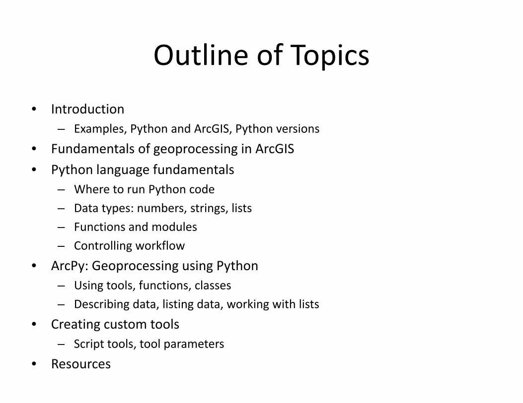
Outline of TopicsOutline of Topicsd• Introduction
– Examples, Python and ArcGIS, Python versions
• Fundamentals of geoprocessing in ArcGISFundamentals of geoprocessing in ArcGIS• Python language fundamentals
– Where to run Python code– Data types: numbers, strings, lists– Functions and modules– Controlling workflowg
• ArcPy: Geoprocessing using Python– Using tools, functions, classes
b d l d k h l– Describing data, listing data, working with lists
• Creating custom tools– Script tools, tool parametersp , p
• Resources

Workshop Materials PostedWorkshop Materials Posted
posted until October 24
h // l db / k h
posted until October 24
http://www.paulzandbergen.com/workshops

Forthcoming BookForthcoming Book
• Python Scripting for ArcGIS• Esri PressEsri Press• Sometime in 2012• Updated for ArcGIS 10.1
• Sample exercises posted (for 10.0)

Introduction

Prior Knowledge and ExperiencePrior Knowledge and Experience
• Using ArcGIS 9.3 or 10.0?– Workshop is for 10.0p
• Prior Python experience?– I’m not assuming anyg y
O h i i ?• Other programming experience?– I’m not assuming any

Example 1Example 1
• Script to copy all shapefiles in a folder into a geodatabase
import arcpyfrom arcpy import envenv.overwriteOutput = True
k " / k h / 01"env.workspace = "c:/workshop/ex01"fclist = arcpy.ListFeatureClasses()for fc in fclist:
fcdesc = arcpy.Describe(fc)py ( )arcpy.CopyFeatures_management(fc, "c:/workshop/ex01/study.mdb/"
+ fcdesc.basename)

Example 2Example 2
• Script tool to generate a k‐nearest neighbor table• Runs an existing ArcGIS tool multiple times, writes the result
import arcpyfrom arcpy import env
it t t Tenv.overwriteoutput = Trueinfc = arcpy.GetParameterAsText(0)output = arcpy.GetParameterAsText(1)k = arcpy GetParameter(2)k = arcpy.GetParameter(2)n = 1f = open(output, "w")while n <= k:while n < k:
result = arcpy.CalculateDistanceBand_stats(infc, n)f.write(str(n) + " " + str(result[1])+ "\n")n = n + 1n n + 1
f.close()

Example 3Example 3
• Script tool to run Huff model• Sophisticated analysis not available in ArcGIS

Example 3Example 3
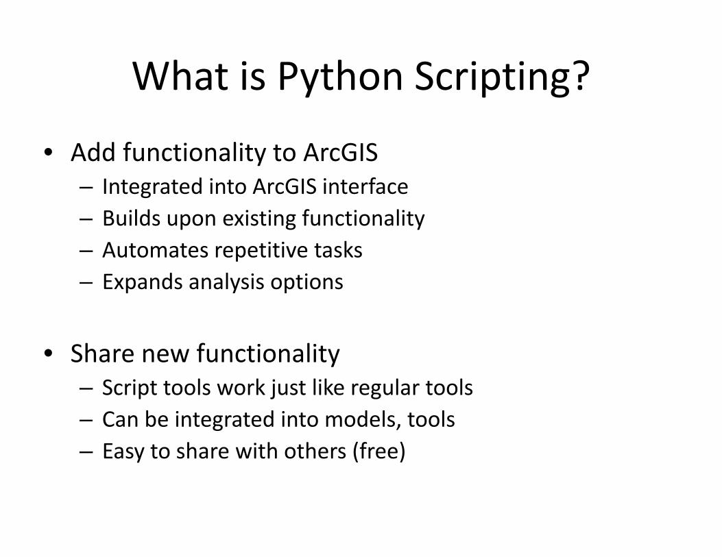
What is Python Scripting?What is Python Scripting?
Add f i li A GIS• Add functionality to ArcGIS– Integrated into ArcGIS interfaceB ild i i f i li– Builds upon existing functionality
– Automates repetitive tasksExpands analysis options– Expands analysis options
Sh f ti lit• Share new functionality– Script tools work just like regular toolsC b i t t d i t d l t l– Can be integrated into models, tools
– Easy to share with others (free)

Why Python?Why Python?
• Free, open source• Object oriented• Basic scripting AND complex object‐oriented programming• “Batteries included”• Embraced by geospatial community, including ESRI• Many libraries

Python CommunityPython Community
http://www.python.org

Python and ArcGISPython and ArcGIS
P h i h f d i i l f A GIS• Python is the preferred scripting language for ArcGIS
1. You can run Python from within ArcGIS– Python Window works like an interactive interpreter
2. All tools in ArcToolbox can be accessed from Python– Import ArcPy to get full library of tools
3 P th i t b d i t t l3. Python scripts can be made into tools– Extend functionality of ArcGIS
4 Support for other scripting languages will go away4. Support for other scripting languages will go away– VBScript and JScript being replaced by Python

Python Versions and ArcGISPython Versions and ArcGIS
• Versions:– Current version of Python is 3.2.2
Python that works with ArcGIS 10 0 is 2 6 x– Python that works with ArcGIS 10.0 is 2.6.x– Python that works with ArcGIS 10.1 is 2.7.x– Move to Python 3.x likely only with ArcGIS 11y y y
• ArcGIS only works with a specific version of Python:y p y– Use the one that comes installed with ArcGIS– Don’t install your own version of Python

Installing PythonInstalling Python
• Remove any existing installations of Python• Install ArcGIS 10.0
– Python 2.6.5 will be installed by default
• Install a Python editorInstall a Python editor• Configure the editor to work with ArcGIS
• Note: You can run different versions of Python on one machine – however, a clean install of Python2.6.5 with ArcGIS 10.0 is recommended

Demo: Check ArcGIS and Python installation

Fundamentals of GeoprocessingFundamentals of Geoprocessingin ArcGIS

Geoprocessing ToolsGeoprocessing Tools

Tool OrganizationTool Organization

Tool DialogsTool Dialogs

Tool ParametersTool Parameters
• Parameters– Requiredq– Optional
• Errors• Warning

Environment SettingsEnvironment Settings

Geoprocessing OptionsGeoprocessing Options

Demo: Geoprocessing Fundamentals

Running Python Code

Two ways to run Python CodeTwo ways to run Python Code
1. Using an Interactive Interpreter– Code is executed directly line‐by‐liney y
2 B i i t2. By running a script– Code saved in a .py file– Run from within a Python editor or directly from
operating systemp g y

Where to type and run Python code?Where to type and run Python code?
1. Python window in ArcGIS– Built into any ArcGIS Desktop application– Good for testing code, very short scripts
2. Python editor– IDLE installed by defaultIDLE installed by default– Many others, PythonWin is a good one to start– Good for more complex code saving scripts– Good for more complex code, saving scripts

Python Window in ArcGISPython Window in ArcGIS

Python Window in ArcGISPython Window in ArcGIS
• Works with current map document• Interactive interpreter:
– Executes code directly line‐by‐line
• Good for testing short codeGood for testing short code• Code can be savedN h ki / d b i• No error checking / debugging
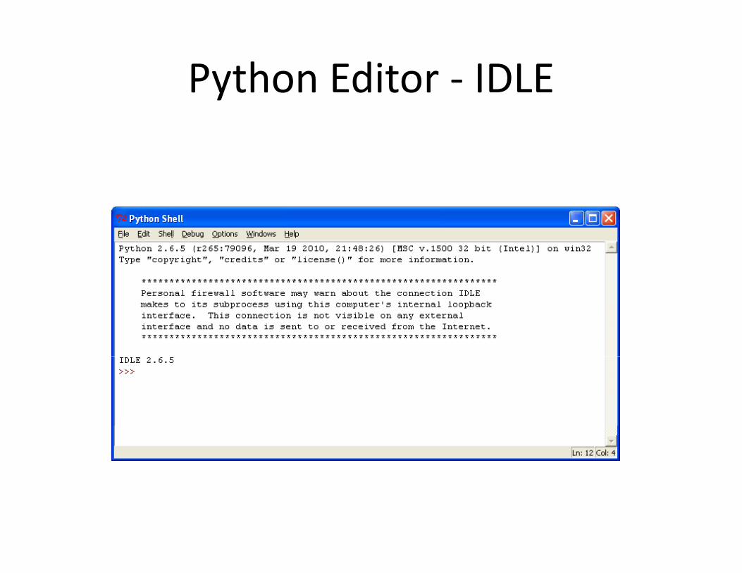
Python Editor IDLEPython Editor ‐ IDLE

Python Editor PythonWinPython Editor ‐ PythonWin

Python EditorPython Editor
• Stand‐alone – outside of ArcGIS• Interactive interpreter:Interactive interpreter:
– Executes code directly line‐by‐line
( )• Save code as script files (.py)• Good for organizing more complex codeGood for organizing more complex code
Demo: Running simple Python code

Python Documentation

Python DocumentationPython Documentation
http://www.python.org

Python DocumentationPython DocumentationVersion specific!p
http://docs.python.org

Python Beginners GuidePython Beginners Guide
http://wiki.python.org/moin/BeginnersGuide

Python BooksPython BooksVersion specific!Version specific!
N f th b k i l di thi A GIS i !None of these books including anything on ArcGIS or geoprocessing!

Python Language Fundamentals

Python Data TypesPython Data Types
• Number (integer and float)• String• List• Tuple• Dictionary
• Strings, lists and tuples are sequences• Strings, numbers and tuples are immutable• List and dictionaries are mutable

NumbersNumbers
• Integers– Whole number, i.e. no decimals– e.g. ‐34
• Floats– Decimal point– e.g. ‐34.8307g

Numerical OperatorsNumerical Operators
Operator Description Integer Floating‐pointExample Result Example Result
* Multiplication 9 * 2 18 9 * 2.0 18.0/%+
DivisionModulusAddition
9 / 29 % 29 + 2
4111
9 / 2.09 % 2.09 + 2.0
4.51.011.0
‐ Subtraction 9 ‐ 2 7 9 – 2.0 7.0
Demo: Numerical Operators

StringsStrings
• A set of characters surrounded by quotes is called a string literal
• To create a string variable, assign a string literal to it
>>> mytext = "Crime hotspot maps are cool.">>> print mytext>>> print mytextCrime hotspot maps are cool.

Quotes in PythonQuotes in Python
• In Python single and double quotes are the same• "NIJ" is the same as 'NIJ'
>>> print "I said: 'Let's go!'">>> print I said: Let s go!
• Quotes in Python are straight‐up• "text" or 'text', not “text” or ‘text’
• Be aware of copy/paste and auto‐formattingBe aware of copy/paste and auto‐formatting
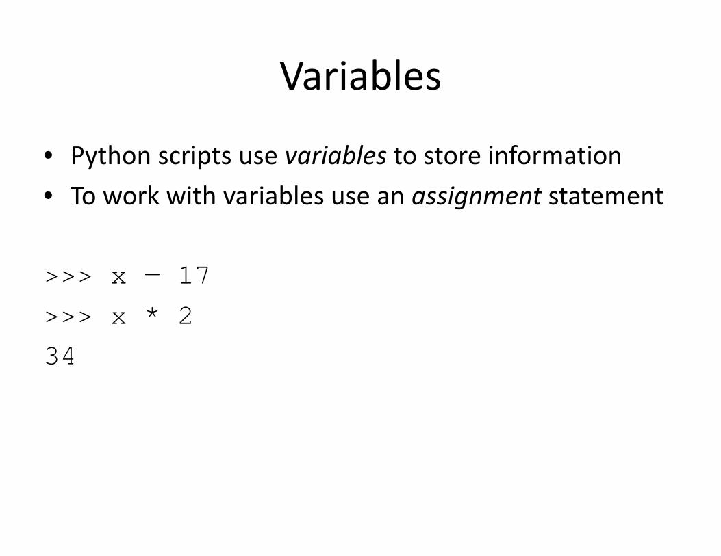
VariablesVariables
• Python scripts use variables to store information• To work with variables use an assignment statement
>>> x = 17>>> x 17>>> x * 234

VariablesVariablesP h d i i• Python uses dynamic assignment
>>> x 17>>> x = 17>>> type(x)<type 'int'><type int >>>> x = "GIS">>> type(x)>>> type(x)<type 'str'>
• No need to declare variables• Value defines the type

Variable NamesVariable Names
• Rules– Letters, digits and underscores– Cannot start with a digit– Don’t use keywords (print, import, etc.)
• RecommendationsRecommendations– Be descriptive (count instead of c)– Keep it short (count instead of count of records)Keep it short (count instead of count_of_records)– Follow convention: all lowercase, use underscores
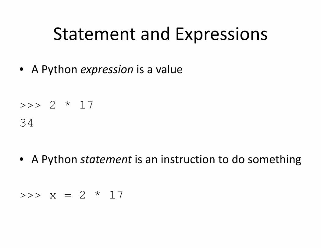
Statement and ExpressionsStatement and Expressions
• A Python expression is a value
>>> 2 * 173434
• A Python statement is an instruction to do something
>>> x = 2 * 17

Working with StringsWorking with Strings
• Concatenate strings
>>> x = "G">>> y = "I">>> y I >>> z = "S">>> print x + y + zGIS
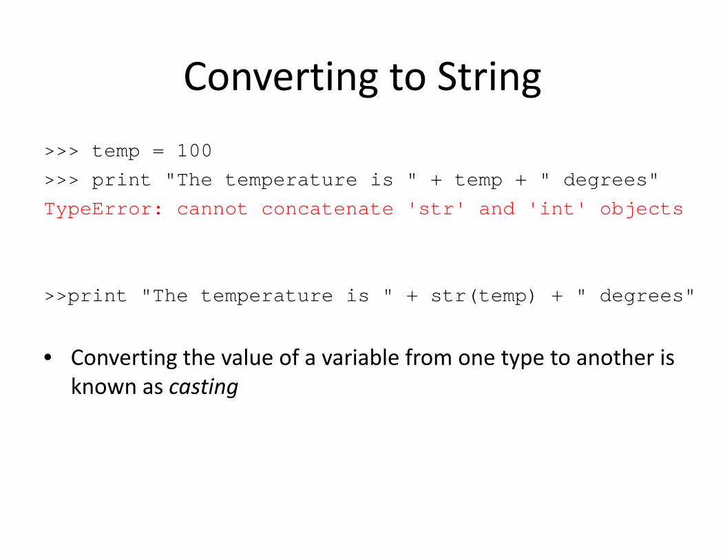
Converting to StringConverting to String100>>> temp = 100
>>> print "The temperature is " + temp + " degrees"TypeError: cannot concatenate 'str' and 'int' objectsTypeError: cannot concatenate str and int objects
>>print "The temperature is " + str(temp) + " degrees"
• Converting the value of a variable from one type to another is known as casting

ListsLists
• A Python list is an ordered set of items• The list of items is surrounded by square brackets [ ], and the
it t d b ( )items are separated by commas (,)• Items can consist of numbers, strings and other data types
mylist = [1, 2, 4, 8, 16, 32]j imywords ["jpg", "bmp", "tif"]
• Lists are very widely used in geoprocessing:– e.g. list of feature classes, list of records, list of fields, etc.

Python FunctionsPython Functions
• A function carries out a certain action• Python has many built‐in functions
<function>(<arguments>)
>> pow(2,3)8
• Using a function is referred to as calling a function• Additional functions can be accessed using modules

Python MethodsPython Methods
• A method is a function that is closely coupled to some object
<object>.<method>(<arguments>)
>>> topic = "Crime Mapping">>> topic.count("i")2
• Many of Python’s data types have methods

String IndexingString IndexingP th t i h i d iti i t• Python strings have an index positioning system
>>> mystring = "Crime Mapping">>> mystring Crime Mapping>>> mystring[0]'C'>>> mystring[-1]'g'
• Strings can be sliced into smaller strings using slicing
>>> mystring[0:5]'Crime’
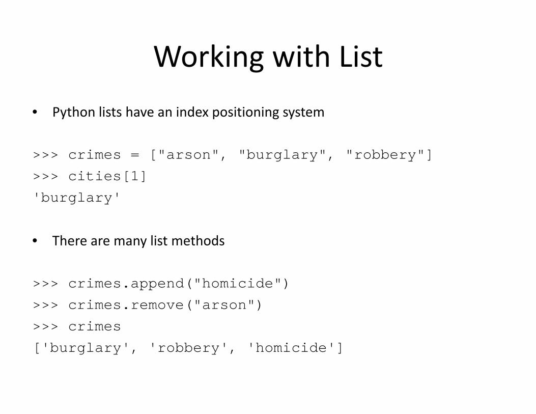
Working with ListWorking with Listh l h d• Python lists have an index positioning system
>>> crimes = ["arson", "burglary", "robbery"]>>> crimes [ arson , burglary , robbery ]>>> cities[1]'burglary'
• There are many list methods
>>> crimes.append("homicide")>>> crimes.remove("arson")>>> crimes.remove( arson )>>> crimes['burglary', 'robbery', 'homicide']
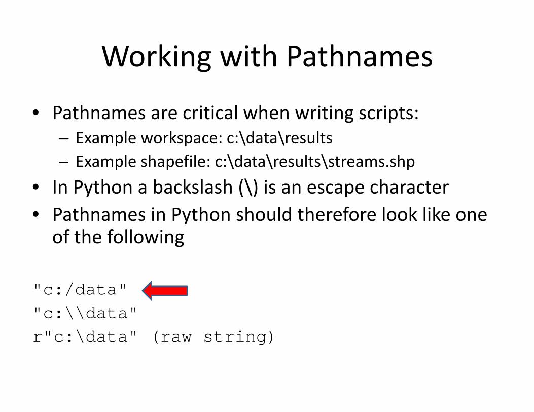
Working with PathnamesWorking with Pathnames
P h i i l h i i i• Pathnames are critical when writing scripts:– Example workspace: c:\data\resultsE l h fil \d \ l \ h– Example shapefile: c:\data\results\streams.shp
• In Python a backslash (\) is an escape character• Pathnames in Python should therefore look like one of the following
"c:/data"\\"c:\\data"
r"c:\data" (raw string)

Python ModulesPython ModulesM d l lik i h b i d i P h• Modules are like extensions that can be imported into Python to extend its capabilities
>>> import time
• A typical module contains a number of specialized functions which can be called once the module has been imported
<module>.<function>
>>> time.localtime()
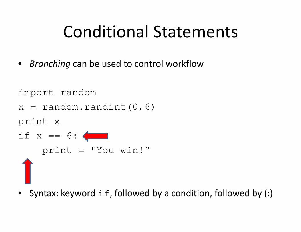
Conditional StatementsConditional Statements
• Branching can be used to control workflow
import randomx = random.randint(0,6)print xif x == 6:
print = "You win!“
• Syntax: keyword if, followed by a condition, followed by (:)
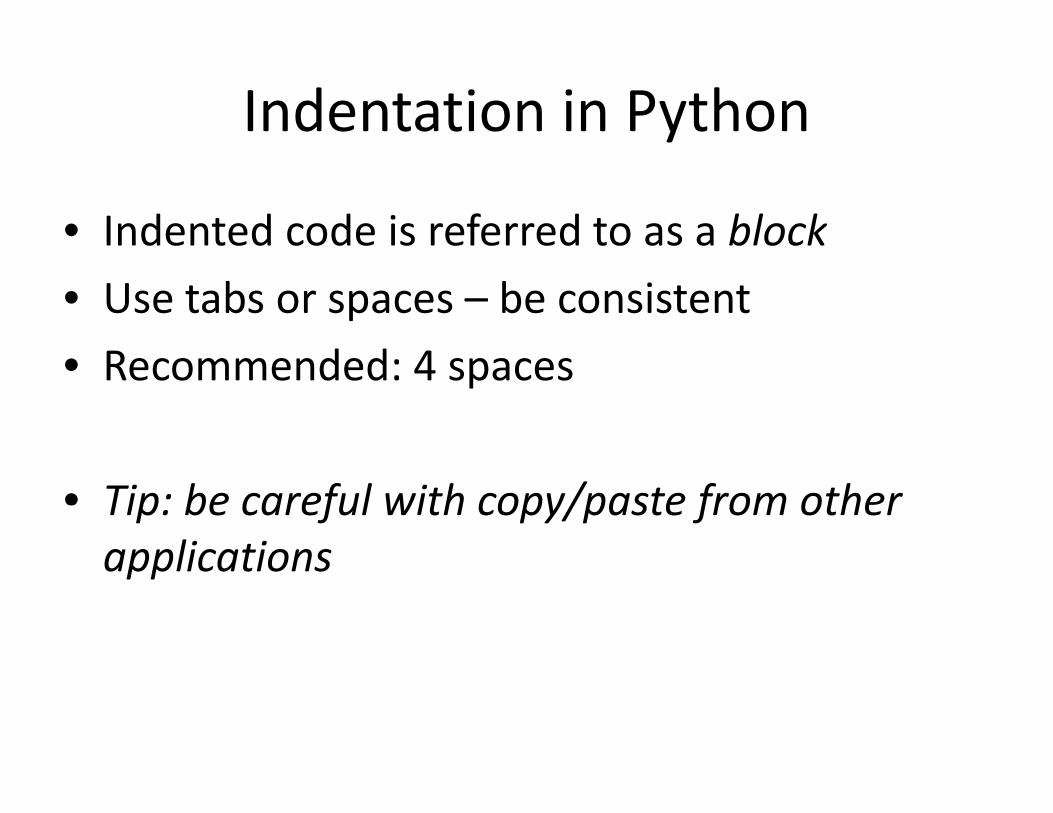
Indentation in PythonIndentation in Python
• Indented code is referred to as a block• Use tabs or spaces – be consistentUse tabs or spaces be consistent• Recommended: 4 spaces
• Tip: be careful with copy/paste from otherTip: be careful with copy/paste from other applications

More Conditional StatementsMore Conditional Statements
f d l• Use of elif and else is optional
import randomimport randomx = random.randint(0,6)print xpif x == 6:
print "You win!" elif x == 5:
print "Try again!" else:else:
print "You lose!"

Loop Structures: WhileLoop Structures: WhileL ll i f• Loop structures allow you to repeat a certain part of your code
• A while loop repeats until a particular condition is reachedA while loop repeats until a particular condition is reached
i = 00while i <= 10:
print ipi += 1
• The while statement uses a sentry variable in the exit condition
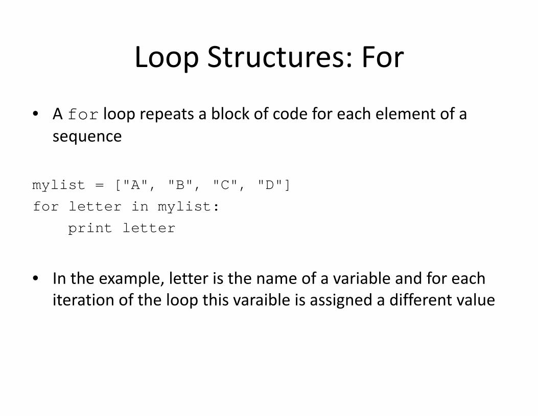
Loop Structures: ForLoop Structures: For
l bl k f d f h l f• A for loop repeats a block of code for each element of a sequence
mylist = ["A", "B", "C", "D"]for letter in mylist:for letter in mylist:
print letter
• In the example, letter is the name of a variable and for each iteration of the loop this varaible is assigned a different value

ArcPy: Geoprocessing using Python
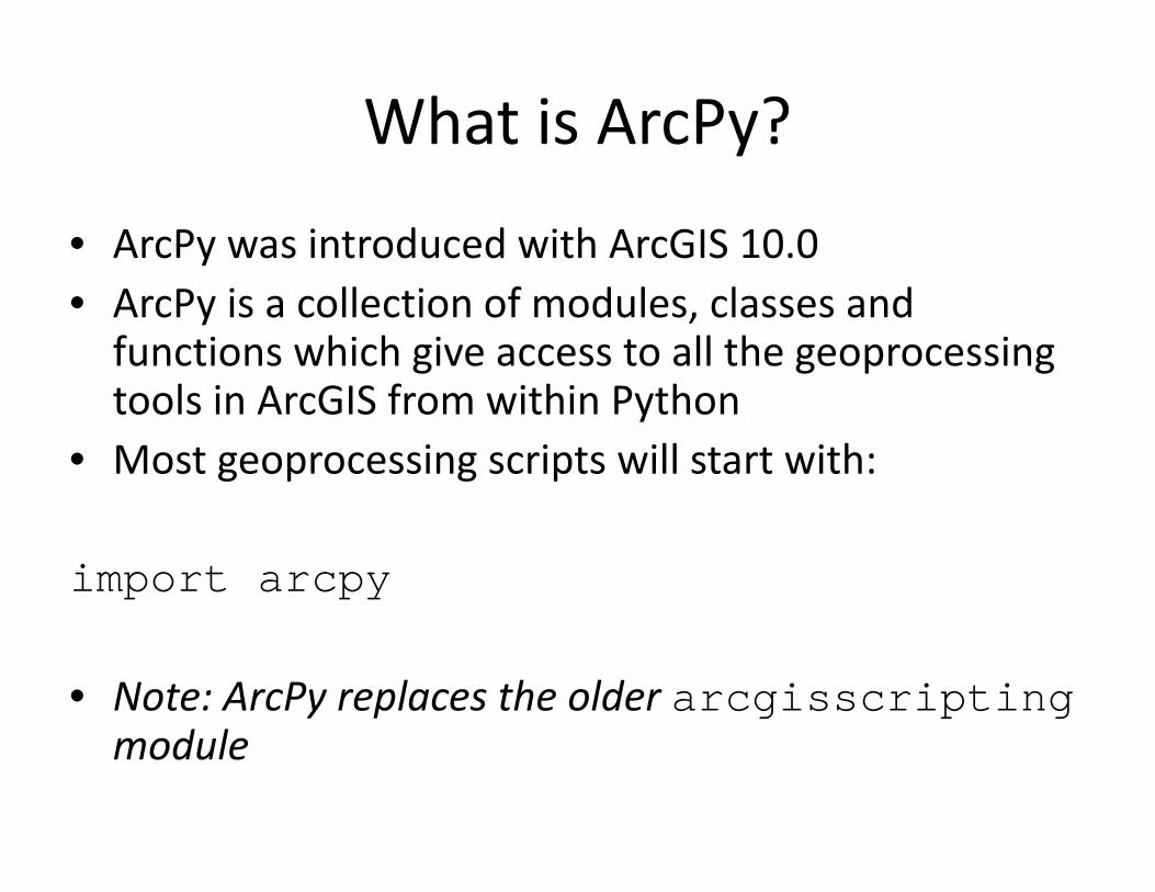
What is ArcPy?What is ArcPy?
A P i d d i h A GIS 10 0• ArcPy was introduced with ArcGIS 10.0• ArcPy is a collection of modules, classes and f i hi h i ll h ifunctions which give access to all the geoprocessingtools in ArcGIS from within PythonM i i ill i h• Most geoprocessing scripts will start with:
import arcpy
• Note: ArcPy replaces the older arcgisscriptingmodule

Setting Current WorkspaceSetting Current Workspace
• After importing ArcPy, most scripts start with setting a workspace to retrieve and store files
import arcpyk " / k h "arcpy.env.workspace = "c:/workshop"
h d b i l d i• In the code above env is a class and workspace is a property of this class
arcpy.<class>.<property>

Using ToolsUsing Tools
• ArcPy gives you access to all tools in ArcToolbox• All tools are provided as functions
arcpy.<toolname_toolboxalias>(<parameters>)
• Example:
import arcpyarcpy env workspace "c:/data"arcpy.env.workspace = "c:/data"arcpy.Clip_analysis("streams.shp", "study.shp", "result.shp")

Tool ParametersTool Parameters
• A good understanding of tool parameters is essential• Parameters have properties:
– Name– Type (feature class, integer, etc.)– Direction (input or output)Direction (input or output)– Required or optional
• Example: Clip toolp p

Tool SyntaxTool Syntax
Tool dialog:
Python syntax: Clip_analysis(in_features, clip_features,out_feature_class,{cluster tolerance}){cluster_tolerance})
Example: Clip_analysis("streams.shp","study.shp"," lt h ")"result.shp")

Optional ParametersOptional Parameters
• Required tool parameters are listed first• Optional tool parameters can be left out
– But what if some need to be set?
Buffer_analysis (in_features, out_feature_classbuffer_distance_or_field, {line_side}, {line_end_type}, {dissolve option}, {dissolve field}){ _ p }, { _ })
arcpy.Buffer_analysis("roads", "buffer", "100 METERS", "", "" "LIST" "Code"), LIST , Code )
arcpy.Buffer_analysis("roads", "buffer", "100 METERS", di l ti LIST di l fi ld C d )dissolve_option=LIST, dissolve_field=Code)

Hard coded ParametersHard‐coded Parameters
• Consider the example
import arcpyimport arcpyarcpy.env.workspace = "c:/data"arcpy.Clip_analysis("streams.shp", "study.shp", "result.shp")
• How can we make this code more usable?

Using Variables for ParametersUsing Variables for Parameters
import arcpyarcpy.env.workspace = "c:/data"infc = "streams.shp"clipfc = "study.shp"outfc = "result.shp"arcpy.Clip_analysis(infc, clipfc, outfc)
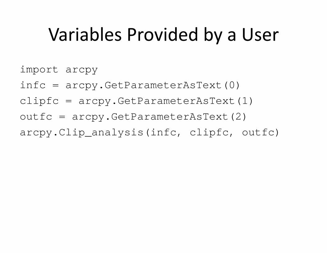
Variables Provided by a UserVariables Provided by a User
import arcpyinfc = arcpy.GetParameterAsText(0)clipfc = arcpy.GetParameterAsText(1)outfc = arcpy.GetParameterAsText(2)arcpy.Clip_analysis(infc, clipfc, outfc)
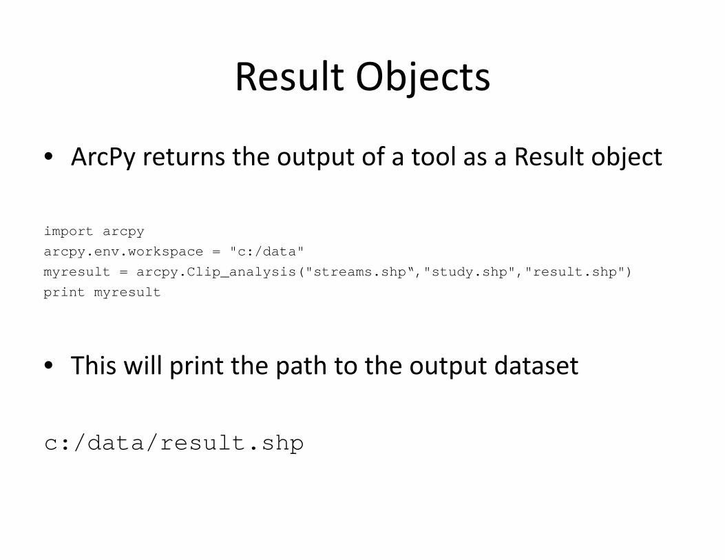
Result ObjectsResult Objects
• ArcPy returns the output of a tool as a Result object
import arcpyarcpy.env.workspace = "c:/data"myresult = arcpy.Clip_analysis("streams.shp“,"study.shp","result.shp")print myresult
• This will print the path to the output dataset
c:/data/result.shp

Multiple Operations using Result ObjectsMultiple Operations using Result Objects
• Result objects can be used as the input into another function
import arcpyarcpy.env.workspace = "c:/data/study.gdb"buffer = arcpy.Buffer_analysis("str","str_buf","100 METERS")count = arcpy.GetCount management(buffer)py _ gprint count
• This allows complex geoprocessing operations
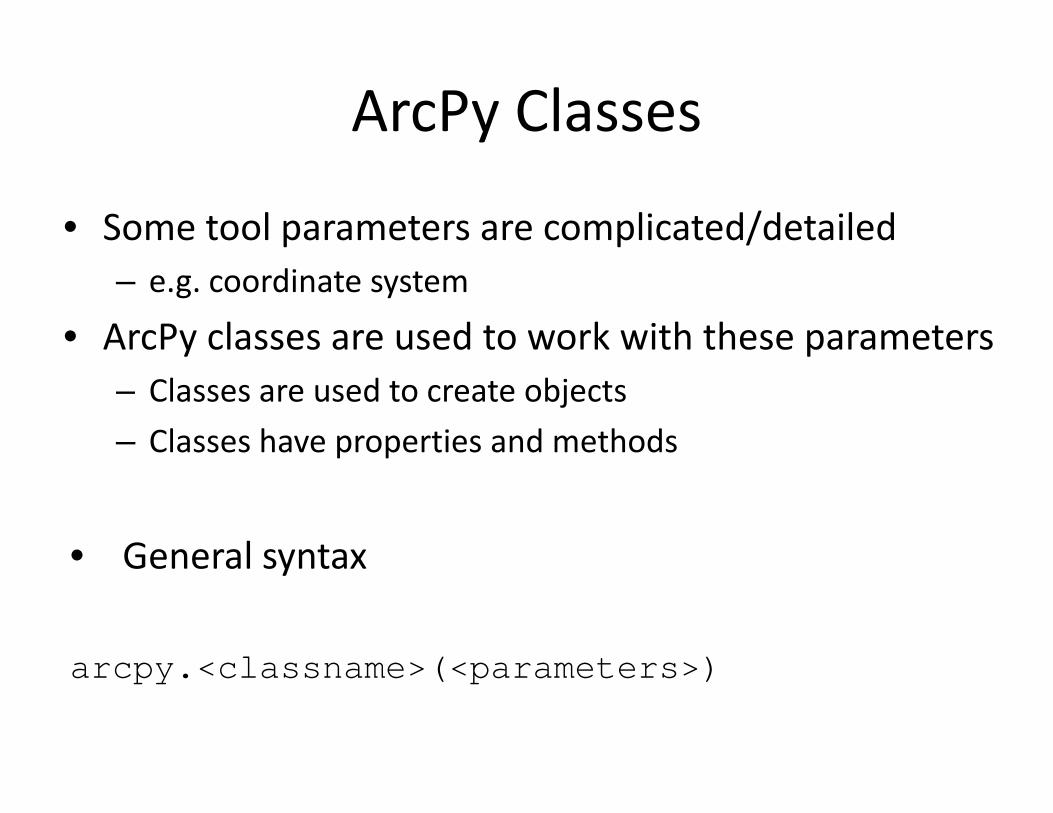
ArcPy ClassesArcPy Classes
• Some tool parameters are complicated/detailed– e.g. coordinate system
• ArcPy classes are used to work with these parameters– Classes are used to create objectsj– Classes have properties and methods
• General syntax
arcpy.<classname>(<parameters>)

ArcPy Classes: ExampleArcPy Classes: Example
• The following is an example of the contents of a .prj file
• To avoid having to work with this actual string, we can use a SpatialReference class

ArcPy Classes: ExampleArcPy Classes: ExampleTh f ll i l i l f bj• The following example creates a spatial reference object based on an existing .prj file ‐ properties of this object can then be used
import arcpyprjfile = "c:/data/streams prj"prjfile = c:/data/streams.prjspatialref = arcpy.SpatialReference(prjfile)myref = spatialRef.nameprint myRefprint myRef
• This will print
NAD_1983_StatePlane_Florida_East_FIPS_0901_Feet
ArcPy Classes: ExampleArcPy Classes: Example
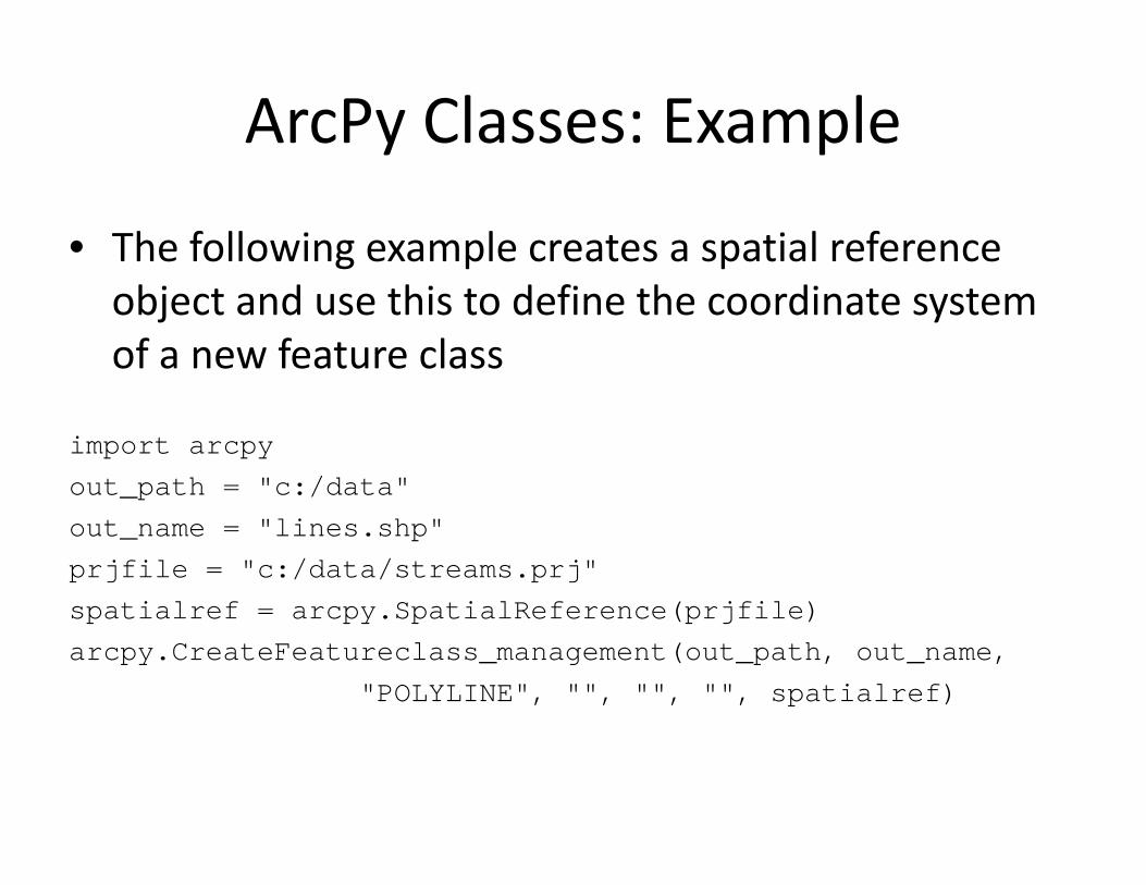
• The following example creates a spatial reference object and use this to define the coordinate system of a new feature class
import arcpyimport arcpyout_path = "c:/data"out_name = "lines.shp"prjfile = "c:/data/streams.prj"spatialref = arcpy.SpatialReference(prjfile)arcpy.CreateFeatureclass management(out path, out name,arcpy.CreateFeatureclass_management(out_path, out_name,
"POLYLINE", "", "", "", spatialref)
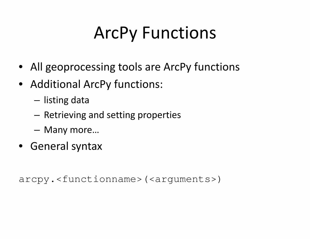
ArcPy FunctionsArcPy Functions
• All geoprocessing tools are ArcPy functions• Additional ArcPy functions:
– listing data– Retrieving and setting propertiesg g p p– Many more…
• General syntaxGeneral syntax
arcpy <functionname>(<arguments>)arcpy.<functionname>(<arguments>)

ArcPy FunctionsArcPy FunctionsC• Cursors
• Describing data• Environment and settings• Fields• General• General data functions• General data functions• Getting and setting parameters• Licensing and installation• Listing data• Messaging and error handling• Progress dialogProgress dialog• Tools and toolboxes
Describing and Listing Data

Describing DataDescribing DataTh D ib f ti i d t d t i ti f d t t• The Describe function is used to determine properties of dataset
• General syntax
import arcpy<variable> = arcpy.Describe(<input dataset>)
• Example:
import arcpydesc = arcpy.Describe("c:/data/streams.shp")print desc shapeTypeprint desc.shapeType

Describing Data: ExampleDescribing Data: Examplei timport arcpyarcpy.env.workspace = "c:/data"infc = "streams.shp"clipfc = "study.shp"outfc = "streams_clip.shp"desc = arcpy Describe(clipfc)desc = arcpy.Describe(clipfc)type = desc.shapeTypeif type == "Polygon":
arcpy.Clip_analysis(infc, clipfc, outfc)else:
print "The clip features are not polygons "print The clip features are not polygons.
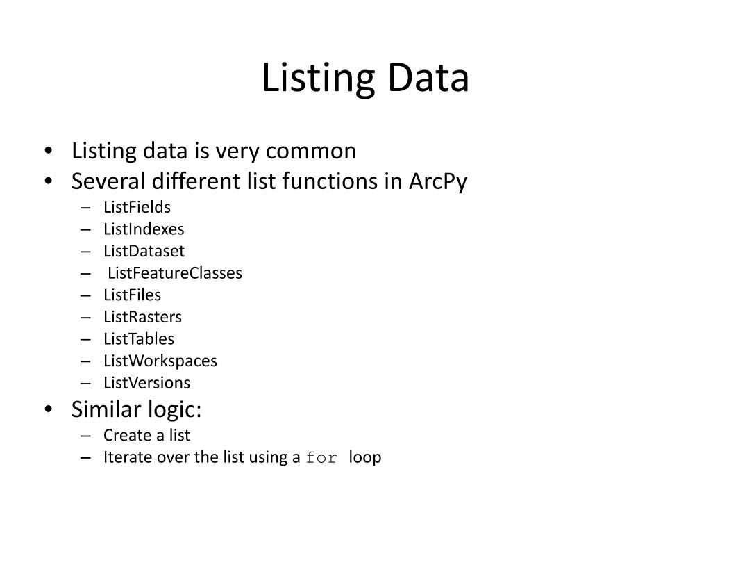
Listing DataListing DataLi ti d t i• Listing data is very common
• Several different list functions in ArcPy– ListFields– ListIndexes– ListDataset– ListFeatureClasses– ListFiles– ListRasters– ListTables– ListWorkspaces– ListVersions
• Similar logic:g– Create a list– Iterate over the list using a for loop

Listing Feature ClassesListing Feature ClassesTh Li tF t Cl f ti t li t f• The ListFeatureClasses function returns a list of feature classes in the current workspace
• General syntax:y
ListFeatureClasses ({wild_card}, {feature_type},{feature dataset}){feature_dataset})
• Example:
import arcpyfrom arcpy import envenv.workspace = "c:/data"fclist = arcpy.ListFeatureClasses()

Listing Feature ClassesListing Feature ClassesN filt i• No filtering:
fclist = arcpy ListFeatureClasses()fclist = arcpy.ListFeatureClasses()
• Filtering based on wild cardFiltering based on wild card
fclist = arcpy.ListFeatureClasses("w*")
• Filtering based on feature type
fclist = arcpy.ListFeatureClasses("", "point")

Listing FieldsListing Fields
h f l h f ld f l• The ListFields function lists the fields in a feature class or table in a specified dataset. G l t• General syntax:
ListFields (dataset {wild card} {field type})ListFields (dataset, {wild_card}, {field_type})
• Examplep
import arcpyarcpy.env.workspace = "c:/data"fieldlist = arcpy.ListFields("roads.shp")

Using Lists in for loopsUsing Lists in for loops
• The following script creates a list of fields of type String and determines for each text field what the length of the field is
import arcpyarcpy.env.workspace = "c:/data"fieldlist = arcpy.ListFields("roads.shp", "",
"String")for field in fieldlist:
print field.name + " " + str(field.length)
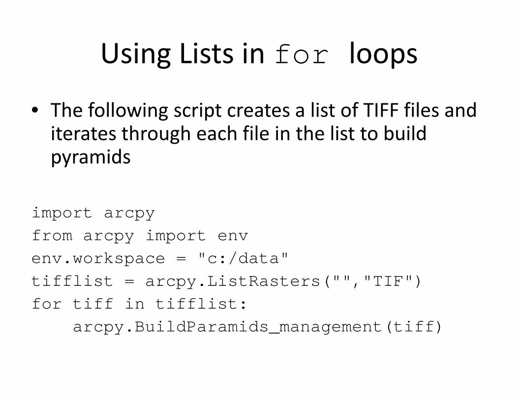
Using Lists in for loopsUsing Lists in for loops
h f ll i i li f fil d• The following script creates a list of TIFF files and iterates through each file in the list to build
idpyramids
import arcpyfrom arcpy import envenv.workspace = "c:/data"tifflist = arcpy.ListRasters("","TIF")for tiff in tifflist:
arcpy.BuildParamids_management(tiff)

Creating Custom Tools
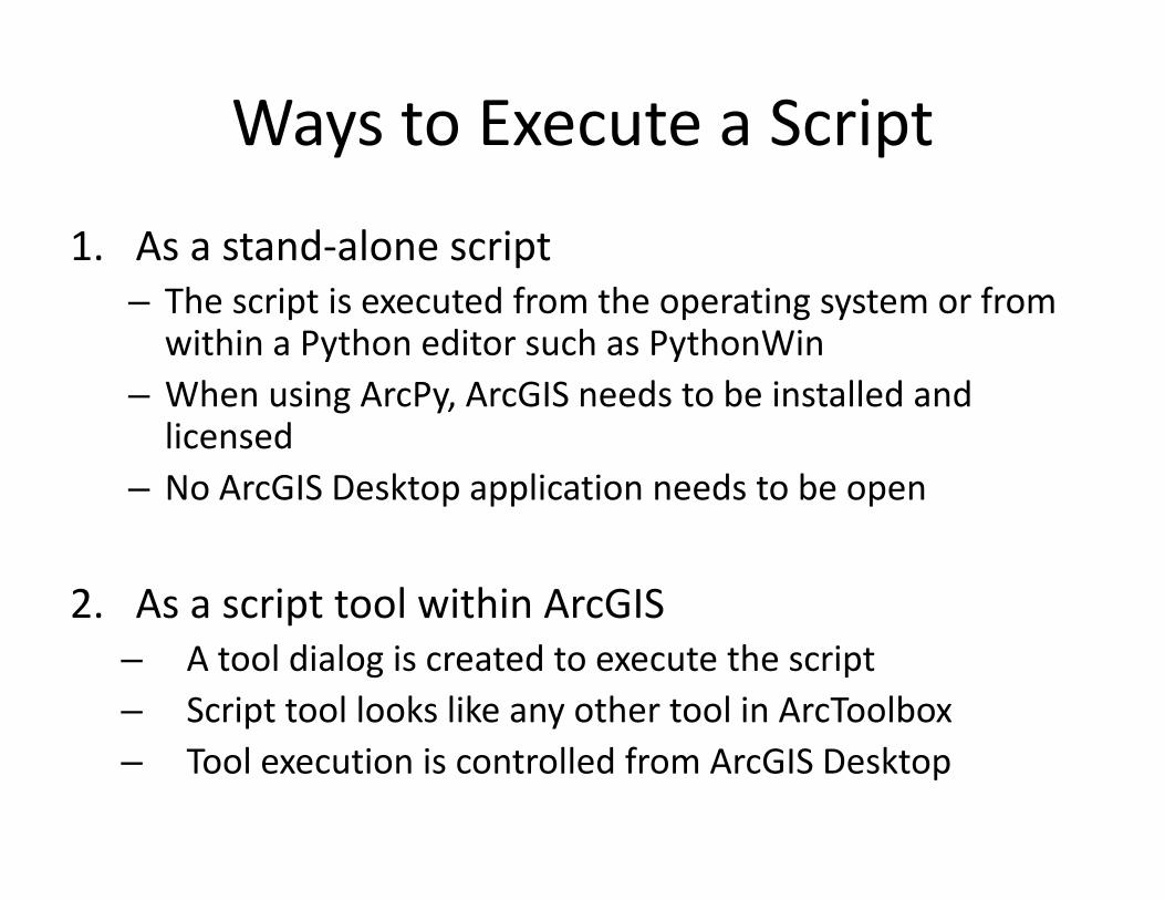
Ways to Execute a ScriptWays to Execute a Script
1 A d l i1. As a stand‐alone script– The script is executed from the operating system or from within a Python editor such as PythonWinwithin a Python editor such as PythonWin
– When using ArcPy, ArcGIS needs to be installed and licensed
– No ArcGIS Desktop application needs to be open
2. As a script tool within ArcGIS– A tool dialog is created to execute the scriptA tool dialog is created to execute the script– Script tool looks like any other tool in ArcToolbox– Tool execution is controlled from ArcGIS Desktopp

Python Scripts as ToolsPython Scripts as Tools

Why Create Script Tools?Why Create Script Tools?
• Tool dialog makes it easier to use• Tool dialog validates user inputs• Becomes part of all geoprocessing• Environment settings are passed on• Environment settings are passed on• Writes messages to the Results window• Easier to share• Does not require user to know Python

Steps to Create Script ToolsSteps to Create Script Tools
1. Create a Python script (.py)2. Create a custom Toolbox (.tbx)2. Create a custom Toolbox (.tbx)3. Add a tool to the Toolbox using Add Script4. Modify the script with inputs and outputs

Example Script: Hardcoded VariablesExample Script: Hardcoded Variables
impo t a cpimport arcpyfrom arcpy import envenv.overwriteoutput = True
/ /infc = "c:/data/points.shp"output = "c:/data/result.txt"k = 10n = 1f = open(output, "w")while n <= k:
result = arcpy.CalculateDistanceBand_stats(infc, n)f.write(str(n) + " " + str(result[1])+ "\n")n = n + 1n n + 1
f.close()

Tool Parameters and DialogTool Parameters and Dialog

Example Script: User Provided ParametersExample Script: User Provided Parameters
impo t a cpimport arcpyfrom arcpy import envenv.overwriteoutput = Trueinfc = arcpy.GetParameterAsText(0)output = arcpy.GetParameterAsText(1)k = arcpy.GetParameter(2)n = 1f = open(output, "w")while n <= k:
result = arcpy.CalculateDistanceBand_stats(infc, n)f.write(str(n) + " " + str(result[1])+ "\n")n = n + 1n n + 1
f.close()

More ArcPy Functionality

More ArcPy FunctionalityMore ArcPy Functionality
• Cursors to work with rows and geometry– Retrieve, edit, create
• arcpy.samodule to work with rasters• arcpy.mappingmodule for map automationa cpy. app gmodule for map automation• Creating custom functions and classes

Resources for Python Scripting in ArcGIS

ArcGIS Desktop HelpArcGIS Desktop Help

Virtual Campus CoursesVirtual Campus Courses
http://training.esri.com
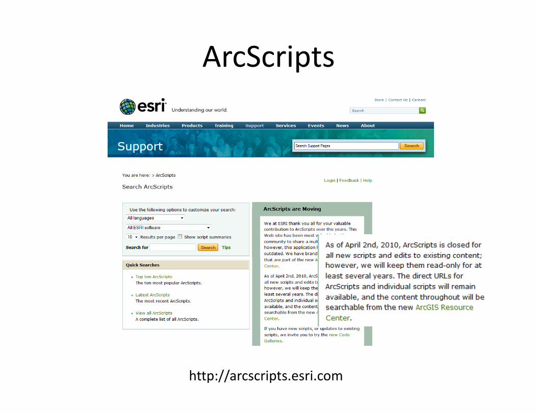
ArcScriptsArcScripts
http://arcscripts.esri.com

ArcGIS Resource CenterArcGIS Resource Center
http://resources.arcgis.com

ArcGIS Resource CenterArcGIS Resource Center
http://resources.arcgis.com/content/geoprocessing/10.0/about

Beyond ArcGIS
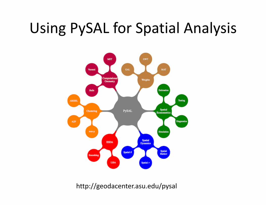
Using PySAL for Spatial AnalysisUsing PySAL for Spatial Analysis
http://geodacenter.asu.edu/pysal

PySALPySAL
• Python library of spatial analysis methods• ESDA, spatial statistics, geostatisticsESDA, spatial statistics, geostatistics• Growing and expandable

Using R for Spatial AnalysisUsing R for Spatial Analysis
• Open source language for data analysis• Libraries have been developed for spatial methods• Large and active user community• Growing and expandable• Growing and expandable

ArcGIS and RArcGIS and R

Script ToolScript Tool

Python script that calls RPython script that calls R

Evaluating R StatementsEvaluating R Statements
Concluding RemarksConcluding Remarks
• Python is a relatively easy to learn language
• ArcGIS is becoming more “Pythonesque”
• Creating time‐savings scripts for repetitive tasks does t t k l t f dnot take a lot of code
• Easy to share script tools

Workshop Materials PostedWorkshop Materials Posted
posted until October 24
h // l db / k h
posted until October 24
http://www.paulzandbergen.com/workshops