Public Participation Vulnerability Mapping Project 070611
15
Public Participation Vulnerability Mapping Project, Halifax Regional Municipality – Pilot Project Eastern Passage-Cow Bay This project has been funded by Nova Scotia Environment under the Climate Change Adaptation Fund Submitted by: Sustainable Environment Management Office, HRM
Transcript of Public Participation Vulnerability Mapping Project 070611

Public Participation Vulnerability Mapping Project, Halifax
Regional Municipality – Pilot Project Eastern Passage-Cow Bay
This project has been funded by Nova Scotia Environment under the
Climate Change Adaptation Fund
Submitted by: Sustainable Environment Management Office, HRM

Disclaimer
This report reflects the views of the author and not necessarily that of the Government of Nova Scotia.
While every reasonable effort has been made to ensure that this document is correct at the time of
printing, the Government of Nova Scotia, its agents and employees, do not assume any responsibility and
shall have no liability, consequential or otherwise, of any kind, arising from the use of or reliance on any
of the information contained in this document.

1.0 INTRODUCTION
Current Climate Change Challenges
Atlantic Canada is facing many challenges relating to climate change now and into the future. Halifax Regional
Municipality’s (HRM’s) communities both on the coast and inland will be affected by these changes. Based on
Environment Canada (EC) modeling to date, within the next 80 years, climate change impacts on HRM are
projected to include:
• an increase in mean temperature from 2o
to 5oC, more days above 30
oC, longer heat wave duration;
• a decrease in days with temperatures below –10oC;
• longer frost-free season;
• increase in precipitation by up to 12% and an increase in rainfall intensity;
• a rise in sea-level of between 50 and 88 cm;
• an increase in peak wind speeds associated with tropical cyclones; and,
• introduction of new and exotic pests1.
HRM has seen impacts related to climate events in recent
years. In particular, between March 2003 and February
2004 Nova Scotia experienced three separate 50-100 year
storm events, including severe spring flooding in March
2003; Hurricane Juan in September of that same year;
followed by a major winter storm nicknamed “White Juan”
in February 2004. In 2007 we were hit by post-tropical
storm Noel and in 2009 Hurricane Danny brushed south,
causing huge waves along the coast. Most recently, in
September 2010 Nova Scotia was hit by Hurricane Earl.
These events have had devastating impacts on public and
private property, and the safety of HRM residents. HRM
residents have seen climate change impacts first hand and
therefore possess a wealth of information on how climate
change has been impacting and changing their communities
over the years.
Vulnerability to climate change and extreme weather events can be reduced through adaptation efforts focused
on limiting exposure through careful planning and preparedness. Regardless of whether the extreme events being
experienced in Nova Scotia are related to a changing climate, HRM and its residents are extremely vulnerable to
these events and their resulting impacts. Part of adaptation is ensuring that residents understand their
vulnerabilities and risks and are educated and prepared for potential climate change related emergency events.
The Climate SMART (Sustainable Mitigation and Adaptation Risk Toolkit) Initiative
In response to HRM’s experience with extreme events and projections indicating that these events are expected to
become more frequent, the Sustainable Environment Management Office (SEMO) in collaboration with members
of ClimAdapt (a network of private sector companies in Nova Scotia that provide climate change adaptation
expertise), partnered with the Federation of Canadian Municipalities, Natural Resources Canada, Environment
Canada and the Province of Nova Scotia to develop an approach that could be implemented to reduce HRM’s
contribution to greenhouse gases and to manage and adapt to the impacts of climate change. The result of this
1 Source: Climate SMART Risk Management Strategy for Halifax Regional Municipality (December 2007).
Courtesy: Sybil Nunn
initiative was Climate SMART (Sustainable Mitigation and Adaptation Risk Toolkit). The objectives of this initiative
were to mainstream climate change into municipal decision making and to develop planning and management
tools both corporately and for the community in preparation for climate change and its impacts.
One of the tools created for the community as part of the Climate SMART Initiative was the Climate SMART
Community Action Guide to Climate Change and Emergency Preparedness2 (the Community Action Guide). This
guide was developed as a tool to help the HRM community minimize climate change impacts and adapt to the
changing climate.
The Project
This report describes a project designed by the
Sustainable Environment Management Office (SEMO) in
consultation with the HRM Emergency Management
Organization (EMO) and funded by the Province of Nova
Scotia’s, Climate Change Adaptation Fund3. This project,
The Public Participation Vulnerability Mapping Project
for Halifax Regional Municipality – Pilot Project Eastern
Passage – Cow Bay was intended to build on the Climate
SMART Initiative. In particular, the project focused on
engaging HRM communities4 to take initiative in the
creation of Climate SMART Community Action Plans5,
which are referenced in the Community Action Guide.
The guide encourages communities to come together
and develop Climate SMART Action Plans to help
prepare for, respond to and recover from climate change related emergency events. Since the development of the
guide in 2007, HRM is not aware of any communities that have taken on the initiative to create such a plan.
Therefore, SEMO identified a need to bring an up-to-date version of the Community Action Guide to the
community to promote this resource and to start them in the process of creating Climate SMART Community
Action Plans through actively engaging residents in mapping their risks, vulnerabilities and resources. This project
also provided an opportunity for HRM to gain helpful community knowledge relating to climate change impacts
(i.e. from extreme events, erosion of property) from individuals who live in these areas.
2 The Climate SMART Community Action Guide to Climate Change and Emergency Preparedness (2010) can be accessed at the
following link: http://www.halifax.ca/climate/documents/ClimateSmartGuide_Final_PressRes.pdf
3 The Climate Change Adaptation Fund aims to help Nova Scotia become more resilient to the impacts of climate change. Its
objectives are to:
a. identify and assess the threats and opportunities related to climate change in Nova Scotia; and
b. build Nova Scotia’s capacity to become better suited to new and different climatic conditions.
4 For the purposes of the Community Action Guide, a Community is defined as a group of people with a common characteristic,
living together within a larger society. A Community for the activity can be a group of neighbours, an entire area of people (i.e.
Eastern Passage, or Cow Bay), or a Community Group such as a Citizens on Patrol Group.
5 A Climate SMART Community Action Plan is utilized to plan what your community will do to prepare for and respond to
related emergencies. It has 3 phases – Before, during and after an Emergency (p.28 Community Action Guide to Climate Change
and Emergency Preparedness).
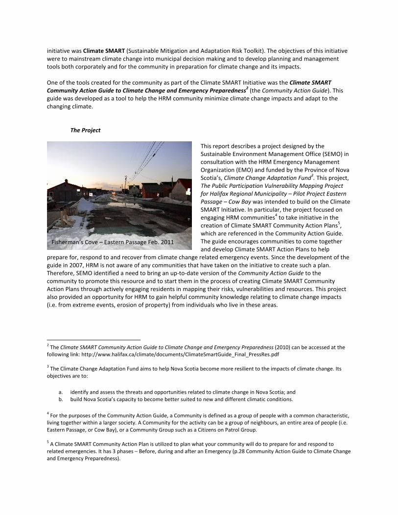
Fisherman’s Cove – Eastern Passage Feb. 2011

SEMO and EMO teamed up to update the Community Action
Guide (2010), present the guide to Joint Emergency Management
(JEM) Teams6 in rural HRM and create a methodology for
engaging communities in creating risk, vulnerability and resource
maps for their areas. This mapping initiative would encourage a
pilot community (Eastern Passage-Cow Bay) to initiate a Climate
SMART Community Action Plan and hopefully engage them on
moving forward in the development of such a plan. In the
Community Action Guide, identifying risks, vulnerabilities and
resources is the first step after establishing a community team, in
developing a community-specific Climate SMART Community
Action Plan.
This initiative helped bring attention to the Community Action
Guide, created relationships between SEMO, EMO and
community members, and has allowed HRM to develop a
creative process that allows us to help communities help
themselves prepare for and respond to climate change
emergencies in their areas. In addition, the pilot project with
Eastern Passage-Cow Bay has provided us with valuable
community knowledge, that can also be used by SEMO in
communicating impacts of climate change in HRM and EMO in
planning for emergency response in that particular area. It has also provided the community of Eastern Passage-
Cow Bay an opportunity to build on relationships with their neighbours and to learn more about the future we are
facing here in HRM.
6 A Joint Emergency Management (JEM) Team is a concept developed by the Halifax Regional Municipality's Emergency Management Office
(EMO), to allow community organizations to prepare for, and respond quickly to, a wide range of emergencies. In times of crises, EMO will
activate JEM Support Centres (JSC) to coordinate humanitarian response to the JEM coverage area. These centres are a facility where trained
individuals can meet to provide local input to the Emergency Operations Centre, located in Dartmouth. This is based on the principle of
"neighbour helping neighbour". In the critical hours following a crisis situation, while local and provincial response agencies are dealing with
the immediate and urgent needs of the municipality, residents in affected communities need to be prepared to help themselves and to assist
their neighbours, who may have been seriously impacted by the event. It is during this period that the JEM will be activated and will mobilize
local resource (for more information on this concept please visit: http://www.halifax.ca/emo/jems.html).
The creative process, February 17, 2011

2.0 PURPOSE
The purpose of this project was to get
communities and individuals involved in
climate change adaptation. Through
educating community members about
HRM’s Community Action Guide, and though
introducing Eastern Passage-Cow Bay to a
process of mapping risks, vulnerabilities and
resources in their specific community
through a fun, interactive community
engagement activity.
As part of this process, SEMO and EMO
developed tools that furthered the goals set
out in the Community Action Guide relating
to assisting a community in identifying its
risks, vulnerabilities and resources. The
process to undertake such an exercise
proved to be a valuable tool to educate
communities about climate change in HRM
and create a dialogue about how to adapt to
such changes.
The pilot project in Eastern Passage-Cow Bay was to educate community members about the Community Action
Guide and test the tools developed by SEMO and EMO to undertake a creative vulnerability, risk and resource
mapping process. The community members in attendance worked together to identify the following on maps:
• Identify specific areas (buildings, activities) where damage/impacts from past emergencies with natural
weather events have occurred (i.e. Hurricane Juan, Hurricane Earl, heavy rains, storm surge events, forest
fires),
• Identify specific residents that are vulnerable to emergencies i.e. seniors, those without transportation,
single parent families, families with small children),
• Identify specific residents/buildings/facilities which are particularly exposed to hazards (i.e. located on the
coast, located in a flood plain, located in low lying areas, located on a hill ; and
• Identify any sensitive natural environments in the community that are vulnerable to climate change
emergencies (i.e. wetlands, beaches, forested areas).
Other:
• Potential safe places in or near the community (i.e. community centres, churches, fire halls)
• Evacuation routes
• Location of equipment for sharing
Through the exercise, Eastern Passage-Cow Bay residents were able to gain a better understanding of how climate
change relates to them, and how to adapt to and prepare for climate change impacts and emergencies in their
communities.
The community knowledge that was gained through this exercise will also be used as a valuable tool for HRM’s
EMO in preparing for climate change related emergencies in this specific area.
The methodology developed and HRM’s Community Action Guide to Climate Change and Emergency Preparedness
(2010) could be applied in other communities around HRM, or across Nova Scotia.
Snapshot of Map created, Feb. 17, 2011

The goals of this project included:
• Updating the 2007 version of the Climate SMART Community Action Guide to Climate Change and
Emergency Preparedness to 2010.
• The provision of Community Action Guide presentations to four Joint Emergency Management (JEM)
Teams in HRM to create relationships and encourage the development of Climate SMART Community
Action Plans in their communities.
• The creation of a clear and concise methodology that can be used in HRM communities and other
communities in NS to work with neighbours to map risks, vulnerabilities and resources in their areas.
SEMO or EMO will be a resource in helping other communities undertake such exercises.
• To hold a community engagement session to assist in the creation of community maps (residents to
identify risks, vulnerabilities and resources, HRM to put this into digital maps) for the pilot area, Eastern
Passage-Cow Bay, delineating risks and vulnerabilities as identified by the session participants. This
information will benefit and can be used by HRM’s EMO, the communities involved, and the Province of
NS in preparing its own vulnerability mapping.
• Building capacity and knowledge around Climate Change related impacts and emergencies in HRM, to
create a better understanding and allow for better decisions regarding adapting to climate change and
climate change related emergencies. It will help communities address potential threats to personal
property, community facilities, and vulnerable people, places and things. It will provide opportunities for
community empowerment, through ensuring that the community has a good understanding of potential
threats, impacts, and how to protect themselves and respond to such impacts.

3.0 METHODOLOGY AND TOOLS
Guide Update and JEM Presentations
The Community Action Guide was reviewed in consultation with HRM Emergency Management Organization
(EMO) staff. The review included updating Climate Change information based on the latest data available, updates
on relevant studies to help with adaptation and emergency preparedness in HRM (including the Halifax Harbour
Sea Level Rise Study, 2009), updates on references, tools, and contact information, and more recent suggestions
on how to mitigate and adapt to climate change based on current technologies. It also involved ensuring that the
guide was consistent with EMO’s approach to Emergency Planning. The updated guide was then presented to four
JEM teams in rural HRM. This was completed based on a desktop review of literature.
Pilot Project Eastern Passage – Cow Bay: Idea for Exercise
HRM and EMO built on what had already been accomplished in terms of the Community Action Guide adaptation
requirements. The guide was updated to reflect the current situation and then SEMO and EMO looked at Phase I
identified in the Adaptation Section, Step Four: Prepare a Climate SMART Community Action Plan (p.28), which
involved Identifying risks, hazards and resources in the community. We further refined a process from this to
undertake such an exercise in HRM communities.
Pilot Project Eastern Passage – Cow Bay: Guiding Principles
It was SEMO and EMO’s intent to follow HRM’s 10 Principles of
Community Engagement as outlined in our Community Engagement
Strategy (December 2008)7 in order to plan the methodology for and
execute the session in the pilot community of Eastern Passage-Cow
Bay. See the 10 principles below:
1. Citizen participation is recognized as an asset, is valued and
encouraged
2. The purpose and the process are clear to all participants
3. Everyone potentially affected by the process has an opportunity to
become involved
4. Barriers to access are recognized and overcome to ensure diverse,
inclusive and balanced participation
5. The process is respectful, fair, effective and transparent
6. Communication is clear, timely and effective
7. Public involvement is adequately resourced
8. Participants are informed of outcomes of community engagement
9. The public has an opportunity to provide feedback on the process
10. Community engagement is evaluated and improved
7 HRMs Community Engagement Strategy can be accessed at the following link:
http://www.halifax.ca/CRCA/CommunityEngagement/CEStrategy.html
Participants discussing climate change
impacts

Pilot Project Eastern Passage – Cow Bay: Session Planning and Implementation
The following tools were developed to assist in advertising the meeting, guiding participants through the process
of identifying risks, vulnerabilities are resources, and setting up a process for follow-up:
o Communications Plan Appendix A
o Presentation Appendix B
Presentation outlining how this information will be valuable to them and valuable to
HRM’s decision making when it comes to Emergency Preparedness
o Maps: Community Maps were developed to be used at the sessions.
o Checklist Appendix C
A basic checklist of risks, vulnerabilities and resources that HRM wanted the community
to consider and identify was developed.
o Key Definitions List Appendix D
A list of key definitions was provided to the participants to help in their understanding
of what they were being asked to identify through the process.
o Evaluation Forms Appendix E
Forms were provided to help evaluate whether this session went well and whether it
was in line with HRM’s Community Engagement Strategy. It also allowed residents to
make comments on the process so that changes could be made if required. The results
of the evaluation have been included in Appendix E as well.
o Sign-in Sheet for Contact Information
Contact information was requested to ensure that HRM could follow-up with residents,
provide them with the completed maps and help guide them through the creation of a
Climate SMART Community Action Plan if requested. Collecting contact information for
those who participated was key to keeping discussion alive and communicating our
willingness to help if they decide to move forward with the process.
o Thank-you email and note Appendix F.
o Updates on process, and maps that have been compiled for the community for their use. Sent
through Email, phone and mail Appendix G
Appendix G includes the finalized maps after being placed into a GIS and a message to
the residents about moving forward in the creation of a Climate SMART Community
Action Plan.

4.0 RESULTS OF PROJECT
TABLE 1.0 PROJECT GOALS AND OUTCOMES TABLE
Goal Outcome
To update the 2007 version of the Climate SMART
Community Action Guide to Climate Change and
Emergency Preparedness to 2010.
• Update was completed in December 2010. Report
is now available on HRM Website at:
http://www.halifax.ca/climate/documents/Climat
eSmartGuide_Final_PressRes.pdf
• The guide was updated to the current situation.
• The format of the guide was also changed to make
it more of a “pocket guide”, as opposed to the
original which was printed on 8.5 X 11 sheets of
paper.
• The guide utilized a coil binding, so that as
residents or communities went through the guide
they could easily keep it open to certain sections,
allowing them to go through the processes
identified on specific pages.
The provision of Community Action Guide
presentations to four Joint Emergency
Management (JEM) Teams in HRM to create
relationships and encourage the development of
Community Action Plans in their communities.
Presentation was prepared and provided at the following
four locations:
• Eastern Shore – October 6th
, 2010 at 7:00 p.m.
• Musquodoboit Valley – October 25th
, 2010 at 7:00
p.m.
• Sheet Harbour - October 18th
, 2010 at 12 noon
• Tantallon – October 13th
, 2010 at 6:30 p.m.
These meetings allowed for an informative presentation on
the contents of the Community Action Guide. Through this,
HRM was able to work with the JEMs to draw on parallels
between their mandates, and what a Climate SMART
Community Action Team is meant to be.
Valuable discussion on climate change impacts in these
communities occurred. The discussion often centered on
experiences in these communities; particularly those
related to extreme events and loss of property due to
erosion.
The difference in the understanding of climate change
impacts varied, especially between the coastal JEMs and
the inland JEM of Musquodoboit Valley. It was apparent
through these sessions that coastal communities have a
good understanding of climate change as they have seen its
impacts over many years of living in these areas. Both types
of communities had a lot of valuable information to share.

While the presentation given was about 30 minutes in
length, the sessions generally lasted upwards of 2 hours
including the valuable discussion.
After the presentation in Tantallon, HRM was requested to
provide the same presentation for the Prospect Citizens on
Patrol Group. This group has expressed interested in
moving forward with creating a Climate SMART Community
Action Plan. A presentation was given on February 10th
,
7:00p.m.
The creation of a clear and concise methodology
that can be used in HRM communities and other
communities in NS to work with neighbours to map
risks, vulnerabilities and resources in their areas.
SEMO or EMO will be a resource in helping other
communities undertake such exercises
• A presentation was developed to present a clear
purpose of the community engagement exercise
and explain the logistics and approach to be
utilized in the session (Appendix B). This was in
line with HRM’s Community Engagement
Principle: Purpose and the Process was clear to all
participants
• In consultation with EMO and a Dalhousie School
of Planning Student, SEMO developed the
requirements for community maps that would be
used to identify risks vulnerabilities and resources.
The maps utilized for this project at a minimum
should include:
-Roads (including street names),
-Buildings; and,
-Major Environmental Features (lakes, rivers,
wetlands, ocean, beaches).
Additional features that could be included are:
-Aerial photo ,
-Identification of critical facilities8; and
-Civic numbers or Property Identification Numbers
(PIDs)
Note: It is realized that not all information is available for
certain areas. Therefore, maps can be adapted to what
information is available for a specific area.
• Maps were split up into different sections to keep
them at a scale that the community could use to
identify different features and buildings. Maps
utilized for our exercise in Eastern-Passage Cow
Bay used a scale of 1: 3,530.
8 Critical Facilities: Facilities that are critical to the health and welfare of the population and that are especially important during and after a
hazard event. Critical facilities include, but are not limited to, shelters, hospitals, and fire stations.

• A larger map was visibly available in the room, this
map was split up into sections and numbers (i.e.
A1, A2) so that participants could find the map for
the area in which they reside (maps were on
different tables throughout the space). A
volunteer was at this map to help participants find
their area and guide them to their table.
• Residents were encouraged in an opening
presentation and by the facilitators at their tables
to move to different areas after completing the
exercise for the location closest to their home
because they also may have valuable information
about other areas in their community.
• At least two maps were provided for each location
to avoid a map getting too ‘messy’, and therefore,
discourage participants to add more information.
The two maps were broken up by Built and
Natural Vulnerability9, and Social Vulnerability
10.
• In consultation with EMO and a Dalhousie School
of Planning Student, SEMO developed a basic
checklist of risks, vulnerabilities and resources that
HRM hoped the community could identify to help
them better understand their community’s
relationship to climate change (see Appendix C).
This also was to ensure that the process was clear
to all participants. SEMO representatives, an EMO
representative, and volunteers from Dalhousie
School of Planning, Bachelor of Community Design
Program helped to facilitate the session. Two
volunteers were sitting at each table to help guide
participants through the process where required
and facilitate discussion around climate change
impacts and opportunities.
• Maps were placed on large tables. Tables should
preferably be round to allow for interaction and
discussion, and to ensure that, as per HRM’s
community engagement principles, everyone
potentially affected by the process has an
opportunity to become involved. In this case, a
round table ensures that all participants are close
9 Vulnerability: Degree to which a system is susceptible to, or unable to cope with, adverse effects of external forces, including natural hazards,
climate variability and weather extremes. Vulnerability is related to the ability of a population or system to react before and cope after a
natural hazard event.
Natural Environment: Areas of the environment that have not experienced large scale human interference or development, primarily located
outside of the built environment.
Built Environment: Manmade areas that provide the setting for human activity. Including personal shelter, transportation networks, utility
networks, and where we work.
10
Social Vulnerability: Special needs populations that may be negatively impacted by the effects of natural hazards. Areas of high social
vulnerability often contain higher concentrations of low to moderate income households that would most likely require public assistance and
services to adapt to or recover from the effects of natural hazards.

to the map and have an opportunity to
participate. Also on these tables were copies of
the checklist sheets (Appendix C) and a list of Key
Definitions (Appendix D) to help in participants’
understanding of the exercise. Pencil crayons,
pens, markers, sticky notes and other tools to help
identify risks, vulnerabilities are resources were
also at the tables.
• Volunteers also took notes on comments being
made that may not have necessarily been
captured on maps.
• Evaluation Forms were filled out and reviewed at
the end of the process to help in improving the
methodology and to evaluate how participants felt
about the sessions (see Attached Form, and
Results – Appendix E). This was in line with HRM’s
principle of community engagement: The public
has an opportunity to provide feedback on the
process and that the session could be evaluated
and improved for use in the future.
• A sign-in sheet was provided in order to obtain
contact information from those who participated.
• Information drawn on maps from residents was
taken back to HRM offices and placed into digital
maps (GIS) that would be given back to the
residents (appendix G – final maps and follow-up
to residents). This tool was utilized to ensure that,
as per HRM’s principles of community
engagement, Participants were informed of
outcomes of the session.
To hold a Community Engagement Session to assist
in the creation of community maps for the pilot
area, Eastern Passage-Cow Bay, delineating risks
and vulnerabilities as identified by the session
participants. This information will benefit and can
be used by HRM’s EMO, the communities involved,
and the Province of NS in preparing its own
vulnerability mapping.
• The Community Engagement Session in Eastern
Passage-Cow Bay was held on February 17th
, 2011
at the Fisherman’s Cove Interpretive Centre.
• There were 17 participants.
• 3 hour time slot allotted (6:30-9:30 p.m.), the
session lasted approximately 2.5 hours and
followed the structure identified in the above
section.
• Food and beverages were provided.
• Related Prizes (Emergency Kits).
To build capacity and knowledge around Climate
Change related impacts and emergencies in HRM
and to create a better understanding and allow for
better decisions regarding adapting to climate
change and climate change related emergencies. It
will help communities address potential threats to
personal property, community facilities, and
vulnerable people, places and things. It will provide
opportunities for community empowerment,
• Copies of the HRM Climate SMART Community
Action Guide to Climate Change and Emergency
Preparedness were printed and distributed to each
participant.
• Red Cross Emergency Kit prizes were awarded to
three participants. These kits included those things
listed in the Community Action Guide to Climate
Change and Emergency Preparedness as required
for an Individual Emergency Pack and Equipment
(p.33)

through ensuring that the community has a good
understanding of potential threats, impacts, and
how to protect themselves and respond to such
impacts.
• A participant evaluation form was handed out at
the workshop and was completed by 14
participants. One of the questions asked was: Did
you feel you gained a greater understanding of
climate change impacts as a result of this
meeting? Only one ‘No’ was received in response
to this. 11 participants indicated ‘Yes’ and 2
individuals did not select ‘Yes’ or ‘No’.
• Participants made several calls to the municipality
after the meeting to discuss taking the Community
Action Guide suggestions further. In particular, a
few community members wanted to start getting
a list of ‘vulnerable’ residents names and phone
numbers together and work on a plan to help
them in emergency situations (this is part of a
Climate SMART Community Action Plan). One
participant also sent a letter with images and news
articles about climate change over the past several
years.
• Thank-you email and letter was sent to
participants (Appendix F).
• Final Maps were the results of the session, and
were provided back to the residents through email
and mail (Appendix G).

5.0 CONCLUSIONS
Overall, HRM believes that this project allowed us to get the word out on our Community Action Guide to Climate
Change and Emergency Preparedness (2010) and actively engage the residents of Eastern Passage – Cow Bay in
working together to adapt to climate change through a creative exercise to map their risks, vulnerabilities and
resources.
The updated guide provides valuable information to be used by the community and is a great resource for
communities not just in HRM but throughout Nova Scotia. Presentations of this guide to four HRM JEM teams,
have started a discussion of how JEM mandates and the emergency preparedness work they are already doing fits
in with the goals of the Community Action Guide. It has also created a discussion on how climate change is related
to the impacts that have been experienced in rural HRM in the past.
HRM believes that through our pilot project in Eastern Passage – Cow Bay, we have developed a valuable
methodology for use in other communities within HRM and in other areas of the Province. Without citizen
participation, however, the pilot session would not have been successful. The information gained from the
residents of Eastern –Passage Cow Bay is valuable to how our organization could work with residents in the future
to educate about Climate Change adaption and how we can help them consider emergency response in their
communities. Communication is key to getting residents to these meetings and engaging them in the issues. HRM’s
plan is to take this project further in the future, not only by reaching out to other communities but also by going
back to Eastern Passage – Cow Bay to involve even more residents. The feedback received at the meeting from the
volunteers, Councillor Jackie Barkhouse, HRM staff and residents was excellent. The evaluation form results can be
seen in Appendix E, which describe how community members in Eastern Passage-Cow Bay received the exercise.