PUBLIC NOTICE NO. FP15-PE01-14 August 3, 2015 CESAM-PD … · Programmatic Biological Opinion...
10
PUBLIC NOTICE NO. FP15-PE01-14 August 3, 2015 CESAM-PD-EC JOINT PUBLIC NOTICE U.S. ARMY CORPS OF ENGINEERS AND FLORIDA DEPARTMENT OF ENVIRONMENTAL PROTECTION PROPOSED ADVANCED MAINTENANCE DREDGING AND PLACEMENT ACTIVITIES FOR THE LOWER PENSACOLA HARBOR FEDERAL NAVIGATION CHANNEL ESCAMBIA COUNTY, FLORIDA A 15-DAY PUBLIC NOTICE A FEDERALLY AUTHORIZED PROJECT Interested persons are hereby notified that the U.S. Army Corps of Engineers (USACE), Mobile District proposes to implement advanced maintenance widening dredging and placement activities for the Lower Pensacola Harbor Federal navigation channel in Escambia County, Florida with placement of the subsequent dredged material into previously certified placement areas described in Public Notice FP09- PE12-10 dated August 25, 2009 and Florida Department of Environmental Protection Agency (DEP) Permit No. 0295-379-001-JC dated December 9, 2010. This public notice is issued in accordance with rules and regulations published in the Federal Register on 26 April 1988. These laws are applied whenever dredged or fill materials may enter waters of the United States, or for the transportation of dredged material for the purpose of placement into ocean waters. The recipient of this notice is requested specifically to review the proposed action as it may impact water quality relative to the requirements of Section 404(b)(l) of the Clean Water Act. Review of any other potential impacts is also requested. WATERWAY AND LOCATION : Pensacola Harbor, Pensacola Pass, Escambia County, Florida. DESCRIPTION OF THE ENTIRE AUTHORIZED PROJECT : The existing Pensacola Harbor Federal navigation project (authorized in 1962 and completed in 1965) consists of the following channels (Figure 1): DEPARTMENT OF THE ARMY MOBILE DISTRICT, CORPS OF ENGINEERS P.O. BOX 2288 MOBILE, ALABAMA 36628-0001 REPLY TO ATTENTION OF:
Transcript of PUBLIC NOTICE NO. FP15-PE01-14 August 3, 2015 CESAM-PD … · Programmatic Biological Opinion...

PUBLIC NOTICE NO. FP15-PE01-14 August 3, 2015 CESAM-PD-EC
JOINT PUBLIC NOTICE
U.S. ARMY CORPS OF ENGINEERS AND
FLORIDA DEPARTMENT OF ENVIRONMENTAL PROTECTION PROPOSED ADVANCED MAINTENANCE DREDGING AND PLACEMENT
ACTIVITIES FOR THE LOWER PENSACOLA HARBOR FEDERAL NAVIGATION CHANNEL
ESCAMBIA COUNTY, FLORIDA
A 15-DAY PUBLIC NOTICE
A FEDERALLY AUTHORIZED PROJECT Interested persons are hereby notified that the U.S. Army Corps of Engineers (USACE), Mobile District proposes to implement advanced maintenance widening dredging and placement activities for the Lower Pensacola Harbor Federal navigation channel in Escambia County, Florida with placement of the subsequent dredged material into previously certified placement areas described in Public Notice FP09-PE12-10 dated August 25, 2009 and Florida Department of Environmental Protection Agency (DEP) Permit No. 0295-379-001-JC dated December 9, 2010. This public notice is issued in accordance with rules and regulations published in the Federal Register on 26 April 1988. These laws are applied whenever dredged or fill materials may enter waters of the United States, or for the transportation of dredged material for the purpose of placement into ocean waters. The recipient of this notice is requested specifically to review the proposed action as it may impact water quality relative to the requirements of Section 404(b)(l) of the Clean Water Act. Review of any other potential impacts is also requested. WATERWAY AND LOCATION: Pensacola Harbor, Pensacola Pass, Escambia County, Florida. DESCRIPTION OF THE ENTIRE AUTHORIZED PROJECT: The existing Pensacola Harbor Federal navigation project (authorized in 1962 and completed in 1965) consists of the following channels (Figure 1):
DEPARTMENT OF THE ARMY MOBILE DISTRICT, CORPS OF ENGINEERS
P.O. BOX 2288 MOBILE, ALABAMA 36628-0001
REPLY TO ATTENTION OF:

PUBLIC NOTICE NO. FP15-PE01-14 August 3, 2015 CESAM-PD-EC
2
1) a 35 by 500-foot (ft) entrance channel approximately 5 miles long, from the Gulf of Mexico to lower Pensacola Bay;
2) a 33 by 300-ft bay channel;
3) two 33 by 300-ft parallel approach channels that lead to opposite ends of the inner harbor channel;
4) an inner-harbor channel 33 by 500-ft, and 3,950 ft long;
5) a 30 by 250-ft approach channel to the pierhead line south of the Muscogee wharf; and
6) a 15 by 100-ft entrance channel into Bayou Chico, thence a channel 14 by 75-ft, which proceeds about 4,400 ft long into a turning basin 14-ft deep and 500-ft square. Plane of reference for the authorized depths is mean lower low water (MLLW).
PROPOSED ACTION: The currently proposed action of advanced maintenance dredging of the Lower Pensacola Harbor Federal navigation channel (Figure 2) would be to widen portions of the entrance channel experiencing high shoaling rates which impede safe navigation leading up to, and through, Pensacola Pass. Advanced maintenance dredged material would be placed within the approved and previously used Perdido Key swash zone placement area of the Gulf Islands National Seashore (GUIS) located on Perdido Key, Florida (Figure 3). Three segments of the Lower Pensacola Harbor Federal navigation channel are proposed for advanced maintenance dredging and placement activities (Figure 2). Advanced maintenance widening is proposed for Segment A: 100 feet to the east of the channel through Pensacola Pass for approximately one mile with approximately 100,000 cubic yards (cys) removed; Segment B: 100 feet to the west of the upper entrance channel for approximately one-half mile with approximately 80,000 cys removed; and Segment C: 50 feet on both sides of the lower section of the entrance channel for approximately one mile with approximately 40,000 cys removed for a total volume removed of approximately 220,000 cys for the proposed advanced maintenance (Figure 2). As a result of the advanced widening, future operations and maintenance (O&M) dredging to maintain these dimensions would be completed every four to six years and would require approximately 500,000 to 600,000 cys be removed and placed within the Perdido Key swash zone placement area. Construction of the advanced maintenance widening, and future O&M dredging, within these portions of the Lower Pensacola Harbor Federal navigation channel would not be conducted all at once. Each section, based on need, would be dredged contingent upon adequate funding and dredging equipment availability. The proposed action would maintain an authorized project depth of -35 feet MLLW (plus 2 feet of advanced maintenance and plus 2 feet of allowable over-depth dredging for a total project segment depth of -39 feet MLLW). Maintenance dredging of soft

PUBLIC NOTICE NO. FP15-PE01-14 August 3, 2015 CESAM-PD-EC
3
dredged material with hopper, mechanical, and/or hydraulic pipeline dredges tends to disturb bottom sediments several feet deeper than the target depth due to inaccuracies of the dredging process. An additional 3 feet of sediment below the 2-ft paid allowable overdepth dredging cut may be disturbed in the process with minor amounts of material being removed. To minimize impacts to protected species of concern and other wildlife resources, it has been previously coordinated that dredged material would be placed between the +3-ft and -12-ft North American Vertical Datum (NAVD) 88 contours of the Perdido Key swash zone placement area. Placement of material in this manner meets established regional sediment management principles by returning suitable beach sand to the littoral system, allowing rapid equilibration of material into a more naturally shaped profile, and minimizing impacts to federally protected species of concern. WATER QUALITY CERTIFICATION: Pursuant to requirements of the Clean Water Act, State Water Certification is required for the proposed action. Water quality certification was issued by the Florida DEP under Permit No. 0295379-001-JC dated December 9, 2010 for a period of ten years. The USACE, Mobile District has requested a minor permit modification from the Florida DEP to incorporate proposed advanced maintenance widening (DEP File No. 0295379-003-JN) of the Lower Pensacola Harbor Federal navigation channel. Upon completion of the required comment period, a decision relative to water quality certification will be made by the Florida DEP. COASTAL ZONE CONSISTENCY: Pursuant to the Coastal Zone Management Act, the proposed action is consistent with the Florida Coastal Management Program to the maximum extent practicable. Coastal zone consistency was issued by the Florida DEP under Permit No. 0295379-001-JC dated December 9, 2010 for a period of ten years. The USACE, Mobile District has requested a minor permit modification from the Florida DEP to incorporate proposed advanced maintenance widening (DEP File No. 0295379-003-JN) of the Lower Pensacola Harbor Federal navigation channel. Upon completion of the required comment period, a decision relative to coastal zone consistency will be made by Florida DEP. USE BY OTHERS: The proposed action is not expected to create significant impacts on land and/or water use plans. NATIONAL ENVIRONMENTAL POLICY ACT (NEPA) CONSIDERATIONS: A draft Environmental Assessment (EA) has been prepared and available for review in the USACE, Mobile District Office or online at http://www.sam.usace.army.mil/Missions/PlanningEnvironmental.aspx. Based on the conclusion presented in the draft EA, it is determined that the implementation of the proposed action would not result in long-term adverse impacts and that no significant cumulative impacts would occur. Upon finalization of the draft EA, a Findings of No Significant Impact (FONSI) will be prepared. SECTION 404(b)(1) EVALUATION REPORT: An evaluation of water quality impacts associated with the proposed action was prepared in accordance with guidelines

PUBLIC NOTICE NO. FP15-PE01-14 August 3, 2015 CESAM-PD-EC
4
promulgated by the Environmental Protection Agency under Section 404(b)(1) of the Clean Water Act. Impacts associated with this action include a temporary increase in turbidity and suspended solids concentrations in and adjacent to the Perdido Key swash zone placement area, short-term elimination of benthic organisms and localized short-term degradation of aesthetics near the placement area. A draft Section 404(b)(1) evaluation report has been prepared and available for review (Appendix A in the draft EA) in the USACE, Mobile District Office or online at http://www.sam.usace.army.mil/Missions/PlanningEnvironmental.aspx. THREATENED AND/OR ENDANGERED SPECIES: The project area is host to the following listed threatened and endangered species. - Loggerhead sea turtle (Caretta caretta) - Green sea turtle (Chelonia mydas) - Kemp's ridley sea turtle (Lepidochelys kempi) - Leatherback sea turtle (Dermochelys coriacea) - Gulf sturgeon (Acipenser oxyrinchus desotoi) - West Indian manatee (J'richechus manatusfloridanus) - Perdido Key beach mouse (Peromystus polionotus trissyllepsis) - Piping plover (Charadvius melundus) - Red knot (Calidris canutus rufa) Previous coordination with the U.S. Department of the Interior, Fish and Wildlife Service (USFWS) and the U.S. Department of Commerce, National Marine Fisheries Service (NMFS), Protected Resource Division (PRD) for routine O&M dredging and placement activities associated with the Lower Pensacola Harbor Federal navigation channel has indicated that similar actions were not likely to adversely affect threatened and endangered species or critical habitats under their purview in conjunction with certain conservation measures. Past O&M dredging of the Pensacola Harbor Federal navigation channel was coordinated with the USFWS and NMFS-PRD. The USFWS issued a Statewide Programmatic Biological Opinion (SPBO) for Shore Protection Activities along the Coast of Florida (September 20, 2010). In 2015, the USFWS revised the 2010 SPBO to include designated loggerhead sea turtle critical habitat. In 2007, NMFS-PRD issued a biological opinion for dredging and placement activities associated with the Naval Air Station Pensacola channel which was subsequently determined to be applicable to the Federal navigation channel. NMFS-PRD determined that use of hydraulic dredging equipment (hopper or cutterhead pipeline) is not likely to adversely affect sea turtles and Gulf sturgeon. The USACE, Mobile District is currently coordinating with the USFWS for the recently listed red knot species and requested concurrence with its determination of not likely to adversely affect (NLAA). The recently designated terrestrial nesting habitat for loggerhead sea turtles is addressed in the 2015 SPBO. Additionally, the USACE, Mobile District determined the proposed action would have no effect on loggerhead

PUBLIC NOTICE NO. FP15-PE01-14 August 3, 2015 CESAM-PD-EC
5
sea turtles critical habitat associated with their nearshore reproductive habitat. This determination was provided to NMFS-PRD. ESSENTIAL FISH HABITAT (EFH): EFH is defined in the Magnuson-Stevens Fishery Conservation and Management Act as ''those waters and substrates necessary to fish for spawning, breeding, feeding or growth to maturity”. The designation and conservation of EFH seeks to minimize adverse effects on habitat caused by fishing and non-fishing activities. The NMFS-Habitat Conservation Division (HCD) has identified EFH habitats for the Gulf of Mexico in its Fishery Management Plan Amendments. These habitats include estuarine areas, such as estuarine emergent wetlands, seagrass beds, algal flats, mud, sand, shell, and rock substrates, and the estuarine water column. The habitat in the project area includes the lower Pensacola Bay and Gulf of Mexico waters and consists primarily of sandy substrate consistent with sediment along the northern Gulf of Mexico. Based on the approach for the implementation of the dredging and disposal activities and the time that it would take to complete each phase and the size of the proposed placement areas in relation to the total available acreage of similar habitat within the Gulf of Mexico, it has been coordinated with NMFS-HCD that the proposed action would not result in long-term adverse effects to EFH. A concurrence from NMFS-HCD was received via email on July 24, 2015. Further discussion of EFH can be found in the draft EA. CULTURAL RESOURCES CONSIDERATION: Cultural resources consist of prehistoric and historic districts, sites, structures, artifacts, and any other physical evidence of human activity considered relevant to a culture or community for scientific, traditional, religious, or other reasons. They include archaeological resources (both prehistoric and historic), historic architectural resources, and American Indian sacred sites, and traditional cultural properties. Historic properties (as defined in 36 CFR 60.4 and 36 CFR 800.15(1) (1)) are significant archaeological, architectural, or traditional resources that are defined as either eligible or ineligible for listing in the National Register of Historic Places (NRHP). A detailed discussion concerning the potential effects of routine O&M dredging and placement activities associated with the Lower Pensacola Harbor Federal navigation channel on historic properties in accordance with Section 106 of the National Historic Preservation Act of 1966 (as amended) and its implementing regulations is included in the 2011 Lower Pensacola Harbor EA (attached at website http://www.sam.usace.army.mil/Missions/PlanningEnvironmental.aspx). Previous coordination with the Florida State Historical Preservation Office (SHPO) indicated no historic or cultural properties were located within the Lower Pensacola Harbor Federal navigation channel. There are however, two targeted resources within the waters adjacent to the Perdido Key swash zone placement area (one recorded shipwreck (Concrete Ballast Wreck 8ES2995) and an unrecorded historic barge shipwreck). A 1,000-ft. radius protective buffer zone was established during previous dredging and placement activities around the two cultural resource targets in the adjacent nearshore area. These sites, however, are well outside of the project area construction zones. The currently proposed action of advanced maintenance widening is being coordinated with the Florida SHPO.
PUBLIC NOTICE NO. FP15-PE01-14 August 3, 2015 CESAM-PD-EC
6
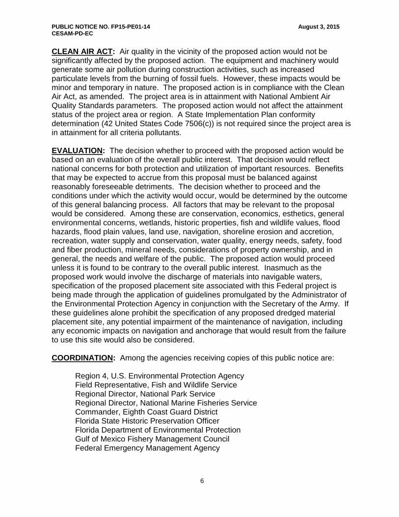
CLEAN AIR ACT: Air quality in the vicinity of the proposed action would not be significantly affected by the proposed action. The equipment and machinery would generate some air pollution during construction activities, such as increased particulate levels from the burning of fossil fuels. However, these impacts would be minor and temporary in nature. The proposed action is in compliance with the Clean Air Act, as amended. The project area is in attainment with National Ambient Air Quality Standards parameters. The proposed action would not affect the attainment status of the project area or region. A State Implementation Plan conformity determination (42 United States Code 7506(c)) is not required since the project area is in attainment for all criteria pollutants. EVALUATION: The decision whether to proceed with the proposed action would be based on an evaluation of the overall public interest. That decision would reflect national concerns for both protection and utilization of important resources. Benefits that may be expected to accrue from this proposal must be balanced against reasonably foreseeable detriments. The decision whether to proceed and the conditions under which the activity would occur, would be determined by the outcome of this general balancing process. All factors that may be relevant to the proposal would be considered. Among these are conservation, economics, esthetics, general environmental concerns, wetlands, historic properties, fish and wildlife values, flood hazards, flood plain values, land use, navigation, shoreline erosion and accretion, recreation, water supply and conservation, water quality, energy needs, safety, food and fiber production, mineral needs, considerations of property ownership, and in general, the needs and welfare of the public. The proposed action would proceed unless it is found to be contrary to the overall public interest. Inasmuch as the proposed work would involve the discharge of materials into navigable waters, specification of the proposed placement site associated with this Federal project is being made through the application of guidelines promulgated by the Administrator of the Environmental Protection Agency in conjunction with the Secretary of the Army. If these guidelines alone prohibit the specification of any proposed dredged material placement site, any potential impairment of the maintenance of navigation, including any economic impacts on navigation and anchorage that would result from the failure to use this site would also be considered. COORDINATION: Among the agencies receiving copies of this public notice are: Region 4, U.S. Environmental Protection Agency Field Representative, Fish and Wildlife Service Regional Director, National Park Service Regional Director, National Marine Fisheries Service Commander, Eighth Coast Guard District Florida State Historic Preservation Officer Florida Department of Environmental Protection Gulf of Mexico Fishery Management Council Federal Emergency Management Agency


PUBLIC NOTICE NO. FP15-PE01-14 August 3, 2015 CESAM-PD-EC
8
Figure 1: Location Map of the Pensacola Harbor Federal Navigation Channel

PUBLIC NOTICE NO. FP15-PE01-14 August 3, 2015 CESAM-PD-EC
9
Figure 2: Overview of proposed advanced maintenance locations

PUBLIC NOTICE NO. FP15-PE01-14 August 3, 2015 CESAM-PD-EC
10
Figure 3: Approved placement areas for the Pensacola navigation project