Prospective Work on Regridding of Remote Sensing Measurements Regridding of Remote Sensing...
9
Prospective Work on Regridding of Remote Sensing Me asurements Y. Calisesi International Space Science Institute V. Soebijanta Belgian Institute of Space Aeronomy
-
date post
19-Dec-2015 -
Category
Documents
-
view
229 -
download
3
Transcript of Prospective Work on Regridding of Remote Sensing Measurements Regridding of Remote Sensing...

Prospective Work onRegridding of Remote Sensing Measurements
Y. CalisesiInternational Space Science Institute
V. SoebijantaBelgian Institute of Space Aeronomy
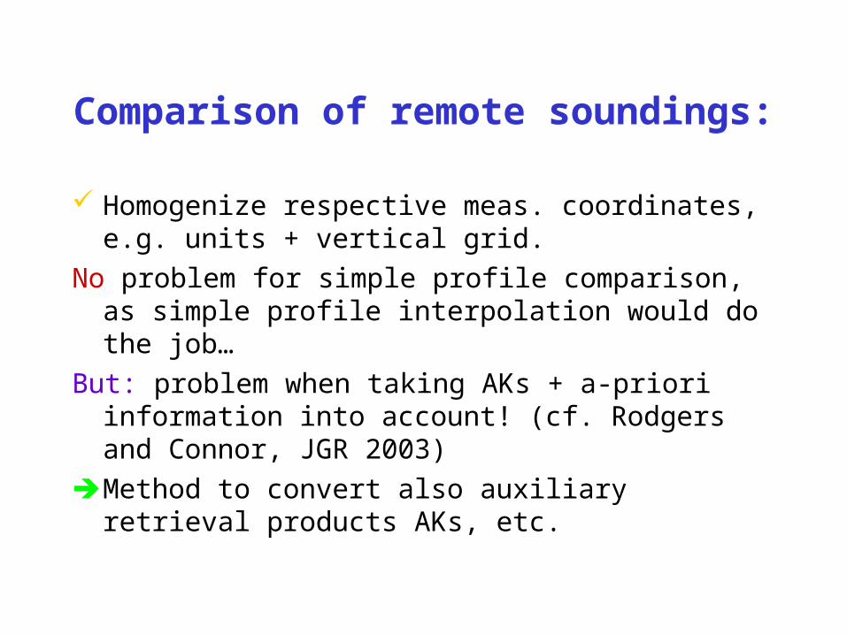
Comparison of remote soundings:
Homogenize respective meas. coordinates, e.g. units + vertical grid.
No problem for simple profile comparison, as simple profile interpolation would do the job…
But: problem when taking AKs + a-priori information into account! (cf. Rodgers and Connor, JGR 2003)
Method to convert also auxiliary retrieval products AKs, etc.

Idea (Trivial!)
: Retrieved profile on a given vertical grid
: Retrieved profile on another vertical grid
It exists W such as
or
And
or
: Pseudo-inverse of W
)x-W(xx-x 00
xy00 ε)xK(xyy
y00 ε)xx(Kyy
xWx *
*W
x
Wxx
)x-x(Wx-x 0*
0
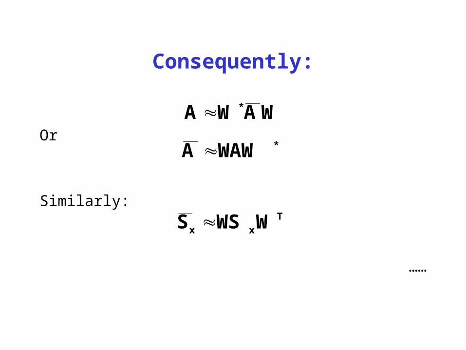
Consequently:
Or
Similarly:
……
WAWA **WAWA
Txx WWSS
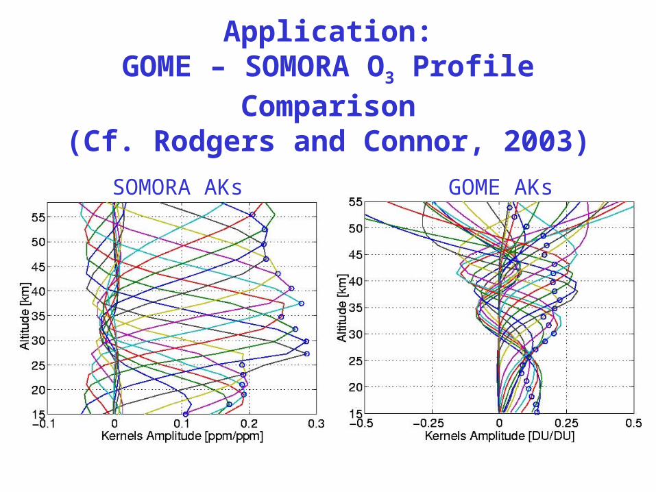
Application:GOME – SOMORA O3 Profile
Comparison(Cf. Rodgers and Connor, 2003)
SOMORA AKs GOME AKs
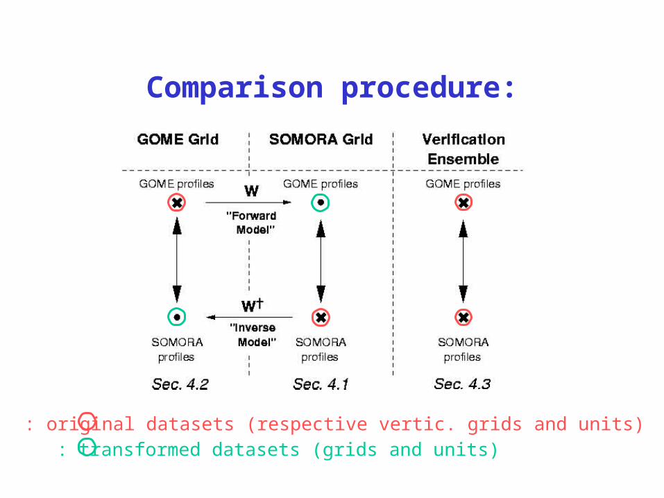
Comparison procedure:
: original datasets (respective vertic. grids and units): transformed datasets (grids and units)
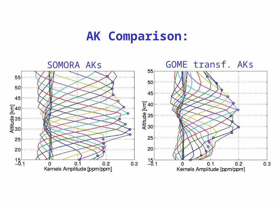
AK Comparison:
SOMORA AKs GOME transf. AKs
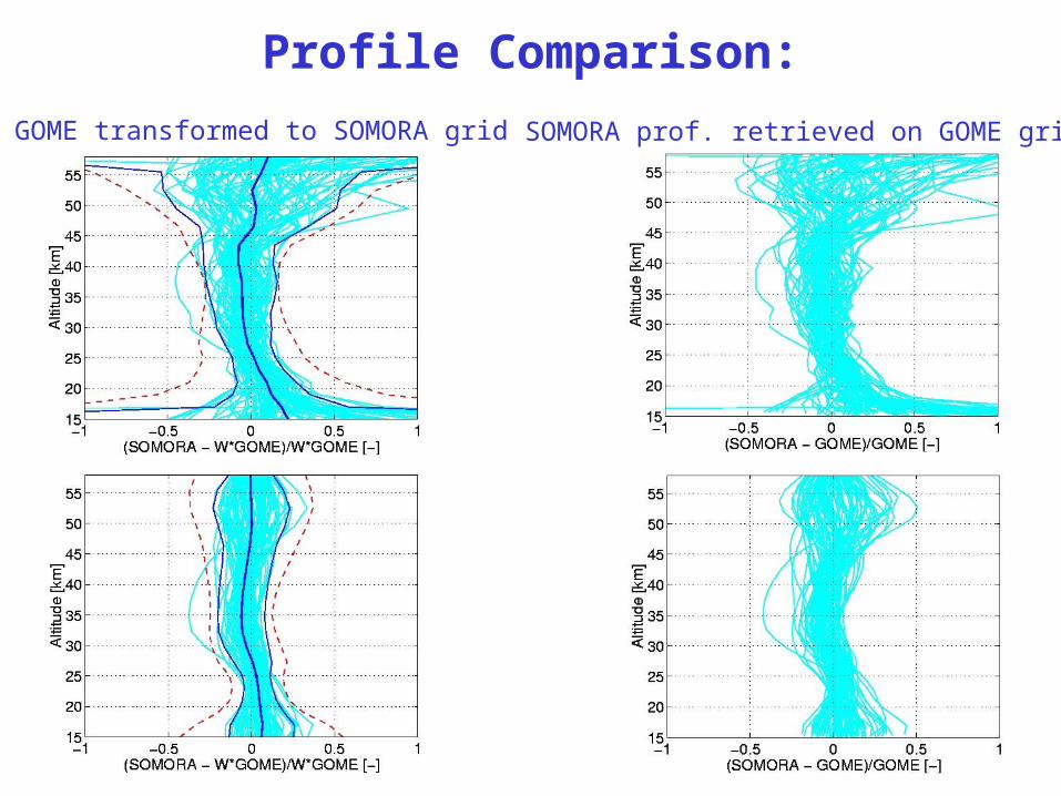
Profile Comparison:
GOME transformed to SOMORA grid SOMORA prof. retrieved on GOME grid
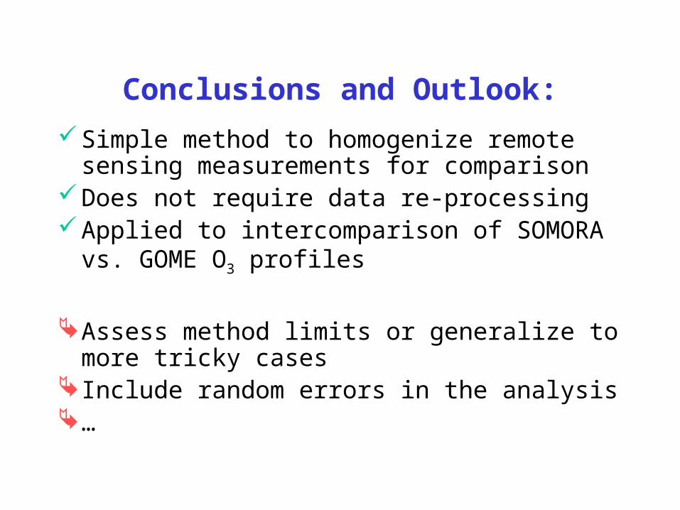
Conclusions and Outlook:
Simple method to homogenize remote sensing measurements for comparison
Does not require data re-processingApplied to intercomparison of SOMORA
vs. GOME O3 profiles
Assess method limits or generalize to more tricky cases
Include random errors in the analysis…