Progress and further requirements for the development of a ... · a Tsunami Warning and Mitigation...
72
Document IOTWS-II/5 Second International Coordination Meeting for the Development of a Tsunami Warning and Mitigation System for the Indian Ocean International Conference Centre, Grand-Baie, Mauritius, 14-16 April 2005 Progress and further requirements for the development of a Tsunami Warning and Mitigation System for the Indian Ocean IOC/INF-1213 UNESCO 2005
-
Upload
nguyenquynh -
Category
Documents
-
view
215 -
download
2
Transcript of Progress and further requirements for the development of a ... · a Tsunami Warning and Mitigation...

Document IOTWS-II/5
Second International Coordination Meeting for the Development ofa Tsunami Warning and Mitigation System for the Indian OceanInternational Conference Centre, Grand-Baie, Mauritius, 14-16 April2005
Progress and further requirements forthe development of aTsunami Warning and MitigationSystem for the Indian Ocean
IOC/INF-1213 UNESCO 2005

IOC/INF-1213Paris, 7 April 2005English only
For bibliographic purposes
This document should be cited as:
Progress and further requirements for the development of atsunami warning and mitigation system for the Indian Ocean;Second International Coordination Meeting for theDevelopment of a Tsunami Warning and Mitigation Systemfor the Indian Ocean, Grand-Baie, Mauritius, 14-16 April 2005
IOC Information Document No 1213, UNESCO 2005
(English)
Published in 2005 by the United NationsEducational, Scientific and cultural Organization,7, place de Fontenoy, 75007 Paris
UNESCO 2005Printed in France
(SC-2005/WS/20)

Table of Contents
1. Introduction . . . . . . . . . . . . . . . . . . . . . . . . . . . . . . . . . . . . . . . . . . . . . . . . . . . . . . . . . . . . . . . . . . . …. . . . .5
2. Tsunami early warning systems aspart of broader disaster riskreduction strategies . . . . . . . . . . . . . . . . . . . . . . . . . . . . . . . . . . . . . . . . . . . . . . . . . . . . . . . .7
3. Scope of the current project . . . . . . . . . . . . . . . . . . . . . . . . . . . . . .. . . . . .10
4. Immediate additional needs forCore system implementation:Project TSU – REG-05/CSS10 – region . . . . . . . . . . . . . .13
5. Further requirements as formulatedby countries and organizations . . . . . . . . . . . . . . . . . . . . . . . . . . . . .17
• Annex 1National and Regional PreliminaryProposals . . . . . . . . . . . . . . . . . . . . . . . . . . . . . . . . . . . . . . . . . . . . . . . . . . . . . . . . . . . . . . . . . . . . . . . … . . . .21
• Annex 2Status of Ongoing Projects:Proposals Submitted to OCHA by ISDR . . . . . . . . .65
• Annex 3Sources of information on current disaster riskmanagement capacities from affectedand threatened countries in the region . . . . . . . .. . . . . .71

INDIAN OCEAN TSUNAMI
TSUNAMI WARNING AND MITIGATION SYSTEM
1
Introduction
The Indian Ocean tsunami was triggered by 9.0-magnitude earthquake near Sumatra in Indonesia.While the earthquake is estimated to have killed at least 80,000 people, more than 200,000 are esti-mated to have died from the tsunami with the main cause of death being trauma and drowning fromthe flux of seawater, water-born debris, and waves pouring into coastal areas without warning. Thedeath toll is believed to be over 300,000 people. No warning systems for tsunamis were in place andall of the affected countries were unprepared.
The Pacific Ocean has had a regional tsunami warning system in place since 1965. This comprisesseismological and oceanic observation networks, regional analysis and advisory centres, andnational tsunami warning centres, linked under cooperative arrangements, and coupled to nationalactivities in risk assessment, preparedness and warning dissemination. The Tsunami WarningSystem for the Pacific (PTWS) was established by the Intergovernmental OceanographicCommission (IOC) of UNESCO and is guided by the International Coordination Group for theTsunami Warning System in the Pacific (ICG/ITSU), which is composed of national experts from 26countries in the Pacific region. It is a subsidiary body of the IOC and reports to the IOC Assemblycomposed of 130 states. These bodies have also endeavored to stimulate interest and capacitydevelopment in tsunami warning systems in other at-risk areas of the world. The IOC also set up in1965 the International Tsunami Information Centre to support ITSU in carrying out its comprehen-sive tsunami mitigaton programme. The ITIC, as an implementing center for tsunami mitigationactivities, works closely with the Pacific Tsunami Warning Center, the Pacific’s international tsunamiwarning operations center, to facilitate improvement and enhancement in its operations, and direct-ly with ITSU Member States to assist in the establishment of national and regional tsunami warningsystems and in the development of national tsunami mitigation programmes.
Tsunami early warning systems are set within the wider framework of disaster reduction and man-agement and early warning systems generally. The International Strategy for Disaster Reduction(ISDR), mandated by a series of UN General Assembly resolutions, provides the overall intergov-ernmental policy environment for integrating the many elements of activity required to effectivelyreduce and manage disaster risks. In particular, the Hyogo Framework for Action 2005-2015, nego-tiated by governments at the World Conference on Disaster Reduction, Kobe, Hyogo, Japan, 18-22January 2005 sets out specific directions and priorities for action by governments and organizationsover the next decade.
Substantial knowledge and expertise in natural disaster management and mitigation is available todeal with the risks of tsunamis in the Pacific region. In particular, invaluable experience and knowl-edge has been accumulated on how to assess tsunami risk at the national and local level, how topromote awareness and preparedness, and how to build national and regional tsunami warning sys-tems. These require strong and sustained commitment by the national governments, collaboratingin a regional framework for sharing data and by jointly bearing the cost for the regional elements ofthe network. The need for regional collaboration is a result of the nature of tsunamis: local tsunamiscan be handled by national warning centres; but regional or ocean-wide tsunamis travel at 800 km/hacross the ocean and require observational data from multiple countries in a region.
5

INDIAN OCEAN TSUNAMI
TSUNAMI WARNING AND MITIGATION SYSTEM
Coordinated and concerted activities by the UN are now underway to support the rapid developmentof early warning capacities in the Indian Ocean region, particularly under the UN Flash Appeal proj-ect “Evaluation and Strengthening of Early Warning Systems in Countries Affected by the 26December 2004 Tsunami in South East and South Asia”, (TSU-REG-05/CS06-REGION), which iscoordinated by the ISDR secretariat’s Platform for the Promotion of Early Warning (PPEW) in closecooperation with UNESCO-IOC.
The purpose of the current document is to elaborate on progress on the above collaborative processand to identify further necessary activities and funding requirements, in particular to supportUNESCO-IOC efforts to build the substantive elements of an effective and sustainable Indian OceanTsunami Warning System for the (IOTWS).
6

INDIAN OCEAN TSUNAMI
TSUNAMI WARNING AND MITIGATION SYSTEM
2
Tsunami early warning systemsas part of broader
disaster risk reduction strategies
It is recognized that an effective early warning system requires a number of elements such as a priorknowledge of the risks faced by communities; technical monitoring and warning service for theserisks; dissemination of understandable warnings to those at risk, as well as education, public aware-ness and preparedness to act.
Frequently, hazard monitoring and forecasting is carried out by specialized scientific agencies atboth the international and national levels. These include meteorological organizations and similarinstitutions involved in the monitoring and research of specific hazards. Depending on each countryand region, these may be public sector, universities, regional organizations, and others.
The responsibility for transforming those warnings into disaster risk reduction activities, however,normally lies with organizations responsible for disaster management at the national level. In mostcountries, specialized government agencies, organizations such as the national Red Crescent orRed Cross Societies or UN agencies play a significant role.
These responsibilities include hazard and vulnerability mapping, the development of disaster pre-paredness strategies, and communicating warnings. These agencies also often have a politicalresponsibility for ensuring that warnings are issued and acted upon.
With the establishment of the International Strategy for Disaster Reduction (ISDR) countries wererequested to establish national and multisectoral platforms for natural disaster reduction with a viewto provide more resourced, effective and integrated efforts of risk reduction amongst national andlocal stakeholders.
Such structures, can contribute considerably to the development of organizational structures, infor-mation flows and decision-making protocols, capable of integrating the different elements of an earlywarning system, at both local and national levels.
A table presenting sources of information on current disaster risk management capacities fromaffected and threatened countries in the region is attached as Annex 3.
These principles, along with the need to adopt multi-hazard approach are driving factors behind theelaboration of the tsunami early warning system for the Indian Ocean and the support provided tocountries by the United Nations.
Action: Development of National Platforms for Disaster Risk Reduction as required
7

INDIAN OCEAN TSUNAMI
TSUNAMI WARNING AND MITIGATION SYSTEM
National Disaster RiskReduction Mechanisms
Legislation, administration,resources, networks,
national platform,local government, NGOs,community organisations
NATIONALTSUNAMIWARNINGSYSTEM
Indian OceanTsunami
Warning System
Observing network,data exchange,governing bodies
Fig 1: national linkages map
2.1. National Tsunami warning mitigation coordinationcommittees proposed mechanisms
While it is the prerogative of Member States to identify the format of national mechanisms for tsuna-mi warning, in order to facilitate the integration of the various sectors and actors required at thenational level it is proposed to establish National Tsunami Warning and Mitigation CoordinationCommittees.
The membership of such committees, during the development phase, could include the followingtype of representatives:
(i) Members of National Disaster Reduction Platform;
(ii) Interim tsunami national contact point(s);
(iii) Representatives of relevant national organizations/institutions (e.g. port authority, mete-orological service, seismological service, ocean research institutions, universities, otherorganizations/institutions relevant to national tsunami warning and mitigation system notincluded in (i),)
(iv) Relevant international experts (tsunami, seismology, sea level, oceanography,);
(v) Civil society representatives including Red Cross and Red Crescent representatives andrepresentatives of the media
(vi) Members of UN country teams;
(vii) Representatives of interested donor countries/agencies.
It is proposed that these Committees, during the development phase, will have the followingobjectives:
(i) Review National Disaster Reduction Platform and how the National Tsunami WarningSystem can “plug in” to it;
(ii) Prepare a national tsunami communication plan;
(iii) Identify/assess infrastructure requirements for the full deployment of the NationalTsunami Warning Centre, taking into consideration (i) and (ii), and taking into consider-ation the need to compatibility with other Centres in the region;
(iv) Identify/assess human resource and related training requirements for the operation ofthe National Tsunami Warning Centre, taking into consideration (i) and (ii);
8

INDIAN OCEAN TSUNAMI
TSUNAMI WARNING AND MITIGATION SYSTEM
(v) Prepare, as required, full project proposals/documents for funding by interesteddonor(s);
(vi) Coordinate closely with IOC and ISDR to ensure that available funding (e.g. from OCHAFlash Appeal) will contribute to fulfilling the requirements identified under (iii) and (iv) andto avoid duplication with (v);
(vii) Report their findings to the First Session of the Intergovernmental Coordination Groupfor the Tsunami Warning and Mitigation System in the Indian Ocean (ICG/IOTWS);
(viii) Prepare the terms of reference of a national tsunami warning, assessment and mitiga-tion programme.
We note that the National Tsunami Warning and Mitigation Coordination Committees will be a bodyunder national authority. International experts will cooperate in an advisory capacity only.
It is recommended that these Committees be established as soon as possible and that experts beidentified to assist with the national assessments as detailed above.
The cost of organizing initial meetings of the Committees and participation of relevant internationalexperts are covered as part of Activity 3 (see Annex 2) of project TSU-REG-05/CS06-REGION.
9

INDIAN OCEAN TSUNAMI
TSUNAMI WARNING AND MITIGATION SYSTEM
3
Scope of the current project
The current project “Evaluation and Strengthening of Early Warning Systems in Countries Affectedby the 26 December 2004 Tsunami in South East and South Asia.”, (TSU-REG-05/CS06-REGION),aims to address immediate matters concerning the implementation of a tsunami early warning sys-tem for the Indian Ocean, and to facilitate a UN-wide coordinated process toward this end. It identi-fied a range of UN and regional entities that would need to be involved, including specializedtechnical organizations (particularly UNESCO-IOC) along with development and disaster risk reduc-tion organisations. Donors have pledged about US$11,000,000 in support to the project.
3.1. Project structure
The project is now structured around five components, each focusing on a coherent area ofresults. The two phases of work described in the original proposal, concerning warning systemdevelopment and preparedness activities, will be pursued in parallel. The five components are asfollows.
3.1.1. Core system1 implemantation
Obtain regional consensus on the nature of a tsunami early warning system, design its core ele-ments, particularly the observing system, national tsunami warning centres, and permanent region-al coordination mechanisms, and commence initial strengthening and implementation steps,including relevant training and other capacity building.
3.1.2. Integrated risk management
Integrate the tsunami early warning system into national disaster risk management and reductionmechanisms, seeking synergies with other hazard early warning systems and strengthening nation-al capacities for disaster risk management and risk reduction as required.
3.1.3. Public awareness and education
Develop and disseminate publications on tsunami, early warning and risk reduction, tailored to locallanguages and cultures, targeting key intermediaries such as public officials, teachers, and commu-nity leaders, and develop and promote mass media materials and campaigns.
3.1.4. Community level learning
Implement community-level pilot activities to test and demonstrate good practices, including hazardand vulnerability assessment, organisational strengthening, warning system operation, capacitybuilding, evacuation planning, and the design and construction of shelters and other works.
1 The expression core system is used here to describe the observing system, national tsunami warningcentres and permanent regional coordination mechanisms, including training of personnel and operationalcapacities, necessary to routinely generate accurate and timely warnings and communicate them toappropriate authorities.
10

INDIAN OCEAN TSUNAMI
TSUNAMI WARNING AND MITIGATION SYSTEM
3.1.5. Project coordination
Establish the mutual understandings, agreements, information resources, networks, support capac-ities and decision-making mechanisms needed to ensure the effective implementation of the projectand its early warning system objectives.
3.2. Project implementation
A project plan has been elaborated that sets out the details of the project activities that will be car-ried out under each component, and the partners involved.
The work of the project will be undertaken through partnerships among a variety of UN and otherorganizations as listed in the original proposal (TSU-REG-05/CS06-REGION), although not restrict-ed to these organisations. At least half of the funds received will be committed to other organisationsto support work plans, as set out in written agreements. Much of the responsibility for the design ofthe work plans will lie with these other organisations, making use of their specialist knowledge andcapacities.
A Memorandum of Agreement has been finalized between ISDR and UNESCO-IOC and an agree-ment is underway with WMO to support the upgrading of the meteorological communications sys-tems in the region used to transfer tsunami data and warnings. Discussions are underway with otherorganisations concerned with disaster preparedness and disaster reduction in the region, includingUNDP, OCHA, UNESCAP, ADRC, ADPC, UNU, UNV and UNEP. A number of work elements andagreements are under consideration and the work plans will be made available in due course.
It should be noted that the different donors each have specific requirements, according to nationallaw or administrative procedure, which must be met. In some cases specific project proposals arebeing developed in order to allow the release of funds. Nevertheless, the project will be operated as asingle project, with all project donations pooled in a single sub-account of the Trust Fund forDisaster Reduction, and will be reported on as a single integrated project.
3.3. Progress on project implementation
A number of activities have been carried out relevant to all five components of the project proposalby UNESCO-IOC and the ISDR secretariat (For a list of activities see Annex 2).
In addition, many partners2 are actively supporting countries in the immediate phase of the estab-lishment of the tsunami early warning systems. In order to facilitate these activities and identify even-tual gaps and needs a group of agencies are developing a matrix of activities/roles and resourcesof partners for the evaluation and strengthening of early warning systems in countries affected bythe 26 December 2004 tsunami. An initial version of this matrix will be presented at the Mauritiusmeeting.
Component 3.1.1 of the project – the core warning system implementation is a task that is both majorand urgent, and therefore this is an immediate priority for action under the project. UNESCO-IOC ismoving quickly on the first steps to establish the necessary basis of technical information and insti-tutional consensus. Likewise, the countries of the region are mobilizing technical capacities andresources to establish national tsunami warning systems and to engage in the international andregional dialogue and negotiations toward a regional early warning system. Several donors haveexpressed their willingness to support countries in the substantial investment needed to build a fullyfledged system, including the provision of specialized instrumentation and training.
2 Partners include: UNDP, OCHA, WMO, UNEP, IFRC, UNESCO-IOC, UNU, ADRC, ADPC, DIPECHO,ISDR secretariat.
11

INDIAN OCEAN TSUNAMI
TSUNAMI WARNING AND MITIGATION SYSTEM
The agreement between ISDR and UNESCO-IOC covers the disbursement of US$ 3,525,000 for aninitial suite of activities that UNESCO-IOC drafted in a project document dated 3 February 2005 (asdescribed in Annex 2 of this Document) and included in project TSU-REG-05/CS06-REGION. Thesepredominantly concern matters of core system implementation. The activities funded by the projectinclude, among other things, the major coordination meetings organised by UNESCO-IOC in Paris,3-8 March and in Grand-Baie, Mauritius, 14-16 April, national coordination and training meetings,and the partial upgrading of the Indian Ocean sea level gauge network.
It was made clear in the Flash Appeal proposal that the project would undertake only the preparato-ry steps and that the development of a fully fledged tsunami early warning system would require fur-ther planning and substantial resources. The discussions and efforts since early January have nowset in place a better basis for elaborating what is required. In particular, UNESCO-IOC has defineda further set of immediate tasks on the core system implementation that require additional supportover the next 6-21 months, as described in Section 4.
The future requirements for other activities concerned with preparedness and in-countrypartnerships with risk reduction and risk management sectors will be elaborated later in 2005following experience with the relevant activities in partnership development, assessments,dialogues and other activities that remain to be undertaken.
12

INDIAN OCEAN TSUNAMI
TSUNAMI WARNING AND MITIGATION SYSTEM
4
Immediate additional needs forCore system implementation:
Project TSU – REG-05/CSS10 – region
Requirements will (i) include short-term requirements that will focus on the strengthening of the inter-im system and the establishment of national capabilities; and (ii) requirements that assist in migrat-ing from the interim system to the permanent operational system. These requirements will be finetuned further on the basis of the Meetings of the proposed National Tsunami Warning and MitigationCoordination Committees.
The list of activities that follows (4.1 to 4.10) has been included in a project proposal submitted toUN/OCHA within the framework of the Mid-Term Review of the Tsunami Flash Appeal. The request-ed budget amounts to US$ 12,000,000. The Project has been given the code TSU – REG-05/CSS10– REGION.
4.1. Support of the interim system
An interim system has been put in place (as part of project TSU-REG-05/CS06-REGION mentionedabove) to generate Indian Ocean tsunami advisory information at the Pacific Tsunami WarningCenter, Hawaii and the Japan Meteorological Agency, Tokyo and to disseminate it to national focalpoints in Indian Ocean countries. The advisory information is initially based on seismic data only,which brings a high risk of false warning. It will progressively make use of real-time sea level databeing developed elsewhere in the project which will considerably improve the quality and reliabilityof tsunami advisory information.
Funding is requested for the continued support and management of this interimsystem by the IOC secretariat.
4.2. Provision and management of sea level gauges in tsunamigenicareas in the eastern Indian Ocean
Work urgently carried out over the period April-June 2005 (as part of TSU-REG-05/CS06-REGION)will result in fifteen tide gauges in the Indian Ocean reporting in real time to the Pacific Tsunamiwarning center, but the resulting sea level observing network is still insufficiently dense to providereliable and timely data for the entire Indian Ocean basin.
Funding is required for upgrading, procurement and installation of new gauges,for mobile service and technical teams, and the continued interim managementof the sea level data reporting system in the Indian Ocean by the IOC’ssecretariat for the Global Sea Level Observing System (GLOSS). The data willsupport the interim advisory system and subsequent permanent system.
13

INDIAN OCEAN TSUNAMI
TSUNAMI WARNING AND MITIGATION SYSTEM
4.3. Utilizing the global marine distress and safety system (GMDSS)to deliver tsunami bulletins to ships in ports or at sea
The GMDSS provides marine weather information that is broadcast via Inmarsat-C SafetyNET by allNational Meteorological Services (NMS) appointed as Issuing Services within the framework of theWMO Marine Broadcast System. All passenger vessels and all cargo ships of over 300 gross tonson international voyages are fitted with applicable satellite and radio communications GMDSSequipment, for sending and receiving alerts. This real time communication system can be used todeliver tsunami bulletins directly to ships in port or at sea and is of particular importance for passen-ger/cruise ships and cargo vessels and tankers carrying hazardous materials.
Funding is requested to develop appropriate tsunami warning information forships, both at harbor and at sea, and implement the broadcasting of thisinformation on the GMDSS;
4.4. Incorporate seismic data from the Federation of DigitalBroad-Band Seismograph Networks (FDSN) and the preparatorycommission for the comprehensive nuclear-test-ban treatyorganization (CTBTO preparatory commission) into the IOTWS
The Federation of Digital Broad-Band Seismograph Networks (FDSN) provides real-time seismicdata from more than 150 stations around the world. An initial agreement between the CTBTO andUNESCO/IOC tsunami warning centers was achieved during the initial phase of the UN CAP Flashappeal.
Funding is requested to (i) carry out technical testing of the inclusion ofadditional seismic data for tsunami warnings; (ii) further developmentand formalization of cooperation between IOC and FDSN and IOC and CTBTO;and (iii) improvement, procurement and installation of stations as needed;
4.5. Support of governance mechanisms for an Indian oceantsunami warning system
An agreement among member states to set up an IOC Intergovernmental Coordination Group forthe Indian Ocean Tsunami Warning and Mitigation System (ICG/IOTWS) subsidiary to the IOCAssembly was achieved during project TSU-REG-05/CS06-REGION. This activity may also includescientific and technical conferences to enable the sharing of expertise and experience.
Funding is requested to cover the activities of this Group and its secretariat;
4.6. Support for the establisment and operational supportof national tsunami warning centers
Country assessments completed during the project TSU-REG-05/CS06-REGION will providedetailed terms of reference for each National Tsunami warning Centre to be established. This activ-ity will assist national government with the practical implementation of the establishment of theCentres through the provision, installation, upgrading or repair of equipment and related materials.In addition, financial support will be provided to assist these new Centres through an initial start-upperiod.
Funding is requested for the procurement, installation, upgrading or repair ofrequired equipments and related materials to establish National TsunamiWarning Centres, as well as for their operational support.
14

INDIAN OCEAN TSUNAMI
TSUNAMI WARNING AND MITIGATION SYSTEM
4.7. Fast-track training related to tsunami warning
This activity will focus on providing fast-track training to national experts as relevant to steps 1 to 6above. It is also a follow-up to the initial set of three training courses implemented during projectTSU-REG-05/CS06-REGION. In particular this activity will cover fast-track training in: (i) interpreta-tion of tsunami advisory information provided by PTWC/JMA; (ii) tsunami travel time calculation; (iii)national tsunami warning response coordination (end-to-end approach); (iv) operation and mainte-nance of sea level gauges and seismic stations used for tsunami warning; (v) tsunami warning com-munication (reaching the population); (vi) preparedness: fast-track “inform the population” actions;(vii) risk assessment: introduction to preparation of inundation maps (tsunami inundation risk needsto be taken into consideration prior to reconstruction of destroyed dwellings). In order to ensure thelong-term re-usability of the training initiatives, a comprehensive training system will be developed,similar to IOC’s OceanTeacher system (TsunamiTeacher). This may also include support for intern-ships and travel grants. In this regard extensive use will be made of the long-term experience andexpertise of the International Tsunami Information Center (ITIC) in Honolulu, Hawaii that has train-ing as a core element of its mandate;
Funding is requested to implement a number of regional training courses,as well as to develop the accompanying computer-assistance training toolTsunamiteacher.
4.8. Development of high resolution near shore bathymetry
Near shore bathymetry data are needed in every site where tsunami hazard and risk assessmentmust be performed. The speed and, in consequence, the amplitude of the tsunami phenomena isdirectly related to the variation of the bathymetry. In consequence, near shore bathymetry withenough accuracy (cells of 10 - 15 m) is absolutely necessary to compute tsunami run-up and inun-dation maps
Funding is requested to identify and obtain high resolution near shorebathymetry data.
4.9. Initial development of a basic and applied scientific research effortto improving tsunami warning science and technology
The capability to correctly assess tsunami occurrence, magnitude and impact depends to a largeextent on the scientific knowledge underpinning the operational activities. Continued scientificresearch as well technological development is required to improve our capabilities. In addition a his-torical tsunami database for the Indian Ocean needs to be developed (as has been done for thePacific region), as an important element in risk assessment).
Funding is requested to strengthen scientific research and technologicaldevelopment efforts focusing on tsunami warning capability in the Indian Ocean.
4.10. Preparation of tsunami inundation maps
To assess tsunami hazard and risk for various coastal areas, taking into consideration populationand reconstruction, focusing on highest risk and highest population areas, tsunami inundation mapshave to be developed at the national level for the most essential coastal areas (e.g. high populationareas). This activity will be strengthened also through activity 9 above.
Funding is requested to support partial funding to develop national tsunamiinundation maps.
15

INDIAN OCEAN TSUNAMI
TSUNAMI WARNING AND MITIGATION SYSTEM
4.11. Timeline for proposed immediate additional needs
The below figure shows the timeline for implementation of the activities outlined in 4.1 to 4.10 above. Itis noted that some activities will need to be supported beyond December 2006.
2005 2006
May Jun Jul Aug Sep Oct Nov Dec Jan Feb Mar
1: Interim system
beyond
2: Sea level gauges
3:GMDSS
4: FDSN/ CTBTO data
5: Governance system
6: NTWC support
7: Fast-track training
8: Bathymetry
9: Science and Technology
10: Inundation maps
4.12. Costing table
Total cost in US$1: Interim system 300,0002: Sea level gauges 3,000,0003:GMDSS 450,0004: FDSN/ CTBTO data 700,0005: Governance system 380,0006: NTWC support 3,000,0007: Fast-track training 1,000,0008: Bathymetry 400,0009: Science and Technology 180,000
10: Inundation maps 1,350,000Coordination support costs 1,240,000
12,000,000
16

INDIAN OCEAN TSUNAMI
TSUNAMI WARNING AND MITIGATION SYSTEM
5
Further requirements as formulated bycountries and organizations
In order to make a preliminary assessment of requirements as identified by countries in theIndian Ocean region, IOC requested countries, as well as a few organizations and programmesto submit relevant proposals. These are collated as Annex 1. We note that only summaries areprovided and the proposals should be considered as preliminary proposal briefs Fully detailedproposals will be prepared after extensive consultations and national assessment exercises thatcould be planned to coincide with meetings of the National Tsunami Warning and MitigationCoordination Committees (see 2.1)
The following proposals have been received: (see Tables, next pages)
17

INDIAN OCEAN TSUNAMI
TSUNAMI WARNING AND MITIGATION SYSTEM
Countries in the Indian Ocean regionCountry/ AmountOrganization Title Cost US$ requestedBangladesh Bangladesh National Comprehensive Tsunami and Not Not
Cyclone Early Warning System for Bay of Bengal specified specifiedFrance French National Center within the IOTWS 16,900 0India Early Warning System for Mitigation of Tsunami
and Storm Surges in Indian Ocean 30,000,000 0Indonesia Establishment of Tsunami Early Warning System Not
in Indonesia 59,800,000 specifiedKenya Establishment Of An Operational Multi-Hazard Early
Warning System For Kenya 2,103,000 2,103,000Madagascar Système d’alerte aux Marées et Inondations
Extraordinaires A Madagascar (Samiem) 1,358,000 1,358,000(to be reduced by $ 25,000/year obtained through ODINAFRICA)
Malaysia Malaysian National Tsunami Early Warning System 5,000,000 0(except for technical expertise)
Mauritius National Tsunami warning System in Mauritius Not Notunder a multi-hazard framework specified specified
Oman Multi-hazard early warning system in Oman Not Notspecified specified
Seychelles Establishment of a Seychelles Early warning andmitigation system based on a multi-hazard approach 2,640,000 2,640,000
Singapore Enhancement of seismic sensorsand tidal gauges network 400,000 400,000
Sri Lanka Establishment of a 24-hour operational Natural Not NotDisaster Early Warning System for Sri Lanka, specified specifiedincluding capacity building
Tanzania Tsunami Warning and Mitigation Systemfor Tanzania 1,050,000 1,050,000
Subtotals 102,367,900 7,551,000
18

INDIAN OCEAN TSUNAMI
TSUNAMI WARNING AND MITIGATION SYSTEM
OthersCountry/ AmountOrganization Title Cost US$ requestedFlanders Data management and other training(Belgium) related to tsunami warning 1,000,000 350,000Russia Integrated Tsunami Database for the Indian Ocean
(ITDB/IND) 60,000 45,000(Tsunami Laboratory, Computational Mathematics and Mathematical Geophysics(TL/ICMMG), Novosibirsk)
IOC Establishment of a Western Indian Ocean and Red Searegional tsunami warning and mitigation systemfor tsunamis and other marine related hazards 7,713,000 7,213,000
(IOC WIO/ODINAFRICA project Office, Kenya)
IOC Sustained Mooring Array for Indian Ocean Tsunami 8,500,000 4,000,000(IOC Regional Office, Perth, Australia)
IOC Building Capacity to generate Coastal Bat hymetry:A critical element in protecting lives and livelihoods
in areas prone to ocean-based extreme events 810,000 800,000(Ocean mapping)
UNESCO Community Based Earthquake and Tsunami Warning,Awareness and Recovery Programme,and Its Implication to Disaster Preparedness 678,000 650,000
(Natural Sciences Sector)
WMO Enhancement of multi-hazard national warning alertand response mechanisms 4,500,000 4,500,000
WMO Use and strengthening of the WMO’s GlobalTelecommunication System (GTS)for exchange and distribution of Tsunami WarningSystem alerts and related information 1,400,000 1,000,000
WMO Increased utilization of space-based capabilitiesin the IO region for multi-hazard EWSincluding Tsunamis 300,000 300,000
Subtotals 24,961,000 18,858,000Grand Totals 127,328,900 26,409,000

Annex 1 National and RegionalPreliminary Proposals
NATIONAL • Bangladesh• France• India• Indonesia• Kenya
• Madagascar• Malaysia• Mauritius• Oman• Seychelles
• Singapore• Sri Lanka• United Republic
of Tanzania
REGIONAL IO-GOOSTsunami Laboratory, Russian FederationUNESCO/IOC – Warning and MitigationUNESCP/IOC – Coastal BathymetryVLIZ/BelgiumUNESCO/SC – Earthquake and Tsunami WarningWMO – Global Telecommunication SystemWMO – Multi-hazard EWSWMO/IOC – National Warning Alert
21

INDIAN OCEAN TSUNAMI
This chapter presents a compilation of summaries of national and regionalinitiatives towards the coordinated development of an Indian OceanTsunami Warning and Mitigation System. These documents were preparedby countries and organisations using a format provided by the IOC.
Some of these summaries reflect the fact that leading countries are alreadyengaged in the process of establishing National Tsunami Warning Systems.Some other summaries can be utilized as starting points towards thedevelopment of fully detailed project proposals for submission to donors.
Countries may want to invite relevant international and other organizationsas well as interested donors to assist with technical guidance and expertisefor further developing their proposals. Some countries have already askedfor technical assistance. UNESCO/IOC and ISDR will undertake technicalmissions with relevant national and international partners with the goalof producing a comprehensive proposal at the country level. These missionswill include national coordination meetings, expert missions and preliminarytraining, as foreseen in the projects submitted by UNESCO/IOC and ISDRthrough the OCHA Flash Appeal.
It is worth to note that some of the components of the national proposalsmay be funded under the UNESCO/IOC Flash Appeal Project, notablythose related to the establishment of core capacities at the national levelfor the tsunami Warning Centre, including provision of equipments.
22

INDIAN OCEAN TSUNAMI
NATIONAL PRELIMINARY PROPOSALS
BANGLADESH
Bangladesh National ComprehensiveTsunami and Cyclone Early Warning System
for Bay of Bengal
Implementing Organization:Directorate of Relief and Rehabilitation, Ministry of Food and Disaster Management
Contact Person:Md. Mahfuzur Rahman, Director GeneralDirectorate of Relief and Rehabilitation, Ministry of Food and Disaster Management, Mahakhali, DhakaPhone: 880-2-8813639, Fax: 880-2-9860130, E-mail: [email protected]
Beneficiaries:a. 20 Million people living in coastal areas of Bay of Bengalb. 15 Urban Clusters, including Chittagong Port City, Khulna Port City and Barisal Townc. International Sea Ports of Chittagong and Chalnad. Industries along the Chittagong, Sitakunda, Mirsharai and Khulna coastal zonee. Sundarban (Mangrove Forest) World Heritage, Agriculture Land and Fisheries
Partners:1. Disaster Management Bureau 8. Chittagong Port Authority2. Prime Ministers Office 9. Khulna Port Authority3. Geological Survey of Bangladesh 10. Bangladesh Armed Forces Div.4. Water Development Board 11. Bangladesh Navy5. Bangladesh Inland Water 12. National Oceanographic Institute
Transportation Authority 13. Bangladesh Red Crescent6. Bangladesh meteorology Dept. 14. Geology Dept. Dhaka University7. Department of Shipping 15. Bangladesh University for and technology
Aim:Comprehensive Tsunami and Cyclone Early Warning System for Bangladesh(Bay of Bengal) to support IOTWS. Integrated observational network for Seismicand Tsunami monitoring, assessment of the tsunami hazard, development ofnational data system and tsunami simulation/prediction systems, arrangementsand standards for warning dissemination and communication, risk management,installation of telecommunication to support the observational and warningcomponents.
Support pledged:A) No support pledged for development of tsunami warning systemB) Well-developed Cyclone Prepared Programme (CPP) exists in Bangladesh.
The cyclone warning system will be linked to the proposed Tsunami Earlywarning system (TEWS).
Financial Support Already Obtained:
23

INDIAN OCEAN TSUNAMI
NATIONAL PRELIMINARY PROPOSALS
Different NGOs and Donor Agencies acting into the maintenance and awareness developmentprogrammes for cyclone, tidal bore and coastal surges. Bangladesh successfully reducedthe loss of lives and properties. Flood forecasting & Warning system also exist in the country,it would be modernized and linked with TEWS.
Financial Support Already Obtained: NA
Support sought:a. Short Period Seismometer-2 Nos., Broadband Seismometer 1 No., Hydro-acoustic Station-3
Nos. Sea height Buoys-3 Nos., Tide gauges-25 Nos., Automated Processing System,Telemetric Communication System, GIS based data integration system, maintenance andoperation cost. Installation cost. Accessories for development of link with the existingcyclone and flood warning system.
Financial Support Being Sought: US$ 9,000,000
b. Research, training and capacity building, periodic updating/replacement of equipment andtools for durability of the system. Coordination with consistent global satellite monitoringnetwork and Global Warning System.
Financial Support Being Sought: US$ 4,000,000
Total: US$ 13,000,000
OverviewAndaman-Summatra earthquake of 26 December 2004 has forced us to re-evaluate the seismo-genic hazard maps and develop observation, monitoring and warning system. It is massive tsunamicausing death of about 300,000 people and destruction of huge livelihood. The earthquake causedunprecedented changes in the seafloor configuration, coastal livelihood and created panic amongthe people living in the earthquake and tsunami vulnerable zones. A cooperative and integratedobservational network a comprehensive assessment of the tsunami hazard, development of nation-al data analysis and tsunami simulation/prediction systems, installation and standards for warningdissemination communication, development of risk management framework, appropriate telecom-munication capabilities to support the observation and warning components. The proposed projectcomprises seismic and geophysical instruments, coastal tidal gauge, and cooperative deep oceanpressure measurement to detect tsunami related changes in the sea, bathymetry, seafloor andcoastal mapping for modeling and mitigation studies, hazards and risk assessment. Implementationwill reduce multi-hazard risk and ensure sustainable development.
24

INDIAN OCEAN TSUNAMI
NATIONAL PRELIMINARY PROPOSALS
FRANCE
French National Center within the IOTWS
Implementing Organization:Météo-France, RSMC La Réunion
Contact Person:The director of Météo-France RSMC La Réunion IslandPhone: +262 262 92 11 01, Fax: +262 262 92 11 47, Email: [email protected]
Beneficiaries:People living in coastal areas of Réunion Island and Mayotte, with extension to countries inthe South-West Indian ocean
Partners:- La Réunion French authorities and agencies- Commission de l'Océan Indien
Aim:Set up an operational 24 hour tsunami warning & mitigation centre, hostedby the Météo-France La Réunion Island, and providing support at Regional level(South-west Indian Ocean).
Overall Budget: 13 000,000Û (immediate actions taken)To be confirmed for the short and longer term actions
Support pledged: Financial Support Already Obtained: NA
Support sought: Financial Support Being Sought: NA
OverviewMétéo-France in La Réunion has been designated to host the French national tsunami warningcentre and act as the focal point within the IOTWS.
– This centre will benefit from the experience gained from operation of the RegionalSpecialized Meteorological Centre (RSMC) for cyclones in La Réunion, in charge oftropical cyclone warning 24 hour-7 day for the South-West Indian Ocean, to the benefitof 14 countries;
– Météo-France in La Réunion has an high speed link to the WMO Global TelecommunicationSystem (GTS) and strong capacity of data collection and information management;
– The centre can rely on expertise of the other French agencies in La Réunion, Mayotte andFrench Austral territories. This namely encompasses those in charge of seismic and volcanic
25

INDIAN OCEAN TSUNAMI
NATIONAL PRELIMINARY PROPOSALS
monitoring (IPGP, CEA), sea level monitoring (SHOM, DDE, CNRS), risk assessment andeducation (BRGM) as well as oceanic studies (IFREMER, IPEV, IRD);
– The centre will be part of the already existing risk management framework set up andcoordinated by the French authorities in La Réunion (Préfet, Zone de Défense civile), andbenefit from previous experience in natural hazard warnings and advisories to localauthorities and neighbouring countries.
– The Centre will be developed further in muti-hazard perspective with focus on sea-levelrelated risks.
26
INDIAN OCEAN TSUNAMI
NATIONAL PRELIMINARY PROPOSALS
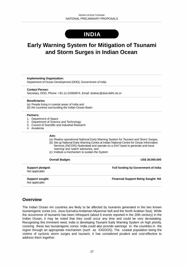
INDIA
Early Warning System for Mitigation of Tsunamiand Storm Surges in Indian Ocean
Implementing Organization:Department of Ocean Development (DOD), Government of India
Contact Person:Secretary, DOD, Phone: +91-11-24360874, Email: [email protected]
Beneficiaries:(a) People living in coastal areas of India and(b) the countries surrounding the Indian Ocean Basin
Partners:1. Department of Space2. Department of Science and Technology3. Council of Scientific and Industrial Research4. Academia
Aim:(a) Realize operational National Early Warning System for Tsunami and Storm Surges,(b) Set up National Early Warning Centre at Indian National Centre for Ocean Information
Services (INCOIS) Hyderabad and operate on a 24x7 basis to generate and issue'warning' and 'watch' advisories, and
(c) Institute a mechanism to sustain the System
Overall Budget: US$ 30.000.000
Support pledged: Full funding by Government of IndiaNot applicable
Support sought: Financial Support Being Sought: NANot applicable
OverviewThe Indian Ocean rim countries are likely to be affected by tsunamis generated in the two knowntsunamigenic zones (viz. Java-Sumatra-Andaman-Myanmar belt and the North Arabian Sea). Whilethe occurrence of tsunamis has been infrequent (about 6 events reported in the 20th century) in theIndian Ocean, it may be noted that they could occur any time and could be very devastating.Recognizing this imminent need, India is developing Tsunami Early Warning System on high priority,covering these two tsunamigenic zones. India could also provide warnings to the countries in theregion through an appropriate mechanism (such as IOGOOS). The coastal population being thevictims of cyclonic storm surges and tsunami, it has considered prudent and cost-effective toaddress them together.
27

INDIAN OCEAN TSUNAMI
NATIONAL PRELIMINARY PROPOSALS
INDONESIA
Establishment of Tsunami Early WarningSystem in Indonesia
Implementing Organization:Meteorological and Geophysical Agency of Indonesia
Contact Person:Prime:Ir. Sri Woro B. Harijono, M.Sc., Deputy for Data & Information SystemMeteorology & Geophysical Agency, Jl. Angkasa No. 2, Kemayoran, Jakarta 10220Phone: 62-21 424 63 21, Fax: 62-21 424 67 03, Mobile: +62-816-1980225E-mail: [email protected], Website: www.bmg.go.id
Alternate:Dr. P.J. Prih Harjadi, Director Center for Geophysical Data & Information SystemMeteorology & Geophysical Agency, Jl. Angkasa No. 2, Kemayoran, Jakarta 10220Phone: 62-21 424 63 21, Fax: 62-21 424 67 03, Mobile: +62-811-109636E-mail: [email protected], Website: www.bmg.go.id
Beneficiaries:– Local Government– People and tourists living in coastal areas– Industries, hotels, restaurants and other business in coastal areas
Partners:National Partners• Ministry of Research and Technology• National Coordinating Agency for Mapping and Survey• National Agency for Assessment and Application Technology• Indonesian Institute for Sciences• National Coordinating Board for Disaster and Refugee• Management• Institute Technology Bandung• Etc.
Foreign Partners• Comprehensive Nuclear Test ban Treaty Organization (CTBTO)• National Research Institute of Earthquake and Disaster• Prevention (NIED), Japan• China Earthquake Administration (CEA)• Ministry of Education and Research of Germany• Japan Meteorological Agency (JMA)• World Meteorological Organization (WMO)• Delf Hydraulic and KNMI of the Netherland
28

INDIAN OCEAN TSUNAMI
NATIONAL PRELIMINARY PROPOSALS
Aim:• To establish one National and ten Indonesian Regional Earthquake Information and
Tsunami Warning Center• Install and upgrade 160 seismic station, 500 accelerograph, DART system, GPS
buoys, network of GPS and network of Tide Gauges• Set up automatic integration system• Set up automatic data acquisition, phase picking and processing• Set up Data base system• Set Up telecommunications system for data collection and warning dissemination
Overall Budget: US$ 59,800,000
Support pledged: Financial Support Already Obtained: NA• China thru CEA will provide ten seismograph broadband and accelerometers, processing
facilities, training, expertise, maintenance for limited time. The Intention of Cooperation isalready signed in early March
• Germany thru Ministry of Federal Education and Research will support on the first phase:up to 25 seismograph and accelerometers, 10 GPS, 10 GPS-buoys, 20 DART, capacitybuilding. Joint Declaration has been signed on mid of March
• Japan thru NIED will support up to 44 seismometer, at which 20 has been operated andothers will be soon
• The Netherlands, thru Delf Hydraulic has support software for tsunami simulation.Cooperation has been signed in February 2005
Support sought: Financial Support Being Sought: NAIn kind support requested are the rest of the equipment and facilities proposedthat are not yet covered by donors countries Japan, Germany , China, Netherlands.The list of countries/organizations expected to become donors are:– Japan– USA– France– Australia– Unesco– Etc.
OverviewIndonesia is located in very seismic active region, this can be referred to the historical record from1900 up to 2004 that 212 earthquakes with magnitude greater and equal 7.0 RS had occurred atwhich 183 located in the sea and 153 were shallow. According to Gusiakov data base, there were86 tsunami generated. On the ASEAN regional basis, earthquake with magnitude greater than 6.0on Richter Scale 46 % located in Indonesia. With regards to Indian Ocean, most of major earthquaketake place in Indonesia along more than 4000 km long of subduction zone which begins from northSumatra to east of Timor island.
The distance of the earthquakes source to shore lines varies from few tenth of kilometers to around300 km, this will correspond to few minutes to 30 minutes of arrival of tsunami waves. In this regards,the tsunami warning should be disseminated much earlier which will need earthquake location andmagnitude and depth should be found before 5 minutes. In order to locate the earthquake source inless than 5 minutes MGA proposes to set up 10 Indonesian Regional Centers and one NationalCenter. When one of the Indonesian regional Center issue the warning for local tsunami, NationalCenter will verify and decide to transmit the warning to national level and regional scale event globalscale.
The system will base on earthquake monitoring system and strongly supported by DART, tidegauges, GPS at which the data will be collected and processed at the respective Center.
29

INDIAN OCEAN TSUNAMI
NATIONAL PRELIMINARY PROPOSALS
KENYA
Establishment of an Operational Multi-HazardEarly Warning System for Kenya
Implementing Organization:Kenya Meteorological Department (KMD)
Contact Person:Dr. Joseph Mukabana, Director / KMDPhone: 254-20-567880, Fax: 254 20 57 6955, [email protected]
Beneficiaries:• The resident Kenyans along the coastal zones• The tourists and visitors at the Kenyan sandy beaches• The Hotel industry and tour operators at the coastal zone• Artisanal and commercial fishermen in Kenya• Scientific community• Decision makers
Partners:Kenya Marine & Fisheries Research Institute (KMFRI)IGAD Climate Prediction and Application Center (ICPAC)IOC/UNESCOWMO Sub-regional office
Aim:To establish an operational multi-hazard warning system for Kenya hosted at KMD.The project aims at contributing to the sustainable use and protection of the marineenvironment through establishment of early warning systems and mitigation forimproved long-term planning and management of impacts of tsunamis and otherhazards (e.g., storm surges, coastal flooding, tropical cyclones, etc).
Overall Budget: US$ 2,103,000
Support pledged: Financial Support Already Obtained: None• Provision of office facilities to host the Multi-hazard early warning system secretariat• Provision of scientists for the operation of the system• Availability of two sea-level gauges at Mombasa and Lamu as part of the system.
University of Hawaii Sea Level Center has pledged to upgrade both Mombasa and Lamugauges to real-time observing stations
• Availability of the global Telecommunication System for links with other regional countrieshosted at KMD
• 15 Drifting Buoys available to Kenya Meteorological Department to be deployed alongthe Kenya Coast donated by NOAA.
• Open and free access of data generated by the system
30

INDIAN OCEAN TSUNAMI
NATIONAL PRELIMINARY PROPOSALS
Support sought: Financial Support Being Sought: US$ 2,103,000• Three (3) anchored oceanographic buoys with meteorological, sea-level and bottom
pressure sensors: to be deployed offshore in the Indian Ocean• 3 tide gauges at Shimoni, Malindi and Kiunga• 8 seismic meters (land based as well as ocean bottom based)• Capacity building for installation and maintenance of above equipment as well
as for analysis and interpretation of data generated by the warning system• Establishment of a modeling center at KMD• Improvement of GTS telecommunication network in Kenya to ensure rapid transmition
and timely exchange of data• Improve the Meteosat Second Generation telecommunication missions to relay
the data and information from these platforms to chosen KMD ground station• VSAT links to marine institutions for broadcasts of warnings• Networking the Early Warning Center to special institutions along the coast
(GoK, NGO, Hotels)• Provision of broadcasts through RANET Radio stations using the most appropriate
language• Provision of Posters showing escape routes during warning• Education Campaign posters• Sustained awareness campaigns etc.• Establishment of all-media all-hazard citizen alert systems with most appropriate
GSM cell broadcasting systems to reach a large number of exposed citizensin the shortest amount of time
OverviewThe recent Indian Ocean Tsunami resulted in devastations amounting to national calamities inseveral countries surrounding the Indian Ocean. Kenya is among the affected countries in theregion. Kenya supports the establishment of multi-hazard warning system on a national level whilecooperating with other countries for setting up a regional system for the Indian Ocean.
The project aims at contributing to the sustainable use and protection of the marine environmentthrough establishment of early warning systems and improved long-term planning and managementof impacts of tsunamis and other hazards (e.g. storm surges, coastal flooding, tropical cyclones,etc). This will be achieved through improved ocean monitoring and predictions, based on enhance-ment of coastal and offshore observing systems. It will also focus on capacity building at technicaland scientific levels through training on equipment installation and maintenance as well as on dataanalysis and interpretation with emphasis of numerical modeling and forecasting. The project alsofocuses on the establishment of all-media all-hazard citizen alert systems with most appropriateGSM cell broadcasting systems to reach a large number of exposed citizens in the shortest amountof time as part of awareness and preparedness. The system will form part of IOTWS. There will beopen and free access of data generated from the system to all countries in the region.
31

INDIAN OCEAN TSUNAMI
NATIONAL PRELIMINARY PROPOSALS
MADAGASCAR
Système d’alerte auxmarées et inondations extraordinaires
à Madagascar (SAMIEM)
Implementing Organization:Ministère de l’Éducation Nationale et de la Recherche Scientifique (MENRS)
Contact PersonRatomahenina Onésime Richard J.c/o: Ministère de l’Education Nationale et de la Recherche Scientifique (MENRS)Direction de la Recherche (DR)BP 4163, Antananarivo (101), Madagascar, Phone: [+261 20] 33 12 419 23, Fax: [+261 20] 20 631 65Email1: [email protected] Email2: [email protected]
Beneficiaries:• Population des zones côtières et• Secteurs potentiels à caractère social et socio-économiques:
– Pêche,– Tourisme,– Transports Maritimes et fluviaux
Partners:• Direction de la Recherche
– IH.SM,– CNRO
• Direction Générale de la Météorologie– Direction des Exploitations Météorologiques
• Institut National de Géographie et d’Hydrographie
Aim:Développer un système intégré scientifique et technique de prévision, d’alerte,face aux risques multiples des marées et des inondations extraordinaires,pour produire des éléments pertinents d’aide à la décision à usages nationauxet internationaux, en vue de réduire leurs effets.
Overall Budget: US$ 1, 358 000(*)
(*) excluant la composante: “Financial Support Already Obtained”
Support pledged: Financial Support Already Obtained: US$ 25,000 per year(valeurs accessibles via IOCWIO/UNESCO Project Office, Nairobi, Kenya)
• Contribution nationale en cours (Direction Générale de la Météorologie)– Personnel scientifique et technique,– Système d’Observation Synoptique,– Météorologie opérationnelle: modélisation des hauteurs des vagues
• Contribution prévue dans le cadre de ODINAFRICA– Installation de marégraphes et– Formation en maintenance et traitements des données marégraphiques
32

INDIAN OCEAN TSUNAMI
NATIONAL PRELIMINARY PROPOSALS
Support sought: Financial Support Being Sought: US$ 1 358 000• Recyclage et/ou formation en matière d’acquisition jusqu’à la restitution
des données et des informations scientifiques et techniques:– Océanographie (physique et opérationnelle),– Météorologie (dynamique et opérationnelle),– Télécommunication (transmission des données environnementales,
systèmes de réseaux de communication,...)• Acquisition et/ou réactualisation des données:
– Bathymétriques et topographiques côtières détaillées,– Courbes de niveau des zones terrestres côtières.
• Acquisition de système informatique de lecture/ traitements (ordinateurs, logiciels,...)et de restitutions cartographiques (imprimante grand format)
• Recyclage et/ou formation en matière de modélisation numérique(inondations dues aux cyclones/ondes de tempête/marées extraordinaires)
• Réhabilitation (Nosy-Be et Fort Dauphin))/installation(Tamatave et Sambava)/Maintenance de quatre stations d’observation du niveaude la mer (marégraphes) et installation de systèmes associés de transmissionet de télétransmission des données
• Recyclage et/ou formation en matière d’Information, d’Educationet de Communication (IEC):
– Acquisition d’un véhicule (4x4) de campagnes de sensibilisation– Production de documents IEC (Brochures, affiches, vidéo,...) bilingues
• Matériels de communication du Comité d’Alerte aux marées et inondationsextraordinaires (CAMIE):
– un ordinateur, emails, deux téléphones, un fax– un véhicule (4x4) de coordination/liaison
OverviewPlus de 38% de la population de Madagascar constituent sa communauté côtière. L’économie del’île est tributaire de l’exploitation de la mer : secteurs Pêche, Tourisme et Transports maritimes etfluviaux.
Sur les façades maritimes, les effets des risques naturels multiples pourraient être : les inondationsinduites par les cyclones tropicaux, par les ondes de tempête, et celles éventuellement engendréespar les marées extraordinaires dont les résidus des ondes de tsunamis. A cette série s’ajouteraient,les menaces de déversement d’hydrocarbures.
Pour pouvoir prendre des mesures pertinentes de réduction de leurs impacts, il faudrait disposer deréseaux thématiques d’observation (niveau national et régional). En amont desquels, les processusde ‘’sensibilisation-prévision-alerte’’ constituent un élément de pérennisation.
Dans cette perspective, Madagascar devrait renforcer ses potentialités scientifiques et techniques, àtravers les grands programmes régionaux tels que le GOOSAFRICA, IO-GOOS, WIOMAP, et desaccords bilatéraux/multilatéraux ciblant les domaines de l’océanographie physique et opéra-tionnelle, de la météorologie maritime et de la télécommunication.
33

INDIAN OCEAN TSUNAMI
NATIONAL PRELIMINARY PROPOSALS
MALAYSIA
Malaysian NationalTsunami Early Warning System
Implementing Organization:Ministry of Science, Technology and InnovationMalaysian Meteorological Service
Contact Person:Mr. Chow Kok-KeePhone: 603-79678046, Email: [email protected]
Beneficiaries:Public and disaster relief agencies
Partners:1) Ministry of Science, Technology and Innovation2) Malaysian Meteorological Service3) National Oceanography Directorate4) National Space Agency5) Malaysian Centre For Remote Sensing6) National Security Division
Aim:To establish a national tsunami warning system centred at the Malaysian MeteorologicalService which is tasked to provide timely and accurate information and early warning onearthquakes and tsunamis to the public and disaster relief agencies.
Overall Budget: US$ 5 000,000
Support pledged: Financial Support Already Obtained: US$ 5 000,000Malaysian Government has allocated US$ 5 000,000 for the implementationof the National Tsunami Early Warning System.
Support sought: Financial Support Being Sought: International centers and donor countriesMalaysia is seeking technical assistance from Japan Meteorological Agency, Pacific TsunamiWarning Centre (PTWC) and other donor countries for the implementation of the nationaltsunami warning system. These include technical advices on network design, risk assessmentand capacity building for seismologists, geologists, coastal hydrologists as well as best practice indissemination of warning and public awareness.
34

INDIAN OCEAN TSUNAMI
NATIONAL PRELIMINARY PROPOSALS
1. OverviewThe proposed national tsunami early warning system shall include the upgrading of present seismicmonitoring network, tidal stations in selected sites along the country shorelines for sea levels meas-urement. The possible need for installation of deep sea pressure sensors will be investigated.Technical assistance will be sought from current existing centers such as Japan MeteorologicalAgency, PTWC and others to guide in the setting up of the tsunami warning system. The tsunamiwarning system will be integrated with existing national early warning system for other hazards suchas storm surges and tropical cyclones.
The national tsunami warning center will be coordinated and eventually linked up with the IndianOcean Tsunami Warning Centre, other international centers and national centers. Seismic data,water-level measurement data and other information in real time will be made available for sharingwith other centers.
35

INDIAN OCEAN TSUNAMI
NATIONAL PRELIMINARY PROPOSALS
MAURITIUS
National Tsunami Warning System in Mauritiusunder a Multi-Hazard Framework
Implementing Organization:(1) Ministry of Environment and NDU (Coordination )(2) Meteorological Services (Technical)(3) Mauritius Oceanography Institute (Technical)
Contact Person:(1) Mrs D Lan Ng, Director, [email protected]
Alternate: Mr P Kallee, Deputy Director, [email protected](2) Mr Sok Appadu, Director, [email protected](3) Dr M. Bhikajee, Director, [email protected]
Beneficiaries:• Public Sector• Fishing Community• Student's School Community• Tourist/ Hotels• Private Sector/ Industrial Community• Coastal Residents• Scientific Community• Port Users/ Harbour/ Shipping Companies
Partners:• Police Force• National Coast Guards• Mauritius Ports Authority• Local Authorities• Meteorological Services• Mauritius Oceanography Institute• Ministry of Fisheries• Media (TV, Radio, Press)• AHRIM• Private Sector• Beach Authority
Aim:Set up an operational 24 hour Tsunami warning system hosted within the nationalmeteorological agency of country under a multi-hazard framework
Overall Budget: NA
Support pledged: Financial Support Already Obtained: NALocal• Ministry of Environment – Promotion and protection of environment• National Environment Fund – Emergency fund• Funding from Government (Ministry of Finance and Economic Development)• Prime Minister's Relief Fund
Government is committed to provide all support – provision will be made forthe setting up of the National Center Personnel: existing staff
36

INDIAN OCEAN TSUNAMI
NATIONAL PRELIMINARY PROPOSALS
Support sought: Financial Support Being Sought: NA• Financial/Technical support for purchase, installation and commissioning of equipment• Logistical Support for networking with other centers.• Short attachment to different Centres such as Pacific Tsunami Warning Centre, JMA…
OverviewThe small size of the island, high population density, fragile ecosystems (coral reefs and coastalzone), inadequate infrastructure and natural resources, climate variability, are the numerous factorswhich affect our social and economic development.
The meteorological office has noted that during the past decades, there is a marked increase in thenumber of violent cyclones which influence our country and also that there is a decrease by 10 % inthe annual rainfall during the last 50 years.
In Mauritius there is already an advance warning system for cyclones. The Met Office is equippedwith sophisticated apparatus to follow the movement of cyclones and accurately predict when it willhit the island and what its force is. The population is warned well in advance and is knowledgeablein terms of precautions that need to be taken during a cyclone.
Moreover there is a natural disaster committee under the Prime Ministers Office which deals withcyclones, floods, landslide and drought. The Committee is composed of several ministries, paras-tatal and private sector.
After the 26th December 2004, Mauritius realized that it is vulnerable to tsunamis and thereforethere is a proposal to include tsunami as one of the natural disasters that shall be considered by theNatural Disaster Committee.
37

INDIAN OCEAN TSUNAMI
NATIONAL PRELIMINARY PROPOSALS
OMAN
Multi-hazard early warning systemin Oman
Implementing Organization:Directorate General of Civil Aviation and Meteorology& The Earthquake Monitoring Center
Contact Person:Mr. Ahmed Al-Harthy, Acting Director of MeteorologyEmail: [email protected]
Beneficiaries:For example: Omani Citizen along the coast and people living in coastal areas of countriessurrounding the Indian Ocean Basin
Partners:Directorate General of Civil Aviation and MeteorologyEarthquake Monitoring Center Ministry of Regional Municipality,Water Resources and Environment Department of Civil Defense
Aim:The main aim of this proposal is to set up an operational 24 hour tsunami warningsystem as well as other natural and man-made hazards hosted within DirectorateGeneral of Civil Aviation and Meteorology of Oman
Overall Budget: US$ NAThe budget is still not known yet?
Support pledged: Financial Support Already Obtained: It is not yet finalizedThe sultanate of Oman is committed to establishing a Tsunami warning system alongthe coastal areas of the country. Oman will finance it own TEWS.
Support sought: Financial Support Being Sought: NoneOman will seek the support of the IOC and countries participating in the Pacific TsunamiWarning System in the planning and training of the local scientist on such a system
38

INDIAN OCEAN TSUNAMI
NATIONAL PRELIMINARY PROPOSALS
OverviewThe December 26 tsunami disaster is one of the largest natural disasters ever to hit South andSoutheast Asia. Oman southern coast was slightly affected by the Tsunami wave which causedminor damage to fishing boats and inundating shore areas in Salalah region. Oman coast extendsfrom Yemen in the south to strait of Homuz in the northwest approximately 1700 km of shore line onwaters that are part of the Indian Ocean.
In response to December 26, 2004 disaster, Oman has called for a coastal monitoring andresponse system to be established. Since Tsunamis are rare events, to be sustainable, such a sys-tem will serve as a multi-hazard warning system for the coastal region of Oman. This system willbe an integral part of the Indian Ocean Tsunami Warning System (IOTWS). The Omani monitoringnetwork will enhance the IOTWS system by providing additional coverage of the region and givethem information that will help in designing the over all Indian Ocean network. The real-time datacan be sent to the monitoring facility designated by the UN for immediate analysis. Therefore, theseismic data which is forwarded will allow prediction of tsunami and local processing of otheroceanographic, meteorological and coastal environments parameters. This data will be of benefitto coastal industries using seawater, and other Omani government institutions.
39

INDIAN OCEAN TSUNAMI
NATIONAL PRELIMINARY PROPOSALS
SEYCHELLES
Establishment of a Seychelles Early warningand mitigation system
based on a multi-hazard approach
Implementing Organization:Submitted by National Meteorological Service of Seychelles
Contact Person:Wills Agricole, Director National Meteorological ServicesPhone: +248 384066/68, Fax +248 384078, Mobile +248 714419, Email: [email protected]
Beneficiaries:The ultimate goal is to save lives and property within the Seychelles and also contributing to the GlobalInitiative towards mitigating natural disasters
Partners:National agencies in the IOC/UNESCO/JICA/UNDP/World Bank/EU
Aim:Develop and establish a 24 hour Early Warning System in Seychelles based on amulti-hazard approach which mainly geared towards the improvement of atmosphericand oceanic observing networks, particularly in the planning of network of observations,acquisition of modern meteorological equipment and a comprehensive capacity buildingprogramme, that will enable all our partners and member from the public to respondpromptly and take appropriate action to mitigate potential loss of life and damages to theenvironment and property
Overall Budget: US$ 2,640,000
Support pledged: Financial Support Already Obtained: US$ 20,000Seychelles Government will provide support personnel and resources during installationand maintenance of all equipment
Support sought: Financial Support Being Sought: US$ 2,640,0005 Sea-level Infrastructure Modernization (tide - gauges); 1 Seismic Infrastructure Modernization;1 deep ocean station; 1 Doppler weather radar for better detection and forecasting of meso andmicro-scales weather phenomenas; strengthening and enhancement of the observationalnetworks of systematic observation, to meet the needs in the meteorological, oceanographicand hydrological observations of Seychelles; Establish a Disaster Information System;Dissemination of Warning – Communications Infrastructure Modernization; To promote communityand residents' awareness and education to improve disaster-preparedness; Capacity Building andInstitutional Strengthening of warning centre operation and a new National Meteorological andEarly Warning Centre
40
INDIAN OCEAN TSUNAMI
NATIONAL PRELIMINARY PROPOSALS
OverviewThe tragedy of the tsunami event of 26th December 2004 and the torrential rain of 28th and 29thDecember 2004 had not only threatens the security and sustainable development of Seychelles, but isalso a reminder that natural hazards know no borders and that we must always be vigilant andprepared for such natural disasters. The global impact of the tsunami tragedy underlines thataddressing threats from natural disasters are a common responsibility and Seychelles NationalMeteorological Service should take the leading role in combating similar disaster in future and theneed for such efforts to be sustained. Hence the main reason to set up an Early Warning Systembased on multi-hazard approach.
The enormous data gaps which existed for the proper monitoring of the Oceanic and Atmosphericparameters, leading to untimely warning during the occurrence of natural disaster has to beaddressed. Therefore as part of the Global Initiative towards mitigating natural disasters, NationalMeteorological Service urgently need to establish an Early Warning System in Seychelles based ona multi-hazard approach which mainly geared towards the improvement of their atmospheric andoceanic observing networks, particularly in the planning of network of observations, acquisition ofmodern meteorological equipment and a comprehensive capacity building programme. This proposalis for a 3-year programme to develop an early warning system based on multi-hazard approach withthe ultimate goal to save lives and property. It is based on an end-to-end principle- from data collectionto the provision of services and issuing warnings. It includes efforts in developing data collection sites,communication arrangements, development of the warning centre, distribution of information, andraising the level of multi-hazard education and awareness.
Attentions are then drawn to the following main items of concern to enhance the existing nationalwarning system based on a multi-hazard approach
41

INDIAN OCEAN TSUNAMI
NATIONAL PRELIMINARY PROPOSALS
SINGAPORE
Enhancement of seismic sensorsand tidal gauges network
Implementing Organization:National Environment Agency, Singapore
Contact Person:Woon Shih Lai, Director General Meteorological Services, National Environment AgencyDID: (65) 6545 7190, Email: Woon_Shih_Lai @nea.gov.sg
Beneficiaries:Singapore residents
Partners:Nil
Aim:To enhance Singapore’s seismic and tsunami surveillance capability for the purposeof setting up an operational 24 hour earthquake and tsunami monitoring and warningsystem within Singapore, and contribute to regional surveillance efforts
Overall Budget: US$ 400,000
Support pledged: Financial Support Already Obtained: NANil
Support sought: Financial Support Being Sought: NANil
1. OverviewThis projects seeks to enhance the existing seismic monitoring system and tidal gauges inSingapore to enable the system to provide operational real-time seismic and tidal wave data fortimely detection of earthquakes and tsunamis. The system will follow international (GlobalSeismographic Network, or GSN) standards to facilitate data sharing with regional countries, and toform part of the integrated network of monitoring stations in contribution to the Indian Ocean TsunamiWarning System.
42

INDIAN OCEAN TSUNAMI
NATIONAL PRELIMINARY PROPOSALS
2. WorkplanSingapore currently has a network of five seismic sensors and a network of 12 tidal gauges. Onlyone seismic sensor follows GSN standard, and many of the tidal gauges do not provide real-timedata update. The project will add an additional GSN-standard sensor to the seismic network, andenhance the tidal gauge network to provide real-time data at selected points.
The enhancement is estimated to cost US$ 400,000 to implement, including purchase and instal-lation of additional seismometers, upgrading of tidal gauges and installation of communicationlinks. It is also expected to incur an annual recurrent cost of US$ 80,000 for subsequent mainte-nance:
43

INDIAN OCEAN TSUNAMI
NATIONAL PRELIMINARY PROPOSALS
SRI LANKA
Establishment of a 24-hour operational NaturalDisaster Early Warning System
for Sri Lanka, including capacity building
Implementing Organization:Department of Meteorology, Sri Lanka
Contact Person:Director General of MeteorologyPhone: 94-11-2694104, Fax: 94-11-2698311, Email: [email protected]
Beneficiaries:People living in coastal areas of Sri Lanka and in other countries in the Indian Ocean Basin
Partners:National agencies:
Departments of Meteorology, Coast Conservation, Irrigation and Geological Surveyand Mines Bureau, National Aquatic Resources Agency, Sri Lanka Navy, National BuildingResearch Organization and National Science Foundation
International organizations:IOC/UNESCO, World Meteorological Organization, IHO, CTBTO, ISDR, UNDP
Aim:Establishment of a 24-hour operational Natural Disaster Early Warning System forSri Lanka including an operational centre catering for collection and analysis of real-timedata, information dissemination, public awareness, research and development needs.
Overall Budget: NA
Support pledged: Financial Support Already Obtained: NA
Support sought: Financial Support Being Sought: NA• To establish an interim mechanism for monitoring, issuance and dissemination
of early warnings• Establishment of the operational center (National Disaster Management Center
– NADIMAC)• Needs assessment for the National early warning system in Sri Lanka• Develop capacities (infrastructure, technologies and human resources) for generation,
reception, monitoring and storing data and issuance of early warnings, dissemination ofwarnings
• Develop capacity of the centre to establish local, regional and global networks• Develop capacities for creating public awareness and research and development
44

INDIAN OCEAN TSUNAMI
NATIONAL PRELIMINARY PROPOSALS
OverviewThe project is aimed at developing a National System for Disaster Early Warning. The Sri LankanGovernment hopes to build this early warning system as a part of the wider scope catering for aNational Disaster Management Centre, where the early warning look after a specific field and anoperational centre for,
– collection and analysis of real-time data
– information dissemination
– public awareness
– research and development.
The government wishes to have the active involvement of non governmental, international andregional donors in implementing the associated projects in order to have a better coordination andend result. The Government of Sri Lanka depends on countries with advanced technologies to renderwhatever support possible to establish the Early Warning System.
As the national centre, this early warning mechanism is expected to integrate with the RegionalTsunami Warning System, thus making it a receiver of warnings as well as a provider of warnings tothe general public, after detailed analysis.
45
INDIAN OCEAN TSUNAMI
NATIONAL PRELIMINARY PROPOSALS
UNITED REPUBLIC OF
TANZANIA
Tsunami Warning and Mitigation Systemfor Tanzania
Implementing Organization:Tanzania Meteorological AgencyP.O. Box 3056, Dar es Salaam, Tanzania, Website: www.meteo.go.tz
Contact Person:Dr. M. S. MhitaPhone: +255 22 2460706, [email protected]
Beneficiaries:Coastal and island communities of Tanzania (including tourists & visitors) with an ultimate goalto save life and property
Partners:• Disaster Management Department (Prime Minister's Office)• Ministry of Water, Construction, Energy and Lands (Zanzibar)• University of Dar es Salaam (Institute of Marine Sciences)• Tanzania Harbours Authority• Tanzania Fisheries Research Institute• International Organizations
(IOC, GLOSS, GOOS, JMA, PTWC, UHSLC, PSMSL, FDSN, CTBTO, ITIC, WMO)
Aim:Set up an operational 24-hour tsunami warning and mitigation system hosted withinthe Tanzania Meteorological Agency
Overall Budget: US$ 1,050,000
Support pledged: Financial Support Already Obtained: US$ NAThe Tanzania Meteorological Agency will avail part of her current facilities and stafffor the Project. The Institute of Marine Sciences in Zanzibar will also provide oceanographicdata through GOOS-AFRICA, NODC and ODINAFRICA Projects
Support sought: Financial Support Being Sought: US$ 1,050,000Upgrading and expansion of the current sea level and communications networks,Development of a seismic and geodetic network and Capacity building
46

INDIAN OCEAN TSUNAMI
NATIONAL PRELIMINARY PROPOSALS
OverviewThis proposal is for a three-year programme to develop a system that will be based on an end-to-end principle – from data collection to the provision of services and issuing of warnings. It will bedesigned based on existing infrastructure and resources, and will consist of four major components:
(a) Data observation network – seismic and sea level
(b) Data transmission and receiving system for evaluation and sharing
(c) Data processing system for acquiring, archiving and evaluation
(d) Dissemination of warnings to target communities.
The system will be integrated into the existing national disaster management system, and will alsocontribute to the IOTWS. Close links with international organizations such as IOC, GLOSS, GOOS,PSMSL, WMO, FDSN, ITIC, CTBTO, JMA, PTWC etc is also envisaged.
47

INDIAN OCEAN TSUNAMI
REGIONAL PRELIMINARY PROPOSALS
IO-GOOS
Sustained Mooring Array forIndian Ocean Tsunami
Implementing Organization:IOGOOS with support from: CMAR, PMEL,IOC Perth Regional Office
Contact Person:Gary Meyers, Chair, Indian Ocean Panel
Beneficiaries:People in the Indian Ocean Rim exposed to tsunami
Partners:NOAA, JAMSTEC, NIO, INCOIS, NIOT, CSIRO, BoM
Aim:– To design, test and build a mooring-instrumentation package for tsunami warning,
at existing weather mooring sites.– To deploy an array of 3 multi-hazard moorings with bottom pressure gauges
spanning the Indian Ocean region– To establish real time communication to hazard warning centers
Overall Budget:This is a pre-proposal. Design, test and build moorings: US$ 2.5 million
Deploy array: US$ 1 millionCommunications: US$ 5 million
Support pledged: Financial Support: US$??? to be provided with the final proposal9 mooring sites for weather and upper ocean monitoring are presently occupied.Resources are provided by JAMSTEC (3 sites), NIO (3 sites) and NOAA (3 sites).3 additional sites will be added in 2005 depending on available resources.
Support sought: Financial Support Being Sought: $4 millionThe IOP is aware that several nations including Australia, India, Thailand and Indonesiaare planning to build and operate warning systems in the Indian Ocean region.This proposal is based on cooperation with some or all of these nations.Collaboration would be necessary to avoid duplication and to capitalize on the synergy.Shared use of shiptime and technical personnel is anticipated.Communication facilities would be shared to the extent possible.In addition, support from nations supporting IOP development activities would besought wherein commitments have already been made to support the climatesystem deployment.
48

INDIAN OCEAN TSUNAMI
REGIONAL PRELIMINARY PROPOSALS
OverviewNations on the Indian Ocean Rim are exposed to tsunamis generated by earthquakes in theIndonesian Archipelago and the Mid-Indian Ocean Ridge system. After an earthquake occurs,tsunamis are predicted using a hydrodynamic model and assumed movement of the sea floor.Bottom pressure measurements can confirm the existence of the tsunami and its amplitude and thusavoid false alarms. The CLIVAR/GOOS Indian Ocean Panel is establishing an array of moorings inthe latitude band of the earthquake zones, for the purpose of weather and climate prediction. Thisproposal is concerned with design, testing and implementation of an instrument package and moor-ing array that will detect tsunamis using bottom pressure sensors at the weather/climate sites. Thehighest cost for any open ocean mooring array is the cost of ship time. The dual purpose mooringsites will in particular be cost effective in ship time.
49

INDIAN OCEAN TSUNAMI
REGIONAL PRELIMINARY PROPOSALS
TSUNAMI LABORATORY
RUSSIAN FEDERATION
Integrated Tsunami Database forthe Indian Ocean (ITDB/IND)
Implementing Organization:Tsunami Laboratory, Institute of Computational Mathematics and Mathematical Geophysics(TL/ICMMG), Novosibirsk, Russia
Contact Person:Dr.V.K.GusiakovPhone: +7(3832)307070, Fax: +7(3832)308783, Email: [email protected]
Beneficiaries:All agencies and institutions involved in the IO TWS planning, development and operation
Partners:ITIC, Honolulu, USANGDC/NOAA, Boulder, USA.
Aim:To develop a comprehensive historical tsunami database for the Indian ocean providedwith an interactive graphic shell and built-in analyzing and modeling tools
Overall Budget: US$ 60,000
Support pledged: Financial Support Already Obtained: US$ 15,000PDM and WinITDB graphic shells for the database compilation, maintenance and handling.Initial tsunami catalog for the Eastern Indian Ocean compiled within the HTDB/PAC Project.
Support sought: Financial Support Being Sought: US$ 45,000Historical data on earthquake and tsunami occurrence available in national and institutionalarchives, mareograph records, data on bathymetry and tectonics
OverviewHistorical data are of primary importance for delineating of tsunami-prone areas, understanding oftsunami generation mechanism, selection of warning criteria and estimation of the long-term tsuna-mi risk for coastal areas. A wealth of data exists, but they are scattered in numerous regional andlocal sources, are not properly organized and are not widely known. Their compilation, parameteri-zation and converting into the computerized database, provided with a specialized graphic shell foreasy data retrieval, visualization and handling will make them readily available for all participants ofthe Indian Ocean Tsunami Programme.
50

INDIAN OCEAN TSUNAMI
REGIONAL PRELIMINARY PROPOSALS
UNESCO/IOC
Establishment of a Western Indian Oceanand Red Sea regional tsunami warning
and mitigation system fortsunamis and other marine related hazards
Implementing Organization:Intergovernmental Oceanographic Commission of UNESCO
Contact PersonMika Odido, UNESCO Nairobi OfficePhone: [254] 20 673830, Email: [email protected]
Beneficiaries:for example: people living in coastal areas of the Western Indian Ocean
Partners:National agencies in the IOC Member states in the region, NEPAD/COSMAR secretariat, ICPAC/IMTR,RCMRD
Aim:Develop 24 hour early warning system for tsunamis and other marine related hazards, thatwill enable member states from the region to respond promptly and take appropriate actionto mitigate potential loss of life and damages to the environment and property.
Overall Budget: US$ 7,713,000
Support pledged:6 sea level stations will be upgraded by UHSLC; 7 Sea level station acquired throughODINAFRICA (5) and GLOSS (2) will be installed with assistance from SAHC; POL/PSMSLwill assist in training on installation and maintenance of tide gauges; National institutionswill provide personnel and resources for maintenance of coastal equipment.
Financial Support Already Obtained: US$ 500,000From ODINAFRICA to installation of some of the tide gaugesand training maintenance and sea level data analysis
Support sought: Financial Support Being Sought: US$ 7,213,000Procurement and installation of 7 additional tide gauges, 20 coastal observation stations, and10 deep ocean stations; Establishment/strengthening of national and regional analysis,processing and warning centers; Mapping of coastal bathymetry and topography;Development and implementation of awareness and preparedness programmes.
51

INDIAN OCEAN TSUNAMI
REGIONAL PRELIMINARY PROPOSALS
OverviewThe inhabitants of the Western Indian Ocean region coastal areas are heavily dependent on goodsand services provided by the ocean and coasts. The diverse ecosystems in the region, comprisingcoral reefs, seagrass beds, mangroves and beaches, make the area attractive for tourism. The dam-ages to property and loss of life that resulted from the Indian Ocean tsunami of December 2004demonstrated the dangers that the coastal communities are exposed to, and the need to find waysof getting early warning of potential hazards and mitigating their impacts. Other marine related haz-ards that pose a danger to the coastal areas of the Western Indian ocean include flooding causedby severe weather systems such as cyclones, and storm surges, as well as oil spills from ships ply-ing the waters of the WIO. The planned system will address these hazards by strengthening thecapacity of countries from the region to forecast, prepare for, and respond to them. This project willalso contribute towards the realization of the objectives of ODINAFRICA, GOOS Africa, WIOMAPand IOGOOS in the region.
52

INDIAN OCEAN TSUNAMI
REGIONAL PRELIMINARY PROPOSALS
UNESCO/IOC
Building Capacity to generate CoastalBathymetry: A critical element in
protecting lives and livelihoods in areas proneto ocean-based extreme events
Implementing Organization:Intergovernmental Oceanographic Commission UNESCO
Contact Person:Mr Dmitri Travin(IOC)Phone: 331-45-68-40-44, fax: 331-45-68-58-12, Emai: [email protected]
Beneficiaries:People living in coastal areas of countries surrounding the Indian Ocean Basin
Partners:National Hydrographic services of the countries of the Indian Ocean region such as Bangladesh,India, Indonesia, Mauritius, Madagascar, Malaysia, Pakistan Seychelles Sri Lanka. Germany,France, India, United Kingdom, USA, International Hydrographic Organization(IHO), UNEP, WMO,IMO, world Agency of Planetary Monitoring and Earthquake Risk Reduction(WAPMERR).
Aim:Determination of tsunami height and wavelengthDecisions concerning zonation and equitable use of coastal spaces– no build areas and buffer zones around vulnerable coastal lines– construction setback lines– identification and protection of natural barriers
Overall Budget: US$ 810,000
Support pledged: Financial Support Already Obtained: US$ 10,000• India – confirmed its desire to provide 'in Region' surveying assistance, including
cartographic/surveying training.• Norway -Norway's offer to replace tidal stations.• UK – offered a range of assistance: survey support, chart production
(for rapid promulgation of new information to mariners), cartographic/surveyingtraining, coastal zone management and equipment. Requests for equipmentshould be passed through UK embassies in country.
• USA – offered survey assistance whilst its naval presence was in the region,fly away survey teams, equipment loans and survey training.
Support sought: Financial Support Being Sought: US$ 800,000Not yet decided
53

INDIAN OCEAN TSUNAMI
REGIONAL PRELIMINARY PROPOSALS
Overviewtsunami warning needs prediction of wave height and length. Both are influenced by Ocean bottomrelief the more a tsunami approaches the coast. Nearshore topography is elucidated by high preci-sion bathymetric surveying. To be able to survey, countries threatened by tsunamis need capacitybuilding for mapping and data handling. IOC with its Ocean Mapping Programme has the mandateto initiate and promote coastal mapping.IOC works in close co-operation and partnership with UNEPand IHO in enhancing locally available expertise providing tools and training for disaster manage-ment and preparedness, and assist national agencies in exploiting data for targeted maps
– An Implementation plan is set up with 3 phases:
– Information gathering/project definition,
– surveys/database construction;
– development in coastal zone model/predictions.
As result, countries will establish coastal sensitivity maps indicating vulnerability to wavw action andflooding, management plans for enhancing the resilience of human populations and coastal ecosys-tems, and coastal engineering models
54

INDIAN OCEAN TSUNAMI
REGIONAL PRELIMINARY PROPOSALS
VLIZ/BELGIUM
Data management and other trainingrelated to tsunami warning
Implementing Organization:Flanders Marine Institute (VLIZ), Oostende, Belgium
Contact Person:Jan Mees, director VLIZPhone: +32 (0) 59 34 21 30, [email protected]
Beneficiaries:students, data managers, decision makers and other professionals of countriessurrounding the Indian Ocean Basin
Partners:IOC Project Office for IODE
Aim:To organize training for students and experts on oceanographic data management,with special attention for the development and exploitation of early warning systemsfor tsunamis and other ocean related hazards.
Overall Budget: US$ 1,000,000
Support pledged: Financial Support Already Obtained: US$ 650,000Administrative, technical and IT support staff of VLIZ will be providedon an as-needed basis.
Support sought: Financial Support Being Sought: US$ 350,000Additional funds to organize more training events in the IOC Project Officefor IODE are welcomed.
OverviewFlanders marine institute (VLIZ,) jointly with the IOC Project Office for IODE is going to organize aset of Tsunami Warning System related trainings directed to the oceanographic data management;GIS usage in marine and coastal issues, use of GIS for the coastal zone management and planningadapted for prediction and reconstruction tasks; development the interaction/mutual understandingbetween ocean numerical modelers and ocean data managers to implement national services forwarnings of wind waves, storm surges, tsunamis, and potential application services such as oil spillsimulations.
55

INDIAN OCEAN TSUNAMI
REGIONAL PRELIMINARY PROPOSALS
UNESCO/SC
Community Based Earthquake and TsunamiWarning, Awareness and Recovery Programme,
and Its Implicationto Disaster Preparedness
Implementing Organization:UNESCO Natural Sciences Sector
Contact Person:Badaoui Rouhban, UNESCO Natural Science Sector1 rue Miollis, 75732 Paris Cedex 15, FrancePhone: +33145684120, Fax: +33145685820, Email: [email protected]
Beneficiaries:• Direct: People, communities in the four affected countries• Indirect: Local and national governments, and other disaster prone countries
Partners:• Kyoto University (Graduate School of Global Environmental Studies), Kyoto, Japan and• Natural Museum of Ethnology
(Graduate University for Advanced Studies, School of Cultural and Social Studies), Osaka, Japan
Aim:• To implement pilot community based recovery programs in four affected countries
(India, Indonesia, Sri Lanka, and Thailand),• To learn from each other’s lessons and practices, and• To formulate future framework of community based learning programs
Overall Budget: US$ 678,000
Support pledged: Financial Support Already Obtained: US$ 28,000UNESO Natural Science Sector and Kyoto University jointly organized a thematic session onEducation for Sustainable Development in the World Conference On Disaster Reductionin January 2005. The focal person in the Kyoto University has been involved in a multi-country,multi-hazard project on community recovery in 7 Asian countries, including Indonesia, andpublished a set of guidelines. Moreover, the National Museum of Ethnology has beenconducting surveys on local culture and community interventions in this region for several years.Also both these institutions have extensive network. All these expertise, network, and humanresources will be used as in-kind contribution
Support sought: Financial Support Being Sought: US$ 650,000The support sought will be mainly used for implementing four pilot programs in the affectedcountries, to document these programs, analyze it, and develop useful learning toolsfor use in other parts of the affected countries, as well as future disaster prone countries.Part of the support will be used to hire consultants, and support the consultant’s travelto the affected countries, conducting workshops, and develop publication materials
56

INDIAN OCEAN TSUNAMI
REGIONAL PRELIMINARY PROPOSALS
OverviewThe key factor of the Earthquake Disaster Preparedness and Tsunami Warning System is its imple-mentation in the community level. The tsunami warning system needs to be used for other disas-ters, and should be linked to other development activities to make it useful and effective in long term.To do so, the project proposes four pilot community based recovery programs in four affected coun-tries (India, Indonesia, Thailand and Sri Lanka), where the disaster preparedness and warning sys-tems will be linked to local development and recovery process, so that its sustainability is ensured.The infrastructure of the warning system will be used for the local development needs, and otherhazards like storm surge, cyclone, which are more common in the areas. While implementing thepilot projects, experience sharing will be facilitated among the countries, and past experiences fromthe relevant countries like Japan, Papua New Guinea (PNG) will be used to enhance the effective-ness of the community based warning system.
57

INDIAN OCEAN TSUNAMI
REGIONAL PRELIMINARY PROPOSALS
WMO’s GTS
Use and strengthening of theWMO’s Global Telecommunication System (GTS)
for exchange and distributionof Tsunami Warning System alerts
and related information
Implementing Organization:World Meteorological Organization (WMO)
Contact Person:Dr Maryam Golnaraghi, Chief of Disaster Prevention and Mitigation ProgrammePhone: +41 22 730 8006, Email: [email protected]
Beneficiaries:Governments and their NMHSs, in particular from developing and less-developed countries inthe IO region
Partners:UNESCO-IOC, ISDR, EUMETSAT, JMA, CMA, NOAA/NWS, MeteoFrance,National Meteorological and Hydrological Services (NMHSs) of States on the Indian Ocean Rim
Aim:Upgrade the GTS where needed, in particular for NMHSs of developing and less-developed countries, to support the exchange and distribution of TsunamiWarning System alerts and related information within multi-hazard alertand response mechanisms, during the interim phase as well as long term
Overall Budget: US$ 1.400,000
Support pledged: Financial Support Already Obtained: US$ 400,000(pledged through the Flash Appeal Proposal Administered by ISDR)
The WMO’s Global Telecommunication System (GTS) is already operational and interconnectsall NMHSs. Operational arrangements were developed and being implemented to supportinterim Tsunami Watch. WMO has advanced the funding for the initial phase for the operationalarrangements, including a Workshop and Expert Meeting (Jakarta, 14-18 March 2005).The $ 400,000 pledged by ISDR would cover the initial phase, roving experts visits to relevantcountries and technical specifications for national GTS upgrade projects
Support sought: Financial Support Being Sought: US$1.000,000Funding planning and implementation coordination meetings, national GTS upgrade projects(equipment and installation), technology transfer, support for implementation and deployment andrelated capacity building are required to enable all countries of the Indian Ocean Rim to fullyparticipate and take benefit from the GTS as part of multi-hazard alert and response mechanisms.The following countries were particularly identified as requiring upgrade/strengthening of equipmentfacilities and training: Bangladesh, Maldives, Myanmar, Sri Lanka and Yemen; Comoros, Djibouti,Kenya, Madagascar, Seychelles, Somalia and Tanzania
58

INDIAN OCEAN TSUNAMI
REGIONAL PRELIMINARY PROPOSALS
OverviewCritical to the success of the Tsunami EWS is availability of reliable telecommunication mechanisms.This need can be achieved through the WMO’s Global Telecommunication System (GTS), whichincludes its satellite-based telecommunications sub-systems and the data-collection and data-distri-bution components of meteorological satellites, and interconnects all National Meteorological andHydrological Services (NMHSs). The GTS already provides for the exchange of warnings related tocyclones and severe weather, including in the Indian Ocean region, and supports the PacificTsunami Warning System in the Pacific basin. The GTS has the potential to support the exchangeof Tsunami Warnings and related information. In the short-term, WMO is ensuring that the GTS sup-port the Tsunami Warning System in the Indian Ocean, in particular for the interim arrangements. Tothis effect, the WMO Workshop and Expert Meeting (Jakarta, 14-18 March 2005) confirmed the fullfeasibility and agreed on operational arrangements that were being implemented, in particular for theinterim Tsunami Watch. Further steps were consolidated and funding is required for necessaryupgrades for strengthening the GTS where needed, in particular for NMHSs of developing and less-developed countries. In the longer-term, WMO proposes to expand the use of the GTS for tsunamiearly warning applications to other at-risk regions, including the Mediterranean Sea, Atlantic Oceanand the Caribbean Sea.
59

INDIAN OCEAN TSUNAMI
REGIONAL PRELIMINARY PROPOSALS
WMO-EWS
Increased utilization of space-basedcapabilities in the IO region
for multi-hazard EWS including Tsunamis
Implementing Organization:World Meteorological Organization (WMO)
Contact Person:Dr Maryam Golnaraghi, Chief of Disaster Prevention and Mitigation ProgrammePhone: +41 22 730 8006, Email: [email protected]
Beneficiaries:governments and inhabitants of the coastal areas of countries surrounding the Indian Ocean Basin
Partners:Space-agencies NESDIS, CMA, ROSHYDROMET, IMD, JMA, EUMETSAT, ESA, NASA,JAXA and CNES, UNESCO-IOC
Aim:• To develop consolidated plan for space component of a multi-hazard including
tsunami alert system based national and regional requirements for increasedutilization of space-based data, products and services;
• To increase national and regional utilization of space-based capabilitiesthrough awareness workshops
Overall Budget: US$ 300,000
Support pledged: Financial Support Already Obtained: NASpace agencies already provide satellite missions with associated data, products andservices costing more than US$ 4.000,000 per day for operations and a capital investmentof more the US$ 8.000,000. Space agencies have committed to coordination throughthe WMO’s space-based GOS
Support sought: Financial Support Being Sought: US$ 300,000Participation by Indian Ocean Rim countries including relevant National Meteorologicaland Hydrological Services, multidisciplinary hazard experts and national organizationsinvolved with seismic and tsunami hazards, as well as other disaster risk managementauthorities and agencies
60

INDIAN OCEAN TSUNAMI
REGIONAL PRELIMINARY PROPOSALS
OverviewWMO is uniquely qualified as the sole intergovernmental organization responsible for the coordinationof the complete global set of environmental satellites. All environmental space agencies have commit-ted to work with WMO to coordinate the space-based Global Observing System for providing criticalinput to the observation, data collection and sharing related to EWS for meteorological hazards. Therecent Asian-Pacific Tsunami highlighted the dramatic need development early warning systems. Theproposed project is a necessary step to develop rapidly a consolidated plan for a coordinated spacesystem amongst the few space agencies covering this region. The plan will identify specific requiredobserving capabilities presently available from existing satellite system but not yet utilized in alertmechanisms, required data collection needs as well as contribution to dissemination systems madepossible through environmental satellite systems. The improved satellite system capabilities will direct- lysupport all National Meteorological Services and other regional and national agencies. A consolidat- edreport of needs will be developed through five regional workshops with participation by IndianOcean Rim countries and space agencies to identify local, regional and global requirements as well asto increase awareness of existing and planned improvements though enhanced satellite system utiliza-tion. WMO will also ensure that these requirements are incorporated in the implementation plan for theGlobal Earth Observing System of Systems (GEOSS).
61

INDIAN OCEAN TSUNAMI
REGIONAL PRELIMINARY PROPOSALS
WMO/IOC
Enhancement of multi-hazard national warningalert and response mechanisms
Implementing Organization:World Meteorological Organization (WMO) with support from UNESCO-IOC
Contact Person:Dr Maryam Golnaraghi, Chief of Disaster Prevention and Mitigation ProgrammePhone: +41 22 730 8006, Email: [email protected]
Beneficiaries:Governments, through enhancement of their overall national alert mechanisms and Peoplein the Indian Ocean Rim exposed to tsunami and other related hydro-meteorological hazards
Partners:National Meteorological Services (NMSs), UNESCO-IOC, ISDR, Media,National and Regional Disaster Management authorities
Aim:Ensure availability of operational 24-hour multi-hazard warning alert capabilitiesof the national meteorological Service, to provide multi-hazard warnings, includingtsunami to authorities, media and the public, in all countries in the Indian Ocean Rim.Raise public awareness and enhance community preparedness through educationaland community outreach programmes of NMSs
Overall Budget: US$ 4.500,000Short-term (2005):
1) Expert Assessments of the NMSs multi-hazard including tsunami,alert capabilities, public awareness programmes
2) Evaluation of countries requirements for alert mechanisms: US$ 500,000Medium to longer-term (2006-2007):
Build strong sustainable multi-hazard (including tsunami)alert mechanisms and public education programmes deliveredthrough NMHSs
Initial proposal: US$ 4.000,000
Support pledged: Financial Support Already Obtained: US$ ???
Support sought: Financial Support Being Sought: Us$ 4.500,000In most countries, early warning mechanisms are a direct part of the NMSs infrastructure andthus are a natural conduit for all natural hazard warnings including tsunami warnings.Partnerships among NMSs with organizations at national to local levels such as regional andnational tsunami centers (if not the NMSs), disaster management agencies, media, educationalinstitutions are critical for reaching this goal. Support and participation of these organizationswould be sought wherein commitments have been made. Other support will be sought throughregional and international organizations involved in disaster reduction activities in the region
62

INDIAN OCEAN TSUNAMI
REGIONAL PRELIMINARY PROPOSALS
OverviewWMO for over 50 years, has been working with NMSs of it Members to enhance and develop publicmeteorological services including national warning capabilities. In most countries, early warningmechanisms are part of the NMSs infrastructure and can be utilized for all hazards such as tsunamiwarnings. NMSs use various mechanisms, from traditional approaches (sirens, flags and beacons) tomore advanced technologies (Internet, public television and radio) to disseminate around-the-clockwarnings to authorities and the public. Expert assessments of the NMSs national to local multi-hazardalert capabilities, public awareness programmes, related needs and gaps will be completed alongwith an evaluation of the countries requirements for alert and response mechanisms. Based on thisinformation concrete projects will be developed to help build sustainable capacity for multi-hazardwarning capabilities of NMSs and their public outreach and educational programmes.
63

Annex 2 Status of OngoingProjects:Proposals Submittedto OCHA by ISDR
65

TSUNAMI WARNING AND MITIGATION SYSTEMANNEX 2
ISDR, together with UNESCO/IOC submitted a proposal (TSU-REG-05/CS06-REGION) for US$ 11M.As on 26 March a total of US$ 5.4M has been received for the project. Another US$ 5.7M has beenpledged. Note that the implementation of activities under the Appeal funding should be completed bySeptember 2005.
Referring to the System Development Components (see 3. above) the following funding was requestedand obtained:
Component Primary Actors Amount requested
Coordination ISDR-PPEW; UNESCO/IOC 1,500,000
Early Warning System implementation(technical) UNESCO/IOC; WMO 4,000,000
Integrated Risk management UNDP; ISDR; OCHA; UNEP; ADRC; ADPC 2,500,000
Public Awareness and education ADPC; ADRC; UNDP; ISDR 2,000,000
Community Level learning IFRC; ADPC; UNDP; OCHA; ISDR 1,000,000
Totals 11,000,000
66

TSUNAMI WARNING AND MITIGATION SYSTEMANNEX 2
List of Activities
IMPLEMENTED
ISDR Activity 1: Activity 3The Scoping Meeting on the Development of Tsunami Early Warning Systems,particularly in the Indian Ocean.
On 22 January 2005 (Kobe, Japan), It was intended to share information on the process todevelop more effective tsunami early warning systems globally and in particular for thecountries affected by the tsunami of 26 December 2004. The technical meeting of nationalrepresentatives and UN organizations was organized by UNESCO/IOC and UN/ISDRhttp://ioc.unesco.org/indotsunami/documents/IOTWS_scopingmtg.pdf.
ISDR Activity 2Training Seminar – Mission on Policy Dialogue for High Level Administrative Policy Makerson Establishing a Tsunami Early Warning System in the Indian Ocean.
Tokyo, Japan, 22-24 February 2005.
IOC Activity 1:International coordination meeting for the development of a Tsunami Warning andMitigation system in the Indian Ocean within a global framework
This is the Coordination Meeting that was held at UNESCO, Paris,, 3-8 March 2004
IOC Activity 2:Regional coordination and planning meeting for the deployment of an Indian OceanTsunami Warning System
This is the Second Coordination Meeting, held in Grand Baie, Mauritius, 14-16 April 2005
PLANNED
IOC Activity 3:National coordination meetings and expert advisory missions
All participating countries will need to establish national tsunami warning centres as well asnational coordinating committees that ensure the end-to-end chain from earthquake observationto population evacuation. In this regard it is essential for all countries to assess availableresources and avoid building new facilities or organizations that duplicate existing ones. TheProject will provide support to facilitate the organization and meetings of the national commit-tees, as well as to organize expert missions to assist with assessment of existing resources andidentification of requirement, as required.
67

TSUNAMI WARNING AND MITIGATION SYSTEMANNEX 2
Expected output:
– Formal arrangements made at the national level to ensure end-to-end chain between earth-quake (that generates tsunami) observation and population evacuation with all relevantnational stakeholders
– National focal points for regional tsunami warning system identified
IOC Activity 4:Distribution of pamphlets to promote awareness and preparedness
To issue a warning without having prepared and exercised how the population should respondto the warning is useless. The IOC/ITSU Programme already prepared a number of schooltextbooks to teach children from pre-school to secondary school about tsunamis and how torespond to them. The Asian Disaster Reduction Center (Japan) has extensive experience inpreparing easy-to-understand pamphlets related to disaster warning. ADRC will design, trans-late, print and distribute 200,000 pamphlets to the 7 countries that were affected most by the26 December 2004 tsunami.
IOC Activity 5:Support for national awareness and preparedness activities
National awareness and preparedness against the tsunami hazard is one of the cornerstonesof a national and regional tsunami warning and mitigation system. Each country will need toimplement an extensive work plan working through emergency managers, local authorities,national broadcasting companies, schools, relevant NGOs etc to promote tsunami awarenessand preparedness. The project will provide start-up support to each country to implement awide range of activities.
IOC Activity 6:Establishment of core of operational GLOSS sea-level gauges in the Indian Ocean region The
establishment of the 6 eastern Indian Ocean real-time GLOSS sites in conjunction with theupgrade of the existing central and western Indian Ocean real-time GLOSS sites willenable PTWC to provide basic basin-wide tsunami monitoring and warning to the IndianOcean nations. The existing real-time GLOSS stations and the new established interimGLOSS stations will supply PTWC with high frequency, 1-4 minute sampling, sea level datatransmitted via the European Space Agency’s Meteosat and the Japanese MeteorologicalAgency’s GMS satellites. The sea level data messages will be forwarded immediately to thePTWC and the Japanese National Center using WMO’s GTS facilities (note that ensuring thatGTS can accommodate this data stream is a separate activity implemented by WMO). Thesea level messages will be suitable to confirm the existence of a major tsunami or to cancel atsunami watch or warning by confirming a major tsunami does not exist.
These interim sea level station will remain in place until appropriate national agencies haveestablished their own stations at the GLOSS sites and are routinely forwarding data via theGTS suitable for tsunami monitoring and warning to PTWC or another appropriate duly des-ignated international tsunami warning center. Additionally, UNESCO’s IOC will upgrade the15 existing real-time GLOSS sea level stations increasing their capability to monitor tsunamifor warning purposes.
68

TSUNAMI WARNING AND MITIGATION SYSTEMANNEX 2
IOC Activity 7:Provision of tsunami bulletin service
PTWC and JMA will provide an intermediate bulletin service for the Indian Ocean service andwill disseminate the bulletins to all national focal points.
IOC Activity 8:Training Courses on the establishment of a national tsunami assessment, mitigation andwarning system
Courses will be organized to provide training in each of the core areas of the regional system:
1. Hazard Assessment (historical and paleo-tsunami studies, field surveys, numerical mod-elling, vulnerability studies: result in hazard, risk, inundation, and evacuation maps)
2. Hazard Mitigation (education and communication of safety and preparedness informationin culturally-appropriate ways taking into consideration gender issues: results arebrochures, books, videos, community meetings, public service messages on TV/radio, pre-disaster planning, table-top disaster response exercises, TsunamiReady and tsunami-resilient communities)
3. Warning Guidance (measurement, scientific evaluation, numerical modelling, threatassessment, warning message transmission: results in real-time data, early detection,wave forecasts, warning dissemination, even to the most isolated communities
PROVISIONAL TIMELINE IOC ACTIVITIES
Note: this timeline has been revised on 1 April 2005 based upon available funding at this time.
Jan Feb Mar Apr May Jun Jul Aug Sep Oct Nov Dec
1: Coordination meeting 1
2: Coordination meeting 2
3: Natl. Assessments
4: Awareness pamphlets
5: Support national awareness
6: Core sea level gauges
7: Startup interim system
8: Training courses 1st cycle
implemented planned provided funds are available
69

TSUNAMI WARNING AND MITIGATION SYSTEMANNEX 2
COSTING TABLE IOC ACTIVITIES
Total cost in US$1: Coordination meeting 1 249,0002: Coordination meeting 2 299,0003: Natl. Assessments 447,0004: Awareness pamphlets 188,0005: Support national awareness 579,0006: Core sea level gauges 556,0007: Startup interim system 797,0008: Training courses 1st cycle 410,000
3,525,000
70

Annex 3 Sources of informationon current disaster riskmanagement capacitiesfrom affected andthreatened countriesin the region
71
TSUNAMI WARNING AND MITIGATION SYSTEMANNEX 3
It is recognized that an effective early warning system requires a number of elements such as a priorknowledge of the risks faced by communities; technical monitoring and warning service for theserisks; dissemination of understandable warnings to those at risk, as well as education, public aware-ness and preparedness to act.
Therefore tsunami early warning systems have to be part of boarder disaster risk reduction strate-gies, as recommended by the Governments during the World Conference on Disaster Reduction(WCDR) in Kobe in January 2005.
It is usually the responsibility of Governments, through their national disaster risk managementorganizations to disseminate to the communities at risks the useful knowledge they need to reducetheir vulnerability to natural hazards in general and to tsunamis in particular.
The present document provide sources of information of existing national capacities for disaster riskmanagement in countries affected by the 26 December Tsunami or threatened by Tsunamis aroundthe Indian Ocean. This input comes from the following sources of information:
1. The Yokohama review report:
The information provided by countries served as one of the main inputs for the “Review ofthe Yokohama Strategy and Plan of Action for a Safer World”. The original national reports sub-mitted by countries are available in the UN/ISDR website under country information:http://www.unisdr.org/eng/country-inform/introduction.htm
The preparation of the national information provided an opportunity to bring together stakeholdersfrom governments, academic and other sectors dealing with disaster risk reduction. In many casesconsultations were held with institutions specializing in disaster management including environmen-tal planning and education departments, meteorological services, NGOs and other key domains.
The guidelines provided a reporting structure based on the components and priority areas specified inthe ISDR/UNDP “Framework for disaster risk reduction for guidance and monitoring”. The followingthemes serve as a core set of principles to understand, guide and monitor current status of disasterrisk reduction and therefore provide a common basis for consolidated observations:
• Political Commitment and Institutional Aspects;
• Risk Identification;
• Knowledge Management;
• Risk Management Applications and Instruments;
• Preparedness and Contingency Planning;
National authorities and platforms on disaster reduction were therefore invited to provide information toidentify needs and develop future policy recommendations for consideration.
72

TSUNAMI WARNING AND MITIGATION SYSTEMANNEX 3
2. ADPC’s Report “Overview of Early Warning Systemsin selected Countries of Southeast Asia,by Lolita Garcia, July 2002. http://www.adpc.net/pdr-sea/publications/OEWS.pdf
This report attempts to raise awareness of the early warning systems in the respective countriesand to provide a basis for further enhancing institutional mechanisms, technical capacities andcommunity response options for reducing vulnerability to extreme climate events. The study hasthe following objectives:
• Review the international initiatives on early warning system;
• Conduct a rapid appraisal of existing early warning system for hydro-meteorological hazards;
• Undertake short case studies to assess community-level vulnerability and response to for hydro-meteorological hazards;
3. ADRC’s national report from member statehttp://www.adrc.or.jp/country_report.php
The information is being regularly updated and additional sources of information will be includedbased on feedback from partners and will be made available on ISDR/PPEW and IOC of UNESCOwebsite.
South Asia
IndiaNational Disaster Management, Ministry of Home Affairs.http://www.ndmindia.nic.in(YR) http://www.unisdr.org/eng/country-inform/reports/India-report.pdf(ADRC) http://www.adrc.or.jp/countryreport/IND/INDeng02/India_CR.htm
Sri LankaNational Disaster Management Centre, Ministry of Social Services and Housing Development.http://www.lk.undp.org/ndmc(YR) http://www.unisdr.org/eng/country-inform/reports/Sri-Lanka-report.pdf(ADRC) http://www.adrc.or.jp/countryreport/LKA/2003/index.html
MaldivesMinistry of Home Affairs, Housing and Environment and National Council for Protectionand Preservation of the Environment
PakistanThe Federal Flood Commission, Ministry of Water and Power, Flood Forecasting Division(YR) http://www.unisdr.org/eng/country-inform/reports/Pakistan-report.pdf
BangladeshMinistry of Disaster Management and Relief, Government of the People’s Republic of Bangladesh(YR) http://www.unisdr.org/eng/country-inform/reports/Bangladesh-report.pdf(ADRC) http://www.adrc.or.jp/countryreport/BGD/2003/index.html
73

TSUNAMI WARNING AND MITIGATION SYSTEMANNEX 3
Southeast Asia
IndonesiaNational Natural Disaster Management Coordinating Board (Bakornas PB),Ministry of People’s Welfare and Poverty Alleviation(YR) http://www.unisdr.org/eng/country-inform/reports/Indonesia-report.pdf(ADPC) http://www.adpc.net/pdr-sea/publications/OEWS.pdf p. 31(ADRC) http://www.adrc.or.jp/countryreport/IDN/2004/index.html
MalaysiaCentral Disaster Management and Relief Committee, Inter-Ministerial Committee(ADRC) http://www.adrc.or.jp/countryreport/MYS/2003/index.html
MyanmarCentral Committee for Disaster Prevention and Relief, Ministry of Home and Religious Affairs(ADRC) http://www.adrc.or.jp/countryreport/MMR/2002/CR_MMR2002.htm
ThailandNational Civil Defense Committee, Ministry of Interior(YR) http://www.unisdr.org/eng/country-inform/reports/Thailand-report.pdf(ADRC) http://www.adrc.or.jp/countryreport/THA/2004/index.html
Singapore(ADRC) http://www.adrc.or.jp/countryreport/SGP/2003/index.html
PhilippinesNational Disaster Coordinating Committee (NDCC), Department of National Defense(YR) http://www.unisdr.org/eng/country-inform/reports/Philippines-report.pdf(ADPC) http://www.adpc.net/pdr-sea/publications/OEWS.pdf p. 43(ADRC) http://www.adrc.or.jp/countryreport/PHL/PHLeng99/Philippines99.htm
VietnamDepartment of Dike Management, Flood and Storm Control, Ministry of Agriculture and Rural Development(YR) http://www.unisdr.org/eng/country-inform/reports/Vietnam-report.pdf(ADPC) http://www.adpc.net/pdr-sea/publications/OEWS.pdf p. 51(ADRC) http://www.adrc.or.jp/countryreport/VNM/VNMeng99/Vietnam99.htm
74

TSUNAMI WARNING AND MITIGATION SYSTEMANNEX 3
Africa and other Indian ocean countries
Somalia(YR) http://www.unisdr.org/eng/country-inform/reports/Somalia-report.pdf
KenyaNational Disaster Operations Centre.(YR) http://www.unisdr.org/eng/country-inform/reports/kenya-report.pdf
MadagascarConseil National de Secours, Ministry of Interior and Administrative reform(YR) http://www.unisdr.org/eng/country-inform/reports/Vietnam-report.pdf
Seychelles
MauritiusMeteorological Services(YR) http://www.unisdr.org/eng/country-inform/reports/Mauritius-report.pdf
Tanzania
YemenEnvironmental Emergency Unit, Ministry of Water and Environment(YR) http://www.unisdr.org/eng/country-inform/reports/Yemen-report.pdf
Oman(YR) http://www.unisdr.org/eng/country-inform/reports/Oman-report.pdf
75