Precision SAR processing using chirp scaling - Geoscience ...
1
Professional SAR Data ProcessingSAR Tutorial at EUSAR 2012 in Nürnberg (Germany)Dr. Thomas Bahr
The information contained in this document pertains to software products and
services that are subject to the controls of the Export Administration Regulations
(EAR). The recipient is responsible for ensuring compliance to all applicable U.S.
Export Control laws and regulations.
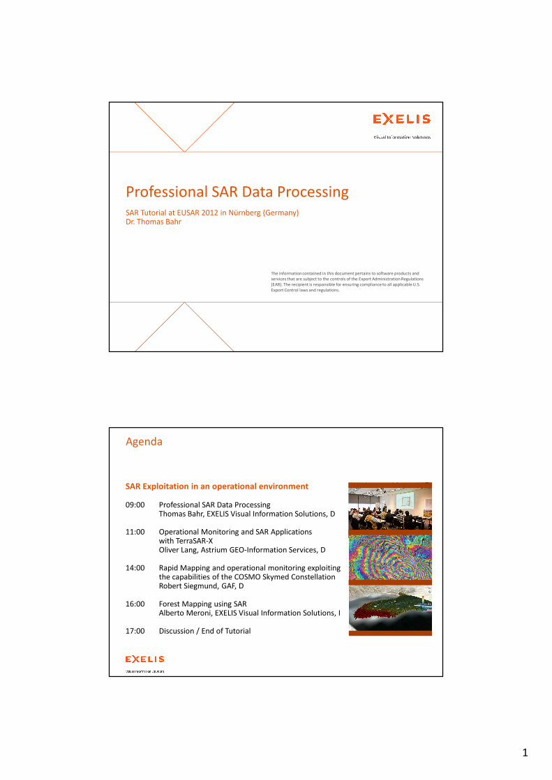
SAR Exploitation in an operational environment
09:00 Professional SAR Data ProcessingThomas Bahr, EXELIS Visual Information Solutions, D
11:00 Operational Monitoring and SAR Applications with TerraSAR-XOliver Lang, Astrium GEO-Information Services, D
14:00 Rapid Mapping and operational monitoring exploiting the capabilities of the COSMO Skymed ConstellationRobert Siegmund, GAF, D
16:00 Forest Mapping using SARAlberto Meroni, EXELIS Visual Information Solutions, I
17:00 Discussion / End of Tutorial
Agenda
2
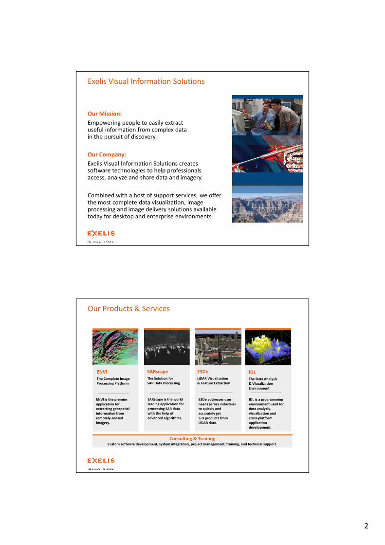
Exelis Visual Information Solutions
Our Mission:
Empowering people to easily extract useful information from complex data in the pursuit of discovery.
Our Company:
Exelis Visual Information Solutions creates software technologies to help professionals access, analyze and share data and imagery.
Combined with a host of support services, we offer the most complete data visualization, image processing and image delivery solutions available today for desktop and enterprise environments.
IAS provides advanced
image compression and
delivery capabilities
based on
JPEG2000 standards.
IAS
Rapid Image Delivery
to the Field
E3De addresses user
needs across industries
to quickly and
accurately get
3-D products from
LiDAR data.
E3De
LiDAR Visualization
& Feature Extraction
IDL
The Data Analysis
& Visualization
Environment
IDL is a programming
environment used for
data analysis,
visualization and
cross-platform
application
development.
Consulting & TrainingCustom software development, system integration, project management, training, and technical support.
Our Products & Services
ENVI
The Complete Image
Processing Platform
ENVI is the premier
application for
extracting geospatial
information from
remotely-sensed
imagery.
SARscape
The Solution for
SAR Data Processing
SARscape is the world
leading application for
processing SAR data
with the help of
advanced algorithms.
3
SARscape
The Solution for
SAR Data Processing
SARscape is the world
leading application for
processing SAR data
with the help of
advanced algorithms.
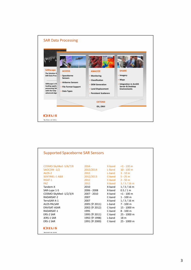
SAR Data Processing
ACCESS
> SpaceborneSensors
> Airborne Sensors
> File Format Support
> Data Types
ANALYZE
> Monitoring
> Classification
> DEM Generation
> Land Displacement
> Persistent Scatterers
SHARE
> Imagery
> Maps
> Integration in ArcGISServer & Desktop Environments
EXTEND
IDL, ENVI
Supported Spaceborne SAR Sensors
COSMO-SkyMed -5/6/7/8 2014 - X-band <1 - 100 m
SAOCOM -1/2 2013/2014 L-Band 10 - 100 m
ALOS-2 2013 L-band 1 - 10 m
SENTINEL-1 A&B 2012/2013 C-band 5 - 25 m
RISAT-1 2012 C-band 2 - 50 m
PAZ 2012 X-band 1 / 3 / 16 m
Tandem-X 2010 X-band 1 / 3 / 16 m
SAR-Lupe 1-5 2006 - 2008 X-band 0.5 / 1 m
COSMO-SkyMed -1/2/3/4 2007 - 2010 X-band <1 - 100 m
RADARSAT-2 2007 C-band 1 - 100 m
TerraSAR-X-1 2007 X-band 1 / 3 / 16 m
ALOS PALSAR 2005 (� 2011) L-band 7 - 100 m
ENVISAT-ASAR 2002 (� 2012) C-band 15 - 1000 m
RADARSAT-1 1995 C-band 8 - 100 m
ERS-2 SAR 1995 (� 2011) C-band 25 - 1000 m
JERS-1 SAR 1992 (� 1998) L-band 18 m
ERS-1 SAR 1991 (� 2000) C-band 25 - 1000 m
4
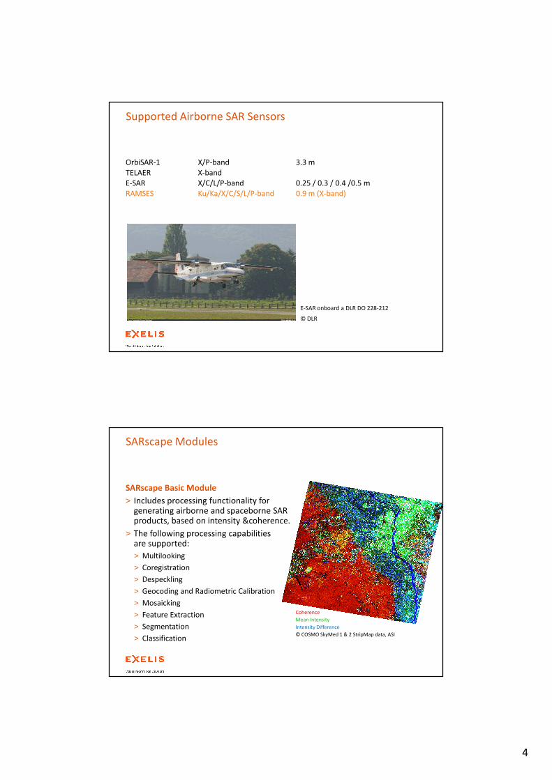
Supported Airborne SAR Sensors
OrbiSAR-1 X/P-band 3.3 m
TELAER X-band
E-SAR X/C/L/P-band 0.25 / 0.3 / 0.4 /0.5 m
RAMSES Ku/Ka/X/C/S/L/P-band 0.9 m (X-band)
E-SAR onboard a DLR DO 228-212
© DLR
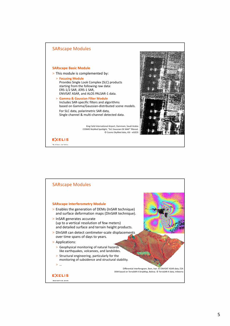
SARscape Basic Module
> Includes processing functionality for generating airborne and spaceborne SAR products, based on intensity &coherence.
> The following processing capabilitiesare supported:
> Multilooking
> Coregistration
> Despeckling
> Geocoding and Radiometric Calibration
> Mosaicking
> Feature Extraction
> Segmentation
> Classification
SARscape Modules
Coherence
Mean Intensity
Intensity Difference
© COSMO SkyMed 1 & 2 StripMap data, ASI
5
SARscape Modules
SARscape Basic Module
> This module is complemented by:
> Focusing ModuleProvides Single Look Complex (SLC) products starting from the following raw data: ERS-1/2 SAR, JERS-1 SAR, ENVISAT ASAR, and ALOS PALSAR-1 data.
> Gamma & Gaussian Filter ModuleIncludes SAR-specific filters and algorithms based on Gamma/Gaussian-distributed scene models.
For SLC data, polarimetric SAR data, Single channel & multi-channel detected data.
King Fahd International Airport, Dammam, Saudi Arabia
COSMO SkyMed Spotlight, “SLC Gaussian DE MAP” filtered.
© Cosmo SkyMed data, ASI - eGEOS
SARscape Modules
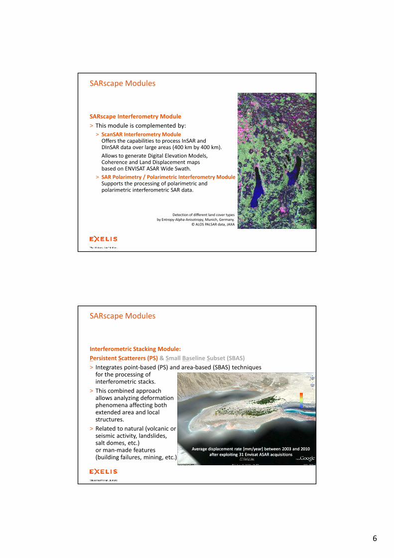
Differential interferogram, Bam, Iran. © ENVISAT ASAR data, ESA
DEM based on TerraSAR-X StripMap, Bolivia. © TerraSAR-X data, Infoterra
SARscape Interferometry Module
> Enables the generation of DEMs (InSAR technique) and surface deformation maps (DInSAR technique).
> InSAR generates accurate (up to a vertical resolution of few meters) and detailed surface and terrain height products.
> DInSAR can detect centimeter-scale displacements over time spans of days to years.
> Applications:
> Geophysical monitoring of natural hazards like earthquakes, volcanoes, and landslides.
> Structural engineering, particularly for the monitoring of subsidence and structural stability.
> …
6
SARscape Modules
SARscape Interferometry Module
> This module is complemented by:
> ScanSAR Interferometry ModuleOffers the capabilities to process InSAR and DInSAR data over large areas (400 km by 400 km).
Allows to generate Digital Elevation Models, Coherence and Land Displacement maps based on ENVISAT ASAR Wide Swath.
> SAR Polarimetry / Polarimetric Interferometry ModuleSupports the processing of polarimetric and polarimetric interferometric SAR data.
Detection of different land cover types
by Entropy-Alpha-Anisotropy, Munich, Germany.
© ALOS PALSAR data, JAXA
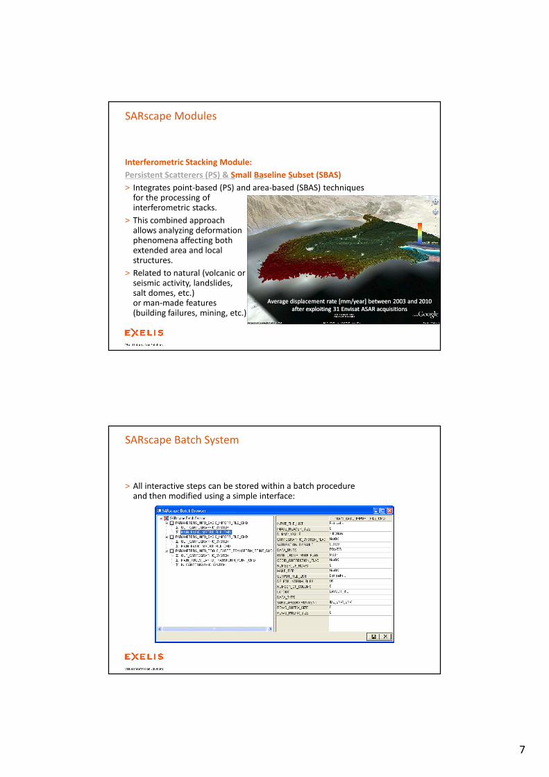
Interferometric Stacking Module:
Persistent Scatterers (PS) & Small Baseline Subset (SBAS)
> Integrates point-based (PS) and area-based (SBAS) techniques for the processing of interferometric stacks.
> This combined approach allows analyzing deformation phenomena affecting both extended area and local structures.
> Related to natural (volcanic or seismic activity, landslides, salt domes, etc.) or man-made features (building failures, mining, etc.).
Average displacement rate [mm/year] between 2003 and 2010
after exploiting 31 Envisat ASAR acquisitions
Average displacement rate [mm/year] between 2003 and 2010
after exploiting 31 Envisat ASAR acquisitions
SARscape Modules
7
Interferometric Stacking Module:
Persistent Scatterers (PS) & Small Baseline Subset (SBAS)
> Integrates point-based (PS) and area-based (SBAS) techniques for the processing of interferometric stacks.
> This combined approach allows analyzing deformation phenomena affecting both extended area and local structures.
> Related to natural (volcanic or seismic activity, landslides, salt domes, etc.) or man-made features (building failures, mining, etc.).
Average displacement rate [mm/year] between 2003 and 2010
after exploiting 31 Envisat ASAR acquisitions
Average displacement rate [mm/year] between 2003 and 2010
after exploiting 31 Envisat ASAR acquisitions
SARscape Modules
SARscape Batch System
> All interactive steps can be stored within a batch procedure and then modified using a simple interface:
8
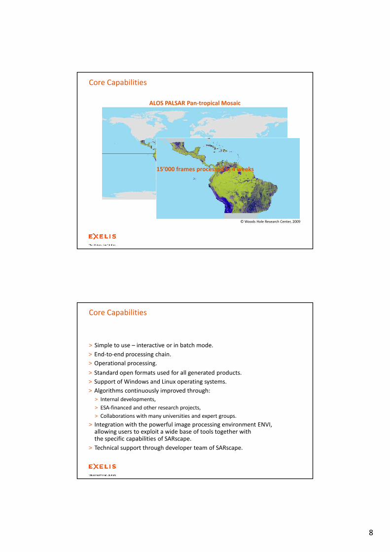
© Woods Hole Research Center, 2009
15’000 frames processed in 4 weeks
ALOS PALSAR Pan-tropical Mosaic
Core Capabilities
Core Capabilities
> Simple to use – interactive or in batch mode.
> End-to-end processing chain.
> Operational processing.
> Standard open formats used for all generated products.
> Support of Windows and Linux operating systems.
> Algorithms continuously improved through:
> Internal developments,
> ESA-financed and other research projects,
> Collaborations with many universities and expert groups.
> Integration with the powerful image processing environment ENVI, allowing users to exploit a wide base of tools together with the specific capabilities of SARscape.
> Technical support through developer team of SARscape.
9
> Cross-mode
> ALOS PALSAR FBS – FBD – PLR, ENVISAT ASAR WS – IM, ERS-2 – ENVISAT ASAR
> Processing optimised for all different cases
Core Capabilities
Specific Support instead
of Generic Support.
> Spotlight
> TerraSAR-X, COSMO-Skymed, SAR-Lupe
> Height dependent coregistration
> Proper handling of azimuth-varying Doppler spectrum
> ScanSAR Interferometry
> ENVISAT ASAR WS
> Proper handling of azimuth-varying Doppler spectrum
> Airborne SAR
> Proper handling of motion compensated data
> Height dependent coregistration
> Proper handling of azimuth-varying Doppler spectrum
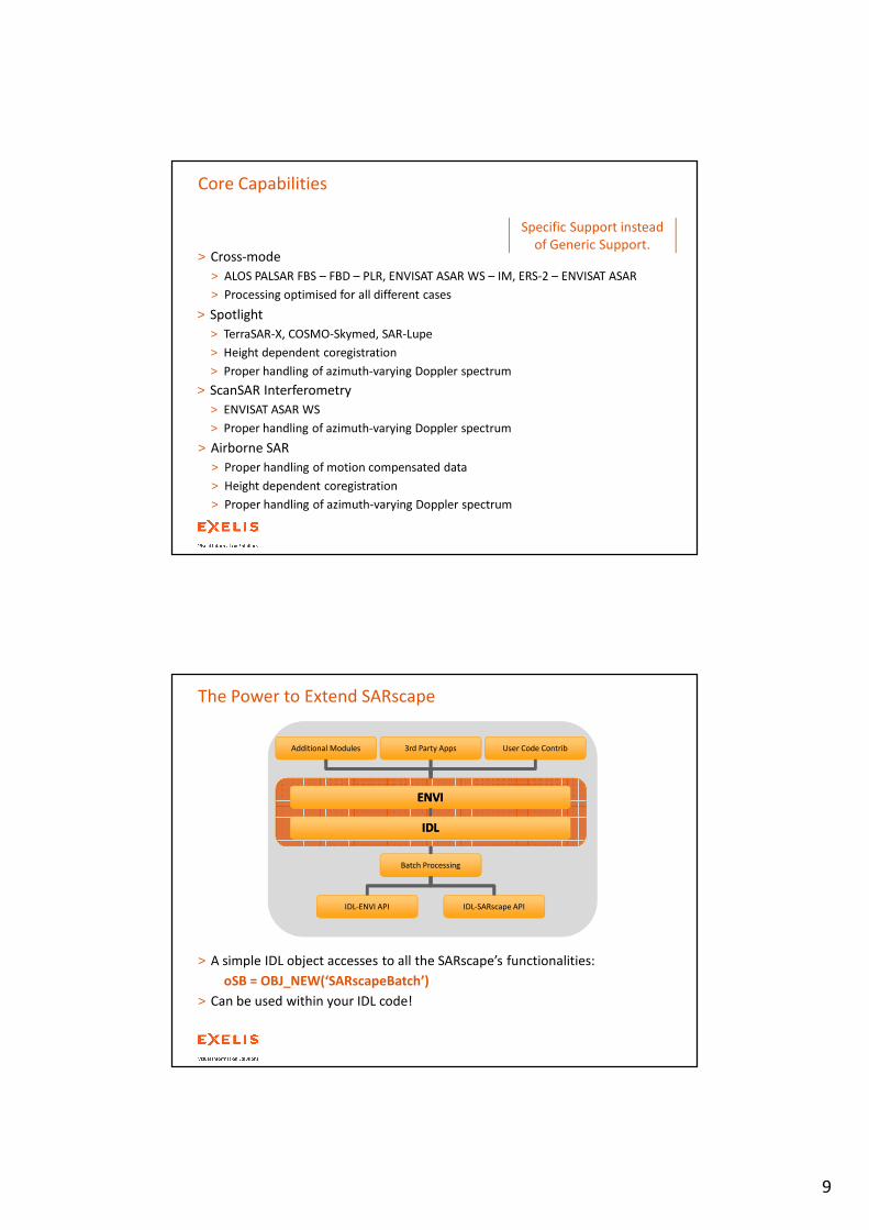
The Power to Extend SARscape
> A simple IDL object accesses to all the SARscape’s functionalities:
oSB = OBJ_NEW(‘SARscapeBatch’)
> Can be used within your IDL code!
ENVI ENVI
IDLIDL
Additional Modules User Code Contrib3rd Party Apps
Batch Processing
IDL-ENVI API IDL-SARscape API
10
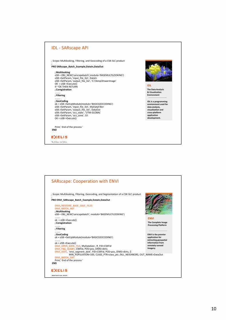
IDL - SARscape API
; Scope: Multilooking, Filtering, and Geocoding of a CSK-SLC product; PRO SARscape_Batch_Example,DataIn,DataOut
; MultilookingoSB = OBJ_NEW('sarscapebatch',module='BASEMULTILOOKING')oSB->SetParam, 'input_file_list', DataInoSB->SetParam, 'output_file_list', 'C:\Temp\PowerImage‘OK = oSB->Execute()IF ~OK THEN RETURN; Coregistration……… ; Filtering……… ; GeoCodingok = oSB->SetUpModule(module='BASICGEOCODING')oSB->SetParam, 'input_file_list', MyDataFilteroSB->SetParam, 'output_file_list', DataOutoSB->SetParam, 'ocs_state', 'UTM-GLOBAL‘oSB->SetParam, 'ocs_zone', 33OK = oSB->Execute()
Print,' End of the process 'END
IDL
The Data Analysis
& Visualization
Environment
IDL is a programming
environment used for
data analysis,
visualization and
cross-platform
application
development.
SARscape: Cooperation with ENVI
; Scope: Multilooking, Filtering, Geocoding, and Segmentation of a CSK-SLC product; PRO ENVI_SARscape_Batch_Example,DataIn,DataOut
ENVI,/RESTORE_BASE_SAVE_FILESENVI_BATCH_INIT; MultilookingoSB = OBJ_NEW('sarscapebatch', module='BASEMULTILOOKING')……… ok = oSB->Execute(); Coregistration……… ; Filtering……… ; GeoCodingok = oSB->SetUpModule(module='BASICGEOCODING')……… ok = oSB->Execute()ENVI_OPEN_DATA_FILE, MyDataGeo , R_FID=CSKFidENVI_FILE_QUERY, CSKFid, POS=pos, DIMS=dimsENVI_DOIT, 'envi_segment_doit', FID=CSKFid, POS=pos, DIMS=dims, $
MIN_POPULATION=100, CLASS_PTR=class_ptr, /ALL_NEIGHBORS, OUT_NAME=DataOutENVI_BATCH_EXITPrint,' End of the process '
END
ENVI
The Complete Image
Processing Platform
ENVI is the premier
application for
extracting geospatial
information from
remotely-sensed
imagery.
11
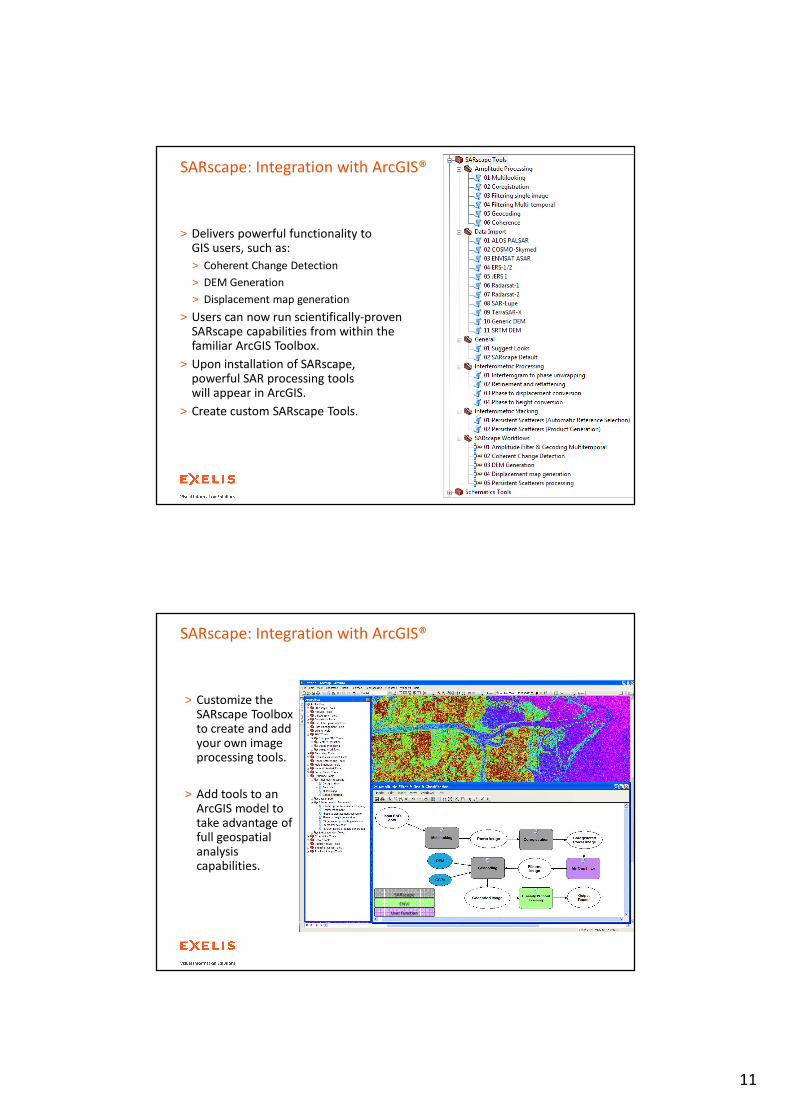
> Delivers powerful functionality to GIS users, such as:
> Coherent Change Detection
> DEM Generation
> Displacement map generation
> Users can now run scientifically-proven SARscape capabilities from within the familiar ArcGIS Toolbox.
> Upon installation of SARscape, powerful SAR processing tools will appear in ArcGIS.
> Create custom SARscape Tools.
SARscape: Integration with ArcGIS®
> Customize the SARscape Toolbox to create and add your own image processing tools.
> Add tools to an ArcGIS model to take advantage of full geospatial analysis capabilities.
SARscape: Integration with ArcGIS®
SARscape
ENVI
User Function
12
> The SARscape® platform provides a suite of
> state-of-the-art,
> operational modules
enabling users to exploit all the technologies today available for information generation from SAR data.
Summary
> The modular set of functions is
> integrated in the ENVI/ArcGIS environments,
> supports all the data and acquisition modes available from the today existing spaceborne and airborne SAR sensors.
> The key subject of the forthcoming releases will be
> data fusion (SAR-SAR, SAR-Optical),
> generation of DEMs from SAR stereo data.
> Customized solutions are provided on request.
Thank You
Exelis Visual Information Solutions - Headquarters
4990 Pearl East Circle
Boulder, CO 80301
phone: 303.786.9900
Exelis Visual Information Solutions - United Kingdom
Venture House
2 Arlington Square,
Bracknell
Berkshire, RG12 1WA United Kingdom
phone: +44 (0) 1344 742826
Exelis Visual Information Solutions - Germany
Talhofstrasse 32a
D-82205 Gilching, Germany
phone: +49.8105.378.0
Exelis Visual Information Solutions - France
Tour de l’Horloge
4 Place Louis Armand
75603 Paris Cedex 12, France
phone: +33 (0)1.73.02.46.20
Exelis Visual Information Solutions - Italy
Via Salvo D'Acquisto 31
20863 Concorezzo MB, Italy
phone: +39.039.605.8605
Exelis Visual Information Solutions - Tokyo
Orimoto Bldg. 3F
2-7-17 Sarugaku-cho
Chiyoda-ku
Tokyo, Japan 101-0064
phone: +81.3.6904.2475


![CalFresh Handbook SAR 7 Processing [63-508.3] 25. SAR 7 ... · Update #14-03 Revised: 03/12/14 CalFresh Handbook page 25-1 SAR 7 Processing [63-508.3] 25. SAR 7 Processing [63-508.3]](https://static.fdocuments.us/doc/165x107/5b0e482d7f8b9ab7658db96a/calfresh-handbook-sar-7-processing-63-5083-25-sar-7-14-03-revised-031214.jpg)