
Procedural and Fractal Terrains. Gameplay goals for a terrain engine Large enough to travel around...
65
Procedural and Fractal Terrains
-
Upload
austen-long -
Category
Documents
-
view
214 -
download
0
Transcript of Procedural and Fractal Terrains. Gameplay goals for a terrain engine Large enough to travel around...

Procedural and Fractal Terrains

Gameplay goals for a terrain engine
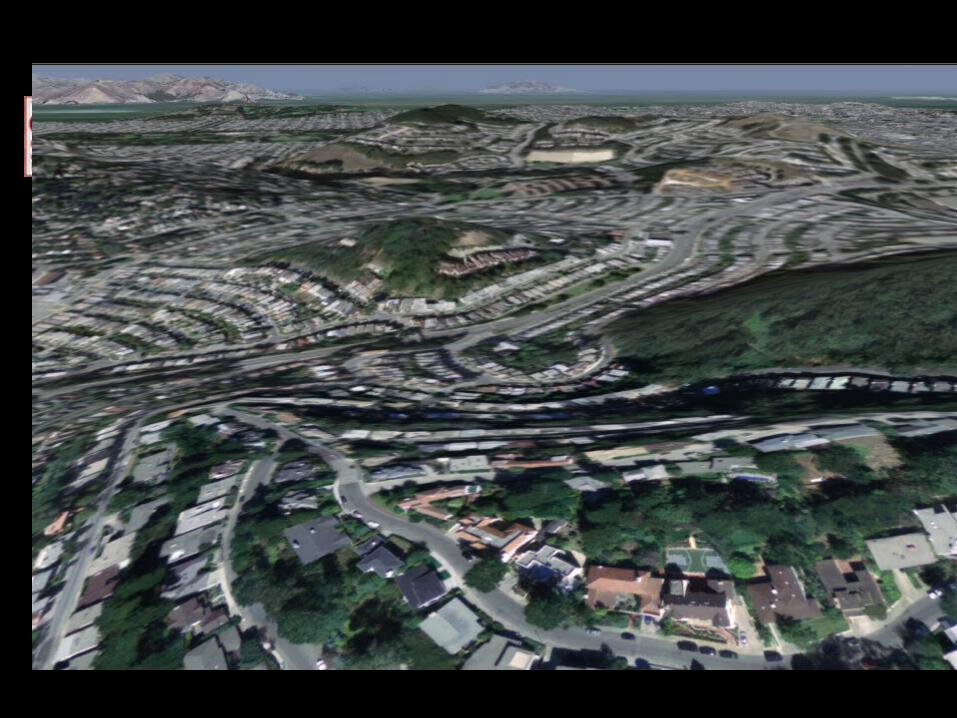
• Large enough to travel around for hours
• Detailed when seen at a human scale
• Dynamic modification of terrain data
• Runs at high, stable frame rates
• Need fast rotation of viewpoint

Technical goals
• Level-of-detail management (static or continuous?)
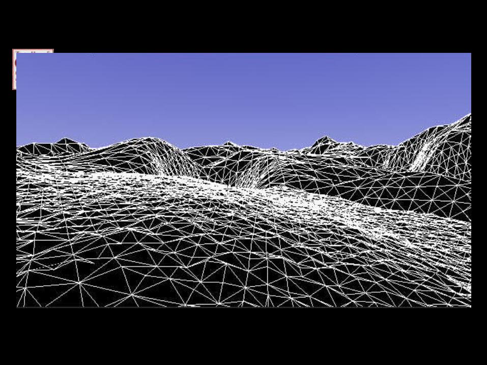
• A lot of polygons (231 in un-reduced terrain, 70,000+ in a given tessellation)
• Efficient graphics primitives
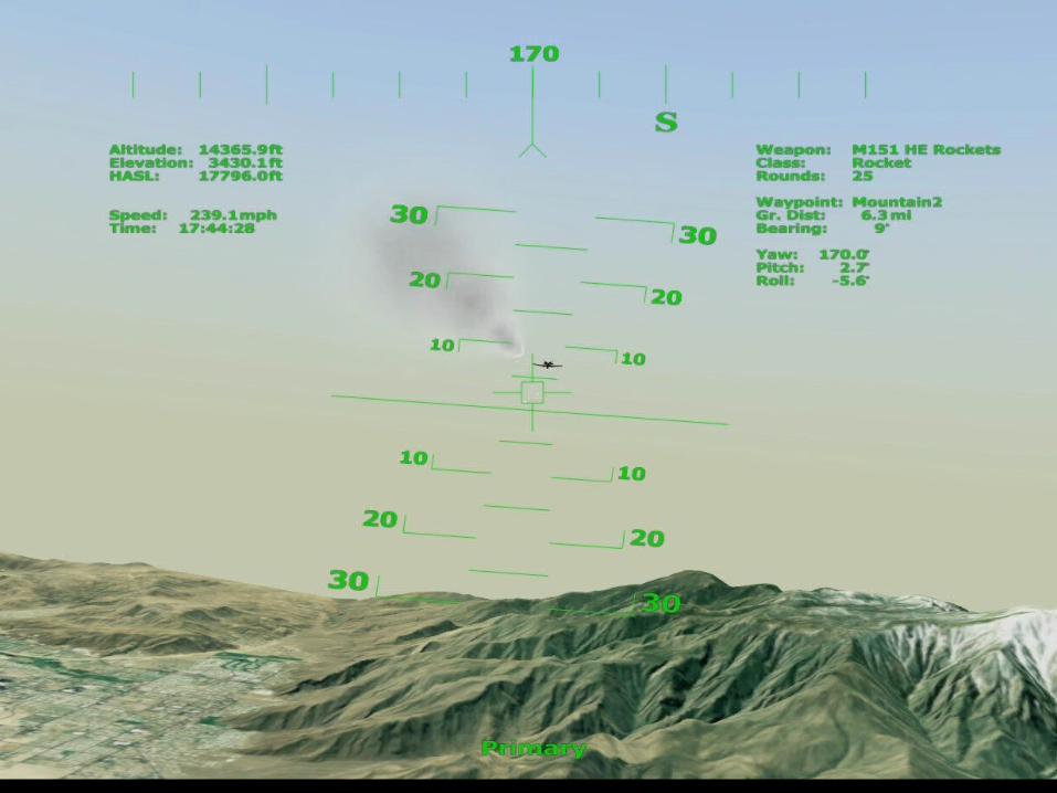
• Near-field detail (geometric and color)


Terrain Map
• Height Map
z = f(x, y)x and y are sampled on a 2D integer grid
– Real data : Satellite, Elevation maps– Synthetic : Texture map, Noise functions
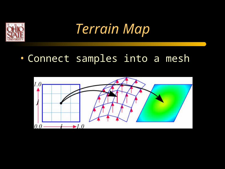
Terrain Map
• Connect samples into a mesh
Terrain Map
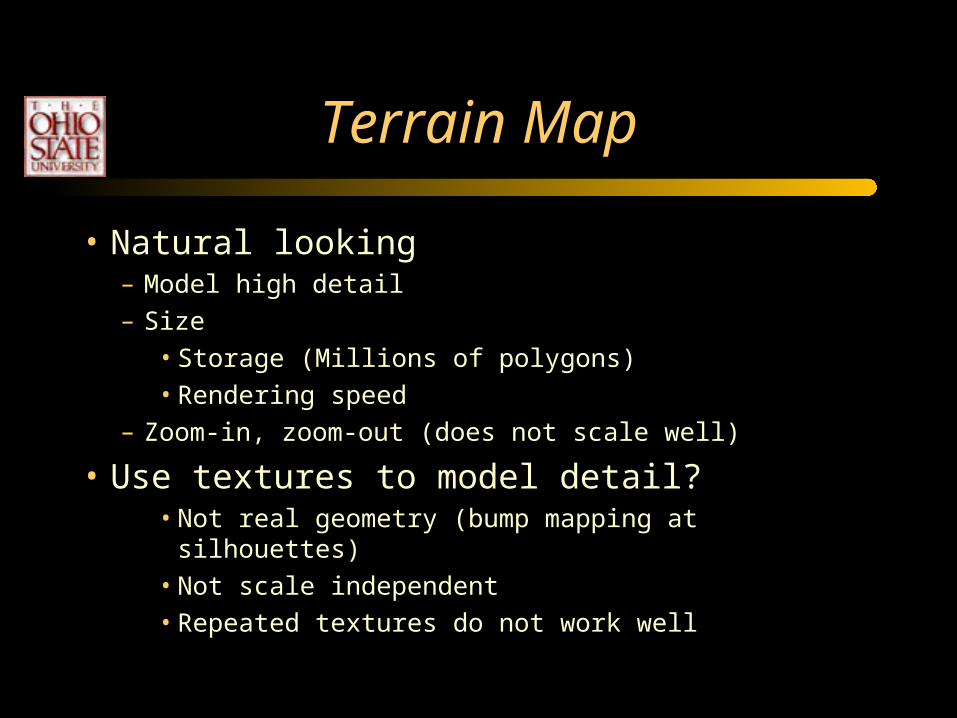
• Natural looking– Model high detail– Size
• Storage (Millions of polygons)• Rendering speed
– Zoom-in, zoom-out (does not scale well)
• Use textures to model detail?• Not real geometry (bump mapping at silhouettes)• Not scale independent• Repeated textures do not work well

Fake Terrain
• Generate the heightfield:– Coarse height map + periodic details– Procedural or function-based– Random process
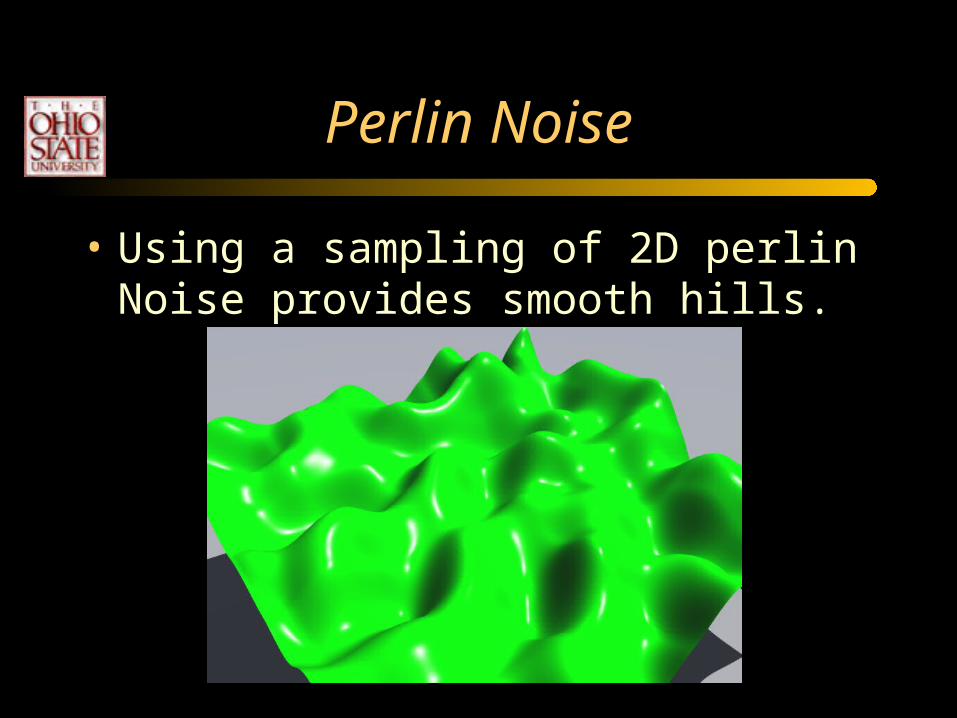
Perlin Noise
• Using a sampling of 2D perlin Noise provides smooth hills.

Terrain Coloring
• Using a 1D texture map based on the altitude can provide many useful mapping.

Terrain Coloring
• Striped 1D texture map.

Terrain Coloring
• Using a 2D texture map provides richer detail, but is independent of the terrain.

Terrain Coloring
• More advanced coloring is based on altitude and slope.

Rolling Hills
• Scaling in one dimension gives smooth rolling hills.
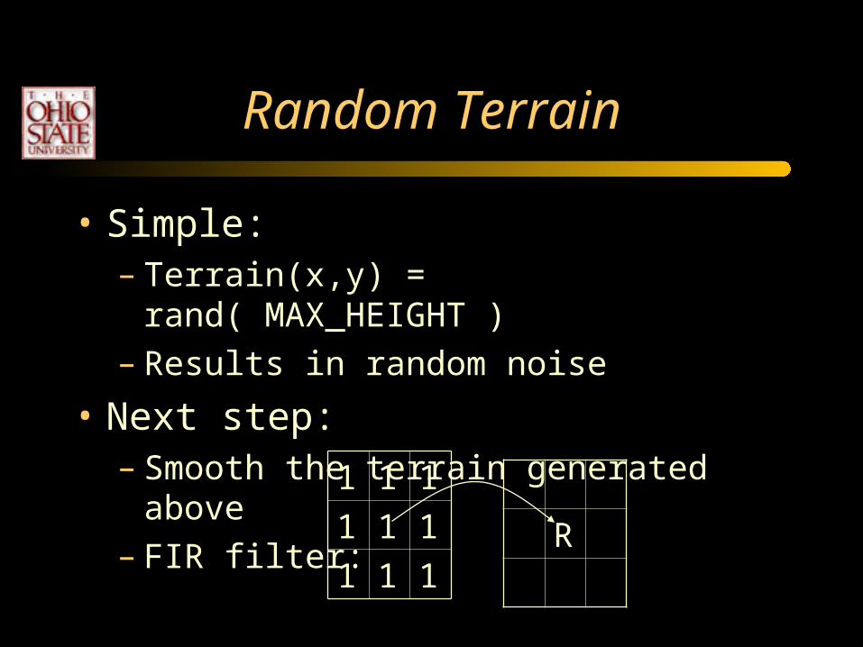
Random Terrain
• Simple:– Terrain(x,y) = rand( MAX_HEIGHT )– Results in random noise
• Next step:– Smooth the terrain generated above– FIR filter: 1 1 1
1 1 1
1 1 1R
Filtering
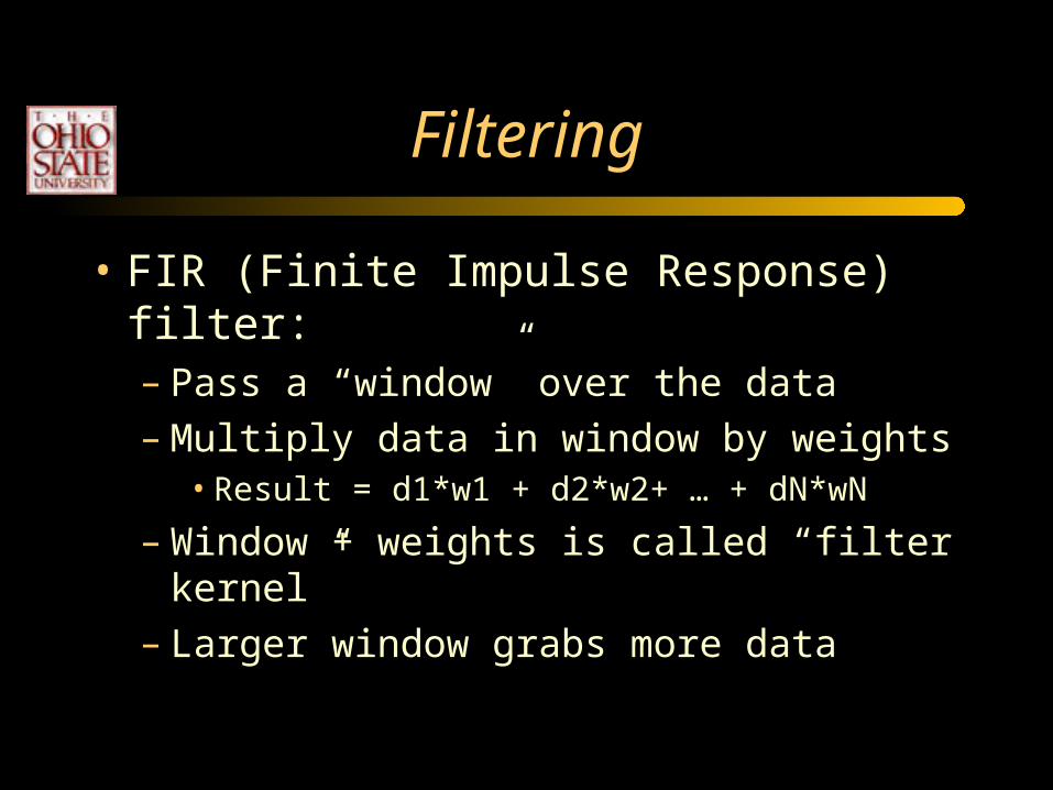
• FIR (Finite Impulse Response) filter:– Pass a “window” over the data– Multiply data in window by weights
• Result = d1*w1 + d2*w2+ … + dN*wN
– Window + weights is called “filter kernel”– Larger window grabs more data

Random Fault Lines
• Repeatedly:– Create a line that crosses terrain– Add dHeight offset on one side of
line– dHeighti = dHeight0 + (i/n)(dHeightn -
dHeight0)– Select random endpoints to generate
line
• Compute “side of line” by plugging X,Y into line equation
+dHeight

More Realistic Faults
• Apply FIR filter to faulted heightmap
• Smooth out abrupt fault transitions: “Erosion”

Particle Deposition
• Drop particles in areas where you want volcanic mountains
• Particles flow downhill until they have cause to rest
• Move the drop point to create interesting peak
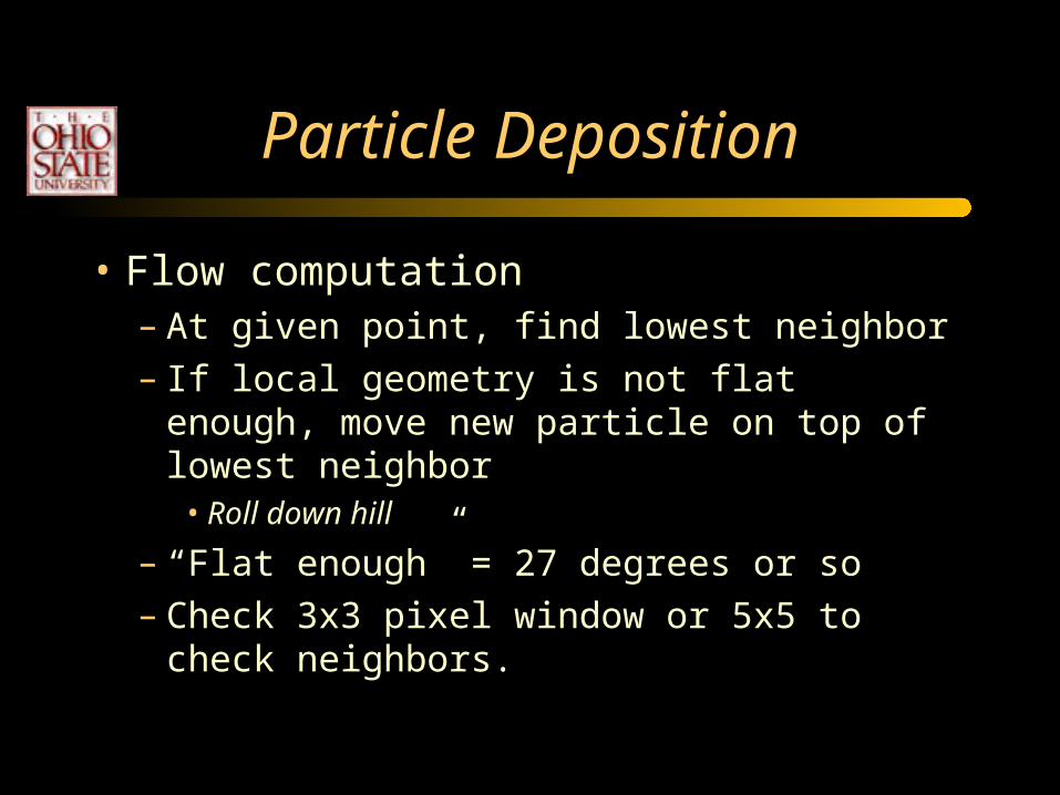
Particle Deposition
• Flow computation– At given point, find lowest neighbor– If local geometry is not flat enough, move new
particle on top of lowest neighbor• Roll down hill
– “Flat enough” = 27 degrees or so– Check 3x3 pixel window or 5x5 to check
neighbors.

Particle Deposition
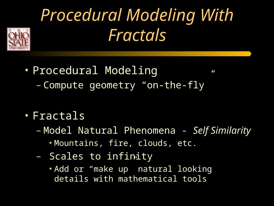
Procedural Modeling With Fractals
• Procedural Modeling– Compute geometry “on-the-fly”
• Fractals– Model Natural Phenomena - Self Similarity
• Mountains, fire, clouds, etc.
– Scales to infinity• Add or “make up” natural looking details with
mathematical tools

Fractals
“Repetition of form over a variety of scales”
• Mandelbrot set, Julia set
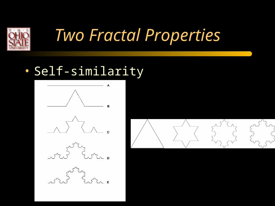
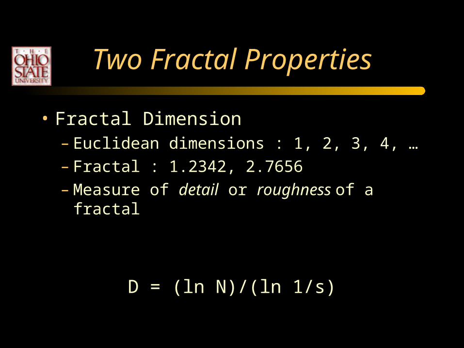
Two Fractal Properties
• Self-similarity
Two Fractal Properties
• Fractal Dimension– Euclidean dimensions : 1, 2, 3, 4, …– Fractal : 1.2342, 2.7656– Measure of detail or roughness of a fractal
D = (ln N)/(ln 1/s)
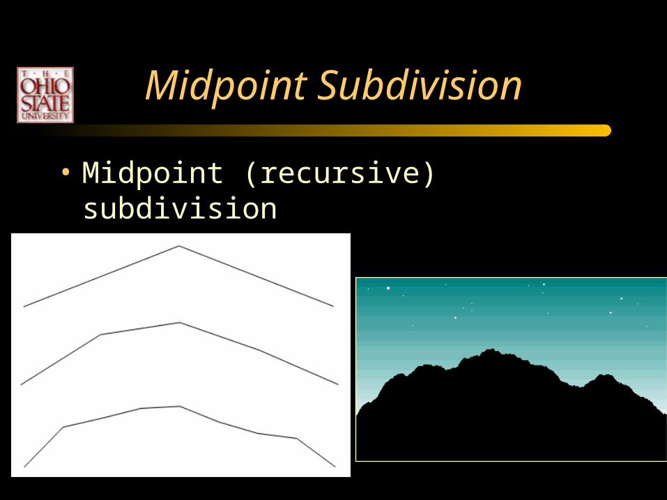
Midpoint Subdivision
• Midpoint (recursive) subdivision

Midpoint Subdivision
• Brownian Motion– Describes random movement of particles in a
gas or fluid
• Fractional Brownian Motion– Brownian Motion + Fractal Dimension– A useful model for natural phenomena

Fractional Brownian Motion
• Fractional Brownian Motion– Equations are compute intensive– Approximate with “A family of 1D Gaussians ”
• Zero mean
• Standard Deviation : S = k2-iH
H = fractal dimension (roughness)

Fractional Brownian Motion
• Fractal dimension = roughness, I.e. H

Fractal Mountains
• Recursively subdivide geometry by random number d:–dHeight/2 < d < dHeight/2
• At each recursion:– dHeight *= 2-r
– r=1 : self-similar– r>1 : large features early– r<1 : large features late
A B
A B
A B

Triangle Subdivision
• Subdivide a triangle into 4 triangles at edge midpoint

Terrain Modeling Criteria
• Input– Initial coarse mesh + stochastic parameters
• Two criteria– Internal Consistency
• Reproducibility : Model is independent of position and orientation
• Associate “random numbers” to point index
– External Consistency• Continuity between adjacent primitives
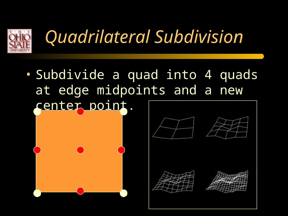
Quadrilateral Subdivision
• Subdivide a quad into 4 quads at edge midpoints and a new center point.

Diamond-Square Subdivision
• Alternate subdivision

Fractal Terrain
Mesh Subdivision
• Square-square Subdivision– Addresses “creasing problem” (slope
discontinuities)
• Subdivide parametric patches

Mesh Subdivision
• Displacement is scaled by the recursion level.– | b – a | -rn
• When do you stop the recursion?– Pixel resolution
• Displace upward, or towards the normal to the surface?

Mesh Subdivision
• External Consistency– Avoid tears between neighboring polygons– How do we compute the normals?
• Average polygon normals at each vertex.
• Propagate normals down the recursion
• Cheaper : use the original mesh normals only

Ridged Fractal Terrains
• To create sharp peaks, add an absolute value and flip the surface upside down.
• Or, reflect about a maximum value.
• Provides a volcano-like effect.

Caldera

Multi-Fractal
• This produces a ridged multi-fractal

Add a 1D Texture

More Controls
• To create plateaus, add a min function to flatten out high areas.
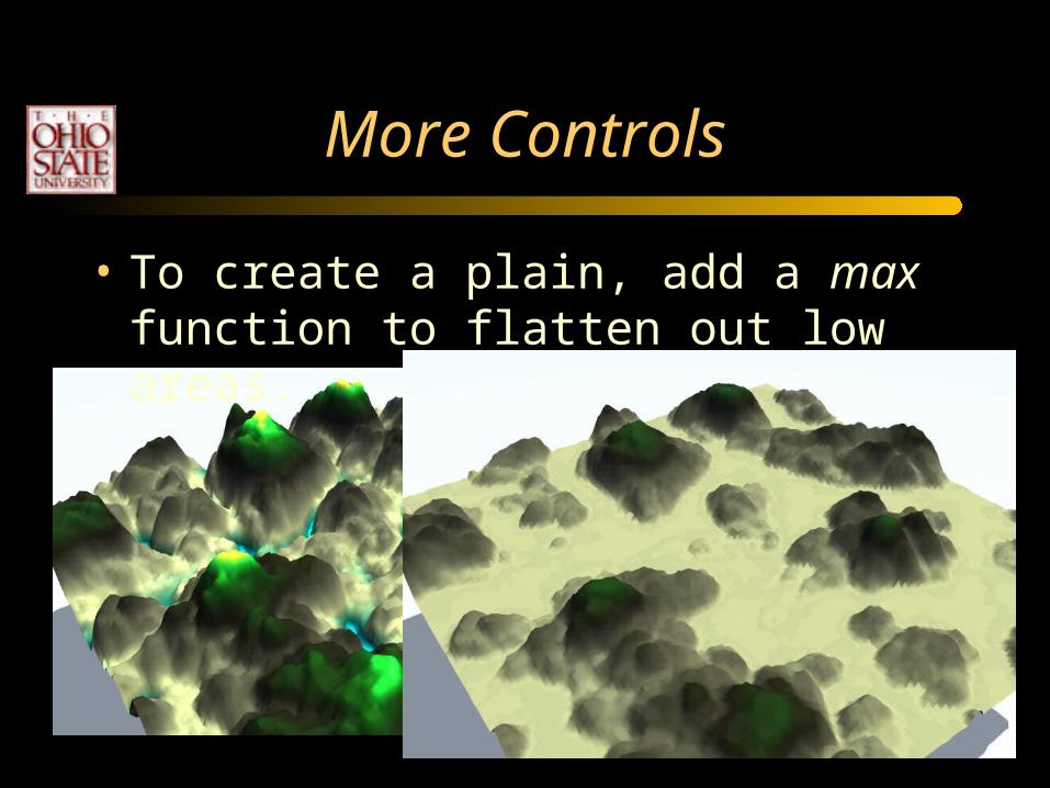
More Controls
• To create a plain, add a max function to flatten out low areas.
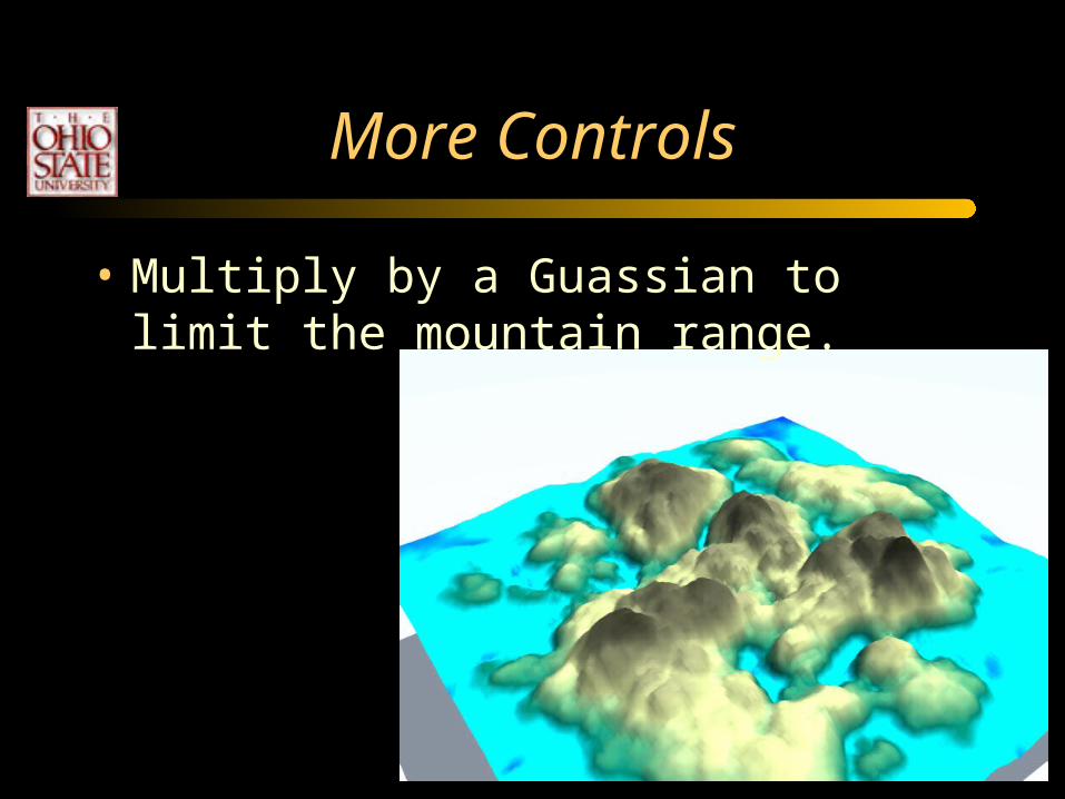
More Controls
• Multiply by a Guassian to limit the mountain range.

More Controls
• To create valleys, create a lower amplitude and rather smooth terrain to use as the max operator.

max (Fractal, Smooth Noise)

max (Fractal, Smooth Noise)

Ridges
• Quantize a terrain to create ridges– Use directly or as the min function.– Can also be done as a transfer function that
maps f(x)->g(x).
height
New height

Ridges
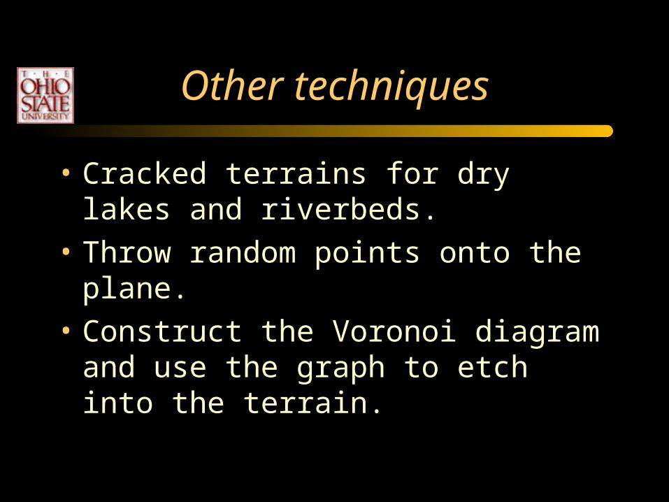
Other techniques
• Cracked terrains for dry lakes and riverbeds.
• Throw random points onto the plane.
• Construct the Voronoi diagram and use the graph to etch into the terrain.

Cracked Terrains
Crawfis, 2002
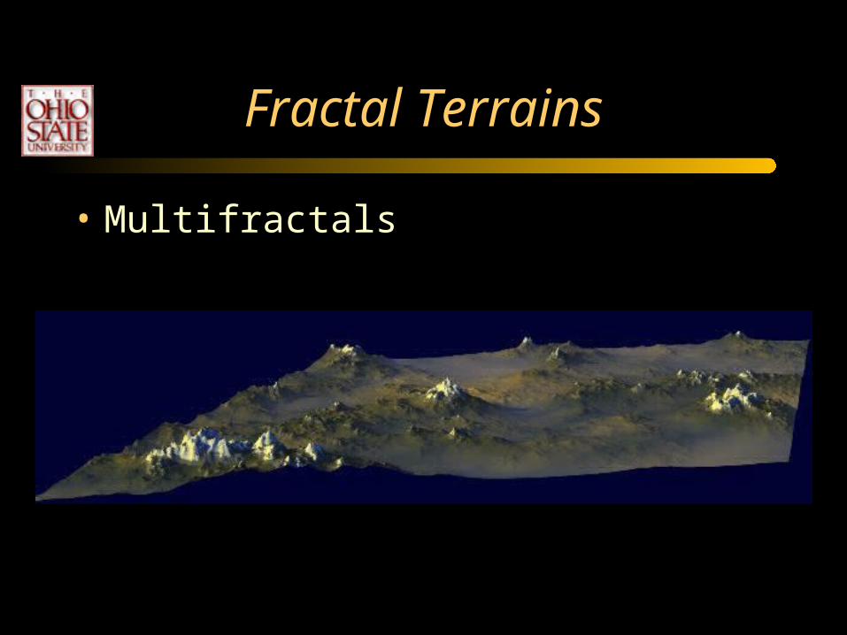
Fractal Terrains
• Multifractals

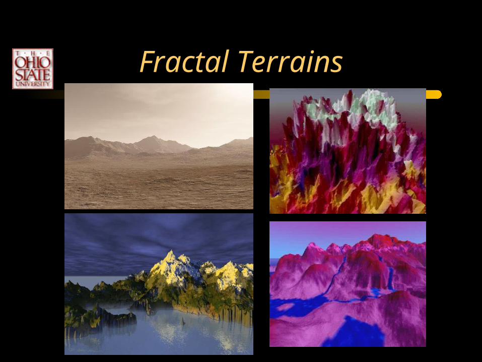
Fractal Terrains
• Color, texture
Fractal Terrains

Ground Clutter
• Grass• Rocks• Trees• Bushes
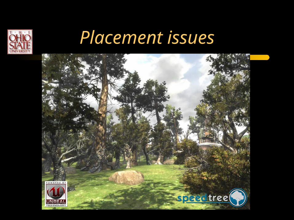
Placement issues
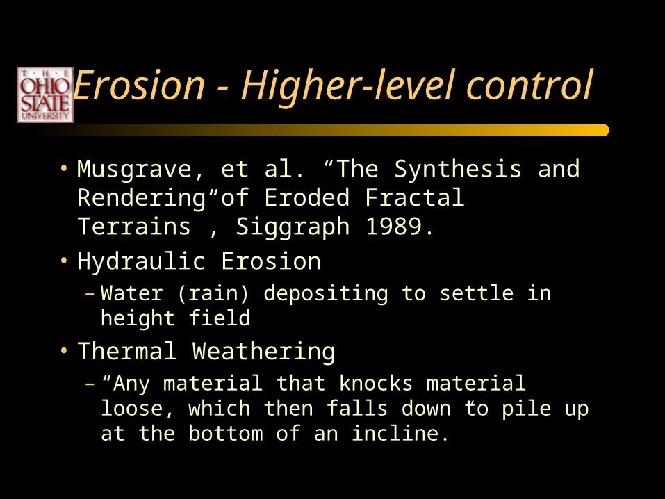
Erosion - Higher-level control
• Musgrave, et al. “The Synthesis and Rendering of Eroded Fractal Terrains”, Siggraph 1989.
• Hydraulic Erosion– Water (rain) depositing to settle in height field
• Thermal Weathering– “Any material that knocks material loose, which
then falls down to pile up at the bottom of an incline.”

Erosion

Erosion by water

Erosion by wind and water


![WELCOME [aws.profantasy.com]aws.profantasy.com/downloads/FT3_Essentials.pdf · Welcome to Fractal Terrains 3 (FT3) by ProFantasy Software Ltd. FT3 enables you to use fractals, real](https://static.fdocuments.us/doc/165x107/5b87d2e87f8b9a46538c5a9e/welcome-aws-aws-welcome-to-fractal-terrains-3-ft3-by-profantasy-software.jpg)

![An Algorithm for Automated Fractal Terrain Deformation · constraining fractal terrains has been studied previously. [ST89] present a method to approximate a coarse spline mesh with](https://static.fdocuments.us/doc/165x107/5fb9c085e15ffb6a3b16e6ec/an-algorithm-for-automated-fractal-terrain-deformation-constraining-fractal-terrains.jpg)


![2 Procedural Fractal Terrains - University of Chicago · 2-5 This is a generalization of Perlin's original "chaos" function. [6] I have provided new parameters to control lacunarity](https://static.fdocuments.us/doc/165x107/5e8b54eba9f09007916d1126/2-procedural-fractal-terrains-university-of-chicago-2-5-this-is-a-generalization.jpg)