Presented by : Said Shakib Atef PI: Fahimeh Salehi Partner ... · drought management, source and...
17
Presented by : Said Shakib Atef PI: Fahimeh Salehi Partner : Dr . Daniel. B.Fagre , USG - Supported partner Prof. Ulrich Kamp, Project co - PI/Adviser 2019 PEER Forum - Transboundary Water Research in Central Asia In Partnership with IWMI October 21-22, 2019
Transcript of Presented by : Said Shakib Atef PI: Fahimeh Salehi Partner ... · drought management, source and...
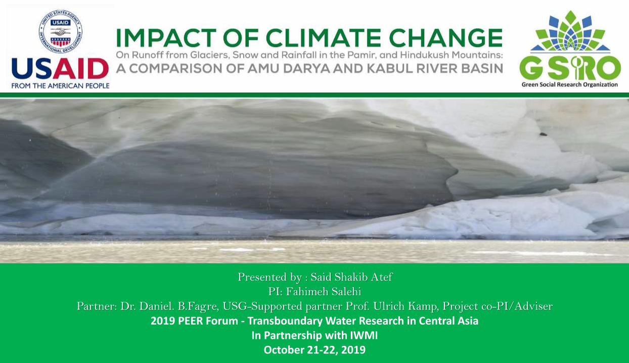
Presented by : Said Shakib Atef
PI: Fahimeh Salehi
Partner: Dr. Daniel. B.Fagre, USG-Supported partner Prof. Ulrich Kamp, Project co-PI/Adviser
2019 PEER Forum - Transboundary Water Research in Central AsiaIn Partnership with IWMI
October 21-22, 2019
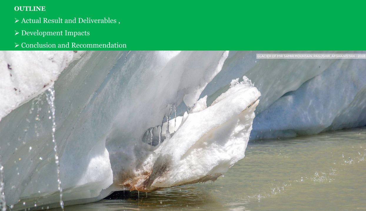
OUTLINE
Actual Result and Deliverables ,
Development Impacts
Conclusion and Recommendation

ST
UD
Y A
RE
A
This study involves the calculation
of streamflow from rainfall, snow
and glacier melt as components
of the runoff.
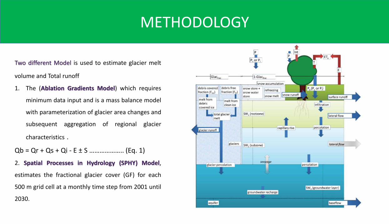
Two different Model is used to estimate glacier melt
volume and Total runoff
1. The (Ablation Gradients Model) which requires
minimum data input and is a mass balance model
with parameterization of glacier area changes and
subsequent aggregation of regional glacier
characteristics .
Qb = Qr + Qs + Qi - E ± S ……………….. (Eq. 1)
2. Spatial Processes in Hydrology (SPHY) Model,
estimates the fractional glacier cover (GF) for each
500 m grid cell at a monthly time step from 2001 until
2030.
METHODOLOGY
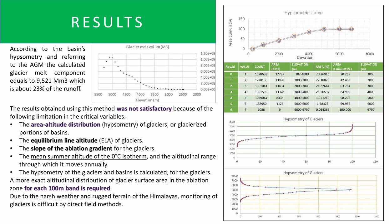
The results obtained using this method was not satisfactory because of the following limitation in the critical variables:• The area-altitude distribution (hypsometry) of glaciers, or glacierized
portions of basins.• The equilibrium line altitude (ELA) of glaciers.• The slope of the ablation gradient for the glaciers.• The mean summer altitude of the 0°C isotherm, and the altitudinal range
through which it moves annually.• The hypsometry of the glaciers and basins is calculated, for the glaciers. A more exact altitudinal distribution of glacier surface area in the ablation zone for each 100m band is required. Due to the harsh weather and rugged terrain of the Himalayas, monitoring of glaciers is difficult by direct field methods.
According to the basin’shypsometry and referringto the AGM the calculatedglacier melt componentequals to 9,521 Mm3 whichis about 23% of the runoff.
R E S U LT S
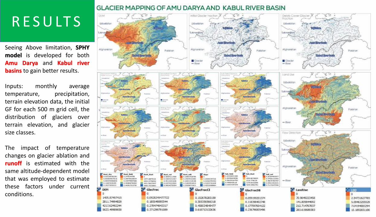
Seeing Above limitation, SPHYmodel is developed for bothAmu Darya and Kabul riverbasins to gain better results.
Inputs: monthly averagetemperature, precipitation,terrain elevation data, the initialGF for each 500 m grid cell, thedistribution of glaciers overterrain elevation, and glaciersize classes.
The impact of temperaturechanges on glacier ablation andrunoff is estimated with thesame altitude-dependent modelthat was employed to estimatethese factors under currentconditions.
R E S U LT S
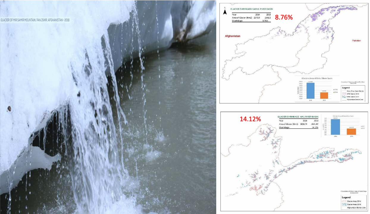
8.76%
14.12%
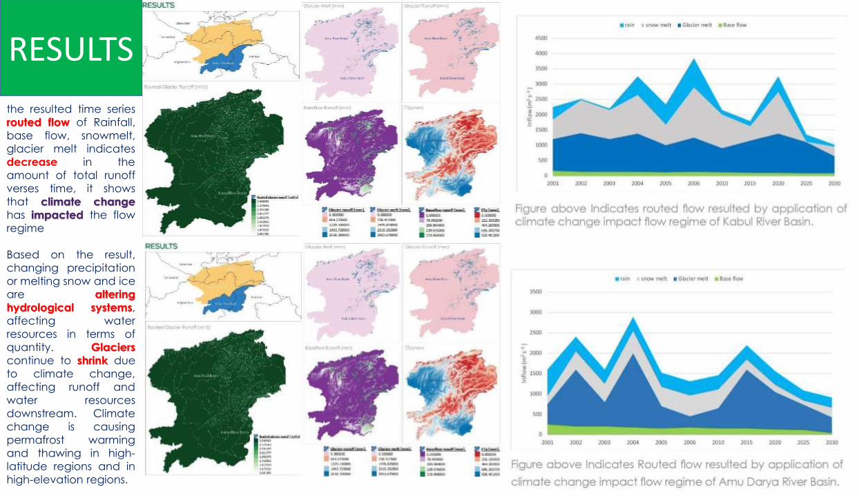
the resulted time series
routed flow of Rainfall,
base flow, snowmelt,
glacier melt indicates
decrease in the
amount of total runoff
verses time, it shows
that climate change
has impacted the flow
regime
Based on the result,
changing precipitation
or melting snow and ice
are altering
hydrological systems,
affecting water
resources in terms of
quantity. Glaciers
continue to shrink due
to climate change,
affecting runoff and
water resources
downstream. Climate
change is causing
permafrost warming
and thawing in high-
latitude regions and in
high-elevation regions.
RESULTS

The snow cover maps of both Kabul
and Amu Darya River basin in
different time periods is analyzed, the
snow coverage decreased each
year, and there are signs of early melt
of snow coverage in the basin.
Previously the water was produced by
melting of snow was used for irrigation
in the summer, however the early
melting of snow created the following
problems in both basins:
• Less water for irrigation in the
summer period,
• Flash floods in the rivers, and
flooding of the canals
• More rainfall comparing the
snowfall,
Fallowing bands are used to generate
snow cover map of both Kabul and
Amu Darya river basins from terra
(MOD10) Satellites considering
deferent time periods.
R E S U LT S
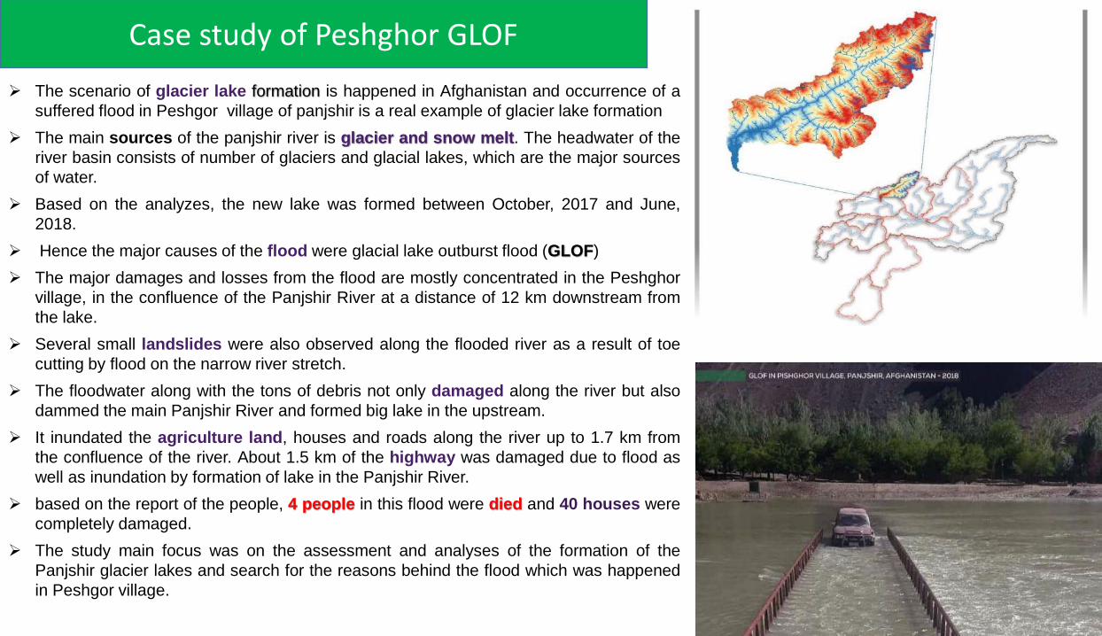
The scenario of glacier lake formation is happened in Afghanistan and occurrence of a
suffered flood in Peshgor village of panjshir is a real example of glacier lake formation
The main sources of the panjshir river is glacier and snow melt. The headwater of the
river basin consists of number of glaciers and glacial lakes, which are the major sources
of water.
Based on the analyzes, the new lake was formed between October, 2017 and June,
2018.
Hence the major causes of the flood were glacial lake outburst flood (GLOF)
The major damages and losses from the flood are mostly concentrated in the Peshghor
village, in the confluence of the Panjshir River at a distance of 12 km downstream from
the lake.
Several small landslides were also observed along the flooded river as a result of toe
cutting by flood on the narrow river stretch.
The floodwater along with the tons of debris not only damaged along the river but also
dammed the main Panjshir River and formed big lake in the upstream.
It inundated the agriculture land, houses and roads along the river up to 1.7 km from
the confluence of the river. About 1.5 km of the highway was damaged due to flood as
well as inundation by formation of lake in the Panjshir River.
based on the report of the people, 4 people in this flood were died and 40 houses were
completely damaged.
The study main focus was on the assessment and analyses of the formation of the
Panjshir glacier lakes and search for the reasons behind the flood which was happened
in Peshgor village.
Case study of Peshghor GLOF

Other Glacier Lakes in the Basin
The Glacier Lake is forming Again, -GLOF may occur
again-Temperature is increasing
Other Critical Glacier Lakes in the Basin
There is no monitoring mechanism,

CONCLUSION AND RECOMMENDATIONS
Amu Darya and Kabul river basin receives the majority of their water from
melting of glaciers, snow packs, and icecaps which are stored in High
Mountain of Asia; Hindu-Kush Himalayan and Pamir. This rivers because
of rise of temperature and acceleration in the process of snow and glacier
melt have experienced a great diminish in the amount of their water in
recent years.
The countries in the region need to take the GLOF threat seriously a
mechanism should be placed for regular monitoring of glacial lakes,
identification of critical lakes and GLOF prone areas using remote sensing
approach.
Also detail field investigation is essential in the most dangerous glacial
lakes.
Installation of real time sensor network to measure the rise and discharge
of lake water and early warning system coupled with GLOF simulation
models for predicting the level and time of arrival of flood in the most
dangerous glacial lake area is necessary, to reduce the intensity of
disaster associated with the GLOFs.
Strengthening certain related policies to diminish the climate change
impacts; and mechanism for prevention of such impacts would help in the
preparedness for and countering impacts of natural disasters in
Afghanistan and other countries.
It is also necessary to create awareness to the peoples living downstream
of these dangerous lakes and guide them about prevention measures.
To capture and store excess water during periods of high water availability.
A clear policy is required to prevent deathful flood and drought.
Achievement, Specific Activities, Results and Impacts
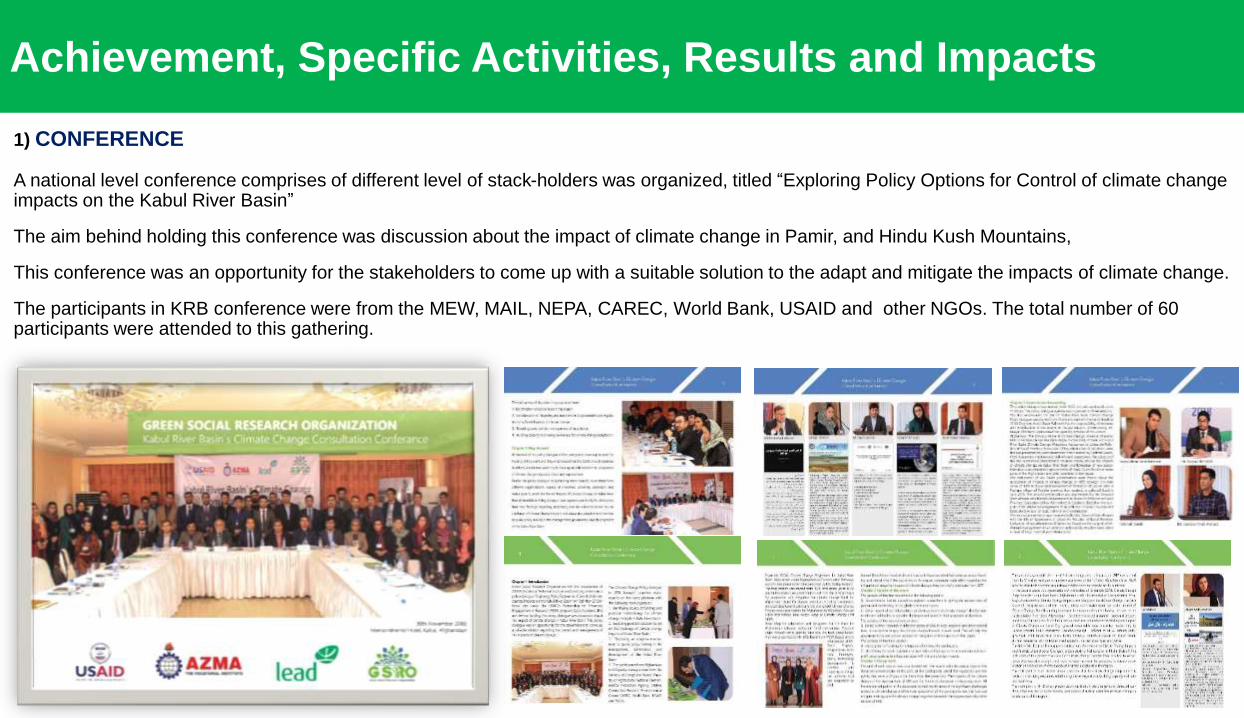
1) CONFERENCE
A national level conference comprises of different level of stack-holders was organized, titled “Exploring Policy Options for Control of climate change impacts on the Kabul River Basin”
The aim behind holding this conference was discussion about the impact of climate change in Pamir, and Hindu Kush Mountains,
This conference was an opportunity for the stakeholders to come up with a suitable solution to the adapt and mitigate the impacts of climate change.
The participants in KRB conference were from the MEW, MAIL, NEPA, CAREC, World Bank, USAID and other NGOs. The total number of 60 participants were attended to this gathering.

2. POLICY RECOMMENDATIONS
A set of policy outlines were accumulated, documented and
disseminated to relevant stakeholders in the national level
conference.
The document “Kabul River Basin Climate Change Policy
Recommendations” covers set of policy outlines including
climate change adaptation, mitigation, air pollution, flood and
drought management, source and road map for funding.
Conducting several meetings with stakeholders and decision
makers and highlighting the importance of the climate change
impacts have resulted to formulation and structuring of climate
change division under hydro metro logy department of MEW.
New Glacier Monitoring Stations, and alarm system is in the
process of Installation,
Achievement, Specific Activities, Results and Impacts
Achievement, Specific Activities, Results and Impacts
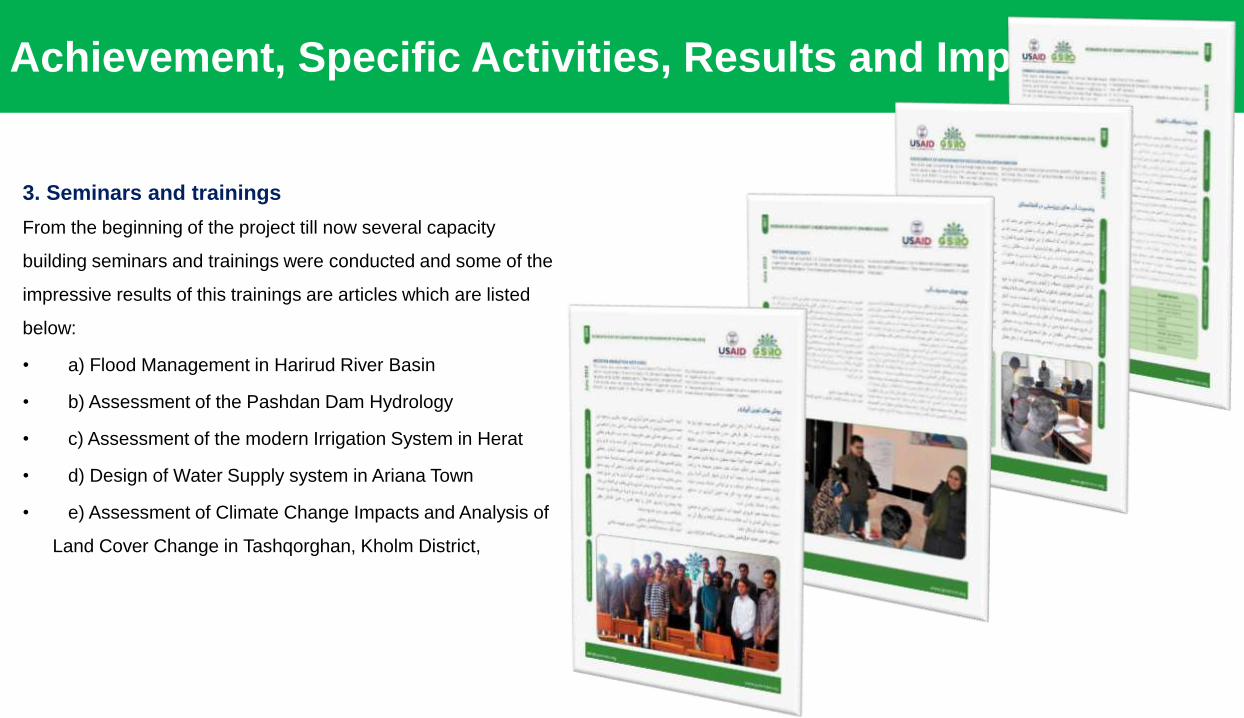
3. Seminars and trainings
From the beginning of the project till now several capacity
building seminars and trainings were conducted and some of the
impressive results of this trainings are articles which are listed
below:
• a) Flood Management in Harirud River Basin
• b) Assessment of the Pashdan Dam Hydrology
• c) Assessment of the modern Irrigation System in Herat
• d) Design of Water Supply system in Ariana Town
• e) Assessment of Climate Change Impacts and Analysis of
Land Cover Change in Tashqorghan, Kholm District,

4) PUBLICATIONS AND DISSEMINATION The project has resulted to several papers, article, oral presentation and publications as listed below:
Two Booklet, Was prepared. And distributed to relevant agencies. Presentation of Impact of Climate Change on Runoff from Glaciers, Snow and Rainfall in The Pamir, and Hindu Kush Mountains: A Comparison of Amu Darya and KRB to the conference of State of Cryosphere in the Himalaya with a focus on Sikkim and eastern Himalia- gaps, challenges and opportunities
The abstract of the first paper “Afghanistan the obvious victim of climate change” is accepted for oral presentation in 2nd World Congress on Climate Change 19 in Berlin Germany.- Central Asia Journal of water Research accepted the paper-Under review.
The abstract of second paper “Impact of Climate Change on Runoff from Glaciers, Snow and Rainfall in The Pamir, and Hindu Kush Mountains” is submitted to International Journal of Innovative Science and Research Technology.
5) DATA GENERATION AND DISTRIBUTION Spatial Precipitation, Temperature, DEM data, Slope, Sub-basin, Latitude Map, Root
Field Map, Field Capacity Map, Root zone and sub zone Physical Map of Soil, Land use map, Glacier maps including initial glacier fraction, clean ice, debris cover glacier fraction maps and flow direction/routing map of KRB and Amu Darya River Basin were generated from HKH datasets and distributed to relevant stakeholders.
Glacier Lakes which were created in KRB were identified, mapped and data were shared with stakeholders.
6) Cooperation and Collaboration This project has provided a great opportunity to create a cooperation platform through
organizing conferences with the local and international PEER Awardees. Through this project, GSRO has organized a national conference with cooperation of LEAD Pakistan, AZMA Vocational Institute and contribution of GOs and NGOs agencies.
Achievement, Specific Activities, Results and Impacts

THANK YOU FOR YOUR ATTENTION