Presentation1 - INSPIREinspire.ec.europa.eu/events/conferences/inspire_2012/presentations/... ·...
22
6/29/2012 1 Harmonisation and Schema Transformation of Existing Spatial Data Dean Hintz, Safe Software Soren Dupke, con terra June 2012 Agenda FME Tools to support INSPIRE Harmonisation principles Key challenges Examples con terra’s INSPIRE Solution Pack for FME Examples and demos Consuming INSPIRE Reading Building value added services FME and INSPIRE Safe is committed to supporting INSPIRE interoperability including: INSPIRE GML reading, writing and validation Schema mapping to INSPIRE data model Web services, security and metadata support Safe works closely with our partners to provide INSPIRE solutions: Conterra: FME INSPIRE Solution Pack Supports ArcGIS for INSPIRE North Rhine Westphalia and others Metria: Swedish Protected Areas Pilot AedSicad: German NAS to INSPIRE transforms HNIT: Lithuania SDI (LGII) Safe Software Facts Private company Founded in 1993 Headquarters in Vancouver, BC, Canada 90+ employees 50+ value-added resellers & system integrators in 35 countries ~100 FME Certified Professionals & Trainers around the globe Thousands of customers across 116 countries
Transcript of Presentation1 - INSPIREinspire.ec.europa.eu/events/conferences/inspire_2012/presentations/... ·...

6/29/2012
1
Harmonisation and Schema Transformation of Existing Spatial Data
Dean Hintz, Safe Software
Soren Dupke, con terra
June 2012
Agenda
� FME Tools to support INSPIRE
� Harmonisation principles
� Key challenges
� Examples
� con terra’s INSPIRE Solution Pack for FME
� Examples and demos
� Consuming INSPIRE
� Reading
� Building value added services
FME and INSPIRE
� Safe is committed to supporting INSPIRE interoperability including:� INSPIRE GML reading, writing and validation� Schema mapping to INSPIRE data model� Web services, security and metadata support
� Safe works closely with our partners to provide INSPIRE solutions:� Conterra: FME INSPIRE Solution Pack
� Supports ArcGIS for INSPIRE� North Rhine Westphalia and others
� Metria: Swedish Protected Areas Pilot� AedSicad: German NAS to INSPIRE transforms� HNIT: Lithuania SDI (LGII)
Safe Software Facts
� Private company
� Founded in 1993
� Headquarters in Vancouver, BC, Canada
� 90+ employees� 50+ value-added resellers &system integrators in 35 countries
� ~100 FME Certified Professionals & Trainers around the globe
� Thousands of customersacross 116 countries

6/29/2012
2
Introduction to FME
� What is FME?
� How Does FME Work?� Centralized
� Semantic
� Transformational
Data Translation Basics FME Desktop Training 2012
Barriers to Interoperability
Web
Data Types
Data Translation Basics FME Desktop Training 2012
Translation
FME supports reading from a wide array of data formats and types
� 300+ formats, with more added each year
� CAD, GIS, XML, raster, database, non-spatial, 3D
7
Transformation:FME Workbench

6/29/2012
3
Common Spatial ETL Workflows -Cases
� Non-spatial to spatial
� Merge spatial with attributes
� CAD to GIS
� Data validation
� Data cleaning
� Migration between data models
� Database loading, replication and extraction
� Automation
Common Spatial ETL Workflows -Tasks
� Constructing geometry
� Transferring attributes
� Joins to external databases
� Testing geometry and attributes
� Schema mapping (field, feature type)
� Feature merging and fanout
Examples…
CAD<-> GIS � Exchange data between CAD and GIS
Quality Assurance� Validate data. Easy to build data validation web service.
Data Integration and Federation� Combine data from multiple sources
Schema and Spatial Data Restructuring
Examples…
Data Migration and Loading
“Spatialize” non-spatial data� Convert simple non-spatial text files to spatial� Exploit Geocoding services to spatialize addresses
Format conversion� Convert data from one format to other formats. Free example web service
Stream spatial data via the web � Example real-time web service
Web-based spatial data download� Example web service

6/29/2012
4
FME Tools for INSPIRE
� Format translation
� Schema mapping
� Data validation
� Database loading and extraction
� WFS, GML, XML: reading, validation, publication
� Web services: WFS, WMS, integration with others
� Metadata support
� Enterprise services with FME Server
FME Tools for INSPIRE XML
� GML reading and writing � Full support for INSPIRE GML and metadata� XML Reading – read virtually any XML and extract features� XML Processing – validate, format, and update XML� Geometry Extraction (features > GML objects)� XML Writing - Write XML or GML no matter how complex� XMLTemplater
� FME merges attribute values into a template structure� Template per feature type and dataset
� XML Validation – validated to ensure compliance with INSPIRE schemas for both data and metadata
INSPIRE - Goals
� Assist EU environmental management
� Extend Member States’ SDIs using:
� Common data model
� Open standards
� INSPIRE SDI should:
� Combine spatial data from different sources
� Share spatial data between public authorities
INSPIRE - Challenge
� You want to meet INSPIRE data provision
requirements, but your data is organized rather differently
?

6/29/2012
5
Harmonisation concept
� Harmonisation: implied INSPIRE requirement.
� Disparate sources must be mapped to a common destination data model to support integration
� Core to the harmonization workflow is a process called schema mapping.
� Delivered by services based on open standards
SDI Harmonisation Principles
Typical stages:
1. Evaluation
2. Assembly
3. Transformation
4. Validation
5. Publication
Spatial ETL concept (Extract, Transform and Load), as applied to INSPIRE SDI’s
Evaluation
� Assess destination schema and data requirements
� Assess source datasets and schema
� Closely inspect actual representative datasets
� Consider fundamental differences in
representation
Data Assembly
� Assess the diversity of source data types involved.
� vector, raster, CAD, GIS, database, text, XML, web, 3D, sensor and non-spatial
� Address format and semantic translation requirements
� Decide how to perform necessary joins
� ID joins, spatial relates, nearest neighbor, one to many relationships
Goal is to build a data structure to correspond with INSPIRE requirements

6/29/2012
6
Translation
FME supports reading from a wide array of data formats and types
� 300+ formats, with more added each year
� CAD, GIS, XML, raster, database, non-spatial, 3D
21
Transformation: Geometry
� Non-spatial to spatial
� Geometry extraction (spatial to GML)
� Representation transform: CAD drawing lines with labels to GIS polygonal features with attributes
� Coordinate System Reprojection (ED50 to ETRF89)
� Simple to complex geometry� Source point and polygon data to multiple geometric representations (city as point / area, river as line / area)
� Generalization and interpolation� Highly granular national and regional datasets often require thinning to be usable on pan-European scales
Geometric Transformation
� What is geometric transformation?
� Example: Intersection
23
Data Transformation - Schema
� Reshape source data to match required
destination schema
� Schema mapping
� feature type
� attribute name
� new attribute creation
� code lists
� conditional value mappings

6/29/2012
7
Data Transformation 25
Schema Mapping in FME
Feature Type Mapping in FME Workbench
Attribute Mapping in FME Workbench
� Value Mapping
FME Data Model Restructuring: Attribute Names & Values
FME SchemaMapper: INSPIRE geographic names
Name mapping
Name &
value mapping
FME Workspace
Harmisation Stages: INSPIRE Geographic Names

6/29/2012
8
Schema Mapping: NVR to INSPIRE
FilterAttribute
FilterAttributeValue SourceAttribute Field_Inspire DestinationAttributeValue DestinationAttribute
fullINSPIRE_APPLICATIONSCHEMA
DID INSPIRE_LOCALID
SEINSPIRE_NAMESPACE
VALID_FROM_DATE INSPIRE_LEGALFOUNDATI
ONDATE
DECISIONDATE INSPIRE_DATE
creationINSPIRE_DATETYPE
IUNC_CATEGORY0
Empty value INSPIRE_DESIGNATION
IUNC_CATEGORYIa strictNatureReserve
INSPIRE_DESIGNATION
IUNC_CATEGORYIb wildernessArea
INSPIRE_DESIGNATION
IUNC_CATEGORYII nationalPark
INSPIRE_DESIGNATION
IUNC_CATEGORY
III naturalMonument
INSPIRE_DESIGNATION
IUNC_CATEGORYIV habitatSpecies ManagementArea
INSPIRE_DESIGNATION
IUNC_CATEGORYV protectedLandscape OrSeascape
INSPIRE_DESIGNATION
IUNC_CATEGORY null Empty value INSPIRE_DESIGNATION
OBJECTNAME INSPIRE_SITENAME
PROTECTIONTYPE 1 natureConservation INSPIRE_PROTECTIONCLASSIFICATION
PROTECTIONTYPE 2 natureConservation INSPIRE_PROTECTIONCLASSIFICATION
PROTECTIONTYPE 3 natureConservation INSPIRE_PROTECTIONCLASSIFICATION
PROTECTIONTYPE 4 cultural INSPIRE_PROTECTIONCLASSIFICATION
Geographic Names: GML Result
Validation
� INSPIRE schema validation (xsds)� Data integrity
� Unique IDs� Geometric integrity (closed polygons)� Null values (nullable?)� Valid values: ranges and domain codes� Data gaps� Bounds� Network integrity
� Custom validity rules specific to domain
Ensure data quality throughout the data transformation process.
Publication
How to make data most accessible?
� Support for mandated open standards and OGC
services
� Support for defacto industry standards,
proprietary and legacy agency systems
� Possibilities for Invoke Spatial Data Services as a
bridge
� accepts user request
� queries required INSPIRE OGC services
� provides desired web service (KML, PDF)

6/29/2012
9
Publication
� Produce INSPIRE compliant GML
� Provide discovery, view or download services, for
WxS, GML and other desired formats
� Publish with FME Server or integrate with your
geo web server of choice:
� ArcServer (ArcGIS for INSPIRE)
� Others
� Spatial Data Services
Metadata
� Metadata support and demo
Example INSPIRE Solutionsby FME Partners
� INSPIRE Solution Pack from con terra
(25+ implementations across Europe)
� Metria, Sweden (Protected Areas Pilot; Swedish
Department of Transportation)
� Spatialworld, Finland (National Land Survey)
� HNIT Lithuania (LGII)
� Technical University of Munich (multiple INSPIRE projects)
� AED Sicad (NAS to INSPIRE schema mapping and
conversions)
LGII – Lithuania Geospatial Portal Translation Support
File Formats:
� AutoCAD DXF / DWG
� ESRI Personal Geodatabase
� Shape
� MapInfo TAB
� Microstation Design V8
� GML
� GIF / PNG
� JPEG
� TIFF
� ERDAS IMG
� ECW
Coordinate systems:
� LKS94
� WGS84
� ETRS89
� 1963
� Pulkovo 1942
� UTM (34, 35 zones)
Other data sources:
� WFS
� SDE
� Files
6/29/2012
10
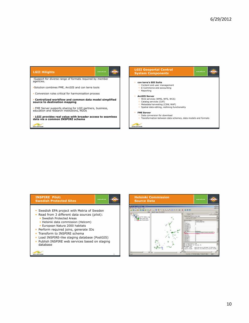
LGII Hilights
�Support for diverse range of formats required by member agencies.
�Solution combines FME, ArcGIS and con terra tools
� Conversion rules critical for harmonisation process
� Centralized workflow and common data model simplified source to destination mapping
� FME Server supports sharing for LGII partners, business, education and research institutions, NGOs
� LGII provides real value with broader access to seamless data via a common INSPIRE schema
LGII Geoportal Central System Components
� con terra’s SDI Suite
� Content and user management
� E-Commerce and accounting
� Reporting
� ArcGIS Server
� WxS services (WMS, WFS, WCS)
� Catalog services (CAT)
� Metadata harvesting (CSW, WAF)
� Spatial data editing, redlining functionality
� FME Server
� Data conversion for download
� Transformation between data schemes, data models and formats
INSPIRE Pilot:Swedish Protected Sites
� Swedish EPA project with Metria of Sweden
� Read from 3 different data sources (pilot):
� Swedish Protected Areas
� Helsinki data commission (Helcom)
� European Natura 2000 habitats
� Perform required joins, generate IDs
� Transform to INSPIRE schema
� Load INSPIRE-like staging database (PostGIS)
� Publish INSPIRE web services based on staging database
39
Helsinki Commission Source Data

6/29/2012
11
Schema Restructured for Loader to Staging Database
Results in Staging Database
* Data provided by Lantmäteriet, the Swedish mapping, cadastral and land registration authority www.lantmateriet.se , and Metria, Sweden www.metria.se.
FME Import to Staging Database: Swedish NVR Importer
Protected Sites Schema Mapping: NVR to INSPIRE
FilterAttribute
Filter
Attribute
Value SourceAttribute Field_Inspire
Destination
AttributeValue DestinationAttribute
FullINSPIRE_APPLICATIONSCHEMA
DID INSPIRE_LOCALID
SE INSPIRE_NAMESPACE
VALID_FROM_DATE
INSPIRE_ LEGALFOUNDATIONDATE
DECISIONDATE INSPIRE_DATE
creationINSPIRE_DATETYPE
IUNC_CATEGORY0
Empty value INSPIRE_DESIGNATION
IUNC_CATEGORYIa strictNatureReserve
INSPIRE_DESIGNATION
IUNC_CATEGORYIb wildernessArea
INSPIRE_DESIGNATION
IUNC_CATEGORYII nationalPark
INSPIRE_DESIGNATION
IUNC_CATEGORYIII naturalMonument
INSPIRE_DESIGNATION
IUNC_CATEGORY null Empty value INSPIRE_DESIGNATION
OBJECTNAME INSPIRE_SITENAME
PROTECTIONTYPE 1 natureConservation INSPIRE_PROTECTIONCLASSIFICATION
PROTECTIONTYPE 2 natureConservation INSPIRE_PROTECTIONCLASSIFICATION

6/29/2012
12
Swedish Protected Sites Update
� Swedish Environmental Protection Agency
� Production system for down load services following on the successful pilot last year.
� Metria hosts the protected sites view services.
� Metria performs schema mapping for five protected sites source datasets to INSPIRE using FME Server.
Validation at Swedish Transportation Administration
� Swedish Transportation Administration
� System supports propagation of municipal and regional road data to national dataset
� Data model transformation and QC to translate 2.5 million road links into NVDB
� Transform between NVDB and INSPIRE compliant data
� Workflows automated by FME and FME Server
� Validation key to support upload services
Other INSPIRE Examples
� Technical University Of Munich� XMI mapping of UML schema transformation rules� Maps between AAA and INSPIRE data models� Uses FME to perform schema mapping based on XMI
� Nature SDI: Datasiel, Liguria Region, Italy� FME used for data harmonization and loading a staging database� Generates INSPIRE compliant protected sites GML for publication via WFS
� Croatian NSDI: Geoportal� By State Geodetic Administration (SGA)� Central register of base map, ortho, spatial units, cadastre � Database of geodetic control points� FME used primarily in data migration and updates
Example INSPIRE Solutionsby FME Partners
� INSPIRE Solution Pack from con terra (North
Rhine-Westphalia)
� Metria, Sweden (Protected Areas Pilot; Swedish
Department of Transportation)
� Spatialworld, Finland (National Land Survey)
� HNIT Lithuania (LGII)
� Technical University of Munich (multiple INSPIRE
projects)
� AED Sicad (NAS to INSPIRE conversions)
6/29/2012
13
FME and INSPIRE
� Safe is committed to supporting INSPIRE interoperability including:� INSPIRE GML reading, writing and validation� Schema mapping to INSPIRE data model� Web services, security and metadata support
� Safe works closely with our partners to provide INSPIRE solutions:� Conterra: FME INSPIRE Solution Pack
� Supports ArcGIS for INSPIRE� North Rhine Westphalia and others
� Metria: Swedish Protected Areas Pilot� AedSicad: German NAS to INSPIRE transforms� HNIT: Lithuania SDI (LGII)
FME Tools for INSPIRE
FME provides a full range of tools for INSPIRE, our partners provide complete solutions
� Data modeling interface makes it easier to handle schema mapping - no coding required.
� Automated workflows save time in creating and maintaining transformation processes.
� Self-documenting workspaces ease collaboration
� Easily integrates with INSPIRE-compliant services:� Esri ArcGIS Server
� Others
� Scalability and performance support quality of service requirements
Conterra ISP Presentation
Internal information/
storage systems
Consumers
European SDI
INSPIRE fusionCenter –
Data models and web services
transformation & integration
2. Integration into business
processes and
transformation of data to
INSPIRE
1. Data Models for spatial data
sets compliant to INSPIRE data
specifications (COTS product)
3. Access via INSPIRE network
services meeting the Quality-of-
Service requirements (COTS
product)
con terra – FME INSPIRE Solution Pack: 3 Key Tasks

6/29/2012
14
con terra – FME INSPIRE Solution Pack Highlights
� Simplify data transformation and schema mapping for ArcGISfor INSPIRE
� Predefined FME Workbench templates help jump start the data migration and harmonisation process
� Connect your existing databases to the standardized ESRI INSPIRE Geodatabase
� Automate data load and update processes
� Quality assurance and metadata
� Publish once and use many times
ETL Workflow descriptionimport source data
create destination schema
import destination schema
Load Data INSPIRE GDB
automated
FME INSPIRE
Solution Pack
schema mapping
FME data import process
con terra - FME INSPIRE Solution Pack: Schema Mapping
� Additional INSPIRE information
� Tutorial workspace (complete sample mapping [AdminUnits])
� Additional HTML Workbench Help (description of INSPIRE GDB data model)
� Direct access to the INSPIRE data specification (link to specific themes)
� Additional functionality
� Template workspaces (destination schema and predefined workspaces)
� Destination data schema for all Annex 1 themes (INSPIRE GDB of ArcGIS for
INSPIRE)
� More than 100 additional INSPIRE transformers
� INSPIRE specific value and attribute mapping (voidable values)
� transformer for recurrent tasks (ID management, lifespan setter)
Components of the FME INSPIRE Solution Pack
Solution Pack Template Workspaces
� one template Workspace per Annex I theme
� predefined destination datasets (INSPIRE GDB)
� predefined attribute-creation and settings
� predefined attribute-mapping
� integrated description for mapping file completion
� one template Workspace per Annex I theme
� predefined destination datasets (INSPIRE GDB)
� predefined attribute-creation and settings
� predefined attribute-mapping
� integrated description for mapping file completion

6/29/2012
15
INSPIRE Transformers (Attribute and Value Mapping)
� Automated filling of obligated attribute
� legalStatus
� legalStatus_void
� Possible values for obligated attributes (if not void)
� agreed
� notAgreed
� Predefined void value reasons (if void)
� 0 = no reason given
� 1 = reason: unknown
� 2 = reason: unpopulated
� AttributeRenamer functionality
� usable if attribute already
existing
Start of FME presentation after conterra ISP
INSPIRE Compliant GML – Now What?
<?xml version="1.0" encoding="UTF-8"?><gml:FeatureCollection xmlns="http://www.w3.org/2001/XMLSchema" xmlns:gml="http://www.opengis.net/gml/3.2"
xmlns:ps-f="urn:x-inspire:specification:gmlas:ProtectedSitesFull:3.0" xmlns:ps-n2000="urn:x-inspire:specification:gmlas:ProtectedSitesNatura2000:3.0" gml:id="id-0">
<gml:boundedBy>
<gml:Envelope srsName="EPSG:4326" srsDimension="2">
<gml:lowerCorner>0 360</gml:lowerCorner>
<gml:upperCorner>0 360</gml:upperCorner>
</gml:Envelope>
</gml:boundedBy>
<gml:featureMembers>
<ps-f:ProtectedSite xmlns:ps="urn:x-inspire:specification:gmlas:ProtectedSites:3.0" xmlns:gco="http://www.isotc211.org/2005/gco" xmlns:gmd="http://www.isotc211.org/2005/gmd" xmlns:xlink="http://www.w3.org/1999/xlink" xmlns:xsi="http://www.w3.org/2001/XMLSchema-instance"
xmlns:tn-a="urn:x-inspire:specification:gmlas:AirTransportNetwork:3.0" xmlns:base="urn:x-inspire:specification:gmlas:BaseTypes:3.2" xmlns:tn="urn:x-inspire:specification:gmlas:CommonTransportElements:3.0" xmlns:gn="urn:x-inspire:specification:gmlas:GeographicalNames:3.0" xmlns:net="urn:x-
inspire:specification:gmlas:Network:3.2" gml:id="ID_0A16FE5BFD6C9CB51DE1DEE17804A757">
<ps:geometry>
<gml:MultiSurface gml:id="id-9e3bfd62-aa14-4f81-a3ef-9af6d5129518-0" srsName="EPSG:4326" srsDimension="2">
<gml:surfaceMember>
<gml:Surface gml:id="id-9e3bfd62-aa14-4f81-a3ef-9af6d5129518-1">
<gml:patches>
<gml:PolygonPatch>
<gml:exterior>
<gml:LinearRing>
<gml:posList>59.42 18.87 59.42... </gml:posList>
</gml:LinearRing>
</gml:exterior>
<gml:interior>
<gml:LinearRing>
<gml:posList>59.41 18.89 59.47 ... </gml:posList>
</gml:LinearRing>
</gml:interior>
</gml:PolygonPatch> …
Now What? Consuming INSPIRE
“How is anyone going to use INSPIRE?”
� FME allows you to consume INSPIRE compliant GML as well as create it.
� Why not build value on the web services every one else is investing in?
� Extract and flatten complex INSPIRE structures for use within your GIS applications
� Modify INSPIRE structures with XML update functions
Leverage INSPIRE data for business intelligence.

6/29/2012
16
What is XML?
� Extensible Markup Language (XML)
� Defines a set of rules for encoding documents in a format that is both human-readable and machine-readable
� XML 1.0 Specification produced by the W3C
� Design goals emphasize:
� Simplicity
� Generality
� usability over the Internet
http://en.wikipedia.org/wiki/XML
What is XML?
� A textual data format
� Also called “structured text”
e.g.
<FMEUser>
<name>Joan</name>
</FMEUser>
Defines the grammar, not the words.
XML Opportunity and Challenges
� Opportunity: XML / GML are growing in use for
exchange formats and metadata - open and self-documenting
� Challenge: Not necessarily easy to read or write.
� XML is often very nested or object oriented
� GIS works with flat or relational structures
� Can be hard to convert between the two or
modifying elements within the XML structure
XML vs. Relational
attribute1 attribute2 Active
Date_From
Active
Date_To
John Vancouver 11-22-99 12-11-09
June Surrey 02-25-05 9-15-10
Relational

6/29/2012
17
XML Concepts
� Tag <Course>
� XML Element <Course>FME</Course>
� Child element <Course><Id>101</Id>…
� Element attribute <Course id=“101”>
� GML Object
� Object property
� Object attribute
� XML Schema - xsd's
� Namespaces
� <ps-f:geometry>
XML Reading
� XML Profile (GML, KML, NAS etc)
� Feature Path (XML tag to match)
� XQuery
� XfMaps
� XRS
XML Profile Readers
� FME supports reading more than 30 XML formats.
� Type XML in the Formats Gallery to see them.
� Examples: GML, KML, GeoRSS, WFS, GPX, CityGML, OSM, NAS, TIGERGML, LandXML, etc
� Don’t forget to check the reader parameters
� Sometimes our profile reader does not support some custom schema variations.
� XML reader + workspace can allow you to read virtually any XML, even if it’s complex GML
XML Formats in FME 2012

6/29/2012
18
Reading INSPIRE GML: with flattening
FME Tools for INSPIRE XML
� GML reading and writing (3.2.1 and earlier)
� XML Reading – read virtually any XML and extract features
� XML Processing – validate, format, and update XML
� Geometry Extraction (features > GML objects)
� XML Writing - Write XML or GML no matter how complex
� XMLTemplater� FME merges attribute values into a template structure
� Template per feature type and dataset
� XML Validation – validated to ensure compliance with INSPIRE schemas
Consuming INSPIRE: Value added Spatial Data Services
� Reading INSPIRE GML
� Building Spatial Data Services that consume
INSPIRE services and produce new services
adapted to consumer client requirements
� KML
� GeoJSON
� Enabled by FME Server
� Take spatial ETL workflows (FME workspace) and generate a spatial transformation service
How FME Server Works with FME Desktop
FME Desktop
Author and run
spatial ETL tasks
FME Server
Run and share
spatial ETL capabilities
72

6/29/2012
19
Five Key FME Server Services
1. Spatial Data Download & Streaming Services
2. Scheduled, Centrally Managed Data Transformation
3. Server-Based Spatial Data Conversion Service
4. Spatial Data Upload and Validation Service
5. Bulk Data Loading and Migration Service
FME Server Architecture
Safe Overview 75
FME Server
� Brings spatial ETL capabilities to server� Federate data on the fly.� Transform data so user’s get view they need.� Serve data in any supported format.
� Service Oriented Architecture (SOA)� Makes data available in a wide variety of different services.
� Model Driven Approach (MDA)� Workbench is the authoring environment!� FME Server operations are specified with workspaces
� Provide data access in a myriad of Web services.� Standards-based access protocols.� Defacto standards access protocols.� Variety of API’s.
Access Protocols are the formats of the Web!
FME Server
� Scalable, efficient spatial ETL solution
� Provide users with access to spatial data - where, when & how they need it
� Centralize spatial data transformation and distribution tasks in a server environment
76

6/29/2012
20
Share Spatial ETL Tasks over the Web
77
� Author spatial data flows in FME Workbench� Available as part of a FME Desktop license
� Publish to FME Server with one click� For storage in a central repository
� Enable others to run FME workspaces – right over the web
Transform Large Volumes of Spatial Data
78
� Offload intensive spatial ETL processing tasks
to FME Server for faster throughput
� Scalable, services-oriented architecture
� Large jobs can be split into many small jobs.
Stream Spatial Data to Web Applications
79
� Dynamically transform and stream data on the fly in any FME-supported format
� Raster formats (PNG, GIF, TIFF and JPEG)
� Web-friendly streaming formats like KML (Google Earth), GeoRSS
and GeoJSON
� Supply data to mash-ups
� Integrate with popular web mapping apps
� Google Earth/Maps, Virtual Earth, OpenLayers and more
Offer a Spatial Data Download Service
� Let users download the spatial data they need in the
exact format and projection they want
� Create a spatial data clearing house
80
clip, manip’ zip and ship
6/29/2012
21
Summary: FME Benefits
� Improve efficiency
� Eliminate manual, hand coding
� Validate and QA your data before it goes into your database
� Service diverse spatial data requests quickly and easily
� Reduce costs
� Learn, use and maintain a single integrated solution
� Re-use FME workspaces across multiple projects/users
� Eliminate risks
� Invest in a proven, long-term solution� FME is consistently chosen by the best in GIS
� FME is always ahead of format changes in the market
81
FME Tools for INSPIRE
� Format translation
� Schema mapping
� Data validation
� Database loading and extraction
� WFS, GML, XML: reading, validation, publication
� Web services: WFS, WMS, integration with others
� Metadata support
� Enterprise services with FME Server
FME Tools for INSPIRE
FME provides a full range of tools for INSPIRE, our partners provide complete solutions
� Data modeling interface makes it easier to handle schema mapping - no coding required.
� Automated workflows save time in creating and maintaining transformation processes.
� Self-documenting workspaces ease collaboration
� Easily integrates with INSPIRE-compliant services:� leading OGC servers such as Deegree, MapServer and GeoServer
� Esri ArcGIS Server
� Scalability and performance support quality of service requirements
INSPIRE Trends
� Integration between proprietary and open standards –especially as deployment moves to regional and local agencies
� Increased focus on consuming INSPIRE services and GML
� More opportunities for spatial data and invoke services to bridge this gap
� Examples: machine to machine communication to provide seamless support for KML and PDF streaming
� Success = User isn’t aware they are accessing INSPIRE

6/29/2012
22
Thank You!
Questions?
For more information:
Safe Software
www.safe.com/inspire
www.fmepedia.com (examples)
Con terra
www.conterra.de/fme