Present and future ESA satellite missions for atmospheric remote sensing
76
Present and future European satellite missions for atmospheric remote sensing Yves-Louis DESNOS Head R&D section EO Science , Applications and New Technologies Department European Space Agency ESRIN Frascati - ITALY
Transcript of Present and future ESA satellite missions for atmospheric remote sensing

Present and future European satellite missions for
atmospheric remote sensing
Yves-Louis DESNOSHead R&D section
EO Science , Applications and New Technologies DepartmentEuropean Space Agency ESRIN
Frascati - ITALY
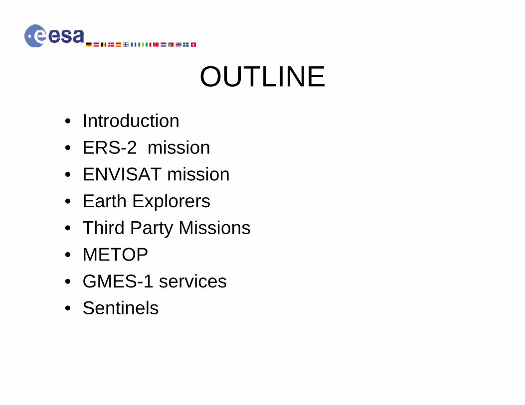
OUTLINE• Introduction• ERS-2 mission• ENVISAT mission• Earth Explorers• Third Party Missions• METOP• GMES-1 services• Sentinels
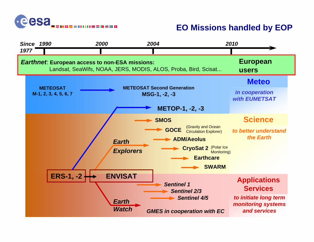
METEOSAT Second GenerationMSG-1, -2, -3
METEOSATM-1, 2, 3, 4, 5, 6, 7
METOP-1, -2, -3
Earth Watch
Earth Explorers
ERS-1, -2
1990 2000 2004 2010
ENVISAT
Scienceto better understand
the Earth
ApplicationsServices
to initiate long term monitoring systems
and services
ADM/Aeolus
SMOS
Earthcare
GMES in cooperation with EC
GOCE (Gravity and Ocean Circulation Explorer)
CryoSat 2 (Polar IceMonitoring)
SWARM
Earthnet: European access to non-ESA missions: Landsat, SeaWifs, NOAA, JERS, MODIS, ALOS, Proba, Bird, Scisat...
European users
in cooperationwith EUMETSAT
Meteo
EO Missions handled by EOP
Since 1977
Sentinel 1Sentinel 2/3
Sentinel 4/5
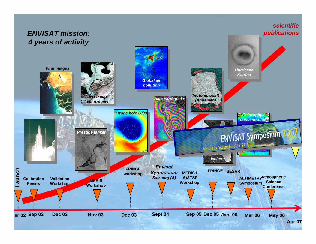
Calibration Review
Sep 02 Dec 02
Validation Workshop
ENVISAT mission: 4 years of activity
Nov 03
MERIS Workshop
First images
Prestige tanker
First image via Artemis
ar 02
Laun
chscientific
publications
Sept 04
Envisat SymposiumSalzburg (A)
Sep 05
MERIS /(A)ATSR
Workshop
Dec 03
FRINGEworkshop
Ozone hole 2003
Bam earthquake
Global airpollution
Tectonic uplift(Andaman)
Chlorophyllconcentration
Dec 05
FRINGE
May 06
B-15A iceberg
HurricaneKatrina
Atmospheric Science
Conference
Jan 06
SESAR
ALTIMETRYSymposium
Mar 06Apr 07

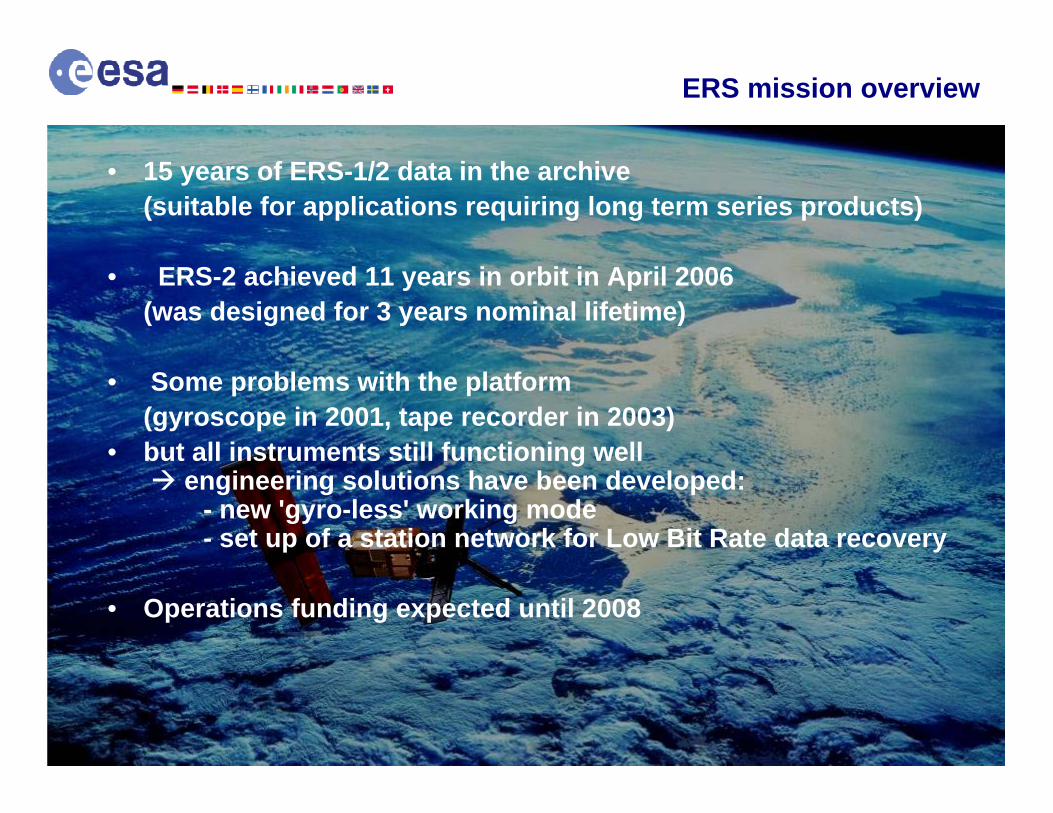
• 15 years of ERS-1/2 data in the archive(suitable for applications requiring long term series products)
• ERS-2 achieved 11 years in orbit in April 2006(was designed for 3 years nominal lifetime)
• Some problems with the platform (gyroscope in 2001, tape recorder in 2003)
• but all instruments still functioning wellengineering solutions have been developed:
- new 'gyro-less' working mode- set up of a station network for Low Bit Rate data recovery
• Operations funding expected until 2008
ERS mission overview

Calibration lamp problem overcome by using sun measurements GoodGOME
Reduced surface transponders covering North & South Poles and Europe only; no redundancyExcellentPRARE
Scan Mirror problem has been overcome by patches on groundGoodATSR
ExcellentRA & MWR
Sub System on redundant side FairScatterometer
ExcellentSAR Wave ModeExcellentSAR Image Mode
Tape Recorders Failed, Realtime mission only with some 40% global coverage. Transmission Tube redundancy available.
FairPayload Equipment Bay
1/3 of hydrazine has been consumed within 11 yearsExcellentPropulsion and
Hydrazine
Relaxed attitude control +- 2deg, all other sub-systems with full redundancy. SPOT-1 platform flown for 17 years before de-orbiting.
GoodService Module
CommentsExpected evolutionMission elements
ERS-2 satellite and payload status

Launched on ERS-2 during April 1995 - operational since
GOME is a nadir viewing spectrometer which collects sunlight backscattered from the earth’s atmosphere
• Spectral coverage: 240 - 790 nm - 4 channels - 6 spectral bands• Spectral resolution: 0.2 - 0.4 nm

Release of GOME Products to Users during July 1996 (about 1 year after launch) -GDP V2.2: Total Ozone differed by 5% below 60 deg. SZA and by about 10% below 90 deg. SZA as compared to reference measurements
1st Product Upgrade - mid 1998 - GDP V2.4: Total ozone accuracy within ±2%-5% at SZA lesser than 70 degrees, and 10% or better at larger SZA, except under special conditions, such as in wintertime polar regions where low ozone values could be overestimated by more than 15%
2nd Product Upgrade - mid 1999 – GDP V2.7: no significant improvement in total ozone (improvement of NO2 instead)

3rdThird Product Upgrade – mid 2002 – GDP V3: The average deviation of GOME from reference data does not exceed ±2-4% for SZA below 70°. At lower sun elevation, the average error ranges from -8% to +5% depending on the season.
4th Product Upgrade – 2004 – GDP V4: During 2003 3 ESA studies were running in parallel on the development of a GOME total ozone algorithm to be suitable for trend monitoring – 1% relative accuracy over 10 years; One algorithm (GDOAS) has been selected and was implemented into the ESA operational processor during 2004 (including the reprocessing of all historic data by the end of 2004) – GOME total ozone accuracy comparable to ground-based measurements.

Ozone Trend Monitoring (Relative Accuracy of 1% per Decade)

GOME Sulphur Dioxide Measurements:
University Bremen Deutsches Zentrumfuer Luft- und Raumfahrt (DLR)

Instrument Stability/Sensitivity to measure minor Trace Gases responsible for Ozone Depletion

GOME Bromine Monoxide Measurements:
Belgian Institute for Space Aeronomy


• Launch1st March 2002
• Orbit800 km, sun synchronous10:00 am, i.e. 30 minutes before ERS-2
Advanced Synthetic Aperture Radar
Advanced Along Track Scanning Radiometer
Medium ResolutionImaging Spectrometer
Global Ozone Monitoring by Occultation of Stars
Michelson Interferometric Passive Atmospheric Sounder
Radar Altimeter 2
Microwave Radiometer
Scanning Imaging Absorption Spectrometerfor Atmospheric Cartography
Doppler Orbitography and Radio-positioning Integrated by Satellite
ENVISAT: 10 instruments to monitor the EarthENVISAT: 10 instruments to monitor the Earth
to Data Relay Satellite Artemis
to Ground Stations

Largest European satellite & largest worldwide EO satellite: - unique combination of 10 instruments addressing land,
ocean, ice and atmosphere studies,- instruments working nominally, in particular ASAR - some concern with altimeter instrument
Satellite OK with long-term operations capabilities:- 57 % of fuel available (i.e. about 4 years assuming same orbit control strategy: +/- 1 km)
Operations funding until 2010
78 different types of ESA data products (27 types of ASAR products)
250 Gigabytes of data products generated per day at ESA(+ telemetry)
ENVISAT mission

Instrument on redundant side.New operations scenario is satisfactory.
FairGOMOS
Progressive mechanical degradation in non redundant part. Used on campaign basis.FairMIPAS
ExcellentSCIAMACHY
Instrument on redundant sideFairDORIS
GoodMWR
Recent anomaly with altimetric range measurement On ground correction tablesFairRA-2
ExcellentAATSR
ExcellentMERIS
Sub-system on redundant sideFairASAR
ExcellentPayload Equipment Bay
Main limiting factor of the missionFairPropulsion and Hydrazine
ExcellentService Module
CommentsExpected evolutionMission elements
Expected Envisat evolutionExpected Envisat evolution

Altitud
e (K
m)
03 H20 NO2 NO3 N2O CH4 HNO3 CO CO2 BrO p,T Aerosol100
90
80
70
60
50
40
30
20
10
0
GOMOS MIPAS SCIAMACHY
Troposphere
Stratosphere
O3layer
Stratosphere
Mesosphere
Thermosphere
Operational routine products from GOMOS, MIPAS and SCIAMACHY

GOMOS: Global Ozone Monitoring by Observationof Stars
The instrument GOMOS
•Limb measurements•Self calibrating•High accuracy of Ozone•UVIS spectrometer (250-675 nm), IR spectrometer (756-773, 926-952 nm), star tracker, 2 fast photometers (470-520 nm and 650-700 nm)•Integration time 0.5 sec. Vertical resolution better than 1.7 km•About 40 occultations per orbit, day and night, 400-600 in 24 hours


Measurements in the Mesosphereas provided by GOMOS

Measurements of High vertical Resolution Temperature Profiles
as provided by GOMOS

Sequence of Ozone Fields as measured by GOMOS during Sept. 2002

MIPAS: Michelson Interferometer for PassiveAtmospheric Sounding
• Limb measurement• measuring emission in the IR(greenhouce gases CFCs)•Capability to measure 30 trace gases

MIPAS measurement scenario (nominal mode)
Characteristics:
sweep duration: 4.45 s (full resolution)sweeps per limb seq.: 17 (68km, 60km, 52km, 47km, (42 – 6) km in 3 km
steps # limb seq. per orbit: ~ 75 (deep space cal. every 5 sequences) azimuth scan range: ~ +/-150
rearward geometries: global coverage, poles visible

MIPAS Functional Description
Interferometer
Front End Optics

AzimuthScanUnit
Telescope
Baseplate
ElevationScanUnit
Front End Optics (FEO)
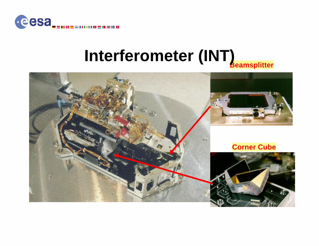
Beamsplitter
Corner Cube
Interferometer (INT)


CFC (ozone depletion species) Time-series
provided by MIPAS

SCIAMACHY: SCanning Image Absorption SpectroMeterfor Atmospheric CartograpHY
•Nadir and limb mode• combination of both measurements provide info on the troposphere

Viewing Geometry NadirLimbOccultation
Combination of Prism and 8 high resolution channels (each having its own grating)Spectral range from 214 to 2380 nmSpectral resolution from 0.2 to 1.5 nm 7 broadband polarization measurement Devices PMDsOn-board calibration H/W
Scanners Prism
Channel 1
Channel 2
1
Channel 8
Channel 7
Channel 6
Channel 5
Channel 4
Channel 3
2 3 4 5 6 45
Polarization Measurement Devices (PMD)
WLS SLS
Atmosphere
Science channels
Imaging Spectrometer
Sun

Retrieval of Greenhouse Gases from Space
SCIAMACHY Channel 6 CO2 retrieval

1e15 molec/cm2
Courtesy of Steffen Beirle, Univ. Heidelberg, D
Ship tracks
18 months: January 2003 - June 2004
NO2 CONCENTRATION

NO2 concentration Sunday and Wednesday – Year 2004
Sunday Wednesday
NO2 CONCENTRATION
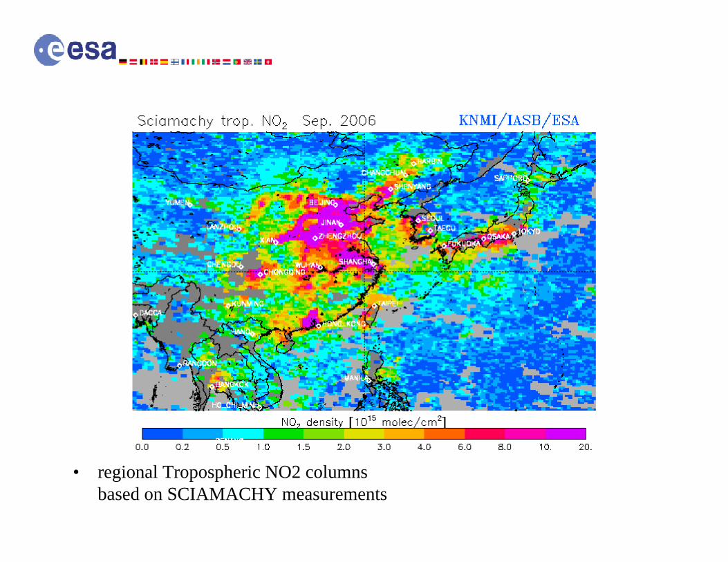
• regional Tropospheric NO2 columnsbased on SCIAMACHY measurements


ESA selected Third Party Missions
Research and Applications Opportunities2004 2005 2006 2007
OMI Cat-1ERS, ENVISAT, OMI
ALOS AOERS, ENVISAT, All TPM
Proba Cat-1ERS, ENVISAT, All TPM
Landsat Cat-1ERS, ENVISAT, All TPM
Kompsat Cat-1ERS, ENVISAT, All TPM
Scisat Cat-1ERS, ENVISAT, All TPM
Orbview-2 Cat-1ERS, ENVISAT, All TPM
Spot-4 Cat-1ERS, ENVISAT, All TPM
+ Kompsat-2, Bird, CBERS, DMC….
IRS-P6 Cat-1ERS, ENVISAT, All TPM

ESA Support to OMI Calibration/Validation via a dedicated AO – 22 Projects

Advantage of OMI: Daily Global Coverage and good Spatial Resolution
More Details on OMI: see presentation of H. Kelder

ESA Open Category I Call on the SciSat Mission
Solar Occultation

ESA Open Category I Call on the SciSat Mission


13 instruments
1813 W (Avg SL consumption)
4082 kg at launch6.52 m height
Sun Synchronous orbit: 817 km, 9h30 MLST DN, 29 days cycle (412 orbits)
316 kg Hydrazine at launch
AOCS: 3-ais, ES/SS, RW, MT, N2H4 RCSMission lifetime: 5
years

Global Imagery: AVHRR/3
Humanitarian services: SARP-3, SARR
Space Environment Monitoring: SEM-2
Temp/Humidity sounding: IASI, HIRS/4, MHS, AMSU-A1/A2, GRAS
Sea surface winds: ASCAT
Ozone/Gases monitoring:
GOME-2
Data collection: A-DCS

MetOp PFM in the Acoustic Chamber at ITS
MetOp PFM in the EMC Chamber at ITS

• The GOME-2 instrument consists of an improved instrument
• GOME-2 will be providing measurement of the:
– backscattered Earth radiance and Sun irradiance using its Ultra-violet, visible and near infrared double spectrometer
• Changes to provide enhanced performance of GOME-2 include the following:
– Improved polarisation measuring capability
– Inclusion of a new on-board white light source for calibration
– Increased maximum swath width (1920Km) & artefacts in irradiance calibration/measurements.

– IASI is an IR instrument, based on a Fourier Transform Spectrometer (3.7 to 15.5 µm) with an co-mounted IR imager (10.3 to 12.5 µm).
– The spectrometer is a Michelson interferometer
– IASI provides atmospheric sounding for NWP and Climate monitoring models. IASI will measure O3, CH4, CO and N2O trace gas columns.
– IASI will also contribute in the study of cloud to atmosphere radiation exchange by characterizing cloud coverage, cloud top temperature, type and transparency.


Next Call
2005 201020092008200720062004 20122011
EXPLORER 2
EXPLORER 1
EXPLORER 3
EXPLORER 4
EXPLORER 5
EXPLORER 6
CryoSat
GOCE
SMOS
ADM - Aeolus
Swarm
EarthCARESelection
EXPLORERS > 6
Living Planet Programme

ESA’s Wind Mission

The Earth Explorer Atmospheric Dynamics Mission
ESA’s Wind Mission
Objectives of the ADM-Aeolus mission: to provide global observations of wind profiles to provide global observations of wind profiles
from space from space to improve the quality of weather forecastingto improve the quality of weather forecastingto enhance our understanding of atmospheric to enhance our understanding of atmospheric
dynamics and climate processesdynamics and climate processes
Wind Wind profileprofile chartchart

Measurement Concept
• Backscatter signal
• Winds are derived from Doppler shift of aerosols andmolecules along lidar line-of-sight

Expected Scientific Output
ESA’s Wind Mission
measurements of global three-dimensional wind fields, giving a more accurate picture of the Earth's global energy budget
data of global atmospheric circulation and related features (precipitation systems, El Niño, Southern Oscillation phenomena), distribution of atmospheric constituents like ozone or aerosol, and stratosphere/troposphere exchange
Better modelling, and a greater understanding, of tropical dynamics; better estimates of the position and intensity of tropical cyclones
Significant improvement of short range forecast of synoptic events; small-scale details of intense wind events will improve for short-range forecasts because of the earlier detection of their development.

Examples of Scientific Applications
ESA’s Wind Mission
Improved Earth climate models
Progress in numerical weatherprediction and better operational forecasting
Lawrence Livermore National Laboratory
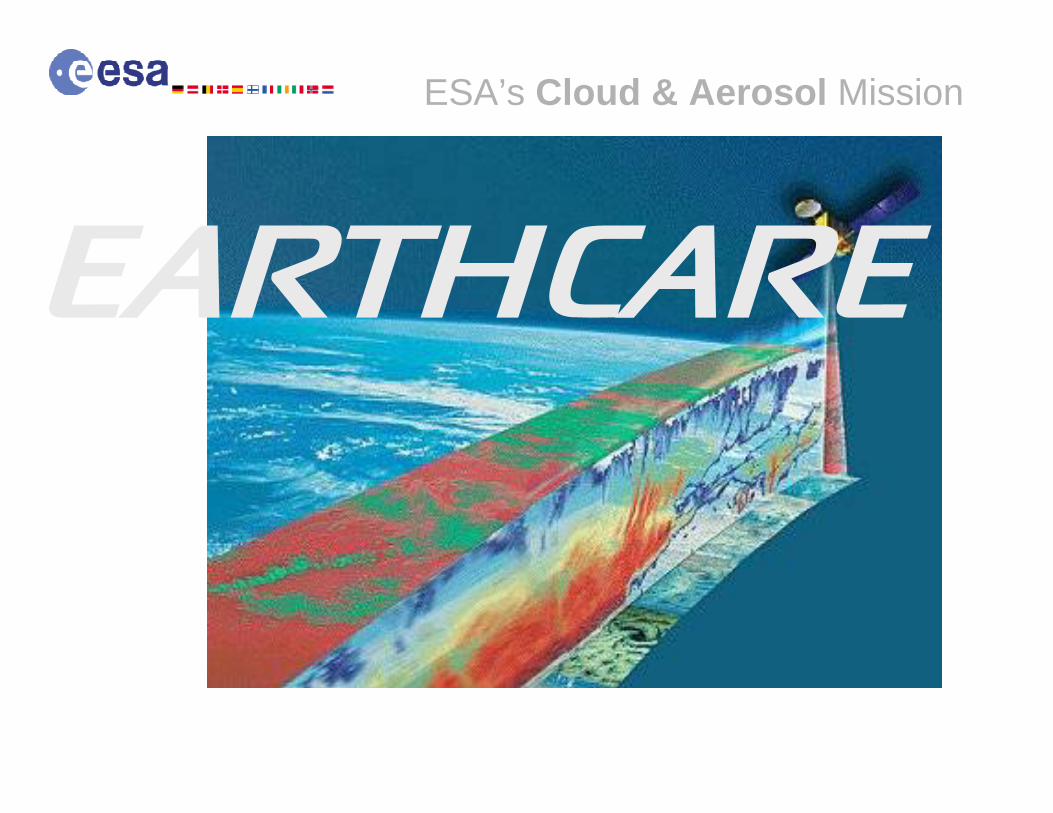
ESA’s Cloud & Aerosol Mission

The Earth Clouds, Aerosols and Radiation Explorer
ESA’s Cloud & Aerosol Mission
EarthCARE is a joint European (ESA) – Japanese (JAXA) mission with the objective:to quantify and thus improve understanding of cloudto quantify and thus improve understanding of cloud--aerosolaerosol--radiation interactionsradiation interactionsto include such parameters correctly and reliably in to include such parameters correctly and reliably in climate and weather prediction modelsclimate and weather prediction models

Vertical profiles of extinction and characteristics of aerosols
Vertical profiles of extinction and characteristics of aerosols
Vertical profiles of liquid, supercooled and ice water, cloud overlap, particle size and extinction
Vertical profiles of liquid, supercooled and ice water, cloud overlap, particle size and extinction
Convective updraft and ice fall speedConvective updraft and ice fall speed
Horizontal structure of clouds and aerosolsHorizontal structure of clouds and aerosols
Shortwave and Longwavefluxes at Top of AtmosphereShortwave and Longwavefluxes at Top of Atmosphere
Atmospheric data
Broadband RadiometerBroadband Radiometer
MultispectralImager
MultispectralImager
Doppler RadarDoppler Radar
RadarRadar
High spectral resolution Lidar
High spectral resolution Lidar
Techniques
CPRCPR
MSIMSI
BBRBBR
ATLIDATLID
EarthCARE instruments
Temperature and humidity from operational analysis

Expected Scientific Output
ESA’s Cloud & Aerosol Mission
Vertical profiles of natural and anthropogenic aerosols on a global scale, their radiative properties and interaction with clouds
Vertical distribution of atmospheric liquid water and ice on a global scale, their transport by clouds and radiative impact
Cloud overlap in the vertical, cloud-precipitation interactions and the characteristics of vertical motion within clouds
The profiles of atmospheric radiative heating and coolingthrough a combination of retrieved aerosol and cloud properties

Example of Scientific Applications
ESA’s Cloud & Aerosol Mission
MoreMore reliablereliable climateclimate predictionspredictions and betterbetter weatherweatherforecastsforecasts through the improved representation of processes involving clouds, aerosol and radiation

Selected atmospheric Missions for pre-Phase A studies
TRAQ – the mission focuses on monitoring air quality and long-range transport of air pollutants.
A new synergistic sensor concept allows for process studies, particularly with respect to aerosol-cloud interactions.
The main issues are the rate of air quality change on regional and global scales, the strength and distribution of sources and sinks of tropospheric trace gases and aerosols influencing air quality, and the role of tropospheric composition in global change.
The instrumentation consists of imaging spectrometers in the range from ultraviolet to short-wave infrared.
TRAQ (TRopospheric composition and Air Quality) - to monitor air quality and long-range transport of air pollutants.
Call for New Earth Explorer Missions

PREMIER – Many of the most important processes for prediction of climate change occur in the upper troposphere and lower stratosphere (UTLS).
The objective is to understand the many processes that link trace gases, radiation, chemistry and climate in the atmosphere – concentrating on the processes in the UTLS region.
By linking with MetOp/ National Polar-orbiting Operational Environmental Satellite System (NPOESS) data, the mission also aims to provide useful insights into processes occurring in the lower troposphere.
The instrumentation consists of an infrared and a microwave radiometer.
PREMIER (PRocess Exploration through Measurements of Infrared and millimetre-wave Emitted Radiation) to understand processes that link trace gases, radiation, chemistry and climate in the atmosphere.
Selected atmospheric Missions for pre-Phase A studies
Call for New Earth Explorer Missions
A-SCOPE – The mission aims to observe total column carbon dioxide with a nadir-looking pulsed carbon dioxide DIfferential Absorption Lidar (DIAL) for a better understanding of the global carbon cycle and regional carbon dioxide fluxes, as well as for the validation of greenhouse gas emission inventories. It will provide a spatially resolved global carbon budget combined with diagnostic model analysis through global and frequent observation of carbon dioxide.
Spin-off products like aerosols, clouds and surface reflectivity are important parameters of the radiation balance of the Earth.
A contribution to Numerical Weather Prediction is foreseen in connection with accurate temperature profiles.
A-SCOPE (Advanced Space Carbon and Climate Observation of Planet Earth) – to improve our understanding of the global carbon cycle and regional carbon dioxide fluxes.
Selected atmospheric Missions for pre-Phase A studies
Call for New Earth Explorer Missions
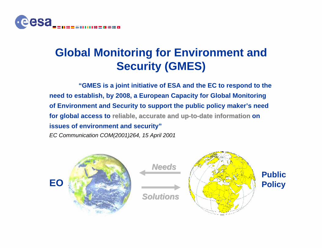
Global Monitoring for Environment and Security (GMES)
“GMES is a joint initiative of ESA and the EC to respond to the need to establish, by 2008, a European Capacity for Global Monitoring of Environment and Security to support the public policy maker’s need for global access to reliable, accurate and upreliable, accurate and up--toto--date informationdate information on issues of environment and security”EC Communication COM(2001)264, 15 April 2001
EOPublic Policy
NeedsNeeds
SolutionsSolutions


PROMOTE Services on Stratospheric Ozone

Service Example/Success Story on Ozone
NRT Delivery of SCIAMACHY Total Ozone to ECMWF to improve operational Weather Forecasting (KNMI)

PROMOTE Services on UV Radiation

Service Example/Success Story on UV20 000 people in Germany using the UV-check Service in 2004 (DLR)


Sentinels 4 & 5 (in GEO and LEO, respectively) answer operational needs in the areas of atmospheric chemistry, air quality and climate applications.
Sources of user and observation requirements:
Derivation and traceability of requirements
GSE
EC
Missions
Environment and climate protection protocols, directives etc.EU FP projects, e.g. Create-Daedalus, EvergreenEU GMES-GATO report
ENVISATMetOpESA studies on CO2 and on atmospheric chemistry observation requirements
PROtocol MOniToring for The GMES service Element: Atmosphere (PROMOTE)
User groups/consult.
IGOS-IGACO Theme reportGCOS implementation plan, WCRP-SPARC long-term observation reqs.Eumetsat user consultations in the frame of MTG and postEPS

Environmental themes, data usage,applicationsEnvironmental Theme
Data usageOzone Layer &
Surface UV radiationAir Quality Climate
Protocols UNEP Vienna Convention; Montreal and subsequent protocols;CFC emission verification;Stratospheric ozone, halogen and surface UV distribution and trend monitoring
UN/ECE CLRTAP; EMEP / Göteborg Protocol; EC directives EAP / CAFÉ;AQ emission verification;AQ distribution and trend monitoring
UNFCCC Rio Convention; Kyoto Protocol; Climate policy EU;GHG and aerosol emission verification;GHG/aerosol distribution and trend monitoring
Services Stratospheric composition and surface UV forecast;NWP assimilation and (re-) analysis
Local Air Quality (BL); Health warnings (BL);Chemical Weather (BL/FT);Aviation routing (UT)
NWP assimilation and (re) analysis;Climate monitoring;Climate model validation
Assessment
(lower priority for operational mission)
Long-term global data records;WMO Ozone assessment;Stratospheric chemistry and transport processes;UV radiative transport processes;Halogen source attribution;UV health & biological effects
Long-term global, regional, and local data records;UNEP, EEA assessments;Regional & local boundary layer AQ processes; Tropospheric chemistry and long-range transport processes;AQ source attribution;AQ Health and safety effects
Long-term global data records;IPCC assessments;Earth System, climate, rad. forcing processes; UTLS transport-chemistry processes;Forcing agents source attribution;Socio-economic climate effects

The GMES Sentinels
Sentinels
Sentinel 1 – SAR imagingAll weather, day/night applications, interferometry
Sentinel 2 – Superspectral imagingContinuity of Landsat, SPOT & Vegetation-type data
Sentinel 3 – Ocean monitoringWide-swath ocean color and surface temperature
sensors, altimeter
Sentinel 4 – Geostationary atmosphericAtmospheric composition monitoring, trans-boundary
pollution
Sentinel 5 – Low-orbit atmosphericAtmospheric composition monitoring