Opening Remarks Presented to: Counterinsurgency Conference 27 October 2009 USA/USMC COIN Center
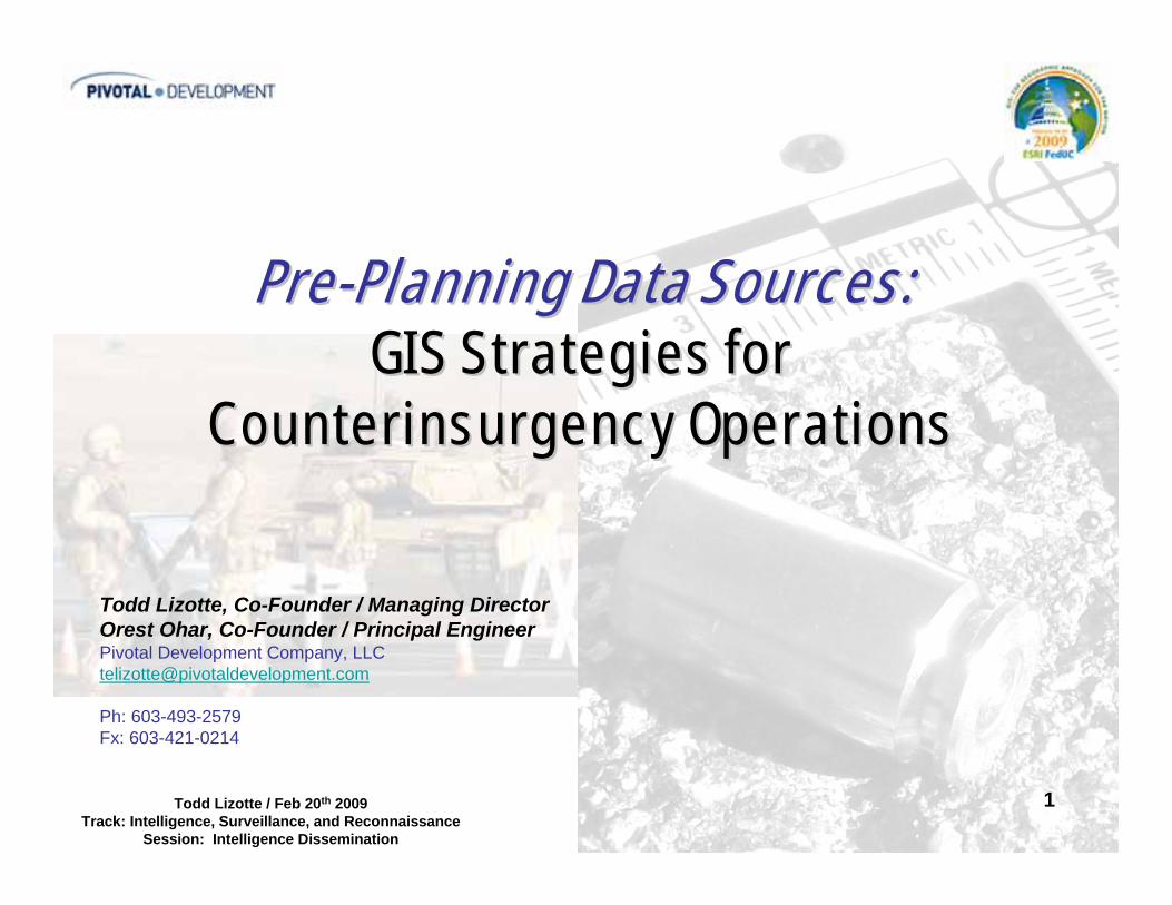
1Todd Lizotte / Feb 20th 2009Track: Intelligence, Surveillance, and Reconnaissance
Session: Intelligence Dissemination
PrePre--Planning Data Sources:Planning Data Sources:GIS Strategies for GIS Strategies for
Counterinsurgency OperationsCounterinsurgency Operations
Todd Lizotte, Co-Founder / Managing DirectorOrest Ohar, Co-Founder / Principal EngineerPivotal Development Company, [email protected]
Ph: 603-493-2579Fx: 603-421-0214
2Todd Lizotte / Feb 20th 2009Track: Intelligence, Surveillance, and Reconnaissance
Session: Intelligence Dissemination
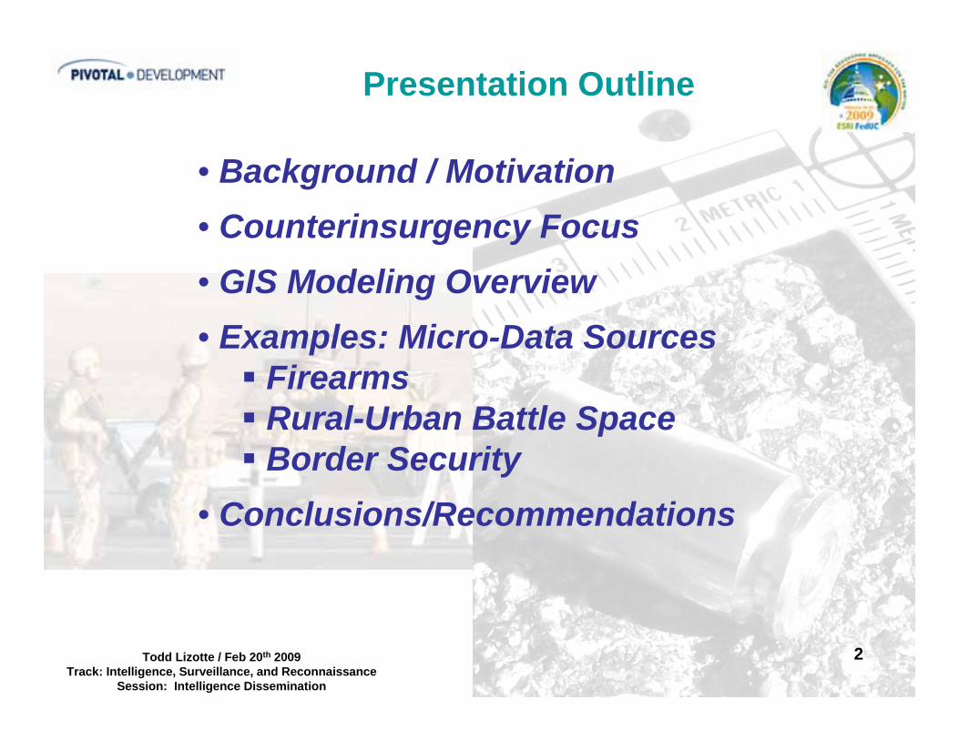
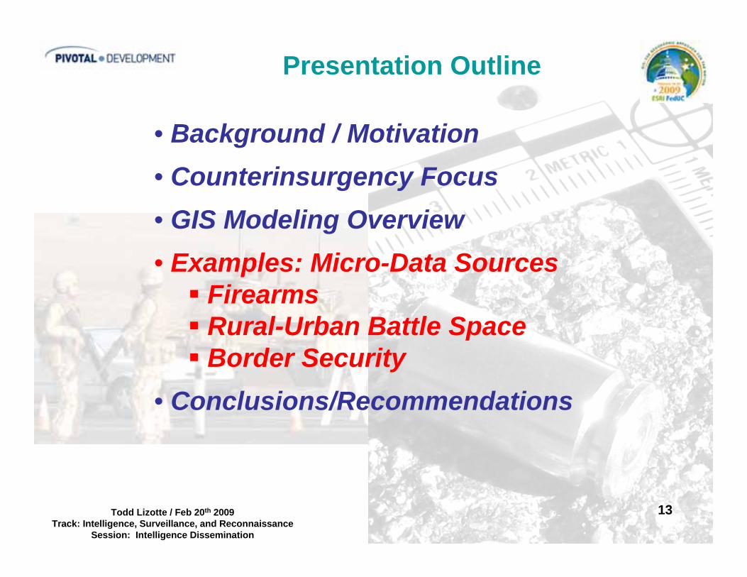
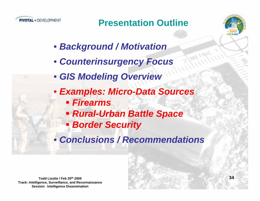
Presentation Outline
• Background / Motivation• Counterinsurgency Focus• GIS Modeling Overview• Examples: Micro-Data Sources
FirearmsRural-Urban Battle SpaceBorder Security
• Conclusions/Recommendations

3Todd Lizotte / Feb 20th 2009Track: Intelligence, Surveillance, and Reconnaissance
Session: Intelligence Dissemination
Background / Motivation
• Modify the emphasis of GIS mapping from solely macro level data to a mix of macro/micro data. (Pre-Planning Data Sources – Supporting Theater to Squad Level Operations)
• Emphasize “in real time” Intel by (using shortest time to crime model) Identifying specific insurgent infiltration / locations through relatable data source
• Emphasize that everything provided to the Host nation should be considered an opportunity for monitoring or data source. (Rifles, Handguns, Helmets, Body Armor, Vehicles, Grenades, Mortars, Artillery Shells, MRE’s, etc.)“Things tend to go missing in a war zone!!!! Passive Tags
and Active Tags”1. Chainey, Ratcliffe, “GIS and Crime Mapping” Wiley, 2005

4Todd Lizotte / Feb 20th 2009Track: Intelligence, Surveillance, and Reconnaissance
Session: Intelligence Dissemination
Presentation Outline
• Background / Motivation• Counterinsurgency Focus• GIS Modeling Overview• Examples: Micro-Data Sources
FirearmsRural-Urban Battle SpaceBorder Security
• Conclusions/Recommendations
5Todd Lizotte / Feb 20th 2009Track: Intelligence, Surveillance, and Reconnaissance
Session: Intelligence Dissemination
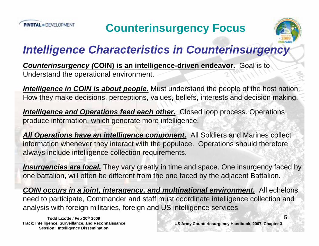
Counterinsurgency Focus
Intelligence Characteristics in CounterinsurgencyCounterinsurgency (COIN) is an intelligence-driven endeavor. Goal is toUnderstand the operational environment.
Intelligence in COIN is about people. Must understand the people of the host nation.How they make decisions, perceptions, values, beliefs, interests and decision making.
Intelligence and Operations feed each other. Closed loop process. Operationsproduce information, which generate more intelligence.
All Operations have an intelligence component. All Soldiers and Marines collectinformation whenever they interact with the populace. Operations should thereforealways include intelligence collection requirements.
Insurgencies are local. They vary greatly in time and space. One insurgency faced byone battalion, will often be different from the one faced by the adjacent Battalion.
COIN occurs in a joint, interagency, and multinational environment. All echelonsneed to participate, Commander and staff must coordinate intelligence collection andanalysis with foreign militaries, foreign and US intelligence services.
US Army Counterinsurgency Handbook, 2007, Chapter 3

6Todd Lizotte / Feb 20th 2009Track: Intelligence, Surveillance, and Reconnaissance
Session: Intelligence Dissemination
Counterinsurgency Focus
Support Govern
ment
Insurgent
Neutral or
Passive
Support Govern
ment
Insurgent
Neutral or
Passive
Atti
tude
of P
opul
ace Security Operations
Develop Security Forces
Better Governance
Essential Services
Economic Development
Information OperationsStarting Conditions End State
1. David Kilcullen, Rand Insurgency Board Presentation 8MAY2008.ppt2. US Army Counterinsurgency Handbook, 2007, Chapter 3
TARGET INSURGENTS OR TRACK THEIR SPHERE OF INFLUENCE WITHIN HOST NATION
7Todd Lizotte / Feb 20th 2009Track: Intelligence, Surveillance, and Reconnaissance
Session: Intelligence Dissemination
Presentation Outline
• Background / Motivation• Counterinsurgency Focus• GIS Modeling Overview• Examples: Micro-Data Sources
FirearmsRural-Urban Battle SpaceBorder Security
• Conclusions/Recommendations

8Todd Lizotte / Feb 20th 2009Track: Intelligence, Surveillance, and Reconnaissance
Session: Intelligence Dissemination
GIS Modeling Overview
Insurgent Tracking DataInsurgent Tracking Data
Insurgent Incident DataInsurgent Incident Data
CounterinsurgencyCounterinsurgencyOperationsOperations
Transport Networks &Transport Networks &InfrastructureInfrastructureCensus, DemographicsCensus, Demographics& Land Use& Land Use
Amalgamated GIS MAPAmalgamated GIS MAP
• Data Layers Integrated To Provide Different Perspective
• Data Layers Are AnalyzedAgainst Each Other
• Micro Data Can ProvideHigher Resolution To Analysis
9Todd Lizotte / Feb 20th 2009Track: Intelligence, Surveillance, and Reconnaissance
Session: Intelligence Dissemination
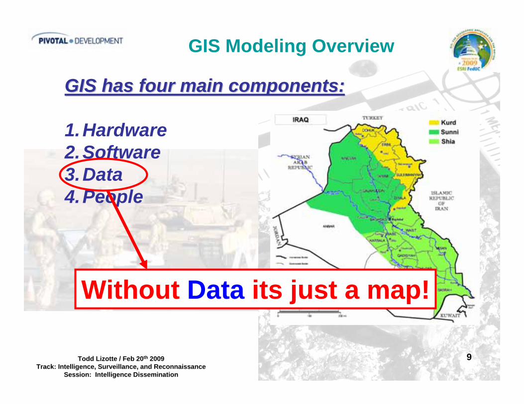
GIS Modeling Overview
GIS has four main components:GIS has four main components:
1.Hardware2.Software3.Data4.People
Without Data its just a map!
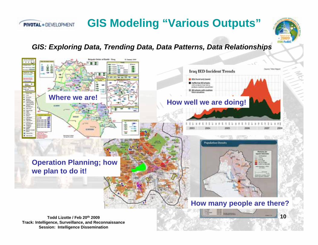
10Todd Lizotte / Feb 20th 2009Track: Intelligence, Surveillance, and Reconnaissance
Session: Intelligence Dissemination
GIS Modeling “Various Outputs”
GIS: Exploring Data, Trending Data, Data Patterns, Data Relationships
Where we are!
Operation Planning; howwe plan to do it!
How well we are doing!
How many people are there?

11Todd Lizotte / Feb 20th 2009Track: Intelligence, Surveillance, and Reconnaissance
Session: Intelligence Dissemination
GIS DATA GOAL “Real Time”
Macro Data
Macro Data
MICRO DATA
MICRO DATA
MICRO DATA
MACRO DATA PROVIDES A OVERALL DIRECTION
MICRO DATA CAN BREAK THROUGH TO IDENTIFY A SPECIFIC TARGET
12Todd Lizotte / Feb 20th 2009Track: Intelligence, Surveillance, and Reconnaissance
Session: Intelligence Dissemination
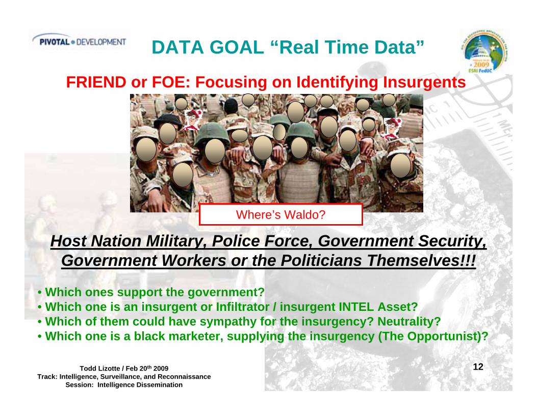
DATA GOAL “Real Time Data”
FRIEND or FOE: Focusing on Identifying Insurgents
Host Nation Military, Police Force, Government Security, Government Workers or the Politicians Themselves!!!
• Which ones support the government?• Which one is an insurgent or Infiltrator / insurgent INTEL Asset?• Which of them could have sympathy for the insurgency? Neutrality?• Which one is a black marketer, supplying the insurgency (The Opportunist)?
Where’s Waldo?
13Todd Lizotte / Feb 20th 2009Track: Intelligence, Surveillance, and Reconnaissance
Session: Intelligence Dissemination
Presentation Outline
• Background / Motivation• Counterinsurgency Focus• GIS Modeling Overview• Examples: Micro-Data Sources
FirearmsRural-Urban Battle SpaceBorder Security
• Conclusions/Recommendations

14Todd Lizotte / Feb 20th 2009Track: Intelligence, Surveillance, and Reconnaissance
Session: Intelligence Dissemination
Focus on Micro-Data Sources
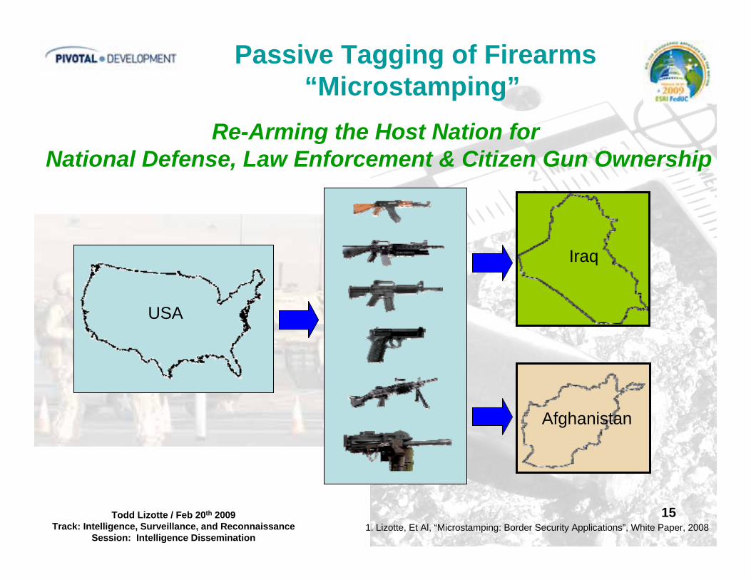
Data SourceData SourcePassive Tagging of Firearms “Microstamping”
A. Arming a Host Nation with Foresight: Tracking Insurgent Infiltrators and Black Market Opportunists
B. Maintaining Civilian Gun Rights: Firefight Reconstruction (Friend or Foe ID)
15Todd Lizotte / Feb 20th 2009Track: Intelligence, Surveillance, and Reconnaissance
Session: Intelligence Dissemination
Passive Tagging of Firearms“Microstamping”
1. Lizotte, Et Al, “Microstamping: Border Security Applications”, White Paper, 2008
Re-Arming the Host Nation for National Defense, Law Enforcement & Citizen Gun Ownership
Iraq
Afghanistan
USA

16Todd Lizotte / Feb 20th 2009Track: Intelligence, Surveillance, and Reconnaissance
Session: Intelligence Dissemination
Passive Tagging of Firearms“Microstamping”
Host NationDefense & Law Enforcement
Host NationMilitias / NG Security Groups
Microstamped Prior to Export(Government Firearm Vendors)
Microstamped in the Field“Insurgent Active Areas”
Mobile Microstamping
Planned ImplementationPlanned Implementation In situ ImplementationIn situ Implementation
1. Lizotte, Et Al, “Microstamping: Border Security Applications”, White Paper, 2008
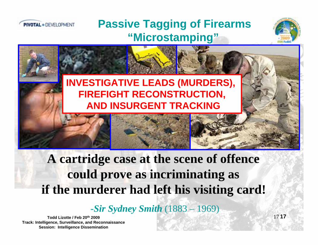
17Todd Lizotte / Feb 20th 2009Track: Intelligence, Surveillance, and Reconnaissance
Session: Intelligence Dissemination
17
Passive Tagging of Firearms“Microstamping”
A cartridge case at the scene of offence could prove as incriminating as
if the murderer had left his visiting card!-Sir Sydney Smith (1883 – 1969)
INVESTIGATIVE LEADS (MURDERS), FIREFIGHT RECONSTRUCTION,
AND INSURGENT TRACKING

18Todd Lizotte / Feb 20th 2009Track: Intelligence, Surveillance, and Reconnaissance
Session: Intelligence Dissemination
Passive Tagging of Firearms“Microstamping”

19Todd Lizotte / Feb 20th 2009Track: Intelligence, Surveillance, and Reconnaissance
Session: Intelligence Dissemination
Passive Tagging of Firearms“Microstamping”

20Todd Lizotte / Feb 20th 2009Track: Intelligence, Surveillance, and Reconnaissance
Session: Intelligence Dissemination
Firearm Cycles & Ejects
Cartridge Evidence
Passive Tagging of Firearms“Microstamping”
21Todd Lizotte / Feb 20th 2009Track: Intelligence, Surveillance, and Reconnaissance
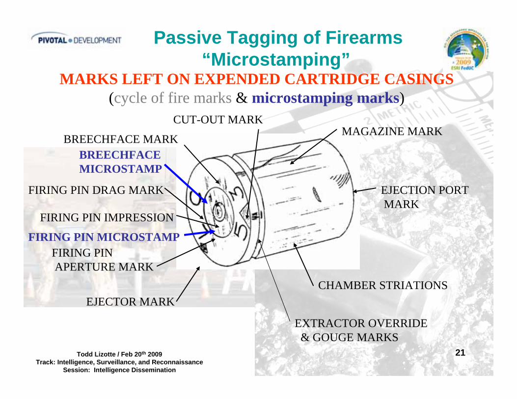
Session: Intelligence Dissemination
MARKS LEFT ON EXPENDED CARTRIDGE CASINGS(cycle of fire marks & microstamping marks)
EJECTOR MARK
FIRING PINAPERTURE MARK
FIRING PIN IMPRESSION
FIRING PIN DRAG MARK
BREECHFACE MARK
CUT-OUT MARKMAGAZINE MARK
EJECTION PORTMARK
CHAMBER STRIATIONS
EXTRACTOR OVERRIDE & GOUGE MARKS
FIRING PIN MICROSTAMP
BREECHFACEMICROSTAMP
Passive Tagging of Firearms“Microstamping”

22Todd Lizotte / Feb 20th 2009Track: Intelligence, Surveillance, and Reconnaissance
Session: Intelligence Dissemination
8 Digit Code
SW10
1233
Breach Face Mark
Gear Code
Head Stamp / Casing
Primer
SW10
1233Firing Pin Mark
SW10
1233
Passive Tagging of Firearms“Microstamping”
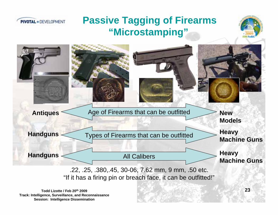
23Todd Lizotte / Feb 20th 2009Track: Intelligence, Surveillance, and Reconnaissance
Session: Intelligence Dissemination
Passive Tagging of Firearms“Microstamping”
Age of Firearms that can be outfittedAntiques New Models
Types of Firearms that can be outfittedHandguns Heavy Machine Guns
Handguns Heavy Machine Guns
.22, .25, .380,.45, 30-06, 7.62 mm, 9 mm, .50 etc.“If it has a firing pin or breach face, it can be outfitted!”
All Calibers
24Todd Lizotte / Feb 20th 2009Track: Intelligence, Surveillance, and Reconnaissance
Session: Intelligence Dissemination
• Microstamping leverages existing forensic analysis techniques and Infrastructure (FBI / BATFE / ARMY)(Squad level analysis using portable hand microscope.)
• Microstamping = Fresh GIS Intel / Trafficking Routes & Insurgent Patterns / Time (Temporal Progression), Location, Re-Location / Black Markets
(Identifies the firearm the first time it is used in a fire fight)
• It targets the supply side of firearm trafficking including insurgent infiltrators or rouge security forces, rouge police units and opportunistic black market dealers.
Benefit of Microstamping: Tracking/Trace Data!!!
Passive Tagging of Firearms“Microstamping”

25Todd Lizotte / Feb 20th 2009Track: Intelligence, Surveillance, and Reconnaissance
Session: Intelligence Dissemination
Passive Tagging of Firearms“GIS Mapping”
GIS Mapping (Firearm Movement):GIS Mapping (Firearm Movement):
1.1. Confiscated FirearmsConfiscated Firearms
2.2. Firearm Trafficking RoutesFirearm Trafficking Routes
3.3. Insurgent Migration RoutesInsurgent Migration Routes
4.4. Insurgent Force Size EstimatesInsurgent Force Size Estimates
5.5. Insurgent Hot SpotsInsurgent Hot Spots

26Todd Lizotte / Feb 20th 2009Track: Intelligence, Surveillance, and Reconnaissance
Session: Intelligence Dissemination
Police issued firearm used in insurgent activity(Time, Date, Number of Rounds)
Passive Tagging of Firearms“GIS Mapping”
1
2
3
5
6
4
Suspected Police Station
GIS Maps: Combining Macro/Micro (Thematic, Spatial Statistics, TGIS Maps: Combining Macro/Micro (Thematic, Spatial Statistics, Temporal, etc) Data Setsemporal, etc) Data Sets

27Todd Lizotte / Feb 20th 2009Track: Intelligence, Surveillance, and Reconnaissance
Session: Intelligence Dissemination
Presentation Outline
• Background / Motivation• Counterinsurgency Focus• GIS Modeling Overview• Examples: Micro-Data Sources
FirearmsRural-Urban Battle SpaceBorder Security
• Conclusions/Recommendations
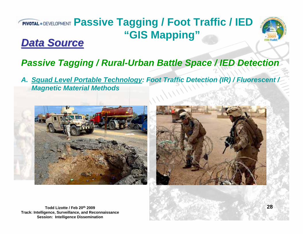
28Todd Lizotte / Feb 20th 2009Track: Intelligence, Surveillance, and Reconnaissance
Session: Intelligence Dissemination
Data SourceData Source
Passive Tagging / Rural-Urban Battle Space / IED Detection
A. Squad Level Portable Technology: Foot Traffic Detection (IR) / Fluorescent / Magnetic Material Methods
Passive Tagging / Foot Traffic / IED“GIS Mapping”

29Todd Lizotte / Feb 20th 2009Track: Intelligence, Surveillance, and Reconnaissance
Session: Intelligence Dissemination
Passive Tagging / Foot Traffic / IED“GIS Mapping”
Squad / Individual Soldier Level ProductSquad / Individual Soldier Level ProductIR & UV Excited Fluorescent Intruder DetectionIR & UV Excited Fluorescent Intruder Detection
Place on ground to determine use of buildingPlace on ground to determine use of buildingMovement during night time hours / trackingMovement during night time hours / tracking
1. Fluorescent Powder1. Fluorescent Powder2. Magnetic/Fluorescent2. Magnetic/Fluorescent
PowderPowder3. Retro3. Retro--Reflective MicroReflective Micro
Optical Elements / SpheresOptical Elements / Spheres4. Fluorescent Electrostatic4. Fluorescent Electrostatic
Cling SpheresCling Spheres
30Todd Lizotte / Feb 20th 2009Track: Intelligence, Surveillance, and Reconnaissance
Session: Intelligence Dissemination
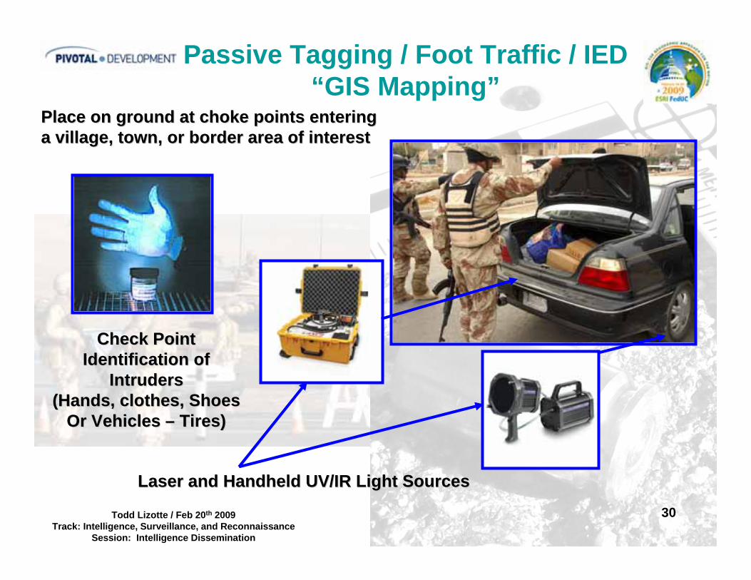
Passive Tagging / Foot Traffic / IED“GIS Mapping”
Check PointCheck PointIdentification ofIdentification of
IntrudersIntruders(Hands, clothes, Shoes(Hands, clothes, Shoes
Or Vehicles Or Vehicles –– Tires)Tires)
Place on ground at choke points enteringPlace on ground at choke points enteringa village, town, or border area of interesta village, town, or border area of interest
Laser and Handheld UV/IR Light SourcesLaser and Handheld UV/IR Light Sources

31Todd Lizotte / Feb 20th 2009Track: Intelligence, Surveillance, and Reconnaissance
Session: Intelligence Dissemination
Passive Tagging / Foot Traffic / IED“GIS Mapping”
Place on ground at choke points enteringPlace on ground at choke points enteringa village, town or border area of interest.a village, town or border area of interest.
Deploy Magnetic Fluorescent DustDeploy Magnetic Fluorescent DustOr Retro reflective Spheres Or Retro reflective Spheres
(Attachable to Cars / Trucks)(Attachable to Cars / Trucks)
Deploy High Brightness Fluorescent DustDeploy High Brightness Fluorescent Dust(Attachable to Cars / Trucks)(Attachable to Cars / Trucks)
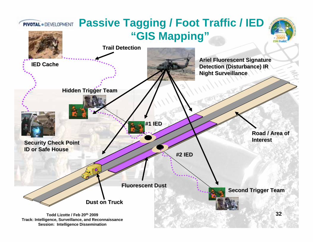
32Todd Lizotte / Feb 20th 2009Track: Intelligence, Surveillance, and Reconnaissance
Session: Intelligence Dissemination
Ariel Fluorescent SignatureAriel Fluorescent SignatureDetection (Disturbance) IR Detection (Disturbance) IR Night SurveillanceNight Surveillance
Hidden Trigger TeamHidden Trigger Team
Second Trigger TeamSecond Trigger Team
#2 IED#2 IED
#1 IED#1 IED
IED CacheIED Cache
Security Check PointSecurity Check PointID or Safe HouseID or Safe House
Passive Tagging / Foot Traffic / IED“GIS Mapping”
Trail DetectionTrail Detection
Road / Area ofRoad / Area ofInterestInterest
Fluorescent DustFluorescent Dust
Dust on TruckDust on Truck
33Todd Lizotte / Feb 20th 2009Track: Intelligence, Surveillance, and Reconnaissance
Session: Intelligence Dissemination
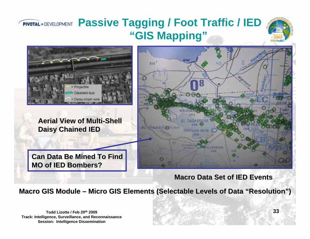
Passive Tagging / Foot Traffic / IED“GIS Mapping”
Aerial View of MultiAerial View of Multi--ShellShellDaisy Chained IEDDaisy Chained IED
Macro Data Set of IED EventsMacro Data Set of IED Events
Can Data Be Mined To FindCan Data Be Mined To FindMO of IED Bombers?MO of IED Bombers?
Macro GIS Module Macro GIS Module –– Micro GIS Elements (Selectable Levels of Data Micro GIS Elements (Selectable Levels of Data ““ResolutionResolution””))
34Todd Lizotte / Feb 20th 2009Track: Intelligence, Surveillance, and Reconnaissance
Session: Intelligence Dissemination
Presentation Outline
• Background / Motivation• Counterinsurgency Focus• GIS Modeling Overview• Examples: Micro-Data Sources
FirearmsRural-Urban Battle SpaceBorder Security
• Conclusions / Recommendations
35Todd Lizotte / Feb 20th 2009Track: Intelligence, Surveillance, and Reconnaissance
Session: Intelligence Dissemination
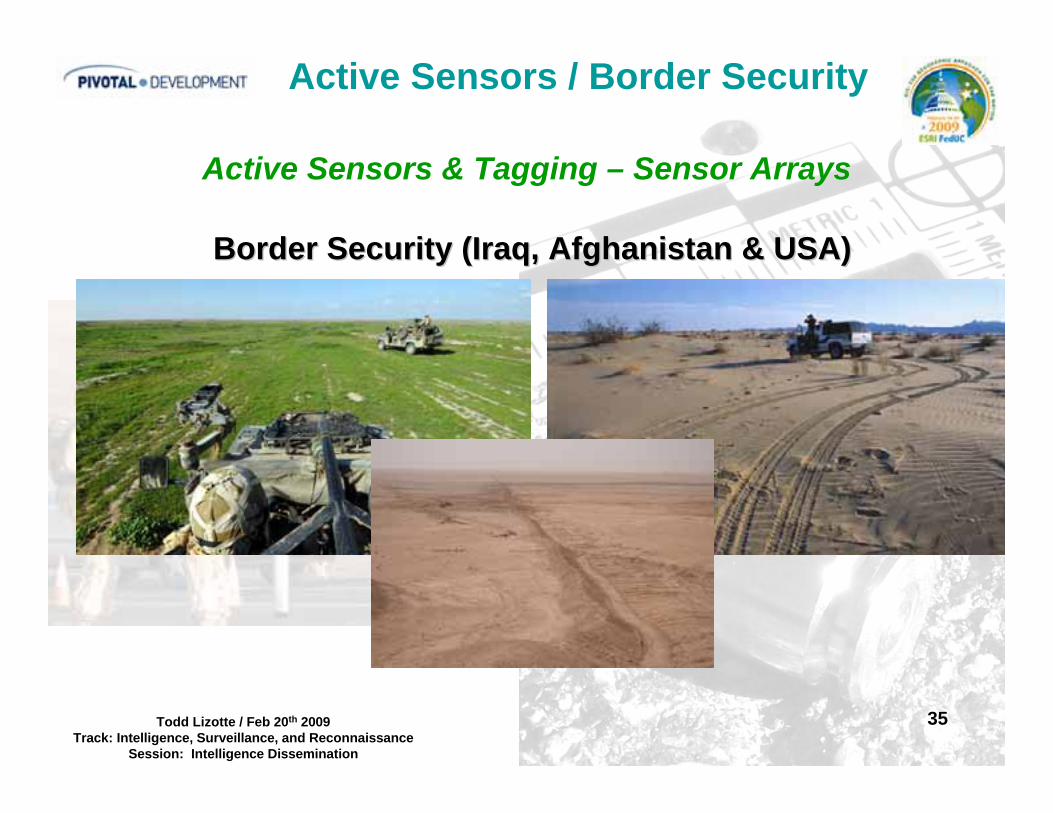
Active Sensors / Border Security
Active Sensors & Tagging – Sensor Arrays
Border Security (Iraq, Afghanistan & USA)Border Security (Iraq, Afghanistan & USA)
36Todd Lizotte / Feb 20th 2009Track: Intelligence, Surveillance, and Reconnaissance
Session: Intelligence Dissemination
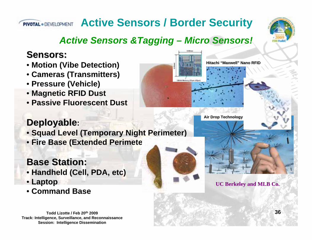
Hitachi Hitachi ““MaxwellMaxwell”” Nano RFIDNano RFID
Active Sensors &Tagging – Micro Sensors!
Active Sensors / Border Security
Sensors:Sensors:• Motion (Vibe Detection)• Cameras (Transmitters)• Pressure (Vehicle)• Magnetic RFID Dust• Passive Fluorescent Dust
DeployableDeployable:• Squad Level (Temporary Night Perimeter)• Fire Base (Extended Perimeter)
Base Station:Base Station:• Handheld (Cell, PDA, etc)• Laptop• Command Base
Air Drop TechnologyAir Drop Technology
UC Berkeley and MLB Co.UC Berkeley and MLB Co.

37Todd Lizotte / Feb 20th 2009Track: Intelligence, Surveillance, and Reconnaissance
Session: Intelligence Dissemination
Active Tagging – Micro Sensors!Active Sensors / Border Security
Check PointCheck Point
BorderBorder
Active SensorActive SensorArrayArray
GIS / Real Time -Micro Data
1. Noam Sapiens, UC Berkley, Smartdust.ppt

38Todd Lizotte / Feb 20th 2009Track: Intelligence, Surveillance, and Reconnaissance
Session: Intelligence Dissemination
Conclusion / Recommendation• Implementing Microstamping to firearms imported for use by Host Nations can provide many opportunities for targeting insurgents, closing black market firearm trafficking and provide investigative leads for killings.
• Small Scale / Soldier Deployable Taggants (Fluorescent Dust) etc – will provide opportunities to extract data on insurgent modus operandi and detection of persons of interest at check points.
• GIS is a powerful tool, modules that allow for real time data acquisition via sensor arrays and RFID tracking of tagged materials (Gear or Bait) would be helpful in understanding temporal behavior of various groups within a Host Country.
39Todd Lizotte / Feb 20th 2009Track: Intelligence, Surveillance, and Reconnaissance
Session: Intelligence Dissemination
Conclusion / Recommendation
Thank you for your time.