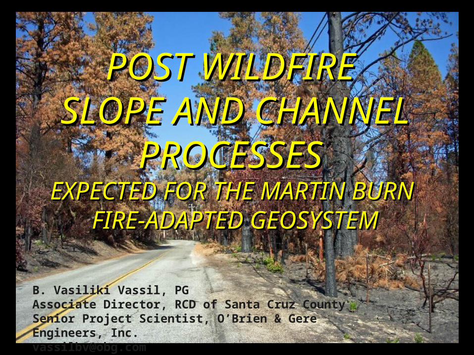
POST WILDFIRE SLOPE AND CHANNEL PROCESSES EXPECTED FOR THE MARTIN BURN FIRE-ADAPTED GEOSYSTEM B....
16
POST WILDFIRE POST WILDFIRE SLOPE AND CHANNEL SLOPE AND CHANNEL PROCESSES PROCESSES EXPECTED FOR THE MARTIN BURN EXPECTED FOR THE MARTIN BURN FIRE-ADAPTED GEOSYSTEM FIRE-ADAPTED GEOSYSTEM B. Vasiliki Vassil, PG Associate Director, RCD of Santa Cruz County Senior Project Scientist, O’Brien & Gere Engineers, Inc. [email protected]
-
Upload
sheryl-ward -
Category
Documents
-
view
214 -
download
0
Transcript of POST WILDFIRE SLOPE AND CHANNEL PROCESSES EXPECTED FOR THE MARTIN BURN FIRE-ADAPTED GEOSYSTEM B....
POST WILDFIRE POST WILDFIRE SLOPE AND CHANNEL SLOPE AND CHANNEL
PROCESSES PROCESSES EXPECTED FOR THE MARTIN BURN EXPECTED FOR THE MARTIN BURN
FIRE-ADAPTED GEOSYSTEMFIRE-ADAPTED GEOSYSTEM
B. Vasiliki Vassil, PGAssociate Director, RCD of Santa Cruz CountySenior Project Scientist, O’Brien & Gere Engineers, [email protected]
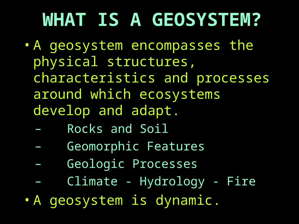
WHAT IS A GEOSYSTEM?• A geosystem encompasses the
physical structures, characteristics and processes around which ecosystems develop and adapt.– Rocks and Soil
– Geomorphic Features
– Geologic Processes
– Climate - Hydrology - Fire
• A geosystem is dynamic.

MARTIN BURN AREA GEOSYSTEM ROCKS
– SANTA MARGARITA FORMATION• Upper Miocene, thick bedded to massive, medium to fine
grained, white to light yellow-gray, friable sandstone
– METASEDIMENTARY ROCKS• Mesozoic aged schist and quartzite - may be deeply
weathered, differentially fractured
SOIL– DEVELOPS FROM PARENT MATERIAL
• Sandy on Santa Margarita - usually rapid drainage
• More clayey on metasedimentary rocks - slower drainage

GEOLOGIC MAP OF SANTA CRUZ COUNTY, CA SHOWING MARTIN BURN AREA
BURN AREA
Santa Margarita sandstone
Metasedimentary schist and quartzite
Granite and adamallite
Marble(Geologic map adapted from E.E. BRABB, 1997; Fire boundaries from Chris Berry, city water department)
Tsm
ga

MARTIN BURN AREA GEOSYSTEM
GEOMORPHIC FEATURES
Deeply incised stream canyons
Steep to moderately sloping and semi-level upland terrain

ACTIVE GEOLOGIC PROCESSES
Periodic strong seismic shaking
High rates of uplift
Landsliding and erosion - these help offset high uplift rates
MARTIN BURN AREA GEOSYSTEM
MARTIN BURN AREA GEOSYSTEM CLIMATE
– Mediterranean - dry summers, wet winters• Average annual ppt, 1981-2001: 48.3 inches • ~70-80% can occur in just a few storm events• Ppt range: 27.3 inches (1987) to 93.2 inches (1982) (Bonny Doon area rainfall data from: http://www.cantrall.net/Rain/Rain.shtml)
HYDROLOGY– Low flow to no flow during summer– Intense flows, channel scour, bank failure, floods
can accompany high intensity winter rain storms– Sediment storage during low flows, rapid
transport (sediment pulses) during high flows
MARTIN BURN AREA GEOSYSTEM
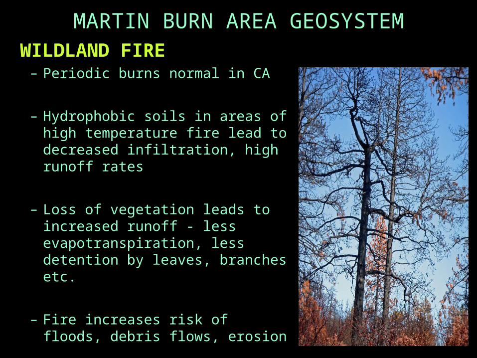
WILDLAND FIRE– Periodic burns normal in CA
– Hydrophobic soils in areas of high temperature fire lead to decreased infiltration, high runoff rates
– Loss of vegetation leads to increased runoff - less evapotranspiration, less detention by leaves, branches etc.
– Fire increases risk of floods, debris flows, erosion

ECOSYSTEM ADAPTED TO GEOSYSTEM• Episodic influxes of large amounts of runoff and
sediment are natural processes throughout CA and western North America - and are part of the long term dynamic-equilibrium of our channels.
• Rapid delivery of sediment from fires, intense storms and earthquakes prevents build up of unstable earth materials in the upper watersheds - clearing clogged channels and reducing risk from mega-debris flows.
• Channels transport sediment to the sea - this replenishes beaches and protects shorelines.
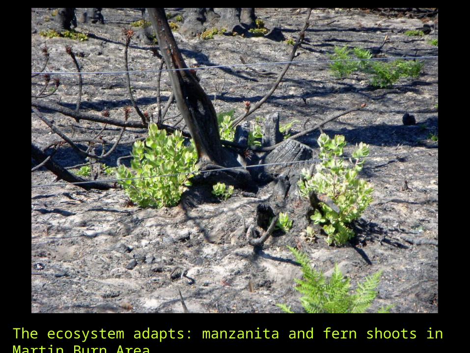
The ecosystem adapts: manzanita and fern shoots in Martin Burn Area

“…and the beat goes on…..”
Small deerherd with young - browsingon new growth2 months after the Martin Burn

NATURAL CAN STILL BE DANGEROUS
WHAT TO LOOK FOR AS WINTER APPROACHES
when good slopes begin to fail …when good slopes begin to fail …
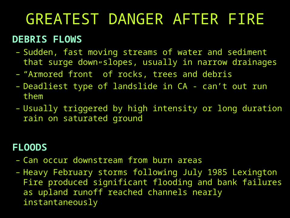
GREATEST DANGER AFTER FIREDEBRIS FLOWS– Sudden, fast moving streams of water and sediment that
surge down slopes, usually in narrow drainages– “Armored front” of rocks, trees and debris– Deadliest type of landslide in CA - can’t out run them– Usually triggered by high intensity or long duration rain on
saturated ground
FLOODS– Can occur downstream from burn areas – Heavy February storms following July 1985 Lexington Fire
produced significant flooding and bank failures as upland runoff reached channels nearly instantaneously
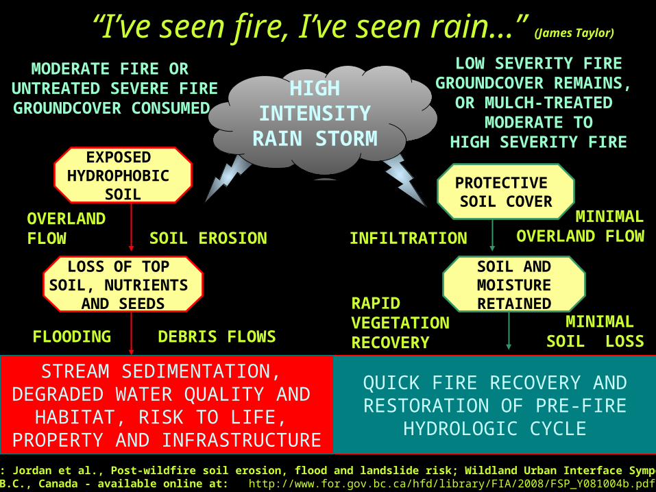
““I’ve seen fire, I’ve seen rain…”I’ve seen fire, I’ve seen rain…”MODERATE FIRE OR
UNTREATED SEVERE FIREGROUNDCOVER
CONSUMED
LOW SEVERITY FIREGROUNDCOVER REMAINS,
OR MULCH-TREATED MODERATE TO
HIGH SEVERITY FIREEXPOSED
HYDROPHOBIC SOIL
PROTECTIVE SOIL COVER
LOSS OF TOP SOIL, NUTRIENTS
AND SEEDS
SOIL AND MOISTURERETAINED
OVERLAND FLOW INFILTRATION
MINIMALOVERLAND FLOW
DEBRIS FLOWS
SOIL EROSION
RAPID VEGETATION RECOVERYFLOODING
MINIMAL SOIL LOSS
QUICK FIRE RECOVERY ANDRESTORATION OF PRE-FIRE
HYDROLOGIC CYCLE
(James Taylor)
HIGH INTENSITY
RAIN STORM
Adapted from: Jordan et al., Post-wildfire soil erosion, flood and landslide risk; Wildland Urban Interface Symposium, 2008,Penticton, B.C., Canada - available online at: http://www.for.gov.bc.ca/hfd/library/FIA/2008/FSP_Y081004b.pdf
STREAM SEDIMENTATION, DEGRADED WATER QUALITY AND
HABITAT, RISK TO LIFE, PROPERTY AND INFRASTRUCTURE
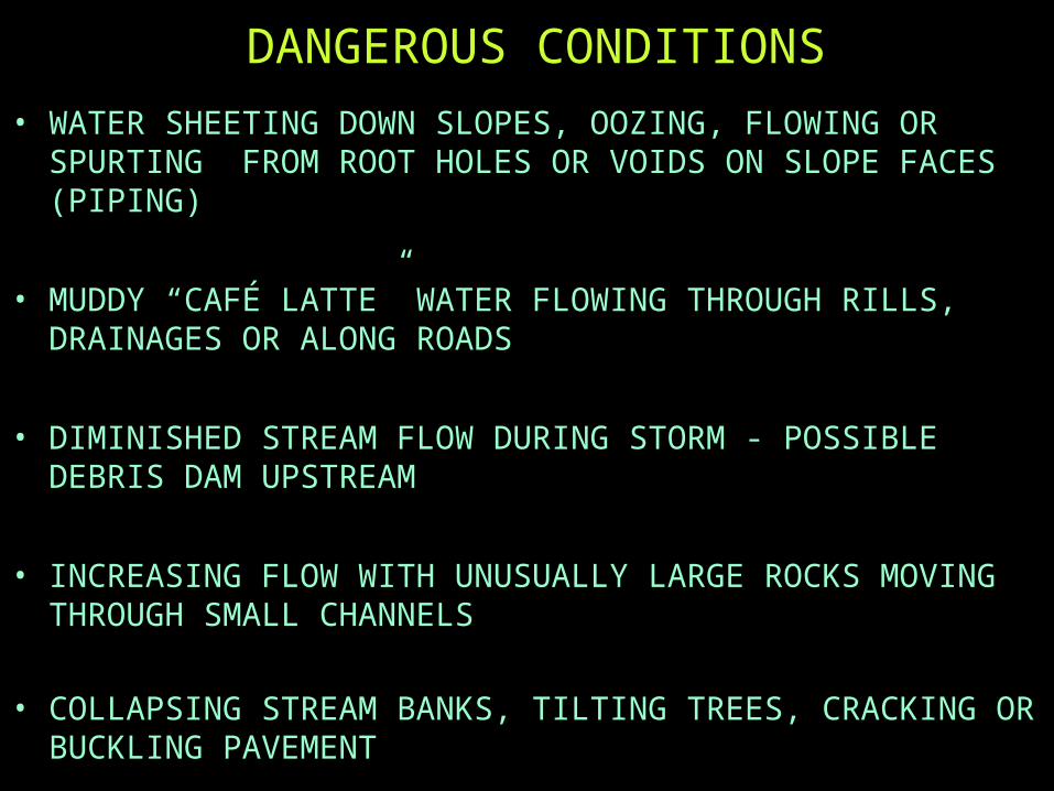
DANGEROUS CONDITIONS
• WATER SHEETING DOWN SLOPES, OOZING, FLOWING OR SPURTING FROM ROOT HOLES OR VOIDS ON SLOPE FACES (PIPING)
• MUDDY “CAFÉ LATTE” WATER FLOWING THROUGH RILLS, DRAINAGES OR ALONG ROADS
• DIMINISHED STREAM FLOW DURING STORM - POSSIBLE DEBRIS DAM UPSTREAM
• INCREASING FLOW WITH UNUSUALLY LARGE ROCKS MOVING THROUGH SMALL CHANNELS
• COLLAPSING STREAM BANKS, TILTING TREES, CRACKING OR BUCKLING PAVEMENT

POST-FIRE RISK MITIGATION• MULTI-AGENCY, INTERDISCIPLINARY TEAMS
– ASSESSED VULNERABLE CHANNELS AND SLOPES AFFECTED BY RECENT FIRES
– PRESCRIBED TREATMENTS WHERE NEEDED
• NEXT SPEAKER, RICH CASALE OF THE NRCS– INVOLVED IN POST-FIRE ASSESSMENTS AND
TREATMENT PRESCRIPTIONS
• RCD OF SANTA CRUZ COUNTY – A GREAT RESOURCE FOR MORE INFORMATION!