PORT LANDS - Toronto · The Port Lands are an unparalleled revitalization opportunity for Toronto,...
29
PORT LANDS PLANNING FRAMEWORK: LAND USE DIRECTION JUNE 5, 2014
Transcript of PORT LANDS - Toronto · The Port Lands are an unparalleled revitalization opportunity for Toronto,...

PORT LANDSPLANNING FRAMEWORK:LAND USE DIRECTIONJUNE 5, 2014

Copyright © June 2014 City of TorontoPublished by: City of Toronto, City Planning - Toronto and East York District

TABLE OF CONTENTS
1. EXECUTIVE SUMMARY 12. INTRODUCTION 3CREATING A BLUEPRINT FOR THE PORT LANDS 4A STUDY IN PROCESS 5
3. THE PORT LANDS AND THE SURROUNDING CONTEXT 6A WORKING PORT 7CITY SERVING USES 8FILM INDUSTRY 9MAJOR ASSETS 10THE PORT LANDS IN CONTEXT 12
4. CURRENT LAND USE DIRECTION 16PROVINCIAL POLICY STATEMENT 17GROWTH PLAN 17CITY OFFICIAL PLAN 18CENTRAL WATERFRONT SECONDARY PLAN 18LOWER DON LANDS PLANNING 20LAKE ONTARIO PARK MASTER PLAN 21PORT LANDS ACCELERATION INITIATIVE PHASE 1 21
5. REVITALIZATION OBJECTIVES 236. BALANCING LAND USE NEEDS 25LAND USE CATEGORIES 26LAND USE OPTIONS 27EVALUATION OF LAND USE OPTIONS 33PUBLIC CONSULTATION 34LAND USE COMPATIBILITY ANALYSIS 36CONSULTATION WITH DIVISIONS, AGENCIES AND INDUSTRY REPRESENTATIVES 41REVITALIZATION OBJECTIVES 44POLICY AND GUIDELINES 45IMPLEMENTATION 46
7. LAND USE DIRECTION 53FIVE LAND USE THEMES 54THE LOWER DON LANDS 57THE FILM STUDIO DISTRICT 60THE EAST PORT 66SOUTH SHIP CHANNEL 70
8. CONCLUSIONS AND NEXT STEPS 74REFERENCES 76APPENDIX 1: OWNERSHIP MAP 78


1EXECUTIVE SUMMARYThe Port Lands are an unparalleled revitalization opportunity for Toronto, and also our city’s only working port. At the direction of City Council, a high-level Port Lands Planning Framework is being developed. It will be a “blueprint” that will establish a refined and refreshed vision for the lands, guiding revitalization and redevelopment over the coming decades. Elements of the Planning Framework include:• Establishing more specific land use direction to provide clarity and certainty as
development proceeds;
• Identifying the transportation network (streets, transit and pedestrian/cycling facilities) needed to connect the Port Lands with the broader city through the concurrent Municipal Class EA;
• Establishing and protecting for a range of parks and open spaces, including “locking in” the outcomes of the amended and finalized DMNP EA;
• Identifying the character of specific areas and providing more detailed urban design and built form direction;
• Identifying the community services and facilities needed to support new communities;
• Providing direction for the appropriate conservation of heritage resources, and interpretation and commemoration of First Nations history in the area; and
• Providing implementation and phasing direction.
LAND USE DIRECTIONThe land use direction in this report represent a land use vision for the Port Lands that balances competing interests to produce new and emerging employment sectors, new mixed-use communities and parks, and protection for port-related operations and businesses. The vision will provide greater clarity and certainty about activities and uses in the Port Lands, as well as direction to eliminate or mitigate potential conflicts. Five themes underpin the directions:
1. Supporting naturalization of the mouth of the Don River and accelerating development;
2. Creating vibrant new mixed-use communities and employment clusters alongside a working port;
3. Consolidating and relocating uses to create opportunities and improve public access;
4. Creating synergies with the South of Eastern area; and
5. Future proofing and creating a strategic land reserve.
1

2
SOUTH SHIP CHANNELThe South Ship Channel lands will continue to be utilized for port and employment purposes for the foreseeable future. However, existing port activity will need to updated and modernized over time, including developing new marine terminals for storage, rather than the current practice of outdoor storage. This would also assist in reducing potential impacts to the new mixed-use areas proposed north of the Ship Channel. Additionally, other employment and industrial areas, on short- to medium-term leases should also be pursued for this area. A “maritime hub” is targeted for the Cherry Street frontage to create both a gateway to Cherry Beach, as well as provide amenity for visitors and employees.
NEXT STEPSNext steps in completing the Port Lands Planning Framework include:
• Establishing appropriate separation distances, buffer uses, mitigation and/or requirements from existing industrial operations through further assessment;
• Establishing dedicated, reliable trucking routes to minimize impacts on new and existing communities;
• Establishing performance standards for new open port and industrial operations to modernize operations and mitigate potential impacts;
• Assessing existing zoning permissions and pursue rezoning lands in the East Port and South Ship Channel to align with the land use directions;
• Establishing implementation timeframes (short, medium, and longer term) and a phasing strategy that works towards implementing the land use vision for the Port Lands; and
• Continuing to consult with SAC, LUAC, public and other stakeholders on the Planning Framework and related studies.
The final Port Lands Planning Framework document will establish the basis for amending the Central Waterfront Secondary Plan as it relates to the Port Lands. Additional planning instruments, such as a Zoning By-law Amendments or Development Permit System(s), in areas where precinct planning is underway, are currently being explored to implement the outcomes of current planning efforts.
Land use direction is provided for four sub areas within the study area: the Lower Don Lands, the Film Studio District, the East Port and South Ship Channel.
THE LOWER DON LANDSThe Lower Don Lands continue to be identified as being transformed into a new, diverse mixed-use urban district framed by the re-naturalized mouth of the Don River and Promontory Park, consistent with the Central Waterfront Secondary Plan and the first phase of the Port Lands Acceleration Initiative. Additional, more detailed assessment will be undertaken in the next stage of the study to identify buffers and/or other mitigation measures needed to address the existing Lafarge operation on Polson Quay, in accordance with City Council direction.
THE FILM STUDIO DISTRICTThe Film Studio District is identified as being transformed into a “modern media city”. This includes building on the existing media cluster, anchored by Pinewood Toronto Studios located within the district. Soundstage expansion opportunities are provided throughout the district. Surrounding film studio expansion opportunities are identified for employment uses, such as creative industries, and will provide a buffer between film studios and new mixed-use residential development. Mixed-use residential and employment uses are proposed north of Commissioners Street and along the future Don Greenway. More detailed assessment will be undertaken in the next phase of planning for lands adjacent to Carlaw Avenue and the Turning Basin to establish whether residential uses will be permitted, and if so, the nature and amount.
THE EAST PORTThe East Port is proposed to continue to be utilized for port and employment uses for the foreseeable future. North of Commissioners Street, many of the existing uses will remain in the long-term. As existing uses vacate this area or seek to redevelop, synergies with the South of Eastern Employment Area will be encouraged. The concrete batching and aggregate operations south of Commissioners Street are able to continue their operations. Over time, lands adjacent to dock wall should continue to be optimized for port and other maritime uses.

3
BIRD’S EYE VIEW OF THE LOWER DON LANDS AND SOUTH SHIP CHANNEL
INTRODUCTIONThe Port Lands are located east of Toronto’s downtown area between the Inner Harbour and Leslie Street, south of Lake Shore Boulevard. The lands are the result of filling in Ashbridges Bay in the early 20th century to serve the city’s growing industrial sector. At approximately 356 hectares (880 acres) in area, the Port Lands are an unparalleled revitalization opportunity for Toronto, and also our city’s only working port.
The Port Lands have long been identified as a revitalization opportunity, starting with the 1998 release of the report City Unlocking the Port Lands, to the adoption of the Central Waterfront Secondary Plan in 2003, ongoing efforts to renaturalize the mouth of the Don River, and the current studies underway as part of the Port Lands Acceleration Initiative.
In 2011, the City, Waterfront Toronto and the Toronto and Region Conservation Authority initiated the Port Lands Acceleration Initiative (PLAI) to refine the Don Mouth Naturalization and Port Lands Flood Protection Project Environmental Assessment (DMNP EA) and develop a business and implementation plan with the objective of accelerating development opportunities in the Port Lands. City Council adopted the direction developed during the PLAI in October 2012, and directed City and Waterfront Toronto staff to develop a high-level planning framework for the entire Port Lands.
2
4
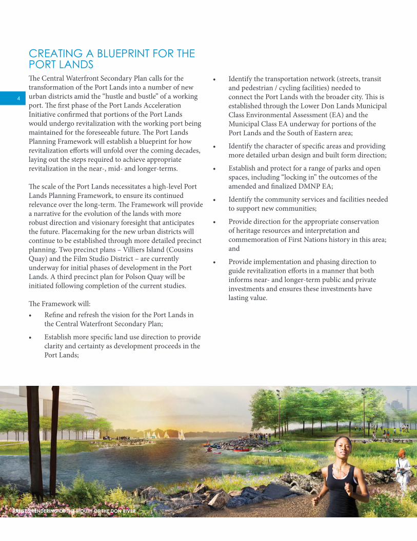
• Identify the transportation network (streets, transit and pedestrian / cycling facilities) needed to connect the Port Lands with the broader city. This is established through the Lower Don Lands Municipal Class Environmental Assessment (EA) and the Municipal Class EA underway for portions of the Port Lands and the South of Eastern area;
• Identify the character of specific areas and providing more detailed urban design and built form direction;
• Establish and protect for a range of parks and open spaces, including “locking in” the outcomes of the amended and finalized DMNP EA;
• Identify the community services and facilities needed to support new communities;
• Provide direction for the appropriate conservation of heritage resources and interpretation and commemoration of First Nations history in this area; and
• Provide implementation and phasing direction to guide revitalization efforts in a manner that both informs near- and longer-term public and private investments and ensures these investments have lasting value.
CREATING A BLUEPRINT FOR THE PORT LANDSThe Central Waterfront Secondary Plan calls for the transformation of the Port Lands into a number of new urban districts amid the “hustle and bustle” of a working port. The first phase of the Port Lands Acceleration Initiative confirmed that portions of the Port Lands would undergo revitalization with the working port being maintained for the foreseeable future. The Port Lands Planning Framework will establish a blueprint for how revitalization efforts will unfold over the coming decades, laying out the steps required to achieve appropriate revitalization in the near-, mid- and longer-terms.
The scale of the Port Lands necessitates a high-level Port Lands Planning Framework, to ensure its continued relevance over the long-term. The Framework will provide a narrative for the evolution of the lands with more robust direction and visionary foresight that anticipates the future. Placemaking for the new urban districts will continue to be established through more detailed precinct planning. Two precinct plans – Villiers Island (Cousins Quay) and the Film Studio District – are currently underway for initial phases of development in the Port Lands. A third precinct plan for Polson Quay will be initiated following completion of the current studies.
The Framework will:• Refine and refresh the vision for the Port Lands in
the Central Waterfront Secondary Plan;
• Establish more specific land use direction to provide clarity and certainty as development proceeds in the Port Lands;
ARTIST’S RENDERING OF THE MOUTH OF THE DON RIVER

5
needed to inform other studies underway, such as the Transportation and Servicing Master Plan and Film Studio District Precinct Plan.
This Land Use Direction sets clear expectations for land use, providing the foundation for continued planning and visioning to occur in the next stages of developing the Port Lands Planning Framework with continued community, landowner/user and agency consultation and participation. It is a path forward for the Port Lands. It allows for both the establishment of new urban, waterfront districts, while also allowing for the continued viability of marine and city-serving industrial operations.
In addition, this Land Use Direction:1. Provides greater clarity on how the wide range of
interests expressed in the consultations to date are being considered;
2. Provides the necessary direction and certainty for land uses in the Port Lands with the aim to eliminate or mitigate potential land use conflicts;
3. Identifies where there are opportunities to consolidate or relocate existing city serving and marine uses to facilitate future growth opportunities;
4. Identifies initial opportunities for improving public access and creating new spectacular waterfront parks and open spaces that will be further explored in the next stage of the process; and
5. Provides a foundation for achieving broader city building objectives and creating synergies with the South of Eastern employment area.
A STUDY IN PROGRESSThe City Planning Division and Waterfront Toronto, in consultation with the Toronto and Region Conservation Authority, are developing the Port Lands Planning Framework in phases. The first phase involved background research and the development of revitalization objectives to guide the study. In November 2013, the Port Lands Profile, documenting the background research, was released. An introductory community meeting was also held at the end of November 2013. The second phase of the process is currently underway. The intent of this phase is to create a cohesive and comprehensive vision for the Port Lands, starting with land use and connections. Land use options and infrastructure alternatives were drafted. A community meeting was held on February 13, 2014, followed by a March 5, 2014 workshop at which these options and alternatives were presented for feedback. This Land Use Direction is the product of those efforts. Additional analysis will occur over the coming months on other elements of the Framework. The final phase involves finalizing the Framework which will provide the basis for amending the Central Waterfront Secondary Plan.
A key component and necessary initial step for developing the Planning Framework is providing more detailed land use direction. As it stands today, a broad range of land uses are identified in the Central Waterfront Secondary Plan (CWSP) for the Port Lands. These uses include new mixed-use residential developments, knowledge-based industries, film and new media activities, “green” industries, recreational, cultural and tourist amenities, city-serving uses and marine-related industries.
The CWSP, however, does not identify where these uses should be located, nor does it resolve how these land uses can co-exist. Moreover, land use direction is also
Q2 2014 Q3 2014 Q4 2014 Q1 2015
May June July August September October November December January February MarchApril April May
Q1 2014
February MarchJanuary
Q4 2013
November DecemberOctober
Q2 2015
CCM #1 CCM #2 CCM #3PGM
CITYCOUNCIL
PGM
CITYCOUNCIL
SAC/LUAC SAC/LUAC SAC/LUACWORKSHOP
CHARRETTECHARRETTE
PORT LANDSPROFILE
Phase 1 Phase 2a Phase 2b Phase 3Research,
Gathering Input &Setting the Context
Objectives &Alternatives
Land Use StrategyPhase 2c
Continued Visioning &Elements of the
Framework
Finalizing the Framework
PORT LANDS PLANNING FRAMEWORK WORK PROGRAM

6
THE PORT LANDS AND THE SURROUNDING CONTEXTThe Port Lands, while generally underutilized, is an area that serves several purposes crucial to the City’s operations and prosperity. The Port Lands is Toronto’s only industrial marine port and is actively used for the import and storage of road salts and construction materials. The Port Lands are also home to power generation and distribution facilities that are important city-serving uses. The film industry, with a wide variety of industry assets, studios and related services in the Port Lands and area to the north (South of Eastern), is a major contributor to the City’s economy. The area’s natural heritage assets — extensive parkland and shoreline — provide a network of open spaces and regional recreational destinations. Opportunities to expand on these assets have been, and will continue to be, identified. This section provides a description of the current activities in the Port Lands and in the surrounding context.
3AERIAL OF THE PORT LANDS AND VICINITY

7
the Great Lakes shipping may involve vessels of greater size but they cannot access the Atlantic Ocean (The St. Lawrence Seaway Management Corporation, 2003).
The marine shipping season in Toronto is typically from late March to December since the Toronto Harbour, St. Lawrence Seaway, and Welland Canal partially freeze in the winter. During the winter months the port is still active as materials, particularly road salt, are shipped by truck from the Port Lands to other areas of the City. Compared to other forms of transport, such as rail or truck, marine shipping is the most fuel-efficient, least polluting and safest. According to the Great Lakes Maritime Research Institute, for every marine shipping accident there are approximately 15 train accidents and 75 truck accidents. The St. Lawrence Seaway Management Corporation estimates that shipping on the Great Lakes is 14 per cent more fuel efficient than shipping by rail and
close to 600 per cent more efficient than shipping by truck (Research and Traffic Group, 2013: 6). Furthermore, marine shipping produces fewer greenhouse gas emissions per tonne/kilometre than both the rail
and truck modes (Research and Traffic Group, 2013: 8).
Marine shipping is also beneficial because it does not directly contribute to traffic congestion and is not limited by the operating capacity of rail corridors. According to Statistics Canada, the busiest domestic trucking routes in Canada are between Toronto and Montreal, and between Hamilton and Toronto. Maintaining lands for port operations could provide opportunities to increase marine shipping between theses areas since they can be well served by the St. Lawrence Seaway and Lake Ontario.
The Port Lands has approximately 9,770 linear metres of dockwall, including dockwall on the Ship Channel, Turning Basin, Keating Channel, Essroc Quay, Cousins Quay, Polson Quay and the Toronto Port Authority site south of the Ship Channel. A substantial portion of the existing dockwall is not actively used, and in many areas the dockwall is in disrepair. The dockwalls are primarily owned by the Toronto Port Lands Company, with the exception of the dockwall at the Toronto Port Authority
A WORKING PORT While the Port Lands is actively used as an industrial port, it does not compete with other major port centres in Canada or abroad. Toronto’s port was ranked the 36th largest port in Canada and 11th among Ontario ports on the Great Lakes by cargo tonnage in 2011 (Statistics Canada, Shipping in Canada, 2012). The Port Lands is primarily a receiver of raw materials and supplies which support the growth of the city and maintain our civic infrastructure. The major cargoes delivered to the port include cement, salt and aggregates. Very little cargo is exported from the Port Lands.
Toronto relies on the Port Lands as its only industrial port area. The only other marine terminal in the city is Redpath’s operation west of Lower Jarvis Street. The closest alternative industrial port is Hamilton. This situation makes revitalization more challenging because, unlike many other cities post-industrial ports revitalization and redevelopment in cities such as HafenCity, Hamburg, Germany, or Rotterdam, Netherlands which have other ports that can be relied on, there is no opportunity to relocate industrial shipping within the City of Toronto. A new port area would need to be created adjacent to our waterfront elsewhere in the city, requiring new lake fill in our waterfront to accommodate this function. The balance of lands adjacent to our waterfront consists of stable or emerging neighbourhoods and parks and open spaces.
An industrial port has five characteristics that attribute to its successful function: dockwalls; space adjacent to dockwalls to facilitate shipments; loading / unloading equipment; access (intermodal connections via rail and truck); and separation from sensitive land uses. The Port Lands currently has all five of these characteristics, which need to be preserved to some degree in order to maintain the port function.
Toronto’s port is accessible to the rest of the Great Lakes via the Welland Canal and to overseas ports via the St. Lawrence Seaway. The St. Lawrence Seaway is limited by the capacity of the locks, which are insufficient to accommodate modern container ships, precluding viable international container shipping to Toronto. The maximum size vessel that can be accommodated in the Seaway, known as a seawaymax vessel, is 226 metres long, 24 metres wide, and has a draft of 27 feet. Shipping within
BULK SALT STORAGE SOUTH OF THE SHIP CHANNEL

8
their site. It has been accommodating Great Lakes cruise ships. A rail spur links Toronto Port Authority’s site with CN and CP rail corridors.
In addition its function as an industrial port, the Port Lands also accommodates several recreational boating facilities including the Bayside Rowing Club at theTurning Basin, the Great White North Dragon Boat Club near the Hearn discharge channel, the Royal Canadian Yacht Club (City Station) located adjacent to the Port of Toronto south of the Ship Channel, and the Outer Harbour Sailing Federation, consisting of eight member clubs, located in Cherry Beach and Clarke Beach Park on the north shore of the Outer Harbour.
CITY-SERVING USESThe Port Lands is home to a number of industrial and commercial uses that provide important services to the city. Power generation, distribution and maintenance is the most extensive city-serving use in the Port Lands in terms of the land it occupies, comprising the Portlands Energy Centre (PEC), two Hydro One switching stations that transform power from higher to lower voltages, transmission lines and towers, and a Toronto Hydro Service Centre. Other city-serving uses include the Commissioners Transfer Station, a Canada Post distribution facility and a Toronto Transit Commission garage for Wheel-Trans vehicles.
The PEC, located on Unwin Avenue across from the Turning Basin, is on an 11.3-hectare site that is owned by Ontario Power Generation Inc. (OPG), a public company wholly owned by the Government of Ontario. The PEC is a 550-megawatt natural gas-fired power plant operated by Hydro One that can supply up to 25 per cent of Toronto’s energy needs. The power plant is only in operation approximately 40 per cent of the time, typically during peak demand hours on regular business days to supply power to downtown Toronto(Portlands Energy Centre). In addition to producing electricity, the PEC is capable of producing steam (272,000 kg/hr) for district heating in the Port Lands if operated on a continuous basis (Environment Canada, 2010).
The two switching stations owned by Hydro One distribute electricity from the Portlands Energy Centre (PEC) to the rest of the City. One station is newly constructed and located adjacent to the PEC on the Hearn site. The other station is located on the north side of the Ship Channel at the foot of Bouchette Street. Both sites are provincially
site. The planned naturalization of the Don River mouth will result in a loss of 2,140 metres of dockwall along Keating Channel, Essroc Quay, Cousins Quay, and Polson Quay, reducing the total dockwall to approximately 7,630 metres.
Shipping activities in the Port Lands are mainly centred on the Ship Channel, which provides marine access and dockwall for large cargo ships. There are currently three salt companies that deliver salt to three properties located on the south side of the Ship Channel between Cherry Street and the Hearn. The salt is stored in outdoor piles covered by tarps. At the east end of the Ship Channel, Strada Aggregates and Essroc Canada (currently being relocated from Essroc Quay on Cherry Street) have long-term leases on municipally owned properties that are used for importing shipments of aggregates and concrete materials. Strada Aggregates and their aggregate product outdoors. Essroc Canada is completing construction on new silos for cement powder, and will also store aggregate product outdoors.
In addition to the Ship Channel, dockwall in Polson Quay is used by Lafarge Canada for importing cement powder, which is stored in enclosed silos and then trucked to concrete batching plants across the city. Redpath has also stored its sugar product on barges moored at Cousins Quay over the winter months. The DMNP EA and planning for the Lower Don Lands has protected for this activity. However, Redpath stored its product at the Toronto Port Authority’s site south of the Ship Channel this past year.
In 2013, a total of 950,349 metric tonnes of bulk and general cargo was shipped to the Port Lands. The average annual cargo tonnage shipped to the Port Lands in the last ten years (2004-2013) is 1.19 million metric tonnes. These figures do not include sugar shipments that are shipped directly from Redpath Sugar’s operation on Queens Quay East. During the last economic downtown in the late 2000s, shipping of the raw products destined to the Port Lands declined. With the recovery of the economy in the last few years, cargo tonnage of certain products shipped to the Port Lands increased.
Toronto Port Authority’s site located at the west end of the Ship Channel is a 20-hectares facility that receives and ships a variety of bulk and general cargo. The facility includes Marine Terminal 51 and Warehouse 52, which together provide 21,000 m2 of warehousing space. The International Marine Passenger Terminal is also located on

9
corporation owned by the federal government. The TTC garage, known as the Lakeshore Garage, is used for the storage and maintenance of Wheel-Trans vehicles. The garage consists of three buildings with a combined floor area of 15,569 m2 on a 2.84-hectare property. There is also a Toronto Water facility located at 545 Commissioners Street, which includes laboratories, office space, a fueling depot, storage yard and surface parking.
FILM INDUSTRYThe Port Lands has a number of film and film-related industries, including Pinewood Toronto Studios and supporting uses such as production equipment rental companies and post-production facilities. Pinewood Toronto Studios, located on the south side of Commissioners Street between Bouchette Street and the Don Roadway, is Toronto’s largest film studio complex with 12 stages, including the largest soundstage in North America.
Surface parking lots adjacent to the stages provide staging and parking for employees and productions. Pinewood Toronto Studios consist of purpose-built stages developed initially to attract major feature film productions. The studio complex currently occupies 4.9-hectares of land leased from the Toronto Port Lands Company. A secure perimeter around the studio complex restricts public access. Pinewood Toronto Studios has the ability to expand, with an option from the Toronto Port Lands company to lease an additional 7.3-hectares of land to the west and south of the existing complex from the Toronto Port Lands Company.
Showline Limited, another soundstage, is also located within the Port Lands. Additionally, there are a number of supporting uses in the Lower Don Lands, including PS Production Services, United Rentals and Studio City Rentals, which are production equipment rental companies. The Foundry Studios Complex (previously known as Cherry Beach Sound), has numerous tenants providing sound studio space and post-production services. The decommissioned Hearn Generating Station, currently on lease to Studios of America, is also used for film production and warehousing.
owned. Overhead transmission lines run across the Ship Channel between the two switching stations and continue on transmission towers north to Commissioners Street, east along Commissioners Street on three towers located in the middle of the right-of-way to the Don Roadway, north along the east side of the Don Roadway to Lake Shore Boulevard East, then northwest towards downtown Toronto.
The Toronto Hydro Service Centre, located at 500 Commissioners Street north of the Turning Basin, includes a large office building and outdoor storage on a 6.97-hectare property owned by the Toronto Port Lands Company, a municipal corporation wholly owned by the City of Toronto. Toronto Hydro holds a long-term lease on the property. The Commissioners Street Waste Management Facility, located at 400 Commissioners Street between Bouchette
Street and Logan Avenue, is on a 2.48-hectare property. The main building was originally constructed as an incinerator in 1953 before it was converted to a waste transfer station. The facility is a drop-off depot that accepts a wide range of waste and recycling materials, including garbage, blue bin recycling materials, household hazardous waste, electronic waste, construction waste, yard waste, tires, and scrap metal. All waste materials are stored indoors and compacted before they are trucked to the Green Lane Landfill located southwest of London, Ontario.
The Canada Post facility, and the Toronto Transit Commission (TTC) garage for Wheel-Trans vehicles are located on adjacent properties on the north side of Commissioners Street, west of Leslie Street, at 600 and 580 Commissioners Street respectively. The Canada Post facility is a letter carrier depot on a two-hectare property owned by the Canada Post Corporation, a crown
COMMISSIONERS TRANSFER STATION

10
The Martin Goodman / Waterfront Trail is a major pedestrian and cycle path that connects Port Lands parkland with the rest of the city. The trail, which runs along Cherry Street, through Clarke / Cherry Beach Park, along the east end of Unwin Avenue and along Leslie Street, is mostly separated from vehicular traffic. As part of earlier waterfront revitalization efforts, Leslie Street was enhanced with substantial landscaping, known as the Leslie Street Greening. This greening will be further enhanced and reinstated following completion of the new Leslie Barns Streetcar Yard and associated work.
MAJOR ASSETSThe Port Lands has several major assets that will be capitalized on and showcased in revitalization efforts. The most distinctive assets are the aquatic features and associated shorelines, including the Inner Harbour, Outer Harbour, Ship Channel, Turning Basin, Keating Channel and planned naturalization of the Don River mouth. The Ship Channel, which is 2.8 kilometres long and 120 metres wide, together with the Turning Basin, at 335 metres wide and 210 metres deep, provide over six kilometres of water’s edge frontage. All lands within the Port Lands are within 500 metres, or a five minute walk, from the water’s edge.
Framing the north side of the Outer Harbour is Clarke / Cherry Beach Park, which includes beaches, active recreational space including sports fields, and naturalized areas. This park connects with Tommy Thompson Park, which includes the Leslie Street Spit. There are plans to merge and improve these parks through the Lake Ontario Park Master Plan, which is discussed in Section 4 of this report.
The shorelines along much of the Ship Channel, Turning Basin and Keating Channel provide opportunity for a new public promenade in accordance with the Central Waterfront Secondary Plan. The future naturalization of the Don River mouth will be surrounded by open space in the form of a river valley, creating the setting for Promontory Park, a planned public park facing the Inner Harbour and the downtown.
Other parkland assets include McCleary Park, a 2.8-hectare park on Lake Shore Boulevard East between Bouchette Street and Logan Street, which features two lighted baseball diamonds and cricket pitch, and Jennifer Kateryna Koval’s’kyj Park, a 0.14-hectare park located at the west end of Polson Street overlooking the Inner Harbour and city’s skyline.
INDUSTRIAL / WAREHOUSING
COMMERCIAL
FILM SECTOR & RELATED
UTILITIES
TEMPORARY USE / VACANT
TRANSPORTATION
SHIPPING / OPEN STORAGE
PARKS
PARKING
FRONT STREET EAST
GARDINER EXPRESSWAY
DON VALLEY PARKWAY
LAKE SHORE BOULEVARD EAST
TEERTS EI LSELEUNEVA WALRAC
EUNEVA NAGOL
EASTERN AVENUE
Keating Channel
Don River
KING STREET EAST
DON ROADWAY
CHERRY STREET
LESLIE STREET
Leslie Barns
EASTERN AVENUE
UNWIN AVENUE
COMMISSIONERS STREET
Hydro OneSwitching Stations
PEC
Lafarge
Toronto PortAuthority
Bulk Storageof Road Salts
PinewoodFilm Studios
Toronto Hydro
Service Centre
The Hearn
EssrocRelocation
CommissionersTransfer Station
FIGURE 1: EXISTING LAND USES

11
INDUSTRIAL / WAREHOUSING
COMMERCIAL
FILM SECTOR & RELATED
UTILITIES
TEMPORARY USE / VACANT
TRANSPORTATION
SHIPPING / OPEN STORAGE
PARKS
PARKING
FRONT STREET EAST
GARDINER EXPRESSWAY
DON VALLEY PARKWAY
LAKE SHORE BOULEVARD EAST
TEERTS EI LSELEUNEVA WALRAC
EUNEVA NAGOL
EASTERN AVENUE
Keating Channel
Don River
KING STREET EAST
DON ROADWAY
CHERRY STREET
LESLIE STREET
Leslie Barns
EASTERN AVENUE
UNWIN AVENUE
COMMISSIONERS STREET
Hydro OneSwitching Stations
PEC
Lafarge
Toronto PortAuthority
Bulk Storageof Road Salts
PinewoodFilm Studios
Toronto Hydro
Service Centre
The Hearn
EssrocRelocation
CommissionersTransfer Station
FIGURE 1: EXISTING LAND USES
cultural and/or community uses that could serve as a catalyst for revitalization.
Other heritage structures listed on the City’s Inventory include, but are not limited to, the bascule bridge that crosses the Ship Channel at Cherry Street, the Commissioners Transfer Station, the Essroc silos on Cherry Street used for cement storage, which will soon be vacated when Essroc relocates its operations to the east end of the Ship Channel, and the silos on Lafarge’s property on Polson Quay.
The Port Lands also has a number of potential cultural heritage landscapes. A cultural heritage landscape is defined as a geographical area of heritage significance which has been modified by human activities and is valued by a community. The entire Port Lands was created through the implementation of the Toronto Harbour Commission’s 1912 Waterfront Development Eastern Section Plan and its continued evolution has contributed to the formation of an industrial landscape that offers tremendous opportunities to emphasize the legacy of Toronto’s working harbour. As such, the entire Port Lands is a potential cultural heritage landscape. Specific cultural heritage landscapes within the Port Lands include the Ship Channel, Turning Basin, Keating Channel, rail lines and spurs, and the streetscapes of Villiers Street, Commissioners Street, Cherry Street and the Don Roadway.
The Port Lands has several heritage buildings and structures listed in the City’s Inventory of Heritage Properties, as well as one designated under the Ontario Heritage Act. These buildings and structures could be repurposed to celebrate and showcase the area’s industrial heritage. Probably the most iconic of the heritage buildings is the Hearn Generating Station (the Hearn), a decommissioned power plant with its 213-metre high chimney stack located on the south side of the Ship Channel adjacent to the PEC. The Hearn is a massive building capable of being repurposed for a variety of

12
to the north. This area features industrial-type buildings and offices with a range of business establishments, including film studios and other creative industries. While the creative industry sector experienced a sharp decline in the mid- to late 2000s, this sector remains firmly entrenched in the area. There are a number of soundstages, including Cinespace, Revival 629 and Film Port. The existing employment uses provide approximately 4,000 jobs with the largest employment sector being the public sector. There is also a small residential enclave of two- and three-storey houses between Booth Avenue and Carlaw Avenue. At the intersection of Lake Shore Boulevard East and Leslie Street there are two supermarkets and three fast-food establishments with large surface parking lots.
Over the past 30 years there has been a steady decline in traditional industry in the South of Eastern area. To address the loss of jobs and lack of investment, the City initiated the South of Eastern Strategic Direction, a planning study focused on economic development, urban design and transportation. The study will identify:
• Strategies to encourage investment and development to create new jobs;
• Transportation needs to support employment uses and provide better connections to surrounding areas; and
• Urban design guidelines for the built form and public realm.
The study is being coordinated with the Port Lands and South of Eastern Transportation and Servicing Master Plan, with this Environmental Assessment informing, in part, the transportation aspect of the study.
The South of Eastern area has a number of large redevelopment sites, which are key to the area’s future.
THE PORT LANDS IN CONTEXTThe Port Lands is centrally located on Toronto’s waterfront, situated approximately five kilometres southeast of the downtown area. The Port Lands is surrounded by a variety of distinct land uses and natural features. To the west is the Inner Harbour and views to downtown Toronto. To the south is the Outer Harbour, and Tommy Thompson Park, a recreational destination also known as the Leslie Street Spit. To the east are industrial city-serving uses including Ashbridges Bay Treatment Plant and a new TTC streetcar yard known as the Leslie Barns. To the north, east of the Don Valley, is an employment area referred to as the South of Eastern area. West of the Don Valley are existing and planned mixed-use neighbourhoods.
EAST OF LESLIE STREETTo the east of the Port Lands are allotment gardens at the north end of Tommy Thompson Park and city-serving industrial uses including, a Transportation Services yard, and the Leslie Barns, which is a new TTC storage and maintenance facility that will be completed in late 2014 for the City’s new fleet of low-floor streetcars. Further east is the Ashbridges Bay Treatment Plant, one of four treatment plants in Toronto, and one of the largest wastewater treatment plants in Canada. The treatment plant is a heavy industrial use that sometimes causes sewage odour that adversely impacts surrounding lands, particularly after a heavy rainfall. The treatment plant currently relies on rail spurs for the delivery of chlorine and other chemicals used to treat sewage.
SOUTH OF EASTERNTo the north of the Port Lands is the South of Eastern Employment Area. The Employment Area is bounded by the Don River to the west, Woodfield Road to the east, Lake Shore Boulevard East to the south and Eastern Avenue
EXISTING 6-STOREY BUILDING ON THE UNILEVER SITE
13
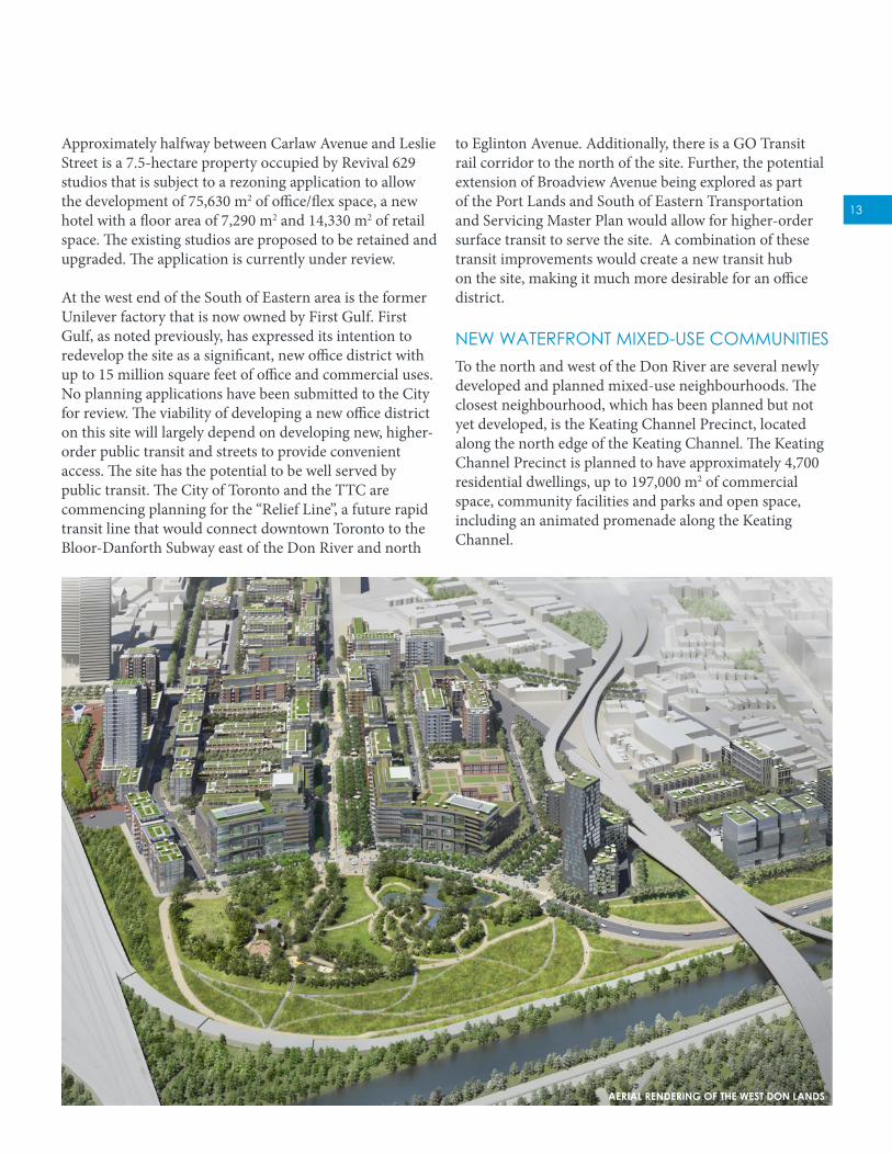
to Eglinton Avenue. Additionally, there is a GO Transit rail corridor to the north of the site. Further, the potential extension of Broadview Avenue being explored as part of the Port Lands and South of Eastern Transportation and Servicing Master Plan would allow for higher-order surface transit to serve the site. A combination of these transit improvements would create a new transit hub on the site, making it much more desirable for an office district.
NEW WATERFRONT MIXED-USE COMMUNITIESTo the north and west of the Don River are several newly developed and planned mixed-use neighbourhoods. The closest neighbourhood, which has been planned but not yet developed, is the Keating Channel Precinct, located along the north edge of the Keating Channel. The Keating Channel Precinct is planned to have approximately 4,700 residential dwellings, up to 197,000 m2 of commercial space, community facilities and parks and open space, including an animated promenade along the Keating Channel.
Approximately halfway between Carlaw Avenue and Leslie Street is a 7.5-hectare property occupied by Revival 629 studios that is subject to a rezoning application to allow the development of 75,630 m2 of office/flex space, a new hotel with a floor area of 7,290 m2 and 14,330 m2 of retail space. The existing studios are proposed to be retained and upgraded. The application is currently under review.
At the west end of the South of Eastern area is the former Unilever factory that is now owned by First Gulf. First Gulf, as noted previously, has expressed its intention to redevelop the site as a significant, new office district with up to 15 million square feet of office and commercial uses. No planning applications have been submitted to the City for review. The viability of developing a new office district on this site will largely depend on developing new, higher-order public transit and streets to provide convenient access. The site has the potential to be well served by public transit. The City of Toronto and the TTC are commencing planning for the “Relief Line”, a future rapid transit line that would connect downtown Toronto to the Bloor-Danforth Subway east of the Don River and north
AERIAL RENDERING OF THE WEST DON LANDS

14
North of the Keating Channel Precinct is the historic Distillery District, which is a mixed-use neighbourhood that emphasizes its industrial heritage with the adaptive reuse of several Victorian-era industrial buildings set amid pedestrian cobblestone streets. According to 2011 census data, the Distillery District has 797 residential dwellings, substantial commercial and retail space, and various cultural uses.
West of the Keating Channel Precinct is East Bayfront, a newly planned mixed-use community that is now under construction with the first residential buildings expected to be complete in 2016. East Bayfront will provide approximately 6,000 residential dwellings, 8,000 new jobs, 279,000 m2 of retail space and 5.5 hectares of parks and public space.
SOUTH OF EASTERNSTRATEGIC DIRECTION
PORT LANDSPLANNING FRAMEWORK
PORT LANDS + SOUTH OF EASTERNTRANSPORTATION + SERVICING
MASTER PLAN
VILLIERS ISLAND (COUSINS QUAY)PRECINCT PLAN
FILM STUDIO DISTRICTPRECINCT PLAN
SOUTH OF EASTERNSTRATEGIC DIRECTION
PORT LANDSPLANNING FRAMEWORK
PORT LANDS + SOUTH OF EASTERNTRANSPORTATION + SERVICING
MASTER PLAN
FRONT STREET EAST
TEERTS EILSEL
LRAC
EUNEVA NAGOL
GARDINER EXPRESSWAY
Leslie Barns
COMMISSIONERS STREET
LAKE SHORE BOULEVARD EAST
WESTDON
LANDS
GARDINEREXPRESSWAYINDIVIDUAL
EA
DISTILLERYDISTRICT
CHERRYSTREET
TRANSITEA
EASTBAYFRONT
QUEENSQUAY
TRANSITEA
WATERFRONTSANITARY
SERVICING MASTER PLAN
DON RIVER & CENTRAL
WATERFRONTCLASS EA
KEATINGCHANNELPRECINCT
PLAN
LOWER DONRIVER WEST
REMEDIAL FLOODPROTECTION
PROJECT
LESLIEVILLE
LOWER DONLANDS
FRAMEWORKPLAN
DMNPEA LAKE
ONTARIOPARK
MASTER PLAN
LOWER DONLANDS
INFRASTRUCTUREMASTER PLAN
LESLIEBARNS
TRANSIT PROJECTASSESSMENT
OUTERHARBOURMARINACHERRY
BEACH
CHERRYBEACH
SPORTSFIELDS
UNILEVER
FIGURE 2: CONTEXT MAP

15
SOUTH OF EASTERNSTRATEGIC DIRECTION
PORT LANDSPLANNING FRAMEWORK
PORT LANDS + SOUTH OF EASTERNTRANSPORTATION + SERVICING
MASTER PLAN
VILLIERS ISLAND (COUSINS QUAY)PRECINCT PLAN
FILM STUDIO DISTRICTPRECINCT PLAN
SOUTH OF EASTERNSTRATEGIC DIRECTION
PORT LANDSPLANNING FRAMEWORK
PORT LANDS + SOUTH OF EASTERNTRANSPORTATION + SERVICING
MASTER PLAN
FRONT STREET EAST
TEERTS EILSEL
LRAC
EUNEVA NAGOL
GARDINER EXPRESSWAY
Leslie Barns
COMMISSIONERS STREET
LAKE SHORE BOULEVARD EAST
WESTDON
LANDS
GARDINEREXPRESSWAYINDIVIDUAL
EA
DISTILLERYDISTRICT
CHERRYSTREET
TRANSITEA
EASTBAYFRONT
QUEENSQUAY
TRANSITEA
WATERFRONTSANITARY
SERVICING MASTER PLAN
DON RIVER & CENTRAL
WATERFRONTCLASS EA
KEATINGCHANNELPRECINCT
PLAN
LOWER DONRIVER WEST
REMEDIAL FLOODPROTECTION
PROJECT
LESLIEVILLE
LOWER DONLANDS
FRAMEWORKPLAN
DMNPEA LAKE
ONTARIOPARK
MASTER PLAN
LOWER DONLANDS
INFRASTRUCTUREMASTER PLAN
LESLIEBARNS
TRANSIT PROJECTASSESSMENT
OUTERHARBOURMARINACHERRY
BEACH
CHERRYBEACH
SPORTSFIELDS
UNILEVER
hectares of parks and public space, including Corktown Common, the area’s signature new park and flood protection landform. The first new residents began moving into the area in spring 2013. OUTER HARBOUR, TOMMY THOMPSON PARK CLARKE / CHERRY BEACH PARKThe Outer Harbour, located south of Clarke / Cherry Beach, is a sheltered body of water often used as a recreational destination for boating, paddleboarding and kite boarding. Tommy Thompson Park, also known as the Leslie Street Spit, is a peninsula made of landfill on the south side of the Outer Harbour that includes over 260 hectares of parkland, a wildlife sanctuary and a five kilometre trail. The park is currently only open to the public on weekends since it is still used as a landfill for construction materials during the week. Once landfill operations cease, the park could be expanded to over 500 hectares.
Clarke / Cherry Beach is located on the north shore of the Outer Harbour at the foot of Cherry Street. The west side of the beach is popular with kiteboarders and there is also an off-leash dog area. In 2008, the Cherry Beach Sports Fields were built as part of waterfront revitalization efforts. The sports fields consist of two regulation-sized elite soccer and lacrosse fields, new landscaping and permanent restroom facilities. These fields were developed to assist in meeting the high demand for playing fields in Toronto.
Adjacent to the historic Distillery District is the West Don Lands, a 32-hectare brownfield currently under construction as part of waterfront revitalization efforts. The West Don Lands is a new mixed-use community that is also home to the 14-hectare Athletes’ Village for the 2015 Pan/Parapan Am Games. At full build-out, the West Don Lands will include approximately 6,000 residential dwellings, substantial retail and commercial space and 9.3
CHERRY BEACH SPORTS FIELDS
16
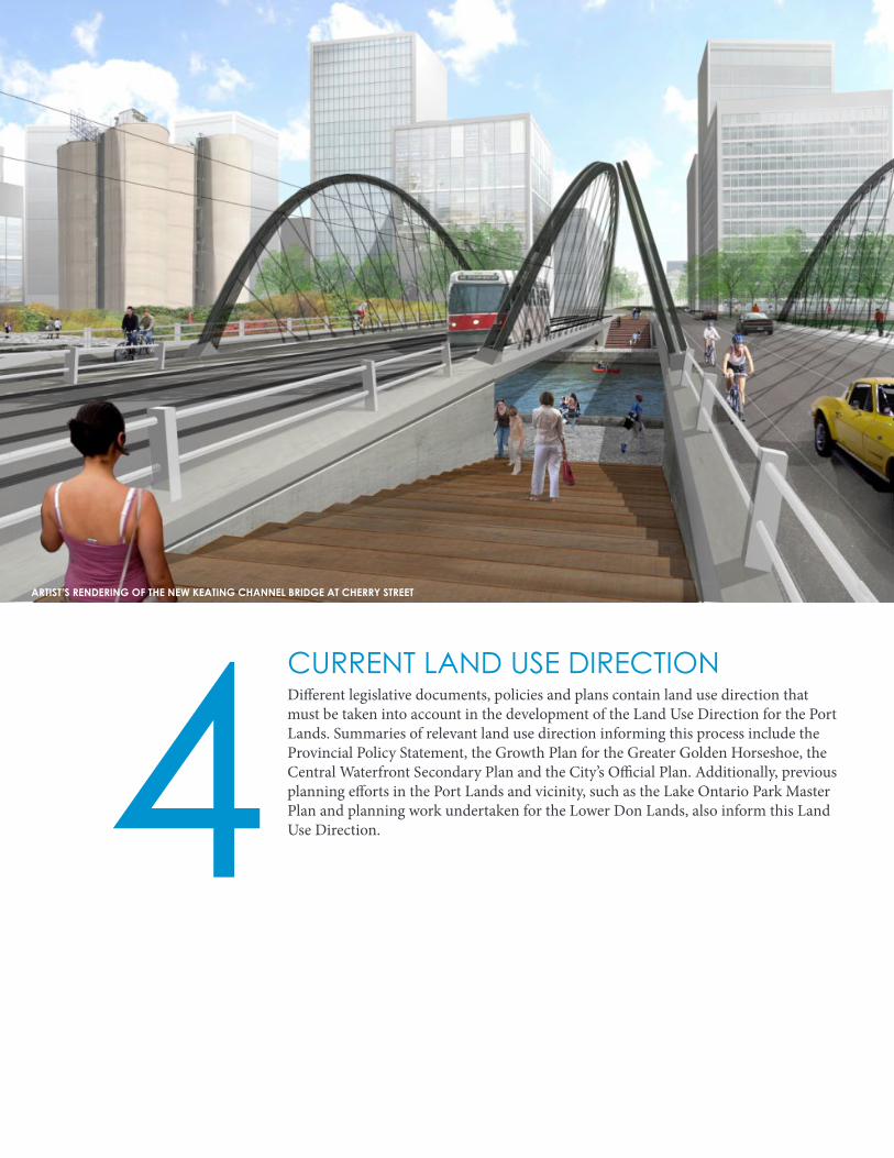
CURRENT LAND USE DIRECTIONDifferent legislative documents, policies and plans contain land use direction that must be taken into account in the development of the Land Use Direction for the Port Lands. Summaries of relevant land use direction informing this process include the Provincial Policy Statement, the Growth Plan for the Greater Golden Horseshoe, the Central Waterfront Secondary Plan and the City’s Official Plan. Additionally, previous planning efforts in the Port Lands and vicinity, such as the Lake Ontario Park Master Plan and planning work undertaken for the Lower Don Lands, also inform this Land Use Direction. 4
ARTIST’S RENDERING OF THE NEW KEATING CHANNEL BRIDGE AT CHERRY STREET
17
GROWTH PLANThe Growth Plan for the Greater Golden Horseshoe provides a framework for implementing the provincial
government’s vision for building stronger, prosperous communities by better managing growth within the Greater Golden Horseshoe. The Growth Plan guides decisions on a wide range of issues including transportation, infrastructure, urban form, housing, natural
heritage and resource protection. Land use planning decisions are required to conform to the Growth Plan.
The Growth Plan identifies population and employment forecasts for the City of Toronto that the City is required to plan for. The Growth Plan also provides policy direction relating to how municipalities, including the City of Toronto, intensify. Key applicable policies for the development of this Land Use Direction include:
• Providing a diverse and compatible mix of land uses, including residential and employment uses, to support vibrant neighbourhoods; and
• Planning for land uses adjacent to, or in the vicinity of, transportation facilities such as rail yards and dockyards that are compatible with, and supportive of, the primary goods movement function of these facilities.
The employment conversion policies of the Growth Plan do not apply to employment areas consisting of downtown or regeneration areas. For these areas, the employment area policies of the PPS apply.
PROVINCIAL POLICY STATEMENTIssued under Section 3 of the Planning Act, the Provincial Policy Statement (PPS) provides policy direction on matters of provincial interest related to land use planning and development in Ontario. Land use planning decisions are required to be consistent with the PPS.
A new policy statement came into effect April 30, 2014. The PPS 2014 applies to land use decisions for the Port Lands. The PPS is to be read as a whole, and applies to both the macro city level and the micro local level. Some of the PPS’s policies are more specific to the macro level such as the requirement to assess employment area conversion requests only through a comprehensive review.
The PPS 2014 supports building strong, liveable and resilient communities by promoting a mix of land uses in a compact form with transportation choices that facilitate pedestrian mobility and other modes of travel. New strengthened policy directives have been introduced that promote active transportation and transit-supportive development. Additionally, the PPS 2014 identifies that compact, mixed-use development with compatible employment uses will be promoted.
A key change in the PPS 2014 pertinent to the Land Use Direction for the Port Lands is the introduction of policy direction to protect the long-term operation and economic role of marine and rail facilities. The PPS 2014 also now requires that these facilities are appropriately designed, buffered and/or separated from sensitive land uses, like residential uses, to prevent or mitigate adverse effects and to ensure the long-term viability of these facilities.

18
Moreover, in planning for new subways, light rapid transit and GO routes, the location of established and potential new office concentrations are to be considered.
Additional site specific policies were also introduced through the MCR process for sites within the South of Eastern area. Policy 426 encourages comprehensively planning the Unilever site as an employment precinct that is fully integrated and connected to the surrounding area and that includes a mix of non-residential land uses, primarily consisting of offices, post-secondary colleges/universities/trade schools, hotels, studios and research facilities. Policy 427 was introduced for the Revival 629 studios site, which sets parameters within which the certain uses may be permitted. Secondary uses to primary employment uses up to a maximum of 20 per cent of the site’s total gross floor area may be considered.
CENTRAL WATERFRONT SECONDARY PLANSecondary Plans are more detailed policy documents applying to a specific geographic area. They adapt and implement the objectives, land use designations and overall planning approach of the parent official plan to fit within local contexts.
The Central Waterfront Secondary Plan (CWSP) was adopted by City Council in 2003 as an amendment to the former City of Toronto Official Plan to spell out key public priorities and opportunities for Toronto’s waterfront. While the CWSP is not in force for the Port Lands due to appeals to the Ontario Municipal Board, it continues to represent Council policy to guide the revitalization of the lands. The CWSP is based on four key principles: • Removing Barriers and Making Connections;
• Building a Network of Spectacular Waterfront Parks and Public Spaces;
• Promoting a Clean and Green Environment; and
• Creating Dynamic and Diverse New Communities.
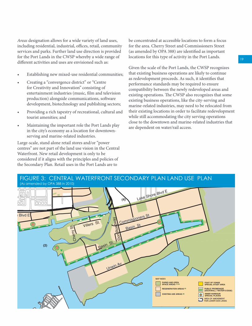
The CWSP generally provides for a mixed-use policy direction for the Central Waterfront area as a whole, including the Port Lands. The Port Lands are largely designated Regeneration Areas in the CWSP (Figure 3). The Toronto Port Authority site at the Inner Harbour is designated Existing Use Areas and the remaining lands are designated Parks and Open Space Areas. The Regeneration
CITY OFFICIAL PLANThe City’s Official Plan is a long-term vision for how the city should grow. The Plan is not in effect in the Central Waterfront area. However, the Plan provides important insight into long-term, broader city building objectives that are key considerations for the development of this Land Use Direction. The City’s Official Plan came into effect in 2006. It recognizes the Central Waterfront, which includes the Port Lands, as a unique opportunity for employment and residential growth. New business ventures and neighbourhoods in the Central Waterfront are seen as an extension to Toronto’s downtown area, strengthening and contributing to the vitality of our economy and urban lifestyle appeal.
The Planning Act requires that a city’s official plan be reviewed every five years. The City of Toronto began this review in 2011 with some aspects now complete such as the mandated Municipal Comprehensive Review (MCR) that looked specifically at designated areas of employment. Municipalities are only permitted to consider conversions of employment areas to allow for non-employment uses through the MCR. The Province is now reviewing the City’s MCR and revised employment policies. A decision is anticipated shortly.
The City’s MCR confirmed that the South of Eastern Employment Area, located to the north of the Port Lands across Lake Shore Boulevard East, continues to be an important and needed employment area. New policy direction was also introduced that promotes office growth, and in particular the development of large freestanding office buildings, to the Downtown, Central Waterfront, the Centres, and within 500 metres of rapid transit stations such as subways, light rapid transit routes and GO stations.
19
(2)
(4)
(4)
Cox
wel
l Av
Lesl
ie S
t
Car
law
Av
Bro
advi
ew A
v
Par
limen
t St
She
rbou
rne
St
Jarv
is S
t
Yon
ge S
t
Bay
St
Blu
e Ja
ys W
ay
Sim
coe
St
John
St
Spa
dina
Av
Bat
hurs
t St
Queen St E
Eastern Av
Lake Shore Blvd EWellington St
Front St
Richmond StAdelaide St
King St
Don
Val
ley
Pkw
y
Bay
view
Av
Bremner Blvd
Commissioners St
Unwin Av
Lake Shore Blvd EFort York Blvd
Existing F G Gardiner Expressway
Queens Quay W Basin St
(1) SEE MAP C FOR FURTHER DETAIL(2) NEW MOUTH OF DON RIVER SHOWN CONCEPTUALLY(3) SEE DEFINITIONS SECTION FIVE: MAKING IT HAPPEN, 1) A SIMPLIFIED APPROACH TO LAND USE REGULATION
FOOT OF YONGESPECIAL STUDY AREA
PUBLIC PROMENADE(DOCKWALL / WATER'S EDGE)
INNER HARBOURSPECIAL PLACES
EXISTING USE AREAS
REGENERATION AREAS
PARKS AND OPENSPACE AREAS (1) (3)
(3)
(3)
January 29,2008
(4) INTERSECTION AND / OR ALIGNMENT CONFIGURATION SUBJECT TO FURTHER STUDY
Villers St.
AREA OF AMENDMENTFOR LOWER DON LANDS
Don
Roa
dway
Basin St.
Che
rry
St.
Central Waterfront
OMB NUMBER OMB EXHIBIT NUMBER
Revised July 2010
NOVEMBER 2011
Revised Nov. 2011
FIGURE 3: CENTRAL WATERFRONT SECONDARY PLAN LAND USE PLAN(As amended by OPA 388 in 2010)
FOOT OF YONGESPECIAL STUDY AREA
PUBLIC PROMENADE(DOCKWALL / WATER'S EDGE)
INNER HARBOURSPECIAL PLACES
EXISTING USE AREAS
REGENERATION AREAS
PARKS AND OPENSPACE AREAS (1) (3)
(3)
(3)
AREA OF AMENDMENTFOR LOWER DON LANDS
be concentrated at accessible locations to form a focus for the area. Cherry Street and Commissioners Street (as amended by OPA 388) are identified as important locations for this type of activity in the Port Lands.
Given the scale of the Port Lands, the CWSP recognizes that existing business operations are likely to continue as redevelopment proceeds. As such, it identifies that performance standards may be required to ensure compatibility between the newly redeveloped areas and existing operations. The CWSP also recognizes that some existing business operations, like the city-serving and marine-related industries, may need to be relocated from their existing locations in order to facilitate redevelopment while still accommodating the city serving operations close to the downtown and marine-related industries that are dependent on water/rail access.
Areas designation allows for a wide variety of land uses, including residential, industrial, offices, retail, community services and parks. Further land use direction is provided for the Port Lands in the CWSP whereby a wide range of different activities and uses are envisioned such as:
• Establishing new mixed-use residential communities;
• Creating a “convergence district” or “Centre for Creativity and Innovation” consisting of entertainment industries (music, film and television production) alongside communications, software development, biotechnology and publishing sectors;
• Providing a rich tapestry of recreational, cultural and tourist amenities; and
• Maintaining the important role the Port Lands play in the city’s economy as a location for downtown-serving and marine-related industries.
Large-scale, stand alone retail stores and/or “power centres” are not part of the land use vision in the Central Waterfront. New retail development is only to be considered if it aligns with the principles and policies of the Secondary Plan. Retail uses in the Port Lands are to

20
FIGURE 4: LOWER DON LANDS AND DMNP EA PREFERRED SOLUTION (2013)
proposed “a vision that included retaining the Keating Channel, and relocating the new naturalized valley and river mouth” to the south of the Keating Channel, integrating renaturalization with placemaking and creating a much sought-after destination to live, work and play. The design formed the basis of an alternative assessed during the DMNP EA process, eventually being selected as the preferred EA alternative. Waterfront Toronto used this preferred alternative as a basis for the development of a Framework Plan for the Lower Don Lands and Precinct Plan for the Keating Channel Precinct.
The completed plans received endorsement by City Council in 2010, including the adoption of an Official Plan Amendment (OPA 388) for the Lower Don Lands and zoning by-law amendment for the lands north of Keating Channel and west of the Cherry Street in the Keating Precinct. OPA 388 introduced specific land use policy direction for the Lower Don Lands. The policy direction states that the Lower Don Lands “comprise a new urban district within the Port Lands and will be developed into a number of diverse mixed-use communities focused around the renaturalized Don River and the historic Keating Channel”. While not in effect due to appeals
LOWER DON LANDS PLANNINGPlanning for the Lower Don Lands began following the creation of the Toronto Waterfront Revitalization Corporation (now known as Waterfront Toronto), the agency created by the three levels of government in 2001 with a mandate to revitalize 2,000 acres of brownfield lands on Toronto’s waterfront. The renaturalization of the mouth of Don River and flood protecting the Port Lands were identified as one of four priority projects by all three levels of government. The Toronto and Region Conservation Authority (TRCA) initiated the Don Mouth Naturalization and Port Lands Flood Protection Project Environmental Assessment (DMNP EA) in 2004 on behalf of Waterfront Toronto. A terms of reference for the Environmental Assessment was completed in 2006. Initially, renaturalization and flood protection was to occur in the vicinity of the Keating Channel, with the creation of a greenway along the Don Roadway to the Ship Channel.
As part of the planning efforts for the DMNP EA, Waterfront Toronto held a design competition in 2007 to assist in establishing a master vision and to help address the myriad of challenges that were emerging. The winning design by Michael Van Valkenburg and Associates

21
BAYVIEW A
VE.
DO
N VA
LLEY PARKWA
Y
PARLIA
MEN
T AVE.
JARVIS STREET
YON
GE STREET
FRONT STREET
QUEEN STREET
CARLA
W A
VE.
EILS
EL ST
TEER
CO
XWELL
AVE
.
WO
OA
ENI
BD
VE.
VICTO
RIAPA
RA
KVE
.
LAKESHORE BLVD.
AL K SE HO R E B LVD.
QUEENS QU AY
DO
N R
OA
DW
AY
CH
ERRY S
TRE
ET
COMMISSIONERS BLVD.
UNWIN AVE .
GLEN
MA
NO
R DR.
SILVER BIRCH
THE SPIT
THE BASE LANDS
THE BAR
THE BAY
TORONTO INNER HARBOUR
TORONTO ISLAND PARK
LOWER DON
WEST DONLANDS
EASTERN BEACHES
LESLIEVILLE
ASHBRIDGE’S BAY TREATMENT PLANT
1
3
4
5
9
6
9
9
9
14
15
16
17
13
18
19
20 2122
23
2425
26
27
28
29
30
31
32
33
34
35
36
37
38
40
39
4142
4344
45
46
47
4849
50
51
52
53
54
55
56
58
58
59
60
61
62
63
64
65
66
67
68
7072
74 73
75
2
78
10
11
12
6971
57
FIGURE 5: LAKE ONTARIO PARK MASTER PLAN (2008)
preferred solution (Figure 4). The final DMNP EA has been submitted to the Province for approval.
LAKE ONTARIO PARK MASTER PLANThe Central Waterfront Secondary Plan identifies the creation of a “new Lake Ontario Park” as a “Big Move” to provide Toronto with an enhanced, continuous urban park system along the waterfront which would include Clarke / Cherry Beach Park, Tommy Thompson Park and the Base Lands. In 2006, Waterfront Toronto began preparing the Lake Ontario Park Master Plan (Figure 5) to guide the future implementation of this important regional park. The Lake Ontario Park Master Plan was completed in 2008, but has not yet received Council endorsement.
PORT LANDS ACCELERATION INITIATIVE PHASE 1The first phase of the Port Lands Acceleration Initiative (PLAI) was undertaken in 2011 to refine the DMNP EA and develop a business and implementation plan to
to both the CWSP and to OPA 388, the mixed-use community land use direction has long been established for the Lower Don Lands, with the precise mix of residential and employment development to be established through detailed precinct planning for the area.
The original plan for the Lower Don Lands and the renaturalization of the mouth of the Don River assumed that certain existing uses, such as the Lafarge site on Polson Slip, would no longer operate within the Lower Don Lands. The plan also included promontories that extended into the Inner Harbour, precluding future mooring of ships as is the current practice by Redpath for the storage of their sugar product over the winter months. This issue was addressed during the first phase of the Port Lands Acceleration Initiative, resulting in a revised plan which recognizes existing users while still respecting the original mixed-use direction for the lands. The revised plan also maintains a richness of ecological and open space design opportunities. Outcomes of the first phase of the Port Lands Acceleration Initiative are discussed in more detail below. Through 2013, the three co-proponents of the DMNP EA refined and finalized the

22
be retained in place. Further, the PLAI recognized that given the scale of the Port Lands and the projected level of demand, there would be no immediate need for these lands to be redeveloped. Port-related industrial activity was seen as a part of the essential character of the Port Lands with these uses creatively woven into its future.
accelerate development. This phase of the PLAI confirmed that the Port Lands will become a new mixed-use area, with diverse precincts combining residential, employment, retail and port-related uses at an intensity appropriate to its central city location (Figure 6). The review examined the appropriate future uses for all areas within the Port Lands.
As noted above, the Lower Don Lands continued to be identified for new mixed-use communities to the north and south of the naturalized river valley. The Film Studio District was envisioned as generally being developed with a new office district, having a strong mix of employment uses and drawing on the catalytic effect of expanding Film Studio uses based on a market demand forecast prepared by Cushman and Wakefield Limited. The market demand forecast identified a stronger than anticipated potential demand for office and retail activity. At the time, a significant office node in the South of Eastern area, as currently being proposed by First Gulf on the Unilever site, was not contemplated.
The lands and existing uses to the east and south of the Ship Channel were identified as being important for the successful functioning of the city and were to generally
*
*
REVIR NODKRAP
YAWLLIPS
DO
N R
IVER
KEATING CHANNEL
SOIDUTS MLIF
SDRAY TRL
DO
N R
OA
DW
AY
CA
RLA
W A
VE.
COMMISSIONERS ST. LESLIE S
T.
LAKE SHORE BLVD. E.
QUEEN’S QUAY
UNWIN AVE.
.EVA NRETSAE
CH
ERR
Y ST.
GARDINER EXPRESSWAY
DON
VALLEY
PAR
KW
AY
DO
N R
OA
DW
AY
DO
N
RO
AD
WA
Y
CH
ERRY STR
EET
CH
ERR
Y S
TREET
COMMISSIONERS STREET
POLSON STREET
VILLIERS STREET
COMMISSIONERS STREET
UNWIN AVENUE
UNWIN AVENUE
LAKE SHORE BOULEVARD EAST
LESLI
E S
TR
EET
LESLI
E S
TREE
T
CA
RLA
W
AVEN
UE
LOG
AN
A
VEN
UE
BO
UC
HET
TE S
TREE
T
SA
ULT
ER S
TREE
T
EASTERN AVENUE
Keating Channel
Don R
iver
Commissioners St.Completed to Cherry St.
New Lake Shore Blvd
LRT Transit
Future PhaseBridge
Future PhaseBridges
New River is In Place
Future Continuation of Promenade
New River Crossing
Port Lands Acceleration Initiative Plan (2012)
FIGURE 6: PORT LANDS ACCELERATION INITIATIVE (2012)

23
REVITALIZATION OBJECTIVESSix revitalization objectives for the Port Lands were drafted by the project team prior to the initial community meeting held on November 28, 2013. The objectives were presented at this community meeting for feedback from the public and stakeholders. The objectives are being used to inform the development of the planning framework and other studies currently underway. The objectives, as revised based on feedback received, are presented on the following page.
In addition to the revitalization objectives, a draft vision statement was developed by the project team following the February 13, 2014 community consultation meeting. The draft vision statement, as amended to reflect comments received, is:
The Port Lands will be transformed into a number of new, vibrant urban districts with unique local identities and character. The new districts take their cue from the naturalized river valley, spectacular waterfront parks and open spaces, remnants of the area’s industrial past, and the energy and vibrancy of the city’s working port and creative industries that call the area home.
The Ship Channel, Quays, Keating Channel and sites adjacent to the new river valley offer incredible water’s edge development opportunities that embrace the theatre and richness of the city’s working port while contributing to the overall economic viability of the city.
5ARTIST’S RENDERING OF THE VISION FOR SHIP CHANNEL AND ADJACENT DEVELOPMENT

24
industrial heritage. The future Lake Ontario Park, which includes Tommy Thompson Park, the Base Lands and Leslie Spit, is a key asset that distinguishes the Port Lands as a unique destination for people, and provides habitat for wildlife.
DEVELOPING A HIGH-QUALITY PUBLIC REALMA comprehensive network of public parks and open spaces of all different sizes will be developed that capitalizes on the Port Lands’ waterfront setting, the new river valley, the Ship Channel and future Lake Ontario Park. The new parks and open spaces will provide a range of recreational opportunities. High-quality streetscapes, outstanding parks, natural linkages and new public facilities with the highest caliber of design will be secured to ensure that the complete communities and new employment clusters created in the Port Lands are great places to live, work and visit.
CONTRIBUTING TO THE SUSTAINABLE FUTURE OF THE CITYThe dynamic mix of uses developed in a walkable, urban form, the creation of new jobs and opportunities and continued port activity will be the cornerstones of the Port Lands’ and the city’s sustainable future.
Equally important is ensuring that all aspects of redevelopment contribute to a healthy and sustainable environment. Leading-edge and innovative approaches will be utilized that showcase the revitalized Port Lands as a leader of sustainable development on the world’s stage. Reducing resource consumption, providing low-carbon developments, minimizing dependency on the private automobile and fostering new technologies will be just some of the principles that are employed to optimize the sustainability of the revitalized Port Lands.
PROVIDING FLEXIBILITY AND CERTAINTY IN THE PLAN’S IMPLEMENTATIONThe Port Lands, at 356 hectares, will incrementally redevelop over an extended period of time. The planning framework for the Port Lands must allow for a high degree of flexibility to accommodate changes over time. Notwithstanding this flexibility, it must also be specific enough to ensure that public and private investments contribute to the long-term vision for the Port Lands and have lasting value.
CREATING AN INTERESTING AND DYNAMIC URBAN MIX The revitalized Port Lands will be a dynamic and vibrant area of the city. A number of new inclusive, sustainable, urban-scaled, compact, mixed-use communities and employment areas will be created. The Port Lands will be developed with a diverse mix of uses for residents, employees and tourists. Each new urban area will have a unique local identity and character. The Port Lands will have a variety of building forms, predominantly consisting of mid-rise buildings, to add interest and create a dynamic, distinctive new skyline for the city.
Water permeates and influences all facets of the revitalized Port Lands given its proximity to the waterfront, new river valley and continued port activity. A number of new destinations and special places are to be developed which promote walking and taking transit, provide opportunities for social interaction and contribute to an interesting urban life.
CONNECTING THE PORT LANDS TO THE CITY Enhanced physical, social and visual connections will connect the Port Lands to the city. These connections include a network of fine-grained public streets with animated streetscapes, higher-order transit, new bridges, enhanced pedestrian and cycling connections and the renaturalized Don River. New public street connections will provide permeability into, out of and within the Port Lands. The public streets and land uses will promote synergies between the South of Eastern area and the Port Lands by stitching these two areas together, and better connecting the Port Lands with the rest of the city. The unparalleled views, including those of the city’s skyline, will be protected, framed by development and celebrated. New views to the water’s edge, river valley and iconic structures will also be created.
LEVERAGING THE PORT LANDS ASSETSThe Port Lands are an important remnant of the city’s industrial past and portions have since evolved into wonderfully diverse natural areas. There is also a rich history of First Nations activity in the area that will be commemorated and interpreted through a variety of means. Significant and iconic heritage resources will be conserved, repurposed and appropriately leveraged to contribute to placemaking and to celebrate the Port Lands’
25
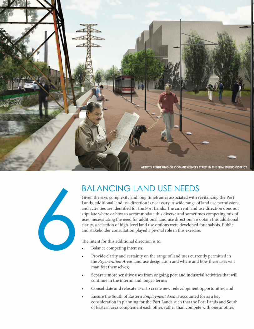
BALANCING LAND USE NEEDSGiven the size, complexity and long timeframes associated with revitalizing the Port Lands, additional land use direction is necessary. A wide range of land use permissions and activities are identified for the Port Lands. The current land use direction does not stipulate where or how to accommodate this diverse and sometimes competing mix of uses, necessitating the need for additional land use direction. To obtain this additional clarity, a selection of high-level land use options were developed for analysis. Public and stakeholder consultation played a pivotal role in this exercise.
The intent for this additional direction is to:• Balance competing interests;
• Provide clarity and certainty on the range of land uses currently permitted in the Regeneration Areas land use designation and where and how these uses will manifest themselves;
• Separate more sensitive uses from ongoing port and industrial activities that will continue in the interim and longer-terms;
• Consolidate and relocate uses to create new redevelopment opportunities; and
• Ensure the South of Eastern Employment Area is accounted for as a key consideration in planning for the Port Lands such that the Port Lands and South of Eastern area complement each other, rather than compete with one another.
6ARTIST’S RENDERING OF COMMISSIONERS STREET IN THE FILM STUDIO DISTRICT