BPG Bangkok Photo Walks Magazine Edition #2 Wong Wian Yai Walk #29
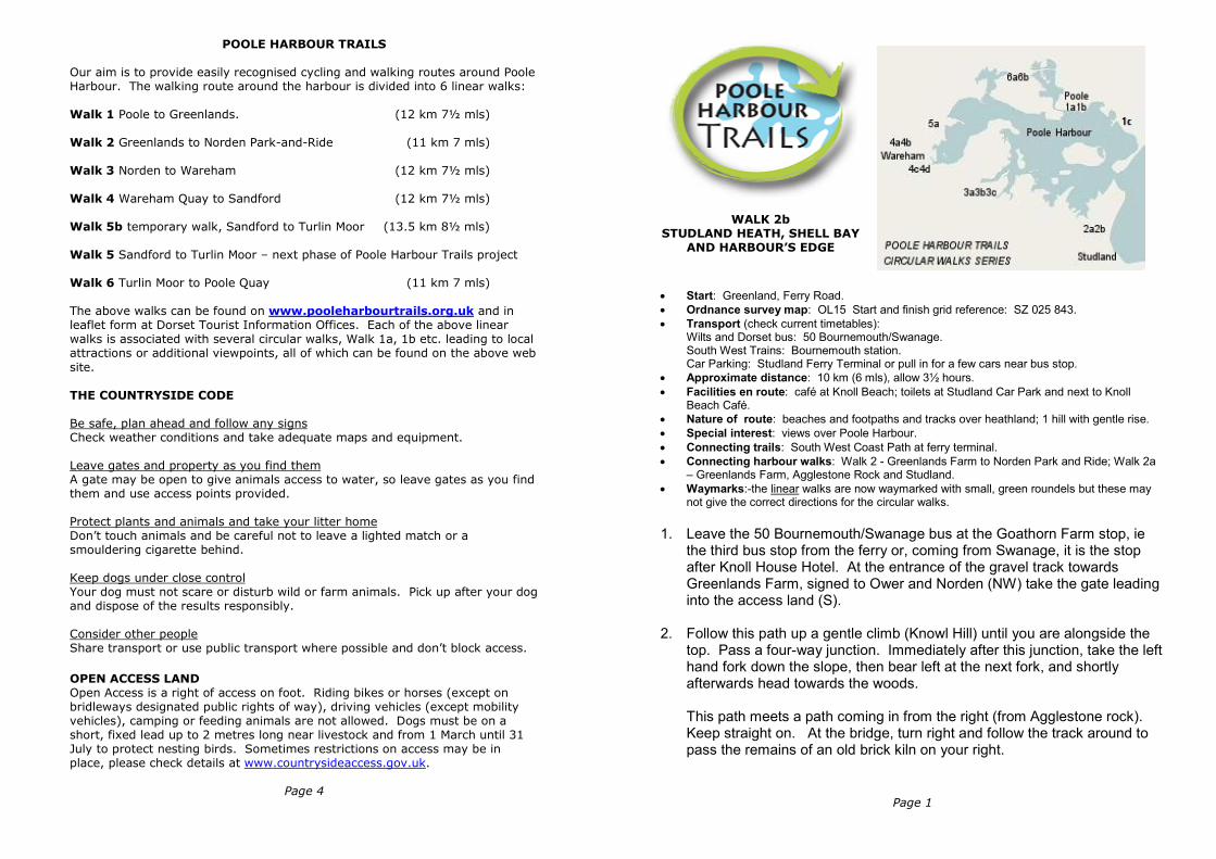
POOLE HARBOUR TRAILS
Our aim is to provide easily recognised cycling and walking routes around Poole Harbour. The walking route around the harbour is divided into 6 linear walks:
Walk 1 Poole to Greenlands. (12 km 7½ mls) Walk 2 Greenlands to Norden Park-and-Ride (11 km 7 mls) Walk 3 Norden to Wareham (12 km 7½ mls) Walk 4 Wareham Quay to Sandford (12 km 7½ mls) Walk 5b temporary walk, Sandford to Turlin Moor (13.5 km 8½ mls) Walk 5 Sandford to Turlin Moor – next phase of Poole Harbour Trails project
Walk 6 Turlin Moor to Poole Quay (11 km 7 mls) The above walks can be found on www.pooleharbourtrails.org.uk and in leaflet form at Dorset Tourist Information Offices. Each of the above linear walks is associated with several circular walks, Walk 1a, 1b etc. leading to local attractions or additional viewpoints, all of which can be found on the above web
site.
THE COUNTRYSIDE CODE
Be safe, plan ahead and follow any signs Check weather conditions and take adequate maps and equipment. Leave gates and property as you find them A gate may be open to give animals access to water, so leave gates as you find them and use access points provided. Protect plants and animals and take your litter home Don’t touch animals and be careful not to leave a lighted match or a smouldering cigarette behind. Keep dogs under close control Your dog must not scare or disturb wild or farm animals. Pick up after your dog and dispose of the results responsibly. Consider other people Share transport or use public transport where possible and don’t block access.
OPEN ACCESS LAND
Open Access is a right of access on foot. Riding bikes or horses (except on bridleways designated public rights of way), driving vehicles (except mobility vehicles), camping or feeding animals are not allowed. Dogs must be on a short, fixed lead up to 2 metres long near livestock and from 1 March until 31 July to protect nesting birds. Sometimes restrictions on access may be in place, please check details at www.countrysideaccess.gov.uk.
Page 4
Page 1
WALK 2b
STUDLAND HEATH, SHELL BAY
AND HARBOUR’S EDGE
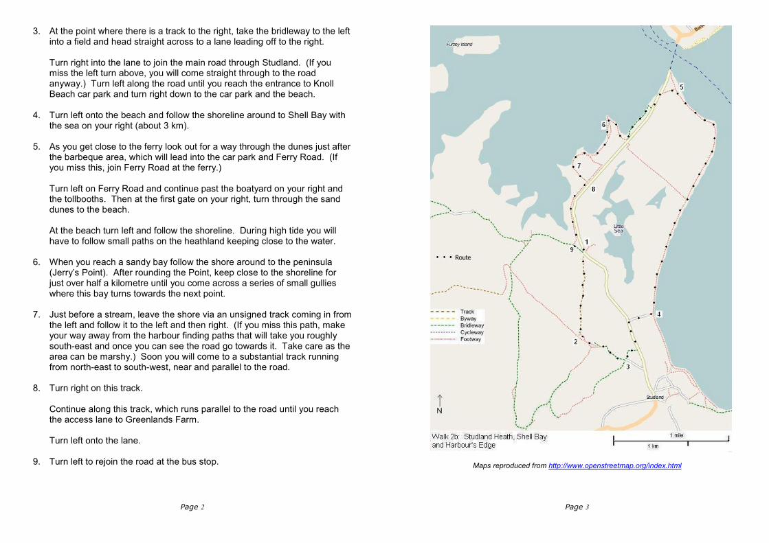
• Start: Greenland, Ferry Road.
• Ordnance survey map: OL15 Start and finish grid reference: SZ 025 843.
• Transport (check current timetables): Wilts and Dorset bus: 50 Bournemouth/Swanage. South West Trains: Bournemouth station. Car Parking: Studland Ferry Terminal or pull in for a few cars near bus stop.
• Approximate distance: 10 km (6 mls), allow 3½ hours.
• Facilities en route: café at Knoll Beach; toilets at Studland Car Park and next to Knoll Beach Café.
• Nature of route: beaches and footpaths and tracks over heathland; 1 hill with gentle rise.
• Special interest: views over Poole Harbour.
• Connecting trails: South West Coast Path at ferry terminal.
• Connecting harbour walks: Walk 2 - Greenlands Farm to Norden Park and Ride; Walk 2a – Greenlands Farm, Agglestone Rock and Studland.
• Waymarks:-the linear walks are now waymarked with small, green roundels but these may not give the correct directions for the circular walks.
1. Leave the 50 Bournemouth/Swanage bus at the Goathorn Farm stop, ie
the third bus stop from the ferry or, coming from Swanage, it is the stop after Knoll House Hotel. At the entrance of the gravel track towards Greenlands Farm, signed to Ower and Norden (NW) take the gate leading into the access land (S).
2. Follow this path up a gentle climb (Knowl Hill) until you are alongside the top. Pass a four-way junction. Immediately after this junction, take the left hand fork down the slope, then bear left at the next fork, and shortly afterwards head towards the woods. This path meets a path coming in from the right (from Agglestone rock). Keep straight on. At the bridge, turn right and follow the track around to pass the remains of an old brick kiln on your right.
Page 2
3. At the point where there is a track to the right, take the bridleway to the left into a field and head straight across to a lane leading off to the right. Turn right into the lane to join the main road through Studland. (If you miss the left turn above, you will come straight through to the road anyway.) Turn left along the road until you reach the entrance to Knoll Beach car park and turn right down to the car park and the beach.
4. Turn left onto the beach and follow the shoreline around to Shell Bay with the sea on your right (about 3 km).
5. As you get close to the ferry look out for a way through the dunes just after the barbeque area, which will lead into the car park and Ferry Road. (If you miss this, join Ferry Road at the ferry.) Turn left on Ferry Road and continue past the boatyard on your right and the tollbooths. Then at the first gate on your right, turn through the sand dunes to the beach. At the beach turn left and follow the shoreline. During high tide you will have to follow small paths on the heathland keeping close to the water.
6. When you reach a sandy bay follow the shore around to the peninsula (Jerry’s Point). After rounding the Point, keep close to the shoreline for just over half a kilometre until you come across a series of small gullies where this bay turns towards the next point.
7. Just before a stream, leave the shore via an unsigned track coming in from the left and follow it to the left and then right. (If you miss this path, make your way away from the harbour finding paths that will take you roughly south-east and once you can see the road go towards it. Take care as the area can be marshy.) Soon you will come to a substantial track running from north-east to south-west, near and parallel to the road.
8. Turn right on this track. Continue along this track, which runs parallel to the road until you reach the access lane to Greenlands Farm. Turn left onto the lane.
9. Turn left to rejoin the road at the bus stop.
Page 3
Maps reproduced from http://www.openstreetmap.org/index.html