Pontcysyllte Aqueduct and Canal World Heritage Site ... · adopted as a Supplementary Planning...
20
Pontcysyllte Aqueduct & Canal WORLD HERIT AGE SITE S U P P L E M E N TA RY P L A N N I N G D O C U M E N T Supplementary Planning Document Draft for Consultation Autumn 2011
Transcript of Pontcysyllte Aqueduct and Canal World Heritage Site ... · adopted as a Supplementary Planning...

Pontcysyllte Aqueduct & Canal W O R L D H E R I T A G E S I T E
S U P P L E M E N T A R Y P L A N N I N G D O C U M E N T
Supplementary Planning Document Draft for Consultation Autumn 2011

-
Supplementary
Planning Document
Draft for Consultation
Autumn 2011
Pontcysyllte Aqueduct & Canal WORLD HERITAGE SITE
Content 1 Introduction 1
2 Planning Policy Context 1
3 World Heritage Site - The Inscibed Site 2
4 Buffer Zone and its Purpose 3
5 Vision for Managing Development 3
6 General Guidance - Planning Applications 4
7 Development Affecting Associated Undesignated Features 8
8 Other Considerations 8
9 Key Background Documents 10
10 WHS Nomination, Management, Characterisation and Features 11
Plan 1 Location Plan 2
Plan 2 Typical Development Scenarios 5
Table 1 Typical Development Scenarios 6
Appendix I Map 1: Pontcysyllte Aqueduct and Canal World Heritage Site 12
Appendix II Additional Clarification 14

1. Introduction 1.1 This guidance note has been jointly produced by the three Local Authorities of Wrexham County Borough Council, Denbighshire County Council and Shropshire Council in relation to the Pontcysyllte Aqueduct and Canal World Heritage Site. This guidance note amplifies development plan policies of the three respective Councils and is a material consideration in the determination of planning applications that affect the World Heritage Site and its setting. It is intended to provide guidance to developers, members of the public, Officers and Members of the Council.
1.2 The aim is to ensure the integrity of the Pontcysyllte Aqueduct and Canal World Heritage Site, its buildings, structures and landscape are maintained. New development should ensure no adverse impact. It is recommended that dependant on the type and complexity of development that applicants discuss their proposals with the relevant Council prior to submitting any application to ensure there are no specific requirements arising from the World Heritage Site Inscription.
2. Planning Policy Context 2.1 Welsh Planning Guidance
● Chapter 6 Planning Policy Wales (2011)
● Welsh Office Circular 60/96: Planning and the Historic Environment: Archaeology
● Welsh Office Circular 61/96: Planning and the Historic Environment: Historic Buildings and Conservation Areas
● Wrexham Unitary Development Plan 19962011 (Policies EC7 Conservation Areas and EC11 Archaeology)
● Denbighshire UDP 1996-2011: Policy CON5 Development Within Conservation Areas and Policy CON10 Scheduled Ancient Monuments
2.2 English Planning Guidance
● Circular 07/09 Protection of World Heritage Sites (2009),
● Planning Policy Statement 1: Delivering Sustainable Development
● Planning Policy Statement 5: Planning for the Historic Environment
● Planning Policy Statement 7: Sustainable Development in Rural Areas
● Shropshire Council Core Strategy: CS6 Sustainable Design and Development Principles
2.3 Due to the difference in the Welsh and English planning systems, this document will be adopted as a Supplementary Planning Document for Wrexham and Denbighshire. However for Shropshire Council this document will be used to inform the development of a Supplementary Planning Document regarding the historic environment.
2.4 Within England the Government propose to replace the current planning policy statements with a single National Planning Policy framework document this is currently in a consultation draft form.
2.5 This guidance note will be reviewed when the respective Local Planning Authorities adopt their respective Local Development Plans/Frameworks. Please seek advice of the relevant Local Planning Authority regarding the most recently adopted plan.
1

3. World Heritage Site – The Inscribed Site 3.1 World Heritage Sites are places of Outstanding Universal Value to the whole of humanity. The Pontcysyllte Aqueduct and Canal achieved World Heritage Site status in June 2009 because its value and significance is clearly expressed within the integrity and authenticity of its features and its landscape and cultural setting.
3.2 The World Heritage Site inscription site forms a linear corridor which extends from the Horseshoe Falls west of Llangollen (Denbighshire) to Gledrid Bridge to the east of Chirk Bank (Shropshire) (see Map 1 in Appendix 1). The area inscribed within the World Heritage Site
incorporates the Pontcysyllte Aqueduct and associated engineering features Horseshoe Falls, Chirk Aqueduct, the Llangollen feeder canal, cuttings, embankments and tunnels. The immediate visual setting of the Horseshoe Falls, Pontcysyllte Aqueduct and Chirk Aqueduct are also included.
Plan 1: Location Plan
2

4. Buffer Zone and its Purpose 4.1 The Outstanding Universal Value of the World Heritage Site is not contained purely within the inscribed area. The cultural, settled and aesthetic landscape which contribute to the presentation, setting, sense of arrival and history of the World Heritage Site are all important to the integrity of the designation. Buildings, archaeology, views and landscape features combine in places to form distinctive character and sense of place which compliment the experience and understanding of the World Heritage Site. A Buffer Zone has therefore been drawn around the World Heritage Site to allow historic, cultural and landscape elements which contribute to the authenticity and integrity of the Site and therefore to its Outstanding Universal Value to be conserved.
4.2 The boundary follows the principal ridgelines of the Dee, Chirk and Ceiriog valleys to include the Site’s broad landscape and visual context (see Map 1 in Appendix 1).
4.3 The Buffer Zone itself is not of Outstanding Universal Value, it simply defines the outer limits of a zone containing areas which by association with the World Heritage Site are important to the Site’s Outstanding Universal Value. It is not the purpose of the Buffer Zone to impose a blanket conservation approach to the entire area, but to encourage sustainable development which through contextual awareness conserves and enhances the World Heritage Site.
4.4 The ICOMOS Xian Declaration of 2005 is the reference point for understanding setting in the context of a World Heritage Site. http://www.international.icomos.org/xian2005/xian -declaration.htm
4.5 The full statement of Outstanding Universal Value for the Pontcysyllte Aqueduct and Canal and the criteria the Site meets can be found at http://whc.unesco.org/en/list/1303. Further explanation can be seen in Appendix 2.
5. Vision for Managing Development 5.1 The objective of the Local Planning Authorities responsible for protecting the World Heritage Site is to manage development in a positive way that supports the vision for the Management of the World Heritage Site.
5.2 The following objectives are taken from page 79 of the Pontcysyllte World Heritage Site Management Plan (2007 - 2012):
● To manage the World Heritage Site and Buffer Zone in a sustainable manner to conserve, enhance and present the Outstanding Universal Value of the Site locally and internationally.
● To balance the needs of protection, conservation and access, the interests of the local community and the achievement of sustainable growth.
● To engage with and deliver benefits to the local communities around the Site.
● To attract visitors to the area; and
● To generate income that adds value to the local economy or is reinvested in the running of the Site.
3
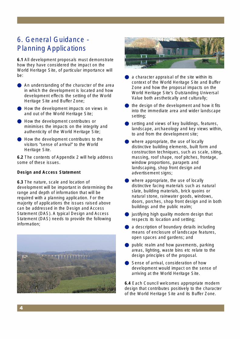
6. General Guidance Planning Applications 6.1 All development proposals must demonstrate how they have considered the impact on the World Heritage Site, of particular importance will be:
● An understanding of the character of the area in which the development is located and how development effects the setting of the World Heritage Site and Buffer Zone;
● How the development impacts on views in and out of the World Heritage Site;
● How the development contributes or minimises the impacts on the integrity and authenticity of the World Heritage Site;
● How the development contributes to the visitors ”sense of arrival” to the World Heritage Site.
6.2 The contents of Appendix 2 will help address some of these issues.
Design and Access Statement
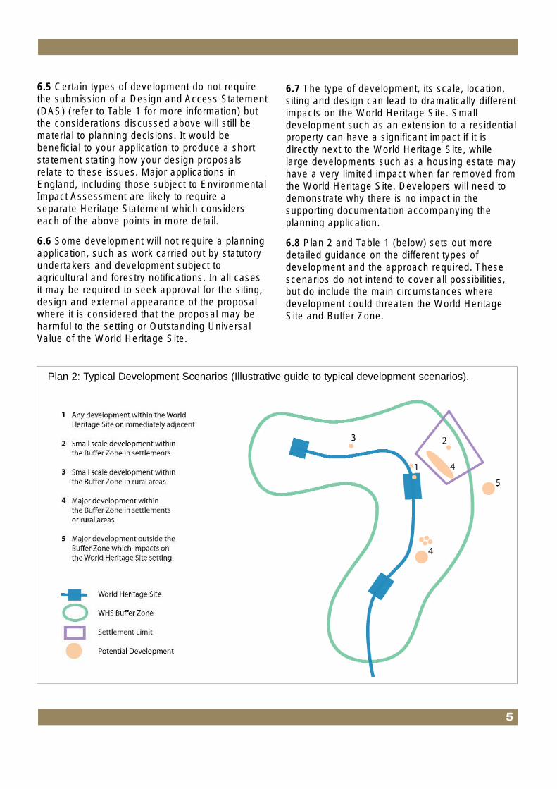
6.3 The nature, scale and location of development will be important in determining the range and depth of information that will be required with a planning application. For the majority of applications the issues raised above can be addressed in the Design and Access Statement (DAS). A typical Design and Access Statement (DAS) needs to provide the following information;
● a character appraisal of the site within its context of the World Heritage Site and Buffer Zone and how the proposal impacts on the World Heritage Site’s Outstanding Universal Value both aesthetically and culturally;
● the design of the development and how it fits into the immediate area and wider landscape setting;
● setting and views of key buildings, features, landscape, archaeology and key views within, to and from the development site;
● where appropriate, the use of locally distinctive building elements, built form and construction techniques, such as scale, siting, massing, roof shape, roof pitches, frontage, window proportions, parapets and landscaping, shop front design and advertisement signs;
● where appropriate, the use of locally distinctive facing materials such as natural slate, building materials, brick quoins or natural stone, rainwater goods, windows, doors, porches, shop front design and in both buildings and the public realm;
● justifying high quality modern design that respects its location and setting;
● a description of boundary details including means of enclosure of landscape features, open spaces and gardens; and
● public realm and how pavements, parking areas, lighting, waste bins etc relate to the design principles of the proposal.
● Sense of arrival, consideration of how development would impact on the sense of arriving at the World Heritage Site.
6.4 Each Council welcomes appropriate modern design that contributes positively to the character of the World Heritage Site and its Buffer Zone.
4
6.5 Certain types of development do not require the submission of a Design and Access Statement (DAS) (refer to Table 1 for more information) but the considerations discussed above will still be material to planning decisions. It would be beneficial to your application to produce a short statement stating how your design proposals relate to these issues. Major applications in England, including those subject to Environmental Impact Assessment are likely to require a separate Heritage Statement which considers each of the above points in more detail.
6.6 Some development will not require a planning application, such as work carried out by statutory undertakers and development subject to agricultural and forestry notifications. In all cases it may be required to seek approval for the siting, design and external appearance of the proposal where it is considered that the proposal may be harmful to the setting or Outstanding Universal Value of the World Heritage Site.
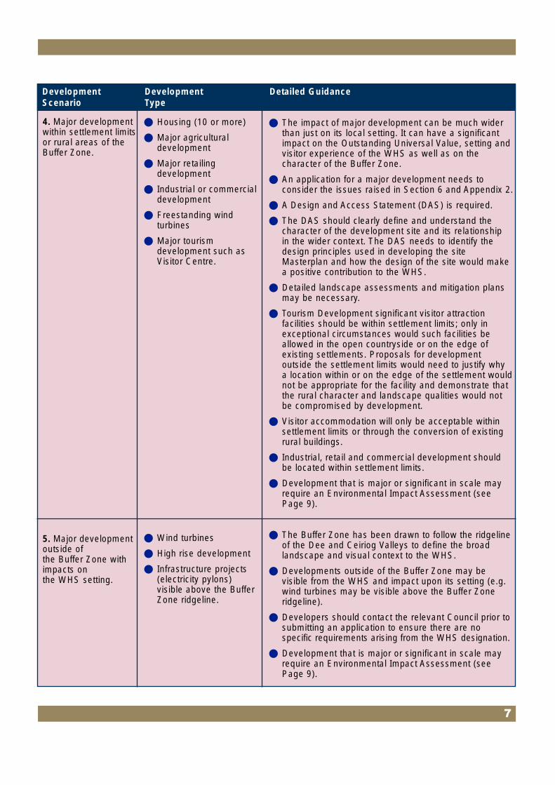
6.7 The type of development, its scale, location, siting and design can lead to dramatically different impacts on the World Heritage Site. Small development such as an extension to a residential property can have a significant impact if it is directly next to the World Heritage Site, while large developments such as a housing estate may have a very limited impact when far removed from the World Heritage Site. Developers will need to demonstrate why there is no impact in the supporting documentation accompanying the planning application.
6.8 Plan 2 and Table 1 (below) sets out more detailed guidance on the different types of development and the approach required. These scenarios do not intend to cover all possibilities, but do include the main circumstances where development could threaten the World Heritage Site and Buffer Zone.
Plan 2: Typical Development Scenarios (Illustrative guide to typical development scenarios).
5

(less than 10 dwellings).
Table 1 – Typical Development Scenarios
1. Any development within the WHS, or immediately adjacent to it.
2. Small scale development within the Buffer Zone in settlement limits.
3. Small scale development within the Buffer Zone in rural areas.
● Typically small scale
● Householder (residential extensions and conservatories)
● Changes of use
● Minor tourist development (toilets, small parking areas, picnic areas).
● Householder developments
● Shop front or small scale retail development in urban areas
● Minor development
● Rural conversions
● Small scale agricultural development.
● Minor tourist development for essential small scale facilities could be appropriate in the open countryside where the openness of the countryside is maintained.
● Design and materials important.
● Statement required to state how the development contributes to the WHS’s character.
● Use the guidance within Section 6 and Appendix 2 to assess whether the proposal is of local impact or of wider impact on the WHS.
● Detail this analysis within a Design and Access Statement (DAS). If it can be demonstrated that the proposal is of local impact the DAS should look towards local character for design guidance.
● Any development that impacts on the WHS’s “sense of arrival” or on buildings or landscape features e.g. archaeological features or buildings of historical or cultural association with the WHS that contribute to its Outstanding Universal Value should stipulate how the effects of development will be mitigated.
● Use the guidance within Section 6 and Appendix 2 to assess whether the proposal is of local impact or of wider impact on the WHS.
● Detail this analysis within a Design and Access Statement (DAS).
● If it can be demonstrated that the proposal is of local impact the DAS should look towards local character for design guidance.
● Any development that impacts on the WHS’s “sense of arrival” or on buildings or landscape features e.g. archaeological features or buildings of historical or cultural association with the WHS that contribute to its Outstanding Universal Value should identify how the effects of development will be mitigated.
● Development subject to agricultural notifications may be required to seek approval for the siting, design and external appearance of the proposal where it is considered that the proposal may be harmful to the setting or Outstanding Universal Value of the WHS.
● Development by Statutory Undertakers (Gas and Electricity) may require approval for the design and external appearance of works as detailed in the General Permitted Development Order.
Detailed Guidance Development Type
Development Scenario
6
within settlement limits 4. Major development
or rural areas of the Buffer Zone.
5. Major development outside of the Buffer Zone with impacts on the WHS setting.
● Housing (10 or more)
● Major agricultural development
● Major retailing development
● Industrial or commercial development
● Freestanding wind turbines
● Major tourism development such as Visitor Centre.
● Wind turbines
● High rise development
● Infrastructure projects (electricity pylons) visible above the Buffer Zone ridgeline.
● The impact of major development can be much wider than just on its local setting. It can have a significant impact on the Outstanding Universal Value, setting and visitor experience of the WHS as well as on the character of the Buffer Zone.
● An application for a major development needs to consider the issues raised in Section 6 and Appendix 2.
● A Design and Access Statement (DAS) is required.
● The DAS should clearly define and understand the character of the development site and its relationship in the wider context. The DAS needs to identify the design principles used in developing the site Masterplan and how the design of the site would make a positive contribution to the WHS.
● Detailed landscape assessments and mitigation plans may be necessary.
● Tourism Development significant visitor attraction facilities should be within settlement limits; only in exceptional circumstances would such facilities be allowed in the open countryside or on the edge of existing settlements. Proposals for development outside the settlement limits would need to justify why a location within or on the edge of the settlement would not be appropriate for the facility and demonstrate that the rural character and landscape qualities would not be compromised by development.
● Visitor accommodation will only be acceptable within settlement limits or through the conversion of existing rural buildings.
● Industrial, retail and commercial development should be located within settlement limits.
● Development that is major or significant in scale may require an Environmental Impact Assessment (see Page 9).
● The Buffer Zone has been drawn to follow the ridgeline of the Dee and Ceiriog Valleys to define the broad landscape and visual context to the WHS.
● Developments outside of the Buffer Zone may be visible from the WHS and impact upon its setting (e.g. wind turbines may be visible above the Buffer Zone ridgeline).
● Developers should contact the relevant Council prior to submitting an application to ensure there are no specific requirements arising from the WHS designation.
● Development that is major or significant in scale may require an Environmental Impact Assessment (see Page 9).
Detailed Guidance Development Type
Development Scenario
7

7. Development Affecting Associated Undesignated Features 7.1 Several undesignated archaeological features within the Buffer Zone are closely associated with the World Heritage Site and are important for its interpretation (e.g. the industries that provided economic justification for building the site, features associated with the construction of the site e.g. iron works, tramways, settlements and quarry workings).
7.2 An Archaeological Audit is available which considers the purpose and function of these features; their relevance to the World Heritage Site; their significance (whether local, regional, national or international) It may be necessary for archaeological surveys to be undertaken and appropriate mitigation may be required to make a development acceptable. Advice can be given at preapplication stage.
8. Other Considerations 8.1 The rich cultural and valued landscape setting of the World Heritage Site and the Buffer Zone is apparent within the high number of statutory and nonstatutory designations within the area (including the European Designation ”Special Area of Conservation” on the River Dee). World Heritage Site designation does not remove these obligations or diminish their significance within planning decisions. Below is a list of a relevant few, and you are advised to contact your Local Planning Authority to check.
Scheduled Ancient Monument & Listed Buildings Consent
8.2 The Pontcysyllte Aqueduct and Canal is a Scheduled Ancient Monument (SAM). Works to a Scheduled Ancient Monument or on land adjoining a Scheduled Ancient Monument require separate consent from Cadw in Wales or English Heritage in England. Listed Building Consent is also a eparate consent from the relevant Council that is required for works to a listed building.
8
Conservation Areas
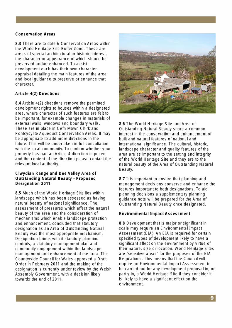
8.3 There are to date 6 Conservation Areas within the World Heritage Site Buffer Zone. These are areas of special architectural or historic interest, the character or appearance of which should be preserved and/or enhanced. To assist development each has their own character appraisal detailing the main features of the area and local guidance to preserve or enhance that character.
Article 4(2) Directions
8.4 Article 4(2) directions remove the permitted development rights to houses within a designated area, where character of such features are felt to be important, for example changes in materials of external walls, windows and boundary walls. These are in place in Cefn Mawr, Chirk and Pontcysyllte Aqueduct Conservation Areas. It may be appropriate to add more directions in the future. This will be undertaken in full consultation with the local community. To confirm whether your property has had an Article 4 direction imposed and the content of the direction please contact the relevant local authority.
Clwydian Range and Dee Valley Area of Outstanding Natural Beauty - Proposed Designation 2011
8.5 Much of the World Heritage Site lies within landscape which has been assessed as having natural beauty of national significance. The assessment of pressures which affect the natural beauty of the area and the consideration of mechanisms which enable landscape protection and enhancement, concluded that statutory designation as an Area of Outstanding Natural Beauty was the most appropriate mechanism. Designation brings with it statutory planning controls, a statutory management plan and community engagement within the landscape management and enhancement of the area. The Countryside Council for Wales approved a Draft Order in February 2011 and the making of the designation is currently under review by the Welsh Assembly Government, with a decision likely towards the end of 2011.
8.6 The World Heritage Site and Area of Outstanding Natural Beauty share a common interest in the conservation and enhancement of built and natural features of national and international significance. The cultural, historic, landscape character and quality features of the area are as important to the setting and integrity of the World Heritage Site and they are to the natural beauty of the Area of Outstanding Natural Beauty.
8.7 It is important to ensure that planning and management decisions conserve and enhance the features important to both designations. To aid planning decisions a supplementary planning guidance note will be prepared for the Area of Outstanding Natural Beauty once designated.
Environmental Impact Assessment
8.8 Development that is major or significant in scale may require an Environmental Impact Assessment (EIA). An EIA is required for certain specified types of development likely to have a significant affect on the environment by virtue of their nature, size or location. World Heritage Sites are ”sensitive areas” for the purposes of the EIA Regulations. This means that the Council will require an Environmental Impact Assessment to be carried out for any development proposal in, or partly in, a World Heritage Site if they consider it is likely to have a significant effect on the environment.
9

8.9 When an Environmental Impact Assessment is required, the developer must prepare and submit 9. Key background an Environmental Impact Assessment to documents accompany the planning application. An Environmental Impact Assessment in the World Heritage Site should:
● Take account of ICOMOS guidance on Heritage Impact Assessments (HIA). A Heritage Impact Assessment undertaken in these circumstances is not additional to a standard Environmental Impact Assessment but integral to it using methodology to focus on Outstanding Universal Value and attributes that contribute to Outstanding Universal Value.
● Examine alternatives;
● Highlight the environmental effects of proposed developments; and
● Propose appropriate mitigation and monitoring measures.
8.10 Applicants are encouraged to contact the relevant Council to confirm if it is likely the proposal will require an Environmental Impact Assessment.
● Planning Policy Wales (2011) and associated Technical Advice Notes.
● Welsh Office Circular 61/96: Planning and the Historic Environment: Historic Buildings and Conservation Areas (2006)
● Communities and Local Government Circular 07/2009: Protection of World Heritage Sites (July 2009)
● Wrexham Unitary Development Plan (adopted February 2005)
● Denbighshire Unitary Development Plan (adopted July 2002)
● Shropshire Council Core Strategy (adopted March 2011)
● X’ian Declaration on the Conservation of the Setting of Heritage Structures, Sites and Areas, ICOMOS (2005)
● Guidance on Heritage Impact Assessments for Cultural World Heritage Properties, ICOMOS (Draft 2010)
● The Protection & Management of World Heritage Sites in England, English Heritage (2009)
● Seeing the History in the View: A Method for Assessing Heritage Significance Within Views, English Heritage (Draft 2008)
● The Setting of Heritage Assets: English Heritage Guidance, English Heritage (Draft 2010)
10

10. World Heritage Site Nomination, Management, Characterisation and Features ● Pontcysyllte Aqueduct and Canal Nomination
as a World Heritage Site - Nomination Document (2009)
● Pontcysyllte and its canal: World Heritage Management Plan (2007)
● Pontcysyllte Landscape and Visual Assessment (2007)
● Pontcysyllte Archaeological Audit (2007)
● Pontcysyllte Aqueduct Conservation Area Assessment and Management Plan (2009)
● Tree and Ecology Management Plan (2010)
● Llangollen Conservation Area Appraisal (1997-1998)
● Llantysilio Conservation Area Appraisal (1997)
● Trevor Mill / Plas yn Pentre (1997-1998)
● Cefn Mawr Conservation Area Character Assessment (2005)
● Chirk Conservation Area Character Assessment (2001)
● Clwyd Register of Landscapes, Parks and Gardens of Special Historic Interest in
Wales Part 1: Parks and Gardens (CADW/ ICOMOS UK)
● Register of landscapes of Special Historic Interest in Wales (CADW/ ICOMOS UK)
● Vale of Llangollen and Eglwyseg Historic Landscape Characterisation (Clwyd-Powys Archaeological Trust)
● LANDMAP – Provides an assessment of 5 aspects which together contribute to the Welsh landscape: geological landscapes; visual and sensory landscapes; landscape habitats; cultural landscapes and historic landscapes http://test.landmap.ccw.gov.uk
County Landscape Assessments:
● Denbighshire Landscape Strategy (2003)
● Wrexham LANDMAP Supplementary Planning Guidance
● Shropshire Landscape Typology (September 2006)
11
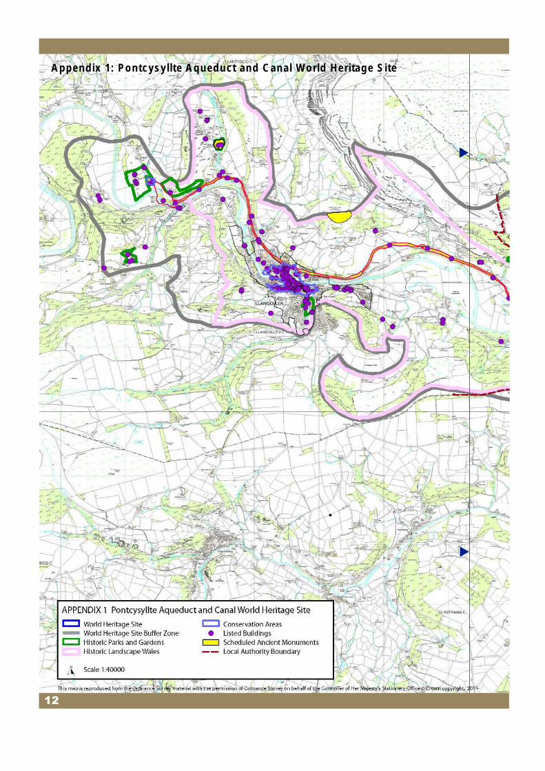
Appendix 1: Pontcysyllte Aqueduct and Canal World Heritage Site ▲
▲
12
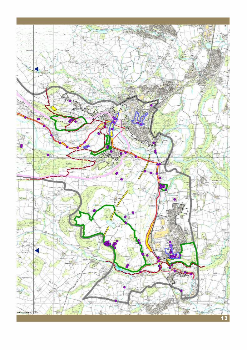
▲
▲
13

Appendix 2: Additional clarification – Outstanding Universal Value.
OUTSTANDING UNIVERSAL VALUE
“World Heritage Sites are places of outstanding universal value to the whole of humanity”¨
Communities and Local Government Circular 07/2009: Protection of World Heritage Sites (July 2009).
What are we protecting?
“Outstanding universal value” means cultural and/or natural significance which is so exceptional as to transcend national boundaries. In June 2009 UNESCO inscribed Pontcysyllte Aqueduct and Canal on the World Heritage List because it bears witness to very substantial international interchanges and influences in the fields of inland waterways, civil engineering, land-use planning, and the application of iron in structural design.The full statement of Outstanding Universal Value for the Pontcysyllte Aqueduct and Canal and the criteria the site meets can be found at http://whc.unesco.org/en/list/1303
In order to be inscribed on the UNESCO World Heritage Site list a site has to demonstrate and meet one or more of ten criteria to assess Outstanding Universal Value, satisfy requirements of authenticity and/or integrity and demonstrate the site’s importance. UNESCO considers Pontcysyllte Aqueduct and Canal satisfies three Outstanding Universal Value criteria.
These are:
● It is a masterpiece of two of the exceptional figures in the heroic phase of civil engineering in the late eighteenth and early nineteenth centuries;
● It exhibits important international interchanges of values in inland navigation, civil engineering
and the application of iron to structural design; and
● It is an outstanding example of transport improvements in the Industrial Revolution, which initiated the process of industrialisation that spread to Europe, North America and the entire globe.
Some of the key features from the adopted statement of Outstanding Universal Value are:
● recognition of the difficult geographical environment and the use of extensive and boldly conceived civil engineering works that resulted in monumental architecture;
● acknowledgement that the integrity of the landscapes and the Buffer Zone of the property (World Heritage Site) contribute to the expression of the value of the property (World Heritage Site);
● noting the property (World Heritage Site) has all the values of integrity as a major historic canal of the Industrial Revolution; and
● noting the good degree of authenticity between the buildings associated with the canal and its immediate environment.
The content of the following boxes explains the terms referred to in paragraph 6.1 of the Local Guidance Note.
14

Outstanding Universal Value, Character.
Character appraisals should identify the local distinctiveness and special interest of the visual and cultural environment.
The principal aims of character appraisals are to:
● identify the factors that create the “quality of place”;
● define what built and natural features chiefly reflect this character and what is most worth conserving;
● identify what has suffered damage or loss and may need reinstating;
● establish how the development proposals sit within the character of the WHS and buffer zone in which it is located.
A character appraisal should ensure that the quality of townscape / rural scape in its broadest sense is understood as well as protected to ensure that new development is sympathetic to the areas special interest.
It is the character of the World Heritage Site of Pontcysyllte Aqueduct and Canal and the parts of the buffer zone affected by development proposals that should be the prime consideration in a character appraisal. Appraisals of development sites should consider:
● architectural character;
● the layout and grouping (perhaps historic) of property boundaries and street patterns, lanes or tracks;
● the scale of buildings, building block patterns, frontage sizes (vertical, horizontal); fenestration patterns; a building’s relationship to outdoor spaces;
● any architectural detailing or rhythm to building frontages;
● any particular mix of building or land uses;
● characteristic local materials to buildings and other surfaces, such as walls, gates, railings etc;
● the mix and importance of focus and background buildings;
● the mix and importance of open spaces and hard and soft landscaping;
● important views and visual compositions to and from the development site in relation to the WHS (including vistas along streets and between buildings where relevant);
● important topographical features
● quality of advertisements.
The appraisal should form the basis of the design and quality of new development taking all the above factors into consideration. Maps and photographs should also assist in this process.
Further work is being undertaken by Cadw to assist with identification of characterisation.
15

Outstanding Universal Value, Views Relating to the World Heritage Site.
All developments need to consider whether they fall within views of the World Heritage Site and/or are viewed from the World Heritage Site. If a proposal falls within such views then the developer needs to consider the impact of development on the setting of the World Heritage Site and the character of the Buffer Zone.
Views of the World Heritage Site are important for appreciating the site and its integrity and authenticity. In some cases it may be required to preserve an existing view, in other cases it may be desirable to leave a view obscured for example where opening up a view would reveal previously hidden insensitive development. Development proposals will be considered for opportunities to enhance views of the site in the design, siting and landscaping of the proposal.
Within the Buffer Zone are significant views which have historic or cultural value. These views may be from historic sites like Castell Dinas Bran, A5 or from tourist attractions and national trails such as Offa’s Dyke, Clwydian Way, Maelor Way, or may provide attractive views of the principal features of the World Heritage Site.
The significant views have been identified in the World Heritage Site nomination document: Pontcysyllte Landscape and Visual Assessment (2007).
Outstanding Universal Value, Authenticity and Integrity.
Integrity means completeness/intactness of the attributes needed to convey Outstanding Universal Value;
The adopted statement of Outstanding Universal Value for Pontcysyllte World Heritage Site notes the high integrity of the site as a major historic canal of the Industrial Revolution. It also notes the integrity of the landscape contributes to the expression of the value of the Pontcysyllte Aqueduct and Canal.
Authenticity means the link between attributes (attributes could take a variety of forms e.g. materials and substance, use and function, form and design or other forms of intangible heritage) and Outstanding Universal Value. How well those links convey Outstanding Universal Value;
The adopted statement of Outstanding Universal Value for Pontcysyllte World Heritage Site notes the good degree of authenticity between buildings associated with the canal and its immediate environment.
16

Outstanding Universal Value, Sense of Arrival.
A journey along major road and rail access routes to the World Heritage Site creates a ‘sense of arrival’ for visitors and can help interpret the value of the World Heritage Site and its Outstanding Universal Value. Development proposals along the major tourist access routes will need to consider how the proposal relates to this ‘sense of arrival’ and how it can positively contribute to it.
The Buffer Zone has a value in its own right where it creates a ‘sense of arrival’ to the World Heritage Site. This includes buildings, sites or landscape features that contribute to the Outstanding Universal Value of the World Heritage Site. These features may not be visible to or from the World Heritage Site but may be important to the character of that particular part of the Buffer Zone.
For development with a significant influence on the ‘sense of arrival’ by virtue of its scale, size, location or nature a context appraisal will need to be undertaken as part of the Design and Access Statement. The Design and Access Statement will need to consider the various landscape and urban characters along the route including the character of the World Heritage Site and the Outstanding Universal Value of the site. The development design will need to react positively to this context.
For example with the Outstanding Universal Value in mind, a drive to the World Heritage Site through the rural valley gives views of the difficult geographical environment in which the World Heritage Site was engineered, reveals views of the monumental architecture, passes settlements with historic association to the World Heritage Site and finally a visit to the World Heritage Site reveals the engineering solutions to the difficult terrain. Context appraisal may reveal an opportunity to open up views of the World Heritage Site and the valley, it may provide historic industrial links, buildings or features that could be reflected in the design or it could provide inspiration for materials.
Minor development (householder, change of use) along the main access routes will have more limited impact, in these circumstances a high quality of design and landscaping in keeping with the locality will be required.
17
Key Contacts
● Wrexham County Borough Council Community Wellbeing and Development Lambpit Street Wrexham LL11 1AR
Tel: 01978 292485 General Enquiries Tel: 01978 292019 Conservation Enquiries web: www.wrexham.gov.uk/planning
● Denbighshire County Council Development Control Caledfryn Smithfield Road Denbigh LL16 3RJ
Tel: 01824 706727 web: www.denbighshire.gov.uk
● Shropshire Council Development Services Shirehall, Abbey Foregate Shrewsbury Shropshire SY2 6ND
Tel: 0345 678 9004 web: www.shropshire.gov.uk
Maer’ ddogfen hon ar gael yn Gymraeg. Ffoniwch 01978 292013
This document is available in alternative formats. ameich copi.Please cal 01978 292013 for your copy.


![Discover Denbighshire · Discover Denbighshire . Denbighshire at tips ... river valleys[p14] - await exploration here, along with the changes made ... in height. These are the remote](https://static.fdocuments.us/doc/165x107/5b06f4627f8b9a93418d8112/discover-denbighshire-denbighshire-denbighshire-at-tips-river-valleysp14.jpg)