PONDS Planning, Design, & Management
43
PONDS PONDS Planning, Design, & Management Planning, Design, & Management David Krietemeyer David Krietemeyer USDA USDA - - NRCS Area III Engineer NRCS Area III Engineer Assisted by: Assisted by: Scott Turner, Field Office Engineer Scott Turner, Field Office Engineer January 29, 2010 January 29, 2010
Transcript of PONDS Planning, Design, & Management

PONDSPONDSPlanning, Design, & ManagementPlanning, Design, & Management
David KrietemeyerDavid Krietemeyer
USDAUSDA--NRCS Area III EngineerNRCS Area III Engineer
Assisted by:Assisted by:Scott Turner, Field Office EngineerScott Turner, Field Office Engineer
January 29, 2010January 29, 2010

Pondsn Usesn Considerations for Location of Pondsn Commonly Used Termsn Design Considerationsn Maintenance of Pondsn Maintenance of Damsn Referencesn Examplesn Questions

Ponds
n A water impoundment made by excavating a pit, or constructing a dam or an embankment.
n Two Types of Ponds: • Excavated• Embankment

UsesUses
nn Livestock Water Livestock Water SupplySupply
nn IrrigationIrrigation
nn Fish ProductionFish Production
nn Landscape Landscape AppearanceAppearance
nn Fire ProtectionFire Protection
nn RecreationRecreation
nn Waterfowl and Other Waterfowl and Other WildlifeWildlife
nn Sediment CaptureSediment Capture

Livestock Water SupplyLivestock Water Supply

IrrigationIrrigation
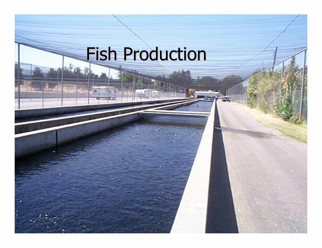
Fish ProductionFish Production

Landscape AppearanceLandscape Appearance
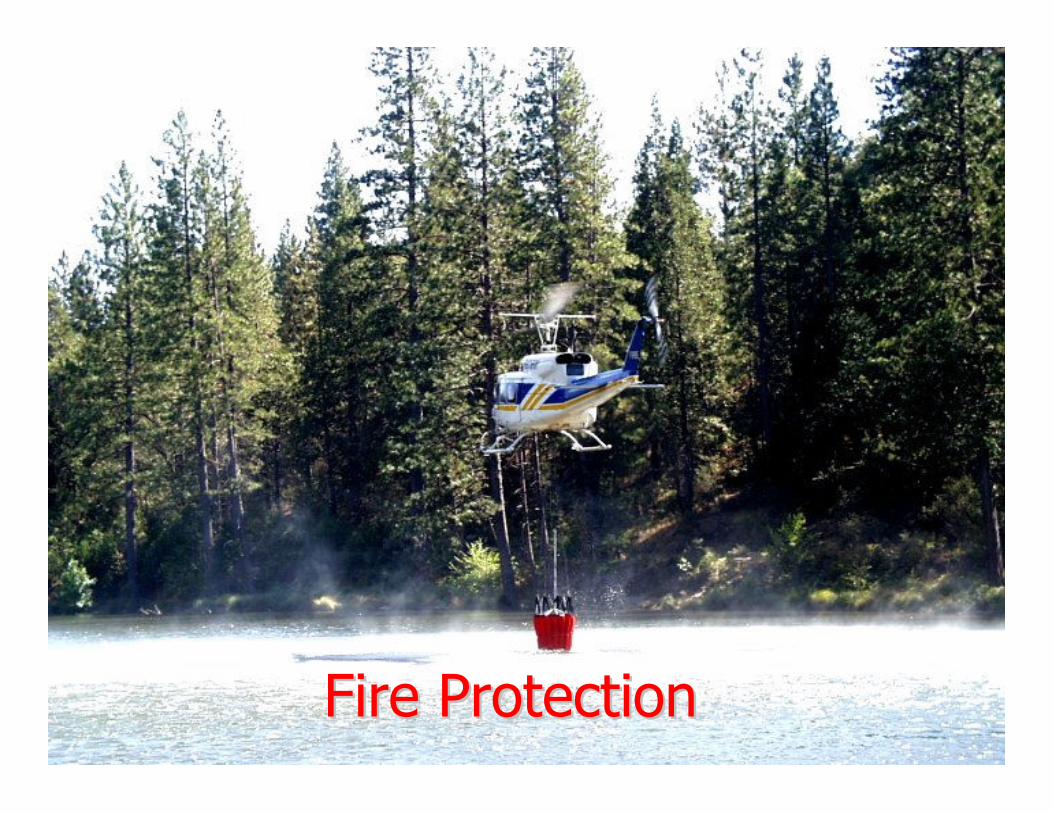
Fire ProtectionFire Protection

RecreationRecreation

Waterfowl and Other WildlifeWaterfowl and Other Wildlife

Sediment CaptureSediment Capture

Considerations for Location of Considerations for Location of PondsPonds
nn EconomicsEconomics Largest water storage Largest water storage volume that can be volume that can be obtained with least obtained with least amount of earthfill. amount of earthfill.
nn UsesUses Are the locations in Are the locations in suitable spots for the suitable spots for the intended use?intended use?
Considerations for Location of Considerations for Location of PondsPonds
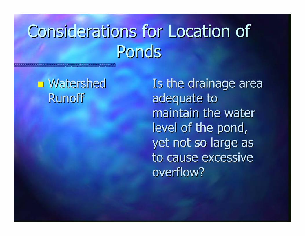
nn Watershed Is the drainage area Watershed Is the drainage area RunoffRunoff adequate to adequate to
maintain the water maintain the water level of the pond, level of the pond, yet not so large as yet not so large as to cause excessive to cause excessive overflow? overflow?

Considerations for Location of Considerations for Location of PondsPonds
nn TopographyTopography Look for the largest Look for the largest volume of water volume of water stored per cubic yard stored per cubic yard of soil moved.of soil moved.
nn SoilsSoils Proximity to source Proximity to source material for building material for building dam.dam.


Considerations for Location of Considerations for Location of PondsPonds
nnGeologyGeology–– Depth to impervious layer.Depth to impervious layer.
–– Ability of foundation to withstand load Ability of foundation to withstand load of the fill in the dam.the fill in the dam.
–– Potential for seepage through foundation Potential for seepage through foundation and abutments.and abutments.

Considerations for Location of Considerations for Location of PondsPonds
nn Estimated Minimum Pond Depth:Estimated Minimum Pond Depth:*Requirements vary by state*Requirements vary by state
–– Northern California Northern California -------------------------- 77’’--1010’’
–– Northern Coast Northern Coast ---------------------------------- 55’’--77’’–– Sierra Mountains Sierra Mountains ------------------------------ 55’’--77’’
–– Central Valley Central Valley -------------------------------------- 1010’’--1414’’–– Central & Southern Coast Central & Southern Coast ---------- 1010’’--1212’’
–– Desert Desert -------------------------------------------------------- 1212’’--1414’’

Considerations for Location of Considerations for Location of PondsPonds
nn Water RightsWater RightsAre water rights available?Are water rights available?
Is the water in the watershed fully allocated?Is the water in the watershed fully allocated?
Information on water rights can be found at: Information on water rights can be found at:
http://www.waterboards.ca.gov/waterrightshttp://www.waterboards.ca.gov/waterrights

Considerations for Location of Considerations for Location of PondsPonds
nn Emergency and recreational vehicle Emergency and recreational vehicle access.access.
nn If pond were to overIf pond were to over--flow, consideration flow, consideration must be made to the surrounding area must be made to the surrounding area and downstream areas.and downstream areas.
nn Dam failure hazard.Dam failure hazard.

Commonly Used TermsCommonly Used Terms
nn Principle SpillwayPrinciple Spillway:: A pipe or A pipe or vegetated outlet channel to carry vegetated outlet channel to carry daily daily flowsflows safely past earth embankments. May safely past earth embankments. May also serve as an emergency spillway where also serve as an emergency spillway where space is limited.space is limited.
nn Emergency SpillwayEmergency Spillway: : A rock, concrete, A rock, concrete, or vegetated outlet channel to carry or vegetated outlet channel to carry flood flood flowsflows safely past earth embankments.safely past earth embankments.

Commonly Used TermsCommonly Used Terms
nn Trickle tube:Trickle tube: A small pipe to allow water to pass A small pipe to allow water to pass through the dam, and protect the vegetation in the through the dam, and protect the vegetation in the earth spillway against saturation.earth spillway against saturation.
nn Drainpipe:Drainpipe: Allows drainage of pond without having Allows drainage of pond without having to remove fill, use a siphon, pump or other devices.to remove fill, use a siphon, pump or other devices.
nn WaterWater--Supply Pipe:Supply Pipe: Used to fill orchard sprayers, Used to fill orchard sprayers, stockwater troughs and to pump water for irrigation. stockwater troughs and to pump water for irrigation. Usually in addition to the trickle tube.Usually in addition to the trickle tube.

Design Considerations
nAverage Annual Rainfall For Design Storm–Rainfall amounts and expected frequency–Hydrologic groupings of soils–Runoff curve numbers–Peak discharge rate–Estimate volume of storm runoff

Design ConsiderationsDesign Considerations
nnTopographyTopography–– Acquire enough survey data to plan the Acquire enough survey data to plan the
dam, spillway, and other features.dam, spillway, and other features.
nnWatershed AreaWatershed Area–– From USGS Quad Sheet.From USGS Quad Sheet.
nnWatershed SlopeWatershed Slope–– From USGS Quad Sheet.From USGS Quad Sheet.

Design Considerations
nStability of Dam– Downstream channel stability– Stability of side slopes of the dam – Stability of spillway(s)– Proximity to active faults
nComposition of Dam– Optimum soil for dam should be a mixture
of coarse and fine textured soils– Volume of soil available

Design Considerations
nRecommended 3:1 Slope on Upstream Side of Dam– Slope will attenuate erosion by wave action
from the pond.
nRecommended 2:1 Slope on Downstream Side of Dam– Slope should be flat enough to be stable,
yet steep enough to minimize amount of fill required.

Design ConsiderationsDesign Considerations
nn The combined upstream and The combined upstream and downstream side slopes of downstream side slopes of embankments shall not be less than 5 embankments shall not be less than 5 horizontal to 1 vertical.horizontal to 1 vertical.
nn All slopes must be designed to be All slopes must be designed to be stable, even if flatter side slopes are stable, even if flatter side slopes are required.required.

Design ConsiderationsDesign Considerations
nnType of Soil in Pond AreaType of Soil in Pond Area–– Soil should have a high enough clay Soil should have a high enough clay
content to prevent seepage.content to prevent seepage.
nnHazard Class of the DamHazard Class of the Dam–– Used to quantify hazard potential in the Used to quantify hazard potential in the
event of failure.event of failure.
nnDepth Required For Intended UsesDepth Required For Intended Uses

Design ConsiderationsDesign Considerations
nnEmergency Spillway LocationEmergency Spillway Location–– TopographyTopography
–– SoilSoil–– Discharge Flow RateDischarge Flow Rate
–– VelocityVelocity–– Stable outletStable outlet

Design ConsiderationsDesign Considerations
nn Minimum Spillway CapacityMinimum Spillway CapacityPage 6 of NRCS Conservation Practice Standard #378: Ponds
n Outflow from 50 year 24 hour storm (credit can be given for other pipes through the dam and detention of flows).
n Minimum bottom width is 5 feet for dams < 20 feet talln Minimum bottom width is 10 feet for dams > 20 feet tall n For closed emergency spillways (culverts, etc.) outflow from 100 year 24 hour storm (credit can be given for other pipes through the dam and detention of flows).

Design ConsiderationsDesign Considerations
nnCriteria for State Size DamCriteria for State Size Dam
–– Over 25 feet high and 15 or more acre feet Over 25 feet high and 15 or more acre feet of storage.of storage.
–– Over 6 feet high and 50 or more acre feet Over 6 feet high and 50 or more acre feet of storage.of storage.

Other ConsiderationsOther Considerations
nnCounty OrdinancesCounty OrdinancesnnLocal OrdinancesLocal OrdinancesnnPermitsPermits
–– County Grading PermitCounty Grading Permit–– Fish and Game PermitFish and Game Permit–– Regional Water Quality Control Board Regional Water Quality Control Board
Clean Water ActClean Water Act–– Water RightsWater Rights–– Army Corps of Engineers Army Corps of Engineers -- Clean Water ActClean Water Act
http://carcd.org/Watershed/guidetowatershed.pdf

Maintaining the Pond
nImportance of Maintaining Vegetation
– Erosion control– Climate control– Wildlife habitat

Maintaining the PondMaintaining the Pond
nnProtecting Emergency Spillway Against Protecting Emergency Spillway Against ErosionErosion–– Apply seed or sod and fertilization for Apply seed or sod and fertilization for
proper vegetation.proper vegetation.
–– Use mulch on slopes that are difficult to Use mulch on slopes that are difficult to vegetate.vegetate.
–– Irrigate to insure proper germination and Irrigate to insure proper germination and growth.growth.

Maintaining the DamMaintaining the Dam
nnPipes Through the DamPipes Through the Dam
–– Trickle tube Trickle tube
–– DrainpipeDrainpipe
–– WaterWater--Supply PipesSupply Pipes

Maintaining the Dam
n Trees– Keep trees off and away from dam to
prevent seepage through roots.
n Rodents– Rodents that burrow through the dam will
create holes that allow seepage.

ReferencesPond Conservation Practice Standard #378Section IV of USDA-NRCSField Office Technical Guide
http://efotg.nrcs.usda.gov/references/public/CA/378STD-8-06.pdf
Ponds - Planning, Design, ConstructionAgricultural Handbook #590 of USDA-NRCS
www.in.nrcs.usda.gov/pdf%20files/PONDS.PDFwww.in.nrcs.usda.gov/pdf%20files/PONDS.PDF

Example of Trees on Dam

Example of Dam Breach

Example of Rock Riprap Movement in Spillway

Example of Headcutting of Emergency Spillway

Example of Poor Riprap

Questions