
Political map spain
11
GEOGRAPHY OF SPAIN
-
Upload
cienciastercerciclo -
Category
Business
-
view
622 -
download
1
Transcript of Political map spain

GEOGRAPHY OF SPAIN
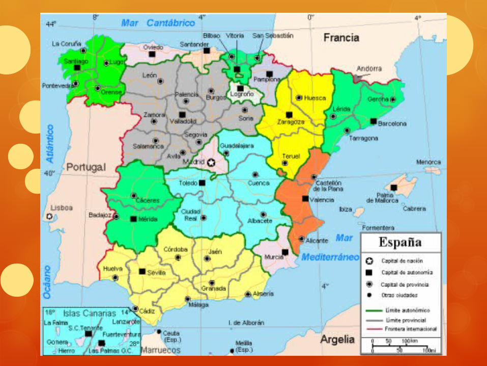
Spanish territory includes: - The peninsula - The Balearic Islands in the Mediterranean Sea - The Canary Islands off the western coast of Africa - And Ceuta and Melilla on the northern Morocco’s coast
Spain is located in southwestern Europe. Its mainland is bordered to the south and east by the Mediterranean Sea, to the north by the Cantabrian Sea and a small land boundary with France, and to the west by the Atlantic Ocean and Portugal
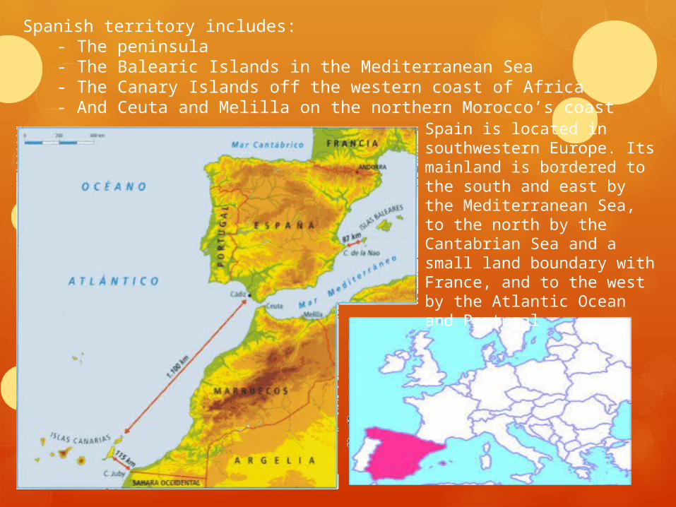
Spain is comprised of 17 autonomous communities which are divided into 50 provinces, and 2 autonomous cities: Ceuta and Melilla.
The capital of Spain is Madrid

AUTONOMOUS COMMUNITIES
GALICIACapital: Santiago de Compostela
CANTABRIACapital: Santander
ASTURIASCapital: Oviedo
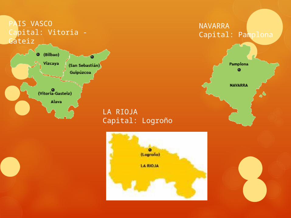
LA RIOJACapital: Logroño
NAVARRACapital: Pamplona
PAIS VASCOCapital: Vitoria - Gateiz
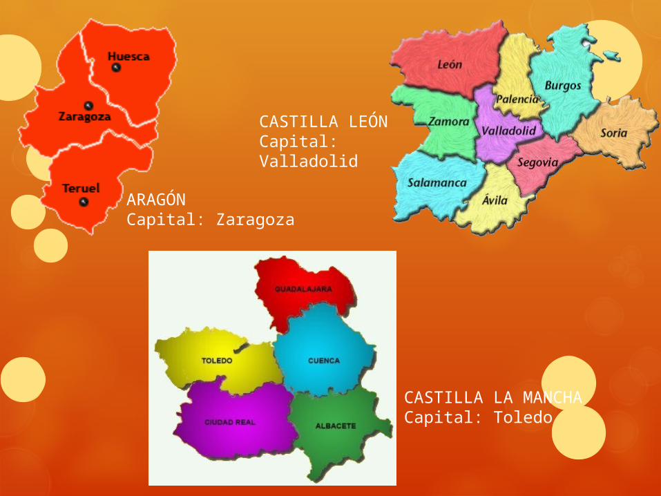
ARAGÓNCapital: Zaragoza
CASTILLA LEÓNCapital: Valladolid
CASTILLA LA MANCHACapital: Toledo
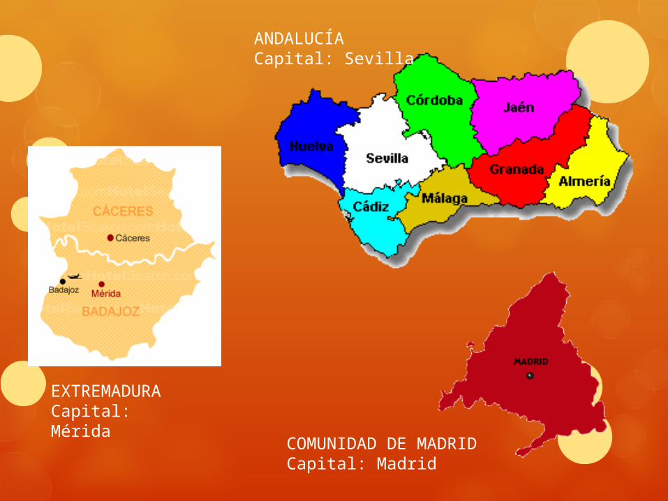
ANDALUCÍACapital: Sevilla
EXTREMADURACapital: Mérida
COMUNIDAD DE MADRIDCapital: Madrid
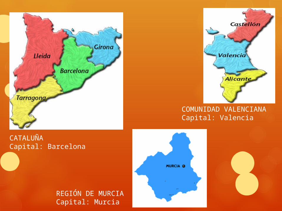
CATALUÑACapital: Barcelona
REGIÓN DE MURCIACapital: Murcia
COMUNIDAD VALENCIANACapital: Valencia
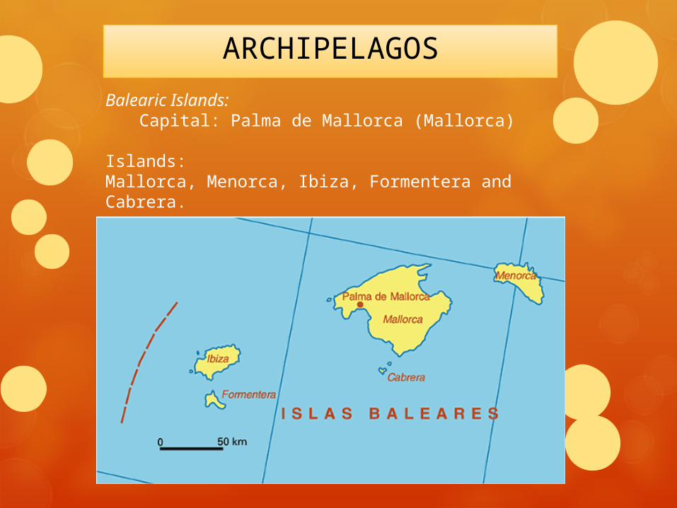
ARCHIPELAGOS
Balearic Islands:Capital: Palma de Mallorca (Mallorca)
Islands:Mallorca, Menorca, Ibiza, Formentera and Cabrera.
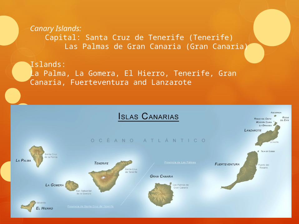
Canary Islands:Capital: Santa Cruz de Tenerife (Tenerife)
Las Palmas de Gran Canaria (Gran Canaria)
Islands:La Palma, La Gomera, El Hierro, Tenerife, Gran Canaria, Fuerteventura and Lanzarote