PLATTE RIVER RECOVERY IMPLEMENTATION … – ED OFFICE FINAL 3/03/2016 Page 1 of 12 PLATTE RIVER...
12
PRRIP – ED OFFICE FINAL 3/03/2016 Page 1 of 12 PLATTE RIVER RECOVERY IMPLEMENTATION PROGRAM REQUEST FOR PROPOSALS 1 2 SUBJECT: 2016-2019 Annual LiDAR and Aerial Photography 3 PROJECT NUMBER: P16-009 4 REQUEST DATE: March 23, 2016 5 CLOSING DATE: April 29, 2016 6 POINT OF CONTACT: Justin Brei 7 Headwaters Corporation 8 4111 4 th Kearney, NE 68845 10 Ave, Suite 6 9 (308) 237-5728 Ext. 4 11 [email protected] 12 13 I. OVERVIEW 14 The Platte River Recovery Implementation Program (Program) was initiated on January 1, 2007 15 between Nebraska, Wyoming, and Colorado and the Department of the Interior to address 16 endangered species issues in the central and lower Platte River basin. The species considered in 17 the Program, referred to as “target species”, are the whooping crane, piping plover, interior least 18 tern, and pallid sturgeon. 19 20 A Governance Committee (GC) has been established that reviews, directs, and provides 21 oversight for activities undertaken during the Program. The GC is comprised of one 22 representative from each of the three states, three water user representatives, two representatives 23 from environmental groups, and two members representing federal agencies. The GC named Dr. 24 Jerry Kenny to serve as the Program Executive Director (ED). Dr. Kenny established 25 Headwaters Corporation as the staffing mechanism for Program. Program staff are located in 26 Nebraska and Colorado and are responsible for assisting in carrying out the various Program- 27 related activities. 28 29 Annual aerial photography is a requirement of the Program's Adaptive Management Plan and an 30 integral part of several research and monitoring protocols. This annual aerial photography is 31 typically acquired in June when piping plovers and interior least terns are nesting. 32 33 The Program acquired LiDAR for the central Platte River in the spring of 2009 as a part of 34 baseline data collection. The Program has continued to acquire LiDAR over a portion of the 35 original acquisition in order to assess change within the river banks. The Program will acquire 36 LiDAR over this area annually to document change in channel characteristics and to assist in 37 habitat availability evaluations for target species. Additional aerial photography that 38 accompanies the LiDAR acquisition will assist in, and add value to the evaluation. 39 40 The GC submits this Request for Proposals (RFP) to solicit proposals from contractors to 41 acquire LiDAR and aerial photography. 42 43
Transcript of PLATTE RIVER RECOVERY IMPLEMENTATION … – ED OFFICE FINAL 3/03/2016 Page 1 of 12 PLATTE RIVER...

PRRIP – ED OFFICE FINAL 3/03/2016
Page 1 of 12
PLATTE RIVER RECOVERY IMPLEMENTATION PROGRAM REQUEST FOR PROPOSALS 1
2 SUBJECT: 2016-2019 Annual LiDAR and Aerial Photography 3 PROJECT NUMBER: P16-009 4 REQUEST DATE: March 23, 2016 5 CLOSING DATE: April 29, 2016 6 POINT OF CONTACT: Justin Brei 7
Headwaters Corporation 8 4111 4th
Kearney, NE 68845 10 Ave, Suite 6 9
(308) 237-5728 Ext. 4 11 [email protected] 12
13 I. OVERVIEW 14 The Platte River Recovery Implementation Program (Program) was initiated on January 1, 2007 15 between Nebraska, Wyoming, and Colorado and the Department of the Interior to address 16 endangered species issues in the central and lower Platte River basin. The species considered in 17 the Program, referred to as “target species”, are the whooping crane, piping plover, interior least 18 tern, and pallid sturgeon. 19 20 A Governance Committee (GC) has been established that reviews, directs, and provides 21 oversight for activities undertaken during the Program. The GC is comprised of one 22 representative from each of the three states, three water user representatives, two representatives 23 from environmental groups, and two members representing federal agencies. The GC named Dr. 24 Jerry Kenny to serve as the Program Executive Director (ED). Dr. Kenny established 25 Headwaters Corporation as the staffing mechanism for Program. Program staff are located in 26 Nebraska and Colorado and are responsible for assisting in carrying out the various Program-27 related activities. 28 29 Annual aerial photography is a requirement of the Program's Adaptive Management Plan and an 30 integral part of several research and monitoring protocols. This annual aerial photography is 31 typically acquired in June when piping plovers and interior least terns are nesting. 32 33 The Program acquired LiDAR for the central Platte River in the spring of 2009 as a part of 34 baseline data collection. The Program has continued to acquire LiDAR over a portion of the 35 original acquisition in order to assess change within the river banks. The Program will acquire 36 LiDAR over this area annually to document change in channel characteristics and to assist in 37 habitat availability evaluations for target species. Additional aerial photography that 38 accompanies the LiDAR acquisition will assist in, and add value to the evaluation. 39 40 The GC submits this Request for Proposals (RFP) to solicit proposals from contractors to 41 acquire LiDAR and aerial photography. 42 43

PRRIP – ED OFFICE FINAL 3/03/2016
Page 2 of 12
II. PROJECT DESCRIPTION 44 Annual color-infrared (CIR) orthophotography will be used to help document habitat conditions 45 for Program target species. In addition, it can be used to document summertime vegetation 46 characteristics throughout the system, on Program lands, and within managed areas. For 47 example, bare sand substrates will be identified that may be potential least tern and piping plover 48 nesting habitat, and major management changes can be tracked, such as tree clearing or cropland 49 changes. Changes in available tern/plover nesting habitat will be tracked throughout the First 50 Increment. Information gained from aerial photography will also be used in conjunction with 51 measurements taken at specific sites on the ground that relate to vegetation establishment on 52 sandbars, height of sandbars, etc. CIR photos will be used to estimate the land use/land cover 53 types present (e.g., amount of grassland, forest, etc). This CIR photography will also be used for 54 channel morphology measurements. The photos will be used to help measure parameters such as 55 channel width, bank position, island position and stability, hydraulic geometry characteristics of 56 width, and track changes associated with management techniques. Photos will be taken on an 57 annual basis between late May and late June with flows at or near 1,200 cfs (i.e., Program target 58 flow levels during this time of year). Aerial photography will be acquired in color-infrared at a 59 six-inch digital resolution. The contractor will work with Program staff during the acquisition 60 window to schedule flights in accordance with these requirements. 61 62 Acquiring LiDAR within the river channel every year allows the Program to evaluate the effects 63 of annual flow conditions on channel morphology. These analyses will affect how the Program 64 uses its limited water resources to manage habitat. CIR orthophotography will be acquired in 65 combination with the LiDAR acquisition. This photography will be used as a tool to further 66 assess both the quality and accuracy of the LiDAR, and as an additional data set for evaluating 67 geomorphic change. Since the LiDAR and this additional photography acquisition will take 68 place under low-flow conditions, this photography will also provide a picture of the Platte River 69 under different conditions than the Program’s annual spring aerial photography acquisition. CIR 70 photography acquired in combination with the LiDAR also provides a way to examine land 71 cover types and condition for use in modeling efforts. Aerial photography will be acquired in 72 color-infrared at a six-inch digital resolution, and will be acquired concurrently with the LiDAR. 73 The contractor will work with Program staff during the acquisition window to schedule flights in 74 accordance with these requirements. 75 76 This RFP describes a multi-year program of work encompassing acquisition of aerial 77 imagery and LiDAR in 2016 through 2019 according to the following schedule: 78 79
- May/June 2016: Full Program area aerial photography and bathymetric LiDAR 80 test 81
- November/December 2016: River channel LiDAR and concurrent aerial 82 photography 83
- May/June 2017: Full Program area aerial photography and partial area LiDAR 84 - November/December 2017: River channel LiDAR and concurrent aerial 85
photography 86 - May/June 2018: Full Program area aerial photography and partial area LiDAR 87
PRRIP – ED OFFICE FINAL 3/03/2016
Page 3 of 12
- November/December 2018: River channel LiDAR and concurrent aerial 88 photography 89
- May/June 2019: Full Program area aerial photography and partial area LiDAR 90 - November/December 2019: River channel LiDAR and concurrent aerial 91
photography 92 93 In total, this includes four summer Program area aerial photography flights with a partial LiDAR 94 coverage and four fall/winter concurrent LiDAR and Aerial photography flights. Under the final 95 contract, written Notice to Proceed from the Program Executive Director’s Office (ED Office) 96 will be required before each acquisition period (spring/fall). All work will be contingent on 97 availability of Program funding. 98 99 In addition, the Program is requesting that the contractor include one alternate solution (buy-up) 100 with associated budgets in their proposal. The alternate solution is described in section IV. The 101 contractor must include a cost for the buy-up in section IV. 102 103 III. SCOPE OF WORK 104 The Program is requesting proposals from potential bidders to provide LiDAR and digital aerial 105 imagery of the project area as described above. Minimum product specifications follow: 106
107 1) Schedule 108
109 a) Sub-Project 1 - November/December concurrent LiDAR and Aerial photography. 110
i) LiDAR and imagery will be acquired each year between November 1 and December 111 15 under leaf-off and low Platte River flow conditions beginning in November 2016. 112 Bidder must be flexible and work with Program staff during that time to schedule 113 flights such that river flows in the project area are as low as possible (ideally under 114 1,000 cfs). 115
ii) Imagery will be acquired on cloud-free days with the sun at a sufficient angle to 116 reduce the effect of shadows from trees and structures and efforts should be made to 117 reduce sun glare on water surfaces. 118
iii) Imagery will be acquired in combination with LiDAR such that the imagery reflects 119 the condition of the river during the LiDAR acquisition. River conditions can change 120 daily, and imagery must be flown at least the same day, if not at the exact same time 121 as the LiDAR. 122
iv) The acquisition area must be free of snow and ice, and extraneous environmental 123 conditions such as rain, fog or smoke should be avoided. 124
v) Final delivery of Sub-Project 1 aerial imagery deliverables will be within 45 days of 125 final acquisition flight each year. 126
vi) Final delivery of all other Sub-Project 1 deliverables will be within 90 days of final 127 acquisition flight each year. 128 129 130 131

PRRIP – ED OFFICE FINAL 3/03/2016
Page 4 of 12
b) Sub-Project 2 - May/June Aerial photography. 132 i) Imagery will be acquired each year between May 15 and June 30 Beginning in May 133
2016. Bidder must be flexible and work with Program staff during that time to 134 schedule flights such that river flows in the project area are as close to 1,200 cfs as 135 possible. 136
ii) Imagery will be acquired on cloud-free days with the sun at a sufficient angle to 137 reduce the effect of shadows from trees and structures and efforts should be made to 138 reduce sun glare on water surfaces. 139
iii) Final delivery of Sub-Project 2 deliverables will be within 45 days of final acquisition 140 flight each year. 141 142
c) Sub-Project 2A – May/June LiDAR 143 i) LiDAR will be acquired each year between May 15 and June 30 in combination with 144
the Sub-Project 2 imagery acquisition. SEE SUB-PROJECT 3 FOR 2016 145 ACQUISITION. 146
ii) LiDAR will be acquired in combination with imagery such that the imagery reflects 147 the condition of the river during the LiDAR acquisition. River conditions can change 148 daily, and imagery must be flown at least the same day, if not at the exact same time 149 as the LiDAR over the Sub-Project 2A area. 150
iii) Final delivery of Sub-Project 2A deliverables will be within 60 days of final 151 acquisition flight each year. 152 153
d) Sub-Project 3 – 2016 Bathymetric LiDAR Test 154 i) In June 2016, Sub-Project 3 will replace the Sub-Project 2A acquisition. 155 ii) The Sub-Project 2A area will be collected as bathymetric (green) LiDAR as opposed 156
to terrestrial LiDAR in 2016. 157 iii) Sub-Project 3 schedule remains the same as Sub-Project 2A. 158
159 2) Project Area 160
161 a) The area of interest for Sub-Project 1 consists of an area generally between the high 162
banks of the Platte River beginning near the junction of U.S. Highway 283 and Interstate 163 80 near Lexington, Nebraska, and extending eastward to near Chapman, Nebraska 164 (approximately 128 square miles). A polygon shapefile of the acquisition area is 165 included on the Program website (www.platteriverprogram.org) in the same location as 166 this solicitation. 167
b) The area of interest for Sub-Project 2 consists of an area 3.5 miles either side of the 168 centerline of the Platte River beginning at the junction of U.S. Highway 283 and 169 Interstate 80 near Lexington, Nebraska, and extending eastward to Chapman, Nebraska 170 (approximately 750 square miles). A polygon shapefile of the acquisition area is 171 included on the Program website (www.platteriverprogram.org) in the same location as 172 this solicitation. 173
c) The area of interest for Sub-Project 2A consists of an area generally between the high 174 banks of the Platte River beginning near the J-2 Hydropower Return southeast of 175
PRRIP – ED OFFICE FINAL 3/03/2016
Page 5 of 12
Lexington, NE and extending eastward to the Highway 183 bridge near Elm Creek, NE 176 (approximately 26 square miles). A polygon shapefile of the acquisition area is included 177 on the Program website (www.platteriverprogram.org) in the same location as this 178 solicitation. 179
d) The area of interest for Sub-Project 3 in 2016 is identical to Sub-Project 2A. 180 181 3) Sub-Project 1 Technical Specifications 182
CIR aerial photography and LiDAR over approximately 128 sq. mi. 183 184 a) LiDAR Technical Specifications 185
i) The LiDAR data will be collected at a mean resolution of 2.3 ft (0.7 m) GSD or 186 better. 187
ii) The contractor shall ensure that the area of interest is fully and sufficiently covered 188 with no data voids due to gaps between flightlines or system malfunction. 189
iii) Data voids in the bare-earth not caused by classification of geographic features shall 190 not exceed three times the point spacing. Data voids of this size are sufficient 191 reason to reject the dataset. 192
iv) LiDAR data should be classified using the following ASPRS Standard LiDAR 193 Point Classes: 194
• Class 1 – Unclassified 195 • Class 2 – Ground 196 • Class 7 – Low point and noise 197 • Class 9 – Water 198 • Class 12 – Overlap 199
(1) Class 1 will be used for feature points that are not in Classes 2, 7, 9, or 12. 200 These typically represent returns from man-made structures, vegetation etc. 201
(2) Class 2 will be used for feature points that represent the bare-earth. 202 (3) Class 7 will be used for artifacts that do not represent the ground, manmade 203
structures or vegetation. Typically these are extraneous points that are either 204 below, or well above the surface not representing any true feature. 205
(4) Class 9 will be used to identify points found within water bodies, including 206 streams and rivers. 207
(5) Class 12 will be used for LiDAR points in the overlap portion of flight lines that 208 have been removed due to redundancy (if necessary). 209
(6) No points shall be deleted from the LAS files. 210 v) Bare-earth classification shall adhere to the following specifications using both 211
automated and manual filtering classification routines: 212 • 90% of artifacts classified 213 • 95% of outliers classified 214 • 95% of vegetation classified 215 • 98% of building classified 216

PRRIP – ED OFFICE FINAL 3/03/2016
Page 6 of 12
vi) Special attention must be applied to the classification process due to the geographic 217 nature of the project area which consists of extremely flat terrain mixed with 218 important hydrographic characteristics. Channel geometry of streams and drainage 219 features must be maintained as well as the ability to identify sand bar features 220 within the Platte River. Dense vegetation data voids must also be minimized by the 221 automatic removal process and “over smoothing” due to aggressive classification 222 must be avoided. 223
vii) Vertical accuracy for LiDAR will meet or exceed 0.3 ft (9.2 cm) RMSE (Accuracyz 224 = 0.6 ft (0.18 m) at the 95% confidence level). 225
viii) Horizontal accuracy for LiDAR will meet or exceed 1.97 ft (0.6 m) RMSE 226 (Accuracyr = 3.41 ft (1.04 m) at the 95% confidence level). 227
ix) The vertical datum for LiDAR is NAVD88 (Geoid03), and the horizontal datum is 228 Nebraska State Plane (1983). Elevation and projection in feet. 229
230 b) Aerial Photography Technical Specifications 231
i) The imagery will be six-inch (0.5 ft) pixel resolution. 232 ii) The imagery will be color-infrared. 233 iii) The imagery will be ortho-rectified and seamless, and will be tone-balanced with 234
adjacent images across the project area. 235 iv) Imagery will be acquired on cloud-free days with the sun at a sufficient angle to 236
reduce the effect of shadows from trees and structures and efforts should be made to 237 reduce sun glare on water surfaces. 238
v) The imagery will be projected in Nebraska State Plane Feet (1983 datum). 239 vi) The imagery must be acquired concurrently with the LiDAR so as to reflect river 240
conditions during acquisition. The imagery must be collected at least the same day, if 241 not at the exact same time, as the LiDAR. 242
4) Sub-Project 2 Technical Specifications 243 Four-band aerial photography over approximately 750 sq. mi. LiDAR over approximately 26 244 sq. mi. 245
a) Aerial Photography Technical Specifications 246 i) The imagery will be six-inch (0.5 ft) pixel resolution. 247 ii) The imagery will be 4-band (R, G, B, NIR). 248 iii) The imagery will be ortho-rectified and seamless, and will be tone-balanced with 249
adjacent images across the project area. 250 iv) Imagery will be acquired on cloud-free days with the sun at a sufficient angle to 251
reduce the effect of shadows from trees and structures and efforts should be made to 252 reduce sun glare on water surfaces. 253
v) The imagery will be projected in Nebraska State Plane Feet (1983 datum). 254 vi) Deliverables will include both RGB and CIR products described in Section III.6. 255 256
b) LiDAR Technical Specifications 257 i) Same as Sub-Project 1 LiDAR Specifications in Section III.3.a above. 258
PRRIP – ED OFFICE FINAL 3/03/2016
Page 7 of 12
5) Sub-Project 3 Technical Specifications 259 Bathymetric LiDAR over approximately 26 sq. mi. in June 2016. 260 261 a) Bathymetric LiDAR Specifications 262
i) Bathymetric LiDAR is expected to meet the accuracies and specifications as provided 263 for terrestrial LiDAR in Section III.3.a above, with vertical accuracies of 0.3 ft 264 RMSE. 265
6) Project Deliverables 266 All project deliverables should be processed and delivered according to the schedule in 267 Section III.1. 268 269 a) LiDAR (terrestrial and bathymetric) 270
i) LiDAR point data meeting or exceeding 2.3 ft (0.7 m) GSD resolution in a classified 271 LAS file format and adhering to the technical specifications in III.3 above. LAS file 272 projected to Nebraska State Plane Feet (1983 datum) and vertical reference NAVD88 273 feet (Geoid 03). Classified LAS file will include all LiDAR points, including first 274 and last returns. 275
ii) Daily reports during acquisition that display all flight lines, as well as completed 276 areas. Once acquisition is complete, a project summary report that shows time and 277 date of all flightline acquisitions. Time of day, not just the day, is important to match 278 river flow condition to acquisition. 279
iii) Tiling scheme shapefile for identifying LAS and DEM file locations. Tile size and 280 file size is flexible and will be discussed upon award of project. 281 282
b) Digital Elevation Model 283 i) Hydro-enforced bare-earth digital elevation model raster tiles (3-foot cell size), 284
projected in Nebraska State Plane coordinate system – elevation and projection in 285 feet. 286 (1) See pages 11-13, 15, and Appendix 2 of the USGS LiDAR Guidelines and Base 287
Specifications v13 for details on hydro-flattening: http://pubs.usgs.gov/tm/11b4/. 288 In the proposal, provide details of the software/methodology to be used for this 289 alternative. 290
(2) Breaklines used in the generation of the hydro-enforced DEM are also a required 291 deliverable. 292
ii) Full project area mosaic of digital elevation model tiles (3-foot cell size). 293 iii) NOTE: For Bathymetric LiDAR acquisition, two versions of the DEM will be 294
required. One hydro-enforced DEM for the given flow conditions during the flight, 295 and one DEM that incorporates bathymetry below the water surfaces. 296 297
c) Imagery 298 i) Color-infrared (Sub-Project 1) and 4-band (Sub-Project 2) digital orthophotography 299
with a six-inch (0.5 ft) pixel resolution (or better), covering the entire project area 300 seamlessly and without data gaps. 301
ii) The imagery should be geo-referenced and provided in tiled GeoTIFF (.tif) format. 302
PRRIP – ED OFFICE FINAL 3/03/2016
Page 8 of 12
iii) Shapefiles displaying photocenters and flight dates and times for image acquisitions. 303 Time of day, not just the day, is important to match river flow condition to 304 acquisition. 305
iv) Compressed imagery mosaic (.sid). Typically entire reach compiled into one mosaic, 306 but may be split due to file size. Sub-Project 2 will require both a RGB mosaic and a 307 CIR mosaic. Sub-Project 1 will be a CIR mosaic only. 308 309
d) LiDAR and Imagery 310 i) FGDC-compliant metadata to include, but not limited to: flight dates and times, flight 311
altitude, camera system information, LiDAR system information, aircraft information, 312 imagery resolution, LiDAR point density, horizontal accuracy, post-processing 313 software and steps, and horizontal and vertical control references. 314
ii) All LiDAR data, photography, and supplemental products will be delivered on USB 315 external hard drives or flash drives and will become the property of the Program. All 316 media and data collected under the contract shall be the sole property of and can be 317 freely distributed by the Program. No restrictions shall be placed on the data by the 318 contractor. 319
7) Permits and Clearances 320 321 a) It is the contractor's responsibility to file all required flight plans and obtain all necessary 322
approvals to fly over and acquire aerial imagery and LiDAR in the Project area. 323
IV. ALTERNATE SOLUTIONS (BUY-UPS) 324 In addition to the minimum specifications above, the contractor is required to provide additional 325 costs and deliverables for the following alternate solution. The additional cost and deliverables 326 for this addition will be considered with the minimum requirements and may be accepted and 327 incorporated into the final contract. 328 329 1)
a) Acquire LiDAR as described for Sub-Project 1 and Sub-Project 2a for all years using 331 bathymetric (green) LiDAR as opposed to traditional terrestrial LiDAR. Deliverables 332 would include an additional DEM that incorporates the sub-surface bathymetry. 333
Alternate 1 330
334 V. CONTRACT TERMS 335 The selected contractor will be retained by: 336 337 Nebraska Community Foundation 338 PO Box 83107 339 Lincoln, NE 68501 340 341 Terms and conditions will be negotiated as mutually agreeable. It is understood that the 342 Governance Committee reserves the right to accept any proposal that, in its judgment, is the best 343 proposal, and to waive any irregularities in any proposal. 344 345

PRRIP – ED OFFICE FINAL 3/03/2016
Page 9 of 12
Proposal costs incurred in response to this RFP will be the responsibility of the bidder. Neither 346 the Nebraska Community Foundation nor the Governance Committee will be liable for any costs 347 incurred by the bidder in the completion and submission of the proposal. 348 349 VI. SUBMISSION REQUIREMENTS 350 All interested parties having experience providing the services listed in this RFP are requested to 351 submit a proposal. 352 353 Instructions for Submitting Proposals 354 One electronic copy of your proposal must be submitted in PDF format to Justin Brei at 355 [email protected] no later than 5:00 p.m. Central Time on Friday, April 29, 2016.
359
356 Maximum allowable PDF size is 8MB. A proposal is late if received any time after 5:00 p.m. 357 Central Time and will not be eligible for consideration. 358
Questions regarding the information contained in this RFP must be SUBMITTED IN 360 WRITING by 5:00 p.m. Wednesday, April 20, 2016. No questions on content can be 361 submitted after this time. Questions and answers will be shared with all interested parties. 362 These can be emailed to Justin Brei at [email protected] or mailed to the address 363 at the top of this RFP. Submitted questions and answers may be posted intermittently to 364 the Program website during the proposal period. Final questions and answers will be made 365 available on the Program website in the location of this RFP by Thursday, April 21, 2016 367
. 366
Proposal Content 368 Proposals must include: 369
370 1) Technical information including: 371
a. Aircraft/LiDAR/camera system details 372 b. Post-processing software and summary of methodology 373 c. Design accuracy information 374
375 2) Relevant LiDAR and aerial photography experience from the last two years, especially 376
projects related to natural resources and river geomorphology and projects using bathymetric 377 LiDAR. Please provide a minimum of two project references including the name, location, 378 and brief summary of the projects; name, address, and phone number of the contracting 379 officer for the client; and when the project was completed. 380
381 3) Statement of annual availability within the acquisition window of November 1 to 382
December 15 for Sub-Project 1 and May 15 to June 30 for Sub-Project 2. 383 384 4) Estimated timeline for activities including mobilization, acquisition and processing. Also, 385
specifically the estimated flight time necessary to complete acquisition over entire project 386 area (for planning purposes related to river operations in order to achieve lowest possible 387 flow). 388
389
PRRIP – ED OFFICE FINAL 3/03/2016
Page 10 of 12
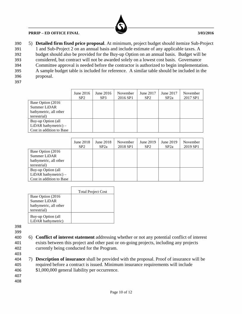
5) Detailed firm fixed price proposal. At minimum, project budget should itemize Sub-Project 390 1 and Sub-Project 2 on an annual basis and include estimate of any applicable taxes. A 391 budget should also be provided for the Buy-up Option on an annual basis. Budget will be 392 considered, but contract will not be awarded solely on a lowest cost basis. Governance 393 Committee approval is needed before the contractor is authorized to begin implementation. 394 A sample budget table is included for reference. A similar table should be included in the 395 proposal. 396
397
June 2016 SP2
June 2016 SP3
November 2016 SP1
June 2017 SP2
June 2017 SP2a
November 2017 SP1
Base Option (2016 Summer LiDAR bathymetric, all other terrestrial) Buy-up Option (all LiDAR bathymetric) – Cost in addition to Base
June 2018 SP2
June 2018 SP2a
November 2018 SP1
June 2019 SP2
June 2019 SP2a
November 2019 SP1
Base Option (2016 Summer LiDAR bathymetric, all other terrestrial) Buy-up Option (all LiDAR bathymetric) – Cost in addition to Base
Total Project Cost
Base Option (2016 Summer LiDAR bathymetric, all other terrestrial)
Buy-up Option (all LiDAR bathymetric)
398 399 6) Conflict of interest statement addressing whether or not any potential conflict of interest 400
exists between this project and other past or on-going projects, including any projects 401 currently being conducted for the Program. 402
403 7) Description of insurance shall be provided with the proposal. Proof of insurance will be 404
required before a contract is issued. Minimum insurance requirements will include 405 $1,000,000 general liability per occurrence. 406
407 408

PRRIP – ED OFFICE FINAL 3/03/2016
Page 11 of 12
VII. CONTRACTOR SELECTION 409 The GC will appoint a selection committee to review responses to this RFP. Proposals will be 410 reviewed and the award made to the lowest cost proposal that conforms to the specifications of 411 this solicitation and is considered to provide the most value to the Program. 412 413 414 VIII. PROGRAM PERSPECTIVE 415 The GC of the Program has the sole discretion and reserves the right to reject any and all 416 proposals received in response to this RFP and to cancel this solicitation if it is deemed in the 417 best interest of the Program to do so. Issuance of this RFP in no way constitutes a commitment 418 by the Program to award a contract, or to pay contractor’s costs incurred either in the preparation 419 of a response to his RFP or during negotiations, if any, of a contract for services. The Program 420 also reserves the right to make amendments to this RFP by giving written notice to contractors, 421 and to request clarification, supplements, and additions to the information provided by a 422 contractor. 423 424 By submitting a proposal in response to his solicitation, contractors understand and agree that 425 any selection of a contractor or any decision to reject any or all responses or to establish no 426 contracts shall be at the sole discretion of the Program. To the extent authorized by law, the 427 contractor shall indemnify, save, and hold harmless the Nebraska Community Foundation, the 428 states of Colorado, Wyoming, and Nebraska, the Department of the Interior, members of the GC, 429 and the ED Office, their employees, employers, and agents, against any and all claims, damages, 430 liability, and court awards including costs, expenses, and attorney fees incurred as a result of any 431 act or omission by the contractor or its employees, agents, subcontractors, or assignees pursuant 432 to the terms of this project. Additionally, by submitting a proposal, contractors agree that they 433 waive any claim for the recovery of any costs or expenses incurred in preparing and submitting a 434 proposal. 435 436 IX. AVAILABLE INFORMATION 437 A shapefile of the acquisition area for Sub-Projects 1, 2, and 2A are available on the Program 438 website (www.platteriverprogram.org) at the same location as this RFP solicitation. A map of the 439 acquisition area is found on the last page of this solicitation. 440 441 442

PRRIP – ED OFFICE FINAL 3/03/2016
Page 12 of 12