Pinellas County (SS) Ap… · File #: 16-1955A, Version: ... Pinellas County Page 1 of 2 Printed on...
56
Pinellas County Staff Report 315 Court Street, 5th Floor Assembly Room Clearwater, Florida 33756 File #: 16-1955A, Version: 1 Agenda Date: 12/13/2016 Subject: Ranking of firms and agreement with Jones, Edmunds and Associates, Inc. for professional engineering and biological, planning, and environmental services for the Curlew Creek and Smith Bayou Watershed Evaluation and Management Plan. Recommended Action: Approve the ranking of firms and execute the agreement with the number one ranked firm, Jones, Edmunds and Associates, Inc., for professional engineering and biological, planning, and environmental services for the Curlew Creek and Smith Bayou Watershed Evaluation and Management Plan. Contract No. 145-0425-NC, in the amount of $935,000.00 ($262,944.00 is the County share plus percentage of contingency if needed) from the notice to proceed date for thirty-six (36) consecutive calendar months. Chairman to sign and Clerk of Court to attest. Strategic Plan: Practice Superior Environmental Stewardship 3.3 Protect and improve the quality of our water, air, and other natural resources Foster Continual Economic Growth and Vitality 4.4 Invest in infrastructure to meet current and future needs Deliver First Class Services to the Public and Our Customers 5.2 Be responsible stewards of the public’s resources Summary: The objective of this project is to develop a watershed management plan for Curlew Creek and Smith Bayou. The management plan will be used as a tool in the planning, regulation, and management of the watershed for future development, and as a basis for determining and prioritizing future capital improvements projects. The firms in order of ranking are attached on the ranking spreadsheet. Background Information: The Curlew Creek and Smith Bayou Watershed is a combined 8,546 acre drainage basin located in northwest Pinellas County. This large drainage basin is included in parts of unincorporated Pinellas County, as well as in the cities of Dunedin and Clearwater. The primary tributaries to Curlew Creek and Smith Bayou have existing poor water quality, and are known to contribute significant sediment loadings to St. Joseph Sound. A Request for Qualifications (RFQ) to comply with the Consultants Competitive Negotiation Act (CCNA) per Florida Statute 287.055 was released on December 1, 2015; the negotiation and scoping process was concluded in October 2016. Pinellas County Printed on 12/7/2016 Page 1 of 2 powered by Legistar™
Transcript of Pinellas County (SS) Ap… · File #: 16-1955A, Version: ... Pinellas County Page 1 of 2 Printed on...

Pinellas County
Staff Report
315 Court Street, 5th FloorAssembly Room
Clearwater, Florida 33756
File #: 16-1955A, Version: 1 Agenda Date: 12/13/2016
Subject:
Ranking of firms and agreement with Jones, Edmunds and Associates, Inc. for professionalengineering and biological, planning, and environmental services for the Curlew Creek and SmithBayou Watershed Evaluation and Management Plan.Recommended Action:Approve the ranking of firms and execute the agreement with the number one ranked firm, Jones,Edmunds and Associates, Inc., for professional engineering and biological, planning, andenvironmental services for the Curlew Creek and Smith Bayou Watershed Evaluation andManagement Plan.
Contract No. 145-0425-NC, in the amount of $935,000.00 ($262,944.00 is the County share pluspercentage of contingency if needed) from the notice to proceed date for thirty-six (36) consecutivecalendar months. Chairman to sign and Clerk of Court to attest.Strategic Plan:Practice Superior Environmental Stewardship3.3 Protect and improve the quality of our water, air, and other natural resources
Foster Continual Economic Growth and Vitality4.4 Invest in infrastructure to meet current and future needs
Deliver First Class Services to the Public and Our Customers5.2 Be responsible stewards of the public’s resources
Summary:The objective of this project is to develop a watershed management plan for Curlew Creek and SmithBayou. The management plan will be used as a tool in the planning, regulation, and management ofthe watershed for future development, and as a basis for determining and prioritizing future capitalimprovements projects.
The firms in order of ranking are attached on the ranking spreadsheet.
Background Information:The Curlew Creek and Smith Bayou Watershed is a combined 8,546 acre drainage basin located innorthwest Pinellas County. This large drainage basin is included in parts of unincorporated PinellasCounty, as well as in the cities of Dunedin and Clearwater. The primary tributaries to Curlew Creekand Smith Bayou have existing poor water quality, and are known to contribute significant sedimentloadings to St. Joseph Sound.
A Request for Qualifications (RFQ) to comply with the Consultants Competitive Negotiation Act(CCNA) per Florida Statute 287.055 was released on December 1, 2015; the negotiation and scopingprocess was concluded in October 2016.
Pinellas County Printed on 12/7/2016Page 1 of 2
powered by Legistar™

File #: 16-1955A, Version: 1 Agenda Date: 12/13/2016
The contract includes negotiated fully burdened hourly rates including all labor, direct/indirectoverhead margins/profits, and travel within the Tampa Bay Metropolitan Statistical Area (TBMSA).Travel outside of the TBMSA will be reimbursed in accordance with Section 112.061, FloridaStatutes.
Fiscal Impact:Funding for this project is derived from collaborative partnerships with the Southwest Florida WaterManagement District (SWFWMD), and the cities of Clearwater and Dunedin. Funding from partnerswill be provided on a reimbursement basis.
The County’s share is derived from the Surface Water Utility Fee. A contingency amount of$85,000.00 is included for minor unforeseen circumstances that may arise during design of theproject and will only be used at the discretion and approval of the County. The County may seekreimbursement from partners for contingency funds utilized if applicable.
The basic services funding distribution is as follows:County Share (31%): $262,944.00City of Clearwater Share (8%): $ 70,326.00City of Dunedin Share (11%): $ 91,730.00SWFWMD Share (50%): $425,000.00Total basic services not to exceed: $850,000.00
Basic services not to exceed: $850,000.00Contingency services not to exceed: $ 85,000.00Total expenditure not to exceed: $935,000.00
Staff Member Responsible:Rahim Harji, P.E., Stormwater and Vegetation Division Manager, Public WorksJoe Lauro, Director, Purchasing
Partners:SWFWMDCity of DunedinCity of Clearwater
Attachments:AgreementContract ReviewRanking SpreadsheetLocation Map
Pinellas County Printed on 12/7/2016Page 2 of 2
powered by Legistar™
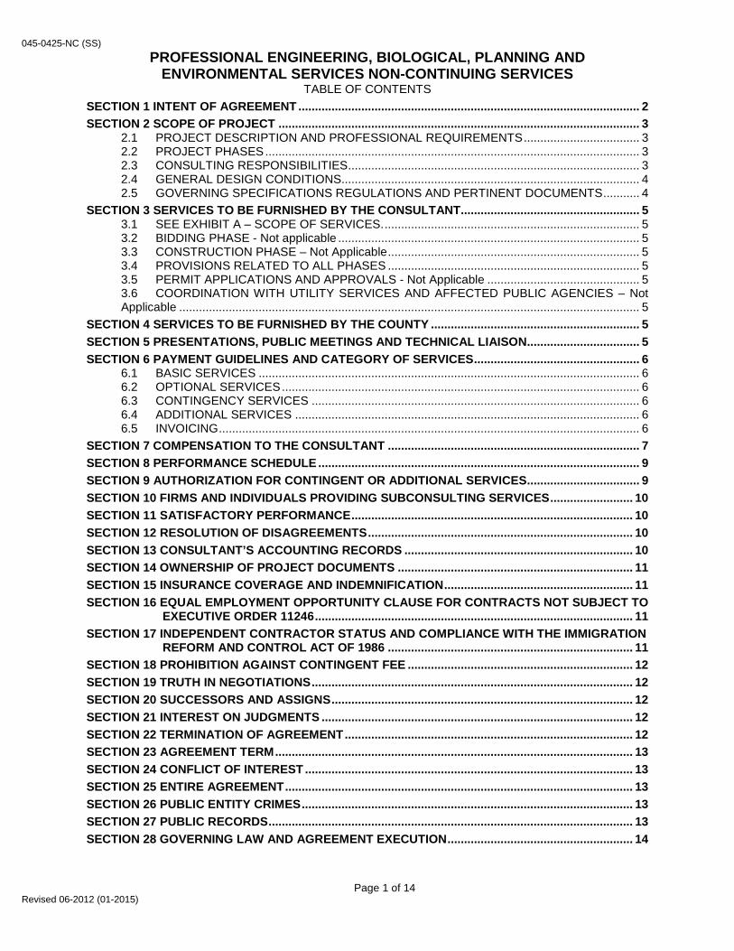
045-0425-NC (SS) PROFESSIONAL ENGINEERING, BIOLOGICAL, PLANNING AND
ENVIRONMENTAL SERVICES NON-CONTINUING SERVICES TABLE OF CONTENTS
SECTION 1 INTENT OF AGREEMENT ....................................................................................................... 2 SECTION 2 SCOPE OF PROJECT ............................................................................................................. 3
2.1 PROJECT DESCRIPTION AND PROFESSIONAL REQUIREMENTS ................................... 3 2.2 PROJECT PHASES ................................................................................................................. 3 2.3 CONSULTING RESPONSIBILITIES ........................................................................................ 3 2.4 GENERAL DESIGN CONDITIONS .......................................................................................... 4 2.5 GOVERNING SPECIFICATIONS REGULATIONS AND PERTINENT DOCUMENTS ........... 4
SECTION 3 SERVICES TO BE FURNISHED BY THE CONSULTANT...................................................... 5 3.1 SEE EXHIBIT A – SCOPE OF SERVICES. ............................................................................. 5 3.2 BIDDING PHASE - Not applicable ........................................................................................... 5 3.3 CONSTRUCTION PHASE – Not Applicable ............................................................................ 5 3.4 PROVISIONS RELATED TO ALL PHASES ............................................................................ 5 3.5 PERMIT APPLICATIONS AND APPROVALS - Not Applicable .............................................. 5 3.6 COORDINATION WITH UTILITY SERVICES AND AFFECTED PUBLIC AGENCIES – Not Applicable ........................................................................................................................................... 5
SECTION 4 SERVICES TO BE FURNISHED BY THE COUNTY ............................................................... 5 SECTION 5 PRESENTATIONS, PUBLIC MEETINGS AND TECHNICAL LIAISON .................................. 5 SECTION 6 PAYMENT GUIDELINES AND CATEGORY OF SERVICES .................................................. 6
6.1 BASIC SERVICES ................................................................................................................... 6 6.2 OPTIONAL SERVICES ............................................................................................................ 6 6.3 CONTINGENCY SERVICES ................................................................................................... 6 6.4 ADDITIONAL SERVICES ........................................................................................................ 6 6.5 INVOICING ............................................................................................................................... 6
SECTION 7 COMPENSATION TO THE CONSULTANT ............................................................................ 7 SECTION 8 PERFORMANCE SCHEDULE ................................................................................................. 9 SECTION 9 AUTHORIZATION FOR CONTINGENT OR ADDITIONAL SERVICES .................................. 9 SECTION 10 FIRMS AND INDIVIDUALS PROVIDING SUBCONSULTING SERVICES ......................... 10 SECTION 11 SATISFACTORY PERFORMANCE ..................................................................................... 10 SECTION 12 RESOLUTION OF DISAGREEMENTS ................................................................................ 10 SECTION 13 CONSULTANT’S ACCOUNTING RECORDS ..................................................................... 10 SECTION 14 OWNERSHIP OF PROJECT DOCUMENTS ....................................................................... 11 SECTION 15 INSURANCE COVERAGE AND INDEMNIFICATION ......................................................... 11 SECTION 16 EQUAL EMPLOYMENT OPPORTUNITY CLAUSE FOR CONTRACTS NOT SUBJECT TO
EXECUTIVE ORDER 11246 ................................................................................................ 11 SECTION 17 INDEPENDENT CONTRACTOR STATUS AND COMPLIANCE WITH THE IMMIGRATION
REFORM AND CONTROL ACT OF 1986 .......................................................................... 11 SECTION 18 PROHIBITION AGAINST CONTINGENT FEE .................................................................... 12 SECTION 19 TRUTH IN NEGOTIATIONS ................................................................................................. 12 SECTION 20 SUCCESSORS AND ASSIGNS ........................................................................................... 12 SECTION 21 INTEREST ON JUDGMENTS .............................................................................................. 12 SECTION 22 TERMINATION OF AGREEMENT ....................................................................................... 12 SECTION 23 AGREEMENT TERM ............................................................................................................ 13 SECTION 24 CONFLICT OF INTEREST ................................................................................................... 13 SECTION 25 ENTIRE AGREEMENT ......................................................................................................... 13 SECTION 26 PUBLIC ENTITY CRIMES .................................................................................................... 13 SECTION 27 PUBLIC RECORDS .............................................................................................................. 13 SECTION 28 GOVERNING LAW AND AGREEMENT EXECUTION ........................................................ 14
Page 1 of 14 Revised 06-2012 (01-2015)


045-0425-NC (SS) SECTION 2
SCOPE OF PROJECT
2.1 PROJECT DESCRIPTION AND PROFESSIONAL REQUIREMENTS For the purposes of this Agreement the term PROJECT shall include all areas of proposed watershed
management plan, all areas that may reasonably be judged to have an impact on the PROJECT, and all PROJECT development phases and the services and activities attendant thereto. It is not the intent of this Agreement to identify the exact limits or details involved in providing satisfactorily completed PROJECT management plan documents. The CONSULTANT shall provide the following professional services to prepare a watershed management plan of the PROJECT. The PROJECT design shall be based on the following data:
The PROJECT will be used as a tool in the planning, regulation, and management of the Watershed
for future development and as a basis for determining and prioritizing capital improvements. These objectives will be met, in part, by conducting an analysis of the watershed in order to characterize the existing watershed conditions and recommend improvements for flood protection, natural systems, habitat, water quality, erosion control, public awareness and involvement, regulatory control, and capital improvements.
Exhibit A, Scope of Services is attached.
a) Required Deliverables
• All deliverables listed in the Tasks in the Scope of Services in Exhibit A • A complete watershed management plan including model input and output data and
associated geodatabases.
2.2 PROJECT PHASES All project phases shall be completed on or before the milestone dates provided in the COUNTY approved PROJECT design schedule referenced in Exhibit A.
2.3 CONSULTING RESPONSIBILITIES A. It is the intention of the COUNTY that the CONSULTANT is held accountable for its work,
including checking and review each task deliverable, and that submittals are complete. B. The CONSULTANT shall be responsible for the accuracy of the work and shall promptly correct
its errors and omissions without additional compensation. Acceptance of the work by the COUNTY will not relieve the CONSULTANT of the responsibility for subsequent correction of any errors and the clarification of any ambiguities.
C. The CONSULTANT represents that it has secured or will secure, at its own expense, all
personnel necessary to complete this Agreement; none of whom shall be employees of or have any contractual relationship with the COUNTY. Primary liaison with the COUNTY will be through the CONSULTANT’S Project Manager. All of the services required hereunder will be performed by the CONSULTANT or under the CONSULTANT’S supervision, and all personnel engaged in the work shall be fully qualified and shall be authorized or permitted under law to perform such services.
D. The CONSULTANT shall endorse all reports, calculations, and survey data. Services shall be
prepared under the direction of an engineer registered in the State of Florida and qualified in the required discipline. Products or services performed or checked shall be signed and sealed by the CONSULTANT’S Florida registered engineer.
Page 3 of 14 Revised 06-2012 (01-2015)

045-0425-NC (SS)
E. The CONSULTANT shall be responsible for the preparation of a PROJECT design schedule, prepared in Microsoft Project 2013 or later, which shows a breakdown of all tasks to be performed, and their relationship in achieving the completion of each phase of work. A bar chart schedule showing overall PROJECT time frames should also be prepared. These schedules must be submitted for COUNTY approval within ten (10) days of the initial PROJECT Notice to Proceed. These schedules will be used to verify CONSULTANT performance in relationship to Fees claimed and to allow the COUNTY’S Project Manager to monitor the CONSULTANT’S efforts. The CONSULTANT shall be responsible for any updates to these schedules and for documenting in writing to the COUNTY any major deviations in the actual versus estimated PROJECT time frames. The CONSULTANT shall be responsible to adhere to the performance schedule in Exhibit A. The COUNTY may approve deviations from this performance schedule upon written justification from the CONSULTANT.
F. The CONSULTANT shall respond, in writing, to all review comments made by the COUNTY, and
shall incorporate appropriate design adjustments into the PROJECT, in a timely manner, resulting from the review exchange.
G. The CONSULTANT agrees to provide the COUNTY with a report indicating all contractors and
subcontractors who performed work in association with the PROJECT the amount spent with each contractor or subcontractor, and to the extent such information is known, whether each contractor or subcontractor was a minority owned or woman owned or small business enterprises were used in the performance of this Agreement, then the report shall so indicate. The Minority/Women Owned and Small Business Utilization Report form is attached as an exhibit to this Agreement. The report is required upon final completion of the PROJECT prior to final payment, or within thirty (30) days of the execution of any amendment that increases PROJECT funding for information up to the date of the amendment and prior to the disbursement of any additional funds by the COUNTY.
2.4 GENERAL DESIGN CONDITIONS
2.4.1 The CONSULTANT shall coordinate and solicit appropriate input, with the knowledge of
the COUNTY. 2.4.2 All deliverables shall be delivered electronically in accordance with Pinellas County’s
requirement to utilize AutoCAD Civil 3D Pinellas County Kit Requirements (latest version) as well as providing reproducible hard copies of the reports. All reports and other documents shall be delivered electronically and or on a CD ROM, Microsoft Word & Excel format as required, as well as the reproducible hard copies.
2.4.3 Not Applicable 2.4.4 The CONSULTANT shall develop acceptable alternates to any and all design
recommendations that may be declared unacceptable.
2.5 GOVERNING SPECIFICATIONS REGULATIONS AND PERTINENT DOCUMENTS The PROJECT shall be designed by the CONSULTANT in accordance with applicable industry
standards. The CONSULTANT shall be responsible for utilizing and maintaining current knowledge of any laws, ordinances, codes, rules, regulations, standards, guidelines, special conditions, specifications, or other mandates relevant to the PROJECT or the services to be performed. The CONSULTANT will perform the required professional services in accordance with the "Federal Emergency Management Agency’s Guidelines and Specifications for Flood Hazard Mapping Partners" (Available at http://www.fema.gov/mit/tsd/dl cgs.htm), the nine elements listed in the United States Environmental Protection Agency’s (USEPA) 319(h) Guidance Manual, Southwest Florida Water Management District SWFWMD Standards (Available at http://ftp.swfwmd.state.fl.us/pub/GWIS/ ) and Pinellas COUNTY Standards (Available at http://www.pinellascounty.org/plan/comprehensive_plan.htm ) as applicable. All deliverables will be in accordance with the template provided by the DISTRICT.
Page 4 of 14 Revised 06-2012 (01-2015)
045-0425-NC (SS) SECTION 3
SERVICES TO BE FURNISHED BY THE CONSULTANT
3.1 SEE EXHIBIT A – SCOPE OF SERVICES. 3.2 BIDDING PHASE - Not applicable
3.3 CONSTRUCTION PHASE – Not Applicable
3.4 PROVISIONS RELATED TO ALL PHASES
3.4.1 Not Applicable 3.4.2 The CONSULTANT will coordinate work designed by various disciplines. 3.4.4 Not Applicable 3.4.5 Not Applicable 3.4.6 The CONSULTANT shall make such reviews, visits, attend such meetings and
conferences and make such contacts as are necessary for the proper preparation of the watershed management plan for the PROJECT.
3.4.7 The COUNTY in no way obligates itself to check the CONSULTANT’S work and further is
not responsible for maintaining project schedules. 3.4.8 Not Applicable 3.4.9 Not Applicable 3.4.10 All work prepared and/or submitted shall be reviewed and checked by a CONSULTANT
(Engineer) registered in Florida. All reports shall be signed and sealed by the Professional CONSULTANT in responsible charge.
3.5 PERMIT APPLICATIONS AND APPROVALS - Not Applicable 3.6 COORDINATION WITH UTILITY SERVICES AND AFFECTED PUBLIC AGENCIES – Not
Applicable
SECTION 4 SERVICES TO BE FURNISHED BY THE COUNTY
4.1 The COUNTY shall provide the following for the CONSULTANT’S use and guidance:
A. Copies of existing maps, existing aerial photographs, as-built construction plans and data
pertinent to the PROJECT design, existing stormwater inventory, previous watershed management plans, which the COUNTY may have in its possession.
SECTION 5
PRESENTATIONS, PUBLIC MEETINGS AND TECHNICAL LIAISON
The following services shall be provided at no additional cost to the COUNTY:
5.1 Prior to the commencement of design activities, the COUNTY will conduct with the CONSULTANT a pre-design conference for the purpose of discussing issues relative to the PROJECT, report preparation and submittal procedures and to convey to the CONSULTANT such items provided for under Section 4 as may be required and available at that time.
Page 5 of 14 Revised 06-2012 (01-2015)
045-0425-NC (SS)
5.2 The CONSULTANT shall make presentations to the COUNTY’S Director of Public Works or designee as often as reasonably requested and at any point in the PROJECT development should issues arise which make additional presentations other than those listed elsewhere in this Agreement, in the COUNTY’S best interest.
5.3 The CONSULTANT shall participate in Monthly PROJECT Conferences with COUNTY staff personnel. The meetings will be scheduled by the COUNTY at a location provided by the COUNTY. 5.4 Not Applicable
5.5 The CONSULTANT shall keep accurate minutes of all meetings and distribute copies to all attending. These meetings shall be set up through the COUNTY and appropriate COUNTY staff shall attend.
SECTION 6
PAYMENT GUIDELINES AND CATEGORY OF SERVICES
6.1 BASIC SERVICES
The services described and provided for under Sections 2, 3 and Exhibit A shall constitute the Basic Services to be performed by the CONSULTANT under this Agreement.
6.2 OPTIONAL SERVICES
Services noted in Exhibit A of this Agreement as “Optional” shall constitute the Optional Services to
be performed by the CONSULTANT under this Agreement. Optional Services shall be rendered by the CONSULTANT only upon written authorization by the COUNTY’s Director of Public Works, or designee.
6.3 CONTINGENCY SERVICES
When authorized in writing by the COUNTY’S Director of Public Works or designee, the
CONSULTANT shall furnish services resulting from unforeseen circumstances not anticipated under Basic Services due to minor changes in the PROJECT scope.
Compensation for any Contingency Services assignments shall be negotiated between the COUNTY
and the CONSULTANT at the time the need for services becomes known.
6.4 ADDITIONAL SERVICES When executed by the County Administrator or Board of County Commissioners as an amendment
to this Agreement, the CONSULTANT shall provide such additional services as may become necessary because of changes in the Scope of PROJECT. Additional Services shall be classified as any change beyond the Contingency Services upset limit for compensation.
6.5 INVOICING
The CONSULTANT may submit invoices for fees earned upon completion, and acceptance by the County, of individual tasks. Such invoicing shall be supported by a Progress Report showing the actual tasks performed and their relationship to the fee claimed for each phase. The COUNTY shall make payments to the CONSULTANT for work performed in accordance with the Local Government Prompt Payment Act, Section 218.70 et. seq., F.S.
The CONSULTANT shall provide copies of supporting receipts/invoices/billing documentation. A
breakdown of man hours and billing rates shall be provided with each invoice. An hourly rate sheet is attached (Exhibit B).
Page 6 of 14 Revised 06-2012 (01-2015)
045-0425-NC (SS) Should an invoiced amount for fees earned appear to exceed the work effort believed to be
completed, the COUNTY may, prior to processing of the invoice for payment, require the CONSULTANT to submit satisfactory evidence to support the invoice.
All progress reports shall be mailed to the attention of the designated Project Manager, Public Works
Department, 22211 US Highway 19 North, Clearwater, FL 33765. SUPPLIER shall submit invoices for payment due as provided herein with such documentation as
required by Pinellas County and all payments shall be made in accordance with the requirements of Section 218.70 et. seq, Florida Statutes, “The Local Government Prompt Payment Act.” Invoices shall be submitted to the address below unless instructed otherwise on the purchase order, or if no purchase order, by the ordering department:
Finance Division Accounts Payable Pinellas County Board of County Commissioners P. O. Box 2438 Clearwater, FL 33757
Each invoice shall include, at a minimum, the Supplier’s name, contact information and the standard purchase order number. The County may dispute any payments invoiced by SUPPLIER in accordance with the County’s Dispute Resolution Process for Invoiced Payments, established in accordance with Section 218.76, Florida Statutes, and any such disputes shall be resolved in accordance with the County’s Dispute Resolution Process.
Fees for contingent or additional services authorized shall be invoiced separately, and shall be due
and payable in full upon the presentation of satisfactory evidence that the corresponding services have been performed.
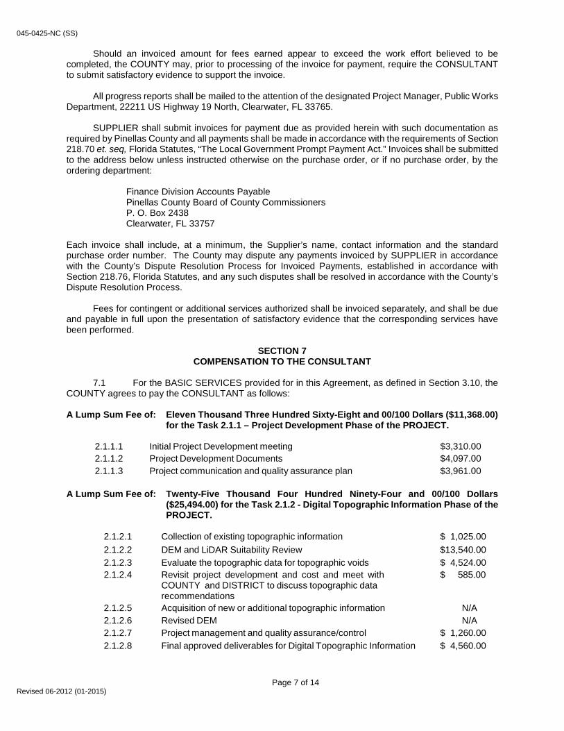
SECTION 7 COMPENSATION TO THE CONSULTANT
7.1 For the BASIC SERVICES provided for in this Agreement, as defined in Section 3.10, the
COUNTY agrees to pay the CONSULTANT as follows:
A Lump Sum Fee of: Eleven Thousand Three Hundred Sixty-Eight and 00/100 Dollars ($11,368.00) for the Task 2.1.1 – Project Development Phase of the PROJECT.
2.1.1.1 Initial Project Development meeting $3,310.00 2.1.1.2 Project Development Documents $4,097.00 2.1.1.3 Project communication and quality assurance plan $3,961.00
A Lump Sum Fee of: Twenty-Five Thousand Four Hundred Ninety-Four and 00/100 Dollars
($25,494.00) for the Task 2.1.2 - Digital Topographic Information Phase of the PROJECT.
2.1.2.1 Collection of existing topographic information $ 1,025.00 2.1.2.2 DEM and LiDAR Suitability Review $13,540.00 2.1.2.3 Evaluate the topographic data for topographic voids $ 4,524.00 2.1.2.4 Revisit project development and cost and meet with
COUNTY and DISTRICT to discuss topographic data recommendations
$ 585.00
2.1.2.5 Acquisition of new or additional topographic information N/A 2.1.2.6 Revised DEM N/A 2.1.2.7 Project management and quality assurance/control $ 1,260.00 2.1.2.8 Final approved deliverables for Digital Topographic Information $ 4,560.00
Page 7 of 14 Revised 06-2012 (01-2015)

045-0425-NC (SS) A Lump Sum Fee of: Four Hundred Thirty-Eight Thousand Six Hundred Ninety-Five and 00/100
Dollars (438,695.00) for the Task 2.1.3 – Watershed Evaluation Phase of the PROJECT.
2.1.3.1 Assembly of existing watershed feature data $23,444.00
2.1.3.2 Initial desktop evaluation and processing of Generic Features to provide catchments and surface connectivity
$62,469.50
2.1.3.3 Pre-Field reconnaissance evaluation and field acquisition approach and methods
$42,182.00
2.1.3.4 Public notification N/A 2.1.3.5 Field reconnaissance and acquisition 2.1.3.5.1 HEP Population $10,120.00 2.1.3.5.2 Hydraulic Inventory $63,189.50 2.1.3.5.3 Survey $95,926.00 2.1.3.5.4 Maintenance Condition $7,412.00 2.1.3.6 TERRAIN refinement $5,174.00 2.1.3.7 Processing to develop final generic catchments and connectivity $33,156.00 2.1.3.8 Set up preliminary model features and parameters $33,276.00 2.1.3.9 Surface water resource assessment analysis approach $28,902.00 2.1.3.10 Project management and quality assurance/control $15,440.00 2.1.3.11 Final approved deliverables for the Watershed Evaluation $18,004.00 2.1.3.12 Peer Review (done by separate consultant for County) N/A
A Lump Sum Fee of: Three Hundred Seventy-Four Thousand Four Hundred Forty-Three and
00/100 Dollars ($374,443.00) for the Task 2.1.4 – Watershed Management Plan Phase of the PROJECT.
2.1.4.1 Watershed parameterization $51,948.00 2.1.4.2 Interim Preliminary Model Review $4,596.00 2.1.4.3 Floodplain Analysis $62,598.00 2.1.4.4 Public Notification $5,176.00 2.1.4.5 Public Meeting $5,118.00 2.1.4.6 Revised floodplain analysis and delineation $14,962.00 2.1.4.7 Presentation to Governing Board N/A 2.1.4.8 Sea-level Rise (SLR) Scenarios (Future Task - $13,528.00) N/A 2.1.4.9 Critical Storm Analysis (Future Task - $13,128.00) N/A 2.1.4.10 Level of Service Determination $20,098.00 2.1.4.11 Surface water resource assessment (water quality only) 2.1.4.11.1 Water Quality and Watershed Assessment $25,080.00 2.1.4.11.2 Pollutant Loading Estimates $68,440.00 2.1.4.11.3 Water Quality Monitoring Plan $4,500.00 2.1.4.12 Geomorphic Analysis (Future Task - $118,035.00) N/A 2.1.4.13 Best Management Practices (BMP) alternative analysis $46,681.00 2.1.4.14 Project management and quality assurance/control $29,656.00 2.1.4.15 Final approved deliverables for the Watershed Management Plan $16,314.00 2.1.4.16 Final Watershed Management Plan Report $19,276.00
Page 8 of 14 Revised 06-2012 (01-2015)
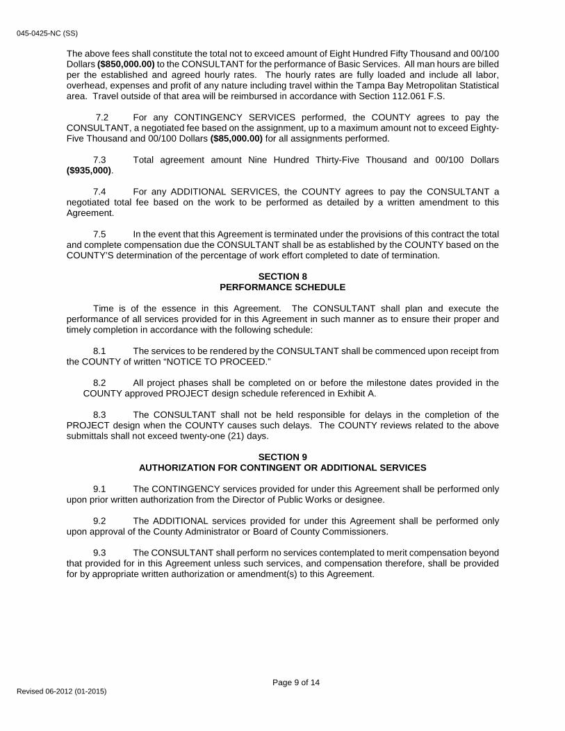
045-0425-NC (SS) The above fees shall constitute the total not to exceed amount of Eight Hundred Fifty Thousand and 00/100 Dollars ($850,000.00) to the CONSULTANT for the performance of Basic Services. All man hours are billed per the established and agreed hourly rates. The hourly rates are fully loaded and include all labor, overhead, expenses and profit of any nature including travel within the Tampa Bay Metropolitan Statistical area. Travel outside of that area will be reimbursed in accordance with Section 112.061 F.S.
7.2 For any CONTINGENCY SERVICES performed, the COUNTY agrees to pay the CONSULTANT, a negotiated fee based on the assignment, up to a maximum amount not to exceed Eighty-Five Thousand and 00/100 Dollars ($85,000.00) for all assignments performed.
7.3 Total agreement amount Nine Hundred Thirty-Five Thousand and 00/100 Dollars
($935,000). 7.4 For any ADDITIONAL SERVICES, the COUNTY agrees to pay the CONSULTANT a
negotiated total fee based on the work to be performed as detailed by a written amendment to this Agreement.
7.5 In the event that this Agreement is terminated under the provisions of this contract the total
and complete compensation due the CONSULTANT shall be as established by the COUNTY based on the COUNTY’S determination of the percentage of work effort completed to date of termination.
SECTION 8
PERFORMANCE SCHEDULE Time is of the essence in this Agreement. The CONSULTANT shall plan and execute the
performance of all services provided for in this Agreement in such manner as to ensure their proper and timely completion in accordance with the following schedule:
8.1 The services to be rendered by the CONSULTANT shall be commenced upon receipt from
the COUNTY of written “NOTICE TO PROCEED.” 8.2 All project phases shall be completed on or before the milestone dates provided in the
COUNTY approved PROJECT design schedule referenced in Exhibit A. 8.3 The CONSULTANT shall not be held responsible for delays in the completion of the
PROJECT design when the COUNTY causes such delays. The COUNTY reviews related to the above submittals shall not exceed twenty-one (21) days.
SECTION 9
AUTHORIZATION FOR CONTINGENT OR ADDITIONAL SERVICES 9.1 The CONTINGENCY services provided for under this Agreement shall be performed only
upon prior written authorization from the Director of Public Works or designee. 9.2 The ADDITIONAL services provided for under this Agreement shall be performed only
upon approval of the County Administrator or Board of County Commissioners. 9.3 The CONSULTANT shall perform no services contemplated to merit compensation beyond
that provided for in this Agreement unless such services, and compensation therefore, shall be provided for by appropriate written authorization or amendment(s) to this Agreement.
Page 9 of 14 Revised 06-2012 (01-2015)

045-0425-NC (SS)
SECTION 10 FIRMS AND INDIVIDUALS PROVIDING SUBCONSULTING SERVICES
The COUNTY reserves the right to review the qualifications of any and all subconsultants, and to
reject any subconsultant in a proper and timely manner, deemed not qualified to perform the services for which it shall have been engaged. Any subconsultant not listed as part of the prime consultants team at time of award must be approved by the Director of Purchasing prior to performing any service.
SECTION 11
SATISFACTORY PERFORMANCE All services to be provided by the CONSULTANT under the provisions of this Agreement, including
services to be provided by subcontractors, shall be performed to the reasonable satisfaction of the COUNTY’S Director of Public Works or designee.
SECTION 12
RESOLUTION OF DISAGREEMENTS 12.1 The COUNTY shall reasonably decide all questions and disputes, of any nature
whatsoever, that may arise in the execution and fulfillment of the services provided for under this Agreement.
12.2 The decision of the COUNTY upon all claims, questions, disputes and conflicts shall be
final and conclusive, and shall be binding upon all parties to this Agreement, subject to judicial review.
SECTION 13 CONSULTANT’S ACCOUNTING RECORDS
13.1 Records of expenses pertaining to all services performed shall be kept in accordance with
generally accepted accounting principles and procedures. 13.2 The CONSULTANT’S records shall be open to inspection and subject to examination,
audit, and/or reproduction during normal working hours by the COUNTY’S agent or authorized representative to the extent necessary to adequately permit evaluation and verification of any invoices, payments or claims submitted by the CONSULTANT or any of his payees pursuant to the execution of the Agreement. These records shall include, but not be limited to, accounting records, written policies and procedures, subcontractor files (including proposals of successful and unsuccessful bidders), original estimates, estimating worksheets, correspondence, change order files (including documentation covering negotiated settlements), and any other supporting evidence necessary to substantiate charges related to this Agreement. They shall also include, but not be limited to, those records necessary to evaluate and verify direct and indirect costs (including overhead allocations) as they may apply to costs associated with this Agreement. The COUNTY shall not audit payroll and expense records on task assignments paid by lump sum fee.
13.3 For the purpose of such audits, inspections, examinations and evaluations, the COUNTY’S
agent or authorized representative shall have access to said records from the effective date of the Agreement, for the duration of work, and until three (3) years after the date of final payment by the COUNTY to the CONSULTANT pursuant to this Agreement.
13.4 The COUNTY’S agent or authorized representative shall have access to the
CONSULTANT’S facilities and all necessary records in order to conduct audits in compliance with this Section. The COUNTY’S agent or authorized representative shall give the CONSULTANT reasonable advance notice of intended inspections, examinations, and/or audits.
Page 10 of 14 Revised 06-2012 (01-2015)
045-0425-NC (SS)
SECTION 14 OWNERSHIP OF PROJECT DOCUMENTS
Upon completion or termination of this Agreement, all records, documents, tracings, plans,
specifications, maps, evaluations, reports and other technical data, other than working papers, prepared or developed by the CONSULTANT under this Agreement shall be delivered to and become the property of the COUNTY. The CONSULTANT, at its own expense, may retain copies for its files and internal use. The COUNTY shall not reuse any design plans or specifications to construct another project at the same or a different location without the CONSULTANT’S specific written verification, adaptation or approval.
SECTION 15
INSURANCE COVERAGE AND INDEMNIFICATION 15.1 The Contractor must maintain insurance in at least the amounts required in the Request
for Proposal throughout the term of this contract. The contractor must provide a Certificate of Insurance in accordance with Insurance Requirements of the Request for Proposal, evidencing such coverage prior to issuance of a purchase order or commencement of any work under this Contract. See Section C Insurance Requirements – Attached
15.2 If the CONSULTANT is an individual or entity licensed by the state of Florida who holds a
current certificate of registration under Chapter 481, Florida Statutes, to practice architecture or landscape architecture, under Chapter 472, Florida Statutes, to practice land surveying and mapping, or under Chapter 471, Florida Statutes, to practice engineering, and who enters into a written agreement with the COUNTY relating to the planning, design, construction, administration, study, evaluation, consulting, or other professional and technical support services furnished in connection with any actual or proposed construction, improvement, alteration, repair, maintenance, operation, management, relocation, demolition, excavation, or other facility, land, air, water, or utility development or improvement, the CONSULTANT will indemnify and hold harmless the COUNTY, and its officers and employees, from liabilities, damages, losses, and costs, including, but not limited to, reasonable attorneys' fees, to the extent caused by the negligence, recklessness, or intentionally wrongful conduct of the CONSULTANT and other persons employed or utilized by the CONSULTANT in the performance of the Agreement.
SECTION 16
EQUAL EMPLOYMENT OPPORTUNITY CLAUSE FOR CONTRACTS NOT SUBJECT TO EXECUTIVE ORDER 11246
In carrying out the contract, the CONSULTANT shall not discriminate against employee or applicant
for employment because of race, color, religion, sex or national origin.
SECTION 17 INDEPENDENT CONTRACTOR STATUS AND COMPLIANCE WITH THE
IMMIGRATION REFORM AND CONTROL ACT OF 1986 CONSULTANT acknowledges that it is functioning as an independent contractor in performing under
the terms of this Agreement, and it is not acting as an employee of COUNTY. CONSULTANT acknowledges that it is responsible for complying with the provisions of the Immigration Reform and Control Act of 1986, located at 8 U.S.C. Section 1324, et seq., and regulations relating thereto. Failure to comply with the above provisions of this contract shall be considered a material breach and shall be grounds for immediate termination of the contract.
Page 11 of 14 Revised 06-2012 (01-2015)

045-0425-NC (SS)
SECTION 18 PROHIBITION AGAINST CONTINGENT FEE
The CONSULTANT warrants that he has not employed or retained any company or person, other
than a bona fide employee working solely for the CONSULTANT to solicit or secure this Agreement, and that he has not paid or agreed to pay any person, company, corporation, individual, or firm other than a bona fide employee working solely for the CONSULTANT, any fee, commission, percentage, gift or any other consideration, contingent upon or resulting from the award or making of this Agreement.
SECTION 19
TRUTH IN NEGOTIATIONS By execution of this Agreement, the CONSULTANT certifies to truth-in-negotiations and that wage
rates and other factual unit costs supporting the compensation are accurate, complete and current at the time of contracting. Further, the original contract amount and any additions thereto shall be adjusted to exclude any significant sums where the COUNTY determines the contract price was increased due to inaccurate, incomplete or non-current wage rates and other factual unit costs. Such adjustments must be made within one (1) year following the end of the contract.
SECTION 20
SUCCESSORS AND ASSIGNS The CONSULTANT shall not assign, sublet, or transfer his interest in this Agreement without the
written consent of the COUNTY.
SECTION 21 INTEREST ON JUDGMENTS
In the event of any disputes between the parties to this Agreement, including without limitation
thereto, their assignees and/or assigns, arising out of or relating in any way to this Agreement, which results in litigation and a subsequent judgment, award or decree against either party, it is agreed that any entitlement to post judgment interest, to either party and/or their attorneys, shall be fixed by the proper court at the rate of five percent (5%), per annum, simple interest. Under no circumstances shall either party be entitled to pre-judgment interest. The parties expressly acknowledge and, to the extent allowed by law, hereby opt out of any provision of federal or state statute not in agreement with this paragraph.
SECTION 22
TERMINATION OF AGREEMENT 22.1 The COUNTY reserves the right to cancel this Agreement, without cause, by giving thirty
(30) days prior written notice to the CONSULTANT of the intention to cancel. Failure of the CONSULTANT to fulfill or abide by any of the terms or conditions specified shall be considered a material breach of contract and shall be cause for immediate termination of the contract at the discretion of COUNTY. Alternatively, at the COUNTY’S discretion, the COUNTY may provide to CONSULTANT thirty (30) days to cure the breach. Where notice of breach and opportunity to cure is given, and CONSULTANT fails to cure the breach within the time provided for cure, COUNTY reserves the right to treat the notice of breach as notice of intent to cancel the Agreement for convenience.
22.2 If COUNTY terminates the Agreement for convenience, other than where the
CONSULTANT breaches the Agreement, the CONSULTANT’S recovery against the COUNTY shall be limited to that portion of the CONSULTANT’S compensation earned through date of termination, together with any costs reasonably incurred by the CONSULTANT that are directly attributable to the termination. The CONSULTANT shall not be entitled to any further recovery against the COUNTY, including but not limited to anticipated fees or profit on work not required to be performed.
22.3 Upon termination, the CONSULTANT shall deliver to the COUNTY all original papers,
records, documents, drawings, models, and other material set forth and described in this Agreement.
Page 12 of 14 Revised 06-2012 (01-2015)

045-0425-NC (SS) 22.4 In the event that conditions arise, such as lack of available funds, which in the COUNTY’S
opinion make it advisable and in the public interest to terminate this Agreement, it may do so upon written notice.
SECTION 23
AGREEMENT TERM This Agreement will become effective on the date of execution first written above and shall remain
in effect for thirty-six (36) consecutive calendar months from the commencement date on the Notice to Proceed) unless terminated at an earlier date under other provisions of this Agreement, or unless extended for a longer term by amendment.
SECTION 24
CONFLICT OF INTEREST 24.1 By accepting award of this Contract, the CONSULTANT, which shall include its directors,
officers and employees, represents that it presently has no interest in and shall acquire no interest in any business or activity which would conflict in any manner with the performance of services required hereunder, including as described in the CONSULTANT’S own professional ethical requirements. An interest in a business or activity which shall be deemed a conflict includes but is not limited to direct financial interest in any of the material and equipment manufacturers suppliers, distributors, or contractors who will be eligible to supply material and equipment for the PROJECT for which the CONSULTANT is furnishing its services required hereunder.
24.2 If, in the sole discretion of the County Administrator or designee, a conflict of interest is
deemed to exist or arise during the term of the contract, the County Administrator or designee may cancel this contract, effective upon the date so stated in the Written Notice of Cancellation, without penalty to the COUNTY.
SECTION 25
ENTIRE AGREEMENT This Agreement represents, together with all Exhibits and Appendices, the entire written Agreement
between the COUNTY and the CONSULTANT and may be amended only by written instrument signed by both the COUNTY and the CONSULTANT.
SECTION 26
PUBLIC ENTITY CRIMES CONSULTANT is directed to the Florida Public Entity Crime Act, Fla. Stat. 287.133, and Fla. Stat.
287.135 regarding Scrutinized Companies, and CONSULTANT agrees that its bid and, if awarded, its performance of the agreement will comply with all applicable laws including those referenced herein. CONSULTANT represents and certifies that CONSULTANT is and will at all times remain eligible to bid for and perform the services subject to the requirements of these, and other applicable, laws. CONSULTANT agrees that any contract awarded to CONSULTANT will be subject to termination by the County if CONSULTANT fails to comply or to maintain such compliance.
SECTION 27
PUBLIC RECORDS Contractor acknowledges that information and data it manages as part of the services may be public
records in accordance with Chapter 119, Florida Statutes and Pinellas County public records policies. Contractor agrees that prior to providing services it will implement policies and procedures to maintain, produce, secure, and retain public records in accordance with applicable laws, regulations, and County policies, including but not limited to the Section 119.0701, Florida Statutes. Notwithstanding any other provision of this Agreement relating to compensation, the Contractor agrees to charge the County, and/or any third parties requesting public records only such fees allowed by Section 119.07, Florida Statutes, and County policy for locating and producing public records during the term of this Agreement.
Page 13 of 14 Revised 06-2012 (01-2015)


Exhibit A Scope of Services
Curlew Creek and Smith Bayou Watershed Evaluation and Management Plan (Management Plan)
*Note: All deliverables are required to meet the requirements of the Southwest FloridaWater Management District (DISTRICT) and Pinellas County (COUNTY)
The MANAGEMENT PLAN provides an evaluation of the watershed, to identify problems requiring management of resources, recommend solutions affecting water quantity, and natural resources. The MANAGEMENT PLAN will address localized flooding situations, erosion, sedimentation, and stormwater pollution. The MANAGEMENT PLAN will include the initial collection of design, water quality, and sediment data, the evaluation of existing twenty-five (25)-year and one hundred (100)- year flood elevations, the diagnostic evaluation of the watershed, the use of an appropriate hydraulic/hydrologic model that is accepted by the National Flood Insurance Program, the COUNTY, and the DISTRICT, and the development of a MANAGEMENT PLAN that provides recommendations for non-structural and site-specific structural improvements. Interconnected Pond Routing version four (ICPR4) is the preferred surface water modeling software package and will be used for this project unless the County directs CONSULTANT to use ICPR 3.2. A switch to ICPR 3.2 may be initiated by the COUNTY at any point up until the beginning of Task 2.1.4. A pollutant-loading model will be developed to estimate pollutant loads generated by sub-basins, relative levels of pollutant loads delivered to the Curlew Creek and Smith Bayou Canal by major outfall or adjacent sub-basins, and relative pollutant loads delivered from the watershed to St. Joseph Sound. The model will also estimate pollutant load reductions that may result through implementing the MANAGEMENT PLAN.
The MANAGEMENT PLAN will include, as feasible, the conceptual design for recommended structural alternatives that will be necessary to determine permitting and construction feasibility, and cost effectiveness at the planning level. This plan does not include preparing information for permit applications. The MANAGEMENT PLAN will also address the Florida Department of Environmental Protection’s (FDEP) Total Maximum Daily Load (TMDL) program as described in Section 2.1.4.11, below.
1.1 LIMITS OF WORK
1.1.1 The MANAGEMENT PLAN shall encompass all areas for the improvements described herein and shall extend, laterally and linearly, to those boundaries delineated as the watershed, a total area of approximately 8,546 acres. The extent of the study area is generally defined as the Curlew Creek and Smith Bayou Canal and those lands draining to it. A detailed project area will be determined upon project initiation
Page 1 of 27

1.1.2 Proposed improvements, when feasible and practical, should be contained within the limits of existing publicly owned lands, rights-of-way, or easements. Regional improvements on privately held land that could further the objectives of the MANAGEMENT PLAN may also be considered.
1.2 KEY PERSONNEL
1.2.1 The COUNTY and the DISTRICT reserve the right to approve/disapprove for whatsoever reason all personnel assigned to this project by the CONSULTANT. The individual(s) named in the proposal response and/or such other individuals who are to be assigned to work under this contract are necessary for the successful performance of this contract. The CONSULTANT agrees that whenever for any reason, one or more of the individuals named in the proposal are unavailable for performance under this contract; the CONSULTANT shall replace such individual(s) with an individual(s) of substantially equal abilities, qualifications, and demonstrated applicable experience, subject to approval by the COUNTY and the DISTRICT.
1.2.2 The CONSULTANT shall submit to the COUNTY a resume giving the full name, title, qualifications, and experience, for all successors and/or new persons prior to assignment of such personnel to perform work under this contract. Should the COUNTY or DISTRICT decide the successor personnel does not meet the qualifications of the replaced personnel, or in the case of new personnel, the COUNTY or DISTRICT determines they are not qualified to perform the work assigned, the COUNTY will advise the CONSULTANT accordingly. The CONSULTANT shall then submit name(s) and qualifications of an individual(s) to the COUNTY until a determination is made by the COUNTY or DISTRICT that the replacement individual(s) has substantially equal abilities, qualifications, and demonstrated applicable experience of the individual(s) named herein.
1.2.3 The designated Project Manager shall serve as the project representative for the CONSULTANT. The CONSULTANT, in recognition of the existing Cooperative Agreement, will submit correspondence to the COUNTY and the DISTRICT, who will in turn copy project correspondence to all members of the TEAM as appropriate.
Page 2 of 27

1.3 PROJECT DESCRIPTION
Funding for this PROJECT will be used to develop a MANAGEMENT PLAN for the watershed. The Curlew Creek and Smith Bayou Watershed is a combined 8,546 acre drainage basin located in north Pinellas County. This large drainage basin includes parts of unincorporated Pinellas County as well as the cities of Dunedin and Clearwater. The Curlew Creek and Smith Bayou system includes multiple tributaries. Dominant land use categories in the Curlew Creek and Smith Bayou Watershed include residential, commercial, and recreational open space. The main channels of Curlew Creek and Smith Bayou flow from east to west, ultimately discharging into St. Joseph Sound. The primary tributaries to Curlew Creek and Smith Bayou have existing poor water quality and are known to contribute significant sediment loadings to St. Joseph Sound. This request involves the development of a comprehensive watershed management plan that results in recommendations for water quality, drainage, and natural system improvement projects.
Performing elements of the watershed management program in cooperation with local governments is one of the Comprehensive Watershed Management (CWM) initiatives implemented by the DISTRICT. CWM teams for each of the major watersheds of the DISTRICT were assembled to address issues regarding the DISTRICT'S four areas of responsibility: Flood Protection, Water Quality, Water Supply, and Natural Systems. Out of this team effort, the DISTRICT recommended strategies and goals to address issues associated with these areas of responsibility. A recurrent theme of the CWM teams is the need for a watershed decision support system by which current and projected watershed conditions could be evaluated. The MANAGEMENT PLAN addresses this need.
The MANAGEMENT PLAN includes five major elements: 1) Digital Topographic Information, 2) Watershed Evaluation, 3) Watershed Management Plan, 4) Identification of Best Management Practices (BMPs), and 5) Watershed Management Plan Database Maintenance and Watershed Model Updates. Implementing elements of the watershed management program with local governments is one of the CWM initiative strategies. The watershed management program provides a method of evaluating the capacity of a watershed to protect, enhance, and restore water quality and natural systems, while achieving flood protection, and of measuring the effectiveness of the strategies and goals of the CWM initiative to reach the desired watershed condition through data analysis, modeling, projection, evaluation.
Page 3 of 27

2.1 PROJECT SCOPE OF WORK
The PROJECT shall be designed by the CONSULTANT in accordance with applicable industry standards. The CONSULTANT shall be responsible for utilizing and maintaining current knowledge of any laws, ordinances, codes, rules, regulations, standards, guidelines, special conditions, specifications, or other mandates relevant to the PROJECT or the services to be performed. The CONSULTANT will perform the required professional services in accordance with the "Federal Emergency Management Agency’s Guidelines and Specifications for Flood Hazard Mapping Partners" (Available at http://www.fema.gov/mit/tsd/dl cgs.htm), the nine elements listed in USEPA’s 319(h) Guidance Manual, SWFWMD Standards (Available at http://ftp.swfwmd.state.fl.us/pub/GWIS/) and Pinellas COUNTY Standards (Available at http://www.pinellascounty.org/plan/comprehensive_plan.htm) as applicable. All deliverables will be in accordance with the template provided by the DISTRICT.
All agendas will be delivered forty-eight (48) hours before each meeting, and all draft minutes will be delivered within five (5) business days after each meeting. The CONSULTANT assumes that all comments from the team will be consolidated by the COUNTY’s Project Manager and submitted to the CONSULTANT within five (5) business days of delivery.
2.1.1 Project Development is the discussion of how the agreement will be fulfilled and
how well the CONSULTANT understands the Project.
2.1.1.1 Initial Project Development meeting This task includes time to become familiar with the watershed under study, the data available to the CONSULTANT, and the DISTRICT study process. The CONSULTANT will develop an approach outline that will be based on the outline of the “General Scope of Work.” Detail will be added specific to the generic watershed with specifics about the anticipated work effort and issues of importance. A meeting will be conducted to present and discuss the scope.
Deliverables • Draft scope of work with issues identified for each task. • Meeting to discuss scope of work.
2.1.1.2 Project Development Documents The CONSULTANT will document and review the expected project timeline, allocate staff resources, and develop the cost spreadsheet. This is the initial effort; however, additional time will be spent on this task to periodically update the project timeline, evaluate staff allocations, and update the Itemized Project Budget spreadsheet.
Page 4 of 27
Deliverables
• Itemized Project Budget spreadsheet based on the initial scope of
work. • Entire project timeline based on the initial scope of work. • Staff allocation spreadsheet based on tasks and staff qualifications.
2.1.1.3 Project communication and quality assurance plan This task includes establishing a communication protocol with members of the project team, the DISTRICT, Pinellas COUNTY, and incorporated communities in order to negotiate and commence the project. The CONSULTANT will provide a copy of the communication protocol and the firm’s Quality Assurance Plan for review and approval. The project-specific Quality Assurance/Quality Control (QA/QC) document will outline who will perform specific tasks, who will perform the QA/QC for specific tasks, and the procedures for the QA/QC (e.g. use of LP (three hundred sixty) 360, DataQE and submission of a comment geodatabase). A signed and sealed QA/QC document confirming the work assignments and the QA/QC procedures that were used will be submitted with each deliverable. Deliverables
• Communication protocol document • the CONSULTANT’S Quality Assurance Plan • Project-specific QA/QC document 2.1.2 Digital Topographic Information is the generation of a Digital Terrain Model (DTM) of the watershed from digital and/or hardcopy topographic information. Hardcopy topographic information is converted to digital format along with a review of all source information regarding land surface accuracy. The Digital Topographic Information element will include the following: 2.1.2.1 Collecting existing topographic information
The CONSULTANT will receive L ight Detect ion and Ranging (LiDAR)-derived topographic information, including a 5 X 5 foot D i g i t a l E l e v a t i o n M a p ( DEM) from the DISTRICT generated from the 2016 LiDAR. The topographic information will be verified and certified by other parties before it is submitted to the CONSULTANT, However, the CONSULTANT is responsible for reviewing the data to confirm that there are no missing data or other oversights that occurred in the delivery of data. The CONSULTANT will make the COUNTY and DISTRICT aware of any discrepancies that exist.
Page 5 of 27
2.1.2.2 DEM and LiDAR Suitability Review
The CONSULTANT will review the 2016 DEM, breaklines, and accuracy report. The DEM will be used to identify possible problems with the LiDAR based DEM such as floating breaklines and insufficient post spacing, and voids. The CONSULTANT will perform a desktop review of the 2016 DEM for suitability. If necessary, comments and concerns will be relayed to the COUNTY and DISTRICT. The CONSULTANT will review metadata accompanying the LiDAR data and incorporate subsequent changes and updates to the DEM throughout the project. It is understood that the DEM is a dynamic dataset, and a final DEM will be delivered at the end of the Watershed Evaluation phase of the study.
Deliverables
• Technical memo detailing comments and concerns based on desktop review • DEM (if deemed suitable)
2.1.2.3 Evaluate the topographic data for topographic voids The CONSULTANT will review the LiDAR-based DTM for topographic void areas that may result from development that will have an effect on hydraulic or hydrologic components of the model and has occurred since the LiDAR data were collected. The CONSULTANT will delineate topographic void areas in a separate geodatabase feature class and determine a plan of action for obtaining the necessary data (i.e. new LiDAR mission, ground survey, field measurements). Areas of topographic change will be identified. The CONSULTANT will make all datum conversions in accordance with procedures provided in the document FEMA Guidelines and Specifications for Flood Hazard Mapping Partners, Appendix B: Guidance for Converting to the North American Vertical Datum of 1988, April 2003 (Guidance Document 9). A single conversion factor will be used throughout the watershed. Deliverable
• Technical memo detailing plan of action for obtaining the necessary
data to address topographic voids.
Page 6 of 27

2.1.2.4 Revisit project development and cost and meet with the COUNTY
and DISTRICT to discuss topographic data recommendations
Deliverables
• Itemized Scope of Work and Project Budget spreadsheet. • Updated project timeline. • Meeting with the COUNTY and DISTRICT.
2.1.2.5 Acquisition of new or additional topographic information (*Not included) This task includes aerial or terrestrial LiDAR acquisition that will not be accomplished during the field reconnaissance.
2.1.2.6 Revised DEM (*Not included) 2.1.2.7 Project management and QA/QC The CONSULTANT will manage and provide quality assurance/quality control for the “Digital Topographic Information” element. Quality control reviews will be documented as appropriate.
Deliverables • Meet with the COUNTY to review the quality of the Digital Topographic
Information. • Quality control document. 2.1.2.8 Final approved deliverables for Digital Topographic Information. The CONSULTANT will provide required digital topographic information in the form of Envi ronmental Systems Research Inst i tute (ESRI) ArcGIS Geodatabase Feature Classes and associated tables, terrain datasets, domains, relationship classes, and metadata. Feature Classes provided will include those outlined in the Geographic Watershed Informat ion System (GWIS) document and the supplied GWIS database schema and will be housed in the Topographic Information Feature Dataset. Deliverables • GWIS geodatabase for Topographic Information. • Refined project development and cost documentation. • Refined project schedule.
Page 7 of 27

2.1.3 Watershed Evaluation is the systematic inventory of watershed features and their assessment to gain an understanding of the watershed. It consists of several tasks related to the creation of a GWIS Geodatabase that will contain information about the water resource features of the watershed. The watershed evaluation will include the following:
2.1.3.1 Assembly of existing watershed feature data
The CONSULTANT will collect and evaluate the following possible sources of information: • Information collected in surveys. • Additional topographic information from Environmental Resource
Permits (ERP), construction plans (as-built and permitted), and bathymetry in waterways and open channels.
• Road projects and plans • Local stormwater inventories, land use, impervious surfaces, and other
geodatabases that apply. • Repetitive loss areas and hot spots. • The Watershed Management Plan (WMP) should take into account the
Pinellas County Stormwater Master Plan (SWMP). The new WMP should mention that it updates the information in the SWMP for the Curlew and Smith basins.
• Use the Pinellas County stormwater inventory and retain the naming scheme that Pinellas County uses in their geodatabase.
Applicable documents will be hyperlinked within the GIS feature class. It is assumed that all necessary stormwater asset inventory information from Pinellas COUNTY, City of Clearwater, and City of Dunedin will be provided in a digital format that does not require digitizing to convert it to an ArcGIS format. The CONSULTANT is to collect and evaluate ERP information. The CONSULTANT will identify watershed features based on a cut-off date identified by the COUNTY and DISTRICT. The COUNTY, DISTRICT, and the CONSULTANT will select up to 400 ERPs to be incorporated into the parameters and model.
The DISTRICT will provide pdfs and, if available, computer-aided drafting files for the ERPs. The CONSULTANT will not be responsible for converting ERP information to an electronic format including converting hardcopy or microfiche information to PDF. The CONSULTANT will review up to 500 ERPs for this task.
Verification of information: The CONSULTANT will collect information to help verify the floodplain results during the Watershed Management Plan task. The CONSULTANT will collect information on historic water levels, surveys, photos or videos of flooding, and any other available information and identify areas where additional historic water levels information is desirable but unavailable based on the data located from the efforts discussed above. If required, the CONSULTANT will collect data for up to ten (10) high water marks in each watershed. Throughout this process, the CONSULTANT will remain in contact with the COUNTY and the DISTRICT PM to help review the appropriateness of the data collection.
Page 8 of 27

Deliverables
• Feature classes showing locations of ERPs, land use coverage and impervious
areas (if available). • Point file showing locations of historic water levels. • Documentation of data collection and evaluation efforts, including pdf copies of
ERP information from DISTRICT and FDEP and/or COUNTY files, surveys, as-built drawings, and, geotechnical information.
• Documented results of data collection and evaluation. A GIS feature class showing the location of the plans and that includes hyperlinks to PDF files of the plans,
2.1.3.2 Initial desktop evaluation and processing of Generic Features to provide initial catchments and surface connectivity
ArcHydro processing will be conducted to provide initial catchments for reference purposes. The CONSULTANT will document hydraulic features that are used to determine catchment boundaries but which are not modeled explicitly in a simple GIS feature outside of the GWIS 1.6 framework.
The CONSULTANT will place junctions appropriately to determine the effects of storage routing on hydrologically determined flow rates. As a goal CONSULTANT will place junctions in stormwater management and storage areas, ponds or lakes, natural lakes, wetlands and depressions that are larger than 10,000 square feet; however, the initial catchments will be delineated at a scale that results in a minimum of 600 nodes.
The 600-node minimum specified above may result in a model that is unable to accurately set base flood elevations (BFEs) and plan for BMPs at a desirable scale. The adequacy of the 600-node minimum will be assessed during this task and the team will meet, if needed, to discuss measures that can be taken to meet the 600-node minimum, such as performing limited detail study in areas of the watershed where flooding is not a concern. Alternately, the COUNTY may choose to increase detail. This task removes the 600-node limit and provides for increased detail throughout the watershed and a higher task cost. The increased-detail alternate will provide adequate detail for accurate BFE determination and BMP planning throughout the watershed. The increased level of detail envisioned would bring the Curlew Creek and Smith Bayou watershed models to a level of detail similar to the McKay Creek watershed model completed by COUNTY in 2014.
Deliverable • Initial catchment delineations.
Page 9 of 27

2.1.3.3 Pre-field reconnaissance evaluation and field acquisition approach and methods development The CONSULTANT will develop an approach to the data acquisition methodology that is specific to the watershed to include locations where collection will occur and what the method of collection will be. The CONSULTANT will submit this document to the COUNTY and the DISTRICT for approval before beginning the Field Reconnaissance task. Hydrojunctions will be placed where field work is required to parameterize a hydraulic feature and will be developed for use in the field reconnaissance, the GWIS Database Design Document Version 2.0 (Guidance Document 2), and for eventual documentation of the reconnaissance process. The CONSULTANT will further develop preliminary hydronetwork with hydrojunction and hydroedge feature classes during the field reconnaissance work. The goal of the field reconnaissance will be to populate the hydronetwork and Hydraulic Element Point feature class and the associated sub-element tables. Field reconnaissance will also include photographing culverts and pipes that are included in the model, reviewing areas of the DTM that were noted in Element 2.1.2, and documenting maintenance concerns. Deliverables
• GIS layers for hydronetwork including hydrojunctions where field data acquisition is
required. • Pre-field reconnaissance geodatabase. • Meeting to discuss collection methods and accuracy. 2.1.3.4 Public notification (*Not included) 2.1.3.5 Field Reconnaissance and Acquisition During Field Reconnaissance task, the CONSULTANT will compare new data to the County’s existing stormwater geodatabase and identify areas for update. The CONSULTANT will also make an assessment of the physical pipe condition and maintenance condition in line with the COUNTY’S assessment methods. When this task is complete, the CONSULTANT will provide the results to the COUNTY Project Manager (PM) for incorporation into our Work Management System. 2.1.3.5.1 The CONSULTANT will Populate the Hydraulic Element Points (HEP) HEPs within the GWIS that are needed to characterize the ICPR model. These features will be used to define sub-elements (culverts, weirs, etc.) in accordance with the GWIS Hydraulic Element Point (HEP) User’s Guide (Guidance Document two (2) supporting information). HEP features will only be populated for sub-elements that will be explicitly modeled in the final watershed model.
Page 10 of 27
2.1.3.5.2 Hydraulic Inventory The CONSULTANT will conduct a hydraulic inventory which will involve field investigation of the hydraulic features needed to model the watershed at the scale identified in 2.1.3.2. The field investigation will be conducted only for hydraulic features lacking exiting information. Hydraulic features for which ERP data or plan sets exist will not be visited. The CONSULTANT will provide documentation of each hydraulic feature visited as required in the G&S (Guidance Document 1), including location, condition, dimensions and elevations, description of accessibility, and photographs. This information will be compiled into an ESRI ArcGIS-ArcInfo 10.2 GWIS geodatabase that will have all back up descriptive files (including sketches, surveys, descriptions, and digital photos) hyperlinked to the appropriate feature class. 2.1.3.5.3 The CONSULTANT will survey up to 200 hydraulic structures Real-Time Kinematic GPS and traditional survey techniques with the results provided in an “X, Y, Z, Comment” format. The CONSULTANT will provide bathymetric survey for up to thirty (30) open channel cross-sections. The CONSULTANT will use the LiDAR based DTM to develop dry open-channel cross-sections and irregular overland weir cross-sections. Where available, the CONSULTANT will use As-Built information to determine structure invert elevations for up to 500 structures, including as-builts collected and evaluated under Task 2.1.3.1. The CONSULTANT will collect these data in accordance with the SWFWMD document Acquisition of Geospatial Information to Complete the Generic Watershed Parameters (Hydro Network) (Guidance Document 3). The CONSULTANT project manager (in close consultation with the COUNTY project manager and the DISTRICT project manager) will determine the appropriate level of accuracy (Levels 1 through 5 ) that is needed for the survey. This level of accuracy will be verified by the COUNTY project manager and the DISTRICT project manager before survey is started.
2.1.3.5.4 Maintenance Condition
The CONSULTANT will enter all data obtained during the field reconnaissance process into the GWIS geodatabase. During the field reconnaissance the CONSULTANT will note if the condition of the structure is “maintained” or “not maintained”. The CONSULTANT will report the condition in the geodatabase by populating the maintenance field. Note that this task does not include maintenance cost estimates or schedules for maintenance.
Deliverables • HEP Feature Classes • Survey Documentation • Pictures, Data Sheets • Maintenance Condition included in the Geodatabase • Relevant GIS data • Meeting with the COUNTY and DISTRICT to present and discuss deliverables
Page 11 of 27

2.1.3.6 TERRAIN refinement
The CONSULTANT will make topographic void updates at up to five (5) sites within the watershed that were identified in 2.1.2.3. The topographic void updates will be made using available permitted or as-built drawings. Georeferenced PDFs of the drawings used for the topographic void updates will be included in the deliverable. This task does not include site survey.
2.1.3.7 Final generic catchments and connectivity
Information collected during the previous steps will be used to finalize the generic catchments and connectivity.
Deliverables
• Geodatabase with:
o Final generic catchment delineations
o Refined connectivity
o Final hydro network
• CONSULTANT’s Comment Geodatabase
2.1.3.8 Setup preliminary model features and parameters
The final generic catchments and connectivity will be used setup the preliminary model features. Model features will include 1-D ICPR nodes, links, and basins.
Deliverables
• Geodatabase with ICPR model specific feature classes for preliminary model links, nodes, basins and model features to define level of detail.
• Meeting with the DISTRICT and the COUNTY to discuss deliverables to date.
• CONSULTANT’s Comment Geodatabase
Page 12 of 27

2.1.3.9 Surface water resource assessment analysis approach
The CONSULTANT will compile additional water resource information concerning water quantity and water quality as described in the accompanying section of the G&S (Guidance Document one 1). The CONSULTANT will develop an approach to the surface water resource assessment that is specific to the watershed and submit this approach to the COUNTY and the DISTRICT for approval before beginning the surface water resource assessment analysis task. The CONSULTANT will discuss the recommended approach with the COUNTY project manager and the DISTRICT project manager. Note that existing water quantity and quality data may be unavailable. Therefore, the scope of this task may deviate from that described in the G&S (Guidance Document 1), and may focus on advisement of data collection and monitoring activities that would be beneficial for this study or future updates. Several waterbody identification numbers (WBIDs) within the Curlew Creek and Smith Bayou watershed have been deemed impaired due to water quality standard exceedances. The CONSULTANT will identify and review any existing documents dealing with either the impairment assessment or TMDL development and recommend appropriate actions with regard to either the impairment assessment or TMDL. The information compiled will be examined in order to develop recommendations to reduce pollutant loadings to assist in addressing the impairment or implementing the TMDL. These recommendations will be the basis for the development of water quality BMPs to be included in the BMP Alternatives Analysis.
Deliverable
• Meeting with the DISTRICT and the COUNTY to discuss surface water resource assessment analysis approach and meeting minutes
• Surface Water Resource Assessment Analysis Approach
2.1.3.10 Project management and quality assurance/control
The CONSULTANT will attend a meeting to discuss the watershed evaluation deliverables and the modeling approach. This task includes time for project management and quality assurance/quality control for the “Watershed Evaluation” task. Coordination is anticipated with other project managers of adjacent watershed studies on issues such as water interactions between watersheds and aspects of the studies that may need to be consistent across the COUNTY. The CONSULTANT will conduct quality assurance and quality control. Quality control reviews will be documented by memorandum with attached graphics, if appropriate.
Deliverables • Participation at the meeting and providing final approved deliverables
for the Watershed Evaluation • The deliverables will be GWIS compliant • The final deliverables will be the items listed below in final approved
deliverables for the Watershed Evaluation and as noted in QA/QC deliverable spreadsheets
• All feature classes will be provided in one ArcMap GIS Project File Map (mxd).
Page 13 of 27

2.1.3.11 Final approved deliverables for the Watershed Evaluation The Watershed Evaluation list of deliverables will be compiled to generally include the GWIS geodatabase and Watershed Evaluation Documents (in digital format). It should be noted that the CONSULTANT will consider the DTM “finalized” at this point in the study. Further refinement of the DTM during or after floodplain delineation will be avoided to the greatest extent practicable to avoid unnecessary revisions to the floodplains. Deliverables • Watershed Evaluation • Draft Technical Support Data Notebook (TSDN)
o Updated Major Drainage Channels (conveyances that drain over 200 acres of drainage area)
• Resubmittal of Deliverables from Watershed Evaluation element (with revisions as necessary)
• GWIS Geodatabase with hydronetworks, catchments and connectivity 2.1.3.12 Peer Review The peer review will be completed by a separately-retained Consultant for the County. 2.1.4 Watershed Management Plan Consists of several tasks related to the management of surface water resources. Development of the MANAGEMENT PLAN builds upon information generated from the Watershed Evaluation so that planning and management decisions can be formulated. The MANAGEMENT PLAN will include the following: 2.1.4.1 Watershed parameterization Sub-basin Stage-Storage The CONSULTANT will develop stage-storage relationships for each sub-basin, as appropriate. This process will be conducted using a GIS tool, to reduce hand calculations and improve accuracy. Channel storage exclusion polygons will be used to exclude storage that will be modeled within a channel. The CONSULTANT will check each sub-basin for general consistency. The CONSULTANT will manually develop five stage-storage relationships for comparison to the automated results.
Page 14 of 27

Doppler Storm Runoff Generation
The CONSULTANT will use Doppler radar rainfall information to develop rainfall coverage for calibration and verification events. Calibration and verification events shall have a discharge duration of at least ten (10) hours and a depth meeting or exceeding the depth of a mean annual storm event. It is anticipated that the rainfall data will be available directly from the DISTRICT in f i f t e e n ( 15) minute incremental rainfall amounts over 2-kilometer-square grids. The CONSULTANT will use the rainfall data to generate a GIS layer and rainfall tables with overlay assignment to each sub-basin. Methodology for Determining Starting Water Levels The CONSULTANT will establish initial stages for stormwater management areas and ponds based on best available information such as ERP documents, control feature data, orthophotography, or seasonal high water levels when control feature data are not applicable. Initial stages in wetland areas may be based on a desktop vegetation/terrain evaluation. The CONSULTANT will discuss proposed methods with the COUNTY project manager and DISTRICT project manager before selecting starting water elevations. The CONSULTANT will plot the area inundated by the initial conditions.
Methodology for Determining Directly Connected Impervious Area (DCIA) and Unconnected Impervious Area (UCIA) The CONSULTANT will discuss the methodology for assigning DCIA and UCIA with the COUNTY project manager and DISTRICT project manager before it is used. This task will not include developing a spatial DCIA and UCIA feature. Hydrology The CONSULTANT will develop an event-based surface water model for this project using the computer program Interconnected Pond Routing (ICPR) version 4 (or latest FEMA-approved version). The most recent service packs at the time of model development will be used. The hydrology will be based on the NRCS Curve Number (CN) method with DCIA parameters, if applicable, unless a more rigorous infiltration method, such as Green-Ampt, is needed to accurately represent runoff from the watershed’s well-drained sands. All hydrologic data will also be verified and methods of verification will be documented. The CONSULTANT will use the methodology for estimating times of concentration that is referenced in Natural Resources Conservation Service Technical Release 55 (NRCS TR-55).
Page 15 of 27
Cross-Sections for weirs The CONSULTANT will generate cross-sections to represent weirs for the surface water model. It is anticipated that all cross-sections will either be derived from the terrain or based on surveys, as-built drawings, or construction plan information. The process of deriving the cross-section information from the terrain in x,y,z format will be automated using ArcHydro or alternate GIS tool approved by the COUNTY and DISTRICT. Some manipulation of the data may be necessary for input into the surface water model. The CONSULTANT will check crest elevations to ensure that cross-sections are being cut at the correct locations and the overtopping elevation is correctly represented. The irregular weirs and weir cross-sections tables in the GWIS geodatabase will be completed with additional inputs from surveyed information. Deliverables • Doppler Storm Runoff Generation GIS Layer • Discussion of Methodology of Determining Starting Water Levels • Discussion of Methodology of Determining DCIA and NDCIA • Input GIS data • GIS data, calculations, and discussion about Methodology for Times of
Concentration • Methodology memorandum covering starting water levels, DCIA and NDCIA,
Curve Numbers, and times-of-concentration • Irregular weir GWIS data • Plot of area inundated by initial starting conditions 2.1.4.2 Interim Preliminary Model Review The DISTRICT and COUNTY will review the preliminary ICPR model input data and provide comments to the CONSULTANT. The CONSULTANT is responsible for submitting the preliminary model and responding to DISTRICT and COUNTY comments. Deliverables • Preliminary ICPR model. • Response to Comments. 2.1.4.3 Floodplain analysis The CONSULTANT will update the boundary conditions to and from adjacent watersheds to reflect all significant physical connections. COUNTY and DISTRICT staff will oversee boundary condition coordination in areas identified by the CONSULTANT.
Page 16 of 27

Hydraulic and Hydrologic Information The CONSULTANT will compile the hydraulic and hydrologic information and develop a surface water model using the surface water modeling program ICPR. All model data (including hydraulic data, hydrologic data, and soils data) will be downloaded from GWIS formats into ICPR for development of the surface water model. The CONSULTANT will simulate the 100-year/24-hour rainfall event and the 100-year/5-day storm. The CONSULTANT will coordinate with the DISTRICT project manager and COUNTY project manager and consultants of adjoining watershed studies to ensure that the new watershed boundaries are agreed upon before model development. Model Calibration and Verification The CONSULTANT will calibrate the ICPR model to one (1) of the rainfall events developed in 2.1.4.1. If necessary the CONSULTANT will adjust model parameters and rerun the model to verify results. The CONSULTANT will verify the calibration using the other rainfall event developed in 2.1.4.1.
Model Validation Existing flood information will be used to validate the model, where available. Floodplain plots will be prepared for comparison in areas where available high water information corresponds to one of the existing, suitable simulations. The existing, suitable simulations include the calibration event, verification event, or design event with similar depth and duration. Verification of the model may lead to refinement of the model to improve accuracy of the results. The CONSULTANT will also review the stability and reasonableness of the results. Justifications will be provided to support the CONSULTANTS’ floodplain results. Draft Floodplain Delineations and QA/QC Maps The CONSULTANT will conduct an internal QA/QC review of the ICPR model. Additionally, the CONSULTANT will develop an ArcMap GIS Project File Map (mxd) for “QA/QC” of the preliminary floodplain model results and other relevant data used or developed by CONSULTANT for use in reviews by outside entities. Present Model Results and Justification for Changes in Floodplain If applicable, the CONSULTANT will prepare written justification of changes in the floodplain (horizontal and vertical extents) from the FEMA's effective floodplain information and for rainfall durations longer than 24-hours. Changes in the floodplains may have to be revised as a result of the presentation to COUNTY and DISTRICT staff mentioned in the deliverables below.
Page 17 of 27

Deliverables • Model input/output files • PDF of the ICPR Node Computation Performance Report • PDF plots of stage-time and flow-time hydrographs • Pdfs of existing 25-year and 100-year storm elevations • Model Calibration and Validation results and a summary of Calibration
Adjustments. • Justification for use of multi-day storm event (if applicable) • Justification Report of changes in floodplains • Floodplain Delineations with Transition Zones and Flood Depth Grids • QA/QC Maps (electronic only) • Polygon coverage showing areas where the digital terrain does not reflect the
ground conditions • Geodatabase • Presentation to COUNTY and DISTRICT staff including a review of quality
assurance • Response to DISTRICT • Certification that the work was done in accordance with FEMA standards 2.1.4.4 Public notification The public notification component will consist of the CONSULTANT hosting a web page or Facebook page to share information with the public and to gather citizen comments. The County may assist with public notification. 2.1.4.5 Public Meeting: CONSULTANT shall provide staffing and support for one (1) public meeting. 2.1.4.6 Revised floodplain analysis and delineation The CONSULTANT will revise the geodatabase and model, as appropriate, based on comments and information received from the DISTRICT, COUNTY. The CONSULTANT’s deliverable will conform to the applicable sections of the latest edition of FEMA’s Guidelines and Standards for Flood Risk Analysis and Mapping Deliverable • Revised floodplain 2.1.4.7 Presentation to Governing Board (*Not Included)
Page 18 of 27

2.1.4.8 Sea-level Rise (SLR) Scenarios (*Future Task) CONSULTANT shall model scenarios for SLR of the following projections: six (6) inch, one (1) -foot, two (2) - feet, three (3) -feet and five (5) -feet. Evaluate the one hundred (100) year and fifty (50) year- twenty-four (24) hour rainfall in these scenarios for both the near-term and far-term projections. Associated draft, level-pool floodplains will be developed. SLR scenarios will be evaluated using the existing conditions model (developed in Task 2.1.4.3) with updated boundary conditions and rainfall depths. 2.1.4.9 Critical Storm Analysis (*Future Task) The critical storm for each catchment should also be identified. The critical storm analysis will be used to evaluate all open and closed basins for recommended regulatory requirements for new development or redevelopment. The Critical Storm Analysis will be conducted using the existing conditions model (developed in Task 2.1.4.3) with updated rainfall distributions and depths. 2.1.4.10 Level-of-Service determination The CONSULTANT will determine the Level-of-Service (LOS) throughout the watershed. The CONSULTANT will create a GWIS feature class in conformance with the G&S (Guidance Document 1) and the reference document, Stormwater Level of Service Methodology, SWFWMD, 1993 (Guidance Document 10). The LOS documentation will also include an estimate of the number of habitable structures within floodplain areas by reviewing aerial photography. A Floodplain Level-of-Service Report will be developed in compliance with the accompanying section of the G&S (Guidance Document 1). Verify the Stormwater LOS Methodology (SWFWMD 1993, Guidance Document 10) is consistent with the County LOS in the Comp Plan. Deliverables • LOS Report • LOS Geodatabase
2.1.4.11 Surface water resource assessment (water quality only) The surface water resource assessment includes tasks for watershed and water quality assessment, estimation of pollutant loads, and water quality modeling. The assessment will follow the agreed upon approach from task 2.1.3.9 - Surface water resource assessment analysis approach.
Page 19 of 27

2.1.4.11.1 Water Quality and Watershed Assessment The CONSULTANT will assess water quality data to identify trends, potential impairment risk, and any noteworthy water quality, hydrology, or structural issues that may be impacting the impairment condition. The assessment will include updating the 2013 trend analysis. Data sets examined will include the IWR data set used by FDEP, as well as additional data sets – as available – from the County and/or other publically-available water quality monitoring efforts. This task may also include a field review of sampling station locations and the physical characteristics of these stations, including the appropriateness of sample sites for characterization of surface water quality. Curlew Creek and Smith Bayou watershed characteristics will also be assessed relative to any known anthropogenic or environmental factors, and physical features within the watershed which may be impacting water quality conditions or sampling results, particularly for the impairment parameters, such as land use types, point and non-point discharges, extent of existing stormwater runoff treatment, and base flow. The assessment will include a comparison against criteria, as well as a discussion of the appropriateness of the criteria including discussion of the recent tidal creeks study and recommendations. The assessment will be used along with the Pollutant Loading Model to guide in the development of water quality BMPs. A report will be presented to summarize the work related to the water quality and watershed assessment, consistent with the requirements in the accompanying section of the G&S (Guidance Document 1). Deliverable • Surface Water Resource Assessment Report 2.1.4.11.2 Pollutant Loading Estimates
The CONSULTANT will develop pollutant loading estimates for to ta l n i t rogen (TN), to ta l phosphorous (TP), b io log ica l oxygen demand BOD), and to ta l suspended so l ids (TSS) using a spreadsheet, GIS, or similar model agreed upon by the COUNTY and CONSULTANT. Pollutant loading will take into account the presence and efficiency of BMPs in the basin. Gross and net pollutant loads will be reported and mapped by sub-basin. Point source loads will be included. The Pollutant Loading Model will be used along with the Surface Water Resource Assessment to guide in the development of water quality BMPs. Additionally, the Tampa Bay Estuary model will be applied to the study area and a comparative analysis will be conducted. Deliverables
• Pollutant Loading Model/GIS files • Pollutant Loading Assessment Report
Page 20 of 27

2.1.4.11.3 Water Quality Monitoring Plan The CONSULTANT will identify, obtain, and review existing water quality monitoring programs currently being implemented on Curlew Creek and Smith Bayou. In consultation with the COUNTY, the CONSULTANT will define appropriate water quality monitoring objectives. The CONSULTANT will review the output from the existing monitoring programs with respect to these objectives. The CONSULTANT will recommend a water quality monitoring program design that makes best use of existing program outputs and satisfies the desired monitoring program objectives. Deliverable • Surface Water Quality Monitoring Assessment and Design 2.1.4.12 Geomorphic Analysis and Recommendations (*Future Task) The CONSULTANT will conduct a geomorphic analysis of Curlew Creek and Smith Creek. The geomorphic analysis will include a synthesis of human impacts in the basin such as channelization, dredging, bank engineering, and stormwater management. Interviews with County staff, long-time residents, and other individuals will be conducted to support this investigation of anthropogenic influences on the creek systems. The analysis will include documentation of likely surface and along-channel sources of sediment (e.g. bed and bank erosion) through desktop reconnaissance using aerial photographs and field investigation. Cross-sections defining geomorphic attributes will be collected for up to thirty (30) cross-sections. While cross-section locations for the geomorphic analysis will be co-located with the cross sections defined in Section 2.1.3.5.3 to the extent possible, up to f i f t e e n ( 15) additional cross sections will be collected if needed in locations not covered by the hydraulic feature survey. The CONSULTANT will collect field data defining the longitudinal creek profiles, kick points, and channel entrenchment. The assessment will include mapping stream and floodplain erosion and sedimentation hotspots using historical imagery, supporting LiDAR, and field observations. Up to eight (8) erosion and sedimentation monitoring sites along the creek will be installed and monitored for short-term confirmations within the span of the study. The results of the analysis will be used to develop recommendations for stream and sediment management. Where feasible, environmentally-friendly methods of improving and rehabilitating function and form of the stream system will be identified. Deliverables • Field Plan • Draft Geomorphic Analysis • Final Geomorphic Analysis • Three Project Meetings
Page 21 of 27

2.1.4.13 Best Management Practices (BMP) alternative analysis The CONSULTANT will conduct a BMP alternatives analysis for up to ten (10) structural BMPs and two (2) non-structural BMPs in the watershed. An alternative BMP Analysis Report will be developed. The CONSULTANT will model the selected BMPs using ICPR and will estimate the pollutant load reductions for the BMPs. A comparison of the estimated pollutant load reductions to any TMDL required load reductions for the watershed will be made. If estimated pollutant load reductions from the selected BMPs do not meet the TMDL required reductions, then general recommendations for future actions to meet the TMDL will be included in the report. The gross cost to meet the load deficit to meet TMDLs will be estimated using a single estimated dollars-per-pound removed per TMDL constituent. The CONSULTANT will rank the alternatives based on a combination of cost and ease of implementation. The CONSULTANT will not apply for conceptual ERP permits for the proposed BMPs. Existing spatial data sources will be used to identify significant existing wetlands and other natural open space areas. The WMP will recommend preserving these areas from development, so that natural attenuation, retention, or detention of runoff is provided.
Deliverables • BMP Alternative Analysis Report • ICPR model and model results for BMPs • Pollutant load reduction estimates for the BMP • Ranking of BMP alternatives • Natural Systems and Open Space Preservation Areas 2.1.4.14 Project management and quality assurance/control This task includes one meeting and necessary follow-up conference calls or meetings between the CONSULTANT, the COUNTY, and other consultant(s) performing maintenance of other watersheds to maintain consistency in the methodology. It also includes at least two meetings with the COUNTY to discuss the Watershed Management Plan and final deliverables. The CONSULTANT will prepare a Digital QA/QC review MXD for the watershed. It will include the following layers and information: historical and most recent imagery, terrain information, soils, land use, FEMA Q3 data or current effective floodplains, review comments and responses, high water mark database information, Soil Survey Geographic Database (SSURGO) information, sub-basins, junctions, network, abutting watershed boundaries, roads, parcels, and ERPs included in the surface water model. The QA/QC review MXD will be used during the various meetings.
Page 22 of 27

This task includes time for project management and quality assurance/quality control for the “Watershed Management Plan” task. The CONSULTANT will conduct quality assurance and quality control. Reviews will be documented by GIS shapefile or memorandum with attached graphics, as appropriate. Additionally, all reviews will be recorded in a master QA/QC log spreadsheet.
The Engineer of Record will certify that QA/QC has been performed on all deliverables and that any outstanding issues have been communicated to the DISTRICT. Deliverables • Participation in meetings and conference calls as needed • The digital QA/QC map 2.1.4.15 Final approved deliverables for the Watershed Management Plan Final deliverables will include the electronic versions of the updated G&S GWIS geodatabase and tables, modeling files, and the G&S map atlas. The Watershed Management Plan list of deliverables will be compiled, to generally include the GWIS geodatabase and Watershed Management Plan Document. The final Technical Support Data Notebook (TSDN) will be included with this submittal in digital format. Please note that the TSDN will be submitted two times in digital format, as a draft and a final version.
Deliverables • Electronic version of the updated G&S GWIS geodatabase and tables, including
the final TSDN • Modeling files • The G&S map atlas • Complete model (ICPR and GIS) which includes all deliverables. • All files will be provided as a cohesive PDF with a hard copy.
2.1.4.16 Final approved Watershed Management Plan Report Deliverables • Final Watershed Management Plan Report for each Watershed - Curlew Creek
and Smith Bayou. Ensure the final documents are complete PDF documents.
2.2 PERFORMANCE SCHEDULE
The following tasks are to be completed within the number of months indicated below, counted forward from the date the COUNTY issues Notice to Proceed to the CONSULTANT. The COUNTY has up to six (6) months to issue Notice to Proceed to the CONSULTANT.
Page 23 of 27

Performance Schedule - Task Description Months
2.1.1 Project Development 2.1.1.1 Initial Project Development meeting 1 2.1.1.2 Project Development Documents 1
2.1.1.3 Project communication and quality assurance plan 1
2.1.2 Digital Topographic Information
2.1.2.1 Collection of existing topographic information 1
2.1.2.2 DEM and LiDAR Suitability Review 2
2.1.2.3 Evaluate the topographic data for topographic voids 2.5
2.1.2.4 Revisit project development and cost and meet with COUNTY and DISTRICT to discuss topographic data recommendations
3
2.1.2.5 Acquisition of new or additional topographic information N/A
2.1.2.6 Revised DEM N/A
2.1.2.7 Project management and quality assurance/control 2.5
2.1.2.8 Final approved deliverables for Digital Topographic Information 3
2.1.3 Watershed Evaluation 2.1.3.1 Assembly of existing watershed feature data 4
2.1.3.2
Initial desktop evaluation and processing of Generic Features to provide catchments and surface connectivity
6
2.1.3.3 Pre-Field reconnaissance evaluation and field acquisition approach and methods 7
2.1.3.4 Public notification N/A 2.1.3.5 Field reconnaissance and acquisition 2.1.3.5.1 HEP Population 9 2.1.3.5.2 Hydraulic Inventory 10 2.1.3.5.3 Survey 13 2.1.3.5.4 Maintenance Condition 12 2.1.3.6 Terrain refinement 12
Page 24 of 27

Performance Schedule - Task Description Months
2.1.3.7 Processing to develop final generic catchments and connectivity 14
2.1.3.8 Set up preliminary model features and parameters 15
2.1.3.9 Surface water resource assessment analysis approach 18
2.1.3.10 Project management and quality assurance/control 18
2.1.3.11 Final approved deliverables for the Watershed Evaluation 16
2.1.3.12 Peer Review (done by separate consultant for County) 18
2.1.4 Watershed Management Plan
2.1.4.1 Watershed parameterization 20 2.1.4.2 Interim Preliminary Model Review 21 2.1.4.3 Floodplain Analysis 24 2.1.4.4 Public Notification 24 2.1.4.5 Public Meeting 24 2.1.4.6 Revised floodplain analysis and delineation 26
2.1.4.7 Presentation to Governing Board (not included) NA
2.1.4.8 Sea-level Rise (SLR) Scenarios (Future Task) NA
2.1.4.9 Critical Storm Analysis (Future Task) NA
2.1.4.10 Level of Service Determination 27
2.1.4.11 Surface water resource assessment (water quality only) 30
2.1.4.12 Geomorphic Analysis (Future Task) NA
2.1.4.13 Best Management Practices (BMP) alternative analysis 28
2.1.4.14 Project management and quality assurance/control 30
2.1.4.15 Final approved deliverables for the Watershed Management Plan 29
2.1.4.16 Final Watershed Management Plan Reports 30 Project Close-out 36
COMPLETION OF TASKS: 36
Page 25 of 27

The lump sum amounts for each task in the performance schedule are based on an assumed production schedule. Deviations from the proposed schedule may result in effort beyond the anticipated Scope of Services. The CONSULTANT shall make the COUNTY aware of deviations in project schedule and provide an estimate of costs associated with the additional effort. DELIVERABLES REQUIRMENTS The deliverables that the CONSULTANT is required to submit for review and approval by the COUNTY and the DISTRICT must meet the requirements of the Federal Emergency Management Agency's Guidelines and Specifications for Flood Hazard Mapping Partners, USEPA’s 319(h) Guidance Manual, and COUNTY Standards as applicable. Approval of these deliverables is a prerequisite for payment of the CONSULTANT'S invoices. The COUNTY shall make payments to the CONSULTANT for work performed in accordance with the Local Government Prompt Payment Act, Section 218.70 et. seq., F.S. The COUNTY and DISTRICT shall have a fifteen (15) calendar days to review and approve deliverables submitted by the CONSULTANT. The COUNTY’s project manager shall provide written comments on all unapproved deliverables to the Consultant’s project manager within the review period. In addition to the task based deliverables mentioned above, a Progress & Status Report will be sent by the CONSULTANT to the COUNTY’s Project Manager by the tenth (10th) calendar day of every month. This Report will contain an itemized task area with a list of activities and accomplishments per task for the preceding month, and will include a statement of whether the task completion is on schedule or not. Should the task completion fall behind schedule, the CONSULTANT shall include a remediation plan in the Progress & Status Report. The Remediation Plan will outline how the CONSULTANT will immediately focus staff to “catch up” on each task(s) that have fallen behind. A “to be done by” date will be assigned to each task that has fallen behind. Failure to comply with the remediation plan will result in the Termination of Agreement, per section twenty-two (22) of the Agreement. 3.1 SUBMITTAL REQUIREMENTS (GENERAL) Each submittal shall be delivered with the associated QA/QC documentation and a transmittal letter signed by the CONSULTANT’S Project Manager stating that the submittal package is complete, and all pertinent calculations and details have been checked for accuracy and completion. Reviews will be performed by the COUNTY and the DISTRICT to confirm that the submittal is complete. Incomplete submittals shall be returned to the CONSULTANT. ALL ENGINEERING DOCUMENTS MUST BE SIGNED AND SEALED BY A PROFESSIONAL ENGINEER REGISTERED IN THE STATE OF FLORIDA. The COUNTY will issue deliverable approval only in writing.
Page 26 of 27

3.1.1 Invoicing from the CONSULTANT and payment by the COUNTY shall be directly correlated to submittal completion and approval.
3.1.2 The COUNTY and the DISTRICT in no way obligates themselves to check the CONSULTANT’S work and further is not responsible for maintaining project schedules.
3.1.3 The actual acceptance by the COUNTY and the DISTRICT of any submittal shall neither constitute nor imply any review or approval by the COUNTY and the DISTRICT of the services performed by the CONSULTANT under the provisions of this AGREEMENT, but shall indicate only the COUNTY and the DISTRICT'S acceptance of the CONSULTANT’S affirmation of compliance with the provisions and intent of this AGREEMENT.
3.1.4 By executing this AGREEMENT, the CONSULTANT accepts the responsibility and obligation to correct, to the satisfaction of the Public Works Department Director, and at no additional cost to the COUNTY, any and all deficiencies in the preparation of the project documents resulting from errors or omissions, at such time, and whenever the deficiencies may become known. Final acceptance by the COUNTY and the DISTRICT of the contract documents provided for in this AGREEMENT shall not relieve the CONSULTANT of compliance with the intent of this AGREEMENT to provide the COUNTY and the DISTRICT with documents that are complete in every respect.
4.1 DATA PROVIDED BY THE COUNTY OR THE DISTRICT The COUNTY and the DISTRICT shall provide the following for the CONSULTANT’S use and guidance:
4.1.1 Horizontal and Vertical Primary Project Control referenced to the North American Datum (NAD) of 1983/1990 Adjustment and North American Vertical Datum (NAVD) of 1988. The unit of measure shall be the United States Survey Foot. Primary Control points set shall not exceed o n e h a l f ( ½) mile intervals.
4.1.2 Copy of the COUNTY Guide for Professional Survey and Mapping.
4.1.3 Copies of all existing drainage studies and plans, computer information, existing maps, existing aerial photographs, as built construction plans and other available information and data pertinent to the MANAGEMENT PLAN, which the COUNTY and DISTRICT may have in their possession.
4.1.4 Copy of the most recent LIDAR available.
Page 27 of 27

PROJECT BUDGET BY: JONES EDMUNDSWATERSHED NAME: CURLEW CREEK (PINELLAS COUNTY)SUBIMITTED: 9/16/2016
PROJECT OFFICER
SENIOR PROJECT MANAGER
SENIOR ENGINEER
PROJECT ENGINEER ENGINEER ENGINEER
INTERN SENIOR GIS ANALYST GIS ANALYST ADMIN.
ASSISTANTSub-Consultant Line Item Costs
$199.75 $180.00 $178.50 $130.50 $108.00 $90.00 $112.50 $100.00 $65.002.1.1
2.1.1.1 4 8.0 6.0 3,310.00$
2.1.1.2 2 8.0 9.0 2.0 6.0 4,097.00$
2.1.1.3 4 8.0 6.0 2.0 6.0 3,961.00$
10 24 21 4 0 0 0 0 121.25 3 2.625 0.5 0 0 0 0 1.5$1,997.50 $4,320.00 $3,748.50 $522.00 $0.00 $0.00 $0.00 $0.00 $780.00 -$ 11,368.00$
2.1.2 DIGITAL TOPOGRAPHIC INFORMATION
2.1.2.1 2.0 8.0 1,025.00$
2.1.2.2 3.0 48.0 76.0 13,540.00$
2.1.2.3 1.0 8.0 8.0 24.0 4,524.00$
2.1.2.4 2.0 2.0 585.00$
2.1.2.5 -$
2.1.2.6 -$
2.1.2.7 2.0 8.0 1,260.00$
2.1.2.8 2.0 16.0 24.0 4,560.00$
0.0 10.0 0.0 8.0 0.0 0.0 84.0 132.0 0.00.0 1.3 0.0 1.0 0.0 0.0 10.5 16.5 0.0
-$ 1,800.00$ -$ 1,044.00$ -$ -$ 9,450.00$ 13,200.00$ -$ -$ 25,494.00$
2.1.3
2.1.3.1 1.0 4.0 60.0 66.0 80.0 12.0 $23,444.00
2.1.3.2 2.0 10.0 40.0 60.0 120.0 196.0 24.0 120.0 $62,469.50
2.1.3.3 24.0 32.0 120.0 121.0 56.0 0.0 $42,182.00
2.1.3.4 $0.00
2.1.3.5 $0.00
2.1.3.5.1 2.0 8.0 24.0 40.0 16.0 $10,120.00
2.1.3.5.2 2.0 8.0 40.0 60.0 120.0 208.0 24.0 120.0 $63,189.502.1.3.5.3 8.0 16.0 160.0 60.0 160.0 $48,000 $95,926.002.1.3.5.4 1.0 24.0 8.0 32.0 $7,412.00
2.1.3.6 2.0 4.0 8.0 32.0 $5,174.00
2.1.3.7 8.0 16.0 80.0 40.0 80.0 8.0 60.0 $33,156.00
2.1.3.8 8.0 16.0 120.0 40.0 100.0 $33,276.00
2.1.3.9 8.0 8.0 $26,942 $28,902.00
2.1.3.10 80.0 16.0 $15,440.00
2.1.3.11 34.0 24.0 40.0 40.0 $18,004.00
2.1.3.12 $0.00
4.0 194.0 200.0 708.0 320.0 851.0 132.0 716.0 36.00.5 24.3 25.0 88.5 40.0 106.4 16.5 89.5 4.5
799.00$ 34,920.00$ 35,700.00$ 92,394.00$ 34,560.00$ 76,590.00$ 14,850.00$ 71,600.00$ 2,340.00$ $74,942 $438,695.00
2.1.4
2.1.4.1 1.0 8.0 32.0 120.0 212.0 16.5 80.0 $51,948.00
2.1.4.2 2.0 8.0 16.0 8.0 $4,596.002.1.4.3 8.0 60.0 120.0 16.0 184.0 40.0 120.0 $62,598.002.1.4.4 1.0 16.0 6.0 16.0 $5,176.002.1.4.5 12.0 4.0 8.0 12.0 $5,118.00
2.1.4.6 4.0 12.0 40.0 32.0 40.0 $14,962.00
2.1.4.7 $0.00
2.1.4.8 $0.002.1.4.9 $0.00
2.1.4.10 8.0 8.0 60.0 60.0 40.0 $20,098.00
2.1.4.11 $0.00
2.1.4.11.1 6.0 $24,000 $25,080.002.1.4.11.2 8.0 40.0 $63,000 $68,440.002.1.4.11.3 $4,500 $4,500.00
2.1.4.12 $0.00
2.1.4.13 2.0 40.0 16.0 121.0 80.0 32.0 $10,035 $46,681.00
2.1.4.14 80.0 16.0 80.0 80.0 $29,656.00
2.1.4.15 2.0 24.0 25.0 24.0 40.0 $16,314.00
2.1.4.16 40.0 16.0 40.0 40.0 $19,276.00
5.0 241.0 213.0 549.0 16.0 662.0 56.5 460.0 80.0
0.6 30.1 26.6 68.6 2.0 82.8 7.1 57.5 10.0
$999 $43,380 $38,021 $71,645 $1,728 $59,580 $6,356 $46,000 $5,200 $101,535 $374,443
19.0 469.0 434.0 1,269.0 336.0 1,513.0 272.5 1,308.0 128.02.4 58.6 54.3 158.6 42.0 189.1 34.1 163.5 16.0
3,795.25$ 84,420.00$ 77,469.00$ 165,604.50$ 36,288.00$ 136,170.00$ 30,656.25$ 130,800.00$ 8,320.00$ $176,477 $850,000
NA
NA
NA
NA
NA
REVISED DEM
PROJECT DEVELOPMENT
INITIAL PROJECT DEVELOPMENT MEETING
PROJECT DEVELOPMENT DOCUMENTS
PROJECT COMMUNICATION AND QUALITY ASSURANCE
EVALUATE THE TOPOGRAPHIC DATA FOR TOPOGRAPHIC VOIDS
REVISIT PROJECT DEVELOPMENT AND COST AND MEET WITH COUNTY AND DISTRICT TO DISCUSS
ACQUISITION OF NEW OR ADDITIONAL TOPOGRAPHIC INFORMATION
TITLE/ JOB DESCRIPTION
Personnel Hourly Rate
PROJECT MANAGEMENT AND QUALITY ASSURANCE/CONTROL
FINAL APPROVED DELIVERABLES FOR DIGITAL TOPOGR
ELEMENT 2.1.1 HOURSELEMENT 2.1.1 DAYS (8 HOUR/DAY)ELEMENT 2.1.1 COSTS
COLLECTION OF EXISTING TOPOGRAPHIC INFORMATION
DEM AND LiDAR SUITABILITY REVIEW
PROCESSING TO DEVELOP FINAL GENERIC CATCHMENTS AND CONNECTIVITYSET UP PRELIMINARY MODEL FEATURES AND PARAMETERS
ASSEMNLY OF EXISTING WATERSHED FEATURE DATAINITIAL DESKTOP EVALUATION AND PROCESSING OF GENERIC FEATURES TO PROVIDE CATCHMENTS AND SURFACE CONNECTIVITY
PRE-FIELD RECONNAISSANCE EVALUATION AND FIELD ACQUISITION APPROACH AND METHODSPUBLIC NOTIFICATION
FIELD RECONNAISSANCE AND ACQUISITION
HEP POPULATION
WATERSHED MANAGEMENT PLAN
WATERSHED PARAMETERIZATION
INTERIM PRELIMINARY MODEL REVIEWFLOODPLAIN ANALYSIS
ELEMENT 2.1.3 COSTS
SURACE WATER RESOURCE ASSESSMENT ANALYSIS APPROACHPROJECT MANAGEMENT AND QUALITY ASSURANCE/CONTROLFINAL APPROVED DELIVERABLES FOR THE WATERSHED EVALUATIONPEER REVIEW (DONE BY SEPARATE CONSULTANT FOR COUNTY)
PUBLIC NOTIFICATIONPUBLIC MEETING
REVISED FLOODPLAIN ANALYSIS AND DELINEATION
PRESENTATION TO GOVERNING BOARD
SEA-LEVEL RISE SCENARIOS (Future Task)CRITICAL STORM ANALYSIS (Future Task)LEVEL OF SERVICE DETERMINATIONSURFACE WATER RESOURCE ASSESSMENT (WATER QUALITY ONLY)WATER QUALITY AND WATERSHED ASSESSMENTPOLLUTANT LOADING ESTIMATESWATER QUALITY MONITORING PLAN
GEOMORPHIC ANALYSIS (Future Task)
WATERSHED EVALUATION
ELEMENT 2.1.2 HOURSELEMENT 2.1.2 DAYS (8 HOUR/DAY)ELEMENT 2.1.2 COSTS
ELEMENT 2.1.3 HOURSELEMENT 2.1.3 DAYS (8 HOUR/DAY)
HYDRAULIC INVENTORYSURVEYMAINTENANCE CONDITIONTERRAIN REFINEMENT
Element 2.1.4 Costs
BEST MANAGEMENT PRACTICES (BMP) ALTERNATIVE ANALYSISPROJECT MANAGEMETN AND QUALITY ASSURANCE/CONTROL
FINAL APPROVED DELIVERABLES FOR THE WATERSHED MANAGEMENT PLAN
FINAL WATERSHED MANAGEMENT PLAN REPORT
Element 2.1.4 Hours
Element 2.1.4 Days (8 Hour/Day)
Total HoursTotal Days (8 Hour/Day)Total Costs
Curlew Creek Budget September 16, 2016.xlsConsultant Cost Sheet

730 NE Walddo Road | Gaainesville, FL 322641 | Phonee 352.377.5821 | Fax 352.377.3166 | wwww.jonesedmunnds.com

2555 Nursery Road, Clearwater, FL 33764 (727-420-2487)
Date: March 2, 2016 Reference: Curlew Creek and Smith Bayou Watershed Evaluation and Management Plan
145-0425-NC (SS)
Rate Schedule Job Classification Contract Billing Rate ($/hour)
Administrative Assistant $60
Designer $95 Engineer Intern $90
Principal $190 Project Engineer $135 Project Manager $165 Senior Engineer $175 Staff Engineer $110
Technician $105
The above billing rates are fully loaded (burdened) rates shall remain fixed for the duration. The above rates include all labor, direct/indirect overhead, margins/profit, salary escalations, customary expenses such as copies, postage, etc., and travel within the Tampa Bay Metropolitan Statistical Area. Travel expenses outside of the Tampa Bay Metropolitan Statistical Area shall be reimbursed in accordance with Florida Statutes.

1155 Eden Isle Drive NE St. Petersburg, FL 33704 (727)895-7722 fax (727)895-4333
Exhibit B
Janicki Environmental, Inc. Rates
Principal Scientist $175.00
Senior Scientist $104.50
Scientist $85.50

DEGROVE SURVEYORS, INC
2131 CORPORATE SQUARE BLVD. JACKSONVILLE, FLORIDA 32216
(904) 722 0400 FAX (904) 722 0402
605 N.W. 53rd AVENUE Suite A11a GAINESVILLE, FLORIDA 32609
(352) 338-9667 FAX (352) 338-9677
WWW.DEGROVE.COM
Curlew Creek and Smith Bayou Watershed Evaluation and Management Plan Contract No. 145‐0425‐NC (SS)
Degrove Surveyors, Inc. 2016 Standard Rate Schedule
Schedule “B” Labor Category Hourly Rate
Professional Surveyor and Mapper (PSM), Principal $145.00
Professional Surveyor and Mapper, Project Manager $125.00
Professional Surveyor and Mapper, Data Processing $115.00
Field Crew, 2 Person $110.50
Field Crew, 3 Person $130.50
Senior CAD Tech $84.00
CAD Tech $76.50
Project Assistant/Clerical $52.00

AGREEMENT NO. 16CF0000208
EXHIBIT "C" MINORITY/WOMEN OWNED AND SMALL BUSINESS UTILIZATION REPORT
Projects receiving $100,000 or more in cooperative funding from the Southwest Florida Water Management District require the submission of the following information within 30 days of any amendment increasing project funding and with the final invoice. Questions regarding use of this form should be directed to Contracts Administration, Phone (352) 796-7211 ext. 4133.
INDICATE THE ONE CATEGORY THAT BEST DESCRIBES EACH ORGANIZATION LISTED*
COOPERATOR: BUSINESS CERTIFIED MBE NON-CERTIFIED MBE UNKNOWN
CLASSIFICATION
z (/) (/) )> I )> )> z )> )> I )> )> z )> 0 �s: "Tl ui s: (/) )> s: "Tl ui s: (/) )> s:
AGREEMENT NO.: z :::!: )> :::0 -0 m:j; -I m :::0 -0 m )> -I m
� or () )> :::oz < :::0 () )> :::oz < :::0 :::, r )> z <'5:i: m () )> z <'5:i: m () z N Cll z () )> )> )> )> z () )> )> )> )>
0 CX> c?" (/) )> )>
z� s: z )> )> z� s: z
:::0 �- s: s: � m � s: s: � m � PROJECT NAME: =i oz rn :::0 m :::0
-< w rn :::0 rn )> () 0 :::0 m )> () 0
-:::;: (/) ()
:::0 z )> s: () :::0 z )> s: � (/) () )> () )>
"Tl )> )> z z )> )> z z 0
z z z z TOTAL PROJECT COST:
NAMES OF CONTRACTORS AND TOTAL AMOUNT PAID
SUBCONTRACTORS UTILIZED
* o Our organization does not collect minority status data.
Signature Date Print Name and Title
16.00-026 (01 /07) Page 1 of 1
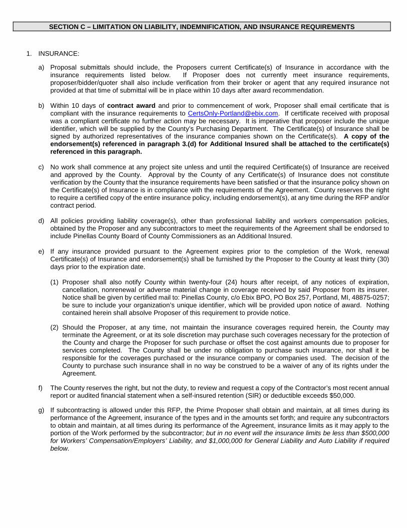
SECTION C – LIMITATION ON LIABILITY, INDEMNIFICATION, AND INSURANCE REQUIREMENTS
1. INSURANCE:
a) Proposal submittals should include, the Proposers current Certificate(s) of Insurance in accordance with the insurance requirements listed below. If Proposer does not currently meet insurance requirements, proposer/bidder/quoter shall also include verification from their broker or agent that any required insurance not provided at that time of submittal will be in place within 10 days after award recommendation.
b) Within 10 days of contract award and prior to commencement of work, Proposer shall email certificate that is
compliant with the insurance requirements to [email protected]. If certificate received with proposal was a compliant certificate no further action may be necessary. It is imperative that proposer include the unique identifier, which will be supplied by the County’s Purchasing Department. The Certificate(s) of Insurance shall be signed by authorized representatives of the insurance companies shown on the Certificate(s). A copy of the endorsement(s) referenced in paragraph 3.(d) for Additional Insured shall be attached to the certificate(s) referenced in this paragraph.
c) No work shall commence at any project site unless and until the required Certificate(s) of Insurance are received
and approved by the County. Approval by the County of any Certificate(s) of Insurance does not constitute verification by the County that the insurance requirements have been satisfied or that the insurance policy shown on the Certificate(s) of Insurance is in compliance with the requirements of the Agreement. County reserves the right to require a certified copy of the entire insurance policy, including endorsement(s), at any time during the RFP and/or contract period.
d) All policies providing liability coverage(s), other than professional liability and workers compensation policies,
obtained by the Proposer and any subcontractors to meet the requirements of the Agreement shall be endorsed to include Pinellas County Board of County Commissioners as an Additional Insured.
e) If any insurance provided pursuant to the Agreement expires prior to the completion of the Work, renewal
Certificate(s) of Insurance and endorsement(s) shall be furnished by the Proposer to the County at least thirty (30) days prior to the expiration date.
(1) Proposer shall also notify County within twenty-four (24) hours after receipt, of any notices of expiration,
cancellation, nonrenewal or adverse material change in coverage received by said Proposer from its insurer. Notice shall be given by certified mail to: Pinellas County, c/o Ebix BPO, PO Box 257, Portland, MI, 48875-0257; be sure to include your organization’s unique identifier, which will be provided upon notice of award. Nothing contained herein shall absolve Proposer of this requirement to provide notice.
(2) Should the Proposer, at any time, not maintain the insurance coverages required herein, the County may
terminate the Agreement, or at its sole discretion may purchase such coverages necessary for the protection of the County and charge the Proposer for such purchase or offset the cost against amounts due to proposer for services completed. The County shall be under no obligation to purchase such insurance, nor shall it be responsible for the coverages purchased or the insurance company or companies used. The decision of the County to purchase such insurance shall in no way be construed to be a waiver of any of its rights under the Agreement.
f) The County reserves the right, but not the duty, to review and request a copy of the Contractor’s most recent annual
report or audited financial statement when a self-insured retention (SIR) or deductible exceeds $50,000.
g) If subcontracting is allowed under this RFP, the Prime Proposer shall obtain and maintain, at all times during its performance of the Agreement, insurance of the types and in the amounts set forth; and require any subcontractors to obtain and maintain, at all times during its performance of the Agreement, insurance limits as it may apply to the portion of the Work performed by the subcontractor; but in no event will the insurance limits be less than $500,000 for Workers’ Compensation/Employers’ Liability, and $1,000,000 for General Liability and Auto Liability if required below.
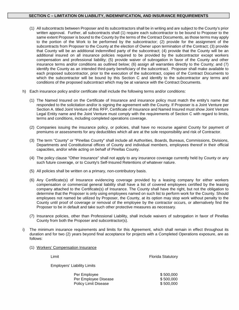
SECTION C – LIMITATION ON LIABILITY, INDEMNIFICATION, AND INSURANCE REQUIREMENTS
(1) All subcontracts between Proposer and its subcontractors shall be in writing and are subject to the County’s prior written approval. Further, all subcontracts shall (1) require each subcontractor to be bound to Proposer to the same extent Proposer is bound to the County by the terms of the Contract Documents, as those terms may apply to the portion of the Work to be performed by the subcontractor; (2) provide for the assignment of the subcontracts from Proposer to the County at the election of Owner upon termination of the Contract; (3) provide that County will be an additional indemnified party of the subcontract; (4) provide that the County will be an additional insured on all insurance policies required to be provided by the subcontractor except workers compensation and professional liability; (5) provide waiver of subrogation in favor of the County and other insurance terms and/or conditions as outlined below; (6) assign all warranties directly to the County; and (7) identify the County as an intended third-party beneficiary of the subcontract. Proposer shall make available to each proposed subcontractor, prior to the execution of the subcontract, copies of the Contract Documents to which the subcontractor will be bound by this Section C and identify to the subcontractor any terms and conditions of the proposed subcontract which may be at variance with the Contract Documents.
h) Each insurance policy and/or certificate shall include the following terms and/or conditions:
(1) The Named Insured on the Certificate of Insurance and insurance policy must match the entity’s name that
responded to the solicitation and/or is signing the agreement with the County. If Proposer is a Joint Venture per Section A. titled Joint Venture of this RFP, Certificate of Insurance and Named Insured must show Joint Venture Legal Entity name and the Joint Venture must comply with the requirements of Section C with regard to limits, terms and conditions, including completed operations coverage.
(2) Companies issuing the insurance policy, or policies, shall have no recourse against County for payment of
premiums or assessments for any deductibles which all are at the sole responsibility and risk of Contractor.
(3) The term "County" or "Pinellas County" shall include all Authorities, Boards, Bureaus, Commissions, Divisions, Departments and Constitutional offices of County and individual members, employees thereof in their official capacities, and/or while acting on behalf of Pinellas County.
(4) The policy clause "Other Insurance" shall not apply to any insurance coverage currently held by County or any
such future coverage, or to County's Self-Insured Retentions of whatever nature.
(5) All policies shall be written on a primary, non-contributory basis.
(6) Any Certificate(s) of Insurance evidencing coverage provided by a leasing company for either workers compensation or commercial general liability shall have a list of covered employees certified by the leasing company attached to the Certificate(s) of Insurance. The County shall have the right, but not the obligation to determine that the Proposer is only using employees named on such list to perform work for the County. Should employees not named be utilized by Proposer, the County, at its option may stop work without penalty to the County until proof of coverage or removal of the employee by the contractor occurs, or alternatively find the Proposer to be in default and take such other protective measures as necessary.
(7) Insurance policies, other than Professional Liability, shall include waivers of subrogation in favor of Pinellas
County from both the Proposer and subcontractor(s).
i) The minimum insurance requirements and limits for this Agreement, which shall remain in effect throughout its duration and for two (2) years beyond final acceptance for projects with a Completed Operations exposure, are as follows:
(1) Workers’ Compensation Insurance
Limit Florida Statutory
Employers’ Liability Limits
Per Employee Per Employee Disease Policy Limit Disease
$ 500,000 $ 500,000 $ 500,000

SECTION C – LIMITATION ON LIABILITY, INDEMNIFICATION, AND INSURANCE REQUIREMENTS
(2) Commercial General Liability Insurance including, but not limited to, Independent Contractor, Contractual Liability Premises/Operations, Products/Completed Operations, and Personal Injury.
Limits
Combined Single Limit Per Occurrence Products/Completed Operations Aggregate Personal Injury and Advertising Injury General Aggregate
$ 1,000,000 $ 1,000,000 $ 1,000,000 $ 2,000,000
(3) Business Automobile or Trucker’s/Garage Liability Insurance covering owned, hired, and non-owned vehicles. If the Proposer does not own any vehicles, then evidence of Hired and Non-owned coverage is sufficient. Coverage shall be on an "occurrence" basis, such insurance to include coverage for loading and unloading hazards, unless Proposer can show that this coverage exists under the Commercial General Liability policy.
Limit
Combined Single Limit Per Accident $ 1,000,000
(4) Professional Liability (Errors and Omissions) Insurance including errors & omissions resulting in a pollution event with at least minimum limits as follows. If “claims made” coverage is provided, “tail coverage” extending three (3) years beyond completion and acceptance of the project with proof of “tail coverage” to be submitted with the invoice for final payment. In lieu of “tail coverage”, Proposer may submit annually to the County, for a three (3) year period, a current certificate of insurance providing “claims made” insurance with prior acts coverage in force with a retroactive date no later than commencement date of this contract.
Limits
Each Occurrence or Claim General Aggregate
$ 5,000,000 $ 5,000,000
For acceptance of Professional Liability coverage included within another policy required herein, a statement notifying the certificate holder must be included on the certificate of insurance and the total amount of said coverage per occurrence must be greater than or equal to the amount of Professional Liability and other coverage combined.
(5) Pollution Legal/Environmental Legal Liability Insurance coverage for pollution may be met by a separate pollution
policy as outlined in (5) for pollution losses arising from all services performed to comply with this contract. Coverage shall apply to sudden and gradual pollution conditions including the discharge, dispersal, release or escape of smoke, vapors, soot, fumes, acids, alkalis, toxic chemicals, liquids or gases, waste materials or other irritants, contaminants or pollutants into or upon land, the atmosphere or any watercourse or body of water, which results in Bodily Injury or Property Damage. If policy is written on a Claims Made form, a retroactive date is required, and coverage must be maintained for 3 years after completion of contract or “tail coverage must be purchased. Coverage should include and be for the at least the minimum limits listed below:
1) Bodily injury, sickness, disease, mental anguish or shock sustained by any person, including death; property
damage including physical injury to or destruction of tangible property including the resulting loss of use thereof, clean up costs, and the loss of use of tangible property that has not been physically injured or destroyed;
2) Defense including costs, charges and expenses incurred in the investigation, adjustment or defense of claims
for such compensation damages.
3) Cost of Cleanup/Remediation.
Limits
Per Claim or Occurrence General Aggregate
$ 5,000,000 $ 5,000,000

SECTION C – LIMITATION ON LIABILITY, INDEMNIFICATION, AND INSURANCE REQUIREMENTS
For acceptance of Pollution Legal/Environmental Legal Liability coverage included within another policy coverage required herein, a statement notifying the certificate holder must be included on the certificate of insurance and the total amount of said coverage per occurrence must be greater than or equal to the amount of Pollution Legal/Environmental Legal Liability and other coverage. For herbicide and pesticide spraying operations only, an endorsement to the Commercial General Liability policy that provides Pollution Liability coverage for herbicide and pesticide spraying is acceptable.
(6) Property Insurance Proposer will be responsible for all damage to its own property, equipment and/or materials.

PURCHASING DEPARTMENT CONTRACT REVIEW TRANSMITTAL
PROJECT: Curlew Creek and Smith Bayou Watershed Evaluation and Management Plan
BID NUMBER: 145-0425-NC (SS)
TYPE: LJ Purchase Contract \~Other: CCNA I LJ Construction-Less than $100,000 j LJ One Time
In accordance with the policy guide for Contract Administration, the attached documents are submitted for review and comment.
Upon completion of review, complete Contract Review Transmittal and forward to next Review Authority listed. Please indicate suggested changes by revising, In RED, the appropriate section of the document reflecting the exact wording of the change.
RISK MANAGEMENT: Please enter required llablllty coverage on pages:~ This Is a CCNA contract Estimated Expenditure: 50 000
1.
2.
Purchasing Dept. J. Lauro, Director C. Mancuso
S. Steele Public Works Pick Talley, Director Kelli Levy, Manager
Merry CelesteUO' __.,
~;i·f ,~ 11.llj r,
Robert McWiUia.;; -i- \ "1-1 > Usin De lease rovlde below Information:
PRODUCT ONLY D
.N ,t
Yes, funding for this project is using grant funding. 0No, funding for this project is not using grant funding. If grant funding is being used you must provide Purchasing with the exact clauses that need to be on attached document.
B. f'/ l L:, Initial and Date Funding is availa.ble for this pr-Otect . . ~ ..Z'J . t SuxWM~ Provide title of funding source ~te(' £e;e . ~ d~~?o . .Llll.-1c.."'-. n1Nl
Arhcqoo .. :tt.d velVv\bt~.hS-€,vvl~ ~v,v\C-t.-h-t.-- ~ · u.n-ed'if'\ I
C. Please check attached vendor list. Circle vendors you want bids mailed to. Add additRmal 'vendors with complete information Name, Address Phone and Email
3. BCC Finance () \ \ Attn: Cassandra Wllllams 'tl'11i)
4. OMB I) Attn: Biii Berger 7 tf )) ... ·.,
HIGH RISK Risk Management Director J / Attn: Virginia E. Holscher °{q /~ -(Check applicable box at right)
6. .Li9!! Attn: Miies Belknap
7. A&&t. County Administrator C7 1,. ,~ Paul Sacco O I v ?
RETURN ALL DOCUMENTS TO PURCHASING
Maka all in ulries to: at Extension 44776 In order to meet the followln lease return ur requirements to Purchasln · b . 08/06/15
Revised April 2015 (all types)
I TENTATIVE DATES
Advertisement: TBD l Opening: TBD

Company Name Point Total RankingJones Edmunds & Associates, Inc. 1769.00 1Atkins North America, Inc. 1748.25 2AECOM Technical Services, Inc. 1704.25 3
PINELLAS COUNTY RANKING
RFP TITLE: Curlew Creek and Smith Baou Watershed Evaluation and Management PlanRFP # 145-0425-NC (SS) ORAL PRESENTATION AND FINAL COMBINED SCORE

CR 1
US H
IGHW
AY 19
N
BELC
HER
RD
US 19
A
MAIN ST
CURLEW RD
TAMPA RD
SUNSET POINT RD
SR 580
BAYS
HORE
BLVD
N BE
LCHE
R RD
OMAH
A ST
N KE
ENE R
D
EDGE
WATE
R DR
KEEN
E RD
BROA
DWAY
^
GULF
BLV
D
US H
IGHW
AY 19
N
4TH
ST N
I-275
66TH
ST N
49TH
ST N
TAMPA RD
CR 1
PARK BLVD N
SR 580
ULMERTON RD
US 19
A
54TH AVE N
22ND AVE N
38TH AVE N
1ST AVE S
EAST LAKE RD
1ST AVE N
62ND AVE N
34TH
ST S
CENTRAL AVE
PARK
ST N
113T
H ST
N
5TH AVE N
SEMI
NOLE
BLV
D
CURLEW RD
STAR
KEY
RD
34TH
ST N
16TH
ST N
KEYSTONE RD
102ND AVE N
DREW ST
22ND AVE S
BELLEAIR RD
MCMU
LLEN
BOO
TH R
D
GANDY BLVD
SUNSET POINT RD
EAST BAY DR
PINELLAS BAYWAY
I-175
GULF TO BAY BLVD
N KE
ENE R
D
BELC
HER
RDN
BELC
HER
RD
I-375
DR M
ARTI
N LU
THER
KIN
G JR
ST N
71ST
ST N
BAYSIDE BRIDGE
TYRONE BLVD N
118TH AVE NBRYAN DAIRY RD
WEST BAY DR
SR 590
OAKH
URST
RD
COURT ST
BAYS
HORE
BLV
D
INDIAN ROCKS RD
KEEN
E RD
ALDERMAN RD
S BEL
CHER
RD
GULFPORT BLVD S
S MIS
SOUR
I AVE
TRINITY BLVD
N PI
NELL
AS AV
E
SUNSHINE SKYWAY
COURTNEY CAMPBELL CSWY
PASA
DENA
AVE S
PINELLAS BAYWAY S
WALSINGHAM RD
BLIND PASS RD
CR 296
EDGE
WAT
ER D
R
S FT
HARR
ISON
AVE
N MY
RTLE
AVE
ROOSEVELT BLVD
CR 611
DUHME RD
RIDG
E RD
SW
3RD
ST N
150TH AVE
GULF BLVD
CR 29
6
SR 580
BELC
HER
RD
I-275
Curlew Creek and Smith Bayou Location
Curlew Creek Basin
Smith Bayou Basin
engza14
Typewritten Text
engza14
Typewritten Text
engza14
Typewritten Text
engza14
Typewritten Text
engza14
Typewritten Text
engza14
Typewritten Text
engza14
Typewritten Text
engza14
Typewritten Text
EXHIBIT A
engza14
Typewritten Text
engza14
Typewritten Text