
Philippine YMC Program - JAMSTEC · extreme rainfall events among top ... What are the best weather...
26
Philippine YMC Program Olivia Cabrera, Gerry Bagtasa, Gay Jean Perez, Mylene Gonzales (Institute of Environmental Science and Meteorology, University of the Philippines) Cesar Villanoy (Marine Science Institute, University of the Philippines) Gemma Narisma (Manila Observatory) Ronald Macatangay (National Astronomical Research Institute of Thailand, Chiang Mai, Thailand)
Transcript of Philippine YMC Program - JAMSTEC · extreme rainfall events among top ... What are the best weather...
Philippine YMC ProgramOlivia Cabrera, Gerry Bagtasa, Gay Jean Perez, Mylene Gonzales (Institute of Environmental Science and Meteorology, University of the Philippines)
Cesar Villanoy (Marine Science Institute, University of the Philippines)
Gemma Narisma (Manila Observatory)
Ronald Macatangay (National Astronomical Research Institute of Thailand, Chiang Mai, Thailand)
Motivation
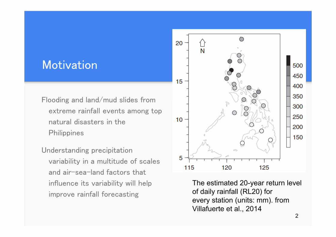
Flooding and land/mud slides from
extreme rainfall events among top
natural disasters in the
Philippines
Understanding precipitation
variability in a multitude of scales
and air-sea-land factors that
influence its variability will help
improve rainfall forecasting
The estimated 20-year return level of daily rainfall (RL20) forevery station (units: mm). from Villafuerte et al., 2014
2
Research Questions
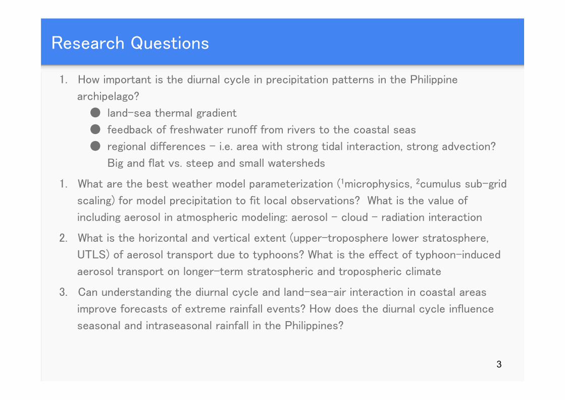
1. How important is the diurnal cycle in precipitation patterns in the Philippine
archipelago?
● land-sea thermal gradient
● feedback of freshwater runoff from rivers to the coastal seas
● regional differences – i.e. area with strong tidal interaction, strong advection?
Big and flat vs. steep and small watersheds
1. What are the best weather model parameterization (1microphysics, 2cumulus sub-grid
scaling) for model precipitation to fit local observations? What is the value of
including aerosol in atmospheric modeling: aerosol – cloud – radiation interaction
2. What is the horizontal and vertical extent (upper-troposphere lower stratosphere,
UTLS) of aerosol transport due to typhoons? What is the effect of typhoon-induced
aerosol transport on longer-term stratospheric and tropospheric climate
3. Can understanding the diurnal cycle and land-sea-air interaction in coastal areas
improve forecasts of extreme rainfall events? How does the diurnal cycle influence
seasonal and intraseasonal rainfall in the Philippines?
3
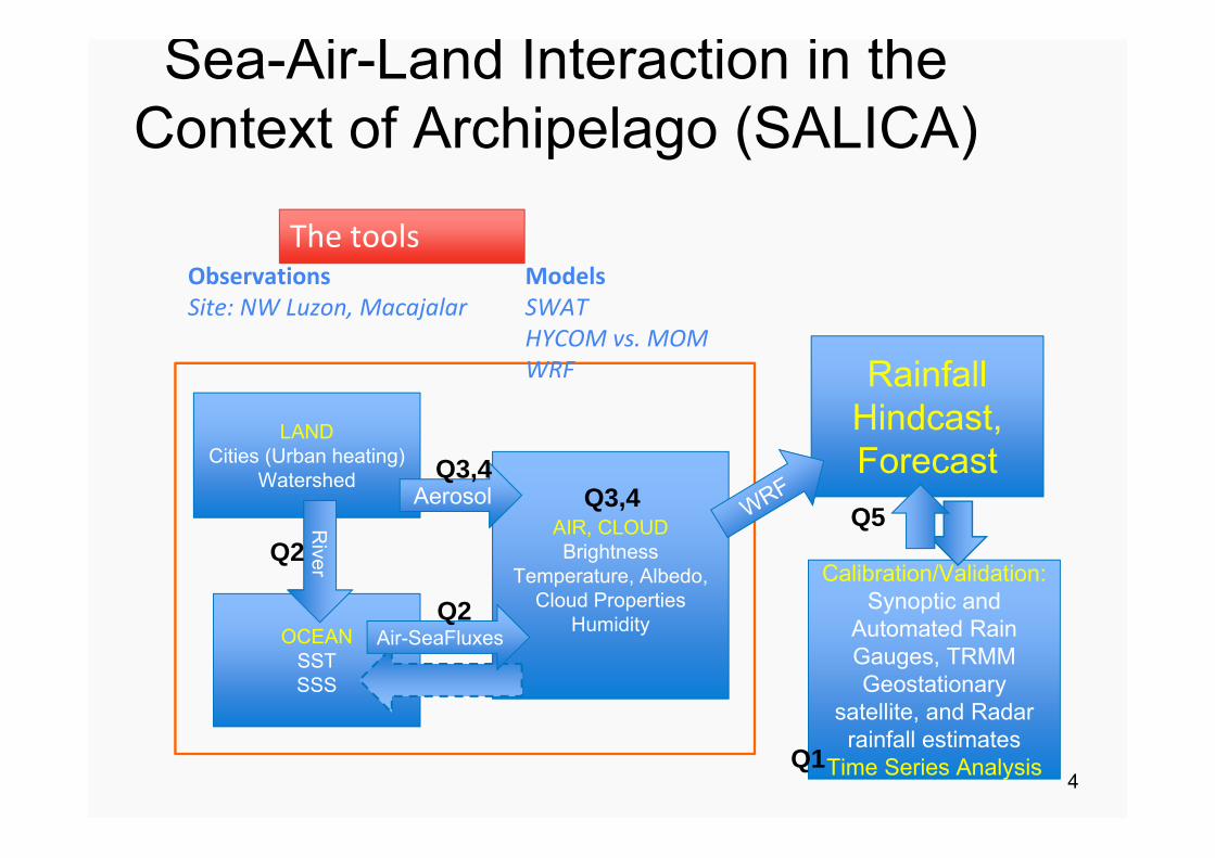
Sea-Air-Land Interaction in the Context of Archipelago (SALICA)
LANDCities (Urban heating)
Watershed
AIR, CLOUDBrightness
Temperature, Albedo, Cloud Properties
HumidityOCEANSSTSSS
Rainfall Hindcast, Forecast
Calibration/Validation:Synoptic and
Automated Rain Gauges, TRMM Geostationary
satellite, and Radar rainfall estimates
Time Series Analysis
River
Aerosol
Air-SeaFluxes
Q2
Q3,4Q5
Q3,4
ObservationsSite: NW Luzon, Macajalar
ModelsSWATHYCOM vs. MOMWRF
The tools
Q1
Q2
4
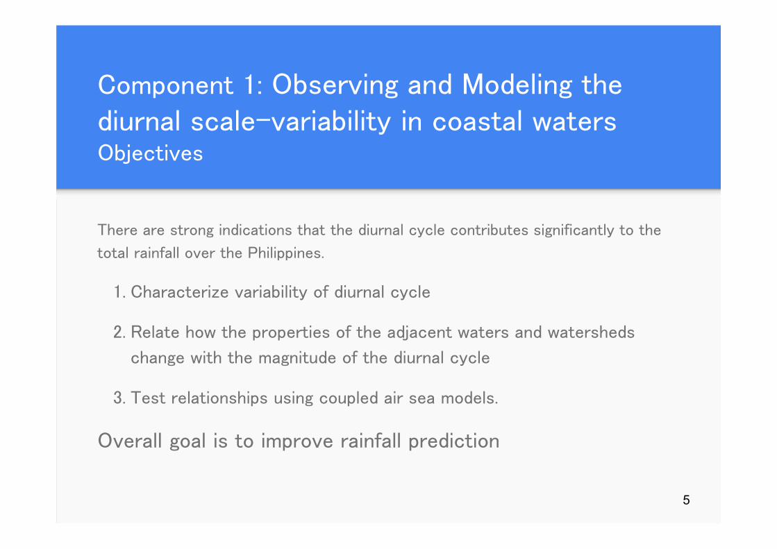
Component 1: Observing and Modeling the diurnal scale-variability in coastal waters Objectives
There are strong indications that the diurnal cycle contributes significantly to the
total rainfall over the Philippines.
1. Characterize variability of diurnal cycle
2. Relate how the properties of the adjacent waters and watersheds
change with the magnitude of the diurnal cycle
3. Test relationships using coupled air sea models.
Overall goal is to improve rainfall prediction
5
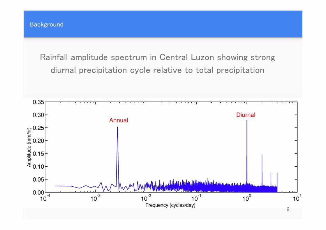
Background
Rainfall amplitude spectrum in Central Luzon showing strong
diurnal precipitation cycle relative to total precipitation
6
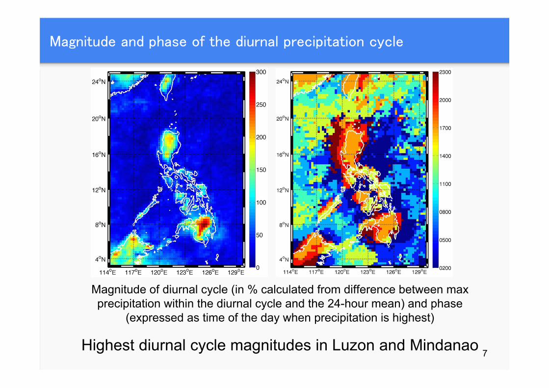
Magnitude and phase of the diurnal precipitation cycle
Magnitude of diurnal cycle (in % calculated from difference between max precipitation within the diurnal cycle and the 24-hour mean) and phase
(expressed as time of the day when precipitation is highest)
Highest diurnal cycle magnitudes in Luzon and Mindanao 7

Diurnal cycle 2004
JJA
SON
Hypothesis: different air-sea interaction west & east of Philippines● NE Monsoon, east is
wet, cold & w/ convective mixing
● SW Monsoon, west is wet, warm, w/ less convective mixing, strong barrier layer
● different land-sea temperature gradient results in stronger diurnal pattern west of Luzon during SW Monsoon
2 pm
2 pm
2 am
2 am
8
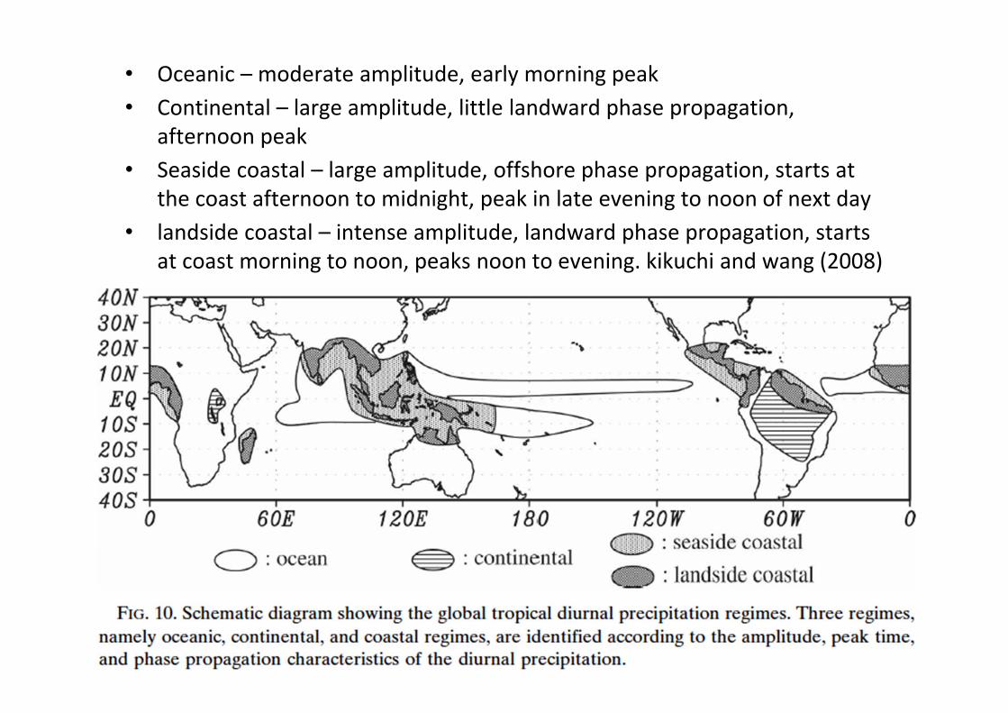
• Oceanic – moderate amplitude, early morning peak• Continental – large amplitude, little landward phase propagation,
afternoon peak• Seaside coastal – large amplitude, offshore phase propagation, starts at
the coast afternoon to midnight, peak in late evening to noon of next day• landside coastal – intense amplitude, landward phase propagation, starts
at coast morning to noon, peaks noon to evening. kikuchi and wang (2008)
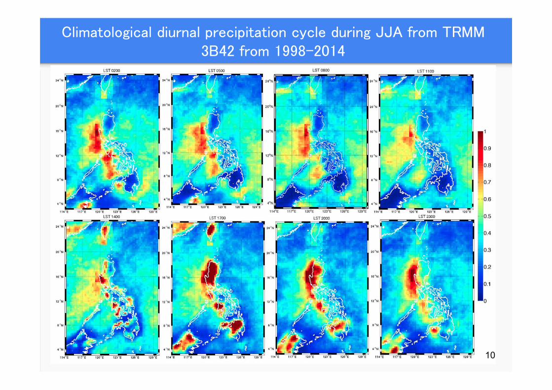
Climatological diurnal precipitation cycle during JJA from TRMM 3B42 from 1998-2014
10
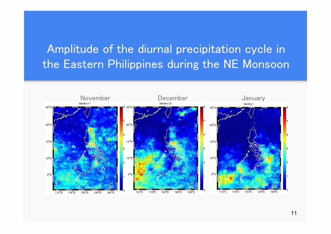
Amplitude of the diurnal precipitation cycle in the Eastern Philippines during the NE Monsoon
November December January
11
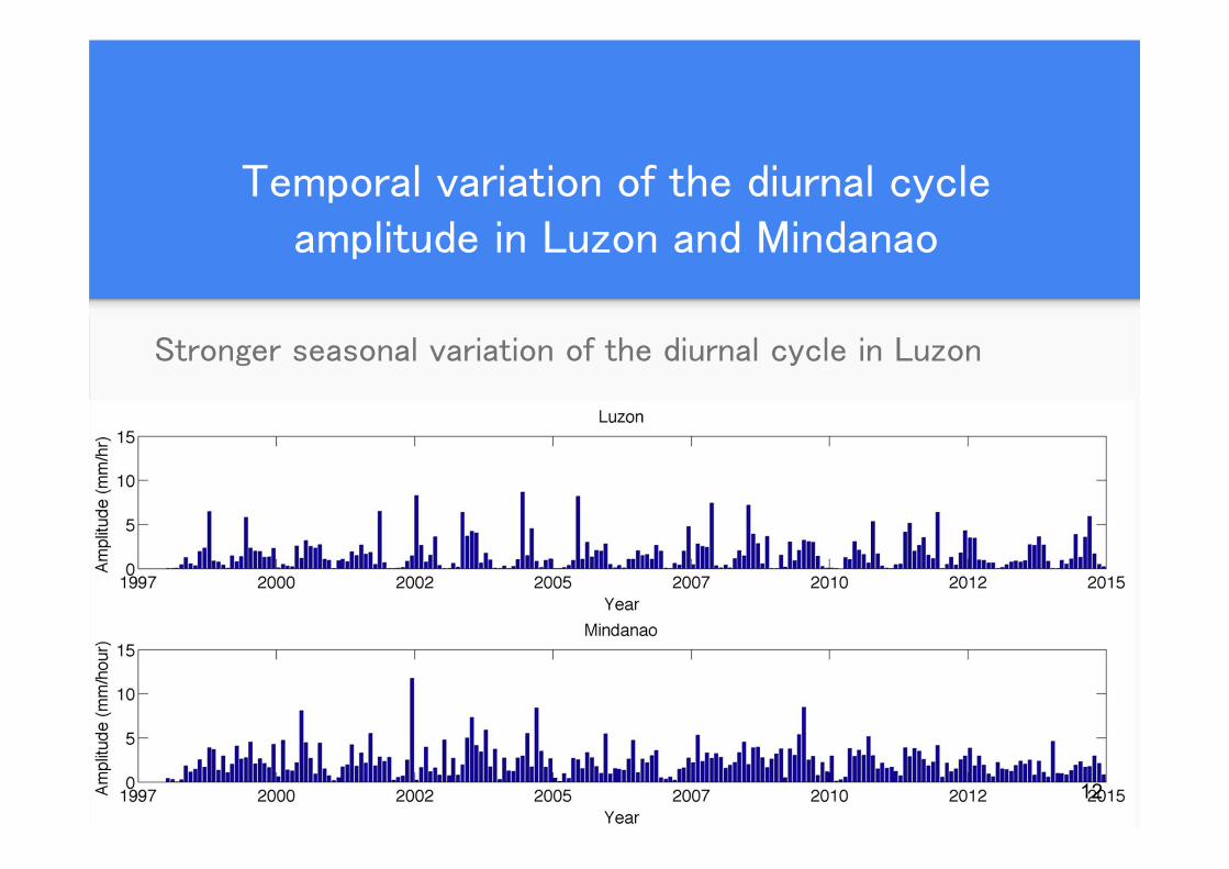
Temporal variation of the diurnal cycle amplitude in Luzon and Mindanao
Stronger seasonal variation of the diurnal cycle in Luzon
12
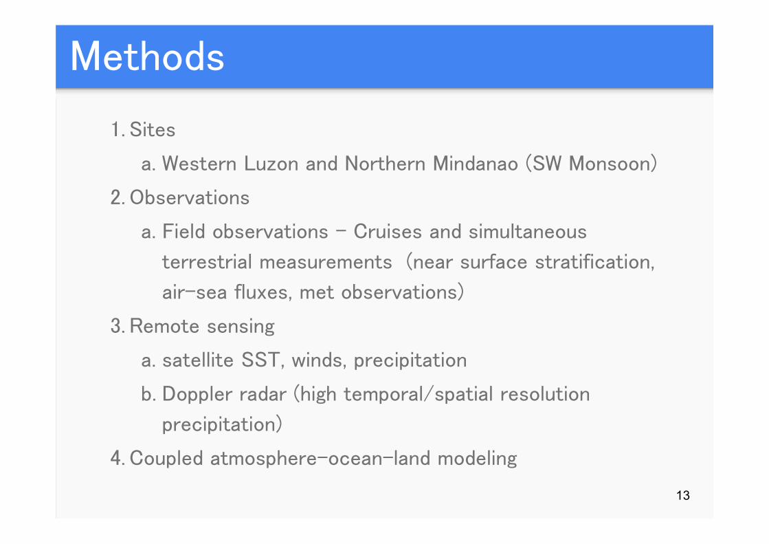
Methods
1. Sites
a. Western Luzon and Northern Mindanao (SW Monsoon)
2. Observations
a. Field observations - Cruises and simultaneous
terrestrial measurements (near surface stratification,
air-sea fluxes, met observations)
3. Remote sensing
a. satellite SST, winds, precipitation
b. Doppler radar (high temporal/spatial resolution
precipitation)
4. Coupled atmosphere-ocean-land modeling
13
Component 2: In-situ parameterization of Aerosols
Remote sensing of aerosols (AOD) provides a larger spatial coverage and
temporally resolved AOD measurements. However, there is a need to
support the AOD algorithm with critical parameters, such as:
• Aerosol size distribution
• Particle shape
• Particle composition
• Optical characteristics
Hence, in-situ measurements of aerosol physical and chemical parameters
are needed for more accurate weather
14
Proposed Measurement Systems
15
• Cyclone URG samplers
• Magee 7 λ Aethalometer, Nephelometer
• Aerosol Spectrometer Particle into Liquid
Sampler – Ion Chromatograph
Component 3: Weather Model Parameterization
Sensitivity studies on which parameterization is best
Calibration of schemes to fit local observation
In the Philippines, rain is the most important weather parameter, yet it is 1 of the most difficultparameters to model
2 parts of model calculate precipitation. • The Microphysics includes explicitly resolved water vapor, cloud, and precipitation
processes that computes grid-scale precipitation. • Cumulus parameterization schemes are responsible for the sub-grid-scale effects of convective and/or shallow clouds. These are intended to represent vertical fluxes due to unresolved updrafts and downdrafts and compensating motion outside the clouds.
16
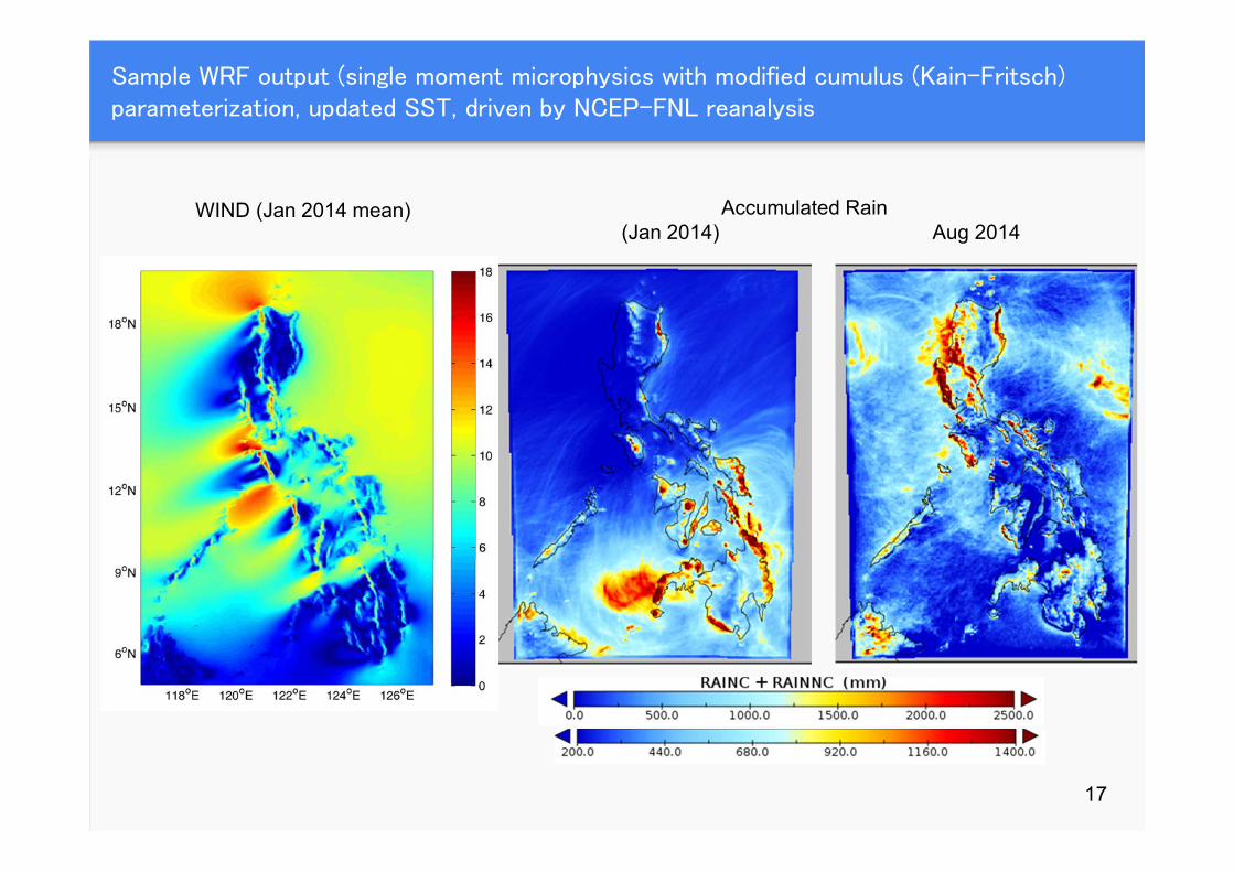
Sample WRF output (single moment microphysics with modified cumulus (Kain-Fritsch) parameterization, updated SST, driven by NCEP-FNL reanalysis
WIND (Jan 2014 mean) Accumulated Rain(Jan 2014) Aug 2014
17
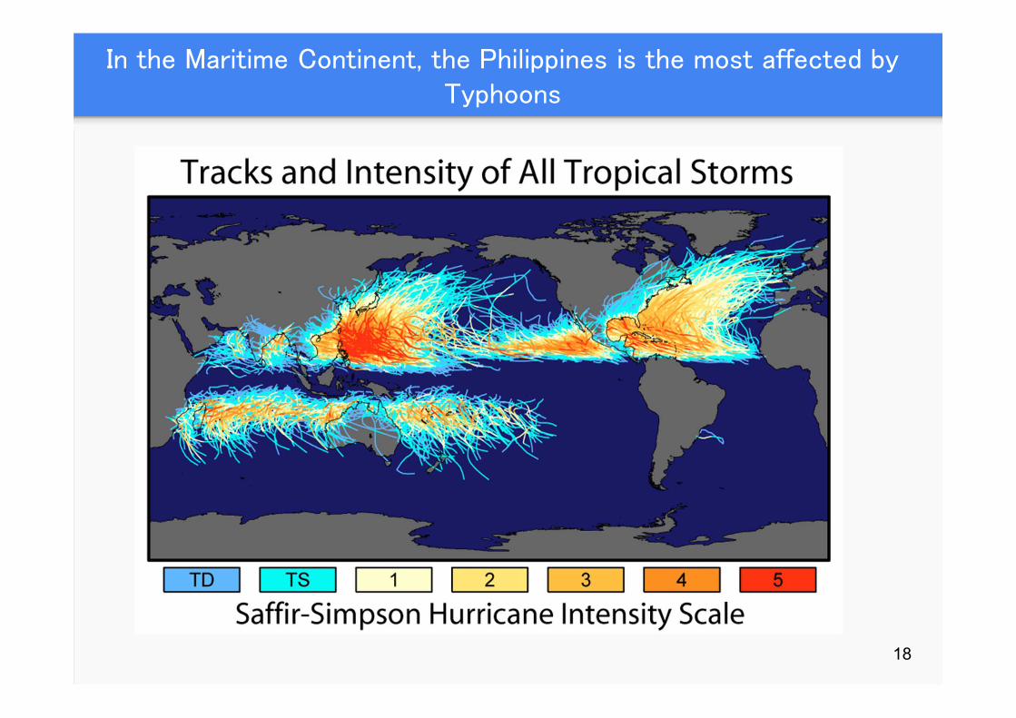
In the Maritime Continent, the Philippines is the most affected by Typhoons
18
Component 4: Extent of Typhoon-induced Transport of Aerosols
• To determine the horizontal and vertical extent (upper-troposphere lower stratosphere, UTLS) of aerosol transport due to tropical cyclones using a chemistry-coupled numerical weather prediction model
• To validate model simulations with current and new observations that would be setup by the project
• To determine the effects of tropical cyclone induced aerosol transport on longer-term stratospheric and tropospheric climate
19
Haze transport in October 2015 influenced by Typhoon Koppu affecting Mindanao and parts of Visayas
The recent Indonesian forest fires have garnered more attention this year due to the extent of the burning as a result of El Nino conditions. Together
with aerosol emissions from mainland Asia, unhealthy levels of the air quality index have been reported in Thailand, Malaysia and as far as the
Philippines during Typhoon Koppu’s passage. 20
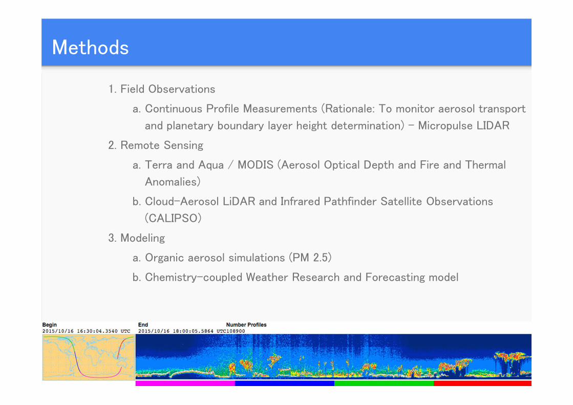
Methods
21
1. Field Observations
a. Continuous Profile Measurements (Rationale: To monitor aerosol transport
and planetary boundary layer height determination) - Micropulse LIDAR
2. Remote Sensing
a. Terra and Aqua / MODIS (Aerosol Optical Depth and Fire and Thermal
Anomalies)
b. Cloud-Aerosol LiDAR and Infrared Pathfinder Satellite Observations
(CALIPSO)
3. Modeling
a. Organic aerosol simulations (PM 2.5)
b. Chemistry-coupled Weather Research and Forecasting model
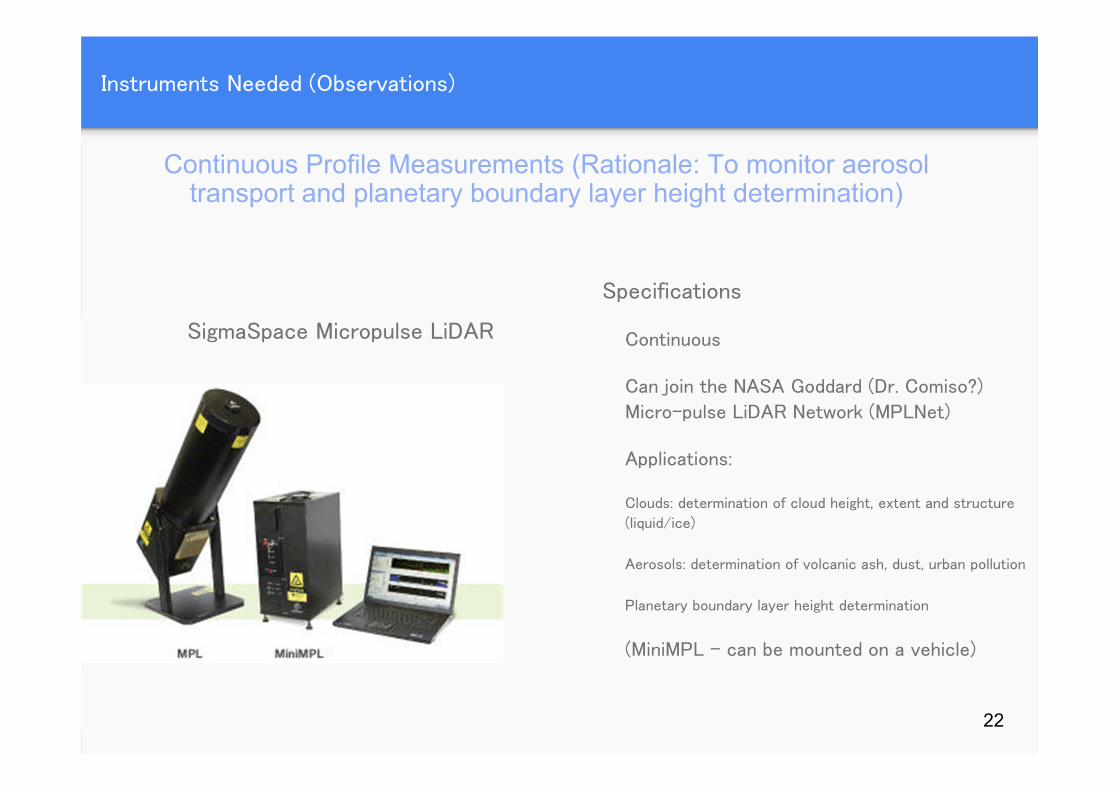
Instruments Needed (Observations)
Specifications
Continuous
Can join the NASA Goddard (Dr. Comiso?)
Micro-pulse LiDAR Network (MPLNet)
Applications:
Clouds: determination of cloud height, extent and structure
(liquid/ice)
Aerosols: determination of volcanic ash, dust, urban pollution
Planetary boundary layer height determination
(MiniMPL – can be mounted on a vehicle)
SigmaSpace Micropulse LiDAR
Continuous Profile Measurements (Rationale: To monitor aerosol transport and planetary boundary layer height determination)
22
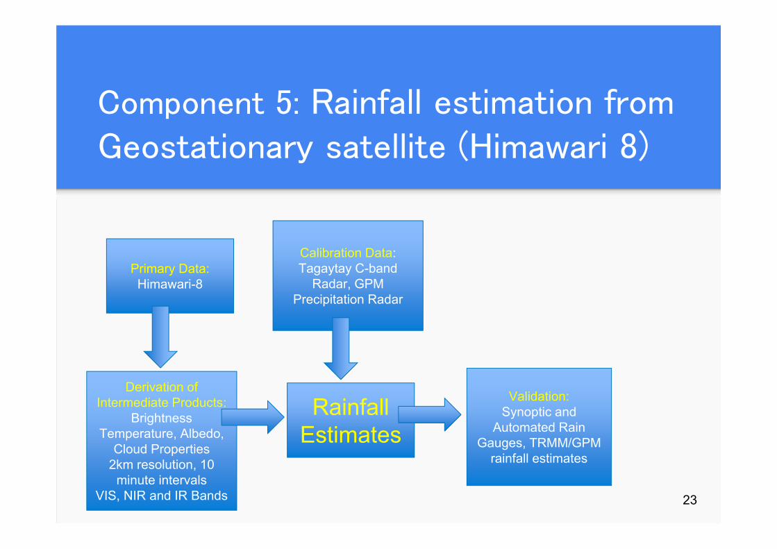
Component 5: Rainfall estimation from Geostationary satellite (Himawari 8)
23
Primary Data:Himawari-8
Derivation of Intermediate Products:
Brightness Temperature, Albedo,
Cloud Properties2km resolution, 10
minute intervalsVIS, NIR and IR Bands
Calibration Data:Tagaytay C-band
Radar, GPM Precipitation Radar
Rainfall Estimates
Validation:Synoptic and
Automated Rain Gauges, TRMM/GPM
rainfall estimates
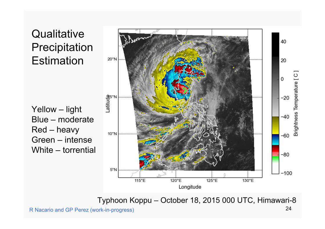
Typhoon Koppu – October 18, 2015 000 UTC, Himawari-8
QualitativePrecipitationEstimation
Yellow – lightBlue – moderateRed – heavyGreen – intenseWhite – torrential
R Nacario and GP Perez (work-in-progress) 24
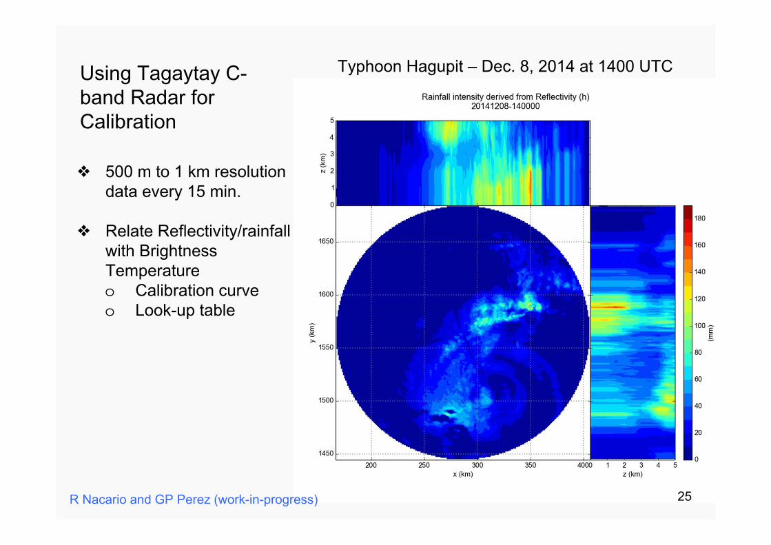
Typhoon Hagupit – Dec. 8, 2014 at 1400 UTCUsing Tagaytay C-band Radar for Calibration
❖ 500 m to 1 km resolution data every 15 min.
❖ Relate Reflectivity/rainfall with Brightness Temperatureo Calibration curveo Look-up table
R Nacario and GP Perez (work-in-progress) 25
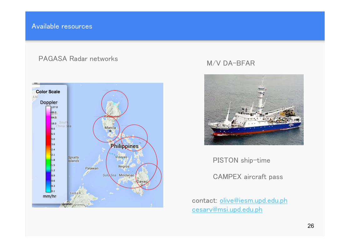
Available resources
PAGASA Radar networks
26
M/V DA-BFAR
PISTON ship-time
CAMPEX aircraft pass
contact: [email protected]@msi.upd.edu.ph